

Multi Reservoir Operation
and Planning
Mr. Hiralal Mendhegiri
DG, WALMI, Aurangabad

Outline
1. Introduction
2. Reservoir Operation
3. Multi Reservoir Operation
4. RS & GIS for Planning
5. DSS: Upper Godavari

3
Introduction
• Reservoirs serve to
regulate natural
stream-flow,
thereby modifying
the temporal and
spatial availability
of water according
to human needs.
Reservoir Pench Photo
4
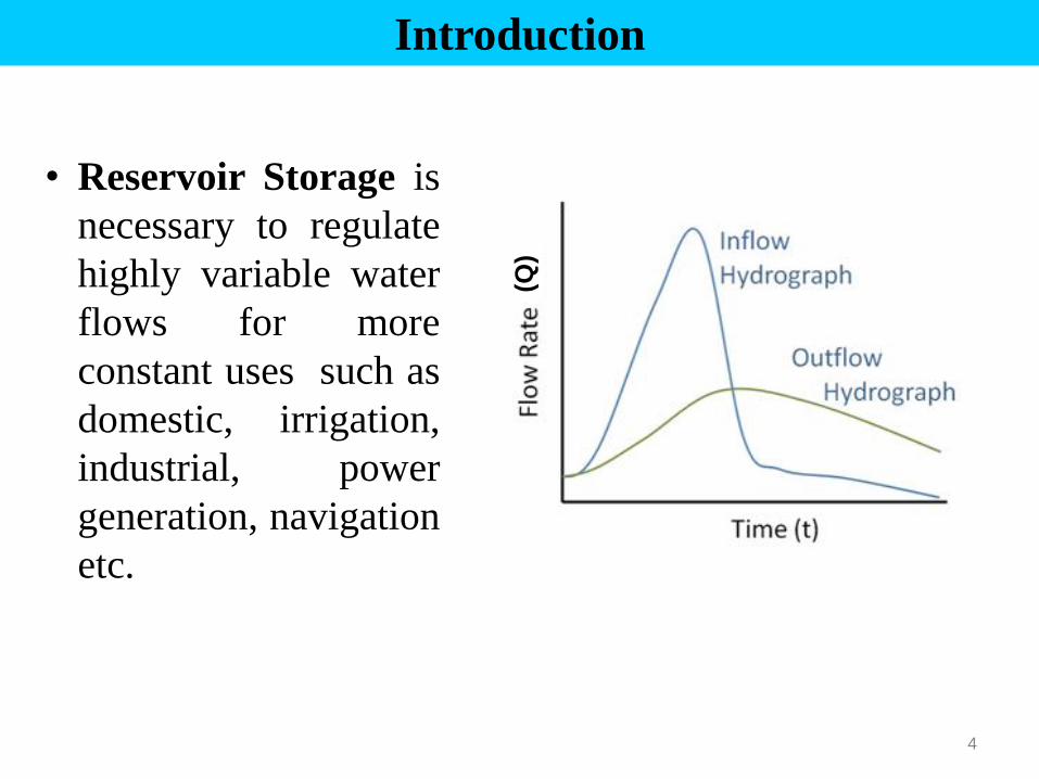
Introduction
• Reservoir Storage is
necessary to regulate
highly variable water
flows for more
constant uses such as
domestic, irrigation,
industrial, power
generation, navigation
etc. (Q
)
5
Multi Reservoir System
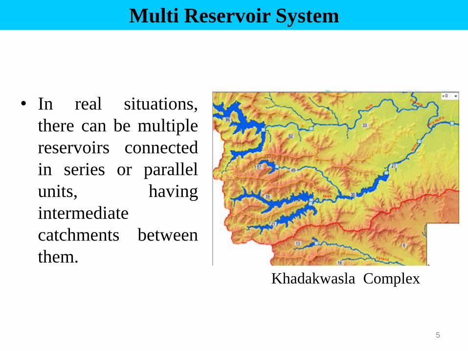
• In real situations,
there can be multiple
reservoirs connected
in series or parallel
units, having
intermediate
catchments between
them.
Khadakwasla Complex
Outline
1. Introduction
2. Reservoir Operation
3. Multi Reservoir Operation
4. RS & GIS for Planning
5. DSS: Upper Godavari

7
Reservoir Operation for Conservation
(a) Single Purpose Reservoirs :
• Usually be operated to fill as early as possible
during filling period (Monsoon)
• All water in excess of the requirements of the
filling period (Kharif) shall be impounded until
FRL is reached
• Depletion period begins thereafter for meeting
the requirements (demands).

8
Illustration of conceptual guide curves

9
Reservoir Operation for Conservation
(b) Multi-Purpose Reservoirs :
• Governed by the manner in which various uses
of the reservoir have been combined.
• While operating the reservoirs to meet the
demands of end users, the priorities for
allocation be used as a guideline.
• Part of conservation space can be utilized for flood
moderation, during the earlier stages of monsoon.
• This part of conservation space has to be filled up
towards the end of monsoon progressively.

Reservoir storage space allocations
Outline
1. Introduction
2. Reservoir Operation
3. Multi Reservoir Operation
4. RS & GIS for Planning
5. DSS: Upper Godavari
12
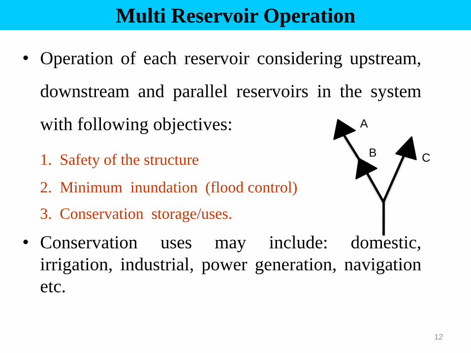
Multi Reservoir Operation
• Operation of each reservoir considering upstream,
downstream and parallel reservoirs in the system
with following objectives:
1. Safety of the structure
2. Minimum inundation (flood control)
3. Conservation storage/uses.
• Conservation uses may include: domestic,
irrigation, industrial, power generation, navigation
etc.
A
B C

Ujjani Dam

14
Multi Reservoir Operation
• Individual reservoir operation as a single entity
will have to be switched over to a strategy for :
• Necessary to adopt a strategy for integrated
operation of reservoirs to achieve optimum
utilization of the water resources available and to
benefit best out of the reservoir system.

15
Multi Reservoir Operation : Conservation
Principles :
• River basin and sub-basin as the unit for water
resources planning, adopting multi-sectoral
approach.
• Consider water demands for various purposes,
available conservation storage in individual
reservoirs and the distribution of releases among
the reservoirs.
• Develop a coordinated plan to produce the
optimum benefits and minimize water losses due
to evaporation and transmission.

Availability
of yield
• 100 % dep
• 90 % dep
• 75 % dep
• 50 % dep
• Average
• Good Year
Demands Constraints
Options (Proportionate
Curtailment)
(% allocation)
• Domestic
• Irrigation
• Industrial
• Evaporation
• Water Release Restrictions
• Large No
of M I Tanks
• No Spills
From Terminal
reservoir
• Min Transit
Losses
Non Irrigation
• Domestic
• Industrial
Irrigation
• Kharif
• Rabi
• HW
Operating Strategies
Output
17
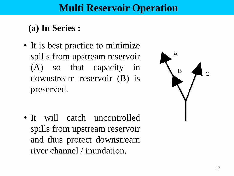
Multi Reservoir Operation
(a) In Series :
• It is best practice to minimize
spills from upstream reservoir
(A) so that capacity in
downstream reservoir (B) is
preserved.
• It will catch uncontrolled
spills from upstream reservoir
and thus protect downstream
river channel / inundation.
A
B C

18
Multi Reservoir Operation
(a) In Series :
• Easy to release water
from upstream reservoir
to a downstream but not
the other way around.
• Helpful to maximize
conservation storage so
that users benefitted.

19
Multi Reservoir Operation
(b) In Parallel :
• Objective should be to balance
storage between the two (B & C)
• Best rule curve may require
apportionment of releases from
two or more reservoirs based on
available storage capacity or
other criteria
• This system set up may require
optimization approach

20
Multi Reservoir Operation
• Coordinated operation of multi reservoir systems
is typically a complex decision making process
involving many variables, many objectives and
considerable risk and uncertainty.
• System operators are challenged to meet often
conflicting objectives, while complying with all
tribunal awards, agreements and traditions
affecting water allocations and uses.
21

22
23
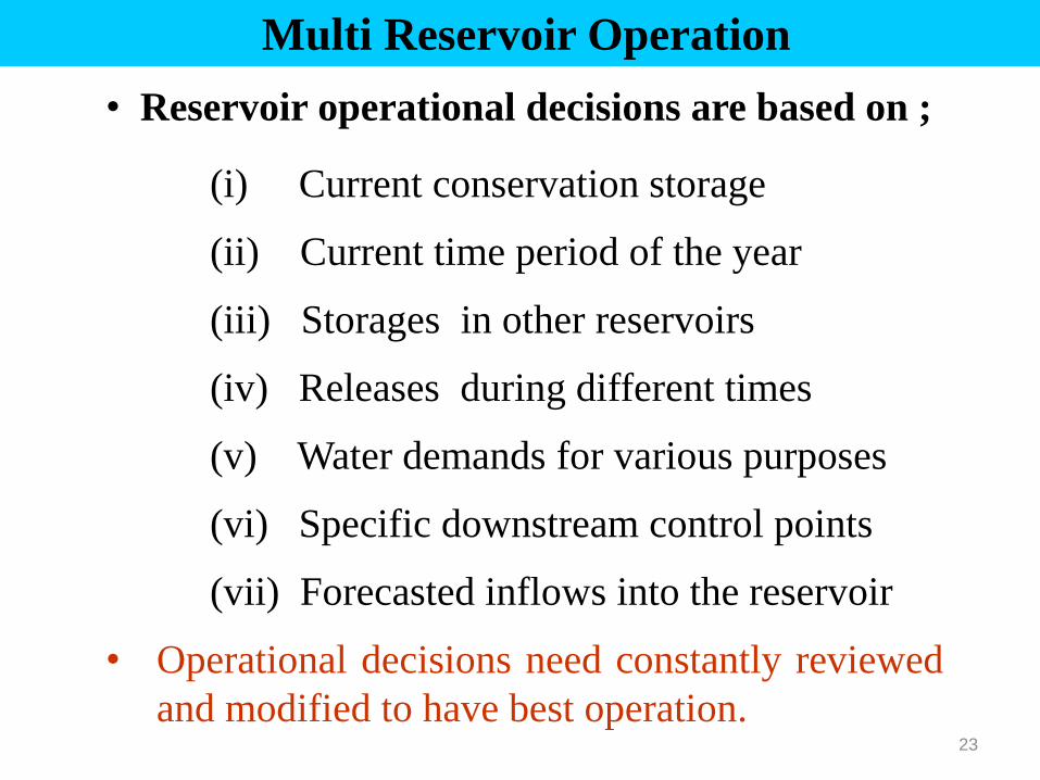
Multi Reservoir Operation
• Reservoir operational decisions are based on ;
(i) Current conservation storage
(ii) Current time period of the year
(iii) Storages in other reservoirs
(iv) Releases during different times
(v) Water demands for various purposes
(vi) Specific downstream control points
(vii) Forecasted inflows into the reservoir
• Operational decisions need constantly reviewed
and modified to have best operation.

Outline
1. Introduction
2. Reservoir Operation
3. Multi Reservoir Operation
4. RS & GIS for Planning
5. DSS: Upper Godavari

DHOM RESERVOIR MULSHI RESERVOIR
GANGAPUR RESERVOIR PANSHET & WARASGAON RESERVOIRS
Remote Sensing Images of Various Reservoirs

• RS offers temporal features of Catchments, Reservoirs
and Command area with various spatial resolution
• Spatial resolution of images have improved from
70 m to 0.5 m with launching of sophisticated RS
satellites
• Therefore, it has become possible to capture the
spatial and temporal complexity in the river basin, and
enabled to use these technologies for multi reservoir
operation
• RS acts as a important input to various GIS softwares
to ascertain real time situation
Remote Sensing for Multi Reservoir Operation
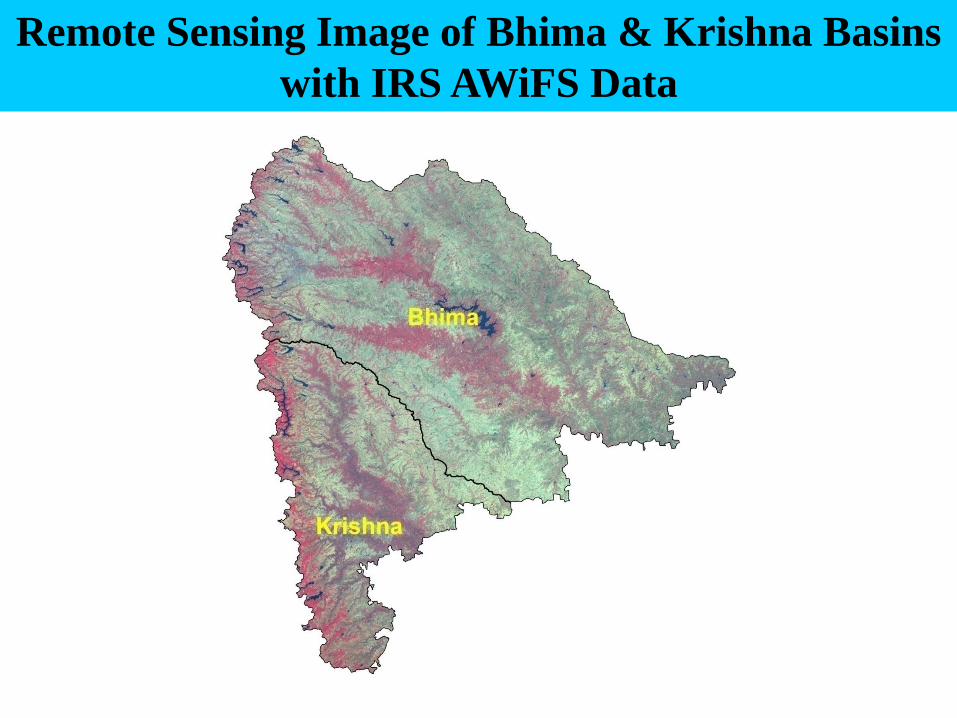
Remote Sensing Image of Bhima & Krishna Basins
with IRS AWiFS Data
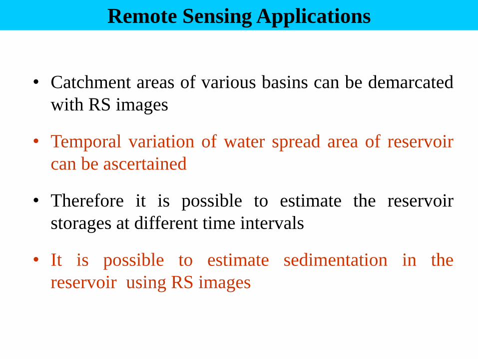
• Catchment areas of various basins can be demarcated
with RS images
• Temporal variation of water spread area of reservoir
can be ascertained
• Therefore it is possible to estimate the reservoir
storages at different time intervals
• It is possible to estimate sedimentation in the
reservoir using RS images
Remote Sensing Applications

Land use and land cover (LU/LC) is important input for:
• Rainfall-Runoff modelling
• Erosion Studies
• Watershed Management
• Change detection of LU/LC and its hydrologic
impact
Remote Sensing for Multi Reservoir Operation

• Crop Inventory → Spatial distribution of crops
• Water Demand → Vegetative indices for crop condition
• Canal Network → Demarcation of canal network
• Water Logged & Salinity → Extent of Saline area
• Change Detection → Changes in cropping pattern
• Irrigation Scheduling → Crop conditions can be related to
vegetative indices to ascertain crop water requirement
Application of RS in Command Area
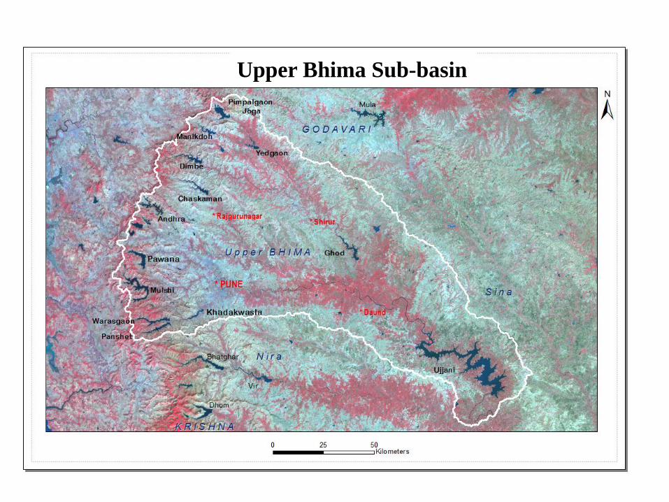
Upper Bhima Sub-basin

Outline
1. Introduction
2. Reservoir Operation
3. Multi Reservoir Operation
4. RS & GIS for Planning
5. DSS: Upper Godavari


Upper Godavari Sub-Basin
• Entire catchment of Godavari river from its source to Paithan
dam
• Geographical Area = 21774 Sq Km
• Mula, Pravara, Kadwa, Darna, Kaadava, Dodni, Shivna are
main tributaries
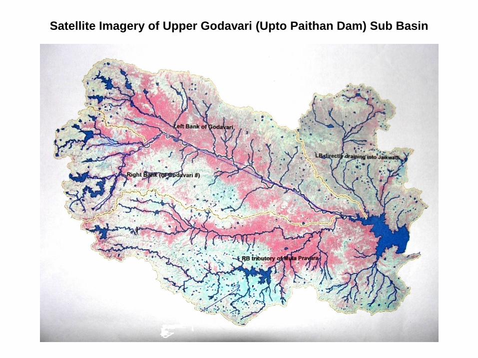
Satellite Imagery of Upper Godavari (Upto Paithan Dam) Sub Basin

Upper Godavari Sub-Basin
• Sub-basin is considered well-developed from a water storage
perspective as 17 major, 14 medium & 558 minor irrigation
schemes constructed.
• Rapid urbanization, faster industrial & agricultural
developments posed increase in water demands for various
uses, resulting in conflicts


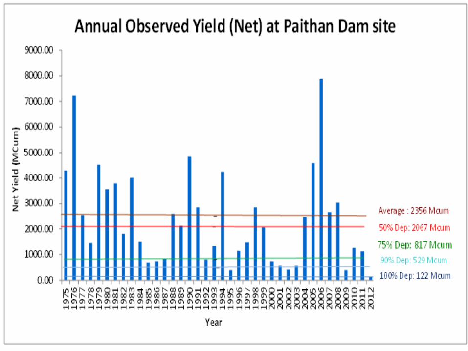
Present Water Planning Scenario of Sub-Basin (Figures in TMC)
• 75% dep Virgin Yield 157.20
• Average Virgin Yield 193.06
• Total Design Live Storage Capacity
193.44
• Design Water Use 253.37
• Sanctioned NI Use 34.47
• Project provision for NI Use 8.73

Water Deficit in Sub-Basin (Figures in TMC)
• Design Water Use 253.37
• 75% dep Virgin Yield 157.20
• Regeneration from u/s use 12.07
• Water Deficit 84.10
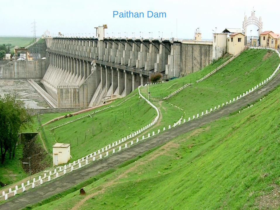
Paithan Dam

Jayakwadi Project
• Paithan dam, part of Jayakwadi Project is located on Godavari
river at upstream of Paithan town.
• Gross Storage : 102.73 TMC
• Live Storage : 76.66 TMC
• Dead Storage : 26.06 TMC
• Design Water Use : 92.47 TMC

Water Stress
• Water Stress situation is creating to the competition and
conflict among different category of uses and among upper
and lower reach water users.
• Present water stress situation most likely to occur more
frequently in future as water available in sub-basin not
sufficient to meet the demands.
• Water, which once considered as abundant, becomes a scarce and economic resource.
• Distribution of water is uneven over a large part of sub-basin.

Isohytel Map (Sinchan ayog)

45
IWRM Concept
• IWRM is a process which
promotes coordinated
development and
management of water,
land and related
resources…
Social
Env needs
Economic
Sustai
-nable
Bearabl
e
Equitable
Viable
in order to maximize the
resultant economic and
social welfare in an
equitable manner without
compromising
sustainability of vital
ecosystems.

Equitable Distribution of Water
• Maharashtra has enacted MWRRA Act, 2005 to regulate
water resources within the state, for ensuring judicious,
equitable and sustainable management, allocation and
utilization of water resources
• State Water Policy (2003) envisages that water resources of
the state shall be planned, developed, managed with a river
basin and sub-basin as the unit, adopting multi-sectoral
approach.
• As per State Water Policy, the distress (deficit in water
availability) is to be shared equitably amongst different
sectors and also amongst upstream and downstream users

DSS : River Basin Management
• A scientific water management along with an operational
support tool based on computer modelling and forecasting will
increase efficiency and allow prioritization to meet the goals
of equitable access / distribution at sub-basin level.
• GoM & NSW (Australia) have decided to exchange and
cooperation for actions to improve river basin management in
Upper Godavari Sub-basin.

DSS : Study Goals
1. To develop a Source modelling framework suitable to support
development of IWRM plan for the sub-basin's surface and
subsurface water resources.
2.To analyse a range of planning and operational scenarios
through the modelling process on a GIS platform and develop
metrics and governance to stage and prioritise works to
improve equitable access to water across the sub-basin.
3. To facilitate water management and governance processes
based on modelling to implement the objectives of the
Maharashtra State Water Policy

Water ; New Battle Ground
• Battles of yesterday were fought over land .
• Those of today are over energy.
• Battles of tomorrow will be over water.
• That danger will be greater in water distressed area,
……Henceforth, manage water better by switching over from
fragmented approach to river basin management approach for
sustainability . DSS for WR Planning is inevitable.

Thank You


