

JerryJerry CloughCloughSK53 on OpenStreetMap
Maps Matter Blog : www.sk53-osm.blogspot.com

OHM Strapline CandidatesOHM Strapline Candidates
–A map of everything that has ever existed
–Putting a time-slider on the World–The World's most out of date map

OpenHistoricalMapOpenHistoricalMap
● Newish project, kicked-off SF April 2013
● Based on OpenStreetMap technology ('the stack')
● No formal ontology or rules– Elements & Time described by
free-form tagging
– No validation
● Mainly repository of vector map data
● Open data (OdbL/CC-BY-SA)
● Close links with – Wikimedia Commons (Wikimaps)– GLAM (Galeries, Libraries, Archives &
Museums) Wiki
– Wikidata
– OpenStreetMap– Open Knowledge Foundation
● Participants– GIS specialists (e.g., Topomancy LLP)– Academics (mainly CS)– Wikimedians
– OpenStreetMappers
● Infrastructure hosted by Topomancy
URL: www.openhistoricalmap.org

OSM Historical Starting Point

OSM Nottingham : Example 1Dead Pubs

OSM Nottingham : Example 2Listed Buildings &
Old Maps
http://osm-nottingham.org.uk/?z=16&lon=-1.15010&lat=52.95162&bgl=Salmon,1,11&l=listedbuildings&lh=GradeII

Open Historical MapOpen Historical Map Now Now

Step 1 : Georectify Old Map(s)
http://mapwarper.net

Step 2 : Create vector map in editor
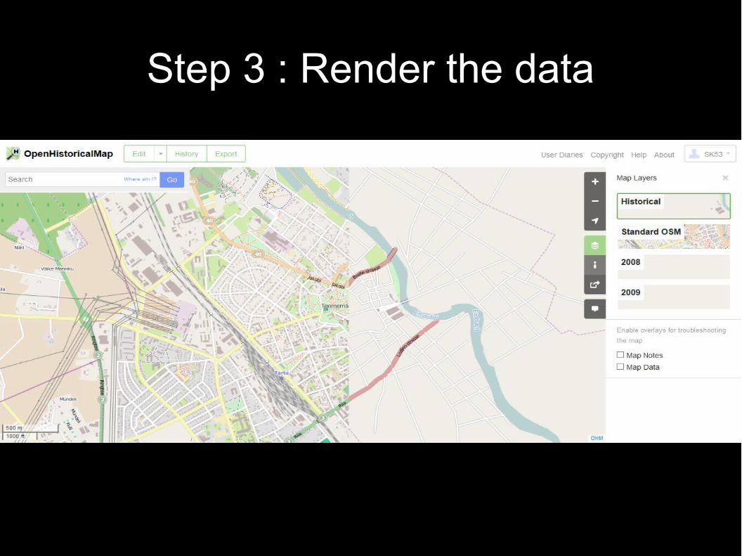
Step 3 : Render the data

Derby Derby RoadRoad

Derby Derby RoadRoad

Derby Derby RoadRoad
No. Start location End location Start Date End Date
1 Priory Roundabout
Adams' Hill 1800 9999
2 Adams Hill Lenton Lodge 1800 1825
3 Adams Hill Lenton Lodge 1825 9999
4 Lenton Lodge W of Rose and Crown
1800 9999
5 W of Rose and Crown
E of Rose and Crown
1800 1936
6 W of Rose and Crown
E of Rose and Crown
1936 9999
7 Three Wheatsheaves
Faraday Road 1800 1910
8 Three Wheatsheaves
Faraday Road 1910 9999
9 Faraday Road Tollhouse Hill 1800 9999

NYPL Building InspectorNYPL Building Inspector
http://leatherwood.herokuapp.com/footprint

OHM Current & Future OHM Current & Future DevelopmentsDevelopments

Summary : OHMSummary : OHM
NowNow● Ready for sets of 'snapshot'
data ● Temporal data (tags) manual
process● Routing● Limited automated rendering
– Existing tools (TileMill) fine for specific needs
To comeTo come● More & better examples
– Pre 1800 too
● Integrating temporal tools into website & editor– Time-sliders
– Map Warper
● Additional QA tools● In browser rendering

Time SliderTime Slider
● Unifying element for:– Search– Editing data– Viewing data
● Across OHM / Wikimedia● Prototype work
– Summer 2014 GsoC student
● Date & Period based● Range or 'Snapshot'

More ToolsMore Tools
● Building Inspector– Ports currently in
progress (with NLS)
● Integration of MapWarper in editor
● Additional semi-automated data capture
● Map Roulette
● QA tools– Many exist in OSM
– Identify problems to fix
● Overlapping temporalities
● Temporal Geocoder

Tangible ChallengesTangible Challenges
● Data volumes● Creating maps (rendering)● Editing & fixing data● Imprecise temporality● Calendars
– implicit proleptic Gregorian
● Buildings– 3D (some existing OSM work)
– Phased construction
http://demo.f4map.com/#lat=41.8909282&lon=12.4906339&zoom=17

Data VolumesData Volumes
● Potential combinatorial explosion of data elements– Exploration using OSM data suggests not major problem
– Some mitigation routes possible
● Link to wikidata to need for multiple elements– Name changes
– Historical population
● Urban areas much smaller in past● Change mainly localised

●Classifying ChangeClassifying Change

RenderingRendering
http://www.openhistoricalmap.org/#map=14/40.7766/-119.2265&layers=H
● Current Approach– Static Rendering
– Requires new tiles for each time period
● Future Approach– In browser rendering
● Vector Tiles● MapCSS
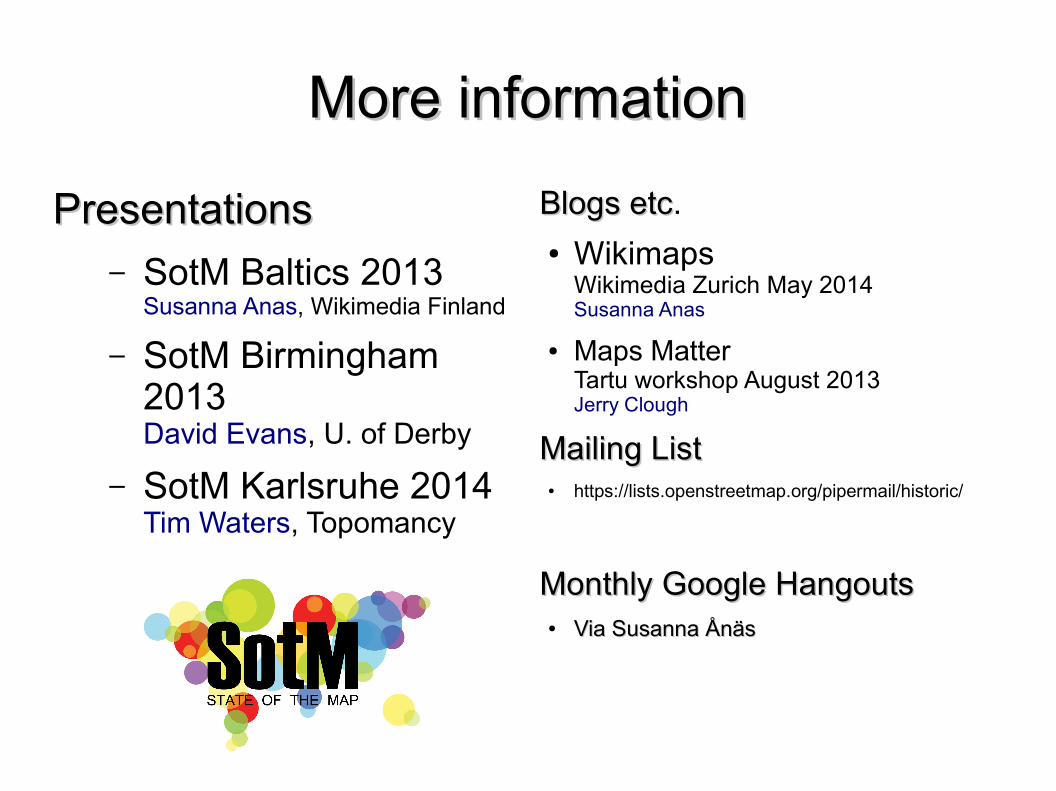
More informationMore information
PresentationsPresentations– SotM Baltics 2013
Susanna Anas, Wikimedia Finland
– SotM Birmingham 2013David Evans, U. of Derby
– SotM Karlsruhe 2014Tim Waters, Topomancy
Blogs etcBlogs etc.● Wikimaps
Wikimedia Zurich May 2014Susanna Anas
● Maps MatterTartu workshop August 2013Jerry Clough
Mailing ListMailing List● https://lists.openstreetmap.org/pipermail/historic/
Monthly Google HangoutsMonthly Google Hangouts● Via Susanna ÅnäsVia Susanna Ånäs


