
RE-Powering America’s Land: Renewable Energy on Potentially Contaminated
Land and Mining Sites
March 15, 2012Local Governments Cultivating Green Energy on Brownfields
Lura MatthewsOSWER Center for Program Analysis
U.S. Environmental Protection Agency
What Will be Covered Today
� What is RE-Powering America’s Land?� Why Focus on Renewable Energy Generation on Contaminated Sites?� Existing RE-Powering Tools � Feasibility Studies� Success Stories
RE-Powering America’s Land: Renewable Energy on Contaminated Land &
Mining Sites
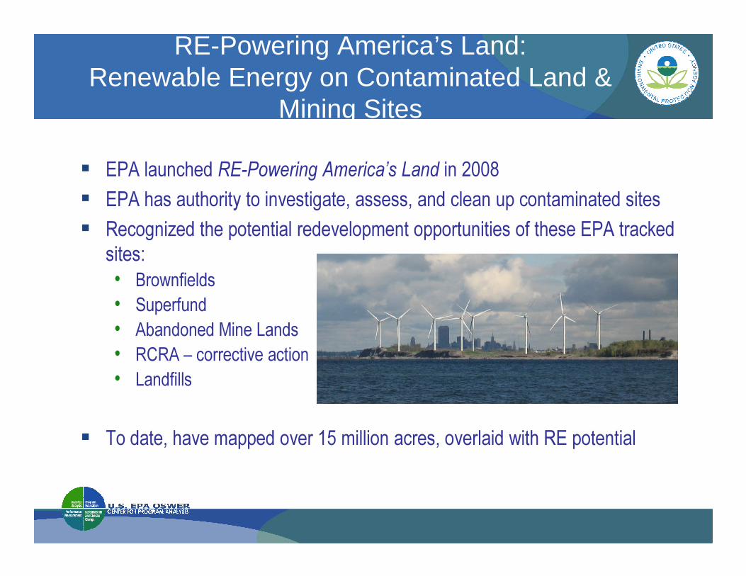
� EPA launched RE-Powering America’s Land in 2008� EPA has authority to investigate, assess, and clean up contaminated sites� Recognized the potential redevelopment opportunities of these EPA tracked
sites:• Brownfields • Brownfields • Superfund• Abandoned Mine Lands• RCRA – corrective action • Landfills
� To date, have mapped over 15 million acres, overlaid with RE potential

Why Focus on Renewable Energy on Contaminated Sites?
InfrastructureCommunity Support
Reduced Land Cost
Zoned Industrial
Tax Incentives
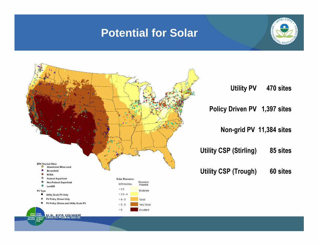
Potential for Solar
Utility PV 470 sites
Policy Driven PV 1,397 sites
Non-grid PV 11,384 sites
Utility CSP (Stirling) 85 sites
Utility CSP (Trough) 60 sites
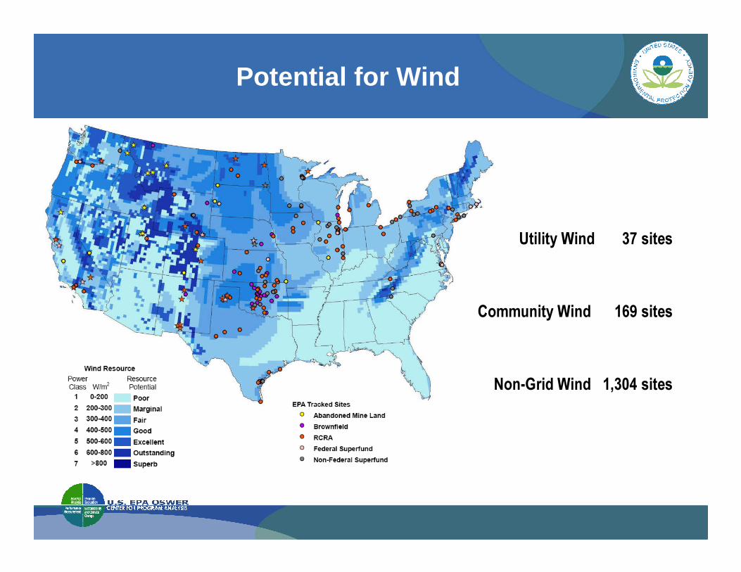
Potential for Wind
Utility Wind 37 sites
Community Wind 169 sites
Non-Grid Wind 1,304 sites
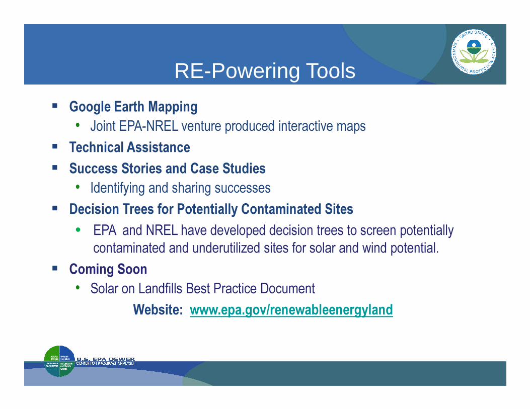
RE-Powering Tools
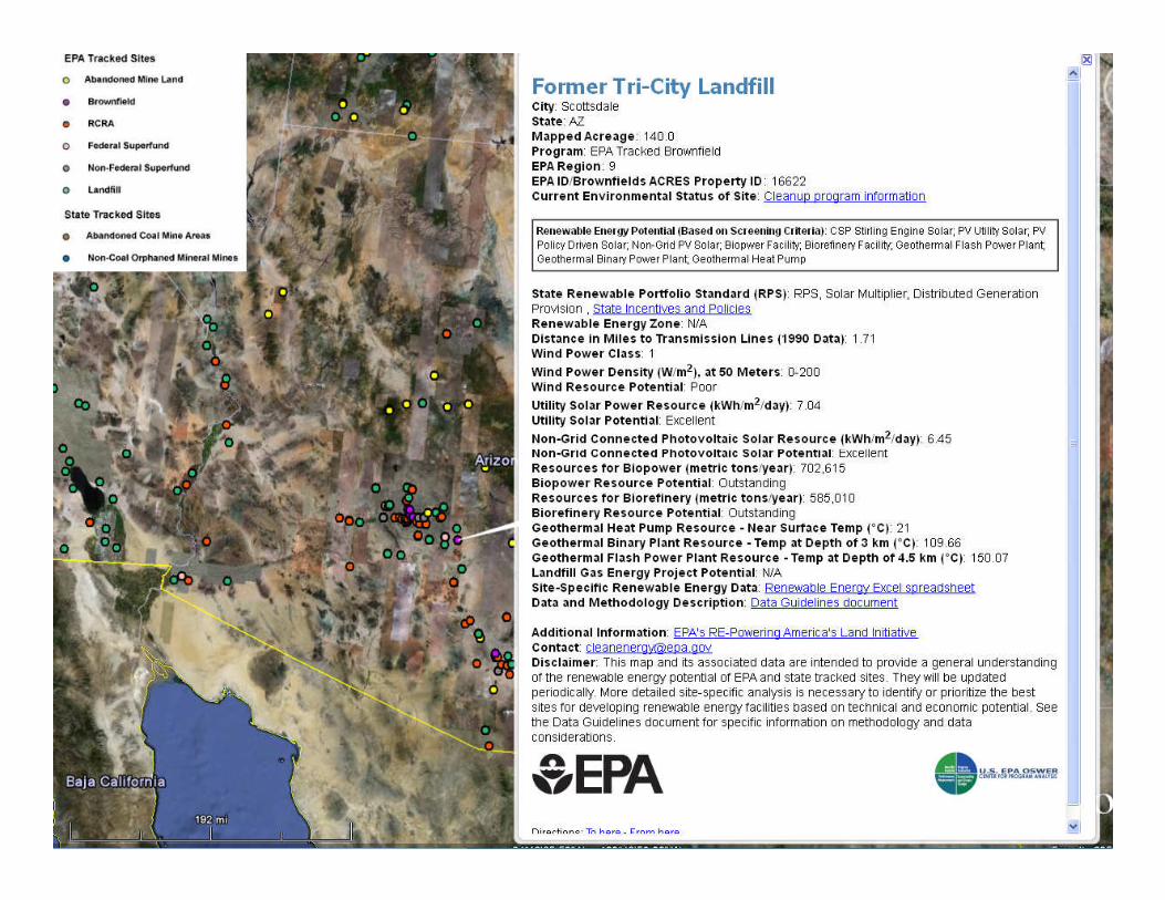
� Google Earth Mapping • Joint EPA-NREL venture produced interactive maps
� Technical Assistance� Success Stories and Case Studies
• Identifying and sharing successes � Decision Trees for Potentially Contaminated Sites� Decision Trees for Potentially Contaminated Sites
• EPA and NREL have developed decision trees to screen potentially contaminated and underutilized sites for solar and wind potential.
� Coming Soon• Solar on Landfills Best Practice Document
Website: www.epa.gov/renewableenergyland

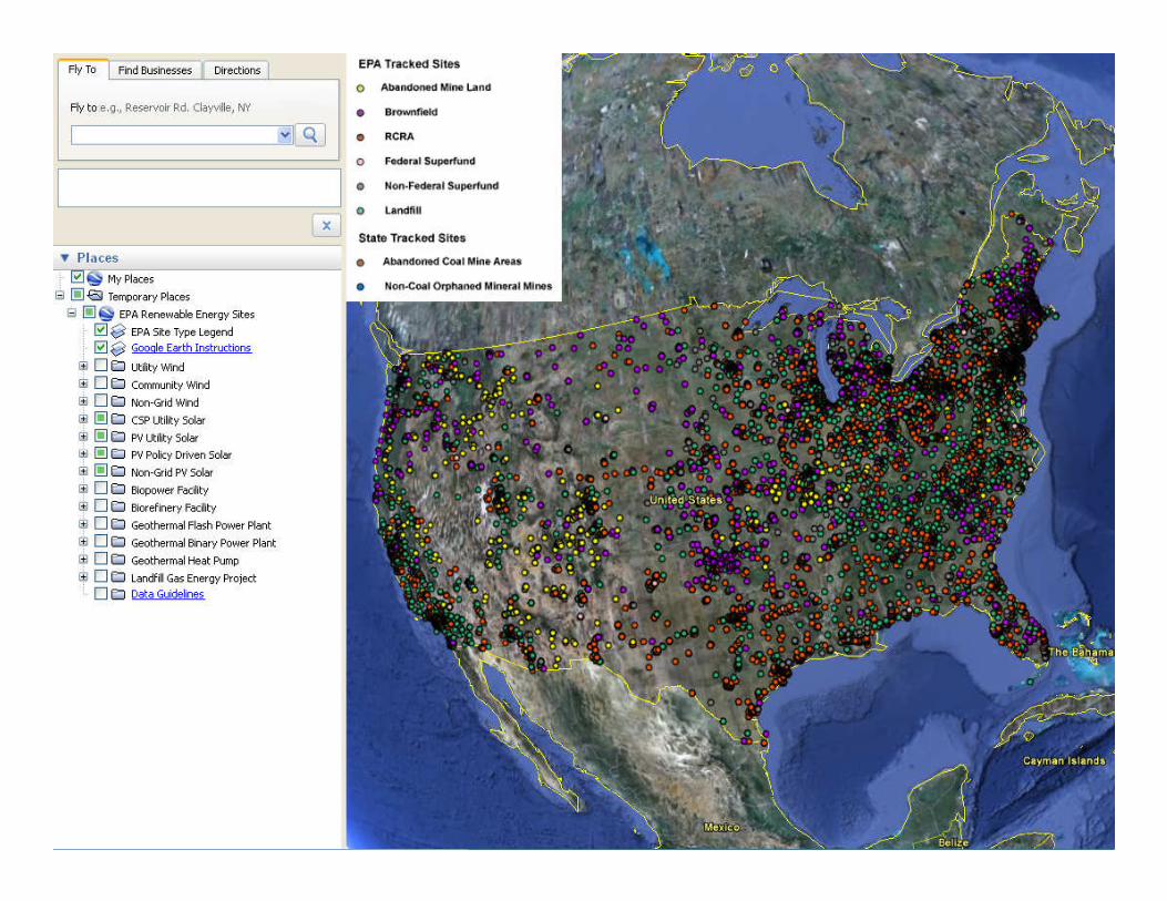
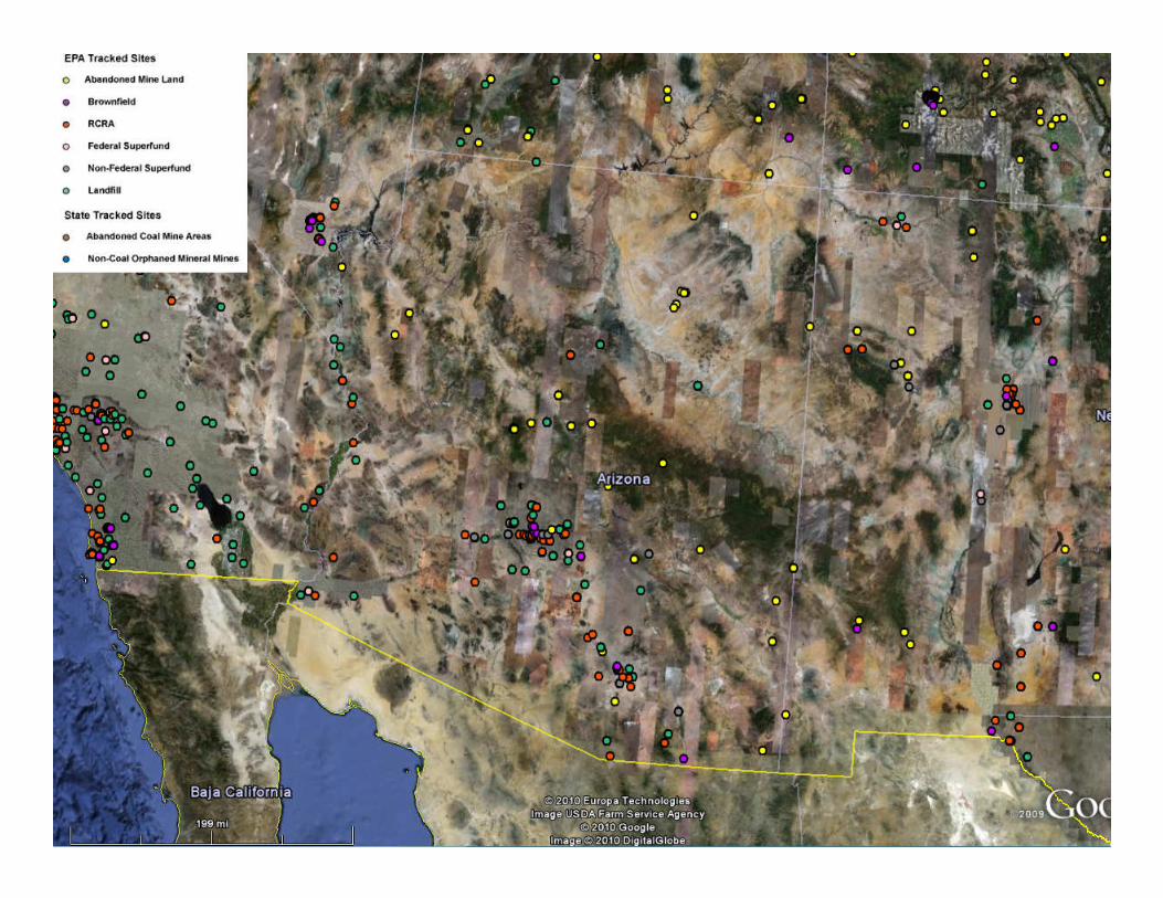
� Mapped EPA inventory of EPA tracked sites• Abandoned Mine Lands• Brownfields – sites that received a Brownfields grant• RCRA • Superfund• Landfills
Google Earth Mapping Tool
• Landfills� National Renewable Energy Laboratory (NREL) Data
• Wind, Solar, Biomass, and Geothermal Resources� Infrastructure Data
• U.S. Highways• U.S. National Transportation Atlas Railroads• Transmission Lines

Solar and Wind Decision Trees
Goal Enable state and local governments to evaluate potentially contaminated or underutilized sites for renewable energy potentialApproach Collaborate between EPA and NREL to create new tools to guide stakeholders through the process of screening sites for their suitability for future redevelopment with solar photovoltaic (PV) or wind energyNeeds and Objectives� Fills a knowledge gap� Fills a knowledge gap� Encourages a leadership role for local governments
• To address opportunities in the community for both privately-owned & publicly-owned sites
� Provides a straightforward, step-by-step screening process short of a detailed site-specific assessment• Aim is to narrow the field to good candidate sites for renewable energy based on technical and economic feasibility criteria

Key Stakeholders
State & Local GovernmentsTo help states and municipalities screen and prioritize existing sites for their suitability for solar PV installation
Renewable Energy DevelopersTo introduce considerations unique
Stakeholders & Targeted Sites
Brownfields, Superfund or RCRA sites
Landfills
Targeted Sites: Potentially Contaminated or Underut ilized Sites
To introduce considerations unique to redevelopment of potentially contaminated sites and provide common framework for interactions with state and local governments during project development phase
Clean-up Project ManagersTo aid clean-up PMs to screen their potentially contaminated sites for PV development potential
Underutilized rooftops Parking lots Abandoned parcels

NREL Partnership: Site Specific Analysis
� EPA Partnered with NREL to evaluate the feasibility of siting renewable energy on specific sites
� In 2010, conducted 12 feasibility studies and one alternative gas station project� In 2011-2012, selected 26 additional sites for feasibility studies through public
RFP� The analysis will include: � The analysis will include:
• determining the best renewable energy technology for the site, • the optimal location for placement of the renewable energy technology, • potential energy generating capacity, • the return on the investment, and • the economic feasibility of the renewable energy projects.
� Expected Outcome: A tool for the community to use when seeking developers for the site
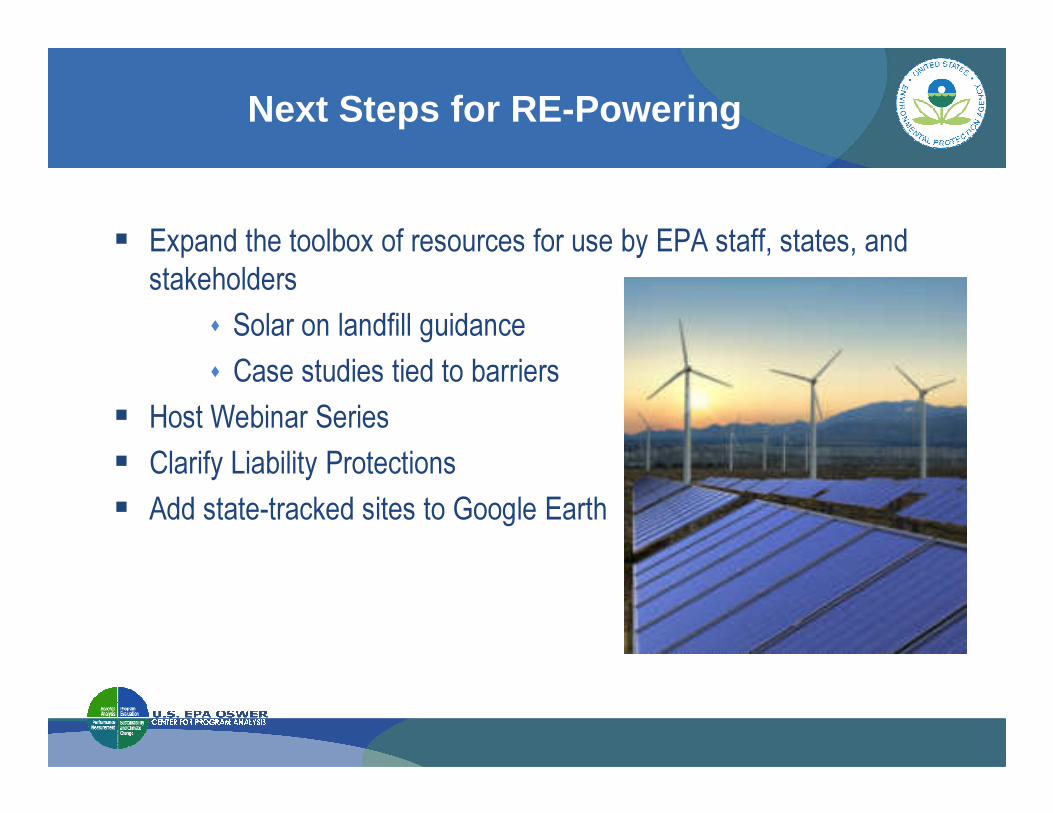
Next Steps for RE-Powering
� Expand the toolbox of resources for use by EPA staff, states, and stakeholders
� Solar on landfill guidance� Case studies tied to barriers
� Host Webinar Series� Host Webinar Series� Clarify Liability Protections� Add state-tracked sites to Google Earth
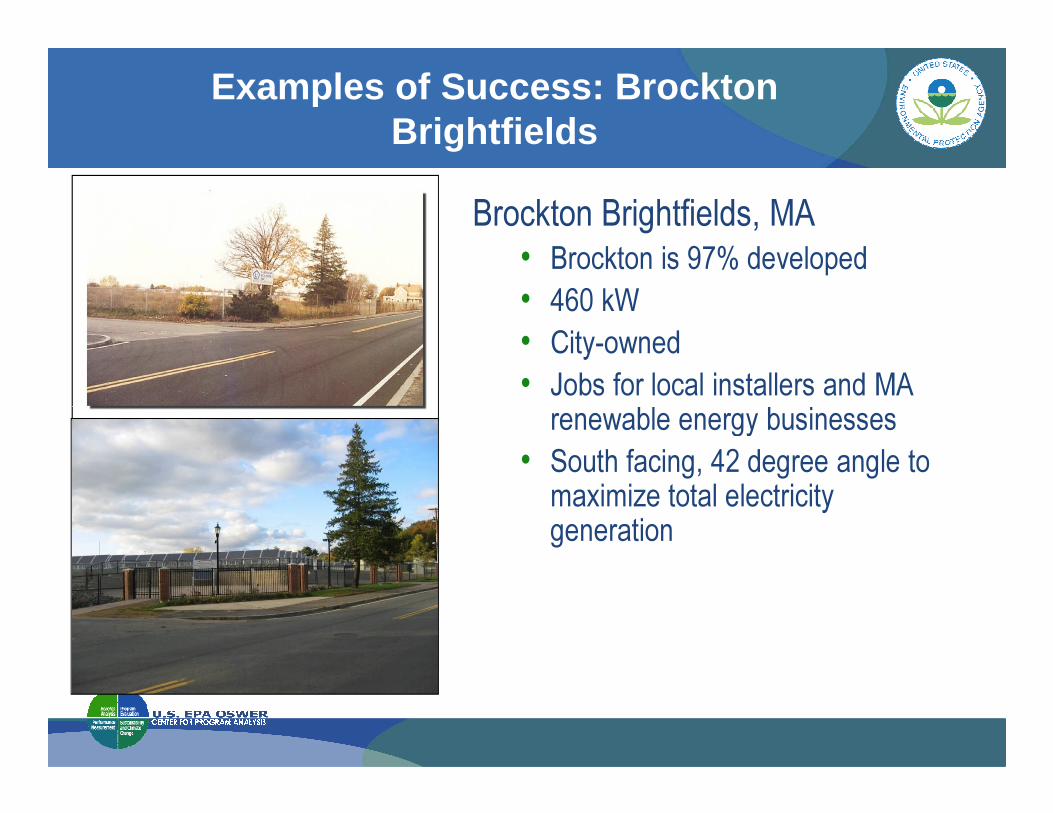
Examples of Success: Brockton Brightfields
Before and After Brockton Brightfields, MA • Brockton is 97% developed• 460 kW• City-owned• Jobs for local installers and MA renewable energy businessesrenewable energy businesses
• South facing, 42 degree angle to maximize total electricity generation
» Lura Matthews» Phone: (202) 566-2539» Email: [email protected]
Thank You
» www.epa.gov/renewableenergyland


