REMOTE SENSING APPLICATION CENTER INDONESIAN NATIONAL INSTITUTE OF AERONAUTICS AND SPACE (LAPAN)
United Nations International Conference on Space-based Technologies for Disaster Risk Reduction – “Understandiing Disaster Risk
BEIJING, CHINA, 19-21 SEPTEMBER 2016
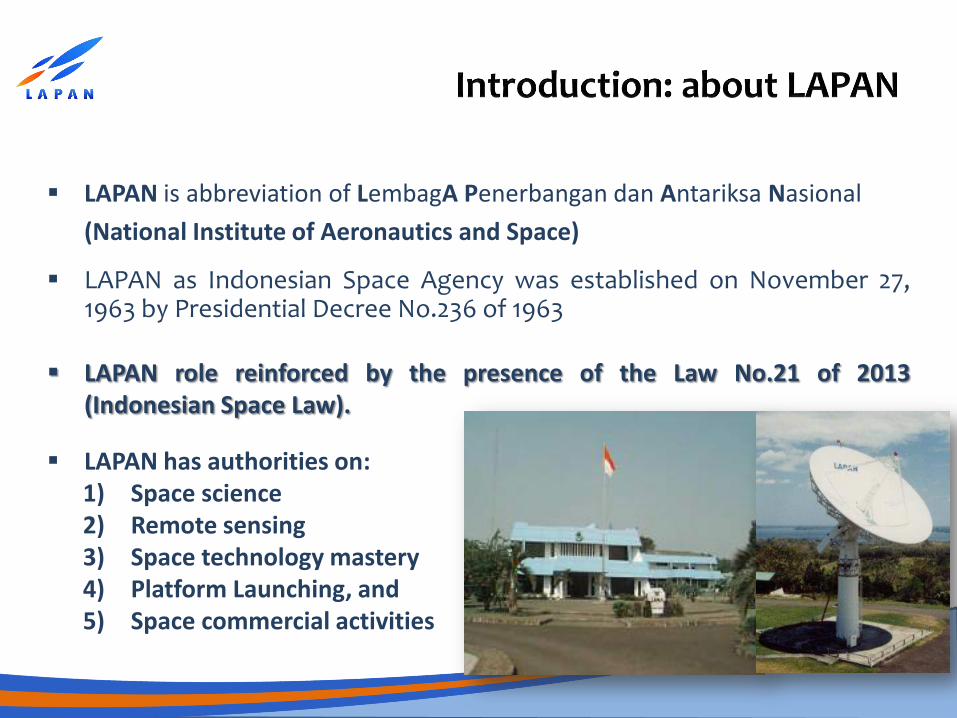
LAPAN as Indonesian Space Agency was established on November 27, 1963 by Presidential Decree No.236 of 1963
LAPAN has authorities on: 1) Space science 2) Remote sensing 3) Space technology mastery 4) Platform Launching, and 5) Space commercial activities
LAPAN role reinforced by the presence of the Law No.21 of 2013 (Indonesian Space Law).
LAPAN is abbreviation of LembagA Penerbangan dan Antariksa Nasional
(National Institute of Aeronautics and Space)
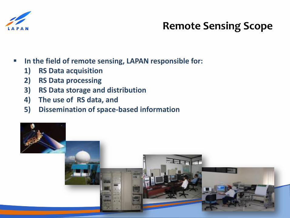
In the field of remote sensing, LAPAN responsible for: 1) RS Data acquisition 2) RS Data processing 3) RS Data storage and distribution 4) The use of RS data, and 5) Dissemination of space-based information
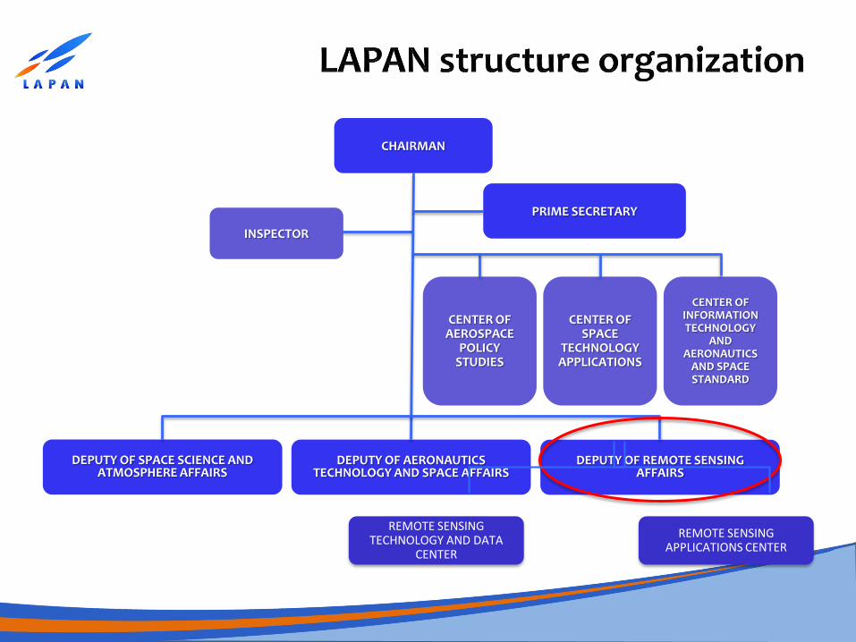
CHAIRMAN
INSPECTOR
PRIME SECRETARY
DEPUTY OF SPACE SCIENCE AND ATMOSPHERE AFFAIRS
DEPUTY OF AERONAUTICS TECHNOLOGY AND SPACE AFFAIRS
DEPUTY OF REMOTE SENSING AFFAIRS
CENTER OF AEROSPACE
POLICY STUDIES
CENTER OF SPACE
TECHNOLOGY APPLICATIONS
CENTER OF INFORMATION TECHNOLOGY
AND AERONAUTICS
AND SPACE STANDARD
REMOTE SENSING TECHNOLOGY AND DATA
CENTER
REMOTE SENSING APPLICATIONS CENTER
The Indonesian Space Act No.21/2013
• LAPAN requires to provide the high resolution satellite remote sensing data with the Indonesian Government license for Ministries/Government Agencies, Army, Police, and Local Governments.
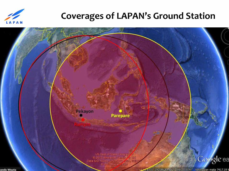
• Regulation on remote sensing Satellite and Ground Station in Indonesia.
• Regulation on standard methods of remote sensing data processing.
• Regulation on guidelines of remote sensing applications and information dissemination.
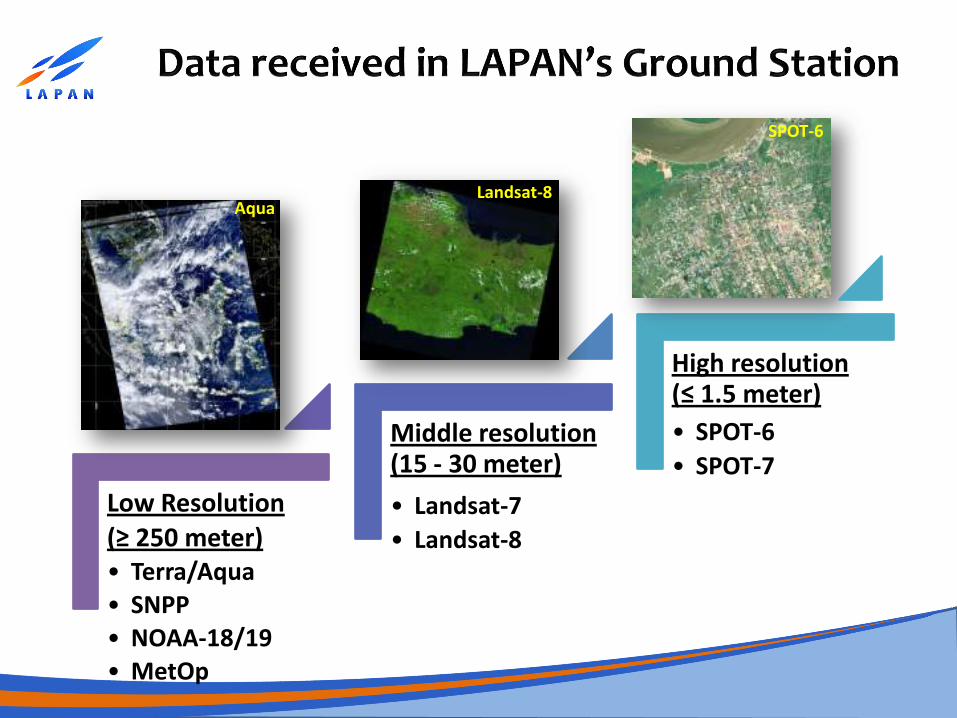
Low Resolution (≥ 250 meter) • Terra/Aqua • SNPP • NOAA-18/19 • MetOp
Middle resolution (15 - 30 meter)
• Landsat-7
• Landsat-8
High resolution (≤ 1.5 meter)
• SPOT-6
• SPOT-7
Aqua Landsat-8
SPOT-6
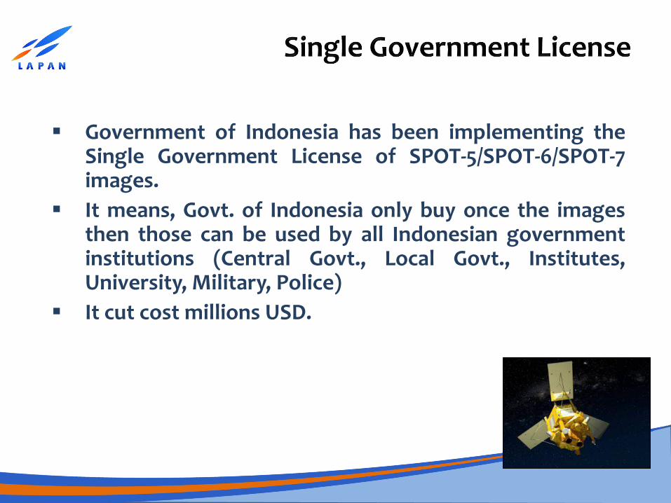
Government of Indonesia has been implementing the Single Government License of SPOT-5/SPOT-6/SPOT-7 images.
It means, Govt. of Indonesia only buy once the images then those can be used by all Indonesian government institutions (Central Govt., Local Govt., Institutes, University, Military, Police)
It cut cost millions USD.
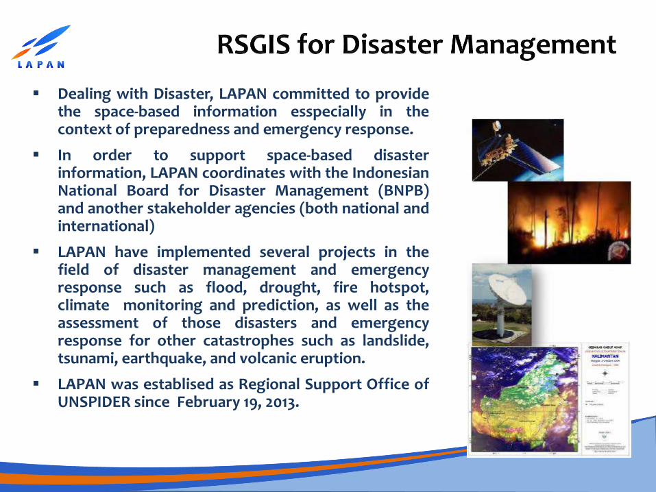
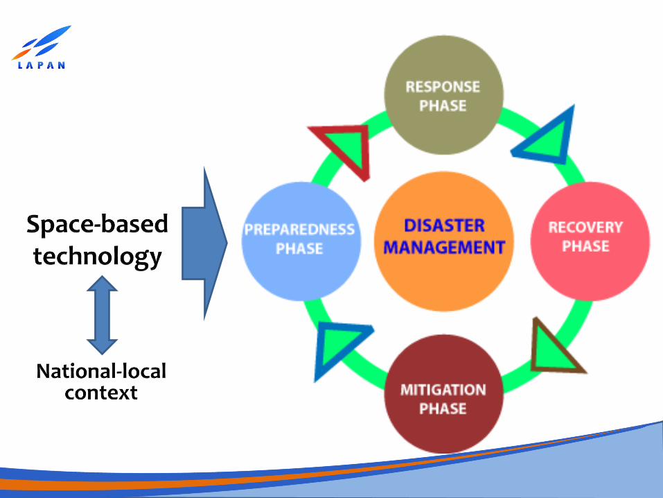
Dealing with Disaster, LAPAN committed to provide the space-based information esspecially in the context of preparedness and emergency response.
In order to support space-based disaster information, LAPAN coordinates with the Indonesian National Board for Disaster Management (BNPB) and another stakeholder agencies (both national and international)
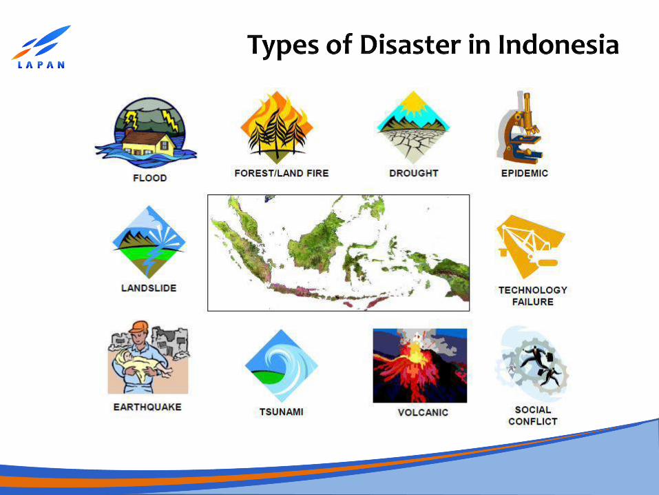
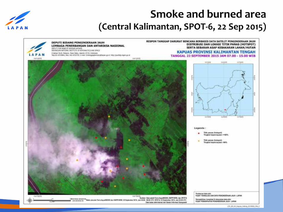
LAPAN have implemented several projects in the field of disaster management and emergency response such as flood, drought, fire hotspot, climate monitoring and prediction, as well as the assessment of those disasters and emergency response for other catastrophes such as landslide, tsunami, earthquake, and volcanic eruption.
LAPAN was establised as Regional Support Office of UNSPIDER since February 19, 2013.
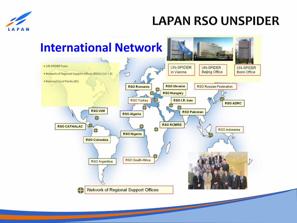
International Network
www.lapan.go.id
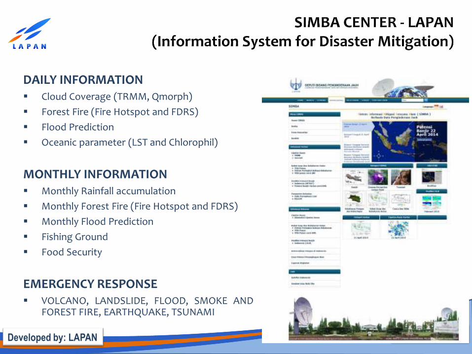
DAILY INFORMATION Cloud Coverage (TRMM, Qmorph)
Forest Fire (Fire Hotspot and FDRS)
Flood Prediction
Oceanic parameter (LST and Chlorophil)
MONTHLY INFORMATION Monthly Rainfall accumulation
Monthly Forest Fire (Fire Hotspot and FDRS)
Monthly Flood Prediction
Fishing Ground
Food Security
EMERGENCY RESPONSE VOLCANO, LANDSLIDE, FLOOD, SMOKE AND
FOREST FIRE, EARTHQUAKE, TSUNAMI
Developed by: LAPAN
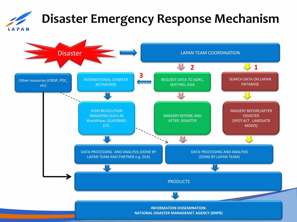
Disaster LAPAN TEAM COORDINATION
SEARCH DATA ON LAPAN DATABASE
IMAGERY BEFORE/AFTER DISASTER
(SPOT-6/7 , LANDSAT8 MODIS)
PRODUCTS
DATA PROCESSING AND ANALYSIS (DONE BY LAPAN TEAM)
REQUEST DATA TO ADRC, SENTINEL ASIA
IMAGERY BEFORE AND AFTER DISASTER
INTERNATIONAL CHARTER ACTIVATION
HIGH RESOLUTION IMAGERIES SUCH AS
WorldView, QUICKBIRD, ETC.
DATA PROCESSING AND ANALYSIS (DONE BY LAPAN TEAM AND PARTNER e.g. DLR)
INFORMATION DISSEMINATION: NATIONAL DISASTER MANAGEMET AGENCY (BNPB)
Other resources (CRISP, PDC, etc)
1 2 3
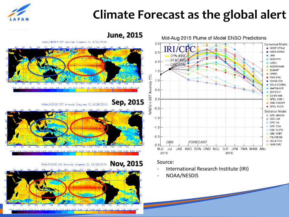
June, 2015
Nov, 2015
Sep, 2015
Source: - International Research Institute (IRI) - NOAA/NESDIS
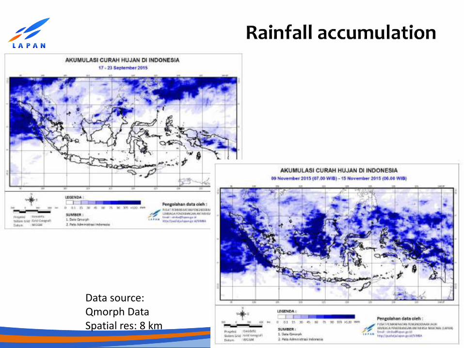
Data source: Qmorph Data Spatial res: 8 km
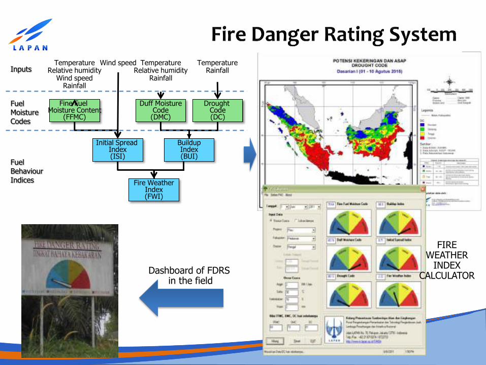
Fine Fuel Moisture Content
(FFMC)
Duff Moisture Code (DMC)
Drought Code (DC)
Initial Spread Index (ISI)
Buildup Index (BUI)
Fire Weather Index (FWI)
Temperature Relative humidity
Wind speed Rainfall
Temperature Rainfall
Temperature Relative humidity
Rainfall
Wind speed Inputs
Fuel Moisture Codes
Fuel Behaviour Indices
Dashboard of FDRS in the field
FIRE WEATHER
INDEX CALCULATOR
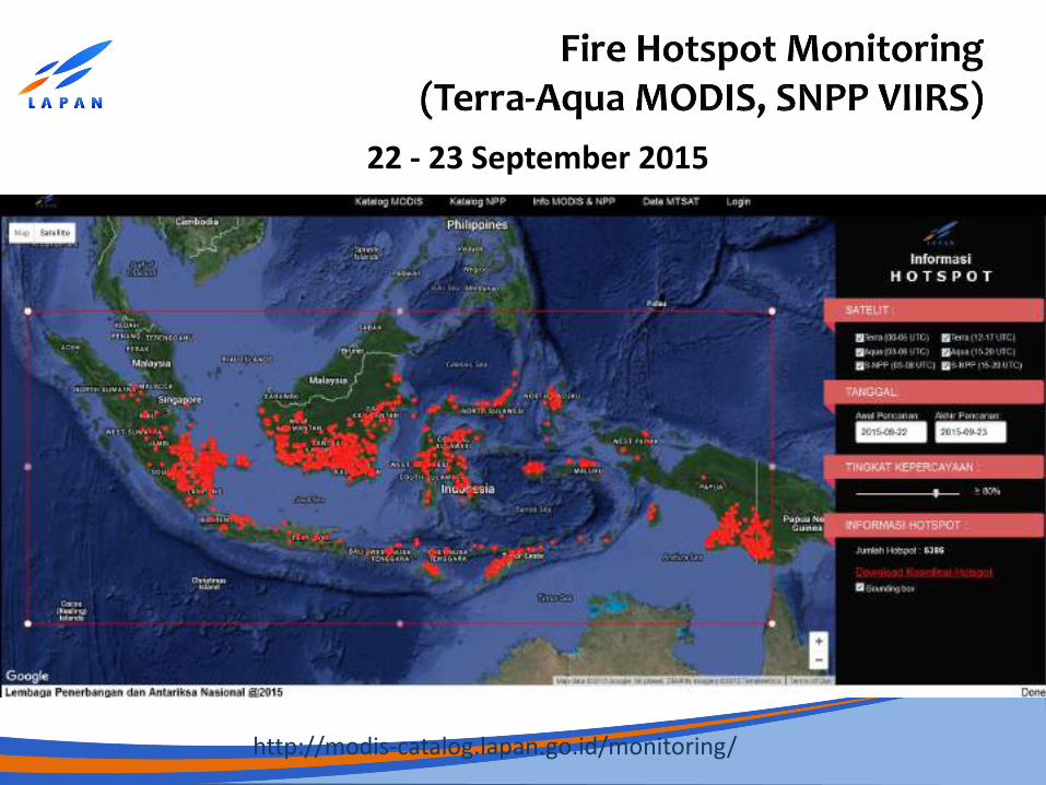
22 - 23 September 2015
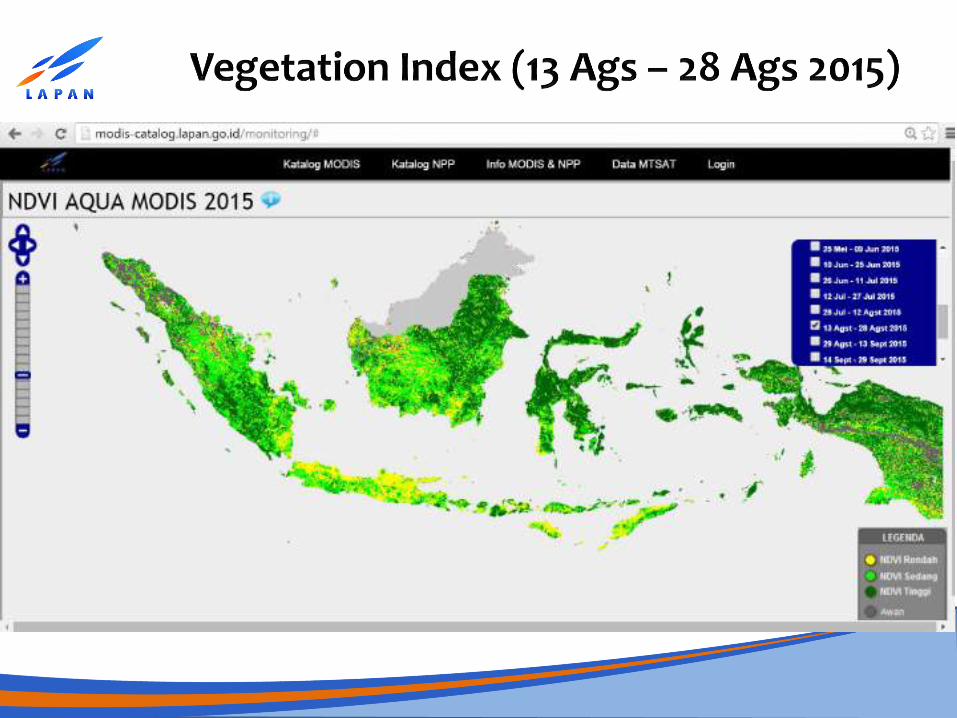
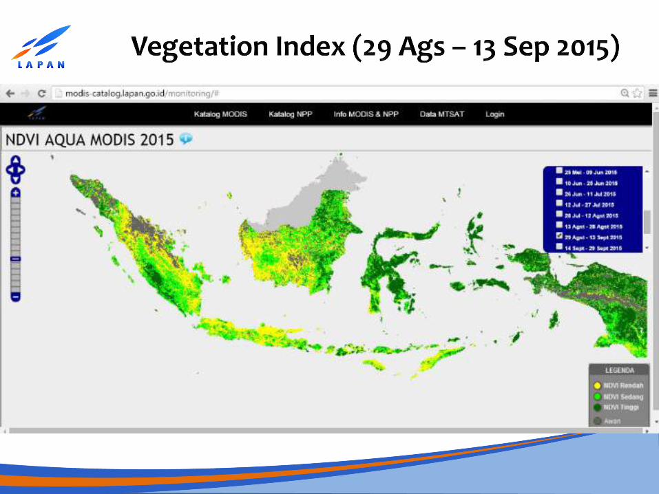
http://modis-catalog.lapan.go.id/monitoring/
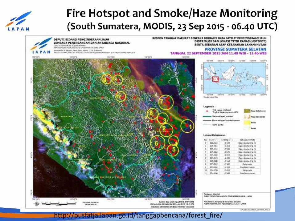
http://pusfatja.lapan.go.id/tanggapbencana/forest_fire/
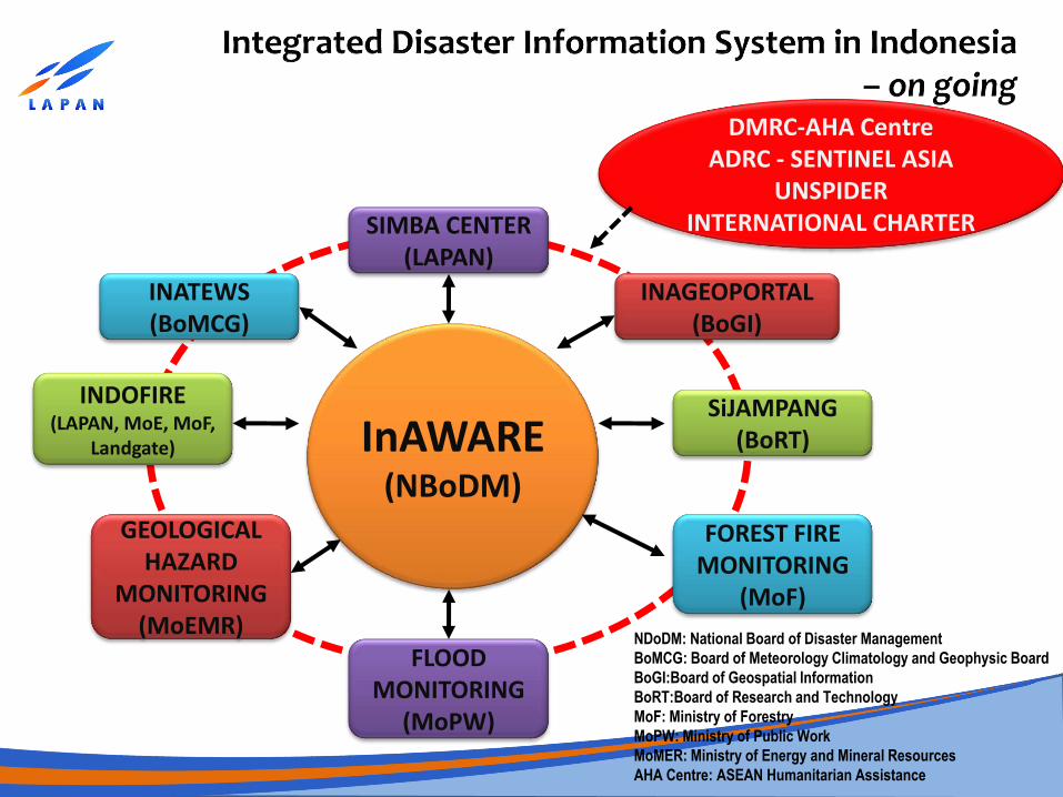
InAWARE (NBoDM)
SIMBA CENTER (LAPAN)
INATEWS (BoMCG)
INAGEOPORTAL (BoGI)
INDOFIRE (LAPAN, MoE, MoF,
Landgate)
SiJAMPANG (BoRT)
GEOLOGICAL HAZARD
MONITORING (MoEMR)
FLOOD MONITORING
(MoPW)
FOREST FIRE MONITORING
(MoF)
DMRC-AHA Centre ADRC - SENTINEL ASIA
UNSPIDER INTERNATIONAL CHARTER
NDoDM: National Board of Disaster Management
BoMCG: Board of Meteorology Climatology and Geophysic Board
BoGI:Board of Geospatial Information
BoRT:Board of Research and Technology
MoF: Ministry of Forestry
MoPW: Ministry of Public Work
MoMER: Ministry of Energy and Mineral Resources
AHA Centre: ASEAN Humanitarian Assistance
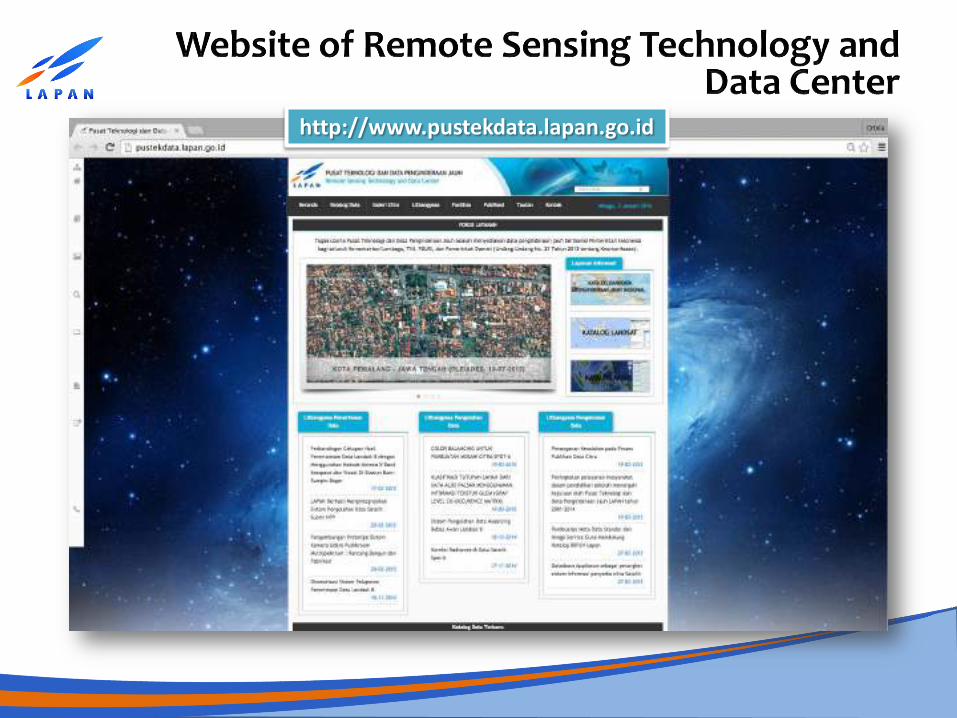
http://www.pustekdata.lapan.go.id
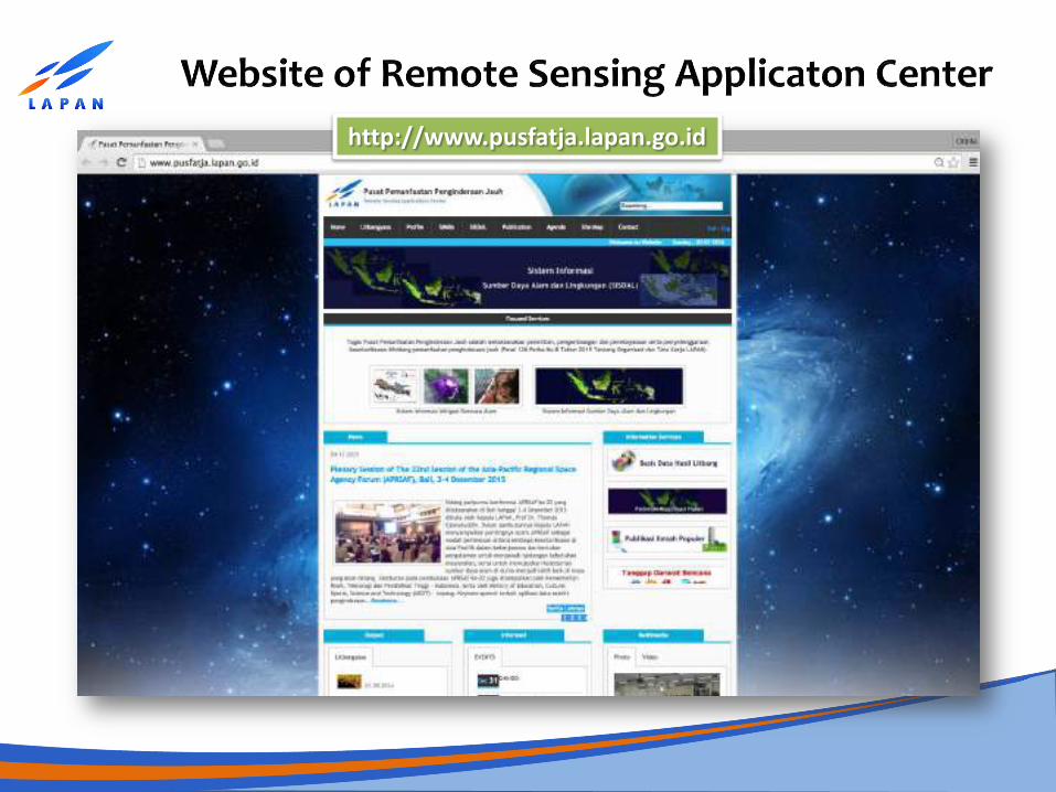
http://www.pusfatja.lapan.go.id
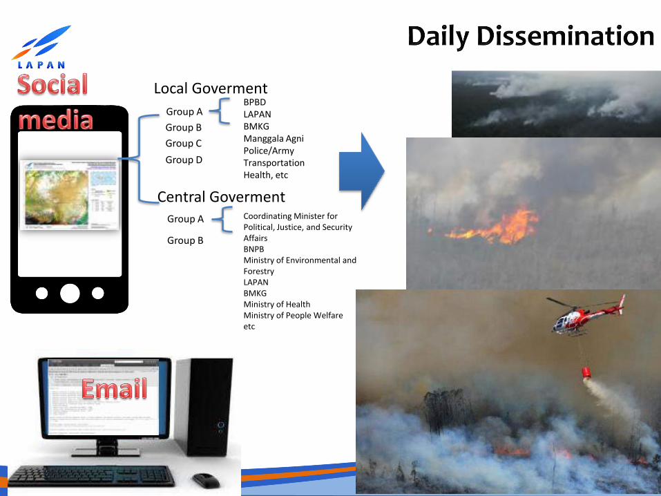
Group A Group B Group C Group D
Local Goverment
Group A Group B
Central Goverment
BPBD LAPAN BMKG Manggala Agni Police/Army Transportation Health, etc
Coordinating Minister for Political, Justice, and Security Affairs BNPB Ministry of Environmental and Forestry LAPAN BMKG Ministry of Health Ministry of People Welfare etc
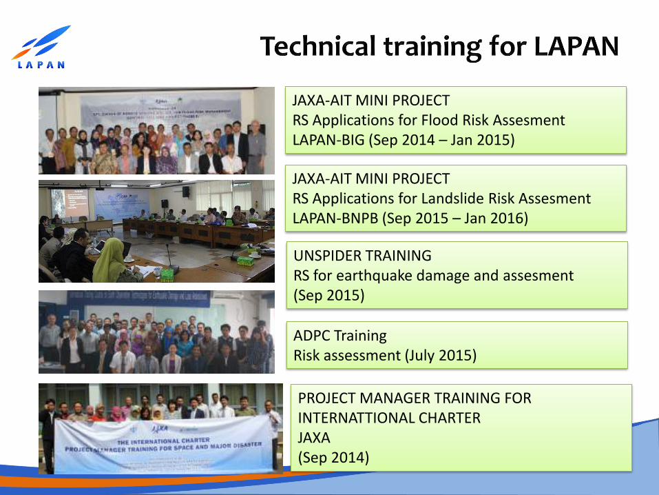
JAXA-AIT MINI PROJECT RS Applications for Flood Risk Assesment LAPAN-BIG (Sep 2014 – Jan 2015)
JAXA-AIT MINI PROJECT RS Applications for Landslide Risk Assesment LAPAN-BNPB (Sep 2015 – Jan 2016)
UNSPIDER TRAINING RS for earthquake damage and assesment (Sep 2015)
PROJECT MANAGER TRAINING FOR INTERNATTIONAL CHARTER JAXA (Sep 2014)
ADPC Training Risk assessment (July 2015)
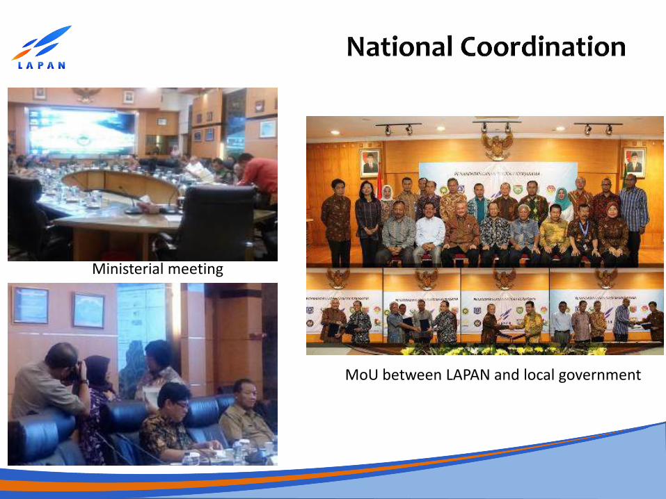
Ministerial meeting
MoU between LAPAN and local government
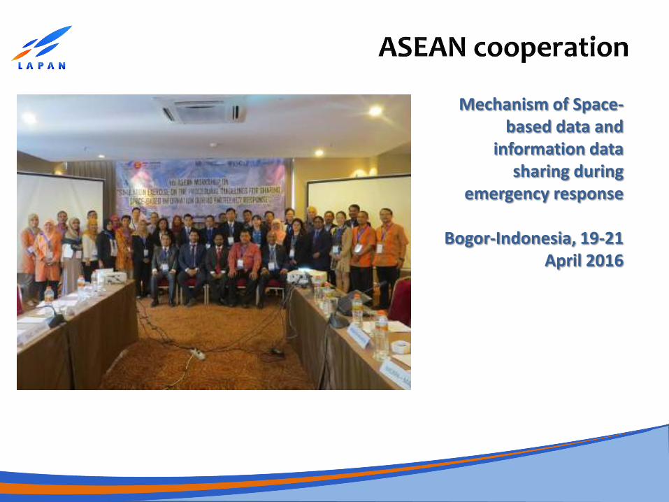
Mechanism of Space-based data and
information data sharing during
emergency response
Bogor-Indonesia, 19-21 April 2016
How can the process of identification, analysis, interpretation and delivery of disaster information can be done in an effective, efficient, accurate and fast, so that people in the danger zone of disaster can anticipate the disasters? Discrepancies in maps and data from various organisations. Data sharing mechanism. Timely availability of data. Huge data size that make difficult to process and transfer via internet. Difficulty in getting high resolution satellite images during
emergencies. Lack of trained manpower at local level.
How do the results of the process of high tech remote sensing can be easily understood by the various levels of society?
The need for proper education process and comprehensively to various walks of life.