

NASA/TMm2000-209891, Vol. 193
Technical Report Series on theBoreal Ecosystem-Atmosphere Study (BOREAS)
Forrest G. Hall and Karl Huemmrich, Editors
Volume 193
BOREAS TF-2 SSA-OA Tower Flux,
Meteorological, and PrecipitationData
Harold Neumann, Robert Mickle, and Ralf Staebler
Atmospheric Environment Service, Downsview, Ontario
National Aeronautics and
Space Administration
Goddard Space Flight Center
Greenbelt, Maryland 20771
October 2000
https://ntrs.nasa.gov/search.jsp?R=20010022231 2020-07-01T02:28:15+00:00Z

The NASA STI Program Office ... in Profile
Since its founding, NASA has been dedicated to
the advancement of aeronautics and spacescience. The NASA Scientific and Technical
Information (STI) Program Office plays a key
part in helping NASA maintain this importantrole.
The NASA STI Program Office is operated by
Langley Research Center, the lead center forNASA's scientific and technical information. The
NASA STI Program Office provides access to
the NASA STI Database, the largest collection of
aeronautical and space science STI in the world.
The Program Office is also NASA's institutional
mechanism for disseminating the results of its
research and development activities. These
results are published by NASA in the NASA STI
Report Series, which includes the following
report types:
• TECHNICAL PUBLICATION. Reports of
completed research or a major significant
phase of research that present the results of
NASA programs and include extensive data or
theoretical analysis. Includes compilations of
significant scientific and technical data and
information deemed to be of continuing
reference value. NASA's counterpart of
peer-reviewed formal professional papers but
has less stringent limitations on manuscript
length and extent of graphic presentations.
• TECHNICAL MEMORANDUM. Scientific
and technical findings that are preliminary or
of specialized interest, e.g., quick release
reports, working papers, and bibliographiesthat contain minimal annotation. Does not
contain extensive analysis.
• CONTRACTOR REPORT. Scientific and
technical findings by NASA-sponsored
contractors and grantees.
CONFERENCE PUBLICATION. Collected
papers from scientific and technical
conferences, symposia, seminars, or other
meetings sponsored or cosponsored by NASA.
SPECIAL PUBLICATION. Scientific, techni-cal, or historical information from NASA
programs, projects, and mission, often con-
cerned with subjects having substantial publicinterest.
TECHNICAL TRANSLATION.
English-language translations of foreign scien-
tific and technical material pertinent to NASA'smission.
Specialized services that complement the STI
Program Office's diverse offerings include creat-
ing custom thesauri, building customized data-
bases, organizing and publishing research results...
even providing videos.
For more information about the NASA STI Pro-
grain Office, see the following:
Access the NASA STI Program Home Page at
http://www, sti.nasa.gov/STI-homepage.html
E-mail your question via the Internet to
help@ sti.nasa.gov
Fax your question to the NASA Access Help
Desk at (301) 621-0134
• Telephone the NASA Access Help Desk at
(301) 621-0390
Write to:
NASA Access Help Desk
NASA Center for AeroSpace Information7121 Standard Drive
Hanover, MD 21076-1320

NASA/TMm2000-209891, Vol. 193
Technical Report Series on theBoreal Ecosystem-Atmosphere Study (BOREAS)
Forrest G. Hall and Karl Huemmrich, Editors
Volume 193
BOREAS TF-2 SSA-OA Tower Flux,
Meteorological, and PrecipitationData
Harold Neumann, Robert Mickle, and Ralf Staebler
Atmospheric Environment Service, Downsview, Ontario
National Aeronautics and
Space Administration
Goddard Space Flight Center
Greenbelt, Maryland 20771
October 2000

NASA Center for AeroSpace Information7121 Standard Drive
Hanover, MD 21076-1320Price Code: A17
Available from:
National Technical Information Service
5285 Port Royal RoadSpringfield, VA 22161
Price Code: A10

BOREAS TF-2 SSA-OA Tower Flux, Meteorological, and Precipitation
Data
Harold Neumann, Robert Mickle, Ralf Staebler
Summary
The BOREAS TF-2 team collected energy, carbon dioxide, water vapor, and momentum flux dataabove the canopy and in profiles through the canopy, along with meteorological data at the BOREASSSA-OA site. Above-canopy measurements began in early February and ran through mid-Septemberof 1994. Measurements were collected over a longer period of 1994 than most BOREAS flux sites.Daily precipitation data from several gauges were also collected. The data are available in tabularASCII files.
Table of Contents
1) Data Set Overview
2) Investigator(s)3) Theory of Measurements4) Equipment5) Data Acquisition Methods6) Observations
7) Data Description8) Data Organization9) Data Manipulations10) Errors11) Notes
12) Application of the Data Set13) Future Modifications and Plans14) Software15) Data Access
16) Output Products and Availability17) References
18) Glossary of Terms19) List of Acronyms20) Document Information
1. Data Set Overview
1.1 Data Set Identification
BOREAS TF-02 SSA-OA Tower Flux, Meteorological, and Precipitation Data
1.2 Data Set Introduction
The Tower Flux (TF)-02 team collected heat, carbon dioxide, water vapor, and momentum fluxesalong with meteorological data measured from the BOReal Ecosystem-Atmosphere Study (BOREAS)Southern Study Area (SSA) Old Aspen (OA) tower. Measurements were collected at several differentheights within and above the forest canopy to produce profiles of several variables, including sensibleheat flux, latent heat flux, air density, wind speed and direction, friction velocity, momentum flux,CO2 concentration and flux, water vapor flux, air temperature, vapor pressure, and dewpoint
temperature. Data collection began in early February 1994, making this site the earliest BOREAS fluxtower to collect data in 1994.
Page 1

1.3 Objective/PurposeThegeneralobjectivewasto studyCO 2 and water vapor exchange between the forest and
atmosphere at the SSA-OA site. Specific objectives were:• To measure the fluxes of sensible heat, H20 and CO2 above and within the aspen stand
throughout the year.• To obtain from the CO2 flux data estimates of gross photosynthesis and respiration.
• To determine the contribution of the hazelnut understory to net ecosystem productivity (NEP).• To determine the effects of environmental factors on stand evapotranspiration and NEP.• To take part in the development of procedures for scaling up component fluxes to the stand
level.
• To study the processes controlling turbulent transfer of H20 and CO2 within the stand.
• To take part in the evaluation of methods of estimating nocturnal CO2 in and above the stand.
1.4 Summary of Parameters
Profiles through the forest canopy of the following variables were measured: latent heat flux, latentheat storage, sensible heat flux, air density, CO2 flux, CO2 concentration, CO2 storage flux,
momentum flux, air temperature, wind speed and direction, friction velocity, standard deviation of thevertical wind speed, water vapor flux, and virtual heat flux. Other measurements include net radiation,incident and reflected photosynthetic photon flux density (PPFD), incident shortwave radiation, airpressure, relative humidity, canopy surface temperature, absolute humidity, ozone concentration, andprecipitation.
1.5 Discussion
In 1993 and 1994, the TF-01 group measured fluxes under the canopy at the SSA-OA site, whilethe TF-02 group measured above-canopy fluxes and profiles at that site. In 1996, the TF-01 groupmoved its equipment to the top of the 39-meter tower to measure above-canopy fluxes; this documentdescribes the TF-02 1994 data collection effort.
The TF-02 group operated an eddy correlation system at the 39-m height. It consisted of a 3-Dsonic anemometer (model DAT-310 with model TR-61B probe, Kaijo-Denki, Tokyo, Japan) with a20-cm path length, a model 6262 Infrared Gas Analyzer (IRGA), and an ozone sensor. Air was drawnat 6.5 l/rain down 6-m long heated 3.2-ram inner diameter (i.d.) Bev-a-line sampling tubing, thenpumped through the sample cell using two diaphragm pumps (model TD-4X2N, Brailsford Co. Rye,NY) connected in parallel. To prevent condensation, the sampling tubing was heated (2-3 °C aboveambient) by passing an electric current through 20-AWG nichrome wire (about 15 ohms resistance)coiled around the exterior of the tubing. Sample cell pressure was approximately atmospheric pressureand the delay time was 1.2 s. The IRGA was operated in differential mode with 320 retool/tool CO2 in
dry air flowing through the reference cell at 30 cm3/min. TF-02 also operated 3-D sonic anemometersat 28.6, 18.6, 5.9 (all TR-61B probes), and 0.5 m (miniature probe). A second University of BritishColumbia (UBC) IRGA unit was used with the 28.6, 5.9, and 0.5 m units during selected periods in1994 (see P.C. Yang's Ph.D. thesis, 1998).
Other measurements included air temperatures using aspirated platinum resistance thermometers (at0.8, 2.3, 6.8, 9.9, 13.0, 16.1, 19.2, 22.3, 25.4, 30.1, and 34.6 m), downward total and diffusesolar (model PSP pyranometer, The Eppley Laboratory, Inc., Newport, RI), downward longwave(Eppley model PIR pyrgeometer) and net radiation (Middleton model CN- 1 net radiometer), PPFD(LI-COR model 190-SB quantum sensor) above the forest (at 33-m height from the ground), airhumidity above (model M1 dewpoint hygrometer with a model D2 sensor, General EasternInstruments Corp., Watertown, MA) and below (model HMP-35C sensor, Vaisala, Inc., Woburn,MA) the overstory, wind speed and direction above and below the overstory (model 05031 vanepropeller anemometer, R.M. Young Co., Traverse City, MI), and infrared surface temperatures of theaspen and hazelnut canopies (model 4000 IR thermometer, Everest Interscience, Inc., Fullerton, CA).Precipitation was measured using a weighing rain gauge (Belfort Instrument Co., Baltimore, MD). Inaddition, TF-02 operated a CO2 concentration profile system, consisting of eight levels: 0.8, 2.3, 9.5,
15.7, 18.8, 21.9, 25, and 34.5 m. Air was drawn through heated Dekoron tubing (9.3-ram innerdiameter) by a rotary pump and pushed through a LI-COR 6262 IRGA by a small diaphragm pump.
Page 2

1.6 Related Data SetsBOREAS TF-01 SSA-OA Soil Characteristics Data
BOREAS TF-01 SSA-OA Tower Flux and Meteorological Data, and Soil Temperature DataBOREAS TF-01 Understory Flux, Meteorological, and Soil Temperature DataBOREAS TF-09 SSA-OBS Tower Flux, Meteorological, and Soil Temperature Data
2. Investigator(s)
2.1 Investigator(s) Name and TitleGerry den HartogAtmospheric Environment Service
Harold Neumann
Air Quality Processes Research DivisionAtmospheric Environment Service
2.2 Title of InvestigationBoreal Forest Atmosphere Interactions: Exchanges of Energy, Water Vapor and Trace Gases
(SSA-OA)
2.3 Contact Information
Contact 1:Harold Neumalm
Air Quality Processes Research DivisionAtmospheric Environment Service4905 Dufferin Street
Downsview, ONCanada M3H 5T4
(416) 739-4858(416) 739-4224 (fax)[email protected]
Contact 2:Robert Mickle
Air Quality Processes Research DivisionAtmospheric Environment Service4905 Dufferin Street
Downsview, ONCanada M3H 5T4
Contact 3:Ralf Staebler
Air Quality Processes Research DivisionAtmospheric Environment Service4905 Dufferin Street
Downsview, ONCanada M3H 5T4
ralf. staebler@ ec.gc .ca
Page 3

Contact 4:K. FredHuemmrichUniversityof MarylandNASA GSFCCode923Greenbelt,MD 20771(301)286-4862(301)286-0239(fax)[email protected]
3. Theory of Measurements
Measurements of the fluxes of momentum, sensible heat, water vapor, and C02 were made with the
eddy covariance technique. Velocity components, air temperature, water vapor density, and CO2
concentration in the air were sampled rapidly, and calculations of relevant covariances were performedfrom these samples to obtain the fluxes. For example, the flux of CO2 was determined as follows:
F c = w'c'
where w' is the departure of the vertical velocity component from its mean over the averaging interval,usually 30 minute, and c' is the departure of CO2 concentration from its mean.
At the overstory level, three rotations in the coordinate transformation are applied to the flux data tomake the lateral component (v '), vertical component (w '), and covariance (u 'v ') of the wind vectorequal to zero. At the understory level, however, only the mean lateral wind velocity component wasrotated to zero under the suspicion that nonzero mean vertical velocities are possible within the trunkspace. Webb, Pearman, and Leuning (1980) (WPL) corrections were made to the water vapor andcarbon dioxide fluxes measured using the closed-path LI-COR 6262 infrared gas analyzer (IRGA).Broadening correction was done, but not on-line (see Chen et al., 1998, for summary of theory).
4. Equipment
4.1 Sensor/Instrument Description
4.1.1 Collection Environment
Measurements were collected from beginning of the year to mid-September of 1994. Over that timeperiod, temperature conditions from less than -30 °C to over 30 °C were experienced.
4.1.2 Source/Platform
A 37-m walk-up scaffold main tower and a 6-m scaffold tower about 40 m from the main tower.Rain gauges were located in a small clearing 70 m NE of the main tower.
4.1.3 Source/Platform Mission Objectives
The objective of the flux tower was to support instrumentation for the study of the fluxes of C02,
energy, water vapor, and momentum between the forest and atmosphere at the SSA-OA.
4.1.4 Key Variables
Variables measured using eddy covariance: C02 and water vapor fluxes, momentum fluxes,sensible heat fluxes, and latent heat fluxes.
Supporting meteorological variables: net radiation, downward solar radiation, incident andreflected PPFD, wind speed, wind direction, air temperature, and precipitation.
Page 4

4.1.5 Principles of Operation
A sonic anemometer determines the wind speed by a pair of transducers acting alternately astransmitters and receivers, sending pulses of high-frequency ultrasound between themselves. The 3-Dsonic has three pairs of transducers arranged in nonparallel axes.
The LI-COR 6262 CO2/HzO analyzer is based on the difference in absorption of infrared radiation
passing through two gas sampling cells. The reference cell is used for a gas of known CO2 or H20
concentration, and the sample cell is used for a gas of unknown concentration. Infrared radiation istransmitted through both cell paths, and the output of the analyzer is proportional to the difference inabsorption between the two.
The principles of operation of most of the supporting instruments can be found in Pearcy et al.(1991) and Fritschen and Gay (1979).
4.1.6 Sensor/Instrument Measurement Geometry
Above-canopy sensors were supported by a vertical triangular mast mounted on top of a 37-m-tallscaffold-type main tower. Air temperature profiles were measured using aspirated resistance bulbthermometers at 0.8, 2.3, 6.8, 9.9, 13.0, 16.1, 19.2, 22.3, 25.4, 30.1, and 34.6 m above groundlevel. All thermometers were mounted on the main tower except for the 0.8 and 2.3 m heights, whichwere on a minitower 8 m WSW of the main tower. Vapor pressure and dewpoint profiles weremeasured using two water vapor instruments connected to the sampling system, a chilled mirrordewpoint hygrometer and an IRGA. Measurements were collected at 0.8, 2.3, 9.9, 16.1, 19.2, 22.3,25.4, and 34.6 m above ground level, with all sampling locations on the main tower except for 0.8 and2.3 m heights, which were on the minitower. The same sampling heights were used for the CO2concentration profiles. 3-D sonic anemometers were operated at 39.5, 28.6, 18.6, 5.9 (all TR-61Bprobes), and 0.5 m (miniature probe) to provide profiles of energy, water vapor, and CO2 fluxes.
Rain gauges were located in a small clearing 70 m NE of the main tower. Wind speed and directionwere measured with a vane propeller anemometer mounted on the tower at 39.4 m height.Above-canopy air temperature and relative humidity were measured at 37.3 m height. The atmosphericpressure sensor was located in instrument hut B. Incident shortwave radiation was measured at 39.4 mheight, mounted above the SW comer of the tower. Incident PPFD was measured at 38.8 m mounted1 m out from the SW comer of the tower, and the reflected PPFD was measured at 38.7 m, just belowthe incident PPFD sensor. The two net radiometers were mounted side-by-side at end of a boom arm4.5 m to SSW of the SW comer of the tower at 38.5 m height. The IR thermometer measuring canopysurface temperature was mounted at 27.4 m viewing canopy to NNE at an angle of 30 °. Above-canopydewpoint was measured with a dewpoint hygrometer at 39.5 m. Above-canopy CO2 concentration was
measured at 34.6 m. Above-canopy ozone concentration was measured at 37.4 m, and the belowcanopy ozone concentration was sampled just outside instrument hut B at 3 m.
4.1.7 Manufacturer of Sensor/Instrument
DAT-310 sonic anemometer:
Kaijo-Denki Co., Ltd.No 19.1 Chrome Kanda-Nishikicho
Chiyoda-KuTokyo 101Japan
LI-COR LI-6262 IRGA, 190-SB PPFD, and LAI-2000 PCA:LI-COR, Inc.P.O. Box 4425/4421
Superior StreetLincoln, NE 68504(303) 499-1701(303) 499-1767 (fax)
Page 5

KH20 kryptonhygrometer:CampbellScientificP.O.Box 551Logan,UT 84321
CN-1netradiometer:MiddletonInstruments,Inc.P.O.Box 442SouthMelbourneVictoria, 3205Australia
S-1netradiometer:SwisstecoInstrumentsInc.Stegweg,Eichenwies,CH-94633OBERRIETSGSwitzerland
PSPpyranometerandPIRpyrgeometer:TheEppleyLaboratory,Inc.12ShefieldAve.P.O.Box 419Newport,RI 02840(401)847-1020(401)847-1031(fax)
05031vanepropelleranemometer:R.M. YoungCo.TraverseCity, MI
Distributor:CampbellScientificP.O. Box 551,Logan,UT 84321(801)753-234(801) 752-3268
4000 IR thermometer:
Everest Interscience, Inc.P.O. Box 3640
Fullerton, CA 92634-3640(714) 992-4461
M1 dewpoint hygrometer (with D2 sensor):General Eastern Instruments Corp.Watertown, MA
HMP-35C Vaisala humidity sensor:Vaisala, Inc.Woburn, MA
Page 6

Distributor:
Campbell ScientificP.O. Box 551
Logan UT 84321(801) 753-2342(801) 752-3268 (fax)
CS 105 Barometer:
Vaisala, Inc.Woburn, MA
Distributor:
Campbell ScientificP.O. Box 551
Logan, UT 84321(801) 753-2342(801) 752-3268 (fax)
TE525 Tipping-bucket rain gauge:Texas Electronics
Distributor:
Campbell ScientificP.O. Box 551
Logan, UT 84321(801) 753-2342(801) 752-3268 (fax)
Weighing rain gauge:Belfort Instrument Co.1600 S. Clinton Street
Baltimore, MD 21224
21x, CR10 Data logging system:Campbell ScientificP.O. Box 551,
Logan, UT 84321(801) 753-2342(801) 752-3268 (fax)
TD-4X2N diaphragm pump:Brailsford Co.670 Milton Road
Rye, NY 10580(914) 967-1820(914) 967-1836 (fax)
DOA-V 191-AA diaphragm pump:Gast, Inc.P.O. Box 97
Benton Harbor, MI(616) 926-6171(616) 925-8288 (fax)
Page 7

Bev-a-line tube:
Thermoplastic Processes, Inc.Sterling NS
Dekoron tubing:Wirex Controls Ltd.
9446 McLaughlin Road N. Unit #27Brampton, ONCanada, L6X 4H9(905) 459-0742(905) 450-8216
4.2 Calibration
4.2.1 Specifications
Zeroing and calibration was done manually on the IRGA. Calibration was done using 350 ppmCO2 cylinders (Medigas) calibrated using AES cylinders and a LI-COR dewpoint generator.
The two net radiometers were intercompared. The comparison yielded NET_RAD_ABV_CNPY_2= 1.11 I*NET_RAD_ABV_CNPY_I for net radiation values greater than 0 andNET_RAD_ABV_CNPY_2 = 1.224*NET_RAD_ABV_CNPY_l net radiation values less than 0.
TF-01 checked net radiometer calibration against a precision pyranometer by shading on 11-Apr-1994at 17:30 to 18:30 Greenwich Mean Time (GMT); the change in NET_RAD_ABV_CNPY_2 was 3.1%greater than for the standard.
4.2.1.1 Tolerance
The tipping bucket gauge had a resolution of 0.45 ram.
4.2.2 Frequency of Calibration
Not given.
4.2.3 Other Calibration InformationNone.
5. Data Acquisition Methods
The overstory eddy correlation system consisted of a 3-D sonic anemometer (model DAT-310 withmodel TR-61B probe, Kaijo-Denki, Tokyo, Japan) with a 20-cm path length, a model 6262 IRGA,and an ozone sensor. Air was drawn at 6.5 1/min down 6-m-long heated 3.2-mm i.d. Bev-a-linesampling tubing, then pumped through the sample cell using two diaphragm pumps (model TD-4X2N,Brailsford Co. Rye, NY) connected in parallel. To prevent condensation, the sampling tubing washeated (2-3 °C above ambient) by passing an electric current through 20-AWG nichrome wire (about15 ohms resistance) coiled around the exterior of the tubing. Sample cell pressure was approximatelyatmospheric pressure, and the delay time was 1.2 s. The IRGA was operated in differential mode with
320 mmol/mol CO2 in dry air flowing through the reference cell at 30 cm3/min. All raw data were
recorded using PC systems with backup tape drives. Half-hour fluxes were calculated online.
Page 8

6. Observations
6.1 Data Notes
CO2 concentration, vapor pressure, and dewpoint profiles were collected from 03-Feb to19-Sep-1994. Air temperature profiles were collected from 01-Feb to 19-Sep-1994. Daily precipitationdata, the total of a 24-hour period ending at 15:00 GMT, were collected from 31-Jan to 19-Sep-1994.Tipping bucket gauge precipitation data were collected from 16-May to 29-Jul-1994.
Above-canopy air temperature, wind speed and direction, relative humidity, dewpoint, incidentshortwave radiation, incident PPFD, ozone concentration, and air pressure data begin on 01-Jan-1994.Net radiation begins 04-Feb-1994, reflected PPFD begins 19-July-1994, canopy surface temperaturebegins 18-Feb- 1994, above-canopy CO2 concentration begins 03-Feb- 1994, and below-canopy ozone
concentration begins 25-May- 1994. All end 19-Sep- 1994.Flux data were collected at the following heights:• 39.5 m, above canopy;• 28.6 m, above canopy;• 18.6 m, within crown space, no water vapor or CO2 fluxes at this height;
• 5.85 m, above understory;• 1.8 m, at top of understory, no water vapor or CO2 fluxes at this height;
• 0.45 m, within understory.
Flux data at 39.5 m were collected from 02-Feb to 19-Sep-1994, at 28.6 m from 12-Feb to19-Sep-1994, at 18.6 m from 09-Aug to 19-Sep-1994, at 5.85 m from 03-Apr to 19-Sep-1994, at 1.8m from 19-May to 16-Jun-1994, and at 0.45 m from 16-Jun to 19-Sep-1994. Water vapor and CO2
flux data at 39.5 m were collected from 02-Feb to 19-Sep-1994, at 28.6 m from 10-Jun to16-Jun-1994, at 5.85 m from 10-Aug to 22-Aug-1994, and at 0.45 m from 16-Jun to 19-Sep-1994except for the period from 10-Aug to 22-Aug-1994. Coordinate transforms to set mean v and w windvectors to zero were applied to the 39.5- and 28.6-m data; for data from the other heights, thecoordinate transform applied set only mean v wind vector to zero.
6.2 Field NotesNone.
7. Data Description
7.1 Spatial Characteristics
7.1.1 Spatial CoverageAll data were collected at the BOREAS SSA-OA site in the Prince Albert National Park (PANP).
North American Datum of 1983 (NAD83) coordinates for the site are:
• SSA-OA: latitude 53.62889 ° N, longitude 106.19779 ° W, and elevation of 600.63 m.
7.1.2 Spatial Coverage Map
Not applicable.
7.1.3 Spatial ResolutionAlthough the eddy covariance measurement is made at one point, it is well known that the fluxes
measured with this technique can represent fluxes averaged over a relatively large area. An analysis ofthe upwind land surface area that contributes to a scalar flux measurement, often referred to as "fetch"or "footprint," is crucial in understanding the origins of the flux and any possible influences of spatialheterogeneity. According to Blanken's (1997) results (using Schuepp et al., 1990, model), thecumulative flux at 39 m reached 80% of the total flux at an upwind distance of 1,200 m under neutralconditions, 900 m under typical daytime stability conditions, and 2,700 m under typical nighttimestability conditions. The corresponding values for the 4-m height (above the understory) were 130, 80,
Page 9

and300m.Baldocchi(1997)suggeststhelattervaluesareoverestimates.Fromtheaboveresults,therewasadequatefetchattheOA sitebecausetheforestextendedfor atleast3km in all directions.
7.1.4 ProjectionNone.
7.1.5 Grid DescriptionNone.
7.2 Temporal Characteristics
7.2.1 Temporal CoverageDifferent instruments came online at different times, so the periods of available data vary with
instruments. CO2 concentration, vapor pressure, and dewpoint profiles were collected from 03-Feb to19-Sep-1994. Air temperature profiles were collected from 01-Feb to 19-Sep-1994. Daily precipitationdata were collected from 31-Jan to 19-Sep-1994. Tipping bucket gauge precipitation data werecollected from 16-May to 29-Jul- 1994.
Above-canopy air temperature, wind speed and direction, relative humidity, dewpoint, incidentshortwave radiation, incident PPFD, ozone concentration, and air pressure data begin on 01-Jan-1994.Net radiation began 04-Feb- 1994, reflected PPFD began 19-Jul- 1994, canopy surface temperaturebegan 18-Feb-1994, above-canopy CO2 concentration began 03-Feb-1994, and below-canopy ozoneconcentration began 25-May-1994. All end 19-Sep-1994. Note that Saskatchewan Research Council(SRC) (Airborne Fluxes and Meteorology (AFM)-07) operated a MESONET site at the OA (70 msoutheast of main tower) through the study period.
Flux data at 39.5 m were collected from 0 2-Feb to 19-Sep-1994, at 28.6 m from 12-Feb to19-Sep-1994, at 18.6 m from 09-Aug to 19-Sep-1994, at 5.85 m from 03-Apr to 19-Sep-1994, at 1.8m from 19-May to 16-Jun-1994, and at 0.45 m from 16-Jun to 19-Sep-1994. Water vapor and CO2
flux data at 39.5 m were collected from 02-Feb to 19-Sep-1994, at 28.6 m from 10-Jun to16-Jun-1994, at 5.85 m from 10-Aug to 22-Aug-1994, and at 0.45 m from 16-Jun to 19-Sep-1994except for the period from 10-Aug to 22-Aug-1994.
7.2.2 Temporal Coverage MapNone.
7.2.3 Temporal Resolution
The data reported in the tower flux data are 30-minute statistical mean values. Daily precipitationdata are the total of a 24-hour period ending at 15:00 GMT.
7.3 Data Characteristics
7.3.1 Parameter/Variable
The parameters contained in the data files on the CD-ROM are:
TF02 DAILY PRECIP
Column Name
SITE NAME
SUB SITE
DATE OBS
TIME OBS
TIP BUCKET PRECIP
BELFORT PRECIP
STANDARD PRECIP
CRTFCN CODE
REVISION DATE
Page 10

TF02 TOWER FLUX
Column Name
SITE NAME
SUB SITE
DATE OBS
TIME OBS
NET RAD ABV CNPY 1
NET RAD ABV CNPY 2
SENSIBLE HEAT FLUX ABV CNPY
SENSIBLE HEAT FLUX 2806CM
SENSIBLE HEAT FLUX 585CM
SENSIBLE HEAT FLUX 45CM
LATENT HEAT FLUX ABV CNPY
LATENT HEAT FLUX 2806CM
LATENT HEAT FLUX 585CM
LATENT HEAT FLUX 45CM
AIR DENSITY ABV CNPY
AIR DENSITY 2806CM
AIR DENSITY 1860CM
AIR DENSITY 585CM
AIR DENSITY 140CM
AIR DENSITY 45CM
WIND SPEED ABV CNPY
WIND SPEED 2806CM
WIND SPEED 1860CM
WIND SPEED 585CM
WIND SPEED 140CM
WIND SPEED 45CM
FRICTION VEL ABV CNPY
FRICTION VEL 2806CM
FRICTION VEL 1860CM
FRICTION VEL 585CM
FRICTION VEL 140CM
FRICTION VEL 45CM
MOMENT FLUX ABV CNPY
MOMENT FLUX 2806CM
MOMENT FLUX 1860CM
MOMENT FLUX 585CM
MOMENT FLUX 140CM
MOMENT FLUX 45CM
SDEV W WIND SPEED ABV CNPY
SDEV W WIND SPEED 2806CM
SDEV W WIND SPEED 1860CM
SDEV W WIND SPEED 585CM
SDEV W WIND SPEED 140CM
SDEV W WIND SPEED 45CM
H20 FLUX ABV CNPY
H20 FLUX 2806CM
H20 FLUX 585CM
H20 FLUX 45CM
CO2 FLUX ABV CNPY
CO2 FLUX 2806CM
CO2 FLUX 585CM
Page 11

CO2 FLUX 45CM
STABILITY INDEX ABV CNPY
STABILITY INDEX 2806CM
STABILITY INDEX 1860CM
STABILITY INDEX 585CM
STABILITY INDEX 140CM
STABILITY INDEX 45CM
SDEV WIND DIR ABV CNPY
SDEV WIND DIR 2806CM
SDEV WIND DIR 1860CM
SDEV WIND DIR 585CM
SDEV WIND DIR 140CM
SDEV WIND DIR 45CM
VIRTUAL HEAT FLUX ABV CNPY
VIRTUAL HEAT FLUX 2806CM
VIRTUAL HEAT FLUX 1860CM
VIRTUAL HEAT FLUX 585CM
VIRTUAL HEAT FLUX 140CM
VIRTUAL HEAT FLUX 45CM
SDEV SONIC AIR TEMP ABV CNPY
SDEV SONIC AIR TEMP 2806CM
SDEV SONIC AIR TEMP 585CM
SDEV SONIC AIR TEMP 45CM
SDEV VIRTUAL TEMP ABV CNPY
SDEV VIRTUAL TEMP 2806CM
SDEV VIRTUAL TEMP 1860CM
SDEV VIRTUAL TEMP 585CM
SDEV VIRTUAL TEMP 140CM
SDEV VIRTUAL TEMP 45CM
LATENT HEAT STORAGE ABV CNPY
LATENT HEAT STORAGE 2806CM
LATENT HEAT STORAGE 1860CM
LATENT HEAT STORAGE 585CM
LATENT HEAT STORAGE 140CM
LATENT HEAT STORAGE 45CM
CO2 STORAGE ABV CNPY
CO2 STORAGE 2806CM
CO2 STORAGE 1860CM
CO2 STORAGE 585CM
CO2 STORAGE 140CM
CO2 STORAGE 45CM
WIND SPEED 3940CM
WIND DIR 3940CM
AIR TEMP 2830CM
AIR TEMP 3730CM
REL HUM 2830CM
REL HUM 3730CM
SURF PRESS
DOWN SHORTWAVE RAD ABV CNPY
DOWN PPFD ABV CNPY
UP PPFD ABV CNPY
SURF TEMP ABV CNPY
ABS HUM ABV CNPY
OZONE CONC ABV CNPY
Page 12

OZONE CONC BELOW CNPY
MEAN AIR TEMP ABV CNPY
MEAN AIR TEMP 3010CM
MEAN AIR TEMP 2540CM
MEAN AIR TEMP 2230CM
MEAN AIR TEMP 1920CM
MEAN AIR TEMP 1610CM
MEAN AIR TEMP 1300CM
MEAN AIR TEMP 990CM
MEAN AIR TEMP 680CM
MEAN AIR TEMP 230CM
MEAN AIR TEMP 80CM
SDEV AIR TEMP ABV CNPY
SDEV AIR TEMP 3010CM
SDEV AIR TEMP 2540CM
SDEV AIR TEMP 2230CM
SDEV AIR TEMP 1920CM
SDEV AIR TEMP 1610CM
SDEV AIR TEMP 1300CM
SDEV AIR TEMP 990CM
SDEV AIR TEMP 680CM
SDEV AIR TEMP 230CM
SDEV AIR TEMP 80CM
TIP BUCKET PRECIP
CO2 CONC ABV CNPY
CO2 CONC 3460CM
CO2 CONC 2540CM
CO2 CONC 2230CM
CO2 CONC 1920CM
CO2 CONC 1610CM
CO2 CONC 990CM
CO2 CONC 230CM
CO2 CONC 80CM
HYGRO VAPOR PRESS ABV CNPY
HYGRO VAPOR PRESS 2540CM
HYGRO VAPOR PRESS 2230CM
HYGRO VAPOR PRESS 1920CM
HYGRO VAPOR PRESS 1610CM
HYGRO VAPOR PRESS 990CM
HYGRO VAPOR PRESS 230CM
HYGRO VAPOR PRESS 80CM
IRGA VAPOR PRESS ABV CNPY
IRGA VAPOR PRESS 2540CM
IRGA VAPOR PRESS 2230CM
IRGA VAPOR PRESS 1920CM
IRGA VAPOR PRESS 1610CM
IRGA VAPOR PRESS 990CM
IRGA VAPOR PRESS 230CM
IRGA VAPOR PRESS 80CM
HYGRO DEW POINT ABV CNPY
HYGRO DEW POINT 3950CM
HYGRO DEW POINT 2540CM
HYGRO DEW POINT 2230CM
HYGRO DEW POINT 1920CM
Page 13

HYGRO DEW POINT 1610CM
HYGRO DEW POINT 990CM
HYGRO DEW POINT 230CM
HYGRO DEW POINT 80CM
IRGA DEW POINT ABV CNPY
IRGA DEW POINT 2540CM
IRGA DEW POINT 2230CM
IRGA DEW POINT 1920CM
IRGA DEW POINT 1610CM
IRGA DEW POINT 990CM
IRGA DEW POINT 230CM
IRGA DEW POINT 80CM
CRTFCN CODE
REVISION DATE
7.3.2 Variable Description/Definition
The descriptions of the parameters contained in the data files on the CD-ROM are:
TF02 DAILY PRECIP
Column Name Description
SITE NAME
SUB SITE
DATE OBS
TIME OBS
TIP BUCKET PRECIP
BELFORT PRECIP
STANDARD PRECIP
CRTFCN CODE
REVISION DATE
The identifier assigned to the site by BOREAS, in
the format SSS-TTT-CCCCC, where SSS identifies
the portion of the study area: NSA, SSA, REG,
TRN, and TTT identifies the cover type for the
site, 999 if unknown, and CCCCC is the identifier
for site, exactly what it means will vary with
site type.
The identifier assigned to the sub-site by BOREAS,
in the format GGGGG-IIIII, where GGGGG is the
group associated with the sub-site instrument,
e.g. HYD06 or STAFF, and IIIII is the identifier
for sub-site, often this will refer to an
instrument.
The date on which the data were collected.
The Greenwich Mean Time (GMT) of the start of the
data collection.
Precipitation measured using a tipping bucket
rain gauge.
Precipitation measured using a Belfort weighing
rain gauge.
Precipitation measured using a standard rain
gauge.
The BOREAS certification level of the data.
Examples are CPI (Checked by PI), CGR (Certified
by Group), PRE (Preliminary), and CPI-??? (CPI but
questionable).
The most recent date when the information in the
referenced data base table record was revised.
Page 14

TF02 TOWER FLUX
Column Name Description
SITE NAME
SUB SITE
DATE OBS
TIME OBS
NET RAD ABV CNPY 1
NET RAD ABV CNPY 2
SENSIBLE HEAT FLUX ABV CNPY
SENSIBLE HEAT FLUX 2806CM
SENSIBLE HEAT FLUX 585CM
SENSIBLE HEAT FLUX 45CM
LATENT HEAT FLUX ABV CNPY
LATENT HEAT FLUX 2806CM
LATENT HEAT FLUX 585CM
LATENT HEAT FLUX 45CM
AIR DENSITY ABV CNPY
AIR DENSITY 2806CM
AIR DENSITY 1860CM
AIR DENSITY 585CM
AIR DENSITY 140CM
AIR DENSITY 45CM
WIND SPEED ABV CNPY
WIND SPEED 2806CM
The identifier assigned to the site by BOREAS,
in the format SSS-TTT-CCCCC, where SSS identifies
the portion of the study area: NSA, SSA, REG,
TRN, and TTT identifies the cover type for the
site, 999 if unknown, and CCCCC is the identifier
for site, exactly what it means will vary with
site type.
The identifier assigned to the sub-site by BOREAS,
in the format GGGGG-IIIII, where GGGGG is the
group associated with the sub-site instrument,
e.g. HYD06 or STAFF, and IIIII is the identifier
for sub-site, often this will refer to an
instrument.
The date on which the data were collected.
The Greenwich Mean Time (GMT) of the start of the
data collection.
The net radiation measured above the canopy.
A second net radiation measurement made above
the canopy.
The sensible heat flux measured above the canopy
at 39.5 meters above ground level.
The sensible heat flux measured at 28.06 meters
above ground level.
The sensible heat flux measured at 5.85 meters
above ground level.
The sensible heat flux measured at 0.45 meters
above ground level.
The latent heat flux measured above the canopy
at 39.5 meters above ground level.
The latent heat flux measured at 28.06 meters
above ground level.
The latent heat flux measured at 5.85 meters
above ground level.
The latent heat flux measured at 0.45 meters
above ground level.
The air density computed from air temperature
above the canopy at 39.5 meters above ground level.
The air density computed from air temperature at
28.06 meters above ground level.
The air density computed from air temperature at
18.6 meters above ground level.
The air density computed from air temperature at
5.85 meters above ground level.
The air density computed from air temperature at
1.4 meters above ground level.
The air density computed from air temperature at
0.45 meters above ground level.
The wind speed measured above the canopy
at 39.5 meters above ground level.
The wind speed measured at 28.06 meters above
ground level.
Page 15

WIND SPEED 1860CM
WIND SPEED 585CM
WIND SPEED 140CM
WIND SPEED 45CM
FRICTION VEL ABV CNPY
FRICTION VEL 2806CM
FRICTION VEL 1860CM
FRICTION VEL 585CM
FRICTION VEL 140CM
FRICTION VEL 45CM
MOMENT FLUX ABV CNPY
MOMENT FLUX 2806CM
MOMENT FLUX 1860CM
MOMENT FLUX 585CM
MOMENT FLUX 140CM
MOMENT FLUX 45CM
SDEV W WIND SPEED ABV CNPY
SDEV W WIND SPEED 2806CM
SDEV W WIND SPEED 1860CM
SDEV W WIND SPEED 585CM
SDEV W WIND SPEED 140CM
SDEV W WIND SPEED 45CM
H20 FLUX ABV CNPY
H20 FLUX 2806CM
H20 FLUX 585CM
H20 FLUX 45CM
CO2 FLUX ABV CNPY
The wind speed measured at 18.6 meters above
ground level.
The wind speed measured at 5.85 meters above
ground level.
The wind speed measured at 1.4 meters above
ground level.
The wind speed measured at 0.45 meters above
ground level.
The friction velocity above the canopy
at 39.5 meters above ground level.
The friction velocity at 28.06 meters above
ground level
The friction velocity at 18.6 meters above
ground level
The friction velocity at 5.85 meters above
ground level
The friction velocity at 1.4 meters above ground
level.
The friction velocity at 0.45 meters above
ground level
Momentum flux density measured above the canopy
at 39.5 meters above ground level.
Momentum flux density measured at 28.06 meters
above ground level.
Momentum flux density measured at 18.6 meters
above ground level.
Momentum flux density measured at 5.85 meters
above ground level.
Momentum flux density measured at 1.4 meters
above ground level.
Momentum flux density measured at 0.45 meters
above ground level.
The 30 minute standard deviation of the vertical
wind speed measured above the canopy at 39.5
meters above ground level.
Standard deviation of the vertical wind velocity
at 28.06 meters above ground level.
Standard deviation of the vertical wind velocity
at 18.6 meters above ground level.
Standard deviation of the vertical wind velocity
at 5.85 meters above ground level.
Standard deviation of the vertical wind velocity
at 1.4 meters above ground level.
Standard deviation of the vertical wind velocity
at 0.45 meters above ground level.
The water vapor flux measured above the canopy
at 39.5 meters above ground level.
The water vapor flux at 28.06 meters above
ground level.
The water vapor flux at 5.85 meters above ground
level.
The water vapor flux at 0.45 meters above ground
level.
The carbon dioxide flux measured above the canopy
Page 16

CO2 FLUX 2806CM
CO2 FLUX 585CH
CO2 FLUX 45CH
STABILITY INDEX ABV CNPY
STABILITY INDEX 2806CM
STABILITY INDEX 1860CM
STABILITY INDEX 585CM
STABILITY INDEX 140CM
STABILITY INDEX 45CM
SDEV WIND DIR ABV CNPY
SDEV WIND DIR 2806CM
SDEV WIND DIR 1860CM
SDEV WIND DIR 585CM
SDEV WIND DIR 140CM
SDEV WIND DIR 45CM
VIRTUAL HEAT FLUX ABV CNPY
VIRTUAL HEAT FLUX 2806CM
VIRTUAL HEAT FLUX 1860CM
VIRTUAL HEAT FLUX 585CM
VIRTUAL HEAT FLUX 140CM
VIRTUAL HEAT FLUX 45CM
at 39.5 meters above ground level.
The carbon dioxide flux at 28.06 meters above
ground level.
The carbon dioxide flux at 5.85 meters above
ground level.
The carbon dioxide flux at 0.45 meters above
ground level.
The z/L stability index measured above the canopy
at 39.5 meters above ground level.
The z/L stability index at 28.06 meters above
ground level.
The z/L stability index at 18.6 meters above
ground level.
The z/L stability index at 5.85 meters above
ground level.
The z/L stability index at 1.4 meters above
ground level.
The z/L stability index at 0.45 meters above
ground level.
The standard deviation of the wind direction
measured above the canopy over a 30 minute period
at 39.5 meters above ground level.
The standard deviation of the wind direction at
28.06 meters above ground level over a 30 minute
period.
The standard deviation of the wind direction at
18.6 meters above ground level over a 30 minute
period.
The standard deviation of the wind direction at
5.85 meters above ground level over a 30 minute
period.
The standard deviation of the wind direction at
1.4 meters above ground level over a 30 minute
period.
The standard deviation of the wind direction at
0.45 meters above ground level over a 30 minute
period.
Virtual heat flux from virtural temperature
measured above the canopy by sonic anemometer,
corrected for wind effects, at 39.5 meters above
ground level.
Virtual heat flux from virtural temperature
measured at 28.06 meters above ground level by
sonic anemometer, corrected for wind effects.
Virtual heat flux from virtural temperature
measured at 18.6 meters above ground level by
sonic anemometer, corrected for wind effects.
Virtual heat flux from virtural temperature
measured at 5.85 meters above ground level by
sonic anemometer, corrected for wind effects.
Virtual heat flux from virtural temperature
measured at 1.4 meters above ground level by
sonic anemometer, corrected for wind effects.
Virtual heat flux from virtural temperature
Page 17

SDEV SONIC AIR TEHP ABV CNPY
SDEV SONIC AIR TEMP 2806CM
SDEV SONIC AIR TEMP 585CM
SDEV SONIC AIR TEMP 45CM
SDEV VIRTUAL TEMP ABV CNPY
SDEV VIRTUAL TEMP 2806CM
SDEV VIRTUAL TEMP 1860CM
SDEV VIRTUAL TEMP 585CM
SDEV VIRTUAL TEMP 140CM
SDEV VIRTUAL TEMP 45CM
LATENT HEAT STORAGE ABV CNPY
LATENT HEAT STORAGE 2806CM
LATENT HEAT STORAGE 1860CM
LATENT HEAT STORAGE 585CM
LATENT HEAT STORAGE 140CH
LATENT HEAT STORAGE 45CH
measured at 0.45 meters above ground level by
sonic anemometer, corrected for wind effects.
Standard deviation of air temperature measured
above the canopy by sonic anemometer, corrected
for wind and humidity effects, at 39.5 meters above
ground level.
Standard deviation of air temperature measured
at 28.06 meters above ground level by sonic
anemometer, corrected for wind and humidity
effects.
Standard deviation of air temperature measured
at 5.85 meters above ground level by sonic
anemometer, corrected for wind and humidity
effects.
Standard deviation of air temperature measured
at 0.45 meters above ground level by sonic
anemometer, corrected for wind and humidity
effects.
Standard deviation of virtual temperature
measured above the canopy by sonic anemometer,
corrected for wind effects, at 39.5 meters above
ground level.
Standard deviation of virtual temperature
measured at 28.06 meters above ground level by
sonic anemometer, corrected for wind effects.
Standard deviation of virtual temperature
measured at 18.6 meters above ground level by
sonic anemometer, corrected for wind effects.
Standard deviation of virtual temperature
measured at 5.85 meters above ground level by
sonic anemometer, corrected for wind effects.
Standard deviation of virtual temperature
measured at 1.4 meters above ground level by
sonic anemometer, corrected for wind effects.
Standard deviation of virtual temperature
measured at 0.45 meters above ground level by
sonic anemometer, corrected for wind effects.
The storage term for latent heat flux under the
eddy flux system, measured above the canopy at
39.5 meters above ground level.
The storage term for latent heat flux under the
eddy flux system, measured at 28.06 meters above
ground level.
The storage term for latent heat flux under the
eddy flux system, measured at 18.6 meters above
ground level.
The storage term for latent heat flux under the
eddy flux system, measured at 5.85 meters above
ground level.
The storage term for latent heat flux under the
eddy flux system, measured at 1.4 meters above
ground level.
The storage term for latent heat flux under the
eddy flux system, measured at 0.45 meters above
Page 18

CO2 STORAGE ABV CNPY
CO2 STORAGE 2806CM
CO2 STORAGE 1860CM
CO2 STORAGE 585CM
CO2 STORAGE 140CM
CO2 STORAGE 45CM
WIND SPEED 3940CM
WIND DIR 3940CM
AIR TEMP 2830CM
AIR TEMP 3730CM
REL HUH 2830CM
REL HUH 3730CH
SURF PRESS
DOWN SHORTWAVE RAD ABV CNPY
DOWN PPFD ABV CNPY
UP PPFD ABV CNPY
SURF TEMP ABV CNPY
ABS HUH ABV CNPY
OZONE CONC ABV CNPY
OZONE CONC BELOW CNPY
MEAN AIR TEMP ABV CNPY
MEAN AIR TEMP 3010CM
MEAN AIR TEMP 2540CM
MEAN AIR TEMP 2230CM
ground level.
The storage term for CO2 flux under the eddy flux
system, measured above the canopy, at 39.5
meters above ground level.
The storage term for CO2 flux under the eddy flux
system, measured at 28.06 meters above ground
level.
The storage term for CO2 flux under the eddy flux
system, measured at 18.6 meters above ground
level.
The storage term for CO2 flux under the eddy flux
system, measured at 5.85 meters above ground
level.
The storage term for CO2 flux under the eddy flux
system, measured at 1.4 meters above ground
level.
The storage term for CO2 flux under the eddy flux
system, measured at 0.45 meters above ground
level.
The wind speed measured at 39.4 meters above
ground level.
The wind direction at 39.4 meters above ground
level.
The air temperature at 28.3 meters above ground
level.
The air temperature at 37.3 meters above ground
level.
The relative humidity measured at 28 3 meters
above ground level.
The relative humidity measured at 37 3 meters
above ground level.
The atmospheric pressure measured at the station.
The downward (incoming) solar radiation measured
above the canopy.
The downward (incoming) photosynthetic photon flux
density measured above the canopy.
The reflected photosynthetic photon flux density
measured above the canopy.
The surface radiation temperature measured from
above the canopy.
The absolute humidity measured above the canopy.
Ozone concentration measured at 37.4 meters
above ground level.
Ozone concentration measured at 3 meters above
ground level.
The mean air temperature measured above the
canopy over a 30 minute period, at 34.6 meters
above ground level.
The air temperature at 30.1 meters above ground
level.
The air temperature at 25.4 meters above ground
level.
The air temperature at 22.3 meters above ground
level.
Page 19

MEAN AIR TEMP 1920CM
MEAN AIR TEMP 1610CM
MEAN AIR TEMP 1300CM
MEAN AIR TEMP 990CM
MEAN AIR TEMP 680CM
MEAN AIR TEMP 230CM
MEAN AIR TEMP 80CM
SDEV AIR TEMP ABV CNPY
SDEV AIR TEMP 3010CM
SDEV AIR TEMP 2540CM
SDEV AIR TEMP 2230CM
SDEV AIR TEMP 1920CM
SDEV AIR TEMP 1610CM
SDEV AIR TEMP 1300CM
SDEV AIR TEMP 990CM
SDEV AIR TEMP 680CM
SDEV AIR TEMP 230CM
SDEV AIR TEMP 80CM
TIP BUCKET PRECIP
CO2 CONC ABV CNPY
CO2 CONC 3460CM
CO2 CONC 2540CM
CO2 CONC 2230CM
CO2 CONC 1920CM
CO2 CONC 1610CM
CO2 CONC 990CM
CO2 CONC 230CM
The air temperature at 19.2 meters above ground
level.
The air temperature at 16.1 meters above ground
level.
The air temperature at 13.0 meters above ground
level.
The air temperature at 9.9 meters above ground
level.
The air temperature at 6.8 meters above ground
level.
The air temperature at 2.3 meters above ground
level.
The air temperature at 0.8 meters above ground
level.
The standard deviation of the air temperature
measured above the canopy over a 30 minute period,
at 34.6 meters above ground level.
The standard deviation of the air temperature
measured at 30.1 meters above ground level
The standard deviation of the air temperature
measured at 25.4 meters above ground level
The standard deviation of the air temperature
measured at 22.3 meters above ground level
The standard deviation of the air temperature
measured at 19.2 meters above ground level
The standard deviation of the air temperature
measured at 16.1 meters above ground level
The standard deviation of the air temperature
measured at 13.0 meters above ground level
The standard deviation of the air temperature
measured at 9.9 meters above ground level.
The standard deviation of the air temperature
measured at 6.8 meters above ground level.
The standard deviation of the air temperature
measured at 2.3 meters above ground level.
The standard deviation of the air temperature
measured at 0.8 meters above ground level.
Precipitation measured using a tipping bucket
rain gauge.
The carbon dioxide concentration measured above
the canopy at 34.6 meters above ground level.
The carbon dioxide concentration at 34.6 meters
above ground level
The carbon dioxide concentration at 25.4 meters
above ground level
The carbon dioxide concentration at 22.3 meters
above ground level
The carbon dioxide concentration at 19.2 meters
above ground level
The carbon dioxide concentration at 16.1 meters
above ground level
The carbon dioxide concentration at 9.9 meters
above ground level
The carbon dioxide concentration at 2.3 meters
Page 20

CO2 CONC 80CM
HYGRO VAPOR PRESS ABV CNPY
HYGRO VAPOR PRESS 2540CM
HYGRO VAPOR PRESS 2230CM
HYGRO VAPOR PRESS 1920CM
HYGRO VAPOR PRESS 1610CM
HYGRO VAPOR PRESS 990CM
HYGRO VAPOR PRESS 230CM
HYGRO VAPOR PRESS 80CM
IRGA VAPOR PRESS ABV CNPY
IRGA VAPOR PRESS 2540CM
IRGA VAPOR PRESS 2230CM
IRGA VAPOR PRESS 1920CM
IRGA VAPOR PRESS 1610CM
IRGA VAPOR PRESS 990CM
IRGA VAPOR PRESS 230CM
IRGA VAPOR PRESS 80CM
HYGRO DEW POINT ABV CNPY
HYGRO DEW POINT 3950CM
HYGRO DEW POINT 2540CM
HYGRO DEW POINT 2230CM
above ground level.
The carbon dioxide concentration at 0.8 meters
above ground level.
The vapor pressure above the canopy measured
using a dew point hygrometer at 34.6 meters above
ground level.
The vapor pressure at 25.4 meters above ground
level measured uslnc a dew point hygrometer
The vapor pressure at 22.3 meters above ground
level measured uslnc a dew point hygrometer
The vapor pressure at 19.2 meters above ground
level measured uslnc a dew point hygrometer
The vapor pressure at 16.1 meters above ground
level measured uslnc a dew point hygrometer
The vapor pressure at 9.9 meters above ground
level measured uslnc a dew point hygrometer
The vapor pressure at 2.3 meters above ground
level measured uslnc a dew point hygrometer
The vapor pressure at 0.8 meters above ground
level measured uslnc a dew point hygrometer
The vapor pressure above the canopy measured
using an infrared gas analyzer (IRGA) at 34 6
meters above ground level.
The vapor pressure at 25.4 meters above ground
level measured uslnc an infrared gas analyzer
IRGA)
The vapor pressure at 22.3 meters above ground
level measured uslnc an infrared gas analyzer
IRGA)
The vapor pressure at 19.2 meters above ground
level measured uslnc an infrared gas analyzer
IRGA)
The vapor pressure at 16.1 meters above ground
level measured uslnc an infrared gas analyzer
IRGA)
The vapor pressure at 9.9 meters above ground
level measured uslnc an infrared gas analyzer
IRGA)
The vapor pressure at 2.3 meters above ground
level measured uslnc an infrared gas analyzer
IRGA)
The vapor pressure at 0.8 meters above ground
level measured uslnc an infrared gas analyzer
IRGA)
The dew point temperature above the canopy
measured using a dew point hygrometer at 34.6
meters above ground level.
The dew point temperature at 39.5 meters above
ground level measured using a dew point
hygrometer.
The dew point temperature at 25.4 meters above
ground level measured using a dew point
hygrometer.
The dew point temperature at 22.3 meters above
Page 21

HYGRO DEW POINT 1920CH
HYGRO DEW POINT 1610CM
HYGRO DEW POINT 990CM
HYGRO DEW POINT 230CM
HYGRO DEW POINT 80CM
IRGA DEW POINT ABV CNPY
IRGA DEW POINT 2540CM
IRGA DEW POINT 2230CM
IRGA DEW POINT 1920CM
IRGA DEW POINT 1610CM
IRGA DEW POINT 990CM
IRGA DEW POINT 230CM
IRGA DEW POINT 80CM
CRTFCN CODE
REVISION DATE
ground level measured using a dew point
hygrometer.
The dew point temperature at 19.2 meters above
ground level measured using a dew point
hygrometer.
The dew point temperature at 16.1 meters above
ground level measured using a dew point
hygrometer.
The dew point temperature at 9.9 meters above
ground level measured using a dew point
hygrometer.
The dew point temperatur( at 2.3 meters above
ground level measured using a dew point
hygrometer.
The dew point temperatur( at 0.8 meters above
ground level measured using a dew point
hygrometer.
The dew point temperature above the canopy
measured using an infrared gas analyzer (IRGA),
at 34.6 meters above ground level.
The dew polnt temperature at 25.4 meters above
ground level measured using an infrared gas
analyzer (IRGA
The dew point temperature at 22.3 meters above
ground level measured using an infrared gas
analyzer (IRGA
The dew point temperature at 19.2 meters above
ground level measured using an infrared gas
analyzer (IRGA)
The dew point temperature at 16.1 meters above
ground level measured using an infrared gas
analyzer (IRGA
The dew point temperature at 9.9 meters above
ground level measured using an infrared gas
analyzer (IRGA
The dew point temperature at 2.3 meters above
ground level measured using an infrared gas
analyzer (IRGA
The dew point temperature at 0.8 meters above
ground level measured using an infrared gas
analyzer (IRGA)
The BOREAS certification level of the data.
Examples are CP (Checked by PI), CGR (Certified
by Group), PRE Preliminary), and CPI-??? (CPI but
questionable).
The most recent date when the information in the
referenced data base table record was revised.
Page 22

7.3.3 Unit of Measurement
The measurement units for the parameters contained in the data files on the CD-ROM are:
TF02 DAILY PRECIP
Column Name Units
SITE NAME [none]
SUB SITE [none]
DATE OBS [DD-MON-YY]
TIME OBS [HHMM GMT]
TIP BUCKET PRECIP [millimeters]
BELFORT PRECIP [millimeters]
STANDARD PRECIP [millimeters]
CRTFCN CODE [none]
REVISION DATE [DD-MON-YY]
TF02 TOWER FLUX
Column Name Units
SITE NAME [none]
SUB SITE [none]
DATE OBS [DD-MON-YY]
TIME OBS [HHMM GMT]
NET RAD ABV CNPY 1 [Watts] [meter^-2]
NET RAD ABV CNPY 2 [Watts] [meter^-2]
SENSIBLE HEAT FLUX ABV CNPY [Watts] [meter^-2]
SENSIBLE HEAT FLUX 2806CM [Watts] [meter^-2]
SENSIBLE HEAT FLUX 585CM [Watts] [meter^-2]
SENSIBLE HEAT FLUX 45CM [Watts] [meter^-2]
LATENT HEAT FLUX ABV CNPY [Watts] [meter^-2]
LATENT HEAT FLUX 2806CM [Watts] [meter^-2]
LATENT HEAT FLUX 585CM [Watts] [meter^-2]
LATENT HEAT FLUX 45CM [Watts] [meter^-2]
AIR DENSITY ABV CNPY [kilograms] [meter^-3]
AIR DENSITY 2806CM [kilograms] [meter^-3]
AIR DENSITY 1860CM [kilograms] [meter^-3]
AIR DENSITY 585CM [kilograms] [meter^-3]
AIR DENSITY 140CM [kilograms] [meter^-3]
AIR DENSITY 45CM [kilograms] [meter^-3]
WIND SPEED ABV CNPY [meters] [second^-l]
WIND SPEED 2806CM [meters] [second^-l]
WIND SPEED 1860CM [meters] [second^-l]
WIND SPEED 585CM [meters] [second^-l]
WIND SPEED 140CM [meters] [second^-l]
WIND SPEED 45CM [meters] [second^-l]
FRICTION VEL ABV CNPY [meters] [second^-l]
FRICTION VEL 2806CM [meters] [second^-l]
FRICTION VEL 1860CM [meters] [second^-l]
FRICTION VEL 585CM [meters] [second^-l]
FRICTION VEL 140CM [meters] [second^-l]
FRICTION VEL 45CM [meters] [second^-l]
MOMENT FLUX ABV CNPY [meters^2] [second^-2]
MOMENT FLUX 2806CM [meters^2] [second^-2]
MOMENT FLUX 1860CM [meters^2] [second^-2]
Page 23

MOMENT FLUX 585CM
MOMENT FLUX 140CM
MOMENT FLUX 45CM
SDEV W WIND SPEED ABV CNPY
SDEV W WIND SPEED 2806CM
SDEV W WIND SPEED 1860CM
SDEV W WIND SPEED 585CM
SDEV W WIND SPEED 140CM
SDEV W WIND SPEED 45CM
H20 FLUX ABV CNPY
H20 FLUX 2806CM
H20 FLUX 585CM
H20 FLUX 45CM
CO2 FLUX ABV CNPY
CO2 FLUX 2806CM
CO2 FLUX 585CM
CO2 FLUX 45CM
STABILITY INDEX ABV CNPY
STABILITY INDEX 2806CM
STABILITY INDEX 1860CM
STABILITY INDEX 585CM
STABILITY INDEX 140CM
STABILITY INDEX 45CM
SDEV WIND DIR ABV CNPY
SDEV WIND DIR 2806CM
SDEV WIND DIR 1860CM
SDEV WIND DIR 585CM
SDEV WIND DIR 140CM
SDEV WIND DIR 45CM
VIRTUAL HEAT FLUX ABV CNPY
VIRTUAL HEAT FLUX 2806CM
VIRTUAL HEAT FLUX 1860CM
VIRTUAL HEAT FLUX 585CM
VIRTUAL HEAT FLUX 140CM
VIRTUAL HEAT FLUX 45CM
SDEV SONIC AIR TEMP ABV CNPY
SDEV SONIC AIR TEMP 2806CM
SDEV SONIC AIR TEMP 585CM
SDEV SONIC AIR TEMP 45CM
SDEV VIRTUAL TEMP ABV CNPY
SDEV VIRTUAL TEMP 2806CM
SDEV VIRTUAL TEMP 1860CM
SDEV VIRTUAL TEMP 585CM
SDEV VIRTUAL TEMP 140CM
SDEV VIRTUAL TEMP 45CM
LATENT HEAT STORAGE ABV CNPY
LATENT HEAT STORAGE 2806CM
LATENT HEAT STORAGE 1860CM
LATENT HEAT STORAGE 585CM
LATENT HEAT STORAGE 140CM
LATENT HEAT STORAGE 45CM
CO2 STORAGE ABV CNPY
CO2 STORAGE 2806CM
CO2 STORAGE 1860CM
[meters^2] [second^-2]
[meters^2] [second^-2]
[meters^2] [second^-2]
[meters] [second^-l]
[meters] [second^-l]
[meters] [second^-l]
[meters] [second^-l]
[meters] [second^-l]
[meters] [second^-l]
[millimoles] [meter^-2] [second^-l]
[millimoles] [meter^-2] [second^-l]
[millimoles] [meter^-2] [second^-l]
[millimoles] [meter^-2] [second^-l]
[micromoles] [meter^-2] [second^-l]
[micromoles] [meter^-2] [second^-l]
[micromoles] [meter^-2] [second^-l]
[micromoles] [meter^-2] [second^-l]
[unitless]
[unitless]
[unitless]
[unitless]
[unitless]
[unitless]
[degrees from north]
[degrees from north]
[degrees from north]
[degrees from north]
[degrees from north]
[degrees from north]
[Watts] [meter^-2]
[Watts] [meter^-2]
[Watts] [meter^-2]
[Watts] [meter^-2]
[Watts] [meter^-2]
[Watts] [meter^-2]
[degrees Celsius]
[degrees Celsius]
[degrees Celsius]
[degrees Celsius]
[degrees Celsius]
[degrees Celsius]
[degrees Celsius]
[degrees Celsius]
[degrees Celsius]
[degrees Celsius]
[Watts] [meter^-2]
[Watts] [meter^-2]
[Watts] [meter^-2]
[Watts] [meter^-2]
[Watts] [meter^-2]
[Watts] [meter^-2]
[micromoles] [meter^-2] [second^-l]
[micromoles] [meter^-2] [second^-l]
[micromoles] [meter^-2] [second^-l]
Page 24

CO2 STORAGE 585CM
CO2 STORAGE 140CM
CO2 STORAGE 45CM
WIND SPEED 3940CM
WIND DIR 3940CM
AIR TEMP 2830CM
AIR TEMP 3730CM
REL HUM 2830CM
REL HUM 3730CM
SURF PRESS
DOWN SHORTWAVE RAD ABV CNPY
DOWN PPFD ABV CNPY
UP PPFD ABV CNPY
SURF TEMP ABV CNPY
ABS HUM ABV CNPY
OZONE CONC ABV CNPY
OZONE CONC BELOW CNPY
MEAN AIR TEMP ABV CNPY
MEAN AIR TEMP 3010CM
MEAN AIR TEMP 2540CM
MEAN AIR TEMP 2230CM
MEAN AIR TEMP 1920CM
MEAN AIR TEMP 1610CM
MEAN AIR TEMP 1300CM
MEAN AIR TEMP 990CM
MEAN AIR TEMP 680CM
MEAN AIR TEMP 230CM
MEAN AIR TEMP 80CM
SDEV AIR TEMP ABV CNPY
SDEV AIR TEMP 3010CM
SDEV AIR TEMP 2540CM
SDEV AIR TEMP 2230CM
SDEV AIR TEMP 1920CM
SDEV AIR TEMP 1610CM
SDEV AIR TEMP 1300CM
SDEV AIR TEMP 990CM
SDEV AIR TEMP 680CM
SDEV AIR TEMP 230CM
SDEV AIR TEMP 80CM
TIP BUCKET PRECIP
CO2 CONC ABV CNPY
CO2 CONC 3460CM
CO2 CONC 2540CM
CO2 CONC 2230CM
CO2 CONC 1920CM
CO2 CONC 1610CM
CO2 CONC 990CM
CO2 CONC 230CM
CO2 CONC 80CM
HYGRO VAPOR PRESS ABV CNPY
HYGRO VAPOR PRESS 2540CM
HYGRO VAPOR PRESS 2230CM
HYGRO VAPOR PRESS 1920CM
HYGRO VAPOR PRESS 1610CM
[micromoles] meter^-2] [second^-l]
[micromoles] meter^-2] [second^-l]
[micromoles] meter^-2] [second^-l]
[meters] [second^-l]
[degrees from north]
[degrees Celsius]
[degrees Celsius]
[percent]
[percent]
[kiloPascals
[Watts] [meter^-2]
[micromoles] meter^-2] [second^-l]
[micromoles] meter^-2] [second^-l]
[degrees Celsius]
[grams] [meter^-3]
[parts per billion]
[parts per billion]
[degrees Celsius]
[degrees Celsius]
[degrees Celsius]
[degrees Celsius]
[degrees Celsius]
[degrees Celsius]
[degrees Celsius]
[degrees Celsius]
[degrees Celsius]
[degrees Celsius]
[degrees Celsius]
[degrees Celsius]
[degrees Celsius]
[degrees Celsius]
[degrees Celsius]
[degrees Celsius]
[degrees Celsius]
[degrees Celsius]
[degrees Celsius]
[degrees Celsius]
[degrees Celsius]
[degrees Celsius]
[millimeters
[parts per million]
[parts per million]
[parts per million]
[parts per million]
[parts per million]
[parts per million]
[parts per million]
[parts per million]
[parts per million]
[kiloPascals]
[kiloPascals]
[kiloPascals]
[kiloPascals]
[kiloPascals]
Page 25

HYGRO VAPOR PRESS 990CH
HYGRO VAPOR PRESS 230CM
HYGRO VAPOR PRESS 80CM
IRGA VAPOR PRESS ABV CNPY
IRGA VAPOR PRESS 2540CM
IRGA VAPOR PRESS 2230CM
IRGA VAPOR PRESS 1920CM
IRGA VAPOR PRESS 1610CM
IRGA VAPOR PRESS 990CM
IRGA VAPOR PRESS 230CM
IRGA VAPOR PRESS 80CM
HYGRO DEW POINT ABV CNPY
HYGRO DEW POINT 3950CM
HYGRO DEW POINT 2540CM
HYGRO DEW POINT 2230CM
HYGRO DEW POINT 1920CM
HYGRO DEW POINT 1610CM
HYGRO DEW POINT 990CM
HYGRO DEW POINT 230CM
HYGRO DEW POINT 80CM
IRGA DEW POINT ABV CNPY
IRGA DEW POINT 2540CM
IRGA DEW POINT 2230CM
IRGA DEW POINT 1920CM
IRGA DEW POINT 1610CM
IRGA DEW POINT 990CM
IRGA DEW POINT 230CM
IRGA DEW POINT 80CM
CRTFCN CODE
REVISION DATE
[kiloPascals]
[kiloPascals]
[kiloPascals]
[kiloPascals]
[kiloPascals]
[kiloPascals]
[kiloPascals]
[kiloPascals]
[kiloPascals]
[kiloPascals]
[kiloPascals]
[degrees Celsius]
[degrees Celsius]
[degrees Celsius]
[degrees Celsius]
[degrees Celsius]
[degrees Celsius]
[degrees Celsius]
[degrees Celsius]
[degrees Celsius]
[degrees Celsius]
[degrees Celsius]
[degrees Celsius]
[degrees Celsius]
[degrees Celsius]
[degrees Celsius]
[degrees Celsius]
[degrees Celsius]
[none]
[DD-MON-YY]
7.3.4 Data Source
The source of the parameter values contained in the data files on the CD-ROM are:
TF02 DAILY PRECIP
Column Name Data Source
SITE NAME
SUB SITE
DATE OBS
TIME OBS
TIP BUCKET PRECIP
BELFORT PRECIP
STANDARD PRECIP
CRTFCN CODE
REVISION DATE
TF02 TOWER FLUX
Column Name
[Assigned by BORIS.]
[Assigned by BORIS.]
[Supplied by Investigator.]
[Supplied by Investigator.]
[tipping bucket rain gauge]
[Belfort rain gauge]
[Standard rain gauge]
[Assigned by BORIS.]
[Assigned by BORIS.]
Data Source
SITE NAME
SUB SITE
DATE OBS
TIME OBS
[Assigned by BORIS.]
[Assigned by BORIS.]
[Supplied by Investigator.]
[Supplied by Investigator.]
Page 26

NET RAD ABV CNPY i
NET RAD ABV CNPY 2
SENSIBLE HEAT FLUX ABV CNPY
SENSIBLE HEAT FLUX 2806CM
SENSIBLE HEAT FLUX 585CM
SENSIBLE HEAT FLUX 45CM
LATENT HEAT FLUX ABV CNPY
LATENT HEAT FLUX 2806CM
LATENT HEAT FLUX 585CM
LATENT HEAT FLUX 45CM
AIR DENSITY ABV CNPY
AIR DENSITY 2806CM
AIR DENSITY 1860CM
AIR DENSITY 585CM
AIR DENSITY 140CM
AIR DENSITY 45CM
WIND SPEED ABV CNPY
WIND SPEED 2806CM
WIND SPEED 1860CM
WIND SPEED 585CM
WIND SPEED 140CM
WIND SPEED 45CM
FRICTION VEL ABV CNPY
FRICTION VEL 2806CM
FRICTION VEL 1860CM
FRICTION VEL 585CM
FRICTION VEL 140CM
FRICTION VEL 45CM
MOMENT FLUX ABV CNPY
MOMENT FLUX 2806CM
MOMENT FLUX 1860CM
MOMENT FLUX 585CM
MOMENT FLUX 140CM
MOMENT FLUX 45CM
SDEV W WIND SPEED ABV CNPY
SDEV W WIND SPEED 2806CM
SDEV W WIND SPEED 1860CM
SDEV W WIND SPEED 585CM
SDEV W WIND SPEED 140CM
SDEV W WIND SPEED 45CM
H20 FLUX ABV CNPY
H20 FLUX 2806CM
H20 FLUX 585CM
H20 FLUX 45CM
CO2 FLUX ABV CNPY
CO2 FLUX 2806CM
CO2 FLUX 585CM
CO2 FLUX 45CM
STABILITY INDEX ABV CNPY
STABILITY INDEX 2806CM
STABILITY INDEX 1860CM
STABILITY INDEX 585CM
STABILITY INDEX 140CM
STABILITY INDEX 45CM
[Net radiometer]
[Net radiometer]
[Sonic anemometer]
[Sonic anemometer]
[Sonic anemometer]
[Sonic anemometer]
[IRGA]
[IRGA]
[IRGA]
[IRGA]
[Sonic anemometer]
[Sonic anemometer]
[Sonic anemometer]
[Sonic anemometer]
[Sonic anemometer]
[Sonic anemometer]
[Sonic anemometer]
[Sonic anemometer]
[Sonic anemometer]
[Sonic anemometer]
[Sonic anemometer]
[Sonic anemometer]
[Sonic anemometer]
[Sonic anemometer]
[Sonic anemometer]
[Sonic anemometer]
[Sonic anemometer]
[Sonic anemometer]
[Sonic anemometer]
[Sonic anemometer]
[Sonic anemometer]
[Sonic anemometer]
[Sonic anemometer]
[Sonic anemometer]
[Sonic anemometer]
[Sonic anemometer]
[Sonic anemometer]
[Sonic anemometer]
[Sonic anemometer]
[Sonic anemometer]
[IRGA]
[IRGA]
[IRGA]
[IRGA]
[IRGA]
[IRGA]
[IRGA]
[IRGA]
[Sonic anemometer]
[Sonic anemometer]
[Sonic anemometer]
[Sonic anemometer]
[Sonic anemometer]
[Sonic anemometer]
Page 27

SDEV WIND DIR ABV CNPY
SDEV WIND DIR 2806CM
SDEV WIND DIR 1860CM
SDEV WIND DIR 585CM
SDEV WIND DIR 140CM
SDEV WIND DIR 45CM
VIRTUAL HEAT FLUX ABV CNPY
VIRTUAL HEAT FLUX 2806CM
VIRTUAL HEAT FLUX 1860CM
VIRTUAL HEAT FLUX 585CM
VIRTUAL HEAT FLUX 140CM
VIRTUAL HEAT FLUX 45CM
SDEV SONIC AIR TEMP ABV CNPY
SDEV SONIC AIR TEMP 2806CM
SDEV SONIC AIR TEMP 585CM
SDEV SONIC AIR TEMP 45CM
SDEV VIRTUAL TEMP ABV CNPY
SDEV VIRTUAL TEMP 2806CM
SDEV VIRTUAL TEMP 1860CM
SDEV VIRTUAL TEMP 585CM
SDEV VIRTUAL TEMP 140CM
SDEV VIRTUAL TEMP 45CM
LATENT HEAT STORAGE ABV CNPY
LATENT HEAT STORAGE 2806CM
LATENT HEAT STORAGE 1860CM
LATENT HEAT STORAGE 585CM
LATENT HEAT STORAGE 140CM
LATENT HEAT STORAGE 45CM
CO2 STORAGE ABV CNPY
CO2 STORAGE 2806CM
CO2 STORAGE 1860CM
CO2 STORAGE 585CM
CO2 STORAGE 140CM
CO2 STORAGE 45CM
WIND SPEED 3940CM
WIND DIR 3940CM
AIR TEMP 2830CM
AIR TEMP 3730CM
REL HUM 2830CM
REL HUM 3730CM
SURF PRESS
DOWN SHORTWAVE RAD ABV CNPY
DOWN PPFD ABV CNPY
UP PPFD ABV CNPY
SURF TEMP ABV CNPY
ABS HUM ABV CNPY
OZONE CONC ABV CNPY
OZONE CONC BELOW CNPY
MEAN AIR TEMP ABV CNPY
MEAN AIR TEMP 3010CM
MEAN AIR TEMP 2540CM
MEAN AIR TEMP 2230CM
MEAN AIR TEMP 1920CM
MEAN AIR TEMP 1610CM
[Sonic anemometer]
[Sonic anemometer]
[Sonic anemometer]
[Sonic anemometer]
[Sonic anemometer]
[Sonic anemometer]
[Sonic anemometer]
[Sonic anemometer]
[Sonic anemometer]
[Sonic anemometer]
[Sonic anemometer]
[Sonic anemometer]
[Sonic anemometer]
[Sonic anemometer]
[Sonic anemometer]
[Sonic anemometer]
[Sonic anemometer]
[Sonic anemometer]
[Sonic anemometer]
[Sonic anemometer]
[Sonic anemometer]
[Sonic anemometer]
[IRGA]
[IRGA]
[IRGA]
[IRGA]
[IRGA]
[IRGA]
[IRGA]
[IRGA]
[IRGA]
[IRGA]
[IRGA]
[IRGA]
[vane propeller anemometer]
[vane propeller anemometer]
[thermocouple]
[thermocouple]
[dewpoint hygrometer]
[dewpoint hygrometer]
[barometer]
[pyranometer]
[quantum sensor]
[quantum sensor]
[IR thermometer]
[dewpoint hygrometer]
[Ozone sensor]
[Ozone sensor]
[thermocouple]
[thermocouple]
[thermocouple]
[thermocouple]
[thermocouple]
[thermocouple]
Page 28

MEAN AIR TEMP 1300CM
MEAN AIR TEMP 990CM
MEAN AIR TEMP 680CM
MEAN AIR TEMP 230CM
MEAN AIR TEMP 80CM
SDEV AIR TEMP ABV CNPY
SDEV AIR TEMP 3010CM
SDEV AIR TEMP 2540CM
SDEV AIR TEMP 2230CM
SDEV AIR TEMP 1920CM
SDEV AIR TEMP 1610CM
SDEV AIR TEMP 1300CM
SDEV AIR TEMP 990CM
SDEV AIR TEMP 680CM
SDEV AIR TEMP 230CM
SDEV AIR TEMP 80CM
TIP BUCKET PRECIP
CO2 CONC ABV CNPY
CO2 CONC 3460CM
CO2 CONC 2540CM
CO2 CONC 2230CM
CO2 CONC 1920CM
CO2 CONC 1610CM
CO2 CONC 990CM
CO2 CONC 230CM
CO2 CONC 80CM
HYGRO VAPOR PRESS ABV CNPY
HYGRO VAPOR PRESS 2540CM
HYGRO VAPOR PRESS 2230CM
HYGRO VAPOR PRESS 1920CM
HYGRO VAPOR PRESS 1610CM
HYGRO VAPOR PRESS 990CM
HYGRO VAPOR PRESS 230CM
HYGRO VAPOR PRESS 80CM
IRGA VAPOR PRESS ABV CNPY
IRGA VAPOR PRESS 2540CM
IRGA VAPOR PRESS 2230CM
IRGA VAPOR PRESS 1920CM
IRGA VAPOR PRESS 1610CM
IRGA VAPOR PRESS 990CM
IRGA VAPOR PRESS 230CM
IRGA VAPOR PRESS 80CM
HYGRO DEW POINT ABV CNPY
HYGRO DEW POINT 3950CM
HYGRO DEW POINT 2540CM
HYGRO DEW POINT 2230CM
HYGRO DEW POINT 1920CM
HYGRO DEW POINT 1610CM
HYGRO DEW POINT 990CM
HYGRO DEW POINT 230CM
HYGRO DEW POINT 80CM
IRGA DEW POINT ABV CNPY
IRGA DEW POINT 2540CM
IRGA DEW POINT 2230CM
[thermocouple]
[thermocouple]
[thermocouple]
[thermocouple]
[thermocouple]
[thermocouple]
[thermocouple]
[thermocouple]
[thermocouple]
[thermocouple]
[thermocouple]
[thermocouple]
[thermocouple]
[thermocouple]
[thermocouple]
[thermocouple]
[tipping bucket rain gauge]
[IRGA]
[IRGA]
[IRGA]
[IRGA]
[IRGA]
[IRGA]
[IRGA]
[IRGA]
[IRGA]
[dewpoint hygrometer]
[dewpoint hygrometer]
[dewpoint hygrometer]
[dewpoint hygrometer]
[dewpoint hygrometer]
[dewpoint hygrometer]
[dewpoint hygrometer]
[dewpoint hygrometer]
[IRGA]
[IRGA]
[IRGA]
[IRGA]
[IRGA]
[IRGA]
[IRGA]
[IRGA]
[dewpoint hygrometer]
[dewpoint hygrometer]
[dewpoint hygrometer]
[dewpoint hygrometer]
[dewpoint hygrometer]
[dewpoint hygrometer]
[dewpoint hygrometer]
[dewpoint hygrometer]
[dewpoint hygrometer]
[IRGA]
[IRGA]
[IRGA]
Page 29

IRGA DEW POINT 1920CM [IRGA]
IRGA DEW POINT 1610CM [IRGA]
IRGA DEW POINT 990CM [IRGA]
IRGA DEW POINT 230CM [IRGA]
IRGA DEW POINT 80CM [IRGA]
CRTFCN CODE [Assigned by BORIS.]
REVISION DATE [Assigned by BORIS.]
7.3.5 Data Range
The following table gives information about the parameter values found in the data files on theCD-ROM.
TF02 DAILY PRECIP
Column Name
Minimum Maximum Missng Unrel Below
Data Data Data Data Detect
Value Value Value Value Limit
Data
Not
Cllctd
SITE NAME
SUB SITE
DATE OBS
TIME OBS
TIP BUCKET PRECIP
BELFORT PRECIP
STANDARD PRECIP
CRTFCN CODE
REVISION DATE
SSA-9OA-FLXTR SSA-9OA-FLXTR None None None
9TF02-DPR01 9TF02-DPR01 None None None
31-JAN-94 19-SEP-94 None None None
1500 1500 None None None
0 68.8 -999 None None
0 61 None None None
0 59.2 -999 None None
CPI CPI None None None
03-AUG-99 03-AUG-99 None None None
None
None
None
None
None
None
None
None
None
TF02 TOWER FLUX
Column Name
Minimum Maximum Missng Unrel Below
Data Data Data Data Detect
Value Value Value Value Limit
Data
Not
Cllctd
SITE NAME SSA-9OA-FLXTR
SUB SITE 9TF02-FLX01
DATE OBS 01-JAN-94
TIME OBS 0
NET RAD ABV CNPY 1 -116.1
NET RAD ABV CNPY 2 -94.71
SENSIBLE HEAT FLUX -124.6
ABV CNPY
SENSIBLE HEAT FLUX -56.63
2806CM
SENSIBLE HEAT FLUX -44.22
585CM
SENSIBLE HEAT FLUX -8.127
45CM
LATENT HEAT FLUX ABV -11.85
CNPY
LATENT HEAT FLUX -8.639
2806CM
LATENT HEAT FLUX -11.57
585CM
LATENT HEAT FLUX -4.985
SSA-9OA-FLXTR
9TF02-FLX01
19-SEP-94
2330
763.4
712 8
540 1
277 3
84.79
18.03
499
253.3
145
62.36
None None None None
None None None None
None None None None
None None None None
-999 None None None
-999 None None None
-999 None None Blank
-999 None None Blank
-999 None None Blank
-999 None None Blank
-999 None None Blank
-999 None None Blank
-999 None None Blank
-999 None None Blank
Page 30

45CM
AIR DENSITY ABV CNPY
AIR DENSITY 2806CM
AIR DENSITY 1860CM
AIR DENSITY 585CM
AIR DENSITY 140CM
AIR DENSITY 45CM
WIND SPEED ABV CNPY
WIND SPEED 2806CM
WIND SPEED 1860CM
WIND SPEED 585CM
WIND SPEED 140CM
WIND SPEED 45CM
FRICTION VEL ABV
CNPY
FRICTION VEL 2806CM
FRICTION VEL 1860CM
FRICTION VEL 585CM
FRICTION VEL 140CM
FRICTION VEL 45CM
1 O89
1 091
1 089
1 O9
0
1 085
.217
.1821
•09447
.ii
0
02112
OO3
002929
00346
0001958
•0002092
MOMENT FLUX ABV CNPY -4•952m m m
MOMENT FLUX 2806CM -6•128
MOMENT FLUX 1860CM -2•032
MOMENT FLUX 585CM -.276
MOMENT FLUX 140CM -•05183
MOMENT FLUX 45CM -•01484
SDEV W WIND SPEED .01
ABV CNPY
SDEV W WIND SPEED •02236
2806CM
SDEV W WIND SPEED •02396
1860CM
SDEV W WIND SPEED •02116
585CM
SDEV W WIND SPEED •01798
140CM
SDEV W WIND SPEED •01257
45CM
H20 FLUX ABV CNPY -925
H20 FLUX 2806CM -•193667
H20 FLUX 585CM -•261278
H20 FLUX 45CM -115•111111
CO2 FLUX ABV CNPY -30•14
CO2 FLUX 2806CM -26.2
CO2 FLUX 585CM -5.97
CO2 FLUX 45CM -2•984
STABILITY INDEX ABV -2130
CNPY
STABILITY INDEX -1396
2806CM
STABILITY INDEX -2324
1860CM
STABILITY INDEX -9188
585CM
1.383
1.34
1.189
1.255
1.203
1.194
14.3
11.23
1.698
2.078
.8121
.4528
2.225
2.475
1.426
.5253
.2277
.1218
04412
02712
01797
0547
007978
004387
2.663
2.626
1 .497
.7543
.2636
•0992
40•6278
5•711111
3•293333
8•183333
13.15
9.98
14.74
10.38
37620
638.5
3062
659700
Page 31
-9 99
-9 99
-9 99
-9 99
-9 99
-9 99
-9 9
-9 9
-9 9
-9 9
-9 9
-9 9
-9 9
-999
-999
-999
-999
-999
-999
-999
-999
-999
-999
-999
-999
-999
-999
-999
-999
-999
-999
-999
-999
-999
-999
-999
-999
-999
-999
-999
-999
-999
None
None
None
None
None
None
None
None
None
None
None
None
None
None
None
None
None
None
None
None
None
None
None
None
None
None
None
None
None
None
None
None
None
None
None
None
None
None
None
None
None
None
None
None
None
None
None
None
None
None
None
None
None
None
None
None
None
None
None
None
None
None
None
None
None
None
None
None
None
None
None
None
None
None
None
None
None
None
None
None
None
None
None
None
Blank
Blank
Blank
Blank
Blank
Blank
Blank
Blank
Blank
Blank
Blank
Blank
Blank
Blank
Blank
Blank
Blank
Blank
Blank
Blank
Blank
Blank
Blank
Blank
Blank
Blank
Blank
Blank
Blank
Blank
Blank
Blank
Blank
Blank
Blank
Blank
Blank
Blank
Blank
Blank
Blank
Blank

STABILITYINDEX -6482140CMSTABILITYINDEX45CM-9943SDEVWINDDIR ABV 0CNPYSDEVWINDDIR 2806CM0SDEVWINDDIR 1860CM12.56SDEVWINDDIR 585CM 0SDEVWINDDIR 140CM 0SDEVWINDDIR 45CM 4.282VIRTUALHEATFLUX -123.4ABVCNPYVIRTUALHEATFLUX -136.72806CMVIRTUALHEATFLUX -4631860CMVIRTUALHEATFLUX -62.86585CMVIRTUALHEATFLUX -34.33140CMVIRTUALHEATFLUX -5.09545CMSDEVSONICAIR TEMP 02174ABVCNPYSDEVSONICAIR TEMP 026622806CMSDEVSONICAIR TEMP 0199585CMSDEVSONICAIR TEMP 0226645CMSDEVVIRTUALTEMP 02175ABVCNPYSDEVVIRTUALTEMP 019032806CMSDEVVIRTUALTEMP 022291860CMSDEVVIRTUALTEMP 01992585CMSDEVVIRTUALTEMP 02565140CMSDEVVIRTUALTEMP 0228245CMLATENTHEATSTORAGE-120.6ABVCNPYLATENTHEATSTORAGE-86.952806CMLATENTHEATSTORAGE-26.031860CMLATENTHEATSTORAGE-18.01585CMLATENTHEATSTORAGE-3.553140CMLATENTHEATSTORAGE-1.02445CM
190800
355800100.2
99.32103 8103 8102103 6541 6
591 5
189 6
309
125 8
20.47
1.205
.6554
1.103
i.ii
1.205
1.218
1.468
1.115
1.247
1.128
87.57
63.14
31.08
13.56
4.34
1.043
Page 32
-999
-999
-999
-999
-999
-999
-999
-999
-999
-999
-999
-999
-999
-999
-999
-999
-999
-999
-999
-999
-999
-999
-999
-999
-999
-999
-999
-999
-999
-999
None
None
None
None
None
None
None
None
None
None
None
None
None
None
None
None
None
None
None
None
None
None
None
None
None
None
None
None
None
None
None
None
None
None
None
None
None
None
None
None
None
None
None
None
None
None
None
None
None
None
None
None
None
None
None
None
None
None
None
None
Blank
Blank
Blank
Blank
Blank
Blank
Blank
Blank
Blank
Blank
Blank
Blank
Blank
Blank
Blank
Blank
Blank
Blank
Blank
Blank
Blank
Blank
Blank
Blank
Blank
Blank
Blank
Blank
Blank
Blank

CO2STORAGEABVCNPY-20.5590909CO2STORAGE2806CM -16.7613636CO2STORAGE1860CM -13.2181818CO2STORAGE585CM -8.3CO2STORAGE140CM -2.2772727CO2STORAGE45CM -1.9327273WINDSPEED3940CM .323WINDDIR 3940CM 0AIR TEMP2830CM -35.39AIR TEMP3730CM -34.9RELHUM2830CM 6.259RELHUM3730CM 5.844SURFPRESS -999.9DOWNSHORTWAVERAD -3.617ABVCNPYDOWNPPFDABVCNPY -.5203UPPPFDABVCNPY -.1226SURFTEMPABVCNPY -29.44HYGRODEWPOINT -39.93950CMABSHUMABVCNPY .12OZONECONCABVCNPY 3.177OZONECONCBELOW .6754CNPYMEANAIR TEMPABV -36.62CNPYMEANAIR TEMP3010CM-36.14MEANAIR TEMP2540CM-36 43MEANAIR TEMP2230CM-36 73MEANAIR TEMP1920CM-36 4MEANAIR TEMP1610CM-36 36MEANAIR TEMP1300CM-36 86MEANAIR TEMP990CM -37 04MEANAIR TEMP680CM -36 65MEANAIR TEMP230CM -37 52MEANAIR TEMP80CM -38 81SDEVAIR TEMPABV 0CNPYSDEVAIR TEMP3010CM0SDEVAIR TEMP2540CM0SDEVAIR TEMP2230CM0SDEVAIR TEMP1920CM0SDEVAIR TEMP1610CM0SDEVAIR TEMP1300CM0SDEVAIR TEMP990CM 0SDEVAIR TEMP680CM 0SDEVAIR TEMP230CM 0SDEVAIR TEMP80CM 0TIP BUCKETPRECIP 0CO2CONC3460CM 323.9CO2CONCABVCNPY 323.9CO2CONC2540CM 323.5CO2CONC2230CM 322.6CO2CONC1920CM 322.8
19.247727316.797727314.46818188.75681822.31590911.521136414.3136027.5427.3894.9997.596.57993.5
187199 2823 6517 46
14 5660 2952 81
27 23
27 12
27 ii
27 3
27 45
27 27
27 48
27 47
27 26
31 41
29 52
3 82
3 047
2 905
2 707
2.286
2.221
5.605
2.192
2.217
2.135
2.321
10.8
411.3
411.3
436.7
442.1
446.9
Page 33
-999
-999
-999
-999
-999
-999
-999
-999
-999
-999
-999
-999
None
-999
-999
-999
-999
-999
-999
-999
-999
-999
-999
-999
-999
-999
-999
-999
-999
-999
-999
-999
-999
-999
-999
-999
-999
-999
-999
-999
-999
-999
-999
-999
-999
-999
-999
-999
-999
None
None
None
None
None
None
None
None
None
None
None
None
None
None
None
None
None
None
None
None
None
None
None
None
None
None
None
None
None
None
None
None
None
None
None
None
None
None
None
None
None
None
None
None
None
None
None
None
None
None
None
None
None
None
None
None
None
None
None
None
None
None
None
None
None
None
None
None
None
None
None
None
None
None
None
None
None
None
None
None
None
None
None
None
None
None
None
None
None
None
None
None
None
None
None
None
None
None
Blank
Blank
Blank
Blank
Blank
Blank
None
None
None
None
None
None
None
None
None
None
None
None
None
None
None
Blank
Blank
Blank
Blank
Blank
Blank
Blank
Blank
Blank
Blank
Blank
Blank
Blank
Blank
Blank
Blank
Blank
Blank
Blank
Blank
Blank
Blank
Blank
None
Blank
Blank
Blank
Blank

CO2CONC1610CMCO2CONC990CMCO2CONC230CMCO2CONC80CMHYGROVAPORPRESSABVCNPYHYGROVAPORPRESS2540CMHYGROVAPORPRESS2230CMHYGROVAPORPRESS1920CMHYGROVAPORPRESS1610CMHYGROVAPORPRESS990CMHYGROVAPORPRESS230CMHYGROVAPORPRESS80CMIRGAVAPORPRESSABVCNPYIRGAVAPORPRESS2540CMIRGAVAPORPRESS2230CMIRGAVAPORPRESS1920CMIRGAVAPORPRESS1610CMIRGAVAPORPRESS990CMIRGAVAPORPRESS230CMIRGAVAPORPRESS80CMHYGRODEWPOINTABV -37CNPYHYGRODEWPOINT -382540CMHYGRODEWPOINT -372230CMHYGRODEWPOINT -381920CMHYGRODEWPOINT -371610CMHYGRODEWPOINT -37990CMHYGRODEWPOINT -37230CMHYGRODEWPOINT80CM-38IRGADEWPOINTABVCNPYIRGADEWPOINT
323.i321.9324.3325.901794
01592
01726
01613
01709
01788
01673
01509
.04481
04481
04477
04472
04477
04472
04422
04305
O5
13
4
01
49
O8
68
61-28 .45
-28 .45
455.1466.1644.1841.3634
6372
6299
6326
6317
6331
678
6368
.615
6177
6111
6145
6145
6159
6654
6213
.45
.52
.36
.42
.4
.43
1.38
.51
.03
.09
Page 34
-999
-999
-999
-999
-999
-999
-999
-999
-999
-999
-999
-999
-999
-999
-999
-999
-999
-999
-999
-999
-999
-999
-999
-999
-999
-999
-999
-999
-999
-999
None
None
None
None
None
None
None
None
None
None
None
None
None
None
None
None
None
None
None
None
None
None
None
None
None
None
None
None
None
None
None
None
None
None
None
None
None
None
None
None
None
None
None
None
None
None
None
None
None
None
None
None
None
None
None
None
None
None
None
None
Blank
Blank
Blank
Blank
Blank
Blank
Blank
Blank
Blank
Blank
Blank
Blank
Blank
Blank
Blank
Blank
Blank
Blank
Blank
Blank
Blank
Blank
Blank
Blank
Blank
Blank
Blank
Blank
Blank
Blank

2540CMIRGADEWPOINT -28.46 -.05 -999 None None Blank2230CMIRGADEWPOINT -28.47 .02 -999 None None Blank1920CMIRGADEWPOINT -28.46 .02 -999 None None Blank1610CMIRGADEWPOINT990CM-28.47 .05 -999 None None BlankIRGADEWPOINT230CM-28.58 1.12 -999 None None BlankIRGADEWPOINT80CM -28.84 .17 -999 None None BlankCRTFCNCODE CPI CPI None None None NoneREVISIONDATE 09-AUG-99 31-AUG-99 None None None None
MinimumData Value --MaximumData Value --Missng Data Value --
Unrel Data Value --
Below Detect Limit --
Data Not Cllctd --
Blank --N/A --None --
The minimumvalue found in the column.The maximumvalue found in the column.The value that indicates missing data. This is used toindicate that an attempt was madeto determine theparameter value, but the attempt was unsuccessful.The value that indicates unreliable data. This is usedto indicate an attempt was madeto determine theparameter value, but the value was deemedto beunreliable by the analysis personnel.The value that indicates parameter values below theinstruments detection limits. This is used toindicate that an attempt was madeto determine theparameter value, but the analysis personnel determinedthat the parameter value was below the detectionlimit of the instrumentation.This value indicates that no attempt was madetodetermine the parameter value. This usuallyindicates that BORIScombined several similar butnot identical data sets into the samedata base tablebut this particular science team did notmeasurethat parameter.
Indicates that blank spaces are used to denote that type of value.
Indicates that the value is not applicable to the respective column.
Indicates that no values of that sort were found in the column.
7.4 Sample Data Record
The following are wrapped versions of data records from a sample data file on the CD-ROM.
TF02 DAILY PRECIP
SITE NAME,SUB SITE,DATE OBS,TIME OBS,TIP BUCKET PRECIP
STANDARD PRECIP,CRTFCN CODE, REVISION DATE
'SSA-9OA-FLXTR', '9TF02-DPR01',31-JAN-94, 1500, -999.0, .4
'SSA-9OA-FLXTR', '9TF02-DPR01', 01-FEB-94, 1500, -999.0, .8
BELFORT PRECIP,
-999.0, 'CPI',03-AUG-99
-999.0, 'CPI',03-AUG-99
Page 35
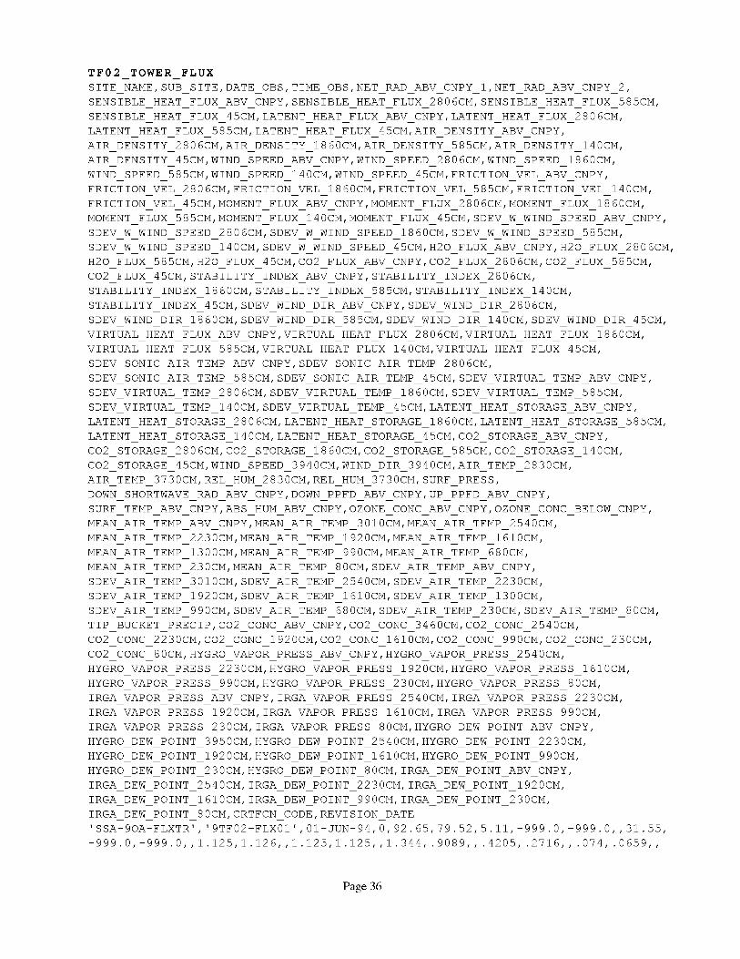
TF02 TOWER FLUX
SITE NAHE,SUB SITE,DATE OBS,TIHE OBS,NET RAD ABV CNPY 1,NET RAD ABV CNPY 2,
SENSIBLE HEAT FLUX ABV CNPY, SENSIBLE HEAT FLUX 2806CH, SENSIBLE HEAT FLUX 585CH,
SENSIBLE HEAT FLUX 45CH, LATENT HEAT FLUX ABV CNPY, LATENT HEAT FLUX 2806CH,
LATENT HEAT FLUX 585CH, LATENT HEAT FLUX 45CH, AIR DENSITY ABV CNPY,
AIR DENSITY 2806CH, AIR DENSITY 1860CH, AIR DENSITY 585CH, AIR DENSITY 140CH,
AIR DENSITY 45CH, WIND SPEED ABV CNPY,WIND SPEED 2806CH, WIND SPEED 1860CH,
WIND SPEED 585CH, WIND SPEED 140CH, WIND SPEED 45CH, FRICTION VEL ABV CNPY,
FRICTION VEL 2806CH, FRICTION VEL 1860CH, FRICTION VEL 585CH, FRICTION VEL 140CH,
FRICTION VEL 45CH, HOHENT FLUX ABV CNPY,HOHENT FLUX 2806CH, HOHENT FLUX 1860CH,
HOHENT FLUX 585CH, HOHENT FLUX 140CH, HOHENT FLUX 45CH, SDEV W WIND SPEED ABV CNPY,
SDEV W WIND SPEED 2806CH, SDEV W WIND SPEED 1860CH, SDEV W WIND SPEED 585CH,
SDEV W WIND SPEED 140CH, SDEV W WIND SPEED 45CH, H20 FLUX ABV CNPY,H20 FLUX 2806CH,
H20 FLUX 585CH, H20 FLUX 45CH, CO2 FLUX ABV CNPY,CO2 FLUX 2806CH, CO2 FLUX 585CH,
CO2 FLUX 45CH, STABILITY INDEX ABV CNPY, STABILITY INDEX 2806CH,
STABILITY INDEX 1860CH, STABILITY INDEX 585CH, STABILITY INDEX 140CH,
STABILITY INDEX 45CH, SDEV WIND DIR ABV CNPY, SDEV WIND DIR 2806CH,
SDEV WIND DIR 1860CH, SDEV WIND DIR 585CH, SDEV WIND DIR 140CH, SDEV WIND DIR 45CH,
VIRTUAL HEAT FLUX ABV CNPY,VIRTUAL HEAT FLUX 2806CH, VIRTUAL HEAT FLUX 1860CH,
VIRTUAL HEAT FLUX 585CH, VIRTUAL HEAT FLUX 140CH, VIRTUAL HEAT FLUX 45CH,
SDEV SONIC AIR TEHP ABV CNPY, SDEV SONIC AIR TEHP 2806CH,
SDEV SONIC AIR TEHP 585CH, SDEV SONIC AIR TEHP 45CH, SDEV VIRTUAL TEHP ABV CNPY,
SDEV VIRTUAL TEHP 2806CH, SDEV VIRTUAL TEHP 1860CH, SDEV VIRTUAL TEHP 585CH,
SDEV VIRTUAL TEHP 140CH, SDEV VIRTUAL TEHP 45CH, LATENT HEAT STORAGE ABV CNPY,
LATENT HEAT STORAGE 2806CH, LATENT HEAT STORAGE 1860CH, LATENT HEAT STORAGE 585CH,
LATENT HEAT STORAGE 140CH, LATENT HEAT STORAGE 45CH, CO2 STORAGE ABV CNPY,
CO2 STORAGE 2806CH, CO2 STORAGE 1860CH, CO2 STORAGE 585CH, CO2 STORAGE 140CH,
CO2 STORAGE 45CH, WIND SPEED 3940CH, WIND DIR 3940CH, AIR TEHP 2830CH,
AIR TEHP 3730CH, REL HUH 2830CH, REL HUH 3730CH, SURF PRESS,
DOWN SHORTWAVE PAD ABV CNPY,DOWN PPFD ABV CNPY,UP PPFD ABV CNPY,
SURF TEHP ABV CNPY,ABS HUH ABV CNPY,OZONE CONC ABV CNPY,OZONE CONC BELOW CNPY,
HEAN AIR TEHP ABV CNPY,HEAN AIR TEHP 3010CH, HEAN AIR TEHP 2540CH,
HEAN AIR TEHP 2230CH, HEAN AIR TEHP 1920CH, HEAN AIR TEHP 1610CH,
HEAN AIR TEHP 1300CH, HEAN AIR TEHP 990CH, HEAN AIR TEHP 680CH,
HEAN AIR TEHP 230CH, HEAN AIR TEHP 80CH, SDEV AIR TEHP ABV CNPY,
SDEV AIR TEHP 3010CH, SDEV AIR TEHP 2540CH, SDEV AIR TEHP 2230CH,
SDEV AIR TEHP 1920CH, SDEV AIR TEHP 1610CH, SDEV AIR TEHP 1300CH,
SDEV AIR TEHP 990CH, SDEV AIR TEHP 680CH, SDEV AIR TEHP 230CH, SDEV AIR TEHP 80CH,
TIP BUCKET PRECIP,CO2 CONC ABV CNPY,CO2 CONC 3460CH, CO2 CONC 2540CH,
CO2 CONC 2230CH, C02 CONC 1920CH, CO2 CONC 1610CH, CO2 CONC 990CH, CO2 CONC 230CH,
CO2 CONC 80CH, HYGRO VAPOR PRESS ABV CNPY,HYGRO VAPOR PRESS 2540CH,
HYGRO VAPOR PRESS 2230CH, HYGRO VAPOR PRESS 1920CH, HYGRO VAPOR PRESS 1610CH,
HYGRO VAPOR PRESS 990CH, HYGRO VAPOR PRESS 230CH, HYGRO VAPOR PRESS 80CH,
IRGA VAPOR PRESS ABV CNPY, IRGA VAPOR PRESS 2540CH, IRGA VAPOR PRESS 2230CH,
IRGA VAPOR PRESS 1920CH, IRGA VAPOR PRESS 1610CH, IRGA VAPOR PRESS 990CH,
IRGA VAPOR PRESS 230CH, IRGA VAPOR PRESS 80CH, HYGRO DEW POINT ABV CNPY,
HYGRO DEW POINT 3950CH, HYGRO DEW POINT 2540CH, HYGRO DEW POINT 2230CH,
HYGRO DEW POINT 1920CH, HYGRO DEW POINT 1610CH, HYGRO DEW POINT 990CH,
HYGRO DEW POINT 230CH, HYGRO DEW POINT 80CH, IRGA DEW POINT ABV CNPY,
IRGA DEW POINT 2540CH, IRGA DEW POINT 2230CH, IRGA DEW POINT 1920CH,
IRGA DEW POINT 1610CH, IRGA DEW POINT 990CH, IRGA DEW POINT 230CH,
IRGA DEW POINT 80CH, CRTFCN CODE,REVISION DATE
'SSA-9OA-FLXTR', '9TFO2-FLXOI',OI-JUN-94,0,92.65,79.52,5.11,-999.0,-999.0,,31.55,
-999.0,-999.0,,1.125,1.126,,1.125,1.125,,1.344,.9089,,.4205,.2716,,.074,.0659,,
Page 36

.04656, .02907,,-.005471,-.004343,, .002168,-.0008452,, .304, .2592,, .i004, .04625,,
.7133,-999.0,-999.0,,-.6775,-999.0,-999.0,,-5.77,-5.934,,-.i073,14.14,,55.11,
69.27,,82.37,88.78,,7.05,8.599,, .07876,-2.666,, .1481,-999.0,-999.0,, .1473, .1435,
,.1176,.2751,,9.661,6.769,,1.066,.3507,,.2475,.3177273,,.2089545,.11125,,1.383,
81.65,19.02,18.97,26.19,26.39,95.06,182.0,322.1,-999.0,14.67,4.46,42.37,33.42,
19.04,18.96,18.85,18.91,18.95,18.78,18.92,18.92,18.85,18.59,18.13, .i, .i011, .0969,
.09108,.09329,.08541,.09858,.1049,.1131 .2625,
355.6,355.8,356.1,365.8,378.1 ...............
31-AUG-99
'SSA-9OA-FLXTR', '9TF02-FLX01'
-999.0,-999.0,,1.125,1.126,,1
.09762,.04463,,-.1241,-.08699
-999.0,-999.0,,.1608,-999.0,-
72.18,83.37
.2372,,14.3
82.59,18.93
18.94,18.85
.1573,.1173
355.7,355.7
31-AUG-99
3172,0.0,356.1,356.1,355.9,355.8,
- 3296 'CPI'• , ,,,,, ,,,,,,,, ,
01-JUN-94 30,110 3,91.11 21.82 -999.0,-999.0,,65.4,
125,1.125,,1.495 .9316,, 2888, 1792,,.352,.2949,,
,.00953,.001992, .343,.2942,,.118,.04701,,1.4789,
99.0,,-.2002,-.2616,,-1.339,.8526,,38.82,43.61,
,25.87,33.6,,9.554,-.5821,,.1841,-999.0,-999.0,,.185,.2537,,.2025
11.19,,3.753,1.132,,.6713636,.7352273,,.5761364,.2120227,,1.531,
18.94,28.22,28.22,95.07,220.2,381.6,-999.0,15.03,4.73,40.53,32.34
18.79,18.91,18.88,18.67,18.8,18.81,18.75,18.43,18.13,.15,.1209,.1287,
.1109,.1136,.1426,.1419,.1566,.1914,0.0,355.8,355.8,355.6,356.0,
358.3,364.0,378.4 ................... 4999 ................ 'CPI',
8. Data Organization
8.1 Data GranularityThe smallest unit of data tracked by the BOREAS Information System (BORIS) was data collected
at a given site on a given date.
8.2 Data Format
The Compact Disk-Read-Only Memory (CD-ROM) files contain American Standard Code forInformation Interchange (ASCII) numerical and character fields of varying length separated bycommas. The character fields are enclosed with single apostrophe marks. There are no spaces betweenthe fields.
Each data file on the CD-ROM has four header lines of Hyper-Text Markup Language (HTML)code at the top. When viewed with a Web browser, this code displays header information (data settitle, location, date, acknowledgments, etc.) and a series of HTML links to associated data files andrelated data sets. Line 5 of each data file is a list of the column names, and line 6 and following linescontain the actual data.
9. Data Manipulations
9.1 Formulae
9.1.1 Derivation Techniques and Algorithms
There are many equations and formulae used in the calculations of fluxes from the raw voltagesignals. Readers are referred to the relevant references for details.
9.2 Data Processing Sequence
Page 37

9.2.1 Processing Steps
Averages, variances, and covariances are calculated in real time, and coordinate rotation is appliedon the half-hourly covariances and variances. Vapor pressure was calculated from dewpointtemperature using equations from Buck (1981).
BORIS staff processed these data by:• Reviewing the initial data files and loading them online for BOREAS team access.• Designing relational data base tables to inventory and store the data.• Loading the data into the relational data base tables.• Working with the team to document the data set.• Extracting the data into logical files.
9.2.2 Processing Changes
Above-canopy dewpoint temperature was measured with the dewpoint hygrometer, except for theperiod 01-Jan to 01-Feb, when it was calculated from relative humidity and air temperature.
9.3 Calculations
9.3.1 Special Corrections/Adjustments
Sensible heat flux was derived from temperature from the sonic anemometer corrected for windand humidity effects. Latent heat and water vapor fluxes were determined from the closed-path sensorwith no density corrections applied. The CO2 flux from the closed-path sensor included corrections for
water vapor flux. The standard deviation of wind direction from the sonic anemometers was computedusing the Yamartino algorithm. The virtual heat flux was calculated from the virtual temperature asmeasured by the sonic anemometer, and corrected for wind effects. The standard deviation of airtemperature and virtual temperature from the sonic anemometer was corrected for wind and humidityeffects.
The storage fluxes for latent heat and CO2 were calculated from differences of water vapor profiles
and CO2 profiles, respectively, for the runs before and after the current run. The storage fluxes couldbe added to the latent heat flux or CO2 flux. However, this assumes no horizontal advection below the
measurement height. The validity of this assumption is difficult to evaluate, and obvious problemsoccur after frontal passages.
9.3.2 Calculated Variables
The above-canopy absolute humidity was calculated from air temperature and dewpointtemperature. Air density was computed from air temperature for air pressure = 94.5 kPa. The stabilityindex was calculated using virtual temperature from the sonic anemometer.
9.4 Graphs and PlotsNone.
10.1 Sources of Error
None given.
10.2 Quality Assessment
10. Errors
Page 38

10.2.1 Data Validation by SourceOutliers were removed from the data.
The two net radiometers were intercompared. The comparison yielded NET_RAD_ABV_CNPY_2-- 1.11 I*NET_RAD_ABV_CNPY_I for net radiation values greater than 0 andNET_RAD_ABV_CNPY_2 = 1.224*NET_RAD_ABV_CNPY_1 net radiation values less than 0. Net
radiometer calibration was checked by TF-01 group against a precision pyranometer by shading on11-Apr-1994 at 17:30 to 18:30 GMT; change in NET_RAD_ABV_CNPY_2 was 3.1% greater thanfor the standard.
10.2.2 Confidence Level/Accuracy Judgment
None given.
10.2.3 Measurement Error for Parameters
None given.
10.2.4 Additional Quality Assessments
The Belfort rain gauge tended to lag in registering precipitation events, and occasionally producedspurious readings. The standard rain gauge was probably the most reliable of the precipitationmeasurements.
10.2.5 Data Verification by Data Center
Data were examined to check for spikes, values that are four standard deviations from the mean,long periods of constant values, and missing data.
11.1 Limitations of the Data
None given.
11.2 Known Problems with the Data
None given.
11.3 Usage GuidanceNone given.
11.4 Other Relevant InformationNone.
1 1. Notes
12. Application of the Data Set
These data are useful for the study of water, energy, and carbon exchange in a mature aspen forest.
13. Future Modifications and Plans
Data collection from the SSA-OA tower continued after 1996. Contact Dr. T.A. Black for informationabout these data.
Page 39

14.1 Software Description
None given.
14.2 Software Access
None given.
14. Software
15. Data Access
The SSA-OA tower flux, meteorological, and precipitation data are available from the Earth ObservingSystem Data and Information System (EOSDIS) Oak Ridge National Laboratory (ORNL) DistributedActive Archive Center (DAAC).
15.1 Contact Information
For BOREAS data and documentation please contact:
ORNL DAAC User Services
Oak Ridge National LaboratoryP.O. Box 2008 MS-6407
Oak Ridge, TN 37831-6407Phone: (423) 241-3952Fax: (423) 574-4665
E-mail: [email protected] or [email protected]
15.2 Data Center Identification
Earth Observing System Data and Information System (EOSDIS) Oak Ridge National Laboratory(ORNL) Distributed Active Archive Center (DAAC) for Biogeochemical Dynamicshttp://www-eosdis.ornl.gov/.
15.3 Procedures for Obtaining DataUsers may obtain data directly through the ORNL DAAC online search and order system
[http://www-eosdis.ornl.gov/] and the anonymous FTP site [ftp://www-eosdis.ornl.gov/data/] or bycontacting User Services by electronic mail, telephone, fax, letter, or personal visit using the contactinformation in Section 15.1.
15.4 Data Center Status/Plans
The ORNL DAAC is the primary source for BOREAS field measurement, image, GIS, andhardcopy data products. The BOREAS CD-ROM and data referenced or listed in inventories on theCD-ROM are available from the ORNL DAAC.
16.1 Tape ProductsNone.
16. Output Products and Availability
16.2 Film ProductsNone.
16.3 Other Products
These data are available on the BOREAS CD-ROM series. Raw (20-Hz) data are available on
CD-ROM by special request on a cost-recovery basis directly from the TF-02 team.
Page 40

17. References
17.1 Platform/Sensor/Instrument/Data Processing DocumentationNone.
17.2 Journal Articles and Study ReportsBaldocchi, D.D. 1997. Flux footprints within and over forest canopy. Boundary-Layer Meteorology,85, 273-292.
Black, T.A., G. den Hartog, H.H. Neumann, P.D. Blanken, P.C. Yang, C. Russell, and Z. Nesic.1996. Annual cycle of water vapor and carbon dioxide fluxes in and above a boreal aspen forest.Global Change Biology, 2, 101-111.
Blanken, P.D. 1997. Evaporation within and above a boreal aspen forest. Ph.D. Thesis of UBC,79-84.
Buck. 1981. J. Appl. Meteorol. 20:1527-1532.
Chen, W.J., T.A. Black, P.C. Yang, A.G. Barr, H.H. Neumann, Z. Nesic, P.D. Blanken, M.D.Novak, J. Eley, R.J. Ketler, and R. Cuenca. 1998. Effects of climatic variability on the annual carbonsequestration by a boreal aspen forest. Global Change Biology (in press).
Fritschen, L.J. and L.W. Gay. 1979. Environmental Instrumentation. Springer-Verlag, Berlin, NewYork and Heidelberg.
Fuchs, M. and C.B. Tanner. 1968. Calibration and field tests of soil heat flux plates. Soil ScienceSociety of America Proceedings, 32, 326-328.
Hook, W.R. and N.J. Livingston. 1996. Errors in converting time domain reflectometrymeasurements of propagation velocity to estimated of soil water content. Soil Sci. Soc. Amer. J., 59,35-41.
Kaimal, J.C. and J.E. Gaynor. 1991. Another look at sonic thermometry. Boundary-LayerMeteorology, 56, 401-410.
Lee, X., T.A. Black, and M.D. Novak. 1994. Comparison of flux measurements with open-andclosed-path gas analyzers above an agricultural field and a forest floor. Boundary-Layer Meteorology,67, 1995-202.
Leuning, R. and K.M. King. 1992. Comparison of eddy covariance measurements of CO2 fluxes by
open- and closed-path CO2 analyzers. Boundary-Layer Meteorology, 59, 297-311.
Newcomer, J., D. Landis, S. Conrad, S. Curd, K. Huemmrich, D. Knapp, A. Morrell, J. Nickeson,A. Papagno, D. Rinker, R. Strub, T. Twine, F. Hall, and P. Sellers, eds. 2000. Collected Data of TheBoreal Ecosystem-Atmosphere Study. NASA. CD-ROM.
Pearcy, R.W., J. Ehleringer, H.A. Mooney, and P.W. Rundel. 1991. Plant physiological ecology:Field methods and instrumentation. Chapman and Hall, London and New York.
Schuepp, P.H., M.Y. Leclerc, J.I. MacPerson, and R.L. Desjardins. 1990. Footprint prediction ofscalar fluxes from analytical solutions of the diffusion equation. Boundary-Layer Meteorology, 50,355-373.
Page 41

Sellers,P.andF.Hall. 1994.BorealEcosystem-AtmosphereStudy:ExperimentPlan.Version1994-3.0,NASA BOREASReport(EXPLAN 94).
Sellers,P.andF.Hall. 1996.BorealEcosystem-AtmosphereStudy:ExperimentPlan.Version1996-2.0,NASA BOREASReport(EXPLAN 96).
Sellers,P.,F. Hall, andK.F. Huemmrich.1996.BorealEcosystem-AtmosphereStudy:1994Operations.NASA BOREASReport(OPSDOC94).
Sellers,P.,F. Hall, andK.F. Huemmrich.1997.BorealEcosystem-AtmosphereStudy:1996Operations.NASA BOREASReport(OPSDOC96).
Sellers,P.,F. Hall, H. Margolis,B. Kelly, D. Baldocchi,G. denHartog,J.Cihlar, M.G. Ryan,B.Goodison,P.Crill, K.J.RansomD. Lettenmaier,andD.E. Wickland. 1995.Theborealecosystem-atmospherestudy(BOREAS):anoverviewandearlyresultsfrom the1994field year.Bulletinof theAmericanMeteorologicalSociety.76(9):1549-1577.
Sellers,P.J.,F.G.Hall, R.D. Kelly, A. Black, D. Baldocchi,J. Berry, M. Ryan,K.J. Ranson,P.M.Crill, D.P.Lettenmaier,H. Margolis,J.Cihlar, J.Newcomer,D. Fitzjarrald,P.G.Jarvis,S.T.Gower,D. Halliwell, D. Williams, B. Goodison,D.E.Wickland, andF.E.Guertin.1997.BOREASin 1997:ExperimentOverview,ScientificResultsandFutureDirections.Journalof GeophysicalResearch102(D24):28,731-28,770.
Webb,E.K., G.I.Pearman,andR. Leuning. 1980.Correctionof flux measurementsfor densityeffectsdueto heatandwatervaportransfer.QuarterlyJournalof theRoyalMeteorologicalSociety,106,85-100.
Yang,P.C.1998.Carbondioxideflux within andaboveaborealaspenforest.Ph.D.thesis,Universityof British Columbia,Vancouver,Canada.
17.3 Arehive/DBMS Usage DocumentationNone.
None.
18. Glossary of Terms
AES
AFM
ASCII
ATD
ATI
BOREAS
BORIS
CD-ROM
DAAC
EOS
EOSDIS
GIS
GMT
19. List Of Acronyms
- Atmospheric Environment Service
- Airborne Fluxes and Meteorology
- American Standard Code for Information
- Atmospheric Technology Division
- Applied Technologies, Inc.
- BOReal Ecosystem-Atmosphere Study
- BOREAS Information System
- Compact Disk-Read-Only Memory
- Distributed Active Archive Center
- Earth Observing System
- EOS Data and Information System
- Geographic Information System
- Greenwich Mean Time
Interchange
Page 42

GSFC
HTML
i.d.
IFC
IR
IRGA
LAI
NAD83
NASA
NEP
NSA
OA
ORNL
PANP
PAR
PC
PPFD
SRC
SSA
TDR
TF
UBC
URL
WPL
- Goddard Space Flight Center
- Hyper-text Markup Language
- inner diameter
- Intensive Field Campaign
- Infrared
- Infrared Gas Analyzer
- Leaf Area Index
- North American Datum of 1983
- National Aeronautics and Space Administration
- Net Ecosystem Productivity
- Northern Study Area
- Old Aspen
- Oak Ridge National Laboratory
- Prince Albert National Park
- Photosynthetically Active Radiation
- Personal Computer
- Photosynthetic Photon Flux Density
- Saskatchewan Research Council
- Southern Study Area
- Time Domain Reflectometry
- Tower Flux
- University of British Columbia
- Uniform Resource Locator
- Webb, Pearman, and Leuning
20. Document Information
20.1 Document Revision Date
Written: 09-Sep- 1999Last Updated: 28-Feb-2000
20.2 Document Review Date(s)BORIS Review: 14-Feb-2000Science Review:
20.3 Document ID
20.4 Citation
When using these data, please include the following acknowledgment as well as citations ofrelevant papers in Section 17.2:
Data were collected and processed by G. den Hartog and H.H. Neumann of AtmosphericEnvironment Service.
If using data from the BOREAS CD-ROM series, also reference the data as:den Hartog, G., R.E. Mickie, H.H. Neumann, and N.B.A. Trivett, "Boreal Forest Atmosphere
Interactions: Exchanges of Energy, Water Vapor and Trace Gases." In Collected Data of The BorealEcosystem-Atmosphere Study. Eds. J. Newcomer, D. Landis, S. Conrad, S. Curd, K. Huemmrich,D. Knapp, A. Morrell, J. Nickeson, A. Papagno, D. Rinker, R. Strub, T. Twine, F. Hall, and P.Sellers. CD-ROM. NASA, 2000.
Page 43

Also,cite theBOREASCD-ROMsetas:Newcomer,J.,D. Landis,S.Conrad,S.Curd,K. Huemmrich,D. Knapp,A. Morrell, J.
Nickeson,A. Papagno,D. Rinker,R. Strub,T. Twine,F. Hall, andP.Sellers,eds.CollectedDataofTheBorealEcosystem-AtmosphereStudy.NASA. CD-ROM.NASA, 2000.
20.5 Document Curator
20.6 Document URL
Page 44

REPORT DOCUMENTATION PAGE FormApprovedOMB No. 0704-0188
Public reporting burden for this collection of informationis estimated to average 1 hour per response, including the time for reviewing instructions, searching existing data sources,gathering and maintaining the data needed, and completing and reviewing the collection of information. Send comments regarding this burden estimate or any other aspect of thiscollection of information, including suggestions for reducing this burden, to Washington Headquarters Services, Directorate for Information Operations and Reports, 1215 JeffersonDavis Highway, Suite 1204, Arlington, VA 22202-4302, and to the Office of Management and Budget, Paperwork Reduction Project (0704-0188), Washington, DC 20503.
1. AGENCY USE ONLY (Leave blank) 2. REPORT DATE 3. REPORT TYPE AND DATES COVERED
October 2000 Technical Memorandum
4. TITLE AND SUBTITLE
Technical Report Series on the Boreal Ecosystem-Atmosphere Study (BOREAS)
BOREAS TF-2 SSA-OA Tower Flux, Meteorological, and Precipitation Data
6. AUTHOR(S)
Harold Neumann, Robert Mickle, and Ralf Staebler
Forrest G. Hall and Karl Huemmrich, Editors
7. PERFORMING ORGANIZATION NAME(S) AND ADDRESS (ES)
Goddard Space Flight Center
Greenbelt, Maryland 20771
9. SPONSORING / MONITORING AGENCY NAME(S) AND ADDRESS (ES)
National Aeronautics and Space Administration
Washington, DC 20546-0001
5. FUNDING NUMBERS
923
RTOP: 923-462-33-01
8. PEFORMING ORGANIZATIONREPORT NUMBER
2000-03136-0
10. SPONSORING / MONITORING
AGENCY REPORT NUMBER
TM--2000-209891
Vo1.193
11. SUPPLEMENTARY NOTES
H. Neumann, R. Mickle, and R. Staebler: Atmospheric Environment Service, Downsview, Ontario;
K. Huemmrich, University of Maryland, NASA Goddard Space Flight Center, Greenbelt, Maryland
12a. DISTRIBUTION / AVAILABILITY STATEMENT
Unclassifie_Unlimited
Subject Category: 43
Report available from the NASA Center for AeroSpace Information,
7121 Standard Drive, Hanover, MD 21076-1320. (301) 621-0390.
12b. DISTRIBUTION CODE
13. ABSTRACT (Maximum 200 words)
The BOREAS TF-2 team collected energy, carbon dioxide, water vapor, and momentum flux data
above the canopy and in profiles through the canopy, along with meteorological data at the BOREAS
SSA-OA site. Above-canopy measurements began in early February and ran through mid-September
of 1994. Measurements were collected over a longer period of 1994 than most BOREAS flux sites.
Daily precipitation data from several gauges were also collected. The data are available in tabular
ASCII files.
14. SUBJECT TERMS
BOREAS, tower flux, meteorological data.
17. SECURITY CLASSIFICATIONOF REPORT
Unclassified
NSN 7540-01-280-5500
18. SECURITY CLASSIFICATIONOF THIS PAGE
Unclassified
19. SECURITY CLASSIFICATIONOF ABSTRACT
Unclassified
15. NUMBER OF PAGES
4416. PRICE CODE
20. LIMITATION OF ABSTRACT
UL
Standard Form 298 (Rev. 2-89)Prescribed by ANSI Std. Z39.18298-102


