

TrentTrent--Severn WaterwaySevern Waterway National Historic Site of CanadaNational Historic Site of Canada
Water Management ProgramWater Management Program
State of the State of the Kawartha Kawartha Lakes Workshop Lakes Workshop OctoberOctober 2828thth, 2008, 2008
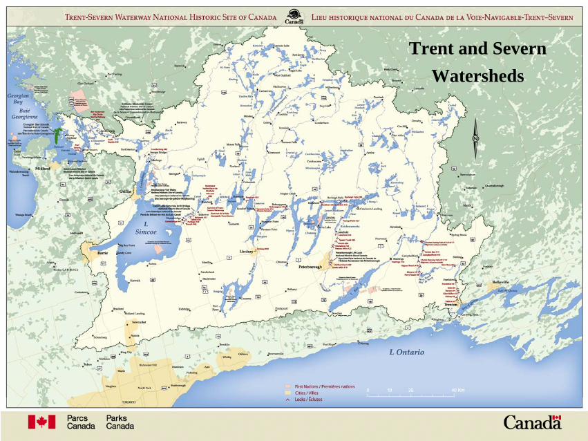
Trent and Severn Watersheds
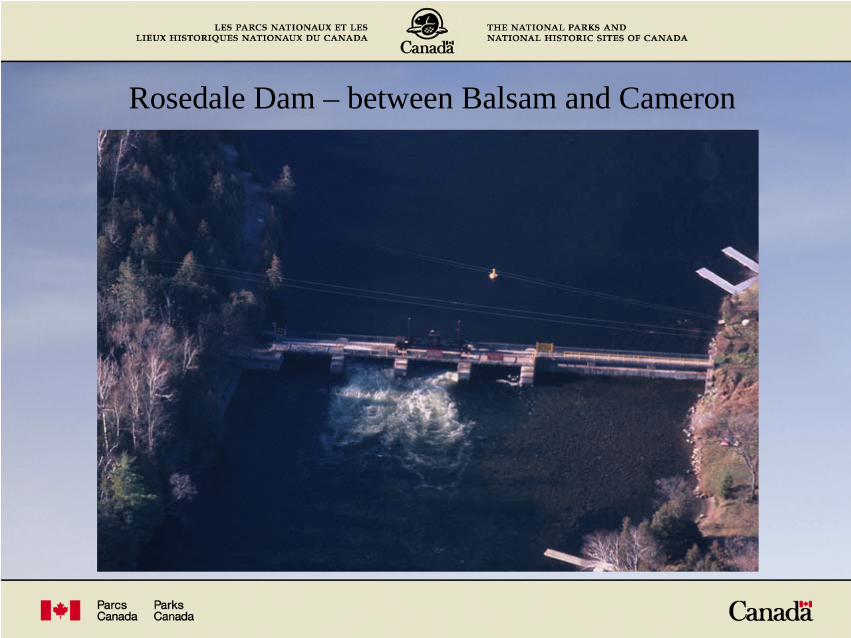
Rosedale Dam – between Balsam and Cameron

Fenelon Falls Dam – between Cameron and Sturgeon
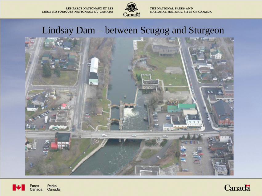
Lindsay Dam – between Scugog and Sturgeon
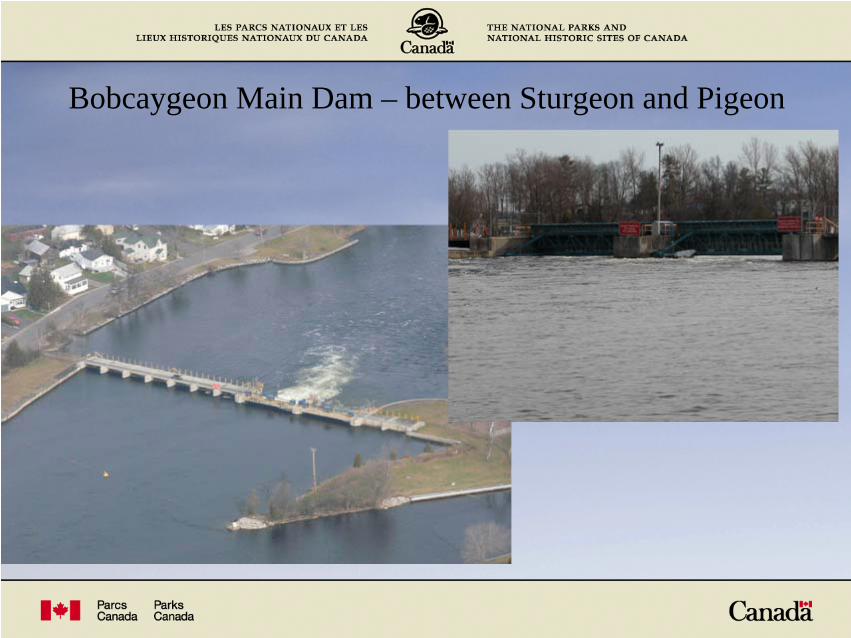
Bobcaygeon Main Dam – between Sturgeon and Pigeon
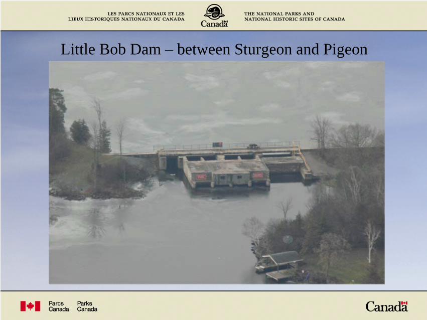
Little Bob Dam – between Sturgeon and Pigeon

Buckhorn Dam – between Buckhorn and Lower Buckhorn
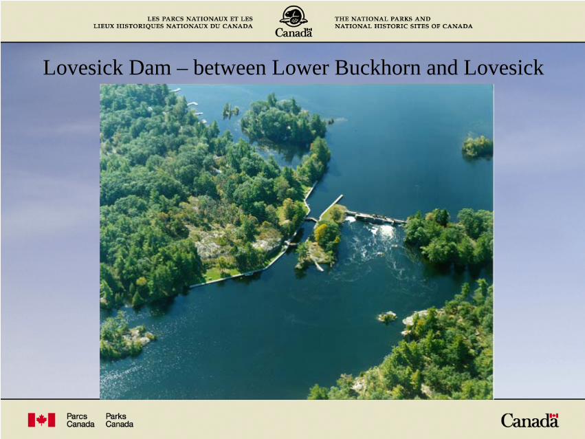
Lovesick Dam – between Lower Buckhorn and Lovesick

Burleigh Falls Dam – between Lovesick and Stony
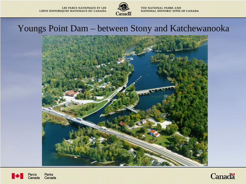
Youngs Point Dam – between Stony and Katchewanooka
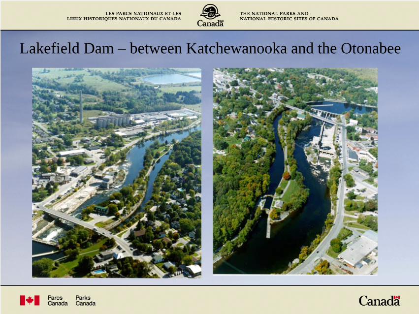
Lakefield Dam – between Katchewanooka and the Otonabee

Dam Operation – Stoplog Dams, the majority
Hydraulic Log Lifter
Maunal Winches Jacking Stoplogs

Dam Operation – Mechanized Dams
Vertical Lift GatesRadial Gates

Water Management Program Priorities
Navigation Mandate along the Canal System
Green Energy
Environment (Wildlife and the Fishery)
Public Health and Safety
Appropriate Water Levels and Flows for other uses

Competing Interests
In the event of wet conditions:
• Public Safety can be endangered with increased water levels/flows.• Resulting high flows can disrupt navigation along the waterway.• High flows allow fish to spawn in elevated areas prone to declines.• Excess spill at many hydro generating stations.

Competing Interests
In the event of dry conditions:
• Public Health is not initially endangered, water quality. • Navigation can be threatened as lake levels decline• Fish spawn in shallow areas are in danger of being left dry.• Reservoir lake levels drop more than normal.• Hydro generation is diminished as water flow is reduced.

Annual Cycle of Operation - Kawartha Lakes
1 Draw down on the larger lakes commences January 1.
2 Snow surveys are conducted weekly.
3 Mid February decision point, refill or continue draw down.
4 Spring Freshet begins, lakes are refilled with snowmelt and rainfall.
5 Try to maintain minimum flows in the Spring for the walleye spawn.
6 Lake levels must be maintained using water from the reservoirs.
7 After navigation, most smaller lakes are lowered in preparation for
winter.

Kawartha Lakes Summary
0
20
40
60
80
100
120
140
Janu
ary 1
, 200
8
Janu
ary 1
1, 20
08
Janu
ary 2
1, 20
08
Janu
ary 3
1, 20
08
Febr
uary
10, 2
008
Febr
uary
20, 2
008
March 1
, 200
8
March 1
1, 20
08
March 2
1, 20
08
March 3
1, 20
08Apri
l 10,
2008
April 2
0, 20
08
April 3
0, 20
08May
10, 2
008
May 20
, 200
8May
30, 2
008
June
9, 20
08
June
19, 2
008
June
29, 2
008
July
9, 20
08Ju
ly 19
, 200
8Ju
ly 29
, 200
8
Augus
t 8, 2
008
Augus
t 18,
2008
Augus
t 28,
2008
Septem
ber 7
, 200
8
Septem
ber 1
7, 20
08
Septem
ber 2
7, 20
08
Octobe
r 7, 2
008
Octobe
r 17,
2008
Octobe
r 27,
2008
Novem
ber 6
, 200
8
Novem
ber 1
6, 20
08
Novem
ber 2
6, 20
08
Decem
ber 6
, 200
8
Decem
ber 1
6, 20
08
Decem
ber 2
6, 20
08
Per
cent
age
(%)
0
50
100
150
200
250
300
350
400
Flow
(cm
s)
Kawartha % Average % Max Drawdown Otonabee

Data CollectionLevel gauges on the Kawartha Lakes, Haliburton Reservoirs, and the Severn River system
• 100 Manual Level Gauges (weekly/daily readings)• 50 Automatic Level Gauges (daily/hourly readings)• 12 Flow Gauges: rated level gauges, flow meters• 11 Rainfall Accumulation Gauges

Snow Surveys
Snow survey sites are laid out throughout the watershed to better anticipate the magnitude of spring melt water.
Sampling tube is forced into the snow pack to measure depth
Sampling tube is weighed to determine moisture content

Flooding…A Natural Event
Upper Otonabee River: Frazil ice blocking the flow of the river causing flooding downstream of Peterborough.
Dam at Lakefield: dams are wide open to pass high spring flows.

Lock 1 at Trenton: Sudden heavy rains and warm weather cause localized flooding.
Healey Falls Dam: Extremely fast melt coupled with above average snowfall accumulation.
Flooding…A Natural Event
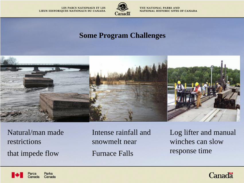
Some Program Challenges
Natural/man made restrictionsthat impede flow
Intense rainfall and snowmelt nearFurnace Falls
Log lifter and manual winches can slow response time

Summary
The Trent-Severn Waterway NHSC:
• Considers the interests and needs of
all stakeholders.
• Manages water levels/flows based on
an annual cycle of operation and
current conditions.
It is important to understand that Mother Nature drives the Water
Management Program on the TSW. We do our best to steer it but
sometimes She has other ideas.


