1
UAV (aka drone) Forensics

Who Am I
2
David Kovar
• 15+ years of SAR experience
• Fixed wing and rotor pilot
• Big 4:
- Cyber security investigator
- Incident response consultant
- Senior manager
3

4
Why Is This Relevant?

Market Growth and Jobs
‣ CEA forecasts the global market for consumer drones will approach $300
million by 2018 on factory-to-dealer sales of just under a million units. This
marks a strong increase over CEA’s forecast for 2014 of $84 million in
global revenues on sales of 250,000 units.
‣ AUVSI’s The Economic Impact of Unmanned Aircraft Systems Integration in
the United States report shows the economic benefit of UAS integration.
AUVSI’s findings show that in the first three years of integration more than
70,000 jobs will be created in the United States with an economic impact
of more than $13.6 billion. This benefit will grow through 2025 when we
foresee more than 100,000 jobs created and economic impact of $82
billion.
‣ 10,000 DJI Phantoms sold each week.
5
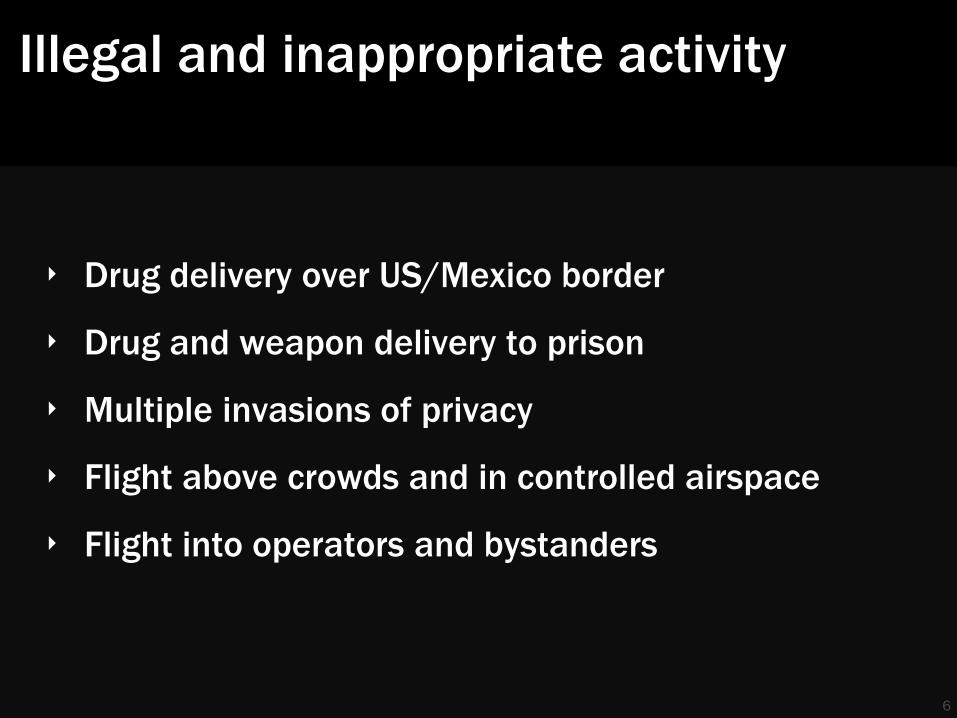
Illegal and inappropriate activity
‣ Drug delivery over US/Mexico border
‣ Drug and weapon delivery to prison
‣ Multiple invasions of privacy
‣ Flight above crowds and in controlled airspace
‣ Flight into operators and bystanders
6

What You Do?
‣ Are you in Law Enforcement?
‣ Agriculture?
‣ Real estate?
‣ Mining?
‣ Oil and Gas?
‣ Insurance?
‣ Journalism?
‣ …
7
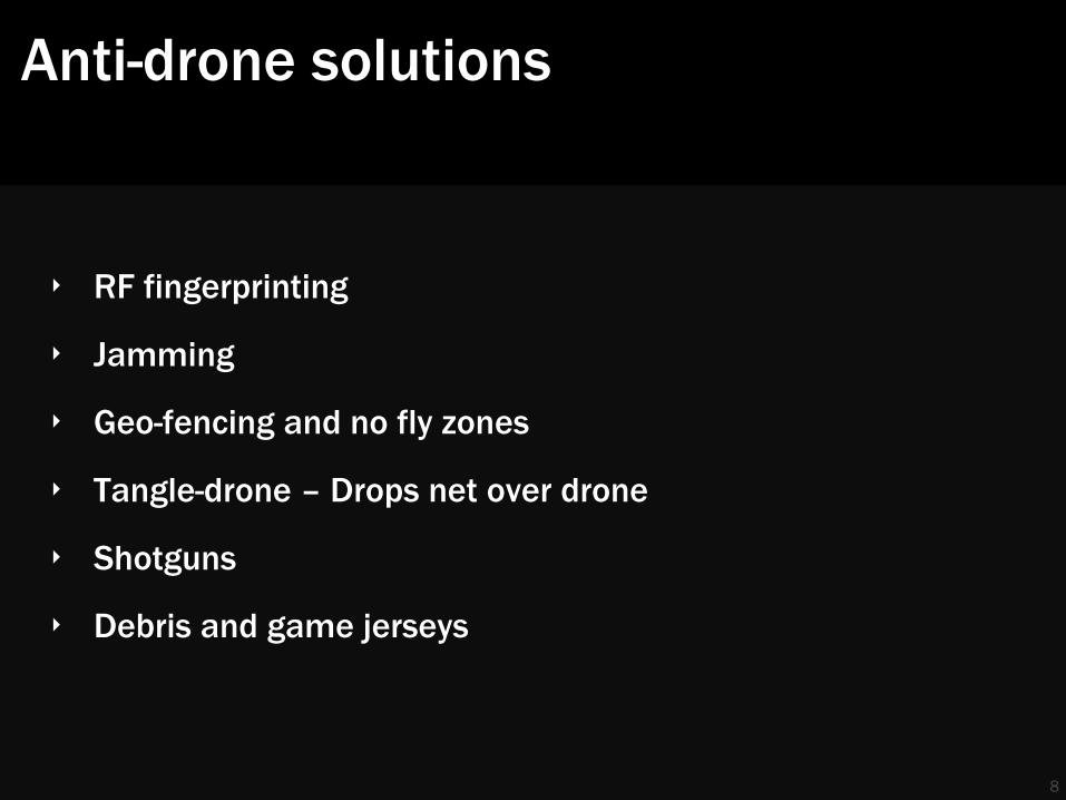
Anti-drone solutions
‣ RF fingerprinting
‣ Jamming
‣ Geo-fencing and no fly zones
‣ Tangle-drone – Drops net over drone
‣ Shotguns
‣ Debris and game jerseys
8

Terminology
‣ UAS – Unmanned Aerial System – Emphasis on system
‣ UAV – Unmanned Aerial Vehicle – The aircraft portion of the system
‣ GCS – Ground Control Station – The flight control portion of the system.
May include manual and automatic control features
‣ Data link – radio system to transmit data to and from the UAV. Often used
for telemetry, sensor data, and FPV operation
‣ Drone – Common term for any UAV but most often used to describe quads
and other multirotor UAVs
‣ FPV – First Person View – technology that enables the operator to fly the
UAV from the perspective of the UAV
9
10
Drone Forensics – High Altitude View

DJI Phantom 2 – Example UAV
‣ Very common UAV
‣ Relatively easy to hack
‣ SDK available
‣ Demonstrates all the major components
11
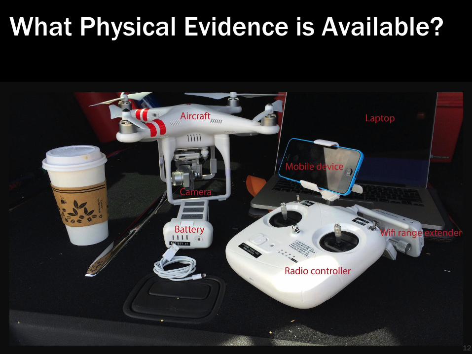
What Physical Evidence is Available?
12
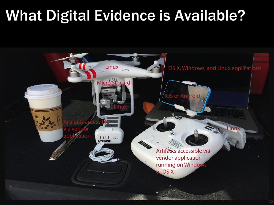
What Digital Evidence is Available?
13

Physical, digital, and other evidence
14
Physical
Drone
Flight controller
Sensor
Physical evidence
Ground Station
Data link
Ground control station
Radio controller
Support and Post
Processing
Maintenance system
Image processing
Billing, R&D, et al
Digital
Mobile OS
Traditional OS
Embedded Linux
Variety of file systems
(e.g. JFFS2)
Media storage
EEPROMs
Firmware
Other
Mission planning
Maintenance logs
Purchase records
Social media
Fingerprints
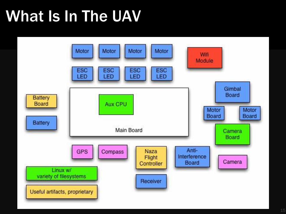
What Is In The UAV
15
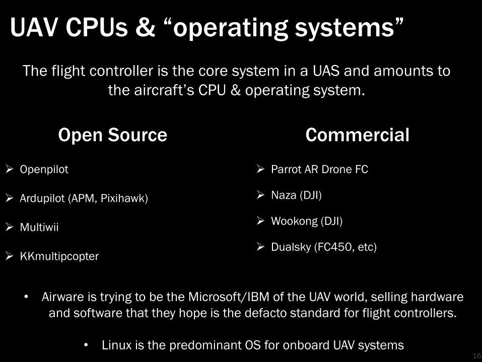
UAV CPUs & “operating systems”
16
Open Source
Openpilot
Ardupilot (APM, Pixihawk)
Multiwii
KKmultipcopter
Commercial
Parrot AR Drone FC
Naza (DJI)
Wookong (DJI)
Dualsky (FC450, etc)
The flight controller is the core system in a UAS and amounts to
the aircraft’s CPU & operating system.
• Airware is trying to be the Microsoft/IBM of the UAV world, selling hardware
and software that they hope is the defacto standard for flight controllers.
• Linux is the predominant OS for onboard UAV systems

17
Collection and Analysis Workflow

Workflow
Gather a lot of information
‣ Systems are highly complex
‣ Systems can be highly customized
‣ Lots of components
Determine the problem you are trying to solve
‣ Crash
‣ Flight into controlled airspace
‣ Invasion of privacy
‣ Illegal activity
18

Guiding Principles ‣ Know what you are looking at
• A UAS is just a physical container for a lot of different hardware running a wide array of firmware and software. Determine what everything is before you start trying to analyze anything.
‣ Know how to talk to it
• USB, WiFi, Bluetooth, physical image, ISP for eMMC, JTAG
‣ Know what it is running
• OS X, Windows, Linux (embedded or normal), IOS, Android
• Various small and embedded Linux systems are very common
• Lots of weird file systems
‣ Know what it contains
• Are you looking for waypoints, still images, video, configuration files, flight logs ….
‣ Know what problem you are trying to solve
• Crash, theft, inappropriate use, …. 19
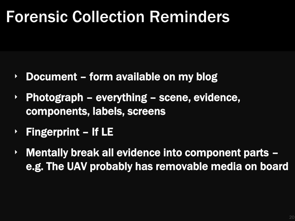
Forensic Collection Reminders
‣ Document – form available on my blog
‣ Photograph – everything – scene, evidence,
components, labels, screens
‣ Fingerprint – If LE
‣ Mentally break all evidence into component parts –
e.g. The UAV probably has removable media on board
20
21
We have a crashed drone, now what?

Scenario
The White House lawn was hardly unique
A drone is found on the front yard of a local estate
‣ Who owns it?
‣ How did it get there?
‣ Where was it before crashing?
‣ Where was it going?
‣ What was its purpose?
22

UAS Exam – UAV
23
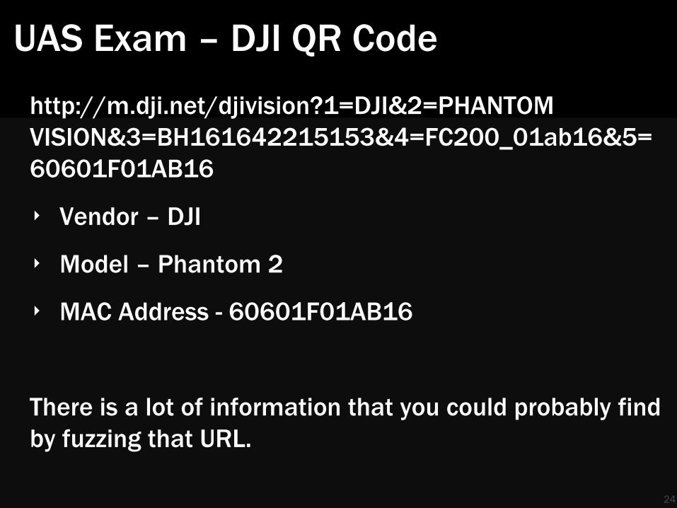
UAS Exam – DJI QR Code
24
http://m.dji.net/djivision?1=DJI&2=PHANTOM
VISION&3=BH161642215153&4=FC200_01ab16&5=
60601F01AB16
‣ Vendor – DJI
‣ Model – Phantom 2
‣ MAC Address - 60601F01AB16
There is a lot of information that you could probably find
by fuzzing that URL.

Linux Systems on the DJI Phantom
25
Collection
ssh 192.168.1.1 -l root "dd if=/dev/mem " | dd of=mem.dd ssh 192.168.1.1 -l root "tar cf - / " | tar xf - ssh 192.168.1.1 -l root "dd if=/dev/mtdblock3 " | dd of=root.dd
Plus a modified copy of Brian Moran’s Live Response Collection script for volatile data
WiFi Extender (on GCS)
‣ 192.168.1.2
‣ root/19881209
‣ OpenWRT
‣ Connection point for GCS and analysis systems
‣ Can be replaced with any OpenWRT system
Camera
‣ 192.168.1.10
‣ root/123456
General CPU
‣ 192.168.1.1
‣ root/19881209
‣ Pictures, videos, telemetry
‣ Mounts camera file system
‣ Flight controller via ser2net
Connect the Phantom to an OpenWRT AP, connect your analysis system to the AP.
Instructions on how to do this available from the web site.
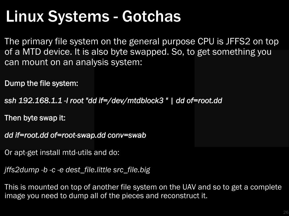
Linux Systems - Gotchas
26
The primary file system on the general purpose CPU is JFFS2 on top of a MTD device. It is also byte swapped. So, to get something you can mount on an analysis system:
Dump the file system: ssh 192.168.1.1 -l root "dd if=/dev/mtdblock3 " | dd of=root.dd Then byte swap it: dd if=root.dd of=root-swap.dd conv=swab Or apt-get install mtd-utils and do: jffs2dump -b -c -e dest_file.little src_file.big This is mounted on top of another file system on the UAV and so to get a complete image you need to dump all of the pieces and reconstruct it.
UAV Exam – SDKs and Live UAV
27
Most of the flight data is in RAM and most of the flight controller software is running off of flash media. Very little useful data persists after power is removed other than sensor data on the removable media. Similar to many other “normal” systems, APIs and SDKs exist for UAVs. Most commercial UAV applications will not extract all of the data an analyst needs.
Be prepared to develop your own investigative tools using SDKs.

UAV Exam – SDKs and Live UAV
28
Battery:
{designedVolume=5200|fullChargeVolume=5200|currentElectricity=41
41|currentVoltage=11876|currentCurrent=-
961|remainLifePercent=100|remainPowerPercent=79|batteryTemperatu
re=20|dischargeCount=2|}
MC:
{satelliteCount=6.0|homeLocationLatitude=40.4314293|homeLocation
Longitude=-
89.31180890000002|phantomLocationLatitude=40.4314619|phantomLoca
tionLongitude=-
89.31181570000001|velocityX=0.0|velocityY=0.0|velocityZ=-
1.0|speed=0.1|altitude=-8.31500244140625|pitch=0.0|roll=-
1.0|yaw=-
120.0|remainPower=11878.0|remainFlyTime=0.0|powerLevel=2.0|isFly
ing=false|noFlyStatus=0.0|noFlyZoneCenterLatitude=0.0|noFlyZoneC
enterLongitude=0.0|noFlyZoneRadius=0.0|}

UAV Exam – Data Logging (Black Box)
29
• Many flight controllers, PixHawk for example, have data logging capabilities included
• Others, such as the DJI Naza, require an off board data logger • Some ground control station applications have data logging
capabilities

30
The Answer is Often in the Data
Sensor and Sensor Data
‣ The type of sensor will tell you a lot about the purpose
of the flight
LIDAR
Optical
NVIR
Thermal
WiFi
‣ The sensor data will tell you a lot about where it has
been, particularly since GPS data is critical for most
types of missions
31

Sensors – Optical
Most common sensor out there
• Consumer - GoPro, DJI, Canon, Sony
• Pro-sumer and professional
Artifacts
• The image
• The EXIF data
Location
• Right there on the UAV – pull the SD card
32
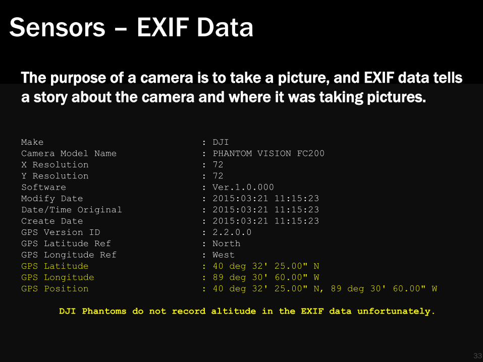
Sensors – EXIF Data
The purpose of a camera is to take a picture, and EXIF data tells
a story about the camera and where it was taking pictures.
Make : DJI
Camera Model Name : PHANTOM VISION FC200
X Resolution : 72
Y Resolution : 72
Software : Ver.1.0.000
Modify Date : 2015:03:21 11:15:23
Date/Time Original : 2015:03:21 11:15:23
Create Date : 2015:03:21 11:15:23
GPS Version ID : 2.2.0.0
GPS Latitude Ref : North
GPS Longitude Ref : West
GPS Latitude : 40 deg 32' 25.00" N
GPS Longitude : 89 deg 30' 60.00" W
GPS Position : 40 deg 32' 25.00" N, 89 deg 30' 60.00" W
DJI Phantoms do not record altitude in the EXIF data unfortunately.
33

Sensors – EXIF Data
34
Sensor Data - Cloud
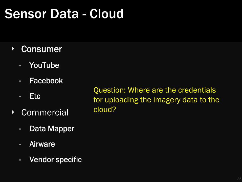
‣ Consumer
• YouTube
• Etc
‣ Commercial
• Data Mapper
• Airware
• Vendor specific
35
Question: Where are the credentials
for uploading the imagery data to the
cloud?
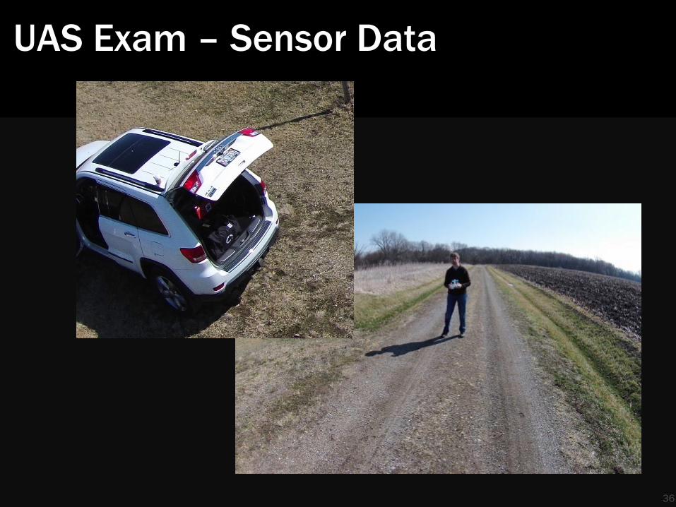
UAS Exam – Sensor Data
36

37
Ah, found the launch point!

UAS Exam – Launch Point Evidence
Ground Control Station
‣ Often a mobile device combined with a radio controller
‣ Vendor applications and community developed
‣ Looking for:
• Default settings
• Launch points, dates
• Owner name, account
Other Items
‣ Spare removable media
‣ Other UAVs
‣ Laptops, cell phones, tablets
38
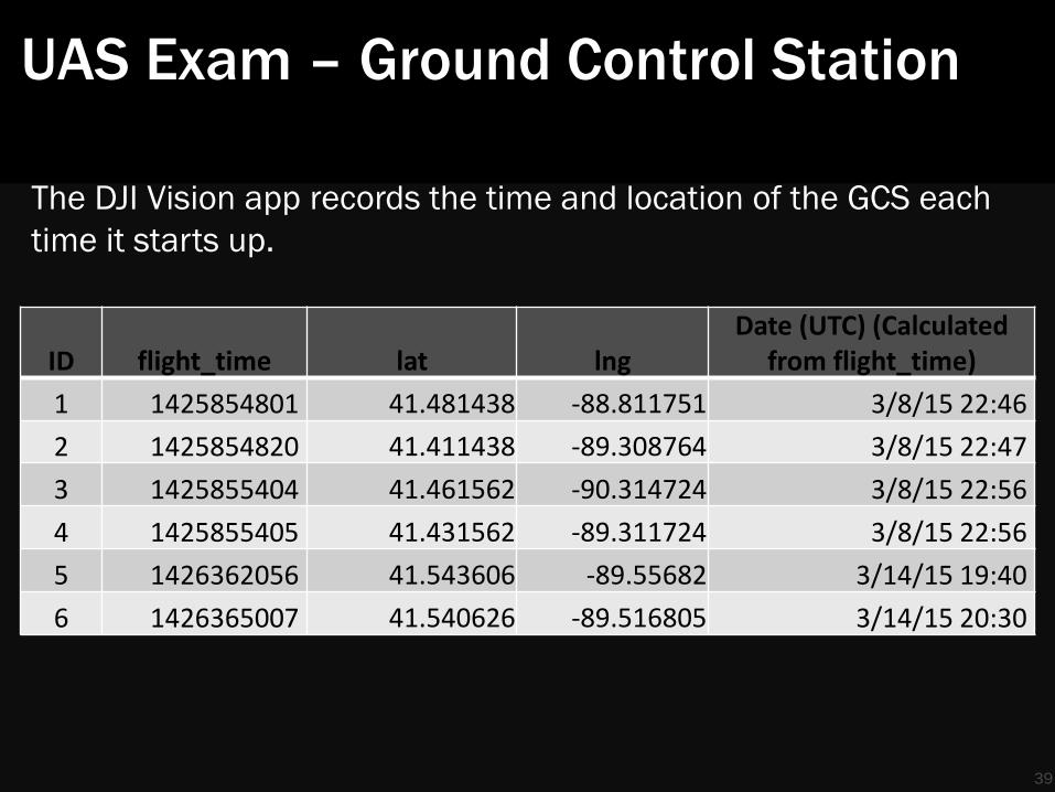
UAS Exam – Ground Control Station
ID flight_time lat lng Date (UTC) (Calculated
from flight_time)
1 1425854801 41.481438 -88.811751 3/8/15 22:46
2 1425854820 41.411438 -89.308764 3/8/15 22:47
3 1425855404 41.461562 -90.314724 3/8/15 22:56
4 1425855405 41.431562 -89.311724 3/8/15 22:56
5 1426362056 41.543606 -89.55682 3/14/15 19:40
6 1426365007 41.540626 -89.516805 3/14/15 20:30
39
The DJI Vision app records the time and location of the GCS each
time it starts up.
UAS Exam – Ground Control Station
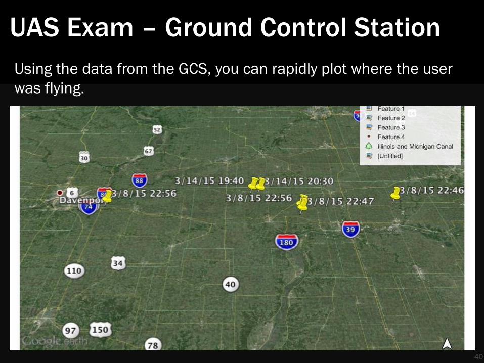
40
Using the data from the GCS, you can rapidly plot where the user
was flying.
UAS Exam – Ground Control Station
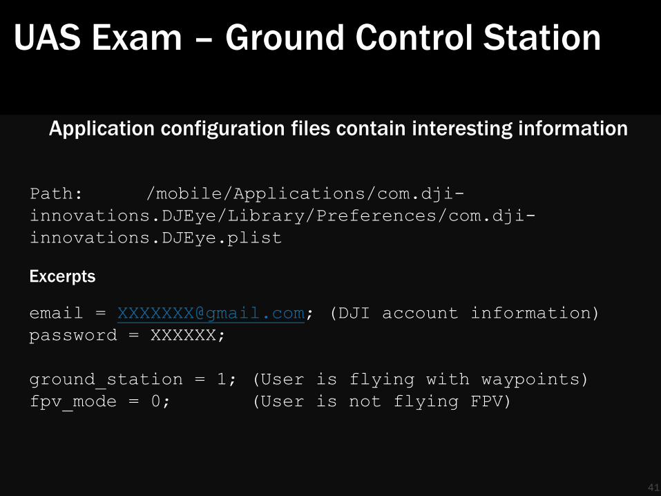
Application configuration files contain interesting information
Path: /mobile/Applications/com.dji-
innovations.DJEye/Library/Preferences/com.dji-
innovations.DJEye.plist
Excerpts
email = [email protected]; (DJI account information)
password = XXXXXX;
ground_station = 1; (User is flying with waypoints)
fpv_mode = 0; (User is not flying FPV)
41
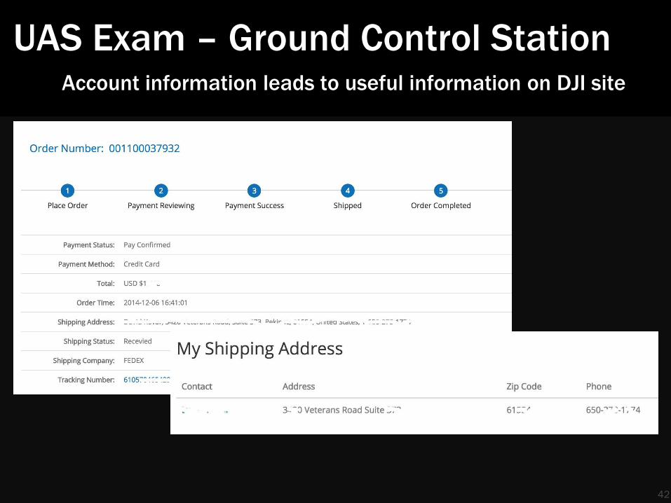
UAS Exam – Ground Control Station Account information leads to useful information on DJI site
42

43
We’ve traced the UAV back home

UAS Exam – Home & Office Evidence
Maintenance, logging & business systems
‣ Flight and maintenance logs, often with date/time/location/aircraft
‣ Client & accounting data
Data analysis system
‣ If not cloud based, this will have a lot of disk, CPU, and RAM
‣ Historical sensor data
Other
‣ UAVs, spare parts
‣ Spare removable media
‣ Other GCS
44
45
We have a drone in flight, can we do
anything?
Scenario – real time
A drone is flying over a local estate
‣ Who is flying it?
‣ Where is it going?
‣ What is it collecting?
Can we answer these questions?
Yes
46

Real Time Analysis
Connect via WiFi and send commands to the flight controller using ser2net.
** Rcv from port 0x08, seq 0, cmd 0x04, subcmd 0x00, error 0,
payload len 0
0x0400: server says hello!
** Sent to port 0x0a, seq 3, cmd 0x53, subcmd 0x00, error 0,
payload len 0
** Rcv from port 0x0a, seq 2, cmd 0x49, subcmd 0x00, error 0,
payload len 52
[0x49]: Seq 2, GPS sats 4, home [+40.431455, -89.311694] loc
[+40.431496, -89.311653], accel xyz [+00, +00, +00], ag +1.2 meter,
compass roll/pitch/heading [180, 180, 093], batt 12065mV (74%),
unknown 6
[0x53]: Seq 3, battery <5200mA, 5440mA>, current level <12090mV,
4619mA>, unknown 6e fc 63 54 1e 03 00
47

Real Time Hijack of UAV
Several commercial UAVs use WiFi for command & control and
data. A user can identify the SSID, deauthenticate the UAV, and
then capture the UAVs attempt to reestablish the link. Once the
link is established, they can control the UAV, download telemetry,
or download sensor data.
Skyjack is a AR Parrot hijack tool. This approach will work on a DJI
Phantom using WiFi as well.
You can hack into other data link mechanisms as well.
48
49
Analysis of Other UAVs
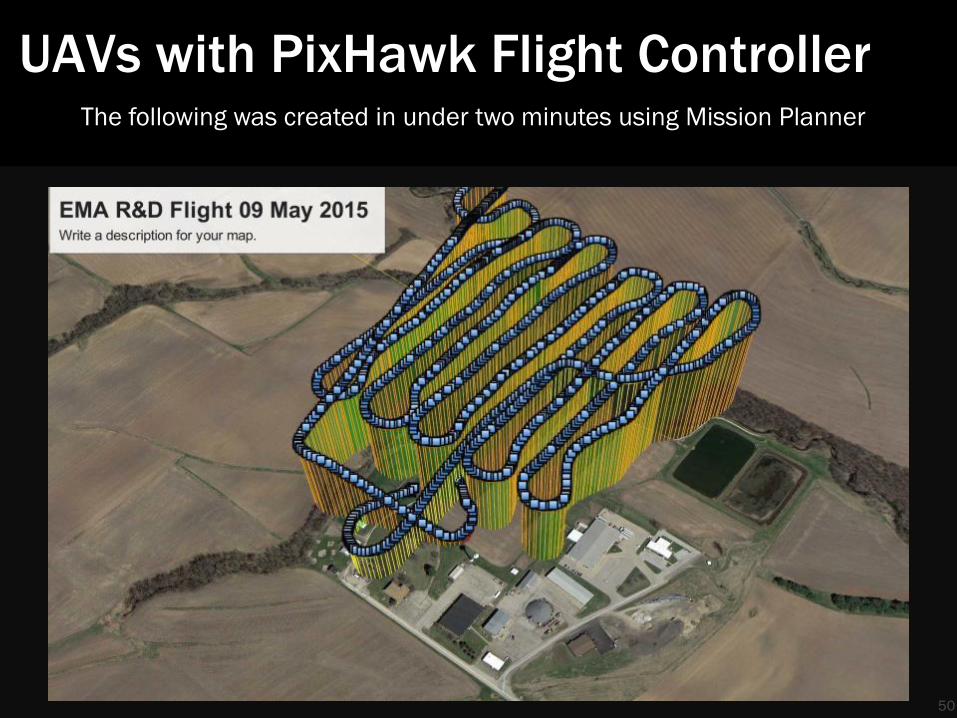
UAVs with PixHawk Flight Controller
50
The following was created in under two minutes using Mission Planner

UAVs with PixHawk Flight Controller
51
And this is what a crash looks like ….

UAVs with PixHawk Flight Controller
52
And all flight parameters are easily collected

53
Closing Thoughts
Challenges & Solutions
54
• Data and command & control moving from WiFi to Bluetooth to dedicated radio to LTE & 4G
• Harder to hack, easier to triangulate and identify with
existing tools
• Many vendors, lots of variety, embedded systems
• Focus on ground control stations and post processing
systems, analyze the sensor data. They tell 80% of the story

Closing Thoughts - Forensics
55
The UAV is paired with controller
And
The UAV is also paired with ground control station
Means unique IDs
Means forensic evidence linking devices

Closing Thoughts - Forensics
56
I needed to analyze the following to cover the entire system: • Three different versions of Linux • IOS or Android • OS X or Windows • 6+ file systems • ser2net • Wifi or Bluetooth or 915Mhz data link • EXIF • GPS • “Social media” • SDK
No single UAV analysis tool
Closing Thoughts
57
Cybersecurity: The proper term for drones is sUAS – small unmanned aerial system. Take a system approach to security and investigations, do not treat the vehicle as a discreet or standalone element.
Law & Policy:
UAVehicle. Apply law and policy to the risk/threat posed by the sensors and services rather than by the delivery mechanism