
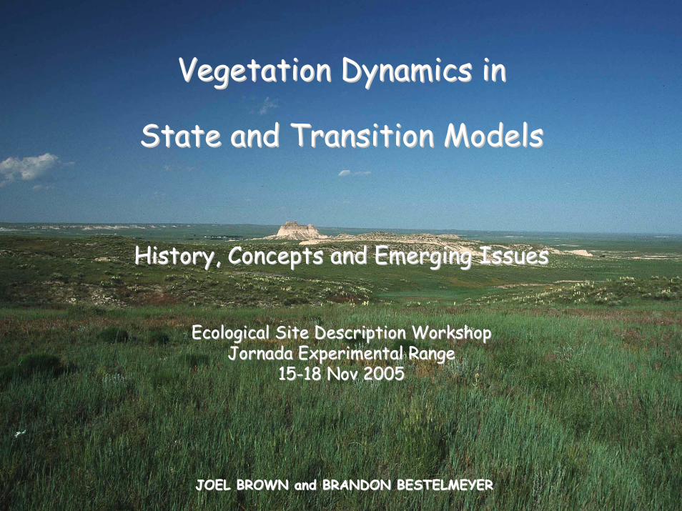
Vegetation Dynamics in Vegetation Dynamics in
State and Transition ModelsState and Transition Models
History, Concepts and Emerging IssuesHistory, Concepts and Emerging Issues
Ecological Site Description WorkshopEcological Site Description WorkshopJornadaJornada Experimental RangeExperimental Range
1515--18 Nov 200518 Nov 2005
JOEL BROWN and BRANDON BESTELMEYERJOEL BROWN and BRANDON BESTELMEYER
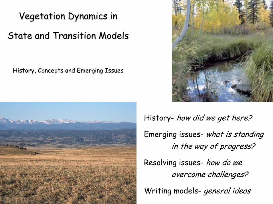
Vegetation Dynamics in Vegetation Dynamics in
State and Transition ModelsState and Transition Models
History, Concepts and Emerging IssuesHistory, Concepts and Emerging Issues
History- how did we get here?
Emerging issues- what is standing in the way of progress?
Resolving issues- how do we overcome challenges?
Writing models- general ideas
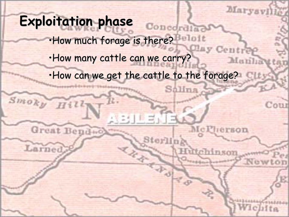
Exploitation phaseExploitation phase••How much forage is there?How much forage is there?
••How many cattle can we carry?How many cattle can we carry?
••How can we get the cattle to the forage?How can we get the cattle to the forage?
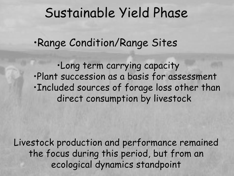
Sustainable Yield PhaseSustainable Yield Phase
••Range Condition/Range SitesRange Condition/Range Sites
••Long term carrying capacityLong term carrying capacity••Plant succession as a basis for assessmentPlant succession as a basis for assessment••Included sources of forage loss other than Included sources of forage loss other than
direct consumption by livestockdirect consumption by livestock
Livestock production and performance remained Livestock production and performance remained the focus during this period, but from an the focus during this period, but from an
ecological dynamics standpointecological dynamics standpoint

ECOLOGICAL SITE DESCRIPTIONS
•Allows for multiple stable states and nonequilibrium dynamics•Includes multiple values•Recognizes multiple objectives for
planning purposes
Livestock production is one of many potential uses of land…usually simultaneously with other uses
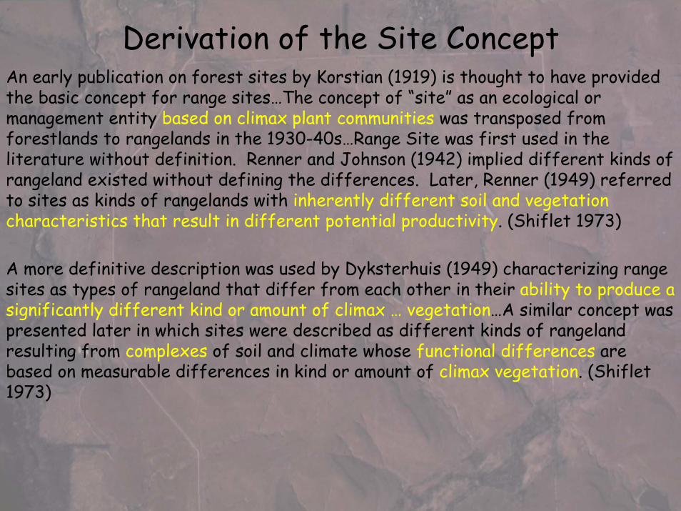
Derivation of the Site ConceptAn early publication on forest sites by Korstian (1919) is thought to have provided the basic concept for range sites…The concept of “site” as an ecological or management entity based on climax plant communities was transposed from forestlands to rangelands in the 1930-40s…Range Site was first used in the literature without definition. Renner and Johnson (1942) implied different kinds of rangeland existed without defining the differences. Later, Renner (1949) referred to sites as kinds of rangelands with inherently different soil and vegetation characteristics that result in different potential productivity. (Shiflet 1973)
A more definitive description was used by Dyksterhuis (1949) characterizing range sites as types of rangeland that differ from each other in their ability to produce a significantly different kind or amount of climax … vegetation…A similar concept was presented later in which sites were described as different kinds of rangeland resulting from complexes of soil and climate whose functional differences are based on measurable differences in kind or amount of climax vegetation. (Shiflet1973)

A climate, a plant community or a soil, in the sense of an individual, is a ... section of the landscape with a range in characteristics set by our logic, not by nature. (Dyksterhuis 1958)
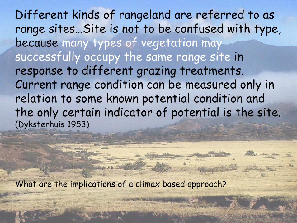
Different kinds of rangeland are referred to as range sites…Site is not to be confused with type, because many types of vegetation may successfully occupy the same range site in response to different grazing treatments. Current range condition can be measured only in relation to some known potential condition and the only certain indicator of potential is the site. (Dyksterhuis 1953)
What are the implications of a climax based approach?
Time
% d
esir
able
spe
cies
com
posi
tion
successio
n
retrogressio
n
drought
heavy gr
azing
shrub inv
asion
normal r
ainfall
moderate gra
zing
prescribed burn
ing
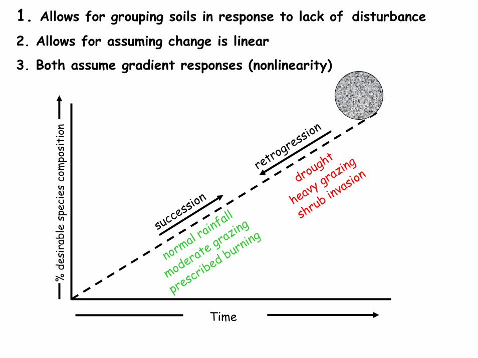
1. Allows for grouping soils in response to lack of disturbance
2. Allows for assuming change is linear
3. Both assume gradient responses (nonlinearity)

T im eT im e
F ire Freq u en c yF ire Freq u en c y
G ra zin g P ressu reG ra zin g P ressu re
P ro b ab ility & ra te o f w o o d y p lan t estab lish m en tP ro b ab ility & ra te o f w o o d y p lan t es tab lish m en t
AA = T a ll / m id= T a ll / m id -- g rasse sg rassesBB = M id / sho rt g rasses= M id / sho rt g rassesCC = S ho rt g rass / ann ua ls= S ho rt g rass / an nua ls
= T rans ition th resho ld= T rans ition th resho ldD = C lu s te rs an d g rovesD = C lus te rs a nd g rovesE = W ood landE = W oo d land
AA BB CC
H erbaceousH erbaceou sre trog ress io nre tro g re ss ion
P eren n ia lP eren n ia lg rassesg ra sses
W o o d yW o o d yp lan tsp lan ts
Com
mun
ityC
ompo
sitio
n
Tim
e or
cul
tura
l ene
rgy
incr
emen
ts re
quire
dto
driv
e sy
stem
to n
ew c
onfig
urat
ion S h o rt /S h o rt /
lo wlo w
L o n g /L o n g /h ig hh ig h
S hrub -d riven success ionG ram in o id -d rive n
success ion
h ig h h ig h
lo w lo w
lo w lo w
lo w lo w
lo w lo w
h ig h h ig h
h ig hh ig h
DDEE
Holling 1973 ‘Stability and resilience of ecological systems’
May 1977 ‘Multiple stable states in ecological system’
Westoby et al 1989 ‘Opportunistic management for rangelands not at equilibrium’
Archer 1989
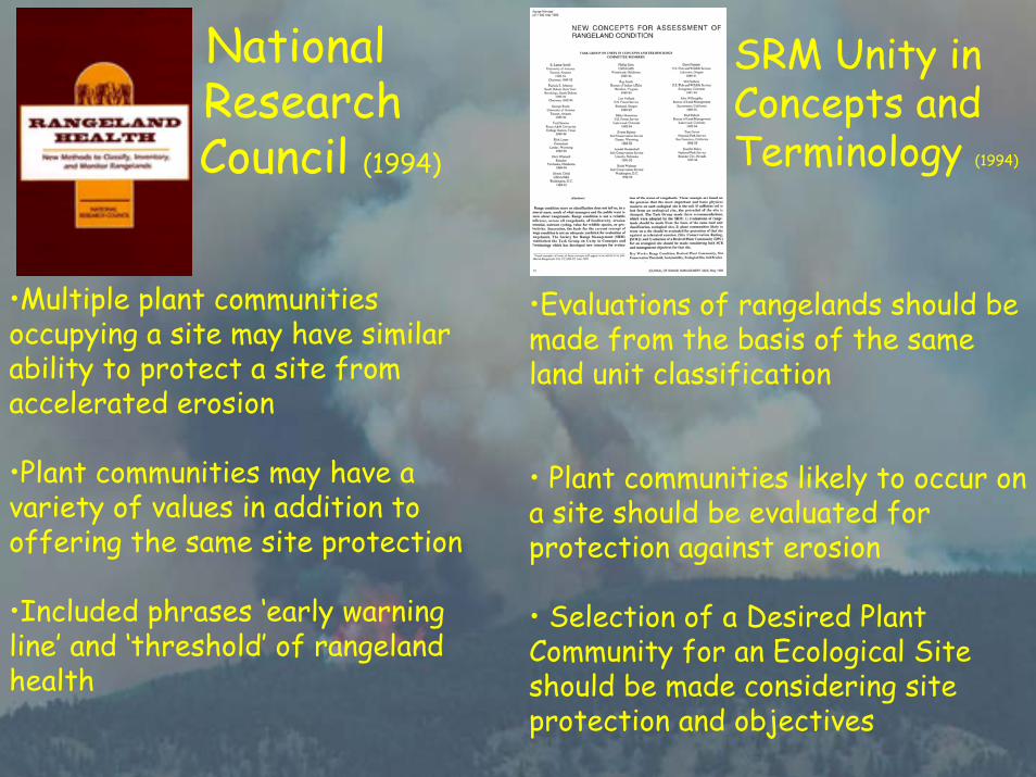
National Research Council (1994)
•Multiple plant communities occupying a site may have similar ability to protect a site from accelerated erosion
•Plant communities may have a variety of values in addition to offering the same site protection
•Included phrases ‘early warning line’ and ‘threshold’ of rangeland health
SRM Unity in Concepts andTerminology (1994)
•Evaluations of rangelands should be made from the basis of the same land unit classification
• Plant communities likely to occur on a site should be evaluated for protection against erosion
• Selection of a Desired Plant Community for an Ecological Site should be made considering site protection and objectives
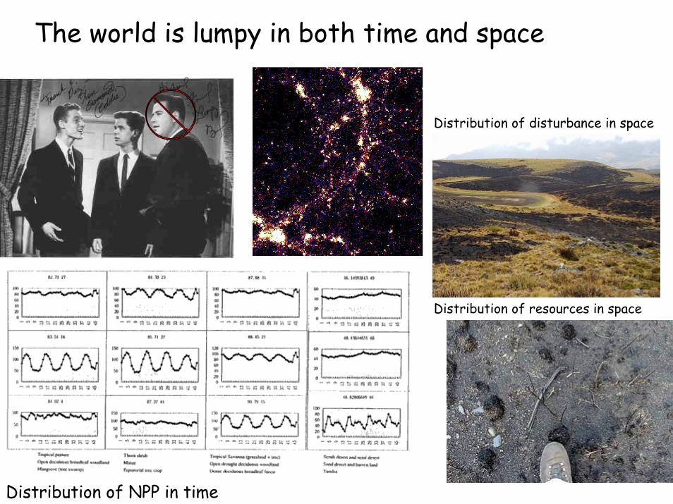
The world is lumpy in both time and space
Distribution of NPP in time
Distribution of disturbance in space
Distribution of resources in space
Archer 1989

Thresholdcommunity
Communitypathways
State B
Transition 1Community
Transition 2
Using state and transition models allow us to better organize information
State A
State C
Thresholdcommunity
Stringham et al. 2001

Emerging issues in the development of Ecological Site Descriptions
1. Artificial separation of forest and range sitesVariation in shrub and tree cover
2. Grouping soil map units into ecological sitesNew soil surveys-lower order includes more variabilityExisting surveys need to be reexamined
3. Lack of transparent, logical decision making Extant examples of reference states (HCPC) Relevant supporting dataDistribution of reference and sampling sites
4. Reliance on non-spatially explicit species composition and productivity dataImportance of spatial distribution of attributes-scale

Observation of pattern
Tests of pattern
Formulation ofHypotheses
Consistency of Pattern
Formulation ofAlternative Hypotheses
Initial theory
Mature theory Comparative Tests
Avoid Type II Error
Coarse Filter
(accuracy)
Avoid Type I Error
Fine Filter
(precision)
Adaptive Inference CycleHolling and Allen 2002
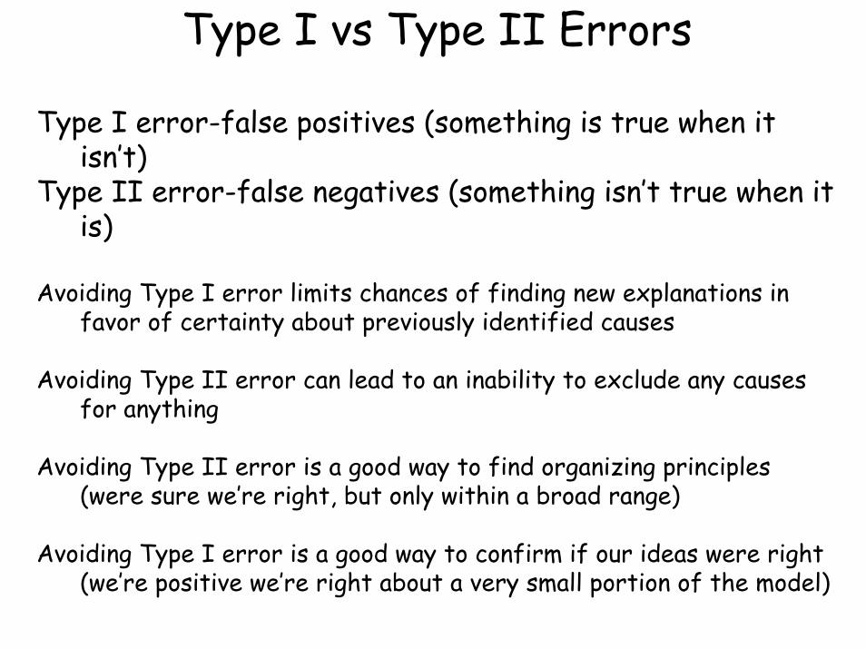
Type I vs Type II Errors
Type I error-false positives (something is true when it isn’t)
Type II error-false negatives (something isn’t true when it is)
Avoiding Type I error limits chances of finding new explanations in favor of certainty about previously identified causes
Avoiding Type II error can lead to an inability to exclude any causes for anything
Avoiding Type II error is a good way to find organizing principles (were sure we’re right, but only within a broad range)
Avoiding Type I error is a good way to confirm if our ideas were right (we’re positive we’re right about a very small portion of the model)
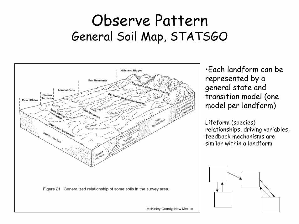
Observe Pattern General Soil Map, STATSGO
•Each landform can be represented by a general state and transition model (one model per landform)
Lifeform (species) relationships, driving variables, feedback mechanisms are similar within a landform
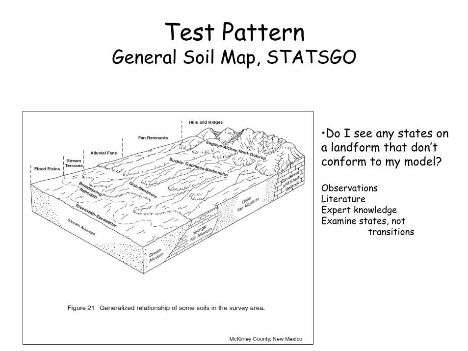
Test Pattern General Soil Map, STATSGO
•Do I see any states on a landform that don’t conform to my model?
ObservationsLiteratureExpert knowledgeExamine states, not
transitions
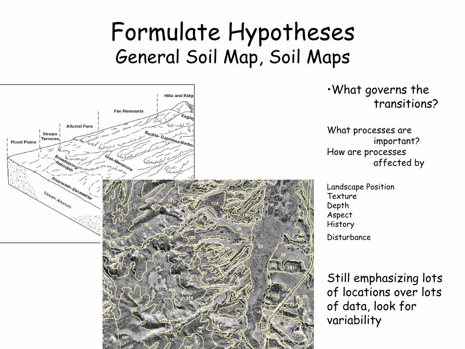
Formulate HypothesesGeneral Soil Map, Soil Maps
•What governs the transitions?
What processes are important?
How are processes affected by
Landscape PositionTextureDepthAspect HistoryDisturbance
Still emphasizing lots of locations over lots of data, look for variability
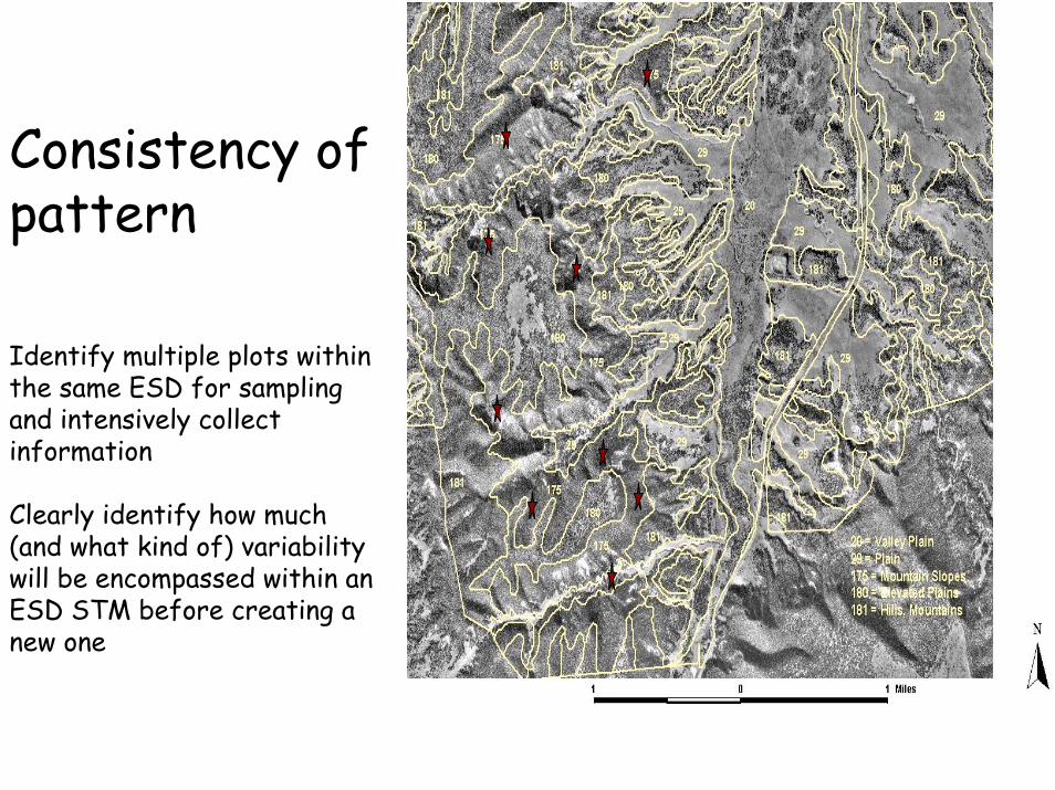
Consistency of pattern
Identify multiple plots within the same ESD for sampling and intensively collect information
Clearly identify how much (and what kind of) variability will be encompassed within an ESD STM before creating a new one
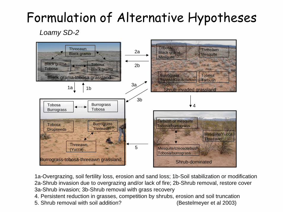
Formulation of Alternative Hypotheses Loamy SD-2
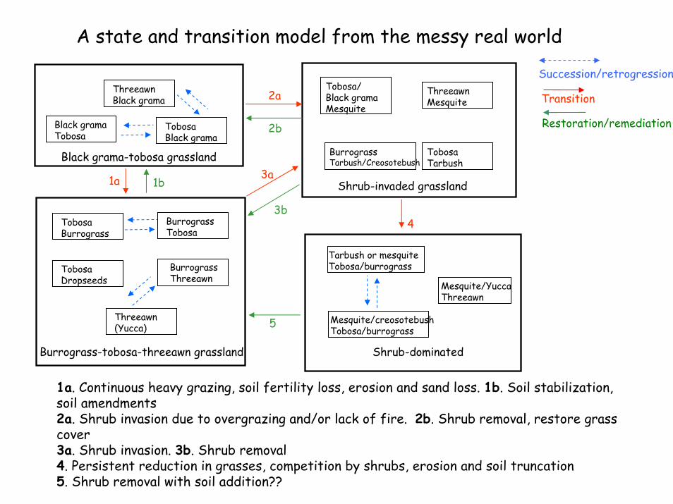
1a-Overgrazing, soil fertility loss, erosion and sand loss; 1b-Soil stabilization or modification2a-Shrub invasion due to overgrazing and/or lack of fire; 2b-Shrub removal, restore cover3a-Shrub invasion; 3b-Shrub removal with grass recovery4. Persistent reduction in grasses, competition by shrubs, erosion and soil truncation5. Shrub removal with soil addition? (Bestelmeyer et al 2003)
BurrograssTarbush/Creosotebush
Mesquite/creosotebushTobosa/burrograss
Tarbush or mesquiteTobosa/burrograss
ThreeawnBlack grama
TobosaBlack grama
Black grama-tobosa grassland
TobosaBurrograss
BurrograssThreeawn
Burrograss-tobosa-threeawn grassland
Shrub-invaded grassland
Shrub-dominated
Black gramaTobosa
1a
2a
3a
4
TobosaDropseeds
BurrograssTobosa
Threeawn(Yucca)
ThreeawnMesquite
TobosaTarbush
Mesquite/YuccaThreeawn
2b
3b
5
1b
Tobosa/Black gramaMesquite
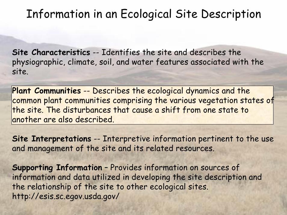
Information in an Ecological Site Description
Site Characteristics -- Identifies the site and describes the physiographic, climate, soil, and water features associated with the site.
Plant Communities -- Describes the ecological dynamics and the common plant communities comprising the various vegetation states of the site. The disturbances that cause a shift from one state to another are also described.
Site Interpretations -- Interpretive information pertinent to the use and management of the site and its related resources.
Supporting Information – Provides information on sources of information and data utilized in developing the site description and the relationship of the site to other ecological sites. http://esis.sc.egov.usda.gov/

Transition 1a(shrub invasion)
State B
Community A
State A
State C
Transition 2(soil erosion)
Communitypathways
(facilitatingpractices)
Transition 1b(acceleratingpractices)
Community B
Community C
Community D
Community E
Community F
Transition 3(acceleratingpractices)
A idealized state and transition model
This model has 16 elements that should be described

Building a Box & Arrow Diagram
•Components of a state and transition model•States and Communities
•Differing types of change
•Transitions
•Thresholds
•How do you write the information?
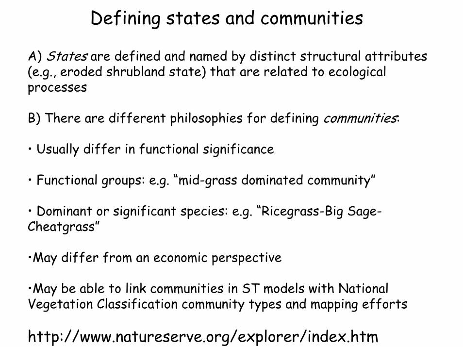
Defining states and communities
A) States are defined and named by distinct structural attributes (e.g., eroded shrubland state) that are related to ecological processes
B) There are different philosophies for defining communities:
• Usually differ in functional significance
• Functional groups: e.g. “mid-grass dominated community”
• Dominant or significant species: e.g. “Ricegrass-Big Sage-Cheatgrass”
•May differ from an economic perspective
•May be able to link communities in ST models with National Vegetation Classification community types and mapping efforts
http://www.natureserve.org/explorer/index.htm
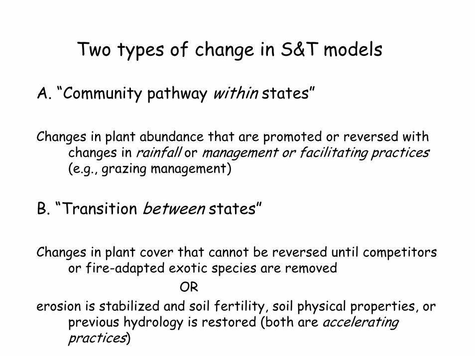
Two types of change in S&T models
A. “Community pathway within states”
Changes in plant abundance that are promoted or reversed with changes in rainfall or management or facilitating practices (e.g., grazing management)
B. “Transition between states”
Changes in plant cover that cannot be reversed until competitorsor fire-adapted exotic species are removed
ORerosion is stabilized and soil fertility, soil physical properties, or
previous hydrology is restored (both are accelerating practices)
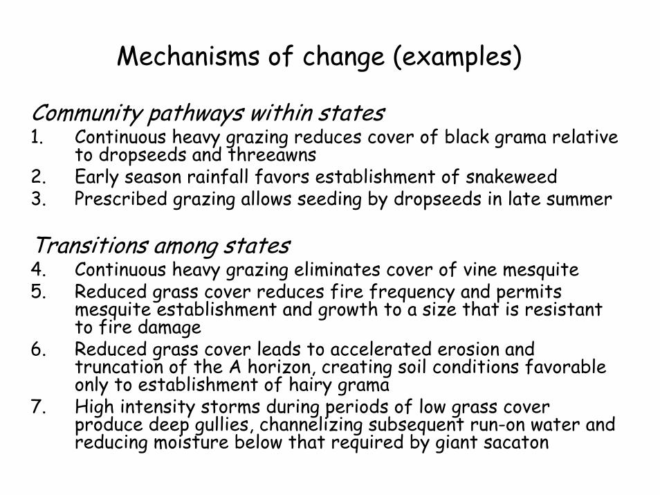
Mechanisms of change (examples)
Community pathways within states1. Continuous heavy grazing reduces cover of black grama relative
to dropseeds and threeawns2. Early season rainfall favors establishment of snakeweed3. Prescribed grazing allows seeding by dropseeds in late summer
Transitions among states4. Continuous heavy grazing eliminates cover of vine mesquite5. Reduced grass cover reduces fire frequency and permits
mesquite establishment and growth to a size that is resistant to fire damage
6. Reduced grass cover leads to accelerated erosion and truncation of the A horizon, creating soil conditions favorable only to establishment of hairy grama
7. High intensity storms during periods of low grass cover produce deep gullies, channelizing subsequent run-on water and reducing moisture below that required by giant sacaton
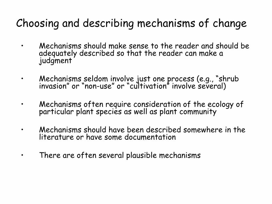
Choosing and describing mechanisms of change
• Mechanisms should make sense to the reader and should be adequately described so that the reader can make a judgment
• Mechanisms seldom involve just one process (e.g., “shrub invasion” or “non-use” or “cultivation” involve several)
• Mechanisms often require consideration of the ecology of particular plant species as well as plant community
• Mechanisms should have been described somewhere in the literature or have some documentation
• There are often several plausible mechanisms

Describing thresholds: risk and consequences
In some periods, you take a risk and get lucky---succession leads to recoveryIn some periods, you take a risk and get unlucky---things don’t workWhat is the probability of each?‘You have to ask yourself, punk “do I feel lucky today?”
1) Inappropriate grazing, low soil protection, low rainfall
2) Grazing management, good rainfall, high soil protection
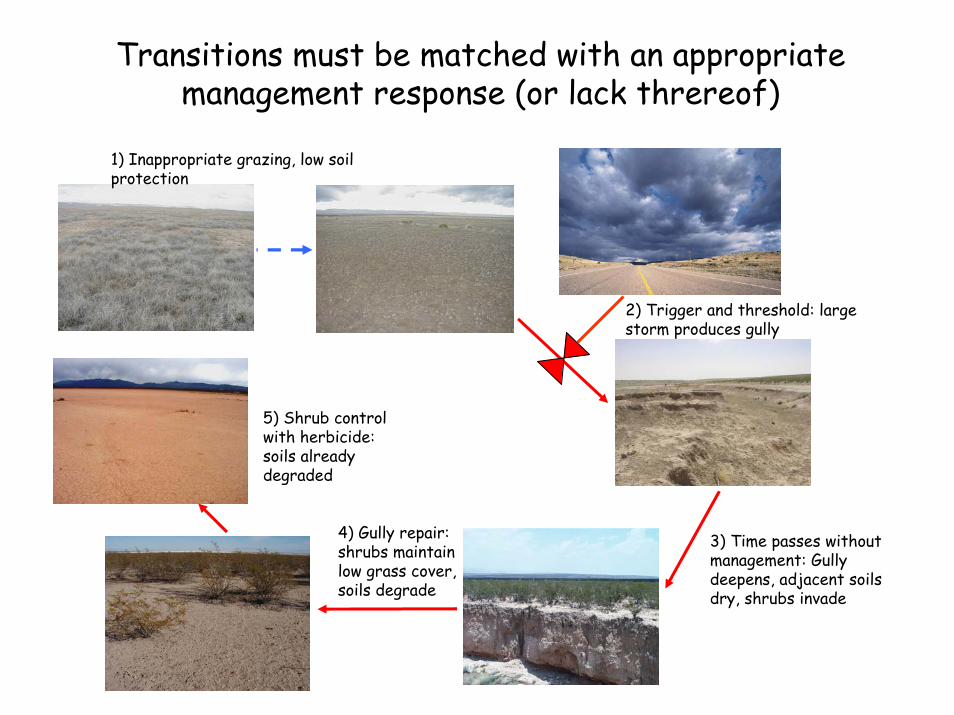
Transitions must be matched with an appropriate management response (or lack threreof)
2) Trigger and threshold: large storm produces gully
3) Time passes without management: Gully deepens, adjacent soils dry, shrubs invade
1) Inappropriate grazing, low soil protection
4) Gully repair: shrubs maintain low grass cover, soils degrade
5) Shrub control with herbicide: soils already degraded
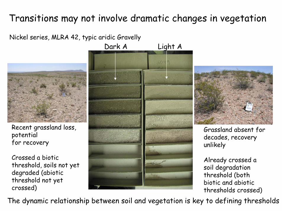
Transitions may not involve dramatic changes in vegetation
Recent grassland loss, potentialfor recovery
Crossed a biotic threshold, soils not yet degraded (abiotic threshold not yet crossed)
Grassland absent fordecades, recovery unlikely
Already crossed a soil degradation threshold (both biotic and abiotic thresholds crossed)
Dark A Light ANickel series, MLRA 42, typic aridic Gravelly
The dynamic relationship between soil and vegetation is key to defining thresholds

Common mechanisms of transitions
Loss of fire disturbance Restore fuel loads and fire regimeregime change grazing management/prescribed
burning
Soil degradation Soil stabilization/amendmentsphysical/biological pitting, contour furrowing,
fertilizer
Altered hydrology Gully plugs, create meanderssub/surface stream restoration
Undesired establishment Reduce target speciesinvasive species mechanical/herbicide treatment
Depletion of seed pool Seeding/practices to favor establishment
Cause of transition Accelerating/restoration practice

When is a transition so severe that a new ecological site should be created?
Never: because then a rangeland can be degraded into a healthy state with a new potential. For instance, mesquite and juniper dominance could be the ‘potential’ for a new site.
Alternative: When soil morphology is severely altered, establish a new site but maintain its connection as a degraded state of its ancestral site
Danger: When is soil morphology “severely altered” --and isn’t this a value judgment?
1b
Transition
A state and transition model from the messy real world
Succession/retrogression,
Restoration/remediation
BurrograssTarbush/Creosotebush
Mesquite/creosotebushTobosa/burrograss
Tarbush or mesquiteTobosa/burrograss
ThreeawnBlack grama
TobosaBlack grama
Black grama-tobosa grassland
TobosaBurrograss
BurrograssThreeawn
Burrograss-tobosa-threeawn grassland
Shrub-invaded grassland
Shrub-dominated
Black gramaTobosa
1a
2a
3a
4
TobosaDropseeds
BurrograssTobosa
Threeawn(Yucca)
ThreeawnMesquite
TobosaTarbush
Mesquite/YuccaThreeawn
2b
3b
5
Tobosa/Black gramaMesquite
1a. Continuous heavy grazing, soil fertility loss, erosion and sand loss. 1b. Soil stabilization, soil amendments 2a. Shrub invasion due to overgrazing and/or lack of fire. 2b. Shrub removal, restore grass cover3a. Shrub invasion. 3b. Shrub removal 4. Persistent reduction in grasses, competition by shrubs, erosion and soil truncation5. Shrub removal with soil addition??

Strategies for the Text
Ecological Dynamics of the SiteSummarize the causes and constraints to community change within the historic state, and causes and constraints to transitions among states
Catalog of States and Transitions (a proposal)State 1 (state containing historic community): Describe attributes that
define this state, how to distinguish state from other states
Transition 1A: Describe the mechanisms of transition in detailTransition 2A: Describe the mechanisms of transition to another
stateTransition 1B: Describe the accelerating practice to get back in
detailCommunity A: Describe attributes of community
Pathway 1A…Pathway 1B (facilitating practices)
State 2 (alternative state):…
This structure will allow links to Web Soil Survey
Strategies for the Text
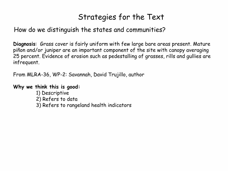
Diagnosis: Grass cover is fairly uniform with few large bare areas present. Mature piñon and/or juniper are an important component of the site with canopy averaging 25 percent. Evidence of erosion such as pedestalling of grasses, rills and gullies are infrequent.
From MLRA-36, WP-2: Savannah, David Trujillo, author
Why we think this is good:1) Descriptive2) Refers to data3) Refers to rangeland health indicators
How do we distinguish the states and communities?
Strategies for the Text
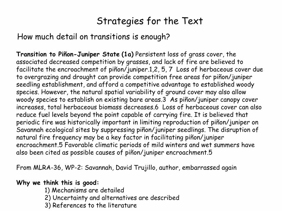
Transition to Piñon-Juniper State (1a) Persistent loss of grass cover, the associated decreased competition by grasses, and lack of fire are believed to facilitate the encroachment of piñon/juniper.1,2, 5, 7 Loss of herbaceous cover due to overgrazing and drought can provide competition free areas for piñon/juniper seedling establishment, and afford a competitive advantage to established woody species. However, the natural spatial variability of ground cover may also allow woody species to establish on existing bare areas.3 As piñon/juniper canopy cover increases, total herbaceous biomass decreases.6 Loss of herbaceous cover can also reduce fuel levels beyond the point capable of carrying fire. It is believed that periodic fire was historically important in limiting reproduction of piñon/juniper on Savannah ecological sites by suppressing piñon/juniper seedlings. The disruption of natural fire frequency may be a key factor in facilitating piñon/juniper encroachment.5 Favorable climatic periods of mild winters and wet summers have also been cited as possible causes of piñon/juniper encroachment.5
From MLRA-36, WP-2: Savannah, David Trujillo, author, embarrassed again
Why we think this is good:1) Mechanisms are detailed2) Uncertainty and alternatives are described3) References to the literature
How much detail on transitions is enough?

Photos and indicators summary
Shrub-invaded state, threeawn-mesquite
Shrub-invaded state, burrograss-creosotebush
Shrub-dominated state, creosotebush-tarbush
•Threeawn dominant, some burrograssand fluffgrass. Mesquite and tarbushpresent•Cover of grasses low (18/3%)•Evidence of wind erosion and pedestalling, large bare patches.•Algerita sandy loam, eroded phase, Jornada Exp. Range, Dona Ana Co.
•Burrograss dominant, some tobosa.Creosotebush at moderate density•Cover of grasses low-moderate (28/6%)•Evidence of wind erosion and pedestalling, large bare patches.•Dona Ana fine sandy loam, Jornada Exp. Range, Dona Ana Co.
•Creosotebush dominant, some bush muhlyamong shrubs. Borders gravelly site.•Cover of grasses very low (<1%)•Evidence of wind erosion and pedestalling, nearly continuous bare ground, physical crusts.•Dona Ana fine sandy loam, Jornada Exp. Range, Dona Ana Co.


