35
1 SUBSTRUCTURE DISCOVERY IN REAL WORLD SPATIO-TEMPORAL DOMAINS Jesus A. Gonzalez Supervisor: Dr. Lawrence B. Holder Committee: Dr. Diane J. Cook Dr. Lynn Peterson
| Date post: | 28-Dec-2015 |
| Category: |
Documents |
| Upload: | ami-butler |
| View: | 214 times |
| Download: | 0 times |

1
SUBSTRUCTURE DISCOVERY IN REAL WORLD SPATIO-TEMPORAL
DOMAINS
Jesus A. GonzalezSupervisor: Dr. Lawrence B. HolderCommittee: Dr. Diane J. Cook
Dr. Lynn Peterson

2
Motivation and Goal.
Knowledge Discovery with Subdue.
Application to two Real-World Relational
Databases.
Comparison of Subdue with ILP Systems.
Conclusion and Future Work.
OUTLINE

3
MOTIVATION AND GOAL
Need to analyze large amounts of information in
real world databases.
Information that standard tools can not detect.
Aviation Safety Reporting System Database.
Earthquake Database.
Previous knowledge: Spatio-Temporal relations.
4
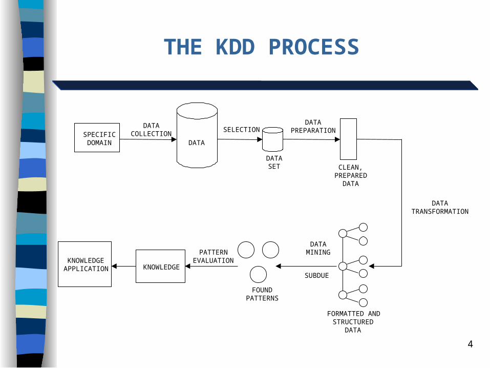
THE KDD PROCESS
SPECIFICDOMAIN DATA
SELECTION
DATASET
DATAPREPARATION
DATATRANSFORMATION
CLEAN,PREPARED
DATA
FORMATTED ANDSTRUCTURED
DATA
DATAMINING
FOUNDPATTERNS
PATTERNEVALUATION
KNOWLEDGEKNOWLEDGEAPPLICATION
DATACOLLECTION
SUBDUE
5
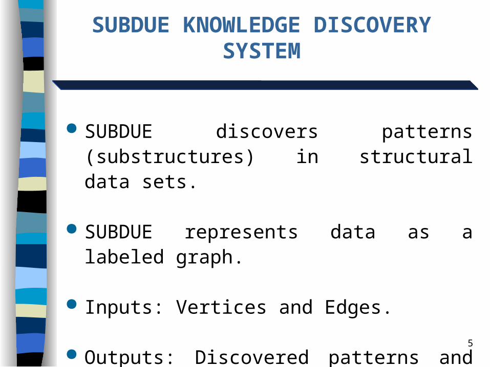
SUBDUE KNOWLEDGE DISCOVERY SYSTEM
SUBDUE discovers patterns (substructures) in structural data sets.
SUBDUE represents data as a labeled graph.
Inputs: Vertices and Edges.
Outputs: Discovered patterns and instances.
6
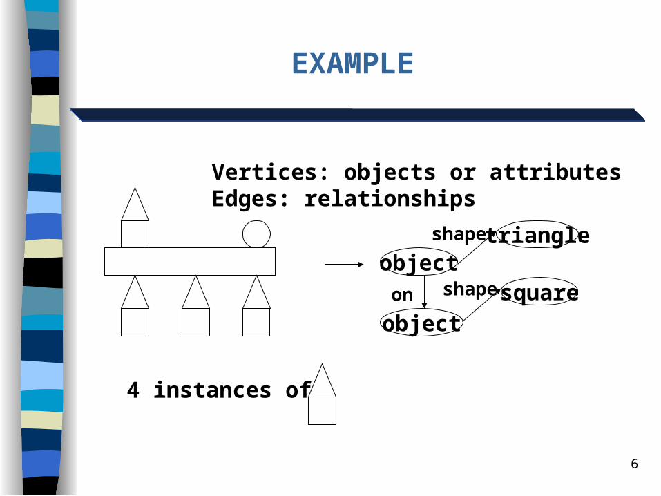
EXAMPLE
objecttriangle
object
squareon
shape
shape
Vertices: objects or attributesEdges: relationships
4 instances of

7
Starts with a single vertex and expand by one
edge.
Computationally Constrained Beam Search.
Space is all Sub-graphs of Input Graph.
Guided by Compression Heuristics.
SUBDUE’S SEARCH
8
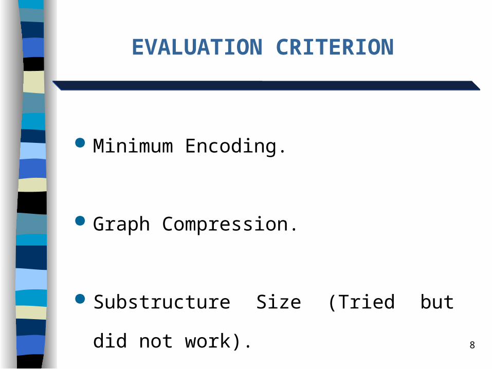
EVALUATION CRITERION
Minimum Encoding.
Graph Compression.
Substructure Size (Tried but did not work).

9
EVALUATION CRITERIONMINIMUM DESCRIPTION LENGTH
Minimum Description Length (MDL) principle. The best theory to describe a set of data is the one that minimizes the DL of the entire data set.
DL of the graph: the number of bits necessary to completely describe the graph.
Search for the substructure that results in the maximum compression.

10
THE ASRS DATABASE
The Aviation Safety Reporting System (ASRS).
Reports of incidents that might affect the aviation safety.
Some fields modified or omitted to keep the pilot’s identity confidential.
72,504 records, with 74 fields each.

11
THE ASRS DATABASE KNOWLEDGE REPRESENTATION
EVENT 1
Small_Transport
ATC
Cockpit
Others
2.000000
Land_Plane
EVENT 2
EVENT m
Near_in_distance
Acft _type
Detectors
Detectors
Detectors
Num _engine
Surface
12
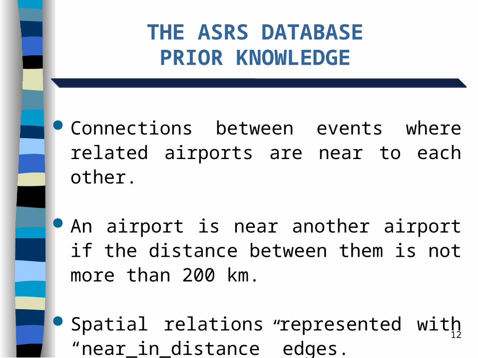
THE ASRS DATABASEPRIOR KNOWLEDGE
Connections between events where related airports are near to each other.
An airport is near another airport if the distance between them is not more than 200 km.
Spatial relations represented with “near_in_distance” edges.
13
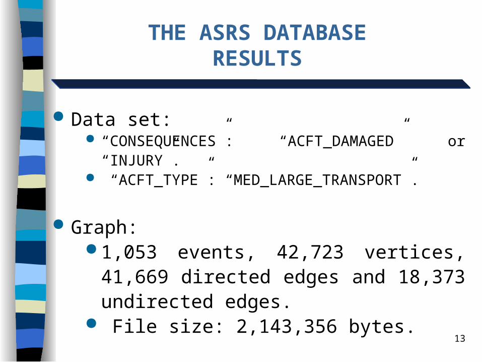
THE ASRS DATABASERESULTS
Data set: “CONSEQUENCES”: “ACFT_DAMAGED” or “INJURY”. “ACFT_TYPE”: “MED_LARGE_TRANSPORT”.
Graph: 1,053 events, 42,723 vertices, 41,669 directed
edges and 18,373 undirected edges. File size: 2,143,356 bytes.
14
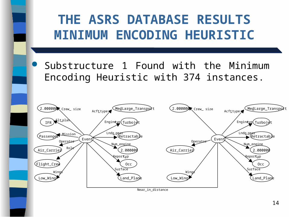
THE ASRS DATABASE RESULTSMINIMUM ENCODING HEURISTIC
Substructure 1 Found with the Minimum Encoding Heuristic with 374 instances.
Event
Med _Large_Transport2.000000
Turbojet IFR
RetractablePassenger
2.000000Air_Carrier
OccFlight_Crew
Land_PlaneLow_Wing
Acft _type Crew_ size
Engine_typFlt _plan
Lndg _gear
Num _engineOperator
Mission
Report_typ
Role
SurfaceWings
Event
Med _Large_Transport2.000000
Turbojet
Retractable
2.000000Air_Carrier
Occ
Land_PlaneLow_Wing
Acft _type Crew_ size
Engine_typ
Lndg _gear
Num _engineOperator
Report_typ
SurfaceWings
Near_in_distance
15
THE ASRS DATABASE RESULTSMINIMUM ENCODING HEURISTIC
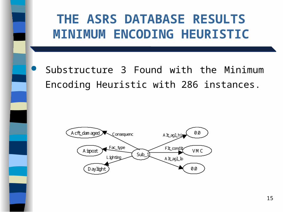
Sub_1
0.0Acft_damaged
VMCAirport
Daylight
Alt_agl_hiConsequenc
Flt_condit
Alt_agl_loLighting
Fac_type
0.0
Substructure 3 Found with the Minimum Encoding
Heuristic with 286 instances.

16
THE ASRS DATABASE RESULTSMINIMUM ENCODING HEURISTIC
Sub_2 EventNear_in_distance
Substructure 4 Found with the Minimum Encoding
Heuristic with 67 instances.
17
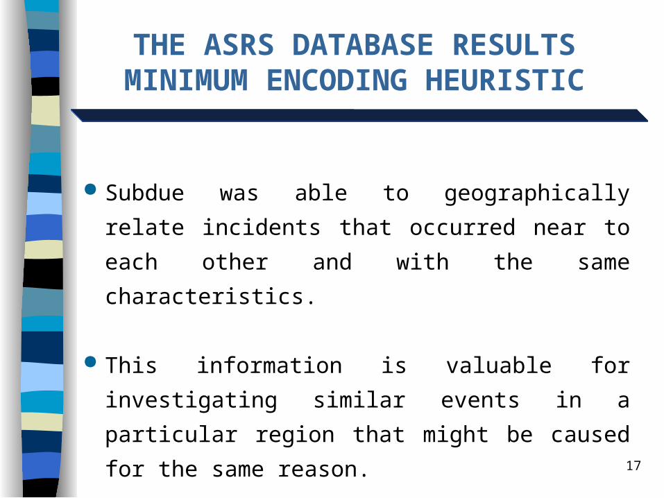
THE ASRS DATABASE RESULTSMINIMUM ENCODING HEURISTIC
Subdue was able to geographically relate incidents that
occurred near to each other and with the same
characteristics.
This information is valuable for investigating similar
events in a particular region that might be caused for the
same reason.
18
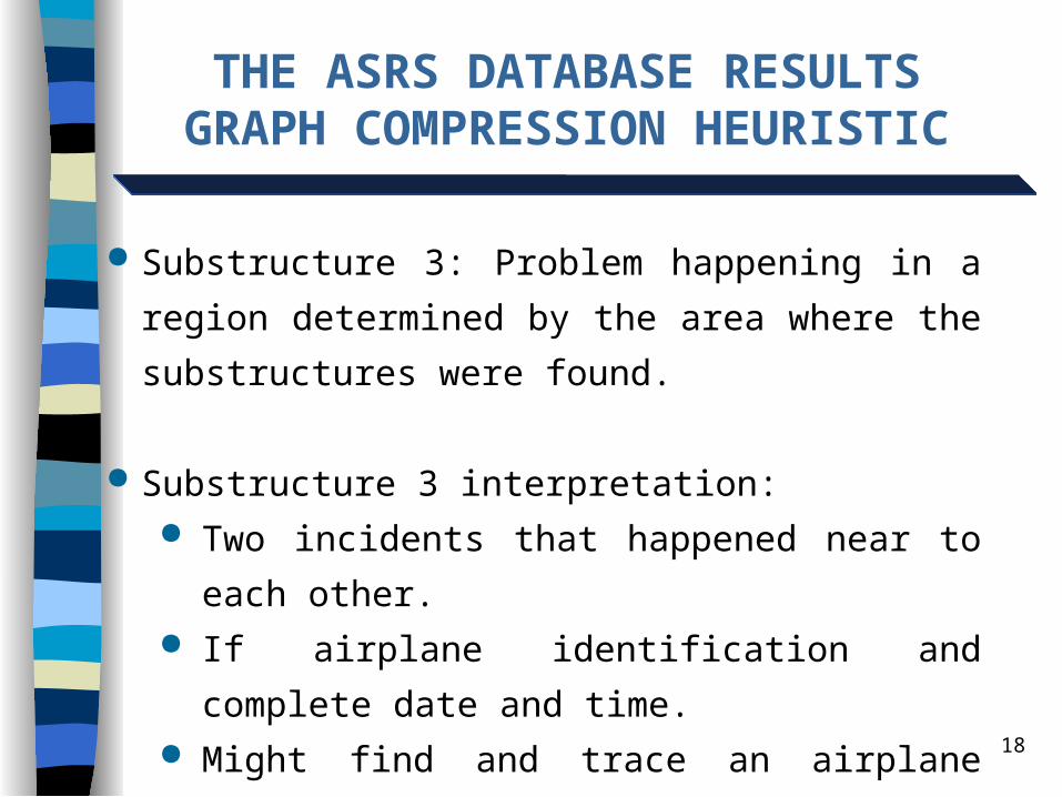
THE ASRS DATABASE RESULTSGRAPH COMPRESSION HEURISTIC
Substructure 3: Problem happening in a region determined
by the area where the substructures were found.
Substructure 3 interpretation: Two incidents that happened near to each other. If airplane identification and complete date and time. Might find and trace an airplane that failed near one
airport, was reported and later had to land close to this
first airport due to another failure.
19
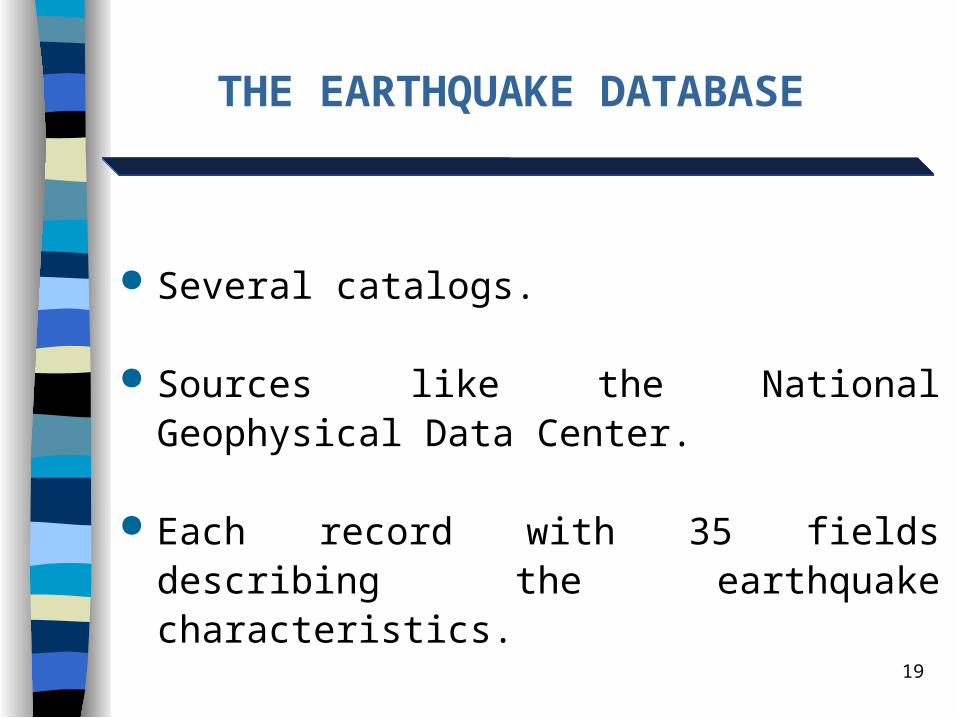
THE EARTHQUAKE DATABASE
Several catalogs.
Sources like the National Geophysical Data Center.
Each record with 35 fields describing the earthquake characteristics.
20
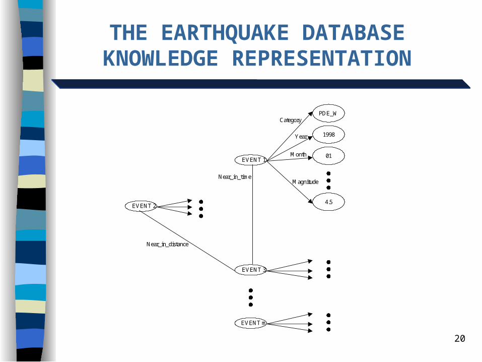
THE EARTHQUAKE DATABASEKNOWLEDGE REPRESENTATION
EVENT 2
EVENT 1
EVENT 3
EVENT m
PDE_W
1998
01
4.5
Near_in_distance
Near_in_time
Category
Year
Month
Magnitude
21
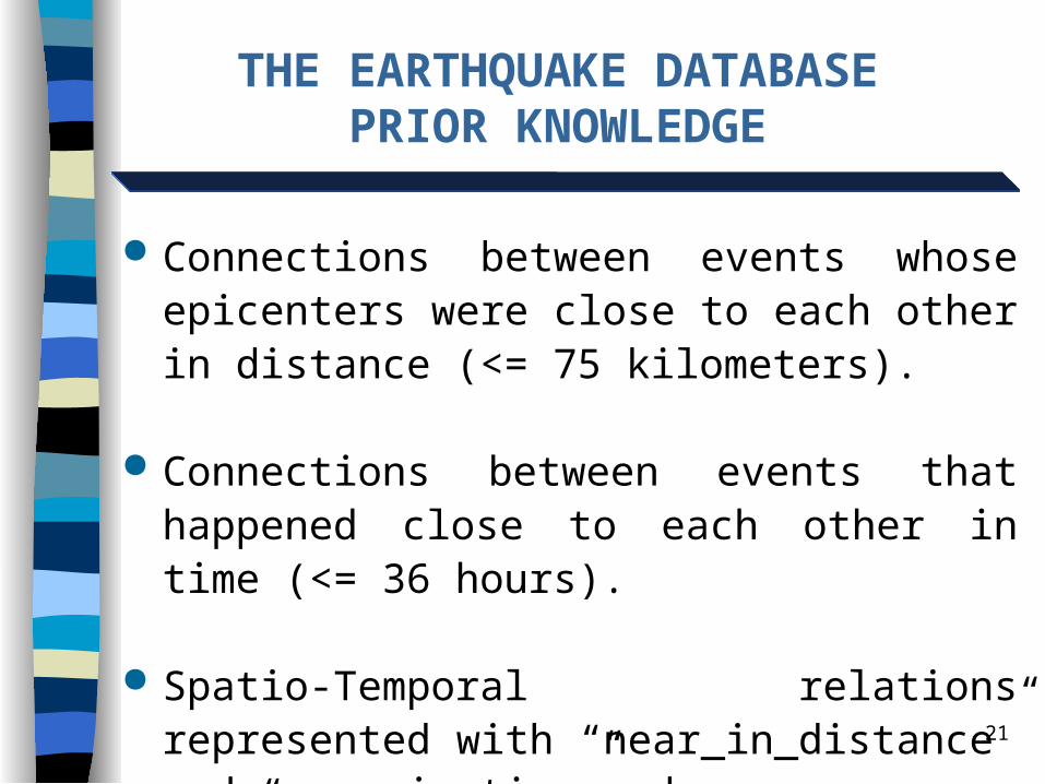
THE EARTHQUAKE DATABASEPRIOR KNOWLEDGE
Connections between events whose epicenters were close to each other in distance (<= 75 kilometers).
Connections between events that happened close to each other in time (<= 36 hours).
Spatio-Temporal relations represented with “near_in_distance” and “near_in_time” edges.
22
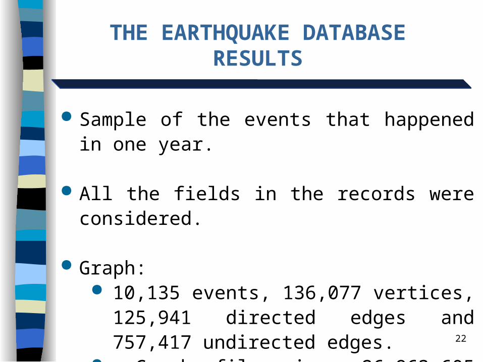
THE EARTHQUAKE DATABASERESULTS
Sample of the events that happened in one year.
All the fields in the records were considered.
Graph: 10,135 events, 136,077 vertices, 125,941
directed edges and 757,417 undirected edges. Graph file size: 26,963,605 bytes.

23
THE EARTHQUAKE DB RESULTSGRAPH COMPRESSION HEURISTIC
Substructure 8 Found with the Graph Compression
Heuristic with 140 instances.
33.0000
Sub-1 Sub-7
Near_in_time
Depth

24
THE EARTHQUAKE DB RESULTS
Graph Compression works faster --> more iterations.
Given enough time MDL could find those substructures. MDL finds substructures using Spatio-Temporal relations.
Subdue found relations with fields like “Catalog”, “Month”, “Mag1 Scale”, and “Depth”.
More earthquakes happened in the months of May and June.
Most frequent earthquake depths were 33 and 10 kilometers.
25
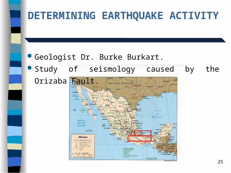
DETERMINING EARTHQUAKE ACTIVITY
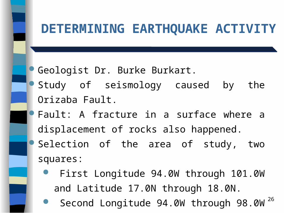
Geologist Dr. Burke Burkart. Study of seismology caused by the Orizaba Fault.
26
Geologist Dr. Burke Burkart. Study of seismology caused by the Orizaba Fault. Fault: A fracture in a surface where a displacement of
rocks also happened. Selection of the area of study, two squares:
First Longitude 94.0W through 101.0W and Latitude
17.0N through 18.0N. Second Longitude 94.0W through 98.0W and Latitude
18.0N through 19.0N.
DETERMINING EARTHQUAKE ACTIVITY

27
DETERMINING EARTHQUAKE ACTIVITY
Divide the area in 44 rectangles of one half of a degree in
both longitude and latitude.
Sample the earthquake activity in each sub-area.
Run Subdue in each sub-area.
28
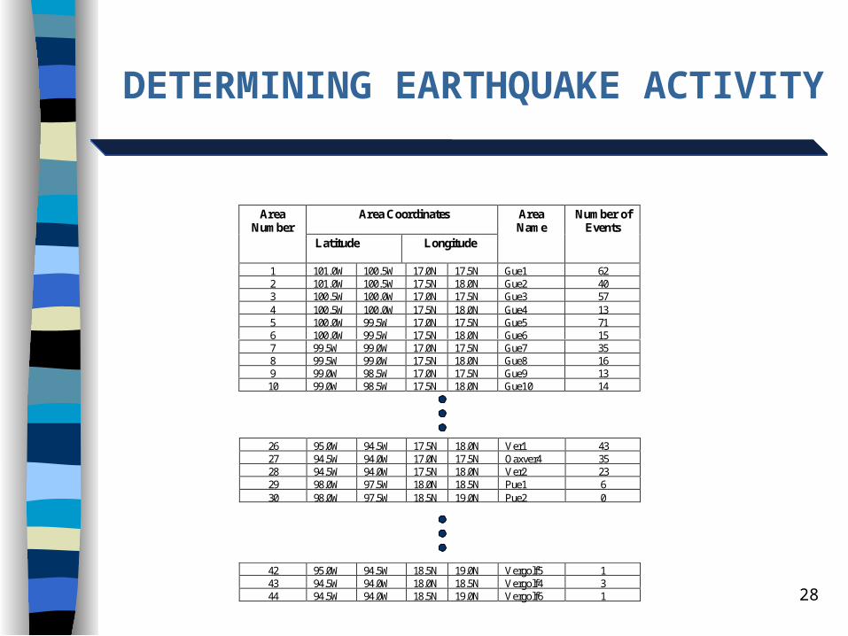
DETERMINING EARTHQUAKE ACTIVITY
Area CoordinatesAreaNumber
Latitude Longitude
AreaName
Number ofEvents
1 101.0W 100.5W 17.0N 17.5N Gue1 622 101.0W 100.5W 17.5N 18.0N Gue2 403 100.5W 100.0W 17.0N 17.5N Gue3 574 100.5W 100.0W 17.5N 18.0N Gue4 135 100.0W 99.5W 17.0N 17.5N Gue5 716 100.0W 99.5W 17.5N 18.0N Gue6 157 99.5W 99.0W 17.0N 17.5N Gue7 358 99.5W 99.0W 17.5N 18.0N Gue8 169 99.0W 98.5W 17.0N 17.5N Gue9 1310 99.0W 98.5W 17.5N 18.0N Gue10 14
26 95.0W 94.5W 17.5N 18.0N Ver1 4327 94.5W 94.0W 17.0N 17.5N Oaxver4 3528 94.5W 94.0W 17.5N 18.0N Ver2 2329 98.0W 97.5W 18.0N 18.5N Pue1 630 98.0W 97.5W 18.5N 19.0N Pue2 0
42 95.0W 94.5W 18.5N 19.0N Vergolf5 143 94.5W 94.0W 18.0N 18.5N Vergolf4 344 94.5W 94.0W 18.5N 19.0N Vergolf6 1
29
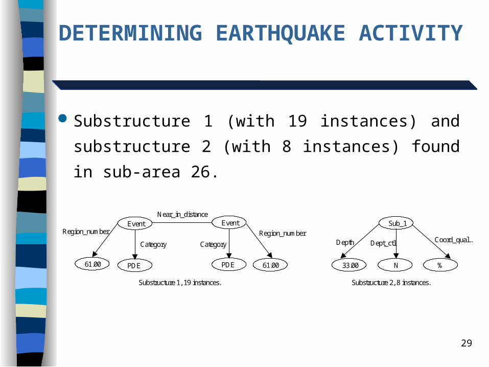
DETERMINING EARTHQUAKE ACTIVITY
33.00
Substructure 2, 8 instances.
Sub_1
N %
Depth Dept_ctl Coord_qual..
PDE
Substructure 1, 19 instances.
Event EventNear_in_distance
Category
PDE
Category
61.00 61.00
Region_numberRegion_number
Substructure 1 (with 19 instances) and substructure 2 (with
8 instances) found in sub-area 26.
30
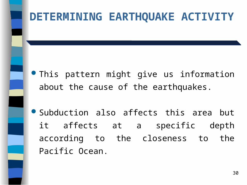
DETERMINING EARTHQUAKE ACTIVITY
This pattern might give us information about the cause of
the earthquakes.
Subduction also affects this area but it affects at a specific
depth according to the closeness to the Pacific Ocean.

31
SUBDUE’S POTENTIAL
Subdue finds not only shared characteristics of events, but
also space relations between them. Dr. Burke Burkart is studying the patterns to give direction
to this research. Expect to find patterns representing parts of the paths of
the involved fault. Time relations not considered by Subdue.
Earthquake’s characteristics. Important for other areas.
32
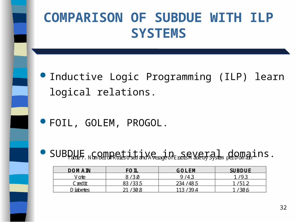
COMPARISON OF SUBDUE WITH ILP SYSTEMS
Inductive Logic Programming (ILP) learn logical
relations.
FOIL, GOLEM, PROGOL.
SUBDUE competitive in several domains.Table 7. Number of Rules Used and Average of Errors Made by System per Domain
DOMAIN FOIL GOLEM SUBDUEVote 8 / 3.0 9 / 4.3 1 / 9.3
Credit 83 / 33.5 234 / 48.5 1 / 51.2Diabetes 21 / 30.8 113 / 39.4 1 / 30.6
33
CONCEPT LEARNING SUBDUE
ILP systems take positive and negative examples
represented with First Order Logic.
New Concept Learning Subdue (CLSubdue) does too.
Can learn multiple rules.
Evaluation is ongoing.
34
CONCLUSION
Subdue successful in real world databases.
Subdue discovered interesting patterns using the temporal
and spatial relations.
Subdue found significant patterns in the Orizaba Fault
Earthquake Database.
Subdue has potential to compete with ILP systems.
Subdue compared with Progol.
35
FUTURE WORK
Theoretical analysis. Show Subdue converges to optimal substructure. Better understanding of search space properties. Bounds on complexity (e.g. PAC learning).
Graphic User Interface to visualize substructures and their
instances. Express ranges of values (ranges of depth, magnitude,
latitude, longitude, etc. in the Earthquake database). Continue Evalutation in Real-World Spatio-Temporal
Databases.


