St. Croix International Waterway Commission 2020 FINAL REPORT PROJECT P2100011 Supporting Alewife Restoration, Creation of Map & Document Library, & Youth Engagement Program International Joint Commission International St. Croix River Watershed Board Submitted by: ELIZABETH HYSLOP Executive Director April 26, 2021 PO Box 2, St. Stephen, NB E3L 2W9 PO Box 610, Calais, ME 04619 [email protected]www.stcroix.org
Transcript
St. Croix International Waterway Commission
2020 FINAL REPORT
PROJECT P2100011 Supporting Alewife Restoration,
Creation of Map & Document
Library, & Youth Engagement
Program
International Joint Commission
International St. Croix River
Watershed Board
Submitted by: ELIZABETH HYSLOP Executive Director April 26, 2021 PO Box 2, St. Stephen, NB E3L 2W9
Message from our Co-Chairs ...........................................................................................................................................4
Executive Director Report ...............................................................................................................................................4
Projects and Programs ............................................................................................................................................. 11
Community Engagement.......................................................................................................................................... 11
Supporting Alewife Restoration in The St. Croix Watershed - Anadromous Fish Counts at Milltown Dam ............... 13
Introduction – History of the Project ....................................................................................................................... 15
Results and Conclusions ....................................................................................................................................... 19
Other Species ....................................................................................................................................................... 23
Fish Health Testing ............................................................................................................................................... 24
River Herring Tracking Studies ............................................................................................................................. 24
Youth Engagement Program ........................................................................................................................................ 33
Methods and Observations ...................................................................................................................................... 34
St. Croix International Waterway Commission
Program Test Run: Outdoor Education – Nature Day Camps – August 2020 .......................................................... 35
Program Safety & Curriculum Development ........................................................................................................... 36
Information and Policy Handbook ....................................................................................................................... 36
Program Curriculum ............................................................................................................................................. 37
Next Steps ................................................................................................................................................................ 37
Methods and Observations ...................................................................................................................................... 39
Phase 1: Confirm if there is an interest in the library. ......................................................................................... 40
Phase 2: Identify a cataloguing system and move entire collection central location. ........................................ 40
Phase 3: Sort, scan and catalogue the map collection. ....................................................................................... 40
Phase 4: Sort and catalogue the items in the library. .......................................................................................... 41
Benthic Invertebrate Sampling on the St. Croix River ................................................................................................. 44
Methods and Observations ...................................................................................................................................... 46
Results and Conclusions ........................................................................................................................................... 47
Water Quality Monitoring in the St. Croix Watershed ................................................................................................ 52
Methods Water Quality Monitoring ........................................................................................................................ 54
Chemical Parameters ........................................................................................................................................... 54
Field Parameters .................................................................................................................................................. 55
Results and Conclusions ........................................................................................................................................... 55
Water Quality Monitoring .................................................................................................................................... 55
Water Quality Index (WQI)................................................................................................................................... 57
St. Croix International Waterway Commission
Appendix 1: Youth Engagement Program Information & Policy Handbook ...................................................................1
Supporting Alewife Restoration, Creation of Map & Document Library, & Youth Engagement Program | Page | 4
Message from our Co-Chairs
The 2020 season was like no previous year as we all have been affected by the uncertainties of COVID-19.
The staff of the St Croix International Waterway Commission (SCIWC) rose to the challenge and were able to
complete all the projects planned for 2020, even if their timelines had to be modified as the season progressed.
Flexibility and resourcefulness where key skills as our staff completed their projects on the lower and upper
sections of the Waterway. At the same time the Commission explored new and exciting projects for future years.
Initiatives that will benefit the people, wildlife, and resources of the St Croix Waterway as we go forward into
2021 and beyond.
David Whittingham, Canadian Co-Chair
G. Bob Wallace, US Co-Chair
Executive Director Report
2020 was the second full year in my role as Executive Director of the St. Croix International Waterway
Commission. The transition from the insurance and corporate world to this position has been a wonderful
challenge made as successful as it has been through the support of the Board, Liaisons, Partners, and Staff. Each
group were willing to take the time to teach me and support my growth in this role. There are far too many to
thank individually but I do want all to know that your time and effort are so greatly appreciated.
The information shared in this report I trust will demonstrate the hard work and effort exhibited by our
Board and Staff and provide a greater understanding of our work.
Elizabeth Ann Hyslop, BBA, FCIP
Operational Summary 2020
2020 was a successful, and difficult year, for the St. Croix International Waterway Commission that was
marked by continued improvements in our processes, adapting to a pandemic, and the launch of three new
projects. We were able to implement, with delays and modifications, the Heritage River Recreation, Supporting
Alewife Restoration in the St. Croix River Watershed Anadromous Fish Counts at Milltown Dam, and Water
Quality Monitoring on the St. Croix Watershed programs. Additionally, we added Benthic Invertebrates
Sampling, Map and Document Library Catalogue, and Youth Engagement programs. To follow in subsequent
sections will be a brief overview of each program.
The corona virus pandemic impacted our programs and operations, as it had with our communities and
nations collectively, with layoffs, closure of our administration office in Calais and that of our partners, US
St. Croix International Waterway Commission
Supporting Alewife Restoration, Creation of Map & Document Library, & Youth Engagement Program | Page | 5
Canadian Border closing, adapting to the various emergency orders, and the requirement for staff to work
remotely. The restricted operations of others impacted operations in several areas, just as:
• Our financial documents for 2019 audit were submitted in March but the final audit document was not
received until January 4, 2021, as both our bookkeeper and auditor’s operations were severely impacted.
This resulted in delays in filing required tax returns and the Commission taking on the duties of
bookkeeping from the previously retained accounting firm.
• CABIN Training program was cancelled, and it was difficult arranging for CABIN qualified individuals to
meet the terms of our contract for the Benthic Invertebrate Sampling project.
• Pandemic safety protocols enforced by NB Power and the DFO, resulted in extreme limitations in the
access to the Milltown Dam fishway for the anadromous fish count, forcing our Lead Biologist to be the
sole individual allowed on site for the duration of the fish run.
• Both the Province of NB and State of Maine issued Emergency Measures that closed all recreation sites,
in addition to other restrictions, that delayed the hiring for the Heritage Recreation Program,
cancellations and refunds for site rentals in NB, and delayed site maintenance from April 20, by three
weeks, to May 11.
• There was the substantial delay in obtaining the necessary Work Permits submitted to Immigration,
Refugees and Citizenship Canada (IRCC) for our two American staff members, including our Program
Coordinator. The applications are usually issued directly at the Ferry Point Canada Border Service (CBSA)
office, but all such operations were ceased locally, and the process had to be completed online. This
resulted in a process that usually takes 1 2 hours being delayed by nearly four weeks for our Recreation
Krew staff member and nearly two months for our Program Coordinator. Therefore, neither could not
participate in any work in Canada and were prevented from completing their duties.
The personal impact to our staff was a delay in hiring for the programs and layoffs. Two employees were laid
off in March for approximately a month but did qualified for the Canada Emergency Response Benefit (CERB),
reducing the impact of the layoff. Our Program Coordinator was laid off in April and our office was nearly total
closure. We were able to qualify and received financial assistance US federal Payroll Protection Plan (PPP) and
Canadian Canada Emergency Wage Subsidy (CEWS) funding. These funds permitted us to continue operations
until such time as alterations were made to our various programs to comply with COVID 19 Protocols.
During the six-week period of March 19 – May 5 and beginning October 1, 2020, and into 2021, the Calais
administration office was closed, forcing the Executive Director and Program Coordinator to work from home.
The Peskotomuhkati Nation graciously provided office space from November 6 20, until their office was closed
with the Emergency Order going back to Phase Orange on November 20. As many have experienced, working
from home is difficult because of the lack of interaction and support with key personnel, limited access to
materials and resources, and office set ups that are not conducive to continued good physical and mental health.
It also takes over personal space in the individual’s home, reduces their ability to utilize and enjoy that space, and
does not provide the healthy separation of work and home.
St. Croix International Waterway Commission
Supporting Alewife Restoration, Creation of Map & Document Library, & Youth Engagement Program | Page | 6
The office closure in October resulted in the third layoff for the employee working on the Map & Library
Catalogue project. With the office closed and the border restricted, this employee would no longer had access to
the files for the Map & Library Catalogue project. Additionally, the Youth Engagement project was set do deliver
the curriculum to grade 5 students in early December but was cancelled due to the pandemic concerns. As a
result, the two employees working on these two projects found alternative full-time employment, October, and
December respectively, and we are recruiting for a replacement.
The region experienced an unusual heat wave in July that restricted access to remote areas to protect against
fires and reduced the ability of staff to work safely outdoors. During this period, the water quality sampling was
restricted, and the campsites were closed.
In September, there were two break ins at our St. Croix Outdoor Centre location and several thousand dollars
in equipment was stolen. The police were notified, a file opened but no charges have been laid.
Despite these unusual challenges, we were able to maintain the employment of our Program Coordinator, a
huge triumph as the Commission’s core funding does not cover the basic operations. Additionally, we rehired
one of our American and six of our Canadian employees from last year, and four new employees.
In addition to our focus above, the Commission continued to actively seek opportunities to form partnerships
with the public, government, and others. More details can be found in the EVENTS & PUBLIC ENGAGEMENT
Section for the various events and activities.
Partners
Regional Governmental Agencies
Province of New Brunswick
• Department of Natural Resources and Energy Development (K. Kinney, L. Wilbur)
• Office of the Premier (L. Leger)
State of Maine
• Maine Dept. of Agriculture, Conservation & Forestry (A. Cutco)
• Bureau of Parks & Lands) M. Deroche)
Maine State Legislature, District 6 (Senator M. Moore)
St. Croix International Waterway Commission
• Elizabeth Hyslop, BBA, FCIP, Executive Director
• Gloria Tinker, Program Coordinator
• Pandemic was the most serious and far-reaching issue encountered in 2020.
St. Croix International Waterway Commission
Supporting Alewife Restoration, Creation of Map & Document Library, & Youth Engagement Program | Page | 7
• Core funding continues to present a significant financial challenge, as the funds allocated from the State
of Maine and Province of New Brunswick are not enough to meet the basic operational and
administrative activities of the SCWIC. In 1986, the funding was $50,000 CND from PNB plus $50,000
USD State of ME, but these amounts are currently half at $25,000 CND plus $25,000 USD. To have these
funds increased, the State of Maine must first pass Bill LD 450 of Maine State Legislature. Once the bill is
passed, the Province of New Brunswick will allocate matching funds. Bill LD 450 was approved by the
House and Senate by April 2019 but declared ‘dead’ in November 2020. The process will begin again
with the 130th Legislature.
• July Heat Wave
• NB Power decommissioning of the Milltown Dam that presents challenges in continuing the Fish Count
program, including providing student work placement.
Our Structure
The SCIWC was established in 1987 through a signing of a Memorandum of Understanding (MOU) between
the Province of New Brunswick and the State of Maine.
In New Brunswick, Commissioners are appointed by the Premier’s office and is considered one of the
Provincial agencies, boards and commissions in which the provincial government does have exclusive authority
over appointments. Included in these entities are include self-regulating professions, trusts, and federal and
municipal boards, each with a corresponding Provincial Legislative Act, which in the case of the SCIWC, the act
defines the structure, purpose, and authority of the commission (Government of New Brunswick, 2021).
There is currently one position for a Canadian commissioner.
In Maine, Commissioners are appointed by the Governor’s Office and is considered a Personal Appointment,
which do not require a public hearing or approval of the State Legislature. Persons appointed to Personal Boards
must be sworn in by a Dedimus Justice within 30 days of their appointment. If the appointee is not sworn in
within 30 days, they may not serve until they are reappointed by the Governor (Maine.gov, 2021).
The Board of Directors met three (3) times in 2020, missing the second quarterly meeting due to pandemic
restrictions; one (1) special meeting, five (5) committee meetings, and ten (10) Co-Chair and Management
meetings.
Based on the MOU and legislation, a Board of Directors overseas the operations of the Commission, as
illustrated in the Organizational Chart and Current Board below.
Current Board of Directors
David Whittingham Canadian Co Chair G. Robert Wallace US Co Chair
Cleveland Allaby Canadian Commissioner David Apgar US Commissioner
George Guimond Guimond Richard Scribner US Commissioner
Constance McDougall Canadian Commissioner Honorable Madonna Soctomah US Commissioner
Liaisons Government of Canada, Department of Oceans and Fisheries
St. Croix International Waterway Commission
Supporting Alewife Restoration, Creation of Map & Document Library, & Youth Engagement Program | Page | 8
State of Maine, Maine Dept. of Agriculture, Conservation & Forestry, Bureau of
Parks & Lands
Province of New Brunswick, Department of Natural Resources and Energy
Development
Indigenous Representative
Peskotomuhkati Nation at Skutik – Passamaquoddy Tribe
The Board of Directors met three (3) times in 2020, missing the second quarterly meeting due to pandemic
restrictions; one (1) special meeting, five (5) committee meetings, and ten (10) Co Chair and Management
meetings.
Staff
The Management Team of Elizabeth Hyslop, BBA, Executive Director and Gloria Tinker, Program Coordinator
worked together with our Lead Biologist, Rebecca Goreham, B.Sc. and Heritage River Recreation Supervisor,
Gareth Whittingham, BA in delivering the 2020 projects, and ensuring safe and productive work environments.
We were fortunate to have Rebecca and Gareth return in their important roles, as well as our two Park Hosts
Dale Jackson and Pat Olsen, and Jason Deveau, Xochitl Rodriquez and Dylan Eggleton, B.Sc. for the Heritage River
Recreation Program. Dylan also worked on the Map Catalogue of the 723 regional maps in our possession.
Additionally, we recruited and hired four new staff members – Grace, Brandy, Lauren, and Rhonda. Grace
Huys and Brandy Johnston joined our Recreation Krew this summer, both are from the St. Stephen area. Grace
graduated from attended St. Stephen High School in 2020 and started her Bachelor of Business Administration in
September at Acadia University. Brandy completed her first year at University of New Brunswick in the
Environmental Management program. Lauren Mahon Hodgins, B.Sc., a graduate of Marine Biology & Sustainable
Development, at Dalhousie University, worked with Rebecca in the collecting the water quality samples. Our
final new hire for 2020, was Rhonda Sage, B.Sc. with a degree in Agriculture and Environmental Sciences (Aquatic
St. Croix International Waterway Commission
Supporting Alewife Restoration, Creation of Map & Document Library, & Youth Engagement Program | Page | 9
Biology), from University of Guelph, and extensive experience as a Nature & Forest School Educator in Ontario.
Rhonda developed the curriculum for the Youth Engagement Program for grade 5 students and tested the
curriculum in August at day camps.
Our Purpose
The St. Croix International Waterway Commission is unique in geography, partnerships, and processes as
they relate to the joint management of a transboundary river system. The 1987 Memorandum of Understanding
MOU (Brennan & Hatfield, 1986, p. 3), that outlined the guiding principles and the purpose of the commission,
was a collaboration between two countries to formally commit to working together on a shared interest.
Although worded slightly different, the subsequent legislation enacted by the Premier of New Brunswick
(Province of New Brunswick, 2014, p. 5) and Governor of Maine (State of Maine, 1987, p. 7) demonstrate the
shared interest. For the past 35 years, this commitment has remained intact and continues to be the basis of
operation of the SCIWC and staff.
St. Croix International Waterway Commission
Supporting Alewife Restoration, Creation of Map & Document Library, & Youth Engagement Program | Page | 10
Table 1: MOU & Legislation Comparison
MEMORANDUM OF UNDERSTANDING (1987) CHAPTER 133: Province of New Brunswick (1987, 2014) Chapter 8: State of Maine (1987, 2014)
Protect and manage valuable natural and recreational resource.
To encourage the conservation and management of the natural resources of the Waterway,
Encourage wise use - Encourage continued wise use of the river system and adjacent lands for maximum economic
benefit of the people of the region;
To coordinate the efforts of the Province and the State of Maine in managing and developing the resources of the
Waterway,
Protect recreational resources - Protect and coordinate the management of an increasingly valuable natural and recreational resource for current and future usage;
Encourage and maintain a high-quality back country recreational and educational experience for users of the
resource
To promote preservation and public awareness of the heritage of the early inhabitants of the Waterway, including
that of native peoples and the early European settlers,
Encourage back country experience - Encourage and maintain a high quality back country recreational and educational
experience for users of the resource;
Encourage tourism, based on identified themes, with resultant economic benefits to the region;
To encourage tourism in the Waterway Encourage tourism - Encourage tourism, based on identified themes, with resultant economic benefits to the region;
Protect and promote awareness of human heritage resources including both Indian and Early European
To encourage the use of the natural and historical resources of the Waterway for educational and recreational purposes,
Promote heritage - Protect and promote awareness of human heritage resources, including both Indian and early
European;
Ensure coordination-in the planning and management of a shared resource
To establish working committees to study the present and potential utilization of the resources of the Waterway and to
recommend resource management strategies to the Commission,
Coordinate Shared resources - Ensure coordination in the planning and management of a shared resource
Establish the mechanisms and processes to be used to ensure fair representation of all user groups thereby minimizing
conflicts
To encourage the conservation and management of the forest resources of the Waterway while facilitating the
optimal commercial utilization of this resource,
Ensure fair use - Establish the mechanisms and processes to be used to ensure fair representation of all user groups,
thereby minimizing conflicts; and
And obtain optimal benefits from recreational and educational use of the resource while, recognizing the historic and current economic importance of the forest
resource including its management and commercial utilization.
To encourage and facilitate consultation with residents of the Waterway and groups who make significant use of the
Waterway, and
Obtain optimal benefits - Obtain optimal benefits from recreational and educational use of the resource, while
recognizing the historic and current economic importance of the forest resource, including its management and
commercial utilization.
To encourage the development of public education programs to promote public awareness of the joint efforts of the
Province and the State of Maine.
St. Croix International Waterway Commission
Supporting Alewife Restoration, Creation of Map & Document Library, & Youth Engagement Program | Page | 11
Projects and Programs
Each year, the SCIWC works with local, regional, and federal stakeholders on a variety of projects that align
with our operating purpose, as defined in our MOU and legislation. In 2019 we had been working on the
following projects that are now complete:
ST. CROIX RIVER GEOMATICS INFORMATION SYSTEMS STORY MAP: Canada, Canadian Heritage River
System has launched the site and the web-based story map of the St. Croix River can be viewed at
https://chrs.ca/en/rivers/st croix river. This project was sponsored by Parks Canada, Canadian Heritage River
Systems, and the Province of New Brunswick, Department of Energy and Natural Resources.
LAUNCHED MOBILE APP VAMONDE: www.vamonde.com is a web and mobile creative tool that allows a
service provider to develop a tourist experience platform to engage with its audience. This application was
launched with the support of the Washington County Community College (WCCC).
In 2020, the SCIWC undertook six (6) projects, including three (3) new projects.
Table 2: 2020 Active Project List
Description Funder Contract No. Status
Water Quality Monitoring
in the St. Croix Watershed
Province of NB,
Environmenatl Trust Fund
200189 Completed Renewable
Benthic Inverterbrate
Sampling on the St. Croix
River
Province of NB,
Environmenatl Trust Fund
200169 Partially
Completed
Non-renewable
Supporting Alewife
Restoration in the St. Croix
River Watershed
International Joint
Commission
P2100011 Completed Renewable
Creation of Map &
Document Library
International Joint
Commission
P2100011 Partially
Completed
Non-renewable
Youth Engagement
Program
International Joint
Commission
P2100011 Partially
Completed
Non-renewable
Heritage River Recreation
Project
Various Various Completed Renewable
UPDATE THE RECREATION MAP OF THE ST. CROIX RIVER: We will continue to work with Taylor Printing
Group Inc. to update the ‘St. Croix International Waterway Commission Recreation Map”. In 2021, the next
step is to secure funding.
COMMEMORATIVE PLAQUES: The CHRS (Canadian Heritage River Systems) had new commemorative
plaques made that are in the three languages to represent the Indigenous, English & French history of the
region. Fundraising will be required to cover the cost of having the plaques erected.
Community Engagement
The Commission continues to develop a community engagement culture within the organization. In addition to
the weekly email distribution of a Milltown River Herring Count newsletter to 130 individuals and organizations,
and in compliance with the necessary pandemic safety protocols, we participated in various teleconferences
• ACAP Saint John – Meet staff and collect equipment borrowed from Atlantic Water Network (Saint John)
St. Croix International Waterway Commission
Supporting Alewife Restoration, Creation of Map & Document Library, & Youth Engagement Program | Page | 13
July
• Tourism NB Workshop – hosted Aquila Tours (Virtual Meeting)
• Discussion with NB Power on assisting in upcoming projects (Virtual Meeting)
• Next Steps Working Group Meeting – First Nations lead (Virtual Meeting)
• Hosted Volunteer Event – Spednic Lake Park Clean Up Saturday (Spednic Lake)
• Meeting on North Lake Beach Proposal – PNB (Virtual Meeting)
• NB Power Community Liaison Committee Meeting – Garcelon Civic Centre (St. Stephen)
August • Meeting with SIM Corp to discuss possible Mussel Study (St. Stephen)
• NB Power Community Liaison Committee Meeting – Garcelon Civic Centre (St. Stephen)
• Review of library and map collection with Lee Sochasky (St. Croix)
September • William Francis Ganong Heritage Sculpture Unveiling (St. Stephen)
• IJC International St. Croix River Watershed Board Meeting (Virtual Meeting)
• Ganong Nature Park Various discussions looking for ways to collaborate (St. Stephen)
October 1 to December 31, 2020 – Calais Office Closed
October • PGR Meeting – Chief Akagi (Teleconference)
• NBCC Student Project Meeting to Scope Project Requirements (Teleconference)
November • KAIROS Collaboration – developing relationships with the Indigenous Nations (Teleconference)
• NB Power Community Liaison Committee Meeting – Garcelon Civic Centre (St. Stephen)
2 Weeks Temporary Office Space in Peskotomuhkati Nation Office
December
• Consultation and Stakeholder Engagement – NB Power (Virtual Meeting)
• Local Education Offerings by Community Members – Hosted by Future St. Stephen & Local School Representatives (Virtual Meeting)
• STUDENT EXPERIENTIAL ENRICHMENT: We have contacted New Brunswick Community College to act as a Host Organization for the Business Administration Program group project in early 2021.
INTERNATIONAL JOINT COMMISSION (IJC) INTERNATIONAL WATERSHEDS INITIATIVES (IWI),
INTERNATIONAL ST. CROIX RIVER WATERSHED BOARD
Project No: P2100011 Project Term: April 1, 2019 – March 31, 2020
In 2020, the IJC IWI supported the Commission with three (3) projects:
1. Supporting Alewife Restoration in The St. Croix Watershed Anadromous Fish Counts at Milltown Dam
2. Map and Library Cataloguing
3. Youth Engagement Program
Supporting Alewife Restoration in The St. Croix Watershed - Anadromous Fish Counts at Milltown Dam
Partners
International Joint Commission (IJC)
1717 H Street NW, Suite 835, Washington, DC 20006
St. Croix International Waterway Commission
Supporting Alewife Restoration, Creation of Map & Document Library, & Youth Engagement Program | Page | 14
234 Laurier Avenue West, 22nd Floor, Ottawa ON K1P 6K6
www.ijc.org
R. Phillips
International Watersheds Initiatives (IWI), International St. Croix River Watershed Board
U.S. Army Corps of Engineers New England District, Concord 01742 MA
Milltown Hydro Power Dam, PO Box 336, St. Stephen, NB E3L 1K4
www.nbpower.com
J. Babcock A. Bielecki, E. Fournier, M. Gorman
Government of Canada, Department of Oceans and Fisheries (DFO)
PO Box 1009, St. George, NB E5C 3K6
www.dfo mpo.gc.ca
H. Millar, E. Stuart
Regional Governmental Agencies
State of Maine Maine Dept. of Marine Resources, Division of Sea Run Fisheries and Habitat 21 State House Station, Augusta, ME 04330 www.maine.gov/dmr/science research/searun/index.html S. Ledwin, M. Pasterczyk
Peskotomuhkati Nation at Skutik
27 King St, Saint Stephen, NB E3L 2C1 qonaskamkuk.com
Passamaquoddy at Sipayik
Sipayik Environmental Department PO Box 343, Perry, ME 04667 www.wabanaki.com
St. Croix International Waterway Commission
Rebecca Goreham, BSc., Lead Biologist
Executive Summary
The project supports both St. Croix International Waterway Commission and the International St. Croix
River Watershed Board (IWI SCRWB) mandates related to the joint management of the environmental,
economic, and natural resources of the transboundary St. Croix River. The IWI SCRWB has worked with the
10-Yr Total 10,972,754 2,795,325 121,913 1,758,634
10-Yr Average 1,097,275 279,533 12,191 175,863
Variance from prior decade -75% -96% 1343%
Milltown Dam Escapment Fish Count 15,196,526
Harvested Fish Count 452,100 1990-1991, 1993-1995
Total Fish Count 15,648,626
Table 6: Milltown Dam Fish Count - Fish Count by Species 2017- 2020
2017 2018 2019 2020
Common Name Indigenous Name Scientific Name Apr 26 – Jul 21 May 8 - Jul 16 May 1 – Jul 21 May 18 - Jul 30
River herring: alewife
& blueback
siqonomeq Alosa
pseudoharengus & 157,750 270,659 480,500 611,907
American Eel kat Anguilla rostrata 5 4 10
American shad psam Alosa sapidissima 56 255 29 29
Brook trout skuhtom Salvelinus fontinalis 2 3 5 -
Common shiner Luxilus cornutus 2 1 - -
Fallfish Semotilus corporalis 2 1 -
Golden shiner Notemigonus crysoleucas 3 -
Lamprey Petromyzon marinus 8 -
Pumpkinseed sunfish Lepomis gibbosus 1 -
Rainbow smelt somelts Osmerus mordax 1 -
Smallmouth bass Micropterus dolomieu 45 23 6 1
Sunfish Lepomis auratus 1 -
White sucker Catostomus commersonii 94 87 43 1
Unidentified Fish 6
Total (2017 - 2020) 33,016 157,967 271,030 480,589 611,952
124,951 113,063 209,559 131,363
378.5% 71.6% 77.3% 27.3%% Increase from prior year
Increase / Decrease from prior year
Other Species
Other fish species seen on the video passing through the fishway were counted. Determining other species
was more difficult in 2020 due to the count being conducted via video, with video footage of only the dorsal
side of the fish. It should be noted that this difficulty also exists during the in-person interval counts which were
done in previous years. Much of the data for other species comes from the use of the research trap, and which
fish are found in the trap during slower periods of the migration.
St. Croix International Waterway Commission
Supporting Alewife Restoration, Creation of Map & Document Library, & Youth Engagement Program | Page | 24
In 2020, four other fish species were recorded in small numbers. Except for shad and small eels, these fish
are all assumed to have passed over the dam spillway or through open gates and returned up the fish ladder
after encountering brackish water.
American shad/psam
Twenty-nine American shad (Alosa sapidissima) were observed in 2020. Only shad that were directly observed passing through the fishway during a counting interval were recorded, making it possible that more than twenty-nine shad passed through the fishway in 2020. There were Twenty-nine American shad counted at the fishway in 2019. This is down from 255 shad counted in 2018, and 56 shad in 2017. No shad were recorded in 2016. In 2015 eleven shad were recorded in the fish trap after appearing in the St. Croix/Skutik for the first time since 1999.
Graph 5: Number of American shad counted at Milltown 2015 – 2020.
American eel/kat
The St. Croix/Skutik supports an active American eel (Anguilla rostrata) population and significant commercial fishery for juvenile eels on the Maine shore. Ten American eels (approximately 6 inches in length) were recorded passing through the fishway in 2020.
Sea Lamprey/sakapsqehtom
No lampreys were recorded during the 2020 fish count. Lampreys are usually seen attached to
alewife/blueback herring and are easier to detect when hand counting fish from the fish trap, as opposed to
click counting/video counts.
Atlantic salmon/polam
Wild Atlantic salmon (Salmo salar) have not been recorded at the Milltown trap since 2006
Additional studies
Fish Health Testing
Fish health testing was not conducted in 2020.
River Herring Tracking Studies
No tagging or tracking studies were performed this year.
Scale Aging
29 29
255
56
0 11
0
50
100
150
200
250
300
2020 2019 2018 2017 2016 2015
Nu
mb
er o
f A
mer
ican
Sh
ad
Year
Number of Shad at Milltown 2015 - 2020
St. Croix International Waterway Commission
Supporting Alewife Restoration, Creation of Map & Document Library, & Youth Engagement Program | Page | 25
Fifty-six river herring were sampled by SCIWC staff for the purpose of scale aging by Maine DMR. Of these, 54 were alewife/blueback herring, and two were American shad. All fish were released alive in the fishway, except for one American shad which was sampled after it was found deceased near the exit of the fishway.
Scale collection was delayed until May 26, after access to the fishway was once again possible due to Covid-19 restrictions being relaxed.
Results of the scale collection were sent to Maine DMR for analysis. Results will be added to this report once available.
Additionally, scale samples were collected 25 of the last 40 years, as a tool to identify repeat spawners, age,
sex, and size of a sample population of the fish counted at the Milltown dam.
Note: the total length, fork length, weight and sex details were not collected in 2020
St. Croix International Waterway Commission
Supporting Alewife Restoration, Creation of Map & Document Library, & Youth Engagement Program | Page | 26
Table 7: Milltown Dam Fish Count - Scale Sample Results 2020 Sample No Date Species Scale Age Repeat Spawner Remarks
1 26 May 20 BBH 4 2 26 May 20 BBH 4 1 3 26 May 20 ALW 4 4 26 May 20 BBH 4 1 5 26 May 20 ALW 5 1 6 26 May 20 ALW 5 1 7 26 May 20 ALW 5 1 8 26 May 20 ALW 4 1 9 26 May 20 ALW 4 10 26 May 20 ALW 5 1 11 26 May 20 ALW 5 12 27 May 20 ALW 5 13 27 May 20 ALW 4 14 27 May 20 ALW 4 15 27 May 20 ALW 4 16 27 May 20 BBH 3 17 27 May 20 ALW 4 18 27 May 20 ALW 4 19 27 May 20 ALW 5 1 20 27 May 20 ALW 4 21 5 Jun 20 BBH 3 22 5 Jun 20 ALW 4 23 5 Jun 20 ALW 4 24 5 Jun 20 ALW 4 25 5 Jun 20 ALW 4 26 5 Jun 20 ALW 4 27 5 Jun 20 ALW 3 28 5 Jun 20 ALW 3 29 5 Jun 20 ALW 4 30 5 Jun 20 ALW 4 31 16 Jun 20 ALW 4 32 16 Jun 20 ALW 4 33 16 Jun 20 ALW 4 34 16 Jun 20 ALW 4 35 16 Jun 20 ALW 3 36 16 Jun 20 ALW 4 37 16 Jun 20 ALW 4 38 16 Jun 20 ALW 4 39 16 Jun 20 ALW 5 1 40 16 Jun 20 ALW 5 1 41 16 Jun 20 ALW 3 42 16 Jun 20 ALW 4 43 16 Jun 20 ALW 3 44 16 Jun 20 ALW 4 45 16 Jun 20 ALW 3 46 16 Jun 20 ALW 4 47 16 Jun 20 ALW 5 1 48 16 Jun 20 ALW 3 49 16 Jun 20 ALW 4 50 16 Jun 20 ALW 4 51 29 Jun 20 ALW 4 52 29 Jun 20 ALW 4 53 2 Jul 20 ALW 4 54 6 Jul 20 ALW 3 55 9 Jul 20 ALW 4 56 9 Jul 20 ALW 3 101 16 Jun 20 Shad 4 102 18 Jun 20 Shad 7 2 Ripe eggs; deceased and decaying
St. Croix International Waterway Commission
Supporting Alewife Restoration, Creation of Map & Document Library, & Youth Engagement Program | Page | 27
Executive Director’s Closing Comments
The 2020 fish count provided an opportunity to assess the process to develop and adapt to the restrictions
imposed by the Covid-19 pandemic state of emergency. New methods of counting were tried, proved successful,
and will be incorporated in future counts.
As a member of the NB Power Community Liaison Committee, it has allowed the SCIWC to build stronger
relationships and connections with our partners at the Milltown Dam, DFO, Peskotomuhkati and Passamaquoddy
Nations, and local enterprises. Understanding the process of decommissioning the dam has permitted us to
prepare and adapt for the 2021-2023 fish counts, which are likely to be the final opportunity to do so.
The fish count was successful due to the dedication and hard work of the Lead Biologist, Rebecca Goreham.
She alone managed the entire fish count on site at the dam. The process would not have been possible without
her efforts and commitment.
2021 we hope to have the opportunity to allow student employees access to the fish count to learn and
develop their skills.
Graph 6: Illustration of fish count 1981 2020
(1,500,000)
(1,250,000)
(1,000,000)
(750,000)
(500,000)
(250,000)
-
250,000
500,000
750,000
1,000,000
1,250,000
1,500,000
1,750,000
2,000,000
2,250,000
2,500,000
2,750,000
<--
Ch
ange
in F
ish
Co
un
t |
Fish
Co
un
t-->
Year
Fish Count Comparison 1981 - 2020
Increase or Decrease Number From Prior Year Total Annual Count
St. Croix International Waterway Commission
Supporting Alewife Restoration, Creation of Map & Document Library, & Youth Engagement Program | Page | 28
Records for the fish count include up to 14 weekly periods /
year in which the fish count has been conducted since 1981.
By calculating the total number of fish counted per
period over the course of the 40-year study, the peak
periods can be identified as those periods in which 30% of
the total fish are counted. Based on this calculation, it can
be concluded that Periods 4 7, May 17 – June 13 are the
peak periods. Based on this observation,
Table 8: Fish Count Periods by Week
Period Dates
Period 1 Apr 30–May 2
Period 2 May 3 - 9
Period 3 May 10 - 16
Period 4 May 17 - 23
Period 5 May 24 - 30
Period 6 May 31 - Jun 6
Period 7 Jun 7 - 13
Period 8 Jun 14 - 20
Period 9 Jun 21 - 27
Period 10 Jun 28 - Jul 4
Period 11 Jul 5 - 11
Period 12 Jul 12 - 18
Period 13 Jul 19 - 25
Period 14 Jul 26 - Later
Table 9: Identification of Peak Period
Week PeriodTotal 40-Year
Period Total
# Weeks Fish
Observed
During Per
Period
40-Year % of
Total Fish
Observation
Per Period
Estimated
Annual
Observation
Per Period
Apr 30–May 2 Period 1 5,460 4 10.0% 1.6%
May 3 - 9 Period 2 88,280 12 30.0% 4.7%
May 10 - 16 Period 3 1,228,690 25 62.5% 9.7%
May 17 - 23 Period 4 3,697,685 30 75.0% 11.7%
May 24 - 30 Period 5 4,970,336 31 77.5% 12.1%
May 31-Jun 6 Period 6 3,551,855 30 75.0% 11.7%
Jun 7 - 13 Period 7 1,358,523 30 75.0% 11.7%
Jun 14 - 20 Period 8 259,193 25 62.5% 9.7%
Jun 21 - 27 Period 9 23,465 19 47.5% 7.4%
Jun 28-Jul 4 Period 10 9,359 16 40.0% 6.2%
Jul 5 - 11 Period 11 2,607 14 35.0% 5.4%
Jul 12 - 18 Period 12 908 10 25.0% 3.9%
Jul 19 - 25 Period 13 146 5 12.5% 1.9%
Jul 26-Later Period 14 19 6 15.0% 2.3%
Total 40 15,196,526 257 100.0%
St. Croix International Waterway Commission
Supporting Alewife Restoration, Creation of Map & Document Library, & Youth Engagement Program | Page | 29
Table 10: 40 Year Fish Count by Period (Not Incl Harvest)
Period 1 Period 2 Period 3 Period 4 Period 5 Period 6 Period 7 Period 8 Period 9 Period 10 Period 11 Period 12 Period 13 Period 14
Note 3. Upstream passage. Beginning in 1995, the State of Maine blocked the upstream fishways at Woodland and Grand Falls to spawning river herring. In 2001, Fisheries & Oceans Canada began to truck a portion of the spawning run from Milltown to Woodland Flowage. Number of river herring transported to Woodland: 2001 (3756), 2002 (807), 2003 (6805), 2004 (392), 2005 (7100), 2006 (6653), 2007 (1169). In 2008, Maine removed the Woodland fishway barrier, allowing river herring direct access to Woodland Flowage, and Fisheries & Oceans discontinued its trucking operation. In 2013, Maine removed the Grand Falls fishway barrier, allowing river herring access the upper watershed.
Note 4. Duration of count. Monitoring was discontinued on June 27 in 2006, 2007 and 2012; on July 3 in 2008; July 4 in 2009 and 2013; July 8 in 2014; July 11 in 2011 and 2016; July 18 in 2015 and July 19 in 2010 at the presumed end of each year's run. Any fish entering the river after these dates were not recorded
Note 5. Correction of 1994, 1995 and 2010 counts. In 2016, errors in the day counts for these three years was discovered and corrected. This increased earlier reported totals for 1995 and 2010 and decreased 1994.
St. Croix International Waterway Commission
Supporting Alewife Restoration, Creation of Map & Document Library, & Youth Engagement Program | Page | 33
Youth Engagement Program
Partners
Additional Partners
• Washington County Community College: Outdoor Adventure Center (S. McCormick)
• St. Stephen Elementary School (Principal, C. Winchester)
• Milltown Elementary School (Vice Principal, K. Chambers, C. Parsons)
• Campobello Islands Consolidated School (Principal, D. Carten)
• Passamaquoddy and Peskotomuhkati Nations (M. Soctomah, Chief H. Akagi)
• KAIROS Canada Organization (A. Barahona)
• Town of St. Stephen (K. Sumner)
• Future St. Stephen (K. Kadatz)
St. Croix International Waterway Commission
• Elizabeth Hyslop, BBA, FCIP, Executive Director
• Gloria Tinker, Program Coordinator
• Greg Rickard, Program Technical Support
• Rhonda Sage, Community Engagement Coordinator
Executive Summary
It is a component of the SCIWC purpose to interact with the community and to provide opportunities for
instruction on the educational use of the watershed, recognizing the historic and current economic importance
of the forest resource including its management and commercial utilization. The development of an outdoor
education plan facilities bringing this instruction to local school children.
Introduction
SCIWC and Commissioners are very interested in developing a Youth Engagement Program that can be
provided to the middle school students in Charlotte County, like the programs in Calais for all grade 5 students.
In 2019, we worked with The Washington County Community College and former teacher, Donna Muir, to
discuss the project and have identified staff hires and an initial process to develop the program. The program
would introduce students to various aspects of the St. Croix River, including water quality sampling, outdoor
adventures, and events like a nature scavenger hunt.
The goal for the Outdoor Education Program is to work collaboratively with the St. Stephen Elementary and
Milltown Elementary schools and teachers, Peskotomuhkati elders, municipality and local organizations and
businesses to facilitate the delivery of the proposed curriculum to each of the Grade 5 students in the St.
Stephen community. Through these educational programs, a developed sense of stewardship for the St. Croix
River watershed and the environment; a sense of place, and a collaborative community will inspire the desired
attributes to mentor our youth into innovative, compassionate leaders in our province and world.
Financial Summary
St. Croix International Waterway Commission
Supporting Alewife Restoration, Creation of Map & Document Library, & Youth Engagement Program | Page | 34
Additional costs will be incurred in 2021 as the program is delivered to the grade 5 students in St. Stephen.
We will apply for summer youth employment funding for these costs.
Table 12: Youth Engagement Program Financial Summary
Account Name Revenue Expense
TWSE - CND Temporary Wage Subsidy 43.25$
CEWS - CND Emergency Wage Subsidy 1,874.70$
IJC -IWI Grant 11,115.00$
Office & Miscellaneous 408.04$
US CBP Employee I-94 Fees 7.65$
Travel - Meals and Accommodations 80.96$
Wages - Canadian Employees 9,385.62$
Wages - US Employees 784.30$
Vacation Earned 396.27$
CPP Expense 464.28$
EI Expense 244.91$
WHSCC Expense 99.01$
SOCSEC - FED Social Security 43.80$
FED Medicare - Employer US 10.25$
13,032.95$ 11,925.09$
REVENUE minus EXPENSE 1,107.86$
Methods and Observations
The 5 Grade curriculum to deliver to St. Stephen Elementary School and Milltown Elementary School was
completed and accepted by the school board.
This is a 5-day curriculum to coincide with the classroom curriculum and collaborate. There are different
sessions that are available to offer such as:
• Story and Place: Indigenous and Settler Relations - The program will use activities that seek to
illustrate different ways of viewing ‘natural resources’, the cultural impacts of trade, and the
importance of oral history.
• Snowshoe Adventure and Winter Survival where students will develop competency in a variety of
movement concepts and skills in a diverse range of activities and environments. Understanding life
systems, heat, and energy in the earth and space systems.
• St. Croix Raindrop Adventure was developed to understand water systems and movements of water in
the water cycle. How the sun determines how water molecules moves around the world and use
equipment to understand the water quality and the importance.
• Tree Detectives and Caron Sinks to learn observation skills to identify trees and the importance of
trees to our planet’s health. Learn the importance of trees in global warming and greenhouse gases.
• Orienteering: Map and Compass and Shelter Building is a physical outdoor experience and to
understand navigation and map reading along with how to regulate body temperature in an
emergency. Ensure students come prepared for the outdoors.
St. Croix International Waterway Commission
Supporting Alewife Restoration, Creation of Map & Document Library, & Youth Engagement Program | Page | 35
Students from St. Stephen Elementary School will walk to Elm Street Park where the session of choice will then be delivered. The Milltown Elementary students will be taken to Dover Hill Park to have their sessions delivered there. There are about 120 Grade 5 students all together that will be remain in their student bubble. Because of the student bubbles it will allow for 16 students at a time with a week to develop one session to each student bubble.
The sessions were due to be delivered beginning December 2020, but due to COVID 19 it was postponed
until Spring 2021.
Program Test Run: Outdoor Education – Nature Day Camps – August 2020
In August of 2020, SCIWC did a trial run of Nature Day Camps to gain information on whether there was
interest for outdoor activities. It started out slow, but quickly became a hit with the interest in our area. Each
day camp had between 5-7 registrants ages 8-12. Cost was $35 per child with $20 per each additional sibling.
The $430 collected from the day camps was used to pay for the program supplies.
The camp was held each Thursday in August from am 4 pm AST. These Nature Day Camps demonstrated
there is an interest in the community for outdoor educational activities. The camp themes were as follows:
WEEK #1 (August 6) Surviving and Thriving
This week is all about surviving and thriving with nature! Campers will explore the basics of wilderness
survival and be immersed in various survival activities, including fire building, shelter building, wayfinding,
camouflage and more. Campers will have fun playing outdoor survival games, bushcraft skills, and enjoying
cooking our lunch over a campfire. Campers are asked to bring their own hot dogs and marshmallows in their
lunch for roasting and some surprises from the leaders will be provided.
WEEK #2 (August 13) Zombie Apocalypse Survival
Train to become ready for any Emergency. It is rumored that a zombie like virus has been released in a
neighboring community and we are looking for brave recruits to protect us. Learn how to prepare for an all-
wide national emergency and protect your community from the potential invading Zombies. An outbreak is
threatening our community and through teamwork, a solution is possible to the outbreak! Create a bug out
bag, stalking/sneaking, cook outdoors and defend the camp for from the zombies. This will be an action-packed
week of thrilling adventure.
WEEK #3 (August 20) Wings and Things
From birds to bats to bugs, explore the world outside from the perspective of things with wings! We will
delve into the flying world and learn how they have adapted to their surroundings how it all works and how it
has influenced the human world. Each day we will explore with our binoculars and magnify glasses of various
types of creatures in water to air habitats. We will explore ponds, under logs, in the air, build birdhouses, play
games, and make crafts. Through this exploratory adventure, we will be rewarded with discovering how
interconnected our world is today.
WEEK #4 (August 27) Nature’s Canvas
Calling all artists (no experience necessary). Nature has inspired talented artists since the beginning of
mankind. At this week of camp, campers will get their creative juices flowing as they use inspiration from
nature to create beautiful pieces of artwork. Natural materials such as wood, clay leaves, sticks and natural
St. Croix International Waterway Commission
Supporting Alewife Restoration, Creation of Map & Document Library, & Youth Engagement Program | Page | 36
paint, twine will be sued to design natural masterpieces. Children will make natural wind chimes, ornaments,
and more to take home and share with family.
Photo 3: Shelter building. Photo by G. Tinker
Photo 4: Fire Starting. Photo by Gloria Tinker
Photo 5: Insect identification & drawing. Photo by R Sage
Photo 6: A trail hike to ID trees Photo by R. Sage
Photo 7: Campers listening to instruction from camp leader R. Sage.
Program Safety & Curriculum Development
The important components of the Youth Engagement Program were the development of a handbook and
curriculum. Below is a summary of each and the full documents are included in the Appendix.
Information and Policy Handbook
To ensure the program was successful, enjoyed by the participants and complied with all the relevant
safety protocols, a handbook was developed and provided to each parent and covered the following topic:
• Description o Hours Of Operation o Location o What To Bring o Daily Schedule
• Contacting Us
• Safety And Protection
• During A Pandemic
• Policies And Procedures o Ratio o Participant Sign-In/Sign-Out Procedure
o Late Policy o Payment Policy
• Behaviour Policy
• Litter-Less Lunches
St. Croix International Waterway Commission
Supporting Alewife Restoration, Creation of Map & Document Library, & Youth Engagement Program | Page | 37
o Heath Protocols o Supplies o Control Measures
• Food/Allergy Policy
• Medications
• Participant Withdrawal Policy
• Illness Policy
Program Curriculum
The curriculum consists of five (5) day long activities that bring the participants closer to and interact with
the natural environment around them. The curriculum outline is as follows:
Session 1: Trade and Consequences
Curriculum Expectations
Activity: Trade and Consequences
Round 1: Thriving in Solitude
Round 2: First Encounter
Round 3: Pleasure Doing Business Despite You
Additional First Nation Peoples and Voyageur
Activities
Session 2: Snowshoe Winter Survival
Curriculum Expectations
Activities: : Snowshoe Winter Survival
Rabbit/Fox Wagon Wheel Game
Play Capture the Firewood
Winter Survival
Fire Building
Background on Transfer of Heat on Earth
Session 3: St. Croix Raindrop Adventure
Curriculum Expectations:
Activities: St. Croix Raindrop Adventure
Water Study
Water Study Worksheet
The Incredible Journey
Session 4: Tree Detectives and Carbon Sinks
Curriculum Expectations:
Activities: Tree Detectives and Carbon Sinks
Make a Clinometer.
Trees and Carbon Sinks
Tree Worksheet
Carbon Storage Estimation Chart
Climate Change
Session 5: Orienteering: Map and Compass and Emergency Preparedness
Curriculum Expectations
Activities: Map and Compass
Practice Compass Bearings Activity
Orienteering by Map and Compass
Activities: Emergency Preparedness
Will you Survive? - A Simulation Game adapted
Survival Card
Next Steps
The outdoor education program will be launched in the local schools beginning on May 6 and May 13,
2021, starting at the Campobello Islands Consolidated School. Once the program has been tested in 2021, the
curriculum will be updated and professionally edited before printing. Additionally, in 2021 we will be
St. Croix International Waterway Commission
Supporting Alewife Restoration, Creation of Map & Document Library, & Youth Engagement Program | Page | 38
developing an activity book for children 12 and under that will be focused on the content of the developed
curriculum.
Executive Director’s Closing Comments
The Youth Engagement Program was an exciting and vibrant project that sparked the imagination of the
various staff involved in its development. We look forward to running the program in 2021 and hearing the
feedback from schools, parents and the children. This feedback will permit the finetuning of the curriculum for
other groups, families or schools to use. 2020 demonstrated the importance of being outside and enjoying the
natural beauty around us. The skills and experience that Rhonda Sage brought to the table were extremely
valuable in developing this program.
St. Croix International Waterway Commission
Supporting Alewife Restoration, Creation of Map & Document Library, & Youth Engagement Program | Page | 39
PROGRAM REPORT: MAP AND LIBRARY CATALOGUING
Additional Partners
• David Blair, Local Resident and Historian
• Southwest New Brunswick Service Commission, (X. Gopen)
• Province of New Brunswick, ERD, ( L. Wesley)
• ECO Canada – Youth Employment Program
St. Croix International Waterway Commission
• Greg Rickard, Program Technical Support
• Dylan Eggleton, Program Technical Support
• Lee Sochasky, Former Executive Director
Executive Summary
As noted with the Youth Engagement Program, a purpose of the SCIWC purpose to interact with the
community and to provide opportunities for instruction on the educational use of the watershed, recognizing
the historic and current economic importance of the forest resource including its management and commercial
utilization. With a library of documents, maps, reports, studies, and more, providing this library to the public
further supports the management of the waterway, community engagement, and education.
Introduction
The SCIWC has collected a large selection of historical reports, studies, books, and other documents related
to the region and the waterway. The original Executive Director, Lee Sochasky, collected, sorted and protected
this library during her term from 1986 – 2011. The goal of this project is to document the library in a manner
that allows public access.
The SCIWC also has in its possession a large variety of maps collected by George Pacific (GP) during their
ownership of 60 River Road, St. Croix, NB as their Canadian Headquarters. Initially, the estimated number of
maps was 600 but once complied and catalogued, there were a total of 723. We believe these maps, left
behind in the early 1990’s and dating back to the 1940’s, provide a historical look at various counties in New
Brunswick and from a natural resource position. Our goal with the collection of maps is to have them labeled,
scanned, and provide access to the public.
Methods and Observations
The project was undertaken in four phases:
1. Confirm if there is an interest in the library.
2. Identify a cataloguing system and move entire collection central location for processing and
preservation.
3. Sort, scan and catalogue the map collection.
St. Croix International Waterway Commission
Supporting Alewife Restoration, Creation of Map & Document Library, & Youth Engagement Program | Page | 40
4. Sort and catalogue the items in the library.
Phase 1: Confirm if there is an interest in the library.
In 2019 we undertook to ascertain if there would be interest in the collection of maps and documents.
With respect to the maps, we invited D. Blair, a local historian, a professional archivist, and X. Goguen, of the
Southwest New Brunswick Service Commission to review the collection and provide their feedback. Although
all acknowledged that the monetary value of the maps was negatable, there was a consensus that the
information was valuable.
Throughout 2019 and into 2020, we conducted an informal survey within the scope of our contacts. A
verbal summary of the contents of the library and maps was described, and we then asked if they would
consider these items worthy of protection. Overall, it was thought the library and maps have the potential to
provide some historical environmental context, especially as it relates to forestry, and worthwhile to protect.
Based on these initial assessments and discussions, the SCIWC submitted the proposal to the IJC-IWI in
2020 to permit the hiring of staff that would undertake the process of identifying a platform to store the library
and map data, and then complete the data entry. we have been advised that the maps and library, although
may have little monetary value,
Phase 2: Identify a cataloguing system and move entire collection central location.
To assess the value of the contents of our library and map collection, we must first catalogue the 1000+
items in SCIWC library and 723 maps, with the end goal of making these documents available to the public. It
was decided that the Integrated Library System (ILS) for managing its library online that we would use will be
‘Librarika’. This allows the maps and library to be entered into a catalogue, shared with the public, and has a
process for tracking items loaned. With less than 2000 entries, the service is free to use. The SCIWC Library
has been posted on our website and can be viewed at https://SCIWC.librarika.com, with the items entered to
date. To date, the 723 maps have been scanned and catalogued, and 1/3 of the library has been catalogued.
The maps were all sorted and arranged at the St. Croix Outdoor Centre, as it had the space to review and
sort. The library was moved to the administration office, first in Calais and then in St. Stephen, in preparation
for the data entry.
Phase 3: Sort, scan and catalogue the map collection.
This was a labour intensive process and took a substantial amount of time. The maps had been sorted in
general categories in 2019 and in 2020 the maps were further sorted into subcategories and duplicates
identified. The dimensions were taken on each individual map, and pertinent data was collected to be entered
into Librarika. This data included the map name, author or creator, date created, scale, description, and then
each map was given a unique ID number.
Once the map data was collected, each map was scanned. The Southwest New Brunswick Service
Commission provided access to their map plotter and each map was scanned and attached to the data. All the
information was then entered into the ILS database for each map individually with all the corresponding
information. This will allow the public to view a snapshot of the map and check-out the map if needed.
Supporting Alewife Restoration, Creation of Map & Document Library, & Youth Engagement Program | Page | 42
Kilburn and Duck Lakes 1
Lands and Mines
Scale: 1 inch = 3/4 mile Dimensions: 30 inches x 42 inches
Location: Magaguadavic, Kilburn and Duck Lakes Legend: No
Paper Type: Paper Description: Map of Georgia Pacific Corp. Management Zones I-24 Parts
of Magaguadavic, Kilburn and Duck Lakes St. Croix River
Watershed Satellite Imagery
United States Environmental
Protection Agency New
England
Satellite Imagery
St. Croix River Watershed No Paper
Topographic map of St. Croix Watershed (Sheet 2 of 10) map shows topographic features and shorelines of the St Croix River Watershed near
St. Stephen New Brunswick and Calais Maine Coloured Imagery
St. Croix River Watershed
United States Environmental
Protection Agency New
England
Basemap St. Croix River Watershed No Paper Basemap of the St. Croix
International Watershed and surrounding area. Map shows tributaries, largely populated areas, sub watersheds and tribal areas along the
watershed
Matrix Plot Bathymetric
Michael Goguen and
Crew
1987 Hydrology Scale: 1:1,000 Dimensions: 33 inches x 43 inches
Location: Unknown Legend: No
Paper: Paper Description: Map of water depths along an unknown body of water. Map is labeled as Chart Number 188. This map was drafted for the Sand Point
project. All measurements are taken at 9.7 meters elevation. No. 134 Grant Reference Plan
New Brunswick
Department of Natural
Resources
1976 Land Use Revised for: New Brunswick Department of Natural Resources Revision Date: 1979
Scale: 1 inch= 1 miles Dimensions: 17 inches x 22 inches
Location: North Lake, New Brunswick, Canada Legend: Yes
Paper Description: No. 134 Grant Reference Plan showing parcel ownership and
titles Working Map
Table 14: Library Project - Sample Library Data
Title Author Year Subject Description 1604-2004 Acadie:
First Dialogues - The Meeting of Two
Worlds - Commemoration of
the 400th Anniversary of Acadie
and the First Settlement in North America - Saint Croix Island International
Historic Site Bayside, New Brunswick
Government Services Canada
2004 400th Anniversary of
Samuel de Champlain's arrival on St. Croix Island
A pamphlet produced by the Government of Canada to commemorate the 400th anniversary of Samuel de
Champlain's arrival at St. Croix Island in 1604. The pamphlet focuses on Acadian History, St. Croix Island History, and
Indigenous History. The pamphlet is written in English and French languages.
1983-1984 Activities Report - International
Joint Commission - Canada-United States
IJC 1984 International Joint
Commission's Annual Activities
Report
This document is an activity report on the International Joint Commission for the years of 1983-1984.
Topics Include: - Brief review of the history of the International Joint
Commission and the Boundary Waters Treaty - Featured piece on the Skagit River in British Columbia - The Great Lakes (Consumptive uses, Niagara River Ice
St. Croix International Waterway Commission
Supporting Alewife Restoration, Creation of Map & Document Library, & Youth Engagement Program | Page | 43
Boom, Lake Superior Regulation, St. Mary's Rapids Fisheries)
- Meetings and Workshops (Transboundary monitoring, Ecological effects of In Situ Sediment)
- Great Lakes Water Quality Agreement 2001 State of the Ocean: Physical Oceanographic
Conditions on the Scotian Shelf, Bay of
Fundy and Gulf of Maine
FOC 2003 Oceanographic conditions in the Bay of Fundy and
Gulf of Maine
This document appears to be a portion of an Environment Canada / Fisheries and Oceans 2003 / 002 Ecosystem Status
Report. The document addresses the following topics:
- Average conditions - Long term trends
- Conditions in 2001
A Coastal Areas Protection Policy for
New Brunswick
New Brunswick
Department of the
Environment and Local
Government
2002 New Brunswick Policies for
Coastal Areas Protection
This document is an information booklet produced by The Sustainable Planning Branch of the New Brunswick
Department of the Environment and Local Government. The topic being associated policies of Coastal Areas
Protection and Development. Topics Include:
- The Importance of our Coastal Areas - Issues Affecting our Approach to Coastal Areas
- Identifying Sensitive Coastal Areas - A Provincial and Local Approach
- The Establishment of Protection Zones - Implementation and Legislation
This document is a publication of the New Brunswick Museum and focuses on the examination of Moss presence
in different counties across New Brunswick. The document lists several different mosses, and using a
charting system, indicates in which counties these mosses have been found.
Presumably for the purposes of the St. Croix International Waterway Commission, the column labelled Charlotte County has been highlighted on most pages for quick
reference. A Field Guide to Laws Pertaining to Timber
Harvesting in Organized Areas of
Maine
DOEP; ME 1996 Forestry Practices in Maine
This document is a small informational booklet produced by The Department of Environmental Protection in Maine
about forestry practices and laws. Topics Include:
- Protection and Improvement of Waters - Natural Resources Protection Act (NRPA)
- Shoreland Zoning - Forest Practices Act
St. Croix International Waterway Commission
Supporting Alewife Restoration, Creation of Map & Document Library, & Youth Engagement Program | Page | 44
Figure 1: Library Project - Sample View of Librarika Search
Executive Director’s Closing Comments
Upon finding the library collected and preserved by former Executive Director, Lee Sochasky, and the
multitude of maps left untouched in St. Croix, it was a mission to have these valuable historical assets
catalogued. This process allows for the review of the library and maps, and to develop a method of sharing
them.
Librarika is embedded into our website, allowing public to access. We will continue to catalogue the library
and to add to it. Overall, we believe it is a valuable resource and are pleased with the platform chosen to share
information. The following tables provide a snapshot of the data manually collected and entered in the
catalogue.
PROVINCE OF NEW BRUNSWICK ENVIRONMENTAL TRUST FUND
In 2020, the Environmental Trust Fund supported the Commission in two (2) projects:
1. Benthic Invertebrate Sampling on the St. Croix River – In Progress
2. Water Quality Monitoring in the St. Croix Watershed – Completed
Benthic Invertebrate Sampling on the St. Croix River
Project No: 200169 Project Term: April 1, 2019 – March 31, 2020
Partners
Regional Governmental Agencies
St. Croix International Waterway Commission
Supporting Alewife Restoration, Creation of Map & Document Library, & Youth Engagement Program | Page | 45
Province of New Brunswick
• Department of Natural Resources and Energy Development (K. Kinney, L. Wilbur)
• Dept of Energy and Local Government, Environmental Trust Fund (L. Theriault)
• Office of the Premier (L. Leger)
State of Maine
• Maine Dept. of Agriculture, Conservation & Forestry (A. Cutco)
• Bureau of Parks & Lands) M. Deroche)
Maine State Legislature, District 6 (Senator M. Moore)
Benthic Invertebrate Sample Partners
• Kim Reader, MSc, Independent Consultant, for the Peskotomuhkati Nation ‘Development and Production
of Integrated Watershed Management Planning’ and Rural Action and Voices on the Environment (RAVEN).
Ms. Reader has co-authored publications related to climate change and governance. She achieved a
Master of Applied Science, Environmental Management at University of New Brunswick, and her Forest
Technologist at Maritime Forest Ranger School.
• Claire Goodwin, Ph.D., Research Scientist at Atlantic Reference Centre, specializing in biodiversity and
taxonomy, and curator of the Atlantic Reference Centre (ARC). Dr. Goodwin achieved her Doctor of
Philosophy (biology, ecology and conservation of lamprey in Norther Ireland), is an experienced marine
benthic taxonomist, with over 15 years of experience covering the North Atlantic, Arctic, Antarctic, and sub-
Antarctic faunas.
• Emma Garden, MSc Training Coordinator, Canadian Aquatic Biomonitoring Network. Ms. Garden achieved
a MSc., Water Resources Engineering from University of Guelph, and her BSc from Saint Mary’s University.
St. Croix International Waterway Commission
• Elizabeth Hyslop, BBA, FCIP, Executive Director
• Gloria Tinker, Program Coordinator
• Rebecca Goreham, BSc., Lead Biologist
• Lauren Mahon Hodgins, BSc., Field Biologist
Introduction
This project was new to us this year and provided an opportunity for collaboration with Environment and
Climate Change Canada (ECCC), Huntsman Marine Science Centre, and ACAP. Through consultations with
Emma Garden, CABIN Training Coordinator, Water Science and Technology Directorate of Environment and
Climate Change Canada (ECCC), the sampling locations were identified. There were 6 sites selected to
assess the impact of the Billy Weston Brook that runs into the Dennis Stream. Billy Weston Brook runs
directly through the Town of St Stephen while the Dennis Stream run on the outer limits of St Stephen.
The equipment required to conduct the samples was borrowed from ACAP Saint John, thereby saving the
time and cost associated with the equipment purchase.
Each sample was collected in accordance with the CABIN (Canadian Aquatic Biomonitoring Network)
protocols and utilizing the Field Manual Wadable Streams 2012. These sites were selected for their depth,
St. Croix International Waterway Commission
Supporting Alewife Restoration, Creation of Map & Document Library, & Youth Engagement Program | Page | 46
width, location, and comparable habitat/substrate features. Kim Reeder, MSc, supervised the collections. And
Claire Goodwin, PH.D. analyzed each sample.
Methods and Observations
Benthic Invertebrate sampling is used to assess water quality, as the invertebrate are diverse, sedentary,
respond to environmental alterations, and good indicators of ecosystem productivity and health.
There were months of pre-planning before this project was able to get underway. There was numerous
consultations and collaborations to be made beforehand. There was numerous surveying of the site including
individual rock measurement, gathering of the invertebrates, information on the site such as, terrain, weather,
and then the analyzing.
To comply with the CABIN specifications and regulations, the SCIWC collaborated with a CABIN certified
community member, K. Reeder, MSc., to supervise the CABIN sample collection.
Step 1: Site Observations Sheets
At each site, an Observations Sheet was completed and included:
Woodland Dam SC RWOOD 45.15482 67.39282 31 Aug 20 17/20/14043 366304
Total 52
St. Croix International Waterway Commission
2 0 2 0 F i n a l R e p o r t P r o j e c t P 2 1 0 0 0 1 1 P a g e | 60
Table 20: Samples by Collection Date (Jun 28 29, 2020) RPC Sample ID: 357996 1 357996 2 357996 3 Indicates Analyte Over Parameter Over
Client Sample/Station ID: SC RMTB SC Park1 SC Wharf Analyte Within Parameter Within
ETF Field No. 17/20/14000 17/20/14001 17/20/14002 Analyte Under Parameter Under Analysis of Surface Water Chemistry Analytes / Date Sampled: 28 Jun 20 29 Jun 20 29 Jun 20
Alkalinity (as CaCO3) 20 91 31
Ammonia (as N) < 0.05 < 0.05 < 0.05
Bromine 0.04 61.4 8.1
Calcium 4.48 379 53.4
Carbon Total Organic 7.6 2 6.8
Chloride 9.6 16800 2360
Colour 44 < 5 30
Conductivity 103 92400 8100
Fluoride 0.13 1.67 0.48
Magnesium 0.72 1210 160
Nitrate (as N) 0.08 < 0.05 < 0.05
Nitrate + Nitrite (as N) 0.08 < 0.05 < 0.05
Nitrite (as N) < 0.05 < 0.05 < 0.05
Nitrogen Total 0.6 0.3 0.6
pH 7.6 7.8 7.3
Phosphorus Total 0.045 0.03 0.04
Potassium 1.52 360 49.3
Sodium 13.4 9520 1300
Sulfate 12 2250 330
Turbidity 2.9 1.5 2.3
Un ionized @ 20ºC < 0.001 < 0.001 < 0.001
Calculated Parameters
Bicarbonate (as CaCO3) 19.9 90.4 30.9
Carbonate (as CaCO3) 0.074 0.536 0.058
Hardness (as CaCO3) 14.2 5930 792
TDS (calc) 62 30600 4280
Saturation pH (20°C) 9.4 6.9 8.5
Langelier Index (20°C) 1.76 0.91 1.16
Analysis of Surface Water Metals Aluminum 0.101 < 0.05 0.11
Antimony < 0.0001 < 0.005 < 0.001
Arsenic < 0.001 < 0.05 < 0.01
Barium 0.009 < 0.05 < 0.01
Beryllium < 0.0001 < 0.005 < 0.001
Bismuth < 0.001 < 0.05 < 0.01
Boron 0.005 4.14 0.55
Cadmium 0.00006 < 0.0005 < 0.0001
Calcium 4.48 379 53.4
Chromium < 0.001 < 0.05 < 0.01
Cobalt < 0.0001 < 0.005 < 0.001
Copper < 0.001 < 0.05 < 0.01
Iron 0.19 < 1 0.2
Lead 0.0003 < 0.005 < 0.001
Lithium 0.0004 0.154 0.021
Magnesium 0.72 1210 160
Manganese 0.09 < 0.05 0.08
Molybdenum 0.0002 0.011 0.001
Nickel < 0.001 < 0.05 < 0.01
Potassium 1.52 360 49.3
Rubidium 0.0039 0.106 0.018
Selenium < 0.001 < 0.05 < 0.01
Silver < 0.0001 < 0.005 < 0.001
Sodium 13.4 9520 1300
Strontium 0.023 6.82 0.91
Tellurium < 0.0001 < 0.005 < 0.001
Thallium < 0.0001 < 0.005 < 0.001
Tin < 0.0001 < 0.005 < 0.001
Uranium < 0.0001 < 0.005 < 0.001
Vanadium < 0.001 < 0.05 < 0.01
Zinc 0.004 < 0.05 < 0.01
Analysis of Water Chemistry Solids Total Suspended < 5 < 5 < 5
Microbiological Examination of WQ Analytes
E.coli 65.7 31.8 410.6
Field Observations
Temperature (C ) 25.4 16.4 19.2
Dissolved Oxygen 5.09 6.94 6.41
St. Croix International Waterway Commission
2 0 2 0 F i n a l R e p o r t P r o j e c t P 2 1 0 0 0 1 1 P a g e | 61
ETF Field No. 17/20/14035 17/20/14036 ETF Field No. 17/20/14037 17/20/14038 17/20/14039 17/20/14040
Analysis of Surface Water Chemistry Analysis of Surface Water Chemistry Analytes / Date Sampled: 12 Aug 20 12 Aug 20 Analytes / Date Sampled: 20 Aug 20 20 Aug 20 20 Aug 20 20 Aug 20
Analysis of Surface Water Metals Aluminum 0.164 0.443 0.022 0.039
Antimony < 0.0001 < 0.0001 < 0.0001 < 0.0001
Arsenic 0.002 0.002 < 0.001 < 0.001
Barium 0.016 0.021 0.003 0.004
Beryllium < 0.0001 < 0.0001 < 0.0001 < 0.0001
Bismuth < 0.001 < 0.001 < 0.001 < 0.001
Boron 0.005 0.005 0.006 0.005
Cadmium 0.00002 0.00008 < 0.00001 0.00002
Calcium 15.4 16.1 8.84 13.3
Chromium < 0.001 < 0.001 < 0.001 < 0.001
Cobalt 0.0005 0.0007 < 0.0001 0.0002
Copper < 0.001 0.002 < 0.001 < 0.001
Iron 1.23 2.5 0.11 0.15
Lead 0.0009 0.0023 < 0.0001 0.0002
Lithium 0.0002 0.0003 0.0002 0.0002
Magnesium 2.82 2.83 1.67 2.4
Manganese 1.44 1.05 0.075 0.139
Molybdenum 0.0001 < 0.0001 < 0.0001 < 0.0001
Nickel < 0.001 0.001 < 0.001 < 0.001
Potassium 0.95 1.18 0.36 0.5
Rubidium 0.0031 0.0037 0.0008 0.0012
Selenium < 0.001 < 0.001 < 0.001 < 0.001
Silver < 0.0001 < 0.0001 < 0.0001 < 0.0001
Sodium 3.22 3.27 3.17 2.83
Strontium 0.075 0.082 0.042 0.061
Tellurium < 0.0001 < 0.0001 < 0.0001 < 0.0001
Thallium < 0.0001 < 0.0001 < 0.0001 < 0.0001
Tin < 0.0001 < 0.0001 < 0.0001 < 0.0001
Uranium 0.0001 0.0003 < 0.0001 < 0.0001
Vanadium < 0.001 0.002 < 0.001 < 0.001
Zinc 0.002 0.008 0.001 0.002
Analysis of Water Chemistry Solids Total Suspended 89 55 < 5 < 5
Microbiological Examination of WQ Analytes
E.coli 145.5 478.6 75.4 7.2
Field Observations Temperature (C ) 13.3 18.3 16.8 16.5
Dissolved Oxygen 0.16 0.1 8.25 7.95
St. Croix International Waterway Commission
Y o u t h E n g a g e m e n t H a n d b o o k & C u r r i c u l u m P a g e | 1
Appendix 1: Youth Engagement Program Information & Policy Handbook
DESCRIPTION
St. Croix International Waterway Commission (SCIWC) Nature Explorers Summer Day Adventures provide hands on outdoor experiences that promote respect for the natural world, local history, and each other. Participants spend all day outside exploring the natural environment, discovering natural mysteries and through observing nature, playing games, crafting, and learning about various science concepts in a fun way. Each week will have a different theme for the day and are used to offer unique experiences for family and children to learn skills and the world around them.
HOURS OF OPERATION
Our camps are held every Thursday in August, from 9:00 am – 4:00 pm, for children ages 8-12.
LOCATION
SCIWC Nature Explorers Summer Day Adventures are held at Spednic Provincial Park on Highway 630, McAdam. There is a sign on Hwy 630 and the meeting place will be at the open space behind the kiosk as you come into the
park. This wonderful property offers lots of woods and trails to explore, a portable fire pit, outhouse, and open space for playing.
WHAT TO BRING
Each day your child attends, please ensure to send clothes that can stand up to adventure (they will be getting dirty in the mud and water), and still be comfortable to wear. Please bring the following listed items to ensure they are
prepared. Please label all your child’s belongings.
WHAT TO BRING ADDITIONAL RECOMMENDED ITEMS ✓ Backpack ✓ Full lunch and 2 snacks ✓ Reusable water bottle (with water) ✓ Sun hat ✓ FACE MASK
✓ Rain Gear (waterproof boots, pants, jacket) ✓ Full extra change of clothes ✓ Running shoes (please no open toe) ✓ Sunscreen (keep labelled bottle in backpack) ✓ Bug spray (optional – keep in backpack)
WHAT NOT TO BRING
Electronics Watch
Cell phone Toys
The day is a time to unplug so that full participation and focus is on our wonderful program in nature.
We would not want any of these items to be lost or damaged, and respectfully request that they are not brought to the program.
Note: Depending on the daily theme, some days we ask participants to dress-up or bring additional items (i.e. packing hot dogs/marshmallows for campfire). Reminders will be sent out to parents in advance for these days.
We will have a functioning radio to communicate with our administration office, Outdoor Centre, and field staff.
DAILY SCHEDULE
Each day of camp is packed with a variety of activities that follow the daily theme, free time, and snack breaks. Children will spend all day outside. The general outline of your child’s day at camp will be as follows:
9:00 am – Sign-In & Opening Circle 9:30 am – Morning Snack Break 10:00 am – Block 1 Activities 12:00 pm – Lunch Break & Free Play 1:00 pm – Block 2 Activities 3:00 pm – Afternoon Snack Break 3:30 pm – Clean Up, Pack Up, & Closing Circle
St. Croix International Waterway Commission
Y o u t h E n g a g e m e n t H a n d b o o k & C u r r i c u l u m P a g e | 2
4:00 pm – Sign-Out & Pick-Up
CONTACTING US
If you need to contact us for any reason while your child is at the program, or to discuss matters before or after your child’s day, please contact:
- Program Coordinator: Gloria at 207-952-9088 or email [email protected] - Executive Director: Elizabeth Hyslop at 506-921-0150 or email [email protected]
On-site Radio Access: SCIWC staff are provided with a Motorola APX4000 field radio that provides access in remote areas, has a direct link with 911 services, and allows the SCIWC administration to contact the Program staff while in
the park.
SAFETY AND PROTECTION
A child be released to an individual that is not listed on registration as someone who can pick up child or if
contacted by parent/guardian. It is our duty to ensure the safety and protection of all children attending programs,
will always use our best judgement and act in the best interest of the child.
SCIWC has a legal obligation under Section 30(1) of the Family Services Act makes it mandatory for professionals
to report suspected cases of child abuse and neglect to any child in our care. If a staff member has reasonable
grounds to suspect abuse and/or neglect of a child, they will immediately make a report to the Child Protection
Services at 1-888-99-ABUSE (1-888-992-2873)/in province calls only or After-Hours Emergency Services 1-800-442-
9799. Staff have been educated to know and identify the indicators of abuse and neglect and the steps to be taken
when a child needs protection. Each staff member and volunteer are required to complete and submit a police check
(Vulnerable Sector)to SCIWC prior to participating in any programs.
Supervision and safety are important for the safety of all staff and participants. To ensure everyone is safe, the following is to be followed.
- Identify the go-to person. Even adult groups need to have one person who will take charge in case of an emergency.
- Always have enough competent, trained leaders for the number of children or youth being supervised. The adult to child ratio for ages 6-12 is 1:15. As a rule, the number of leaders required increases proportionally with the risk of the activity and the lower the age of the participants.
- At least one adult member of your group should be trained in first aid and CPR. - Use the buddy system for all activities. Always do activities with another adult or within eyesight of another
adult. An adult should never be alone with a child nor communicate use social media to personally communicate with a child.
- Do a periodic roll call or head count to ensure no one has wandered from the group. - The SCIWC employs the “Do No Harm” strategy outlined in the document “Keeping Children and Youth Safe
from Harm in New Brunswick.” - Make sure participants and their parents or guardians fully understand the nature of all scheduled
activities. - When supervising youth activities, always provide thorough instruction on safety rules corresponding to
the specific activity. Virtually any activity has the potential to cause an injury.
Safety During A Pandemic
References:
- Government of Canada, Public Health Department Public Health Services Coronavirus - Province of New Brunswick, Office of the Chief Medical Officer of Health - GNB Coronavirus
Y o u t h E n g a g e m e n t H a n d b o o k & C u r r i c u l u m P a g e | 3
The SCIWC has implemented extra procedures to protect our staff and families enrolled in our programs. Each family is required to conduct a daily self-assessment based on the PNB questionnaire provided (ATTACHED). If you answer
yes to any of the two questions, we ask that you stay home and contact 811 or your physician. 100% of your program fee will be reimbursed.
SCIWC Nature Explorers Summer Day Adventure staff will be sanitizing all surfaces and high touch items before each program and providing hand sanitizer to each participant prior to starting our program. Regular hand washing and
personal hygiene will be discussed and demonstrated.
Heath Protocols
1. Required daily pre-screening of all participants, staff, and their households. This is our most important protocol and is the personal responsibility of each family unit to uphold this for the safety of the whole group.
Daily Pre-screening before arriving at the program: - Please check temperatures before coming to the program - Please go through the pre-screening procedure attached.
When to stay home - When you or anyone in your family is feeling ill, or has symptoms listed in the daily screening.
2. We have pre-program and post-program surface cleaning of high touch surfaces such as equipment and tabletops and knobs.
3. All participants and staff, adults, and children, will be asked to wash hands with soap and water or with hand sanitizer upon arrival and before and after eating.
4. Health Canada recommends using 70% hand sanitizer if there is not access to soap and water, and if their hands
are not visibly soiled. Children are to be supervised when using these sanitizers. Hand sanitizer products must
not be ingested and must always be kept out of reach of children.
To wash your hands properly with alcohol-based hand sanitizers, follow these steps: a. Apply hand sanitizer. b. Rub into the front and back of hands, between fingers, around nails (especially cuticles), thumbs and
wrists. c. Rub until dry.
5. We will remind all participants to practice coughing/sneezing etiquette (into the elbow or tissue and disposing immediately)
6. Temperatures of participants will be conducted up arrival and every 5 hours. This will be recorded in the daily log.
SUPPLIES
SCIWC Nature Explorers Summer Day Adventures will ensure they have all the necessary disinfecting supplies and staff personal protection equipment. Parents are required to provide masks for their children.
CONTROL MEASURES
Control measures as guided by Public Health if an outbreak is detected.
A suspect case is defined as:
• a child/staff that has 2 or more of the following symptoms: fever or signs of fever, new cough or worsening chronic
cough, runny nose, headache, sore throat, new onset of fatigue, new onset of muscle pain, diarrhea or loss of taste or
smell.
OR
St. Croix International Waterway Commission
Y o u t h E n g a g e m e n t H a n d b o o k & C u r r i c u l u m P a g e | 4
• a child displaying purple fingers or toes even as the only symptom Note: Children or staff who have been identified
as having seasonal allergies or who suffer from chronic runny nose/nasal congestion would not be considered a suspect
case.
If a suspected case is detected at camp the following procedure will be followed:
1) Temperatures will be required to be taken prior to the day and every 5 hours afterward. 2) The symptomatic child/staff will be immediately separated from the others in a supervised area until they can
go home. The staff providing care should maintain a 2-meter distance. 3) The symptomatic child/staff will be requested to wear a mask along with the staff providing care. 4) Parents of the child will be contacted to pick up child all cleaning and disinfection of the isolation area will be
conducted once the ill child/staff has left the facility. 5) The public Health will be notified, and parents will need to follow the guidance of the Regional Health Authority
Public Health Nurse. 6) If there is a confirmed case the Public Health may request the camp to post appropriate notices for
parents/guardians at all entrances to the facility to ensure that disease information is available for staff and parents/guardians or may be ordered to close.
POLICIES AND PROCEDURES
RATIO
Following the Childcare ratio guidelines of 8-12-year-old 1:15 of staff to children with a maximum of 30 in one group. Parents are welcome to stay and participate.
During the pandemic, a maximum group number is 15 and larger groups can be split into smaller groups provided ratio is maintained.
PARTICIPANT SIGN-IN/SIGN-OUT PROCEDURE
Start time is at 9:00 am and end time is at 4:00 pm. All persons will be required to sign the sign-in/out sheet for your child on the attendance sheet. We will request to see your ID on the first day at pick-up.
During a pandemic, we encourage one family member be allocated for drop off/pick up of the child(ren). Should another family member or friend pick up your child, please inform our staff ahead of time. Identification will be
required when someone new is picking up your child.
LATE POLICY
Unless otherwise noted, all children are to be picked up at 4:00 pm. If you know you are going to be early or late picking up your child, the camp coordinator must be notified as soon as possible. A $5 fee for each block of 15
minutes early/late will be charged. Children cannot be dropped off until 8:45 a.m., and all children MUST be picked-up before 4:30 p.m.
PAYMENT POLICY
The cost of camp is $35/day/child, Payment in full is due with registration prior to attending. Payment can be made via credit card or e-transfer by contacting Gloria at St. Croix International Waterway Commission. (No debit cards can
be accepted at this time).
BEHAVIOUR POLICY
SCIWC’s goal is for ALL participants to have the opportunity to discover their strengths and have fun. To do this, it is crucial that all our participants feel safe.
All participants must: 1. Behave in a manner which respects the rights and safety of others, including human, animal and plant life. 2. Participants that physically or emotionally harass, intimidate, bully or abuse another participant, staff, or
others; animals or the plant life; or deliberately damage property of the SCIWC, participants or others, while Nature Explorers Summer Day Adventures will be dismissed from camp immediately, with no refund.
St. Croix International Waterway Commission
Y o u t h E n g a g e m e n t H a n d b o o k & C u r r i c u l u m P a g e | 5
3. No exceptions to this policy will be allowed.
All participants must understand and agree to our “Participant Code of Conduct” to help create a positive camp atmosphere for everyone. Participants and their parents must sign that they understand our “Participant Code of
Conduct” and submit the form prior to their attending events. The Participant Code of Conduct was included in the registration package.
We strive to reduce the amount of waste that is produced at our camp. Therefore, we encourage participants to pack a litter-less lunch or pack their garbage back into their lunch kits to take home. Please also ensure your child brings a reusable water bottle that can be refilled, opposed to plastic disposable bottles. Water will be provided for refilling.
FOOD/ALLERGY POLICY
We want to ensure the safety and accessibility of all participants, and therefore ask that no nut products be sent to camp. Soy and seed butters are a possible alternative. Please be sure to inform our staff of any allergies your child has
and to discuss appropriate precautionary measures to ensure their protection.
As well, there will be times where food and/or beverage are provided as part of the summer camp program theme (i.e. campfire s’mores, crackers, fruit etc.). Please inform our Community Engagement & Education Coordinator prior to camp if your child is not to have a food/beverage item. In these instances, you may pack your child an acceptable
replacement treats if you wish, so they do not feel left out!
MEDICATIONS
Participants and staff under the age of 18 who take medication are to give medications to the Community Engagement & Education Coordinator. The Coordinator will oversee the individual dispensing and taking of
medication at the allocated time. Staff are not permitted to give participants any medications including over the counter, without written permission from the parent/guardians.
PARTICIPANT WITHDRAWAL POLICY
If you need to withdrawal your child for any reason, the following refund policy applies:
Two weeks or more (+14 days) notice before adventure day – 100% refund.
Due to COVID-19 Related illness – 100% refund
One week (7 days) notice before adventure day – 50% refund.
Less than a week notice before adventure day, or a no-show – NO REFUND.
ILLNESS POLICY
We ask that when children are sick, they stay home from camp for at least 24 hours after the disappearance of the following symptoms: temperature over (101 F, 38.3 ºC), vomiting, diarrhea, unidentified rash.
In the case that a child becomes sick while at camp, the parents or alternative contact will be contacted and asked to pick up the child from camp.
CANCELLATION AND REFUND POLICY
Low Enrollment
A one-week advanced notice will be provided to all parents/guardians if an adventure day did not meet enrollment numbers. A minimum of 10 children must be enrolled each day to run the daily camp. A maximum of 15 children are
Y o u t h E n g a g e m e n t H a n d b o o k & C u r r i c u l u m P a g e | 6
As these events are solely outdoors with no indoor shelter available, adventure days where heavy rain, winds, hail, thunderstorms, or extreme heat are forecasted may be cancelled. Notice will be provided to parents/guardians of the cancellation 24 hours beforehand based on the forecast. The Coordinator will closely monitor the weather before and
during adventure days to make informed choices regarding camp activities and child safety.
ACCIDENT AND EMERGENCY POLICY
In the case of a serious accident or emergency, SCIWC staff will:
1. Determine the nature and degree of the emergency. The Coordinator will take the responsibility of responding to and administering first aid.
2. Organize the other children and be sure they are in a safe space. Assess the environment for any hazards that could be present.
3. Ask another adult (educator, volunteer) to call 911 while lead educator preforms first aid. The person calling 911 will need to answer the following questions:
a. Nature and degree of emergency b. Details of the injured: age, gender, medical info c. Location of forest school d. First aid that has been administered.
4. Once 911 has been called, have that same adult meet emergencies services at the front and direct them to the injured (if you are away from the building/classroom and other children are safe and secure)
5. Inform parents or guardians of the emergency. If you cannot reach parents or guardians, call alternate contact indicated in records.
6. Inform SCIWC Executive Director of emergency. 7. Remain in contact with Emergency Services until emergency is over. 8. Make written report of the emergency using the Incident and Accident Report form. Submit to the Executive
Director of SCIWC.
LOST CHILD POLICY
Prevention is always the first line of defense. When a child is not visible to the leaders, either the child or the leader will yell “HEY YOU WHERE ARE YOU?” where the children are instructed to respond with “HEY YOU HERE WE ARE!”
while waving their hands for easy visuality.
- If a child does not respond and is out of view of the group: - Check the attendance to ensure the child is present. - Obtain a description of the lost/missing person including what they were wearing, gender, name, apparel,
age, race, hair colour, where last seen. - Record the time. - full shut down of the facility and a staff/volunteer with go to the exit and keep watch for anyone coming in
or out. - one staff with stay with the other children while the other one goes ahead and looks in the last place the
child was seen and then where the child might have gone. - If the child is not found within 5 minutes - All available staff will then start a search with the Head Lead in charge - If the child is not found within 10 minutes, 911 is called along with the executive Director and parents. - Available staff will continue search. - If someone finds the child, they are to report back to the Head Lead and behavior management will take
place along with a report. - Determine how the person became missing, identify any corrective action that needs to be taken and
provide follow up and support if necessary. This may include communication with participants and family. - Fill out an incident report.
SPECIAL ASSISTANCE POLICY
St. Croix International Waterway Commission
Y o u t h E n g a g e m e n t H a n d b o o k & C u r r i c u l u m P a g e | 7
Parents are asked to provide staff with information regarding any special needs or medical information of their child prior to adventure day, to ensure the camp experience is as successful as possible. SCIWC reserves the right to decline
registration if staff determine that adequate support cannot be provided.
Basic Risk assessment
SCIWC has protocols in place to mitigate risk and help keep everyone safe. However, it is impossible to make a rule for every possible situation. Staff are required to make their best judgment to make informed decisions on how to
handle hazards and mitigate risk. The following strategy will be used:
Risk assessment strategy:
1) Identify Hazard 2) Assess likelihood vs severity (red light/green light model) 3) Decide if risk can be lessened through management (rules, altering activity etc.) 4) Communicate with other staff throughout the assessment process.
Environmental Hazards: examples wasps, trees, bodies of water, poisonous plants, wild animals, feces, water-borne illnesses, fires, sticks, topography, etc.
Human Factor Hazards: examples, fatigue, distraction, conflict, peer pressure, stress, risk homeostat\sis (getting use to the risk) and differing perception of risk.
RED LIGHT/GREEN LIGHT MODEL For judgment-based risk
management Low Likelihood High likelihood
High Severity Yellow Light Red Light
Low Severity Green Light Yellow Light
Red Light
High likelihood + High Severity – These risks have a high likelihood of serious injury or death. Do not participate in these activities at camp. Examples include lightening, fast running water, extreme heights, etc.
Yellow Light
Low Likelihood + High severity
High Likelihood Low severity
A hazard is present, but the risk is worth the benefit. Special rules may be put in place to mitigate risk. Many of our activities are yellow light, including carving, blindfold activities, tree climbing and fire. Be aware of the hazards and
possible consequences and what you are doing to limit them.
Green Light
Low likelihood+ Low Severity
A hazard is present, but it is easy to manage. Staff can be aware of the hard and watch for a change in hazard or ask participants questions so they can become aware of the situation and any adjustments they may have to make.
Environmental Risk Protocol
Lightening: There is no indoor facility to take shelter from lightening. Weather will be monitored by staff and if required camp will be cancelled. If a storm arrives while at camp, parents will be notified to pick up participants.
In a case of caught in a lightning storm, do the following:
- Get into a vehicle if possible.
St. Croix International Waterway Commission
Y o u t h E n g a g e m e n t H a n d b o o k & C u r r i c u l u m P a g e | 8
- Seek a low spot on the landscape (come down from hills) away from tall trees, metal structures of any other tall structure.
- Assume the lightening position (crouched on feet with head down and arms wrapped around legs). - Spread out participants so they are visible and in voice contact but as far apart as possible from one another. - Never sit or lean against a tree trunk.
If someone gets struck, seek medical help immediately and begin CPR if necessary.
TICKS
The deer tick (or black-legged tick) is prevalent in Charlotte County and is a known carrier of Lyme disease. All parents/guardians will be provided an information brochure from the Health Unit on the first day of camp. Staff will
be on the lookout for ticks on participants daily on exposed parts of the body. If a tick is found, it will be carefully removed and put into a vial for parents. It is important that parents/guardians follow the recommendations in the
brochure, including conducting a thorough tick check on their child at the end of camp each day.
WASPS
Wasps can make nests in trees, logs or in the ground. Stings can be painful or life threatening to someone allergic.
Ensure known allergies are documented on registration and staff are aware of allergies. Know the degree of severity.
If a wasp nest is found, move everyone calmly and quickly away from the area.
If someone gets stung, move them away from the area first then administer first aid. Continue to monitor for swelling and adverse effects.
Activity Risk Protocols
CAMPFIRES
Having a campfire is common in our program and encouraged. To keep the safety of the participants and the environment around us, these are the safety rules to follow:
- Check the weather before building a fire. Are there any bans? - Use a pit provided or a mobile fire pit. - Keep the fire manageable and not too big. - Have a bucket of water or a water source to always extinguish the fire. - Never leave a fire unattended - Make sure the fire is out before leaving. - Maintain the fire pit and use the “Leave No Trace” protocol.
Safety around the fire:
- Give the fire safety guidelines to participants when using a fire. A good reminder of proper safety steps around a fire
- No running or horseplay around the inner circle of the fire area. Play can occur outside the fire area (ring of seats)
- No jumping over the fire - If using roasting sticks, always use in a kneeling position, hold the fork up and by the handle. - Instruct the fire pit is hot, including the metal, stones, end of sticks, roasting sticks. - Anything that goes in the fire, stays in the fire.
CARVING AND KNIVES
Knife safety is taught every time a knife is used. Returning participants can participate in the knife safety skills. Staff should make sure knives are sharp as a dull knife is more dangerous.
The ratio of carving participants to staff can vary with skill level. An inexperienced Participant may need 1:1 supervision and assistance, while advanced participants might have a 1:5 ration.
St. Croix International Waterway Commission
Y o u t h E n g a g e m e n t H a n d b o o k & C u r r i c u l u m P a g e | 9
Protocol:
1) Ask permission. Participants must ask to use their knife every time so the adults can supervise. 2) Check your blood bubble/safety circle. The person carving must have an arm-length clearance around them.
DO NOT use your knife to check your blood bubble. The carver is responsible for their blood bubble. If someone approaches you blood bubble, stop carving and kindly let them know.
3) Be Seated when carving. Sit where you can be supervised but not in a high traffic area (such as a fire circle) 4) Carve away from your body. This includes fingers, toes, thighs, faces etc. Be aware of the “triangle of death” –
the femoral arteries in the thighs. 5) Do not carve into the ground. Carve into a piece of bark or wood if you need to . Hitting the earth with a knife
dulls the blade. 6) Pay attention. Keep your eyes on your knife and do not engage in conversations while carving. Never gesture
with a knife or scratch at or itch while holding a knife. 7) The knife goes in the sheath when not carving. Never stick a knife in the ground or leave a knife unsheathed.
Knives left lying around will be taken by staff. 8) Return the knife to your backpack when done carving. Knives left lying around will be taken by staff. 9) Axes, hatches and saws are permitted when appropriate. Each Participant must have a lesson with a staff
member on proper use first. 10) Violence is never acceptable. Even joking threats will result in the knife being taken away.
Knife use is a privilege and a responsibility. Participants must learn knife safety before using a knife and must be able to demonstrate and recite the knife safety rules.
If a knife safety rules are not being followed:
a) For a forgetful moment, remind the Participant of the rule. b) For many instances of forgetting or moderate negligence, a sit-down conversation on knife safety may be had. c) Knives may be taken away for the activity, the day, or the week depending on the situation.
Behaviour Management Policy
SCIWC Nature Explorers Summer Day Adventures, we strive to make rich learning environments for all the children participating in the program. It is vital that every child feels safe and supported, so that they can learn and grow to
their highest potential. In order fulfill this goal, we will:
- observe the child’s developmental level. - implement developmentally appropriate activities. - engage in respectful and responsive relationships with the children and their families. - foster self-regulation, resilience, and positive decision making. - be consistent in our approach to managing behaviour. - help children learn and achieve constructive behaviour strategies. - consult with parents and caregivers to get advice, recommendations and feedback of - successful behaviour approaches for their child. - notify parents and caregivers of any concerns or issues that develop.
Inappropriate behaviour is defined as using actions or words that make others (child or staff) feel uncomfortable or unsafe. Unsafe behaviour is defined as any behaviour that puts another (child or staff) at risk. This includes, but is not
limited to, not responding when called, running away, hiding, taking risks without notifying or consulting staff, and not following community standards and expectations established by the group.
SCIWC reserves the right to suspend or dismiss participants from the program if their behaviour is consistently inappropriate or unsafe for themselves, others, and the environment. We will strive to take every measure to ensure all participants have a safe and rewarding experience while attending programs with parents and caregivers being a vital part of the process. When a situation or event occurs, the behavior management policy will be implemented to provide a consistent guideline and basis for interventions in all situations for all children who attend our programs. This enables staff to record situations and events and coach a child into maintaining a healthy behavioral standard.
St. Croix International Waterway Commission
Y o u t h E n g a g e m e n t H a n d b o o k & C u r r i c u l u m P a g e | 10
This is done through verbal conversations with the child(ren) involved to work through an issue or problem in a manner that is supportive and constructive of their situation and development and growth.
Step One:
- Isolate the issue and those involved. - Gather information relating to the incident from individuals involved. - Compare information with staff/volunteers and witnesses. - Assess the situation in a constructive manner with all children. Maintain a civil and constructive. - conversation always - Identify triggers, underlying situations in family that may have instigated the event. - Walk the child through the event for understanding on everyone’s part. - Help the child to plan on how to avoid incident in the future. - Write up a report.
Step Two: If situation persists, isn’t resolved, escalates or is repetitive.
- remove the child(ren) from the situation and activities. - allow time to cool down, may need a safe quiet spot. - assist the child(ren) to come up with a solution. - communicate the situation with a parent.
Step Three:
- When the situation persists, and staff is no longer about to meet the needs of a child. - parents will be called and depending on the nature of the event, the parent will be. - asked to pick up their child. - reassessment of the child(ren)’s attendance in the program. If the child(ren) will return - the next day, they will be given that opportunity. - If it is not deemed possible for the return of the child(ren), the parent will be asked to - withdraw their child from the program. The regular refund policy as outlined in the - policy will go into effect.
INCLUSION AND ACCESSIBILITY
At SCIWC, we believe that every child needs and deserves to have nature connection in their everyday lives. This is the driving force that fuels our passion to develop high quality programs for our community. We understand that
there are barriers for some families to participate in programing, and these barriers may be well beyond their control. We will take steps to uncover and dismantle these barriers (within our control) to make our programs accessible to all
families in our community. Any suggestions or recommendations to help us achieve this goal are welcomed and appreciated.
COMMUNICATION STRATEGY
General Communication
Although much of the communication between staff and parents will happen during pick up and drop off times, we also rely on email to get information out to parents, as well as notification of closures. If at any time a
parent/caregiver needs to contact SCIWC staff during program hours, a telephone number will be provided (at registration) for them to call. Parents/caregivers are to notify Forest School staff, via email, text, or phone, if a child
will be late or absent from the program.
Emergency Communication
In the case of an emergency, parents/caregivers will be contacted by telephone once emergency services (if needed) have been called. If the parent(s) cannot be reached, the emergency contact provided in the registration form will be
called.
St. Croix International Waterway Commission
Y o u t h E n g a g e m e n t H a n d b o o k & C u r r i c u l u m P a g e | 11
Grievance Policy/Procedure
It is important to us that all participants and their families feel comfortable and satisfied with the programs being delivered by SCIWC. If you have any concerns with something arising from our programming, please voice these
issues and concerns with the staff, either in person or through email or phone. If the issue cannot be resolved directly with staff, please contact the Program Coordinator, Gloria Tinker. If the issue still cannot be resolved with the
Executive Director, further a letter can be sent to the SCIWC Board of Directors.
If you have any questions regarding the above information or your child’s time at camp, please contact our Gloria Tinker at [email protected] 207-952-9088. We look forward to a wonderful time at camp this summer.
Understanding the interaction of the early British and French settlers with the First Nations and Inuit communities and what later became Atlantic Canada. (This Game can be played in one day or split into 3 days over the course of the year. Splitting it may allow for deeper discussions and further extension opportunities.)
Classroom Preparation Talk about why the first settlers came to Canada Roles & Responsibilities No. Roles Responsibilities SCIWC Staff 2 Explain the
activities and schedule of the day
Ensure all materials and equipment is ready for the activity. Represent honourably the First Nations
School Staff 1-2 Supervise/Role Play Role Play in the game and supervise students. Ensure students come prepared. Supervise the students. Help where needed
Volunteers/Parents 1-2 Assist/Role Play Role play and supervise students. Help where needed. Be engaged in the day and students
Signs for Game, trading cards, store, natural resource station Items to demonstrate/illustrate the era/store. Pylons, markers/stamps/orientation punches Clip boards, pencils
Materials Provided by: Booklets will be emailed to the school where they will print off appropriate amount for each group in the class (1:3) Signs and items for the store, bank provided by SCIWC
Participation Fees (if any) FREE
Proposed Budget Session 1: Trade and Consequences
Expenses Wages Program Lead 48 hours $ 959
Assistant Lead 48 hours $ 826
Materials Paper and printing $ 100
Laminating sheets $ 50
Pencils $ 20
Poker Chips $ 25
Clipboards $ 50
Ferrocerium Magnesium/Striker $ 150
Furs $ 1,000
Cast Iron pan $ 30
$ 3,210 Total Estimated Expenses
St. Croix International Waterway Commission
Y o u t h E n g a g e m e n t H a n d b o o k & C u r r i c u l u m P a g e | 18
Agenda
Times may change to accommodate school schedules.
8:30 am School leaves for Elm Street Nature Park (56 Elm Street, St. Stephen)
9:00 am Arrive at Elm Street Nature Park speak with teachers to debrief about students (concerns, schedule,
etc.). Also set up who the Natural Resource Stations and Trading Post persons will be and explain their roles.
9:15 am Welcome Circle, Introductions
9:30 am Why they are there and explain what they will be doing and how the game is played. Also go over
safety, rules and call back.
10:00 am Play the game.
11:45 pm Wrap-up
12:00 pm Lunch and free time
1:00 pm First Nation Peoples training games have 4 stations (Leg wrestling, target practice, Tappe la Galette
and last 15 minutes have a tug of war (15-minute interval)
2:00 pm Debrief, harvest stories.
2:15 pm Head back to school
2:45 pm Arrive at school.
Curriculum Expectations
Activity: Native Studies Set up Cards placed ahead of time according to map.
Natural Resource Station, Store Examples of animal furs Clipboards, booklets, pencils, pen Company Store and Items for Sale (cards) Worksheets for all rounds
10 min Debrief with the teacher over expectations, behaviours, allergies while the students explore a nature table full of artifacts, nature items etc. Will need a few teachers/parents to act as a banker, store merchant and some volunteers to represent fur traders. Gather students together Give gratitude and go over expectations, call back call.
30 min Intro the players to the game. Students take on the role of living in the manner of Indigenous communities during three phases of contact. You also must create a relationship with the local first nations group and if you are successful, they may teach you how to survive or trade with you. Your goals are: To explore the new world and gather enough provisions to survive the coming Canadian winter. Avoid conflict while creating a relationship with the local first nations groups of the area. Go over how to read a map.
SEE ATTACHED HOW TO PLAY THE GAME: Simulation of the Fur Trade 5.1.1 Demonstrate an understanding of how we learn about the past. 5.2.1 Explain how environment influenced the development of an ancient society. 5.4.1 Demonstrate an understanding of the diverse societies of First Nations and Inuit in what later became Canada. 5.4.2 Examine decision-making practices in First Nations and Inuit societies in what later became Atlantic Canada Unit Five: Interactions 5.5.1 Examine interactions between British and French and First Nations and Inuit in what later became Atlantic Canada Unit Six: My Society 5.6.1 Illustrate the similarities and differences of past societies and your society Nature Connections: Build awareness of local mammals through research.
Safety/Hazards
St. Croix International Waterway Commission
Y o u t h E n g a g e m e n t H a n d b o o k & C u r r i c u l u m P a g e | 19
Explore the local habitat while locating mammal cards. Learn about First Nations Peoples and their connection to the land.
Watershed connection Learn about the history of First Nations Peoples connection to the St. Croix River Watershed
Stay on the trails. There is no stealing at this point in history so play with integrity. Always stay within “High-Five” distance with your group (no one is left alone). Anyone found not abiding by the “High-Five” rule will be sent to the merchant store. Come back to the store at the designated signal. Station teacher/volunteer at the Stations
Activity: Trade and Consequences (Anderson, 2019)
Requirements
• Playing Space
o This game is best played outdoors in a large area with clear boundaries. However, it can be
successfully played in a gym or similar space.
• 23+ Natural Resource station cards, mounted.
o The station cards will be distributed over the playing area. They may be secured to trees, poles,
outdoor play equipment, chairs, pylons, use your creativity to meet your needs.
• Punches or Alternatives
o Orienteering punches or other method for students to prove they have visited a station.
o Could be stamp or coloured marker attached to the station.
• Tracking sheets for students – 3 sets for whole game (1 per round)
• Trading Resource Cards
o These cards are displayed in the ‘store’ so students can decide what they want to trade.
• Cheat Sheet and Tally Sheet for teacher managing the ‘store’.
o Let them know what trades are available.
o Sheets and items for staff person(s) – shopping list of things available per round – with pictures and
space for markers for students to use – (markers, crayons, or orienteering punches)
• Big Safe place on a map with defined locations of stops and boundaries.
Introduction:
This activity is intended to demonstrate the relationship between humans and their environment as Indigenous
peoples before and after European contact. The environment at the time is in balance with the harvest made by
Indigenous groups – human and natural systems worked in harmony to support and sustain each other. The carrying
capacity of the space was not exceeded and the natural elements were a part of the human community.
Method:
• Students take on the role of living in the manner of Indigenous communities during three phases of contact:
Pre-European Contact, Initial Contact and Colonialism.
• Students must fulfill all their needs in five categories using the different resources available in each phase
(Food, Technology, Transportation, Clothing and Way of Life).
• They do this by visiting stations that represent resources and/or skills that fulfill those needs and punching
the appropriate space in their books, or by later trading with adults who represent European traders.
• At the end of each round, it is hoped that each group has what they need to successful in fulfilling their
physical needs and enjoying the Way of Life of the culture
Sources: The Sources for all the information provided are from wisdom and learnings from the Indigenous team
of the Simcoe County District School Board, Springwater Provincial Park Education Team and from the following
Y o u t h E n g a g e m e n t H a n d b o o k & C u r r i c u l u m P a g e | 21
Student groups bring their sheets in to make trades.
• When they have decided what they want to take and what they want to give, you will record the changes in
their sheets.
• Visually negate their mark showing hey have visited a Natural Resource Station. Highlight or liquid paper out
marker crayon or stamps if they need the items they need to go back and get it again for themselves.
• Write on their sheets what they are receiving, use a noticeably different system to make this than in the
Natural Resource Markers
• Students cannot retain the Natural Resource that they trade away to use for their own benefit. A beaver pelt
that is traded away, cannot be used for clothing.
Alternately, students can create individual records of visits to the Natural Resource stations using a separate
piece of scrap paper for each visit.
• Students can write the Maliseet-Peskotomuhkati name on a piece of scrap paper to hand in to give to store
and punch or mark it to indicate they were at the station.
• You can retain the slips of paper to keep a count of how many items were brought in for trade and the
impact that has on the environment – the resource impact is a great talking point.
Please ensure entire group is together and knows what they have and what they want before they come up to
trade. If they are not ready, send them to the end of the line or coach them to ensure they have all the things they
need for their quality of living.
Round Three – Pleasuring Doing Business Despite You
This is where the trading is more mercenary on the part of the store – you are not taking in the same things and
the benefits are less for the Indigenous People. Still keep track of what items come in on tally sheet or retaining the
slips of paper.
Be prepared for student groups trying to get the same trades that were available in Round 2 and being frustrated
that fewer items are accepted in trade and the trades are less generous. Example is once you learn the language in
round 2, you do not need to learn it again in round 3, you know it already so no trade.
Round 1: Thriving in Solitude
Time
1 period or 40 minutes including debrief of the round. Time is flexible depending on the size of area used and
your constraints.
Procedure
Students may only use the punches/markers at the Natural Resource Stations to fill the squares in their needs
page. They will need to be able to survive on their own with each category.
This round represents Indigenous groups living according to their cultures, as rich civilizations operating
purposefully within the natural carrying capacity of the land.
At Round Conclusion
Discuss the ease of survival as the class works as a community and provide tips for those who need help in future
rounds.
If a group or groups of students are not successful, interventions to improve are a community responsibility:
St. Croix International Waterway Commission
Y o u t h E n g a g e m e n t H a n d b o o k & C u r r i c u l u m P a g e | 22
• Groups may be tutored by others.
• Groups with surplus may donate some of their resources.
• Groups may be split up and be added to other groups.
Debrief Questions
• Was it easy or hard to meet your needs?
• How does each item or skill meet your needs?
• How do these differ from how we met our needs today?
• Are your personal needs different from the needs of Indigenous people living before Settlers arrived?
Round 2: First Encounter
Time
1 period or 40 minutes including debrief of the round, middle part of the day.
Procedure
• Students may use the station punches/markers to fill their squares or may trade with a Settler who will cross
out the traded item or knowledge and sign/stamp/punch for the items given in return.
• Trade
o One Beaver = 4 Trade Items
o One Language = 3 Trade Items
o One Technology = 2 Trade Items
o One other Animal = 2 Trade Items
Round Conclusion
o Consequences for successful surviving- earn extra items or early start time or gather new group members to
help you out.
o Consequences for not being successful – tutored by successful group or time delay in next round or split up
and added to other groups.
Debrief Questions – for students
• What did you get- items of what you gathered and what you were giving by trading?
• What did you give up having these things?
• How did it feel to get the new items – was it a need or a want?
• How does this reflect what happened in history?
• What feelings do you have about this – where could there be a repeat in history?
• Where do you think the game will go next? Could others have foreseen this turn of events?
Debrief Questions – for the Storekeeper
• What did the store get lots of?
• How easy was it to build a relationship with the indigenous people?
• Are you satisfied with the level of trade?
• Does this help your business mandate of establishing trade relations?
Round 3: Pleasure Doing Business Despite You
Time
1 period or 40 minutes including debrief of the round, last part of the day.
Procedure
St. Croix International Waterway Commission
Y o u t h E n g a g e m e n t H a n d b o o k & C u r r i c u l u m P a g e | 23
• Played as round 2 was, with the following changes:
• A large part of the playing area is cut off as the Settlers have claimed as their own and Indigenous people are
not allowed to live there.
• You may use ropes to block off and area.
• You may remove the Natural Resource station signs in the area claimed by the Settlers and replace with signs
saying, “Claimed Territory”.
• Some of the fur bearing animal stations are removed – including/2 of the Beaver. Those animals have been
extirpated because of overharvest.
• The trades being offered by settlers in trades are much less generous.
• Some Technology stations are removed as those skills have been lost when use of Settler technology made
them less important.
• Trades
o One Beaver = 2 Trade Items
o One Language = 0 Trade Items
o One Technology = 0 Trade Items
o One Other Animal = 1 Trade Item
Debrief Questions - for students
• What did you get – discuss the items of what you have and what you were given?
• What did you give up having these things?
• How did you feel about losing places to play in to get what you needed?
• What other items should be here from the start in the Indigenous perspective?
• What items do you think are missing from the European Explorers and Traders?
• How would you change the game?
• How did the loss of territory make you feel? Did you’re hunting and gathering habits change as you are
denied access to things you once had?
• Who could you talk to for learning the significance of all your different stations?
• Why are some of the Technology stations removed from the game in this round? (Bow Drill, Flint Tools)
• Why were some of the food stations removed from the game in this round? (strawberries, Wild Rice, Corn,
Beans and Squash, Fish)
Debrief Questions – for store
• What level of intake did the store bring in after you set your territory and took the real estate that you did as
yours?
• How did the attitude of the store and the indigenous people change from last round to this one – or did it?
Debrief Questions – for both
• What would happen if we added another round – what could be done on both sides of the play area.
If Time – Stations
Additional First Nation Peoples and Voyageur Activities
Leg Wrestling: Two kids lie down on their back beside each other facing in the opposite directions. They count to
three, lifting their inside leg for each count. On three, they lock legs and try to flip their opponent over.
Tappe la Galette: With a partner, stand face to face. Position your feet so they are in line, toe to heel. Hold out
one hand each like they are going to shake. One person then tries to hit the other’s hand to cause them to lose their
St. Croix International Waterway Commission
Y o u t h E n g a g e m e n t H a n d b o o k & C u r r i c u l u m P a g e | 24
balance, while the other person tries to move their hand out of the way. This game is played to improve balancing
skills needed in a canoe.
Target Practice: Lay out targets and have each member throw 3 bean bags, lawn darts or other weighted items.
Have each person keep track of how many they get in. After each member has thrown, add up the number of darts
that went in. The team with the most points will win the game.
Tug of War: a traditional test of strength. Make two groups (maybe adults against the students).
Wrap Up
• Discuss what it would be like to be a settler back then trying to meet and communicate with the First Nations
Peoples.
• How has the relationship changed since then and what can they do to reconcile with the First Nation
community here in New Brunswick?
After School Extensions
• Have an Elder or someone from the First Nation community come in and speak about the culture, the history
or even what the relationship is now with the Canadian people and what they are doing about it.
St. Croix International Waterway Commission
Y o u t h E n g a g e m e n t H a n d b o o k & C u r r i c u l u m P a g e | 25
Session 2: Snowshoe Winter Survival
Purpose: To offer an opportunity for students to get active outdoors with an outdoor activity (snowshoe) and to learn how to survive in the winter by maintaining body heat.
Delivery: Offered in winter Desired Learning Outcome Students will develop competency in a variety of movement concepts and
skills in a diverse range of activities and environments. Understanding life systems and heat and energy in the earth and space systems.
Classroom Preparation Talk about how the body and animals keep warm in the winter, how do we keep our houses warm.
Roles & Responsibilities No. Roles Responsibilities SCIWC Staff 1-2 Leader Provide instruction and guidance to the
students in the activities School Staff 1-2 Supervise
• Ensure students come prepared.
• Supervise the students.
• Help where needed
Volunteers/Parents 1-2 Assist • Help where needed.
• Be engaged in the day and students
Documentation Required Materials Required:
• Snowshoes
• Tarp
• Rope
• Thermometer
• Ferro Rods
• Bow Drill/matches/flint and steel, lighters
Materials Provided by: • Snowshoes to be rented from OAC.
8:30 am School leaves for Elm Street Nature Park (56 Elm Street, St. Stephen)
St. Croix International Waterway Commission
Y o u t h E n g a g e m e n t H a n d b o o k & C u r r i c u l u m P a g e | 26
9:00 am – arrive at Elm Street Nature Park, speak with teachers to debrief about students (concerns, schedule
etc.).
9:15 am – Welcome Circle, Introductions
9:30 am – Explain the different types of snowshoes.
10:00 am- Go for a snowshoe: while hiking look for tracks and animal adaptations
Games: Fox and rabbit with snowshoes, capture the flag
11:00 am- Play Capture the Firewood (snowshoes can be taken off)
12:00 pm– Lunch and free time
1:00 pm - Shelter building and fire building
2:00 pm - Debrief, harvest stories.
2:15 pm – Head back to school
2:45 pm - Arrive at school.
Curriculum Expectations
Snowshoe Adventure and Winter Survival
Set up Snowshoe
• Display various types of snowshoes.
• Have one snowshoe with a boot in it to demonstrate how to put shoes on.
• Get snowshoes out and ready to allocate to the students/teachers and volunteers.
Winter Survival Ensure equipment is ready for the next activity: tarp, rope, thermometer, pencils, clipboard, worksheet
10 min Debrief with the teacher over expectations, behaviours, allergies while the students explore a nature table full of artifacts, nature items etc. Gather students together Give gratitude and go over expectations, call back call.
60 min Snowshoe Go over the various types of snowshoes and their uses. Ask who has snowshoed before and show how to put snowshoes on. When everyone has snowshoes on, demonstrate and allow the students to practice how to walk, turn, go downhill/uphill, over objects, how to get back up and safety. Ensure you tell students to give each other room and do not give each other a “flat tire” (step on the back of their snowshoe). Go for a hike and play games along the way. Also look for tracks, animal signs and adaptations. Explain the ways a body regulates body temperature (sweating, shivering, radiate heat) the way the sun heats up the planet and how animals utilize these systems: radiation, convection, conduction) Give the challenge that they are to build a shelter and raise the temperature inside.
30 min
Play Capture the Firewood
60-90 min
Winter Survival Then they will learn how to build a fire from the items they collected in the morning. Goal is to get a 5-minute fire burning (small fires).
Snowshoe
a. refine movement concepts with a variety of movement activity.
1.2 apply movement principles related to balance on a variety of steady surfaces, unsteady surfaces, and curriculum.
St. Croix International Waterway Commission
Y o u t h E n g a g e m e n t H a n d b o o k & C u r r i c u l u m P a g e | 27
2.1 select appropriate tactics in a variety of games and activities. apply physical fitness concepts and principles to construct personal wellness plans. SC0 1.2 apply movement principles related to balance on a variety of steady surfaces, unsteady surfaces and moving objects, as well as movement sequences. SCO 3.1 apply movement principles related to balance on a variety of steady surfaces, unsteady surfaces and moving objects, as well as movement sequences. SCO 3.2 apply physical fitness concepts and principles to construct personal wellness plans. Winter Survival 107-5 provide examples of how science and technology have been used to solve problems in their community and region. 107-8 describe examples of technologies that have been developed to improve their living conditions. 204-5 identify and control major variables in investigations. 204-7 plan steps to solve a practical problem and carry out a fair test of a science-related idea. 205-3 follow a given set of procedures. 205-5 make observations and collect information that is relevant to a given question or problem.
• carry out procedures, making certain to control variables, when investigating the factors affecting breathing and heartbeat rate; compile and display data from these investigations in a graph (205-1, 206-2)
Nature Connections:
• Adaptation of animals in winter
• Movement
• Insulation
Watershed connection
• Importance of winter precipitation to the watershed
• Biodiversity increases the health of the watershed.
Safety/Hazards
• Stay on the trails.
• Come back to the designated location at the designated signal.
• Station teacher/volunteer at the boundaries
• Fire Safety
• Risk Assessment
Snowshoeing
Parts of the snowshoe (Woodward, 2020)
St. Croix International Waterway Commission
Y o u t h E n g a g e m e n t H a n d b o o k & C u r r i c u l u m P a g e | 28
Types of Snowshoes
Alaskan: This shoe is ideal for hiking long distances in deep powder and drifted snow. Great for opening trails and
snow drifted country.
Bear Paw: This style of snowshoe makes turning easier. It is used for navigating the thick forests of Ontario and
Quebec. Usually made by bending a stick into a circle and adding webbing.
Algonquin/Huron: Round toe of Ottertail for turning, but long tail for stability in deep snow. The tail also helps to
knock snow off the shoe. This is a multipurpose snowshoe.
Otter Tail or Modified Bear Paw: Stretched to increase surface area. Round toe and round tail to allow quick
overland travel in forests and over frozen lakes. Made of one piece of ash that has been steamed and bent.
Athabaskan/Ojibwe: Used in areas with deep snow and few to no trees (the prairies). The point tips help knock
deep snow off the shoe. Tight turns are tricky with this style of snowshoe.
Show students how to put snowshoes on. There is a left and right aluminum snowshoe. The buckles always go
on the outside of the foot. Pull up on the buckle to make it tighter like a racket. At the back of the foot, do up the clip
then pull the nylon cord to tighten. To remove, pinch the buckle. Once everyone has a pair on, demonstrate how to
walk so you do not give the person ahead of you a “flat tire”, how to turn and how to get back up. Show how to
properly climb over a log and how bridging can damage a snowshoe. Form a line and head out on the trail.
Activities: Snowshoe Winter Survival
Rabbit/Fox Wagon Wheel Game
Get the students to follow you in a single track to make a circle with crossbars inside (like a wagon wheel). Decide
who will start as the fox. Everyone must stay on the trail, no jumping off trail or jumping from track to track. When
the fox tags a rabbit, the rabbit becomes a fox and then the game continues until there is only one rabbit left. (Game
developed by Laura Ehnes) (Ehnes, 2018)
St. Croix International Waterway Commission
Y o u t h E n g a g e m e n t H a n d b o o k & C u r r i c u l u m P a g e | 29
Tracking
Divide into groups and give each group a tracking sheet. Allow them to explore and find tracks and signs of their
animal. (see attached sheets)
Play Capture the Firewood
Divide into two teams. Make a boundary and halfway mark within the boundary. One team is on one side and
the other team is on the other. Each team must collect wood on the opponent’s side without being tagged and get it
to a collection site on the other side. Once the team is back on their own side, they are safe. If someone is tagged,
they are frozen until someone from their team comes and tags them to unfreeze them.
Winter Survival
Talk about survival and what is the most important action one must make in a survival situation. Talk about the
law of 3s: 3 minutes without air, 3 hours without shelter, 3 days without water, 3 weeks without food. Talk about
shelters we use today.
Fire Building
Go through the steps of building a fire with the wood they collected in the morning. Partner up and the goal is to
build and light a fire for 5 minutes. No relighting. Will have a choice to use Flint/steel or matches. Talk about building
a fire smallest to biggest saying you want to start with wisps, babies, toddlers, teens, parents then grandparent size
sticks. For this exercise we will be only using up to parent size as the fire is only too last 5 minutes.
Background on Transfer of Heat on Earth
The heat from the sun is called thermal energy, which gives life on earth. Thermal energy is the total kinetic
energy of all the particles a substance contains. Since energy is defined as the ability to do work, the more energy
you have the more work gets done. An example of this would be a cup of hot chocolate. If you compared a large cup
of hot chocolate to a small cup of hot chocolate, both cups would transfer heat to whatever cooler object it was
subjected to. The big cup however would transfer more heat because it has more particles with energy. Hence the
big cup of hot chocolate would heat your body more.
Thermal energy can be transferred in 3 ways: conduction, convection, and radiation.
Conduction is the only way heat can pass through solids. Heat will move from a high temperature to a low
temperature. The heated molecules will speed up against the slower cool molecules causing them to speed up
and transfer heat. Some materials used to insulate transfer of heat are used in animals, technology, housing, etc.,
are better than others: Styrofoam, air, wood, cotton, wool, body fat, fur.
Convection is a method of heat transfer where the mass motion of fluid is caused to move away from the heat
source, carrying heat with it. An example of this is air. When air is heated the molecules move faster and move
away from each other and causing it to be less dense (same with water). The warmer air rises, and the cold air
then becomes denser and sinks (same with water).
Radiation is a transfer of heat from a heated surface and does not require movement of particles. The energy is
part of the electromagnetic spectrum which includes light, radio waves, x-rays etc. It can also be called infrared
radiation. Heat is emitted from the object. Heat from the sun is a great example. Radiant heat is partially
controlled by colour where dark colours absorb and light repels. This knowledge is used in designs of cars,
clothes, homes etc.
St. Croix International Waterway Commission
Y o u t h E n g a g e m e n t H a n d b o o k & C u r r i c u l u m P a g e | 30
Like our house. How is the heat kept inside? How are all the floors heated? Why is the furnace always in the
basement? What are in the walls to keep the heat inside? What about the doors and windows? You are hoping they
understand the transfers and the laws of heat and energy are understood so that they can build their shelters and be
successful. You are in a plane crash at the top of the mountain. It is cold and snow all around you and all you have are
yourselves, the survivors, a tarp of some type, and a shovel. Working cooperatively decides how you will build your
shelter while understanding how heat is transferred. By using only mother nature and the manmade items provided,
build a shelter so that you can increase the inside temperature.
Keep in mind how buildings are built, animal shelters are built and what we discussed. PLEASE DO NOT MAKE
HOLES IN THE TARPS Have each team make a shelter with items on the ground, do not use anything alive. Time will
be given to construct the shelter. When the time is done, take the temperature outside the shelter. Then tell
everyone to go into their shelters and do whatever they can to increase the temperature inside their shelter.
Remembering that heat transfer can be applied to them as well as we are energy and produce energy as heat. While
they are doing this, have them answer the sheet in appendix. Further investigation: If you were going to build a
house, what type of energy would you use that would be efficient, cost effective and safe for the environment. What
would you do to your house to ensure heat is not lost to the outdoors? What type of materials would you use?
Construct your own house.
St. Croix International Waterway Commission
Y o u t h E n g a g e m e n t H a n d b o o k & C u r r i c u l u m P a g e | 31
Session 3: St. Croix Raindrop Adventure
Purpose: To learn the importance of water quality of our water source, the St. Croix, and how humans and environmental factors impact the water cycle.
Delivery: Fall, Spring Desired Learning Outcome To understand water systems and movement of water in the water cycle.
How the sun determines how water molecules moves around the world and use equipment to understand the water quality and the importance.
Classroom Preparation Ensure students are dressed for the weather, proper foot gear/rubber boots or water shoes. Change of socks and even clothes.
Materials Provided by: St. Croix International Waterway Commission Rhonda Sage
Participation Fees (if any) FREE
St. Croix International Waterway Commission
Y o u t h E n g a g e m e n t H a n d b o o k & C u r r i c u l u m P a g e | 32
Proposed Budget: Session 3 St. Croix Raindrop Adventure
Expenses
Wages Program Lead - 48 hours 959$
Assistant Lead - 48 hours 826$
Materials Printing and laminating 100$
Aquatic nets (15) 450$
Water Quality Test Kits (9 parameter x 100) 300$
Measuring Tape 150$
Meter Stick 80$
Popsicle Sticks 5$
Sampling Tray 30$
Pony Beads- 9 different colours 65$
String 10$
Bristol boards (10) 20$
Containers 20$
Total Estimated Expenses 3,015$
Agenda:
Times may change to accommodate school schedules.
8:30 am School leaves for Elm Street Nature Park (56 Elm Street, St. Stephen)
9:00 am Arrive at Elm Street Nature Park, speak with teachers to debrief about students (concerns schedule
etc.)
9:15 am Welcome Circle, Introductions
9:30 am Why they are there and explain what they will be doing. Also go over safety, rules and call back.
10:00 am Explain what a watershed is, the water cycle, threats, what they will be doing etc.
12:00 pm Lunch and free time
1:00 pm Explain the game – play game.
2:00 pm Debrief, harvest stories.
2:15 pm Head back to school
2:45 pm Arrive at school.
Curriculum Expectations:
Activities: Water Study Water Cycle Game Set up Water Study:
• Ensure each group has all the equipment needed to do the water study: (hip waders/rubber boots, nets, bucket, benthic identification sheet, testing kit, recording booklet, pencil, measuring tape, meter stick, popsicle sticks/tennis ball).
• Water test kit
• Clipboards
• Pencils
Afternoon activity: set up game The Incredible Journey (Project WET)
10 min Debrief with the teacher over expectations, behaviours, allergies while the students explore a nature table full of artifacts, nature items etc. Gather students together Give gratitude and go over expectations, call back call.
60 min Water Study (See the attached worksheet)
St. Croix International Waterway Commission
Y o u t h E n g a g e m e n t H a n d b o o k & C u r r i c u l u m P a g e | 33
Find out what the class knows about watershed and ask for definition. Watershed is an area of land that collects precipitation and drains it through a network of streams and rivers to a common body of water. It is an area where small streams, springs flow into bigger rivers eventually draining to a common large body of water. Canada has 25 major watersheds of various shapes and sizes which consists of over 100 sub watersheds. Today you will be assessing the health of the Saint John-St. Croix Watershed. You will be looking at:
• Water flow – volume of water
• Water Quality – levels of certain chemical substances in the river
• Fish – we will partake in the fish count the SCIWC runs every spring with the Biologist (If available)
• Benthic Invertebrates – reveals the health of the river.
Talk about Watershed Threats
• Alternation of Flow
• Climate Change
• Pollution
• Habitat Loss
• Habitat Fragmentation
• Overuse of Water
• Invasive Species
60 Min Incredible Journey Game (see attached Game write up) Students will become water molecules moving through the water cycle and they will create a bracelet and a map to keep track of their movements. Explain the nine stations: clouds, plants, animals, rivers, oceans, lakes, ground water, soil, and glaciers. Play the Game. An alternative Game that can be played is the Water Cycle Game. The Teacher can decide which one they would like to play.
Properties of Materials classify materials as solids, liquids, or gases, and illustrate the classification in a chart showing the properties of each material (206-1, 300-9
• Physical Changes observe and identify physical changes that affect the form or size of the material in the object without producing any new materials (301-9, 205-5)
• identify and describe some physical changes that are reversible and some which are not (301-10)
Chemical Changes
• describe chemical changes that occur when materials interact with each other to form totally new materials, including those that result in the production of a gas (301-12, 301-11)
• identify and describe chemical changes to materials that are reversible and some which are not (301-10)
• work with team members to develop and carry out a plan to systematically distinguish a material based on its chemical properties (204-7, 207-3, 204-5)
• compile and display data that represents the results of chemical tests used to distinguish one material from another (206-2)
Sun’s Energy Reaching the Earth
• relate the transfer of energy from the sun to weather conditions (303-21)
• identify and use appropriate tools and/or materials to measure the temperature of soil and water which have been exposed to light and draw conclusions about the temperature readings (204- 8, 205-4, 206-5)
St. Croix International Waterway Commission
Y o u t h E n g a g e m e n t H a n d b o o k & C u r r i c u l u m P a g e | 34
Movement of Water relate the constant circulation of water on Earth to the processes of evaporation, condensation, and precipitation (301-13)
Nature Connections:
• Identify animals in the watershed.
• Sense of place
Watershed connection
• Learn about local watershed.
How humans impact watershed
Safety/Hazards
• Do not go past knees in the water.
• Wear water shoes or closed toed sandals, hip waders, or rubber boots (absolutely no flip-flops)
• Walk slowly in the water.
• No horseplay
• Always have first aid kit
• Always have radio/cell phone
• Teacher/staff 1:8 ratio
Activities: St. Croix Raindrop Adventure
Water Study
Explain what each group will be doing.
• Measure with measuring tape the width of the stream at their designated location (each group will have a
section of the stream)
• Measure the depth of the stream in three spots of their location (near bank, middle, far bank).
• Describe the riverbed substrate.
• Measure the speed of the stream: using a measuring tape, measure out 10 feet and have two students at each
end. Upstream, have one student drop a popsicle stick into the water and the student at the end will count
“steamboats” till it reaches the end of the measuring tape. They will do this 3 times and take the average.
• Use the water test kit to test Dissolved Oxygen, pH, Conductivity, Salinity, Temperature, Total Suspended
Particles, Ammonia, Nitrate and Chloride).
• Benthic Invertebrate bug study – use kick nets to collect organisms in the water and ID them. This will take the
bulk of the morning.
It is recommended the students do the measuring and testing before they move onto collecting and identifying
organisms since the last step takes longer and students tend to get very engaged in this part of the activity.
Divide students into groups depending on the size of the class. Hand out group equipment for each group. Ensure
they have water shoes or rubber boots on or else they will not be permitted into the stream. Go over the safety Rules
for the water study. Have them fill out the worksheet.
Wrap UP
• Gather around together and go over findings. See what everyone found and make an assessment on what
was found the health of the stream.
• Discuss why it is healthy/unhealthy and what can be done to keep the stream and the watershed healthy.
After School Extensions
• Have the class map out all the sections of the stream.
• Discuss how the stream contributes to the health of the watershed and to the St. Croix River
St. Croix International Waterway Commission
Y o u t h E n g a g e m e n t H a n d b o o k & C u r r i c u l u m P a g e | 35
Water Study Worksheet
Date:
Location:
Stream Name:
Names of Students in Group:
Use the
Draw a picture of the River including the riverbed substrate:
Instructions in your Water Quality Test Kits and record your findings in the chart below.
Dissolved Oxygen PH BOD (Biochemical Oxygen Demand)
Turbidity
Phosphorus Temperature Coliform Nitrate
Width of the River
Speed of the River: Reading 1
Reading 2
Reading 3
Average Speed (1+2+3)/3
Depth of the River: Near Bank
Middle of Stream
Far Bank
St. Croix International Waterway Commission
Y o u t h E n g a g e m e n t H a n d b o o k & C u r r i c u l u m P a g e | 36
The Incredible Journey
(Project Wet pg. 155)
Objectives:
Describe the movement of water within the water cycle and identify the states of water as it moves through the
water cycle.
Materials:
• 9 large pieces of paper
• 9 playing cubes.
• String with a yellow bead tied to one end to represent the sun.
• 9 different colours of pony beads and in a container
• 9 station markers
Set Up:
• Place the 9 stations around in play area.
• Leave a container of single colour beads at each location.
• Give each student a bracelet and a single yellow bead. They assemble the initial bracelet themselves by tying
a knot in one end and threading the yellow bead, or the bracelets can be preassembled before the activity.
Ask students wheat the yellow bead might signify. Explain that the yellow bead is meant to represent the
Sun, since energy from the sun helps drive the water cycle.
• Give each student a Water Journey map and pencil. Students will use this to record their journey through the
water cycle. Tell students to draw arrows to each station they move to. Students should also record anytime
they stay at a station. They may do this with a symbol of their choosing such as a star or a circle.
• Tell students they will be divided amongst the nine stations. Students can choose a station or bracelets can
be pre-threaded with a second bead to assign students to specific station. Ask students to move to their first
station. Each group share their work.
• Have students identify the different places water can go from their station in the water cycle. Discuss the
conditions that cause the water to move. Explain that water movement depends on energy from the sun,
electromagnetic energy, and gravity. Sometimes water will not go anywhere.
• After students have written their lists, have each group share their work. The cube for each station can be
handed to that group, and they could check to see if they covered all places water can go. The Water Cycle
Table provides an explanation of water movements from each station.
• Students should discuss that water moves from one location to another when in its liquid form. However,
anytime water moves to the clouds, it is in the form of water vapor with molecules moving rapidly and apart
from each other.
• In this game a roll of a cube determines where water will go. Students line up behind the cube at their
station. Students roll the cube and go to the location indicated by the label facing up. If they roll “stay” they
take a bead and move to the back of the line. When students arrive at the next station, they get in line. When
they reach the front to the line, they roll the cube and move to the next station or proceed back to the end of
the line if they roll a “Stay”.
• Students keep track of their movements by taking one bead from the station they arrive at and placing it on
their string and noting their movement on the Water Journey Map. Students should take one bead for each
turn, including stays.
• Tell the students the game will start and end at the sound of a whistle/call etc.
Wrap-Up
St. Croix International Waterway Commission
Y o u t h E n g a g e m e n t H a n d b o o k & C u r r i c u l u m P a g e | 37
1. Have students use their bracelets and travel records to write stories about the places water has been.
They should include a description of what conditions were necessary for water to move to each location
and the state water was in as it moved. Discuss any cycling that took place (that is if any students
returned to the same station) Especially when using the travel records, students should be able to clearly
see the interconnected web of water.
2. Provide students with locations (i.e., parking lot, stream, glacier or one from the human body-bladder)
and have them identify ways water can move to and from that site. Have them identify the states of the
water.
After Program Extensions
1. Have students compare the movement of water during different seasons and at different locations around
the globe. They can adapt the game to represent these different conditions or locations (i.e., change the
faces of the cubes, add alternative stations)
2. Have the students investigate how water becomes polluted and is cleaned as it moves through the water
cycle.
3. Visit a local water authority to find out more about water in the community.
4. Create a video or photo documentary of the local watershed that represents each aspect of the water cycle
to print in the local or school newspaper or to post online to a blog or video site.
St. Croix International Waterway Commission
Y o u t h E n g a g e m e n t H a n d b o o k & C u r r i c u l u m P a g e | 38
Session 4: Tree Detectives and Carbon Sinks
Purpose: To offer an opportunity for students to learn about the importance of trees in our environment as they pertain to global warming and greenhouse gases
delivery: Fall, Winter, Spring Desired Learning Outcome Learn observation skills to identify trees and the importance of trees to our
planet’s health. Learn the importance of trees in global warming and greenhouse gases
Classroom Preparation Ensure students, teachers and parents come prepared for all weather and to walk in the outdoors. Discuss global environmental issues and how to use a calculator. Classes could make their own clinometer to be used.
Materials Provided by: SCIWC NBU: Faculty of Forestry and Environmental Management
Participation Fees (if any) FREE
St. Croix International Waterway Commission
Y o u t h E n g a g e m e n t H a n d b o o k & C u r r i c u l u m P a g e | 39
Proposed Budget Session 4: Tree Detective and Carbon Sinks
Expenses
Wages Program Lead - 48 hours 959$
Assistant Lead - 48 hours 826$
Materials Printing and Laminating 100$
Ping Pong balls 2bags of 144 balls 20$
Fabric 100$
Rubbermaid Bins (1 lg/2sm 15$
Green Mesh Bags 30$
DBH measuring tapes 100$
Calculators 50$
Clinometer 500$
Total Estimated Expenses 2,700$
Agenda:
Times may change to accommodate school schedules.
8:30 am School leaves for Elm Street Nature Park (56 Elm Street, St. Stephen)
9:00 am Arrive at Elm Street Nature Park, speak with teachers to debrief about students (concerns schedule
etc.).
9:15 am Welcome Circle, Introductions
9:30 am Why they are there and explain what they will be doing.
9:45 am Send them on the Tree Detective Course to identify trees.
10:30 am Circle back up and go over the worksheet.
Go over the use of tools and hand out tools to do the sequestering worksheet.
11:45 am Go over the findings of the worksheet, discuss thoughts.
12:00 pm Lunch and free time
12:30 pm Talk about Climate Change, learning how the carbon sinks in the environment affects the planet.
1:00 pm Play the Climate Change Game
2:00 pm Debrief, harvest stories.
2:15 pm Head back to school
2:45 pm - Arrive at school.
Curriculum Expectations:
Activities: Tree Identification, Carbon Sequestering, Carbon Sink Game
Set up Carbon Sink Activity and Game
• Flagging tape (to number the trees for the tree key)
• Calipers and measuring tapes (or meters sticks)
• Tree Key and Carbon Sink calculation sheets
• Calculators and thermometers (one each group)
• Climate Change game equipment
10 min Debrief with the teacher over expectations, behaviours, allergies while the students explore a nature table full of artifacts, nature items etc.
St. Croix International Waterway Commission
Y o u t h E n g a g e m e n t H a n d b o o k & C u r r i c u l u m P a g e | 40
Gather students together Give gratitude and go over expectations, call back call.
60-90 min Carbon Sink Activity Find out what the class knows about climate change and energy conservation Discuss climate change and the role of trees as carbon sinks. Explain that the trees in the forest have lost their names and it is their job to find them. Explain the scientific terminology of coniferous, deciduous, opposite branching, alternate branching. Flag 7 trees and a number 1-7. Students will be working in groups as detectives. They will use the tree key to help them identify each of the trees. Do the “Carbon Sequestering” Worksheet
• Take the air temperature in full sun and under trees (forest).
• Ask what is the cooling effect of the trees?
• Explain the worksheet Groups will revisit the trees:
• At each tree they will also measure the diameter and height of the tree using the instructions on the sheet. (Note: measure the diameter of the tree at height of 4’-6”).
Using the calculations, they will calculate the total mass of carbon the tree absorbs from the atmosphere
105-1 identify examples of weather phenomena that are currently being studied. 106-4 describe instances in which scientific ideas and discoveries have led to new inventions and applications. Performing and Recording 108-1 identify positive and negative effects of technologies that affect weather and the environment. 205-4 select and use tools for measuring. 205-6 estimate measurements 205-7 record observations using single words, notes in point form, sentences, simple diagrams, and charts. 205-10 construct and use devices for a specific purpose.
Nature Connections:
• Students develop a sense of importance for Trees.
• How our actions affect the world global warming?
Watershed connection
• The importance of trees in the watershed
How other industries affects the watershed
Climate Change Game (while they are working on their tree worksheets, set up the game) Explain the game and go over the rules and safety/hazards. Establish a call back. Safety/Hazards
• Stay on the trails.
• Come back to the designated location at the designated signal.
• Station teacher/volunteer at the boundaries
St. Croix International Waterway Commission
Y o u t h E n g a g e m e n t H a n d b o o k & C u r r i c u l u m P a g e | 41
Activities: Tree Detectives and Carbon Sinks
Make a Clinometer. (Brain Chaser, 2013)
(this could be an activity that students do before they come out for the day)
This is a device that also relies on trigonometry. A simple model can be made with a paper plate, a straw (or
empty pen tube), some string and a weight (plasticine/washers).
Cut the plate in half and glue a straw or an empty pen tube along the cut edge. This is a sighting guide.
Exactly halfway along the cut plate edge stick a piece of string with a weight on the end so that it dangles beyond
the edge of the plate.
Paper plate clinometer You now need to be able to find the line that is 45° to the straw.
A position exactly halfway between 0o and the cut edge of the plate is 45°. Alternatively use a protractor (in fact
the clinometer can be made using a protractor to replace the paper plate).
St. Croix International Waterway Commission
Y o u t h E n g a g e m e n t H a n d b o o k & C u r r i c u l u m P a g e | 42
Instructions:
• If printing off a protractor, strengthen it by gluing it to a piece of cardboard (cereal boxes work well), then cut the cardboard in the shape of the protractor. Or you can use a plastic protractor.
• Poke a small hole in your protractor in the middle of the flat edge, where indicated. Attach a piece of string about 8″ long.
• Attach a small weight to the other end of the string, like a small washer or screw.
• Tape a regular drink straw to the flat edge of your protractor.
Trees and Carbon Sinks
Trees are a very important aspect of life. They store carbon and exchange it for the oxygen we breath. Trees act
as carbon sinks storing large amounts of carbon within their systems. Trees play an important role in mitigating
climate change. So how much carbon does a tree hold? Let us find out!
• Pick your Tree.
Pick three of the marked trees that you wish to study today. These trees will be the trees you will use to
complete this activity. Record the species name on your worksheet.
• Identify your Tree.
Use the identification key provided and the skills taught to identify the species of your tree! Record this value on
your worksheet.
• How tall is your tree?
Using the clinometer provided to you, measure the height of your tree (in feet). Record the value on your
worksheet. Look through the straw so that the treetop is visible. Walk backwards away from the tree keeping the top
in the sights. Your partner will need to follow you and note when the weighted string lines up with the 45° line. Stop
and measure the distance that you are from the tree. This distance is equal to the height of the tree plus your height.
Find out how tall you are, add this to the distance from the tree and you have an accurate measurement of the
tree height.
This distance is equal to the height of the tree plus your height.
• Circumference of your Tree
Using the measuring tape provided, measure the
circumference of your tree (inches). Be sure to measure
the circumference of the tree at least 1.3 meters above
the ground! Record this a value on your worksheet.
Diameter of a Tree
With the measuring tape, measure 4.5 feet up the
trunk of the tree from the ground. Use a thumb tack to
mark the height on the tree. Measure around the tree at
4.5 feet
• Determine the Diameter of your Tree.
St. Croix International Waterway Commission
Y o u t h E n g a g e m e n t H a n d b o o k & C u r r i c u l u m P a g e | 43
Using the value from the calculation above determine the diameter of your tree using the following formula
(Diameter = Circumference (inches) /3.14). Record this on your worksheet.
• How old is your tree?
To determine the age of you tree use the table below to find the appropriate growth factor! To get an estimate
of tree age you will multiply the diameter of the tree by the appropriate growth factor. Record on worksheet.
Species Growth Factor
White Birch 5
Yellow Birch 3.5
White Ash 5
Eastern Hemlock 4
White Pine 5.0
Sugar Maple 5.0
American Beech 4.5
• How much carbon is stored in your tree?
Determining the correct amount of carbon that is stored in your tree can be difficult and a lengthy process. But!
There is a way to estimate the amount of carbon stored in your tree. Using two simple pieces of information you
collected already you can provide a rough estimate of how many pounds of carbon is stored within your selected
tree! How cool!
Use the table attached to this form to determine the carbon content in your tree!
Be sure to record this information on your worksheet.
• Okay that is cool! But on average how much carbon do you think is stored in that tree each year as it grows larger and larger?
Simply, take your answer from above and divide that by the estimated tree age to get the estimated amount of
carbon stored in the tree per year.
St. Croix International Waterway Commission
Y o u t h E n g a g e m e n t H a n d b o o k & C u r r i c u l u m P a g e | 44
Tree Worksheet
Date Location
Participants
Leaders
Tree # Species Height (ft.)
Circum - ference (in)
Diameter (in)
Estimated Age (yrs.)
Growth Factor
LBS / CO2 LBS / CO2 / Year
St. Croix International Waterway Commission
Y o u t h E n g a g e m e n t H a n d b o o k & C u r r i c u l u m P a g e | 45
• Yellow and blue bands for the Guardians and the Once-lers. Once-lers represent the humans that use and
dispose of resources after only one use. Once-lers are known for creating excessive waste and greenhouse
gases.
• Golden pinecone
How to Play:
• Divide the group equally into two teams. Hand out yellow and blue bands. One team will be the Guardians
(blue) and one team will be the Once-lers (yellow). Introduce the role of the Once-lers. Ask the students
to come up with some examples of wasteful practices that increase greenhouse gasses. Introduce the role
St. Croix International Waterway Commission
Y o u t h E n g a g e m e n t H a n d b o o k & C u r r i c u l u m P a g e | 47
of “Guardians”. The Guardians fight for the force of good. Ask the students to share examples of ways to
conserve resources and reduce greenhouse gases.
• Set up the playing area by putting the thermometer at one end of the ocean at the other. Set the bin of
carbon dioxide molecules in the middle of the playing area. The goal for the Guardians is to carry one ping
pong ball at a time to the ocean so they can keep the temperature down to optimum (smiley face level or
below)
• The goal of the Once-lets is to carry one ping pong ball at a time to the thermometer to increase the
earth’s temperature to sweating and beyond.
• Guardians and Once-lers can take carbon dioxide molecules from the thermometer, the carbon dioxide
bin, or the ocean at any time.
• The Guardians are also trying to find the golden pinecone that has been hidden in the playing area. Having
possession of the pinecone will allow them to plant trees. Once they have the pinecone, they can choose
3-5 of their teammates to be trees (green bands). The trees can tag the Once-lers and cause them to be
frozen. The trees take the Once-lers’ ping pong ball (if they are carrying one) and put it in their draw string
bag (their carbon sink). A frozen Once-ler is “chill-axing” momentarily mesmerized by the cooling shade
provided by the trees.
• If the Once-lers reach the “sweaty face” level on the thermometer, they unleash “Severe Storms”. One
player becomes “Severe Storms” and is armed with soft balls. This player can tag Guardians and Trees and
cause them to be frozen. If the temperature drops below sweating, “Severe Storms” returns to being the
Once-ler without the raindrops. NOTE: a temporary severe storm may be unleashed before the Once-lers
get to the sweaty face if the leader decides.
• Teammates unfreeze other teammates by crawling under their arms or legs.
• Play continues until all the Ping Pong Balls are either in the ocean or in the Thermometer.
Wrap UP
• What can you do to decrease carbon emissions locally at your school, your home your community, what
about municipally or provincially, nationally, and globally?
• How can we use our resources more wisely?
After School Extensions
Encourage them to discuss how trees are important and calculate the carbon sink in their school yard or
home. Discuss how this may offset the fuel emissions around the world or even in the town.
St. Croix International Waterway Commission
Y o u t h E n g a g e m e n t H a n d b o o k & C u r r i c u l u m P a g e | 48
Session 5: Orienteering: Map and Compass and Emergency Preparedness
Purpose - To offer the experience to elaborate on compass understanding through hands-on special relationship of space through using a map and compass to navigate a course. Also, to understand life systems and earth and space systems in conserving energy.
Season Offered Fall, Winter, Spring Desired Learning Outcome Physical outdoor experience and to understand navigation and map reading
along with how to regulate body temperature in an emergency. Ensure Students/Parents come prepared for the outdoors
Classroom Preparation Understand the Cardinal directions and their intermediates Roles & Responsibilities No. Roles Responsibilities
SCIWC Staff 1-2 Leader • Do risk assessment before the day starts.
• Ensure all items are prepared and in good working order for the day.
• Be prepared to change with alternative if needed.
• Provide instruction and guidance to the students in the activities
School Staff 1-2 Supervise • Ensure Students/Parents come prepared for the outdoors.
• Supervise Students
• Help where needed
Volunteers/Parents 1-2 Assist Supervisor
• Help where needed.
• Be engaged in the day and students
Documentation Required • Survival cards for each group
Proposed Budget Session 5: Orienteering: Map and Compass and Emergency Preparedness
Expenses
Wages Program Lead - 48 hours 959$
Assistant Lead - 48 hours 826$
Materials Printing and Laminating 100$
Compass (18) 60$
Compass teaching Example 20$
Total Estimated Expenses 1,965$
Agenda
St. Croix International Waterway Commission
Y o u t h E n g a g e m e n t H a n d b o o k & C u r r i c u l u m P a g e | 49
Times may change to accommodate school schedules.
8:30 am School leaves for Elm Street Nature Park (56 Elm Street, St. Stephen)
9:00 am Arrive at Elm Street Nature Park, speak with teachers to debrief about students (concerns
schedule etc.).
9:15 am Welcome Circle, Introductions
9:30 am Why they are there and explain what they will be doing. Also go over safety, rules and call back.
10:00 Explain parts of a map, how to read it.
Explain and demonstrate parts of a compass and how to use one.
10:30 am Do compass practice exercise.
11:00 am Give out maps and compasses to partners and do course.
12:00 pm Lunch and free time
1:00 pm Talk about the importance of shelters (rule of 3) and build shelters in groups.
2:00 pm Debrief, harvest stories.
2:15 pm Head back to school
2:45 pm Arrive at school.
Curriculum Expectations
Activities: Map and Compass and Emergency Preparedness
Set up • Set up orientation course with markers.
• Put maps and booklet on clipboards.
• Have enough compasses in working order?
• Have rope for shelters (if using)
10 min Debrief with the teacher over expectations, behaviours, allergies while the students explore a nature table full of artifacts, nature items etc. Gather students together Give gratitude and go over expectations, call back call.
60-90 min Map and Compass Orientation
• Find out what the class knows about maps.
• Go over parts of the map and then how to read a map. Can do an exercise if class is unfamiliar with reading a map.
Go over safety rules
Math N7 Demonstrate an understanding of fractions by using concrete and pictorial representations to:
• create sets of equivalent fractions.
• compare fractions with like and unlike denominators.
SS2 Demonstrate an understanding of measuring length (mm and km) by:
• selecting and justifying referents for the unit mm and km
• modelling and describing the relationship between mm and cm units, and between mm and m units.
• modelling and describing the relationship between m and km units.
SCO: SS3: Demonstrate an understanding of volume by:
• selecting and justifying referents for cm3 or m3 units
• estimating volume by using referents for cm3 or m3
• measuring and recording volume (cm3 or m3)
St. Croix International Waterway Commission
Y o u t h E n g a g e m e n t H a n d b o o k & C u r r i c u l u m P a g e | 50
constructing rectangle 107-5 provide examples of how science and technology have been used to solve problems in their community and region. 107-8 describe examples of technologies that have been developed to improve their living conditions. 204-5 identify and control major variables in investigations. 204-7 plan steps to solve a practical problem and carry out a fair test of a science-related idea. 205-3 follow a given set of procedures. 205-5 make observations and collect information that is relevant to a given question or problem. carry out procedures, making certain to control variables, when investigating the factors affecting breathing and heartbeat rate; compile and display data from these investigations in a graph (205-1, 206-2) 60 min
Nature Connections:
• Being confident to navigate in the outdoors.
• How animals use shelters
Watershed connection
• Understanding the various trees in the area
• What animals use the watershed in their home
Safety/Hazards
• Always stay within “high-five” distance apart
• Know the call back call/sound.
• Stay on the trails (no need to go off trail)
• Only use items on the ground (nothing alive)
• Nothing bigger than your circumference of your thigh
• No building shelters with someone in them
What is a map?
A map is a scaled representation of an area. It gives a flat, symbolic, bird’s eye view of an area on the earth.
There are different types of maps and depending on what you are doing; will determine which kind of map you
need. Ask students where they have seen maps before.
Early explorers relied on maps and maps making to take note of their surroundings in new uncharted lands.
They used their detailed notes to make maps and guides for other settlers that followed them.
First Nation Peoples used many techniques to give directions and the early settlers and pioneers quickly
learned and applied these techniques to their maps to mark portage points, trap areas, transportation routes,
sources of food and water. They soon started to incorporate marking other locations of unusual landmarks, rock
formations, animal trails, waterways that included rapids, waterfalls, forks, etc., and the different types of terrain
they travelled.
Learning these skills can open job opportunities as many careers depend on mapping and charting skills. Some
of the jobs include urban planning, northern development, and transportation. Not only do jobs require these
skills but your life could depend on them as well. If you go hiking, camping, knowing how to find a location on a
map, or how to navigate your trip is essential to a fun and safe adventure.
All maps have certain things to ensure you can read it and understand it. A map will show water, relief areas
that includes mountains, cliffs, hills, valleys, etc., culture that include cities, towns, villages, buildings, railways,
highways and land boundaries and vegetation that includes wooded areas, orchards, vineyards and cleared areas.
Colours are used to tell the difference between these areas.
Legend is a record on a map that tells you what symbols mean on the map.
Scale is used as you cannot put the whole world in your pocket, so the real world must be scaled down in
proportional ratio so you will be able to calculate distance and direction.
St. Croix International Waterway Commission
Y o u t h E n g a g e m e n t H a n d b o o k & C u r r i c u l u m P a g e | 51
Compass Rose is on every map to illustrate which way the map should be oriented to face North.
Title is always on a map, so you know what section of the world you are looking at.
Orienting a Map
Orienting a map means placing a map in correspondence in direction on the actual ground it represents. You
can do this in two ways: (there is a third way but may be too confusing)
a. By a compass: which we will not do but will show easily by placing the compass in the North bearing and
placing it onto the compass rose so that the arrow to North face the same way. Then you move the map
and compass together until the needle points North. Now the map should be in position that represents
the actual terrain you are on.
b. By Inspection: This is what we will use. First find where you are in real life and where you are represented
on the map. Find an object represented on the map and in real life (parking lot, road, lake etc.). Turn your
map so that the object in real life matches the direction it is represented on the map. If you take a line
from yourself to the object, it would be in the same direction as you in real life and you and the object on
the map.
Orientation of the Map by Inspection
When you look at your map, hold the picture the way it is represented in real life. Just like a picture, if you
hold a picture upside down, you will still know what it is but will have a harder time understanding it. The map is
the same, but North does not always have to be pointed to the top of the page. You also will not always be
travelling North. If you have your map oriented correctly the following will be true:
a. What is in front of, to the right, or left of, or behind you on the ground is in the same position on the map.
b. The map corresponds with the ground as you look at it as the bird flies over.
Orienting a Map means turning the map so that the map directions and the objects correspond with the
ground in real life. Orienting the map helps with a few things:
1. Makes it easier to relate the map to real life ground.
2. It helps you find your location or direction if you are in doubt of where you are.
3. It will keep you on track through your travels.
To orient your map, simply hold your map in front of you and turn it until the features on the map are in line
with your own location as it is represented in real life.
How to carry your map:
1. When carrying the map, carry it in your non-dominant hand, leaving your other hand free for other tasks.
2. Map reading by thumb by placing your thumb on the last place you knew where you were. This will help
you find your position quicker when you look at your map.
3. Do not try to navigate by staring at your map, keep your head up and look around, only refer to your map
to remind yourself or to look forward to the next feature or area you need to go.
4. Once you have planned your route, decide on the techniques you will use to get to your destination.
By using the objects on the map, you should be able to navigate to the various areas just by using the map.
However, using a compass will ensure you are going in the right direction. This exercise can be delivered with just
map reading skills or with a compass with bearings to follow.
History of the Compass (Secrest, 1982)
St. Croix International Waterway Commission
Y o u t h E n g a g e m e n t H a n d b o o k & C u r r i c u l u m P a g e | 52
By 500 B.C., it was known that lodestone, a naturally occurring form of iron oxide also known as magnetite,
had the ability to attract iron. No one knows where or when it was first noticed that a freely moving piece of
lodestone tended to align itself so that it was pointing North and South. Written records indicate that the Chinese
used magnetic compasses by 1100 A.D., western Europeans, and Arabs by 1200 A.D., and Scandinavians by
1300 A.D.
Early compasses consisted of a piece of lodestone on a piece of wood, a cork, or a reed floating in a bowl of
water. Somewhat later, a needle of lodestone was pivoted on a pin fixed to the bottom of a bowl of water. By the
thirteenth century, a card marked with directions was added to the compass. By the middle of the sixteenth
century, the bowl of water was suspended in gimbals, which allowed the compass to remain level while being
used aboard a ship being tossed by the ocean.
In 1745, the English inventor Gowin Knight developed a method for magnetizing steel for long periods of time.
This allowed needles of magnetized steel to replace needles of lodestone. During the early nineteenth century,
iron and steel began to be used extensively in shipbuilding. This caused distortions in the operation of magnetic
compasses. In 1837, the British Admiralty set up a special commission to study the problem. By 1840, a new
compass design using four needles was so successful at overcoming this difficulty that it was soon adopted by
navies around the world.
Until the middle of the nineteenth century, navigators used both dry-card compasses, in which the needle
pivoted in air, and liquid compasses, in which the needle pivoted in water or another liquid. Dry-card compasses
were easily disturbed by shocks and vibrations, while liquid compasses tended to leak and were difficult to repair.
In 1862, improvements in the design of liquid compasses quickly made the dry card compass obsolete for naval
use. By World War 1, the British Army used liquid compasses on land, and liquid compasses are still the standard
for the best handheld magnetic compasses.
How a compass works
A compass is used in conjunction of good map reading skills. It is used to make precise measurements in
direction and distance. A small error in calculation or measurement in a large excursion could equal a significant
error in the field. We will be using magnetic navigation. The basic principles of how a compass works are:
1. Magnetic Needle: A small elongated and permanently magnetized needle is placed in a pivot in enclosed
liquid so that it may rotate freely in the horizontal plane.
2. The earth’s magnetic field is shaped like a field around a simple bar magnet, exerts forces on the compass
needle causing it to rotate until it comes to a rest in the same horizontal direction as the magnetic field.
3. The earth has a north and a south magnetic pole.
The compass needle does not point to true north, instead it orients itself to the Earth’s magnetic field which
converges on the north magnetic pole. This magnetic pole is located off the northern tip of Bathurst Island in the
Canadian Arctic which is 1300 km south of the north geographical pole.
Parts of a Compass (Secrest, 1982)
St. Croix International Waterway Commission
Y o u t h E n g a g e m e n t H a n d b o o k & C u r r i c u l u m P a g e | 53
The Gate or the Shed is the red arrow on the
housing, where you will see it always point to North.
Since your needle always points North and is red, you
will be putting the red part of the needle into the gate
or the shed. I refer this to putting “RED IN THE SHED”.
Make sure that when you put “RED IN THE SHED”, you
are moving your whole body and not just the compass.
Points of a Compass
Points of a compass divide up a circle into degrees.
A circle has 360° and they are read clockwise direction
starting from North. North has two readings, 0° and
360°. Starting at North (0°), go around the compass to
figure out what the degrees for the cardinal directions
then the intermediate points.
North, South, East, and West are known as the Cardinal Points. Half a circle is equal to 180°, which is also
South. A quarter of a circle is equal to 90° which is also East. To determine the value of West you would add 90° to
half a circle. Intermediate points are then further divided to give you 4 more directions Northeast, Southeast,
Southwest, and Northwest. They are located between the Cardinal Directions. These are at the 45° between the
Cardinal Directions.
Points of a Compass Image (Boxing the Compass, 2020)
How to Hold a Compass
First put the lanyard around your neck so you
will not lose your compass. Hold your compass so
the direction arrow points out in front of you (does
not point towards you). Hold it in front of you with
your elbows “glued” to your sides. When you
move to get your bearing, you move with your
whole body including your feet till the needle
points north (putting Red into the Shed). Do not
move the compass, we do not walk on weird
angles.
Taking a bearing.
Hold your compass properly. At your
directional line at the top of the circular housing,
place the number you wish to go, or the Cardinal
direction. Remember, if it says to go SE, you would be putting the bearing on 135°. Set your “bearing”- the degree
you wish to go on the directional line by moving the circular housing to that number you wish to go. Hold your
compass in front of you and move your body until “RED IN THE SHED”. Now raise your eyes in the direction where
the arrow is pointing, find a landmark and walk straight to it. When you reach your landmark, check your bearing
again, pick another landmark and go to it. Do this until you reach your destination.
St. Croix International Waterway Commission
Y o u t h E n g a g e m e n t H a n d b o o k & C u r r i c u l u m P a g e | 54
When you reach your destination, there will be a letter. Record the letter and when you are done,
unscramble the letters to find the answer to question.
Activities: Map and Compass
Practice Compass Bearings Activity
Partner up. One partner will stay at the starting point holding the string at the ground level and they will give
directions and number of steps to take to the other partner. The other partner will take the string, take the
bearing, and walk the number of steps in that direction. When they reach the end, they will put the popsicle stick
in the ground and wrap the string around it. Then take the next bearing given by your partner and do the same
until the end (should end up back to your partner).
Shape 1: Shape 3
Bearing one: Go North 20 steps Bearing one: Go 90° 20 steps
Bearing two: Go East 20 steps Bearing two: Go 45° 20 steps
Bearing three: Go South 20 steps Bearing three: Go 360° 20 steps
Bearing four: Go West 20 steps Bearing four: Go 315° 20 steps
Bearing five: Go 270° 20 steps
Shape 2: Bearing six: Go 225° 20 steps
Bearing one: Go 45° 20 steps Bearing seven: Go 180° 20 steps
When they feel comfortable with the compass, send them out with their maps and compasses to find the
clues to the question on their work sheet.
Orienteering by Map and Compass
Elm Park A: At each bearing, write down the letter and number. It is strongly recommended to follow the
bearing to ensure you go to the correct bearing.
Standing at the edge of the log
• Go 10° _______
• Go 133° _______
• Go 338° _______
• Go 352° _______
• Go 188° _______
• Go 304° _______
• Go 274° _______
• Go 272° _______
• Go 140° _______
• Go 173° _______
• Go 140° _______
• Go 136° _______
• Go 198° _______
Who was the stream named after that runs through
Elm park?
____ ____ ____ ____ ____
2 6 9 1 12
____ ____ ____ ____ ____ ____ _____ _____
4 11 3 7 10 5 8 13
St. Croix International Waterway Commission
Y o u t h E n g a g e m e n t H a n d b o o k & C u r r i c u l u m P a g e | 55
Elm Park B: At each bearing, write down the letter and number. It is strongly recommended to follow the
bearing to ensure you go to the correct bearing.
Standing at the edge of the log
1. Go 26° _______ 2. Go 320° _______ 3. Go 324° _______ 4. Go 358° _______ 5. Go 310° _______ 6. Go 90° _______ 7. Go 82° _______ 8. Go 119° _______ 9. Go 18° _______ 10. Go 162° _______ 11. Go 160° _______ 12. Go 314° _______ 13. Go 190° _______
Who was the stream named after that runs through
Elm park?
____ ____ ____ ____ ____
2 6 9 1 12
____ ____ ____ ____ ____ ____ _____ _____
4 11 3 7 10 5 8 13
St. Croix International Waterway Commission
Y o u t h E n g a g e m e n t H a n d b o o k & C u r r i c u l u m P a g e | 56
Activities: Emergency Preparedness
Can You Survive?
When an emergency occurs, the first thing to do is STOP, an acronym that can save your life.
STOP where you are! Do not panic. Many times, lost people waste valuable energy and get themselves into bigger
trouble by panicking. They do this by running aimlessly, continuing to travel after dark, walking in circles and
more.
THINK about immediate and future dangers and the factors involved in your situation. Consider the time of day,
your physical condition, the last time you drank or eat. Try to list the options that are available to you.
OBSERVE your immediate surroundings, the weather, the environment, the terrain, resources available and how
each of these affect your options. Look for a location for a shelter, for fresh drinking water and for clues to
your location or the route you took to get where you are now (i.e., “I followed a stream until it went into a
swamp, then I walked over a hill behind me.
PLAN your best course of action Include in your plan methods you will use to signal rescuers.
Will you Survive? - A Simulation Game adapted (Survival Simulation game, 2020)
You and your companions have just survived the crash of a small plane. Both the pilot and co-pilot were killed
in the crash.
It is mid-January, and you are in Northern Canada. The daily temperature is 25 below zero, and the nighttime
temperature is 40 below zero. There is snow on the ground, and the countryside is wooded with several creeks
crisscrossing the area.
1. The nearest town is 20 miles away.
2. You are all dressed in city clothes appropriate for a business meeting.
3. Your group of survivors managed to salvage the following items:
a. A ball of steel wool
b. A small ax
c. A loaded .45-caliber pistol
d. Can of Crisco shortening
e. Newspapers (one per person)
f. Cigarette lighter (without fluid)
g. Extra shirt and pants for each survivor
h. 20 x 20 ft. piece of heavy-duty canvas
i. A sectional air map made of plastic.
j. One quart of 100-proof whiskey
k. A Compass
l. Family-size chocolate bars (one per person)
Your task as a group is to list the above 12 items in order of importance for your survival. List the uses for
each. You MUST come to agreement as a group.
EXPLANATION FOR FACILITATOR (do not discuss with the class)
Mid-January is the coldest time of year in Northern Canada. The first problem the survivors face is the
preservation of body heat and the protection against its loss. This problem can be solved by building a fire,
minimizing movement and exertion, using as much insulation as possible, and constructing a shelter.
St. Croix International Waterway Commission
Y o u t h E n g a g e m e n t H a n d b o o k & C u r r i c u l u m P a g e | 57
The participants have just crash-landed. Many individuals tend to overlook the enormous shock reaction this
has on the human body, and the deaths of the pilot and co-pilot increases the shock. Decision-making under such
circumstances is extremely difficult. Such a situation requires a strong emphasis on the use of reasoning for
making decisions and for reducing fear and panic. Shock would be shown in the survivors by feelings of
helplessness, loneliness, hopelessness, and fear. These feelings have brought about more fatalities than perhaps
any other cause in survival situations. Certainly, the state of shock means the movement of the survivors should
be at a minimum, and that an attempt to calm them should be made.
Before taking off, a pilot must file a flight plan which contains vital information such as the course, speed,
estimated time of arrival, type of aircraft, and number of passengers. Search-and rescue operations begin shortly
after the failure of a plane to appear at its destination at the estimated time of arrival.
The 20 mile walk to the nearest town is a long walk under even ideal conditions, particularly if one is not used
to walking such distances. In this situation, the walk is even more difficult due to shock, snow, dress, and water
barriers. It would mean almost certain death from freezing and exhaustion. At temperatures of minus 25 to minus
40, the loss of body heat through exertion is a very serious matter.
Once the survivors have found ways to keep warm, their next task is to attract the attention of search planes.
Thus, all the items the group has salvaged must be assessed for their value in signaling the group’s
whereabouts.
The ranking of the survivor’s items was made by Mark Wanvig, a former instructor in survival training for the
Reconnaissance School of the 101st Division of the U.S. Army. Mr. Wanvig currently conducts wilderness survival
training programs in the Minneapolis, Minnesota area. This survival simulation game is used in military training
classrooms.
How to score, each team should list its top 5 choices in order prior to seeing the answer sheet. To award
points, look at the ranking numbers on this answer sheet. Award points to each team’s top choices according to
the numbers here. For example, the map would earn 12 points, while the steel wool would earn 2 points. Lowest
score wins (and survives).
RANKINGS
1. Cigarette lighter (without fluid). The gravest danger facing the group is exposure to cold. The greatest
need is for a source of warmth and the second greatest need is for signaling devices. This makes building a
fire the first order of business. Without matches, something is needed to produce sparks, and even
without fluid, a cigarette lighter can do that.
2. Ball of steel wool. To make a fire, the survivors need a means of catching the sparks made by the cigarette
lighter. This is the best substance for catching a spark and supporting a flame, even if the steel wool is a
little wet.
3. Extra shirt and pants for each survivor. Besides adding warmth to the body, clothes can also be used for
shelter, signaling, bedding, bandages, string (when unraveled), and fuel for the fire.
4. Can of Crisco shortening. This has many uses. A mirror-like signaling device can be made from the lid.
After shining the lid with steel wool, it will reflect sunlight and generate 5 to 7 million candlepower. This is
bright enough to be seen beyond the horizon. While this could be limited somewhat by the trees, a
member of the group could climb a tree and use the mirrored lid to signal search planes. If they had no
other means of signaling than this, they would have a better than 80% chance of being rescued within the
first day. There are other uses for this item. It can be rubbed on exposed skin for protection against the
St. Croix International Waterway Commission
Y o u t h E n g a g e m e n t H a n d b o o k & C u r r i c u l u m P a g e | 58
cold. When melted into an oil, the shortening is helpful as fuel. When soaked into a piece of cloth, melted
shortening will act like a candle. The empty can be useful in melting snow for drinking water. It is much
safer to drink warmed water than to eat snow, since warm water will help retain body heat. Water is
important because dehydration will affect decision-making. The can is also useful as a cup.
5. 20 x 20-foot piece of canvas. The cold makes shelter necessary, and canvas would protect against wind
and snow (canvas is used in making tents). Spread on a frame made of trees, it could be used as a tent or
a wind screen. It might also be used as a ground cover to keep the survivors dry. It is shape, when
contrasted with the surrounding terrain, makes it a signaling device.
6. Small ax. Survivors need a constant supply of wood to maintain the fire. The ax could be used for this as
well as for clearing a sheltered campsite, cutting tree branches for ground insulation, and constructing a
frame for the canvas tent.
7. Family size chocolate bars (one per person). Chocolate will provide some food energy. Since it contains
mostly carbohydrates, it supplies the energy without making digestive demands on the body.
8. Newspapers (one per person). These are useful in starting a fire. They can also be used as insulation under
clothing when rolled up and placed around a person’s arms and legs. A newspaper can also be used as a
verbal signaling device when rolled up in a megaphone-shape. It could also provide reading material for
recreation.
9. Loaded .45-caliber pistol. The pistol provides a sound-signaling device. (The international distress signal is
3 shots fired in rapid succession). There have been numerous cases of survivors going undetected because
they were too weak to make a loud enough noise to attract attention. The butt of the pistol could be used
as a hammer, and the powder from the shells will assist in fire building. By placing a small bit of cloth in a
cartridge emptied of its bullet, one can start a fire by firing the gun at dry wood on the ground. The pistol
also has some serious disadvantages. Anger, frustration, impatience, irritability, and lapses of rationality
may increase as the group awaits rescue. The availability of a lethal weapon is a danger to the group
under these conditions. Although a pistol could be used in hunting, it would take an expert marksman to
kill an animal with it. Then the animal would have to be transported to the crash site, which could prove
difficult to impossible depending on its size.
10. Quart of 100 proof whiskey. The only uses of whiskey are as an aid in fire building and as a fuel for a torch
(made by soaking a piece of clothing in the whiskey and attaching it to a tree branch). The empty bottle
could be used for storing water. The danger of whiskey is that someone might drink it, thinking it would
bring warmth. Alcohol takes on the temperature it is exposed to, and a drink of minus 30 degrees’
Fahrenheit whiskey would freeze a person’s esophagus and stomach. Alcohol also dilates the blood
vessels in the skin, resulting in chilled blood belong carried back to the heart, resulting in a rapid loss of
body heat. Thus, a drunk person is more likely to get hypothermia than a sober person is.
11. Compass. Because a compass might encourage someone to try to walk to the nearest town, it is a
dangerous item. It is only redeeming feature is that it could be used as a reflector of sunlight (due to its
glass top).
12. Sectional air map made of plastic. This is also among the least desirable of the items because it will
encourage individuals to try to walk to the nearest town. It is only useful feature is as a ground cover to
keep someone dry.
Give the Survival Item Cards to each team. Allow them time to determine which order to put them in.
They must put in order of importance. Will take up as a group and discuss what each item may be used for.
Then give them their survival guide. Do not give too much guidance here, most of the instructions are already
in the package. Each group must work together as a team to survive. Hand out Each Survival Scenario package
and tell them they must allocate various roles to their team. They have one hour to fulfill the activity. Go over
safety.
St. Croix International Waterway Commission
Y o u t h E n g a g e m e n t H a n d b o o k & C u r r i c u l u m P a g e | 59
IMPORTANT: No one is to light a fire unless supervised by an adult.
Survival Score Card
Diff Act Your Item
Cigarette Lighter
Newspaper
Family Sized Chocolate Bar
Quart of 85 Proof Whiskey
Can of Shortening
Ball of Steel Wool
Loaded .45-caliber pistol
Extra Shirt and Pants
Small Ax
20 x 20-foot Piece of Canvas
A Sectional Air Map Made of Plastic
A Compass
Total of difference
0-50: All Survive
51-60: Frostbite
61-70: Three Live
71 and up: Prepare for a new Life
St. Croix International Waterway Commission
Y o u t h E n g a g e m e n t H a n d b o o k & C u r r i c u l u m P a g e | 60
WILL YOU SURVIVE?
Wilderness Survival Skills
Scenario: Your plane has crashed in a lake somewhere in Northern Canada. The plane has sunk but the five of
you have made it to an uncharted island. The group has several injuries to deal with. One is a broken leg; another
has a broken arm, and the third person has a head injury. You have two hours until nightfall, you are cold, and
wet. All you have a is a garbage bag with a few items in it and this guide.
What should you do?
a) Assess and attend to injuries.
b) Designate someone to be the leader, perhaps someone with the most experience.
c) Pick a spot to set up camp.
d) Create some sort of SOS signal (flag, rock, sticks, fire, etc.) Visible from the air
e) Build a shelter for the night. It must be large enough to fit everyone in the group.
f) Start a fire: This is the campfire and the signal fire (WAIT UNTIL STAFF GIVES THE ok) You only have two
matches or a flint and steel.
g) Get to work quickly. Working together as a group will save time and energy.
Rules:
1. NO live trees are to be cut or broken. NO live plants are to be pulled up, broken, or used in anyway.
2. Every member of the group must stay within their given area – no visiting other sites, no leaving to gather
extra materials.
3. You will not receive any further instruction. Everything you need is in this guide. If you think there is a
safety issue, contact staff immediately. If you are unsure about anything, ask.
4. Absolutely NO lighting fires unless the Instructor is present.
Evaluation:
After a period (1-1/2 hours) each group will visit each other’s camp and each group will get a chance to
explain what they did to try to survive. It is at this point that the group will be given two matches and the group
leader will choose who gets to light the fire. Points will be awarded in the following categories: treated injuries,
victim simulation, working together, rescue strategies, shelter building, fire building, proper use of materials new
ideas. There is a potential to achieve 90 points.
DISCLAIMER: THE INFORMATION TO FOLLOW IS FOR THE PURPOSE OF THE ACTIVITY AND IS INTENDED
ONLY TO FACILITATE THE ACTIVITY.
St. Croix International Waterway Commission
Y o u t h E n g a g e m e n t H a n d b o o k & C u r r i c u l u m P a g e | 61
Sample First Aid Information
1. Broken bones: determine if the fracture is open or closed.
a. Open means the bone has broken through the skin.
b. Closed means the bone has not punctured the skin.
Treatment: If there is an open fracture, tear the clothing away from the wound. Treat the wound
before splinting. To splint the patient, improvise pieces of equipment. Pad the splint and
place it so that it supports the joints above and below the fracture. You may have to
immobilize a fractured leg by attaching it to an unfractured leg if no materials available.
Elevate.
Do not move patient unless necessary for safety. Do not handle injury. Do not give food or liquid.
2. Neck & Head: A head injury may involve one or more of the following:
a) a cut or bruise of the scalp,
b) a fracture of the skull,
c) an injury of blood vessels of the scalp, skull or brain,
d) an injury to the brain.
Symptoms:
1. A head injury may have the following symptoms, unconscious, and blood or fluid from ears or nose,
headache, slow pulse, vomiting, convulsions, different sized pupils.
2. A neck injury may have the following symptoms: head injury, stiff or painful neck, in ability to move
arms or legs, or to move at all, or tingling sensation.
Treatment: Immobilize head and neck avoiding movement of the head. Keep he patient comfortable,
warm, and dry and handle gently. Give nothing by mouth (including medication), patient
should be watched closely until help arrives. Keep patient lying down and treat for shock.
To control any bleeding, place gauze compresses lightly over the injury.
3. How to prevent hypothermia:
Treatments: Keep warm and dry
Avoid over exertion.
Protect head, face, and ears from wet and cold.
Take frequent rest breaks.
Carry a supply of high energy food and drink items (i.e., hot chocolate and candy bars)
Avoid drinking cold liquids.
4. How to prevent heat emergencies
Treatments: Avoid being outdoors during hottest part of the day
Take frequent rest periods in a shaded or cool area.
Dress for the weather, wear a hat and light coloured clothing.
Drink plenty of fluids (Water is best) and avoid caffeine filled drinks like cola.
Priorities: Once your injuries have been treated, your most important goals are to stay warm and dry. To do
this you need to establish the order of importance of the following, be prepared to explain:
Fire, Food, Signal, Shelter, Water
St. Croix International Waterway Commission
Y o u t h E n g a g e m e n t H a n d b o o k & C u r r i c u l u m P a g e | 62
❖ Fire Building:
To build a fire you need: Ferro rod and striker, dryer lint, kindling, fuel, patience and a little skill and luck.
1. Find a protected spot.
2. Gather tinder (dry paper, pitch, brittle twigs, etc.) that will quickly burn.
3. Break into small pieces
4. Protect from moisture, plastic bag, pocket, cover it, etc.
5. Gather a good supply of kindling and fuel wood before lighting the fire.
6. Build a small teepee over the paper, chips, leaves, pitch, etc.
7. Place the Ferro rod into the tinder bundle and strike until you get a flame.
8. You may gently blow the flame if it will help. Fire needs oxygen, fuel, and ignition
9. Fire climbs, so ad new kindling from your bundle of sticks
10. This is only to burn for 5 minutes so do not make it too big.
Note: a small fire with a reflector is better and gives more heat than a big fire. And uses less fuel.
St. Croix International Waterway Commission
Y o u t h E n g a g e m e n t H a n d b o o k & C u r r i c u l u m P a g e | 63
❖ Shelter Building:
Where to locate a shelter:
• It should be safe from hazards (hang up limbs, wind, floods, poison ivy, pests)
• It should be near building material, fuel for fire and water.
What type of shelter to build? The type will depend on:
• Weather conditions
• The time of day (how much daylight is left).
• What nature can provide?
• What tools you have
• Your physical condition
• Your innovation
Other needs of the shelter:
• Will it be strong enough?
• Will fire be used near it?
• Is it large enough for all of you to sleep in, put your gear in and fuel storage?
Shelter Types
Debris Hut Lean to
Tent Style Quinzhee
St. Croix International Waterway Commission
Y o u t h E n g a g e m e n t H a n d b o o k & C u r r i c u l u m P a g e | 64
❖ Signals:
The purpose is to say “HELP, here I am” and “I’m OK” or “I’m Hurt”. It can also show the direction you
travelled.
Signal types:
1. Battery powered radios, strobe lights, locator beacons and flashlights are all good but limited by the
battery size, temperature, and age. Carry fresh batteries, protect them from the heat and cold and only
use when necessary.
2. Fire and Smoke at night -the fire’s flame is a good signal – in the day, the fire’s smoke is most visible. To
make the fire smoke, add green or damp plants and leaves.
3. Mound and trench these can be constructed out of brush, rocks, or branches or by stomping a giant letter
or arrow or digging gin the snow.
4. Signal Mirror used to attract an aircraft.
5. Whistle great for short distance – 3 blasts
6. Cyalume a chemical light signaling device. The glow sticks you see in camping stores.
Ground Air Emergency codes and how to display them:
X Require Medical Assistance
V Require Assistance
Y Yes – Affirmative
N No – Negative → Going in this Direction
Use whatever you have on hand and around you. Try to provide the biggest colour contrast as possible
between material used and background. Along with symbols, try to use the other signal types. For marine distress,
use a flag with a round ball on it, or any ball shaped object raised over a vessel indicates distress. Make sure you
space out your symbols 10 feet apart where possible and are 1-meter-wide by 6 meters long in an open field for
easy visual from the air. If you are making a signal in the snow, ensure to stomp down the snow so a shadow
appears to form the signals.
Acknowledgement from an Aircraft:
Message received and understood by rocking side to side or by flashing green flashes on a signal
lamp
Message not understood by making a right-hand circle or by flashing red flashes on a signal
lamp
St. Croix International Waterway Commission
Y o u t h E n g a g e m e n t H a n d b o o k & C u r r i c u l u m P a g e | 65
❖ Water:
About 2/3 of your body is water. When there is a water shortage (dehydration), the body, and the mind do
not function well.
Cut down on water leaving he body by:
• Stay in the shade in warm or hot weather.
• Do not sit or lie on the hot ground. It can be as much as 15° cooler just about the ground.
• Keep your shirt on in hot weather – it will cut down on sweat leaving the body and increase body cooling.
• Eat less so that less water is needed to break down food.
• Do not use energy in a careless way.
Need for Water: 3-5 litres of water are needed each day for a grown person. All water should be boiled for at
least 5 minutes or purified using tablets. Just because it looks clean does not mean it is. It can sometimes make
you sick and increase dehydration.
Solar Still Construction:
• Build your still in the sun. Do this right away so while you are doing other things it can be working.
• The hole should be bowl shaped and mounded around the top edge.
• Place a container in the centre of the hole.
• Surround the container with plants and leaves.
• Place the plastic cover over the hole and seal it all around with rocks. Be sure to leave enough slack in the
plastic to make a downward cone (make the plastic droop)
• Place a smooth rock in the centre of the plastic and adjust over the container. The rock should be heavy
enough to pull the plastic tight but should not be allowed to touch the container or sides.
St. Croix International Waterway Commission
Y o u t h E n g a g e m e n t H a n d b o o k & C u r r i c u l u m P a g e | 66
Outdoor Education Program References
(2019). Retrieved from Ojibwe People's Dictionary: https://ojibwe.lib.umn.edu
(2020). Retrieved from Crown-Indigenous Relations and Northern Affairs Canada:


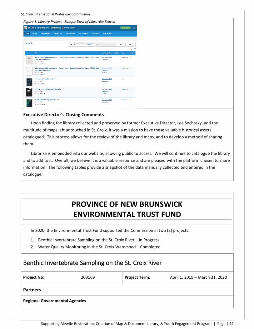


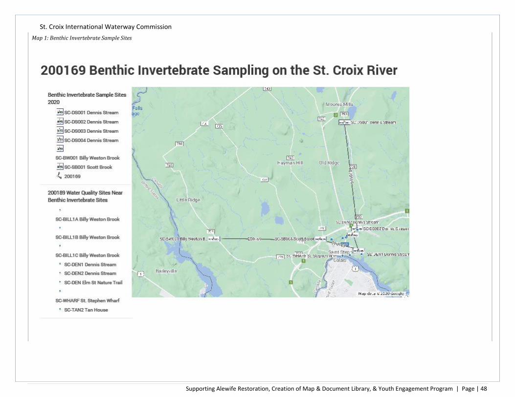


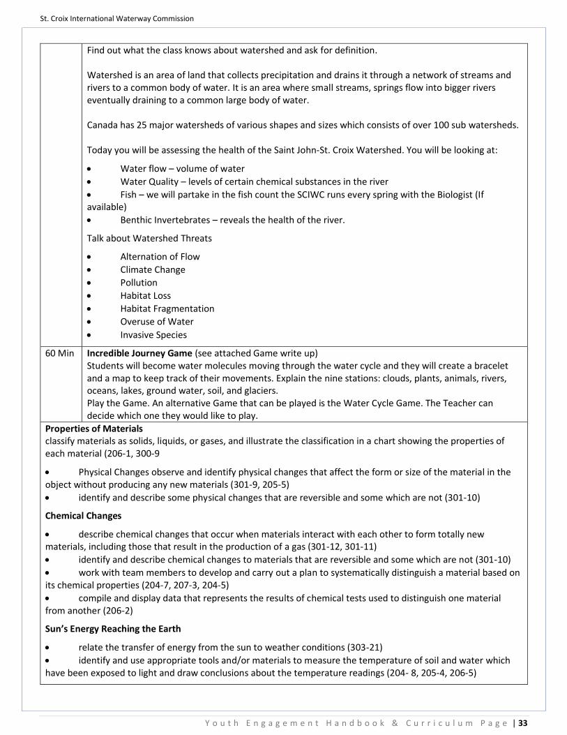


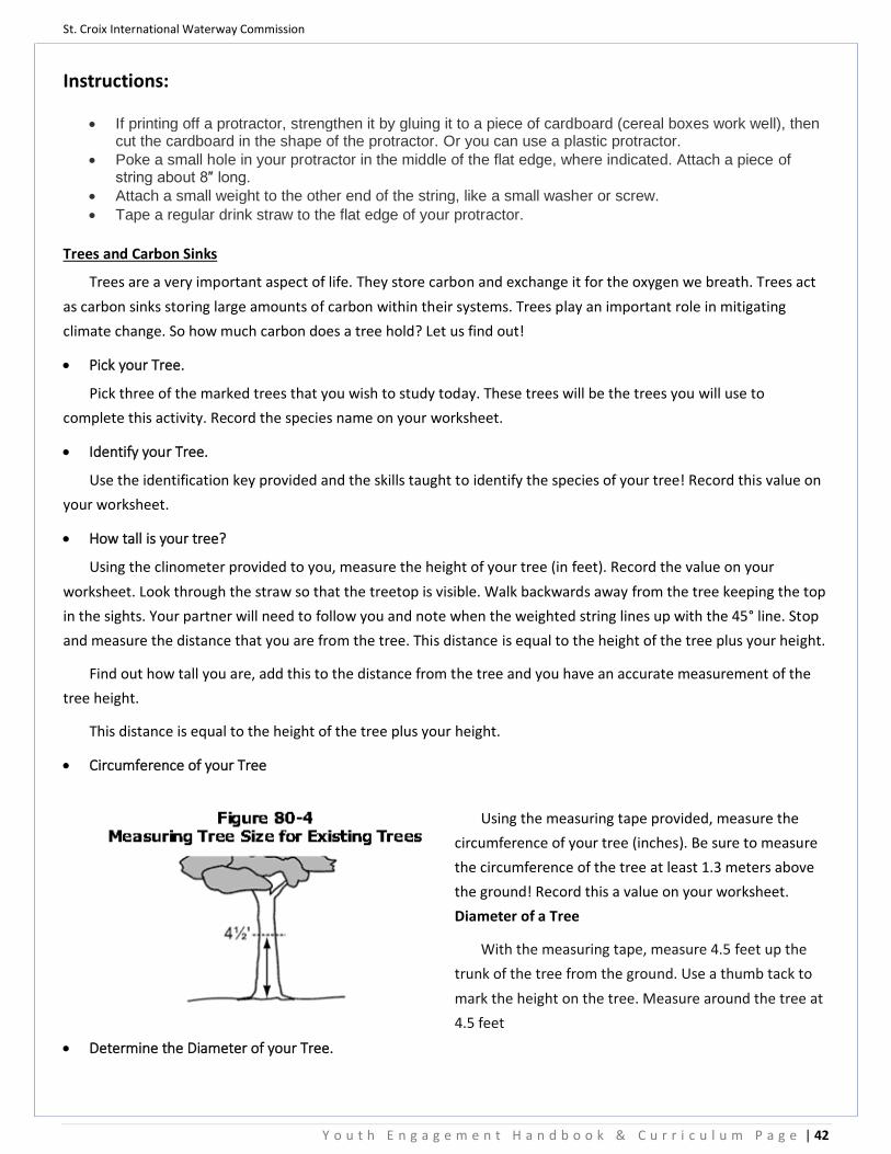


![STARTS Residency Final Report Reiko Yamada March 2020 Project …beyond-absolute]-final_report.pdf · STARTS Residency Final Report Reiko Yamada March 2020 Project title BEYOND ABSOLUTE](https://static.documents.pub/doc/80x56/5f82755e576b144c0a298157/starts-residency-final-report-reiko-yamada-march-2020-project-beyond-absolute-finalreportpdf.jpg)


