Desert Tracks, January 2009 1 Newsletter of the Southwest Chapter of the Oregon-California Trails Association January 2009 Contents A Call for New SWOCTA Officers . . . . . . 1 From the Editors . . . . . . . . . . . . . . . . . 2 Fall 2008 Mapping Trip (Greene) . . . . . . . . . 2 John Finkle Stone (DeVault) . . . . . . . . . . 6 Reviews Lucky Billy (Lawrence) . . . . . . . . . . . . 7 Charles F. Lummis (Hill) . . . . . . . . . . . 7 St. Agnes’ Stand (Lawrence) . . . . . . . . 8 I Have Seen the Fire (Tiscareño) . . . . . . 9 Reverdy Harris (Brigandi) . . . . . . . . . . . 10 Tour of Shakespeare (Hough) . . . . . . . . . . 16 A Call for New Officers for SWOCTA On January 16, 2009, during the OCTA Historic Trails Symposium in Yuma, Tracy and Judy DeVault and Rose Ann and Harland Tompkins announced that the current officers of SWOCTA were resigning. As background, we note that SWOCTA has been in existence for nearly 20 years. In the late 1980’s and early 1990’s, the chapter engaged in the kinds of activities that are typical of an OCTA chapter, having field trips to sites on the trail, running symposia with talks on trail-related activities, holding regular chapter meetings, and producing the Desert Tracks newsletter. The chapter leadership was also active in OCTA activities at the national level. In the mid- 1990’s, it became clear that there were not enough active members to carry out all these activities. A decision was made at that time to focus the chapter’s energies on mapping the trail. The Trail Turtles have been engaged in this process for more than 10 years and, through bi-yearly mapping trips, have successfully mapped a good fraction of the trail through New Mexico, Arizona, and California. The Southern Emigrant Trail is long and traverses many regions where historic trail resources are threatened by development, ranching, and farming, and by insensitive recreational use. A core of knowledgeable and committed people is needed to engage in outreach and education, and to work for preservation. Ideally, by engaging in such activities as those mentioned above – field trips, symposia, chapter meetings, etc. – an active chapter would be able to generate sufficient membership to address these issues. While the Trail Turtles intend to continue mapping, the resignation of the officers (President, Vice President, Secretary, and Treasurer) means that the chapter is effectively dormant unless and until new officers can be found. At the meeting in Yuma, a steering committee (Cecelia Bell, Silver City, NM, [email protected]; Albert Eddins, Scottsdale, AZ, [email protected]; John Fromm, Prescott, AZ, [email protected]; Shannon Perry, Phoenix, AZ, [email protected]; and Dick Schmidt, Prescott, AZ, [email protected]) was formed, with the charge of finding new officers. Please contact one of them, or the editors of this newsletter, if you are interested in participating.
Transcript
Desert Tracks, January 20091
Newsletter of the Southwest Chapter of the Oregon-California Trails AssociationJanuary 2009
On January 16, 2009, during the OCTA Historic Trails Symposium in Yuma, Tracy and Judy DeVault and Rose Ann and Harland Tompkins announced that the current officers of SWOCTA were resigning.
As background, we note that SWOCTA has been in existence for nearly 20 years. In the late 1980’s and early 1990’s, the chapter engaged in the kinds of activities that are typical of an OCTA chapter, having field trips to sites on the trail, running symposia with talks on trail-related activities, holding regular chapter meetings, and producing the Desert Tracks newsletter. The chapter leadership was also active in OCTA activities at the national level. In the mid-1990’s, it became clear that there were not enough active members to carry out all these activities. A decision was made at that time to focus the chapter’s energies on mapping the trail. The Trail Turtles have been engaged in this process for more than 10 years and, through bi-yearly mapping trips, have successfully mapped a good fraction of the trail through New Mexico, Arizona, and California.
The Southern Emigrant Trail is long and traverses many regions where historic trail resources are threatened by development, ranching, and farming, and by insensitive recreational use. A core of knowledgeable and committed people is needed to engage in outreach and education, and to work for preservation. Ideally, by engaging in such activities as those mentioned above – field trips, symposia,
chapter meetings, etc. – an active chapter would be able to generate sufficient membership to address these issues.
While the Trail Turtles intend to continue mapping, the resignation of the officers (President, Vice President, Secretary, and Treasurer) means that the chapter is effectively dormant unless and until new officers can be found. At the meeting in Yuma, a steering committee (Cecelia Bell, Silver City, NM, [email protected]; Albert Eddins, Scottsdale, AZ, [email protected]; John Fromm, Prescott, AZ, [email protected]; Shannon Perry, Phoenix, AZ, [email protected]; and Dick Schmidt, Prescott, AZ, [email protected]) was formed, with the charge of finding new officers. Please contact one of them, or the editors of this newsletter, if you are interested in participating.
Desert Tracks, January 2009 2
From the Editors
In this issue, Richard Greene reports on the Trail Turtles’ Fall 2008 mapping trip to eastern Arizona. The group had the rewarding experience of finding the site of the Cienega Stage Station, but also spent considerable time in areas where no trace of the trail could be found. Tracy DeVault gives a brief synopsis of the Apache attack on John Finkle Stone, whose grave can be found in the Fort Bowie Cemetery.
Phil Brigandi returns to these pages with an article that introduces and edits newspaper accounts, written by Reverdy Harris in the mid-1890’s, on the Southern Emigrant Trail in the Southern California desert region.
The Shakespeare Ghost Town is a key historic trail resource in southwestern New Mexico. Manny Hough, the current owner and overseer of Shakespeare, gave us a tour of the ghost town and explained the efforts underway to restore the site and ensure its survival. We taped, transcribed, and edited his comments, which we present in this issue.
Our book reviewers include Froylán Tiscareño of Irvine, CA, who is currently one of the officers of the Los Angeles Corral of Westerners and who reviews Robert Hine’s new novel that is based on the story of ‘49er Sarah Royce. Walter Drew Hill of Sacramento provides a review of Marc Simmons’ new book on Charles Lummis. We also include our reviews of the novels Lucky Billy by John Vernon and St. Agnes’ Stand by Thomas Eidson.
We attended Roads to Yuma, the OCTA Historic Trails Symposium held in Yuma, AZ, on January 16-18, 2009. We plan to present some of the interesting talks that were given at the meeting, as well as report on the field trips held during the symposium, in the next issue of Desert Tracks. A pressing issue for SWOCTA was that the resignation of the current officers of SWOCTA was announced at the meeting. Without officers, the chapter is effectively dormant. A call for new officers is included in this issue.
Deborah and Jon Lawrence
Trail Turtles’ Fall 2008 Mapping Trip:Sulphur Springs to Dragoon Springs
by Richard Greene
When mapping in November in southern Arizona, we find that the long, long nights are tedious. We get into our vehicles around 6:00 p.m. because of the cold and stay there until sunrise around 7.00 a.m.
The Trail Turtles attending the Fall 2008 mapping trip were Judy DeVault, Tracy DeVault, Marie Greene, Richard Greene, Brock Hileman, Lavida Hileman, Neal Johns, Kay Kelso, Rose Ann Tompkins, Ken White, and Pat White.
Monday, November 17: Cienega Stage Station
The DeVaults, Greenes, Rose Ann Tompkins, Ken and Pat White, and Kay Kelso met at the Cienega Creek Preserve Parking Area, which is down the frontage road at I-10 Exit 281 (Sonoita-Patagonia). The parking area has a sign restricting parking without a permit, and since we didn’t have a permit, we left Marie on guard with our car keys in case somebody official told her to move. The parking area is beside a high, black iron trestle bridge and just down the road is a bridge over some railroad tracks. We headed to the lower set of railroad tracks to find the site of the Cienega Stage Station on the Butterfield Trail. There was a question as to the true location of the site, with some books having the site marked in a location we thought was wrong. A chapter outing led by Sheri Lee years ago had a historic photo showing the site. Rose Ann got a copy of the photo from Sheri and by lining up the landmarks, found a clue to the true location. Rose Ann and Tracy guided the group from the parking lot across the road and then down a rocky, dirt road to the railroad tracks. We walked east along the tracks and crossed a bridge over the flowing Cienega Creek. Walking over the narrow railroad bridge, we discovered that there was a point of no return if a train came along. Indeed, about a half hour later a Union Pacific train did pass by, but fortunately we
Desert Tracks, January 20093
were off the bridge. The site of the stage station that was shown on the aerial proved to be correct. The area was littered with iron, glass, rust on rocks, and a line of foundation stones. Also, the place lined up with Rose Ann’s photo. We were satisfied that we had found the location and took a GPS reading that would leave no doubt for the future.
We then went on to Fort Bowie, where we met Neal Johns with a new Husky named Blue. Neal showed us his recent acquisition, a seven-inch Samsung computer with wireless internet and access to nationwide topo maps. We visited with Head Ranger Larry Ludwig before he headed home. Larry said it was okay to use the worker break room when it got dark and colder. Larry takes care of us and is interested in our mapping results. After dinner we discussed plans for the next day and talked about the possibility of getting into the Maricopa Wells area at some future date. We went to bed around 7:30.
Tuesday, November 18: Fort Bowie to Lizard Lane (68 Miles)
We left Fort Bowie and took I-10 to the Dragoon Exit, parking on Lizard Lane at the site of our GPS reading from the last trip. The group split up and mapped west to Dragoon Springs Stage Station. Ken, Pat, and Rose Ann found the marker tape from the previous trip and mapped to where they intersected the trail that Tracy, Judy, Neal, Kay, and Richard had followed. Everybody saw plenty of rust. After lunch, the DeVaults, Whites, and Neal Johns drove down a rough power line road to the point where Tracy and Richard had ended up on the last trip. Richard and Kay hiked across to join the others on the power line road. We added a few more rust spots, but once again the trail petered out. We found nothing significant there, even with Tracy and Neal using metal detectors. Neal did, however, find a bullet. By 3:00 p.m. we were all back in camp. It was another chilly evening and the early darkness had us in our vehicles by 6:00 p.m. ‒ these are long, long
nights. During the night Rose Ann saw a very bright meteor. The flash was so bright that she thought someone was shining a spotlight on her, but then she saw the streak in the sky as it slowly faded away. It was worth the trip out in the cold.
Wednesday, November 19: Lizard Lane to Sulphur Springs toWillcox (77 Miles)
Daylight arrived around 7 a.m. We took Highway 186 out of Willcox towards Chiricahua National Monument, turned off on Kansas Settlement Road, and then turned west on Sulphur Springs Road. We passed irrigated fields and a hay stack “subdivision.” At Sulphur Springs, Tracy drove out into the grassy flat to get the group closer to a previous GPS reading before leading the group on to find the previously cut “subdivision roads” shown on the aerials. A developer had bladed some dirt roads for a prospective subdivision, but fortunately for us nobody moved there. The area was not as barren as at the spring, and the grass and vegetation provided such thick groundcover that no trail could be seen. We drove along a power line and fenced road and then into the field to the swale that Ken and Pat had mapped last spring. The swale is wide, 18” deep, and covered with thick grass ‒ occasionally there was a
Judy DeVault at the site of the Cienega Stage Station. The railroad runs nearby. The saguaro cactus could have been alive when the emigrants passed by. photo by Tracy DeVault
Desert Tracks, January 2009 4
cleared area of dried-out mud. We all followed the swale, but even with metal detectors we came up with no artifacts or signs of the trail. Tracy and Richard explored another trace for a short time but also came up with nothing.
It was about 2:00 p.m. when we returned to the highway. Deciding that it was too late for more mapping, we drove to Willcox and checked into a motel where Brock and Levida Hileman joined us. We met to review the maps and to decide what to do the next day. We decided to investigate more of the trail crossing Dragoon Road.
Thursday, November 20: Willcox to Dragoon Road to Highway 191 to Lizard Lane (47 Miles)
We left Willcox, taking I-10 to the Highway 191 Exit and drove to Dragoon Road. We stopped close to the 8-mile marker on Golden Rule Road off Dragoon Road and explored within 100 yards of the road where, according to our aerials, the trail was supposed to be. We met the homeowner of the
five-acre lot that was part of our exploration; she didn’t mind us wandering about. There were many old solder-top cans but no sign of trail. A pasture on the other side of the road, where the trail was going, had been plowed up for an orchard. According to the homeowner, the field had been abandoned after water for irrigation had proven to be a problem. We drove on down Golden Rule Road to check out another trace on the aerial, but it proved to be an erosion ditch.
From Golden Rule Road we went back on Dragoon Road to North Nino Place. On the corner lot we met a man named Bob who was building a big house and who said that it was okay for us to walk his 10-acre lot. We walked a swale east for almost a mile. We found occasional rust specks, but we attributed the specks to the horse shoes of the many horses that were roaming the area. We then walked to Dragoon Road where we were shuttled back to our vehicles by Judy and Levida.
After lunch, we drove along Dragoon Road and down Evelyn North Road to where the trail crossed beside a gate. The property owner came out to check the traffic jam at his gate and told us that the trail ran beside his gate for about ¼ mile – the people he had bought the property from 12 years ago had told him this. We decided not to walk the trail at that time, but the owner said that it would be all right to walk it later.
We headed to Highway 191 and parked at the point where the trail crossed the road. Our orange tape was still on the barbed wire fence from the earlier trip when Don, Tracy, and Richard had crossed the fence. Tracy, Neal, Kay, Brock, and Richard walked out to check the area which was another of those prospective subdivisions with bladed dirt roads. The area was sandy and covered with brush. Interestingly, on the highway we were warned to “beware of fissures.” In the area where we walked, we saw a lot of them varying from a foot to several feet wide and three to four feet deep. Perhaps the fissures were the reason for the lack of development. We saw no sign of trail and the only things the metal detectors
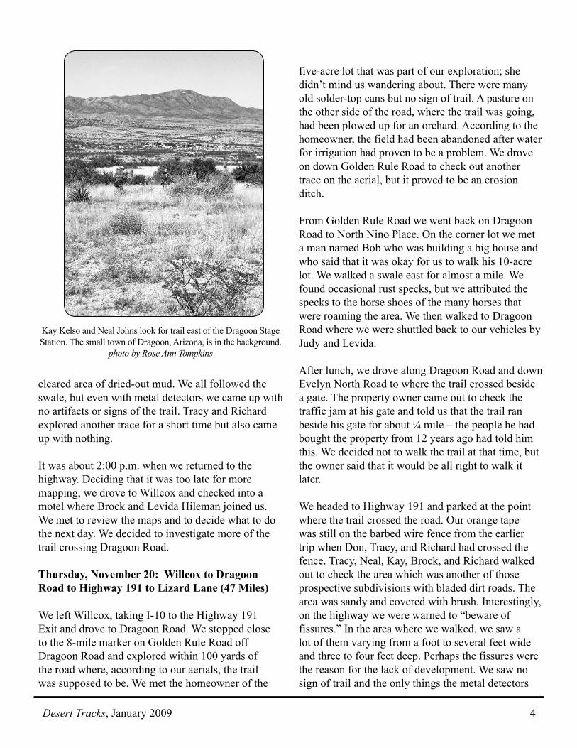
Kay Kelso and Neal Johns look for trail east of the Dragoon Stage Station. The small town of Dragoon, Arizona, is in the background.
photo by Rose Ann Tompkins
Desert Tracks, January 20095
found were pieces of wire and modern nails. While Tracy’s group was exploring, Judy was explaining to an interested property owner on a Harley motorcycle what we were doing. He told Judy that we were on Myrna’s property and that Myrna knew all about the trail. He said that Judy could talk to Myrna at the store just up the road. Judy found that Myrna knew nothing about any trail, but she did give permission for us to be on her land – as did the man on the Harley. Meanwhile, the Whites, Rose Ann, and Marie drove east from the highway to investigate if there was a way to hook up to an area we had previously mapped west of Sulphur Springs. More of the “development” roads gave some access, but no new trail traces were found. At 3:30 p.m. we called it a day and decided to go back to Lizard Lane to camp.
Friday, November 21: Dragoon Springs Station
We woke up to a cold and biting wind. We left camp by 7:45 a.m. and went to the Dragoon Springs Stage Station, which is about seven miles from Lizard Lane. Rose Ann, Marie, and Judy stayed with the vehicles while Tracy,
Richard, Neal, and Kay donned their winter gear and beat the bushes trying to find where the trail went west from the station. The last time out, Rose Ann and Judy had searched from the station as far as the parking area but had found little sign. The group had similar bad luck today; there was plenty of rock but no rust. The ravines on the south side did not seem to be the way the trail would go. It was flatter on the north side of the road, but we found no sign of trail there either. Tracy walked as far as the county road, over a mile away and got some ideas for a possible route the next time we come out. Since we were freezing, we ended mapping at 10:30 a.m.
Looking southeast along the trail between Sulphur Springs and Dragoon Pass. The Sulphur Springs site is near the base of the larger peak on the left of center. photo by Ken White
Lunchtime near the trail. Left to right: Rose Ann Tompkins, Tracy DeVault, Judy DeVault, Kay Kelso, Marie Greene, Richard Greene. The canyon in the background contains
Dragoon Springs, a source of water for the stage station located near the entrance to the canyon. photo by Ken White
OCTA president Glenn Harrison, Harland Tompkins, Rose Ann Tompkins, and Darryl Montgomery at the SWOCTA chapter meeting at the OCTA Historic Trails Symposium in Yuma. photo by Jon Lawrence
Desert Tracks, January 2009 6
Colonel Stone and Escort Massacred East of Dragoon Springs Station
by Tracy DeVault
During the two 2008 mapping trips, the Trail Turtles have been working the section of the Southern Emigrant Trail between Apache Pass and Dragoon Springs. One spot we hope to identify is the place where the Davis and Barrela mail coach1 was attacked on October 1869. John Finkle Stone was one of the victims.
Stone was born in New York in 1836. He was an energetic man of strong character with several adventures behind him when he arrived in Tucson in late 1867. Evidence of gold had been discovered in Apache Pass and Stone helped organize the Apache Pass Mining Company. He was elected president and superintendent of the firm. In early October, Stone was at company headquarters in Apache Pass, checking on the progress of the mining operation.
On October 5, Colonel Stone, the stage driver, and an escort of four soldiers from Fort Bowie were returning to Tucson. Several miles east of the Dragoon Springs Stage Station, the stage was ambushed by Cochise and a group of 50 or 60 of his Apache warriors. The Indians had been hiding in a small wash at the side of the road. The attack came so suddenly that Stone and the others only had time to fire six shots before they were all killed. The bodies were discovered by men in a passing wagon train hauling freight to Tucson. A member of the train, William Sullivan, wrote later that they buried Stone and the others at the site.2
The following day Cochise and his warriors attacked a group of cowboys leading 250 cattle across the Sulphur Springs Valley. One cowboy was killed and the cattle stolen. Soldiers from Fort Bowie followed the Indians and mounted several intensive attacks against Cochise and his warriors during the following several weeks. The two attacks by Cochise and the following military retaliation marked the end of a ten-year reign of terror mounted by Cochise that began with the unfortunate
Bascom Affair.3 In October of 1872, General Oliver Otis Howard, assisted by Thomas J. Jeffords, traveled to Cochise’s camp. Cochise and Howard agreed to a peace treaty giving the Chiricahua a 55-square mile reservation in southeastern Arizona with Jeffords as agent. About a year after the Stone massacre, John Stone’s body was removed from the attack site and reburied at the Fort Bowie Cemetery. It is believed that Stone’s was the only body that was removed. If any evidence of the attack remains, it is probably the graves of the stage driver and the four soldiers from Fort Bowie.
End Notes
1. John Warner Davis and Sacramento Varela/Barela, a Tucson merchant, were partners in a stage company that operated from Tucson eastward. It was their stage that was attacked.
2. It has also been reported that on this trip Colonel Stone was carrying the first gold bar from his mining operations. This bar, taken by the stage’s attackers, was later recovered by the Army when they raided an Apache encampment.
3. In 1861, Lieutenant George Nicholas Bascom and his soldiers were ordered to recover a boy who had been kidnapped by Apaches. Incorrectly determining that Cochise’s Apache were guilty, Bascom attempted to imprison Cochise and his family. Cochise subsequently escaped, and later offered three white captives to Bascom in exchange for his family, but Bascom refused. Cochise killed the American prisoners, and in retaliation Bascom hanged Cochise’s brother and nephews. This incident began the 25-year-long Apache Wars. See Robert M. Utley, Frontiersmen in Blue: The United States Army and the Indians, 1848-1865 (Lincoln: University of Nebraska Press, 1967) 161-163.
Stone’s grave marker in Fort Bowie.
courtesy Tracy DeVault
Desert Tracks, January 20097
Lucky Billy: A Novel about Billy the KidJohn VernonNew York: Houghton Mifflin Co., 2008.ISBN-10: 0547074239 294 pages. Hardback, $24.
Few historical figures from the West have created as much interest and controversy as William H. Bonney (1859-1881), better known as Billy the Kid. John Vernon’s Lucky Billy provides a fresh portrait of the Kid and an interesting interpretation of the Lincoln County War.
Set in New Mexico in the late 1870’s and early 1880’s, John Vernon’s fictional account of the Kid is sure to delight Billy the Kid aficionados. Well-researched, Lucky Billy deals primarily with Billy’s involvement in the Lincoln County War of 1878, and Vernon acknowledges a debt to historian Frederick Nolan, as well as to Pat Garrett’s The Authentic Life of Billy the Kid. The Lincoln County conflict was between a mercantile monopoly led by James Dolan and Lawrence Murphy, and newcomer John Tunstall, an English rancher. On February, 18, 1878, Tunstall was murdered by men deputized by Dolan and Murphy’s appointed sheriff, William Brady. His death ignited the “war” between those loyal to Tunstall and the rival group. Billy the Kid was deeply affected by the murder and swore to get revenge on the men who killed his friend. Vernon uses historical documents ‒ including newspaper articles, proclamations of President Hayes and Governor Wallace, and the actual letters of John Tunstall, Billy Morton, Alexander McSween, and Lew Wallace ‒ to tell his story.
The author of the novels La Salle, Lindbergh’s Son, Peter Doyle, and All for Love, John Vernon provides a compassionate and convincing portrait of Billy. He does not gloss over Billy’s deficiencies; rather, he incorporates them into his creation of a genuine character that is rich in contradictions. His eye for detail evinces the nineteenth-century Southwest. However, although his reconstruction of
Book Reviews Billy’s participation in the Lincoln County War is engrossing, Lucky Billy might prove confusing for readers not familiar with the conflict. Vernon not only tells his story from several points of view, but he jumps back and forth in time, juxtaposing Billy’s escape from the Lincoln jail, for example, with events from his past. For those not familiar with the history of the power struggle between the Irish mercantile monopoly and the men who are on the side of Englishman John Tunstall, there will be a plethora of changing names and shifting alliances.
Despite these reservations, Lucky Billy is sure to be of interest to Billy the Kid buffs and to those with a knowledge of Lincoln County War politics.
Deborah and Jon Lawrence
Charles F. Lummis: Author and AdventurerMarc SimmonsSanta Fe: Sunstone Press, 2008.ISBN: 9780865346369120 pages, photographs. Paperback, $16.95.
In the first chapter of this little book about Charles Fletcher Lummis, historian Marc Simmons includes a reprint of the long unavailable story of the friendship between Lummis and Amado Chaves (first published as Two Southwesterners, Charles Lummis and Amado Chaves, San Marcos Press, 1968). After suffering a paralytic stroke brought on by overwork, Lummis went to New Mexico to recuperate. He lived for a time with the Chaves family in their hacienda near the village of San Mateo, New Mexico, and cultivated a friendship with Amado Chaves. Over the years, Lummis and Chaves kept up a correspondence. Simmons used these letters as his primary source for Two Southwesterners. Simmons’ description of his own association with Chaves’ daughter and the discovery of the Lummis-Chaves papers provides readers with a glimpse of the ways in which a skillful historian comes across his primary sources.
Desert Tracks, January 2009 8
In addition to the story of the Lummis-Chaves friendship, the present book contains an essay on Lummis as a photographer. The article, entitled “Cameras & Controversy,” appeared in New Mexico Magazine (vol. 79, October 2001). An avid photographer, Lummis documented his travels across the Southwest, the Andes, Mexico, and Central America. He shot five-by-eight glass dry-plate negatives on his travels, and then later used the cyanotype process, a printing method based on the light sensitivity of iron salts, to create photos for retail sale. Simmons’ Charles F. Lummis concludes with an original Lummis letter, a tribute to Lummis’ son who died at the age of six, and the notice of Lummis’ death in 1928.
Between 1890 and 1900, Lummis (1859 -1928) published seven books about the Southwest: an autobiographical account, A Tramp across the Continent (1892); two tour books ‒ Some Strange Corners of Our Country (1892) and The Land of Poco Tiempo (1893); and four books of folklore ‒ A New Mexico David and Other Stories and Sketches of the Southwest (1891), The Man Who Married the Moon and Other Pueblo Indian Folk-Stories (1894), The Enchanted Burro (1897), and The King of the Broncos and Other Stories of New Mexico (1897). In addition to promoting the Southwest in general, he was a crusader for the Spanish heritage of California. He was editor of the Daily Times, chief librarian of the Los Angeles Public Library, editor of Land of Sunshine (later retitled Out West), and founder of the Southwest Museum. A flamboyant figure with an incredible amount of energy, Lummis continues to fascinate readers with an interest in the Southwest.
Written in a smooth-flowing style, Simmons’ Charles F. Lummis: Author and Adventurer will appeal to students of southwestern culture.
Walter Drew Hill
St. Agnes’ StandThomas EidsonNew York: Random House, 2007. ISBN: 978-0-8129-7246-7 224 pages. Paperback, $17.95.
First published in 1994, St Agnes’ Stand is a compelling Western. Set in New Mexico in 1858, the novel is the first book of Eidson’s trilogy of western novels. The book details an unforgiving landscape in which any hesitation could prove fatal.
With a bullet in his leg, protagonist Nat Swanson flees across the New Mexico desert from a lynch mob of Texan cowboys. A non-stereotypical loner, he has killed a man in west Texas over a woman whose name he never knew. On his way to sanctuary in California, he stumbles across two overturned freight wagons surrounded by Apaches. The only sign of a survivor is his glimpse of an old woman’s face, the face of 76-year-old Sister St. Agnes. Filled with faith and love, she has been praying to God for someone to save her fellow nuns and the seven orphans in their care. She thinks Swanson is heaven-sent. Faced with the decision of helping them or continuing on to California, Swanson hesitates, struggling with his conscience. Finally deciding to put the lives of others above his own, he stops to help, even though he is sure that he will be unable to rescue the children. For five days, Swanson, the three nuns, and the children struggle to escape the Apache ambush.
The executive vice president of a large communications firm in Boston, Eidson is a powerful storyteller. His writing is evocative, spare, and visual. St. Agnes’ Stand won both the Best First Novel and Novel of the Year awards from the Western Writers’ Association. The movie adaptation will be directed by Scorsese for Spielberg’s Dream Works Pictures. Among Eidson’s other novels is The Last Ride, which was made into a feature film, The Missing.
Deborah and Jon Lawrence
Desert Tracks, January 20099
I Have Seen the FireRobert V. HineAlbuquerque: University of New Mexico Press, 2008.ISBN 978-0-8263-4317-8132 pages. Paperback, $17.95.
I Have Seen the Fire, a fictional treatment of Sarah Royce, will delight the reader who enjoys following the stories of adventurous souls. It tells of a gold-rushing family ‒ father, mother, and two-year-old little girl ‒ as they move across the continent from Iowa to California in 1849. Even after they are in the gold fields, Sarah’s life remains unsettled. Unsuccessful at mining, Sarah’s husband moves his family from the mining camp to Sacramento and then to San Francisco. Finally, they settle in Grass Valley near the Sierra Nevada foothills. The family gradually grows, despite the fact that Sarah’s husband, ever the “dreamer,” is often absent pursuing business away from home. After two more girls are born, a boy is born late in 1855. Obviously a rare event in the family, it becomes even more momentous when the child’s blue eyes hint of a foreign paternity.
A distinguished historian, retired from the University of California, Riverside, Robert Hine has based his novel on historical characters. Originally from England, Josiah Royce and Sarah Bayliss met in upstate New York, got married and soon moved to Iowa to improve their economic condition. Josiah Royce was restless, however, and after he heard of the gold strikes in California, he proposed to leave his wife and young child in Iowa, be away for a few months, and come back rich from the California gold fields. But Sarah, a woman of strong faith in her God, would not be left behind. Their son, Josiah Royce, was destined to become the new state’s spremier philosopher and historian.
Robert Hine’s prose is spare but focused. Readers experience the hardships of the overland trek, including the constant specter of death by exhaustion, dehydration, and cholera. The physical features of the landscape seem very real, just as real as the hardships endured by the travelers. Equally vivid is Hine’s portrayal of the rigors of life in the mining camps and riotous San Francisco. Hine infuses many acts of valor, love, and tenderness into the novel.
Faith and perseverance may not be sufficient to conquer all obstacles, but this story shows us that they strengthened Sarah Royce’s resolve for her trip across the continent and her life in California. Like her historical predecessor, Robert Hine’s Sarah Royce exhibits a conviction and altruism that exemplifies the character that we have come to stereotype as the “pioneer woman.”
Froylán Tiscareño
Tracy Devault leads the OCTA symposium field trip to the “Trail Mappers’ Paradise” on the Southern Emigrant Trail. Standing pools of
water, petroglyphs, and a trail-era inscription by O.W. Randall are found in a small canyon near the site of the Oatman Massacre.
photo by Jon Lawrence
Desert Tracks, January 2009 10
“Off for the Desert!”Reverdy Harris on the Southern Emigrant TrailTravel Accounts from the 1890’s
introduced and edited by Phil Brigandi Reverdy Harris is hardly an important figure in the history of the Southern Emigrant Trail across Southern California, but he stands as an interesting link between old and new. Tied to the trail by his family’s history, he traveled its sandy path in the 1890’s. By the 1890’s, the Southern Emigrant Trail was all but dead as an overland trail (though it remained a regular route of travel across the Colorado Desert). The opening of the Southern Pacific Railroad from Yuma in 1877 had sealed its fate. The last of the old desert stations closed, and some of the old watering places were lost. Reverdy Harris left us some of the last accounts of the trail before the development of the Imperial Valley in the early 1900’s. He was also one of the first to call for the preservation of the old stage stations along the way.
Born in California around 1868, he was the son of William B. and Amanda M. Harris. He grew up in the San Joaquin Valley, but in 1893 moved to San Jacinto, in Riverside County, where he worked as a blacksmith. There, he made some interesting friends. One of them was Edward Hyatt, principal of the local grammar school. In 1894, Hyatt decided to run for County Superintendent of Schools, and “Rev” Harris served as his campaign manager. In The Hyatt Legacy (New York: Exposition Press, 1959), Phyllis H. Gardner paints him as “… a young man with a silver tongue. He brought to San Jacinto his great gift as a spinner of tales and a planner of grand adventures. Conservative folks, while disapproving his expansive ideas, fell victim to his charm, for he loved life and he loved people and this was sufficient compensation for any lack of stability.”1 Hyatt launched his own newspaper, the San Jacinto Searchlight, to bolster his campaign. Reverdy Harris served as circulation manager. Hyatt was elected, serving until 1907. He then went on to serve as State Superintendent of Public Instruction.
Another successful candidate in the 1894 election was John Shaver, who owned a planing mill and lumber yard in San Jacinto. Reverdy Harris did work for him from time to time. Shaver was elected to the Riverside County Board of Supervisors in 1894, the start of a record 36 years on the board.
Shortly after Shaver took his seat in January 1895, Reverdy Harris was appointed Superintendent of the Riverside County Hospital – then in Riverside, but soon moved to San Jacinto. Harris served until March 1898, with his wife, Dessie, acting as matron. Hardly a month after his resignation, the hospital burned down. It was soon rebuilt, but was destroyed for good in the Christmas morning earthquake of 1899. Reverdy Harris was not there to see it. He had followed the call of the Klondike to head north for the Alaska Gold Rush. He spent the next 32 years there. In 1930, he reappeared in Riverside County. He spent the summer in Idyllwild doing publicity work and in September was hired as the secretary of the San Jacinto Valley Chamber of Commerce. He threw himself into the job, promoting the community in print and on the radio. He talked up the old Butterfield Trail as well. He gave talks on the history of the trail and helped to organize a gathering celebrating the old stageline in Temescal Canyon in April 1931. Later that month, he set off with a group of friends for a trip to Alaska. They spent weeks floating along the MacKenzie River, no doubt listening to Harris’ many stories. His friends eventually made their way back to California, but Harris never did. As far as the folks in Riverside County were concerned, he simply disappeared. Presumably he stayed on in the north country, but the circumstances of his death have yet to come to light.
Harris’ trail writings all seem to date from 1894-95. His articles appeared in the Los Angeles Times, the Land of Sunshine magazine, the San Jacinto Register, and perhaps the San Jacinto Searchlight. He made at least two trips across the desert in 1894 – in April and again in August-September.
Desert Tracks, January 200911
Harris wrote at least two articles2 about his first trip during the spring of 1894. Since the two accounts overlap, they are combined in what follows.
“Off for the Desert!” These words recall many interesting events to the writer, bringing back to memory some of the most wonderful scenes it has ever been his lot to behold. Days of travel, though hot, dry sands – weary walks to relieve tired horses – unquenchable thirst – withering heat – and all the distressing incidents as well as the pleasant ones connected with a trip to the great Colorado Desert, are called to mind. Our journey lay over the old Butterfield route leading from Los Angeles to Fort Yuma, and it must necessarily carry us by many places of great interest. For instance, the old adobe ruins that mark the spots where prosperous stations once were. You have but to give play to fancy to see them restored to their full glory of the old ‘50s, when the prosperous teamster, the returning miner, the soldier and the professional gambler sat down at their tables to finger the pasteboards. There are many points of interest on this old route, especially to the writer whose mother came over it across the plains from Illinois in ’49 when there was barely a trail to show the way. Its lonely graves scattered from one end of the road to the other, suggest many interesting stories of romance
and tragedy lived out in those days. Every old stage station has its little grave yard and some graves are marked with stones that have been transported for miles by loving hands. Others are simply elongated heaps of sand, while in places the wind has swept away all signs that went to show where some one who had been loved, had found their last resting place.
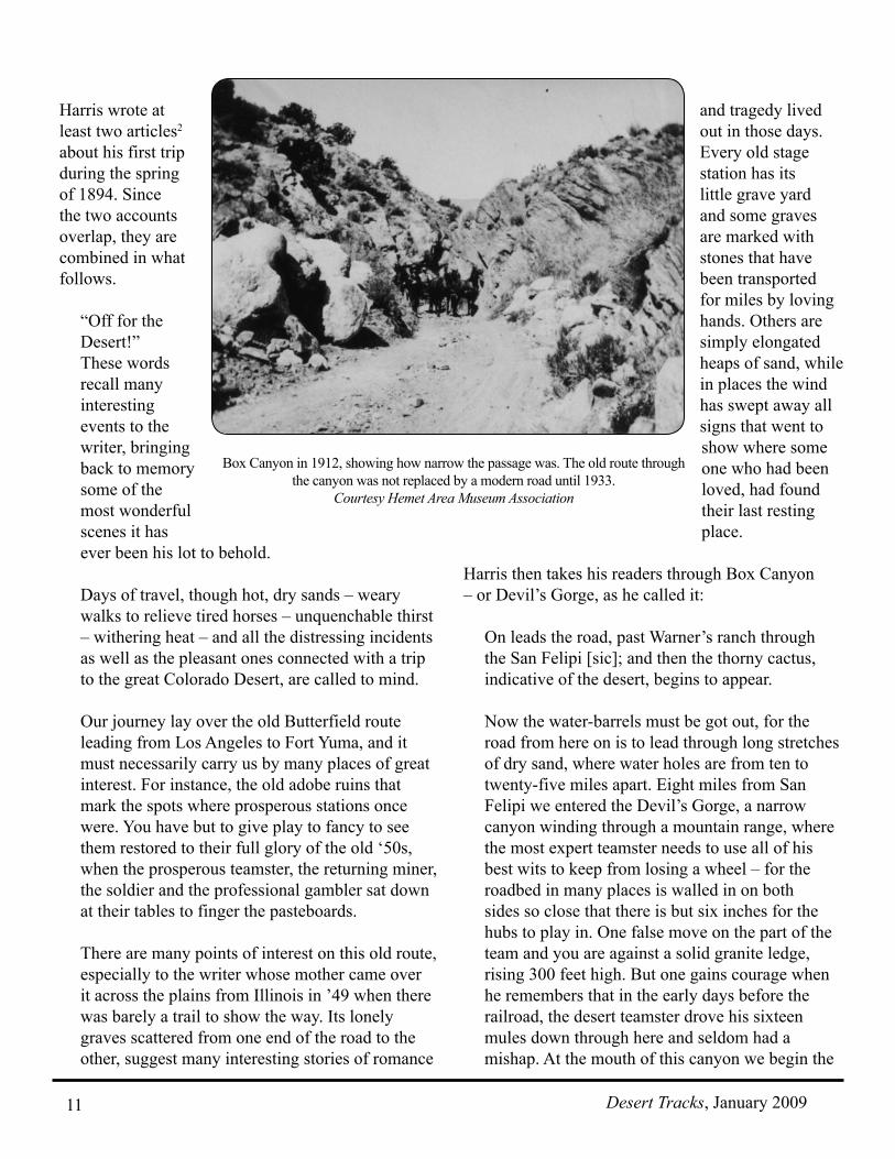
Harris then takes his readers through Box Canyon – or Devil’s Gorge, as he called it:
On leads the road, past Warner’s ranch through the San Felipi [sic]; and then the thorny cactus, indicative of the desert, begins to appear.
Now the water-barrels must be got out, for the road from here on is to lead through long stretches of dry sand, where water holes are from ten to twenty-five miles apart. Eight miles from San Felipi we entered the Devil’s Gorge, a narrow canyon winding through a mountain range, where the most expert teamster needs to use all of his best wits to keep from losing a wheel – for the roadbed in many places is walled in on both sides so close that there is but six inches for the hubs to play in. One false move on the part of the team and you are against a solid granite ledge, rising 300 feet high. But one gains courage when he remembers that in the early days before the railroad, the desert teamster drove his sixteen mules down through here and seldom had a mishap. At the mouth of this canyon we begin the
Box Canyon in 1912, showing how narrow the passage was. The old route through the canyon was not replaced by a modern road until 1933.
Courtesy Hemet Area Museum Association
Desert Tracks, January 2009 12
descent into the desert. For the next seventy miles the road lies in the bed of a dry wash. On past the Vallecite [Vallecito] we go, down through the canyons with mountains of volcanic ashes on each side, with our wagon sinking eight inches deep in the hot, scorching sands. Not a breath of air stirring, not a living creature; no, not even a jackrabbit is there to relieve the utter desolation. From Carizzo [Carrizo] Creek to Laguna, a distance of thirty-five miles, there is no watering-place. As few travelers go prepared to carry water for more than one day’s use, they generally try to make this distance in that time. The road is heavy with sand, and the team soon tires.
Yet despite the hard travel, Harris was clearly taken with the desert:
Here the grand, inspiring desert itself is first seen. The desert is full of woes to the venturesome prospector, who, in search of the yellow metal, allows himself to be enticed out on its broad and waterless sands. Yet, inspiring to the fullest extent, to the young student of geology, botany or animal life. Here one stands face to face with nature in a form new to him. There is no limit to his view, except the lowering horizon of the far distance, with an occasional sand dune or volcanic peak to relieve the eye. One may at first think there is no end to the sameness, and that what is to come is simply a repetition of the few miles he has just gone over. No so. Constant changes take place. Now ‘tis all sand under your feet; but a moment more, and you are treading on a beautiful floor of pebbles. Pebbles that have had their origin in a furnace of fire, thousands of feet under the surface of the earth. They have been thrown out in a half-melted condition, contorted and twisted into all manner of shapes, mixed and melting together with other
pebbles of different kinds and colors, many very beautiful. Then heavy floods have carried them down the long slopes to their present resting places, and, in doing so has polished them with nature’s own burnishing wheels, bringing out all of their beauties. You may travel for miles on these beds of pebbles, picking up a beautiful specimen now and then, only to find one further on that causes you to admire the preceding one less. This study is soon relieved by the advent of a new one in the shape of a beautiful flower you have never seen before. Its delicate tints make you wonder how they keep their brightness without a bit of moisture. But if you cut its tiny stem you will be surprised to see come from it several drops of purest water. Again your eye is caught by the tiny lizard that flies from your approaching steps. Its elegant shape, striped with row after row of marvelous colors, will go to convince one that the desert is not a barren waste, without a redeeming feature. The electric brightness of the wonderful starlight reveals the possibility of a splendid field for the student of astronomy. Here the heavens are studded with millions of bright bodies, the clear, dry atmosphere revealing their brightness as it does nowhere else.
Yet the desert was still the desert:
What man that has traveled through the hot, dry, burning canyons cut through mountains of volcanic ashes with his wagons sinking ten inches deep in the sand will ever forget it. From Viecete [Vallecito] to Carese [Carrizo], a distance of only 18 miles, is a big days travel with a good team and light wagon. Carese is 81 feet above the level of the sea and in the next 30 miles of road you descend to 100 feet below sea level. At this point [is] Laguna where the roads fork, one going to San Diego, the other one in an eastern direction to Yuma. Here begins what we came so far to see, the lands of the New River basin.
Desert Tracks, January 200913
Harris was entering what is now the Imperial Valley, in the last days before irrigation:
You have traveled for 30 miles through dry white sand. The stock is tired, you are tired. You have met no one for days to tell you the way. You are getting uneasy for fear you have taken the wrong road, but move on knowing well if you do not find water, your tired team could never haul your wagon back through that long dry stretch, with what water you have left in the barrels. Now you notice they demand rest oftener. They are getting very tired, the road seems sandier, the sun has set long ago, but the electric brightness of the stars as they shine through the dry atmosphere reveal to you your road far ahead of the team. If you have no company but your team, you soon begin to think of all the harrowing stories you have ever heard of…. Presently your horses seem to liven up, your wagon runs easier and you jump down to examine the cause. You find you are no longer running in sand, but that you are riding on a solid surface of dark red loam. You have struck the land of promise. It is the extreme western edge of the alluvial deposit, left by the annual over-flow of the New River, you consult your map and find you have but a short distance to go. The Mesquite timber that covers this vast country is already beginning to appear. Presently without any indication of such a thing you find yourself on the banks of a lake covering fifty acres. It fairly glistens in the starlight. You involuntarily name it the Hidden lake, for you are unable to see it until you are within a few feet of it. It is sunken below the surface several feet, and fringed all around by Mesquite timber. The thirsty traveler might perish within half-a-mile of its banks. Here a vast oasis in the middle of the desert might be created by the advent of water. A stretch of land 75 miles long north and south, by 50 wide east and west. As level as a floor, the entire body rich with river drift, no alkali, favorable climatic conditions, and yet not a soul actually living on these vast plains!
The human history of the desert also captured Harris’ imagination:
Laguna is the old stage station, where the road from Yuma parts, one going to San Diego via Campo, the other to Los Angeles by Warner’s ranch. In early days a well was the means of getting water here, but since the overflow of the New River has become more permanent, the well has been allowed to fill in and the large lagoon is used instead. Six miles east of Laguna is another old station, Indian Wells, used by the government as a supply station during the establishment of Fort Yuma. This place takes its name from its close proximity to some water holes that were used by the Indians before the coming of the white man. They have filled up in the past few years, and only the knowing ones are now able to find their exact location. Eight miles southeast of this is another lake, covering, when full, nearly one thousand acres, surrounded by a dense growth of mesquite trees. It is almost impossible to find. The writer met a man only a few days ago who had been without water for twenty-four hours within a few hundred feet of its edge and never knew of its existence. The lake lies within one mile of the Mexican border, and is surrounded by one of the most magnificent bodies of agricultural land it has ever been our lot to behold. Miles of level plains, composed of rich alluvial deposit, or river slickness, with sufficient fall for irrigation, and yet not a soul living on it. The reason for this is the lack of water for irrigation purposes…. Going north from this place the traveler passes over the same kind of land for fifty miles, or until he reaches the edge of the Salton Basin. Twenty-five miles south of Salton is Mesquite Lake, a beautiful body of water, some twenty miles in circumference. These lakes are now low, having been filled nearly a year ago. They will soon be filled again, as the annual overflow is expected to commence early this year.
Desert Tracks, January 2009 14
There is at present some 6,000 head of cattle pastured on the plains watering at the large lakes left by the overflow of New river on its way north to the great Salton basin.3
This annual rise and overflow takes place in June. It is caused by the snow melting at the source of the Colorado river, and overflowing its banks about 75 miles below Yuma. The water naturally runs north to the Salton basin 280 ft. below sea level. The flow being very slow, the water deposits immense amounts of drift along its course and as it fills its old channels, it makes new ones. Consequently it has built up land from 12 to 40 ft. deep with an average width of 50 miles. The water flows in during all the month of June and sometimes continues into July. After the overflow, vegetation springs up, and is kept alive by the summer rains, late into the fall. In many places, the Indians have raised corn, pumpkins and melons and sold them to the many teamsters that freighted to the Arizona mines. The advent of the railway stopped all travel on the road, and you might now pass a month in the country and never see a soul. It may seem strange to the reader of this article to be told of these many lakes of water and yet read every few weeks of the horrible death of some one while out prospecting on the desert. It may be called to mind, however, that in no instance have these deaths occurred very far away from water. It is always due to a lack of knowledge on the part of the victims as to the location of the many watering places. The Breedlove party perished within one and a half miles of an abundance of water. The party that perished lately were within a few miles of water.4
Harris found life on the desert instead:
The country abounds in game, such as deer, antelope, rabbit and desert quail, while the lakes
are literally covered with duck the year around. It is indeed the hunter’s paradise. The Mesquite tree is of the deciduous family, bearing a long bean not unlike in appearance to our garden green bean of a sweet pleasant taste. It is used as food by both man and beast. For stock there is nothing excels it, as it is very fattening. The Indians in many places, use it almost exclusively for food.
In tramping around over this deposit one finds large quantities of broken pottery, showing that as some time this entire valley has been densely peopled.
Harris returned to the desert in late summer of 1894, and wrote about the trip in the Los Angeles Times.5
In order to see this country as it should be seen one must come here in the hottest of the summer months…. This is the time one can see the desert at its worst. Today (September 1) while I am lying under the shade of a dense mesquite tree, trying to keep cool, the thermometer registers 108 deg. under the wagon. There are hundreds of men working in the fields of the San Joaquin Valley with the mercury standing at 112 or 115 deg.
But even in the heat, Harris could still joke:
The writer discovered a new way of accurately measuring a mountain’s height here. ‘Tis simple: commence at the base, climb to the top as rapidly as possible – sit down. Take out your watch and as many times as you catch your breath in a minute, divided by two, gives you the exact number of feet you have risen in height.
On a more serious note, he wrote about some of the desert Indians:
Two days journey from here lands one among one of the most curious races of people in Mexico, the Cocopah Indians. They number about four thousand, all told. They are a true type of the old
Desert Tracks, January 200915
Yuma Indians of thirty years ago, when the white man’s rum was unknown to them. The men are mostly six feet high, and straight as an arrow. Broad-shouldered, and have an expression that is at once brave and cruel…. The tribe recognizes no authority higher than their own laws…. They treat a stranger kindly, so long as he is not too inquisitive….
The Cocopah chief speaks Spanish, as well as English. He had made many visits to Yuma and other trading posts…. To penetrate the mountainous regions of their country is almost an impossibility, on account of the lack of any known water.
In his last known desert article, “The Old Stage-Station,”6 Harris makes a plea for the preservation of the landmarks on the trail. Though the station is un-named, the article is accompanied by a photo of Vallecito.
Have you relatives that crossed the plains in the early days by the ‘Overland route’? Have you ever listened to their true stories of hardships and sufferings, or miraculous escapes from murderous Indians, or thirst on the Great Desert when luke-warm water was measured out by the spoonful? To a native born (whose mother crossed the great desert in these early days, and in after life would gather her children around the stone fireplace of an evening and tell them the stories of the plains) there is perhaps nothing more interesting than those old thick, adobe-walled, and mud-roofed, desert stage stations. There are the great hand-hewn beams that support the heavy roof; perhaps transported from some distant range on human shoulders. There are the closely woven tules, bound to slender poles with nearly cut strings of rawhide – miles of them – all in turn covered with eight or twelve
inches of dirt. There is the portico, held up by columns of adobe four feet square. There is the huge fire-place, from which the light is thrown across the main room, through the crumbling corridor, and into the dark recesses beyond. The pale moonlight drops in through the broken roof…. There in the corner lies a broken table, around which gathered the returning miner from the gold fields, the professional gambler and the reckless stage driver. The little graveyard, just above the house, with its quaint little mounds of white sand, bespeak the result of many of these sittings. Below, in the flat, are the alkali Springs – I can taste the water yet! All around are the ruins of old adobe corrals, where the desert teamster kept his mules; where he fed them hay that cost $200 per ton. Each old ruin has its own spectre – We wish they might haunt our law-makers till they appropriate sufficient means to preserve an old station ghost and all. For this is all we will have, soon, to remind us of “The days of old, the days of gold.”
The Vallecito Stage Station, circa 1910.Courtesy Hemet Area Museum Association
Desert Tracks, January 2009 16
End Notes
1. Gardner’s book should probably be classed as historical fiction, rather than narrative history. It has many quotes from Hyatt and his contemporaries, but no footnotes. Certainly some of the names in the story have been changed. But clearly she had access to some reliable sources, and her description of Harris squares with other contemporary accounts.
2. “On the Desert. Graphic Description of Hardships Experienced,” San Jacinto Register, May 24, 1894, and
“California’s Land of Egypt and Its River Nile,” Los Angeles Times, July 15, 1894.
3. The New River was named by the ‘49ers, who were surprised – and grateful – to find a river flowing across the desert in high summer. It was unmentioned by earlier military travelers, who had crossed the desert during the winter. The Salton Basin was partially filled by the New River in flood years; travelers in 1891 spoke of it as Salton Lake. It was permanently filled in 1905 by a break in the irrigation canal that served the Imperial Valley, and has been known ever since as the Salton Sea.
4. S.J. Breedlove, his son, C.W. Breedlove, and a man named F.T. Fish, set out from San Diego for the Cocopah country in June of 1892 to do some prospecting. Their wagon and possessions were found several weeks later. They had apparently abandoned them, taken their mules, and gone searching for water. When the men were found in mid-July, it was estimated they had been dead about two weeks. The bodies were found in a canyon in the Cocopah Mountains, about 25 miles southeast of Campo. (Los Angeles Times, July 18, 23, 24, 30, 1892)
5. “The New River Basin. Description of a Hot, but Fertile Terra Incognita,” Los Angeles Times, October 5, 1894.
6. “The Old Stage-Station,” Land of Sunshine, October 1895. Reprinted in the Butterfield Chronicle (official publication of the Imperial Highway Association), February 1937. Harris published at least one other article from his desert travels, “Fish Springs. A Lonely Spot in the Colorado Desert, and Its Unique Owner,” Los Angeles Times, May 25, 1895.
A Tour of Shakespeare with Manny Hough
[Editors’ Note: Shakespeare Ghost Town, just south of Lordsburg, NM, is an important historic site on the Southern Emigrant Trail. It served as a watering hole for the emigrants, as a pre-Civil War military mail stop, and as a Butterfield stage stop; it later became an important mining town for southwestern New Mexico. In 1935, it was purchased by Frank and Rita Hill, who operated a working ranch, but who also kept the history of the town alive. Ownership passed to their daughter Janaloo Hill, and more recently to her husband Manny Hough. Manny continues to operate a cattle ranch, but he also spends much of his time attempting to restore the old town and its buildings, and trying to ensure the town’s future survival. On December 14, 2008, Manny led us on a tour of the town, showing us the military buildings, the stage building/hotel, and structures associated with the late-1800’s mining era. We have selected those parts of the transcript associated most directly with the trail-era history, and have included some discussion of the efforts to keep Shakespeare alive and well.]
DT (Desert Tracks) Before there were any buildings here, this was a site on the Southern Emigrant Trail, called Mexican Springs. Where are the springs?
MH (Manny Hough) They are up above the town on the walking trail. The spring went dry in the earthquake of 1887. The quake caused certain springs to go dry, while a number of new ones were formed. A well was dug at the Mexican Springs’ site. It now has a well cover.
Manny Hough
Desert Tracks, January 200917
DT Do you have any stories about the Southern Emigrant Trail?
MH Even before the town really started in 1870, when there was only the stage station and the hotel, there were the foundations of a couple of old buildings up on the hill. When Emma Muir1 came here in the early 1880’s, those foundations were already gone. So, even then, they were quite old. We don’t know who built them, but they probably had to do with the emigrant trail.
There was also another stopping place on the trail at the foot of Lee’s Peak. It used to be called called Mount Etna, probably because it looks like a volcanic peak. So they could stop either here or there for water. There was more than one spring around the bottom of Lee’s Peak.
Before the Civil War, three families came out from an area of Arkansas called Two Rivers. I think it was between where the Arkansas River and another river run into the Mississippi. I don’t remember the names of the families; they are probably somewhere in our files. Two families came out at first, and the third joined them later. They camped between Hat Top Hill and Lee’s Peak, near the north side of Hat Top where the emigrant trail went through. This was a few miles south of where the Butterfield Trail went through. The families hunted and sold meat. They did blacksmithing and repair, wagon repair, leather repair. They left rock art on the top of Hat Top Hill – it’s not Indian art, but horses’ heads, things like that. John Evenson2 told Emma Muir about those people.
DT Our understanding is that the first building here was a military mail station.
MH Yes, it was built by the U.S. soldiers before the Civil War. It was a relay point between Fort Thorn on the Rio Grande, north of Las Cruces, and Fort Buchanan south of Tucson. Shakespeare is about halfway between those two places. There were other stations in between. This station was used by both Union and Confederate soldiers.
The back wall was in really bad shape, but we repaired most of it. We put in a steel tie bar, that runs through and between the walls, to stabilize the walls. You have to be careful not to pull too hard or it will collapse the wall.
DT The books say that the Stratford Hotel used to be called “the fort.” Who built the fort?
MH Putting two and two together, it almost had to be built by U.S. soldiers before the Civil War. It was probably built shortly after the mail station. During the war, the Union soldiers withdrew and the Texas Confederates came and stayed here for awhile.
DT Does any of the building date to before the Civil War?
MH The whole lower part is original to the fort. Where the window and two doors are at the ground floor front, there was originally just one big doorway so they could back a wagon in. In the late 1870’s or thereabouts, Colonel Boyle3 added the second story, with four rooms. The hotel was remodeled three different times.
DT Tell us about the Butterfield building.
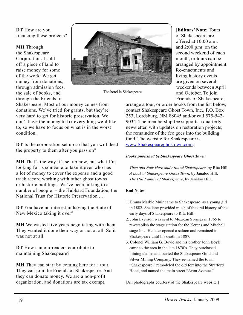
MH The back room was built by the Butterfield stage line about 1858. The dining area up front was added on later.
Butterfield had two different routes. One went by Massacre Peak, Mimbres, and then Cow Springs and Soldier’s Farewell. For awhile they had a station north of Lordsburg called Barney’s Station. When the rainy season came, the water there would turn alkali, which was bad for the animals, so then they moved up into Shakespeare. When the stage left
Army mail station in Shakespeare.
Desert Tracks, January 2009 18
Shakespeare, it went to San Simon over in Arizona. There were two ways to get there. One was through Doubtful Canyon, about four miles north of I-10, where the original town of Steins was. When the Indian problem got bad in Doubtful Canyon, they moved the route south; it crosses Road Forks south of the freeway. The location is before you turn and where it gets winding. You go down over the hill at a place that’s called Granite Gap. There’s a lot of granite rock around there.
DT Is the whole Butterfield building original?
MH Only some of it. The side wall is original. Even in 1935, when Frank and Rita Hill purchased Shakespeare, the building was in pretty bad shape. It had a dirt roof which nobody kept up. About 1978 we put a whole new roof on it, and we had to repair the back wall, which was falling out. We set aside any salvageable adobe brick that could still be used, then we made new bricks ourselves. We put both old and new bricks back on the same foundation.
DT Were there other stage lines here?
MH Before Butterfield, the Birch Mail (the San Antonio and San Diego Mail) used the spring. After the Civil War, Kerens and Mitchell started a new line. They dropped off a stage keeper and hostler (the man who took care of the horses, harnesses, and so on) at various Butterfield stations. The Indians had tried to destroy them, and they had to be repaired. John Evenson was hired to open the station here. He said that when he arrived, the windows were broken out and the door was busted
down. The last hostler was Utter Johnson; we don’t know the names of the others. After Kerens and Mitchell, the National Mail and Transportation Company was the last cross-country stage line that came through here before the railroads. When the railroad ran them out of business, they moved a lot of their coaches to shorter north-south lines ‒ for example, from here to Silver City.
DT Where do you get the information? How do you know what John Evenson said?
MH My wife and her mother knew Emma Muir, who knew John Evenson. She told them the stories.
DT Where are your archives?
MH We keep a lot of the historic material in the office. We lost a lot in the fire that burned the General Merchandise Store. We got most of it back, but it was very expensive. If you donate material to a library or historic society, and then something happens and you want it back, they give it to you for a price – in our case, it was eight dollars a page.
DT We see that there are a number of building projects on the site.
MH We are building a visitor’s center, reconstructing the old General Merchandise Store, propping up the buckling wall on the Stratford Hotel, and fixing up the old frame mining house at the entrance gate.
The new visitor’s center will have a museum with glass cases for displays, a store where we’ll sell books, bottled water, and so on, and an apartment where a caretaker can live.
The outside wall of the Stratford Hotel is buckling out. A weight, such as a log, is leaned against the building, and winched with large truck winches to increase the pressure on the wall. It will take a whole year, gradually increasing the pressure, to move the wall back in to place. After that, it will be restored to the original thickness.
Old Butterfield Stage Station in Shakespeare.
Desert Tracks, January 200919
DT How are you financing these projects?
MH Through the Shakespeare Corporation. I sold off a piece of land to raise money for some of the work. We get money from donations, through admission fees, the sale of books, and through the Friends of Shakespeare. Most of our money comes from donations. We’ve tried for grants, but they’re very hard to get for historic preservation. We don’t have the money to fix everything we’d like to, so we have to focus on what is in the worst condition.
DT Is the corporation set up so that you will deed the property to them after you pass on?
MH That’s the way it’s set up now, but what I’m looking for is someone to take it over who has a lot of money to cover the expense and a good track record working with other ghost towns or historic buildings. We’ve been talking to a number of people – the Hubbard Foundation, the National Trust for Historic Preservation . . .
DT You have no interest in having the State of New Mexico taking it over?
MH We wasted five years negotiating with them. They wanted it done their way or not at all. So it was not at all.
DT How can our readers contribute to maintaining Shakespeare?
MH They can start by coming here for a tour. They can join the Friends of Shakespeare. And they can donate money. We are a non-profit organization, and donations are tax exempt.
[Editors’ Note: Tours of Shakespeare are offered at 10:00 a.m. and 2:00 p.m. on the second weekend of each month, or tours can be arranged by appointment. Re-enactments and living history events are given on several weekends between April and October. To join Friends of Shakespeare,
arrange a tour, or order books from the list below, contact Shakespeare Ghost Town, Inc., P.O. Box 253, Lordsburg, NM 88045 and/or call 575-542-9034. The membership fee supports a quarterly newsletter, with updates on restoration projects; the remainder of the fee goes into the building fund. The website for Shakespeare is www.Shakespeareghostown.com.]
Books published by Shakespeare Ghost Town:
Then and Now Here and Around Shakespeare, by Rita Hill.A Look at Shakespeare Ghost Town, by Janaloo Hill.The Hill Family of Shakespeare, by Janaloo Hill.
End Notes
1. Emma Marble Muir came to Shakespeare as a young girl in 1882. She later provided much of the oral history of the early days of Shakespeare to Rita Hill.
2. John Evenson was sent to Mexican Springs in 1865 to re-establish the stage station for the Kerens and Mitchell stage line. He later opened a saloon and remained in Shakespeare until his death in 1887.
3. Colonel William G. Boyle and his brother John Boyle came to the area in the late 1870’s. They purchased mining claims and started the Shakespeare Gold and Silver Mining Company. They re-named the town “Shakespeare,” remodeled the old fort into the Stratford Hotel, and named the main street “Avon Avenue.”
[All photographs courtesy of the Shakespeare website.]