Pre-Construction Notification (PCN) Form For Nationwide Permits and Regional General Permits (along with corresponding Water Quality Certifications) September 29, 2018 Ver 3 Please note: fields marked with a red asterisk * below are required. You will not be able to submit the form until all mandatory questions are answered. Also, if at any point you wish to print a copy of the E-PCN, all you need to do is right-click on the document and you can print a copy of the form. Below is a link to the online help file. https://edocs.deq.nc.gov/WaterResources/0/edoc/624704/PCN%20Help%20File%202018-1-30.pdf County (or Counties) where the project is located: * Is this project a public transportation project? * Is this a NCDOT Project? * (NCDOT only) T.I.P. or state project number: WBS # * 1a. Type(s) of approval sought from the Corps: * 1b. What type(s) of permit(s) do you wish to seek authorization? * This form may be used to initiate the standard/individual permit process with the Corps. Please contact your Corps representative concerning submittals for standard permits. All required items that are not provided in the E-PCN can be added to the miscellaneous upload area located at the bottom of this form. 1c. Has the NWP or GP number been verified by the Corps? * Nationwide Permit (NWP) Number: NWP Numbers (for multiple NWPS): 1d. Type(s) of approval sought from the DWR: * 1e. Is this notification solely for the record because written approval is not required? * For the record only for DWR 401 Certification: For the record only for Corps Permit: 1f. Is this an after-the-fact permit application? * A. Processing Information Lenoir Yes No This is any publicly funded by municipal,state or federal funds road, rail, airport transportation project. Yes No B-5619 45574.1.1 (for NCDOT use only) Section 404 Permit (wetlands, streams and waters, Clean Water Act) Section 10 Permit (navigable waters, tidal waters, Rivers and Harbors Act) Nationwide Permit (NWP) Regional General Permit (RGP) Standard (IP) Yes No 6 - Survey Activities List all NW numbers you are applying for not on the drop down list. check all that apply 401 Water Quality Certification - Regular 401 Water Quality Certification - Express Non-404 Jurisdictional General Permit Riparian Buffer Authorization Individual Permit Yes No Yes No Yes No
Transcript
Pre-Construction Notification (PCN) Form For Nationwide Permits and Regional General Permits (along with corresponding Water Quality Certifications)
September 29, 2018 Ver 3
Please note: fields marked with a red asterisk * below are required. You will not be able to submit the form until all mandatory questions are answered.
Also, if at any point you wish to print a copy of the E-PCN, all you need to do is right-click on the document and you can print a copy of the form.
County (or Counties) where the project is located:*
Is this project a public transportation project?*
Is this a NCDOT Project?*
(NCDOT only) T.I.P. or state project number:
WBS #*
1a. Type(s) of approval sought from the Corps:*
1b. What type(s) of permit(s) do you wish to seek authorization?*
This form may be used to initiate the standard/individual permit process with the Corps. Please contact your Corps representative concerning submittals for standard permits. All required items thatare not provided in the E-PCN can be added to the miscellaneous upload area located at the bottom of this form.
1c. Has the NWP or GP number been verified by the Corps?*
Nationwide Permit (NWP) Number:
NWP Numbers (for multiple NWPS):
1d. Type(s) of approval sought from the DWR:*
1e. Is this notification solely for the record because written approval is not required?
*For the record only for DWR 401 Certification:
For the record only for Corps Permit:
1f. Is this an after-the-fact permit application?*
A. Processing Information
Lenoir
Yes NoThis is any publicly funded by municipal,state or federal funds road, rail, airport transportation project.
Yes No
B-5619
45574.1.1(for NCDOT use only)
Section 404 Permit (wetlands, streams and waters, Clean Water Act)Section 10 Permit (navigable waters, tidal waters, Rivers and Harbors Act)
Nationwide Permit (NWP)Regional General Permit (RGP)Standard (IP)
Yes No
6 - Survey Activities
List all NW numbers you are applying for not on the drop down list.
check all that apply
401 Water Quality Certification - Regular 401 Water Quality Certification - ExpressNon-404 Jurisdictional General Permit Riparian Buffer AuthorizationIndividual Permit
Please collect site coordinates in decimal degrees. Use between 4-6 digits (unless you are using a survey-grade GPS device) after the decimal place as appropriate, based on how the location wasdetermined. (For example, most mobile phones with GPS provide locational precision in decimal degrees to map coordinates to 5 or 6 digits after the decimal place.)
Latitude:* Longitude:*
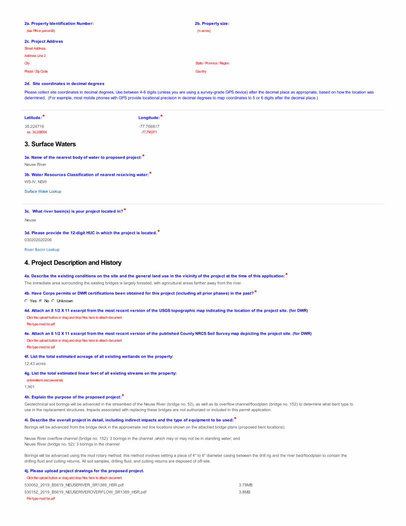
3. Surface Waters
3a. Name of the nearest body of water to proposed project:*
3b. Water Resources Classification of nearest receiving water:*
Surface Water Lookup
3c. What river basin(s) is your project located in?*
3d. Please provide the 12-digit HUC in which the project is located.*
River Basin Lookup
4. Project Description and History
4a. Describe the existing conditions on the site and the general land use in the vicinity of the project at the time of this application:*
4b. Have Corps permits or DWR certifications been obtained for this project (including all prior phases) in the past?*
4d. Attach an 8 1/2 X 11 excerpt from the most recent version of the USGS topographic map indicating the location of the project site. (for DWR)
4e. Attach an 8 1/2 X 11 excerpt from the most recent version of the published County NRCS Soil Survey map depicting the project site. (for DWR)
4f. List the total estimated acreage of all existing wetlands on the property:
4g. List the total estimated linear feet of all existing streams on the property:
4h. Explain the purpose of the proposed project:*
4i. Describe the overall project in detail, including indirect impacts and the type of equipment to be used:*
4j. Please upload project drawings for the proposed project.
(tax PIN or parcel ID) (in acres)
City State / Province / Region
Postal / Zip Code Country
Street Address
Address Line 2
35.224716ex: 34.208504
-77.766817-77.796371
Neuse River
WS-IV; NSW
Neuse
030202020206
The immediate area surrounding the existing bridges is largely forested, with agricultural areas farther away from the river.
Yes No Unknown
Click the upload button or drag and drop files here to attach document
File type must be pdf
Click the upload button or drag and drop files here to attach document
File type must be pdf
12.43 acres
(intermittent and perennial)
1,901
Geotechnical soil borings will be advanced in the streambed of the Neuse River (bridge no. 52), as well as its overflow channel/floodplain (bridge no. 152) to determine what bent type touse in the replacement structures. Impacts associated with replacing these bridges are not authorized or included in this permit application.
Borings will be advanced from the bridge deck in the approximate red line locations shown on the attached bridge plans (proposed bent locations):
Neuse River overflow channel (bridge no. 152): 3 borings in the channel ,which may or may not be in standing water; and Neuse River (bridge no. 52): 3 borings in the channel
Borings will be advanced using the mud rotary method; this method involves setting a piece of 4" to 6" diameter casing between the drill rig and the river bed/floodplain to contain thedrilling fluid and cutting returns. All soil samples, drilling fluid, and cutting returns are disposed of off-site.
Click the upload button or drag and drop files here to attach document
5a. Have the wetlands or streams been delineated on the property or proposed impact areas?*
Comments:
5b. If the Corps made a jurisdictional determination, what type of determination was made?*
Corps AID Number:
5c. If 5a is yes, who delineated the jurisdictional areas?
Name (if known):
Agency/Consultant Company:
Other:
5d. List the dates of the Corp jurisdiction determination or State determination if a determination was made by the Corps or DWR.
5d1. Jurisdictional determination upload
6. Future Project Plans
6a. Is this a phased project?*
Are any other NWP(s), regional general permit(s), or individual permits(s) used, or intended to be used, to authorize any part of the proposed project or related activity? Thisincludes other separate and distant crossing for linear projects that require Department of the Army authorization but don’t require pre-construction notification.
1. Impacts Summary
1a. Where are the impacts associated with your project? (check all that apply):
4. Open Water ImpactsIf there are proposed impacts to lakes, ponds, estuaries, tributaries, sounds, the Atlantic Ocean, or any other open water of the U.S. then individually list all open waterimpacts below.
4a. Site #* (?) 4a1. Impact Reason 4b. Impact type * (?) 4c. Name of waterbody (?) 4d. Activity type * 4e. Waterbody type * 4f. Impact area*
4g. Total temporary open water Impacts:
4g. Total permanent open water impacts:
4g. Total open water impacts:
4h. Comments:
1. Avoidance and Minimization
Yes No Unknown
Preliminary Approved Not Verified Unknown N/A
Example: SAW-2017-99999
Mead and Hunt
A field JD visit was made with the Corps and NCDWR on March 25, 2019.
Click the upload button or drag and drop files here to attach document
File type must be PDF
Yes No
Permitting for impacts associated with replacing the existing structures will be permitted separately. A GP 31 will likely be required, though final discretion as to what permit will berequired lies with the Corps.
D. Proposed Impacts Inventory
Wetlands Streams-tributaries BuffersOpen Waters Pond Construction
1 Soil borings T Neuse River Other Other 0.00(acres)
2 Soil borings T Neuse River overflow channel Other Other 0.00(acres)
0.00
0.00
0.00
Actual impact is 0.52 square feet or 0.00001 acre for six borings, assuming that each boring has a diameter of 4 inches.
E. Impact Justification and Mitigation
1a. Specifically describe measures taken to avoid or minimize the proposed impacts in designing the project:*
1b. Specifically describe measures taken to avoid or minimize the proposed impacts through construction techniques:*
2. Compensatory Mitigation for Impacts to Waters of the U.S. or Waters of the State
2a. Does the project require Compensatory Mitigation for impacts to Waters of the U.S. or Waters of the State?
2b. If this project DOES NOT require Compensatory Mitigation, explain why:
NC Stream Temperature Classification Maps can be found under the Mitigation Concepts tab on the Wilmington District's RIBITS website.
*** Recent changes to the stormwater rules have required updates to this section .***
1. Diffuse Flow Plan
1a. Does the project include or is it adjacent to protected riparian buffers identified within one of the NC Riparian Buffer Protection Rules?
1b. All buffer impacts and high ground impacts require diffuse flow or other form of stormwater treatment. If the project is subject to a state implemented riparian buffer protectionprogram, include a plan that fully documents how diffuse flow will be maintained.
All Stormwater Control Measures (SCM)s must be designed in accordance with the NC Stormwater Design Manual. Associated supplement forms and other documentation shall beprovided.
What type of SCM are you providing?
For a list of options to meet the diffuse flow requirements, click here.
Diffuse Flow Documentation
2. Stormwater Management Plan
2a. Is this a NCDOT project subject to compliance with NCDOT’s Individual NPDES permit NCS000250?*
2b. Does this project meet the requirements for low density projects as defined in 15A NCAC 02H .1003(2)?*
To look up low density requirement click here 15A NCAC 02H .1003(2).
Comments:
1. Environmental Documentation
1a. Does the project involve an expenditure of public (federal/state/local) funds or the use of public (federal/state) land?*
1b. If you answered “yes” to the above, does the project require preparation of an environmental document pursuant to the requirements of the National or State (North Carolina)Environmental Policy Act (NEPA/SEPA)?*
1c. If you answered “yes” to the above, has the document review been finalized by the State Clearing House? (If so, attach a copy of the NEPA or SEPA final approval letter.)*
Comments:*
2. Violations (DWR Requirement)
The drill will be encased and all soil, drill fluid, and cutting returns will be disposed of off-site.
N/A
Yes No
No permanent impacts to jurisdictional resources are anticipated for activities authorized by this permit.
F. Stormwater Management and Diffuse Flow Plan (required by DWR)
Yes No
Level SpreaderVegetated Conveyance (lower SHWT)Wetland Swale (higher SHWT)Other SCM that removes minimum 30% nitrogenProposed project will not create concentrated stormwater flow through the buffer
(check all that apply)
Click the upload button or drag and drop files here to attach document
File type must be PDF
Yes No
Yes No
G. Supplementary Information
Yes No
Yes No
Yes No
These activities are occurring in advance of the NEPA environmental document, which is scheduled for completion in July 2019.
2a. Is the site in violation of DWR Water Quality Certification Rules (15A NCAC 2H .0500), Isolated Wetland Rules (15A NCAC 2H .1300), or DWR Surface Water or Wetland Standards orRiparian Buffer Rules (15A NCAC 2B .0200)?*
3. Cumulative Impacts (DWR Requirement)
3a. Will this project (based on past and reasonably anticipated future impacts) result in additional development, which could impact nearby downstream water quality?*
3b. If you answered “no,” provide a short narrative description.
4. Sewage Disposal (DWR Requirement)
4a. Is sewage disposal required by DWR for this project?*
5. Endangered Species and Designated Critical Habitat (Corps Requirement)
5a. Will this project occur in or near an area with federally protected species or habitat?*
5b. Have you checked with the USFWS concerning Endangered Species Act impacts?*
5d. Is another Federal agency involved?*
What Federal Agency is involved?
5e. Is this a DOT project located within Division's 1-8?*
5j. What data sources did you use to determine whether your site would impact Endangered Species or Designated Critical Habitat?*
Consultation Documentation Upload
6. Essential Fish Habitat (Corps Requirement)
6a. Will this project occur in or near an area designated as an Essential Fish Habitat?*
6b. What data sources did you use to determine whether your site would impact an Essential Fish Habitat?*
7. Historic or Prehistoric Cultural Resources (Corps Requirement)
Link to the State Historic Preservation Office Historic Properties Map (does not include archaeological data: http://gis.ncdcr.gov/hpoweb/
7a. Will this project occur in or near an area that the state, federal or tribal governments have designated as having historic or cultural preservation status (e.g., National HistoricTrust designation or properties significant in North Carolina history and archaeology)?*
7b. What data sources did you use to determine whether your site would impact historic or archeological resources?*
7c. Historic or Prehistoric Information Upload
8. Flood Zone Designation (Corps Requirement)
Link to the FEMA Floodplain Maps: https://msc.fema.gov/portal/search
8a. Will this project occur in a FEMA-designated 100-year floodplain?*
8b. If yes, explain how project meets FEMA requirements:
Yes No
Yes No
This application is for geotechnical borings only.
Yes No N/A
Yes No
Yes No
Yes No Unknown
NOAA National Marine Fisheries Service
Yes No
NC Natural Heritage Program data; rule in federal register (50 CFR 226) promulgating Atlantic sturgeon critical habitat, published on 9/18/2017.
Click the upload button or drag and drop files here to attach document
File type must be PDF
Yes No
NMFS EFH viewer
Yes No
NCSHPO HPOWeb Mapping; a complete review of potential historic and archeological resources on B-5619 will be conducted for inclusion in theenvironmental document, which is anticipated to be a Categorical Exclusion. The document is scheduled for completion in July 2019.
Click the upload button or drag and drop files here to attach document
8c. What source(s) did you use to make the floodplain determination?*
Comments
Miscellaneous attachments not previously requested.
*
I have given true, accurate, and complete information on this form;I agree that submission of this PCN form is a “transaction” subject to Chapter 66, Article 40 of the NC General Statutes (the “Uniform Electronic Transactions Act”);I agree to conduct this transaction by electronic means pursuant to Chapter 66, Article 40 of the NC General Statutes (the “Uniform Electronic Transactions Act”);I understand that an electronic signature has the same legal effect and can be enforced in the same way as a written signature; ANDI intend to electronically sign and submit the PCN form.
Full Name:*
Signature
Date
NCDOT Hydraulics Unit coordination with FEMA. The activities authorized by this permit will take place in open water and/or will not effect base floodelevations.
FEMA mapping (Map number 3720356400J, effective 7/2/2004)
Miscellaneous
The Neuse River at this location is designated as a primary nursery area, and as such carries an in-water work moratorium between February 15 and September 30. Per the WildlifeResources Commission, the activities authorized by this permit are allowed to be conducted during the in-water work moratorium (see attached email response).
Click the upload button or drag and drop files here to attach document
B-5619 WRC.pdf 168.6KBFile must be PDF or KMZ
Signature
By checking the box and signing below, I certify that:
Mack Christopher Rivenbark III
5/20/2019
1
Rivenbark, Chris
From: Wilson, Travis W.Sent: Friday, May 17, 2019 9:58 AMTo: Rivenbark, ChrisCc: Riffey, Deanna; [email protected]: RE: B-5619 Neuse River and overflow geotechnical borings
WRC is ok with the proposed Geotech work.
From: Rivenbark, Chris Sent: Wednesday, May 15, 2019 9:39 AM To: Wilson, Travis W. <[email protected]> Cc: Riffey, Deanna <[email protected]>; [email protected] Subject: B‐5619 Neuse River and overflow geotechnical borings Travis, We are planning to perform geotechnical borings in the Neuse River and it's overflow on Hardy Bridge Rd (SR 1389) in Lenoir County. This project is subject to the Inland PNA moratoria. We plan to conduct the following borings:
Neuse River overflow (bridge no. 152): 3 borings in the flood plain which may or may not be in standing water.
Neuse River (bridge no. 52): 3 borings in the channel, 1 in the flood plain which may or may not be in standing water.
I know you've approved borings during moratoria for other projects but I still like to confirm. Chris Rivenbark Environmental Analysis Unit North Carolina Department of Transportation 919 707 6152 office [email protected] 1598 Mail Service Center Raleigh, NC 27699-1598 1000 Birch Ridge Drive Raleigh, NC 27610
FloodwayWith
FloodwayWithout
Normal Water Surface Elev.
BRIDGE SURVEY & HYDRAULIC DESIGN REPORT
Date
Data on Existing Structure
c.f.s.Frequency
Gage Station No.
ChannelRight O.B.
Hydraulic Design Method
Hydrological Method
Freq.QElev.BackwaterBridge Opening Velocity
Frequency
DischargeElev.
Elev.
Elev. FrequencyCharacter
Flood Study / Status
Data on Structures Up and Down Stream
Computed Scour :GeneralContractionLocal
Left O.B.
Project Engineer
Date
Floods Evaluated:
c.f.s.
RALEIGH, N. C.
DIVISION OF HIGHWAYSHYDRAULICS UNIT
N. C. DEPARTMENT OF TRANSPORTATION
Designed by:
:
Period of Records
Max. Discharge
Base FloodDischarge
Overtopping
Design Discharge
Frequency
Source
Source
Contraction Historical Scour Info. :
:
:
:
DateElev.Est. Freq.SourcePeriod of
Knowledge
DateElev.Est. Freq.SourceKnowledgePeriod of
DateElev.Est. Freq.SourceKnowledgePeriod of
GeneralLocal
Is a Floodway Revision Required?
Assisted by:
I.D. N
o.
Project N
o.
Stre
am
Stru
c. In
v. N
o.
Average Channel Velocity (Design)Average Overbank Velocity (Design)
Stream Classification (Such as Trout, High Quality Water, etc.)
Design Control Elev.
Reviewed by:
Waterway Opening Provided Below:Design W.S. Elev.
Debris Potential:LowModerateHigh
Drainage AreaSource
River Basin
PD
F File
DESIGN DATA
Historical Flood Information:
SITE DATA
ADDITIONAL INFORMATION AND COMPUTATIONS
INFORMATION TO BE SHOWN ON PLANS
ft.
yrs.
ft.
ft.
ft.
yr.
yr.
yr.
yrs.
yrs.
yrs.
ft.ft.ft.
ft/ftft.
Manning's n:
Flood Study 100yr. Dischargeft.ft.
(yr.)
100yr W.S. Elev.Total
ft.ft.ft.
100
s.f.
(f.p.s.) (ft.) (ft.) (c.f.s)
s.f.,s.f.,s.f.,
f.p.s.
c.f.s.
c.f.s.
c.f.s.
f.p.s.
Floodway Established?
yr.
yr.
yr.
ft.
ft.
ft.
Total Waterway OpeningWaterway Opening Below 100yr. WS EL.s.f.
WS Elev.:
Project No.
County
On HighwayBetweenand
Bridge Over
Recommended Structure
Recommended Width of RoadwaySkew
Bench Mark is
Elev.Datum:
Temporary Crossing
I.D. No.Proj. Station
Bridge Inv. No.
Recommended Location is ( Up, At, Down) Stream from Existing Crossing.
ft.
Statewide TierRegional TierSub-Regional Tier
LatitudeLongitude
30+00 34+0033+0032+0031+0029+0028+0027+0026+00
NE
US
E
RIV
ER
60
50
40
30
20
60
50
40
30
20
NE
US
E
RIV
ER
NC
GRID
NA
D 83
NA 2011
1.5:1
1.5:1
NG LT.
NG RT.
NG RT.
NG LT.
3.5'
3.5'
K=344VC=620'EL=55.98PI=30+80
Vertical Curve Information
K=461VC=240'EL=52.11
PI=26+50Vertical Curve Information
K=1440VC=120'EL=52.29PI=34+90
Vertical Curve Information
G.P. ELEV. 54.59'
SKEW 90°
W/ 4' CAPS
GIRDER BRIDGE
36" FLORIDA I-BEAM PRESTRESSED CONCRETE
5@92'
{ STA. -L- 30+80
-L- 30+80 B-561945574.1.1
LENOIRNEUSE RIVER0052
90 DEGREES 35' CLEAR ROADWAY
35.2610477.82089
538246236826538.64
R.S. WEADON, PE
OFF-SITE DETOUR
2600 SQ. MI.USGS STREAMSTATS
NEUSE4-COASTAL
WS-IV, NSW, CA
1@50'3, 7@50', 1@50'3, OAL=451, RC DECK/ I BEAMS, STEEL PILES


![4^:^?- · human information processing capacities, since many information processing theorists consider too much information a source of asperformance degradation (e.g., [1]). There](https://static.documents.pub/doc/80x56/5f91b8f02f7dd268d031eec4/4-human-information-processing-capacities-since-many-information-processing.jpg)
