Presenters John Boline Professional Land Surveyor Licensed UAV Pilot HR Green Inc. Michael Duebner Innovation Director Village of Lake Zurich Scott Uhler Partner Klein Thorpe & Jenkins Ltd. Moderator Ray Keller Village Manager Village of Lake Zurich DRONING ON…. ABOUT DRONES FOR MUNICIPAL & COUNTY SERVICES ILCMA Winter Conference 2018 Peoria, IL
Transcript
Presenters
John BolineProfessional Land Surveyor
Licensed UAV PilotHR Green Inc.
Michael DuebnerInnovation Director
Village of Lake Zurich
Scott UhlerPartner
Klein Thorpe & Jenkins Ltd.
ModeratorRay Keller
Village ManagerVillage of Lake Zurich
DRONING ON….ABOUT DRONES FOR
MUNICIPAL & COUNTY SERVICESILCMA Winter Conference 2018
Peoria, IL
DRONING ON….ABOUT DRONES FOR
MUNICIPAL & COUNTY SERVICES
Topics
Types of Drones
Capabilities & Applications
Showing Off What Drones Can Show
Legal & Practical Considerations
Videos
Discussion
• Small Unmanned Aerial Systems (sUAS)
• Unmanned Aerial Vehicles (UAVs)
• More than toys or military equipment
• May be remotely controlled or can fly autonomously through software-controlled flight plans
• HR Green uses fixed wing aircraft
DRONING ON….ABOUT WHAT DRONES DO
• Can take high-quality imagery cheaper than from traditional airplanes or boots on the ground
• sUAS high-quality imagery can assist:
• Corridor design & construction
• Pavement evaluations
• 3D elevation mapping
• Before-and-after site photos
DRONING ON….ABOUT WHAT DRONES DO
DRONING ON….ABOUT WHAT DRONES DO
DRONING ON….ABOUT WHAT DRONES DO
DRONING ON….ABOUT WHAT DRONES DO
sUASimagery
NAIP imagery
DRONING ON….ABOUT WHAT DRONES DO
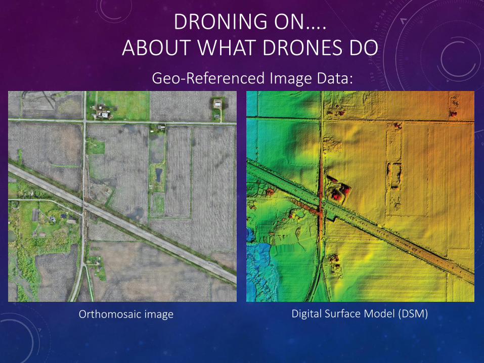
Geo-Referenced Image Data:
Orthomosaic image Digital Surface Model (DSM)
DRONING ON….ABOUT WHAT DRONES DO
Orthoimage:
Raster (dot matrix) image that has been geometrically corrected (“orthorectified”) to remove distortion caused by
camera optics, camera tilt, and differences in elevation.
Data is orthorectified to achieve an accuracy commensurate with a given topographic map equivalent.
Geo-Referenced Image Data:
Orthomosaic image Digital Surface Model (DSM)
DRONING ON….ABOUT WHAT DRONES DO
Environmental applications:
• Quickly document site conditions via aerial photos
• Terrain mapping in non vegetated areas
• Corridor mapping
• Construction progress mapping — pre, during, and post construction flights
DRONING ON….ABOUT WHAT DRONES DO
Asset management & inspection applications:
• Location and condition of community assets
• Dangerous inspections (e.g., roofs, bridges, water towers, dams, flooding, air emissions and stack evaluations)
• Amount of material in gravel pits
DRONING ON….ABOUT WHAT DRONES DO
• Quickly document site conditions via aerial photos
• Terrain mapping in non vegetated areas
• Corridor mapping
• Construction progress mapping — pre, during, and post construction flights
Surveying & terrain mapping:
DRONING ON….ABOUT WHAT DRONES DO
HR Green sUAS Projects:
• 2 Marengo, IL flights for IL I90 / Rte 23
• Jurupa Valley, CA flights:
▪ Park annexation
▪ Bain & Limonite Roads
▪ Pedley Road
▪ Recon for Bain North (Riverside FAA)
DRONING ON….ABOUT WHAT DRONES DO
HR Green sUAS Projects:
• Minnesota Forestry Projects
• Iowa/Illinois I-74 Bridge Project Planned
• Weekly flights for construction observation
• FAA airspace authorization requested
DRONING ON….ABOUT WHAT DRONES DO
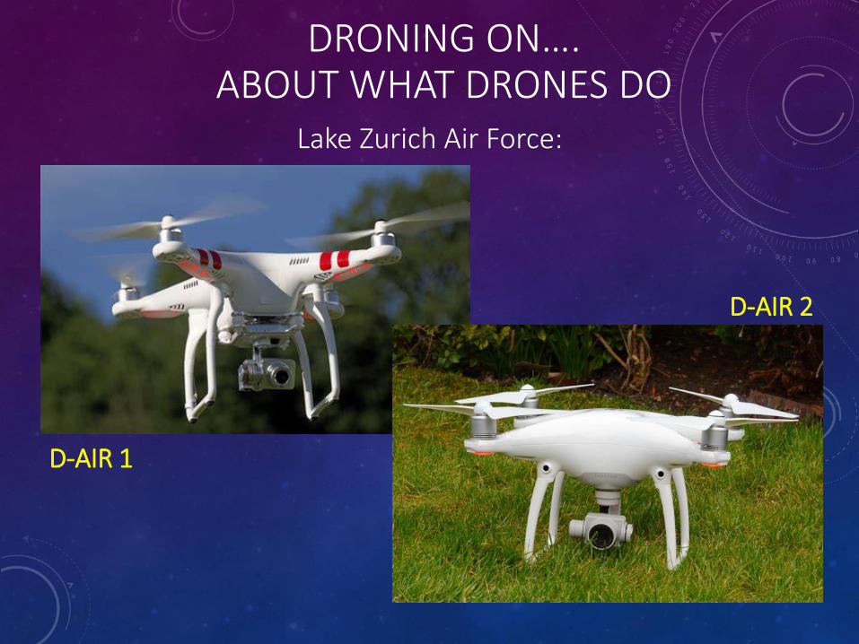
Lake Zurich Air Force:
DRONING ON….ABOUT WHAT DRONES DO
Lake Zurich Air Force:
D-AIR 1
D-AIR 2
• 4 propellers – quadcopter
• Consumer to semi-pro models in varying sizes
• 20 – 27 minutes of flight time
• GPS – ready to fly, preprogrammed course, return to home
• Collision avoidance systems that also permit indoor flight
DRONING ON….ABOUT WHAT DRONES DO
• On-board camera on a gimbal for still pictures and video capture
• Cameras on top of the drone with zoom capabilities
• Photogrammetry, multispectral and thermal imaging
• Live stream video to social media
• New models and features are introduced all of the time.
DRONING ON….ABOUT WHAT DRONES DO
• Quadcopter
• Battery & charger(s)
• Propellers
• Misc. cables
• Factory supplied controller
• Manual Pilot supplied tablet or smart phone
DRONING ON….ABOUT WHAT DRONES DO
What do you get for $1200?
What else do you need?
• Tablet or smartphone
• Extra propellers
• Extra battery
• Media storage
• Patience
• Practice
DRONING ON….ABOUT WHAT DRONES DO
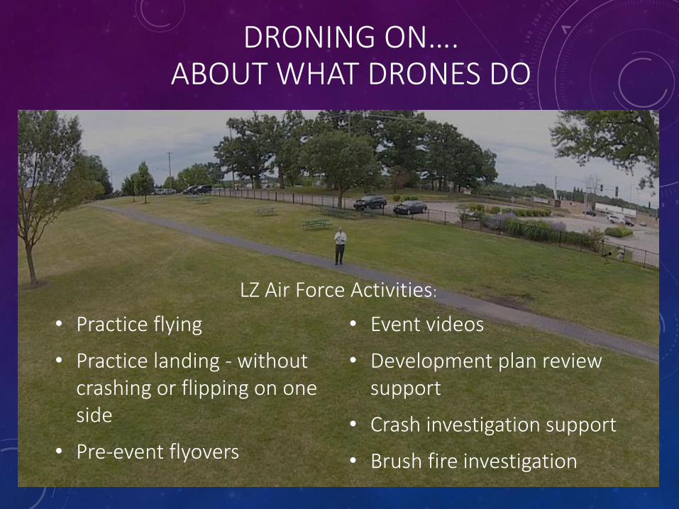
• Practice flying
• Practice landing - without crashing or flipping on one side
• Pre-event flyovers
• Event videos
• Development plan review support
• Crash investigation support
• Brush fire investigation
DRONING ON….ABOUT WHAT DRONES DO
LZ Air Force Activities:
DRONING ON….ABOUT WHAT DRONES DO
DRONING ON….ABOUT WHAT DRONES DO
Event Setup:
DRONING ON….ABOUT WHAT DRONES DO
Event Setup:
DRONING ON….ABOUT WHAT DRONES DO
Event Setup:
DRONING ON….ABOUT WHAT DRONES DO
Safely view a construction scene:
DRONING ON….ABOUT WHAT DRONES DO
Safely view a construction scene:
DRONING ON….ABOUT WHAT DRONES DO
Quickly survey a large area:
DRONING ON….ABOUT WHAT DRONES DO
Saves time:
By Boat:
Staff time: 45 minutes
By Drone:
Staff time: 15 minutes
DRONING ON….ABOUT WHAT DRONES DO
Major Crash Assistance Team:
DRONING ON….ABOUT WHAT DRONES DO
Major Crash Assistance Team:
DRONING ON….ABOUT WHAT DRONES DO
Major Crash Assistance Team:
A Few Answers –
And Many More Questions –
About Legal Issues
With Using Drones
In Municipal And County Services
DRONING ON….ABOUT LEGAL REQUIREMENTS AND LIABILITIES
Municipality must register a drone under either:
FAA Part 107
or
“Public Operator”
(Certificate of Waiver or Authorization (COA))
DRONING ON….ABOUT LEGAL REQUIREMENTS AND LIABILITIES
Local Government Authority to Operate UAS:
Operator must:
• Must be at least 16 years old
• Must pass an aeronautical knowledge test at an FAA-approved knowledge testing center, OR
• Hold a Part 61 pilot certificate other than student pilot
• Must pass applicable TSA screening
• Must hold a remote pilot airman certificate or under direct supervision of the airman, complete a flight review within the previous 24 months, and complete a small UAS online training course provided by the FAA
DRONING ON….ABOUT LEGAL REQUIREMENTS AND LIABILITIES
Option 1: “Part 107” Authority
Drone must:• Must be used in line of sight of operator only
• Cannot operate over people that are not involved in the operation, unless they are covered (i.e., by a structure)
• Must be during daylight or civil twilight
• Must yield right of way to manned aircraft
• Cannot be heavier than 55 pounds
• Cannot interfere with manned aircraft in any way
• Max speed of 100mph, max height 400 feet above ground level unless within 400 feet of a building
• If flown within 5 miles of any airport, must notify air-traffic control
• Cannot fly within 5 miles of a military installation
• No careless/reckless operation
• Cannot fly from a moving vehicle, unless in a sparsely populated area
DRONING ON….ABOUT LEGAL REQUIREMENTS AND LIABILITIES
Option 1: “Part 107” Authority
DRONING ON….ABOUT LEGAL REQUIREMENTS AND LIABILITIES
Option 2: Certificate of Waiver or Authorization (COA)
Only governmental entities can receive a COA:
• Allows operator to fly drones for specific place, governmental function and period of time (often up to two years)
• Authorization issued by the Air Traffic Organization (organizational arm of the FAA), usually for defined airspace and specific time period/time of day.
• The operator can self-certify its pilots.
• Emergency COAs are available – usually issued within 24 hours
• Civil Penalties of up to $1100 per each regulation violated per flight will issue if any provision of Part 107 is violated.
DRONING ON….ABOUT LEGAL REQUIREMENTS AND LIABILITIES
Common Local Government Uses:
• Law Enforcement
• Municipal Operations
• GIS/Mapping/Zoning
• Utilties
• Emergency Response
• Code Enforcement/Property Inspection
• Civic/Community Event Photography
DRONING ON….ABOUT LEGAL REQUIREMENTS AND LIABILITIES
Common Local Government Uses:
• Law Enforcement Regulations
• Freedom from Drone Surveillance Act (“DSA”) - enacted 2014
• "Law enforcement agency" means any agency of this State or a political subdivision of this State which is vested by law with the duty to maintain public order and to enforce criminal laws.
• Prohibited use of drones. Except as provided in Section 15 of the DSA, a law enforcement agency may not use a drone to gather information. 725 ILCS 167/10.
DRONING ON….ABOUT LEGAL REQUIREMENTS AND LIABILITIES
Common Local Government Uses:
• Law Enforcement DSA Exceptions:
• Countering high risk of terrorist attack (Dept. Homeland Security determination)
• In the execution of a proper judicial search warrant, based on probable cause (limited to 45 days after issuance)
• In emergency to prevent imminent loss of life, escape of a suspect or destruction of evidence (use limited to 48 hour period). W/in 24 hours of such use, police chief must provide written notice of use to State’s Attorney.
DRONING ON….ABOUT LEGAL REQUIREMENTS AND LIABILITIES
Common Local Government Uses:
• Law Enforcement DSA Exceptions:
• Missing person search (if not conducting criminal investigation)
• Crime scene/traffic accident photography
• Only on public land or roadways (unless have search warrant)
• All reasonable efforts required to solely photograph crime/traffic scene and avoid other areas
• Disaster or public health emergency – info needed to:
• declare public health or disaster emergency
• monitor weather or emergency conditions
• coordinate response and recovery efforts (during and after)
DRONING ON….ABOUT LEGAL REQUIREMENTS AND LIABILITIES
Common Local Government Uses:
• Law Enforcement DSA Limitations:
• All info obtained from drone shall be destroyed in 30 days – but may be retained with reasonable suspicion that it contains evidence of criminal activity or info is relevant to an ongoing criminal investigation or pending criminal trial.
• Drone info may not be disclosed, unless to another government agency if there is a reasonable suspicion that it contains evidence of criminal activity, or the info is relevant to an ongoing criminal investigation or pending criminal trial.
• If the Act is violated in any way, the evidence is deemed inadmissible in a criminal proceeding, unless the prosecution can prove that a specific US Constitutional exception would render it admissible.
DRONING ON….ABOUT LEGAL REQUIREMENTS AND LIABILITIES
Common Local Government Uses:
• Law Enforcement DSA Requirements:
• All law enforcement agency must provide written notice to the IL Criminal Justice Information Authority of the number of drones it owns by April 1 each year.
• Can’t circumvent DSA by using private third party’s drone
• Any info acquired by third party is subject to the retention and disclosure requirements under the DSA
• DSA does not prohibit private third parties from voluntarily submitting info to law enforcement, but info is still subject to DSA retention and disclosure requirements
DRONING ON….ABOUT LEGAL REQUIREMENTS AND LIABILITIES
Disclosure of Drone Recordings:
• Law Enforcement (DSA provides for treatment)
• FOIA Request
• Is it a record?
• Is it maintained?
• Is it “public business”?
• Surveillance activity/recordings under FOIA
• Unwarranted invasion of personal privacy
• Technological solution – “live” surveillance
• Local Records Act
DRONING ON….ABOUT LEGAL REQUIREMENTS AND LIABILITIES
Common Law Liabilities of Drone Use:
Potential claims for improper use of a drone:
• Intrusion upon seclusion:
✓ intentional intrusion, physically or otherwise, upon the solitude or seclusion of another or his/her private affairs or concerns, which is highly offensive to a reasonable person
• Publication of private facts:
✓ publication or broadcast of private information about another, the disclosure of which is highly offensive to a reasonable person and is not a matter of legitimate public concern
DRONING ON….ABOUT LEGAL REQUIREMENTS AND LIABILITIES
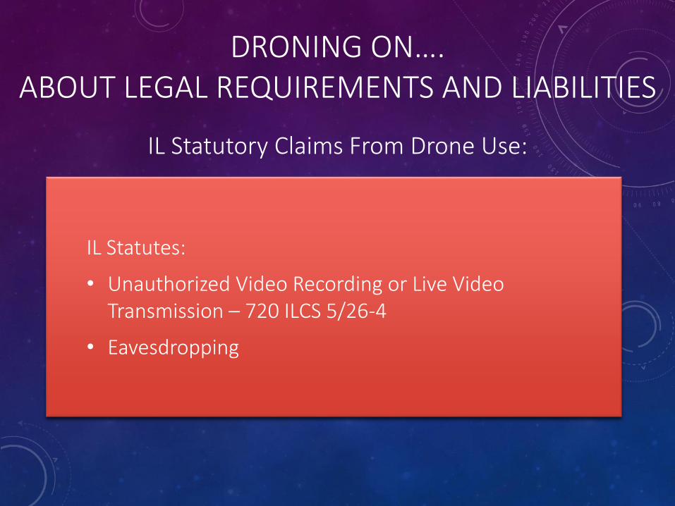
IL Statutory Claims From Drone Use:
IL Statutes:
• Unauthorized Video Recording or Live Video Transmission – 720 ILCS 5/26-4
• Eavesdropping
DRONING ON….ABOUT LEGAL REQUIREMENTS AND LIABILITIES
Tort Immunity For Municipal Drone Use:
Tort Immunity Act:
• Would protect a municipality from liability for negligent use of the drone, or failure to use the drone for a specific purpose that it had in the past (for instance, failure to inspect with a drone)
• HOWEVER, there is no current case law that addresses injury from municipal drone usage.
DRONING ON….ABOUT LEGAL REQUIREMENTS AND LIABILITIES
Federal Enforcement:
• FAA only requires reporting of accidents involving drones when they involve serious injury, loss of consciousness, or damage to property that exceeds $500
• FAA generally does not have the resources to enforce this requirement
• Municipality is not free from civil liability for injury or property damage as a result of willful or wanton use of the drone
DRONING ON….ABOUT LEGAL REQUIREMENTS AND LIABILITIES
Practical Considerations to Minimize Potential Problems:
• When feasible, inform the public of the expected and scheduled use
• Have a privacy policy for staff using the drone and the information it collects
• Avoid collecting personal information when there is a reasonable expectation of privacy
• Avoid routine and continuous collection
• Safeguard use of personal data
DRONING ON….ABOUT LEGAL REQUIREMENTS AND LIABILITIES
Practical Considerations to Minimize Potential Problems:
• Do not allow use of personal data for marketing purposes
• Proper registration/certification and training to manage your security risks and risk of damage to others’ property
• Consider use of live stream video versus recording
• Know and understand how video/audio “surveillance” may become public record subject to disclosure