18
Acho Dene Koe First Nation Fort Liard Métis One people - One Vision © Presented by Robert Diaz – Principle – DM Cultural Services Ltd. March 2017

Acho Dene KoeFirst Nation
Fort Liard Métis
One people - One Vision
© Presented by Robert Diaz – Principle – DM Cultural Services Ltd.March 2017
PRESENTATIONAGENDA
Who we are
Where we live
Our priorities
Future opportunities
Closing remarks
Our road to self sufficiency

6474 SQUARE KM
CERTAINTY FOR OUR COMMUNITY
CERTAINTY FOR OUR PARTNERS
CERTAINTY FOR OUR FUTURE
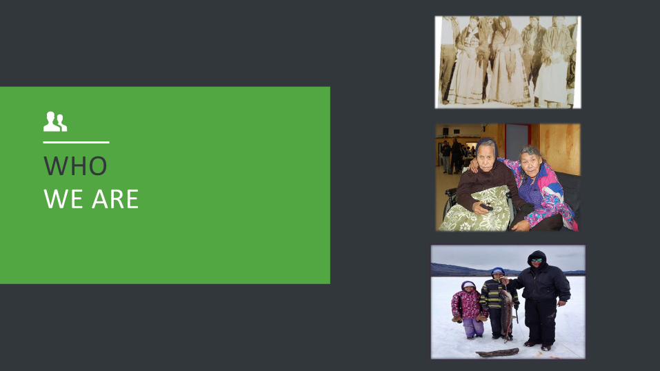
WHOWE ARE
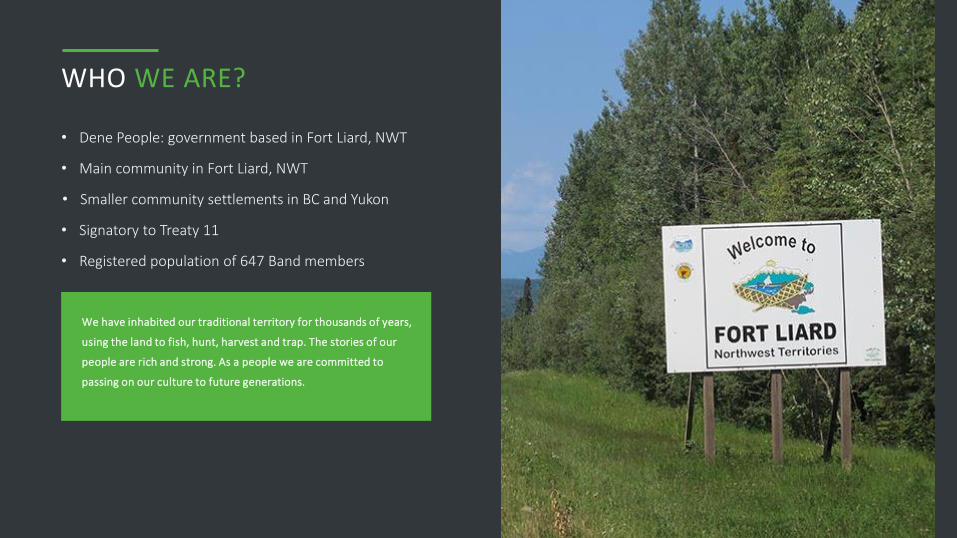
WHO WE ARE?
• Dene People: government based in Fort Liard, NWT
We have inhabited our traditional territory for thousands of years,
using the land to fish, hunt, harvest and trap. The stories of our
people are rich and strong. As a people we are committed to
passing on our culture to future generations.
Our Office in New Jersey
• Main community in Fort Liard, NWT
• Smaller community settlements in BC and Yukon
• Signatory to Treaty 11
• Registered population of 647 Band members

WHEREWE LIVE
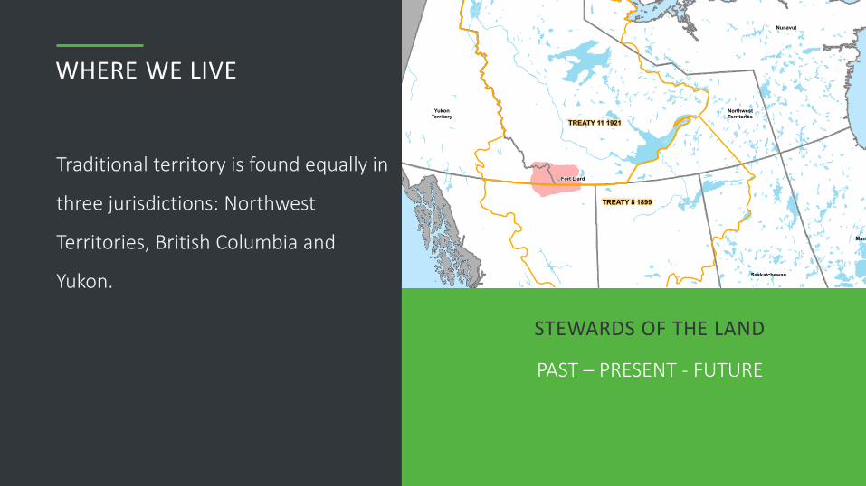
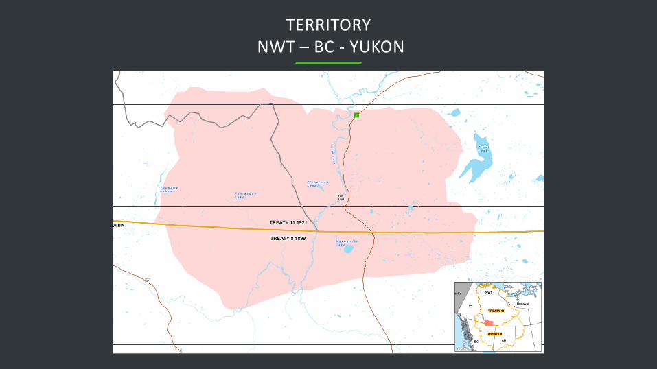
WHERE WE LIVE
Traditional territory is found equally in
three jurisdictions: Northwest
Territories, British Columbia and
Yukon.
STEWARDS OF THE LAND
PAST – PRESENT - FUTURE
TERRITORY NWT – BC - YUKON

OUR ROADTO SELF SUFFICIENCY
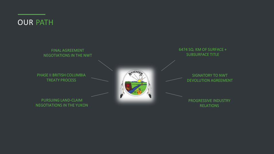
OUR PATH
PHASE II BRITISH COLUMBIA TREATY PROCESS
PURSUING LAND-CLAIM NEGOTIATIONS IN THE YUKON
FINAL AGREEMENT NEGOTIATIONS IN THE NWT
6474 SQ. KM OF SURFACE + SUBSURFACE TITLE
SIGNATORY TO NWTDEVOLUTION AGREEMENT
PROGRESSIVE INDUSTRY RELATIONS
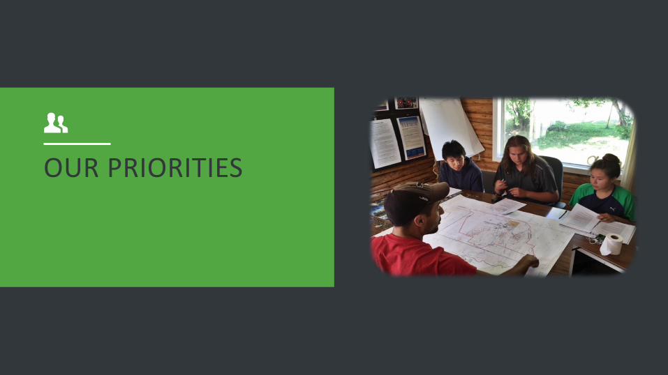
OUR PRIORITIES
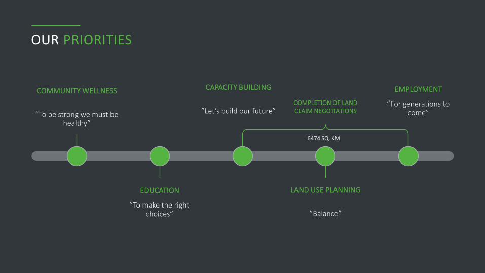
OUR PRIORITIES
”To be strong we must be healthy”
COMMUNITY WELLNESS
6474 SQ. KM
COMPLETION OF LAND CLAIM NEGOTIATIONS
”To make the right choices”
EDUCATION
”Let’s build our future”
CAPACITY BUILDING
”Balance”
LAND USE PLANNING
”For generations to come”
EMPLOYMENT
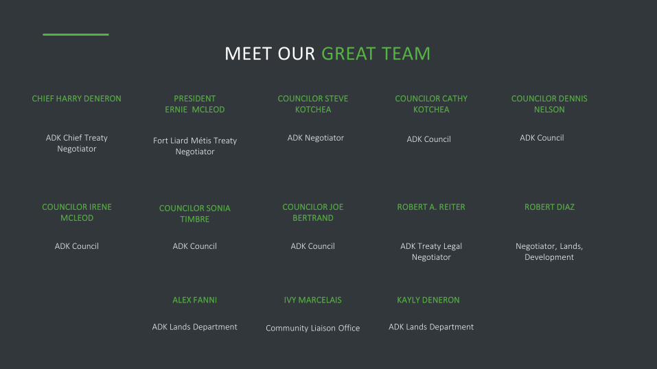
MEET OUR GREAT TEAM
ADK Chief Treaty Negotiator
CHIEF HARRY DENERON
Fort Liard Métis Treaty Negotiator
PRESIDENT ERNIE MCLEOD
ADK Negotiator
COUNCILOR STEVE KOTCHEA
COUNCILOR CATHY KOTCHEA
COUNCILOR DENNIS NELSON
COUNCILOR IRENE MCLEOD
COUNCILOR SONIA TIMBRE
COUNCILOR JOE BERTRAND
ROBERT A. REITER ROBERT DIAZ
ADK Council ADK Council
ADK Council ADK Council ADK Council ADK Treaty Legal Negotiator
Negotiator, Lands, Development
ALEX FANNI
ADK Lands Department
IVY MARCELAIS
Community Liaison Office
KAYLY DENERON
ADK Lands Department

FUTURE
OPPORTUNITIESFort Liard Métis President Ernie McLeod, ADK Chief Harry
Deneron, Premier Bob McLeod, and former MLA Kevin Menicoche
celebrate the signing of the ADK Agreement-in-Principle, February
2014.
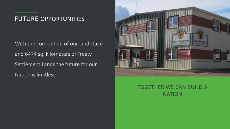
FUTURE OPPORTUNITIES
With the completion of our land claim
and 6474 sq. kilometers of Treaty
Settlement Lands the future for our
Nation is limitless.
TOGETHER WE CAN BUILD A NATION
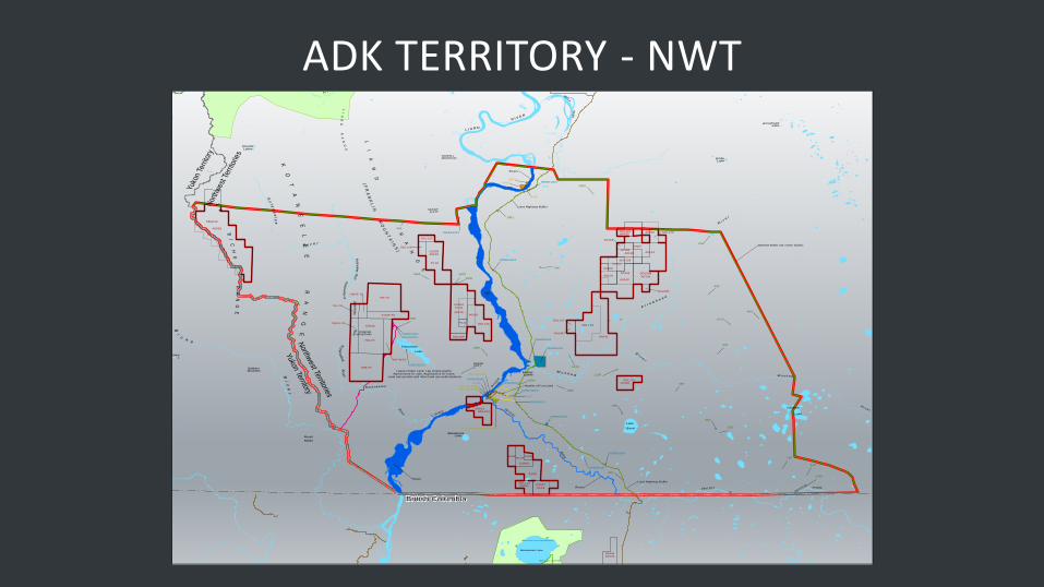
ADK TERRITORY - NWT
Yukon TerritoryN
orthwest Territories
Yuko
n Te
rrito
ryN
orth
wes
t Ter
ritor
ies
British Columbia
BabicheMountain
MountDickie
MountMerrill
Mount
Martin
LA
BI
CH
E
RA
NG
E
KO
TA
NE
EL
EE
R
AN
GE
T L O G O T S H O R A N G E
LI
AR
D
R
AN
GE
MOUNTCOTY
POINTEDMOUNTAIN
BigI
MOUNTFLETT
SAWMILLMOUNTAIN
JAC
KFIS
H R
IDGE
LI
AR
D
R
AN
G
E
(F
RA
NK
LI
N M
OU
NT
AI N
S)
Maxhamish Lake
PETITOT
R
Lake
Bovie
RIV
ER
PETITOT
Riv
er
BrownL
Bi
ch
e
Ri
ve
r
La
J ac k f i s h
R i ve
r
Etanda Lakes
Ko
t an
ee
l ee
R i v e r
Kota
ne
ele
e R
Ko
tan
eelee
PETITOT RIVER
Celibeta
Lake
M u s k e g
R i v e r
Betalamea Lake
L I A R D
RI V
ER
McKayLakes
M u s k e g
Ri v
er
A r r o w h e a d
Ri v
er
EmileLake
ArrowheadLake
Bay Creek
NETLA
RIV
ER
L I A R D
R I V E R
Cre
ekCre
ek
Kotaneelee R
iverK
otan eeleeR
iver
Fisherman
Lake
Kotanee lee
Ri ve r
095B06006
095B06004
095B03019
095B11003
095B03034
095B03017
095B12003
095B05008
095B04001
095B03100
095B03066
095B11004
095B03080
095B06012
095B04001
203-Unsurveyed Quarry
203-SK-00087
203-SK-059
203-SK-00087
413
696
466
494
492
796
502
483
202
612
522
299
155
133
1150
1863
1900
1610
1851
1866
1830
1832
1966
1986
1748
1907
204
C0016
A0062
A0141
SDL012
A0142
A0115
PL09
A0140
C0004
C0005 A0143
838-70
705-70
PL10SDL129
A0162
703-70
C0003
A0129
SDL128
A0163
A0141
PL08
A0165
A0167
SDL124
SDL098
A0169
A0164
A0166
SDL125
A0160
PL12
PL07
A0170
A0168
C0007
A0141A0142
SDL122
A0159
PL08
710-R-70
SDL121
A0161SDL123
SDL099
SDL120
PL11
PL08
708-R-70
707-R-70
A0149
704-70
SDL119
SDL127
SDL129
709-R-70
A0143
SDL090
3416
3424
3416
29460
1655
Hamlet of Fort Liard
ADKSA Buffer (31 meter buffer)
Liard Highway Buffer
Lease Holder Land, Fee simple grants, Agreements for sale, Applications for lease,
Land use permits and other land use authorizations
Rivers
Rivers
Rivers
Liard Highway Buffer
Maxhamish Lake Protected Area
Maxhamish Lake Park
A C H O D E N E K O E F I R S T N AT I O N S
Confidential
KEY MAP ADK TRADITIONAL TERRITORY BOUNDARY
E x c l u s i o n T y p e p e r A D K A g r e e m e n t D o c u m e n t
Agreement Exclusions in NWT Portion of the ADK Territory
ADK Territory
Not to encircle Hamlet of Fort Liard
ADKSA Buffer (31 meter buffer)
Land reserved by IAND or Commissioner (no features on map)
Hamlet of Fort Liard
Land reserved by IAND or Commissioner (no features on map)
Land Not Administered by GNWT
Liard Highway Buffer
Lease Hold Interests, Producing and non producing mines
Oil and Gas Leases, Oil and Gas Licenses
0 10 205
Kilometers
NAD 83 ALBERS
Map produced February 20, 2017
Production Date
Road Network
River/ Lake
Indian Reserve
Parks
Fort Liard Municipal Boundary
B a s e M a p F e a t u r e s
In the ‘D uplicate’ colum n w here it indicates ‘Yes’ m ore than one exclusion type shares the sam e shape file. In thes e cas es
the duplicate is only counted once to determ ine the total area of exclusions.
The ‘no features on m ap’ com m ent above indicates situatons where the features from this layer are overlapped by
other exclusion layers so no exclusions from the layer are displayed.
Rivers
Rights-of-way, Easements
Lease Holder Land, Fee simple grants. Agreements for sale, Applications for lease, Land use permits and other land use authorizations
Government Agency Land, Quarrying permits and leases, Lease Holder Land, Fee simple grants, Agreements for sale, Applications for lease, Land use permits and other land use authorizations
Lease Holder Land, Fee simple grants, Agreements for sale, Applications for lease, Land use permits and other land use authorizations, Timber permits
There is overlap between features in this layer so labels are placed in the general vicinity of the corresponding feature. Thin black lines have been added to show the internal boundaries of the Oil and Gas Parcels.
Known or suspected contaminated sites
These locations are very small polygons labelled as green numerical text.
Map Extent

LIARD AND HORN RIVER GAS BASINS
Northwest TerritoriesBritish Columbia
Yukon Territory
British Columbia
Yuko
n T
errito
ryN
orth
west Te
rritorie
s
Yukon Territory
Northwest Territories
Yuko
n T
err
itory
Nort
hw
est
Terr
itories
British Columbia
M a x h a m i s hL a k e
F i s h e r m a nL a k e
F a n t a s q u eL a k e
T o o b a l l yL a k e s
Lia
rd
R
iv
er
T r o u tL a k e
M u n c h oL a k e
97
77
7
Atlin
Fort Nelson
Fort St. John
Whitehorse
Yellowknife
British Columbia Alberta
Northwest Territories
Yukon Territory
Alaska
Date Produced: 2017-02-21Coordinate System: UTM 10N NAD 83Data Source: GeoBC, NRCan, ADK, GeoGratis
ACHO DENE KOE TRADITIONAL TERRITORYGAS BASINS
Horn River Gas Basin
Liard Gas Basin
Acho Dene Koe Traditional Territory
Major Highway
Major Waterbody
0 25 5012.5
Km
1:375,000
QUESTIONS?


