88
An update on work undertaken during the last five years Action for the Environment on Scotland’s National Forest Estate

An update on work undertaken during the last five years
Action for the Environment on Scotland’s National Forest Estate

Management of Scotland’s National Forest Estate is independently audited againstthe UK Woodland Assurance Standard – endorsed by the international Forest Stewardship Council® and the Programmefor the Endorsement of Forest Certification.
Inside front cover: © Mark Hamblin/2020VISION

Action for the Environment on Scotland’s National Forest Estate 1
Introduction 2
Update on Priority Habitats 4
UKBAP Priority Open Habitats 7
Native woodlands 16
Update on Invasive Species 28
Grey squirrels 30
Mink 31
Rhododendron 32
Management of other invasive non-native plant species 38
Update on Key Species 44
Capercaillie 46
Black grouse 50
Red squirrel 56
Pearl-bordered fritillary and chequered skipper 60
Juniper 64
Update on Archaeology and the Historic Environment 68
Understanding the historic environment 70
Historic environment conservation 79
Valuing the historic environment 83

Action for the Environment on Scotland’s National Forest Estate2
The National Forest Estate is one of Scotland’s greatest assets, providing economic, social and environmental benefits to the people of Scotland, wherever they happen to live.It is home to many treasured places, recognised for their natural and cultural heritage or as exceptional woodlands. Spectacular views, rare plants and ancient monuments all contribute to a vital sense of place and belonging, whether they’re found on the doorstep of our cities or in the furthest reaches of our uplands.
Action for the Environment on Scotland’s National Forest Estate describes just some of the recent work we have been doing to ensure that our natural and cultural heritage is protected, conserved and enhanced. We present updates on our work to protect and conserve priority habitats, tackle invasive species, monitor key species and record the historic environment. Our ongoing work supports the delivery of both the Scottish Government’s 2020 Challenge for Scotland’s Biodiversity strategy and Our Place in Time: the Historic Environment Strategy for Scotland.
The Role of Scotland’s National Forest Estate and Strategic Directions 2013-16 sets out our priorities in terms of integrated land management. The forests we manage for the nation contain a wide range of protected and priority species, habitats and features.
Forest Enterprise Scotland (FES) is the agency of Forestry Commission Scotland which manages the National Forest Estate.
© Colin Leslie
Introduction

Action for the Environment on Scotland’s National Forest Estate 3
We have around
67,500 hadesignated for conservation importance.
We have more than
350 sitesdesignated historical assets.

Action for the Environment on Scotland’s National Forest Estate4
Priority Habitats
UPDATE ON
We are committed to maintaining the best open habitats in good ecological condition.
We are restoring around
85% of areas on ancient woodland sites to largely native species. The remaining areas will be enhanced through our management
We aim to increase the broadleavedtree cover from the current 8% of woodland cover to around
20%

Action for the Environment on Scotland’s National Forest Estate 5
The following case studies highlight the range of activities undertaken in regards to priority open habitats and native woodlands on the National Forest Estate. In addition, two recent national surveys have for the first time, accurately quantified, mapped and to some extent, described the condition of the UK Biodiversity Action Plan (UKBAP) priority habitats occurring on the estate. The Native Woodland Survey of Scotland (NWSS), carried out by Forestry Commission Scotland between 2006 and 2013 established the first comprehensive account of the native woodland resource in Scotland. It identified 51,877 ha of which just under 46,000 ha were attributable to UK Biodiversity Action Plan native woodland priority habitats types (see Figure 1).
The Open Habitat survey of the National Forest Estate is currently 63% complete having started in 2006. So far 84,633 ha of open UKBAP priority habitats have been identified out of the 133,000 ha surveyed so far and 21 priority habitats have been identified (See Figure 2).
Glean na Ciche montane willow colony. © Dr Diana Gilbert

Action for the Environment on Scotland’s National Forest Estate6
Native pinewood
Upland birchwood
Wet woodland
Upland oakwood
Upland mixed ashwood
Lowland mixed deciduous woodlandA
rea
(ha)
,000
20
25
15
10
5
0
Figure 1. Native woodland UKBAP Priority Habitat Types on the National Forest Estate
Upland heathland Blanket bog Upland flush, Fen & Swamp Montane heath Oilgotrophic or Dystrophic loch Inland rock outcrop & Scree habitat Lowland raised bog Purple-moor grass & Rush pasture Lowland heathland Lowland dry acid grassland Lowland fen Upland calcareous grassland
45
20
25
30
35
40
15
10
5
0
Are
a (h
a) ,0
00
Figure 2: Open habitat UKBAP priority habitat types mapped so far on the National Forest Estate

Action for the Environment on Scotland’s National Forest Estate 7
Since then, FES has reported just under 3,000 ha of open UKBAP priority habitat restoration from forestry plantation (see Figure 3). These areas were planted some decades ago. The majority of this area (2,549 ha or 87%) has involved restoration of peatlands, primarily blanket bog and lowland raised bog. The figures also include habitat restoration undertaken by wind farm developers and are likely to be an underestimate as not all work has been reported.
Since 2000 FES has reported just over
9,000 ha of condition improvement work for 20 open UKBAP priority habitats (see Figure 4).
Much of this work involved conservation grazing, particularly on upland heathland, which accounts for the largest proportion (5,717 ha or 62% of the total area). Another significant proportion of this work has focussed on peatlands (2,716 ha or 29%) and such work primarily comprises removing tree regeneration and blocking ditches. FES has also been a significant contributor to improving the condition of Purple-moor Grass and Rush Pasture (wet unimproved meadows) with 174 ha of condition improvement work, primarily grazing and hay cutting since 2000. Again the figures are likely to be an underestimate as not all work has been reported. All of the work is informed by the Strategic Guide for Conservation Management of Open Priority Habitats on the National Forest Estate.
Conservation action for UKBAP Priority Open Habitats
Summary figures for UK Biodiversity Action Plan Priority Open Habitat action reporting have been compiled for open habitat conservation on the National Forest Estate since 2000.
UKBAP Priority Habitat Area (ha)
Blanket bog 1,701
Lowland raised bog 832
Upland heathland 308
Coastal sand dune 62
Upland, flush, fen & swamp 16
Intermediate bog 14
Coastal vegetated shingle 10
Lowland fen 2
Reedbed 1
Total 2,946
Figure 3. Open habitat restoration since 2000

Action for the Environment on Scotland’s National Forest Estate8
UKBAP Priority Habitat Area (ha)
Upland heathland 5,717
Blanket bog 1,324
Lowland raised bog 1,319
River 304
Purple moor-grass & rush pasture 174
Coastal sand dune 91
Arable field margin 54
Intermediate bog 52
Wood pasture and parkland 40
Upland, flush, fen & swamp 32
Lowland heathland 28
Lowland meadow 24
Lowland fen 21
Lowland dry acid grassland 15
Open mosaic habitats on previously developed land 9
Coastal vegetated shingle 7
Eutrophic loch 3
Limestone pavement 1
Lowland calcareous grassland 1
Ponds 1
Total 9,217
Figure 4. Open habitat condition improvements since 2000
Action for the Environment on Scotland’s National Forest Estate 9
To meet woodland expansion targets and other corporate objectives FES has an acquisitions process, acquiring new ground for woodland planting that delivers multiple benefits against seven objective areas: climate change, timber, business development, community development, access and health, environmental quality and biodiversity. The above process inevitably results in the loss of some open habitats, but with consideration of our biodiversity objectives and responsibilities, the loss of open UKBAP priority habitats is avoided (or minimised and mitigated as far as possible). The UKBAP has targets for conservation, including targets for maintaining the overall area of each priority habitat.
FES considers in detail the impact of new woodland planting on a site by site basis. Firstly, before purchase potential acquisitions are assessed for the likely percentage of open priority habitats present and this informs the estimate of the potentially plantable area. If time permits, potential acquisitions are often subject to an open habitat survey before purchase, but if not, a full open habitat survey is completed after purchase to inform woodland expansion and the Forest Design Plan. FES aims to acquire sites with low open priority habitat interest if possible. This reduces any potential conflicts between maintaining the extent of open UKBAP priority habitats and maximising the area planted on each acquisition. However, given the diversity and distribution of UKBAP priority habitats it is often not possible to acquire land for forestry, which is devoid of open priority habitats and such areas are carefully considered in Forest Design Plans.
An example of this is Carserigg, a 630 ha estate near Kirkonnell, Dumfriesshire which was purchased in 2010. Shortly after purchase an ecological contractor was commissioned to undertake a habitat survey using the FES Habitat Action Plan survey method. On the broad open hilltops the vegetation was found to be extensive areas of blanket bog with some upland heath. The steep south facing banks of the Kello Burn were found to be predominantly dry, upland heath, but of particular interest were the scattered extents of the relatively rare upland calcareous grassland habitat. Several uncommon habitat specialist plant species were found to be associated with the upland calcareous grassland and dry heath including carline thistle (Carlina vulgaris), northern bedstraw (Galium boreale) and mountain everlasting (Antennaria dioica).
What must be one of the largest UK populations of the nationally scarce and red data book near threatened hairy stonecrop comprising many thousands of plants was discovered and a locally significant colony of about 50 juniper bushes was recorded.
Hairy stonecrop (Sedum villosum) is a UKBAP priority species and listed on the Scottish Biodiversity List. The survey report included recommendations to retain the blanket bog areas and increase grazing levels on the slopes of the Kello Burn to maintain the calcareous grassland in good condition.
The survey data was mapped and analysed in GIS to inform the concept and analysis map in the Forest Design Plan. This process allowed a balance to be struck between maximising woodland expansion, whilst reducing the loss of significant open priority habitat. The majority of the open priority habitat was retained and areas which would benefit from grazing were fenced in preparation for a starter farm, so that grazing could be used to maintain the priority habitats in good condition.
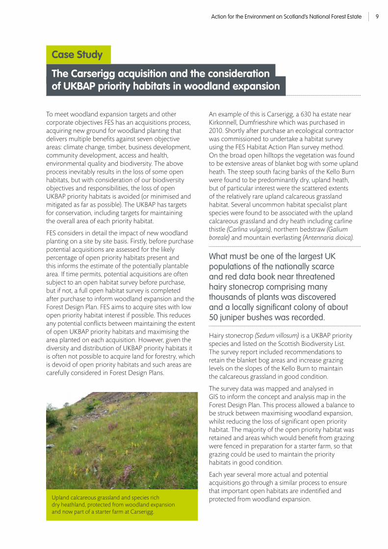
Each year several more actual and potential acquisitions go through a similar process to ensure that important open habitats are indentified and protected from woodland expansion. Upland calcareous grassland and species rich
dry heathland, protected from woodland expansion and now part of a starter farm at Carserigg.
The Carserigg acquisition and the considerationof UKBAP priority habitats in woodland expansion
Case Study
Action for the Environment on Scotland’s National Forest Estate10
The Lochar Mosses Forest near Dumfries was established in the 1970’s on three lowland raised bogs, which are some of the largest examples of this rare habitat in Scotland. Lowland raised bogs have been damaged and destroyed by various land uses including peat extraction, agricultural land claim and afforestation, particularly in the 20th century. Only 11% of the habitat in Scotland is in a near natural condition, whilst approximately 37% is afforested. The National Forest Estate includes some 14% of the Scottish lowland raised bog resource of which, until recently, 65% was in an ecologically degraded afforested state.
The UK Biodiversity Action Plan for Lowland Raised Bogs specifies actions to reduce future impacts and initiate restoration actions. Current woodland expansion policy advises against planting on deep peats including lowland raised bogs, based on our current understanding of both the green house gas implications of doing so and the biodiversity value of these habitats.
In 2001 an ambitious programme of habitat restoration was initiated at Longbridgemuir, one of the three lowland raised bogs in the Lochar Mosses complex and adjacent to the privately owned Longbridgemuir Special Area of Conservation.
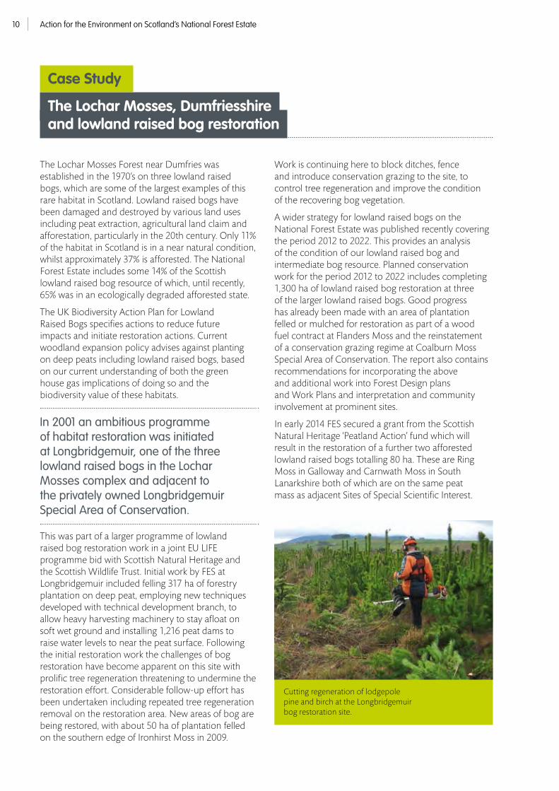
This was part of a larger programme of lowland raised bog restoration work in a joint EU LIFE programme bid with Scottish Natural Heritage and the Scottish Wildlife Trust. Initial work by FES at Longbridgemuir included felling 317 ha of forestry plantation on deep peat, employing new techniques developed with technical development branch, to allow heavy harvesting machinery to stay afloat on soft wet ground and installing 1,216 peat dams to raise water levels to near the peat surface. Following the initial restoration work the challenges of bog restoration have become apparent on this site with prolific tree regeneration threatening to undermine the restoration effort. Considerable follow-up effort has been undertaken including repeated tree regeneration removal on the restoration area. New areas of bog are being restored, with about 50 ha of plantation felled on the southern edge of Ironhirst Moss in 2009.
Work is continuing here to block ditches, fence and introduce conservation grazing to the site, to control tree regeneration and improve the condition of the recovering bog vegetation.
A wider strategy for lowland raised bogs on the National Forest Estate was published recently covering the period 2012 to 2022. This provides an analysis of the condition of our lowland raised bog and intermediate bog resource. Planned conservation work for the period 2012 to 2022 includes completing 1,300 ha of lowland raised bog restoration at three of the larger lowland raised bogs. Good progress has already been made with an area of plantation felled or mulched for restoration as part of a wood fuel contract at Flanders Moss and the reinstatement of a conservation grazing regime at Coalburn Moss Special Area of Conservation. The report also contains recommendations for incorporating the above and additional work into Forest Design plans and Work Plans and interpretation and community involvement at prominent sites.
In early 2014 FES secured a grant from the Scottish Natural Heritage ‘Peatland Action’ fund which will result in the restoration of a further two afforested lowland raised bogs totalling 80 ha. These are Ring Moss in Galloway and Carnwath Moss in South Lanarkshire both of which are on the same peat mass as adjacent Sites of Special Scientific Interest.
The Lochar Mosses, Dumfriesshire and lowland raised bog restoration
Case Study
Cutting regeneration of lodgepole pine and birch at the Longbridgemuir bog restoration site.
Action for the Environment on Scotland’s National Forest Estate 11
In the 1990’s the Forestry Commission undertook some small scale bog restoration, including a few hectares of work to clear trees and installing bunds in peat cuttings to raise the water level at Swarf Moss in the Scottish Borders. It wasn’t until 2002 that peatland restoration progressed to a larger scale benefitting from the EU LIFE programme.
This began with the felling of 30 ha of plantation on deep peat in Borgie Forest, West Sutherland in 2002 around Loch nan Con Dona. By January 2006 a total of 566 ha of plantation on deep peat had been restored across Caithness and Sutherland in Rumster, Borgie, Dyke, Forsinain and Rowens Forests. This work not only restored large areas of blanket bog habitat that had previously been afforested in less enlightened times, but created buffers of restored bog adjacent to the internationally important Caithness & Sutherland Special Area of Conservation and Special Protection Area. The SAC/SPA is composed of several Sites of Special Scientific Interest of which Shielton Peatlands, West Strathnaver and East and West Halladale SSSI’s are adjacent to FES blanket bog restoration areas. The restored areas will have beneficial effects on the hydrology and bird populations of the adjacent designated sites.
Since the initial EU LIFE fund restoration phase additional work has been undertaken in Caithness and Sutherland to secure the restored areas from natural regeneration, which has been prolific in some areas, and expanded to create new areas of restoration from plantation and ditch blocking in unafforested blanket bogs. A further 63 ha of plantation were restored to open bog in Benmore and Longart & Garbat Forests in 2011/12 with an additional 463 ha in 2012/13 at Achairn and North Dalchorch Forests, (the Achairn restoration was undertaken as part of a windfarm development).
At least 371 ha of blanket bog have been subject to tree regeneration control, primarily on sites previously restored from plantation, and at least 513 ha of ditch blocking on open blanket bog has been delivered to reinstate more natural water levels at Benmore and North Dalchorch Forests. The work at Benmore Forest not only benefited the hydrology and ecology of the restored blanket bog, but was designed to improve water quality in the adjacent River Oykel SAC which is an internationally important Salmon and Freshwater Pearl Mussel river with an economically important fishery.
The blanket bog restoration work on the internationally important peatlands of Caithness and Sutherland is part of a wider programme of similar work undertaken by FES.
Approximately 1,700 ha of forest plantation on deep peat have been restored to blanket bog and approximately 1,300 ha of blanket bog condition improvement work has been delivered throughout Scotland since 2000.
Galloway is also a focus for peatland restoration hosting outstanding blanket bogs such as the Silver Flowe National Nature Reserve. Recently Galloway Forest District blocked 5,140m of ditches at Silver Flowe and Eldrick Hill to improve the hydrological condition of these important blanket bogs.
In early 2014 FES secured a grant from the Scottish Natural Heritage ‘Peatland Action’ fund which will result in blanket bog restoration at a further 15 blanket bog sites throughout Scotland covering 827 ha. The work involves a range of techniques including those outlined above, plus the felling of poorly-growing plantations on some of the wettest and deepest peats found on the National Forest Estate.
Blanket bog restoration inCaithness and Sutherland
Case Study

Action for the Environment on Scotland’s National Forest Estate12
FES manages six forests situated on coastal sand dunes and shingle. The managed area of sand dune is around about 5,000 ha or about 10% of the resource in Scotland, if Machair is included. The area of coastal shingle managed is less well known, but is of the order of a few hundred hectares and is a much higher proportion of the Scottish resource of this globally rare habitat.
Only about 4% of the FES managed sand dune resource hosts semi-natural open habitats including the rare and diverse vegetation types associated with sand dunes. Conversely over 90% of the sand dunes on the National Forest Estate are currently coniferous or mixed plantation, some of which have important colonies of rare pinewood plants and other important forest species, including red squirrels.
As well as replacing valuable open habitats and associated rare species, the planting of dunes has a negative effect on their geomorphology, stopping the localised movement of sand which forms and sustains dunes. The relatively small areas of open dunes which remain are suffering from reduced sand mobility, which causes effects such as the loss of the rarest early successional dune habitats and specialised species to common scrub and woodland types. Given the difficulties of growing trees on shingle a slightly higher proportion of this substrate supports the specialised flora and fauna of open coastal vegetated shingle. The open areas of shingle tend to be thin bands, which are suffering from gorse encroachment and needle deposition from neighbouring trees.
Parts of Lossie Forest are designated as both SAC and SSSI for shingle habitats. Sand dune conservation started in earnest on the Moray coast forests in 2001 when pine plantation in parts of the west end of Lossie forest were harvested and left as open sand dune. A further adjacent area was felled here in 2007 bringing the restored area here to 31 ha. Some parts of this area have been colonised by coarse neutral grassland and scrub, but most of the area now hosts the rare heather-sand sedge heath with a high cover of lichens or marram-fescue dune, so has restored to valuable decalcified fixed dune and semi fixed dune habitat.
Coastal sand dune restoration area in the west end of Lossie. Decalcified fixed dune heathland and semi-fixed marram dune vegetation has colonised much of the restoration area.
Coastal habitat managementin Lossie Forest on the Moray coast
Case Study
At the east end of Lossie Forest 11 ha of plantation were felled in two phases during 2004 and 2008 to restore open coastal vegetated shingle habitat, much of this hosts dwarf shrub heath on shingle, a rather rare habitat. In 2009 pine plantation was removed along a 15 m buffer in a 10 ha area along the margin of the largest shingle slack to improve the condition of its hydrology and vegetation. Also In 2009 two small artificial slacks were excavated in the shingle to provide additional habitat for the Red Data Book Endangered curved sedge (Carex maritima) which is listed as a priority species in the UKBAP and Scottish Biodiversity List. In 2010/11 trees were removed from a 2 ha area in shingle slacks and 2 ha of gorse scrub were cut and removed from coastal vegetated shingle.
Elsewhere on the National Forest Estate similar dune restoration work has been undertaken at Culbin Forest SSSI and Morrich More SAC.
In total 62 ha of plantation have been restored to open dune and
91 ha of open dune condition improvement has been undertaken, largely scrub control.

Action for the Environment on Scotland’s National Forest Estate 13
Across the UK 97% of wildflower meadows have been lost over the last 75 years. In 2012, Plantlife published the report Our Vanishing Flora highlighting the loss of wildlflowers from individual counties across the UK. In his foreward to the report HRH The Prince of Wales called for the creation of new wildflower meadows, at least one in every county, to celebrate the 60th anniversary of the Coronation. The Coronation Meadows Project, led by Plantlife and in partnership with the Wildlife Trusts and the Rare Breeds Survival Trust is working to achieve this goal. The project has two main aims: to identify one flagship Coronation Meadow in each county; and to use the Coronation Meadows as donors of seed to establish new wildflower meadows.
In early 2014 FES had two of its meadows recognised as Coronation Meadows, Samhairidh in Lochaber and Yair Haugh in Selkirkshire.
Both of these sites are outstanding and rare examples of unimproved, species rich lowland grassland habitats, which have escaped agricultural improvement and host a wealth of wildflowers in the summer months.
Species rich purple moor-grass and rush pasture habitat at Samhairidh Coronation Meadow in Lochaber. Uncommon plants such as northern marsh orchid occur.
Coronation Meadows on the National Forest Estate
Case Study

Action for the Environment on Scotland’s National Forest Estate14
Samhairidh, gaelic for sorrel-pasture, in Morvern, Lochaber hosts at least
83 species of flowering plant including typical meadows species such as northern marsh orchid, ox-eye daisy and yellow rattle.
It is also has a diverse range of habitat types with four UKBAP priority habitat types present: Lowland Meadow, Lowland Dry Acid Grassland, Purple-moor Grass and Rush Pasture plus Lowland Fen.
Yair Haugh in the Tweed Valley, Selkirkshire hosts at least 60 species of flowering plant including wet meadow specialists such as ragged robin (Lychnis flos-cuculi), devil’s-bit scabious (Succisa pratensis) and northern hawk’s-beard (Crepis mollis) and is largely a wet meadow with purple moor-grass and rush pasture UKBAP priority habitat type.
Continuing the traditional low intensity agricultural management of these sites is crucial to maintaining their diversity of wildlflowers and associated species. The meadows are protected from applications of agrochemicals and instead are grazed using rare breeds where possible including highland cows on Samhairidh and Aberdeen-Angus crosses on Yair Haugh. The stock at Samhairidh are managed by FES staff whilst Yair Haugh is managed in partnership with a local farmer. Both fields have been subject to conservation grazing prior to their selection as Coronation Meadows. Infrastructure, including new fences and watering troughs are being installed in nearbye fields on the National Forest Estate in the Tweed Valley to expand the conservation grazing to other unimproved grassland habitats.
The Coronation Meadows are just two examples of managing rare lowland grassland priority habitat types for conservation. Unusually extensive examples of the wet meadow habitat: Purple-moor Grass and Rush Pasture are found at at Balvag in the Trossachs and on the Kyle of Sutherland SSSI in Sutherland. Balvag is grazed in partnership with a local farmer, whilst FES cut the hay at the Kyle of Sutherland Marshes SSSI.
Oxeye daisy, red clover and meadow buttercup are frequent in the sward.

Action for the Environment on Scotland’s National Forest Estate 15
In 2006 FES reinstated upland cattle grazing in partnership with a local farmer in what was to become part of the core area of the Galloway and South Ayrshire Biosphere Reserve. The area is also part of the Merrick Kells Special Area of Conservation whose designated interest features include wet heaths with cross-leaved heath.
The primary aim was to reduce the abundance and dominance of purple-moor grass and bracken, to improve the condition of the plant communities and better meet favourable condition status for the designated features. Secondary aims were to increase the number and visibility of birds, invertebrates and other animals and to assist public access and minimise the risk of wildfire by reducing tussocky vegetation.
Currently around
115 cattle graze the site in the summer, including native cattle, covering a maximum area of almost 1,700 ha extending from Loch Dee in the south to Loch Enoch in the north.
Recent expert observations indicate that stock numbers should be increased further to better deliver the objectives of the project.
The impact of the cattle in reducing bracken cover on the lower slopes in particular is clear to see and in 2013 the status of the wet heath interest feature was recorded as Unfavourable Recovering by Scottish Natural Heritage. Delegates from SNH, RSPB and the Moorland Forum have visited the site recently and are supportive of the project. The cumulative impacts on the vegetation are accruing each year as the grazing continues and the prospects for further habitat improvements on the site look encouraging.
Upland cattle grazing in the Merrick Kells SAC to benefit the condition of wet heath with Cross-leaved Heath.
Upland cattle grazing in the Galloway & South Ayrshire Biosphere Reserve
Case Study
In 2012 at least 2,400 ha of upland habitat on the National Forest Estate were grazed by cattle to benefit the condition of our internationally important upland habitats as well as making a beneficial contribution to the local agricultural economy.

Action for the Environment on Scotland’s National Forest Estate16
In 1992, we committed to doubling the area of core native pinewood by 2000. The UKBAP was published in 1994 and resulted in priority habitat plans for a range of native woodland habitat types with associated targets and the subsequent reporting rounds against targets. In 1999, the UK Woodland Assurance Standard was agreed and the estate is now audited against the third edition, which contains requirements on native woodland, ancient semi-natural woodland and plantations on ancient woodland sites. Many of our native woodland sites are SACs, and an even wider number are designated as SSSIs with some being NNRs.
However, the Native Woodland Survey of Scotland recorded that only 50% of native woods on the National Forest Estate were in good condition. Of the remaining 50%, excessive herbivore impacts were the biggest factor leading to unfavourable condition. Historically, our deer management has tended to focus more on the protection of productive crops and natural regeneration to safeguard future timber production and quality. However, in recent years our Wildlife Management staff have increasingly managed deer to reduce impacts across the whole estate including our priority habitats. This approach is beginning to produce good results, particularly where our neighbours have similar objectives. Our recent publication Deer Management on the National Forest Estate: current practices and future directions emphasises the need to manage deer populations at landscape or ecosystem scale in order to achieve a wide range of objectives, including the protection of priority habitats.
The range of demands from our native woodlands is increasing. We now aim to make 25% of our expanding broadleaf woodland productive, including some of our native woodlands. Our knowledge of rare species is increasing, both in terms of their distribution and habitat requirements. Whilst a broad habitat approach will be adequate in many cases, the richest woods require careful management to maintain appropriate structure and species composition. These increasingly complex and sometimes conflicting objectives require careful consideration, monitoring and good planning.
A number of diseases threaten our native woodlands. Chalara fraxinea is likely to have a profound impact on our more base rich woodlands and Dothistroma needle blight may have a significant impact within our native pinewoods. We are working with others to find ways to make these woodlands resilient whilst retaining their integrity as priority habitats. Invasive non-native species are another major concern.
Figure 5 identifies actions since 2005 to achieve native woodland habitat action plan targets. Improvement targets include all activities within existing semi-natural woodland (whether ancient or recent) such as rhododendron clearance, targeted deer control and the use of managed grazing. Restoration targets are related to the restoration of Planted Ancient Woodland Sites (PAWS). FES manages 29,000 ha of PAWS and we have begun the process of restoration to native woodland on 56% of this resource. A considerable amount of work took place prior to 2005 to restore PAWS through EU LIFE funding.
The expansion target refers to actions to establish new native woodland – colonisation of open ground with natural regeneration of native trees or planting of native trees in a natural pattern, matching tree species to different micro-sites.
Habitat action plan reporting only allows initial actions to be recorded so that data reflect the area of each priority habitat that has come into management. In 2009, we also started to collect data on subsequent operations (for example, clearing non-native regeneration from restored sites and spraying regrowth of rhododendron from previously cut stumps). Figure 6 shows the areas under each HAP target where follow-up operations have been carried out since 2009.
Conservation action for native woodlands
Native woodland restoration has been taking place on the National Forest Estate for many decades but the main concerted effort was born out of the 1985 broadleaf policy and was initiated in the early 1990’s.

Action for the Environment on Scotland’s National Forest Estate 17
Improvement Restoration Expansion
Native pinewoods 1,865 1,233 3,213
Upland oakwoods 1,663 1,544 581
Upland mixed ashwoods 67 241 81
Wet woodlands 196 77 335
Lowland mixed deciduous 80 153 79
Upland birchwoods 1,532 964 2,218
Total 5,403 4,212 6,507
Figure 5. New operations from 2005-2015
Improvement Restoration Expansion
Native pinewoods 283 2,118 134
Upland oakwoods 1,637 569 68
Upland mixed ashwoods 95 114 1
Wet woodlands 44 54 134
Lowland mixed deciduous 322 66 92
Upland birchwoods 779 408 64
Total 3,160 3,329 493
Figure 6. Repeat operations from 2009 to 2013 on the National Forest Estate

Action for the Environment on Scotland’s National Forest Estate18
Native woodland conservation began in Glen Affric in 1960 with the establishment of an 809 ha pinewood reserve. As well as reducing deer impacts, some of the reserve was thinned to encourage natural regeneration and planting of local provenance Scots pine took place in and outside the reserve. In the early 1970’s, natural regeneration was considered sufficiently successful to avoid further planting within the core pinewood exclosure. Elsewhere, removal of non-natives began around old Scots pine and other mature native trees as well as in amongst natural regeneration.
In 1989, the Forestry Commission began a partnership with the newly formed charity, Trees for Life. This relationship enabled additional funding to be brought in that created the first new fenced exclosure outside of the original pinewood reserve at Coille Ruigh (51 ha). Subsequent fund raising enabled 11 more enclosures to be erected, enclosing approximately 773 ha in order to promote native woodland habitat restoration in the western reaches of Glen Affric. The Forestry Commission also went on to ring fence Fasnakyle Hill, which included the woodland in Glen Cannich bringing another 3883 ha under protection from deer.
In the same period a programme to remove plantation non-native conifers from key parts of the Glen was embarked on. By 2009, more than 1400 ha of non-native conifers had been removed and those parts of the forest set on a path to native woodland by both natural regeneration processes and by planting by Tree for Life volunteers. A programme of fixed point photography has also been underway since 2000, helping to record the change in vegetation following felling and a reduction in deer numbers. The survey illustrates that change takes time in Glen Affric, but that the habitats do have the ability to regenerate themselves. However, deer management is proving to be the most important tool to achieving this change.
Today, the conservation vision for Glen Affric extends to the full
17,602 ha of the Forest Design Plan area.
Importantly the work on habitat restoration has expanded to take in the full range from river to mountain top, reflecting the needs of Natura 2000 designated features that include tall herb fringe communities of plains and of the montane to alpine levels. A new survey in 2014, of old records for a montane willow colony in Glean na Ciche, in south Affric, found that this colony of woolly and downy willow is far more significant to Scotland than previously thought. This is a big challenge as it means working with habitats outside of the deer fences.
Glen Affric native woodland restoration
Case Study

Action for the Environment on Scotland’s National Forest Estate 19
Looking across Loch Beinn a’ Mheadhoin into the pinewood reserve.
Meallan exclosure, established in partnership with Trees for Life.
Looking down onto Loch Beinn a’ Mheadhoin and the pinewood reserve.

Action for the Environment on Scotland’s National Forest Estate20
2005
2011
There is still much work to do. Deer management is central to achieving the conservation vision for Glen Affric. In fact, in 2015 one of the early exclosures that has regenerated to upland birch woodland to test how it reacts to being open to browsing again will begin to be taken down. A new habitat exclosure is planned for the far western reaches of the Glen and FES will work with its neighbours to share its knowledge to extend habitat restoration out of the Glen. 15 years after felling secondary regeneration from the old non-native conifer plantations still needs to be monitored and controlled. A new partnership agreement between FES and Trees for Life will see the Athnamulloch bothy renovated and brought back in to use, so that it can be used as a base for volunteer programmes and will enable more people to become involved in the story of Glen Affric.
A programme of fixed point photography has been underway in Glen Affric since 2000, helping to record the change in vegetation following felling and a reduction in deer numbers. These images show a clearfell close to Barrach Wood (part of the central southern Glen) taken in 2000, 2005 and 2011 respectively. They are representative of how much of Glen Affric has developed over the last decade.
2000

Action for the Environment on Scotland’s National Forest Estate 21Native Woodland Survey of Scotland 5
This case study provides an historic account of the management of the Black Wood. The use of natural processes, monitoring, deer control and removal of non-native trees are the main topics discussed. A brief description of the natural history of the Black Wood is also included.
The Forestry Commission took over the management of the Black Wood of Rannoch in 1947. We inherited a woodland that had experienced exploitation and intermittent management over several centuries. As a forfeited estate, mid to late 18th century management focused on enclosing the forest and felling large numbers of mature trees. Nevertheless, there are references to regulating the amount of felling to avoid over-exploitation. The York Timber Company bought the Black Wood in the early nineteenth century and started felling operations. An elaborate system of canals was built throughout the forest to assist the movement of timber to the Loch side. However, delivery of the timber to the port in Dundee was difficult and the company eventually went bankrupt, leaving mature trees in parts of the Black Wood.
In 1895, the forest was enclosed again, this time, to keep deer in. Shortage of timber in the First World War led to plans to fell the Black Wood in 1918 but the end of the war brought a reprieve. In the Second World War, the Canadian Timber Corp removed many of the straighter trees from the western and central parts of the forest but a small area in the east and other remote clusters of good ‘timber’ trees were left untouched. These remaining straighter trees can still be seen today and contrast with the ‘granny’ pines seen across the rest of the Black Wood.
The Black Wood has been a place for scientific monitoring to learn about how pinewoods develop through natural processes.
A core area was declared at an early stage where no active management would take place. The Black Wood was incorporated into a SSSI in 1955 and the core area (then 808 ha) was recognised as a Forest Nature Reserve in 1975, at which point, a jointly approved management plan was drawn up. This has subsequently been revised and now covers the core pinewood, a restoration zone where thicket stage non-native plantation has been removed, leaving surviving pockets of native woodland and an extension zone where native woodland will replace mature plantation.
Five permanent monitoring plots were set up in 1948. These have been monitored on three occasions since then and have demonstrated continual recruitment of seedlings, the number of trees recruited exceeding the number dying during each monitoring cycle. As well as these initial plots a number of other plots and transects have been established by ourselves, the Institute of Terrestrial Ecology and the Nature Conservancy Council. In 1985, Christa Backmeroff, assisted by George Peterken, set up three very detailed monitoring transects. These have been monitored again every 10 years and the fourth assessment is due to take place in 2015. Analysis of the changes in stand structure and composition over this period should be very enlightening and provide us with more detailed understanding of the amount of seedling recruitment, time required for seedling establishment, frequency of mature tree death and rate of decay of standing and fallen deadwood.
Analysis of the first 20 years showed that the overall number of live trees had risen continuously, from 1286 in 1985 to 1492 in 2005. Recruitment slowed down in the second decade as the wood began to become denser and saplings were re-classified as trees. The greatest diameter increment was a Scots pine that was a 40 cm high seedling in 1985 and a tree of 18 cm Diameter at Breast Height (DBH) in 2005. As well as quantitative monitoring, we have undertaken a programme of fixed point photography which illustrates the rate of change in the core pinewood and rate of recovery in the restoration area.
Black Wood of Rannoch
Case Study

Action for the Environment on Scotland’s National Forest Estate22
A number of experiments have been set up since 1949 in various parts of the Black Wood to assess what management may be appropriate to encourage regeneration. Without the benefit of long-term monitoring results, there were initial fears that the very sparse occurrence of natural regeneration signified a retrogression of woodland to open moorland. Various treatments were applied in a series of experiments to encourage seedling germination and establishment. Whilst there was good initial germination on some cultivation treatments, many seedlings subsequently died due to climatic or biotic factors. Research continued into the 1980’s with ground vegetation being controlled by swiping and excavator screefing. These treatments showed no significant difference with untreated controls after 10 years.
Deer management has been key to successful continual regeneration at the Black Wood.
When the Forestry Commission took over management, the 3,500 ha acquisition within which the Black Wood sits was enclosed in a perimeter fence. Today, deer are controlled through culling in and around the Black Wood to around 8-10 animals per km2. Deer numbers are high in adjoining estates and it is a challenge to maintain the population at this level, increasingly so, with thicket regeneration providing good cover. Deer impacts are variable, with greater impacts seen in favoured patches throughout the pinewood.

Action for the Environment on Scotland’s National Forest Estate 23
Scots pine seed has been collected in significant quantities from the Black Wood during our management. There are many areas of plantation pine around the core pinewood, all of which is Rannoch origin thanks to the foresight of early Forestry Commission managers. Seed from the Black Wood has also been used extensively in new native woodland schemes.
Beyond the core area, planting of Sitka spruce and lodgepole pine took place in the late 1970’s and early 1980’s. Initiatives to restore pinewoods led to the survey of 310 ha of non-native trees within the Black Wood in 1990 and subsequent removal, mostly by felling to recycle, with 10 ha killed standing with chemicals and circa 35 ha felled and extracted. This restoration area is acting as a buffer to the core pinewood reserve and will be naturally regenerated. Contractors have been through twice since the initial clearance to remove non-native tree regeneration. Additional monitoring transects have been established within this area using the same methodology as the ‘Backmeroff’ transects and will be monitored along-side those in the core pinewood. The next phase of management has begun in the expansion zone, with substantial felling of first rotation Sitka spruce and lodgepole pine to the West of the pinewood and further PAWS restoration to the east along the loch shore.
Around 15 ha of non-natives are still to be felled in the SSSI. After that, management in the core area will be restricted to removal of non-native tree regeneration and invasive non-native plant species together with deer control.
The flora and fauna of the Black Wood has been studied in detail, visits from eminent naturalists beginning in the Victorian era. The arrival of the railway in 1894 increased the number of visitors and amount of recording in this pinewood.
To date,
3,200 specieshave been identified, including high profile lepidoptera such as the Welsh clearwing, the Rannoch sprawler and Kentish glory.
Many of the rarer species require open woodland conditions and future woodland structure of the core pinewood may become less suitable if recruitment continues to exceed tree mortality. However, as George Peterken remarked, the true function of the natural reserve is to let the natural disturbance regime prevail as much as possible and the temptation to fell patches to maintain wildlife diversity must be resisted.
Rob Coope was the wildlife ranger managing deer populations in the Blackwood for 16 years. Since 2007 he has worked in the Tay Forest District environment team. Rob’s opinion of how this pinewood should be managed has changed over the years, initially favouring intervention to encourage regeneration. “Now”, Rob says, “I’m convinced that being patient is best, coupled with careful monitoring to provide objective data to inform future management decisions.”

Action for the Environment on Scotland’s National Forest Estate24
This case study describes the landscape scale restoration of native woodland in partnership with our neighbours. Activities within ancient semi-natural woodlands and creation of new native woodlands are the main focus. FES took on the management of the Loch Katrine catchment in 2005. Historically, this was a landscape of loch-side native woodlands and sheep grazed hillsides. Sheep were removed in 2000-2002 and deer numbers quickly built up, taking advantage of the vigorous growth of vegetation.
When the land became part of the National Forest Estate (over 9,500 ha) plans for a landscape scale ecological restoration project were agreed between ourselves and our neighbours (The Woodland Trust to the east in Glen Finglas and the RSPB to the north-west at Inversnaid). The combined project area is 14,500 ha. A substantial proportion of the work described below has been funded by the Scottish Forestry Alliance (a partnership between BP, Forestry Commission Scotland, RSPB and the Woodland Trust).
There are
890 haof ancient semi-natural woodland within the Loch Katrine catchment under our management.
Activities within these wonderful oak, alder and birchwoods have included commissioned surveys of cultural landuse history to allow us to determine where the best ancient wood pastures exist and what objectives for woodland grazing would be appropriate. We have also undertaken herbivore impacts monitoring to assess deer impacts and established baseline conditions prior to the introduction of Highland cattle into some of the wood pasture areas. Deer numbers have been reduced substantially on the south side of the loch and there is abundant natural regeneration of native trees.
Case Study
Loch Katrine native woodlands
Woodland historian Peter Quelch, investigating one of Katrine’s many ancient trees.
Managed cattle grazing is used to maintain open woodland within areas of ancient wood pasture.

Action for the Environment on Scotland’s National Forest Estate 25
Deer impacts have remained high on the north side of the loch due to movement of deer from adjacent properties following the removal of the large sheep stocks. Despite efforts to reduce deer numbers through culling, the project partners have agreed that in order to achieve our woodland restoration objectives in the short-medium term, without adversely impacting on the deer management objectives of neighbouring estates, there is a need to establish fenced exclosures. As a result, an increase in natural regeneration is anticipated around many of the ancient woodland fragments over the coming decades.
Plans for extensive planting of new native woodland were drawn up with care to avoid areas of priority open habitat and important archaeological remains. Planners were also keen to maintain the aesthetic quality of the landscape and access through planted areas to surrounding hills. John Mulgrew from our forest management team has paid close attention to detail when selecting tree species through assessment of soils and use of the Ecological Site Classification. John has also been responsible for the provision of local provenance plants and has worked with seed collectors and nurseries to ensure that these were available over five planting seasons. Planting is now complete, with beat up ongoing. 865 ha of new native woodland have been established. Figure 7 shows the area of each species planted and the associated soil types.
New native woodland planting above Loch Katrine.
Species Area (ha) Soils
Sesile oak 215 Upland brown earths, intergrade ironpans
Hazel 20 Brown earths
Scots pine 350 Intergrade ironpans, podsols, peaty podsols,
Silver birch 120 Ironpans, upland brown earths, podsols
Downy birch 10 Peaty podsols, ironpans
Juniper 30 Podsols, ironpans
Alder 85 Surface water gleys
Ash 25 Calcareous brown earths and surface water gleys
Bird cherry 10 Calcareous brown earths and surface water gleys
Figure 7. Total area of species planted and associated soil types

Action for the Environment on Scotland’s National Forest Estate26
This case study describes a project in the Galloway Hills to develop extensive areas of treeline native woodland. The focus is on FES working in partnership with the Cree Valley Community Woodland Trust and Eadha (a charity dedicated to the conservation of aspen in Southern Scotland) to find wild populations of rare tree species and propagate them for new native woodland creation. An exciting new project is underway in Galloway Forest Park to replace 3,000 ha of high elevation forest plantation with treeline woodlands of predominantly native species. The zone of climatically dwarfed trees and shrubs that once linked forest and open mountaintops has almost vanished from Scotland along with much of the special wildlife that lived there.
The first phase was facilitated by the HLF funded Action for Mountain Woodlands project. This brought together volunteers to survey remote hillsides and islands on high elevation lochs to assess which species of tree and shrub were present in these hills and what condition remnants were in. Downy willow (Salix lapponum) (a very rare species in Scotland) was thought to be present only as a beleaguered remnant high up on the Merrick (Galloway’s biggest hill).
However, the survey identified that there were in fact more than 250 large vigorous plants and copious natural regeneration from seed.
Volunteers have collected cuttings and seed and raised plants. Some of these have already been planted out.
Juniper is another key species. There are now estimated to be around 300 juniper bushes within the Galloway Forest Park, mostly confined to steep rocky crags where they have escaped muir burning. 40 clones have been established in our nursery as a vegetative propagation hedge and, during 2014, 2,850 plants were delivered for establishment on the Bennan hill, away from wild populations and risk of fire or over-grazing.
Aspen is another rare but important native tree in the forest park, again currently restricted to crags and gorges. Galloway Forest District and Eadha are pioneering the use of micro-propagated plants to rapidly accelerate the numbers available for establishment in the woodland fringe. 50 clones have already been registered and bulked up and 50,000 plants were available for establishment in the woodland fringe in 2014.
Case Study
The woodland fringes of Galloway
The downy willow clone bank, established on the Bennan hill.
Some of the remaining wild juniper in the Galloway hills, restricted to rocky ground by fire and grazing.

Action for the Environment on Scotland’s National Forest Estate 27
Due to the lack of seed sources in most of the sites where woodland fringe is planned, around 20% of the ground will be planted with native broadleaves of a suitable seed source. Finding sufficient plants of local provenance will be a real challenge. Volunteers and partners continue to be involved in seed collection and propagation. Sitka spruce regeneration is inevitable in many cases and it will be removed where it becomes excessive, particularly in areas of high wildlife value or potential.
The Bennan new native woodland is being planted on a previously open hill. A deer exclosure of 260 ha has been established to protect palatable transplants of a range of species including downy birch, rowan, eared willow, aspen, juniper and downy willow. Careful planning has been undertaken to ensure that appropriate site types are planted with the right species.
Some existing woodland fringe above Sitka spruce plantation on the Galloway hills.

Action for the Environment on Scotland’s National Forest Estate28
© Ferguss Gill/2020VISION
We are
committedto dealing with invasive plants and animals that threaten habitats and biodiversity.
Invasive Species
UPDATE ON

Action for the Environment on Scotland’s National Forest Estate 29
The following case studies highlight the range of activities undertaken in regards to the control of invasive exotic plants and animals. There has been a long history of rhododendron and grey squirrel control by the Forestry Commission in Scotland.
We have also been given specific responsibilities as a government organisation to further the conservation of biodiversity, particularly the Nature Conservation Scotland Act (2004). The Scottish Government’s paper 2020 Challenge for Scotland’s Biodiversity: a strategy for the conservation and enhancement of biodiversity in Scotland (2013) gives high priority to tackling invasive non-native species and estimates that we spend an estimated £250 million per annum dealing with the control of these species in Scotland.
FES has led the way in dealing with one of our most threatening invasive non-native species: rhododendron. In April 2011, we published our strategy for the eradication of this species from the National Forest Estate, an ambitious target which has generated a considerable amount of activity by Forest Districts and has encouraged SNH and Forestry Commission Scotland to capitalise on our activities by commissioning a critical review and national strategy.
As well as rhododendron, our main activities are focused on grey squirrel control (to protect red squirrel), mink eradication (to protect water vole) and the control of other invasive non-native plant species. New species are taking more of a foot hold in the wider environment and we are constantly increasing our efforts to keep them at bay.© Ferguss Gill/2020VISION

Action for the Environment on Scotland’s National Forest Estate30
This is mainly carried out in strategic locations in Dumfries & Borders, Galloway and Moray & Aberdeenshire Forest Districts and is being done in partnership with the Saving Scotland’s Red Squirrels project (see Figure 8). Since April 2008, FES has funded around 3.5 full-time equivalent posts each year to control grey squirrels in Dumfries & Borders and Galloway Forest Districts.
This emphasis of this work has changed from attempting to stop the spread of grey squirrels to trying to stop the spread of grey squirrels that carry the squirrel-pox virus.
FES has also funded other grey squirrel control work in both Moray & Aberdeenshire and Tay Forest Districts as part of the Scotland-wide Saving Scotland’s Red Squirrels project, of which Forestry Commission Scotland and SNH are key partners.
Management of grey squirrels
Based on the known biology of red squirrels and grey squirrels and their interaction, one of the main actions on the National Forest Estate is grey squirrel control.
Mink predation is thought to be one of the main reasons for the significant decline in the water vole population.
Dumfries & Borders and >60,000 Galloway Forest Districts (approximate ha each year)
Other Forest Districts >5,500 (approximate ha each year)
Figure 8. Grey squirrel control
© Terry Whittaker/2020VISION

Action for the Environment on Scotland’s National Forest Estate 31
Management of mink
Mink predation is thought to be one of the main reasons for the significant decline in water voles.
A trial reintroduction of water voles (Arvicola amphibius) has been carried out in restored National Forest Estate wetland habitat in Cowal & Trossachs Forest District. Between 2008 and 2011, over 1000 were released. Monitoring has been a central part of the project and the spread of the voles has been recorded through structured field surveys carried out with the help of Loch Lomond & the Trossachs National Park volunteers.
A fundamental part of this partnership project has been the control and monitoring of American mink. This has been ongoing on these river systems since 2003. Until 2006, mink control relied upon targeted bank-side trapping based on signs recorded during surveys. In 2006, 40 mink rafts were constructed and set along these watercourses at 1 km intervals. This method gave a more accurate picture of mink distribution and allowed for traps to be set only in areas where mink are known to be present. Since 2006, the number of mink rafts has increased each year to a total of 66 in 2012 (see Figure 9).
The number and locations of mink caught in this area suggest that no mink are now resident in the project area and that mink caught are those attempting to disperse into the area.
American mink (Neovison vison)
This can be managed effectively through continued long-term use of the rafts and bank-side surveys. This work is carried out by the FES Water Vole Project Officer, who is part funded by the Royal Zoological Society of Scotland.
FES staff in other Forest Districts contribute to mink control through the Rivers and Fisheries Trusts of Scotland (RAFTS) project. Rangers check mink rafts and report signs to RAFTS mink project officers.
2002 2003 2004 2005 2006 2007 2008 2009 2010 2011 2012
Mink trapped 8 7 3 7 4 10 14 9 1 2 4
Number of rafts 3* 3* 3* 3* 3* 17 29 54 72 68 66
* Traps
Figure 9. Number of mink monitoring rafts and number of mink caught each year

Action for the Environment on Scotland’s National Forest Estate32
In 2010 FES stated it’s intention to eradicate this species from the National Forest Estate. Our rhododendron strategy was issued in April 2011. This was based on a GIS data model compiled from the existing knowledge of Forest District environment teams and others involved in past rhododendron control. The strategy presented summary statistics and identified an approach to prioritising control. Unfortunately, many of our rhododendron populations have neighbouring seed sources outwith the estate and (with some notable exceptions such as the National Trust for Scotland and the John Muir Trust) there remains little control taking place.
Rhododendron is used in this report to represent the complex hybrids that have developed from Rhododendron ponticum and three rhododendron species from North America.
At the time, the strategy suggested that there was a gross area of
28,839 ha of land that contained rhododendron.
Not surprisingly, West Argyll, Lochaber and Cowal & Trossachs Forest Districts had the largest areas. The cost of eradicating this was estimated to be £15.5 million and we estimated that it may be possible to do this within 10 years.
A substantial amount of work has been undertaken since 2011 to enact this strategy. Framework contracts have been established in several districts and contractors have invested in training, taking on many new sub-contractors. Operations have been planned and recorded on our Forester GIS Tactical Planning Module (TPM). This has proved to be an extremely useful tool in helping to keep track of progress and, most importantly, identify where follow-up treatments will be required in future years. In February 2013, data from the TPM were analysed to assess how much progress we are making. Figure 10 provides an overview of results to that time. The TPM was developed in 2011 and only a proportion of sites cleared prior to that had been recorded so the amount of activity prior to 2011 is under-estimated in column 2 of Figure 10. Nevertheless, there has been a substantial increase in the area treated following the publication of the strategy. Much of this is treatment of mature bushes, reducing the seed source to avoid further colonisation.
Management of rhododendron
Without doubt, the most threatening invasive non-native plant species (INNpS) on the National Forest Estate is rhododendron

Action for the Environment on Scotland’s National Forest Estate 33
District Pre 2011/12 Total First First 2011/12 Onward treatment treatment as Area a % of total
Cowal & Trossachs 246 654 900 900 100%
Dumfries & Borders 0 0 0 0 0%
Galloway 453 294 748 435 58%
Inverness, Ross & Skye 0 205 205 205 100%
Lochaber 454 1,512 1,966 712 36%
Moray & Aberdeenshire 70 2,387 2,457 2,457 100%
North Highland 18 860 878 878 100%
Scottish Lowlands 15 160 175 37 21%
Tay 6 4,384 4,390 4,373 100%
West Argyll 188 660 848 432 51%
Scotland Total 1,451 11,117 12,568 10,428 83%
Figure 10. Summary of rhododendron control on the National Forest Estate by area (ha) (as of Febuary 2013)
Analysis of the TPM has also identified a gross area of 5,385 ha of land containing rhododendron that was not identified as part of the original strategy. This illustrates that our knowledge of the distribution of this INNpS was incomplete in 2011 and that the overall cost and duration to achieve eradication is likely to be greater than originally envisaged.
The total area in Figure 10 (12,568 ha) equates to 23% of the area identified in the FES strategy. The majority of this is a first treatment and will require a number of follow-up treatments to kill regrowth and / or new seedlings invading from neighbouring seed sources.

Action for the Environment on Scotland’s National Forest Estate34
The area of rhododendron treated around the Garry Falls SSSI is only 1.4 ha. However, it is extremely steep and consisted of large bushes growing on vertical crags. Roped access operations began here in 2008. There have been two follow-up operations to treat regrowth. Prior to the start of this clearance, the Garry Falls SSSI was in Unfavourable Declining condition. This has now changed to Unfavourable Recovering thanks to rhododendron control. The adjacent ‘ Tilio-Acerion’ woodland is rich in rare bryophytes and those native trees that survived within the thicket of mature rhododendron bushes still support Atlantic lichen species in their canopies.
There are very good prospects for this steeply sloping slope to restore to a rich native woodland ecosystem.
Unfortunately, a very small seed source remains on privately owned ground at the foot of the crags. Considerable effort has gone into trying to secure the removal of these bushes, with input from the local Forestry Commission Scotland Woodland Officer, SNH and the Highland Rhododendron Project Officer.
Looking up towards the top of the slope during the clearance operation.
Rhododendron clearance at Garry Falls
Case Study

Action for the Environment on Scotland’s National Forest Estate 35
One of the most extreme parts of the site. All cut material has been dragged up the slope to fire sites to keep ground clear for roped access and to make future control of regrowth much easier.
Green lungwort (Lobaria virens), an old growth Atlantic lichen that has survived in the canopy of native trees above dense rhododendron bushes
Part of the boulder strewn slope within the remaining ancient semi-natural woodland supporting rare bryophytes. These should hopefully recolonise the adjoining cleared area in the future.
Action for the Environment on Scotland’s National Forest Estate36
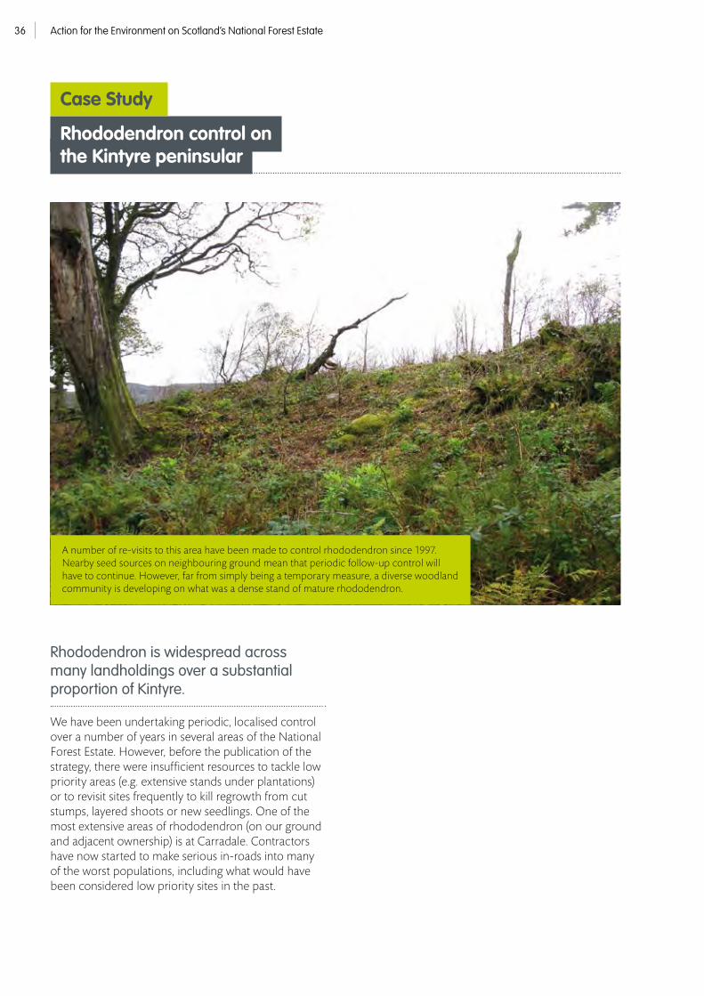
Rhododendron is widespread across many landholdings over a substantial proportion of Kintyre.
We have been undertaking periodic, localised control over a number of years in several areas of the National Forest Estate. However, before the publication of the strategy, there were insufficient resources to tackle low priority areas (e.g. extensive stands under plantations) or to revisit sites frequently to kill regrowth from cut stumps, layered shoots or new seedlings. One of the most extensive areas of rhododendron (on our ground and adjacent ownership) is at Carradale. Contractors have now started to make serious in-roads into many of the worst populations, including what would have been considered low priority sites in the past.
A number of re-visits to this area have been made to control rhododendron since 1997. Nearby seed sources on neighbouring ground mean that periodic follow-up control will have to continue. However, far from simply being a temporary measure, a diverse woodland community is developing on what was a dense stand of mature rhododendron.
Rhododendron control on the Kintyre peninsular
Case Study
Action for the Environment on Scotland’s National Forest Estate 37
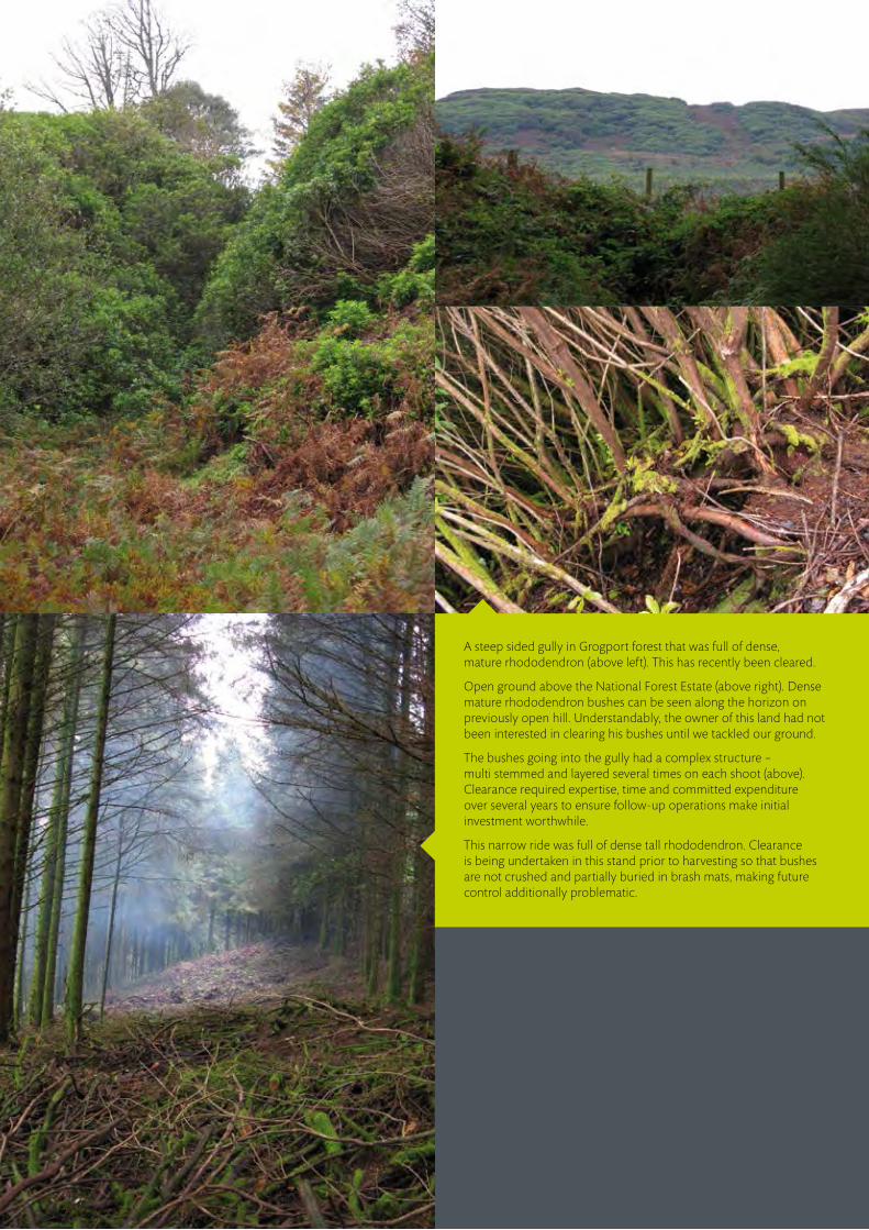
A steep sided gully in Grogport forest that was full of dense, mature rhododendron (above left). This has recently been cleared.
Open ground above the National Forest Estate (above right). Dense mature rhododendron bushes can be seen along the horizon on previously open hill. Understandably, the owner of this land had not been interested in clearing his bushes until we tackled our ground.
The bushes going into the gully had a complex structure – multi stemmed and layered several times on each shoot (above). Clearance required expertise, time and committed expenditure over several years to ensure follow-up operations make initial investment worthwhile.
This narrow ride was full of dense tall rhododendron. Clearance is being undertaken in this stand prior to harvesting so that bushes are not crushed and partially buried in brash mats, making future control additionally problematic.

Action for the Environment on Scotland’s National Forest Estate38
Figure 11 illustrates the range of species encountered and the areas involved. Figures are adapted from our Tactical Planning Module and illustrate gross areas with INNpS. This does not reflect the relative abundance of individual species. For example, there is much more Japanese knotweed (Fallopia japonica) on the estate than salmonberry (Rubus spectabilis). However, the latter is typically scattered over wide areas whereas the former usually occurs in confined clumps.
Figure 12 illustrates the gross polygon area of recorded or planned INNpS control in each Forest District. Once again, this does not entirely reflect the amount of activity. For example, Scottish Lowlands Forest District have recently done extensive surveying of INNpS (including rhododendron) and, in 2012/13 invested in stem injection equipment for control of Japanese knotweed. They treated three separate areas during 2013/14. Stem injection of knotweed and other hollow-stemmed INNpS more effectively targets herbicide and allows application during rain and near water courses (under licence from SEPA).
Management of other invasive non-native plant species (INNpS)
District 2011/12 2012/13 2013/14 2014/15 2015/16 2016/17
Salmonberry 3 11 49
Japanese knotweed 0.1 14.7 0.1
Michelmas daisy 12
Gaultheria 1.5 1.5 0.2 2 2
Pirri pirri burr 0.1 0.1
Gunnera 0.1
Buddliea 0.1
Two-spine aceana 0.1 0.1
Giant hogweed 0.95 0.95
Himalayan balsam 5 5
Skunk cabbage 5 5 5.1 5.1
Multiple species 0.3 30.1 0.3 41 41
Figure 11. Gross area of INNpS on the National Forest Estate where control is recorded or planned (ha)
As well as rhododendron, a number of other invasive non-native plant species occur on the National Forest Estate. These are small isolated pockets arising from dumped garden waste and soil, more extensive patches along rivers and loch-sides or colonisation from game cover and ornamental plantings on private estates and gardens.

Action for the Environment on Scotland’s National Forest Estate 39
Figure 12. Gross area of INNpS control over a 6 year period
Galloway (54.2)
Dumfries & Borders (21)
Scottish Lowlands (1.3)
Tay (3.2)
West Argyll (5.9)
Cowal & Trossachs (12)
Lochaber (22.7)
Inverness, Ross and Skye (11.4)
North Highland (0)
Moray & Aberdeen (83.4)
Minard forest is located on the west side of Loch Fyne. A number of INNpS are present. There is extensive rhododendron that has been treated in the past but needs follow-up treatment; this probably spread into the forest by seed from adjacent estate grounds. Along forest roadsides, there are clumps of buddleia (Buddleja davidii) and Himalayan honeysuckle (Leycesteria formosa), the former probably spread by dumped garden waste and the latter either by the same route or bird dispersed seed from nearby gardens / estate ground. Along the coast, there are large patches of mombretia (Crocosmia x crocosmifolia) and salal (Gaultheria shallon), the former probably spread by vegetative means from the loch and the latter either by the same route or by bird dispersed seed from neighbouring ground.
Treatment of Gaultheria has been programmed for 2015/16 and 2016/17. This will hopefully leave sufficient time for current research work to reach conclusions on the best form of treatment.
Gaultheria has a waxy leaf and is very difficult to control with herbicides. The majority of Gaultheria in Minard are on the edge of the loch, suggesting that propagules have been washed up from the water. However, this is not necessarily the case as this species is intolerant of late spring frost and may only be able to thrive in such micro-sites.
Gaultheria is the most threatening species after rhododendron in this forest. Substantial thickets have established along the loch-side, a zone of naturally high biodiversity. Also within this zone is a significant amount of mombertia. This is forming a dense sward, eliminating other vegetation.
Invasive non-native plant species at Minard, West Argyll
Case Study

Action for the Environment on Scotland’s National Forest Estate40
Gultheria shallon on the shore of Loch Fyne (above left) and regeneration onto fallen deadwood further into the forest (above right).
Extensive stands of Japanese knotweed grow along the side of Loch Fyne, north of Minard forest (below left). This species is dispersed very efficiently by water. We will need to survey all loch-side areas of forest in the future where there are known local populations of INNpS adjacent to the National Forest Estate.
Leycesteria (below right) and buddleia (right) only occur as a few scattered bushes, mostly along forest roads. They are not very threatening currently but will be removed to avoid dispersal into the wider forest.

Action for the Environment on Scotland’s National Forest Estate 41
Culreach lies in the lower reaches of the River Spey. This is an ancient woodland site under restoration to native woodland. Around 2001, plantation was clear felled over three quarters of the landholding (31 hectares in total) leaving patches of wet woodland dominated by common alder, willow and sycamore. This woodland lies above the floodplain and braided river shingle of the Spey and is occasionally inundated during floods. The Spey Foundation carried out a comprehensive survey of the river in 2012 to assess the location and abundance of INNpS.
Japanese knotweed and Himalayan balsam were found to be highly prevalent and abundant in the lower Spey, starting 22 km upstream of Culreach. Giant hogweed was again abundant, originating from a tributary that enters the Spey 11 km north of Culreach. River gravels and disturbed alluvial soils make an excellent substrate for the germination of seeds (from Himalayan balsam and giant hogweed) and vegetative material (Japanese knotweed). The dispersal of these by the river means a constant supply of propagules to Culreach.
Giant hogweed (Heracleum mantegazzianum) and Himalayan balsam (Impatiens glanulifera) growing in amongst a complex vegetation structure at Culreach prior to initial control.
© Alan Campbell
Invasive non-native plant speciesin Culreach wood, River Spey SSSI
Case Study

Action for the Environment on Scotland’s National Forest Estate42
The wet woodland is part of a designated feature on the Lower River Spey SSSI. This is currently in an Unfavourable Declining condition overall but Partially Recovering on the National Forest Estate due to work undertaken and plans in place to tackle INNpS.
Control of the three species took place across Culreach in 2012/13 and 2014/15 follow-up treatments are planned in 2015/16.
In the face of such an abundant source of colonisation upstream, we are inevitably going to have to repeat clearance in the future. However, we have a responsibility to keep designated features in Favourable condition and, if left until there is a co-ordinated strategy to deal with INNpS, it will become a huge and daunting task to effectively control the additional plants that establish by that time, especially given recent disturbance from clearfelling and the increasingly complex structure and composition of vegetation within which these species would have to be located.
Japanese knotweed colonising gravel deposits.
Giant hogweed near Fochabers, upstream from Culreach.
© Brian Shaw

Action for the Environment on Scotland’s National Forest Estate 43
Polloch is a small, remote settlement close to Loch Shiel, approximately 11 km to the east of Acharacle. Skunk cabbage (Lysichiton americanus) is thought to have spread by seed along a small stream from a private garden. Over a 10 year period, approximately 24 plants established along the backwaters that flood periodically from the Polloch River.
Volunteersfrom the Strontian Angling Association have been working in partnership with FES over two consecutive years to remove this invasive species.
Each plant has been carefully dug out to ensure that the whole of the long tap root is removed. For the first few years, seedlings do not have the large signature leaves and can be easily missed. All likely areas have had to be thoroughly searched to look for seedlings in amongst tall vegetation. Pete Madden, FES Conservation Ranger and member of the Angling Association says “Skunk cabbage is relatively slow to establish but our aim is to remove all plants before they get a chance to mature and produce seed, at which point they are likely to quickly colonise the still water lagoons of the Loch Shiel SSSI.”
Skunk cabbage controlat Polloch River, Lochaber
Case Study
The lower reaches of the Polloch River and still water lagoons, both of which are SSSI and SAC.
Skunk cabbage. A flooded backwater of the Polloch River, typical habitat for skunk cabbage colonisation.
The occasional plant is still seen along the river and removed. However, the Angling Association are encouraging the new owners of the private garden to dig out the original source so careful surveillance over the next three to five years should hopefully lead to the eradication of skunk cabbage from the Polloch area.
© Pete Madden
© Pete Madden© GBNNSS

Action for the Environment on Scotland’s National Forest Estate44
We will identify particularly
vulnerable speciesfor which the National Forest Estate is important and take specific conservation action.
Key Species
UPDATE ON

Action for the Environment on Scotland’s National Forest Estate 45
A specific activity set out in our Strategic Directions is that “we will strengthen our monitoring and status reporting for key species and habitats.” Over the last decade, an increasing amount of species-specific conservation work has been undertaken. Many species have benefited from this effort and FES is now developing a more structured and prioritised approach. Monitoring programmes for priority species are now in place and the quality of survey work is improving, allowing the establishment of a knowledge-based adaptive management approach to species conservation. This will increase the benefits for priority species and maximise the value for money that can be achieved.
Species conservation action on the National Forest Estate is also being more effectively targeted towards species the organisation can make a meaningful difference to. The six species identified as priorities for conservation action in Forestry Commission Scotland’s Woods for Nature biodiversity programme are: capercaillie, black grouse, red squirrel, pearl-bordered fritillary, chequered skipper and juniper.
We will strengthen our monitoring and status reporting for key species and habitats.
© Luke Massey/2020VISION

Action for the Environment on Scotland’s National Forest Estate46
Figure 13. Specific conservation action for capercaillie on the National Forest Estate between April 2008 and March 2014
Predator Habitat Deerfence Deerfence Monitoring (ha) control (ha) work (ha) marking (m) removal (m)
11,817* 6,272 8,735 500 35,000*
* Approximate mean area each spring, average over six springs (2008 to 2013)
Conservation action for capercaillie
Fence marking and fence removal have been shown to be beneficial and virtually all deer fences that pose a risk to capercaillie have been removed from forest blocks with resident capercaillie. The remaining fences have been marked to make them more visible to capercaillie.
The habitat work listed in Figure 13 covers actions primarily aimed at improving habitat for broods e.g. swiping heather (Calluna vulgaris) and uneconomical thinning of trees to increase the amount of blaeberry (Vaccinium myrtillus), which is the most important feeding habitat for capercaillie broods. The association between capercaillie broods and blaeberry habitat is well established and there is unanimous expert opinion that these management actions are worthwhile. In addition to this specific work, hundreds of hectares of thinning work has been carried out within forests occupied by capercaillie. This work is beneficial to capercaillie because it increases the light availability within plantations and stimulates the growth and spread of key food plants for capercaillie, such as blaeberry.
The requirement of capercaillie for large areas of suitable forest habitat is also being taken into consideration in Forest Design Plans, and approximately 10,000 ha of important forest blocks are now being managed using capercaillie-friendly alternatives to clear felling. On top of this, operations in woods that have capercaillie are carried out in ways to minimise disturbance of this heavily protected species. Finally, FES is an active member of the Capercaillie Biodiversity Action Plan Steering Group.
Since March 2008, a detailed record has been kept of work for capercaillie (Tetrao urogallus) on the estate that was being done as part of the government-agency-wide Species Action Framework and the Forestry Commission Scotland Woods for Nature biodiversity programme. Figure 13 summarises the work done between 2008 and 2014.
Predator control is carried out in some forest blocks and involves culling of carrion crows (Corvus corone), hooded crows (Corvus cornix) and red foxes (Vulpes vulpes) in spring and early summer to reduce predation on capercaillie broods. This action is well-supported scientifically, but culling efforts in spring do not guarantee improved breeding success as heavy rain and cool temperatures in June can kill many small chicks. The long-term sustainability of predator control is questionable, particularly if compensatory increases in predation by pine martens (Martes martes) and other predators occur.
Over the last decade, a great deal of work has been carried out on the National Forest Estate for capercaillie, including participation in the Capercaillie LIFE Project.

Action for the Environment on Scotland’s National Forest Estate 47
Capercaillie monitoring on the estate is done by counting all known occupied leks and as many of the defunct leks as possible each year.
Leks counts started in 1999 and most leks have been counted each year in Scotland (and on the National Forest Estate) since 2002. In addition, brood counts using highly-trained pointer dogs are carried out on a selection of our sites each year. Brood counts are important because low productivity is the proximate cause of decline in Scotland, so understanding trends is crucial.
Since 1999, capercaillie has gone extinct or effectively extinct (i.e. no known leks) from the following blocks: Black Isle, Elchies, Ferness, Hill of Wangie, Monaughty, Bunzeach, Allean, Errochty and Glen Affric. However, the number of male capercaillie on leks on the estate increased from 37 in 1999 to 57 in 2013 (Figure 14). The overall increase since 1999 is, in small part, due to increased survey effort in the early years, though effort has been reasonably consistent since 2002.
In the main, though, the increase in lekking males is due to events in two FES sites in Strathspey, where the populations have increased, both in number and in range. Capercaillies have spread back throughout these woods in the last 10 years, and even recolonised a neighbouring estate. The events in this part of Strathspey are in stark contrast to the ongoing and rapid decline throughout the rest of Scotland.
If lek data from the two sites in Strathspey are removed, the number of male capercaillie at the other National Forest Estate leks has declined from 37 in 2002 to 15 in 2013. In 2002, 27 leks were counted and 23 were extant, with a total of 43 males. Only 13% (3/23) of the extant leks and 14% (6/43) of the males were in the two FES sites in Strathspey in 2002. In 2013, 51 leks were counted and 25 were extant, with a total of 57 males. However, 65% (15/23) of the extant leks and 74% (42/57) of the males are now located in the two FES sites in Strathspey.
Survey and monitoring
50
60
70
40
1999 20062000 20072001 20082002 20092003 20102004 20112005 2012 2013
30
20
10
0
Figure 14. Number of leks and lekking capercaillie on the National Forest Estate
Number of extent leks
Total number of lekking males
Number of leking males at two FES sites in Strathspay

Action for the Environment on Scotland’s National Forest Estate48
Scots pine plantation with blaeberry – an extremely good habitat for capercaillie chicks.
Low productivity is the main proximate cause of the decline in capercaillie. The national average for the number of chicks per hen (for all counts combined) reared in Scotland between 2002 and 2013 was 0.76 ± 0.11 (SE). In other words, individual hens produced less than one chick per year on average. By comparison, in the 1980s, capercaillie hens routinely produced three or four chicks every year. However, it was estimated by Robert Moss in the year 2000 that, in the absence of fence-related mortality, each hen needed to produce only 0.62 chicks per year on average to maintain a stable population. This calculation may no longer be valid (e.g. due to changes in the predator guild), but it is the best available. Capercaillie productivity varies greatly across Scotland and is generally much better in Strathspey, which partially explains why the population persists in this area. On the National Forest Estate, approximately two-thirds of the 75 brood counts that have been done since 2002 have produced a productivity figure below the 0.62 chicks per hen estimate. On most sites on the estate it is now difficult to locate any hens during brood counts. In recent years, the best performing sites have been the two FES
sites in Strathspey. The number of hens on these has increased over the last decade. In three of the last six years, one of these forests has had productivity well above 0.62 chicks per hen, and has been very close to it in the other three years. In the other, the productivity has been well in excess of 0.62 chicks per hen in five of the last six years. This reasonably good breeding performance coincides with the observed increase in lekking males at these two sites.
There is a growing belief that thinning of pine woods benefits capercaillie productivity by changing the status of blueberry, and we are working with the James Hutton Institute to investigate this phenomenon. Early results indicate that racks provide good growing conditions for blaeberry combined with a particularly good thermal environment for insects such as caterpillars, which are a crucial component of the diet of capercaillie chicks. It is increasingly apparent that management of pine forests for the production of timber creates very suitable habitat for capercaillie.

Action for the Environment on Scotland’s National Forest Estate 49
The national capercaillie population is declining rapidly across the majority of its range and an increasing proportion of the population is now found in Badenoch & Strathspey.
This pattern is reflected in the data presented in Figure 14. The decline is mainly due to poor productivity at most sites (rather than low adult survival). The proximate reasons for this level of productivity are predation, habitat fragmentation and unsuitable weather in spring and summer. The interaction of these factors is important. Research indicates that landscape factors are influential in the demise of capercaillie at individual sites in Scotland. For example, capercaillies are more likely to disappear from forest blocks that are set in agricultural landscapes with high densities of generalist predators and few gamekeepers. The Black Isle and Monaughty forest blocks are two good examples of this situation. The lesson is that irrespective of how well FES manages forests for capercaillie, populations may decline on National Forest Estate blocks because of factors that are prevalent in the wider landscape. Hence it is important that management for capercaillie is carried out in a coordinated way that necessarily involves numerous ownerships.
In the two FES sites in Strathspey, the situation is much more positive and is probably a result of the combination of specific management for capercaillie, the silvicultural activities and the landscape context. All fences have been removed, forest restructuring is creating good habitat, and predator control is practised in the wider landscape; so generalist predator densities are probably lower than in other parts of the capercaillie range.
In summary, despite exemplary management, capercaillie are declining rapidly in most FES forests. This is mainly due to wider landscape issues that cannot be influenced. However, in two FES forests in Strathspey, the populations are performing comparatively very well, and this is probably due to a combination of management and the relatively favourable landscape context. Learning more about what is going on in these sites in Strathspey is potentially crucial. In addition, appropriate management of the native forests within the recently acquired North Rothiemurchus Pinewood SSSI may be vital for the future of this species in Scotland.
Conclusions from capercaillie monitoring
• FES is collaborating with the James Hutton Institute to investigate the effects of forest operations on capercaillie habitat.
• FES is carrying out a pine marten GPS- tagging project to understand foraging behaviour in Glenmore.
• Recent collaboration with Dr Robert Moss has resulted in a published scientific paper on the effects of recreational disturbance on capercaillie. This research is being used to inform the management of recreation on the NFE.
Applied research

Action for the Environment on Scotland’s National Forest Estate50
Conservation action for black grouse
This work is summarised in Figure 15. The logic and objectives of this work for black grouse (Tetrao tetrix) are identical to those for capercaillie – to improve breeding success and to reduce adult mortality. Particularly impressive is the programme of drain blocking, which has been carried out mainly within Galloway Forest Park. Over the next few years this work will result in significant changes in the vegetation – e.g. more cotton grass (Eriophorum spp.) – which should increase black grouse productivity.
It is also evident from Figure 15 that a large amount of fence removal or marking work has been done to reduce the number of black grouse that are killed through collisions with deer fences. However, there remains a lot of fencing on the. For example, in North Highland, Inverness, Ross & Skye, and Moray & Aberdeenshire Forest Districts combined, there is approximately 1000 km of deer fencing. New deer and stock fencing is erected every year. The Forestry Commission policy and the technical solutions are encompassed in a new guidance note: Forestry Commission Technical Note 19: Fence marking to reduce grouse collisions (Trout, R. & Kortland, K. 2012).
An increasing amount of work has been carried out on the National Forest Estate over the last five years in regards to black grouse.
© Mark Hamblin/2020VISION

Action for the Environment on Scotland’s National Forest Estate 51
Black grouse monitoring is done by counting leks and this has been carried out for many years – though generally not in a coordinated way and with significant variations in effort among years and between areas.
In 2007, a concerted effort was made to find and count all leks on or near the National Forest Estate. In total 377 leks with 614 cocks were found, with 237 of these leks located on the estate. In subsequent years, various subsets of these 237 leks were counted again for various reasons. Interpretation of these data is difficult because they were collected within varying and unknown effort and because lek names and localities are inconsistently recorded. Counting 237 leks annually is not realistic. Therefore a set of 13 areas called Defined Monitoring Areas (DMAs) was identified in 2011 and these are surveyed for leks each spring. The DMAs are listed in Figure 16.
Basing black grouse monitoring on counts of known leks only has many problems. The main ones are that leks move over time, not all cocks attend leks every day, cocks routinely move among leks, and cocks will display individually or in small groups away from main leks and at frequently changing locations. Therefore, the usual method of counting ‘traditional’ known leks only, and making no attempt to also search systematically for birds in surrounding areas, is flawed and can yield underestimates of the population. To overcome these problems, FES surveys the entire area of each of the DMAs in the spring of each year, using a consistent method and the same amount of effort. The aim is to count the known leks, and to locate and count other males displaying (or loafing or feeding) elsewhere within the DMAs. Females are also counted.
Survey and monitoring
An assessment of the specific habitat work being carried out for this species reveals that it is mainly targeted at improving brood habitat in key areas by manipulating the vegetation e.g. by swiping or ‘wetting up’. These are appropriate actions that are supported by a good range of scientific research and management experience. These types of actions also represent reasonable value for money, which contrasts markedly attempts to manipulate tree densities along the edges of existing crops. This expensive management prescription currently has limited scientific underpinning yet has been widely advocated, apparently based on anecdote and an interpretation of black grouse habitat use in natural and extensive boreal habitats.
Although black grouse will use these ‘feathered’ edges, there is no evidence that such features can significantly enhance population performance parameters (i.e. productivity or survival). In fact, evidence from a recently completed radio-tracking study, which was part-funded by FES, indicates that forestry is a secondary habitat for black grouse in Scotland, and that conservation efforts should focus on maintaining open habitats, such as heather moorland. Even if edge feathering was shown to have the potential to be beneficial at a population level, it would difficult to carry out a sufficient amount of this action due to the expense involved.
As is the case for capercaillie, operations are planned to avoid disturbance of black grouse leks, and FES are active members of the Scottish Black Grouse Biodiversity Action Plan Steering Group. In addition, FES staff on Arran are active members of a project that is trying to reintroduce black grouse onto the island; a project which has been approved by the BAP group.
Predator Habitat Drain Deer fence Deer fence Stock fence Monitoring Control (ha) work (ha) blocking (m) marking (m) removal (m) removal (m) (ha)
16898* 10638 59660 35900 35286 7900 75739
Figure 15. Specific conservation action for black grouse on the National Forest Estate between April 2008 and March 2014.
* Approximate mean area each spring, average over six springs (2008 to 2013)

Action for the Environment on Scotland’s National Forest Estate52
The set of DMAs have been chosen because they represent a good geographical spread of sites across Scotland; they have good populations of black grouse, or the potential for population growth; and because each site encompasses a meaningful area of FES forest margin and open ground. Some of the sites (e.g. Campsie Glen) are new acquisitions and it will be informative to monitor the response of black grouse to our tree planting and concomitant reductions in grazing on these sites.
Two of the DMAs – called ‘Fort Augustus’ and ‘Galloway Forest Park’ – are sites that were part of the FES/FRS/RSBP Black Grouse Trial Management Project (TMP). Population monitoring was part of the TMP and this has been continued by FES on these two sites.
The Black Grouse Trial Management Project (BGTMP) was set up in 2006. The aim of this project was to identify management prescriptions which could be undertaken and included in commercial forestry design plans to provide suitable habitat for black grouse. Two parts of the National Forest Estate were included within the trial and lek monitoring has taken place, annually, since 2007. The count areas are both DMAs and encompass 14 3 km2 grid squares in the Fort Augustus area in Inverness, Ross & Skye FD, and 15 3 km2 grid squares in Galloway Forest Park in Galloway. The results of this monitoring are summarised in Figure 17 (summarising the data from the period 2007 to 2013 from the Galloway Forest Park DMA and the Fort Augustus DMA.
Forest Defined Area (ha) 2011 2012 2013 District Monitoring Area males males males
NH Dalchork 9,900 9 7 10
IR&S Fort Augustus 11,359 13 16 13
IR&S Glenmore 1,000 12 16 11
IR&S Glen Affric 2,331 8 10 18
Tay Glen Isla 1,500 13 13 14
Lochaber Glen Garry 7,200 2 8 4
WA Dalbuie 600 24 19 7
WA Eredine & Brenchoille 2,700 16 8 6
C&T Loch Katrine 8,289 90 66 65
Scot Low Cochno Hill & Gavinburn 1,294 9 13 3
Scot Low Campsie Glen 892 1 0 1
D&B Glen Tress 1,259 20 15 13
Galloway Galloway Forest Park 27,415 48 56 71
Total 75,739 265 247 242
Figure 16. Black grouse defined monitoring areas on the National Forest Estate

Action for the Environment on Scotland’s National Forest Estate 53
Black grouse monitoring needs to be carried out for several (ideally many) seasons before trends can be determined. This is partly because the counting conditions can vary between years and partly because population changes can happen over long periods. However, black grouse populations can also fluctuate dramatically over short time periods at a local level – often in response to a change in land management (e.g. exclusion of grazing prior to planting trees). This is a natural process for a species that is well adapted to ecological perturbations. Therefore, it is important to monitor a large number of sites across a wide geographical area to obtain a national picture of what is happening to the population.
All FES data are also contributed to the national black grouse monitoring scheme. However, even after a few years, the DMA programme of lek monitoring is yielding much useful information on the distribution of lekking males, which informs forest management for this species. A significant additional benefit of the DMA approach is that it offers the possibility of undertaking studies into the factors that affect black grouse populations. This is important as the ecology of this species is surprisingly poorly understood – particularly the factors that drive populations.
Conclusions from black grouse monitoring
Galloway Forest Park DMA All TMP leks 2007 2008 2009 2010 2011 2012 2013
No. Males 73 57 54 67 61 70 84
No. Leks 30 26 27 26 23 29 44
Mean Males/lek 2.4 2.2 2 2.6 2.7 2.4 1.9
TMP leks on the National Forest Estate
No. Males 57 42 39 56 48 56 71
No. Leks 24 20 21 22 19 22 38
Mean Males/lek 2.4 2.1 1.9 2.5 2.5 2.5 1.9
Fort Augustus DMA All TMP leks 2007 2008 2009 2010 2011 2012 2013
No. Males 160 151 111 148 161 135 98
No. Leks 38 38 34 41 47 39 36
Mean Males/lek 4.2 3.9 3.3 3.6 3.4 3.5 2.72
TMP leks on the National Forest Estate
No. Males 21 23 11 17 13 16 13
No. Leks 10 7 7 7 8 9 8
Mean Males/lek 2.7 3.3 1.6 2.4 1.5 1.8 1.6
Figure 17. Black Grouse Trial Management Project (TMP) data from 2007 to 2013

Action for the Environment on Scotland’s National Forest Estate54
• Lekking groups in the Tay region and elsewhere strongly selected for moorland. Regions had similar compositions of habitats around leks, on average 61-68% moorland- type habitat and 9-15% young forest.
• For 90 home-ranges identified there were differences in habitat selection between males and females. Moorland was strongly selected by all groups. Broadleaf woodland and farmland were selected by males but avoided by females. While closed-canopy and unplanted forestry were avoided by males and by females in spring-summer, they were either used according to their availability or selected by females in autumn-winter. Relative use of mature forest was greatest in winters when weather conditions were harsher. New native pinewood was increasingly avoided by males as they aged and from autumn-winter to spring-summer, whereas females selected for this habitats as adults.
• Females moved significantly further from open habitats into commercial forestry. Movement into forestry appeared greatest where larch or substantial unplanted areas (clearings/rides) were present.
• Moorland areas of at least 2-5 km2 should be protected from afforestation to sustain lekking groups. Forests should be managed to provide a diverse age structure adjacent to these moorland areas, in particular by providing access to both young and mature forest for a single lekking group. Designing boundaries to include more unplanted patches and larch may be beneficial when they mature.
• This research showed that maintaining open moorland is the crucial action for black grouse. The work indicates that expensive interventions in woodland – such as ‘feathering edges’ – are unnecessary as they utilise ‘normal’ plantations.
Applied research The Game and Wildlife Conservation Trust have conducted a major black grouse radio-tracking study. This was funded by SNH, CNPA and FES. The project investigated the spatial and structural requirements of black grouse in Scottish forests and some of the findings are as follows:

Action for the Environment on Scotland’s National Forest Estate 55
© Mark Hamblin/2020VISION

Action for the Environment on Scotland’s National Forest Estate56
There is evidence that the control of grey squirrels (Sciurus carolinensis). is at least partially effective in helping red squirrels (Sciurus vulgaris). In Moray & Aberdeenshire Forest District, for example, red squirrels appear to be increasing in number and they are even now more common in parts of Aberdeen itself! This success is due to the relatively limited geographical range of grey squirrels in that part of Scotland, which means the eradication of grey squirrels may be a practicable proposition. However, in the other parts of Scotland the magnitude of the task is enormous and the financial sustainability of the action may be an issue.
New research indicates that squirrel pox is likely to spread rapidly through grey squirrel populations in southern and central Scotland, and beyond. Targeted control may help to stop or slow the progress of the disease, but will require that very low densities of grey squirrels are achieved. FES will continue to adapt its squirrel management approach as new research emerges.
Conservation action for red squirrel
FES efforts for red squirrels are focused on four main actions: grey squirrel control; protection of red squirrels during forestry operations; ‘stronghold’ establishment and management; and population monitoring.
© Peter Cairns/2020VISION

Action for the Environment on Scotland’s National Forest Estate 57
In addition to grey squirrel control, a large effort is made by Environment staff in all Forest Districts to detect red squirrel dreys during pre-operational coupe surveys and to protect them during operations. Again, applied research is being conducted to inform this issue. Figure 18 summarises the main action for red squirrels on the National Forest Estate since April 2008.
Red squirrel strongholds – Red squirrels are a significant management consideration in all FES plans for forests within their range. However, following a public consultation in 2009, Forestry Commission Scotland has established a suite of 18 public and private forest areas, plus the Island of Arran, as red squirrel strongholds. Specific guidance has been developed on how to manage these strongholds.
The overall objective is to manage the habitat to confer a competitive advantage on red squirrels and to disadvantage grey squirrels. More than two thirds of the stronghold area is on the estate (Figure 19) where FES will be responsible for securing populations of red squirrels in the long-term. The four sites in bold are those where the pilot population monitoring study is being conducted (please note that the table does not include Arran, which is a default stronghold that is subject to specific management for red squirrels).
Grey squirrel control in Grey squirrel control Pre-operational D&BFD and Galloway FD in other forest districts coupe surveys for dreys (approx ha/year) (approx ha/year)
> 60,000 > 5,500 All forests with red squirrels
Figure 18. Specific conservation action for red squirrels on the National Forest Estate between April 2008 and March 2014.
Figure 19. Area of FES woodland ownership in strongholds and number of transects.
Stronghold Woodland (ha) % in National FES (ha) Number name Forest Estate of transects
Morangie Forest 5,467 84 5614.56 30
Glen Glass 3,649 0 -
Black Isle 3,470 89 3250.28 30
Culbin 2,977 90 2764.8
Ordiequish-Aigan 5,696 85 5278.5
Daviot-Moy 3,751 57 2463.54
Abernethy 3,476 0 -
Inshriach-Glenfeshie 3,736 79 3419.91
Glentochty 2,224 68 1634.72
Balmoral-Inver 3,998 4 184.96
Leanachan 3,643 71 2849.23
South Rannoch 3,378 94 3295.64
Inverliever 8,549 98 9237.48
Eredine 11,610 69 9936.69
Kilmichael 8,200 92 8374.76
Glenbranter 6,079 99 8516.97 40
Eskdalemuir 12,055 31 3894.53
Fleet Basin 8,548 99 9189.18 40
Totals 100,506 68 79905.75

Action for the Environment on Scotland’s National Forest Estate58
Monitoring of red squirrel population trends is technically difficult due to the fluctuating populations and the problems of detection. FES is undertaking a pilot population study in four strongholds (Morangie, Black Isle, Glenbranter and Fleet).
These four sites comprise two northern, Scots pine dominated forests, and two southern, spruce dominated forests. Feeding sign surveys will be used and the methodology is described in detail in the Forestry Commission Practice Note Practical techniques for surveying and monitoring squirrels (October 2009).
The pilot study across four sites is necessary in order to assess the practicability and cost of the method, and to determine what changes in population size the method is able to detect. If the method has low power to detect population changes, it may require to be altered. The objective will be to generate an annual abundance index for each stronghold, in order to be able to detect large-magnitude population-threatening declines or increases at the level of individual strongholds. Based on previous work by Peter Lurz, the target magnitude of change that the monitoring will aim to detect will be at least 50% (i.e. the method will detect declines or increases of 50% in any one year). As the same method has been used across all strongholds, the resultant indices will be comparable among strongholds and, over a number of years, will give a coarse indication of population trends both within and among strongholds.
The advantages of using feeding sign surveys are that they are within the resource capabilities of Forestry Commission Scotland, and that they provide an index of the food availability (i.e. cone crop) for squirrels. The combination of the cone crop data, plus data from the monitoring of the carrying capacity of a stronghold (i.e. the age class distribution of tree crops), plus the feeding signs surveys, should yield a reasonably good understanding of squirrel population trends.
In the pilot study, the 50 m x 1 m transects are placed at a density of approximately one per 200 ha and are roughly representative of the available tree species and tree age composition. There are a minimum of 30 transects per stronghold. The maximum number of transects per stronghold is 40. Pine and larch crops are at least 25 years old, and spruce crops at least 30 years old. Transects are distributed as evenly as possible across the stronghold (but only on the NFE) and sample the dominant tree species with multiple replicates.
The entire set of transects for each stronghold is visited twice a year; once during October or early November to clear transects and again six months later (April or May) to collect the cones. For each transect, data on the characteristics of the stand are also collected in year one; namely, tree species, age of crop, provenance, and aspect to allow future analysis that can relate stand characteristics with observed coning and feeding patterns once sample sizes are sufficient. Together with published estimates on red squirrel energy requirements, and seed energies for different tree species, the data are used to calculate a simple, annual index of red squirrel population numbers.
Survey and monitoring
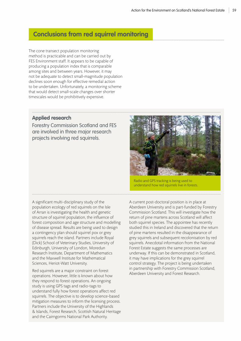
Action for the Environment on Scotland’s National Forest Estate 59
The cone transect population monitoring method is practicable and can be carried out by FES Environment staff. It appears to be capable of producing a population index that is comparable among sites and between years. However, it may not be adequate to detect small-magnitude population declines soon enough for effective remedial action to be undertaken. Unfortunately, a monitoring scheme that would detect small-scale changes over shorter timescales would be prohibitively expensive.
Conclusions from red squirrel monitoring
A significant multi-disciplinary study of the population ecology of red squirrels on the Isle of Arran is investigating the health and genetic structure of squirrel population, the influence of forest composition and age structure and modelling of disease spread. Results are being used to design a contingency plan should squirrel pox or grey squirrels reach the island. Partners include Royal (Dick) School of Veterinary Studies, University of Edinburgh, University of London, Moredun Research Institute, Department of Mathematics and the Maxwell Institute for Mathematical Sciences, Heriot-Watt University.
Red squirrels are a major constraint on forest operations. However, little is known about how they respond to forest operations. An ongoing study is using GPS tags and radio-tags to understand fully how forest operations affect red squirrels. The objective is to develop science-based mitigation measures to inform the licensing process. Partners include the University of the Highlands & Islands, Forest Research, Scottish Natural Heritage and the Cairngorms National Park Authority.
A current post-doctoral position is in place at Aberdeen University and is part-funded by Forestry Commission Scotland. This will investigate how the return of pine martens across Scotland will affect both squirrel species. The appointee has recently studied this in Ireland and discovered that the return of pine martens resulted in the disappearance of grey squirrels and subsequent recolonisation by red squirrels. Anecdotal information from the National Forest Estate suggests the same processes are underway. If this can be demonstrated in Scotland, it may have implications for the grey squirrel control strategy. The project is being undertaken in partnership with Forestry Commission Scotland, Aberdeen University and Forest Research.
Applied research Forestry Commission Scotland and FES are involved in three major research projects involving red squirrels.
Radio and GPS tracking is being used to understand how red squirrels live in forests.

Action for the Environment on Scotland’s National Forest Estate60
All of the action has been aimed at creating or improving habitat for the caterpillars; mainly by breaking up extensive areas of bracken (Pteridium aquilinum) to encourage the growth of the main larval food plant – common dog violet (Viola riviniana) – within areas of patchy bracken, which provides a warm microclimate. The management of bracken is done using cattle and by mechanical means. Clearing of invasive regeneration is another management action. Figure 20 provides a summary of the recorded action for PBF between April 2009 and March 2014.
As is the case for pearl-bordered fritillary (Boloria euphrosyne), work for chequered skipper (Carterocephalus palaemon) has been developed
significantly since 2009. Management aims to maintain open breeding habitats in and near known colonies. Breeding habitat comprises purple-moor grass (Molinia caerulea) tussocks, which provides food for the larvae, and nearby nectar plants for adults e.g. bramble (Rubus fruticosus) and bugle (Ajuga reptans). Such habitats are usually found along rides or way leaves, and on the edges of woods. Cattle and mechanical means are deployed to keep the habitat within colonies open and varied. Figure 21 provides a summary of the recorded action for chequered skipper between April 2009 and March 2014. Future conservation action should aim to increase the number of chequered skipper colonies and the degree to which they are connected.
Conservation action for pearl-bordered fritillary and chequered skipper
In partnership with Butterfly Conservation, work for pearl-bordered fritillary (PBF) on the National Forest Estate has increased over the last five years.
© Mark Hicken

Action for the Environment on Scotland’s National Forest Estate 61
Cattle grazing (ha) Mechanical control Clearance of regeneration (ha) of bracken and scrub (ha)
572 97 495
Figure 20. Specific conservation action for PBF on the National Forest Estate between April 2009 and March 2014.
Cattle grazing (ha) Mechanical control Clearance of regeneration (ha) of bracken and scrub (ha)
222 116 88
Figure 21. Specific conservation action for Chequered skipper on the National Forest Estate between April 2009 and March 2014.
In 2012, a partnership project was established between Forestry Commission Scotland and Butterfly Conservation Scotland (BCS) to substantially increase monitoring coverage of PBF and chequered skipper on the National Forest Estate and more widely across Scotland.
The project was delivered by BCS, under contract to FES and Forestry Commission Scotland. A detailed sampling strategy was formulated, with PBF and chequered skipper being sampled by a combination of single species transects, multi-species transects and timed counts.
The aims were to enable a robust trend to be calculated for each species on the estate and in Scotland; and to enable a comparison of performance for each species between the Scotland’s National Forest Estate and the rest of the UK.
The sampling strategy identified target coverage of twenty widely scattered chequered skipper sites and 25 similarly well spread PBF sites, to achieve both statistical power to detect trends and adequate geographical representation. In total, sample coverage included 47 PBF sites located in 45 1 km squares, and 34 Chequered Skipper sites in 29 1 km squares were sampled. Chequered Skipper target coverage was exceeded by 170% (14 more sites than the target), whilst PBF coverage was exceeded by 188% (22 sites more than the target). This high level of coverage was achieved by careful targeting of monitoring sites and by using both skilled local contractors (13 in total) and volunteers.
Good sample coverage was achieved across the ranges of both species (>10% of the national distribution was sampled); across the known distribution on the National Forest Estate (~40% coverage at the 1km square resolution); across habitat types and by population size category. Abundance indices were calculable at the vast majority of sites (>80%), demonstrating that good quality data were obtained on most sites. Figure 22 summarises the data gathered in all FES sites in 2013.
Survey and monitoring

Action for the Environment on Scotland’s National Forest Estate62
It is too early to infer trends in PBF and chequered skipper populations as only two years’ data have been collected. However, FES and Butterfly Conservation have successfully established a meaningful monitoring programme that will deliver the first Scottish population trends for both of these species. Running the programme in subsequent years will be straightforward. Not only will these data deliver Scottish population trends, they already contribute significantly to the United Kingdom Butterfly Monitoring Scheme and they are providing valuable management information at the site level.
Week -3 -2 -1 0 1 2 3 4 5 6 7 8 9 10 11 12 13 14 Date 3/04 3/11 3/18 3/25 4/01 4/08 4/15 4/22 4/29 5/06 5/13 5/20 5/27 6/03 6/10 6/17 6/24 7/01
Chequered Skipper 0 0 0 0 0 0 0 0 0 0 0 0 4 31 25 10 5 1
Dingy Skipper 0 0 0 0 0 0 0 0 0 0 0 0 4 3 3 2 0 0
Large White 0 0 0 0 0 0 0 0 0 0 0 0 3 3 6 6 1 0
Small White 0 0 0 0 0 0 0 0 0 0 0 14 17 0 30 25 17 0
Green Veined White 0 0 0 0 0 0 0 0 0 0 11 21 62 92 73 28 31 1
Orange Tip 0 0 0 0 0 0 0 0 0 0 14 24 33 28 4 10 5 0
Green Hairstreak 0 0 0 0 0 0 0 0 0 0 0 2 0 5 0 1 1 0
Small Blue 0 0 0 0 0 0 0 0 0 0 0 0 0 0 0 3 0 0
Common Blue 0 0 0 0 0 0 0 0 0 0 0 0 0 0 7 8 26 3
Red Admiral 0 0 0 0 0 0 0 0 0 0 0 0 0 0 0 0 0 0
Small Tortoiseshell 0 0 0 0 0 0 0 0 0 1 2 6 2 0 0 0 0 0
Peacock 0 0 0 0 0 0 0 0 0 1 21 20 9 0 1 0 0 0
Small Pearl- 0 0 0 0 0 0 0 0 0 0 0 0 3 0 6 39 43 15 Bordered Fritillary
Pearl Boarded Fritillary 0 0 0 0 0 0 0 0 0 0 1 7 55 92 43 32 6 0
Dark Green Fritillary 0 0 0 0 0 0 0 0 0 0 0 0 0 1 0 2 0 0
Speckled Wood 0 0 0 0 0 0 0 0 0 0 2 3 7 11 11 12 1 0
Scotch Angus 0 0 0 0 0 0 0 0 0 0 0 0 0 0 0 0 0 0
Meadow Brown 0 0 0 0 0 0 0 0 0 0 0 0 0 1 0 0 0 1
Small Heath 0 0 0 0 0 0 0 0 0 0 0 0 0 3 0 2 2 1
Total 0 0 0 0 0 0 0 0 0 2 51 97 199 270 209 180 138 22
Conclusions from pearl-borderedfritillary and chequered skipper monitoring
Figure 22. Example data sheet for one site for an entire year of monitoring.

Action for the Environment on Scotland’s National Forest Estate 63
15 16 17 18 19 20 21 22 23 24 25 26 27 28 29 30 Total 7/08 7/15 7/22 7/29 8/05 8/12 8/19 8/26 9/02 9/09 9/16 9/23 9/30 10/07 10/14 10/21
0 0 0 0 0 0 0 0 0 0 0 0 0 0 0 0 76
0 0 0 0 0 0 0 0 0 0 0 0 0 0 0 0 12
0 0 0 0 0 0 0 0 0 0 0 0 0 0 0 0 20
0 0 0 0 0 0 0 0 0 0 0 0 0 0 0 0 104
3 2 7 1 2 2 5 0 0 3 0 0 0 0 0 0 334
0 0 0 0 0 0 0 0 0 0 0 0 0 0 0 0 118
0 0 0 0 0 0 0 0 0 0 0 0 0 0 0 0 9
0 0 0 0 0 0 0 0 0 0 0 0 0 0 0 0 3
2 0 1 3 1 9 4 0 0 0 0 0 0 0 0 0 64
0 0 0 0 0 0 0 0 2 1 0 1 0 0 0 0 4
0 0 0 0 0 1 0 0 0 0 0 1 0 0 0 0 13
0 0 0 0 0 0 0 0 14 4 1 2 0 0 0 0 74
0 10 0 3 1 0 0 0 0 0 0 0 0 0 0 0 120
0 0 0 0 0 0 0 0 0 0 0 0 0 0 0 0 236
1 0 1 0 0 1 0 1 0 0 0 0 0 0 0 0 7
7 59 68 62 2 11 40 1 52 12 6 2 0 0 0 0 369
0 7 79 428 353 242 103 64 14 0 0 0 0 0 0 1290
9 5 3 3 1 0 0 0 0 0 0 0 0 0 0 0 23
7 8 0 0 0 0 2 0 0 0 0 0 0 0 0 0 25
29 91 160 501 360 266 154 67 85 17 7 6 0 0 0 0 2,911
Figure 22. Continued

Action for the Environment on Scotland’s National Forest Estate64
This event raised the profile of this species within FES, led to the collection of seed and promoted action more generally. The following records some of our main activities to conserve this species over the last four years. During this period, a threatening disease (Phytophthora austrocedri) of juniper (Juniperus communis) has been discovered and this has had an impact on our approach to the conservation of this key species.
Conservation action for juniper
In September 2009, we organised a seminar on juniper at Glenmore. Speakers included Plantlife and Forestart as well as experts from the Forestry Commission on the ecology and conservation of this priority species.

Action for the Environment on Scotland’s National Forest Estate 65
All populations with 50 or more bushes have been recorded on our GIS database. One of the most remarkable finds was at Slattadale on the west end of Loch Maree in Wester Ross, where a flourishing population of bushes has been discovered some distance to the west of the core area in the Central Highlands.
Another is at Fasnakyle on the hills above Glen Affric where more than 2,000 prostrate juniper have recently been recorded.
A method has been devised to monitor the condition of populations and assess options for conservation action. Monitoring has now been undertaken for all wild populations with 50 or more bushes. We will continue a rolling programme across the National Forest Estate to assess what management is required in smaller populations.
Figure 23 illustrates the condition of 50 juniper populations with 50 or more bushes. 64% of populations are in a Stable, Improving or Favourable condition
The monitoring programme has shown that there is not a simple relationship between deer impacts and juniper regeneration. On some sites juniper has responded to a sudden reduction in deer impacts with a pulse of regeneration, whilst in others deer browsing has helped juniper by suppressing more palatable birch and rowan that would otherwise shade it out.
On heathland sites, provided herbivore impacts are not excessive, populations within the estate are generally able to regenerate naturally due to limited vegetation competition and a lack of systematic muir burning. However, the rate of recruitment is often low: the Stable condition class has the highest representation of sites. This indicates that bush condition is healthy / thriving but that 10% or less of bushes are seedlings / saplings.
Our survey and monitoring work has increased our understanding of the pioneer role of juniper on sites with grass/bracken dominated vegetation (e.g. several in Highland Perthshire and the Scottish Borders). On these sites, rather than planting beside existing moribund populations in rank vegetation we now aim to create successor populations by establishing patches of >50 bushes on suitable ground within the same landscape. In doing so we are minimising risks of spreading the juniper pathogen Phytophthora austrocedri.
Survey and monitoring
Possible Phytophthora samples sent
Phytophthora
Critical
Declining
Stable
Improving
Favourable
18
20
8
10
12
14
16
6
4
2
0
Num
ber o
f site
s
Figure 23. Condition of juniper populations with 50+ bushes on the National Forest Estate

Action for the Environment on Scotland’s National Forest Estate66
We aim to use juniper to diversify existing and new plantations – and have taken steps to increase and safeguard juniper plant supply.
A number of plans have been changed to target juniper conservation since the publication of the 2008 Species Action Note, for example:
• 37 hectares of non-native conifers were felled to expand and link existing juniper stands (Glenkirk, Inverness, Ross & Skye Forest District).
• Plans are in place to open up the canopy of a surrounding birchwood to enhance juniper populations (Grandtully, Tay Forest District).
• Large herbivore impacts have been reduced and a regeneration zone has been planned around a naturally regenerating juniper population at Corserig, Dumfries & Borders Forest District.
Extensive use of juniper is planned in ‘Woodland Fringe’ habitat on the upper margins of The Merrick Kells in Galloway. Juniper plants have been grown from cuttings taken from 40 bushes around the Merrick Kells. Galloway Forest District has also established a clone bank (with 40 local clones) in a location remote from bushes growing in the wild. Plans are also in place to use juniper as an understorey species in Scots pine plantations (in Tay and North Highland Forest Districts) to provide cover for capercaillie.
Within the Loch Katrine new native woodland project 51,000 juniper have been planted since 2008; and a total of over 18,000 juniper have been planted at five new forest sites in Moray & Aberdeenshire, West Argyll, Dumfries & Borders and Scottish Lowlands Forest Districts.
Actions for juniper
This moribund bush in Mervislaw, Borders is within dense bracken that gives very poor prospects for natural regeneration. In the past, we attempted to rescue such populations by planting (note shrub tubes in the background). However, in sites that have become so competitive, we now look for dry and uncompetitive planting sites within the catchment but greater than 1 km away for biosecurity reasons.
FES Environment Ranger Louise Simpson preparing to survey an extensive area of juniper at The Bunzeach, Donside

Action for the Environment on Scotland’s National Forest Estate 67
Delamere nursery has developed an impressive juniper propagation programme to meet the projected demand for plants from FES. Whilst seed collected from Scottish forests are being pre-treated, a bank of material for vegetative propagation has been derived from plants from other nurseries or cuttings from wild populations. Propagation hedges from this material were established in 2009. Trials have been carried out at Delamere to improve the take of cuttings and speed of growth. A technique of warming the roots to encourage root development proved to be very successful; 100 mm roots were produced from small cuttings in 16 weeks. Warm beds have now been installed across the floor of a whole poly-tunnel, with the capacity to grow c. 50,000 cuttings.
Seed has been collected from 18 juniper populations on National Forest Estate sites throughout Scotland since 2009.
This is now being pre-treated so that seedlings can be grown at Delamere nursery to increase the number of seed zones included in the vegetative propagation borders and increase the genetic diversity for some of the less well represented seed zones.
2014 saw a significant increase in the number of positive cases of Phytophthora austrocedri mainly in the Highlands and Grampian. Once Forest Research pathologists understand more about it’s biology and why the disease is occurring in widespread sites with no obvious connection, we will reassess our management strategy for juniper on the National Forest Estate and take a precautionary approach in the meantime.
A juniper bush with Phytophthora austrocedri at Belmaduthy, Black Isle (above).
Some of the juniper cuttings in the heated beds at Delamere (centre).
A newly acquired population a Corserig in Nithsdale. This has heavily browsed seedlings that will benefit from localised protection from grazing in the future (left).

Action for the Environment on Scotland’s National Forest Estate68
© Ed Martin
We will continue to undertake
conservation management, condition monitoring and archaeological recording at significant historic assets;
We will continue to work with stakeholders to develop, share and promote best-practice historic environment conservation management.
Archaeology and the Historic Environment
UPDATE ON
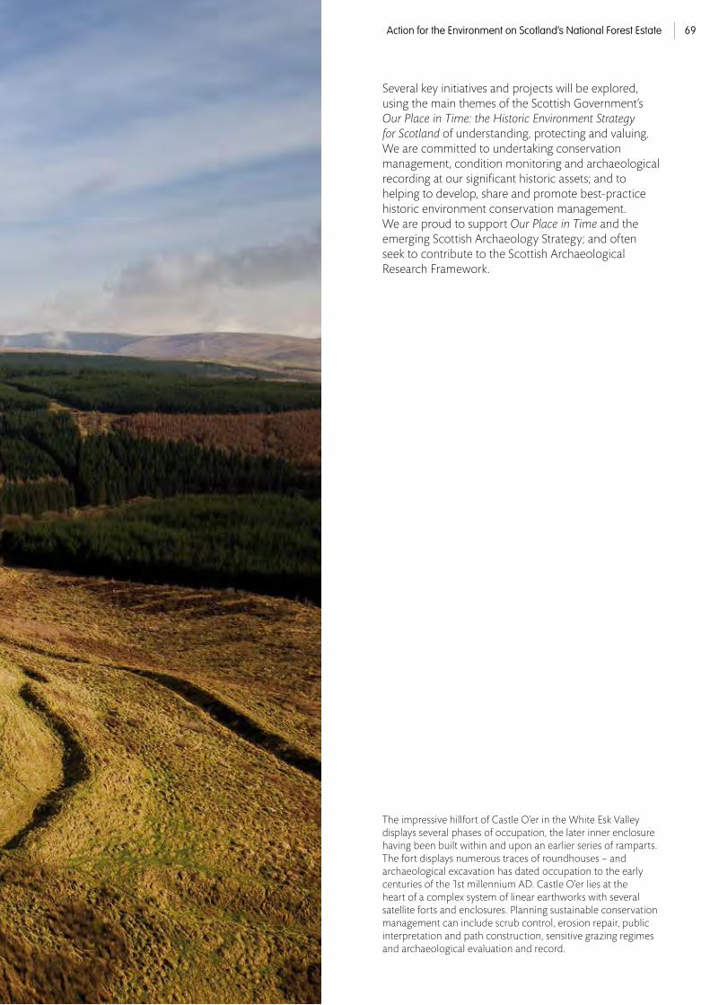
Action for the Environment on Scotland’s National Forest Estate 69
Several key initiatives and projects will be explored, using the main themes of the Scottish Government’s Our Place in Time: the Historic Environment Strategy for Scotland of understanding, protecting and valuing. We are committed to undertaking conservation management, condition monitoring and archaeological recording at our significant historic assets; and to helping to develop, share and promote best-practice historic environment conservation management. We are proud to support Our Place in Time and the emerging Scottish Archaeology Strategy; and often seek to contribute to the Scottish Archaeological Research Framework.
The impressive hillfort of Castle O’er in the White Esk Valley displays several phases of occupation, the later inner enclosure having been built within and upon an earlier series of ramparts. The fort displays numerous traces of roundhouses – and archaeological excavation has dated occupation to the early centuries of the 1st millennium AD. Castle O’er lies at the heart of a complex system of linear earthworks with several satellite forts and enclosures. Planning sustainable conservation management can include scrub control, erosion repair, public interpretation and path construction, sensitive grazing regimes and archaeological evaluation and record.© Ed Martin

Action for the Environment on Scotland’s National Forest Estate70
Forester GIS was implemented across the Forestry Commission in 1999 as a bespoke corporate GIS application to capture spatially, maintain, plan and report on forestry practices and the inventory.
Since 1999, Forester GIS has been developed on a continuous and ongoing basis to meet business requirements. The term Forester GIS describes a huge series of interlinked databases – from timber production forecasting, through forest design planning, to asset management (including nature conservation and cultural heritage). It is a UK-wide system that is used to help create every plan on the Scotland’s National Forest Estate – from Forest Design Plan to operational Work Plan. The Forester modules are data-specific tools for gathering, interrogating and displaying the data.
The previous FES Strategic Plan included an objective to ‘capture known unscheduled monuments in the GIS and address their protection in Forest Design Plans and site operational plans’. In order to meet this aim, the Forester GIS heritage module was developed in 2010. The heritage module is a management tool, ensuring standardisation across the estate and allowing FES to identify and categorise the historic environment resource.
As an internal management tool its aims and objectives are not those of a Historic Environment Record or archive and it is recognised that the standardised independent FES dataset will require regular updating and data exchange with its parent records (Canmore and the Local Authority Historic Environment Records). However, the benefits of ensuring that historic environment data are an integrated part of the larger Forester GIS family far outweigh the risks inherent in creating a new management tool. Forest District environment teams can add data and create polygons for Work Plan use (particularly for Contract Mapper, the system that creates maps for private harvesting contractors and Harvester operators). It allows Forest District staff to properly plan for forestry work and react quickly and efficiently.
Enhancing historic environment GISdata on the Scotland’s National Forest Estate
Understanding the historic environment
A partnership project between FES and the Royal Commission on the Ancient and Historic Monuments of Scotland (RCAHMS) has seen the enhancement of historic environment GIS data on the estate result in what must be amongst the best protection mechanisms for the known archaeological resource anywhere in the UK. Alongside this major data enhancement initiative, we continue to commission a wide range of area-based archaeological walkover surveys and individual site-based archaeological measured surveys.
By investigating and recording the historic environment on Scotland’s National Forest Estate we aim to continually develop our knowledge, understanding and interpretation of our past and how best to conserve, sustain and present it.

Action for the Environment on Scotland’s National Forest Estate 71
Alongside the scheduled area and associated ‘known site extents’ at Wilsontown Ironworks is a good example of a square ‘discovery area’. This indicates the likely location of the discovery of a leaf-shaped arrowhead in 1977. Previously, the feature would have shown up as a point, indistinguishable from many others. The Heritage Module now allows the presentation of such data to be manipulated and, while the ‘discovery areas’ will help inform forest planning, they will not show up on Contract Mapper.
The previously undesignated earthwork of Kier Wood fort had previously been depicted as a point within the available Historic Environment Record (Canmore) and as a defined Antiquity Model by the Ordnance Survey. The heritage module now displays the ‘known site extent’. Other sites are visible (including a walled garden and a small spring), alongside designated features such as Tulliallan Castle designed landscape. The site record for Keir Wood also links to the online Canmore database and (where possible) the Local Authority Historic Environment Record. It also links to information that the Forest District may hold, such as a modern archaeological measured survey and / or the photographic record or management plan.
In order to enhance the data within the Forester GIS heritage module and to further develop the RCAHMS’ map of the Canmore data, FES and RCAHMS entered into a partnership agreement in 2012-13 to re-process the c. 12,000 Heritage Module records from point data to polygons using the DSP methodology. The mapping methodology reviews RCAHMS Canmore data, local authority Historic Environment Record data and information derived from the Historic Landuse Assessment. Information from aerial photography and historic Ordnance Survey mapping is also included. This combined methodology creates ‘known site extent polygons’ using the Historic Environment Polygonisation Standards (Scotland) (Middleton 2010) and detailed in the Guide to the Defining Scotland’s Places (DSP) project methodologies (Middleton 2011).
The heritage module contains two core layers:
• heritage designations contains external Historic Scotland datasets (such as Scheduled Monuments) comprising designated legal constraints polygons that are unavailable for edit; and
• heritage features, an internal FES polygonised dataset made up of categorised individual features that are available for immediate edit and update by Forest District Environment Teams.
The functional heritage features layer is the main working arena for the heritage module. Using the heritage features layer, Forest District environment teams are able to edit existing data (updating grid references for example), create or edit ‘known site extent’ polygons (providing important additional detail for Contract Mapper), manage the depiction of sites (and their buffer zones) on Contract Mapper, create site records for new discoveries and import multiple new records resulting from professional archaeological surveys.
Thanks to the FES Heritage Module / Canmore Mapping enhancement project, the heritage module now contains ‘known site extents’ (a polygon depicting the extent of the archaeological feature) and ‘discovery areas’ (where archaeological sites and features have been found but cannot now be located accurately). The enhanced heritage module now enables Forest District staff to view and depict historic environment features more accurately, managing the data according to their needs. Both the heritage designations and heritage features layers include a buffer zone function – allowing a bespoke buffer zone to be set and saved for any historic environment feature.

Action for the Environment on Scotland’s National Forest Estate72
The spectacular prehistoric cup-and-ring markings at Ormaig in Argyll have been recorded by high resolution sub-millimetre terrestrial laser scanning (TLS) in 2007 and in 2014. This pioneering programme will allow stone weathering and erosion to be accurately monitored over time. In the detailed surface model (above), two of the main ‘rosette’ motifs are shown using a combination of real colour texture (recording lichen growth) and greyscale depiction (allowing accurate measurement).

Action for the Environment on Scotland’s National Forest Estate 73
The protection, conservation and presentation of significant archaeological sites can involve archaeological measured survey, scrub control, erosion repair, access provision and public interpretation. Sustainable conservation management of the historic environment balances environmental, social and economic objectives by seeking to deliver best practice in regard to local and wider priorities, the best value use of resources and any additional benefits for the historic environment that may be gained. These can include the enhancement of the historic environment record or the support and encouragement for the development of new archaeological techniques. The objectives of sustainable conservation management are often complementary and interlinked. For example, archaeological measured survey for record enhancement and conservation management planning often also informs public interpretation and presentation. We also have a commitment to the development and promotion of best-practice historic environment conservation management – as demonstrated by the recent publication Archaeological Measured Survey on Scotland’s National Forest Estate (Forestry Commission Scotland, 2013).
With over
350 designated historic assets and 12,000 archaeological features on record, the sustainable conservation management of the historic environment on the National Forest Estate requires a variety of protection, conservation and presentation measures to ensure that we meet our UK Forestry Standard and Scottish Historic Environment Policy requirements.
Archaeological measured survey is an important tool that can inform and encourage sustainable conservation management.
The objectives of archaeological measured survey and visualisation include:
• an enhanced archaeological record;
• a creative response that is both functional and aesthetic;
• the collection of baseline information that informs conservation management and allows detailed condition monitoring;
• to encourage professional CPD and broaden fieldwork objectives (where possible);
• to visibly demonstrate and confirm the importance of a site; and
• enhance the presentation of both methodology and archaeology.
By commissioning low altitude aerial photography and detailed archaeological measured surveys, FES is also helping to further develop techniques such as aerial and terrestrial laser scanning and its presentational methodology. A major survey programme of terrestrial laser scanning of Iron Age brochs and duns has lead to the development of professional methodology and several instances of best practice conservation. The surveys serve to illustrate our commitment to recording the historic environment on the National Forest Estate. One site in particular has been chosen to illustrate archaeological measured survey: Kraiknish Dun on Skye.
Archaeological measured surveys

Action for the Environment on Scotland’s National Forest Estate74
Brochs and duns are a truly unique aspect of Scotland’s rich prehistoric tapestry. These ruinous drystone strongholds were built in the later first millennium BC and into the first millennium AD and can be found throughout the Atlantic coast of Scotland, the Highlands and the Northern Isles.
Kraiknish Dun sits on a prominent coastal rocky boss at the mouth of Loch Eynort on Skye (NG 354 234). The dun is roughly triangular on plan with a level interior. Although some courses are still visible around the seaward side of the dun, the wall now only survives around the landward facing side.
The massive drystone wall measures over 3 m in thickness and remains standing to a height of 2.5 m on its external face. Rubble masks much of the surviving structural details on the eastern slopes of the knoll, but an unusual outer wall is visible below the dun, with an entrance offset from the upper entrance. The inwardly curving entrance passage is now choked with rubble.
Like many of Scotland’s archaeological sites, the dun had never been properly surveyed. A detailed archaeological measured survey using terrestrial laser scanning (TLS) was undertaken in 2013 in order to enhance the archaeological record and inform conservation management. The work was supported
by a series of low altitude vertical and oblique aerial photographs taken using a remote controlled microcopter. The contemporary archaeological measured plan provides a detailed record of the site and enables typological comparison as part of the wider canon of traditional survey. The plan can be simplified and depicted at a smaller scale for comparative purposes. The TLS data can be manipulated to provide plans and elevations, terrain models and animated fly-throughs.
The dun has significant archaeological importance, both in terms of buried archaeological deposits and in structural detail. Enhancing the historic environment record with a range of archaeological survey and recording techniques benefits our understanding of both this site and others, aiding typological comparison and discussion. Archaeological measured survey provides the comprehensive record that is required to inform ongoing conservation management (the location and maintenance of access paths for example) and condition monitoring (as plans and photographs can be compared over time and conservation issues such as erosion or decay can be detected and addressed).
These images allow comparison of the vertical low altitude aerial photograph, the terrestrial laser scan data presented as an orthoimage coloured by elevation and the traditional detailed archaeological plan.
The only previous survey of Kraiknish Dun was this sketch plan drawn bythe OS Archaeology Division in 1960 (right). The modern terrestrial laser scan produced a number of detailed plans, elevations and terrain models. This simple plan (left) is part of a wider series produced for ready visual comparison.

Action for the Environment on Scotland’s National Forest Estate 75
The aerial laser scan of Kraiknish has produced a spectacular 3D surface model. In this extract, the dun is visible on the left. Surrounding relict landscape features include 18th century lazy beds (feannagan) and a deserted township.
This Sky-View Factor (SVF) visualisation captures the rich relict archaeological landscape – the dun and later township can be seen surrounded by lazy bed cultivation. Applying the diffuse illumination SVF technique for visualisation purposes has an advantage over other methods (such as analytical hill-shading) because it reveals relief features without any ‘sharp edges’ while preserving the perception of general topography.
Low altitude vertical and oblique aerial photography uses a remote controlled microcopter equipped with a digital camera. The technique has proved remarkably adept at capturing images for illustration, site condition monitoring and for conservation management purposes, particularly in regard to upstanding masonry structures and large scale earthworks. The technique can be used to provide detailed oblique images and landscape setting; while rectified vertical images can be used to support archaeological measured survey.
A supporting high resolution aerial laser scan (ALS) survey was undertaken in 2014. This placed the dun in its wider relict landscape setting, the low earthworks and ruined foundations of deserted townships, corn-drying kilns, enclosures and ‘lazy bed’ rig-and-furrow field systems are all captured within the extensive surface model. The ALS survey is a useful management tool (identifying and recording features of interest) and has been a significant demonstration of the potential of ALS as an archaeological tool (particularly in support of landuse management). High resolution ALS survey with appropriate scanning parameters is rarely undertaken for archaeological purposes – the Kraiknish survey has made a significant contribution to a developing technology in Scotland.
© Ed Martin

Action for the Environment on Scotland’s National Forest Estate76
Both of the Iron Age forts of Comar Wood in Glen Affric and Keir Wood in Devilla Forest had been afforested in the past and potential damage to significant buried archaeological deposits was considered likely. The forts were carefully felled and subject to archaeological excavation to evaluate the nature and extent of archaeological deposits and record any potential damage.
The well-preserved Iron Age dun at Comar Wood in Glen Affric (NH 325 310) was recently discovered by an FES member of staff during a pre-felling check in mature conifer forest. Despite local references to a fort at Comar Wood, the site was not recorded on maps and had not been identified by Ordnance Survey surveyors. Initial assessment and careful felling of the mature woodland revealed the well-preserved remains of an Iron Age galleried dun. The dun, a small but impressive defended settlement, would likely have been home to an extended family and their livestock. Situated in a prominent position with commanding views along the valley, the massive conical thatched roof and impressive drystone walls would have been a bold statement in the landscape. Duns were powerful social statements, clearly displaying a family’s wealth and tenure over their land.
Following clear-felling, an archaeological measured survey and evaluation were carried out in 2013 to record the site and establish both the nature and extent of any surviving archaeological deposits and any damage caused by afforestation; to securely date the site and understand its form and function; and to enhance the historic environment record and Forest Design Plan and contribute to the Scottish Archaeological Research Framework. The dun was found to have been poorly constructed of stone and timber. A row of opposing large postholes were found within the entrance passage (likely once holding structural timbers) and a monumental central hearth was uncovered within the interior. Radiocarbon dates place occupation of the dun between 400 BC – 200 AD. Damage caused by afforestation was restricted to root activity; the site had not been ploughed prior to establishment and the harvesting had been undertaken with care. The work was reported at the Highland Archaeology Conference in 2014 and is currently being prepared for full publication.
Archaeological excavationto record and protect

Action for the Environment on Scotland’s National Forest Estate 77
This low altitude aerial photograph of Comar Wood was undertaken during the recent excavation. The massive central hearth is clearly visible, alongside the series of opposing large postholes that frame the entrance passage.
The recent archaeological evaluation of Comar Wood included training opportunities for undergraduate students to experience archaeological excavation in a research-based commercial context. In this picture, the impressive central hearth is seen during excavation by student Sam Williamson from the University of Edinburgh.
The well-preserved Iron Age fort of Keir Wood in Devilla Forest (NS 946 882) was investigated following inadvertent damage caused by felling operations and windblow. The trenches established the form of the defensive earthworks which comprise concentric earthen ramparts and ditches enclosing an area perhaps 70m in diameter. Radiocarbon dates of between 800 – 400 BC were obtained from a charcoal-rich deposit at the base of an escarpment and from within a posthole located at the inner edge of the inner rampart. The final excavation report has been submitted for publication in the Tayside and Fife Archaeological Journal (Kirby, forthcoming).
A trench was dug through the ramparts on the SW side of Keir Wood fort, adjacent to areas damaged by windblown trees. The plan of the ramparts depicts the location of the trench; the SE section contains the stratigraphic detail; and the photograph shows an overview of the trench, view facing NE from SW end. The upcast root plate from a windblown tree is visible top left.
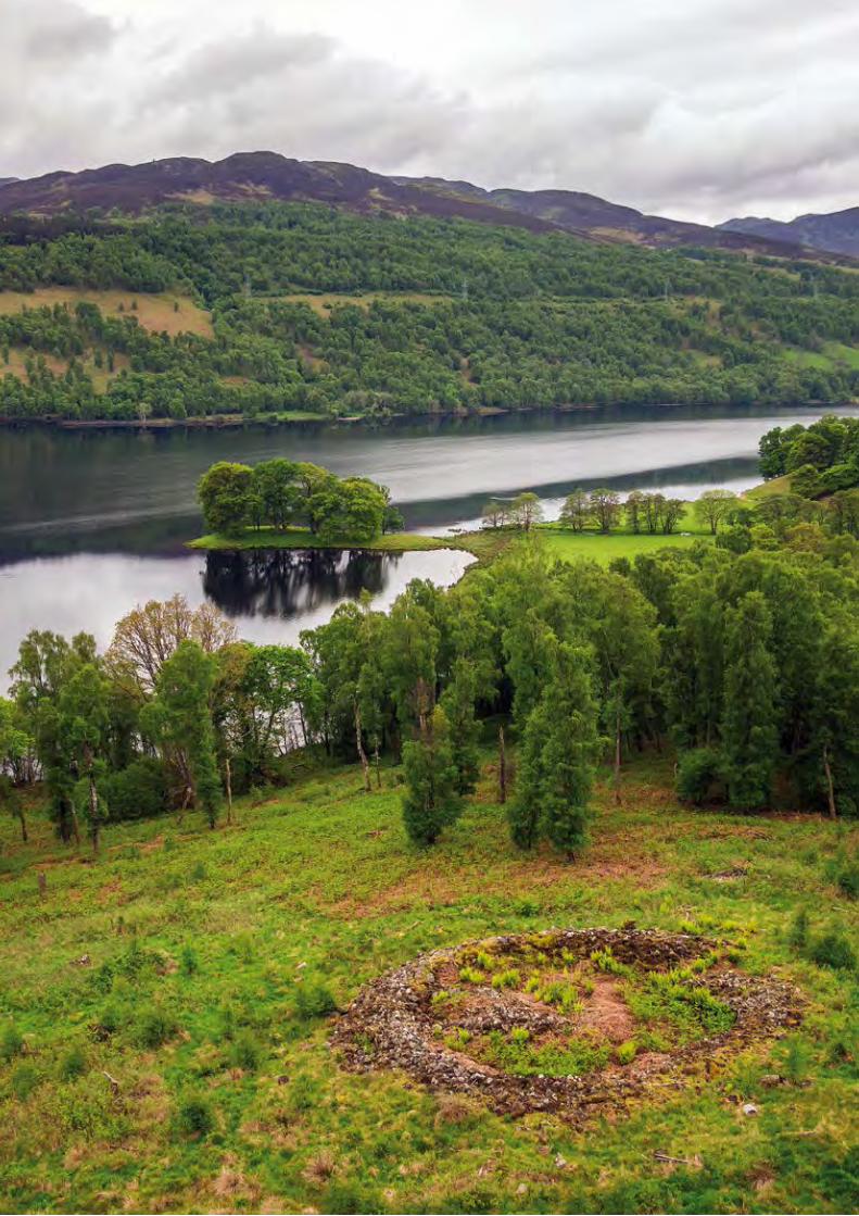
Action for the Environment on Scotland’s National Forest Estate78

Action for the Environment on Scotland’s National Forest Estate 79
FES maintains a Designated Historic Assets Register on the National Forest Estate. All appropriate designated historic assets (and several significant undesignated sites) are included within a Monument Management Plan or are recorded within the Designated Historic Assets Register; and every two years FES report as part of Scotland’s Historic Environment Audit. Conservation management work (such as scrub control or path repair) is organised and undertaken by Forest District Environment Teams. Two case studies have been chosen to highlight our commitment to historic environment conservation: the survey and consolidation of a number of designated historic bridges in the Highlands; and a major development project in 2013 that brought new life to The Lodge, a pioneering visitor centre and B Listed building in Aberfoyle.
Historic environment conservation
The Iron Age ringfort of Borenich on the slopes above Loch Tummell.
© Ed Martin
By caring for and protecting the historic environment we can ensure that we both enjoy and benefit from it today – and conserve and enhance it for the enjoyment and benefit of future generations.

Action for the Environment on Scotland’s National Forest Estate80
Prior to a programme of consolidation and repair, terrestrial laser scan surveys of the bridges were undertaken in order to inform conservation methodology and enhance the historic environment record. The subsequent excavation and recording of the bridges was undertaken in order to record the character of the bridge surfaces prior to any changes required during conservation work. The overall aims of the archaeology programme were to record any archaeological deposits and structural features associated with the bridges that would be uncovered during conservation work. The core of the arch comprised upright voussiers pinned and locked together with small slabs and packed with a gravelly and sandy soil at the surface. The voussiers and smaller pinning slabs were also clearly visible in the underside of the structure, with gaps evident where slabs had fallen out.
The Achlain Bridges consolidation project is only one of a number of major designated historic bridge consolidation projects in the Highlands.
The impressive 18th century military bridge of Little Garve (NH 396 628) was the subject of major consolidation in 2005 and the pioneering late 19th century steel span footbridge at Invergarry (NH 300 009) was repaired in 2011. The early 19th century parliamentary bridge of Allt Ratagan (NG 916 194), built to a Thomas Telford design, has consolidation works programmed to be undertaken over the course of 2014 and 2015.
General George Wade began construction of the military road network in the Highlands between the years of 1725 and 1733. He built over 400 km of road and about 40 bridges, linking the barracks of Fort William, Fort Augustus, Inverness and Ruthven. The network was greatly extended by Major William Caulfeild between 1740 and 1767. In 1769, Thomas Pennant wrote of the work that “these roads, by rendering the Highlands accessible, contributed much to their present improvement and were owing to the industry of our soldiery… [forcing their] way through rocks supposed to be unconquerable.”
The road that linked the garrison at Fort Augustus to the barracks in Bernera, Glenelg, was built by Major Caulfeild between 1748 and 1753 for travel by troops, supply carts and artillery. The road is shown on Roy’s Military Survey of Scotland (1747-55) and, although much is now overlain by modern roads, three small bridges can be found on the National Forest Estate at Achlain in Glen Moriston (NH 281 121), part of a surviving section of road now designated as a scheduled monument.
Repair of historic bridges in the Highlands
Case Study

Action for the Environment on Scotland’s National Forest Estate 81
Little Garve Bridge near Contin, a large 18th century military bridge.
Invergarry Bridge, an elegant single span arch bridge from the very early days of steel construction.
The terrestrial laser scan of the Achlain Bridges provided a record of the scheduled monuments and architectural plans and elevations to inform the conservation work. This is the south side of the westernmost of the three bridges.
To celebrate the completion of the project and restoration of the bridges, a small company of redcoats resumed their patrol. The resulting photographs were picked up by the local press and really helped the story make an impact. This bridge is the westernmost of the three.
The stone masons supported the arch with a steel frame, timber and sandbags, realigning slipped voussiers and repining them from above.
The impressive ‘B’ Listed Parliamentary road bridge of Allt Ratagan, built to a design by Thomas Telford in the early 19th century.
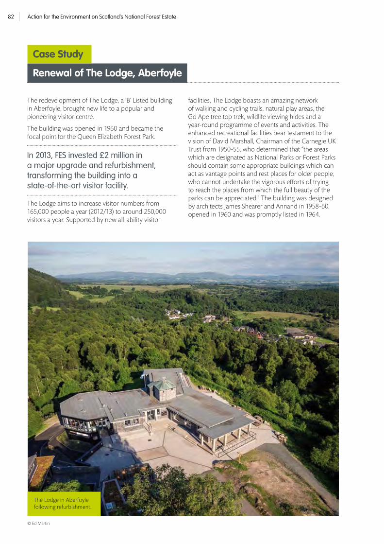
Action for the Environment on Scotland’s National Forest Estate82
The redevelopment of The Lodge, a ‘B’ Listed building in Aberfoyle, brought new life to a popular and pioneering visitor centre.
The building was opened in 1960 and became the focal point for the Queen Elizabeth Forest Park.
In 2013, FES invested £2 million in a major upgrade and refurbishment, transforming the building into a state-of-the-art visitor facility.
The Lodge aims to increase visitor numbers from 165,000 people a year (2012/13) to around 250,000 visitors a year. Supported by new all-ability visitor
facilities, The Lodge boasts an amazing network of walking and cycling trails, natural play areas, the Go Ape tree top trek, wildlife viewing hides and a year-round programme of events and activities. The enhanced recreational facilities bear testament to the vision of David Marshall, Chairman of the Carnegie UK Trust from 1950-55, who determined that “the areas which are designated as National Parks or Forest Parks should contain some appropriate buildings which can act as vantage points and rest places for older people, who cannot undertake the vigorous efforts of trying to reach the places from which the full beauty of the parks can be appreciated.” The building was designed by architects James Shearer and Annand in 1958-60, opened in 1960 and was promptly listed in 1964.
The Lodge in Aberfoyle following refurbishment.
Renewal of The Lodge, Aberfoyle
Case Study
© Ed Martin

Action for the Environment on Scotland’s National Forest Estate 83
Two case studies have been chosen to illustrate our commitment to presenting the historic environment and in working in partnership for its benefit: The Cullaloe Urn learning resource, a replica Bronze Age urn with associated classroom activities linked to the Curriculum for Excellence; and the innovative new access and interpretation project involving the 18th century archaeological landscape of Wilsontown Ironworks.
We have also been active in working with partners to provide Continuing Professional Development opportunities within the heritage sector. These include ‘The illustration of archaeological measured survey’, a workshop hosted by the Chartered Institute for Archaeologist’s Scottish Group in partnership with FES, RCAHMS and the Society of Antiquaries of Scotland; and the publication of Craig Phadrig: Survey and Review (RCAHMS 2014) by CIfA Workplace Learning Bursary placement Alison MacKaig.
We also seek to publish the results of our most significant fieldwork commissions in appropriate academic journals, often in partnership with the organisations involved. Recent examples have included ‘Multi-image photogrammetry as a practical tool for cultural heritage survey and community engagement’ by John McCarthy in the Journal of Archaeological Science 2014; ‘An 18th Century Road in Glen Arklet’ by Jürgen van Wessel in Scottish Archaeological Journal [forthcoming]; ‘Mesolithic flint scatters at Barr River’ by Gavin MacGregor as a Scottish Archaeological Internet Report [forthcoming]; and, on the Cunningar Loop, ‘for beauty and desirability there is none in the kingdom to be compared’: Thomas Telford, James Watt and the evolution of Glasgow’s water supply’ by Louise Turner in Proceedings of the Society of Antiquaries of Scotland 2012.
We often seek to work in partnership with other organisations and communities. Recent harvesting work at work at Achad Mhor near Strathpeffer (NH 420 601) was informed by a detailed archaeological landscape survey undertaken in 2012 by the North of Scotland Archaeology Society.
A number of ruined buildings and enclosures were recorded and subsequently marked out. The surrounding coupe was then carefully felled, with both Harvester and Forwarder keeping to defined access routes to minimise disturbance.
We also seek to communicate historic environment best practice to as wide an audience as possible. The Forestry Commission Scotland ‘Picture this!’ archaeological exhibition comprises a series of posters designed to inform and inspire. The exhibition highlights a number of recent archaeological measured surveys on the National Forest Estate.
The common thread is of innovative new survey techniques combined with an aesthetic illustrative methodology. Aerial and terrestrial laser scanning, rectified photography, terrain modelling and low altitude aerial photography combine with archive images and traditional topographic survey to create exciting new angles from which to appreciate the past.
The exhibition has been presented at several major conferences and is available online. It has also been offered to local museums and libraries across Scotland.
Valuing the historic environment
It is only by sharing and celebrating the richness and significance of our historic environment that we are able to enjoy the fascinating and inspirational diversity of our heritage.
One of the buildings at Achad Mhor during careful clearfell.

Action for the Environment on Scotland’s National Forest Estate84
Wilsontown Ironworks was founded in 1779 on the banks of the Mousewater in Lanarkshire (NS 951 550). The works developed over the following three decades and a sizeable community rapidly grew around it, housing nearly 2,000 people by 1812, when the company employed 521 men. Poor transport links, managerial failures and costly legal disputes between the owners led to the collapse of the company in 1812 and the Ironworks finally closed in 1842. The much-ruined remains of most of the buildings were demolished in 1974. However, many of the early features of the ironworks remain visible, including the blast furnace, coke and calcining kilns and an extensive area of bell pit mines. The area was surveyed using aerial laser scanning in 2009, providing a baseline record prior to the construction of an all-abilities path circuit.
The path improvements and an innovative new interpretation package were completed in 2014 (the works undertaken as part of the Forestry Commission Scotland Woodlands In and Around Towns initiative). Wilsontown is now one of the best presented (and most accessible) industrial archaeological landscapes in Scotland.
Wilsontown Ironworks
Case Study
The Cullaloe Urn archaeological learning resource used a small archaeological rescue excavation (the chance discovery of a Bronze Age urn in the roots of a windblown tree) and its subsequent post-excavation analysis (by the Fife Archaeology Service and AOC Archaeology respectively) as an opportunity to enhance awareness of archaeology within local schools via the local FES Rangers and Archaeology Scotland. The simple learning resource links to Scotland’s Curriculum for Excellence and enables the deliverer to learn about the archaeological and Bronze Age context of the find before beginning a small classroom project (where the children learn about accurate measurement and archaeological illustration). The resource is supplied alongside a replica of the urn. It was also supplied (with replica) to Archaeology Scotland for use by their education and learning team and by Young Archaeologist Clubs.
The Cullaloe Urn
Case Study
Almost 4000 years ago during the Bronze Age, a local Fife man or woman was cremated and their burnt bones and ashes interred within a pot ( just like this replica) and buried on the Cullaloe Hills (between Dunfermline, Cowdenbeath and Kirkcaldy). The burial lay undisturbed for thousands of years until it was discovered in the roots of a windblown tree by a sharp-eyed dog walker in the summer of 2012 and recovered by the Fife Archaeology Service.
This detailed hill shaded surface model shows the bell pits either side of the main tram line. The foundations of a row of cottages can be seen in the top right hand side.


ContactForest Enterprise Scotland1 Highlander WayInverness Business ParkInvernessIV2 7GB
Tel: 0300 067 60003E-mail: [email protected]: www.forestry.gov.uk/scotland
Forest Enterprise Scotland is the agency of Forestry Commission Scotland which manages the National Forest Estate
Published by - Forestry Commission Scotland - Feb 2015ISBN - 978 0 85538 921 5 © Crown Copyright 2015
All photography from Forestry Commission Picture Library unless otherwise stated
Designed by MacDonald Orr Design for Design and Interpretative Services, Forestry Commission Scotland, Edinburgh
FCMS129/FC-S(DIS)/JTCP/1k/FEB2015
If you need this publication in an alternative format, for example, in large print or in another language, please contact:
The Diversity TeamForestry CommissionSilvan House231 Corstorphine RoadEdinburghEH12 7AT
Tel: 0300 067 5046E-mail: [email protected]


