This report concerns a low level airborne VLF-EM and Mag survey that was flown during July 1994 by Geonex Aerodat on contract to Arista Resources Inc of Vancouver BC.
The claims listed below were included in the survey and are owned by John Ewanchuk of New Liskeard Ontario.
SUMMARY
The airborne survey has delineated the known quartz-feldspar porphyry north of Heather Lake. As well there appears to be a large north-south trending dyke like structure running along the west side of Heather Lake.
PROPERTY DESCRIPTION b ACCESS
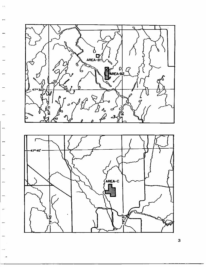
The properties consist of 12 claim units held by John Ewanchuk as well as one claim unit held by Arista Resources Inc. At the time of the survey the Company was negotiating for these claims and have since decided against the aguisition for now.Claim 1198716 will be transferred to John Ewanchuk. Claim # Location No Units Holder
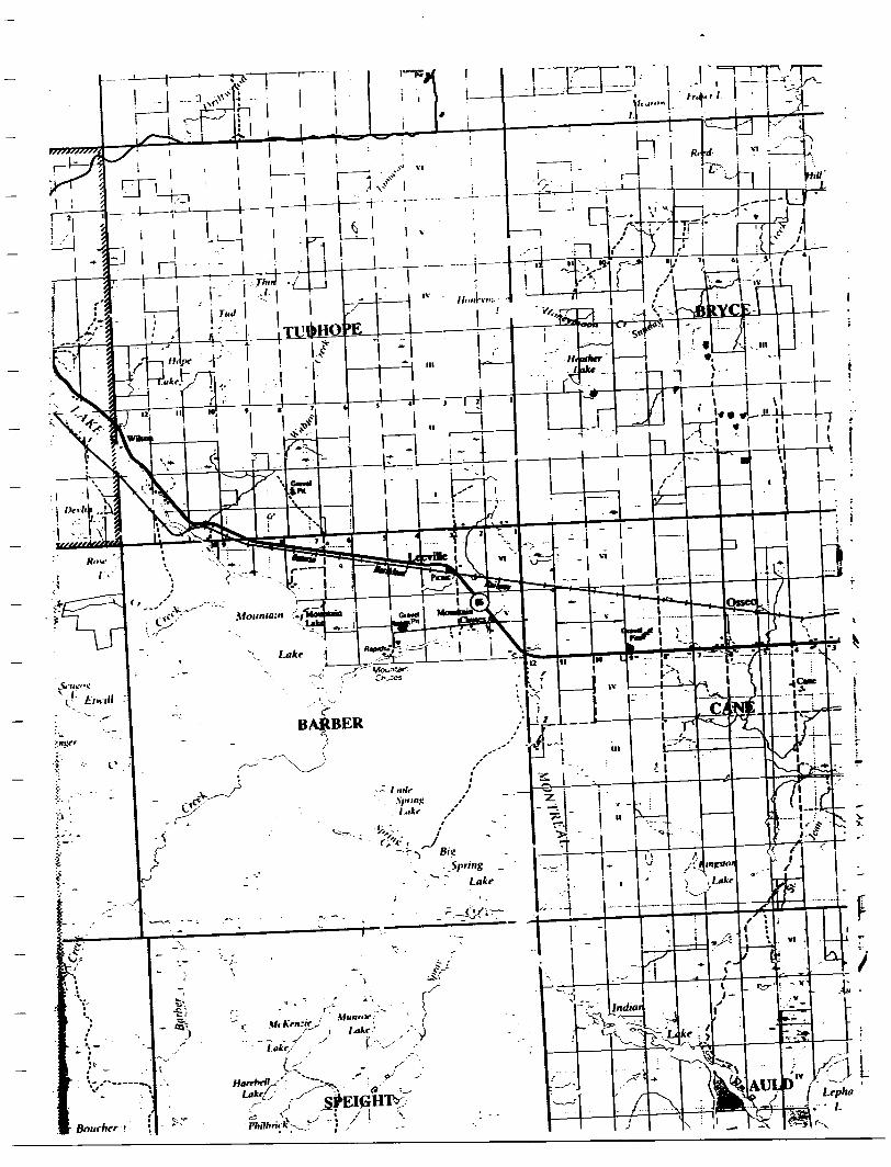
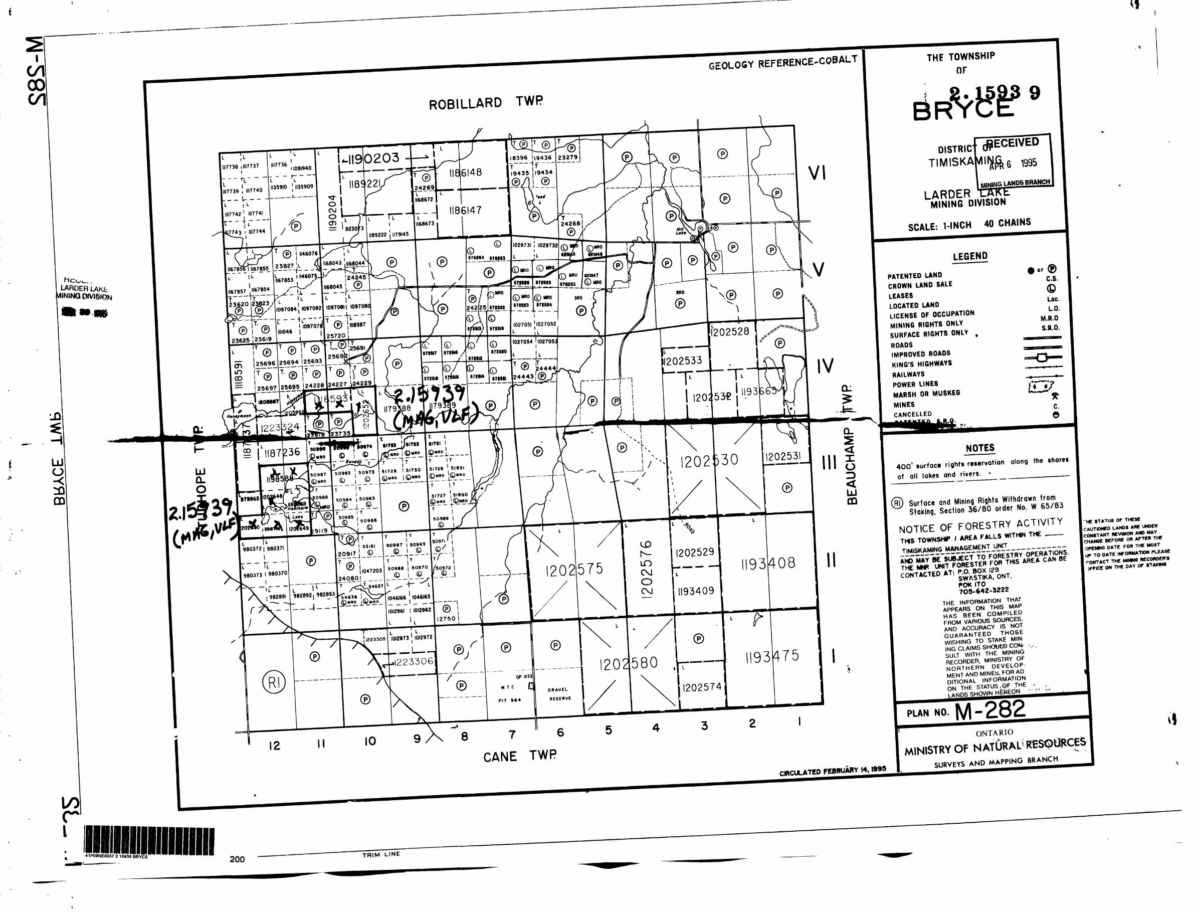
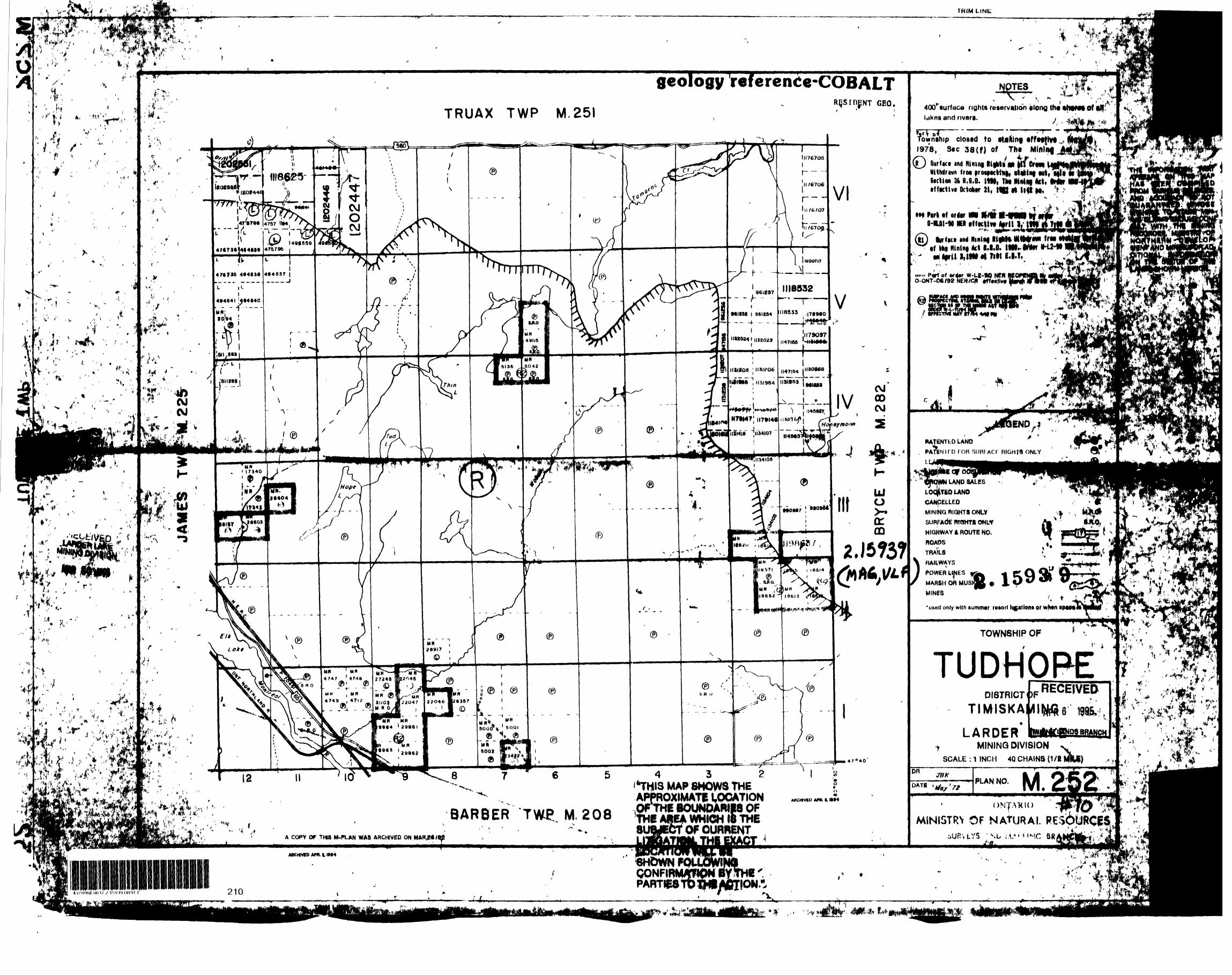
Bryce SEl/4 Sl/2 Lot 12 Cone 111 Bryce Sl/4's Nl/2 Lotl2 Con 111 Bryce NWl/4 Sl/2 Lot 11 Con 111 Tudhope Sl/4's Sl/2 Lot l Con 111 Bryce NEl/4 Sl/2 Lot 12 Con 111 Bryce SWl/4 Sl/2 lot 11 Con 111 Bryce SWl/4 Sl/2 Lot 12 Con 111 NEl/4 SEl/4 Sl/2 lot 10 Con IV Bryce 2 NEl/4 Sl/2 lot 11 Con IV and 2 NWl/4 Sl/2 Lot 10 Con IV Bryce
AristaJohn EwanchukBox 932 New Liskeard
Access is gained by proceeding west from Englehart towards the Hill Lake Fish Hatchery along highway 560, then west along a gravel road, From there a logging road which can be used by ATV or Skidoo can be followed to Heather Lake.
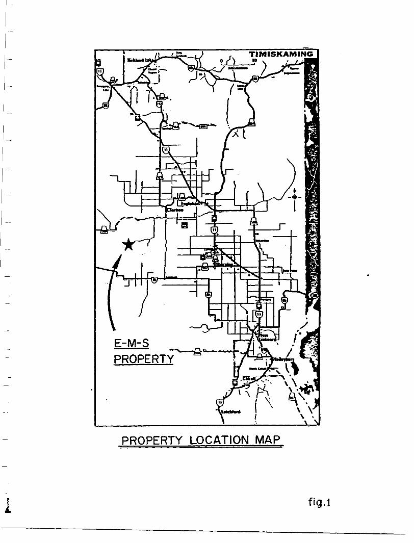
TIMISKAMING
E-M-S
PROPERTY
PROPERTY LOCATiON MAP
i fig.l
j H872361
iV"S—
i-CLOSED TO STAKING SUBJECT
TO SEC 38 (f
(SEPT 20/78)
8THIS MAP SHOWS THE - APPROXIMATE LOCATION OF THE BOUNDARIES OF THE AREA WHICH IS THESUB4ECT OP CURRENT
' t. *i CAI
;THILITIQATION^THE EXACT LOCATION WILL BE
O t f*\t t l|
: - - -; .•v- : ,irv"fl fc -v . "-;
geology ref erence-COBALTRESIDENT GEO.
"8533 ;|789eO
II32O24 l 1132023
,I47IM |H3O9681131205 H3I206
1131955* , 1131954 1131953 JCM CO CM
UJocr m
lak
Towr 1978
S l Sc
Pi O-
uni* P(O-ONT
i nOfs
PA
PA
LE
LK
Cf
LO
C^MJ
SU
HI
W
TF
page 7
TOPOGRAPHY 6 DRAINAGE
The claims in the Heather Lake area have good outcrop exposure around Heather Lake.Relief is moderate with low lying areas filled by cedar swamp.Numerous creeks and beaver ponds surround Heather Lake.
GEOLOGY
The property is underlain by rocks of the "Abitibi Greenstone Belt", and in the vicinity of Heather Lake the pyroclastic breccia may indicate proximity to a volcanic vent. Small diabase dykes are seen as well as exposures of quartz-feldspar-porphyry which may be related to a larger intrusion and may well be the source of the gold-bearing hydrothermal solutions.
PREVIOUS WORK
In 1974 a ground VLF and Magnetometer Survey was carried out by J.A.Gore over part of the claims. The claims are underlain by coarse-grained poorly sorted pyroclastic breccia that has been intruded by quartz and feldspar porhyry dykes and mafic dikes. The rocks are carbonatized and strongly schistose in a northwest direction.Two strong anomalies were outlined on the claims.The northern anomaly lies wholly within Heather Lake approximately parallel to the northern shore of the lake and the other lies to the west of the island in the southwestern part of the lake.
Some stripping was performed,particularily on the quartz-feldspar porphyrys by the claimholders.
In 1987 MinGold performed basal till sampling throughout the immediate area.
In 1988 MinGold completed 365.8m of diamond drilling near Heather Lake to test gold anomalies from the basal till sampling.Several quartz-carbonate stringer vein systems were intersected within shear zones cutting intermediate to felsic breccias and porphyritic metavolcanic rocks of the Abitibi Belt.
In 1991 Orofino Resources completed geophysical surveys on parts of the property optioned from Jim Morris. Ground mag was performed as well as nine lines of combined Crone Pulse Em and IP surveys on selected portions of the property.
page 8
AIRBORNE SURVEY
The helicopter borne mag and VLF EM survey was performed by Geonex Aerodat on a larger area which included the subject property.The logistics report is included in the appendix.
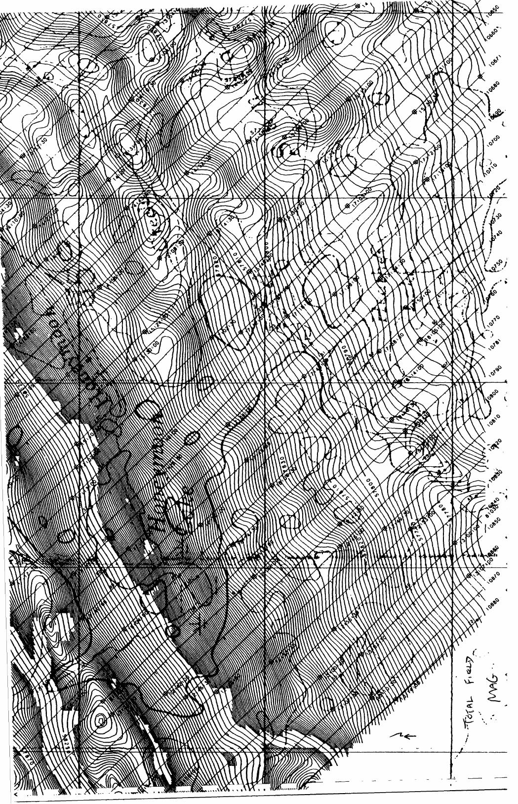
Total Field MagneticsLines were flown @ azimuth of 135-315 with an average line
spacing of 100m.The Total field magnetic intensity was measured by a cesium high sensitivity magnetometer at an average sensor elevation of 45m and corrected for diurnal variation. Map contours are in nano Teslas and are multiples of 2nt. lOnt, 50nt. 250nt, and lOOOnt.Navigation and flight path recovery was conducted using a Global Positioning System (GPS).Average helicopter terrain clearance was 60m monitored by radar and barometric altimeters. Vertical Gradient
Vertical Gradient contour data is calculated from the total field magnetics data by an FFT algorithim. Map contours are in nanoteslas/metre and are multiples of o.oSnT/m, 0.25nTXm, l.OOnT/m, S.OOnT/m.and 25.0nTXm. Total Field VLF-EM
Total field VLF EM data measured by a Herz Totem 2A sensor at an average elevation of 45m.
Flights utilized NAA.Cutler Maine. 24.0 kHz as the transmittor.Quadrature profile l * per/mm.Map contours are in S and multiples of 11, 5%, and 25%.
A total of 7f line kilometres were flown on the Property.
page 9
SUMMARY l CONCLUSIONS
The airborne survey has delineated the known quartz-feldspar- porphry NW of Heather Lake.As well a strong NS response is seen West of Heather Lake which may represent diabase dykes. There is also a NW trending structure delineated which runs up through Heather Lake and on to Honeymoon Lake.
BIBLIOGRAPHY
Report of Activities ....... ............ .. .OGS Paper 1581991Resident Geologists
Report of Activities......................OGS Paper 142Resident Geologists 1988
Geology of the Hill Lake Area.............OGS Paper 250District of Temiskaming 1986
APPENDIX
CERTIFICATION
I Gary Clayton Dunn do hereby certify that,
1) I am a graduate of the three year mining technology program at the Haileybury School of Mines (1974).
2) I have practised my profession continuously in the mining industry since that time
3) I reside at 710 Brewster St Haileybury Ontario
4) I have no interest in the property nor do I expect to receive any
5) This report is based on my knowledge of the area including having been on the property
4. DATA PRESENTATION ..................................... 74.1 Total Field Magnetic Contours ............................ 84.2 Vertical Magnetic Gradient ............................... 84.3 VLF-EM Contours .......... ... ...................... . . 8
APPENDIX l - PersonnelAPPENDIX II - General Interpretive Considerations
1. INTRODUCTION
This report describes an airborne geophysical survey carried out on behalf of
Arista Resources Inc. by Geonex Aerodat Inc. Equipment operated included a
high sensitivity cesium vapour magnetometer, a video tracking camera, an
altimeter and an electronic positioning system. Magnetic and altimeter data were
recorded both in digital form and analogs were created post-flight. Global
positioning data were stored in digital form and encoded on VMS format video
tape.
The area and flight lines were flown at a nominal spacing of 1 CX) m. Coverage and
quality were considered to be within the specifications described in the contract.
The survey covered six separate blocks located in Casey, Auld and Bryce with a
total of 1450 line km flown.
2. SURVEY AREA LOCATION
S J
3. AIRCRAFT AND EQUIPMENT
3.1 Magnetometer
Scintrex optically pumped/monitored, cesium vapour, high sensitivity H-8
magnetometer mounted in a Canagrad towed stabilized magnetometer bird
designed for single engine operations. A Picodas magnetometer processor
operated at a sample rate of 5 samples per second with a 2 Hz bandwidth was
employed. The magnetometer sensitivity is 0.001 nT.
3.2 Digital Recorder
A PDAS 1100 data acquisition system was used to collect the geophysical and
ancillary equipment outputs and display the data on an on-board screen. Digital
output is recorded on a cartridge cassette tape with full read after write checking.
The magnetometer and VLF channels are scanned at 0.2 second rate. In addition,
altimeter, satellite information and coordinates, camera, manual fiducials and time,
will be digitally recorded at appropriate times. The resolution of the VLF data is
1 percent and the altimeter data is 0.5 m. The magnetic readings are measured
to a 0.001 gamma resolution.
3.3 Analog Recorder
Analog records were generated post-flight. The recorder can automatically label
the channels, times and representative values for maximum record clarity.
3.4 Video Camera
Aerodat operated a VMS video camera to record the aircraft's overland flight path.
The time as recorded on the digital record was displayed on the video image for
precise correlation of video image with geophysical response.
3.5 Global Positioning System
GPS receiver, model MX4200D by Magnavox Electronic Systems Company, with
antenna mounted at top of vertical stabilizer. Identical model of GPS base station
for post flight differential correction of flight path.
3.6 Aftimeter
A King KRA-10 radar altimeter was used to record terrain clearance of the aircraft.
The response of the instrument is linear and the digital resolution is better than
2.50A with a departure of 3 m at 100 m altitude discemable. The output of the
instruments were recorded in digital form.
3.7 Aircraft
An Aerospatiale AS 350 B1 A-Star helicopter (C-GNIX), owned and operated by
Questral Helicopters was used for the survey. Installation of the geophysical and
ancillary equipment was carried out by Geonex Aerodat Inc. The survey aircraft
was flown at a mean terrain clearance of 60 metres.
3.8 Magnetic Diurnal Monitor
Magnetic base station with an Overhauser sensor, model GSM-9 by Gem
Systems, with an accuracy of 0.1 nanoTeslas. Data logging will be made at one
second intervals by computer. The time stamp for the magnetic base station is
taken directly from the GPS ground receiver to ensure that it correlates with the
airborne equipment.
3.9 VLF-EM
Herz Totem 2A measuring the total field and the quadrature components from two
stations with full scale sensitivity of plus/minus 2507o. The VLF antenna was
mounted on a boom projecting well forward of the leading edge of the aircraft and
positioned so as to be unaffected by the conductivity of the aircraft.
4. DATA PRESENTATION
A list of products are as follows:
Basic Products (Scale at 1:10,000)
1. Base Map - Topographic base map, prepared from 1:50,000 NTS maps.
2. Magnetics - Photocombination of Total Field Magnetic Contours with the
base map.
3. Magnetics - Photocombination of Calculated Vertical Magnetic Gradient
contours with the base map.
4. VLF-EM - Photocombination of Total Field VLF-EM Contours and Profiles
of Quadrature @ 1 07o per m/m.
Colour Products (Scale at 1:10,000)
All colour products contain planimetry digitized from existing 1:50,000 scale NTS
topographic maps.
1. Magnetics - Colour of Total Magnetic Field with superimposed contours.
2. Magnetics - Colour of Calculated Vertical Magnetic Gradient with
superimposed contours.
3. VLF-EM - Colour of Total Field VLF-EM with superimposed contours and
quadrature profiles.
4.1 Total Reid Magnetic Contours
The aeromagnetic data were corrected for diurnal variations by adjustment using
the digitally recorded base station magnetic values and tie lines. No correction for
regional variation was applied.
4.2 Vertical Magnetic Gradient
The vertical magnetic gradient was calculated from the gridded total field magnetic
data and contoured at a 0.05 nT/m interval.
4.3 VLF-EM Contours
VLF-EM Contours were done at 1 0Xo and .5*56 contour intervals.
8
APPENDIX l
PERSONNEL
OFRCE
Processing E. Hamilton
G. McDonald
Report E. Hamilton
HELD
Pilot R. Morrow
Operator M. Barry
APPENDIX H
GENERAL INTERPRETIVE CONSIDERATIONS
Magnetics
A digital base station magnetometer was used to detect fluctuations in the magnetic field
during flight times. The airborne magnetic data was levelled by removing these diurnal
changes. The Total Field Magnetic map shows the levelled magnetic contours,
uncorrected for regional variation.
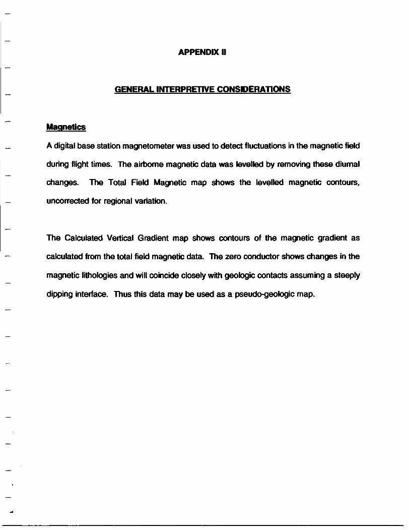
The Calculated Vertical Gradient map shows contours of the magnetic gradient as
calculated from the total field magnetic data. The zero conductor shows changes in the
magnetic lithologies and will coincide closely with geologic contacts assuming a steeply
dipping interface. Thus this data may be used as a pseudo-geologic map.
Ontario
Report of Work Conducted After Recording Claim
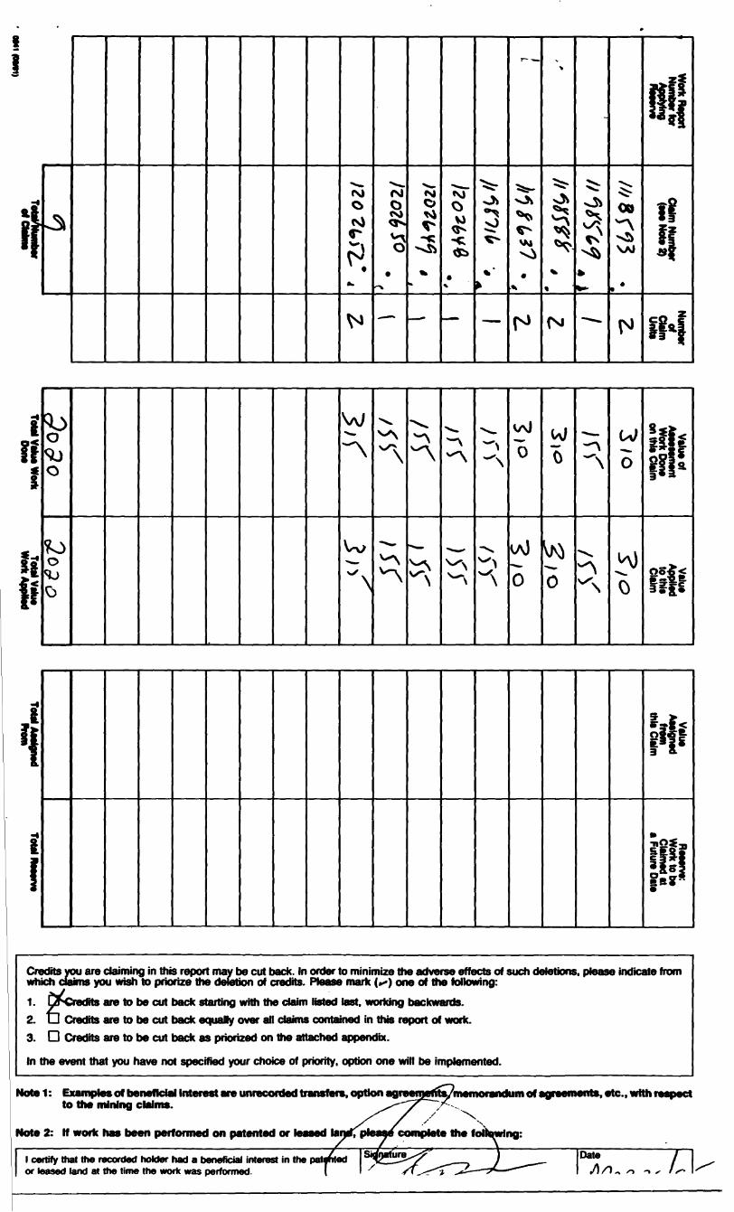
MMngAct
•mm riiMtnf ^ DOCUMENT No.
t ooSKtod on Ms fonn to obWmd undor Hw auttnrty of Ita'MMng ActThhl InOUlQ D9 QsTMlM tO VW PVMIflcW
i type or print and submit in Refer to the Mining Act and Regulations for
IttiOfvfMuOIV^^rofvttumfkvvJfttftSilOUnO^.
tvetopmanl and Mawa. Fourth Floor. 150 Cedar St
2.1593 9Questions about
Fourth Floor. 150 Codor Street
- A separate copy of this form must be compk- Technical reports and maps must accompany- A sketch, showing the daims the work is ass 41P09NE0037 2.15939 BRYCE 900
Jo* 066
(ATownship/Area
7or O rz-
Toe
Work Pertermed (Check One Work Group Only)WorkGroup Type
Total Assessment Work Claimed on the Attached Statement of CostsNote: The Minister may reject for assessment work credit all or part of the assessment work submitted if the recorded
holder cannot verify expenditures claimed in the statement of costs within 30 days of a request for verification.
Persona and Survey Company Who Performed the Work (Give Name and Address of Author of Report)
l certVy that at the tbm the work was perk report**** recorded in ttwcurrent holder's
d. tha claims conrad ki IMa work or hald under a banafcial l
by the current i
of Work Reportl carty that l have a personal knowtedge of tha facts sat torth ki this Work report, having performed tha work or witnessed same during and/or altar Ma completion and annexed report is true.
OM1(Oat91)
i I
ih oPS)M O M
•V)0V)
OvCO
\AI
M
t! SO
w VA) on thic
WoJo 0 lt
Credits you are claiming in this report may be cut back. In order to minimize the adverse effects of such deletions, ptease indicate from which claims you wish to priorize the deletion of credits. Ptease mark f**) one of the following:1. pSCredits are to be cut back starting with the claim listed last, working backwards.2. U Credits are to be cut back equaJry over all claims contained in this report of work.3. D Credits are to be cut back as priorized on the attached appendix.
In the event that you have not specified your choice of priority, option one will be implemented.
nded transfers, optionMotel: Examples of beneficial Interest are unr to the mining claims.
Note 2: If work has been performed on patented or leased la
of agreements, etc., with respect
l certify that the recorded holder had a beneficial interest in the or leased land at the time the work was performed.
(Date l /I/O. ^M.
Ministry of •Northern De
OntarioMMsteredu Devetoppemerrt du Nord at de* mines
Statement of Costs for Assessment Creditfrat des coOts aux fins du credit devaluation
Mining Act/Loi sur tes mines 2.1593 9PW il information cokected on this form is obtained under the authority of the MMng Act This information wM be used to maintain a record and ongoing status of the mining cMm(s). Questions about this cotection should be drected lo the Provincial Manager. Minings Lands. Ministry of Northern Development and Mines. 4th Floor. 159 Cedar Street. Sudbury. Ontario P3E 6A5. telephone (705) 670-7264.
Las renseignsments personnels contenus dans la presente formula sont recueWs en vertu de la Lol sur toe mhws et eaniront a tenlr a jour un reontre des concessions minieres. Adresser toute quesiton sur la coNece de ces rofiBttgnoniuiits au chef provincial des terrains miniers, ministere du Oevetappement du Nord et des Mines. 159. me Cedar. 4* stage. Sudbury (Ontario) P3E 6A5. telephone (70S) 670-7264.
1. Direct Costs/Couts directs
Type
Contractor's and Consultant's
Drottsde
etderexpert-
1 m tt •Sloaa -*—Locmon o*
f\n m fi-ia-iain —UBScnpfion
Labour Main-d'oeuvreField Supervision Supervision sur le lenan
Amount Mont ant
fl/fcakr
TUP*
Type
Total Direct Coats Total das coots directs
Totals Total global
2. Indirect Costs/Coats Indlrects** Not*: When claiming Rehabiitation work Indirect costs are not
Pour le remboursement das travaux da rehabiitaUon. tos cofll* HKfirects ne sont pas aikiiisaUos en tent que travaux d-avahiatton.
Type
Food and Lodging ' i/ii NounttureCt
Description
:CEIVEPPC 1SJS
Amount
Sub Total of Indirect Costs Total parna! des coots Indlrects
Amount Afeowabto (not greater than 20* of Direct Costs)
Total Value of ASM (Total of Urea and
Totato Total global
Note: The recorded holder win be required lo verify expenditures claimed in this statement of costs within 30 days of a request for verification. H verification is not made, the Minister may reject for assessment work si or part of the assessment work submitted.
:Letitu egjstr
ou una parte des travaux d*evi k
i tenu de verifier tos depenses demandeas dans e demanded oat '(Sautrejetertout
FIHng Discounts
1. Work filed within two years of completion is claimed at KXWfc of the above Total Value of Assessment Credtt.
aMuae* flat ri A t lpour oopm i APR e
l. Les travaux deposes daniKaHdetoanejsurBant tour achtvement sont rembourses a 100 H de b vateur totato susme^icir)nft9^e*e*(few*ation.
2. Work filed three, four w five years after completion is claimed at 50** of the above Total Value of Assessment Credit. See calculations below:
2. Les travaux deposes trois. quatre ou cinq ans apres tour achevernent sont rembourses a 50 "fc de la vateur totato du credit d'evaluaoon susmentkxine. Voir tos caJcute ct-dessous.
Total Valua of CredH Total At M Claimedx 0.50
Vatour totato du cradtt d'avahiationx 0.50
Evaluation totato damandaa
Certification Verifying Statement of Costs Attestation de I'etat des coOts
l hereby certify:that the amounts shown are as accurate as possible and these costs were incurred while conducting assessment work on the lands shown
'on the accompanying Report of Work form.
J'atteste par la presente :que toe moments indiques sont to plus exact possible et quo ces depenses ont ete engagees pour effectuer toe travaux d'evaluatkm sur tos terrains indiques dans la formuto de rapport de travail ci-joint.
that as to suis autoriseposto oocupi dans la compagnia)
to make this certification
0212(04/91) Nota : Dans cat^fcnnuto. lorsqu'il dasigna das parsonnas. to masculin ast utilise au sans nautre.
Ontario
Ministry of Ministere duNorthern Development Developpement du Nordand Mines et des Mines
Mining RecorderMinistry of Northern Development t Mines4 Government Road EastKirkland Lake, OntarioP2N 1A2
Dear Mr. Spooner:
Subject: APPROVAL OF ASSESSMENT WORK CREDITS ON MINING CLAIMS 1118593 et al. IN BRYCE ft TUDHOPE TOWNSHIPS
Assessment work credits have been approved as outlined on the report of work form. The credits have been approved under Section 15 (Airborne Geophysics) of the Mining Act Regulations.
The approval date is April 07, 1995.
If you have any questions regarding this correspondence, please contact Steven Beneteau at (705) 670-5858.
ORIGINAL SIGNED BY:
Ron C. GashinskiSenior Manager, Mining Lands Section Mining and Land Management Branch Mines and Minerals Division
PATENTED LANDCROWN LAND SALELEASESLOCATED LANDLICENSE OF OCCUPATIONMINING RIGHTS ONLYSURFACE RIGHTS ONLY ,ROADSIMPROVED ROADSKING'S HIGHWAYSRAILWAYSPOWER LINESMARSH OR MUSKEGMINESCANCELLED
NOTES400* surface rights reservation along the shores
of all lakes and rivers. *
CIRCULATED FEBRUARY 14.1995
(RI) Surface and Mining Rights Withdrawn from Staking, Section 36/80 order No. W 65/83
NOTICE OF FORESTRY ACTIVITYTHIS TOWNSHIP l AREA FALLS WITHIN THE ———
Ji^^^^-^^^FJ^^I^lJ.--.. .,-—.....— Af^MAY"BE~SUBJECT~TO FORESTRY~OPERATIONS. THE MNR UNIT FORESTER FOR THIS AREA CAN BE CONTACTED AT: P.O. BOX 129
SWASTIKA, ONT.POK ITO705-642-3222
THE INFORMATION THAT APPEARS ON THIS MAP HAS BEEN COMPILED FROM VARIOUS SOURCES, AND ACCURACY IS NOT GUARANTEED THOSE WISHING TO STAKE MIN ING CLAIMS SHOULD CON,- v SULT WITH THE MINING RECORDER, MINISTRY OF NORTHERN DEVELOP MENT AND MINES, FOR AD DITIONAL INFORMATION ON THE STATUS,OF THE LANDS SHOWN "knfcriM . i w
-282PLAN NO.* V W
ONTARIO
MINISTRY OFSURVEYS AND MAPPING BRANCH
-HE STATUS OF THESE CAUTONED LANDS AKEUNDER CONSTANT REVWON AND WAY CHANGE BEFORE OR AFTER THE
ENING DATE FOR THE MOST -DATE INFORMATION PLEASE
CONTACT THE M,N* JFFICE ON THE DAY OF
200TRIM LINE
geology retcrcncc-COBALTGEO. 400 surface rights reservation iilongTRUAX TWP M.251
tif V O 4Townihip closed to1978, Sec 38 (f) of The MiningRJ SurUct and Ninini Rt|btl tt
Withdrawn fro* prot**cthi|, tWlnf out, nil BfCtiwi 31 8.8.0. |9M, Tin IHni*j M,21, ma it tin
tH Pirt tf oriir MUQ-HLQI-W NW ifftcMw
RI HIT (*c* md Ntnim ligHH MIMrtw IrM if Mi Nintni Act 1.1.0. lHO-ff IH2*M