Analyzing Spatiotemporal Patterns and Marketing a Changing Community Presented By: Victor J. Gonzalez Zapata Economic Development Corporation Zapata ,Texas Sustainable Development and Humanitarian Affairs
Transcript
Analyzing Spatiotemporal Patterns and Marketing a
Changing Community
Presented By: Victor J. Gonzalez Zapata Economic Development Corporation Zapata ,Texas
Sustainable Development and Humanitarian Affairs
q Zapata Economic Development Center (ZEDC)
q Lack of infrastructure for spatial data
q ZEDC’s Countywide GIS
q Concepts and Agendas for Sustainable Development
q Study Area
qMethods
q Results
q Discussion
Content
v Lack of Spatial Data Infrastructure
v Record As-Builts
v Spatial Cognition
v ZEDC Countywide GIS
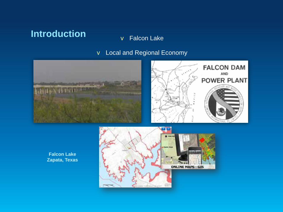
Introduction
v Falcon Lake
v Local and Regional Economy
Falcon Lake Zapata, Texas
Introduction
Sustainable Development
Introduction
“Sustainable development is the balance of meeting humankind’s present needs while protecting the environment to
ensure the fulfillment of future generations’ needs.” (ESRI, 2014)
v Texas Local Government Code, Section 231.172
v ICLEI (International Council for Local Environmental Initiatives)
v Agenda 21 - United Nations (UN) Rio Earth Summit in 1992. Attended by U.S. President George Bush, Sr. and leaders from 178 other nations
v the President’s Council on Sustainable Development by President Clinton’s executive order in 1993
v President Obama’s Federal Leadership in Environmental, Energy, and Economic Performance through executive order in 2009
• Zapata County
• South Texas
• Rio Grande
• Falcon Lake
Study Area
Zapata County has a population of just over 14,000 and covers approximately 677,000 acres of land and about 61 square miles of water
Study Area
• "BASSMASTERS 100 Best Bass Lakes" in the United States in 2012
• Zapata County is a destination for eco-tourism especially in the areas of Fishing, Hunting, and Birding
• pronounced Hispanic culture of music, art, and history with the neighboring town of San Ygnacio within the county being the oldest in Texas and home to nationally recognized historic buildings
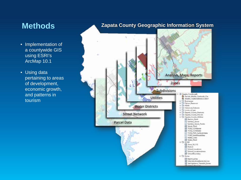
Methods
• Implementation of a countywide GIS using ESRI’s ArcMap 10.1
• Using data
pertaining to areas of development, economic growth, and patterns in tourism
Zapata County Geographic Information System
Methods
The geometrical transformation which occurs is that of size and form affecting the fishery and other lake activities. Spatial relationships among other objects may also change as a consequence (Yeung and Lo, 2002). Beginning the analysis pertaining to Falcon Reservoir and the local tourism economy consisted of the determination of the limits and occurrences of lake level fluctuations.
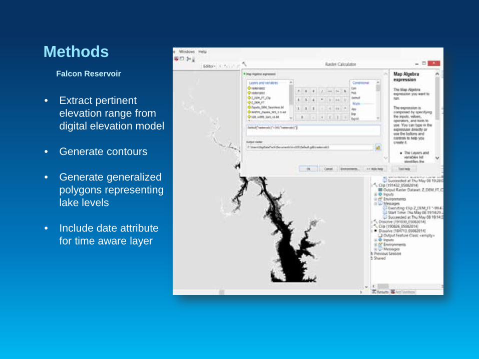
Falcon Reservoir
Methods
• Extract pertinent elevation range from digital elevation model
• Generate contours
• Generate generalized polygons representing lake levels
• Include date attribute for time aware layer
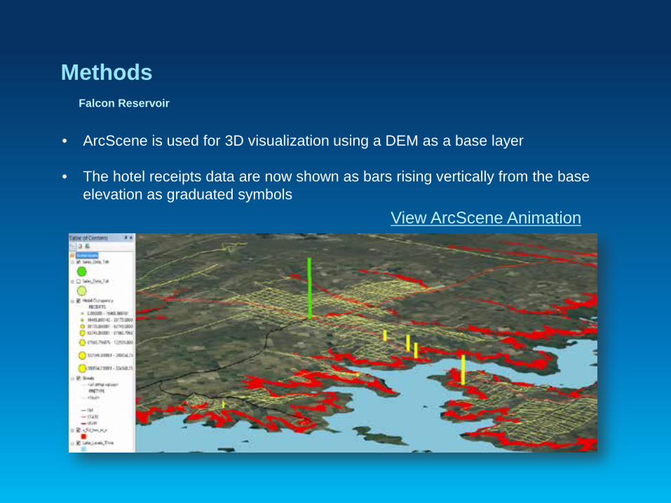
Falcon Reservoir
Methods
• Hotel revenue data is associated with the locations of corresponding hotels
• Point features with hotel revenue and date attributes are quantified with graduated symbols
• Total Hotel Receipts and Total Retail Sales are normalized by the percent of Totals symbolized with a Column Chart
• ArcGIS online is used to create an online geoportal with access to a variety of highly focused special purpose maps
• Increase awareness of available community assets, development constraints, and economic activity
• Comprehensive local business locations
• Voting districts • FEMA flood zone areas • Platted subdivisions • County garbage pickup • School locations and
boundaries.
Publish Spatial Data
Results
• Effectiveness of the GIS implemented.
• Challenges / Constraints
• Data Availability
GIS Implementation
Results
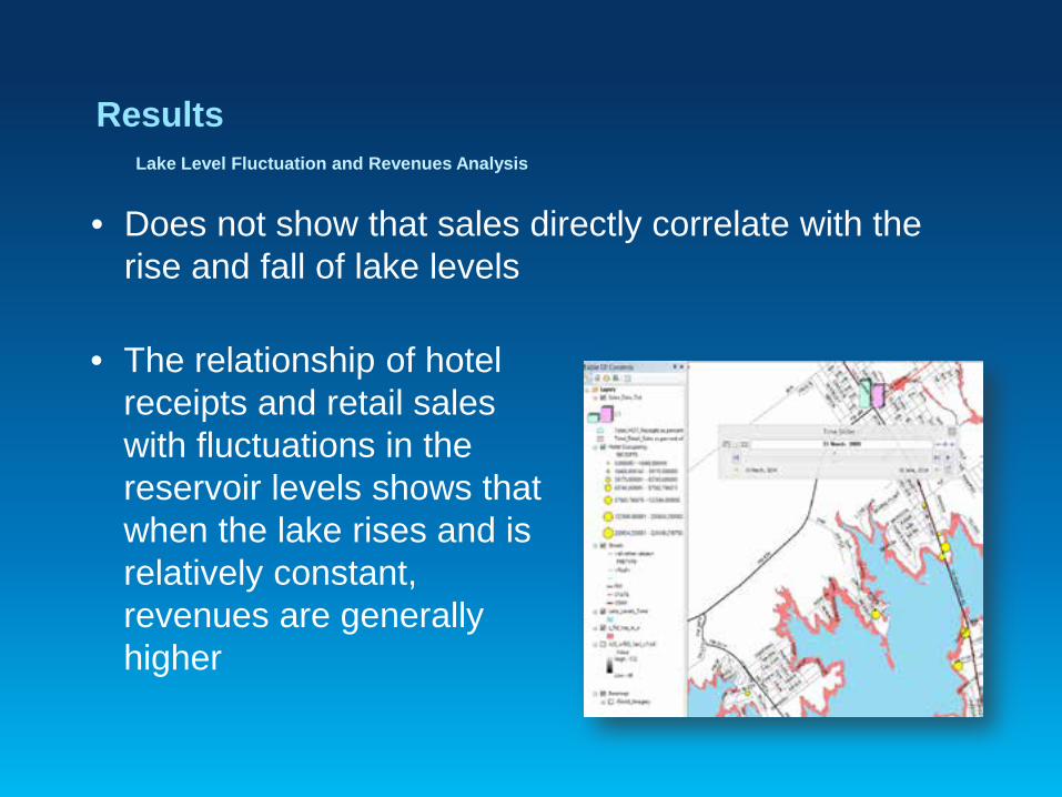
• Does not show that sales directly correlate with the rise and fall of lake levels
Lake Level Fluctuation and Revenues Analysis
• The relationship of hotel receipts and retail sales with fluctuations in the reservoir levels shows that when the lake rises and is relatively constant, revenues are generally higher
Results Publishing and Sharing Spatial Data
• ArcGIS Online
• Presentations
• Public
• Local Government
Results / Discussion
• Publishing and Sharing Spatial Data • Visualization • Site Selectors • Time Animation