15
Map Projections AP Human Geography
| Date post: | 29-Dec-2015 |
| Category: |
Documents |
| Upload: | emmeline-wells |
| View: | 215 times |
| Download: | 0 times |
Map ProjectionsAP Human Geography

What is a Map Projection? Portrays all or parts of the globe on a
flat surface. Cartographers have to pick the best
projection for the project they are creating.

Globe Directions—True Distances—True Shapes—True Areas—True Disadvantages:
• Even the largest globe has a very small scale and shows relatively little detail.
• Costly to reproduce and update.• Difficult to carry around.• Bulky to store

Mercator Used for navigation or maps of equatorial
regions. Distances are true only along Equator, but
are reasonably correct within 15° of Equator.
Areas and shapes of large areas are distorted.
The map is not perspective, equal area, or equidistant.
Cylindrical—Mathematically projected on a cylinder tangent to the Equator.
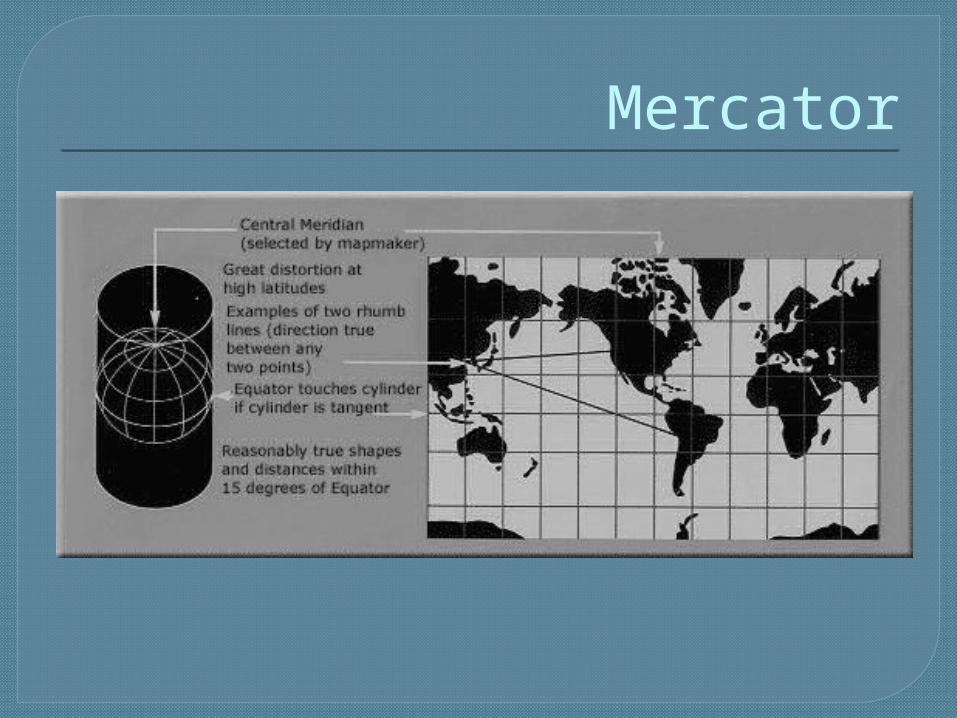
Mercator

Robinson Uses tabular coordinates rather than
mathematical formulas to make the world "look right." Better balance of size and shape of high-latitude lands.
Directions true along all parallels and along central meridian.
Distances constant along Equator andother parallels, but scales vary.
Distortion: All points have some.

Robinson

Sinusoidal Equal Area Used frequently in atlases to show
distribution patterns. Gratitude spacing retains property of
equivalence of area. Areas on map are proportional to same areas on the Earth. Distances are correct along all parallels and
the central meridian(s). Shapes are increasingly distorted away from the central
meridian(s) and near the poles.

Sinusoidal Equal Area
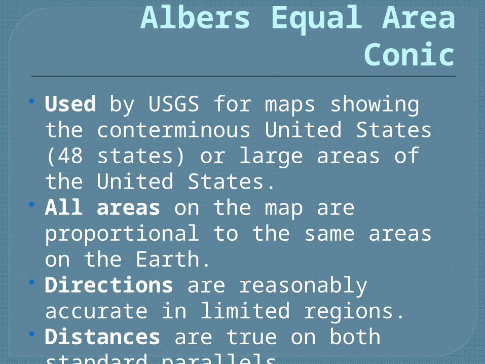
Albers Equal Area Conic Used by USGS for maps showing the
conterminous United States (48 states) or large areas of the United States.
All areas on the map are proportional to the same areas on the Earth.
Directions are reasonably accurate in limited regions.
Distances are true on both standard parallels.

Albers Equal Area Conic

Orthographic (Planar) Used for perspective views of the
Earth, Moon, and other planets. Directions are true only from center
point of projection. Scale decreases along all lines
radiating from center point of projection.
Areas and shapes are distorted by perspective; distortion increases away from center point.
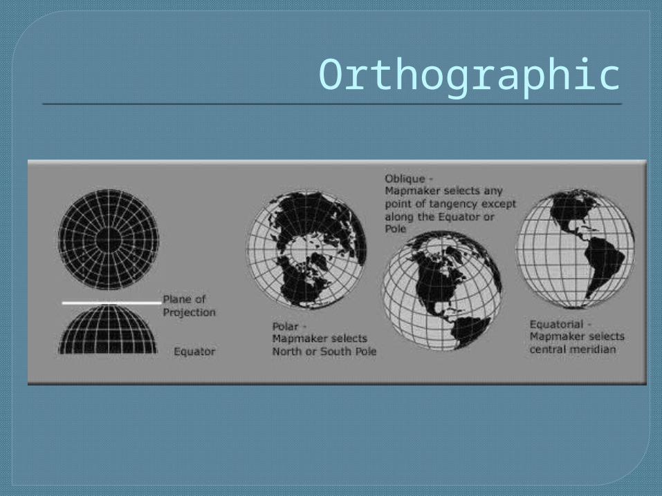
Orthographic
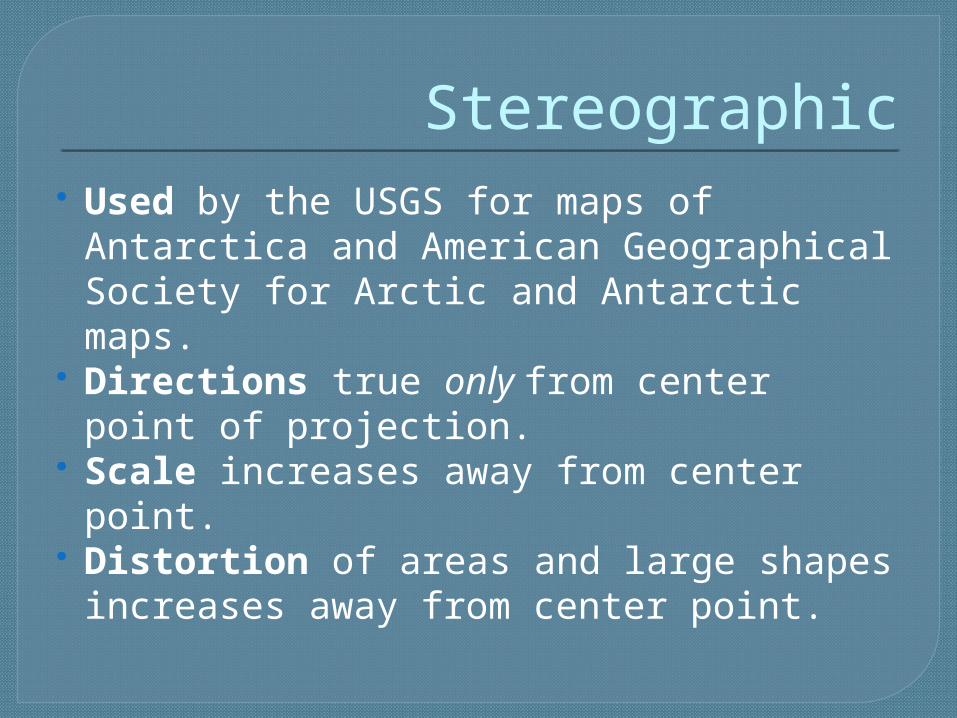
Stereographic Used by the USGS for maps of
Antarctica and American Geographical Society for Arctic and Antarctic maps.
Directions true only from center point of projection.
Scale increases away from center point.
Distortion of areas and large shapes increases away from center point.

Stereographic


