31
Application of Innovative Technologies for Water Monitoring - International Perspective Haseen Khan, P.Eng Amir Ali Khan, PhD June 5, 2007
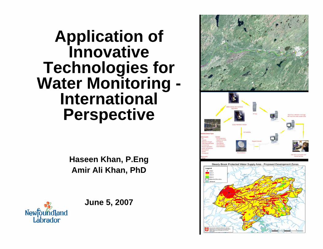
Application ofInnovative
Technologies for Water Monitoring -
International Perspective
Haseen Khan, P.EngAmir Ali Khan, PhD
June 5, 2007

Presentation Layout• Egypt Looming Challenges• Two Projects
– NATO Science for Peace Project “Real Time Water Quality Monitoring Network”
– ESA TIGER Project“Remote Sensing to Measure Water Quality”
• Path Forward– Integration of RTWQ with Remote sensing– Expansion to Other Water Bodies
• Closing Thoughts

Egypt Looming Challenges• Rapid population and urbanization growth• Limited water resources• Degradation of water quality
Year 1965 (33 million)
Year 2005 (72 million)
Year 2025 (100 million)
Population Per capita water share
0200400600800
10001200140016001800
1950 1975 2000 2025
Scarcity Level
Cub
ic m
eter
/Cap
ita//Y
ear

Project 1
Real Time Water Quality Monitoring Network
NATO Science for Peace Project
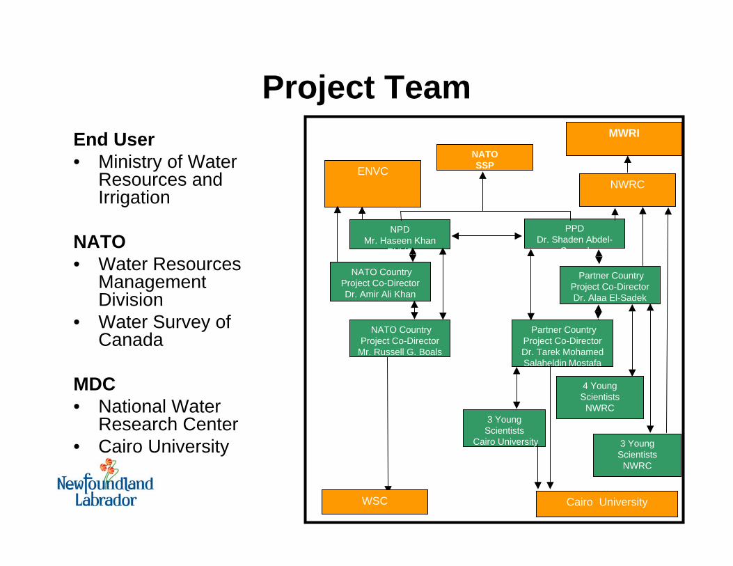
NATOSSP
NPDMr. Haseen Khan
ENVC
PPDDr. Shaden Abdel-
Gawad
NATO Country Project Co-DirectorDr. Amir Ali Khan
ENVC
NATO Country Project Co-Director
Mr. Russell G. BoalsWSC
Partner Country Project Co-DirectorDr. Alaa El-Sadek
NWRC
Partner Country Project Co-DirectorDr. Tarek Mohamed Salaheldin Mostafa
Cairo University4 Young
Scientists NWRC
ENVC
Cairo University
NWRC
3 Young Scientists
Cairo University 3 Young Scientists
NWRC
WSC
Project TeamEnd User• Ministry of Water
Resources and Irrigation
NATO• Water Resources
Management Division
• Water Survey of Canada
MDC• National Water
Research Center• Cairo University
MWRI

Motivation
• There is a need to develop a capacity in Egypt to monitor the strategic water bodies on a real time basis against any natural and man-made threats; take immediate corrective and mitigation measures; and
• To report the suitability of the River Nile water for various uses such as drinking, irrigation, livestock, fishing and recreational.

Current Status of the Technology
• Four semi continuous drainage water quality monitoring sites (Not In situ)
• No central command centre and no RTWQ Reporting
• No exceedance based Water Quality Index
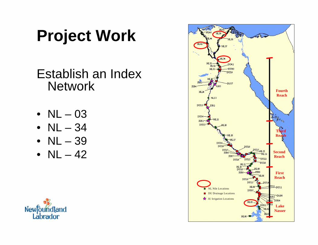
NL Nile Locations
DU Drainage Locations
IU Irrigation Locations
Lake Nasser
First Reach
Second Reach
Third Reach
Fourth Reach
Establish an Index Network
• NL – 03• NL – 34• NL – 39• NL – 42
Project Work

NL-34

NL- 39

NL-42

N L N ile L o c a t io n s
D U D ra in a g e L o c a t io n s
IU Ir r ig a tio n L o c a t io n s
L a k e N a sser
F irst R ea ch
S eco n d R ea ch
T h ird R ea ch
F o u rth R ea ch
Project Contribution
• Capacity to monitor strategic water bodies in an early warning mode
• Protect and report strategic water uses
• Integrated Water Resources Management Proposed RTWQ Sites
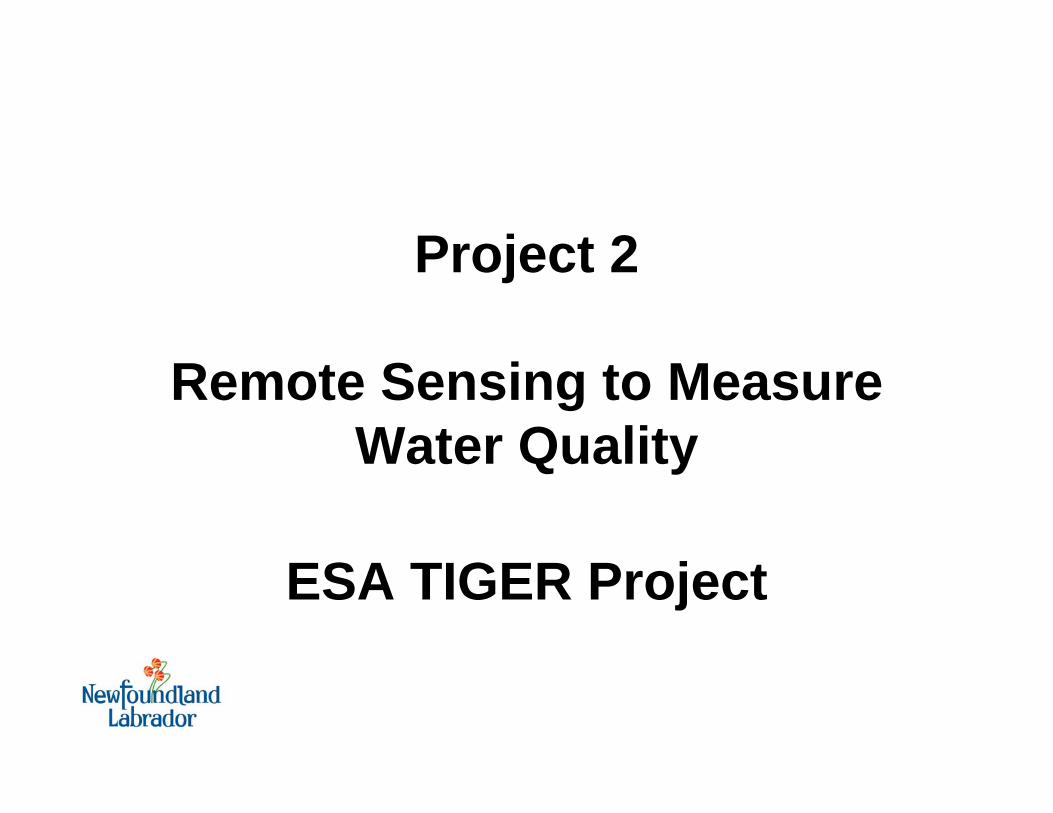
Project 2
Remote Sensing to Measure Water Quality
ESA TIGER Project

Project Team
• DRI• Primary end user • Point of contact to
other operational users (e.g. Ministry of Environment, MWRI, NWRC)
• Local provider of EO-based information
C-CORE• Project lead• Development and
implementation• TrainingWater Resources Management Division (WRMD), NL Department of Environment and Conservation• Expert consultant:
integrating EO and IWRM
• Training
EGYPT CANADA
Finnish Environment Institute (SYKE) and Helsinki University of Technology (HUT)
Expert consultant: operational water quality monitoring using EO
FINLAND

MotivationManzalahBurullus
IdkuMaryut
Birkat Quarun
Toshka
Bitter Lakes
Bardawil
Cairo
• Lakes are vital component of Egypt’s water resources
• Pressure of diverse, multiple uses creates potential for conflict and degradation
• Need for accurate, reliable lake water quality information

Motivation - Lake Manzalah• Physical Characteristics
– Largest of Egypt’s coastal lagoons
• Total area ~1000 km2
• Free water surface ~500 km2
– ~1000 islands– Average depth ~1.3m– Several openings to
Mediterranean Sea– Inflow of agricultural drainage
water and wastewater– Population of 8 Million in area
surrounding Lake Manzalah
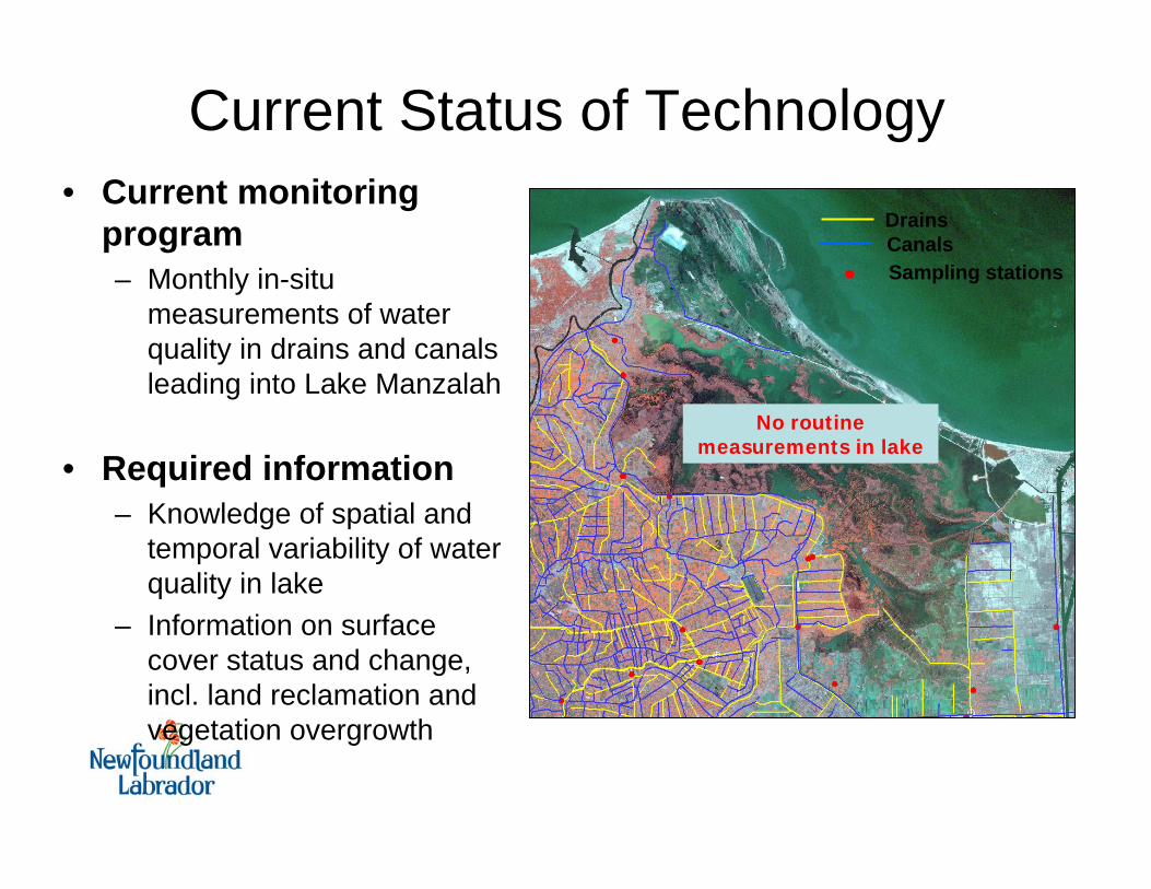
Current Status of Technology• Current monitoring
program– Monthly in-situ
measurements of water quality in drains and canals leading into Lake Manzalah
• Required information– Knowledge of spatial and
temporal variability of water quality in lake
– Information on surface cover status and change, incl. land reclamation and vegetation overgrowth
DrainsCanalsSampling stations
No routine measurements in lake

Project Work• Demonstrate
utility of EO for water quality monitoring and integrated water resources management (IWRM) in Egypt

Relative Products - CHLBand ratio:MERIS Band 9/Band 7May 2 - 27, 2006
Consistently high value may indicate persistently high chlorophyll-a concentration

Chl-Product, April 30

Field Sampling ProgramPlanned sampling locations (54)Actual sampling locations (43)Launch areas (4)

Project Contribution• Systematic measurement of water
quality over large areas
• Spatio-temporal variability of water quality
• Information on surface cover conditions and change
• Identification of critical areas (pristine/impaired) and trends
• Integration with in-situ data

Path Forward
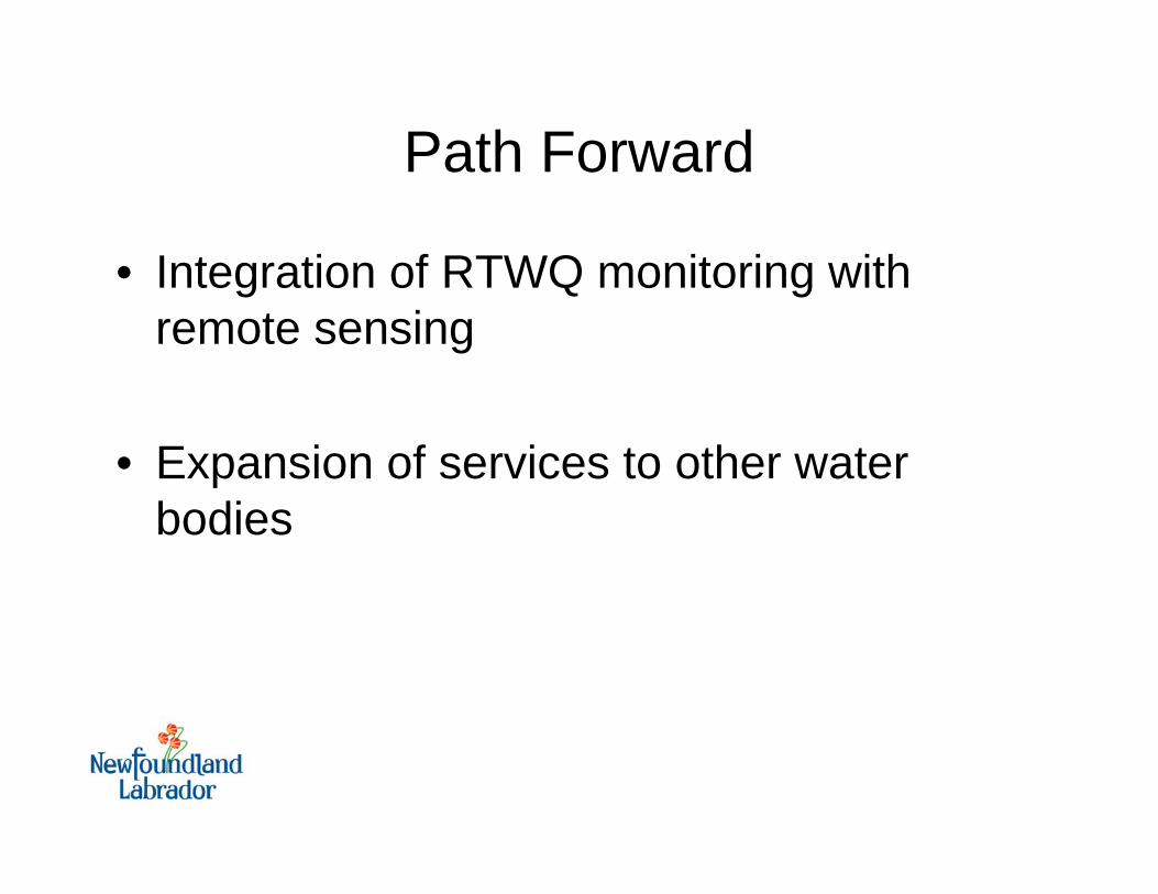
Path Forward
• Integration of RTWQ monitoring with remote sensing
• Expansion of services to other water bodies

RTWQ Monitoring for RS Calibration• Integration of two space technologies

Expansion To Other Water BodiesManzalahBurullus
IdkuMaryut
Birkat Quarun
Bitter Lakes
Bardawil
Cairo
• Lakes
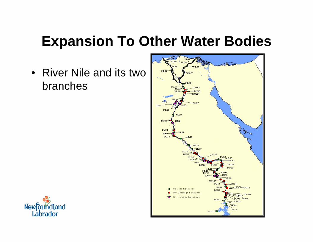
Expansion To Other Water Bodies
• River Nile and its two branches
N L N il e L o c a t io n s
D U D ra in a g e L o c a tio n s
IU I r r i g a ti o n L o c a tio n s
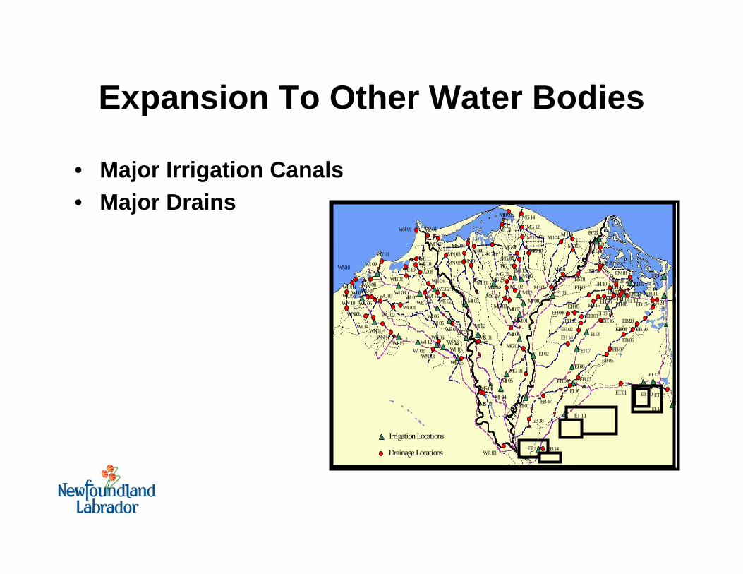
Expansion To Other Water Bodies
• Major Irrigation Canals• Major Drains
WR 03
WR 01
WN 10
WU 03
WU 02 WU 01
WU 06
WU 07 WU 56 WU 09
WU 08
WT 01
WN 11
WN 13 WE 05
WE 06
WE 07
WE 01
WE 02
WE 03 WE 04
WE 08 WE 10 WE 11
WE 19
WB 01
MZ 01 MT 01
MS 07
MS 01
MN 04 MN 03 MN 02 MN 01
MB 02
MB 01
M 111
MK 01
MM 01
M 701 M 801
M 109
M 101
M 103 M 104 M 116
MG 14
MG 12
MG 09
MG 10 MG 08
MG 07 MG 15
MG 05 MG 28
MG 02 MG 04 MG 25
MG 18
MG 01
MG 03
EF 01
ES 01 ES 02
ET 01
EM 01
EB 14
EB 38
EB 47
EB 04 EB 13
EB 05
EB 07
EB 06
EB 08 EB 10 EB 09
EB 15
EB 11
EH 14 EH 02
EH 18 EH 04
EH 05
EH 03
EH 15 EH 06 EH 07
EH 08
EH 09 EH 10
EH 16
EH 12 EH 11
EH 17
EH 20
EH 21
EH 23 EH 24
EI 21
WN01
WN03
WN10
ET 03
WI 03
WI 14
WI 15 WI 02
WI 12
WI 09
WI 08 WI 07
WI 06 WI 05
WI 16 WI 13
WI 04
WI 11
EI 01
EI 02
EI 03
EI 04
EI10
EI 11
EI15 EI 20
EI12
EI19
EI13
EI 06
EI 07
EI 08
EI 09
EI 18
EI 05
EI 14
MI 02
MI 03
MI 04
MI 05
MI 06
MI 07 MI 08
MI 09
MI 11 MI 12
MI 13
Irrigation Locations
Drainage Locations EI 10
EI 11
EI 20

Closing Thoughts

Closing Thoughts• Egypt will have access to the
“state of art” technology for water monitoring– Remote sensing– RTWQ Monitoring
• Environmental Security• Capacity Building• Integrated Water Resources
Management• Trans boundary governance
www.gov.nl.ca/env

THANK YOU


