39
(Chapter 10 in D & R) Geometry and Kinematics: Plates
| Date post: | 22-Dec-2015 |
| Category: |
Documents |
| View: | 240 times |
| Download: | 4 times |
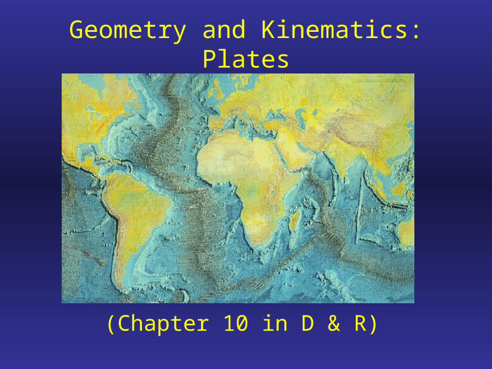
(Chapter 10 in D & R)
Geometry and Kinematics: Plates

Today's lecture
• 1) Building Blocks of the Earth: What's getting deformed?
• 2) Geometry + Kinematics = Plate Tectonics
• 3) Kinematic evolution

Earth Structure: defined by seismic discontinuities;concentric shells of rock or liquid with contrasting chemical and physical properties
Core: iron alloyMantle: ultramaficCrust: mafic to felsic

Note the figure that is to scale!
Boundary between mantle and crust is called the Moho, short for Mohorovicic discontinuity
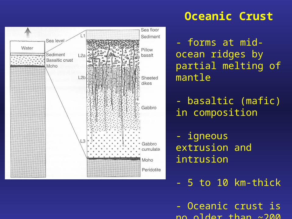
Oceanic Crust
- forms at mid-ocean ridges by partial melting of mantle
- basaltic (mafic) in composition
- igneous extrusion and intrusion
- 5 to 10 km-thick
- Oceanic crust is no older than ~200 Ma. Why??

Continental Crust
- 5 to 10 times thicker than oceanic crust- 40 km avg.
- This is a simplified sketch! Continental crust is very heterogeneous
- Long and complex deformation history. Majority of continental crust formed during the Precambrian (before ~570 Ma) The oldest known rock is ~4 Ga!
Why so much older than oceanic crust??
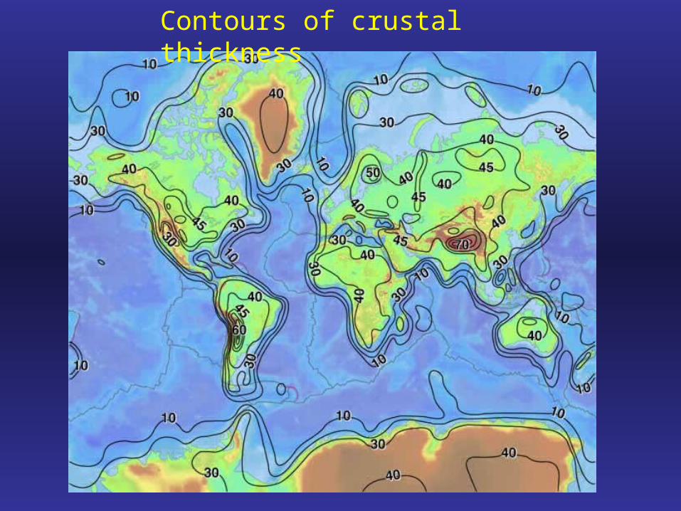
Contours of crustal thickness
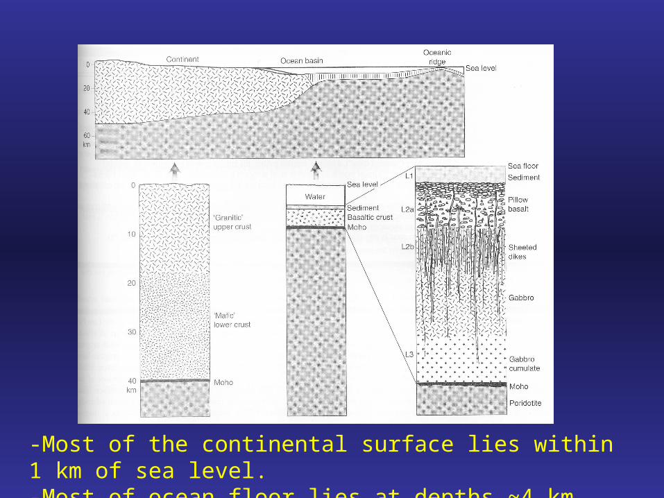
-Most of the continental surface lies within 1 km of sea level.-Most of ocean floor lies at depths ~4 km below sea level.


Rheology (behavior during deformation) of the Earth
Lithosphere: "lithos" = rock, implying strength. It exhibits a component of elastic strength over geological time scales. Includes crust + uppermost mantle! Varies in thickness. Moves as a plate- exceptions are orogens.
Asthenosphere: Weak. It is solid, but behaves like a viscous fluid (convective flow) over geological time scales.

Plates of the Earth
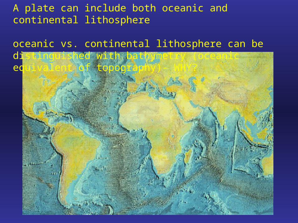
A plate can include both oceanic and continental lithosphere
oceanic vs. continental lithosphere can be distinguished with bathymetry (oceanic equivalent of topography)- WHY?
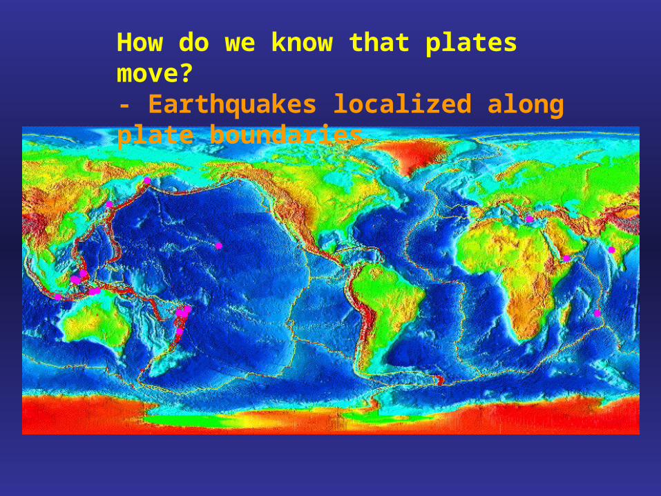
How do we know that plates move?- Earthquakes localized along plate boundaries

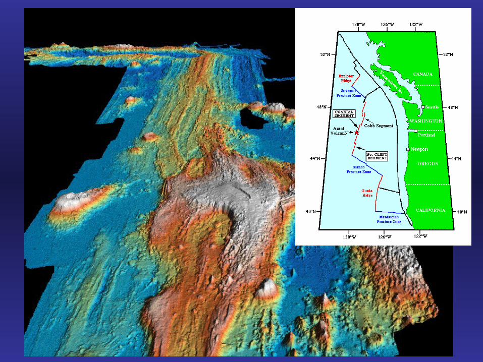
Most folks were convinced when spreading was demonstrated at mid-ocean ridges

What is it?
Geometry: Sketch
Kinematic models1) 2)
Predictions?
Tectonic significance?

Transform faults: more evidence for plate motion
Not observed!
Observed!

Oceanic transform faults: Spreading occurs perpendicular to the ridge axis and any curvature is taken up by transform faults. Different rates of spreading.

GPS (Global Positioning System)
Satellite-based geodesy: A new revolution in Earth Sciences!(more near end of semester!)
InSARInterferometric Synthetic Aperture Radar

Continents also break- to form new oceans

So far: Opening of oceans and creation of oceanic crust
Is the Earth expanding?

Spreading at mid-ocean ridges must be compensated by subduction

Ocean-Continent convergent margins


Continent-Continent convergent margins

An example:
The Indo-Asian Collision

Digital elevation map (DEM) of the Himalayan-Tibetan orogen
Warmer colors represent higher elevations

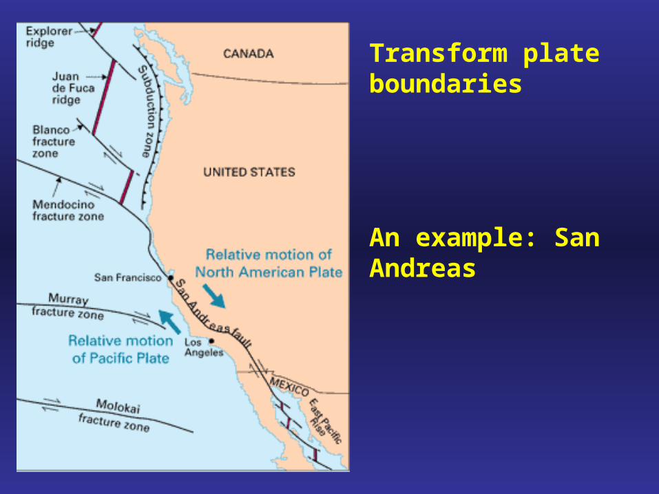
Transform plate boundaries
An example: San Andreas
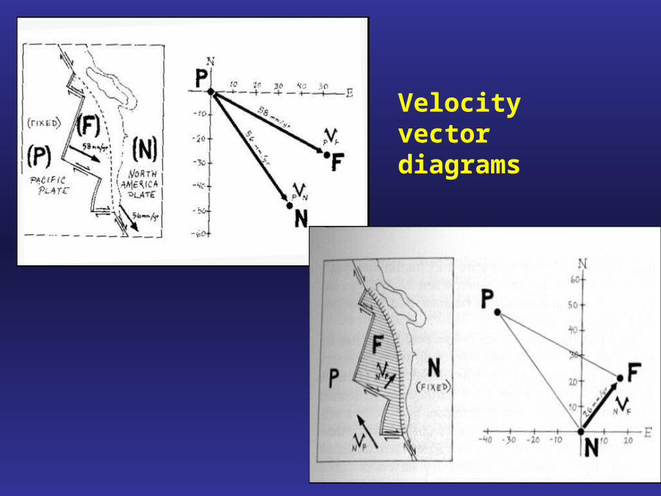
Velocity vector diagrams
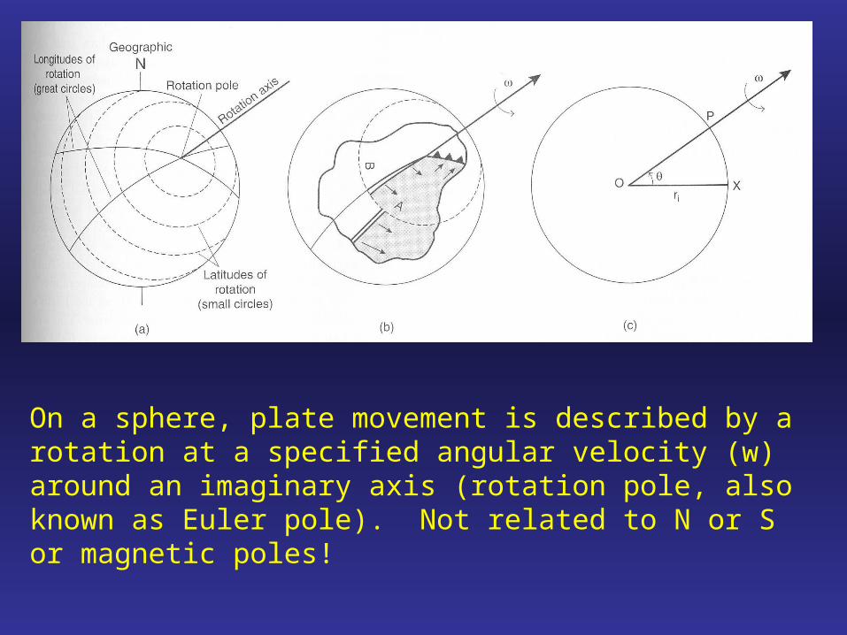
On a sphere, plate movement is described by a rotation at a specified angular velocity (w) around an imaginary axis (rotation pole, also known as Euler pole). Not related to N or S or magnetic poles!

Oceanic plates move perpendicular to ridges and parallel to transform faults.
Euler poles can be determined for oceanic plates by drawing lines perpendicular to transform faults (and fracture zones).
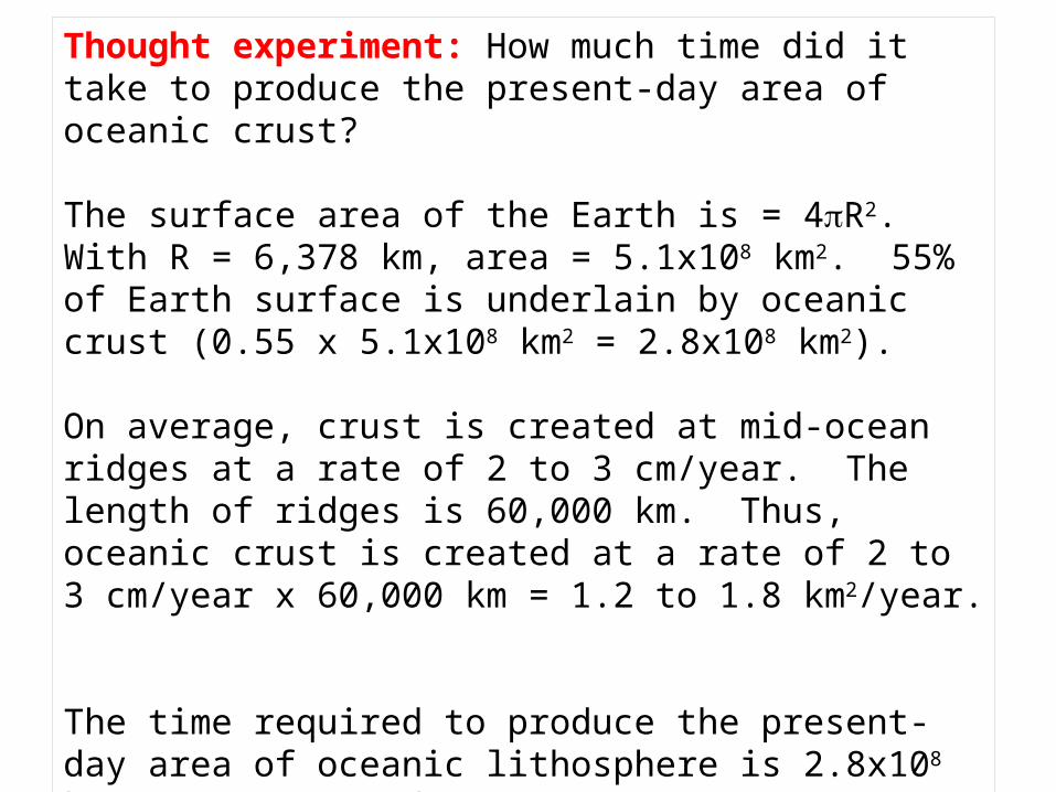
Thought experiment: How much time did it take to produce the present-day area of oceanic crust?
The surface area of the Earth is = 4R2. With R = 6,378 km, area = 5.1x10⁸ km2. 55% of Earth surface is underlain by oceanic crust (0.55 x 5.1x108 km2 = 2.8x10⁸ km2).
On average, crust is created at mid-ocean ridges at a rate of 2 to 3 cm/year. The length of ridges is 60,000 km. Thus, oceanic crust is created at a rate of 2 to 3 cm/year x 60,000 km = 1.2 to 1.8 km2/year.
The time required to produce the present-day area of oceanic lithosphere is 2.8x10⁸ km2/ (1.2 to 1.8 km2/year) = 155 to 230 Ma.
What does this imply about the plate configuration of Earth ~200 m.y.a?

Pangea supercontinent and Tethys Ocean
http://www.scotese.com/earth.htm
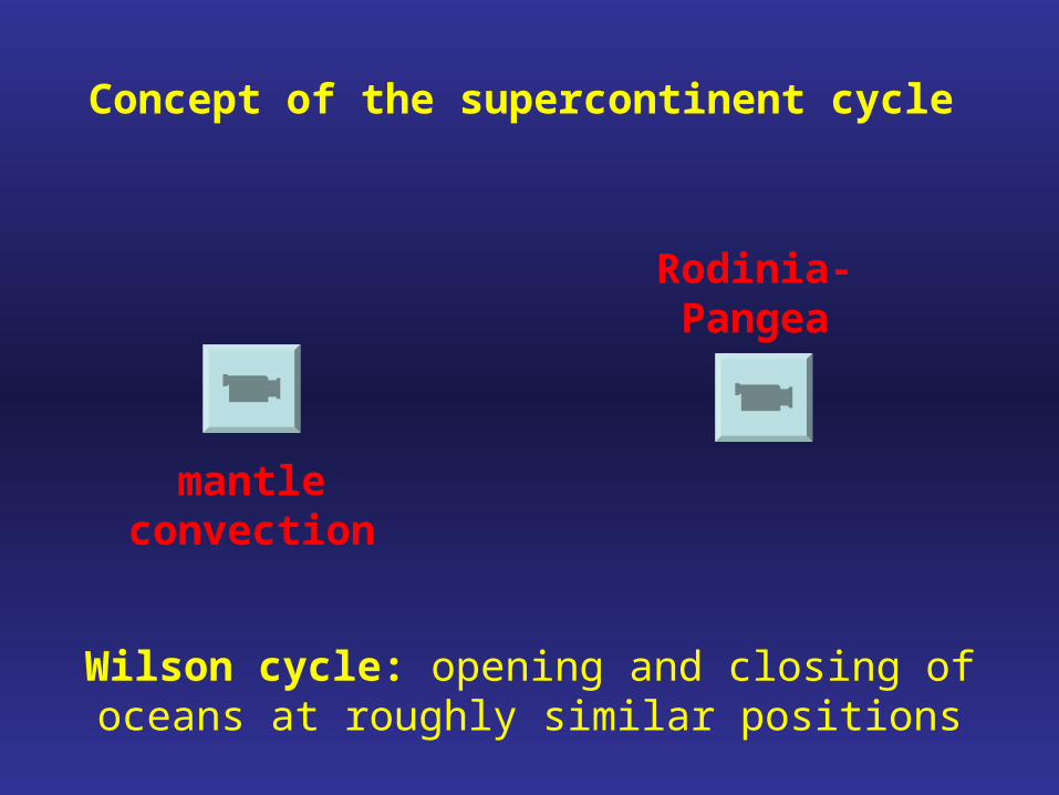
Concept of the supercontinent cycle
Rodinia-Pangea
mantle convection
Wilson cycle: opening and closing of oceans at roughly similar positions

Extraterrestrial plate tectonics?
DEM of Aleutian trench
DEM of Artemis Corona on Venus; same scale as above
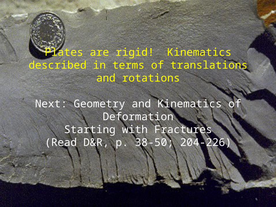
Plates are rigid! Kinematics described in terms of translations and rotations
Next: Geometry and Kinematics of DeformationStarting with Fractures
(Read D&R, p. 38-50; 204-226)
Important terminology/concepts
- Crust: continental vs. oceanic
- Mantle
- Moho
- Rheology: Lithosphere vs. Asthenosphere
- Earth's plates
- Bathymetry
- Evidence for plate motion?
- Mid-oceanic ridges
- Transform faults and fracture zones
- Ocean-continent convergent margins
- trench, accretionary wedge, forearc
- Continent-continent convergent margins
- Plate kinematics
- Euler Pole
- Velocity vector diagrams
- Kinematic history
- Supercontinent cycle


