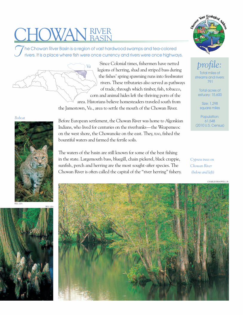
Since Colonial times, fishermen have netted legions of herring, shad and striped bass during the fishes’ spring spawning runs into freshwater rivers. These tributaries also served as pathways of trade, through which timber, fish, tobacco, corn and animal hides left the thriving ports of the area. Historians believe homesteaders traveled south from the Jamestown, Va., area to settle the mouth of the Chowan River. Before European settlement, the Chowan River was home to Algonkian Indians, who lived for centuries on the riverbanks—the Weapemeoc on the west shore, the Chowanoke on the east. They, too, fished the bountiful waters and farmed the fertile soils. The waters of the basin are still known for some of the best fishing in the state. Largemouth bass, bluegill, chain pickerel, black crappie, sunfish, perch and herring are the most sought-after species. The Chowan River is often called the capital of the “river herring” fishery. T he Chowan River Basin is a region of vast hardwood swamps and tea-colored rivers. It is a place where fish were once currency and rivers were once highways. Total miles of streams and rivers: 791 Total acres of estuary: 15,600 Size: 1,298 square miles Population: 61,548 (2010 U.S. Census) profile: CHOWAN RIVER BASIN Bobcat Cypress trees on Chowan River (below and left) Va BILL LEA BILL LEA CHARLES BRASWELL JR.
Transcript
Since Colonial times, fishermen have nettedlegions of herring, shad and striped bass duringthe fishes’ spring spawning runs into freshwaterrivers. These tributaries also served as pathwaysof trade, through which timber, fish, tobacco,
corn and animal hides left the thriving ports of thearea. Historians believe home steaders traveled south from
the Jamestown, Va., area to settle the mouth of the Chowan River.
Before European settlement, the Chowan River was home to AlgonkianIndians, who lived for centuries on the riverbanks—the Weapemeocon the west shore, the Chowanoke on the east. They, too, fished thebountiful waters and farmed the fertile soils.
The waters of the basin are still known for some of the best fishing in the state. Largemouth bass, bluegill, chain pickerel, black crappie,sunfish, perch and herring are the most sought-after species. TheChowan River is often called the capital of the “river herring” fishery.
T he Chowan River Basin is a region of vast hardwood swamps and tea-coloredrivers. It is a place where fish were once currency and rivers were once highways.
Total miles of streams and rivers:
791
Total acres ofestuary: 15,600
Size: 1,298 square miles
Population: 61,548
(2010 U.S. Census)
profile:
CHOWANRIVERBASIN
Bobcat
Cypress trees on
Chowan River
(below and left)
Va
BILL LEA
BILL LEA
CHARLES BRASWELL JR.
The term is applied to both blueback herring and alewife, anadromous species that live asadults in the open ocean but swim back to the freshwater streams of their birth to breed. As recently as three decades ago, more than 12 million herring were processed annually in the town of Colerain. Early settlers ate their herring boiled, fried or corned (cured by salt). Many traded barrels of herring for sugar, rum and other goods. Though the population and commercial harvest of herring have drastically declined, it is still a spring tradition for locals to fry this fish-of-little-flesh to a crisp and eat it bones and all.
The Chowan River proper originates at theNorth Carolina-Virginia border where theBlack water and Nottoway rivers meet. Nar- row and lively at its source, the 50-mile-longChowan flows southeast past such small townsas Winton and Colerain before broadening to nearly two miles wide where it meets theAlbemarle Sound near Edenton. Along withthe Roanoke River, it supplies most of thefresh water to the sound, which is part of thesecond-largest estuary system in the UnitedStates (the Albemarle-Pamlico Estuary). Onlythe Chesapeake Bay is larger in area. Majortributaries in the basin include the Meherrinand Wiccacon Rivers and Potecasi, Ahoskie,Bennetts, Indian and Rockyhock creeks.
Merchants Millpond State Park is a mystical place where
ancient bald cypress trees and draping Spanish moss
wrap around a 760-acre millpond nearly 200 years old. The
float ing leaves of water lilies meet knobby cypress knees at
the surface of the still, black water. The pond’s upper end con -
tains a grove of 800-year-old bald cypresses and some of the
Enchanted Foreststate’s largest water tupelos. More than 200 species of birds
have been recorded, and waterfowl abound in winter.
Water moccasins, or “cottonmouths,” pro lif erate in the
warm months. Other inhabitants include alli gators, black
bears, minks, gray foxes and river otters.
A black bear wades
through duckweed
in a swamp.BILL LEA
GEORGE HUMPHRIES
GEORGE HUMPHRIES
KEN TAYLOR, WILDLIFE IMAGES
One of the most extensive swamp forests in North Carolina, ChowanSwamp, lies along the northeast shore of the Chowan River. Between1973 and 1994, The Nature Conservancy worked with Union CampCorporation and Georgia-Pacific Corporation to protect almost 11,000acres now owned by the N.C. Wildlife Resources Commission, theN.C. Forestry Foundation and the N.C. Division of Parks and Recrea -tion. Most of the swamp is forested in swamp tupelo and red maple,with a narrow strip of bald cypress and water tupelo along the river. Freshwatermarshes at the mouths of Bennett’s,Sarem and Catherine creeks containlarge patches of prairie cordgrass, a
sig nif i cantly rare species in North Caro lina. Wild rice and arrow arum grow there too. The swamp hosts breeding“neotropical” migra tory songbirds, such as prothonotaryand Swainson’s warblers, and mammals such asblack bears, bobcats and river otters. Paddlers canaccess this wilder ness through severalblackwater streams.
The state’s Natural Heritage Programcon siders 100 miles of the Chowan andits trib utaries significant aquatic habitatbecause of diverse, rare and vulnerable popu -la tions of freshwater mussels. Five mussel species
are state-listed as threatened: the triangle and alewife floaters, the eastern lampmussel, theeastern pondmussel and the tidewater mucket. The Chowanoke crayfish, a resident of sluggish,woodland streams of the basin, lives elsewhere only in south eastern Virginia. The Atlanticsturgeon is listed federally as an endangered species, though it hasn’t been recorded in theChowan River for more than 100 years. The red-cockaded woodpecker is another federallyendangered species in the basin. The bald eagle, American alligator and coastal plainsubspecies of the Rafinesque’s big-eared bat are state-listed as threatened.
State officials in charge of monitoring water quality find the condition of the basin’s watersgenerally good, so it’s hard to believe that the Chowan River was once declared “dead.” In1972, the Chowan was the site of the first large-scale algae bloom in coastal North Carolina.Thick, green scum swal lowed the lower half of the river. Depleted oxygen levels caused by the decom posing blue-green algae killed fish, and fish diseases were rampant.
For the past two decades, concerned residentsand scientists have worked to restore waterquality. A local group of residents beganmonitoring the river. They alerted officials toprob lems, attended public meetings and spot - lighted possible polluters. Research indicatedthat excess levels of nitrogen and phosphorusin wastewater and runoff contrib uted greatlyto the river’s problems. In 1979, the Chowanbecame the first river basin in North Caro-lina to receive the “nutrient sen sitive waters”classification. The state’s Divi sion of WaterQuality recommended reduc tions in theamounts of phosphorus and nitrogen thatwastewater treatment sys tems were allowed to discharge into the river.
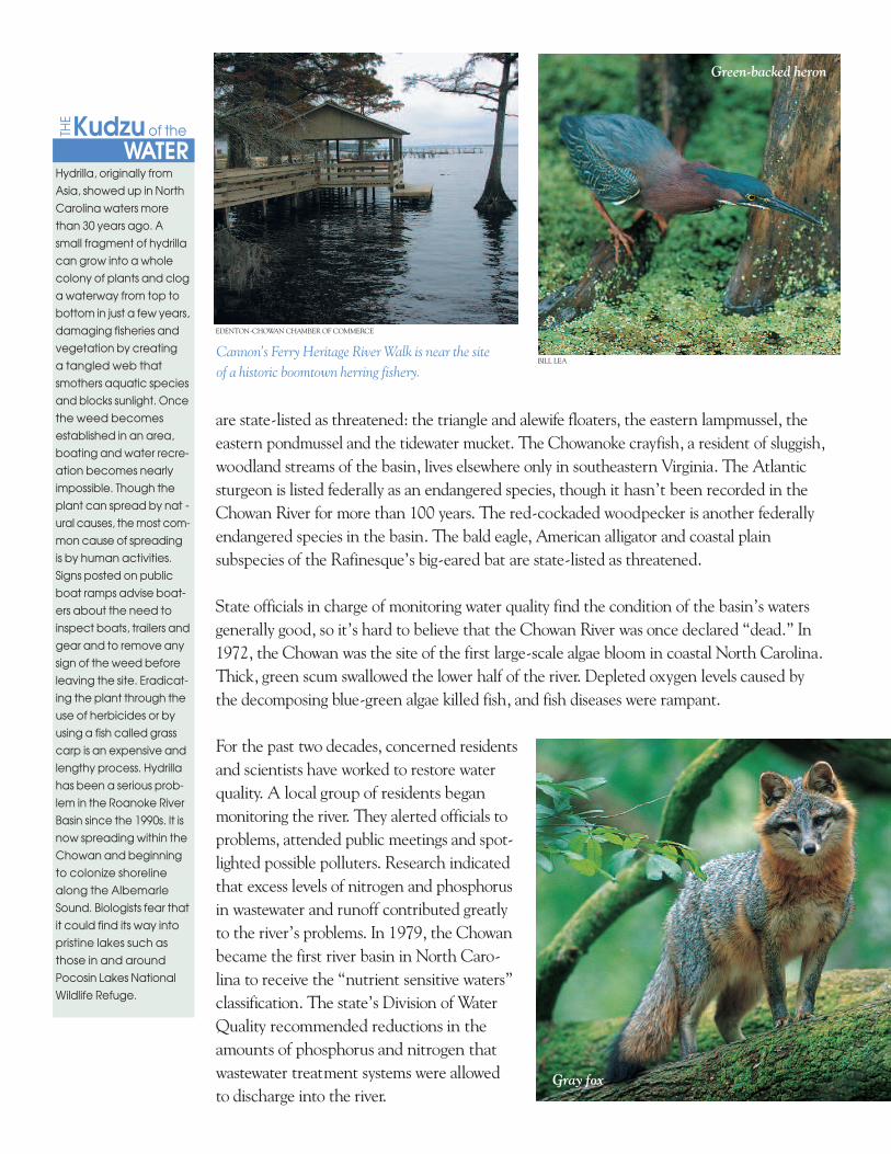
Gray fox
Green-backed heron
BILL LEACannon’s Ferry Heritage River Walk is near the site of a historic boomtown herring fishery.
EDENTON-CHOWAN CHAMBER OF COMMERCE
Hydrilla, originally fromAsia, showed up in NorthCarolina waters morethan 30 years ago. Asmall fragment of hydrillacan grow into a wholecolony of plants and cloga waterway from top tobottom in just a few years,damaging fisheries andvegetation by creating a tangled web thatsmothers aquatic speciesand blocks sunlight. Oncethe weed becomesestablished in an area,boating and water recre -ation becomes nearlyimpossible. Though theplant can spread by nat -ural causes, the most com-mon cause of spreadingis by human activities.Signs posted on publicboat ramps advise boat -ers about the need toinspect boats, trailers andgear and to remove anysign of the weed beforeleaving the site. Eradicat -ing the plant through theuse of herbicides or byusing a fish called grasscarp is an expensive andlengthy process. Hydrillahas been a serious prob -lem in the Roanoke RiverBasin since the 1990s. It isnow spreading within theChowan and beginningto colonize shorelinealong the AlbemarleSound. Biologists fear thatit could find its way intopristine lakes such asthose in and aroundPocosin Lakes NationalWildlife Refuge.
WATER
THEKudzu of the
Area farmers have taken voluntary measures to reduce soil erosion andrunoff of fertilizer and animal waste. Researchers estimate that 123,244fewer tons of soil erode each year because of these practices.
Another positive result can be seen in area fisheries. A 10-year fish consumption dioxin advisory waslifted for the Chowan River in 2000. (Dioxin is a byproduct of certain paper-bleaching pro cesses.)New bleaching technologies at a Virginia paper mill have reduced contaminated waste waterdischarge. The majority of the Chowan River’s watershed (75 percent) lies in Vir ginia. Thanks to work by the Albemarle-Pamlico National Estuary Program, stakeholders in Virginia andNorth Carolina have pledged to work together to protect shared water resources. They’veappointed a watershed field coordinator, and an inter state work group coordinates projects.
A variety of skills, knowledge and talents is necessary to solve water quality problems—which is why it’s soimportant for many different people, organizations andagencies to pool their resources to protect a community’snatural resources. Many opportunities exist for people to get involved in environmental stewardship in theChowan River Basin. For more information, see thecontacts on the back page.
Parker’s FerryThe community of
Parker’s Ferry in Hert-
ford County is the site
of a two-car ferry from
the 1930s. From a ramp
lined with water lilies
off Secondary Road
1306, the ferry still takes
pas sengers across the
mouth of the Meherrin
River. Parker’s Ferry is also
home to the Meherrin
Indians, “the people
of the muddy waters.”
After they were assigned
to a reservation here in
1726, tribe members dis -
banded and moved into
the surrounding swamps.
By concealing their iden -
tities, they and their
de scen dants became
an integral part of the
area’s econ omy. The
Meherrin’s de scen dants
reorganized in 1975 and
gained offi cial recog -
nition as a tribe in 1986.
Bald cypresses stand
like sentries on a
Chowan swamp.
BILL LEA
Parker’s Ferry
MURFREESBORO HISTORICAL ASSOCIATION
State of North Carolina: Governor Pat McCrory • North Carolina Department of Environment and Natural Resources: Secretary John E. Skvarla, III • Office of Environmental Education and Public Affairs: Program Manager Lisa Tolley; Project Manager Ian Brown• EditorCarla Burgess • Designer Kimberly KC Schott, Red Gate Design • Special ThanksNorth Carolina Wildlife Resources Commission,North Carolina Division of Water Quality and North Carolina Natural Heritage Program • Date: 2013 • 5,500 copies of this public documentwere printed at a cost of $1,324.12 or 0.241 per copy. • This publication was funded through a Walmart Stormwater Compliance Grant.
Printed on recycled paper
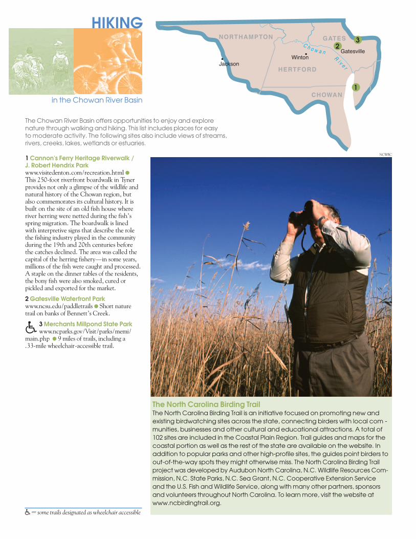
The North Carolina Birding TrailThe North Carolina Birding Trail is an initiative focused on promoting new andexisting birdwatching sites across the state, connecting birders with local com -munities, businesses and other cultural and educational attractions. A total of102 sites are included in the Coastal Plain Region. Trail guides and maps for thecoastal portion as well as the rest of the state are available on the website. Inaddition to popular parks and other high-profile sites, the guides point birders toout-of-the-way spots they might otherwise miss. The North Carolina Birding Trailproject was developed by Audubon North Carolina, N.C. Wildlife Resources Com -mission, N.C. State Parks, N.C. Sea Grant, N.C. Cooperative Extension Service and the U.S. Fish and Wildlife Service, along with many other partners, sponsors and volunteers throughout North Carolina. To learn more, visit the website atwww.ncbirdingtrail.org.
JacksonWinton
GatesvilleC h o w a n
Ri v e r
NORTHAMPTON
HERTFORD
GATES
CHOWAN
2
HIKING
in the Chowan River Basin
1 Cannon's Ferry Heritage Riverwalk / J. Robert Hendrix Parkwww.visitedenton.com/recreation.html l
This 250-foot riverfront boardwalk in Tynerpro vides not only a glimpse of the wildlife andnatural history of the Chowan region, but also commemorates its cultural history. It isbuilt on the site of an old fish house whereriver herring were netted during the fish’sspring migration. The boardwalk is lined with interpretive signs that describe the rolethe fishing industry played in the communityduring the 19th and 20th centuries beforethe catches declined. The area was called thecapital of the herring fishery—in some years,millions of the fish were caught and processed.A staple on the dinner tables of the residents,the bony fish were also smoked, cured orpickled and exported for the market.
2 Gatesville Waterfront Parkwww.ncsu.edu/paddletrails l Short naturetrail on banks of Bennett’s Creek.
� 3 Merchants Millpond State Parkwww.ncparks.gov/Visit/parks/memi/
main.php l 9 miles of trails, including a .33-mile wheelchair-accessible trail.
The Chowan River Basin offers opportunities to enjoy and explorenature through walking and hiking. This list includes places for easy to moderate activity. The following sites also include views of streams,rivers, creeks, lakes, wetlands or estuaries.
�= some trails designated as wheelchair accessible
1
3
NCWRC
JacksonWinton
GatesvilleC h o w a n
Ri v e r
NORTHAMPTON
HERTFORD
GATES
CHOWAN
1 Bennett’s Millpond/Rockyhock CreekPaddle Trailwww.albemarlercd.org/Paddle_Trails.asp l
5-mile paddle trail beginning at old milldam.
2 Cannon's Ferry Heritage Riverwalk / J. Robert Hendrix Parkwww.visitedenton.com/recreation.html l
Canoe launch on the Chowan River.
3 Chowan Swamp Game Land*www.nature.org/ourinitiatives/regions/northamerica/unitedstates/northcarolina/placesweprotect/chowan-swamp-game-land.xml l
Access via Cannon’s Ferry or Gatesvilleaccess areas.
4 Gatesville Waterfront Parkwww.ncsu.edu/paddletrails/albemarle/a1.htmllAccess to Bennett’s Creek.
5 Merchants Millpond State Parkwww.ncparks.gov/Visit/parks/memi/main.php l Paddling on the millpond and access to 6-mile Bennett's Creek Paddle Trail viaLassiter Swamp. l Rental canoes available.
6 Wiccacon River Trail*www.ncsu.edu/paddletrails/roanoketar/rt4.htmll 13-mile paddle trail.
*Denotes site with public access areas main -tained by the N.C. Wildlife Resources Com -mission. For directions to boat ramps, visitwww.ncwildlife.org and click on Boating/Waterways, then Maps/Location.
BFor more information about coastal plainpaddle trails, visit www.ncpaddletrails.info.
PADDLING
in the Chowan River Basin
The Chowan River Basin offers many opportunities for paddling creeks,ponds, streams, rivers, lakes and estuaries. The places included here offerpublic access areas maintained by state, federal or local governments.Privately operated marinas and boat docks may also be available. Thesetrails and lakes are suitable for easy to moderate paddling.
PHOTO COURTESY OF NC DIVISION OF TOURISM, FILM, AND SPORTS DEVELOPMENT
1
6
4
3
2
5
*Basinwide water quality planning is a nonregulatory, watershed-based approach to restoring and protecting thequality of North Carolina’s surface waters. The N.C. Division of Water Quality welcomes community input.
To order additional brochures on any of North Carolina’s 17 river basins, a general river basin booklet or a poster, fill outthe online order form at www.eenorthcarolina.org.t
WHERE SHOULD I GO
HOW CAN I HELP
?
?
What makes the Chowan River Basin so special? See for yourself. Visit these EnvironmentalEducation Centers to discover more about your ecological address:l Merchants Millpond State Park
For more information about Environmental Education Centers in North Carolina, check out the Office of Environmental Education and Public Affairs’ website atwww.eenorthcarolina.org.
You can gain a sense of community pride by learning more and helping to protect streams, riversand lakes in the Chowan River Basin. The contacts listed below can help you do just that. Tofind out about local river organizations and conservation groups, contact your local soil andwater conservation district. To find out about how you can get involved in local waterway andother litter cleanups, contact North Carolina Big Sweep.
Albemarle-Pamlico National Estuary Programwww.apnep.org/
Chowan River Basinwide Plan*http://portal.ncdenr.org/web/wq/ps/bpu/basin/chowan
Clean Water Management Trust Fundwww.cwmtf.net/
Division of Water Quality, Stormwater and Runoff Pollutionwww.ncstormwater.org/
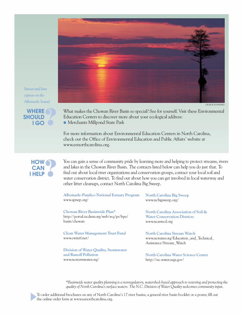
Sunset and lone
cypress on the
Albemarle SoundGEORGE HUMPHRIES
North Carolina Big Sweepwww.ncbigsweep.org/
North Carolina Association of Soil & Water Conservation Districtswww.ncaswcd.org
North Carolina Stream Watchwww.ncwater.org/Education_and_Technical_Assistance/Stream_Watch
North Carolina Water Science Centerhttp://nc.water.usgs.gov/