Page 1
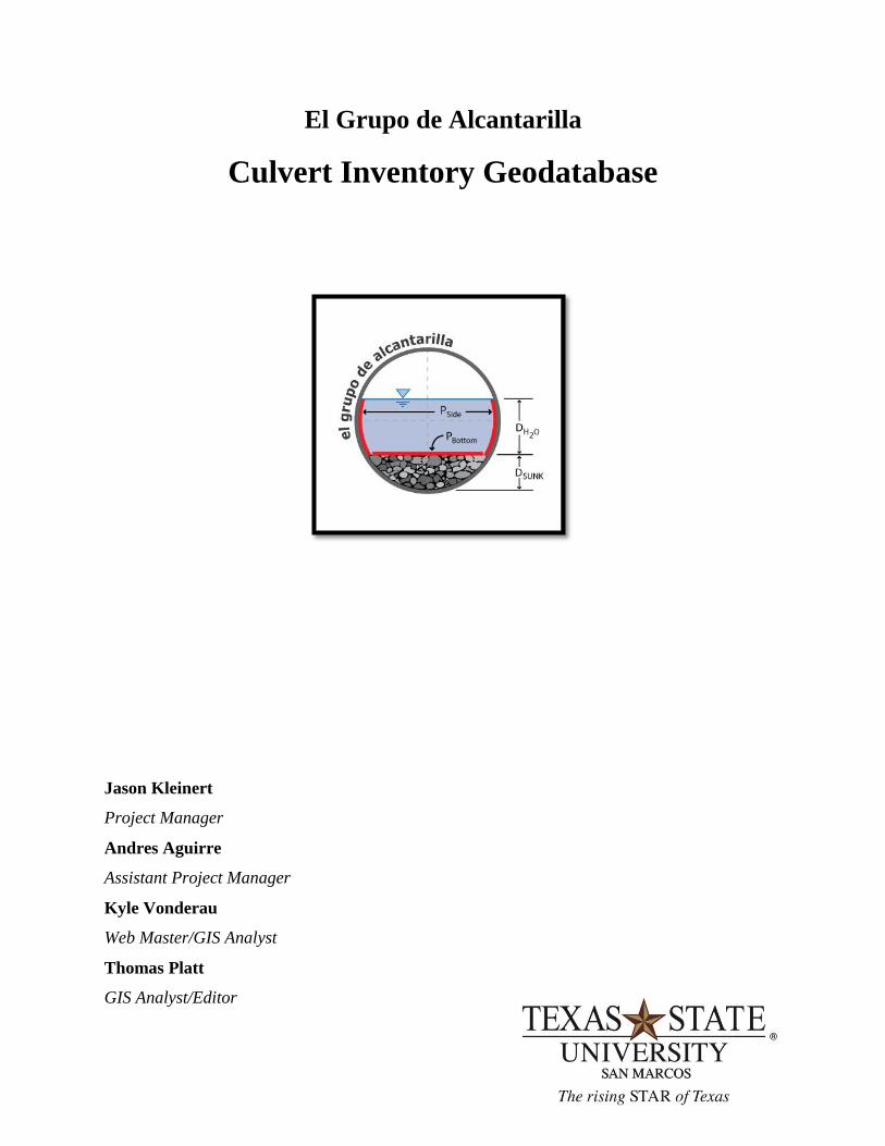
El Grupo de Alcantarilla
Culvert Inventory Geodatabase
Jason Kleinert
Project Manager
Andres Aguirre
Assistant Project Manager
Kyle Vonderau
Web Master/GIS Analyst
Thomas Platt
GIS Analyst/Editor
Page 3
I
Culvert Inventory Geodatabase
Final Report
Prepared for
Texas Department of Transportation
El Grupo de Alcantarilla
Spring 2011
Page 5
II
Abstract
The Texas Department of Transportation, TxDOT, manages and supervises all
construction and maintenance projects that improve roadway efficiency in order to move people
and goods across the state of Texas. One of the entities that play an important role in the impact
of the surface structure is culverts. Culverts channel water to pass underneath a roadway to
allow the road to be free of hazards.
TxDOT has asked Texas State University-San Marcos, Department of Geography (El
Grupo de Alcantarilla), to design a geodatabase that is capable of managing and cataloging the
culverts. In addition to the geodatabase, the team was asked to create an Access database to
assist the TxDOT maintenance office in the collection of culvert inventory data. With a
Geodatabase available to TxDOT, they will be more prepared to provide their staff with an up to
date clearinghouse of culvert information.
The culvert inventory geodatabase is important to both the hydrologists and maintenance
personnel. The relationship between the two departments entering data is important so that both
departments can have access to the same real time data. Once that relationship is bridged
together electronically via the internet or intranet, TxDOT will have a greater range and better
understanding of their equipment in the field.
Page 7
III
Table of Contents
1. INTRODUCTION .......................................................................................................................1
1.1 SUMMARY .......................................................................................................................1
1.2 PURPOSE...........................................................................................................................1
1.3 SCOPE ................................................................................................................................2
1.4 PROBLEM STATEMENT ................................................................................................2
2. LITERATURE REVIEW ........................................................................................................ 2-4
3. DATA ...................................................................................................................................... 4-5
4. METHODOLOGY .................................................................................................................. 6-9
4.2 TASK 1: GEODATABASE IMPLEMENTATION ..........................................................8
4.2 TASK 2:MICROSOFT ACCESS DATABASE IMPLEMENTATION ...................... 8-9
5. RESULTS .............................................................................................................................. 9-10
6. DISCUSSION ...................................................................................................................... 11-13
7. CONCLUSION .................................................................................................................... 13-14
8. REFERENCES ..........................................................................................................................15
APPENDIX I. Metadata........................................................................................................... 16-45
APPENDIX II. Group Participation ........................................................................................ 46-48
Page 9
1
1. Introduction
1.1 Summary
For over one hundred years, the state of Texas has offered safe and reliable roadways to
the public. The Texas Department of Transportation, or TxDOT, oversees these roads and has
offered many resources and services to commuters and travelers since 1917. Culverts allow for
adequate drainage to accommodate surface run-off beside and across roadways; as well as,
maintaining natural drainage in these areas. Flooding, road failures, property damage, and
erosion can occur when a culvert fails to properly convey water. These failures can create
dangerous driving conditions, expensive repairs for taxpayers, costly detours, damage to the
drainage system and the environment. As more and more roadways are built, culverts prove to
be an integral part in the maintenance and longevity of Texas roadways.
1.2 Purpose
Texas State University – San Marcos, Department of Geography, was asked to assist
TxDOT in creating a geodatabase that would provide Hydrologist engineers and Maintenance
personnel the real time data needed to control cost and improve culvert reliability. ArcGIS and
Microsoft Access were used to create the geodatabase system. Hays County Texas was selected
as the pilot study area. TxDOT will be able to use the geodatabase to catalog and manage
information about culverts such as location, age, and type throughout the state of Texas. A well
designed geodatabase will ensure quick and easy access to these large volumes of data and
enable TxDOT to effectively manage their infrastructure.
Page 10
2
1.3 Scope
The geographic extent of the study area is a road section, RM 150, in Hays County that
will be used to validate the functionality of the geodatabase. The route was selected with the aid
of the local TxDOT maintenance office (Section 6) who is familiar with the area and provided
much needed information to the team, such as, what areas would best represent culvert diversity
and age.
1.4 Problem Statement
The problem which this project addresses is:
Why design a geodatabase to Inventory Culverts? This section deals primarily with the “what”
in designing a geodatabase management system. What are the generic processes? What are the
tools that are available? What types of methodologies are important when creating a
geodatabase?
Once a geodatabase is created, a GIS will then be able to provide spatial visualization of
the data contained therein. TxDOT has also requested an additional database be created using
Microsoft Access. This will allow the TxDOT maintenance office to enter data of culverts.
2. Literature Review
The implementation of a GIS to inventory culvert features in a statewide road network
can be a beneficial way for the Department of Transportation to control cost and better manage
their infrastructure. Research was conducted on the benefits of implementing the geodatabase
data model. A GIS is a particularly useful tool in managing our man-made environment and can
provide valuable support to the decision making process.
Page 11
3
The geodatabase data model allows users to implement a series of custom behaviors and
to make GIS data features smarter without writing any code. Coding can be performed when a
set of custom behaviors is required. The geodatabase data model brings a physical data model
closer to its logical data model (Zeiler, 1999, p.5).
There are many benefits to the geodatabase data model that make it far superior to any
non-object-oriented model. According to Zeiler, some of the benefits are: a uniform repository
of geographic data, data entry and editing is more accurate, users work with more intuitive data
objects, features have a richer context, better maps can be made, features on a map display are
dynamic, shapes of features are better defined, sets of features are continuous, and many users
can edit geographic data simultaneously. A principal advantage of the geodatabase data model is
that it includes a framework to make it as easy as possible to create intelligent features that
mimic the interactions and behaviors of real-world objects (Zeiler, 1999, p.7).
A March 2005 article from Public works magazine details the importance of a systematic
approach to culvert inventory and inspection. The article is written by the public information
officer with the Ohio Department of Transportation (ODOT). The article describes an instance
of a culvert failure underneath a busy stretch of I-480 in Cuyahoga County. The incident was
identified and addressed before a catastrophic failure of the roadway occured.
The result of the failure was the creation of a cross-disciplinary, problem-solving process
(PSP) team to confront the problem head-on and develop an approach that would prevent this
type of emergency from occurring (Proctor, 2005). The culvert inspection team developed a plan
that utilized existing technicians and field engineers to inspect and inventory all culverts. Each
culvert is identified with a unique identification number and field-located using a global
Page 12
4
positioning system (Proctor, 2005). This methodology allowed ODOT to adequately track the
condition of each feature and to effectively prioritize and implement maintenance procedures.
3. Data
The data used in the culvert inventory geodatabase project is listed below:
1) Texas Reference Marker System (TRM): Client Supplied (TxDOT)
2) Stratmap County Boundaries: Texas Natural Resources Information Systems
3) San Marcos, Texas Orthoimagery 2008: Capital Area Council of Governments
The shapefiles used from the TRM data for the project are:
1) Hays County Culverts
2) Hays County Reference Markers
3) Control Section Route Polylines
4) Maintenance Section
The quality of the TRM data was not a major concern; the project focuses primarily on
geodatabase design rather than on data analysis. However, the data was very useful in
identifying the attribute fields relevant for culvert inventory and hydrologic analysis.
The only changes to the TRM data were the locations of culverts along RM 150. When
the Hays County Culverts shapefile was compared with orthoimagery, some of the locations
were shown to be inaccurate.
Page 13
5
The TRM data is important to the project because it is used to populate the tables created
in the culvert inventory geodatabase. By using real values for attributes in the geodatabase
tables, future users can better understand what the fields represent and the kinds of data to be
inputted into the geodatabase. The TRM data obtained was not projected and remains as such.
This decision was made to allow users of the system to work with the more familiar latitude and
longitude system.
The second piece of data used for the project is the Stratmap County Boundaries from the
Texas Natural Resources Information System (TNRIS). The data was downloaded from the
Capital Area Council of Governments information clearinghouse website. The data quality is
satisfactory; it accurately displays the county boundaries of the state of Texas. The county
boundaries shapefile is particularly useful in the creation of maps because it will help display the
county boundaries in a study area. The data did not undergo any changes; it is simply included in
the geodatabase.
Finally, the last component of the data for the culvert inventory geodatabase is the San
Marcos, Texas Orthoimagery 2008 from the Capital Area Council of Governments; the spatial
resolution is 0.5 meter. The imagery was used to verify the positional accuracy of the culvert
point features in the Hays County Culverts shapefile from TRM. After selecting the road section
RM 150, the location of the culverts from the shapefile and aerial imagery were compared. If the
point feature did not coincide with the culvert from the image, the location was corrected in the
GIS. By correcting the location of the culverts in the shapefile, a more precise hydrologic
analysis can be performed. Furthermore, the orthoimagery was not changed or processed. The
data was used solely to correct the culvert locations.
Page 14
6
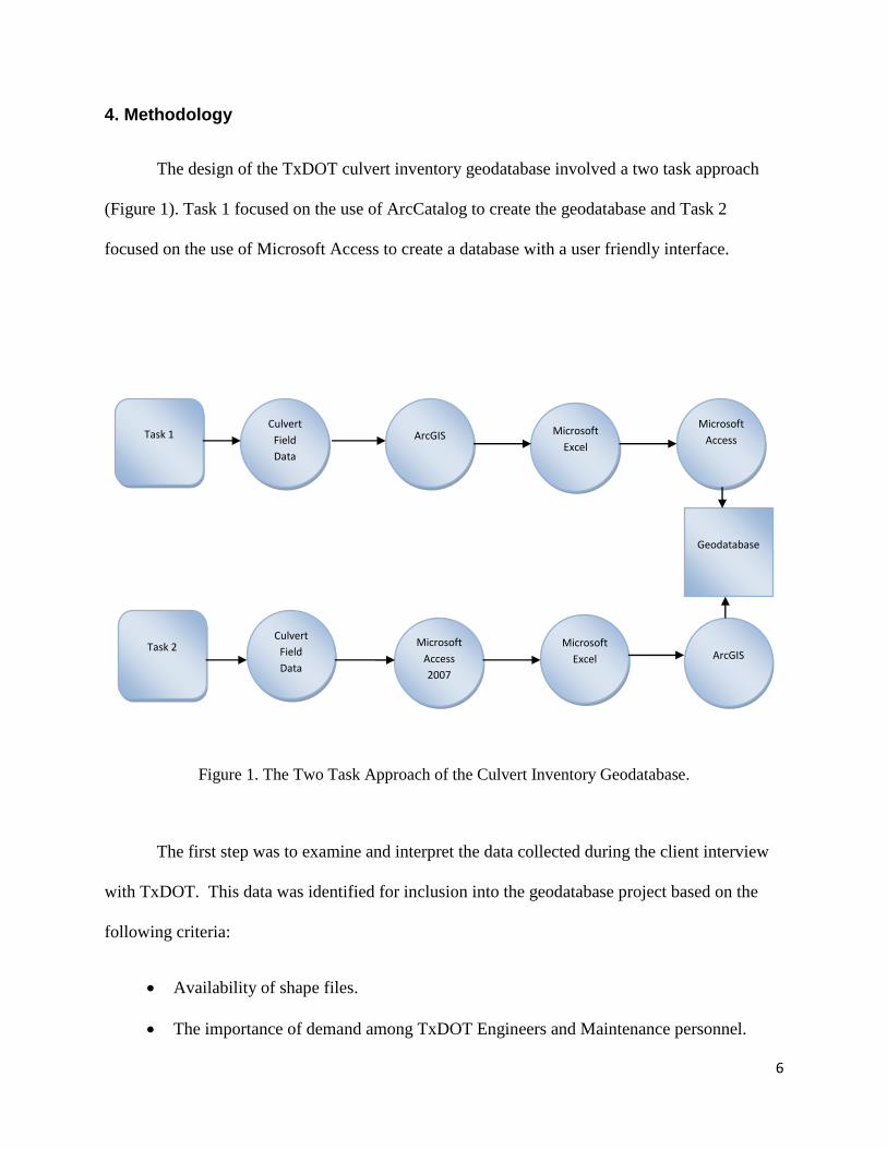
4. Methodology
The design of the TxDOT culvert inventory geodatabase involved a two task approach
(Figure 1). Task 1 focused on the use of ArcCatalog to create the geodatabase and Task 2
focused on the use of Microsoft Access to create a database with a user friendly interface.
Figure 1. The Two Task Approach of the Culvert Inventory Geodatabase.
The first step was to examine and interpret the data collected during the client interview
with TxDOT. This data was identified for inclusion into the geodatabase project based on the
following criteria:
Availability of shape files.
The importance of demand among TxDOT Engineers and Maintenance personnel.
Culvert
Field
Data
Culvert
Field
Data
ArcGIS
Microsoft
Access
2007
Microsoft
Excel
Microsoft
Excel
Microsoft
Access
ArcGIS
Geodatabase
Task 1
Task 2
Page 15
7
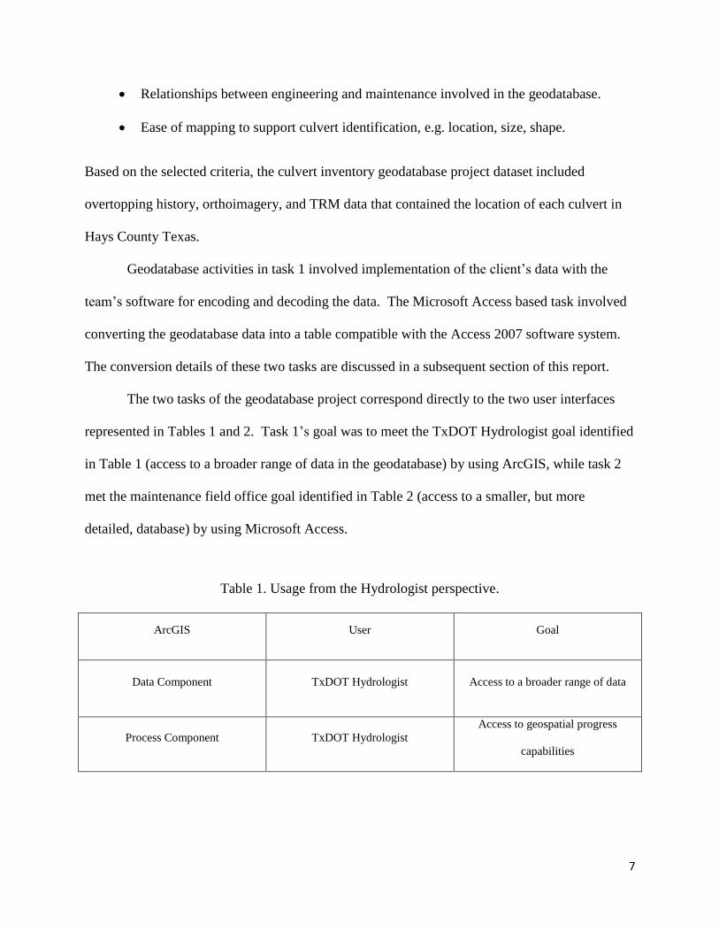
Relationships between engineering and maintenance involved in the geodatabase.
Ease of mapping to support culvert identification, e.g. location, size, shape.
Based on the selected criteria, the culvert inventory geodatabase project dataset included
overtopping history, orthoimagery, and TRM data that contained the location of each culvert in
Hays County Texas.
Geodatabase activities in task 1 involved implementation of the client’s data with the
team’s software for encoding and decoding the data. The Microsoft Access based task involved
converting the geodatabase data into a table compatible with the Access 2007 software system.
The conversion details of these two tasks are discussed in a subsequent section of this report.
The two tasks of the geodatabase project correspond directly to the two user interfaces
represented in Tables 1 and 2. Task 1’s goal was to meet the TxDOT Hydrologist goal identified
in Table 1 (access to a broader range of data in the geodatabase) by using ArcGIS, while task 2
met the maintenance field office goal identified in Table 2 (access to a smaller, but more
detailed, database) by using Microsoft Access.
Table 1. Usage from the Hydrologist perspective.
ArcGIS User Goal
Data Component TxDOT Hydrologist Access to a broader range of data
Process Component TxDOT Hydrologist
Access to geospatial progress
capabilities
Page 16
8
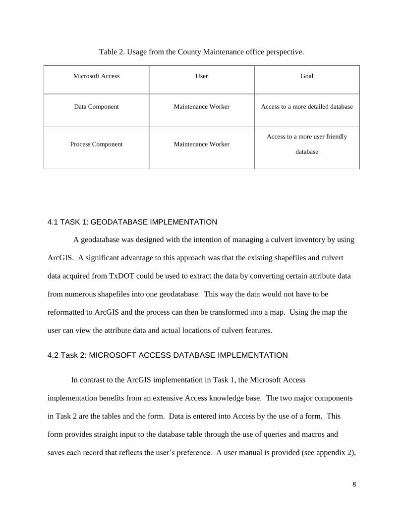
Table 2. Usage from the County Maintenance office perspective.
Microsoft Access User Goal
Data Component Maintenance Worker Access to a more detailed database
Process Component Maintenance Worker
Access to a more user friendly
database
4.1 TASK 1: GEODATABASE IMPLEMENTATION
A geodatabase was designed with the intention of managing a culvert inventory by using
ArcGIS. A significant advantage to this approach was that the existing shapefiles and culvert
data acquired from TxDOT could be used to extract the data by converting certain attribute data
from numerous shapefiles into one geodatabase. This way the data would not have to be
reformatted to ArcGIS and the process can then be transformed into a map. Using the map the
user can view the attribute data and actual locations of culvert features.
4.2 Task 2: MICROSOFT ACCESS DATABASE IMPLEMENTATION
In contrast to the ArcGIS implementation in Task 1, the Microsoft Access
implementation benefits from an extensive Access knowledge base. The two major components
in Task 2 are the tables and the form. Data is entered into Access by the use of a form. This
form provides straight input to the database table through the use of queries and macros and
saves each record that reflects the user’s preference. A user manual is provided (see appendix 2),
Page 17
9
which explains the correct instructions, procedures and abbreviations needed in data entry and
the correct use of the software.
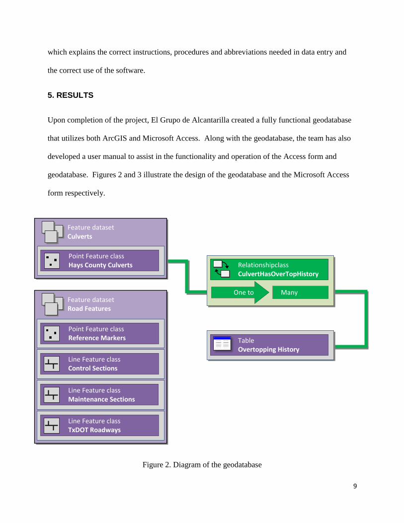
5. RESULTS
Upon completion of the project, El Grupo de Alcantarilla created a fully functional geodatabase
that utilizes both ArcGIS and Microsoft Access. Along with the geodatabase, the team has also
developed a user manual to assist in the functionality and operation of the Access form and
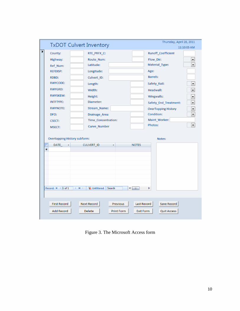
geodatabase. Figures 2 and 3 illustrate the design of the geodatabase and the Microsoft Access
form respectively.
Figure 2. Diagram of the geodatabase
Table Overtopping History
Feature dataset Culverts
Point Feature class Hays County Culverts
Point Feature class Reference Markers
Line Feature class Control Sections
Line Feature class TxDOT Roadways
Feature dataset Road Features
Line Feature class Maintenance Sections
Relationshipclass CulvertHasOverTopHistory
One to Many
Page 18
10
Figure 3. The Microsoft Access form
Page 19
11
6. DISCUSSION
The culvert inventory geodatabase will allow TxDOT to catalog culverts in an organized
and efficient way. This program will allow TxDOT to make the transition to a computerized
system that maintains records of small culverts. The department will be able to improve
maintenance on these features because the culvert data will be organized and easily accessible to
all employees. Overtopping events will be recorded more efficiently and thus facilitate analysis
for future infrastructure development. By creating a system where this information can be
entered, stored, and easily accessed, the department can dramatically improve the planning of
future culverts.
The culvert inventory geodatabase accomplishes the goal of establishing a system for a
culvert inventory. It is a successful system because of the accessibility and ease of use by both
technicians and maintenance workers. One of the major uses of the system is data entry by the
local TxDOT maintenance workers. This was the biggest challenge for the project because the
design of the user interface was critical in determining the functionality of the system. After
assessing the needs and expectations of our client and the local TxDOT maintenance workers,
the design of the interface was tested with real data from culverts on road segment RM 150 in
Hays County, Texas. The geodatabase proves to be a successful design because after entering
the data in the user interface, the data appeared in the table as a new record. The data was then
exported as a Microsoft Excel document; the table was introduced into the GIS and the process
was complete.
With the experiences gained from this project, the group would apply a different
approach if the project were to be repeated again. Instead of designing the tables in ArcGIS, the
design of the tables would have been done in Microsoft Access.
Page 20
12
Also, another modification to the methodology of the project would have been to build an
application in ArcGIS using ArcObjects. However, due to time constraints the group had to
proceed with the project and develop a product using the tools we were most familiar with. If
the time frame allowed, the group would conduct more research on developing custom
applications for ArcGIS.
The time frame was a big constraint for the culvert inventory geodatabase project. Many
improvements could have been done to the product if the group had more time to do research and
learn how to better use the tools we had. If the group had more time, the development of custom
reports in Microsoft Access would have been a very useful extension to the product. Also, a
larger geodatabase with more relational tables could have made the geodatabase more flexible
and efficient.
El Grupo de Alcantarilla has various recommendations for future project extensions,
since the culvert inventory geodatabase can only be used by one user at a time, it is strongly
encouraged to transition to an enterprise level GIS. With this in place, the capabilities of the
culvert geodatabase can be greatly expanded. The enterprise GIS will enable TxDOT to have a
centralized server that stores the culvert data for the entire state of Texas. This geodatabase
would have an unlimited size, could use web applications, and the data could be edited/entered
from anywhere in the state. Another recommendation is to establish a standardized naming
convention for each attribute in the geodatabase. An example of this case would be a distance
measurement (feet vs. inches). Consistency in data handling procedures is necessary to ensure
that the data entered does not violate the specifications of the program and remains consistent.
Field data acquisition utilizing a Global Positioning System (GPS) would streamline data
collection and improve the positional accuracy of the dataset. GPS units, such as those by
Page 21
13
Trimble, allow for an easy migration of data into a GIS. A standardized data dictionary could be
developed and deployed with units statewide. This would help to ensure consistent data
collection and are relatively easy to use.
The final recommendation is to develop a system to assign unique identifiers to culverts
and other road features. With the increasing use of Quick Reference (QR) codes (developed by
Denso-Wave to inventory auto parts for Toyota, Japan), culverts can be assigned a QR code for a
fast digital identification. The codes are two dimensional barcodes capable of storing such
things as attribute information and web links. By using a digital tablet or smart phone capable of
scanning QR codes, the code can direct the user to a web based application for data entry. This
method will simplify the data entry process and cut down on costs.
7. CONCLUSION
What we found is that both Task 1 and Task 2 provided successful solutions for the
creation of a geodatabase, each with benefits and limitations. Through the efforts of using
ArcGIS, a more complete solution was found in Task 2. Some of the findings are accounted for
by familiarity with ArcGIS and the experiences of working with geodatabases in the past. It is
also noted that the challenges of Task 1 increased with the complexities inherited when we tried
to convert some of the culvert data fields to Access from GIS.
Any comparison success of either Task 1 or Task 2 raised the question: What types of
methodologies are important when creating a geodatabase? The team found that open
exchanges of communication were key in creating a geodatabase that fit TxDOT’s culvert
management requirements. The team received adequate data from TxDOT to fulfill the needs of
the project. In addition, the success of any geodatabase system is the extent to which it serves
Page 22
14
the user needs. The team discovered that needs varied significantly depending on the user’s
perspective (Access user vs. GIS user).
The team was able to gather information from TxDOT, through a series of scheduled
interviews, and gain knowledge about the current data collection procedures that the
maintenance office is now conducting. Through these interviews and discussions it was apparent
that the data collection occurs through the use of TxDOT forms, data packets and photos. The
need to eliminate this procedure was one of the main ideas behind creating a geodatabase. The
other was to create a localized data repository to share, perhaps in the future, with other counties
and districts on a state level.
A geodatabase data model was the best suited to this project in many ways. Creating a
geodatabase is comparable to having many compressed files in one location. This will allow
TxDOT to store culvert data in a central location for easy access and management. The
compressed data is a direct-access format, so TxDOT will not have to uncompress it each time
they access it; ArcGIS and ArcReader read it directly. Also, having the geodatabase in a
compressed form re-encodes the files resulting in a process that removes redundancy.
Page 23
15
8. REFERENCES
Arctur, D., and Zeiler, M. 1999. Designing Geodatabases: Case Studies in GIS Data Modeling.
Redlands: ESRI
"Systematically approaching culvert inventory and inspection." Public Works Magazine Online.
1 March 2005. 3 May 2011 < http://www.pwmag.com/industry-
news.asp?sectionID=774&articleID=271430>
Zeiler, M. 1999. Modeling Our World: The ESRI Guide to Geodatabase Design. Redlands: ESRI
Page 24
16
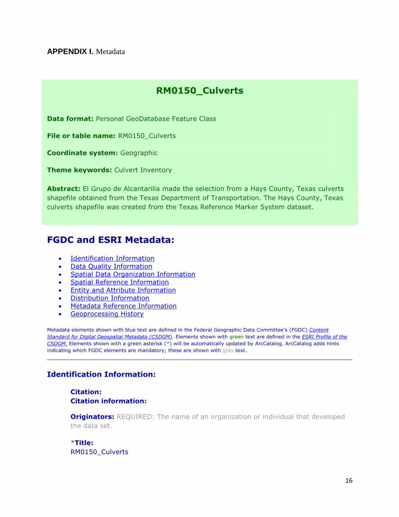
APPENDIX I. Metadata
RM0150_Culverts
Data format: Personal GeoDatabase Feature Class
File or table name: RM0150_Culverts
Coordinate system: Geographic
Theme keywords: Culvert Inventory
Abstract: El Grupo de Alcantarilla made the selection from a Hays County, Texas culverts
shapefile obtained from the Texas Department of Transportation. The Hays County, Texas
culverts shapefile was created from the Texas Reference Marker System dataset.
FGDC and ESRI Metadata:
Identification Information
Data Quality Information
Spatial Data Organization Information
Spatial Reference Information
Entity and Attribute Information
Distribution Information
Metadata Reference Information Geoprocessing History
Metadata elements shown with blue text are defined in the Federal Geographic Data Committee's (FGDC) Content
Standard for Digital Geospatial Metadata (CSDGM). Elements shown with green text are defined in the ESRI Profile of the
CSDGM. Elements shown with a green asterisk (*) will be automatically updated by ArcCatalog. ArcCatalog adds hints
indicating which FGDC elements are mandatory; these are shown with gray text.
Identification Information:
Citation:
Citation information:
Originators: REQUIRED: The name of an organization or individual that developed
the data set.
*Title:
RM0150_Culverts
Page 25
17
*File or table name: RM0150_Culverts
Publication date: REQUIRED: The date when the data set is published or otherwise
made available for release.
*Geospatial data presentation form: vector digital data
*Online linkage:
\\ZOOEY\J\TxDOTCulvertInventoryDEMO\Culvert_Inventory_Geodatabase.mdb
Description:
Abstract:
El Grupo de Alcantarilla made the selection from a Hays County, Texas culverts
shapefile obtained from the Texas Department of Transportation. The Hays County,
Texas culverts shapefile was created from the Texas Reference Marker System
dataset.
Purpose:
The purpose of the dataset is to validate the functionality of the culvert inventory
geodatabase.
Language of dataset: English
Time period of content:
Time period information:
Single date/time:
Calendar date: 5/1/2011
Time of day: 12:00 p.m.CDT
Currentness reference:
publication date
Status:
Progress: Complete
Maintenance and update frequency: As needed
Page 26
18
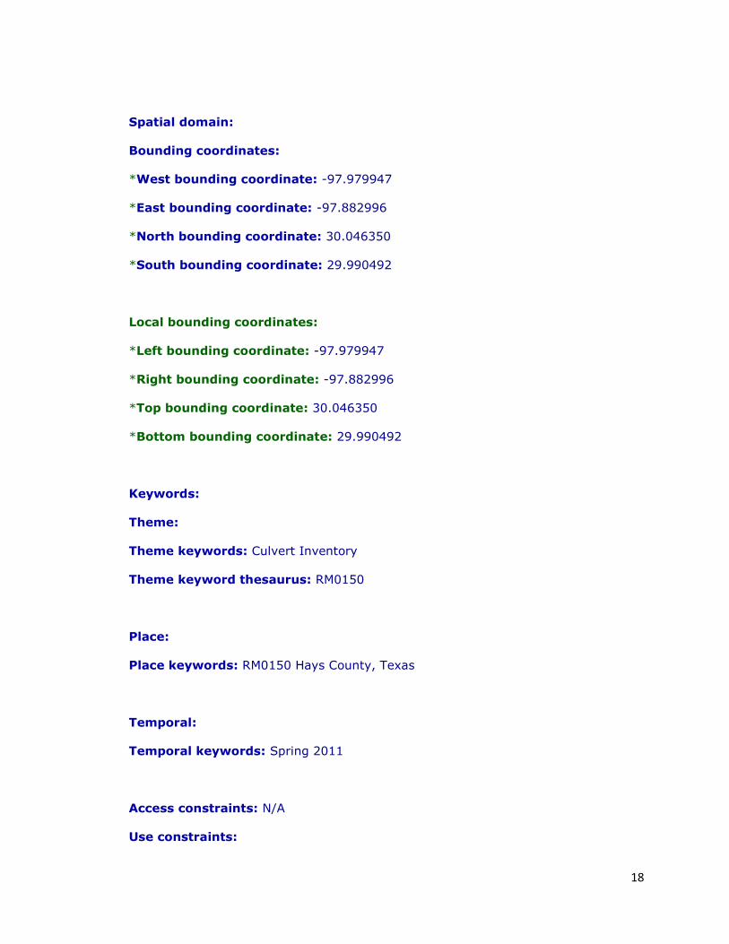
Spatial domain:
Bounding coordinates:
*West bounding coordinate: -97.979947
*East bounding coordinate: -97.882996
*North bounding coordinate: 30.046350
*South bounding coordinate: 29.990492
Local bounding coordinates:
*Left bounding coordinate: -97.979947
*Right bounding coordinate: -97.882996
*Top bounding coordinate: 30.046350
*Bottom bounding coordinate: 29.990492
Keywords:
Theme:
Theme keywords: Culvert Inventory
Theme keyword thesaurus: RM0150
Place:
Place keywords: RM0150 Hays County, Texas
Temporal:
Temporal keywords: Spring 2011
Access constraints: N/A
Use constraints:
Page 27
19
N/A
Point of contact:
Contact information:
Contact person primary:
Contact person: El Grupo de Alcantarilla
Contact organization: Texas State University-San Marcos
Contact position: Student
Data set credit:
Texas Department of Transportation
Security information:
Security classification: Top secret
*Native dataset format: Personal GeoDatabase Feature Class
*Native data set environment:
Microsoft Windows Vista Version 6.1 (Build 7600) ; ESRI ArcCatalog 9.3.0.1770
Back to Top
Data Quality Information:
Lineage:
Process step:
Process contact:
Contact information:
Contact organization primary:
Contact organization: El Grupo de Alcantarilla
Back to Top
Page 28
20
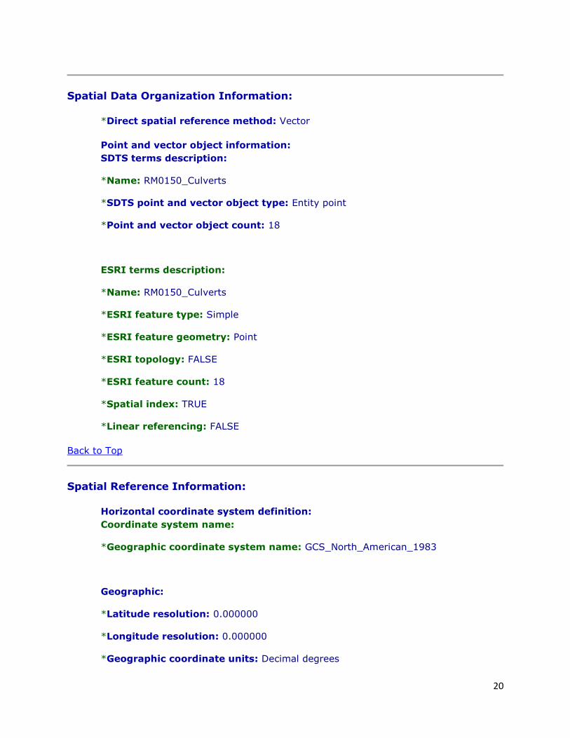
Spatial Data Organization Information:
*Direct spatial reference method: Vector
Point and vector object information:
SDTS terms description:
*Name: RM0150_Culverts
*SDTS point and vector object type: Entity point
*Point and vector object count: 18
ESRI terms description:
*Name: RM0150_Culverts
*ESRI feature type: Simple
*ESRI feature geometry: Point
*ESRI topology: FALSE
*ESRI feature count: 18
*Spatial index: TRUE
*Linear referencing: FALSE
Back to Top
Spatial Reference Information:
Horizontal coordinate system definition:
Coordinate system name:
*Geographic coordinate system name: GCS_North_American_1983
Geographic:
*Latitude resolution: 0.000000
*Longitude resolution: 0.000000
*Geographic coordinate units: Decimal degrees
Page 29
21
Geodetic model:
*Horizontal datum name: North American Datum of 1983
*Ellipsoid name: Geodetic Reference System 80
*Semi-major axis: 6378137.000000
*Denominator of flattening ratio: 298.257222
Vertical coordinate system definition:
Altitude system definition:
*Altitude resolution: 0.000100
*Altitude encoding method: Explicit elevation coordinate included with horizontal
coordinates
Back to Top
Entity and Attribute Information:
Detailed description:
*Name: RM0150_Culverts
Entity type:
*Entity type label: RM0150_Culverts
*Entity type type: Feature Class
*Entity type count: 18
Attribute:
*Attribute label: OBJECTID
*Attribute alias: OBJECTID
*Attribute definition:
Internal feature number.
Page 30
22
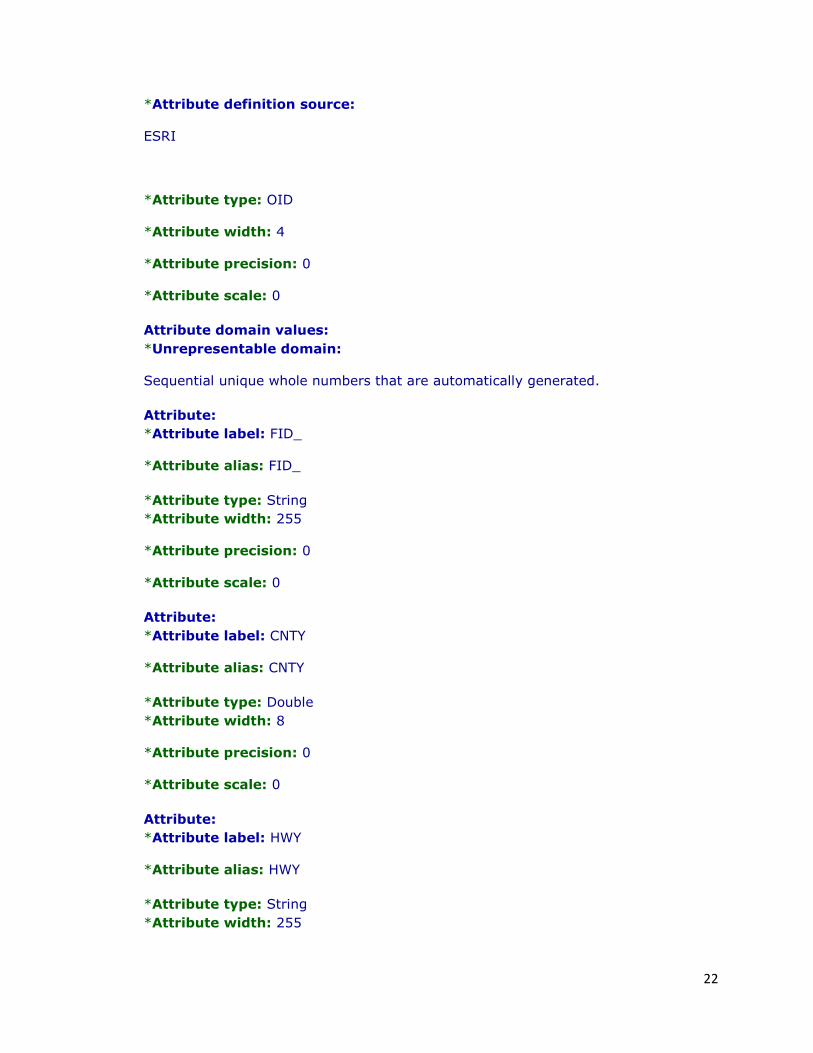
*Attribute definition source:
ESRI
*Attribute type: OID
*Attribute width: 4
*Attribute precision: 0
*Attribute scale: 0
Attribute domain values:
*Unrepresentable domain:
Sequential unique whole numbers that are automatically generated.
Attribute:
*Attribute label: FID_
*Attribute alias: FID_
*Attribute type: String
*Attribute width: 255
*Attribute precision: 0
*Attribute scale: 0
Attribute:
*Attribute label: CNTY
*Attribute alias: CNTY
*Attribute type: Double
*Attribute width: 8
*Attribute precision: 0
*Attribute scale: 0
Attribute:
*Attribute label: HWY
*Attribute alias: HWY
*Attribute type: String
*Attribute width: 255
Page 31
23
*Attribute precision: 0
*Attribute scale: 0
Attribute:
*Attribute label: REFNBR
*Attribute alias: REFNBR
*Attribute type: Double
*Attribute width: 8
*Attribute precision: 0
*Attribute scale: 0
Attribute:
*Attribute label: REFDISP
*Attribute alias: REFDISP
*Attribute type: Double
*Attribute width: 8
*Attribute precision: 0
*Attribute scale: 0
Attribute:
*Attribute label: RDBD
*Attribute alias: RDBD
*Attribute type: String
*Attribute width: 255
*Attribute precision: 0
*Attribute scale: 0
Attribute:
*Attribute label: RWYCODE
*Attribute alias: RWYCODE
*Attribute type: Double
*Attribute width: 8
*Attribute precision: 0
*Attribute scale: 0
Page 32
24
Attribute:
*Attribute label: RWYGRD
*Attribute alias: RWYGRD
*Attribute type: String
*Attribute width: 255
*Attribute precision: 0
*Attribute scale: 0
Attribute:
*Attribute label: RWYSKEW
*Attribute alias: RWYSKEW
*Attribute type: Double
*Attribute width: 8
*Attribute precision: 0
*Attribute scale: 0
Attribute:
*Attribute label: INTFTYPE
*Attribute alias: INTFTYPE
*Attribute type: Double
*Attribute width: 8
*Attribute precision: 0
*Attribute scale: 0
Attribute:
*Attribute label: RWYNOTE
*Attribute alias: RWYNOTE
*Attribute type: String
*Attribute width: 255
*Attribute precision: 0
*Attribute scale: 0
Attribute:
*Attribute label: DFO
Page 33
25
*Attribute alias: DFO
*Attribute type: Double
*Attribute width: 8
*Attribute precision: 0
*Attribute scale: 0
Attribute:
*Attribute label: CSECT
*Attribute alias: CSECT
*Attribute type: Double
*Attribute width: 8
*Attribute precision: 0
*Attribute scale: 0
Attribute:
*Attribute label: MSECT
*Attribute alias: MSECT
*Attribute type: Double
*Attribute width: 8
*Attribute precision: 0
*Attribute scale: 0
Attribute:
*Attribute label: RTE_PRFX_C
*Attribute alias: RTE_PRFX_C
*Attribute type: String
*Attribute width: 255
*Attribute precision: 0
*Attribute scale: 0
Attribute:
*Attribute label: RTE_NBR
*Attribute alias: RTE_NBR
*Attribute type: String
Page 34
26
*Attribute width: 255
*Attribute precision: 0
*Attribute scale: 0
Attribute:
*Attribute label: LATITUDE
*Attribute alias: LATITUDE
*Attribute type: Double
*Attribute width: 8
*Attribute precision: 0
*Attribute scale: 0
Attribute:
*Attribute label: LONGITUDE
*Attribute alias: LONGITUDE
*Attribute type: Double
*Attribute width: 8
*Attribute precision: 0
*Attribute scale: 0
Attribute:
*Attribute label: CULVERT_ID
*Attribute alias: CULVERT_ID
*Attribute type: String
*Attribute width: 255
*Attribute precision: 0
*Attribute scale: 0
Attribute:
*Attribute label: LENGTH
*Attribute alias: LENGTH
*Attribute type: String
*Attribute width: 255
*Attribute precision: 0
Page 35
27
*Attribute scale: 0
Attribute:
*Attribute label: WIDTH
*Attribute alias: WIDTH
*Attribute type: String
*Attribute width: 255
*Attribute precision: 0
*Attribute scale: 0
Attribute:
*Attribute label: HEIGHT
*Attribute alias: HEIGHT
*Attribute type: String
*Attribute width: 255
*Attribute precision: 0
*Attribute scale: 0
Attribute:
*Attribute label: DIAMETER
*Attribute alias: DIAMETER
*Attribute type: String
*Attribute width: 255
*Attribute precision: 0
*Attribute scale: 0
Attribute:
*Attribute label: STREAM_NAME
*Attribute alias: STREAM_NAME
*Attribute type: String
*Attribute width: 255
*Attribute precision: 0
*Attribute scale: 0
Attribute:
Page 36
28
*Attribute label: DA
*Attribute alias: DA
*Attribute type: String
*Attribute width: 255
*Attribute precision: 0
*Attribute scale: 0
Attribute:
*Attribute label: Tc
*Attribute alias: Tc
*Attribute type: String
*Attribute width: 255
*Attribute precision: 0
*Attribute scale: 0
Attribute:
*Attribute label: CN
*Attribute alias: CN
*Attribute type: String
*Attribute width: 255
*Attribute precision: 0
*Attribute scale: 0
Attribute:
*Attribute label: RC
*Attribute alias: RC
*Attribute type: String
*Attribute width: 255
*Attribute precision: 0
*Attribute scale: 0
Attribute:
*Attribute label: FLOW_DIR
*Attribute alias: FLOW_DIR
Page 37
29
*Attribute type: String
*Attribute width: 255
*Attribute precision: 0
*Attribute scale: 0
Attribute:
*Attribute label: MAT_TYPE
*Attribute alias: MAT_TYPE
*Attribute type: String
*Attribute width: 255
*Attribute precision: 0
*Attribute scale: 0
Attribute:
*Attribute label: AGE
*Attribute alias: AGE
*Attribute type: String
*Attribute width: 255
*Attribute precision: 0
*Attribute scale: 0
Attribute:
*Attribute label: BARRELS
*Attribute alias: BARRELS
*Attribute type: String
*Attribute width: 255
*Attribute precision: 0
*Attribute scale: 0
Attribute:
*Attribute label: SAFETY_RAIL
*Attribute alias: SAFETY_RAIL
*Attribute type: String
*Attribute width: 255
Page 38
30
*Attribute precision: 0
*Attribute scale: 0
Attribute:
*Attribute label: HEADWALL
*Attribute alias: HEADWALL
*Attribute type: String
*Attribute width: 255
*Attribute precision: 0
*Attribute scale: 0
Attribute:
*Attribute label: WINGWALLS
*Attribute alias: WINGWALLS
*Attribute type: String
*Attribute width: 255
*Attribute precision: 0
*Attribute scale: 0
Attribute:
*Attribute label: SFTY_END_TRTMT
*Attribute alias: SFTY_END_TRTMT
*Attribute type: String
*Attribute width: 255
*Attribute precision: 0
*Attribute scale: 0
Attribute:
*Attribute label: OVERTOP_HIST
*Attribute alias: OVERTOP_HIST
*Attribute type: String
*Attribute width: 255
*Attribute precision: 0
*Attribute scale: 0
Page 39
31
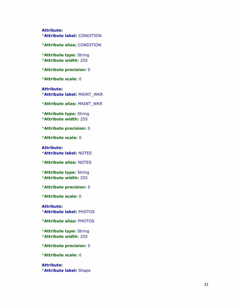
Attribute:
*Attribute label: CONDITION
*Attribute alias: CONDITION
*Attribute type: String
*Attribute width: 255
*Attribute precision: 0
*Attribute scale: 0
Attribute:
*Attribute label: MAINT_WKR
*Attribute alias: MAINT_WKR
*Attribute type: String
*Attribute width: 255
*Attribute precision: 0
*Attribute scale: 0
Attribute:
*Attribute label: NOTES
*Attribute alias: NOTES
*Attribute type: String
*Attribute width: 255
*Attribute precision: 0
*Attribute scale: 0
Attribute:
*Attribute label: PHOTOS
*Attribute alias: PHOTOS
*Attribute type: String
*Attribute width: 255
*Attribute precision: 0
*Attribute scale: 0
Attribute:
*Attribute label: Shape
Page 40
32
*Attribute alias: Shape
*Attribute definition:
Feature geometry.
*Attribute definition source:
ESRI
*Attribute type: Geometry
*Attribute width: 0
*Attribute precision: 0
*Attribute scale: 0
Attribute domain values:
*Unrepresentable domain:
Coordinates defining the features.
Back to Top
Distribution Information:
Resource description: Downloadable Data
Back to Top
Metadata Reference Information:
*Metadata date: 20110504
*Language of metadata: en
Metadata contact:
Contact information:
Contact organization primary:
Contact person: REQUIRED: The person responsible for the metadata information.
Contact organization: El Grupo de Alcantarilla
Page 41
33
Contact address:
Address type: REQUIRED: The mailing and/or physical address for the organization
or individual.
City: REQUIRED: The city of the address.
State or province: REQUIRED: The state or province of the address.
Postal code: REQUIRED: The ZIP or other postal code of the address.
Contact voice telephone: REQUIRED: The telephone number by which individuals
can speak to the organization or individual.
*Metadata standard name: FGDC Content Standards for Digital Geospatial
Metadata
*Metadata standard version: FGDC-STD-001-1998
*Metadata time convention: local time
Metadata security information:
Metadata security classification: Top secret
Metadata extensions:
*Online linkage: http://www.esri.com/metadata/esriprof80.html
*Profile name: ESRI Metadata Profile
Hays_Control_Sections
Data format: Personal GeoDatabase Feature Class
File or table name: Hays_Control_Sections
Coordinate system: Lambert Conformal Conic
Theme keywords: Control Sections
Abstract: Shapefile obtained from the Texas Department of Transportation, created from
the Texas Reference Marker System dataset.
Page 42
34
FGDC and ESRI Metadata:
Identification Information
Data Quality Information
Spatial Data Organization Information
Spatial Reference Information
Entity and Attribute Information
Distribution Information
Metadata Reference Information Geoprocessing History
Metadata elements shown with blue text are defined in the Federal Geographic Data Committee's (FGDC) Content
Standard for Digital Geospatial Metadata (CSDGM). Elements shown with green text are defined in the ESRI Profile of the
CSDGM. Elements shown with a green asterisk (*) will be automatically updated by ArcCatalog. ArcCatalog adds hints
indicating which FGDC elements are mandatory; these are shown with gray text.
Identification Information:
Citation:
Citation information:
Originators: REQUIRED: The name of an organization or individual that developed
the data set.
*Title:
Hays_Control_Sections
*File or table name: Hays_Control_Sections
Publication date: REQUIRED: The date when the data set is published or otherwise
made available for release.
*Geospatial data presentation form: vector digital data
*Online linkage:
\\ZOOEY\J\TxDOTCulvertInventoryDEMO\Culvert_Inventory_Geodatabase.mdb
Description:
Abstract:
Shapefile obtained from the Texas Department of Transportation, created from the
Texas Reference Marker System dataset.
Purpose:
To display the control sections of Hays County, Texas.
Page 43
35
Language of dataset: English
Time period of content:
Time period information:
Single date/time:
Calendar date: REQUIRED: The year (and optionally month, or month and day) for
which the data set corresponds to the ground.
Currentness reference:
publication date
Status:
Progress: Complete
Maintenance and update frequency: As needed
Spatial domain:
Bounding coordinates:
*West bounding coordinate: -98.272989
*East bounding coordinate: -97.711942
*North bounding coordinate: 30.281130
*South bounding coordinate: 29.798620
Local bounding coordinates:
*Left bounding coordinate: 2199067.609267
*Right bounding coordinate: 2375095.707669
*Top bounding coordinate: 14014118.702903
*Bottom bounding coordinate: 13840153.225375
Keywords:
Page 44
36
Theme:
Theme keywords: Control Sections
Theme keyword thesaurus: REQUIRED: Reference to a formally registered
thesaurus or a similar authoritative source of theme keywords.
Place:
Place keywords: Hays County, Texas
Temporal:
Temporal keywords: Spring 2011
Access constraints: N/A
Use constraints:
N/A
Point of contact:
Contact information:
Contact organization primary:
Contact organization: El Grupo de Alcantarilla
Data set credit:
Texas Department of Transportation
*Native dataset format: Personal GeoDatabase Feature Class
*Native data set environment:
Microsoft Windows Vista Version 6.1 (Build 7600) ; ESRI ArcCatalog 9.3.0.1770
Back to Top
Page 45
37
Data Quality Information:
Lineage:
Process step:
Process description:
Dataset copied.
Source used citation abbreviation:
\\TPP-674292-1\D$\Comanche_2009.gdb
Process step:
Process description:
Dataset copied.
Process date: 20110202
Process time: 07484800
Source used citation abbreviation:
Process step:
Process description:
Dataset copied.
Process date: 20110202
Process time: 07541700
Source used citation abbreviation:
Back to Top
Spatial Data Organization Information:
*Direct spatial reference method: Vector
Point and vector object information:
Page 46
38
SDTS terms description:
*Name: Hays_Control_Sections
*SDTS point and vector object type: String
*Point and vector object count: 39
ESRI terms description:
*Name: Hays_Control_Sections
*ESRI feature type: Simple
*ESRI feature geometry: Polyline
*ESRI topology: FALSE
*ESRI feature count: 39
*Spatial index: TRUE
*Linear referencing: TRUE
Back to Top
Spatial Reference Information:
Horizontal coordinate system definition:
Coordinate system name:
*Projected coordinate system name:
NAD_1983_StatePlane_Texas_South_Central_FIPS_4204_Feet
*Geographic coordinate system name: GCS_North_American_1983
Planar:
Map projection:
*Map projection name: Lambert Conformal Conic
Lambert conformal conic:
*Standard parallel: 28.383333
*Standard parallel: 30.283333
Page 47
39
*Longitude of central meridian: -99.000000
*Latitude of projection origin: 27.833333
*False easting: 1968500.000000
*False northing: 13123333.333333
Planar coordinate information:
*Planar coordinate encoding method: coordinate pair
Coordinate representation:
*Abscissa resolution: 0.000328
*Ordinate resolution: 0.000328
*Planar distance units: survey feet
Geodetic model:
*Horizontal datum name: North American Datum of 1983
*Ellipsoid name: Geodetic Reference System 80
*Semi-major axis: 6378137.000000
*Denominator of flattening ratio: 298.257222
Vertical coordinate system definition:
Altitude system definition:
*Altitude resolution: 0.000100
*Altitude encoding method: Explicit elevation coordinate included with horizontal
coordinates
Back to Top
Entity and Attribute Information:
Page 48
40
Detailed description:
*Name: Hays_Control_Sections
Entity type:
*Entity type label: Hays_Control_Sections
*Entity type type: Feature Class
*Entity type count: 39
Attribute:
*Attribute label: OBJECTID_1
*Attribute alias: OBJECTID_1
*Attribute definition:
Internal feature number.
*Attribute definition source:
ESRI
*Attribute type: OID
*Attribute width: 4
*Attribute precision: 0
*Attribute scale: 0
Attribute domain values:
*Unrepresentable domain:
Sequential unique whole numbers that are automatically generated.
Attribute:
*Attribute label: OBJECTID
*Attribute alias: OBJECTID
*Attribute definition:
Internal feature number.
*Attribute definition source:
Page 49
41
ESRI
*Attribute type: Double
*Attribute width: 8
*Attribute precision: 0
*Attribute scale: 0
Attribute domain values:
*Unrepresentable domain:
Sequential unique whole numbers that are automatically generated.
Attribute:
*Attribute label: SHAPE
*Attribute alias: Shape
*Attribute definition:
Feature geometry.
*Attribute definition source:
ESRI
*Attribute type: Geometry
*Attribute width: 0
*Attribute precision: 0
*Attribute scale: 0
Attribute domain values:
*Unrepresentable domain:
Coordinates defining the features.
Attribute:
*Attribute label: RTE_NM
*Attribute alias: RTE_NM
*Attribute type: String
*Attribute width: 15
Page 50
42
*Attribute precision: 0
*Attribute scale: 0
Attribute:
*Attribute label: C_SEC
*Attribute alias: C_SEC
*Attribute type: String
*Attribute width: 15
*Attribute precision: 0
*Attribute scale: 0
Attribute:
*Attribute label: FROM_DFO
*Attribute alias: FROM_DFO
*Attribute type: Double
*Attribute width: 8
*Attribute precision: 0
*Attribute scale: 0
Attribute:
*Attribute label: TO_DFO
*Attribute alias: TO_DFO
*Attribute type: Double
*Attribute width: 8
*Attribute precision: 0
*Attribute scale: 0
Attribute:
*Attribute label: CS_FLAG
*Attribute alias: CS_FLAG
*Attribute type: String
*Attribute width: 15
*Attribute precision: 0
*Attribute scale: 0
Page 51
43
Attribute:
*Attribute label: BIN
*Attribute alias: BIN
*Attribute type: Integer
*Attribute width: 4
*Attribute precision: 0
*Attribute scale: 0
Attribute:
*Attribute label: CREATE_DT
*Attribute alias: CREATE_DT
*Attribute type: String
*Attribute width: 25
*Attribute precision: 0
*Attribute scale: 0
Attribute:
*Attribute label: EDIT_DT
*Attribute alias: EDIT_DT
*Attribute type: String
*Attribute width: 25
*Attribute precision: 0
*Attribute scale: 0
Attribute:
*Attribute label: EDIT_NM
*Attribute alias: EDIT_NM
*Attribute type: String
*Attribute width: 25
*Attribute precision: 0
*Attribute scale: 0
Attribute:
*Attribute label: Shape_Length
Page 52
44
*Attribute alias: Shape_Length
*Attribute definition:
Length of feature in internal units.
*Attribute definition source:
ESRI
*Attribute type: Double
*Attribute width: 8
*Attribute precision: 0
*Attribute scale: 0
Attribute domain values:
*Unrepresentable domain:
Positive real numbers that are automatically generated.
Back to Top
Distribution Information:
Resource description: Downloadable Data
Standard order process:
Digital form:
Digital transfer information:
*Transfer size: 0.000
*Dataset size: 0.000
Back to Top
Metadata Reference Information:
*Metadata date: 20110504
*Language of metadata: en
Page 53
45
Metadata contact:
Contact information:
Contact organization primary:
Contact person: REQUIRED: The person responsible for the metadata information.
Contact organization: El Grupo de Alcantarilla
Contact address:
Address type: REQUIRED: The mailing and/or physical address for the organization
or individual.
City: REQUIRED: The city of the address.
State or province: REQUIRED: The state or province of the address.
Postal code: REQUIRED: The ZIP or other postal code of the address.
Contact voice telephone: REQUIRED: The telephone number by which individuals
can speak to the organization or individual.
*Metadata standard name: FGDC Content Standards for Digital Geospatial
Metadata
*Metadata standard version: FGDC-STD-001-1998
*Metadata time convention: local time
Metadata extensions:
*Online linkage: http://www.esri.com/metadata/esriprof80.html
*Profile name: ESRI Metadata Profile
Page 54
46
APPENDIX II. Group participation
Jason Kleinert
Logo design
Project proposal
Contributed sections
Edited/formatted the final report
Contributed to the presentation
Client point of contact
Set project timeline
Updated team on project status
Conducted research and completed online ESRI courses
Designed the geodatabase
Designed the database tables
Built the geodatabase and corresponding tables
Led client teleconferences
Progress report
Contributed sections
Edited/formatted the final report
Contributed to the presentation
Directed the design of the user interface
Solved technical problems
Designed, edited and sent the poster out to printing
Contributed to the final presentation
Page 55
47
Designed demo for the final presentation
Final report
Contributed sections
Edited/formatted the final report
Created the geodatabase diagram
Wrote the majority of the user manual
Prepared final deliverables
Thomas Platt
Gathered Data from TxDOT to determine fields for geodatabase.
Designed Team Logo
Created Team Name El Grupo de Alcantarilla
Designed and Edited Access Tables
Designed and Edited Access Forms
Contributed and Edited the Introduction, Methodology and Conclusion Request for
Proposal
Contributed and Edited the Progress Report and Power Point slides
Contributed and Edited Abstract, Introduction, Methodology, and Conclusion
Andres Aguirre
Contacted the Hays County TxDOT maintenance office to schedule meetings
Helped write the proposal, progress report and final report
Helped develop the power points for the presentations
Page 56
48
Using orthoimagery aerial images, corrected the locations of culverts in RM 150
Developed maps of the corrected culverts to show the Hays County TxDOT maintenance
office
Assisted in developing the design of the project poster
Kyle Vonderau
Help with data collection and interpretation for conceptual database design
Attended two TxDot maintenance meetings
Attended two conference calls with client
Help develop Progress report
Developed time-table and table of contents for Project Proposal
Created webpage design and layout using Dreamweaver CS5
Structured all data and files for website
Created alternative culvert inspection report
Edited and revised Final Report
Contributed material for Final deliverables