Development, Operation and Evolution of EOSDIS – NASA’s major capability for managing Earth science data H. K. Ramapriyan Assistant Project Manager ESDIS Project, Code 423 [email protected]1 Presented at CENDI/NFAIS Workshop on Repositories in Science & Technology: Preserving Access to the Record of Science November 30, 2011
Transcript
Development, Operation and Evolution of EOSDIS – NASA’s major capability
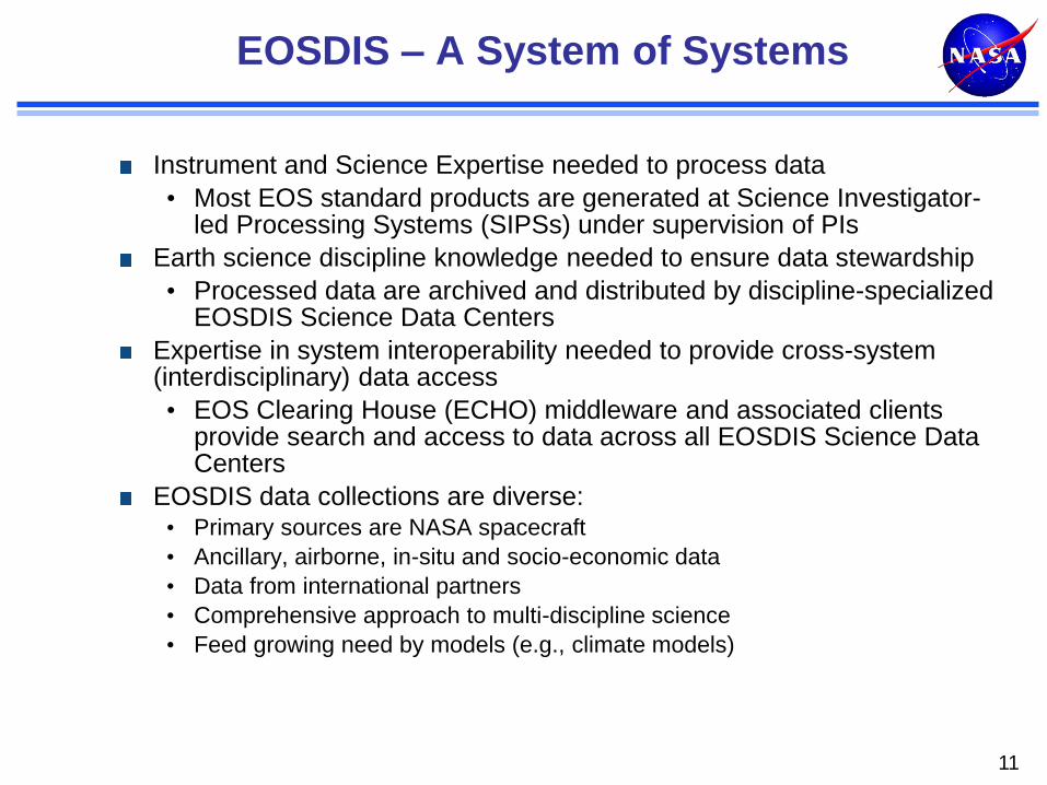
EOSDIS – A System of Systems Search and Access • Interoperability • Near-real-time Data
Metrics and customer feedback History, Development Issues and Evolution • Policy • Missions to Measurements • Technology
Preservation Conclusion
2
NASA Earth Science and EOSDIS
“Advance Earth system science to meet the challenges of climate and environmental change.” -- 2011 NASA Strategic Plan
NASA’s Earth Science Data Systems directly support this objective by providing end-to-end capabilities to deliver data and information products to users
NASA’s Earth Science Data and Information Policy promotes usage of data by the community • No period of exclusive access - Data are available after initial
checkout
• Data available at no cost to all users on a non-discriminatory basis except where agreed upon with international partners
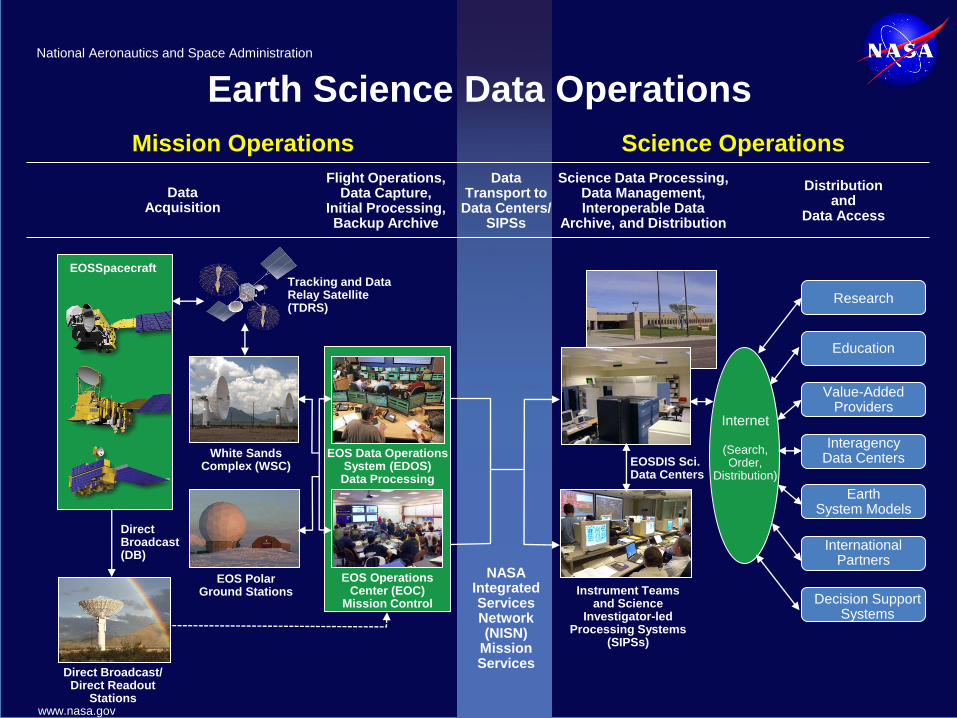
EOSDIS provides: • Science Operations
• Science data processing
• Data management
• Interoperable distributed Data archives
• On-Line data access services
• Earth science discipline-oriented user services
• Network Data Transport to distributed system elements
3
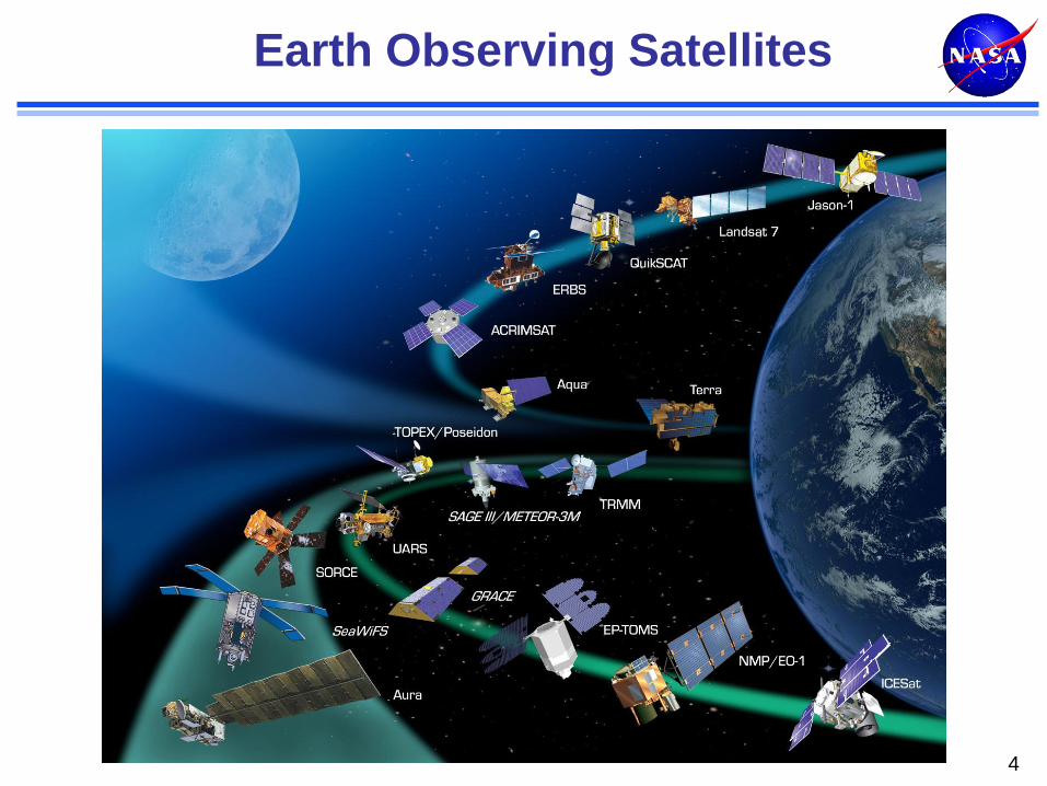
Earth Observing Satellites
4
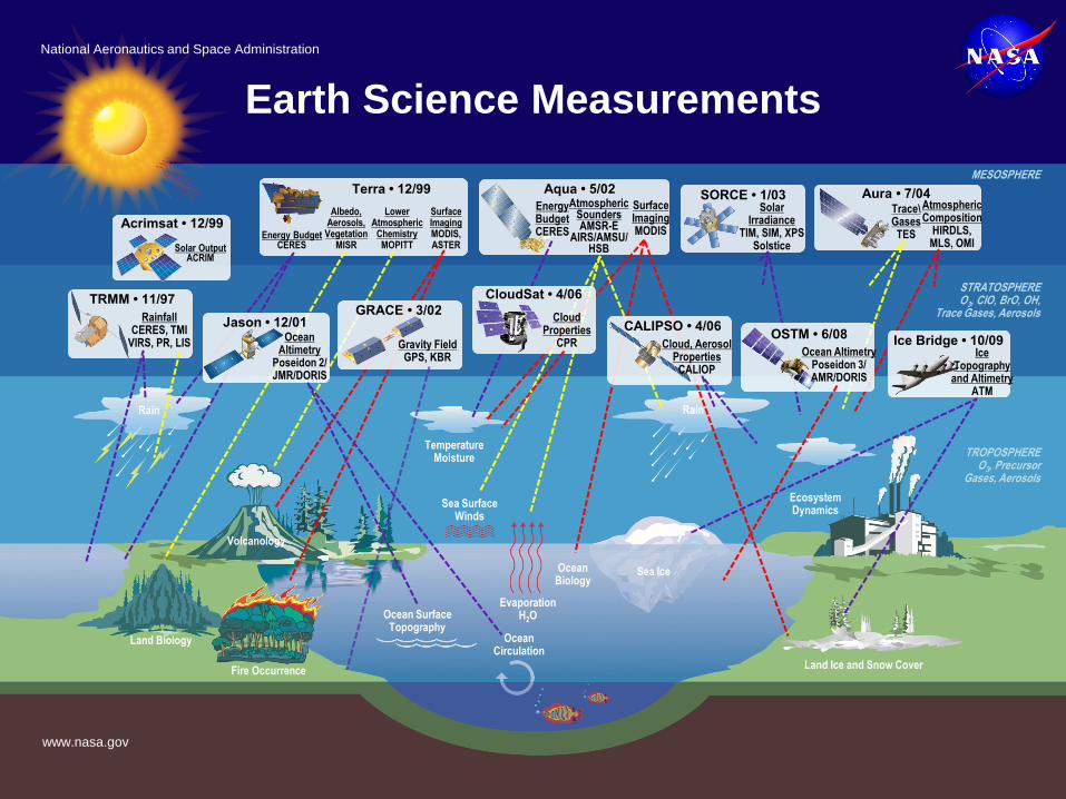
Earth Science Measurements
Acrimsat • 12/99
Solar Output ACRIM
Terra • 12/99
Energy Budget CERES
Albedo, Aerosols, Vegetation
MISR
Lower Atmospheric
Chemistry MOPITT
Surface Imaging MODIS, ASTER
TRMM • 11/97
Rainfall CERES, TMI
VIRS, PR, LIS
Temperature Moisture
Sea Surface Winds
Ecosystem Dynamics
SORCE • 1/03 Solar
Irradiance TIM, SIM, XPS
Solstice
Aura • 7/04 Atmospheric Composition
HIRDLS, MLS, OMI
Trace\ Gases TES
Rain
Sea Ice
TROPOSPHERE O3, Precursor
Gases, Aerosols
Ocean Biology
Ocean Surface Topography
STRATOSPHERE O3, CIO, BrO, OH,
Trace Gases, Aerosols
MESOSPHERE
Aqua • 5/02
Surface Imaging MODIS
Energy Budget CERES
Atmospheric Sounders AMSR-E
AIRS/AMSU/ HSB
Land Ice and Snow Cover
Ocean Circulation
Evaporation H2O
Fire Occurrence
Land Biology
Rain
CloudSat • 4/06
Cloud Properties
CPR
CALIPSO • 4/06
Cloud, Aerosol Properties
CALIOP
Jason • 12/01 Ocean
Altimetry Poseidon 2/ JMR/DORIS
OSTM • 6/08
Ocean Altimetry Poseidon 3/ AMR/DORIS
Ice Bridge • 10/09 Ice
Topography and Altimetry
ATM
Volcanology
GRACE • 3/02
Gravity Field GPS, KBR
National Aeronautics and Space Administration
www.nasa.gov
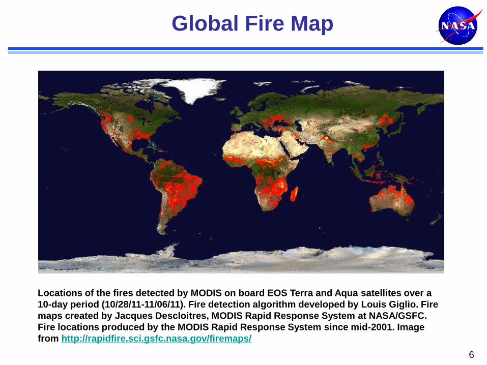
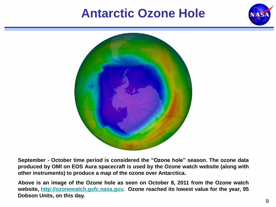
Global Fire Map
6
Locations of the fires detected by MODIS on board EOS Terra and Aqua satellites over a
10-day period (10/28/11-11/06/11). Fire detection algorithm developed by Louis Giglio. Fire
maps created by Jacques Descloitres, MODIS Rapid Response System at NASA/GSFC.
Fire locations produced by the MODIS Rapid Response System since mid-2001. Image
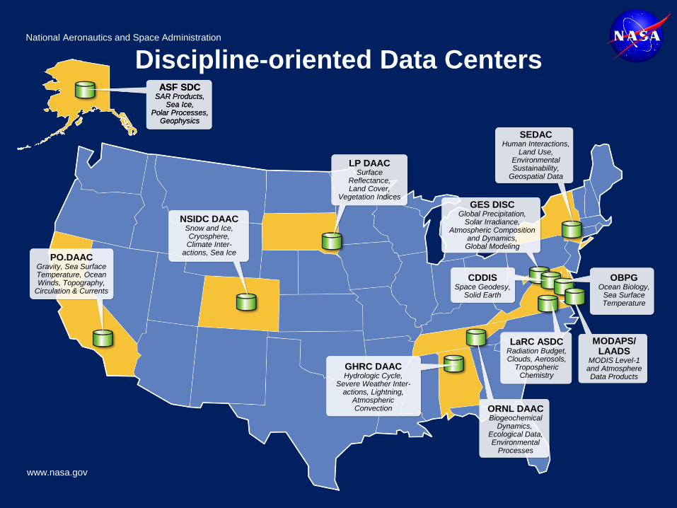
NSIDC DAAC Snow and Ice, Cryosphere, Climate Inter-
actions, Sea Ice
LP DAAC Surface
Reflectance, Land Cover,
Vegetation Indices
GHRC DAAC Hydrologic Cycle,
Severe Weather Inter- actions, Lightning,
Atmospheric Convection ORNL DAAC
Biogeochemical Dynamics,
Ecological Data, Environmental
Processes
CDDIS Space Geodesy,
Solid Earth
LaRC ASDC Radiation Budget, Clouds, Aerosols,
Tropospheric Chemistry
GES DISC Global Precipitation,
Solar Irradiance, Atmospheric Composition
and Dynamics, Global Modeling
OBPG Ocean Biology,
Sea Surface Temperature
MODAPS/ LAADS
MODIS Level-1 and Atmosphere Data Products
SEDAC Human Interactions,
Land Use, Environmental Sustainability,
Geospatial Data
Discipline-oriented Data Centers National Aeronautics and Space Administration
www.nasa.gov
14
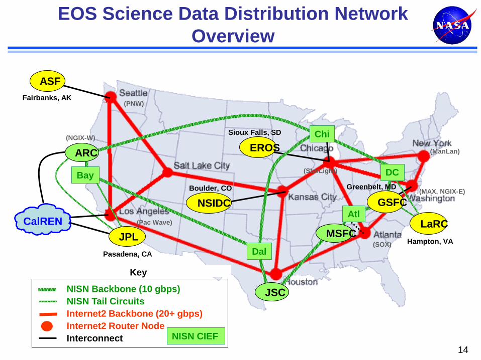
EOS Science Data Distribution Network
Overview
Fairbanks, AK
ASF
MSFC
Atl
Greenbelt, MD
Pasadena, CA
JPL
CalREN
EROS
NSIDC
JSC
GSFC
LaRC
DC
Key
NISN CIEF
NISN Backbone (10 gbps)
NISN Tail Circuits
Internet2 Backbone (20+ gbps)
Internet2 Router Node
Interconnect
Boulder, CO
Sioux Falls, SD
Hampton, VA
Bay
Chi
Dal
(PNW)
(StarLight)
(Pac Wave)
(NGIX-W)
(ManLan)
(MAX, NGIX-E)
(SOX)
ARC
Fairbanks, AK
ASF
MSFC
Pasadena, CA
JPL
EROS
ARC
NSIDC
JSC
GSFC
LaRC
DC Boulder, CO
Sioux Falls, SD
Hampton, VA
Bay
Chi
Dal
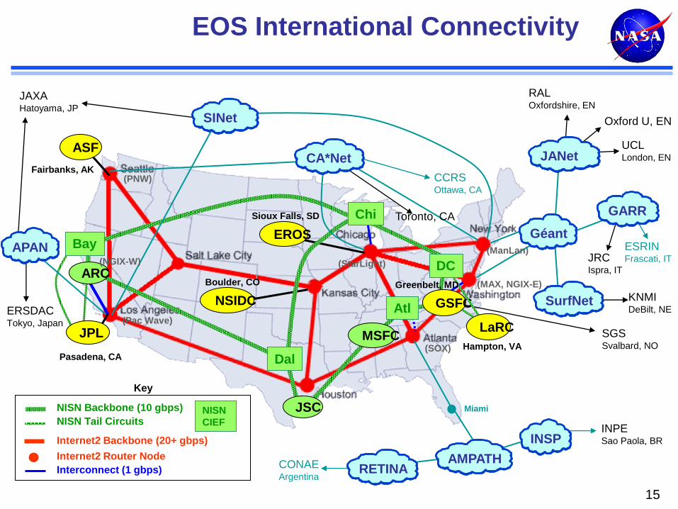
EOS International Connectivity
KNMI DeBilt, NE
ESRIN Frascati, IT
Toronto, CA
ERSDAC Tokyo, Japan
JAXA Hatoyama, JP
JRC Ispra, IT
Oxford U, EN
UCL London, EN
RAL Oxfordshire, EN
CCRS Ottawa, CA
INPE Sao Paola, BR
CONAE Argentina
Géant
AMPATH
JANet
INSP
RETINA
SurfNet
SGS Svalbard, NO
Miami
Atl
Key
NISN
CIEF
NISN Backbone (10 gbps)
NISN Tail Circuits
Internet2 Backbone (20+ gbps)
Internet2 Router Node
Interconnect (1 gbps)
Greenbelt, MD
(StarLight)
(PNW)
(MAX, NGIX-E)
(SOX)
(Pac Wave)
GARR
(ManLan) (NGIX-W)
15
CA*Net
APAN
SINet
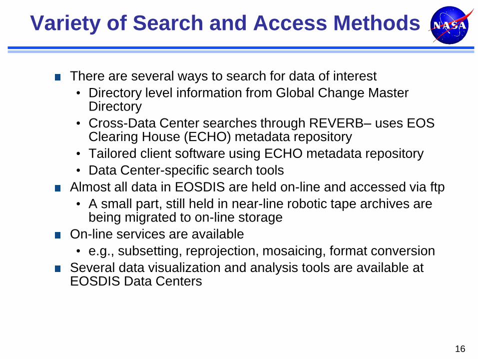
Variety of Search and Access Methods
There are several ways to search for data of interest
• Directory level information from Global Change Master Directory
• Cross-Data Center searches through REVERB– uses EOS Clearing House (ECHO) metadata repository
• Tailored client software using ECHO metadata repository
• Data Center-specific search tools
Almost all data in EOSDIS are held on-line and accessed via ftp
• A small part, still held in near-line robotic tape archives are being migrated to on-line storage
On-line services are available
• e.g., subsetting, reprojection, mosaicing, format conversion
Several data visualization and analysis tools are available at EOSDIS Data Centers
16
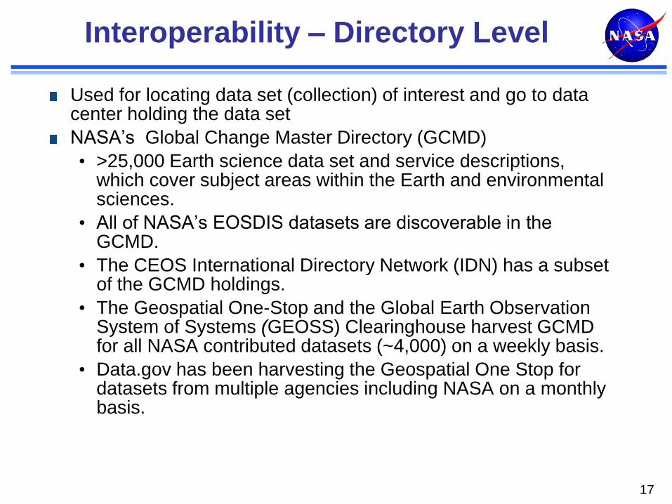
Interoperability – Directory Level
Used for locating data set (collection) of interest and go to data center holding the data set
NASA’s Global Change Master Directory (GCMD)
• >25,000 Earth science data set and service descriptions, which cover subject areas within the Earth and environmental sciences.
• All of NASA’s EOSDIS datasets are discoverable in the GCMD.
• The CEOS International Directory Network (IDN) has a subset of the GCMD holdings.
• The Geospatial One-Stop and the Global Earth Observation System of Systems (GEOSS) Clearinghouse harvest GCMD for all NASA contributed datasets (~4,000) on a weekly basis.
• Data.gov has been harvesting the Geospatial One Stop for datasets from multiple agencies including NASA on a monthly basis.
17
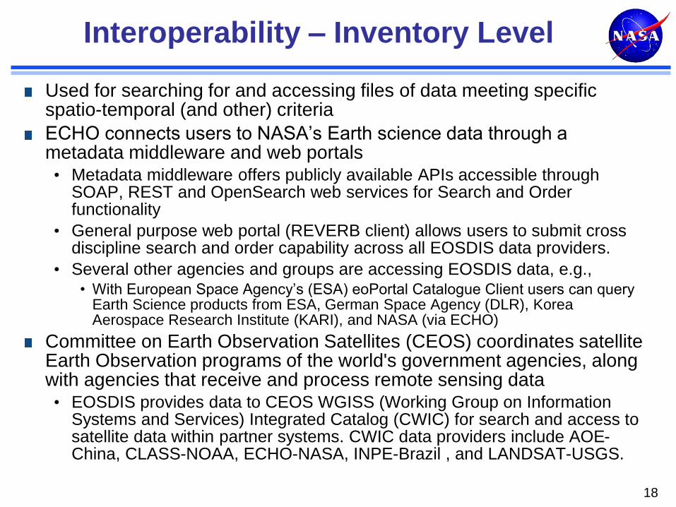
Interoperability – Inventory Level
Used for searching for and accessing files of data meeting specific spatio-temporal (and other) criteria
ECHO connects users to NASA’s Earth science data through a metadata middleware and web portals • Metadata middleware offers publicly available APIs accessible through
SOAP, REST and OpenSearch web services for Search and Order functionality
• General purpose web portal (REVERB client) allows users to submit cross discipline search and order capability across all EOSDIS data providers.
• Several other agencies and groups are accessing EOSDIS data, e.g., • With European Space Agency’s (ESA) eoPortal Catalogue Client users can query
Earth Science products from ESA, German Space Agency (DLR), Korea Aerospace Research Institute (KARI), and NASA (via ECHO)
Committee on Earth Observation Satellites (CEOS) coordinates satellite Earth Observation programs of the world's government agencies, along with agencies that receive and process remote sensing data • EOSDIS provides data to CEOS WGISS (Working Group on Information
Systems and Services) Integrated Catalog (CWIC) for search and access to satellite data within partner systems. CWIC data providers include AOE-China, CLASS-NOAA, ECHO-NASA, INPE-Brazil , and LANDSAT-USGS.
18
Land, Atmosphere Near-real-time Capability for EOS (LANCE)
19
• Building on existing EOSDIS elements provides data from MODIS, OMI, AIRS,
MLS, and AMSR-E instruments in near real-time (< 3 hours from observation)
• Utilizes software for Standard Science Products, but relaxes requirements for
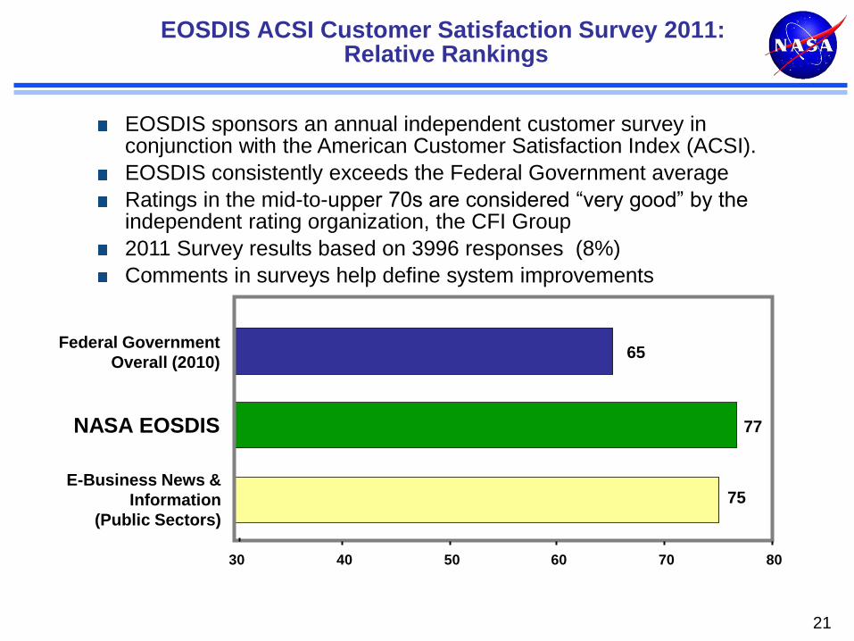
EOSDIS sponsors an annual independent customer survey in conjunction with the American Customer Satisfaction Index (ACSI).
EOSDIS consistently exceeds the Federal Government average
Ratings in the mid-to-upper 70s are considered “very good” by the independent rating organization, the CFI Group
2011 Survey results based on 3996 responses (8%)
Comments in surveys help define system improvements
Evolution from Pre-EOS Era
Data policy
• Formerly PI’ s had exclusive access periods
• Now free and open
Focus on data management
• Formerly small parts of flight projects
• Starting with EOS, separate data system program/project
Missions to measurements
• Discipline-based data centers
• MEaSUREs Program
Technology upgrades and system evolution
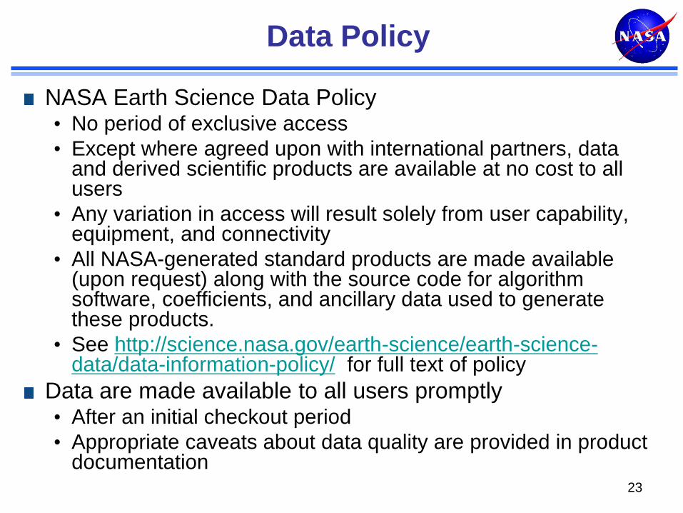
Data Policy
NASA Earth Science Data Policy • No period of exclusive access
• Except where agreed upon with international partners, data and derived scientific products are available at no cost to all users
• Any variation in access will result solely from user capability, equipment, and connectivity
• All NASA-generated standard products are made available (upon request) along with the source code for algorithm software, coefficients, and ancillary data used to generate these products.
• See http://science.nasa.gov/earth-science/earth-science-data/data-information-policy/ for full text of policy
Data are made available to all users promptly • After an initial checkout period
• Appropriate caveats about data quality are provided in product documentation
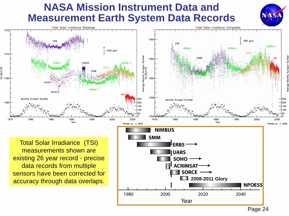
NASA Mission Instrument Data and Measurement Earth System Data Records
2008-2011 Glory
Total Solar Irradiance (TSI)
measurements shown are
existing 26 year record - precise
data records from multiple
sensors have been corrected for
accuracy through data overlaps.
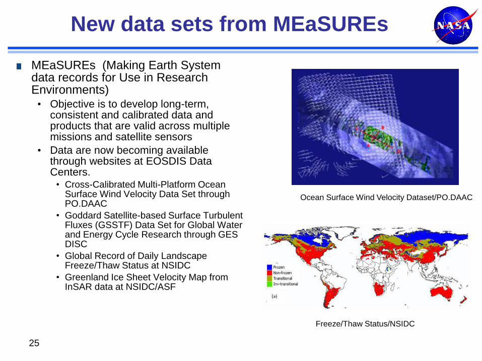
New data sets from MEaSUREs
MEaSUREs (Making Earth System data records for Use in Research Environments) • Objective is to develop long-term,
consistent and calibrated data and products that are valid across multiple missions and satellite sensors
• Data are now becoming available through websites at EOSDIS Data Centers.
• Cross-Calibrated Multi-Platform Ocean Surface Wind Velocity Data Set through PO.DAAC
• Goddard Satellite-based Surface Turbulent Fluxes (GSSTF) Data Set for Global Water and Energy Cycle Research through GES DISC
• Global Record of Daily Landscape Freeze/Thaw Status at NSIDC
• Greenland Ice Sheet Velocity Map from InSAR data at NSIDC/ASF
25
Ocean Surface Wind Velocity Dataset/PO.DAAC
Freeze/Thaw Status/NSIDC
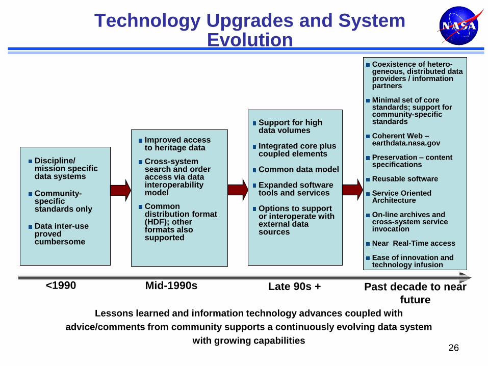
Discipline/ mission specific data systems
Community-specific standards only
Data inter-use proved cumbersome
Improved access to heritage data
Cross-system search and order access via data interoperability model
Common distribution format (HDF); other formats also supported
<1990 Mid-1990s
Technology Upgrades and System Evolution
Support for high data volumes Integrated core plus coupled elements Common data model Expanded software tools and services Options to support or interoperate with external data sources
Coexistence of hetero-geneous, distributed data providers / information partners Minimal set of core standards; support for community-specific standards Coherent Web – earthdata.nasa.gov Preservation – content specifications Reusable software Service Oriented Architecture On-line archives and cross-system service invocation
Near Real-Time access Ease of innovation and technology infusion
Late 90s + Past decade to near
future
Lessons learned and information technology advances coupled with
advice/comments from community supports a continuously evolving data system
with growing capabilities 26
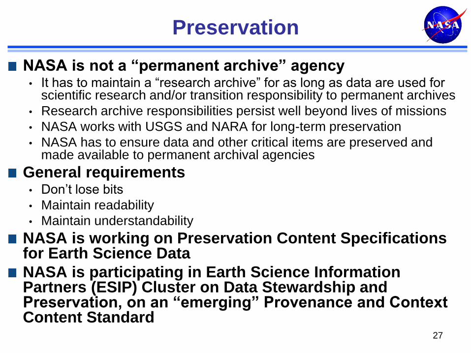
Preservation
NASA is not a “permanent archive” agency • It has to maintain a “research archive” for as long as data are used for
scientific research and/or transition responsibility to permanent archives
• Research archive responsibilities persist well beyond lives of missions
• NASA works with USGS and NARA for long-term preservation
• NASA has to ensure data and other critical items are preserved and made available to permanent archival agencies
General requirements • Don’t lose bits
• Maintain readability
• Maintain understandability
NASA is working on Preservation Content Specifications for Earth Science Data
NASA is participating in Earth Science Information Partners (ESIP) Cluster on Data Stewardship and Preservation, on an “emerging” Provenance and Context Content Standard
27
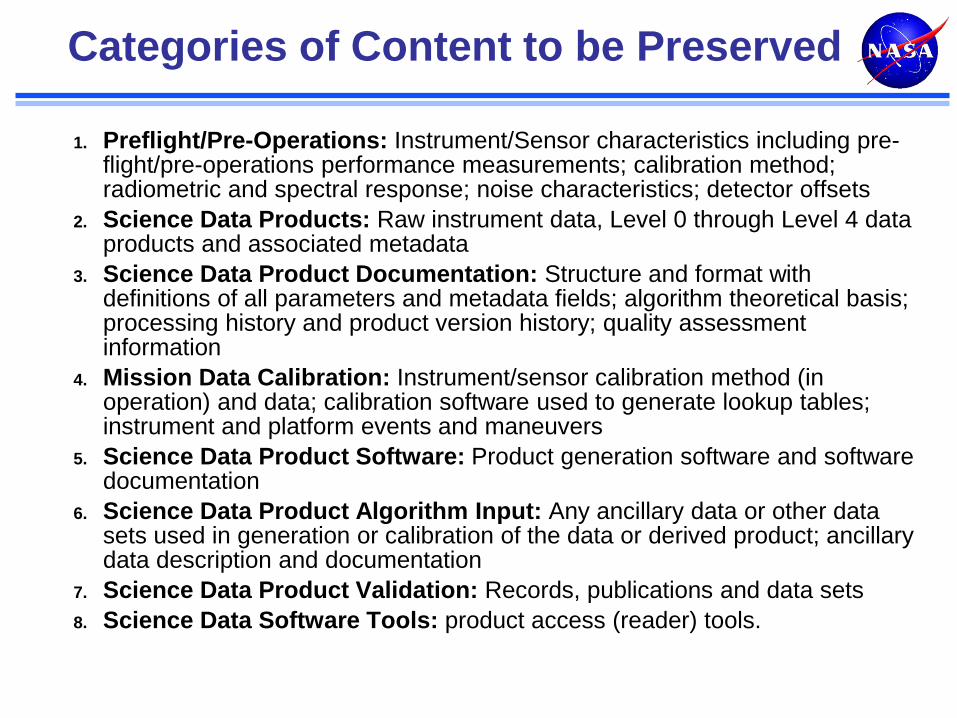
Categories of Content to be Preserved
1. Preflight/Pre-Operations: Instrument/Sensor characteristics including pre-flight/pre-operations performance measurements; calibration method; radiometric and spectral response; noise characteristics; detector offsets
2. Science Data Products: Raw instrument data, Level 0 through Level 4 data products and associated metadata
3. Science Data Product Documentation: Structure and format with definitions of all parameters and metadata fields; algorithm theoretical basis; processing history and product version history; quality assessment information
4. Mission Data Calibration: Instrument/sensor calibration method (in operation) and data; calibration software used to generate lookup tables; instrument and platform events and maneuvers
5. Science Data Product Software: Product generation software and software documentation
6. Science Data Product Algorithm Input: Any ancillary data or other data sets used in generation or calibration of the data or derived product; ancillary data description and documentation
7. Science Data Product Validation: Records, publications and data sets
8. Science Data Software Tools: product access (reader) tools.
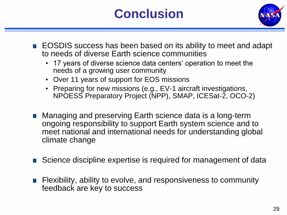
Conclusion
EOSDIS success has been based on its ability to meet and adapt to needs of diverse Earth science communities • 17 years of diverse science data centers’ operation to meet the
needs of a growing user community
• Over 11 years of support for EOS missions
• Preparing for new missions (e.g., EV-1 aircraft investigations, NPOESS Preparatory Project (NPP), SMAP, ICESat-2, OCO-2)
Managing and preserving Earth science data is a long-term ongoing responsibility to support Earth system science and to meet national and international needs for understanding global climate change
Science discipline expertise is required for management of data
Flexibility, ability to evolve, and responsiveness to community feedback are key to success
29
BACK-UP
30
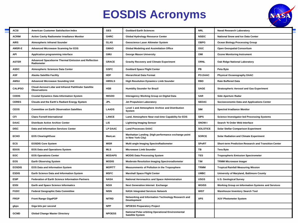
EOSDIS Acronyms ACSI American Customer Satisfaction Index GES Goddard Earth Sciences NRL Naval Research Laboratory
ACRIM Active Cavity Radiometer Irradiance Monitor GHRC Global Hydrology Resource Center NSIDC National Snow and Ice Data Center
AIRS Atmospheric Infrared Sounder GLAS Geoscience Laser Altimeter System OBPG Ocean Biology Processing Group
AMSR-E Advanced Microwave Scanning for EOS GMAO Global Modeling and Assimilation Office OGC Open Geospatial Consortium
API Application programming interface GMU George Mason University OMI Ozone Monitoring Instrument
ASTER Advanced Spaceborne Thermal Emission and Reflection
Radiometer GRACE Gravity Recovery and Climate Experiment ORNL Oak Ridge National Laboratory
ASDC Atmospheric Sciences Data Center GSFC Goddard Space Flight Center PB Peta Byte
ASF Alaska Satellite Facility HDF Hierarchical Data Format PO.DAAC Physical Oceanography DAAC
AMSU Advanced Microwave Sounding Unit HIRDLS High Resolution Dynamics Limb Sounder RBD Rate Buffered Data
CALIPSO Cloud-Aerosol Lidar and Infrared Pathfinder Satellite
Observations HSB Humidity Sounder for Brazil SAGE Stratospheric Aerosol and Gas Experiment
CDDIS Crustal Dynamics Data Information System IWGDD Interagency Working Group on Digital Data SAR Side Aperture Radar
CERES Clouds and the Earth’s Radiant Energy System JPL Jet Propulsion Laboratory SEDAC Socioeconomic Data and Applications Center
CEOS Committee on Earth Observation Satellites LAADS Level 1 and Atmosphere Archive and Distribution
System SIM Spectral Irradiance Monitor
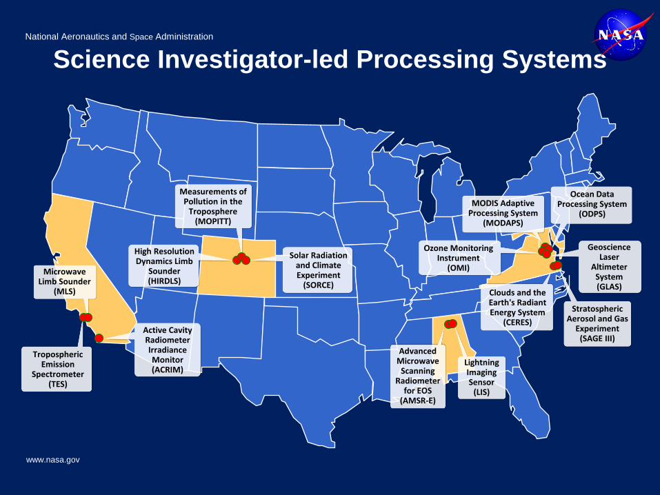
CFI Claes Fornell International LANCE Land, Atmosphere Near-real-time Capability for EOS SIPS Science Investigator-led Processing Systems
DAAC Distribute Active Archive Center LIS Lightning Imaging Sensor SNOW-I Search 'N Order Web Interface
DISC Data and Information Services Center LP DAAC Land Processes DAAC SOLSTICE Solar Stellar Comparison Experiment
ECHO EOS ClearingHOuse ManLan Manhattan Landing (high performance exchange point
in New York City) SORCE Solar Radiation and Climate Experiment
ECS EOSDIS Core System MISR Multi-angle Imaging SpectroRadiometer SPoRT Short-term Prediction Research and Transition Center
EDOS EOS Data and Operations System MLS Microwave Limb Sounder TB Tera Byte
EOC EOS Operations Center MODAPS MODIS Data Processing System TES Tropospheric Emission Spectrometer
EOS Earth Observing System MODIS Moderate Resolution Imaging Spectroradiometer TIM TRMM Microwave Imager
EOSDIS EOS Data and Information System MOPITT Measurements of Pollution in the Troposphere TRMM Tropical Rainfall Measuring Mission
ESDIS Earth Science Data and Information System MSFC Marshall Space Flight Center UMBC University of Maryland, Baltimore County
ESIP Federation of Earth Science Information Partners NASA National Aeronautics and Space Administration USGS U.S. Geological Survey
ESSI Earth and Space Science Informatics NGIX Next Generation Internet Exchange WGISS Working Group on Information Systems and Services
FGDC Federal Geographic Data Committee NISN NASA Integrated Services Network WIST Warehouse Inventory Search Tool
FRGP Front Range GigaPOP NITRD Networking and Information Technology Research and
Development XPS XUV Photometer System
gbps Giga bits per second NPP NPOESS Preparatory Project
GCMD Global Change Master Directory NPOESS National Polar-orbiting Operational Environmental