30


Forest Mensuration

Forest Mensuration
Fifth Edition
John a. Kershaw, Jr.MarK J. DuceythoMas w. BeersBertraM husch

This edition first published 2017 © 1972, 1983, 1993, 2003, 2017 by John Wiley & Sons, Ltd
Registered OfficeJohn Wiley & Sons, Ltd, The Atrium, Southern Gate, Chichester, West Sussex, PO19 8SQ, UK
Editorial Offices9600 Garsington Road, Oxford, OX4 2DQ, UKThe Atrium, Southern Gate, Chichester, West Sussex, PO19 8SQ, UK111 River Street, Hoboken, NJ 07030‐5774, USA
For details of our global editorial offices, for customer services and for information about how to apply for permission to reuse the copyright material in this book please see our website at www.wiley.com/wiley‐blackwell.
The right of the author to be identified as the author of this work has been asserted in accordance with the UK Copyright, Designs and Patents Act 1988.
All rights reserved. No part of this publication may be reproduced, stored in a retrieval system, or transmitted, in any form or by any means, electronic, mechanical, photocopying, recording or otherwise, except as permitted by the UK Copyright, Designs and Patents Act 1988, without the prior permission of the publisher.
Designations used by companies to distinguish their products are often claimed as trademarks. All brand names and product names used in this book are trade names, service marks, trademarks or registered trademarks of their respective owners. The publisher is not associated with any product or vendor mentioned in this book.
Limit of Liability/Disclaimer of Warranty: While the publisher and author(s) have used their best efforts in preparing this book, they make no representations or warranties with respect to the accuracy or completeness of the contents of this book and specifically disclaim any implied warranties of merchantability or fitness for a particular purpose. It is sold on the understanding that the publisher is not engaged in rendering professional services and neither the publisher nor the author shall be liable for damages arising herefrom. If professional advice or other expert assistance is required, the services of a competent professional should be sought.
Library of Congress Cataloging‐in‐Publication Data
Names: Kershaw, John A., Jr., 1962– author. | Ducey, Mark J., author. | Beers, Thomas W., author. | Husch, Bertram, 1923– author.Title: Forest mensuration / by John A Kershaw, Jr., Mark J Ducey, Thomas W Beers, Dr. Bertram Husch.Description: Fifth edition. | Chichester, UK ; Hoboken, NJ : John Wiley & Sons, 2017. | Includes bibliographical references and index.Identifiers: LCCN 2016036142| ISBN 9781118902035 (cloth) | ISBN 9781118902004 (epub)Subjects: LCSH: Forests and forestry–Measurement. | Forest surveys.Classification: LCC SD555 .K47 2017 | DDC 634.9–dc23 LC record available at https://lccn.loc.gov/2016036142
A catalogue record for this book is available from the British Library.
Wiley also publishes its books in a variety of electronic formats. Some content that appears in print may not be available in electronic books.
Set in 10/12pt Times by SPi Global, Pondicherry, India
1 2017
v
Contents
Preface xiv
1 Introduction 1
1.1. Role of Forest Mensuration in Forest Management, 21.2. Forest Mensuration as a Tool for Monitoring Forests, 31.3. Relevance of Forest Mensuration for Ecology and Nontimber Resources, 41.4. Design and Planning of Inventories, 5
1.4.1. Timber Estimation, 51.4.2. Nontimber Estimation, 71.4.3. Inventory Planning, 71.4.4. Forest Inventory Design, 101.4.5. Inventory Fieldwork, 11
2 Principles of Measurement 13
2.1. Scales of Measurement, 142.2. Units of Measurement, 162.3. Systems of Measurement, 16
2.3.1. International System of Units (Metric System), 162.3.2. Imperial System, 182.3.3. Conversions Between Systems, 20
2.4. Variables, 212.5. Precision, Accuracy, and Bias, 212.6. Significant Digits and Rounding Off, 23
2.6.1. Significant Digits in Measurements, 232.6.2. Rounding Off, 242.6.3. Significant Digits in Arithmetic Operations, 25
vi CONTENTS
2.7. Data Summary and Presentation, 272.7.1. Tables, 282.7.2. Graphic Presentation, 282.7.3. Class Limits, 29
2.8. Fundamental Measurements, 302.8.1. Linear Measurements, 302.8.2. Time Measurements, 312.8.3. Weight Measurements, 312.8.4. Area Measurements, 322.8.5. Volume Measurements, 33
3 Basic statistical Concepts 34
3.1. Descriptive Statistics, 343.1.1. Population, 353.1.2. Sample, 353.1.3. Statistics, 38
3.2. Frequency Distributions, 383.3. Measures of Central Tendency, 40
3.3.1. Arithmetic Mean, 403.3.2. Quadratic Mean, 413.3.3. Harmonic and Geometric Means, 423.3.4. Median and Mode, 42
3.4. Measures of Dispersion, 423.4.1. Variance and Standard Deviation, 433.4.2. Coefficient of Variation, 45
3.5. Sampling Error, 453.5.1. Standard Error of the Mean, 463.5.2. Confidence Interval, 48
3.6. Sample Size Determination, 503.7. Influence of Scalar Transformations
and the Estimation of Totals, 523.8. Correlation and Regression Estimation, 53
3.8.1. Covariance and Correlation, 533.8.2. Simple Linear Regression, 563.8.3. Goodness‐of‐Fit and Regression Diagnostics, 583.8.4. Multiple Regression and Transformations, 613.8.5. Advanced Topics in Regression Analysis, 63
3.9. Use of Covariates to Improve Estimation, 633.9.1. Ratio Estimation, 643.9.2. Regression Estimation, 65
4 Land Area Determination in Forest Mensuration 67
4.1. Land Distance and Area Units, 684.2. Measuring Distances, 68
4.2.1. Pacing, 694.2.2. Distances with Chains and Tapes, 69
CONTENTS vii
4.2.3. Optical Rangefinders, 714.2.4. Electronic Distance Measurement Devices, 714.2.5. Maps and Photos, 72
4.3. Measuring Area in the Field, 734.4. Measuring Area Using Maps and Photos, 73
4.4.1. Area by Coordinates, 734.4.2. Area by Dot Grids and Line Transects, 754.4.3. Area by Planimeters, 76
4.5. Determination of Photo Scale, 764.6. Determination of Direction Using a Compass, 80
4.6.1. Magnetic Declination, 804.7. The U.S. Public Land Surveys, 824.8. Global Positioning Systems, 86
4.8.1. Components of GPS, 864.8.2. How GPS Works, 864.8.3. Accuracy of GPS, 874.8.4. GPS Receivers, 884.8.5. Using GPS Data in Forest Mensuration, 89
4.9. Geographic Information Systems, 894.9.1. Applications of GIS to Forest Mensuration, 90
5 Individual tree Parameters 92
5.1. Age, 925.2. Tree Diameters and Cross‐Sectional Areas, 95
5.2.1. Instruments for Measuring Diameter, 985.2.2. Measurement of Upper‐Stem Diameters, 1035.2.3. Cross‐Sectional Area, 1045.2.4. Surface Areas, 1065.2.5. Applications to Understory Plants, 107
5.3. Height, 1085.3.1. Hypsometers Based on Similar Triangles, 1105.3.2. Hypsometers Based on Trigonometry, 1125.3.3. Special Considerations in Measuring Tree Heights, 1175.3.4. Use of LiDAR, 120
5.4. Form, 1215.4.1. Form Factors, 1215.4.2. Form Quotients, 1225.4.3. Taper Tables, Curves, and Formulas, 1235.4.4. Slenderness, 124
5.5. Crown Parameters, 1255.5.1. Crown Length, 1255.5.2. Crown Diameter and Area, 1265.5.3. Crown Surface Area and Volume, 1275.5.4. Foliage Area and Biomass, 1285.5.5. Other Crown Characteristics, 129
5.6. Regression and Allometric Approaches, 130
viii CONTENTS
5.6.1. Allometry of Standing Trees, 1305.6.2. Applications to Seedlings, Saplings, and Understory Plants, 132
6 Determination of tree Volume, Weight, and Biomass 135
6.1. Measurement of Individual Trees, 1376.1.1. Stem Dissection, 1376.1.2. Volume Determination by Displacement, 1386.1.3. Volume Determination by Formulas, 1396.1.4. Determination of Cubic Volume by Graphical Methods
and Integration, 1446.1.5. Determination of Crown and Root Volumes, 1476.1.6. Determination of Bark Volume, 1486.1.7. Weight Determination, 1516.1.8. Biomass Determination, 1536.1.9. Carbon and Nutrient Content Determination, 154
6.2. Allometric Equations for Volume, Weight, and Biomass, 1566.2.1. Standard and Form Class Functions, 1576.2.2. Local Functions, 1586.2.3. Volume Functions to Upper‐Stem Diameter Limits, 159
6.3. Tabular Estimation, 1606.3.1. Descriptive Information to Accompany Tables, 1656.3.2. Checking Applicability of Tables, 1666.3.3. Conversion of Volume Tables to Weight, Biomass, or Carbon
and Nutrient Tables, 1666.4. Volume and Biomass Distribution in Trees, 167
6.4.1. Methods for Estimating Stem Volume Distribution, 1676.4.2. Distribution of Weight and Biomass in Trees, 170
6.5. Other Methods of Estimating Tree Content, 1736.5.1. Determination of Volume by Height Accumulation, 1736.5.2. Importance Sampling and Centroid Methods, 176
6.6. Applications to Seedlings and Understory Vegetation, 1796.7. Applications to Snags and Down Woody Material, 179
6.7.1. Standing Dead Trees, 1796.7.2. Downed Woody Material, 181
7 Measurement of Primary Forest Products 184
7.1. Units of Measurement of Forest Products, 1847.1.1. Board Foot, 1847.1.2. Volume Units for Stacked Wood, 185
7.2. Log Rules, 1867.3. Board Foot Log Rules, 186
7.3.1. Mill‐Study Log Rules, 1877.3.2. Diagram Log Rules, 1877.3.3. Mathematical Log Rules, 1897.3.4. Combination Log Rules, 1917.3.5. Comparison of Log Rules, 1917.3.6. Tabular Presentation of Log Rules, 192
CONTENTS ix
7.4. Log Scaling, 1957.4.1. Board Foot Scaling, 1957.4.2. Cubic Volume Scaling, 1987.4.3. Unmerchantable Logs, 1987.4.4. Sample scaling, 198
7.5. Scaling Stacked Volume, 1997.6. Volume Unit Conversion, 200
7.6.1. Determination of Solid Cubic Contents of Stacked Wood, 2027.7. Scaling By Weight, 204
7.7.1. Weight Measurement of Pulpwood, 2047.7.2. Weight Measurement of Sawlogs, 2077.7.3. Weight Measurement of Pulp, 2087.7.4. Weight Measurement of Other Forest Products, 209
8 stand Parameters 210
8.1. Age, 2118.1.1. Even‐Aged and Single‐Cohort Stands, 2118.1.2. Uneven‐Aged and Multicohort Stands, 211
8.2. Species Composition, 2128.2.1. Describing Species Composition, 2138.2.2. Number and Diversity of Species, 2148.2.3. Assigning Stand Types, 218
8.3. Diameter, 2198.3.1. Expressions of Mean Diameter, 2208.3.2. Basal Area, 2218.3.3. Diameter Distributions, 221
8.4. Height, 2288.4.1. Expressions of Mean Height, 2298.4.2. Height–Diameter Curves, 2308.4.3. Height–Diameter Ratio, 231
8.5. Volume, Weight, and Biomass, 2328.5.1. Volume, 2328.5.2. Weight, Biomass, and Carbon Content, 2348.5.3. Volume, Weight, and Biomass of Dead Wood, 235
8.6. Crown and Canopy Measurements, 2368.6.1. Crown Closure and Canopy Cover, 2368.6.2. Leaf Area Index, 237
8.7. Understory and Regeneration, 2398.7.1. Density and Frequency, 2408.7.2. Cover and Competition, 2418.7.3. Biomass and Forage, 2468.7.4. Regeneration Surveys, 247
8.8. Site Quality, 2508.8.1. Geocentric Approaches, 2518.8.2. Phytocentric Approaches Using Vegetation Composition, 2538.8.3. Dendrocentric Approaches, 2548.8.4. Preparation of Site Index Curves, 257
x CONTENTS
8.9. Density and Stocking, 2598.9.1. Relative Density Based on Volume, 2608.9.2. Stand Density Index, 2618.9.3. Tree–Area Ratio, 2638.9.4. Crown Competition Factor, 2648.9.5. Relative Spacing, 2668.9.6. Density of Mixed‐Species and Complex‐Structure Stands, 2668.9.7. Point Density and Competition Indices, 2668.9.8. Forest Stocking and Density Management Diagrams, 269
9 sampling Units for estimating Parameters 273
9.1. The Factor Concept, 2749.2. Fixed‐Area Plots, 276
9.2.1. Circular Plots, 2769.2.2. Square and Rectangular Plots, 2779.2.3. Subplots, 2789.2.4. Selection of Plots and Trees, 2799.2.5. Stand and Stock Tables, 2809.2.6. Boundary Slopover, 284
9.3. Sampling Trees with Variable Probability, 2879.3.1. Horizontal Point Samples, 2879.3.2. Stand and Stock Tables, 2939.3.3. Boundary Slopover Bias, 2969.3.4. Other Forms of Sampling Proportional to Size, 296
9.4. Other Examples of Variable Probability Sampling, 2989.4.1. Point Intercept Sampling, 2989.4.2. Line Intercept Sampling, 299
9.5. Distance‐Based Sampling Units, 2999.5.1. Nearest‐Neighbor Methods, 2999.5.2. Distance Sampling, 302
9.6. Selecting Appropriate Sampling Units, 303
10 sampling Designs in Forest Inventories 305
10.1. Basic Considerations, 30510.1.1. Errors in Forest Inventories, 30610.1.2. Confidence Limits, 30810.1.3. Precision Level and Intensity, 310
10.2. Simple Random Sampling (SRS), 31110.2.1. Influence of Plot Size on Simple Random Sample Designs, 315
10.3. Systematic Sampling (SYS), 31810.3.1. Systematic Plot Sampling, 31810.3.2. Sampling Error for a SYS Inventory, 32210.3.3. Systematic Strip Sampling, 324
10.4. Selective or Opportunistic Sampling, 32610.5. Stratified Sampling (STS), 327
10.5.1. Estimation of Number of Sampling Units, 33010.5.2. Sample Efficiency, 332
CONTENTS xi
10.6. Cluster Sampling, 33410.7. Multistage Sampling, 33810.8. Sampling with Covariates, 343
10.8.1. Regression Sampling, 34410.8.2. Double Sampling, 349
10.9. List Sampling, 35310.10. 3P Sampling, 357
11 Inventory of standing trees Using sampling with Varying Probability 361
11.1. Horizontal Point Sampling (HPS), 36211.1.1. Angle Gauges for HPS, 36211.1.2. Photographic Methods, 36711.1.3. Sample Size, 36811.1.4. Choosing a Suitable Gauge Constant, 36911.1.5. Proper Use of Gauges, 37111.1.6. Checking Questionable Trees, 37211.1.7. Slope Correction, 37411.1.8. Leaning and Hidden Trees, 37411.1.9. Volume Estimation, 37511.1.10. Special‐Purpose Modifications of HPS, 376
11.2. Subsampling in HPS, 37711.2.1. Big BAF Sampling, 37711.2.2. Point 3P Sampling, 382
11.3. Other Variable Probability Sampling Techniques, 38611.3.1. Horizontal Line Sampling (HLS), 38611.3.2. Vertical Point and Line Sampling, 38911.3.3. Critical Height Sampling, 391
12 Inventory of Downed Dead Material Using sampling with Varying Probability 393
12.1. Fixed‐Area Plots, 39412.2. Line Intersect Sampling, 398
12.2.1. Assumptions of Line Intersect Sampling, 39912.2.2. Estimating Downed Wood Parameters, 40112.2.3. Choosing a Line Length and Design, 40412.2.4. Adaptation for Fine Fuels, 406
12.3. Angle Gauge Methods, 40612.3.1. Transect Relascope Sampling, 40612.3.2. Point Relascope Sampling, 41012.3.3. Gauge Construction and Choice of Angle, 41112.3.4. Estimating Downed Wood Parameters, 41312.3.5. Practical Aspects, 413
12.4. Perpendicular Distance Sampling (PDS), 41412.4.1. PDS for Volume, 41512.4.2. Distance‐Limited PDS, 41912.4.3. PDS for Other Attributes, 420
xii CONTENTS
12.4.4. Estimating Multiple Downed Wood Attributes, 42212.4.5. Choosing a Design and Factor, 424
12.5. Other Methods, 42512.5.1. Diameter Relascope Sampling, 42512.5.2. Critical Length Sampling, 42612.5.3. Line Intersect Distance Sampling, 426
12.6. Design Considerations and Selection of Methods, 427
13 Integrating Remote sensing in Forest Inventory 429
13.1. Types of Remotely Sensed Data, 42913.1.1. Aerial Analog Photography, 43113.1.2. Moderate‐Resolution Optical Data, 43313.1.3. High‐Resolution Optical Data, 43513.1.4. LiDAR, 43613.1.5. Synthetic Aperture Radar, 44013.1.6. Hyperspectral Data, 441
13.2. Remote Sensing for Stratification, 44213.2.1. Photo Interpretation and Stand Mapping, 44213.2.2. Pixel‐Based Classification, 44413.2.3. Object‐Oriented Classification, 44413.2.4. Effects of Misclassification on Estimation, 445
13.3. Individual Tree Measurements, 44613.3.1. Crown Widths, 44713.3.2. Tree Heights, 44813.3.3. Estimating Stand Characteristics, 448
13.4. Remote Sensing for Covariates, 44913.4.1. Tree and Stand Attributes and Sampling Covariates, 44913.4.2. Applications to Ratio and Regression Sampling, 45113.4.3. Imputation and Mapping, 45313.4.4. Areal Importance Sampling, 454
14 Measurement of tree and stand Growth 455
14.1. Individual Tree Growth, 45614.1.1. Tree Growth Curves, 45614.1.2. Growth Percent, 458
14.2. Direct Measurement of Tree Growth, 46014.2.1. Diameter Growth Measurement, 46114.2.2. Height Growth Measurement, 46214.2.3. Crown Growth Measurements, 46314.2.4. Belowground Growth Measurements, 463
14.3. Reconstructing Tree Growth, 46514.3.1. Stem Analysis, 46514.3.2. Estimating Diameter Growth from Increment Cores, 46614.3.3. Allometric Relationships, 472
14.4. Stand and Forest Growth, 47414.4.1. Components of Stand Growth, 47414.4.2. Types of Stand Growth, 475
CONTENTS xiii
14.5. Measurement of Stand and Forest Growth and Yield, 47914.5.1. Stand Reconstruction, 47914.5.2. Estimation of Stand Growth and Yield from Temporary Sample
Plots, 48114.5.3. Estimation of Stand Growth and Yield from Fixed‐Area Permanent
Sample Plots, 48114.5.4. Estimation of Stand Growth and Yield from Permanent Variable
Probability Sample Points, 48414.6. Considerations for the Design and Maintenance of Permanent Sample Plot
Systems, 49414.6.1. Sampling Unit Type, 49714.6.2. Sampling Unit Size and Shape, 49814.6.3. Sampling Unit Layout, 49814.6.4. Measurement Protocols, 499
14.7. Growth and Yield Models, 50314.7.1. Stand Table Projection, 50414.7.2. Yield Tables and Equations, 50914.7.3. Diameter Distribution Models, 51614.7.4. Individual Tree Growth and Yield Models, 51614.7.5. Other Types of Models, 51714.7.6. Feedbacks between Growth and Yield Models and Forest
Mensuration, 518
Appendix 519
References 550
Index 592
xiv
It was not without some trepidation that the two lead authors undertook the revision of this text. The 12 years since the last revision has seen many substantial changes to the field of forest mensuration and has marked a passing of a generation of mensurationists as reflected in the change of authorship of this text. The authors attempted to reflect this change while preserving the classic coverage that this text has been known for.
We first want to mark the passing of Dr. Bertram Husch, who served as lead author on this text through four editions and over 40 years. The first edition of this text, released in 1963, marked the first comprehensive coverage of the field of forest mensuration from a statistical perspective. We also acknowledge the passing of several other great mensuration-ists since the publication of the last edition, many of whom are cited throughout this text: Dr. Walter Bitterlich, Dr. Lew Grosenbaugh, Dr. Al Stage, Dr. Benno Hesske, Dr. George Furnival, Dr. Boris Zeide, Dr. Paul Van Deusen, and Mr. Bill Carr. They dedicated their lives to forest mensuration, advanced our knowledge of its principles and applications, and contributed much to the education of the current generation of mensurationists.
Forest mensuration is a living science, and one that continues to advance and grow as we build our understanding and as society’s needs and expectations of forests change. We have attempted to reflect those changes in this new edition. The fourth edition saw a major reorganization of the materials and the introduction of nontimber vegetation measurement and carbon estimation. This edition builds upon those changes. We moved the planning of a forest inventory from late in the book upfront to Chapter 1 and place a greater emphasis on estimation throughout. The coverage of nontimber vegetation and carbon accounting has expanded to reflect the current emphasis on these factors in forest management and forest inventory. These factors are integrated throughout the text rather than covered in sep-arate chapters. We have developed an expanded chapter on sampling and estimating dead and down woody debris (Chapter 12) and added a new chapter on the use of remote sensing in forest inventory (Chapter 13). We have developed worked examples for all of the sample designs and have provided the base data so that instructors and students can work through examples in their classes. We have maintained the use of both Imperial units and SI units
PREFACE
PREFACE xv
throughout the text. One criticism of the fourth edition was the deletion of the tables of variable probability sampling factors that appeared in the third edition; we have included these tables in this edition and appreciated the feedback from our colleagues.
The authors acknowledge the help of many friends and colleagues during the prepara-tion of this revision. Drs. David Larsen, Peter Marshall, Robert Froese, Tzeng Yih Lam, Kim Iles, and Andrew Robinson commented on the structure of the book early during its development, and Tom Lynch provided especially valuable comments on a late draft. Dr. Jeffrey Gove commented on many of the datasets and examples used throughout the book. Dr. Jim Chamberlain provided data on black cohosh used in Chapter 3. R. Andy Colter provided LiDAR data from the USDA Forest Service, and Jamie Perkins assisted with the optical imagery in Chapter 13. Dr. Joel Hartter, Russell Congalton, Forrest Stevens, and Michael Palace provided outstanding insights on the role of remote sensing through the Communities and Forests in Oregon (CAFOR) project. Tzeng Lam and Andrew Robinson provided critical feedback on several chapters. Laird van Damme provided feedback on the structure of the book from a practitioner’s perspective. Ethan Belair carefully proofread the final versions of the chapters, and Julia Smith and Madison Poe helped with page proofs. Finally, we want to thank our families for their patience, encouragement, tolerance, and occasional distractions as this project progressed and protracted far longer than we led them to believe at the start.

Forest Mensuration, Fifth Edition. John A. Kershaw, Jr., Mark J. Ducey, Thomas W. Beers and Bertram Husch. © 2017 John Wiley & Sons, Ltd. Published 2017 by John Wiley & Sons, Ltd.
1
In the first widely available book on Forest Mensuration in North America, Henry S. Graves (1906) wrote: “Forest mensuration deals with the determination of the volume of logs, trees, and stands, and with the study of increment and yield.” The Dictionary of Forestry (Helms, 1998) states that “Forest mensuration is the determination of dimensions, form, weight, growth, volume, and age of trees, individually or collectively, and of the dimensions of their products.” This definition is essentially a paraphrase of the 1906 defi-nition given by Henry S. Graves. Although some foresters feel this definition is still ade-quate, this text considers that mensuration should embrace new measurement problems that have arisen or have been recognized as the horizons of forestry have expanded.
If we accept the challenge of a broader scope, we must ask: “To what degree should mensuration be concerned with measurement problems of wildlife management, recreation, watershed management, and the other aspects of multiple–use forestry?” One might argue that it is unrealistic to imagine that forest mensuration can take as its domain such a diverse group of subjects. The objection becomes irrelevant if we recognize forest mensuration, not as a collection of specific techniques, but as a subject of study that provides principles applicable to a wide range of measurement problems. We view the measurement and quan-tification of all aspects of forest vegetation as within the domain of forest mensuration. Moreover, many ideas, approaches, and techniques have been developed within the context of traditional forest mensuration that have broad applicability for forest ecology, wildlife habitat, recreation, and watershed management. This book, in addition to a treatment of the traditional product‐oriented measurement problems of forestry, will also provide a unified foundation of principles for solving measurement problems in other aspects of forestry.
During the latter half of the twentieth century, the application of statistical theory and the use of computers, electronics, and lasers wrought a revolution in the solution of forest
INTRODUCTION
1
2 FOreST MeNSurATION
measurement problems. Consequently, mensurationists must have a degree of competence in their use as well as in basic mathematics and statistics. Knowledge of calculus is also desirable. In addition, familiarity with systems analysis and operational research, approaches to problem solving that depend on model building and techniques that include simulation and mathematical programming, will also be valuable, especially in advanced and more sophisticated treatments of forest mensurational problems. We do not presume that all readers of this text will have such a deep and broad background, and have tried to present forest mensuration in a way that is accessible to new students but provides a com-prehensive overview of the possibilities of the field.
1.1. ROLE OF FOREST MENSURATION IN FOREST MANAGEMENT
Forest mensuration is one of the cornerstones in the foundation of forestry. Forestry in the broadest sense is a management activity involving forest land, the plants and animals on the land, and humans as they use the land. Much of the forest land in North America and in other parts of the world is under active forest management. In many jurisdictions, for-esters are required to complete detailed long‐term forest management plans, especially on public lands. These plans require foresters to make detailed predictions about the growth and yield of forest resources, and how harvesting and other forest management activities influence the flow of timber and other resources. Based on the outputs from these models, forest managers make decisions about where, when, how, and how much forest land should be treated. elsewhere, management planning may reflect shorter time horizons, but the decisions are no less critical. Good forest management decisions require good tools to analyze the impacts of management activities on the quantities and flows of the various forest resources and on the state of the forest itself. These tools require good models and, ultimately, these models require good data. The acquisition of this data is the subject of this book.
Foresters are faced with many decisions in the management of a forest. The following questions are examples of the problems that must be solved for a particular forest:
1. What silvicultural treatment will result in best regeneration and growth?
2. What species is most suitable for reforestation?
3. Is there sufficient timber to supply a forest industry and for an economical harvest-ing operation?
4. What is the value of the timber and land?
5. What is the recreational potential?
6. What is the wildlife potential?
7. What is the status of biodiversity on the area?
8. What is the status of the forest as a carbon sink?
A forester needs information to answer these and countless other questions and to make intelligent decisions or recommendations to a client. This information often is needed in quantifiable terms. In most situations, the axiom holds, “You can’t efficiently make, man-age, or study anything you don’t locate and measure.” At the same time, resources for measurement are usually limited, so information must be acquired efficiently. In this sense,

INTrODuCTION 3
forest mensuration is the application of measurement principles to obtain quantifiable information for forest management decision‐making.
To summarize, forest mensuration is concerned with obtaining information about forest resources and conditions. The ultimate objective of forest mensuration is to provide quantitative information about the forest and its resources that will allow making reason-able decisions on its destiny, use, and management.
1.2. FOREST MENSURATION AS A TOOL FOR MONITORING FORESTS
To many, a forest, if not affected by cutting, fire, or some other calamity, is a stable, unchanging entity. Actually, a forest is a dynamic system that is continuously changing. Although this may not be evident over a short term, such as a few years, change is always present: some trees increase their dimensions, others die, and new trees germinate and enter the forest. Consequently, the information obtained about the status of a forest area at a given time is only valid for a length of time that depends on the vegetation itself, and on environmental and external pressures affecting the forest. This means that the mensura-tional information regarding the forest must be updated periodically by monitoring proce-dures so that the appropriate management and policy decisions may be taken.
Throughout the twentieth century, the demand on forest resources increased worldwide (Westoby, 1987). In the opening decades of the twenty‐first century, this increase is expected to continue. During the last 40 years, not only have the demands for timber increased, foresters also have been required to manage for other resources including wild-life habitat, water quality, recreational opportunities, and biodiversity. An increase in the public awareness of the influence of human activities on the environment has resulted in the development of a number of forest certification procedures to ensure that forest management activities are sustainable both economically and environmentally. These pro-cedures require forest managers to document and monitor the impacts of forest management activities on a wide range of forest resources, not just timber.
Monitoring must consider changes in composition, structure, size and health of forests (Max et al., 1996). To be effective, monitoring must be comprehensive. In these situations, foresters must increase the scope of their inventories, and the models they use, to include information on multiple aspects of forest structure, not just timber‐producing trees. To be cost effective, forest managers will be required to design and implement new sampling strategies and measurement procedures to meet the demand for increased information.
In the early 1900s, as professional forestry was beginning in North America, the need to use the quantitative tools forest mensuration and forest inventory offered to monitor forest resources was quickly recognized (Bates and Zon, 1922). Zon (1910), in one of the first attempts to assess global forest resources, recognized the need for systematic moni-toring of forest resources on both a national and global basis. The Scandinavian countries (Norway in 1919, Finland in 1920, and Sweden in 1923) were the first countries to imple-ment systematic national forest inventories (NFIs) based on modern statistical principles (Tokola, 2006; Tomppo, 2006). The united Kingdom began NFIs in 1924 and the united States in 1930. The Food and Agricultural Organization of the united Nations began com-piling global assessments of forest resources in 1947. Many other european and Asian countries began NFIs in the 1960s and 1970s. In the late 1980s and early 1990s, many countries, including the united States and Sweden, redesigned their NFIs, adopting a
4 FOreST MeNSurATION
systematic‐grid‐based sample design and consistent plot designs and remeasurement intervals. A number of countries around the world have redesigned or adopted similar pro-tocols for their NFIs. Although most NFIs began with a focus on timber and related resources, nearly all are actively broadening to address the full range of economic, conservation, and environmental challenges faced by regional and national policymakers. Most countries have also integrated remote sensing, aerial photography, and/or LiDAr data into the analyses of ground‐based data.
While the various NFIs differ by the specific measurements made, plot sizes and lay-outs, grid intensities, and remeasurement intervals, the newer designs make it easier to compare estimates across countries (Liknes et al., 2013). The information collected has many important uses including
1. helping policymakers at national and regional levels to formulate good forest policy, and to assess the sustainability of current and past policy;
2. enabling land managers to devise better management plans and to assess effects of current and past management practices on the land;
3. serving as a starting point for scientific investigations in a variety of areas that involve changes in forest ecosystems over time;
4. formulating business plans that will be both economically and ecologically sustain-able over time;
5. keeping the public informed about the health and sustainability of a nation’s for-ests; and
6. providing consistent and reliable reporting statistics to demonstrate compliance with various treaty obligations including conservation and biodiversity commit-ments and carbon offset accounting.
Most countries provide online access to their NFI data and extensive online report generating capabilities.
1.3. RELEVANCE OF FOREST MENSURATION FOR ECOLOGY AND NONTIMBER RESOURCES
ecologists, conservation biologists, and wildlife managers, like forest managers, require quantitative information to make informed decisions. Sometimes, these decisions are about choices of management actions, and sometimes about choices between competing scientific hypotheses; but either type of choice depends on high‐quality data that are collected and analyzed in a cost‐effective way. While the emphasis of this text is the measurement, sam-pling, and estimation of the tree component of the forest vegetation, the basic principles of mensuration can be applied to a range of forest structures and attributes, and we have included some coverage of measurements for these characteristics. estimation of species diversity, abundance, biomass, and carbon content utilize similar techniques for measurement and sampling, whether the focus is on trees, shrubs, herbs, or grasses. Of course, the types of measurements made, the tools used, the size, shape, and type of sample plots, and the sample intensity will vary depending upon the size of individuals, the spatial heterogeneity, and the estimates required (Bonham, 2013).
INTrODuCTION 5
ecological studies require measurements that are effective, accurate, and precise (Ford, 2000). Many of the stand structure parameters useful to foresters for making management decisions (e.g., density, basal area, volume, biomass, and crown cover) are useful parame-ters for estimating nontimber resources and ecological indices. Wildlife managers often rely on measures of stand structure to assess habitat quality and suitability. The need for accurate measurements and robust sample designs are just as important for these applica-tions as they are for timber management.
An unfortunate consequence of the increasing channelization and specialization of knowledge in the twentieth and twenty‐first century has been the divergence of scholarship and teaching between those working in areas of forestry most closely related to timber management, and those working in areas that have more conventionally been the domain of programs in ecology and conservation biology. Our view is that the two groups have much to learn from each other. recent decades have seen dramatic advances in sampling techniques and forest measurements designed with timber applications in mind, but many of these advances are not widely known even though they have direct application to other challenges in forestry, forest conservation, and ecology in general. Conversely, some for-esters whose training is narrowly focused on timber production have found the emerging science and practice in areas related to biodiversity or carbon accounting a bit mysterious, even though the basic measurement principles—and even some of the techniques—are quite similar to those they already know. An integrated treatment of these areas of forest mensuration will help both scientists and professionals approach forests with greater technical versatility and a broader outlook.
1.4. DESIGN AND PLANNING OF INVENTORIES
A forest inventory is the procedure for obtaining information on the quantity, quality, and condition of the forest resource, associated vegetation and components, and many of the char-acteristics of the land area on which the forest is located. The goals of a forest inventory depend on the management and policy questions it is designed to support. Most forest inven-tories have been and will continue to be focused on timber estimation. The need for information on forest health, water, soils, recreation, wildlife and scenic values, and other nonwood values has stimulated the development of integrated or multiresource inventories (Schreuder et al., 1993; Lightner et al., 2001). Interest in forests as a carbon sink has generated considerable interest in estimating forest biomass and carbon content (Satoo and Madgwick, 1982; Brown, 2002; Smith et al., 2006; Pearson et al., 2007). Development and execution of multire-source inventories often requires cooperation among many specialists in pertinent fields.
1.4.1. Timber Estimation
A complete forest inventory for timber evaluation provides the following information: estimates of the area, description of topography, ownership patterns, accessibility, transpor-tation facilities, estimates of timber quantity and quality, and estimates of growth and drain. The emphasis placed on specific elements will differ depending upon the purpose of the inventory (Husch, 1971). For example, if the purpose of an inventory is for the preparation of a harvesting plan, major emphasis would be put on a description of topography, determi-nation of accessibility and transportation facilities, and estimation of timber quantity.
6 FOreST MeNSurATION
Other aspects would be given little emphasis or eliminated. If the purpose of an inventory is for the preparation of a management plan, major emphasis would be put on timber quantity, growth, and harvest levels with lesser detail on other aspects.
Information is obtained in a forest inventory for timber evaluation by measuring and assessing the trees and various characteristics of the land. The information may be obtained from measurements made on the ground or from remotely sensed data (aerial photographs, satellite imagery, or LiDAr*). When measurements are made on all trees in a forest, the inventory is a complete or 100% inventory. When measurements are made for a sample of the forest, it is a sampling inventory. The terms cruise in North America and enumeration in other english‐speaking areas are frequently used instead of inventory.
In executing a forest inventory for timber evaluation, even one based on a fairly small sample, it is impossible to measure directly quantities such as volume or weight of standing trees. Consequently, a relationship is established between directly measurable tree or stand characteristics (e.g., dbh, height) and the desired quantity. This may be done as follows:
1. Make detailed field measurements of trees or stands and compute the desired quan-tities from these measurements. For example, one might make detailed diameter measurements at determined heights along the stem of standing trees and determine volumes by formulas or graphical methods (Section 6.1).
2. estimate the desired quantities in trees or stands by utilizing relationships previ-ously derived from other trees or stands. For example, one might measure tree or stand characteristics such as dbh, height, and form, and determine the corresponding volume or weight from an equation or a table (Section 6.2).
Timber inventories can estimate gross and net volumes. An estimate of gross volume shows the volume of wood, usually without bark, based on the exterior measurements of the trees: dbh, height and, form, without any deductions for defects. An estimate of net volume reduces the gross volume due to defects such as rot, diseased portions, and stem irregular-ities. The reduction for defect can be determined in two ways: (1) at the time of measurement of each tree, the external defects can be noted, internal defects estimated (or directly deter-mined by boring) and recorded, and the loss in volume estimated per tree; and (2) by applying a cull factor expressed as a percent that will reduce the gross volume of the inventory to net volume. This cull percent can be determined directly by carrying out a study that requires the felling of a sample of trees and determining their gross and net vol-umes to determine cull percentages. Frequently cull percentages are based on previous experience in the kind of timber being inventoried. Inventories can be designed to estimate net volumes or quantities by product classes such as poles, pulpwood, sawtimber, and veneer logs. Of course, this requires specifying the criteria to be used at the time of measurement of sample trees during fieldwork.
Other factors in estimating net usable quantity of timber depend not on the defects in the trees themselves but on several external causes. Impacts of factors such as accessibility, legal restrictions (protected areas, silvicultural requirements, and harvesting restrictions), nonuti-lizable species, minimum quality characteristics and sizes of logs, and losses due to breakage in logging and transport are required to obtain an estimate of the usable net volume.
* Light Detection and ranging, Section 13.1.4.
INTrODuCTION 7
1.4.2. Nontimber Estimation
As Hassan et al. (1996) have pointed out, “the need to look into non‐wood benefits of forestry is … becoming an increasingly important component of forest management planning in view of the fact that the contribution of forestry goes beyond wood production.” The parameters measured in multiresource inventories vary, depending on the information required. These parameters may include timber estimates together with data on nontimber vegetation and/or other forest characteristics, such as biodiversity, forest health, scenic values, recreation resources, water quality, wildlife habitat, carbon storage, and ownership (uSDA, 1992).
Multiresource inventories require considerations in the design and implementation that generally are not required when designing timber inventories. Tree species have large woody structures that persist throughout the year, making identification and quantification relatively easy in most seasons. Many nontree species, on the other hand, have ephemeral structures that may only be present on a site for a relatively short period during the growing season. Nontree vegetation assessments require fieldwork to coincide with periods in which ephemeral species are actively growing and identifiable on the site. Different species also vary in the timing of their growth, with some species present early in the growing season and others later. estimates of total vegetation diversity may require multiple visits to the same sites (rosenzweig, 1995; Li et al., 2008). While many of the measurement and sampling techniques used for tree species can be adapted to nontree species, different assessment methods are required depending on whether presence, counts, biomass, or cover estimates are required. Sample designs will also need to be modified since the spatial variability of nontree species is often much finer than for tree species.
Assessment of wildlife poses similar considerations. Wildlife maybe directly assessed or the forest structure might be assessed for either signs of use or its suitability for use by particular species. Direct assessment of wildlife populations is beyond the scope of this text, and the reader is referred to textbooks specializing in wildlife population estimation (Buckland et al., 2001, 2004; Braun, 2005). estimation of suitability often relies on models that predict habitat suitability for a given species based on forest vegetation attributes found to be correlated with wildlife use or abundance (Morrison et al., 1992). Often, variables used in habitat suitability models are the same as those estimated in timber inventories; however, some require additional measurements such as canopy cover, browse availability, presence of snags, cavities, or down woody debris, and nontree vegetation density.
Water quality, soils, and forest health have specialized variables of interest that may require additional measurements other than those commonly made in timber inventories, though models relating forest structure to these variables are often used (Anhold et al., 1996; rheinhardt et al., 2012; Fernandes et al., 2014). recreation value and scenic values are similarly estimated using forest structure attributes and models predicting recreation and scenic values based on user preference surveys (ribe, 1989).
1.4.3. Inventory Planning
An important step in designing a forest inventory is the development of a comprehensive plan before initiating work. Such a plan ensures that all facets of the inventory, including the data to be collected, financial and logistical support, and compilation procedures, are thought through before the inventory begins. The student is referred to Husch (1971) for a discussion of inventory planning.
8 FOreST MeNSurATION
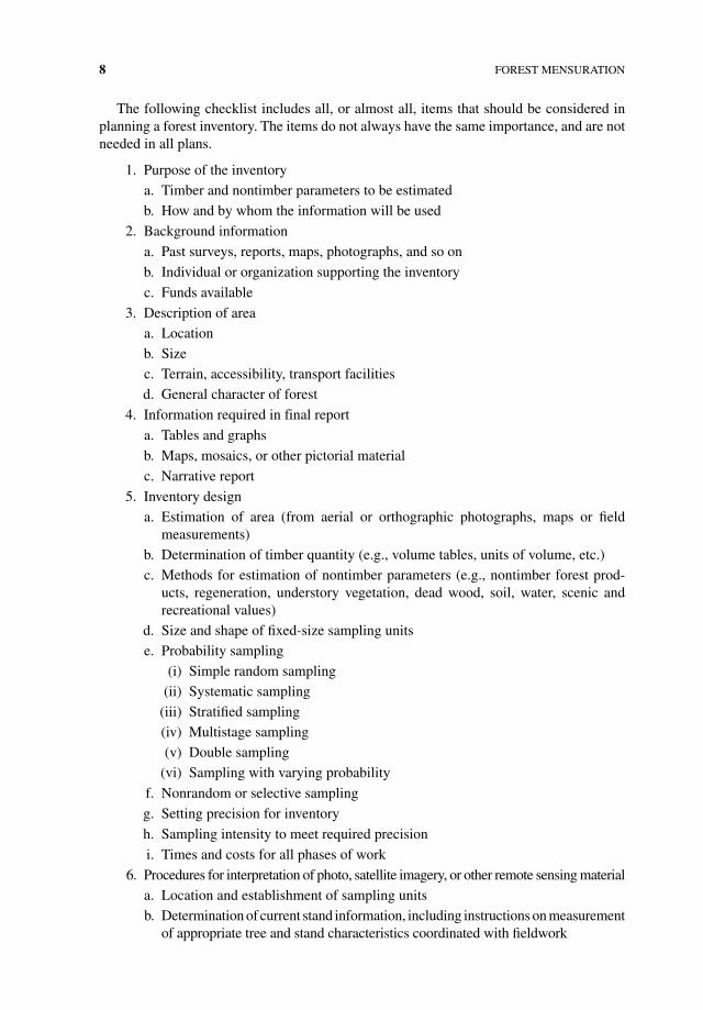
The following checklist includes all, or almost all, items that should be considered in planning a forest inventory. The items do not always have the same importance, and are not needed in all plans.
1. Purpose of the inventorya. Timber and nontimber parameters to be estimatedb. How and by whom the information will be used
2. Background information
a. Past surveys, reports, maps, photographs, and so on
b. Individual or organization supporting the inventory
c. Funds available
3. Description of areaa. Locationb. Sizec. Terrain, accessibility, transport facilitiesd. General character of forest
4. Information required in final report
a. Tables and graphs
b. Maps, mosaics, or other pictorial material
c. Narrative report
5. Inventory designa. estimation of area (from aerial or orthographic photographs, maps or field
measurements)b. Determination of timber quantity (e.g., volume tables, units of volume, etc.)c. Methods for estimation of nontimber parameters (e.g., nontimber forest prod-
ucts, regeneration, understory vegetation, dead wood, soil, water, scenic and recreational values)
d. Size and shape of fixed‐size sampling unitse. Probability sampling
(i) Simple random sampling(ii) Systematic sampling
(iii) Stratified sampling(iv) Multistage sampling(v) Double sampling
(vi) Sampling with varying probability
f. Nonrandom or selective sampling
g. Setting precision for inventory
h. Sampling intensity to meet required precision
i. Times and costs for all phases of work
6. Procedures for interpretation of photo, satellite imagery, or other remote sensing materiala. Location and establishment of sampling unitsb. Determination of current stand information, including instructions on measurement
of appropriate tree and stand characteristics coordinated with fieldwork
INTrODuCTION 9
c. Determination of insect damage, forest cover types, forest fuel types, area, and so on, coordinated with fieldwork
d. Personnel
e. Instruments
f. recording of information
g. Quality control
h. Data conversion and editing
7. Procedures for fieldwork
a. Crew organization
b. Logistical support and transportation
c. Location and establishment of sampling units
d. Determination of current stand information, including instructions on measurement of trees and sample units coordinated with photo interpretation
e. Determination of growth, regeneration, insect damage, mortality, forest cover types, forest fuel types, area, and so on, coordinated with photo interpretation
f. Instruments
g. recording of observations
h. Quality control
i. Data conversion and editing
8. Compilation and calculation procedures for reduction of remote sensing and field measurements
a. Conversion of remote sensing material or field measurements to desired expres-sions of quantity
b. Calculation of sampling errors
c. Specific methods and computer programs to use
d. Description of all phases from handling of raw data to final results, including programs
9. Final report
a. Outline
b. estimated time to prepare
c. Personnel responsible for preparation
d. Method of reproduction
e. Number of copies
f. Distribution
10. Maintenance
a. Storage and retrieval of data
b. Plans for updating inventory
The decision to conduct an inventory depends on the need for information. An inventory is an information‐gathering process that provides one of the bases for rational decisions. These decisions may be required for many reasons such as the purchase or sale of timber,
10 FOreST MeNSurATION
for preparation of timber‐harvesting plans, in forest and wildlife management, for obtain-ing a loan, and so on. If the purpose is clarified, one can foresee how the information will be used and know the relative emphasis to put on the different elements of the inventory.
As a first step in planning an inventory, one should obtain the requisite background information and prepare a description of the area. One should then decide on the information required from the inventory and prepare the outlines of tables that will appear in the final report. Table outlines should include titles, column headings, class limits, measurement units, and other categories needed to indicate the inventory results. These table outlines should be prepared before detailed planning begins because the inventory design will depend on the information required for the final report. Area information is usually shown by such cate-gories as land use class, forest‐type or condition class, and ownership. Timber quantities are usually given in stand‐and‐stock tables. A stand table gives number of trees by species, dbh, and height classes. A stock table gives volumes or weights according to similar classifications (see Chapter 9 for details on construction of stand and stock tables). Stand and stock tables may be on a per unit area basis (per acre or hectare) or for the total forest area and may be prepared for forest types or other classifications (e.g., compartments, watersheds). Since a forest is a living, changing complex, the inventory plan should consider the inclusion of esti-mates of growth and drain. For a discussion of tree and stand growth, see Chapter 14.
1.4.4. Forest Inventory Design
There must be wide latitude in designing an inventory to meet the variety of forest vegeta-tion, topographic, economic, and transportation conditions that may be encountered. The required forest inventory information can be obtained by observations and measurements in the field and on aerial photographs, satellite images, and other remote sensing sources. The most useful and practical approach is typically to use remote sensing materials for forest classification or stratification, mapping, and area determination, and to employ ground work for detailed information about forest conditions, timber quantities and qual-ities, and additional nontimber characteristics. One can design a forest inventory utilizing only fieldwork, but it is usually less efficient unless the area under consideration is quite small. If aerial photographs or satellite imagery are available, they should be used. under some circumstances, it is possible to design a forest inventory based entirely on photo-graphic or remotely sensed interpretations and measurements; however, this method will provide only rough approximations of timber species and the quantity, quality, and sizes present, and information on the nontimber parameters; ground‐based reference data are almost always needed to evaluate the accuracy of the remote sensing work, and to provide estimates of those quantities that cannot easily be observed from an aircraft or satellite (uses of remotely sensed data are discussed in Chapter 13).
The funds available and the cost of an inventory will strongly influence the design chosen. The main factors that will affect costs are the type of information required, the standard of pre-cision chosen, the total size of the area to be surveyed, and the minimum size of the unit area for which estimates are required. General information is relatively inexpensive, but the costs increase, as more details are required. The standard of precision chosen greatly influences costs; costs increase since increases in precision usually require more intensive sampling. Costs per unit area will decrease as the size of the inventory area increases. If independent esti-mates are required for subdivisions of a large forest area, this will also raise costs. Descriptions of basic sampling designs applicable to forest inventory are given in Chapter 10.
INTrODuCTION 11
1.4.5. Inventory Fieldwork
The size and organization of field crews will vary with sampling procedures, the observa-tions or measurements required, forest conditions, and tradition. For timber inventory work in temperate zone forests, crews of one or two workers are widely used. If additional non-timber information is required, additional members may be needed. Small‐sized crews have proved satisfactory in these areas because roads are usually abundant (access by vehicle is good), forest travel is relatively easy (little brush cutting is required), and well‐trained technicians are generally available (they require little supervision). For inventory work in tropical forests, large crews are widely used because roads are generally sparse (access by vehicle is poor), forest travel is difficult (workers are required to cut vegetation), and few trained technicians are available (they require considerable supervision). Whatever the crew size or the assigned tasks, specific, clear instructions should be given to each crewmember.
A basic rule of forest inventory is to prepare complete written instructions before field-work starts. To minimize later changes, instructions should be tested before operations begin. Instructions should be clear and specific enough so that individual judgment by field crews on where and how to take measurements is eliminated. For example, field crews should not be permitted to subjectively choose the position of a sampling unit or to move it to a more accessible position or more “typical” stand. The aim should be to standardize all work to obtain uniform quality and the best possible reliability of the measurements, regardless of which individual does the work. The occurrence of mistakes or nonrandom errors must be eliminated or, at least, held to a minimum.
It is best to settle on a standard set of instruments. The use of several kinds of instru-ments to make the same type of measurements should be avoided. To minimize errors, the instruments should be periodically checked to see if they are in adjustment.
Decisions should be made on the precision required for each of the measurements. Thus, tree diameters may be stipulated to the nearest centimeter, inch, tenth of an inch, and so on, and heights to the nearest foot, meter, one‐half log, and so on. If estimates of timber quantity are to be made by quality or product classes, then field instructions must include tree measurement specifications of minimum dbh and upper stem diameter, section lengths, and total usable length and criteria such as crook, scars, catfaces, evidence of rot, and so forth on individual sections and for the entire tree.
Inventory field operations must include a checking or quality control procedure. Whether plots, strips, or points are used, a certain percentage of the sampling units should be remea-sured. The results of the remeasurements should be compared to the original measurement to see if the work meets the required standards. If it does not, remedial steps should be taken.
There is no standard form or system for recording field observations. The manner in which measurements are recorded depends in large part on the way they will be processed. regardless of whether data will be recorded on paper forms or entered directly into electronic data recorders, consistent forms should be developed for recording information and made available to all crews. The forms should be developed such that they reflect the logical order of measurements and instructions to crews. electronic data recorders can greatly speed up processing of forest inventory data since paper‐based data do not have to be subsequently entered into a computer. electronic data recorders should have internal data quality checks so that measurement or data entry errors can be identified and corrected in the field. electronic data recorders often require more forethought in the design of data

12 FOreST MeNSurATION
entry forms since much field time can be lost if a user must scroll or page through several forms during field measurement procedures.
Plans for calculation and compilation of photo‐interpretation data and field measure-ments should be made before fieldwork begins. It is illogical to postpone consideration of these things until data are obtained because foreknowledge of the calculation and compila-tion procedures can influence collection of data. For example, if volume tables will be used to determine tree volumes, there would be little point in measuring diameters to a tenth of a centimeter in the field if the volume tables give volumes by full centimeter dbh classes. The statistical formulas or computer programs to be used for estimating means, totals, and standard errors should be selected early in the planning process. It is worthwhile to check the formulas with simulated data to verify the applicability of the program or to work out the optimum sequence of computational steps.


