33
Geoapplications development http://rgeo.wikience.org Higher School of Economics, Moscow, www.cs.hse.ru
| Date post: | 19-Apr-2018 |
| Category: |
Documents |
| Upload: | hoangxuyen |
| View: | 223 times |
| Download: | 6 times |
Geoapplications development
http://rgeo.wikience.org
Higher School of Economics, Moscow, www.cs.hse.ru
Agenda 2
• What is geospatial data?
• How is it different from other types of data?
• Examples of geospatial data
• What is geoapplication?
• Course goals & organization
• Examples of consumers: companies using geospatial data
• Competitions & projects to participate
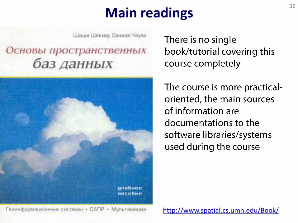
• Main readings
• Practical lesson: QGIS, CartoDB, raster & vector data
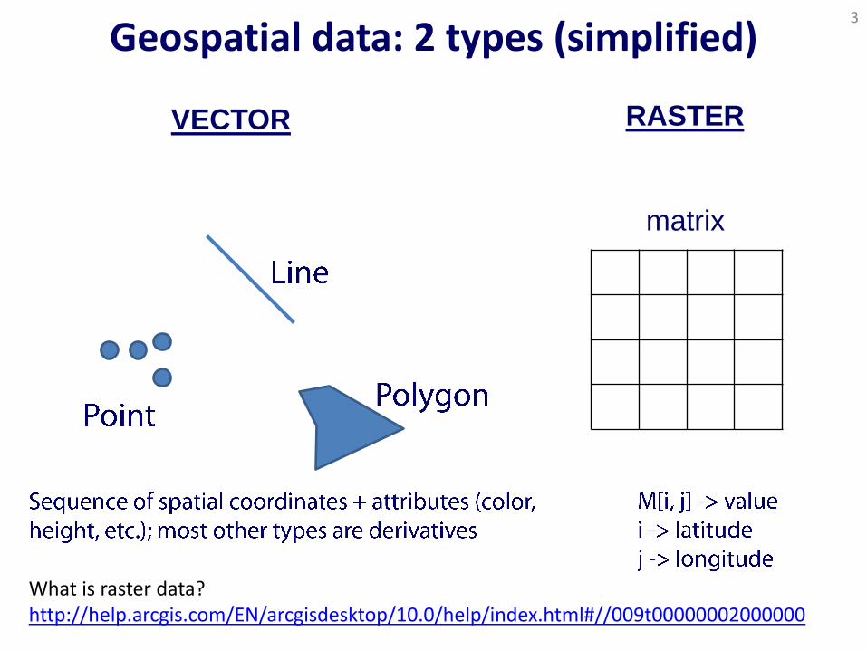
Geospatial data: 2 types (simplified) 3
VECTOR
What is raster data? http://help.arcgis.com/EN/arcgisdesktop/10.0/help/index.html#//009t00000002000000
RASTER
matrix
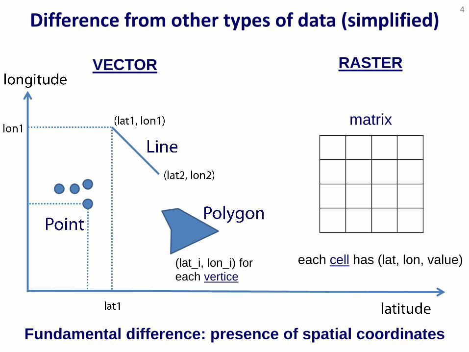
Difference from other types of data (simplified) 4
RASTER
matrix
Fundamental difference: presence of spatial coordinates
each cell has (lat, lon, value)
(lat_i, lon_i) for each vertice
VECTOR
Is that all? 5
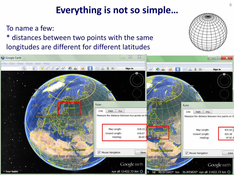
Everything is not so simple… 6
To name a few: * distances between two points with the same longitudes are different for different latitudes

Everything is not so simple… 7
To name a few: * cell sizes are different on different latitudes * singularities at high latitudes
Regular grid 1.0° × 1.0° Terra (MODIS) Aerosol Optical Thickness, 03 Oct, 2004
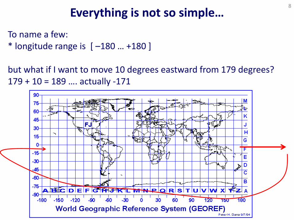
Everything is not so simple… 8
To name a few: * longitude range is [ –180 … +180 ] but what if I want to move 10 degrees eastward from 179 degrees? 179 + 10 = 189 …. actually -171
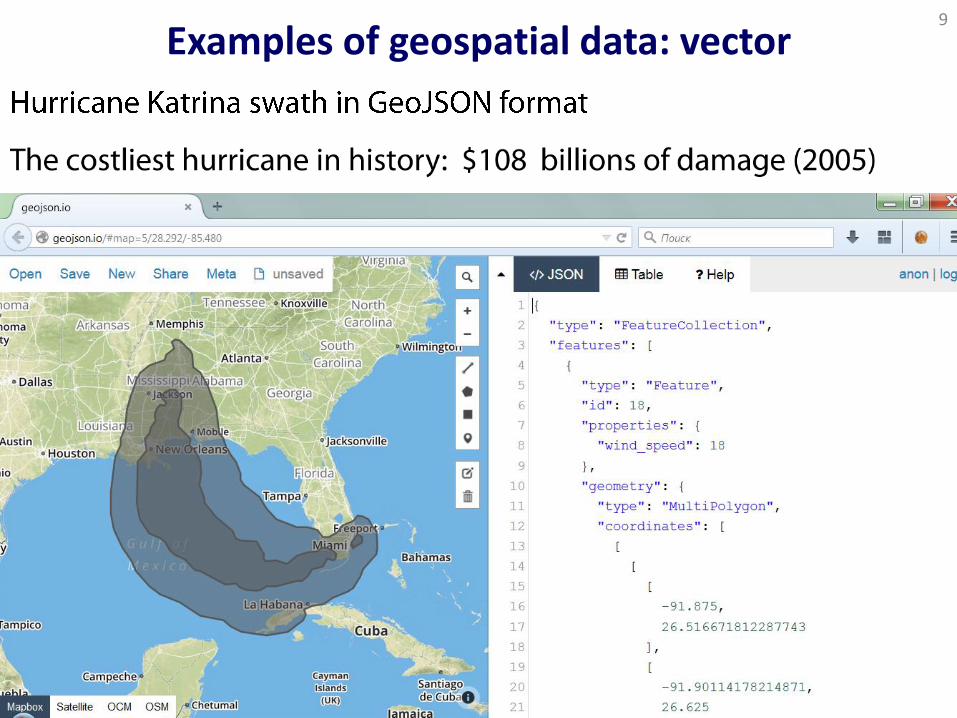
Examples of geospatial data: vector 9
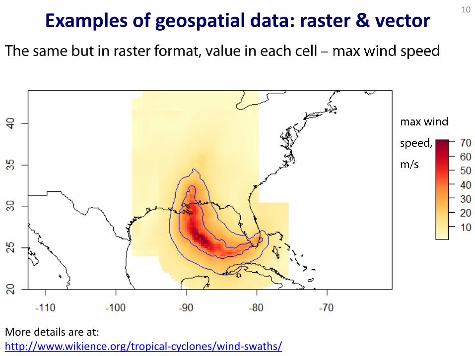
Examples of geospatial data: raster & vector 10
More details are at: http://www.wikience.org/tropical-cyclones/wind-swaths/
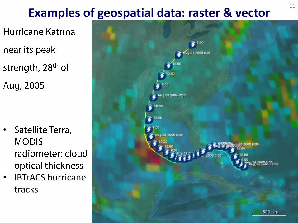
Examples of geospatial data: raster & vector 11
•
• IBTrACS hurricane tracks
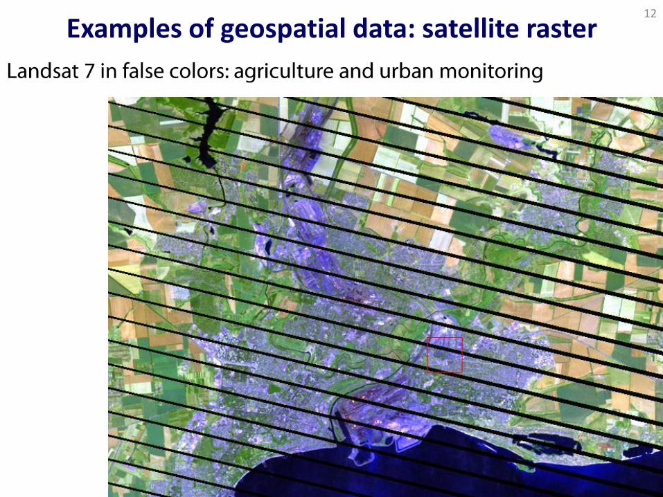
Examples of geospatial data: satellite raster 12
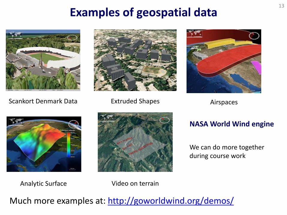
Examples of geospatial data 13
Much more examples at: http://goworldwind.org/demos/
Video on terrain Analytic Surface
Airspaces Extruded Shapes Scankort Denmark Data
We can do more together during course work
NASA World Wind engine

14
Satellites,
smartphones,
GPS
(1): basic theory: geographic coordinate systems, geocoding, vector and raster data types and operations (3): I/O with vector (SHP, KML, GeoJSON, WKT) and raster (GeoTIFF, NetCDF, HDF) formats (4): network protocols for geodata exchange: WCS, WFS, WMS, OPeNDAP (4): frameworks: Mina, Netty that is used by Twitter (3,4,5): spatial databases and servers: PostGIS, SciDB, GeoServer, TDS (5): software libraries for geodata processing: vector Java Topology Suite, Geotoolkit, Apache SIS and raster ImageMagic, GDAL (6): visualizing geodata with NASA WorldWind, Mapbox, Leaflet, CartoDB
Course goals & organization
Topics cover technologies for complete geospatial data
management chain:

Consumers of geospatial data
15
Who needs geospatial data? How do they process them? What kinds of geospatial data exist?
Note: the world around you is *not * iPhone/Android-centric
16
mobile apps are good, but more interesting things exist
Consumers of geospatial data: motivating examples 17
http://www.spatial.cs.umn.edu/Book/sdb-chap1.pdf

EigenRisk 18
Hurricane swaths, flood footprints, assets
Spatial operations
Visualization
Hurricane
Katrina, 2005
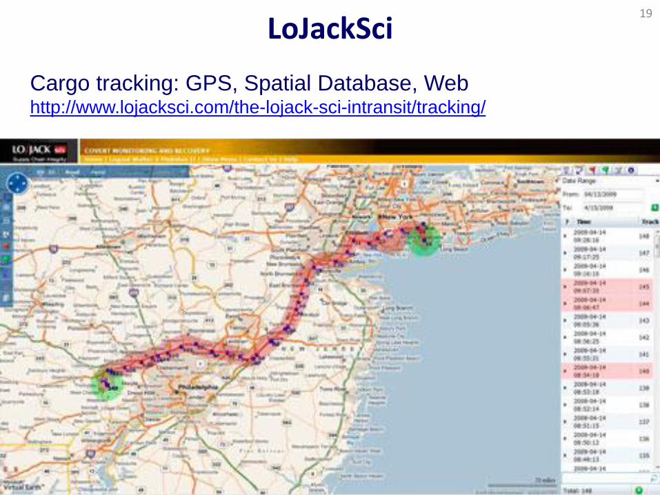
LoJackSci 19
Cargo tracking: GPS, Spatial Database, Web http://www.lojacksci.com/the-lojack-sci-intransit/tracking/
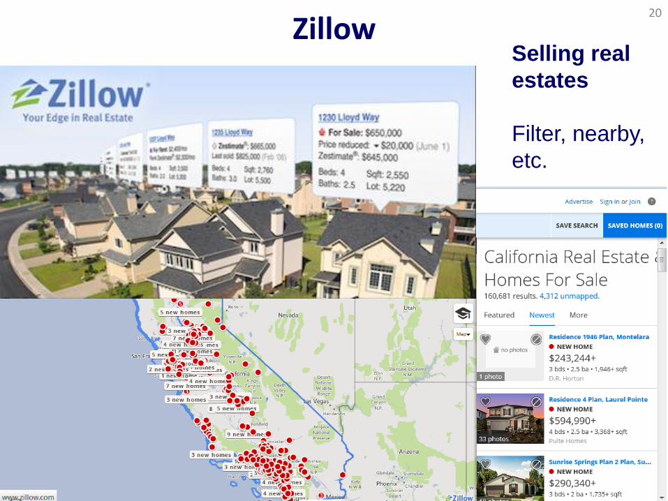
Zillow 20
Selling real
estates
Filter, nearby,
etc.
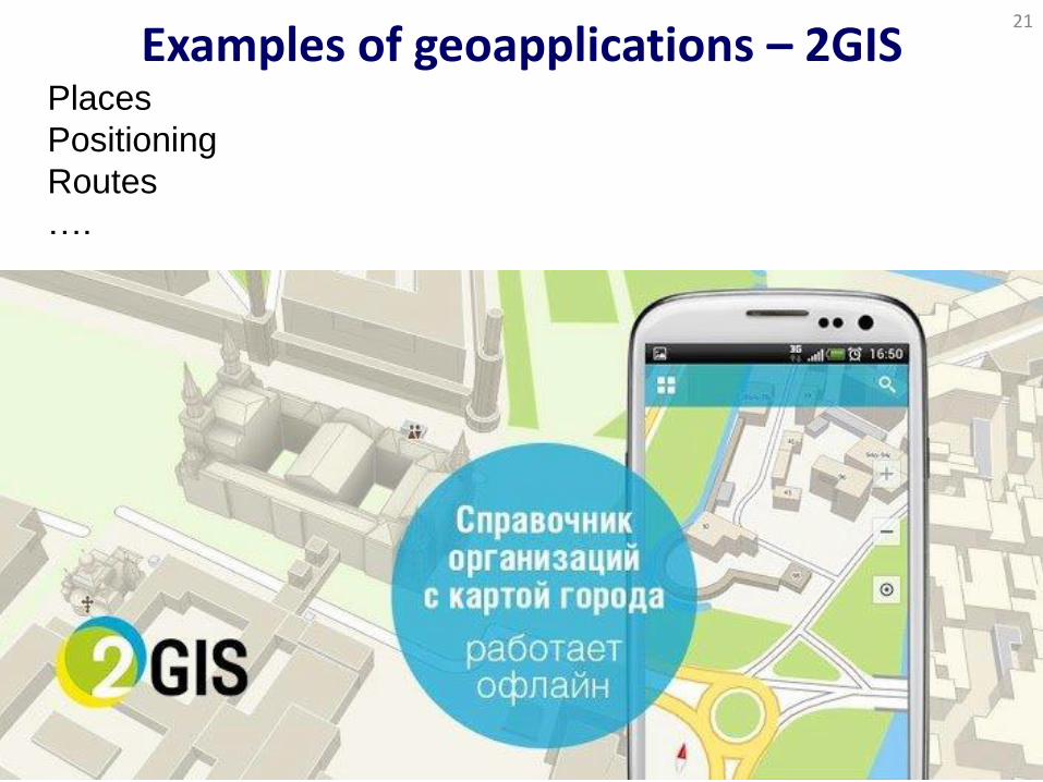
Examples of geoapplications – 2GIS 21
Places
Positioning
Routes
….

Yelp 22
Seek restaurants, hairdressing saloons, etc. + add other
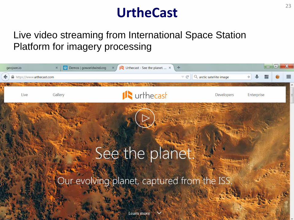
UrtheCast 23
Live video streaming from International Space Station
Platform for imagery processing
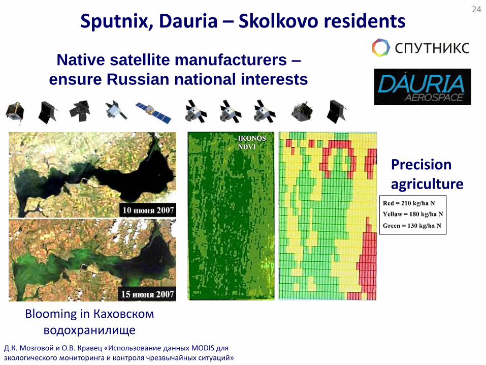
Sputnix, Dauria – Skolkovo residents 24
Native satellite manufacturers –
ensure Russian national interests
Д.К. Мозговой и О.В. Кравец «Использование данных MODIS для экологического мониторинга и контроля чрезвычайных ситуаций»
Blooming in Каховском водохранилище
Precision agriculture
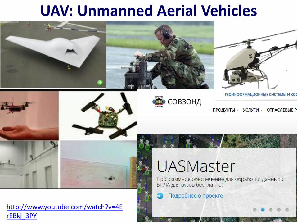
UAV: Unmanned Aerial Vehicles
http://www.youtube.com/watch?v=4ErEBkj_3PY
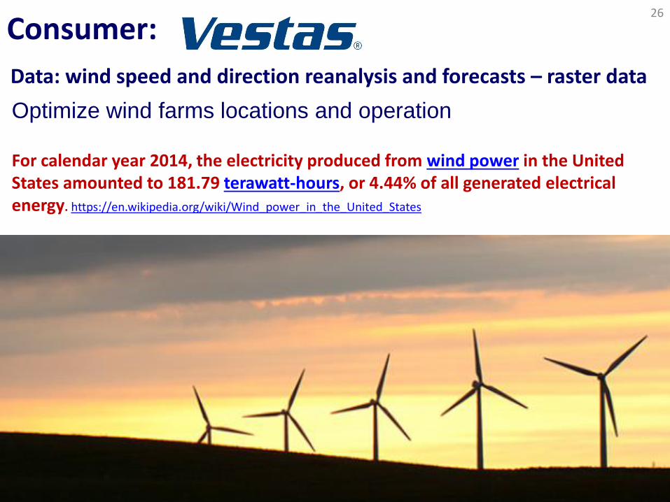
Consumer: 26
Optimize wind farms locations and operation
Data: wind speed and direction reanalysis and forecasts – raster data
For calendar year 2014, the electricity produced from wind power in the United States amounted to 181.79 terawatt-hours, or 4.44% of all generated electrical energy. https://en.wikipedia.org/wiki/Wind_power_in_the_United_States
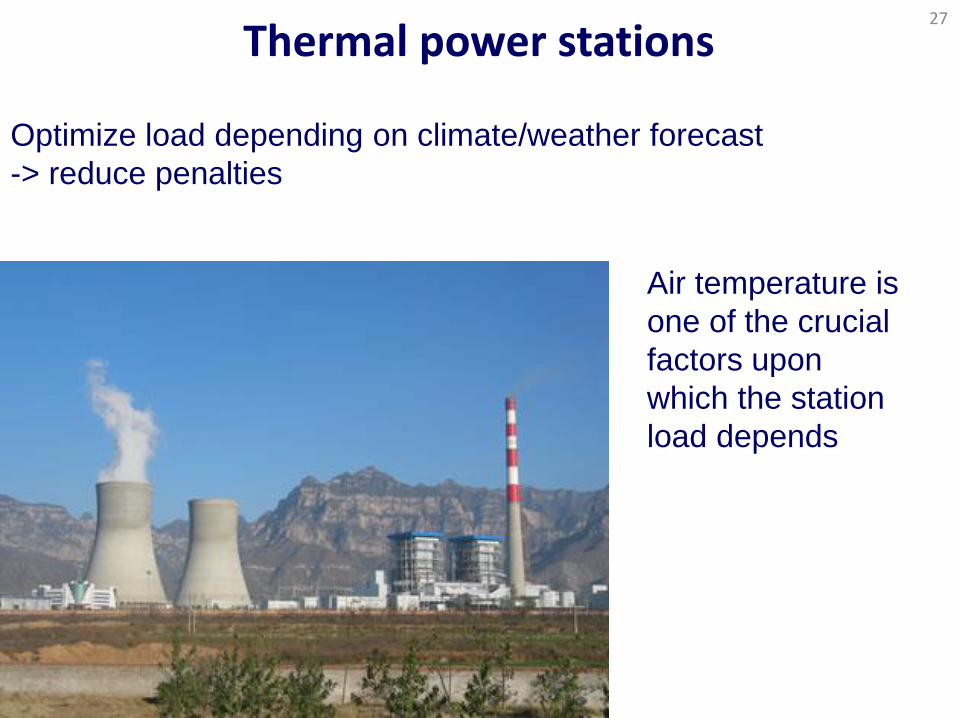
Thermal power stations 27
Optimize load depending on climate/weather forecast
-> reduce penalties
Air temperature is
one of the crucial
factors upon
which the station
load depends
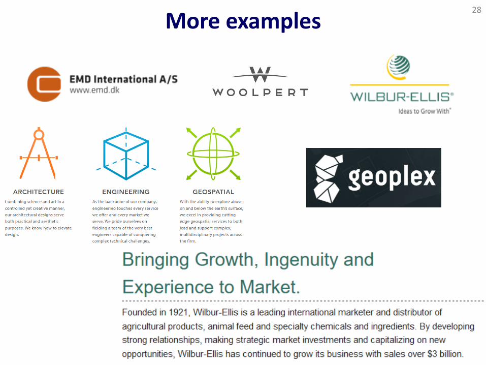
More examples 28
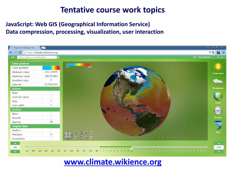
www.climate.wikience.org
Tentative course work topics
JavaScript: Web GIS (Geographical Information Service) Data compression, processing, visualization, user interaction
Hadoop
Tentative course work topics
Enterprise big-data platform
We will develop extension for Hadoop for raster data management
Performance evaluation
Tentative course work topics
Evaluate performance of raster data servers
We will develop distributed & multithreaded application to simulate large load
THREDDS