8
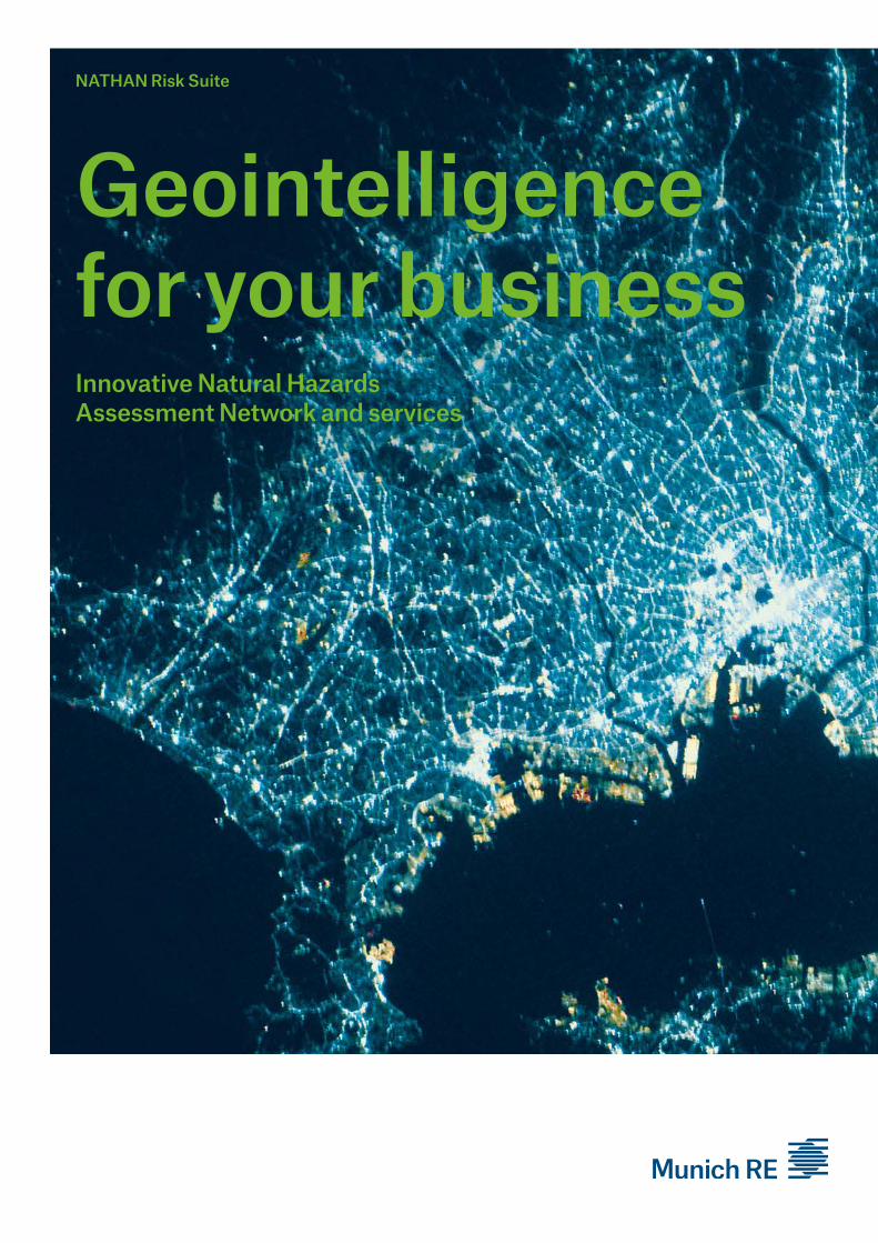
NATHAN Risk Suite Geointelligence for your business Innovative Natural Hazards Assessment Network and services
NATHAN Risk Suite
Geointelligence for your businessInnovative Natural Hazards Assessment Network and services
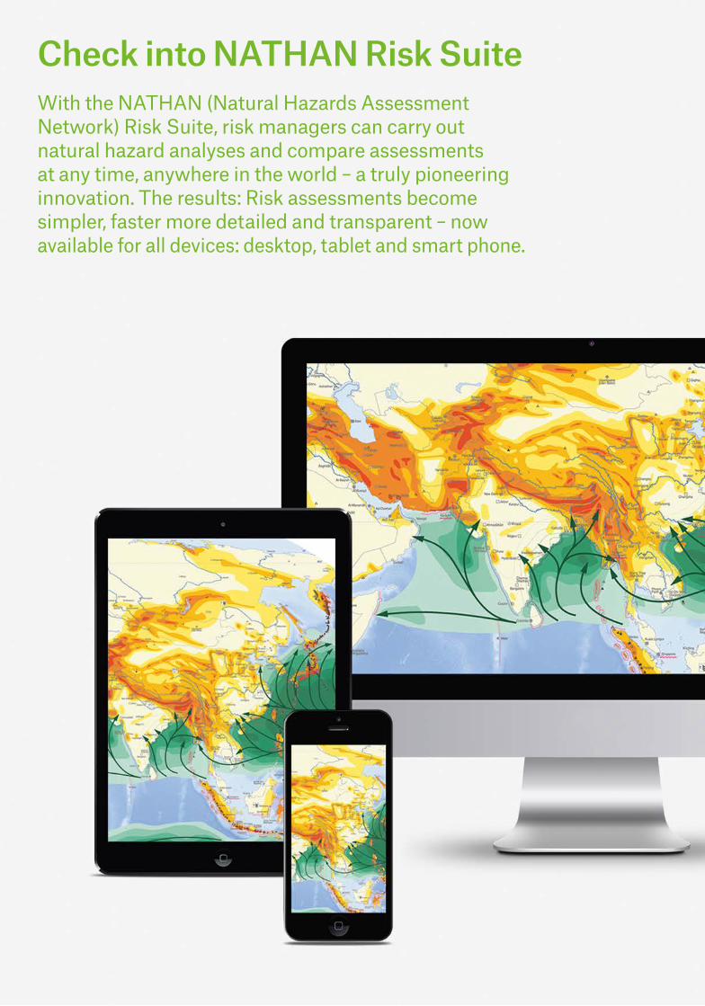
Check into NATHAN Risk SuiteWith the NATHAN (Natural Hazards Assessment Network) Risk Suite, risk managers can carry out natural hazard analyses and compare assessments at any time, anywhere in the world – a truly pioneering innovation. The results: Risk assessments become simpler, faster more detailed and transparent – now available for all devices: desktop, tablet and smart phone.

Your benefits: More information for individually customised ratings: Perform accurate and efficient exposure analyses of your individual risk loca-tions or entire portfolios.
Greater transparency for good decisions: Identify main risk hot spots or accumu-lations in your portfolio and improve your understanding of your risks.
Flexibility for an optimal spread and management of risks: Increase the profitability of your busi-ness with optimum risk diversification and advanced portfolio management.
Insurers require ever more accurate loss potential esti-mates of natural hazards. This knowledge is becoming a decisive factor in the insurance business. The only way to ensure long-term profitability is to improve pricing and completely comprehend the current and future risks caused by natural hazards.
Estimate your individual risks and assess your portfolios and accumulations with our innovative NATHAN Risk Suite. The added value for your business lies in combin-ing your risk data with your exposure levels to natural hazards. Every year more than 10 million risk location evaluations carried out world-wide and a customer satisfac-tion of over 90% yearly dem-onstrate that NATHAN is a proven and trusted tool that keeps adding value.
Get both the big picture and in-depth analysis
Did you ever ask yourself:
To what extent is my loca-tion or portfolio at risk, for instance from windstorms, hail, floods and earthquakes?
Where are the main risk hot spots or accumulations areas in my portfolio or mar-ket?
How can I diversify risks and manage my portfolio?
NATHAN Risk Suite provides you with answers to these and to many more questions.
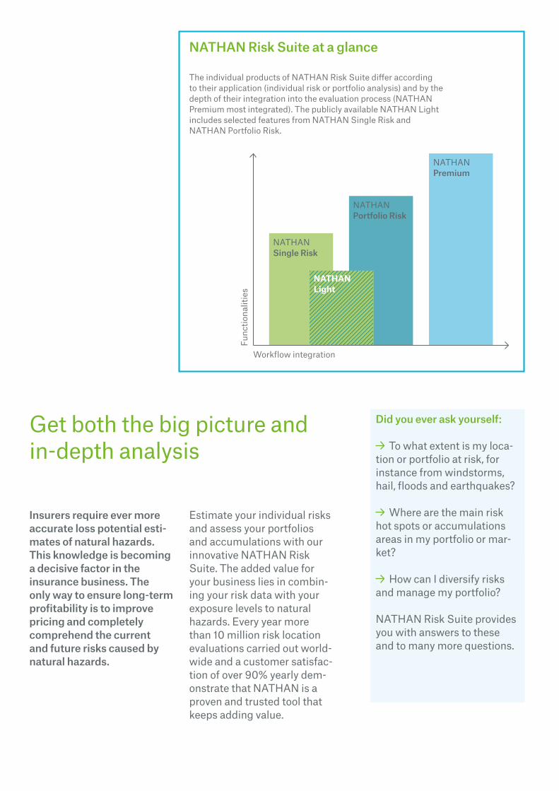
NATHAN Risk Suite at a glance
The individual products of NATHAN Risk Suite differ according to their application (individual risk or portfolio analysis) and by the depth of their integration into the evaluation process (NATHANPremium most integrated). The publicly available NATHAN Light includes selected features from NATHAN Single Risk and NATHAN Portfolio Risk.
Func
tiona
litie
s
Workflow integration
NATHANSingle Risk
NATHANPortfolio Risk
NATHANPremium
NATHAN Light
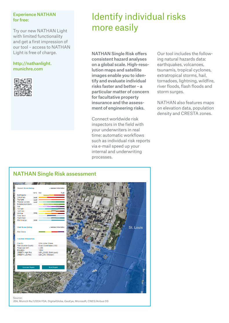
NATHAN Single Risk offers consistent hazard analyses on a global scale. High-reso-lution maps and satellite images enable you to iden-tify and evaluate individual risks faster and better – a particular matter of concern for facultative property insurance and the assess-ment of engineering risks.
Connect worldwide risk inspectors in the field with your underwriters in real time: automatic workflows such as individual risk reports via e-mail speed up your internal and underwriting processes.
Our tool includes the follow-ing natural hazards data: earthquakes, volcanoes, tsunamis, tropical cyclones, extratropical storms, hail, tornadoes, lightning, wildfire, river floods, flash floods and storm surges.
NATHAN also features maps on elevation data, population density and CRESTA zones.
Identify individual risks more easily
Experience NATHAN for free:
Try our new NATHAN Light with limited functionality and get a first impression of our tool – access to NATHAN Light is free of charge.
http://nathanlight. munichre.com
NATHAN Single Risk assessment
Source: JBA, Munich Re/USDA FSA, DigitalGlobe, GeoEye, Microsoft, CNES/Airbus DS
St. Louis

If you want to evaluate the exposure of entire portfolios to natural hazards, the upload/download feature of NATHAN Portfolio Risk is the ideal complement to your workflow.
Quickly and efficiently obtain valuable foundations for your decision-making to support premium calculation and accumulation control.
Benefit from the Portfolio Risk Assessment Report, which vividly presents a port-folio’s exposure at the push of a button. The report com-bines the natural hazard zone system with the insurance values of the risk locations.
Evaluate risks for entire portfolios
Strong commitment to continuous innovation
NATHAN Risk Suite is con-tinuously being expanded and optimised. For example, our global flood maps set a new standard in consistent flood risk assessment and accumu-lation management on a global, regional and local scale.
Global flood maps show flood zones based on a digital ter-rain model with a resolution of 30 metres and return peri-ods of up to 500 years.
The new heatmap function visualises the accumulation situation of your portfolio for all selected regions. The result is a rendered heatmap of areas with clear liability focal points (accen-tuated in red).
Conduct regional research even in large, worldwide portfolios with the new Interactive Circle function. Com-bine your own risk input data with this visual aid to validate your portfolio management decisions.
Advanced geospatial tools
Source: Earthstar Geographics Source: Earthstar Geographics/Esri, HERE, DeLorme, NGA, USGS

With NATHAN Premium we even go a step further: This exclusive real-time Web ser-vice is particularly suitable for assessing large portfolios (more than 500,000 location analyses per year).
Integrate our services into your own workflow
Trust an experienced partner
Based on our extensive tech-nical knowledge and data, which have been gathered over the last 40 years and combined with our company’s state-of-the-art risk model-ling, we are able to offer highly advanced national and global risk evaluations, spatial analy-ses and claims overviews.
Since it eliminates your need to upload/download your portfolio manually, NATHAN Premium offers you enor-mous time-saving potential. This allows you to focus more closely on your risk assess-ment and classification.
Customise and speed up processes with NATHAN Premium
A synchronised data exchange between your global exposure database and Munich Re’s NATHAN database enables you to use NATHAN’s data in your own secure IT environment. All devices running NATHAN are connected to your services.
Contacts
Our experts
Dr. Jürgen SchimetschekGeospatial Solutions [email protected]
Thomas RuttmarGeospatial Solutions [email protected]
www.munichre.com/NATHANonline
Please contact your Client Manager to benefit from the advantages of our NATHAN Risk Suite.
Munich Re’s NATHAN database
Client’sglobal exposure database
Client’s various devices
Secure data exchange

Imprint
© 2015
Münchener Rückversicherungs-Gesellschaft Königinstrasse 107 80802 München Germany
www.munichre.com
Picture credits: Title: NASA
Disclaimer
Münchener Rückversicherungs-Gesellschaft (Munich Reinsur-ance Company) is a reinsurance company organised under the laws of Germany. In some coun-tries, including in the United States, Munich Reinsurance Company holds the status of an unauthorised reinsurer. Policies are underwritten by Munich Reinsurance Company or its affil-iated insurance and reinsurance subsidiaries. Certain coverages are not available in all jurisdic-tions. Any description in this document is for general information pur-poses only and does not consti-tute an offer to sell or a solicita-tion of an offer to buy any product.
NOT IF, BUT HOW


