38
GLACIATION LUFYAGILA Ibrahim H MAGOHE Stephens MAKUE Jamal
| Date post: | 08-Aug-2015 |
| Category: |
Science |
| Upload: | magohe-stephen |
| View: | 76 times |
| Download: | 2 times |

GLACIATION
LUFYAGILA Ibrahim HMAGOHE StephensMAKUE Jamal

CONTENTS:IntroductionGlacial erosional
landformsGlacial depositional
landformsWhy glaciation?
(importance)ConclusionRefferences

The last ice age:The earth has experienced numerous glaciations. The ice age was a series of advance and retreats or ice caps. It lasted 1.7Ma to last10,000 years (Pleistocene). Recent works suggests that there probably were about 20 major events during Pleistocene times which lasted for some 2Ma. Each glacial episode produced its own effect and its own suite of deposits.Reshaping of earlier glacial episodes was made possible by later glacial advances leading to complex glacial sequences.At presentGlaciation is less important in shaping landscapes than it was formerly. Glacial coverage at present is only 10%of the surface contrary to 30% at ancient times. Most glacial today is found in polar regions, above the arctic and Antarctic circles.In fact much of topography in the N part of Northern America as well as the high mountain regions of the west , owe their origin to erosional and deposition processes of glaciers.
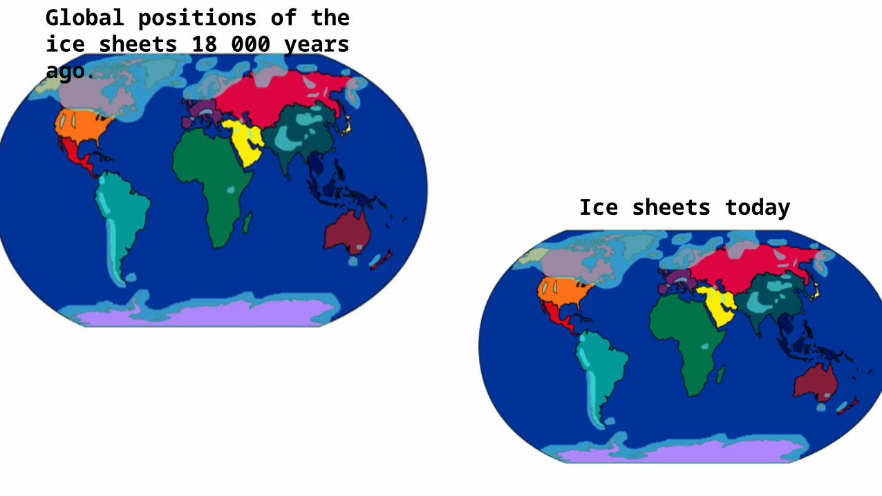
Global positions of the ice sheets 18 000 years ago.
Ice sheets today
.
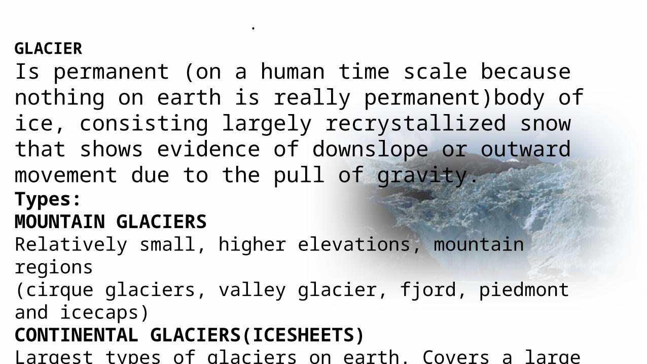
GLACIER
Is permanent (on a human time scale because nothing on earth is really permanent)body of ice, consisting largely recrystallized snow that shows evidence of downslope or outward movement due to the pull of gravity.Types:MOUNTAIN GLACIERSRelatively small, higher elevations, mountain regions(cirque glaciers, valley glacier, fjord, piedmont and icecaps)CONTINENTAL GLACIERS(ICESHEETS)Largest types of glaciers on earth. Covers a large part ofLand surface including Mountain areas.

MODERN ICE SHEETS

As more snow falls the pressure makes the earlier snowflakes melt.
Repeated melting and re- freezing forms granules called firn
Further compression forms larger crystals of glacial ice.
It can take 30 to 40 years for snow to form dense glacial ice.
It now moves downslope under its own weight.
GLACIER FORMATION;
ACCUMULATION & ABLATION influence change in size after formation

Despite being hard and solid, glacier ice flows because of:
· internal deformation - individual ice crystals within a glacier deform and slide across one another.
· basal sliding - meltwater at the base of the glacier lubricates the ice causing it to slide.
GLACIER MOVEMENT:
Glacial flow is essential for the formation of glacial landforms

GLACIATION:Modification of land surfaces by the action of glaciers. Evidences of recent glacial Erosion and deposition still prevails in N. America and Europe. Since Glaciers move they can pick up and transport rocks and thus erode, since they transport materials and they can melt, glaciers tend to deposit materials too.Glaciated landscapes are the results of both glacial erosion and glacial deposition

GLACIAL EROSIONHow the ice erodes? Plucking - glacier ice freezes into cracks in rocks
and when the glacier moves it pulls out chunks to leave a rough surface with sharp points protruding.
Abrasion -This erosion process occurs when pieces of rock debris embedded in the ice wear away the rocks on the valley floor and sides
Freeze Thaw - water in cracks in the rock freezes and expands forcing open the gap. When the ice melts more water can get into the crack and freeze again. After many cycles of freezing and thawing lumps of rock are broken off the surface


Striations

GLACIAL EROSIONAL LANDFORMS Mountain glacier erosional landforms Icecaps and ice sheets erosional
landforms

Corrie A corrie (also called a cirque or cwm) starts as a snow patch on a cold mountain side. The temperatures must be low enough to allow the snow to remain all year round. Under these conditions snow can accumulate and the snow patch will grow in size and depth each year. Due to temperature changes and pressure, the snow becomes altered to ice, and when sufficient ice has accumulated it will begin to move downhill under the influence of gravity
Mountain glacier erosional landforms

Position photographtaken from

Corrie and tarn
Once the glacier retreats, the cirque may be filled with water. A small, generally circular loch is formed. This is known as a tarn or corrie lochan.

Position photographtaken from

Red TarnHelvellynLake District

ArêtesArêtes are ‘knife-edged’ ridges formed between two corries which have formed next to each other.

Pyramidal Peaks
When three or more corries erode backwards and meet they cannot form an arete; it has steep sides but doesn't have the length to make a ridge. Imagine three corries at the corners of a triangle, eventually all eroding back and meeting in the middle. A sharp pointed pyramid shape is created. This is called a Pyramidal Peak, or Horn, and is a common shape for mountain tops in well glaciated areas
Pyramidal Peak

U shaped ValleyWhen a glacier erodes its valley , a classic U shape is formed, the side walls tending to be steep and possibly curving inwards at the base, and the valley floor almost flat

'U' shaped valley
Glaciers are very powerful agents of erosion: they reshape former V-shaped river valleys into wide, deep, steep-sided troughs by the processes of abrasion and plucking.
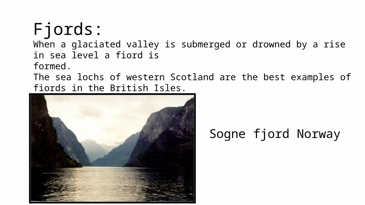
Fjords:When a glaciated valley is submerged or drowned by a rise in sea level a fiord is formed.The sea lochs of western Scotland are the best examples of fiords in the British Isles.
Sogne fjord Norway

When a glacier moves along its valley some parts are deepened more than others.
When the glacier retreats the deepened sections fill with melt water and become lakes.
UllswaterLake District

When a glacier occupying a smaller tributary valley meets the large valley , the tributary glacier usually doesn’t have the ability to erode its base to the floor of the main valley. Thus when the glacial ice melts the floor of the tributary valley hangs above the floor of the main valley forming a hanging valley

Icecaps and ice sheets erosional landformsIncludes abrasion features (striations) Streamlined features(drumlins and Roche
mountainee)

GLACIAL DEPOSITION
sediments deposited direct from melting of a glacial can range from very poorly sorted to better sorted.Depending on how much water transport takes place after the ice melts.All sediments deposited as the result of glacial erosion are called GLACIAL DRIFT.
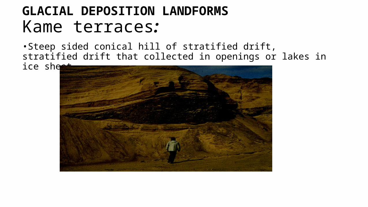
GLACIAL DEPOSITION LANDFORMSKame terraces:•Steep sided conical hill of stratified drift, stratified drift that collected in openings or lakes in ice sheet

Outwash plainStreams running off the end of a melting glacier are usually chocked with sediments and form a braided stream , which deposits poorly sorted stratified sediments. These deposits are referred as outwash.

varvespairs of coarse- and fine grained (light and dark colored) sediment bed pairs deposited in single year in glacial lakes

Kettle lakes – results of depressions forming underneath a glacier and remain after the glacier is melted then water filling those depressions become small lakes where sediments are deposited.
Erratics- These are glacially deposited rocks fragments that now rests on the surface made of different rocks.
Till – consists of a non sorted glacial drift deposited directly from the ice, A till that has undergone diagenesis turns into a rock called tillite.

drop stonesgravel to boulder-size rocks deposited with varves represent material carried into lake by icebergs and released by melting

morainesMoraine deposits of till that has unsorted angular material of all sizes dumped together. Depending on where it formed in relation to glacier moraine can be:
Terminal Moraine-deposited at low elevation end of glacier as the ice retreats due to melting.
Ground Moraine-consists of till deposits beneath the glacier resulting into hummocky topography with lots of enclosed basins.
Lateral moraine- deposits of till along the sides of mountain glacier.
Medial moraines-when two valley glacier meet to a larger glacier , the rock debris along the sides of both glaciers merge to form a medial moraine.

EskerLong ,sinuous ridges of sediments deposited by streams that run under or with a glacier

WHY DO WE STUDY GLACIATION?? Counteracting glacial hazards(glacial floods and summer outbursts) Engineering purpose in glaciated areas(active and
passive construction methods)Importance of glaciation Glaciated features are tourist attraction Glacial till provides fertile soils for arable farming Out wash plains comprise of sand gravel which is used
as material for building and construction Lakes form through glaciation and they can be
exploited for economic uses such as fishing, transportation or tourist attraction

The characteristics of valleys can be changed by glaciation that is ,the build up of ice and the formation of corries. The changes to the river valley characteristics such as formation of U-shaped valleys, truncated spurs, hanging valleys, ribbon lakes, moraines, pyramidal peaks contributes largely to glacial landscapes we see today. Though important to a geologist, there is more into this than to know about ice ages or the processes involved in ice formation beyond the build up and compaction of snow. Opportunities to link glacial landforms and environments can assist other fields such as tourism, fishery and environment to bring about sustainable development..

References Environmental geology(principle &practice)-FRED G BELL,
2002Glacier and glaciation, prof. Stephen A. Nelson, April 2012 Fundamental of geomorphology(2nd edition), Richard John
Hugget,2007 Revise glaciation, GSCE GEOGRAPHY Glaciation ppt-Wangwe and Kulwa

Asante sana @ 2015


