7
How City-Citizen Interactions are Transformed through Maps, Apps, Open Data, and Crowdsourcing
| Date post: | 18-Apr-2018 |
| Category: |
Documents |
| Upload: | trinhkhanh |
| View: | 217 times |
| Download: | 3 times |

How City-Citizen Interactions are Transformed through Maps, Apps, Open Data, and Crowdsourcing

What is Geothink?Geothink is an interdisciplinary research partnership led by McGill University Associate Professor Renee Sieber. As a five-year, $6.5 million Partnership Grant from the Social Science and Humanities Research Council of Canada (SSHRC) and from grant partners, Geothink has involved 27 partners, 26 researchers and over 90 students from universities across Canada and the United States.
Geothink is the largest grant investigating the implications of increasing two-way exchanges of locational information between citizens and their city governments. This locational information can take the form of open data, crowdsourcing, citizen science or the geospatial web. Its researchers gain on-the ground experience and insight from practitioners, leading to research intended to have actionable impacts on city governance.
Find out more at www.geothink.ca.
What does Geothink do?Through research collaborations, which have direct real-world applications, Geothink explores how technologies are shaping civic governance and participation. We work with representatives from municipal governments such as Toronto, Vancouver and Edmonton and organizational partners such as the Neptis Foundation, Open North and ESRI Canada. This partnership helps ground our work in urban realities, leading to practical outputs like metrics, best practices and evaluation frameworks.
Our co-applicants are an interdisciplinary group, hailing from law, urban planning, geography, communication and environmental management. Through innovative investigations with technology, the partnership has developed best practices, authored white papers, published journal articles and created civic applications (apps).
Geothink students, faculty, and staff at the 2016 Summer Institute at Ryerson University in Toronto.
“Geothink sprang from an idea that we’re in this period of huge technological change when it comes to our ability to communicate with cities as citizens, and cities’ ability to communicate with citizens.”
-Geothink Head Renee Sieber, Associate Professor, Department ofGeography and School of Environment, McGill University
Students at Geothink’s 2016 Summer Institute were trained to be Open Data experts (above); Geothink Co-Applicant Daren Brabham discusses crowdsourcing with the grant’s students and faculty at Geothink’s 2015 Summer Institute (below).

Improving Emergency Management Through Volunteered Geographic InformationMunicipal laws and practices can restrict a city’s efforts to rely on the crowd by using citizen contributed reports during crises. Geothink Student Sara Harrison, in the
Paper Spotlight: Understanding Public Opinions from Geosocial MediaOne way social media becomes locational is through embedded global positioning system (GPS) coordinates. In their paper, Shanqi Zhang and Rob Feick demonstrate how spatially referenced Twitter data can shed light on citizens’ transportation and planning concerns. Such geosocial media can help identify geographies of public perceptions concerning public facilities and services and complements other methods of public engagement.
University of Waterloo’s Geography and Environmental Management Department, has developed a framework to help governments adopt this Volunteered Geographic Information (VGI) to improve emergency management practices. Conducted with Co-Applicant Peter Johnson, the project will develop
An overview of a topic hierarchy generated from Twitter Tweets. More location specific content was found in tweets than in letters.
a framework for governments to follow when considering adopting or developing a crowdsourcing application for emergency management.
Regional Land Use Engagement through Geoweb VisualizationThe first iteration of the Neptis geoweb began in 2011 when the Neptis Foundation assembled and synthesized a key spatial data set from more than 100 municipal plans. The settlement layer data set became the basis for interpreting the success of growth management policies in the Toronto region. The latest iteration of the Neptis geoweb was launched in early 2016 and has developed into an interactive mapping and information platform that brings numerous data sources and analytics to help decision-makers, government, NGOs, and the public to understand regional planning issues and policies. The continued
development of the Neptis geoweb is informed by the many different projects and partners who make up the Geothink network.
Investigating Spatially-enabled Government-citizen InteractionsSocial media may fundamentally alter public feedback processes tied to local construction projects. Geothink Student Shanqi Zhang, in University of Waterloo’s School of Planning, has examined light rail construction underway in the Region of Waterloo. She developed a text mining approach to monitor and filter unstructured social media data in which citizens voiced concerns about the construction process. Her supervisor, Geothink Co-Applicant Rob Feick, describes it as one way to dynamically monitor citizen concerns. Zhang and Feick also are developing tools to automatically identify topics of local concern (called harvesting ambient geographic information).
Examining Open Licensing in Application Programming InterfacesA legal examination of the “Terms of Use” agreements for municipal transit application programming interfaces (API) revealed that most are inconsistent with the common understanding of open data licensing. Using real-time global positioning system (GPS) transit data as a case study, Geothink Student Alexandra Diebel, of the University of Ottawa’s Faculty of Law, and Co-Applicant Teresa Scassa have examined these agreements which enable the provision of real-time GPS data as open data. A review shows that many of these agreements impose additional terms on developers and users. A key outcome is determining whether best practices are needed—and what shape they might take—for API terms of use for live-streamed open data.
Torts of the Geoweb: The Liability QuestionCanadian cities are opening up all types of data, from pothole locations to beach water sampling and hillsides available for tobogganing, all of which increase the possibility of liability. Tenille Brown, a Geothink student in University of Ottawa’s Faculty of Law, examined whether local and regional governments incur a risk of tort liability when using open data and volunteered geographic information (VGI). Conducted with Co-Applicant Elizabeth Judge, the research approaches liability for both governments’ roles as information distributors and recipients. They found that governments are exposed to liability whether they act or do not act through negligence on issues such as privacy infringement, intellectual property (IP) infringement or property damage.
Restructuring City-Citizen Interactions through Open Data AppsAs cities increasingly rely on applications (apps) for public service delivery and citizen engagement, how do municipal employees come to view the residents of their cities? Supervised by Geothink Head Renee Sieber, Suthee Sangiambut, a student in McGill University’s Department of Geography, partnered with several Canadian cities to analyze developer and government perceptions of municipal apps and their users. Examination of the Toronto Cycling
App, Edmonton’s Citizen Dashboard, Montreal’s Budget Plateau site and Vancouver’s VanConnect app revealed that Canadian municipal apps exist in an ecosystem of online software services, public organizations and private sector firms. Data can traverse national borders before being used by cities or their citizens. For example, data crossing United States borders may be subject to policies such as the 2001 US Patriot Act. Apps facilitated market-oriented perspectives that promote a transactional approach to citizen-government interaction, rather than civic dialogue.
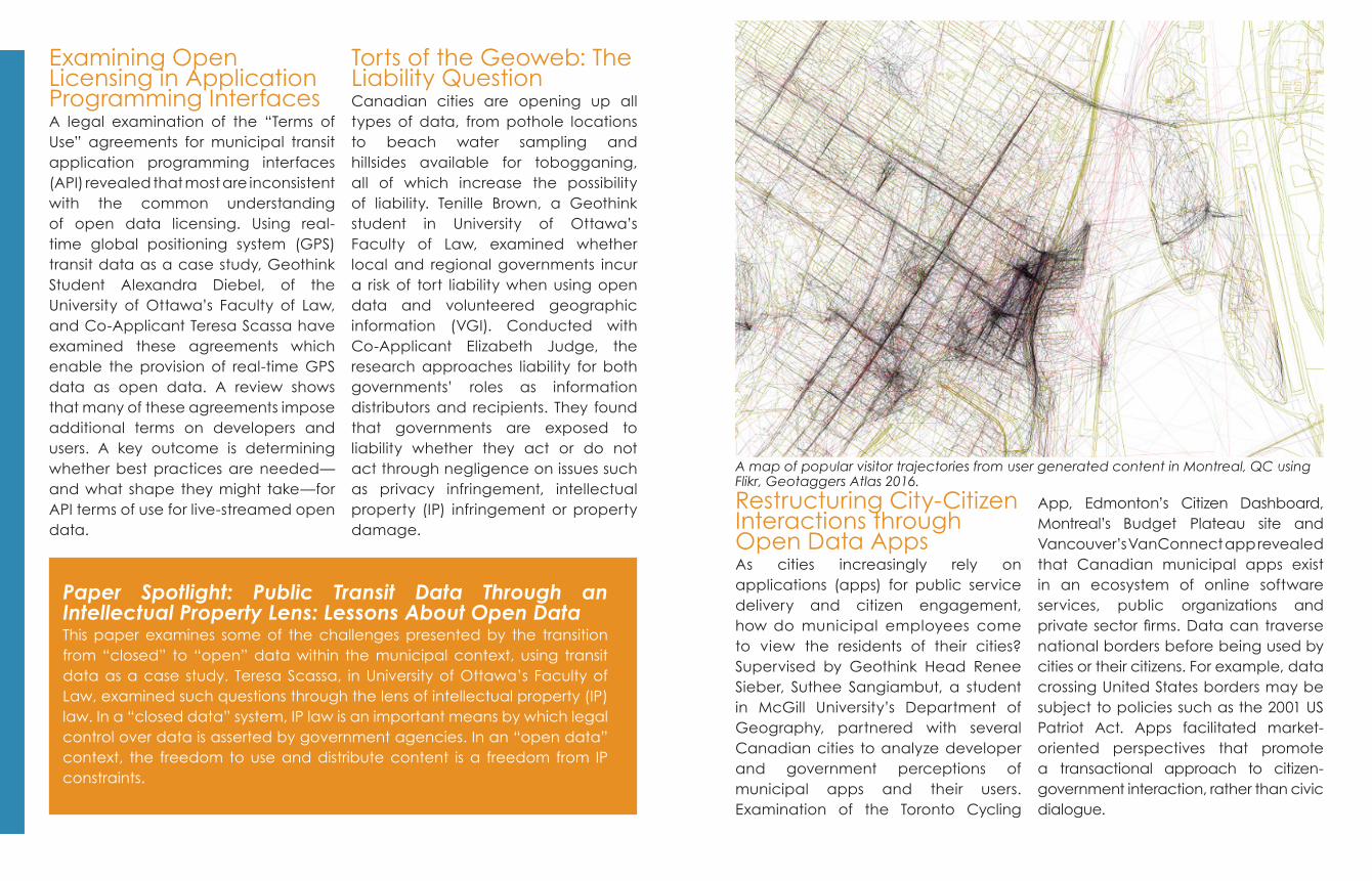
A map of popular visitor trajectories from user generated content in Montreal, QC using Flikr, Geotaggers Atlas 2016.
Paper Spotlight: Public Transit Data Through an Intellectual Property Lens: Lessons About Open DataThis paper examines some of the challenges presented by the transition from “closed” to “open” data within the municipal context, using transit data as a case study. Teresa Scassa, in University of Ottawa’s Faculty of Law, examined such questions through the lens of intellectual property (IP) law. In a “closed data” system, IP law is an important means by which legal control over data is asserted by government agencies. In an “open data” context, the freedom to use and distribute content is a freedom from IP constraints.

Curtis McCord, under Co-Applicant Leslie Shade (University of Toronto, Faculty of Information), highlight how the concept of open data often isn’t as clear-cut as its advocates claim. New literacy skills are necessary in order to ensure that individuals and communities can effectively work with open data. This guide aims to reduce the gap between expert practitioners and interested citizens.
Investigating Citizens’ Subjective Spatial ExperiencesGeothink Student Teriitutea Questnot
Open Data Standards for Better Municipal GovernanceOpen data relies on standards to increase its usability and dissemination. February 2016 marked the launch of Geothink’s Open Data Standards Project, led by Geothink Student Rachel Bloom, in McGill University’s Department of Geography. The project assists municipal publishers of open data in standardizing their datasets. Supervised by Geothink Head Renee Sieber, it culminated in three outputs: an evaluation of standards compliance on certain ‘high-value’ Canadian
municipal open datasets, an inventory of data standards applicable to these types of datasets and a set of metrics to assess the value of open data standards. All help municipal partners to know what standards exist and are used in available datasets.
The Citizen’s Guide to Open DataThe Citizen’s Guide to Open Data provides citizens with tools to understand what makes up open data (OD), how it can be used in their communities and where to find it. Geothink Students Dawn Walker and
Paper Spotlight: Quantifying the Significance of Semantic Landmarks in Familiar and Unfamiliar EnvironmentsPeople rely on objects that have outstanding characteristics for finding their way through cities. The salience of these landmarks is usually divided into three categories: visual, structural (i.e. the location of the landmark) and semantic (or citizens’ subjective spatial experiences). In this paper, Teriitutea Quesnot and Stéphane Roche, from Université Laval’s Department of Geomatics, conducted an experiment on the Internet to explore the significance of the relationship between semantic salience and spatial familiarity. They asked 63 participants to select landmarks along 30 intersections located in Quebec City. Their results indicate that unlike strangers, locals tended to focus on highly semantic landmarks. They also found that visual landmarks grabbed participants’ attention; regardless of their gender and the familiarity with the environment. Finally, the experiment showed that women were more influenced by structural salience than men.
and Co-Applicant Stéphane Roche, from Université Laval’s Department of Geomatics, explore how citizens’ experiences of urban places can be used to identify relevant semantic landmarks for finding one’s way through cities. Their research has three specific goals:1) Enriching the notion of landmark semantic salience by analyzing locational data from social media; 2) Evaluating its relative importance compared to visual and structural saliencies; and3) Investigating how navigational and wayfinding aid systems account for it.
This Inventory and Evaluation of Open Data Standards, catalogues and evaluates 22 open data standards that are available for domain-specific data.

Mapping News Poverty across CanadaLocal news furnishes citizens with information they need to stay connected, work together to solve problems and hold public officials to account. A new crowdsourced online geoweb map paints a picture of Canada’s rapidly evolving local news landscape by tracking the closure, launch and consolidation of local news outlets in communities across the country. The map is a partnership between Geothink co-applicant Jon Corbett from the University of British Columbia (Okanagan) Department of Community Culture and Global Studies, and partner April Lindgren,
who leads the Local News Research Project at Ryerson University’s School of Journalism. The map allows users to add information about changes to online, radio, television and online news outlets that affect the availability of local news. In addition to adding markers to the map, users can comment on the impact of the closure, launch or merger of a local news outlet and complete a survey about where they get their local news and whether their information needs are being addressed.
Using Geospatial Technologies to Improve Transportation ResearchWhat happens when a local bus service
The Local News Map will allow users to crowdsource changes to Canada’s media landscape.
Geothink’s research involves municipal partners, academic researchers, and students in collaborations to improve understandings of how modern technology will impact civic participation and governance.
“Crowdsourcing allows us to draw upon the expertise of residents who know first-hand what’s going on with the local news scene in their communities. People who add information to the map make it more robust and comprehensive and help all of us understand what’s happening to the availability of local news on the ground across the country.”
- Geothink Partner April Lindgren Principal investigator for the Local News Research Project and Academic Director, Ryerson Journalism Research Centre.
ends? Geothink Co-Applicant Scott Bell, in University of Saskatchewan’s Department of Geography and Planning, uses an app to examine how our cities can be healthier. The app, Ethica, was developed by Professors Kevin Stanley and Nathaniel Osgood in computer science. It uses smartphone sensors to monitor movement and behaviour. During one class project, the City of Saskatoon locked out its bus drivers, resulting in a month-long transit lockout. University attendance remained the same before and after the lockout but, when the lockout ended, trips to and from school became shorter and participation in active transportation increased.

For more information, visit:www.geothink.ca
Twitter: @geothinkca
Designed by Drew Bush, Suthee Sangiambut, and Stephanie Austin
Cover Photo by Thomas Hawk (Flickr)
2016
Geothink Academics
Renee Sieber (PI), Alexander Aylett, Scott Bell, Daren Brabham, Jonathan Corbett, Robert Feick, Peter Johnson,
Elizabeth Judge, Claus Rinner, Stéphane Roche, Pamela Robinson,
Teresa Scassa, Leslie Shade
University of British Columbia, Institut National de la Recherche Scientifique
Université Laval, McGill University, University of Ottawa, Ryerson University,
University of Saskatchewan, University of Southern California, University of
Toronto, University of Waterloo
Our Partners
Ajah, Centre for Law, Technology and Society (University of Ottawa), CitizenBridge, City of Edmonton, City of Kitchener, City of Montreal, City of Ottawa, City of Toronto, City of Vancouver, City of Victoria, City of Waterloo, Esri Canada, IBM Canada, Institut national de la recherche scientifique (INRS), The Neptis Foundation, Office of the Privacy Commissioner of Canada (OPC), Okanagan Basin Water Board (OBWB), Open North, OpenStreetMap - US Chapter, Ryerson Journalism Research Centre (RJRC), Sani International Technology Advisors Inc., United States Geological Survey
This research was supported by the Social Sciences and Humanities Research Council of Canada


