WATER RESOURCES MANAGEMENT IN GUJARAT A Sustainable Water State 1 Narmada, Water Resources, Water Supply & Kalpsar Department Government of Gujarat Water for all Water for ever More crop per drop
Transcript
WATER RESOURCES MANAGEMENT IN GUJARAT
A Sustainable Water State
1
Narmada, Water Resources, Water Supply & Kalpsar DepartmentGovernment of Gujarat
Water for all Water for ever More crop per drop
WATER PROFILE OF GUJARAT
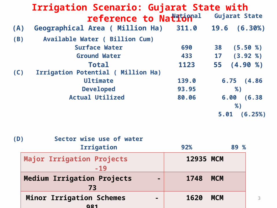
Irrigation Scenario: Gujarat State with reference to NationNational Gujarat State
(A) Geographical Area ( Million Ha) 311.0 19.6 (6.30%)(B) Available Water ( Billion Cum)
Surface WaterGround Water
Total
690433
1123
38 (5.50 %)17 (3.92 %)55 (4.90 %)
(C) Irrigation Potential ( Million Ha)Ultimate
DevelopedActual Utilized
139.093.9580.06
6.75 (4.86 %) 6.00 (6.38 %) 5.01 (6.25%)
(D) Requirement Of Water For Irrigation (Billion Cum)
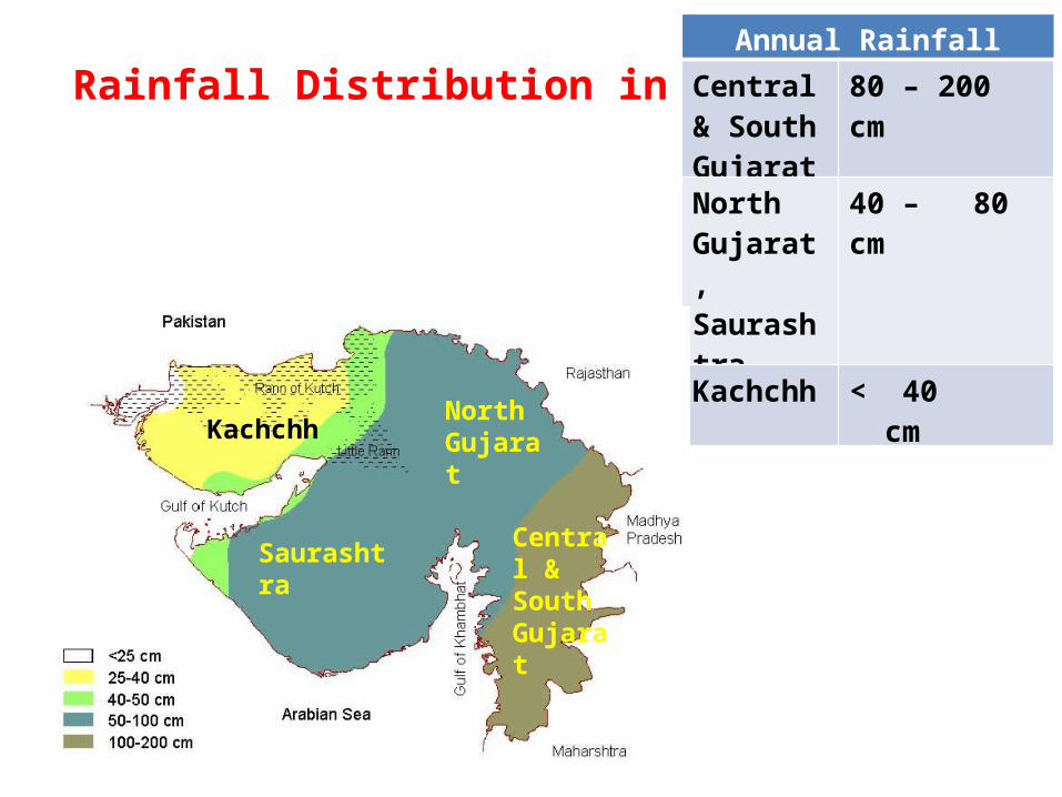
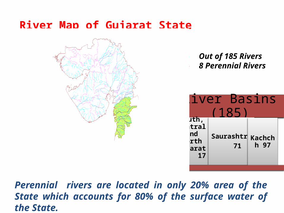
Perennial rivers are located in only 20% area of the State which accounts for 80% of the surface water of the State.
River Basins (185)South, Central
and North Gujarat
17
Saurashtra 71
Kachchh 97
6
North Gujarat (11%)SURFACE WATER 2100 MCM
GROUNDWATER 4200 MCM
TOTAL 6300 MCM
Kachchh (3%)SURFACE WATER 650 MCM
GROUNDWATER 800 MCM
TOTAL 1450 MCM
Saurashtra (17%)SURFACE WATER 3600 MCM
GROUNDWATER 6100 MCM
TOTAL 9700MCM
Central & South Gujarat(69%)
SURFACE WATER 31750 MCM
GROUNDWATER 6350 MCM
TOTAL 38100 MCM
Gujarat stateSURFACE WATER
38100 MCM
GROUND WATER
17500 MCM
TOTAL 55600 MCM
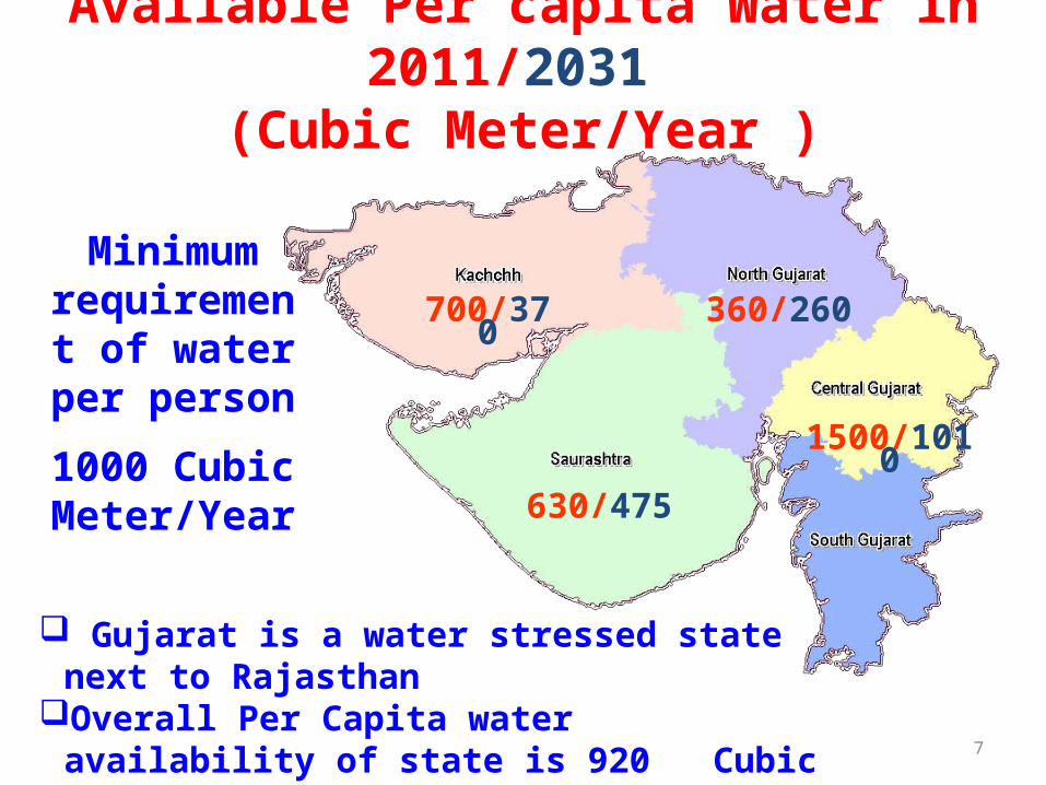
7
Minimum requirement of
water per person
1000 Cubic Meter/Year
360/260
630/475
1500/1010
700/370
Available Per capita Water in 2011/2031 (Cubic Meter/Year )
Gujarat is a water stressed state next to RajasthanOverall Per Capita water availability of state is 920
Cubic meter/year in2011 (640 cum/year in 2031)
WATER RESOURCES OF GUJARAT• TOTAL GEOGRAPHICAL AREA 19.6 M ha• CULTURABLE AREA 12.4 M ha• Ultimate Irrigation Potential 6.75 M ha• Surface Water Potential Major & Medium Dams -1.788 M ha (Thro’92 projects) Sardar Sarovar Project - 1.792 M ha (under progress) Minor Irrigation projects-0.497 M ha (Thro’ 981
Schemes) Water conservation Strucures-0.681 M ha• Ground Water Potential -2.00 M ha Thro’ Tube well, Shallow Wells & Community Wells• Rain fed area - 5.65 M ha
8
Water Resources in MCM
Surface waterGround Water
38100
17500
INNOVATIVE APPROACH
Includes
Water conservation
Micro irrigation
Strengthening of existing
canal system
Participatory irrigation
management
Inter-basin water
transfer by interlinking
Integrated approach adopted for sustainable and efficient water resources development and management
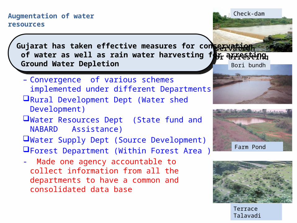
Augmentation of water resources
– Convergence of various schemes implemented under different Departments
Rural Development Dept (Water shed Development)
Water Resources Dept (State fund and NABARD Assistance)
Water Supply Dept (Source Development)Forest Department (Within Forest Area )- Made one agency accountable to collect
information from all the departments to have a common and consolidated data base
11
Gujarat has taken effective measures for conservation of water as well as rain water harvesting for arresting Ground Water Depletion
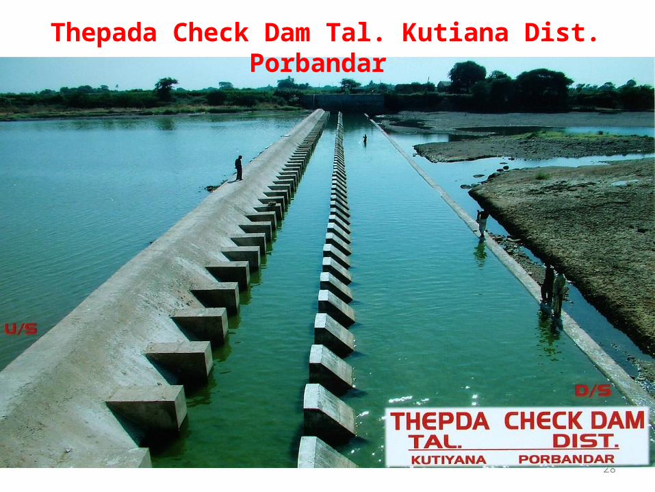
Check-dam
Bori bundh
Terrace Talavadi
Farm Pond
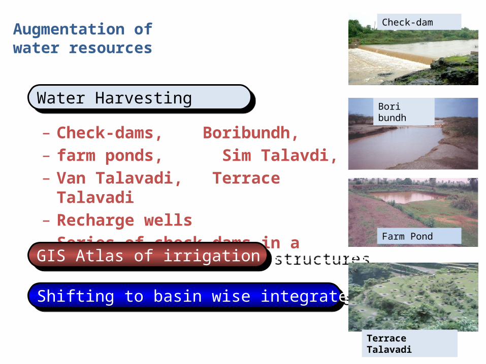
Augmentation of water resources
– Check-dams, Boribundh, – farm ponds, Sim Talavdi, – Van Talavadi, Terrace Talavadi– Recharge wells– Series of check-dams in a river basin
12
Water Harvesting
GIS Atlas of irrigation structures
Shifting to basin wise integrated approach
Check-dam
Bori bundh
Farm Pond
Terrace Talavadi
RIGHT STEP – ASTOUNDING EXPERIENCE
• 1,66,082 Check-dams
• 2,61,785 Farm Ponds
• 1,22,035 Bori Bunds
Water conservation
structures
• About 25,000 deepened to enhance capacity
Ponds
• About 1000 revived, cleaned & put to use
Step-wells
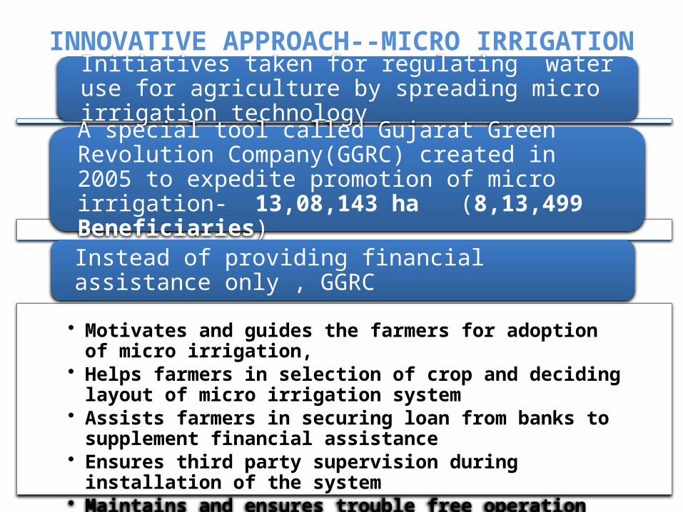
INNOVATIVE APPROACH--MICRO IRRIGATIONInitiatives taken for regulating water use for agriculture by spreading micro irrigation technology
A special tool called Gujarat Green Revolution Company(GGRC) created in 2005 to expedite promotion of micro irrigation- 13,08,143 ha (8,13,499 Beneficiaries)
• Motivates and guides the farmers for adoption of micro irrigation, • Helps farmers in selection of crop and deciding layout of micro
irrigation system• Assists farmers in securing loan from banks to supplement financial
assistance• Ensures third party supervision during installation of the system • Maintains and ensures trouble free operation for 5 years
Instead of providing financial assistance only , GGRC
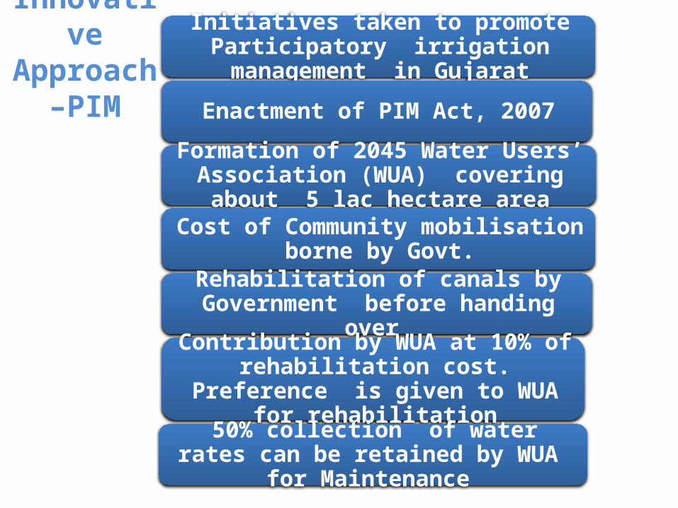
Innovative Approach
–PIM
Initiatives taken to promote Participatory irrigation management in Gujarat
Enactment of PIM Act, 2007
Formation of 2045 Water Users’ Association (WUA) covering about 5 lac hectare area
Cost of Community mobilisation borne by Govt.
Rehabilitation of canals by Government before handing over
Contribution by WUA at 10% of rehabilitation cost. Preference is given to
WUA for rehabilitation
50% collection of water rates can be retained by WUA for Maintenance
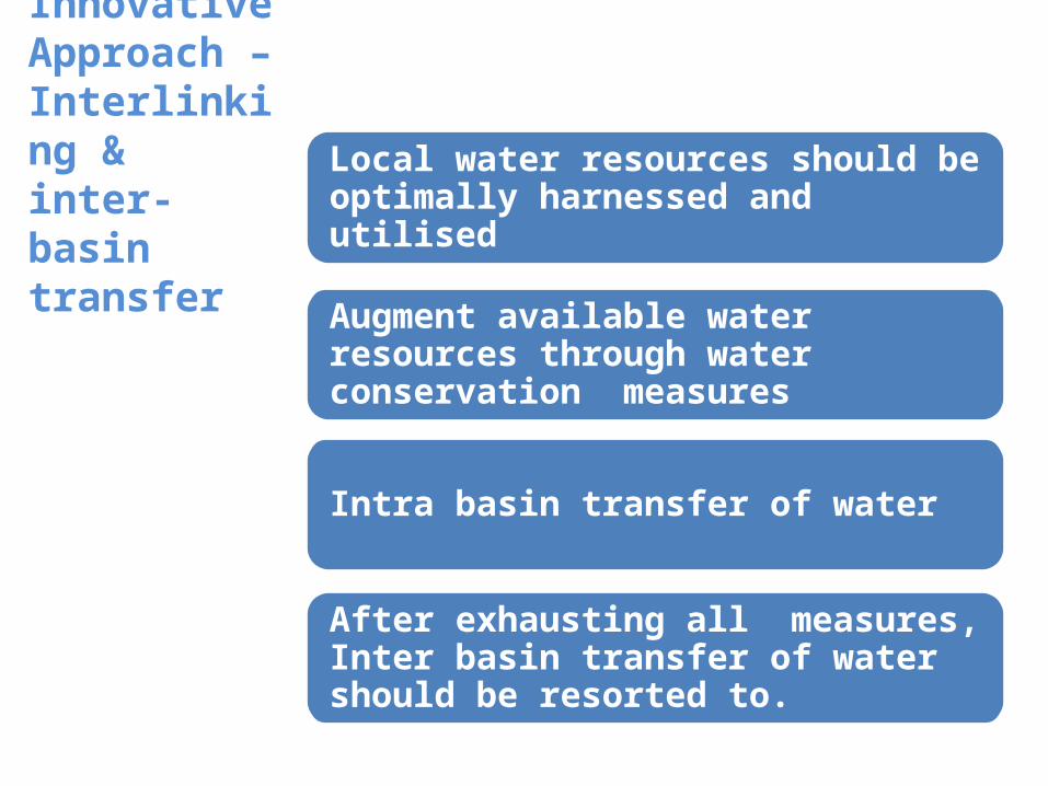
Innovative Approach –Interlinking & inter-basin transfer
Local water resources should be optimally harnessed and utilised
Augment available water resources through water conservation measures
Intra basin transfer of water
After exhausting all measures, Inter basin transfer of water should be resorted to.
Interlinking & inter-basin transfer
Intra linking Projects under
progress
Ukai Purna High Level canal Est. Cost Rs. 159 Cr. Area
9900 Ha.
Spreading Channels to prevent salinity ingress
in coastal region
SAUNI project-10860 CrTo fill 115 reservoirs of
Draught Prone Rea
Inter Linking Projects under
planning
Par Tapi Narmada Link
Damanganga Sabarmati
Chorvad link
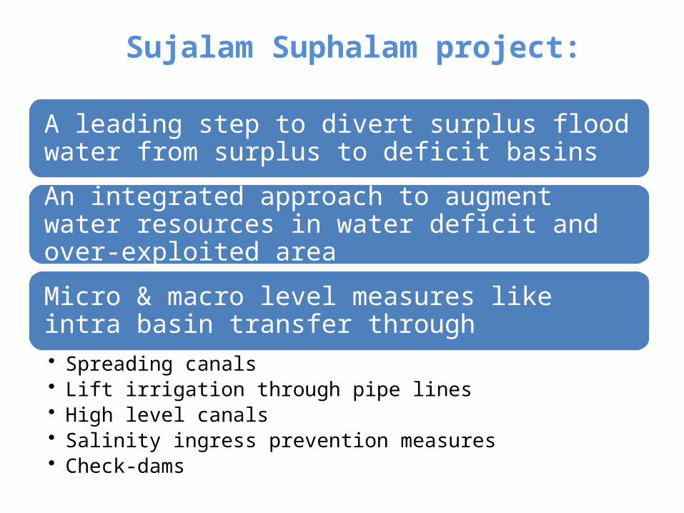
Sujalam Suphalam project:
A leading step to divert surplus flood water from surplus to deficit basins
An integrated approach to augment water resources in water deficit and over-exploited area
Micro & macro level measures like intra basin transfer through• Spreading canals• Lift irrigation through pipe lines• High level canals• Salinity ingress prevention measures• Check-dams
Sujalam Sufalam Spreading Canal & 14 LI schemes
Sujalam Sufalam Spreading canal
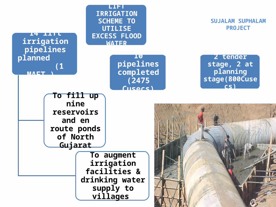
SUJALAM SUPHALAM PROJECT
LIFT IRRIGATION SCHEME TO
UTILISE EXCESS FLOOD WATER
14 lift irrigation pipelines planned
(1 MAFT.)
To fill up nine reservoirs and en route ponds
of North Gujarat
To augment irrigation facilities &
drinking water supply to villages
10 pipelines completed
(2475 Cusecs)
2 tender stage, 2 at planning
stage(800Cusecs)
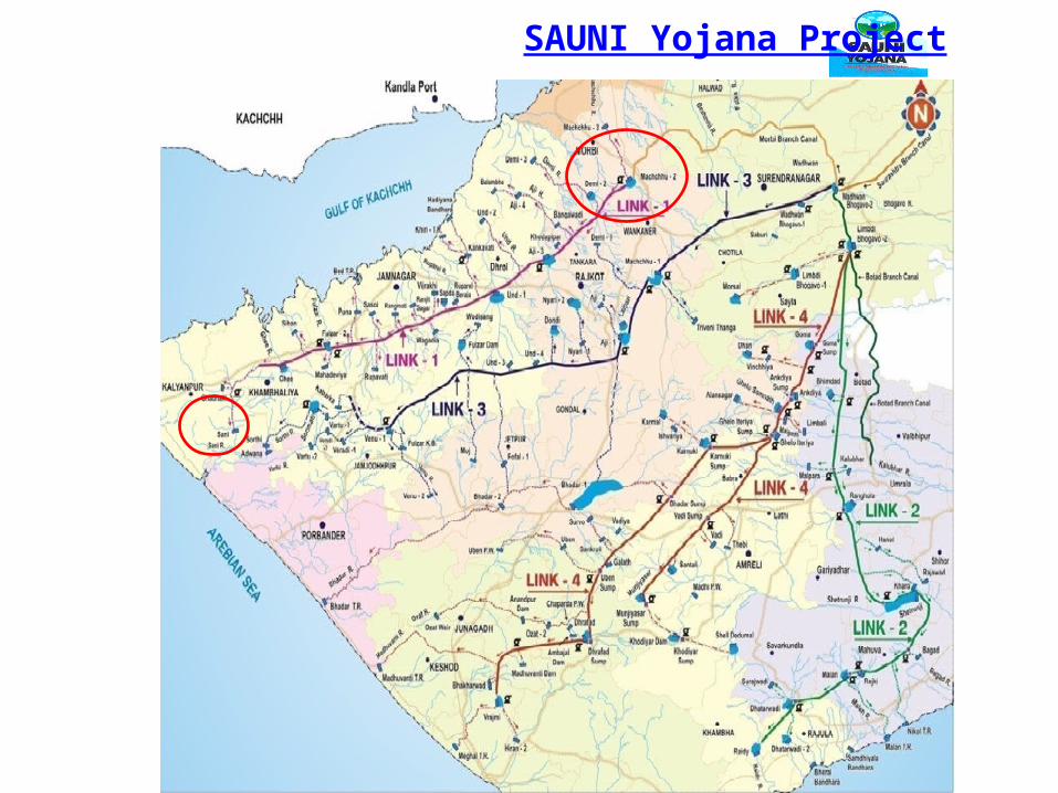
SAUNI Yojana Project
SAUNI : Scheme Details• Four links Machchhu-II to Sani Limbadi Bhogavo-II to Raydi Dholidhaja to Venu-I Limbadi Bhogavo-II to Hiran-II
1126 Km length of pipeline115 Reservoir of Saurashtra region will be filled 412335 ha draught prone area will be benefitted Project Cost - 10860 Cr
23
24
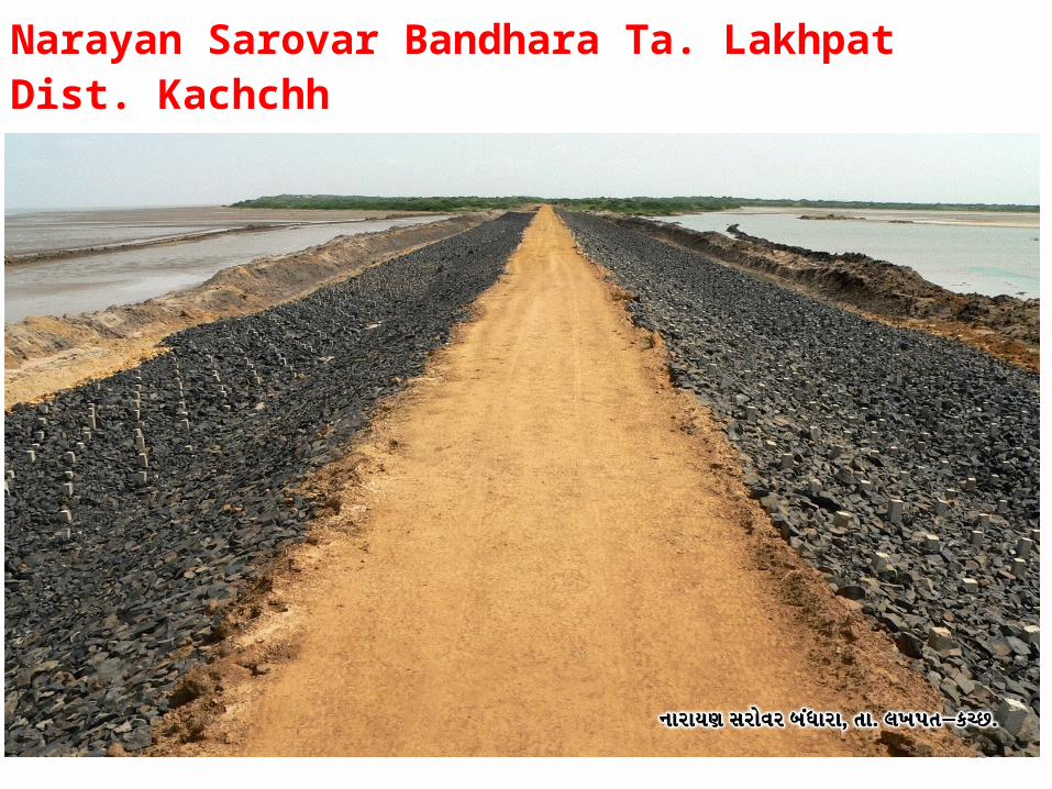
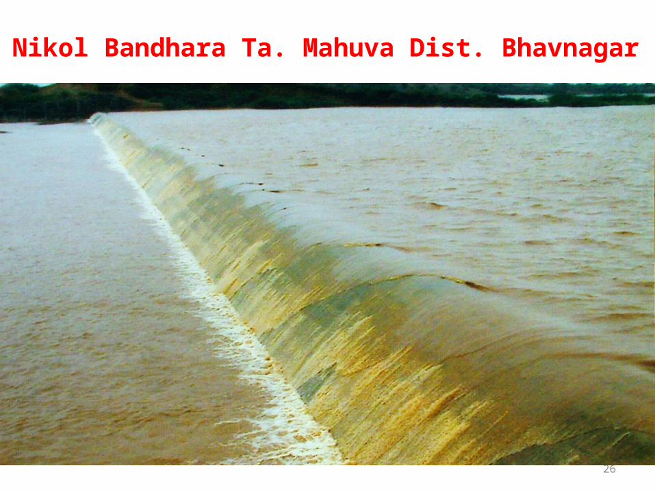
Salinity Ingress Prevention Projects Govt. has taken aggressive steps to prevent salinity Ingress in coastal belt Tidal Regulator/ Bandhara
49 planned in Saurashtra and 53 in Kachchh 47 Completed in Saurashtra and 52 in Kachchh 2 under progress in Saurashtra & 1 in Kachchh Spreading Canal
360 km spreading canal planned in Saurashtra region 220 km completed166 km spreading canal planned in Kachchh region 71 km completed
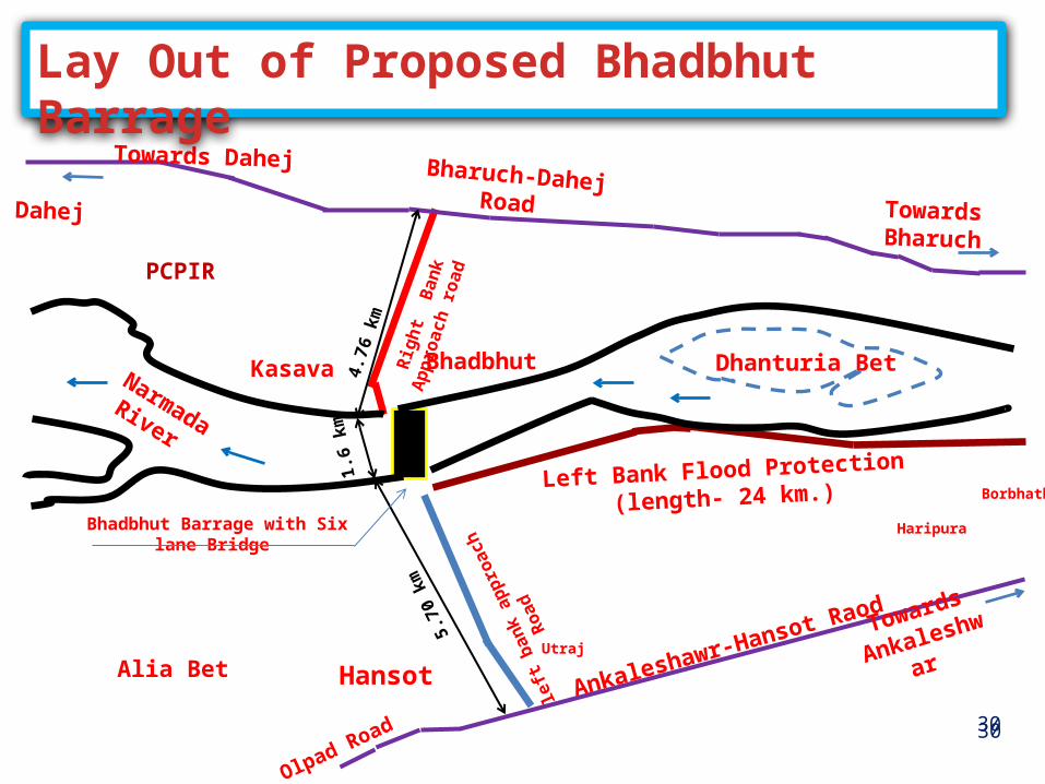
SALIENT FEATURES(Tentative)• River gorge width : 1600m• Sub-soil strata : mostly silty sand• Total length of barrage : 1663 m• Storage capacity : 500 MCM• FRL : (+) 7.50 m• Nos. of gates : 90 (Vertical)• Size of gates : 15.5 m x 9.5 m• Top width of road bridge : 30 m (6-lane road)• Approach road on left & right bank :10.5 km long• Left flood protection embankment : 24 km long• Type of embankment : Rock fill type
32
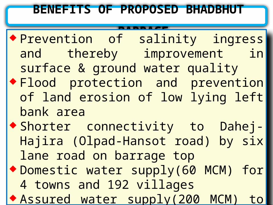
BENEFITS OF PROPOSED BHADBHUT BARRAGE Prevention of salinity ingress and thereby
improvement in surface & ground water quality Flood protection and prevention of land erosion
of low lying left bank area Shorter connectivity to Dahej-Hajira (Olpad-
Hansot road) by six lane road on barrage top Domestic water supply(60 MCM) for 4 towns and
192 villages Assured water supply(200 MCM) to industries in
GIDC and PCPIR, Dahej Lift irrigation facility to the area located at higher
level
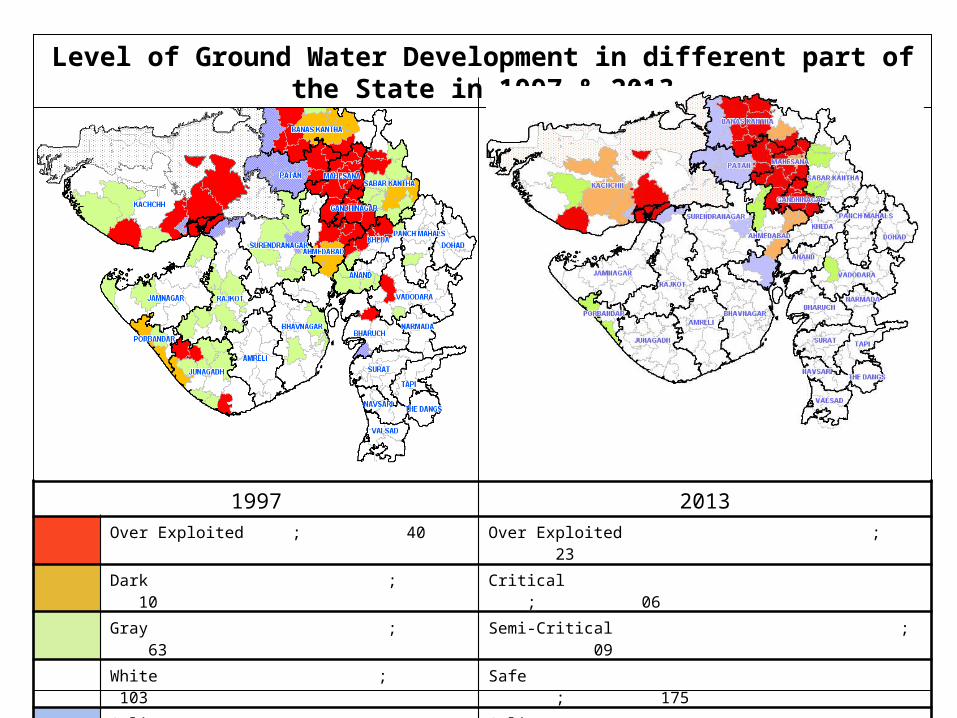
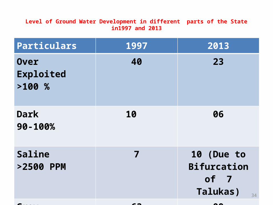
Level of Ground Water Development in different part of the State in 1997 & 2013
1997 2013Over Exploited ; 40 Over Exploited ; 23
Dark ; 10 Critical ; 06
Gray ; 63 Semi-Critical ; 09
White ; 103 Safe ; 175
Saline ; 07 Saline ; 10
Level of Ground Water Development in different parts of the State in1997 and 2013
Particulars 1997 2013Over Exploited >100 %
40 23
Dark90-100%
10 06
Saline>2500 PPM
7 10 (Due to Bifurcation of 7
Talukas)Grey70-90%
63 09
34
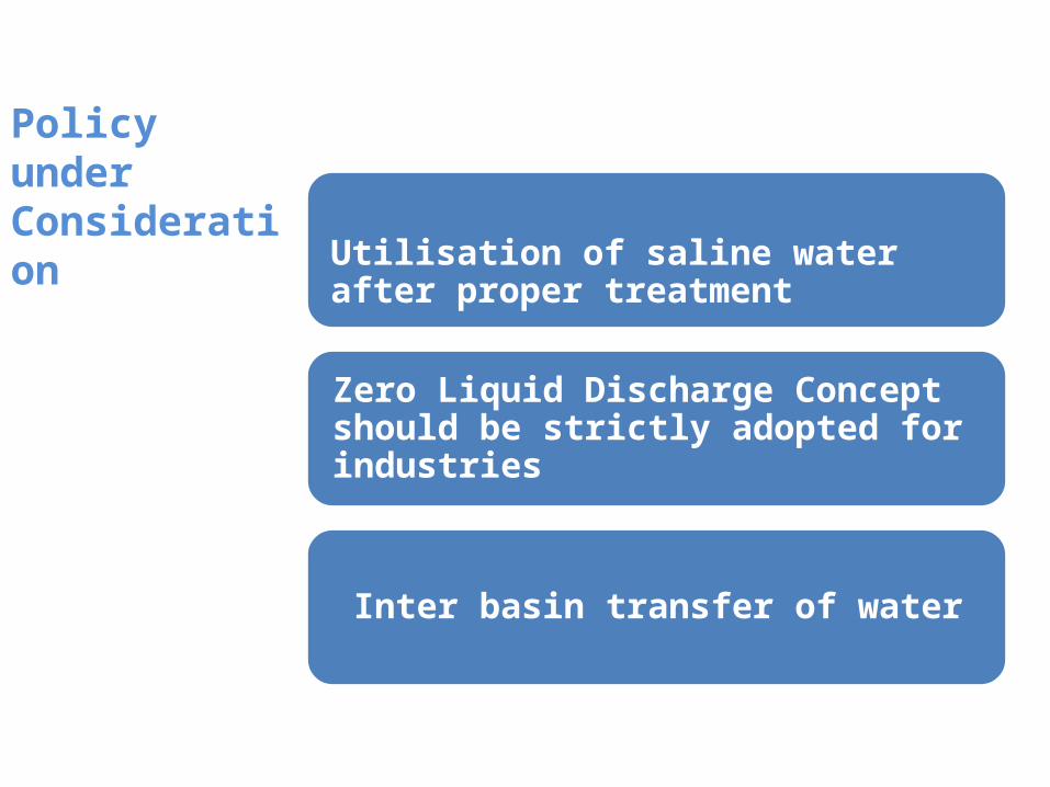
Policy under Consideration
Utilisation of saline water after proper treatment
Zero Liquid Discharge Concept should be strictly adopted for industries