SKETCH MAP SHOWING THE PRESENT TER"JS OF MATANUSKA GLACIER AND SOME FORMER POSITIONS OF THE TERMINUS e Modern couIses Fig9 Landslide Moraines and positions of former ice-marginal :::::::';,': Former meltwater spillway 1 A"",- Fig. 1. Sketch mapshowing the presentterminus of MatanuskaGlacierandsomeformer positions of the terminus.
Transcript
SKETCH MAP SHOWING THE PRESENT TER"JS OF MATANUSKA GLACIER AND SOME FORMER
POSITIONS OF THE TERMINUS
e Modern couIses Fig9 Landslide
Moraines and positions of former ice-marginal :::::::';,': Former meltwater spillway 1 A"",-
Fig. 1. Sketch map showing the present terminus of Matanuska Glacier and some former positions of the terminus.
LATE WISCONSIN AND RECENT HISTORY OF THE MATANUSKA GLACIER, ALASKA*
John R. Williams and Oscar J. Ferrians, Jr.?
The Matanuska Glacier (Fig. 2) is one of the largest glaciers that extend north from the snow and ice fields of the central Chugach Mountains of southern Alaska. It drains 250 square miles of the highest part of the range between Mt. Witherspoon (12,023 feet) and Mt. Marcus Baker (13,176 feet). The glacier terminates in the upper Matanuska Valley that separates the Chugach Mountains from the Talkeetna Mountains to the north. The ter- minus, 82 miles northeast of Anchorage, is visible from “scenic overlooks’’ between mileposts 98 and 108 on the Glenn Highway and is accessible by a cable car across the Matanuska River at J. D. Richardson’s residence near milepost 103. Studies of the glacier in 1953, 1954, and 1957 were part of the authors’ investigation of the glacial geology of the southwestern Copper River Basin and upper Matanuska Valley. The studies are a part of the program of terrain and permafrost investigations in Alaska by the U. S. Geological Survey, and are financed in part by the Office of the Chief of Engineers, U. S. Army. A preliminary report on the history of the Mata- nuska Glacier was given at the Ninth Alaska Science Conference, College, Alaska in 1958 (Williams and Ferrians, 1958).
The glacier lies in a 2-mile-wide valley that is a southeastern tributary of the valley occupied by the Matanuska River. The terminal lobe of the glacier occupies a 4-mile segment of the Matanuska Valley between Glacier Creek and Caribou Creek. The glacier has forced the Matanuska River against the northern edge of its valley, where the river has cut bluffs in which glacial drift, siltstone, and porphyritic igneous rocks are exposed.
Most of the northern part of the terminal zone is stagnant (Fig. 1) and covered by ablation moraine. The southern part of the ablation moraine is free of vegetation because the ice is at shallow depth and the surface mate- rials are still actively slumping and washed by meltwater as the ice melts. Along the northern edge of the ablation moraine, however, the deposit is thick enough to provide a relatively stable environment for the growth of willows and in some places of spruce forest, even though the moraine is
* Publication authorized by the Director, U.S. Geological Survey. t U.S. Geological Survey, Washington 25, D.C., U.S.A.
83
84 HISTORY OF THE MATANUSKA GLACIER
still cored with ice. The western part of the terminal zone is free of debris, and the clear white ice exposed in the seracs and crevasses of this part of the glacier forms the spectacular view seen from the highway. A large medial moraine and several smaller ones are formed by the coalescence of the lateral moraines of the main forks and those of smaller tributary glaciers. Mendenhall (1898), the first to describe the glacier, remarked that the western part of the glacier was more active than the northern or north- eastern part because of different meteorological conditions in the snowfields that feed the two principal forks of the glacier.
The principal meltwater streams flow from below the western part of the terminus. These channels carry a greater volume of water than the upper Matanuska River east of the glacier. Modern outwash deposits form the lowest alluvial level on the outwash plain west of the glacier. Older outwash deposits graded to one or another of the younger group of moraines within 1 mile of the glacier form terraces on this plain.
The U-shaped profile of the valley into which the lower Matanuska River is cut, the truncated spurs on the mountains bordering the valley, and the glacially smoothed bedrock knobs and deposits of glacial drift in the valley bottom show that the glacier was formerly of much greater extent and that it filled the valley during Wisconsin time. At the head of Knik Arm (Fig. 2) near Palmer the Matanuska Glacier at that time coalesced with Knik Glacier; the combined glaciers flowed west and formed the prominent end moraine complex that extends from Anchorage to Willow. This end moraine is of Wisconsin age (Naptowne glaciation of Karlstrom in Pkwk et al. 1953; Karlstrom 1955, 1957; the Elmendorf moraine of Naptowne age of Miller and Dobrovolny 1959, pl. 1 and p. 85). The retreat of the ice from this moraine had a complex history, which is not yet fully understood. How- ever, studies by Trainer (1953, 1960) in the lower Matanuska Valley near Palmer show that the Matanuska lobe of the glacier became stagnant. NO prominent end moraines were seen by the authors or by Trainer (1960, p. 27) in the rough terrain of the valley bottom between Palmer and a point 5 miles from the present glacier terminus.
The readvances, which extended 2.5 to 5 miles beyond the present terminus, formed a series of moraines and marginal channels along the Matanuska River and in the lower valley of Caribou Creek. The position of these moraines and marginal channels at a lower altitude than the old valley floor shows that the ice readvanced into a river valley cut into the drift of Wisconsin age that was deposited during the time the valley was full of ice. The upper Matanuska River was blocked by ice, and a lake was formed near the confluence of the east and southeast forks of the river as indicated by stratified silt, sand, and clay at the surface in the valley bottom. These deposits, like the moraines on Caribou Creek, have been deeply incised by the modern streams. To the south the valley of Glacier Creek was blocked by ice and its waters either diverted down the valley of Lake Creek or conveyed into the channels along the margin of the glacier. During this same period the glacier advanced to a point 3 to 4 miles UP Caribou
HISTORY OF THE MATANUSKA GLACIER 85
Creek where at least three morainal ridges lie near the mouth of Dan Creek. When the glacier occupied these positions meltwater drainage was ponded, together with the water of Caribou Creek, and was diverted west- ward across the present valleys of Dan and Pinochle creeks to Hicks Creek. This spillway is now blocked by a large landslide that forms the divide between Dan and Pinochle creeks. The deep canyon of Pinochle creek now followed by the Glenn Highway between mileposts 97 and 98 was cut by water at some time during these advances. The canyon of Caribou Creek was cut as the ice retreated from moraines near Dan Creek.
Fig. 2. Location of area of investigation.
The ice occupied successively less extended positions as it retreated from the morainal complex 5 to 2.5 miles west of the glacier. The innermost of these positions is marked by a marginal channel about 100 feet above the modern outwash plain. The river has exposed an oblique section of this channel (Fig. 3) about 400 feet S . 20" W. of milepost 102. Most of the mate- rial into which the channel is cut is composed of poorly stratified glacial
86 HISTORY OF THE MATANUSKA GLACER
drift. A thin lag gravel above the drift is covered by 2% feet of pond silt that in turn is overlain by 4 feet of peat at the top of, the section. The silt contains mollusks of the following species: Pisidium casertanum (Poli), Valvata lewisi helicoides Dall, Gyraulus parvus (Say), Physa skinnerî Taylor, Armiger crista L., and Lymnaea sp. (U. S . Geol. Surv., Cenozoic Locality No. 19191). According to D. W. Taylor, U. S . Geol. Surv., who identified the mollusks, their habitat was one of perennial, shallow, quiet water, possibly a pond or swamp or a sheltered stream margin. The config- uration of the silt deposits and the fauna suggest that the water body filled a depression that had been formed by the damming of the channel by the alluvial fan of a tributary creek after meltwater had abandoned the channel.
Fig. 3. Bluff north of Matanuska River near milepost 102 on Glenn Highway with exposure of poorly stratified drift (a) overlain by a thin veneer of lacustrine deposits
and peat (b); the base of the peat is 8,000-~300 years old (W-431).
Above the silt lie 4 feet of uncompressed peat. In the peat are three horizontal, undisturbed, thin beds of white to orange volcanic ash. Material from the basal inch of the peat was submitted for radiocarbon analysis by the Geological Survey. Its age is 8,0002300 years (W-431, Rubin and Alexander 1958). Two conclusions can be reached concerning the age of the glacial deposits near the glacier terminus: (1) the pond silt and dated peat overlie the innermost channel associated with glacial advances 2.5 to 5 miles from the glacier and, therefore, these advances and the channel
HISTORY OF THE MATANUSKA GLACIER 87
must be older than 8,000 years; (2) because the peat is the surface deposit and is not deformed, and because the ash beds show no disturbance, the glacier has not advanced during the last 8,000 years over this site, located only 6,000 feet N. 80" W. of the terminus.
The implication of this radiocarbon date, therefore, is that more than 8,000 years ago the glacier terminated no more than 2.5 miles down-valley from its present position or, in the case of the marginal channel, 6,000 feet away at the edge of the valley. This information is consistent with that from other glaciers with a northern or precipitation-deficient exposure. Capps's (1916, p. 74) studies of the 39-foot peat section exposed in the north bank of the White River, only 8 miles from Russell Glacier, show that that glacier retreated from the locality more than 7,800 years ago. Similarly, in the Nelchina Valley in the northern Chugach Mountains, 22 miles east of the Matanuska Glacier, the ice had withdrawn to within 8 to 10 miles of its present position 8,450+200 years ago (L-368, Olson and Broecker 1959). In the northwestern Kenai Mountains the Tustumena Glacier is reported (Karlstrom, oral communication 1957) to have advanced to positions 4 to 13 miles from the present glacier between 6,000 and 9,000 years ago. Thus the conclusion that the Matanuska Glacier had only slightly greater extent prior to 8,000 years ago than now seems to be borne out in a general way by the available data from other glaciers in similar positions with respect to precipitation.
Following abandonment of the innermost marginal channel prior to 8,000 years ago, the Matanuska Glacier retreated upvalley, perhaps south- east of its present terminus. As soon as the region became free of ice, and perhaps even before, the valley floor was subjected to erosion by the Mata- nuska River, and a canyon about 100 feet deep was excavated in the pre-8,000 B.P. drift. The glacier readvanced into the deepened valley and formed the younger group of moraines within 1 mile of the present glacier. The duration of the retreat is not known, nor is the date of initiation of the readvance to positions within a mile of the present glacier. However, in a road cut north of mile 108.8 (at the east edge of the map area, Fig. 1) occur deposits of outwash gravel that probably are related in age to the deposits of the pre-8,000 B.P. drift 2.5 to 5 miles west of the glacier. The outwash gravel is overlain by a soil consisting of organic silt, silt, and lenses and beds of volcanic ash. The soil is buried under 4 feet of talus rubble. The organic silt horizon of this soil is 3,6202250 years old (W-573, Rubin and Alexander 1960) by radiocarbon analysis. Though not demonstrable, burial of the soil by talus rubble probably reflects a climatic change that accelerated the formation of talus and that caused the readvance of Mats- nuska Glacier. The period of retreat preceding readvance to positions within a mile of the glacier, therefore, is most logically correlated with the Altithermal, and the moraines within 1 mile of the glacier probably are no older than 4,000 years.
The younger group of moraines within a mile of the glacier terminus consists of ridges or groups of ridges one mile, a quarter of a mile, and less
88 HISTORY OF THE MATANUSKA GLACIER
than a quarter of a mile west of the terminus (Fig. 4). The only remnant of the moraine representing the l-mile advance is a ridge that partly blocks the mouth of the canyon of Glacier Creek. An equivalent moraine remnant forms a ridge north of the Matanuska River. At both localities the open- textured morainal deposits consist of slabby, angular fragments of schist, slate, and graywacke that are similar to the rocks of the central Chugach Mountains. Near Glacier Creek these deposits overlie silty till, which in- cludes rounded boulders, and in a few places the moraine is covered with a mantle of as much as 12 inches of eolian silt or loess. The upper 4 to 5 inches of the loess is oxidized. The vegetation consists of second-growth brush and some mature spruce. This moraine is the oldest of the younger group of moraines that post-dates canyon cutting. The age of the oldest moraine may be a few thousand years, but less than 4,000; however, evidence for dating this moraine precisely is not available.
Fig. 4. Matanuska Valley opposite the mouth of Glacier Creek. The canyon of Glacier Creek (a) is partly blocked by moraine (b), one mile from the present terminus. The slightly terraced outwash plain (c) separates the moraine (b) from two younger moraines (d) that lie within a quarter of a mile of the present terminus of Matanuska Glacier and
are probably less than 4,000 years old.
A single ridge, the remnant of an advance of about a quarter of a mile, is located south of the outwash plain. The ridge is covered with mature spruce forest; the oldest tree measured is about 125 years old. This forest
HISTORY OF THE MATANUSKA GLACER 89
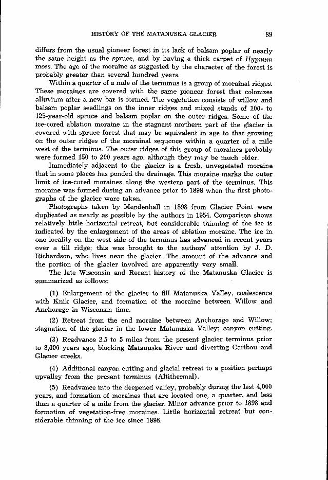
differs from the usual pioneer forest in its lack of balsam poplar of nearly the same height as the spruce, and by having a thick carpet of Hypnum moss. The age of the moraine as suggested by the character of the forest is probably greater than several hundred years.
Within a quarter of a mile of the terminus is a group of morainal ridges. These moraines are covered with the same pioneer forest that colonizes alluvium after a new bar is formed. The vegetation consists of willow and balsam poplar seedlings on the inner ridges and mixed stands of 100- to 125-year-old spruce and balsam poplar on the outer ridges. Some of the ice-cored ablation moraine in the stagnant northern part of the glacier is covered with spruce forest that may be equivalent in age to that growing on the outer ridges of the morainal sequence within a quarter of a mile west of the terminus. The outer ridges of this group of moraines probably were formed 150 to 200 years ago, although they may be much older.
Immediately adjacent to the glacier is a fresh, unvegetated moraine that in some places has ponded the drainage. This moraine marks the outer limit of ice-cored moraines along the western part of the terminus. This moraine was formed during an advance prior to 1898 when the first photo- graphs of the glacier were taken.
Photographs taken by Mendenhall in 1898 from Glacier Point were duplicated as nearly as possible by the authors in 1954. Comparison shows relatively little horizontal retreat, but considerable thinning of the ice is indicated by the enlargement of the areas of ablation moraine. The ice in one locality on the west side of the terminus has advanced in recent years over a till ridge; this was brought to the authors’ attention by J. D. Richardson, who lives near the glacier. The amount of the advance and the portion of the glacier involved are apparently very small.
The late Wisconsin and Recent history of the Matanuska Glacier is summarized as follows:
(1) Enlargement of the glacier to fill Matanuska Valley, coalescence with Knik Glacier, and formation of the moraine between Willow and Anchorage in Wisconsin time.
(2) Retreat from the end moraine between Anchorage and Willow; stagnation of the glacier in the lower Matanuska Valley; canyon cutting.
(3) Readvance 2.5 to 5 miles from the present glacier terminus prior to 8,000 years ago, blocking Matanuska River and diverting Caribou and Glacier creeks.
(4) Additional canyon cutting and glacial retreat to a position perhaps upvalley from the present terminus (Altithermal) .
(5) Readvance into the deepened valley, probably during the last 4,000 years, and formation of moraines that are located one, a quarter, and less than a quarter of a mile from the glacier. Minor advance prior to 1898 and formation of vegetation-free moraines. Little horizontal retreat but con- siderable thinning of the ice since 1898.
90 HISTORY OF THE MATANUSKA GLACIER
References
Capps, S.R. 1916. The Chisana-White River district, Alaska. U.S. Geol. Surv. Bull.
Karlstrom, T.N.V. 1955. Late Pleistocene and Recent glacial chronology of south-
1957. Tentative correlations of Alaskan glacial sequences, 1956. Science
Mendenhall, W.C. 1898. A reconnaissance from Resurrection Bay to the Tanana River, Alaska, in 1898. U.S. Geol. Surv. 20th Ann. Rept., Part VII-c, pp. 265-340.
Miller, R. D., and Ernest Dobrovolny. 1959. Surficial geology of Anchorage and vicinity, Alaska. U.S. Geol. Surv. Bull. 1093,128 pp.
Olson, E. A., and W. S. Broecker. 1959. Lamont natural radiocarbon measurements V. Am. J. Sci. 257:l-28.
PBwB, T. L., E. H. Muller, T. N. V. Karlstrom, D. B. Krinsley, A. T. Fernald, Clyde Wahrhaftig, D. M. Hopkins, and R. L. Detterman. 1953. Multiple glaciation in Alaska, a progress report. U. S. Geol. Surv. Circ. 289,13 pp.
Rubin, Meyer, and Corinne Alexander. 1958. U. S. Geol. Surv. radiocarbon dates IV. Science 127:1476-87.
1960. U. S. Geol. Surv. radiocarbon dates V. A m . J. Sci. Radiocarbon Supplement, 2:129-85.
Trainer, F. W. 1953. Preliminary report on the geology and ground-water resources of the Matanuska Valley agricultural area, Alaska. U. S. Geol. Surv. Circ. 268, 43 pp.
1960. Geology and ground-water resources of the Matanuska Valley agri- cultural area, Alaska. U. S. Geol. Surv. Water-Supply Pap. 1494,116 pp.
Williams, J. R. and 0. J. Ferrians, Jr. 1958. Late Wisconsin and Recent history of the Matanuska Glacier, Alaska. Proc. Ninth Alaska Science Conference, College, Alaska, reprinted Geol. SOC. Am. Bull. 69:1757. (Abstract.)
630,130 pp.
central Alaska. Geol. SOC. Am. Bull. 66:1581-2. (Abstract)