13
Latitude and Longitude Notes
| Date post: | 24-Dec-2015 |
| Category: |
Documents |
| Upload: | brent-griffin |
| View: | 227 times |
| Download: | 0 times |
Latitude and Longitude Notes

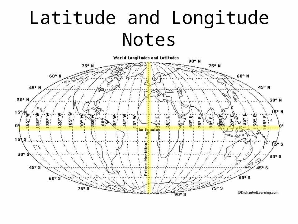
Latitude and Longitude
• Are imaginary lines on a map
• They help you to pin point an exact location on a map

LatitudeTells you how far NORTH or SOUTH of the equator you are. 0 (zero)
degrees latitude is called the EQUATOR.

10
10
20
20
0
30
40
50
60
70
80
90
30
40
50
60
70
80
90
01515
3045
6075
90105
120135
150165
180 3045
6075
90105
120135
150165
180
E
F
G
H

LongitudeTells you how far EAST or WEST of
the prime meridian you are. 0 (zero) degrees
longitude is called the PRIME MERIDIAN.

Longitude• Imaginary lines extending
from the North and South Pole.
• Measured 0-180 degrees, E & W of the Prime Meridian (0 degrees)– 180 degrees Longitude
= International Dateline
Time Zones

10
10
20
20
0
30
40
50
60
70
80
90
30
40
50
60
70
80
90
01515
3045
6075
90105
120135
150165
180 3045
6075
90105
120135
150165
180
E
F
G
H
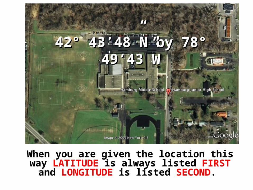
When you are given the location this way LATITUDE is always listed FIRST and LONGITUDE is listed
SECOND.
42° 43’48”N by 78° 49’43”W42° 43’48”N by 78° 49’43”W

Brain Pop – Latitude and Longitude
• http://www.brainpop.com/socialstudies/geography/latitudeandlongitude/preview.weml ( 4 min)

Plot the Following Points on Your Map

10
10
20
20
0
30
40
50
60
70
80
90
30
40
50
60
70
80
90
01515
3045
6075
90105
120135
150165
180 3045
6075
90105
120135
150165
180
E
F
G
H

10
10
20
20
0
30
40
50
60
70
80
90
30
40
50
60
70
80
90
01515
3045
6075
90105
120135
150165
180 3045
6075
90105
120135
150165
180
E
F
G
H
On the coordinate system, plot the coordinates given in your notes:

10
10
20
20
0
30
40
50
60
70
80
90
30
40
50
60
70
80
90
01515
3045
6075
90105
120135
150165
180 3045
6075
90105
120135
150165
180
E
F
G
H
State the coordinates for each of the letters in the figure above:


