Lecture 4 Background about the atmosphere and rotating systems • Variation of temperature, pressure and density with height in the atmosphere • Relationship between wind and pressure in rotating systems • Frictional boundary layers in rotating systems
Transcript
Lecture 4 Background about the atmosphere and
rotating systems • Variation of temperature, pressure and
density with height in the atmosphere • Relationship between wind and pressure
in rotating systems • Frictional boundary layers in rotating
systems
• The basic source of energy for atmospheric circulation is the radiation from the sun.
• The sun is very hot with temperatures around 6000K. The wavelength of maximum emission is inversely proportional to the temperature of the radiating body. Hence the incoming solar radiation is short wave radiation .
• The earth-atmosphere system, in turn emits radiation at long wavelengths (3.5 to 50 microns with a peak around 10 microns), because it is cooler (257K). The associated net radiative cooling of the atmosphere is about 1.5oC/day.
• Since the atmosphere is almost transparent to the incoming short-wave radiation, it gets absorbed primarily at the surface of the earth, be it land or ocean. Thus, although the basic source of energy is the sun, the atmosphere is heated from below.
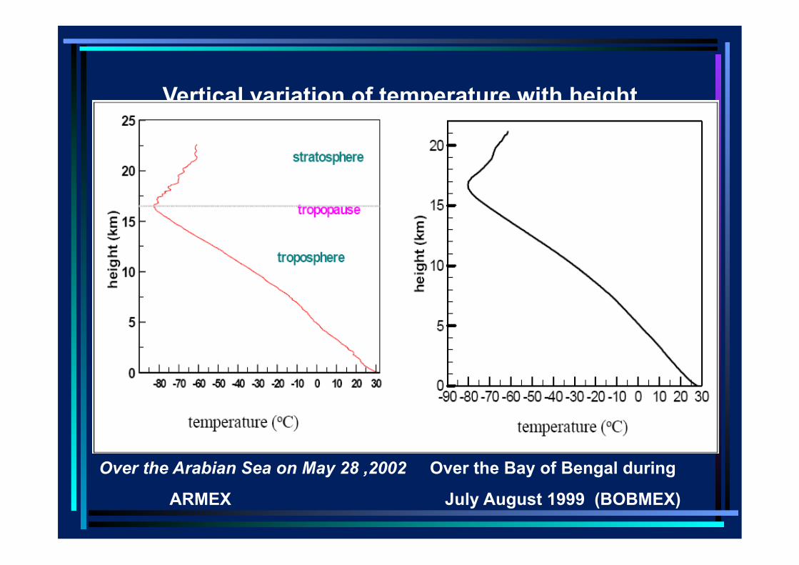
• Hence the temperature of the atmosphere decreases with height up to the tropopause which is around 15 kms in the tropics.
The temperature profiles observed over the Bay and Arabian Sea during the Bay of Bengal and Monsoon Experiment (BOBMEX) and the Arabian Sea Monsoon Experiment (ARMEX) by scientists on the ship O R V Sagarkanya are shown in the next slide.
Vertical variation of temperature with height
Over the Arabian Sea on May 28 ,2002 Over the Bay of Bengal during
ARMEX July August 1999 (BOBMEX)
• It is seen that above the tropopause, in the stratosphere, the temperature increases with height. This is because of absorption of sun’s ultraviolet radiation by ozone, which occurs primarily in the stratosphere.
Pressure Under the influence of the earth’s
gravitational field, the entire mass of the atmosphere exerts a force upon the surface of the earth, known as pressure. Usually pressure is expressed as a force per unit area. Atmospheric pressure is generally expressed in units of millibars (mb). One millibar is 1000 dynes/cm2.
• Recently the unit Pascal (after the French physicist) has become more popular. Pascal is defined so that 1mb is 100 Pascals or one hPa. The pressure that supports a mercury column of 76 cms i.e. the whole atmosphere, is close to 1000hpa. The corresponding weight of the whole atmosphere is 1kg/cm2, showing how light air is!
The atmosphere is almost in hydrostatic balance. Thus the pressure at any point is simply the weight of the air column above the point. Hence the pressure decreases with height.
Density • If we consider an incompressible fluid
like water, pressure would decrease with height at a uniform rate as more and more of the mass of the fluid is left below. However, the atmosphere is highly compressible, it expands with decreasing pressure and becomes compressed with increasing pressure. Thus the density, which is defined as the mass of the atmosphere per unit volume, decreases with a lowering of the pressure.
• This implies that the density decreases with height in the atmosphere. Thus, the atmosphere is stably stratified.
• Stability: A system is said to be stable if when perturbed, it returns to its original state. In other words, in a stable system if we introduce a small perturbation, its magnitude decreases with time. On the other hand, if the system is unstable the perturbation grows with time.
• In the case of the atmosphere, since heavier air is below lighter air, if a parcel of air is displaced vertically upwards, it will be heavier than the surrounding air and will return to its original level.
Because the density decreases with height, pressure decreases at a lesser and lesser rate, the farther we go from the surface of the earth. This is seen in the variation of pressure with height. What matters for fluid flow is pressure gradients.
Relationship between winds & pressure
• First consider the relation between winds and pressure patterns. The location of the minimum surface pressure (trough) in July (next slide) is shown as a red line.
• As one moves northward from the tip of the Indian peninsula, the surface pressure decreases up to the location of the trough.
July November Seasonal variation of the direction of the mean pressure, surface wind
• Thus there is a meridional (north-south) pressure gradient over a large part of the Indian region. This pressure gradient persists up to a few kilometres from the surface.
• We know that water always flows down a pressure gradient. Analogously one would expect the winds to be from the south to the north (southerly). Why, instead, are they from the southwest?
• We note that (i) we measure winds relative to the earth which rotates relative to the inertial frame and (ii) the spatial scale of the system we are considering is large (thousands of kilometers).
• For such large scales, the rotation of the earth becomes important.
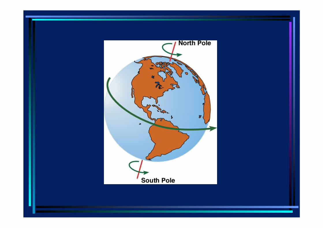
• The oceans and the atmosphere are a thin layer of fluid over the earth, with typical depth of the oceans of about 5 kms and height of the troposphere (the seat of all action, for weather and climate) of about 15kms, while the radius of the earth is about 7000 kms. For flows with spatial scales which are much larger than the vertical extent of these systems, only the component of rotation about the local vertical (proportional to the sine of the latitude) is important.
Axis of rotation
Local vertical
• In rotating fluids, an additional force called the Coriolis force has to be incorporated in the equations of motion. The Coriolis force is proportional to the wind velocity and acts at right angles to it, and to the right of the wind vector in the northern hemisphere of the earth.
• Effects of the rotation of the earth are strong in fluid flow in which the velocity relative to the rotating earth is not large. At the equator the velocity of rotation is 440 m/sec while the relative velocity (of the wind we measure) is at most 40 m/sec.
•
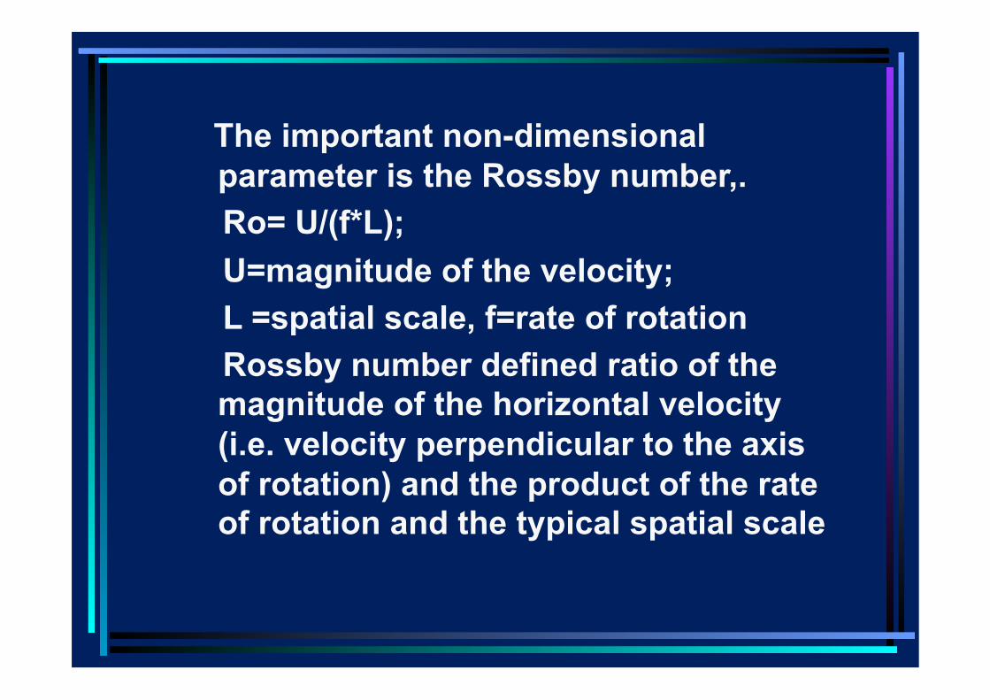
The important non-dimensional parameter is the Rossby number,.
Ro= U/(f*L); U=magnitude of the velocity; L =spatial scale, f=rate of rotation Rossby number defined ratio of the
magnitude of the horizontal velocity (i.e. velocity perpendicular to the axis of rotation) and the product of the rate of rotation and the typical spatial scale
• When the Rossby number is small and frictional forces are unimportant, the basic balance is between the pressure gradient and the Coriolis force.
• The balance between the pressure gradients and Coriolis force is called ‘Geostrophy’ and the associated winds or currents, geostrophic winds or currents.
• To understand the relationship between geostrophic winds and pressure, consider a simple example.
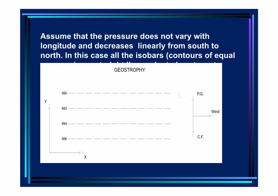
Assume that the pressure does not vary with longitude and decreases linearly from south to north. In this case all the isobars (contours of equal pressure) are straight lines oriented east-west.
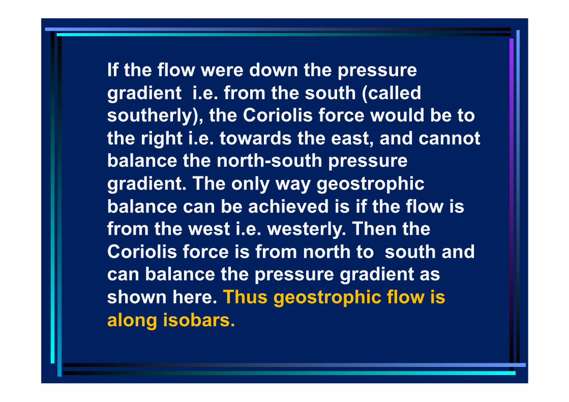
If the flow were down the pressure gradient i.e. from the south (called southerly), the Coriolis force would be to the right i.e. towards the east, and cannot balance the north-south pressure gradient. The only way geostrophic balance can be achieved is if the flow is from the west i.e. westerly. Then the Coriolis force is from north to south and can balance the pressure gradient as shown here. Thus geostrophic flow is along isobars.
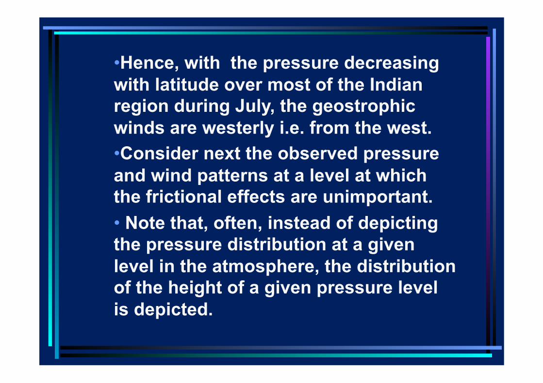
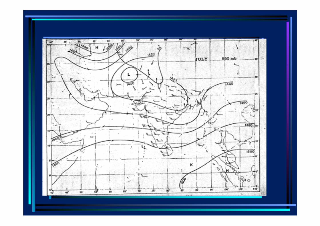
• Hence, with the pressure decreasing with latitude over most of the Indian region during July, the geostrophic winds are westerly i.e. from the west. • Consider next the observed pressure and wind patterns at a level at which the frictional effects are unimportant. • Note that, often, instead of depicting the pressure distribution at a given level in the atmosphere, the distribution of the height of a given pressure level is depicted.
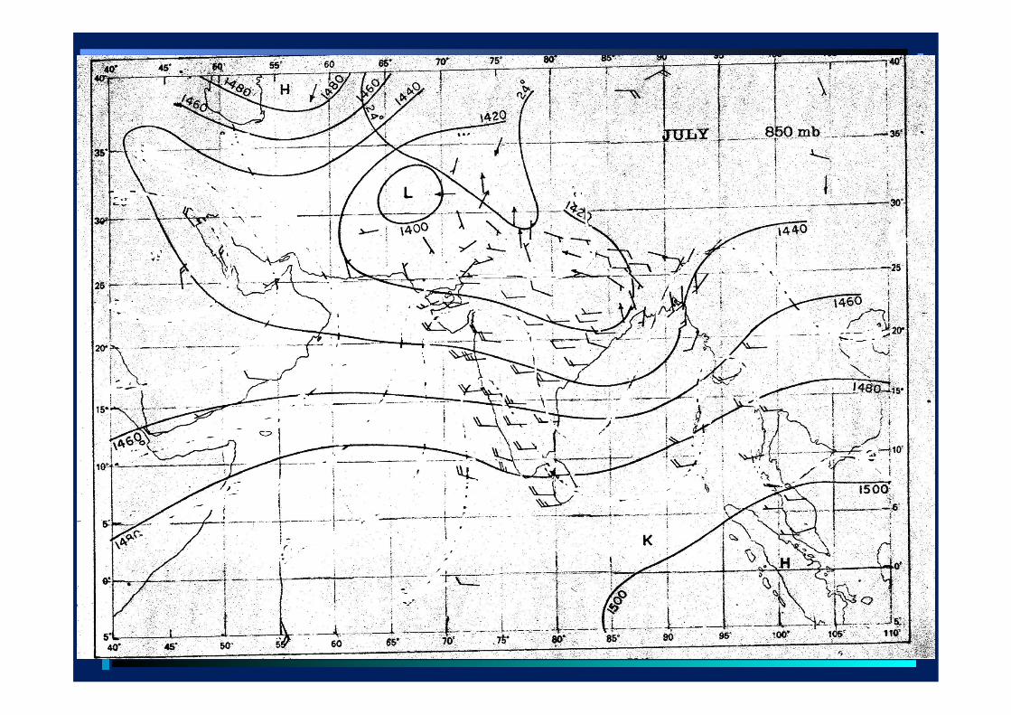
• In the next slide, the mean variation with height of the 850 hpa pressure level for July is shown along with the mean July winds at that level. The height is around 1.5 kms and at this pressure level, frictional effects are not important.
• It is seen that the wind vectors tend to be parallel to the contours of constant height, being westerly over the region south of trough.
Frictional effects, Boundary layers • In order to understand why the winds are southwesterly near the surface , we need to consider frictional effects which become important near the surface . I consider next frictional effects in fluids of low viscosity.
• For air and water, the viscosity is very small. The kinematic viscosity at atmospheric pressure and 200C for glycerine is 6.4, engine oil 10.4, water 0.01and for air 0.15 cm2/sec.
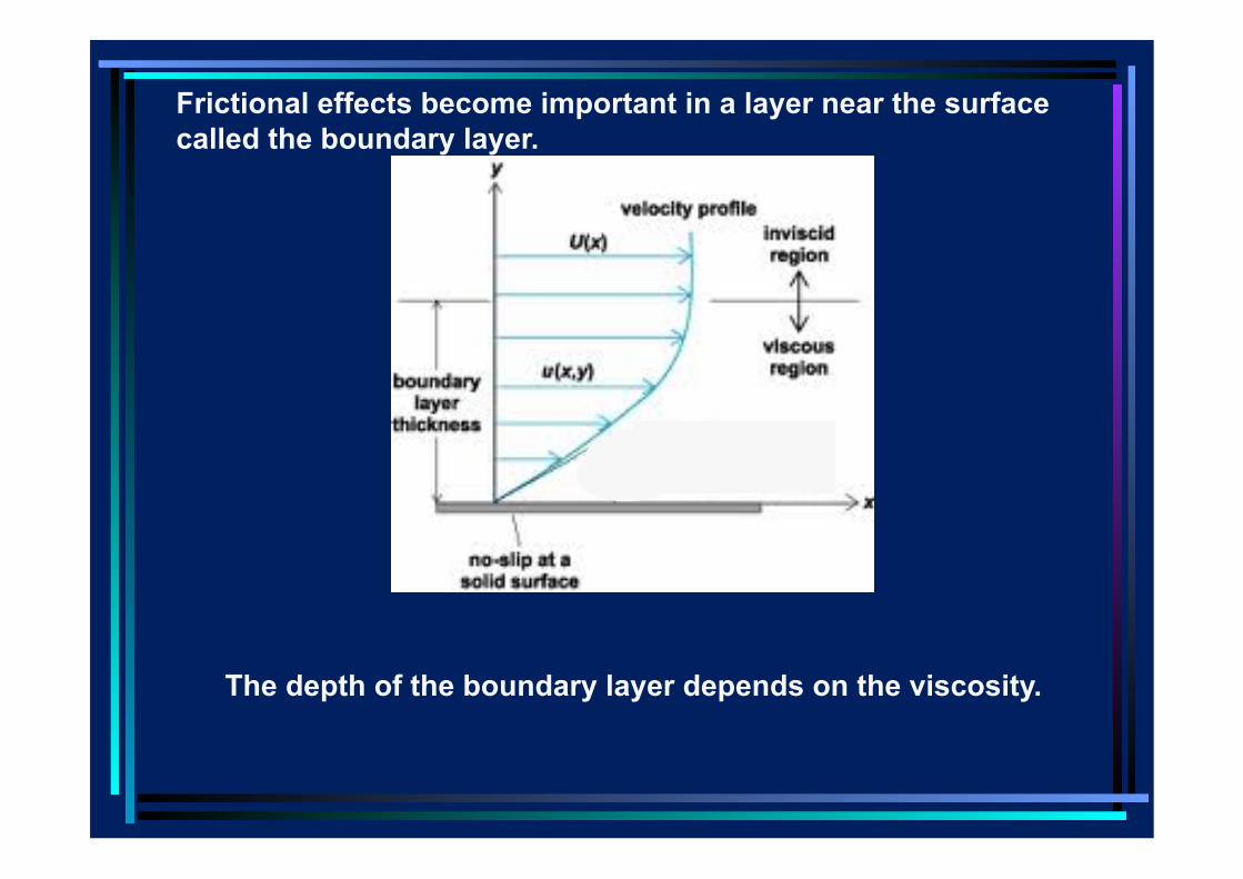
• Consider first the simple problem of flow of air past a flat plate in the laboratory. However small their viscosity, real fluids like air cannot slip past the plate. Hence at the surface of the plate , no slip condition has to be satisfied.
Frictional effects become important in a layer near the surface called the boundary layer.
The depth of the boundary layer depends on the viscosity.
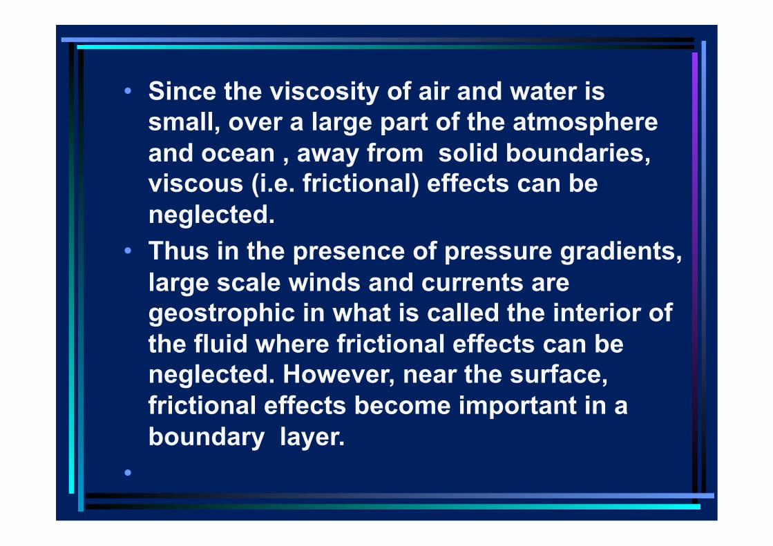
• Since the viscosity of air and water is small, over a large part of the atmosphere and ocean , away from solid boundaries, viscous (i.e. frictional) effects can be neglected.
• Thus in the presence of pressure gradients, large scale winds and currents are geostrophic in what is called the interior of the fluid where frictional effects can be neglected. However, near the surface, frictional effects become important in a boundary layer.
•
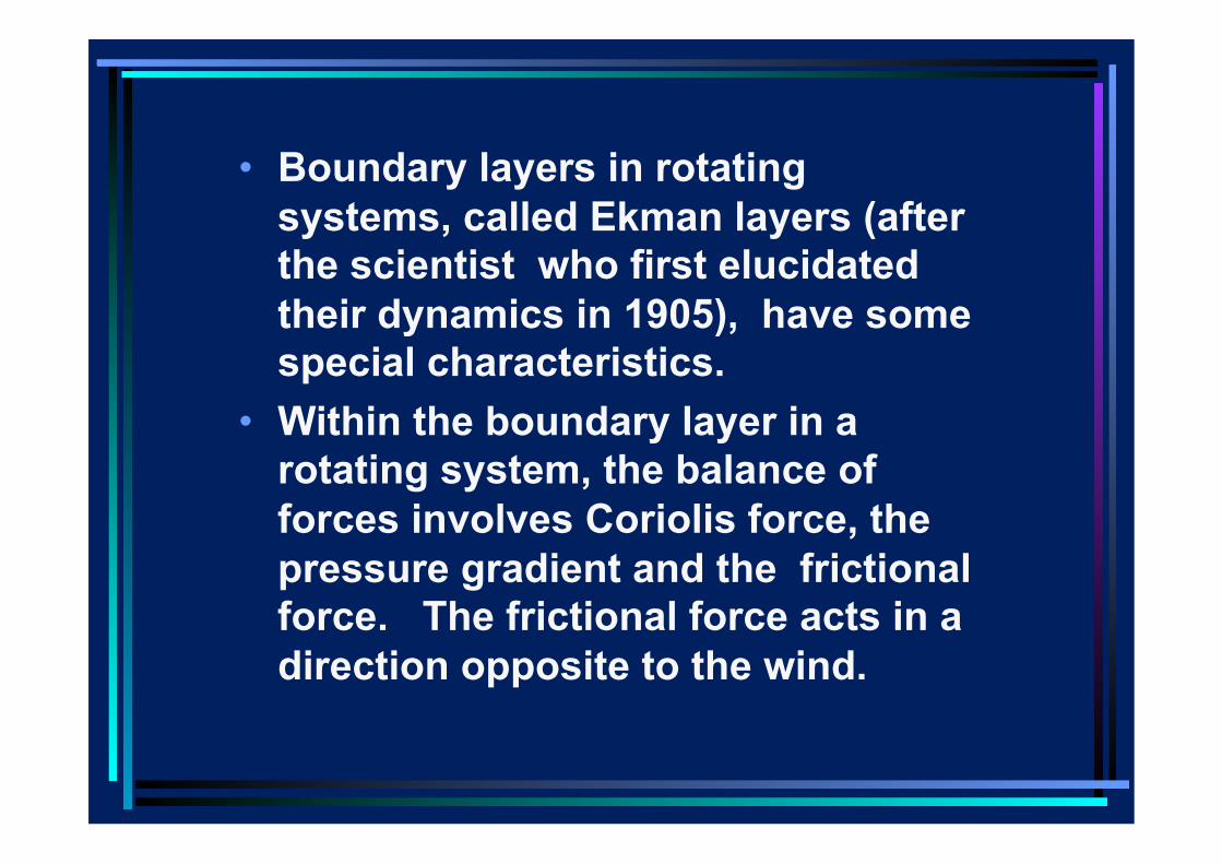
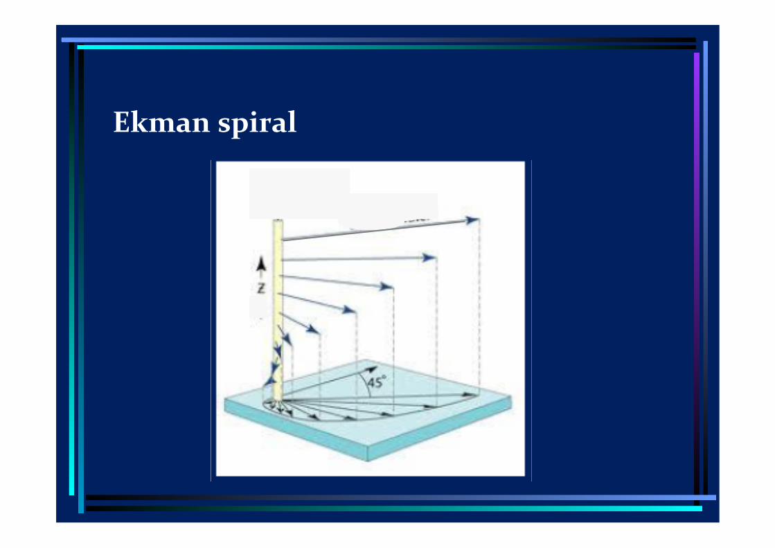
• Boundary layers in rotating systems, called Ekman layers (after the scientist who first elucidated their dynamics in 1905), have some special characteristics.
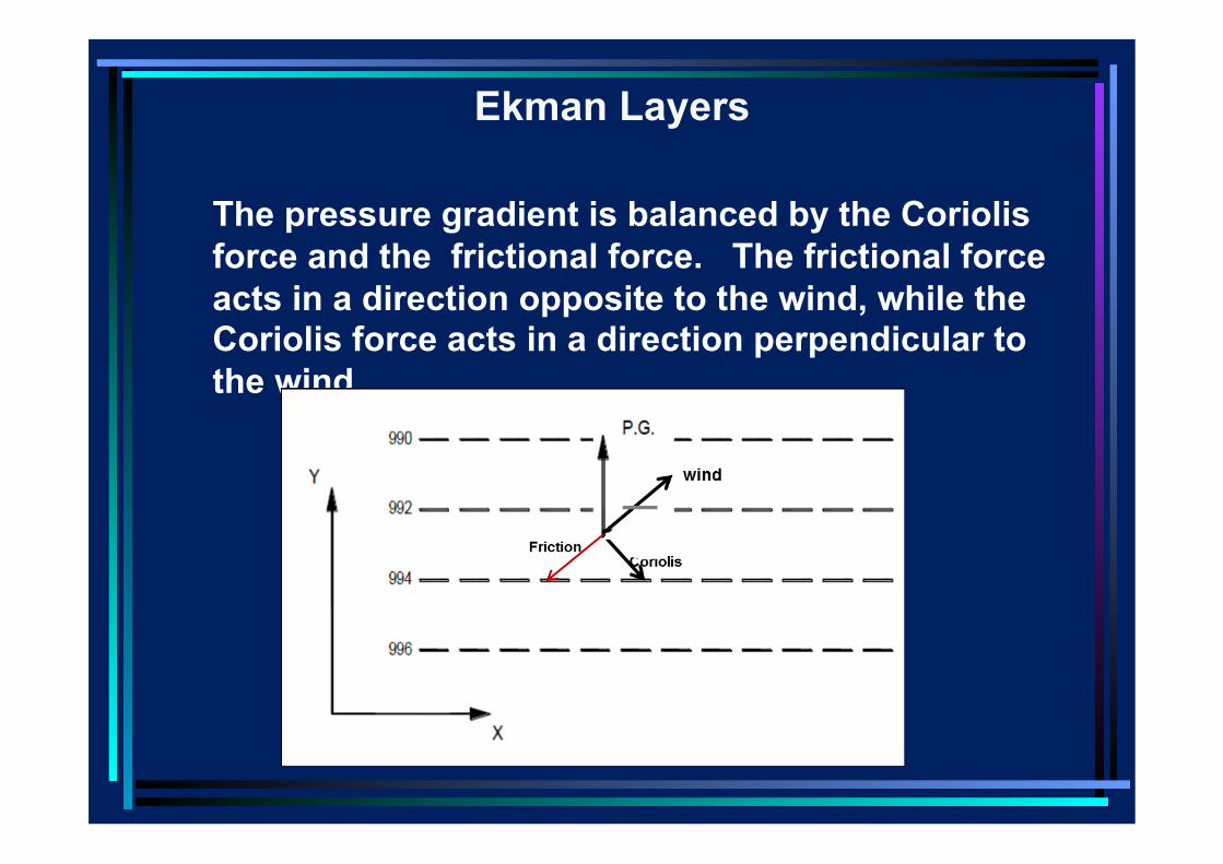
• Within the boundary layer in a rotating system, the balance of forces involves Coriolis force, the pressure gradient and the frictional force. The frictional force acts in a direction opposite to the wind.
The pressure gradient is balanced by the Coriolis force and the frictional force. The frictional force acts in a direction opposite to the wind, while the Coriolis force acts in a direction perpendicular to the wind.
Ekman Layers
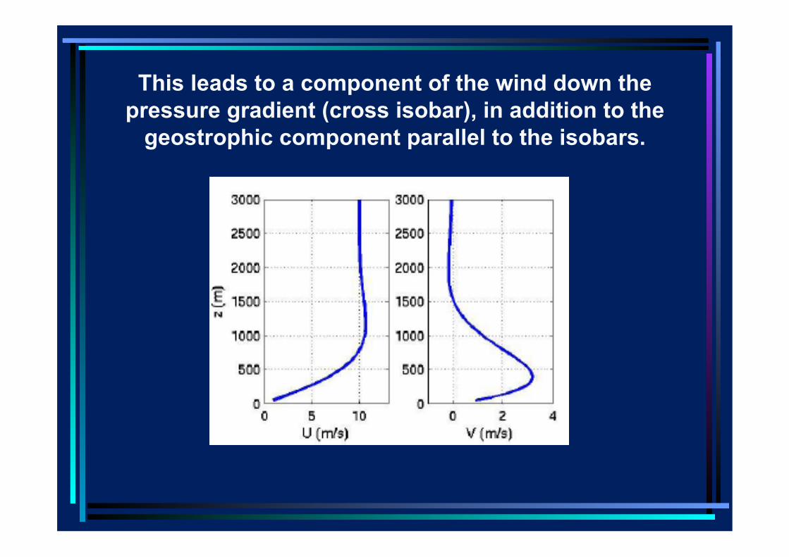
This leads to a component of the wind down the pressure gradient (cross isobar), in addition to the
geostrophic component parallel to the isobars.
Ekman spiral
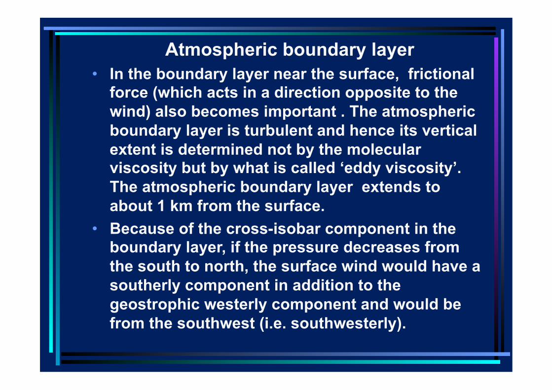
Atmospheric boundary layer • In the boundary layer near the surface, frictional
force (which acts in a direction opposite to the wind) also becomes important . The atmospheric boundary layer is turbulent and hence its vertical extent is determined not by the molecular viscosity but by what is called ‘eddy viscosity’. The atmospheric boundary layer extends to about 1 km from the surface.
• Because of the cross-isobar component in the boundary layer, if the pressure decreases from the south to north, the surface wind would have a southerly component in addition to the geostrophic westerly component and would be from the southwest (i.e. southwesterly).
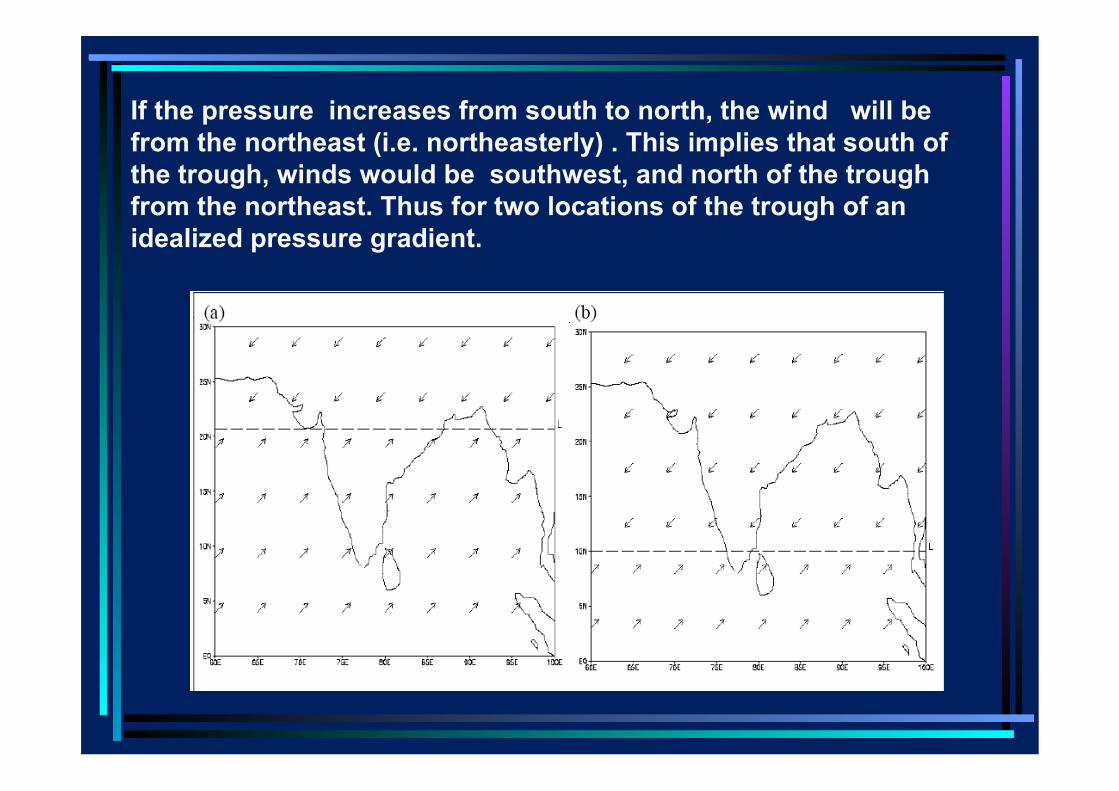
If the pressure increases from south to north, the wind will be from the northeast (i.e. northeasterly) . This implies that south of the trough, winds would be southwest, and north of the trough from the northeast. Thus for two locations of the trough of an idealized pressure gradient.
• Thus the meridional pressure gradient in July, over a large part of India and the surrounding seas (south of the trough) implies that the geostrophic winds (i.e. above the frictional boundary layer) would be westerly and the winds within the atmospheric boundary layer would be south-westerly.
• In November, the pressure decreases from north to south i.e. the pressure gradient reverses. This implies that surface winds would be northeasterly and winds above the boundary layer would be easterly over a large part of India and the surrounding seas.
• Thus the seasonal variation in the direction of winds is associated with the seasonal variation in the location of the trough
• Besides the change in the direction of the wind in the boundary layer, there is another feature of boundary layers in rotating systems which has an important bearing on clouds/convection.
• Before, elucidating that I consider perhaps the most important facet of flow in rotating systems viz. the vorticiy.
VORTICITY • Vorticity is defined as the curl of the velocity, and is related to the rotation of the flow.
• Suppose that an infinitesimally small sphere of the fluid is instantaneously solidified (made rigid) without any change in momentum , angular momentum or mass distribution. Then the sphere will start rotating with an angular velocity which is half the vorticity of the flow.
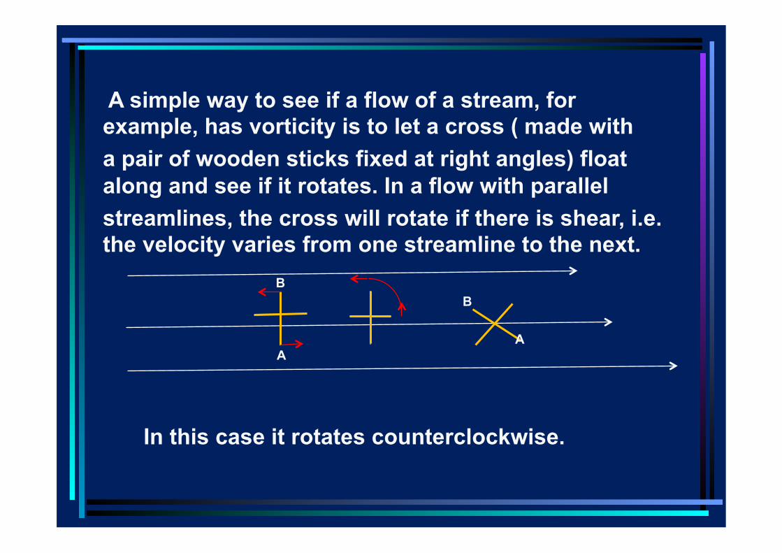
A simple way to see if a flow of a stream, for example, has vorticity is to let a cross ( made with a pair of wooden sticks fixed at right angles) float along and see if it rotates. In a flow with parallel streamlines, the cross will rotate if there is shear, i.e. the velocity varies from one streamline to the next.
A
B
A
B
In this case it rotates counterclockwise.
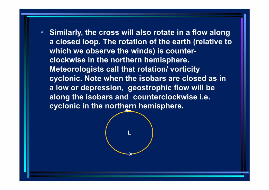
• Similarly, the cross will also rotate in a flow along a closed loop. The rotation of the earth (relative to which we observe the winds) is counter-clockwise in the northern hemisphere. Meteorologists call that rotation/ vorticity cyclonic. Note when the isobars are closed as in a low or depression, geostrophic flow will be along the isobars and counterclockwise i.e. cyclonic in the northern hemisphere.
L
• There is a very special characteristic of boundary layers in a rotating fluid.
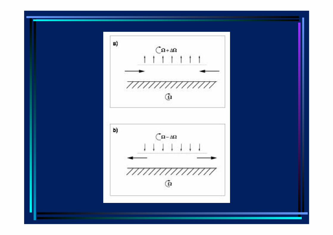
• In a rotating system when the flow above the surface boundary layer i.e. in the interior of the fluid (where viscous effects are negligible) has cyclonic vorticity, i.e., rotation in the same sense as the rotation of the earth, there is convergence of air in the boundary layer, giving rise to ascent above the boundary layer (a, next slide).
• On the other hand, when the vorticity in the interior is anticyclonic, the earth rotates faster than the air above the boundary layer, air diverges in the boundary layer, leading to descent of air from the interior to the boundary layer (b, last slide).
• The vertical velocity at the top of the boundary layer is proportional to the relative vorticity (i.e. vorticity derived from winds measured relative to the earth).
• In this way the effect of friction in the boundary layer communicated directly to the free atmosphere through a forced secondary circulation rather than indirectly by the slow process of viscous diffusion.
• It is seen that the mean July winds above the boundary layer are westerly to the south of the trough and easterly to the north. Thus the vorticity associated with this wind pattern is counter-clockwise or cyclonic i.e., rotation in the same sense as the rotation of the earth.
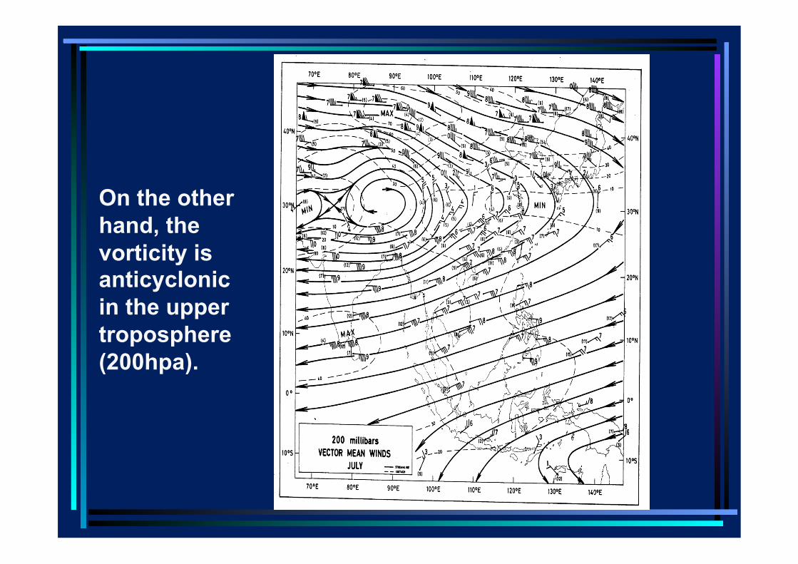
On the other hand, the vorticity is anticyclonic in the upper troposphere (200hpa).
When we consider systems that give us rainfall, we will see that perhaps the most important feature of synoptic and planetary scale systems which are large enough for the rotation of the earth to become important in their dynamics, is the cyclonic vorticity above the boundary layer, which is associated with the convergence of the moist air in the boundary layer and ascent of this air.
• Background • Variation of temperature, pressure and
density with height in the atmosphere • Relationship between wind and pressure
in rotating systems • Frictional boundary layers in rotating