1. Terrestrial Coordinate System A quick review:A quick review:
17
LESSON 15: LESSON 15: Celestial Celestial Coordinate Systems Coordinate Systems • Learning Objectives Learning Objectives – Know the ultimate goal of Know the ultimate goal of celestial navigation. celestial navigation. – Know the definitions of terms Know the definitions of terms and components associated with and components associated with the terrestrial, the terrestrial, celestial celestial , and , and horizon horizon coordinate systems. coordinate systems. – Know the relationship between Know the relationship between the terrestrial, the terrestrial, celestial celestial , and , and horizon horizon coordinate systems. coordinate systems. – Apply correct procedures to Apply correct procedures to describe the location of a describe the location of a celestial body in reference to celestial body in reference to the the celestial celestial and and horizon horizon coordinate systems. coordinate systems.
• Learning ObjectivesLearning Objectives– Know the ultimate goal of celestial Know the ultimate goal of celestial
navigation.navigation.– Know the definitions of terms and Know the definitions of terms and
components associated with the components associated with the terrestrial, terrestrial, celestialcelestial, and , and horizonhorizon coordinate systems.coordinate systems.
– Know the relationship between the Know the relationship between the terrestrial, terrestrial, celestialcelestial, and , and horizonhorizon coordinate systems.coordinate systems.
– Apply correct procedures to Apply correct procedures to describe the location of a celestial describe the location of a celestial body in reference to the body in reference to the celestialcelestial and and horizonhorizon coordinate systems. coordinate systems.
The Goal of Celestial The Goal of Celestial NavigationNavigation
• The solution of spherical The solution of spherical triangles of sides based on the triangles of sides based on the observed positions of celestial observed positions of celestial bodies, in order to determine bodies, in order to determine the position of a vessel.the position of a vessel.
• 100 years ago, this involved 100 years ago, this involved some complicated spherical some complicated spherical trigonometry.trigonometry.
• Today, it requires the use of Today, it requires the use of tables or a navigational tables or a navigational calculator (HP makes one).calculator (HP makes one).
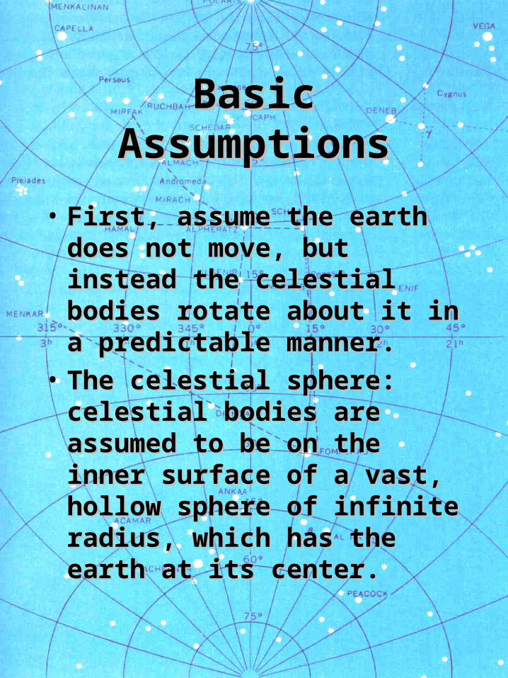
• First, assume the earth does First, assume the earth does not move, but instead the not move, but instead the celestial bodies rotate about celestial bodies rotate about it in a predictable manner.it in a predictable manner.
• The celestial sphere: The celestial sphere: celestial bodies are celestial bodies are assumed to be on the inner assumed to be on the inner surface of a vast, hollow surface of a vast, hollow sphere of infinite radius, sphere of infinite radius, which has the earth at its which has the earth at its center.center.
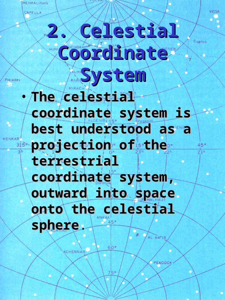
2. Celestial 2. Celestial Coordinate SystemCoordinate System• The celestial coordinate The celestial coordinate
system is best understood system is best understood as a projection of the as a projection of the terrestrial coordinate terrestrial coordinate system, outward into system, outward into space onto the celestial space onto the celestial spheresphere..
• Celestial Equator (Equinoctial)Celestial Equator (Equinoctial)• Celestial MeridiansCelestial Meridians• Hour CirclesHour Circles• Hour Circle of AriesHour Circle of Aries• DeclinationDeclination– celestial equivalent of latitudecelestial equivalent of latitude
• Hour AnglesHour Angles– celestial equivalent of longitudecelestial equivalent of longitude
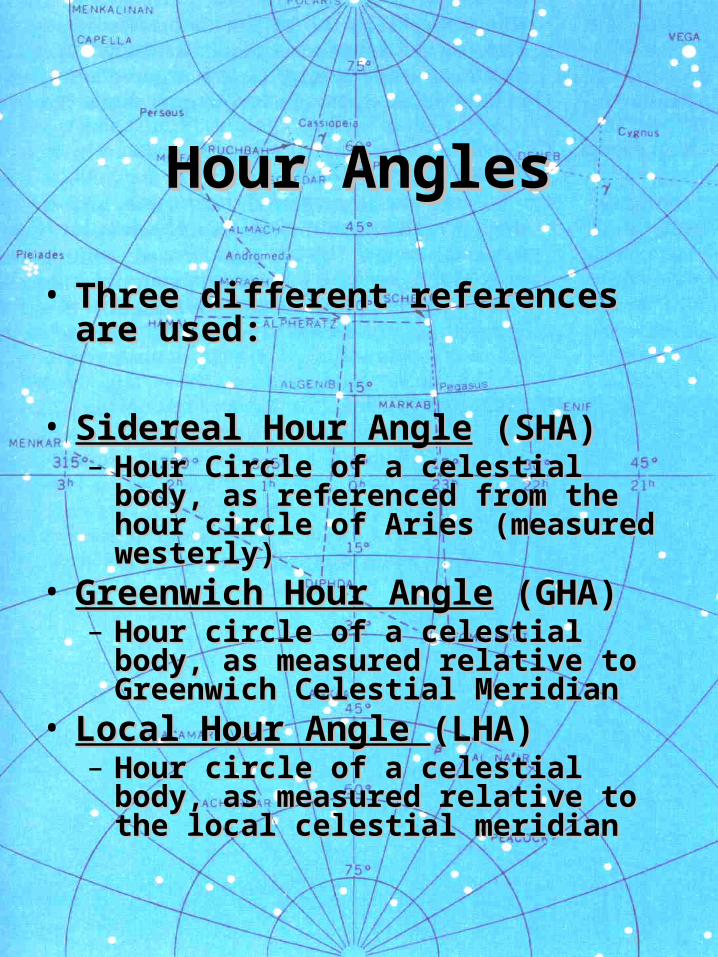
Hour AnglesHour Angles
• Three different references are Three different references are used:used:
• Sidereal Hour AngleSidereal Hour Angle (SHA) (SHA)– Hour Circle of a celestial body, as Hour Circle of a celestial body, as
referenced from the hour circle of referenced from the hour circle of Aries (measured westerly)Aries (measured westerly)
• Greenwich Hour AngleGreenwich Hour Angle (GHA) (GHA)– Hour circle of a celestial body, as Hour circle of a celestial body, as
measured relative to Greenwich measured relative to Greenwich Celestial Meridian Celestial Meridian
• Local Hour Angle Local Hour Angle (LHA)(LHA)– Hour circle of a celestial body, as Hour circle of a celestial body, as
measured relative to the local measured relative to the local celestial meridiancelestial meridian
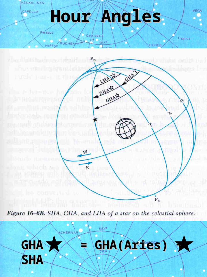
Hour AnglesHour Angles
GHA = GHA(Aries) + SHA GHA = GHA(Aries) + SHA
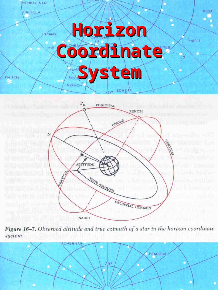
3. Horizon 3. Horizon Coordinate SystemCoordinate System
• In the terrestrial and celestial In the terrestrial and celestial coordinate systems, the basic coordinate systems, the basic references are the poles and the references are the poles and the equator.equator.
• The horizon coordinate system, The horizon coordinate system, however, is based on the however, is based on the observer’s observer’s position.position.
• This system is necessary This system is necessary because stars are sighted with because stars are sighted with respect to the observer’s respect to the observer’s position.position.
• Celestial HorizonCelestial Horizon– analogous to the equatoranalogous to the equator
• True Azimuth (ZTrue Azimuth (Znn))– analogous to longitudeanalogous to longitude
• AltitudeAltitude– analogous to latitudeanalogous to latitude
• Sextant Altitude (hSextant Altitude (hss))– Measured altitudes of celestial bodiesMeasured altitudes of celestial bodies
• Visible or Sea HorizonVisible or Sea Horizon– Used as a reference for celestial body Used as a reference for celestial body
altitude measurementsaltitude measurements• Observed Altitude (HObserved Altitude (Hoo))– Conversion of Sextant Altitude, since Conversion of Sextant Altitude, since
sea horizon is not at celestial horizon.sea horizon is not at celestial horizon.
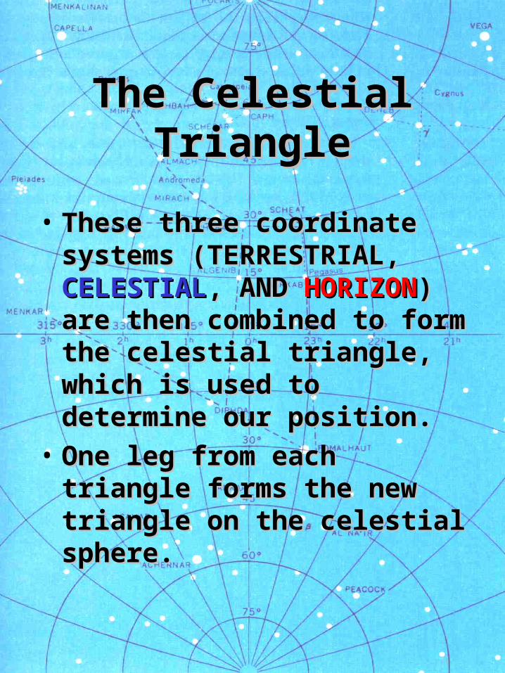
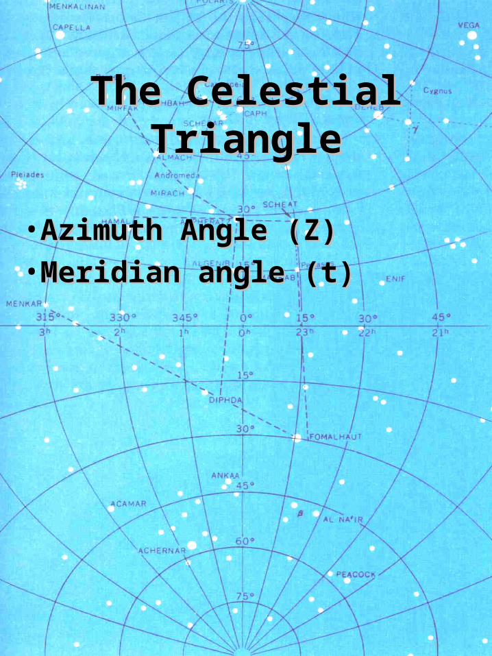
The Celestial The Celestial TriangleTriangle
• These three coordinate These three coordinate systems (TERRESTRIAL, systems (TERRESTRIAL, CELESTIALCELESTIAL, AND , AND HORIZONHORIZON) ) are then combined to form are then combined to form the celestial triangle, which the celestial triangle, which is used to determine our is used to determine our position.position.
• One leg from each triangle One leg from each triangle forms the new triangle on forms the new triangle on the celestial sphere.the celestial sphere.