Don Helmbrecht, Wildland Fire Analyst USFS TEAMS Enterprise Unit Tallgrass Prairie/Oak Savanna & Lake States Fire Science Consortia October 29, 2014 Local Customization of LANDFIRE Fuels Data on the Huron and Hiawatha National Forests
Transcript
Don Helmbrecht, Wildland Fire Analyst USFS TEAMS Enterprise Unit
Tallgrass Prairie/Oak Savanna & Lake States Fire Science Consortia
October 29, 2014
Local Customization of LANDFIRE Fuels Data on the
Huron and Hiawatha National Forests
Greg Seamon
Today: Customizing Data - Don Helmbrecht, Wildland Fire Analyst, USDA Forest Service, TEAMS Enterprise Unit. Local Customization of Fuels Data on the Huron-Manistee and Hiawatha National Forests. Previous TPOS & Lake States Consortia webinars are recorded and available: • LANDFIRE 101 – Randy Swaty’s introduction to LANDFIRE products and processes. • Assessing Needs - Tracy Hmielowski presented Where Should We Burn? A Fire Needs
Assessment for Wisconsin.
• LANDFIRE and TPOS/Lake States offered the series to talk about and illustrate LANDFIRE products and processes that can support large land management and planning.
• Others: Northwest Fire Science Consortium and the Northern/Southern Rockies Fire Science Networks
• Southern Fire Exchange series ends November 17: Curt Stripling, Geospatial Coordinator, Texas A&M Forest Service, and David Buckley, Principal Consultant, Technosylva, present Leveraging LANDFIRE for the Southern Wildfire Risk Assessment.
• Review of LANDFIRE application scale
• Common considerations
• Five-step conceptual framework
• Huron & Hiawatha examples
• Available resources & support
Presentation Overview
• Scale:
– Cartographic scale: a mathematical relationship between a given feature on a map and that feature on the ground; a ratio (e.g., 1:24,000).
– Spatial resolution: the pixel size (raster data) or MMU (polygon data).
– Application scale: specific geography for which the data can be appropriately applied without significant adjustment.
• LANDFIRE data is designed to be used “out-of-the-box” at the national, regional, or very-large landscape level.
• However, this varies by the specific application, geography/ecological and spatial complexity, and product.
LANDFIRE Application Scale
• Fire behavior fuel models are mapped using a rule-based approach.
• Rules are developed at the map zone level (range between 12 and 60 million acres).
• The “best fit” for the zone may not be the best fit for your local area.
• LANDFIRE FBFMs are mapped using a rule-based approach
• Fuel mapping rules identify combinations of biophysical setting, existing vegetation type and ranges of existing cover and height that would indicate a particular fuel model
Define Objectives Identify Data Requirements Critique Modify Analyze
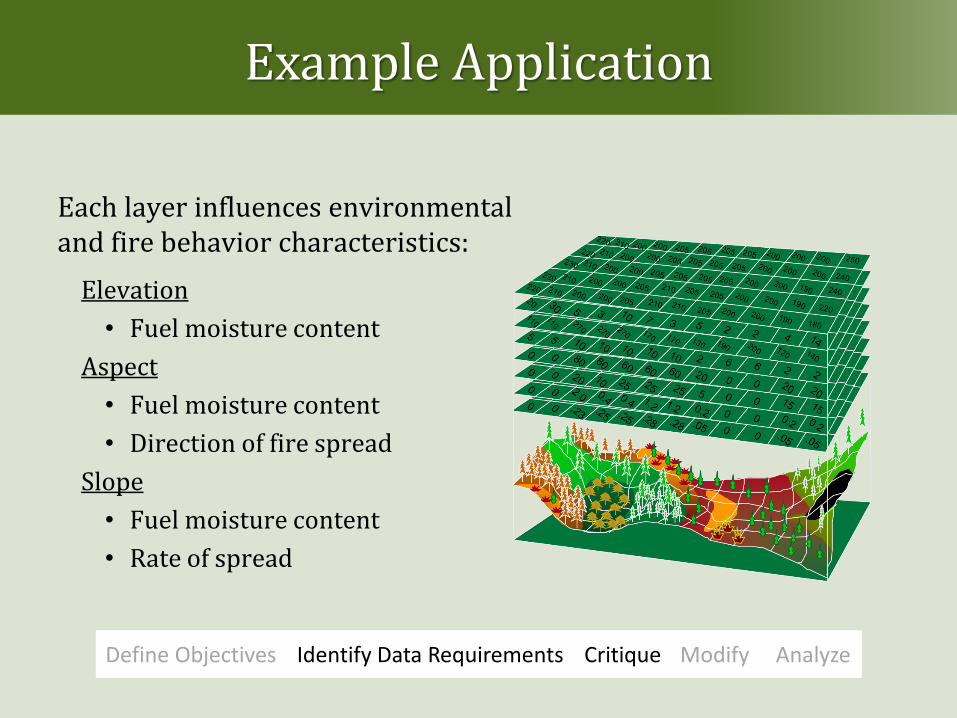
Example Application
Requires new data: Existing vegetation type
Existing vegetation cover
Existing vegetation height
Biophysical setting
Disturbance type, severity, and time since it occurred.
Define Objectives Identify Data Requirements Critique Modify Analyze
Example Application
• LANDFIRE Total Fuel Change Tool facilitates the critique, modification, and analysis of fuels data in one tool.
Define Objectives Identify Data Requirements Critique Modify Analyze
Example Application
Where is adjustment needed?
Define Objectives Identify Data Requirements Critique Modify Analyze
Modify assignment
Modify combinations and thresholds
Example Application
Define Objectives Identify Data Requirements Critique Modify Analyze
• Rules can be added, deleted, or modified and results easily remapped with the LFTFC tool.
• By changing a threshold the spatial distribution is modified.
Spatial distribution is modified
Example Application
Define Objectives Identify Data Requirements Critique Modify Analyze
Fuel model assignment is modified
Example Application
Define Objectives Identify Data Requirements Critique Modify Analyze
Example Application
Define Objectives Identify Data Requirements Critique Modify Analyze
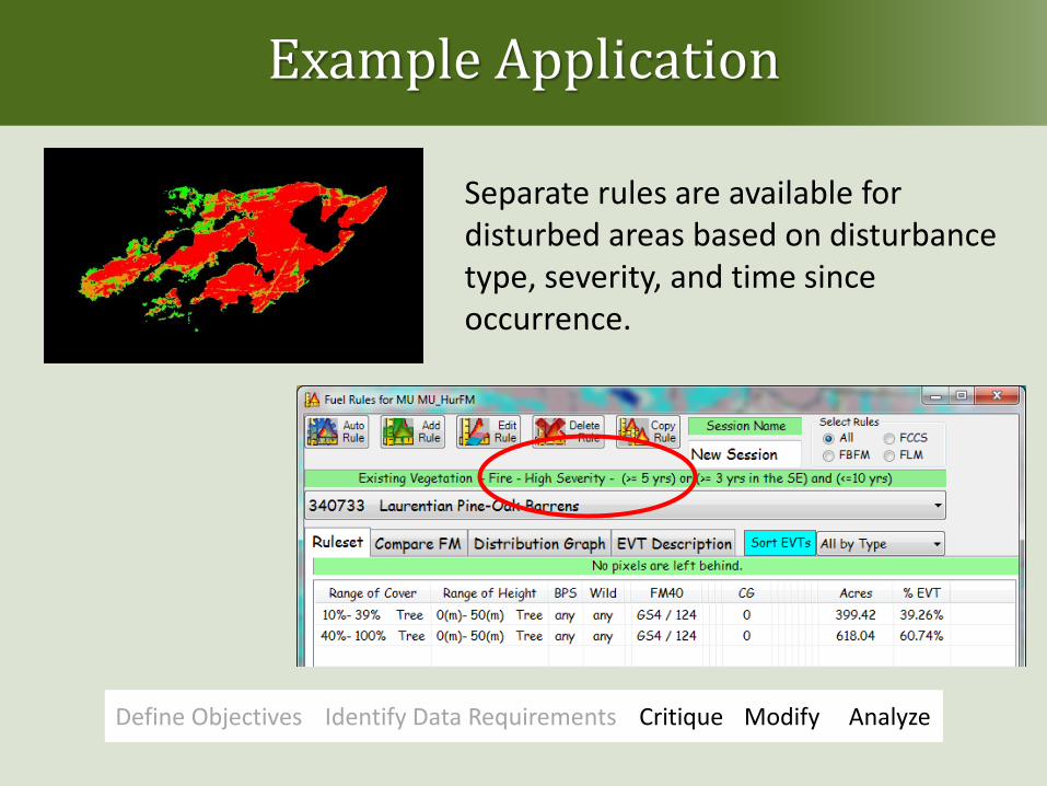
Separate rules are available for disturbed areas based on disturbance type, severity, and time since occurrence.
Example Application
Define Objectives Identify Data Requirements Critique Modify Analyze
Analysis:
• Review results to see if they pass the “straight face test.”
• Sometimes results can highlight hidden errors.
Example Application
Summary of Modification Steps:
• Updated the disturbance grid for time-since-disturbance and post-2008 disturbances.
• Updated canopy cover to reflect new disturbances.
• Critiqued FBFM mapping rules and made modifications where needed based on local expertise.
• Conducted preliminary fire behavior modeling to evaluate data modifications.
What does it take?
Expertise
Time
Expense
Resources and Support
Modifying LANDFIRE data guide www.conservationgateway.org www.frames.gov/wfmrda-ffe