March 2008 Newsletter Wilderness: A Contemporary Archaeology of an Appalachian Landscape By Jodi Barnes* Places, such as national parks and hiking trails, are often celebrated as wilderness and escapes from the problems of the modern world in the United States. Yet the wilderness we think of today -- the parks and forests -- is a product of the 20th century. For instance, Gifford Pinchot (1910) saw conservation as the ‘foresighted utilization, preservation and...renewal of forests, waters, lands and minerals, for the greatest good of the greatest number for the longest time’ and Benton MacKaye (1921) envisioned the Appalachian Trail as part of a plan to offset what he saw as the harm of rapid mechanization and urbanization. Today, the Appalachian Trail (affectionately called the AT) extends from Maine to Georgia for more than 2,174 miles through eight national forests and it is estimated that three and a half to four million people use the Trail each year. These examples of ‘wilderness’ are assumed to be natural and without history, therefore, they are often taken for granted as if they have always and will always be there. They are not seen as under threat of destruction and are seen as not having an impact on the land and people surrounding them. Forests and trails often occupy rural spaces and these spaces continue to be occupied, abandoned, and re-configured as policy makers, developers and consumers transform ‘historic’ buildings and landscapes. The wilderness landscape has a history that tends to be erased by the hegemonic view of the mountain landscape as scenic (Speer 1992). The wilderness also has a present and future. For example, in discussing the problems of urban sprawl Don Owen, the Environmental Protection Specialist for the Trail, describes the AT as “this little ribbon of wilderness, threatened pretty much along its entire length” (Don Owen in Ness 2003: 41). Pam Underhill, the Park Manager adds, “We’re in everybody’s way who wants to get across the Appalachians for a powerline, pipeline, road, telephone line, driveway” (Pam Underhill in Ness 2003: 43). Increasingly, “civilization” or suburbia moves closer eroding away the edges of a wilderness that is supposed to be an escape. The AT and the forest are products of the recent past. As such, they provide insights for understanding the world we live in today, since changes in the recent past are connected to contemporary conditions. Following a trend in British archaeology (e.g., Bradley et al. 2004; Buchli and Lucas 2001; Schofield et al. 2002), this paper takes the recent or contemporary past as its 1
Transcript
March 2008 Newsletter
Wilderness: A Contemporary Archaeology of an Appalachian Landscape
By Jodi Barnes* Places, such as national parks and hiking trails, are often celebrated as wilderness and escapes from the problems of the modern world in the United States. Yet the wilderness we think of today -- the parks and forests -- is a product of the 20th century. For instance, Gifford Pinchot (1910) saw conservation as the ‘foresighted utilization, preservation and...renewal of forests, waters, lands and minerals, for the greatest good of the greatest number for the longest time’ and Benton MacKaye (1921) envisioned the Appalachian Trail as part of a plan to offset what he saw as the harm of rapid mechanization and urbanization. Today, the Appalachian Trail (affectionately called the AT) extends from Maine to Georgia for more than 2,174 miles through eight national forests and it is estimated that three and a half to four million people use the Trail each year. These examples of ‘wilderness’ are assumed to be natural and without history, therefore, they are often taken for granted as if they have always and will always be there. They are not seen as under threat of destruction and are seen as not having an impact on the land and people surrounding them. Forests and trails often occupy rural spaces and these spaces continue to be occupied, abandoned, and re-configured as policy makers, developers and consumers transform ‘historic’ buildings and landscapes. The wilderness landscape has a history that tends to be erased by the hegemonic view of the mountain landscape as scenic (Speer 1992). The wilderness also has a present and future. For example, in discussing the problems of urban sprawl Don Owen, the Environmental Protection Specialist for the Trail, describes the AT as “this little ribbon of wilderness, threatened pretty much along its entire length” (Don Owen in Ness 2003: 41). Pam Underhill, the Park Manager adds, “We’re in everybody’s way who wants to get across the Appalachians for a powerline, pipeline, road, telephone line, driveway” (Pam Underhill in Ness 2003: 43). Increasingly, “civilization” or suburbia moves closer eroding away the edges of a wilderness that is supposed to be an escape. The AT and the forest are products of the recent past. As such, they provide insights for understanding the world we live in today, since changes in the recent past are connected to contemporary conditions. Following a trend in British archaeology (e.g., Bradley et al. 2004; Buchli and Lucas 2001; Schofield et al. 2002), this paper takes the recent or contemporary past as its
1
Figure 1. Map of the Appalachian Trail.
starting point. As the “archaeology of ten minutes ago” (Barnes and Gadsby 2008), this paper starts from the present to consider the archaeology of the modern Appalachian landscape. As John Schofield (2007: 2) states:
By recognising the historic environment as an artefact -- a construct, the result of the action and interaction of natural and human factors -- and by taking a long-term perspective on future views of our own times, we can ensure that recent changes are recognised alongside those of antiquity; and we can begin to recognise their evidential value, their capacity to teach us about ourselves and about contemporary society.
2
Figure 2. The Appalachian Trail.
The landscape is not an accumulated record of continuity and tradition, which gives us access to an authentic past. This is an ideological notion of landscape that conceals inequality and conflict (Daniels 1989; Bender 1998). Instead each new addition to the landscape -- in this case, slavery, tenancy, displacement, and conservation -- enters into a dialogue with the past (McGuire 1991). This Appalachian landscape has a ‘social life’ with a material history (Appadurai 1988). It has developed and evolved in response to forces of nature and economic, political and social conditions. It has been enculturated as people moved into the natural world and marked that intrusion physically and materially (Meskell 2005: 7). As individuals shape and modify the landscape to provide housing, accommodate the system of production, facilitate communication and transportation, mark social inequalities, and express aesthetics, people and the landscape gather time, movement and change. Both people and landscapes are constantly transformed, and these transformations of person and the landscape are tied up with each other (Gosden and Marshall 1999: 169). In this paper, I use archaeological methods and theory to move between social scales -- nation, region, county, individual -- and scales of time -- past and present -- to connect a particular section of the Appalachian Trail with contemporary concerns in the Blue Ridge Mountains of Virginia. I combined two practices that have been utilized in the formation of object biographies: (1) ethnographic research that renders a narrative of how certain objects -- in this case the landscape -- are perceived and experienced by the persons that they are linked to (Hoskins 1993, 1998; Keane 1997; MacKenzie 1991), and (2) archaeological research which ‘interrogates objects themselves’ and tries to make mute objects ‘speak’ by placing them in a historical context, linking them to written and ethnographic sources (Meskell 2004; Miller 1998; Thomas 1996; Tilley 1996, 1999).
3
Brown Mountain Creek: A Section of the AT in Amherst County, Virginia
In the Blue Ridge Mountains of Virginia, a section of the AT winds through a hardwood forest between Long and Brown mountains. Hiking along this section of the Trail, one wanders alongside Brown Mountain Creek as it bubbles toward the Pedlar River, which flows into the James. Orchids and wild geraniums bloom, and cinnamon ferns unfurl their fronds. Ovenbirds, redstarts, and pileated woodpeckers sing and deer can sometimes be seen grazing on the mountainside. Looking a little closer, the hiker may also notice the stone foundations or the chimney falls with periwinkle growing up the back.1 Yet it is difficult to imagine the agricultural terraces, tobacco fields, orchards, and gardens that were once a part of life along Brown Mountain Creek. Two interpretive signs placed along the Trail hint to what life may have been like for sharecropping families. These signs bring the past and the present into a dialogue as hikers and trail maintainers move through the landscape.
Figure 3. House foundation, 44AH0587.
4
Figure 4. Map of the area.
Mountain farms: Slavery and Tenancy in the Blue Ridge
During westward expansion, the Blue Ridge Mountains and the Great Valley of Virginia became the Appalachian and the American frontier (Straw 2006: 3). As life in the colonies became more settled and secure and the English migrants positioned themselves as the coastal elite, immigrant populations, particularly English, Scotch-Irish and German, began to grow, putting pressure on eastern towns and farmlands. As a result of the growth in immigrant populations, resource exploitation, and the conquest of the Indian lands, many colonial leaders urged westward expansion as a vital key to a prosperous future (Cook 2000; Straw 2006). Increasingly after 1750, settlers came to what is now Amherst County, which is situated along the north bank of the James River and straddles a dividing line between the Appalachian Plateau and the Blue Ridge Mountains. The settlers brought an entrepreneurial desire to join the ranks of the plantation South, or at least compete within the emerging agrarian economy. Thus the primary resource sought was the land itself (Cook 2000). At this time, wilderness referred to desolate, wild places untouched by ‘civilization’ and the first settlers diligently set about improving -- fencing and farming -- nature (Steinberg 2002), establishing the farm-and-forest economy through Euro-American and African-American labor.2
5
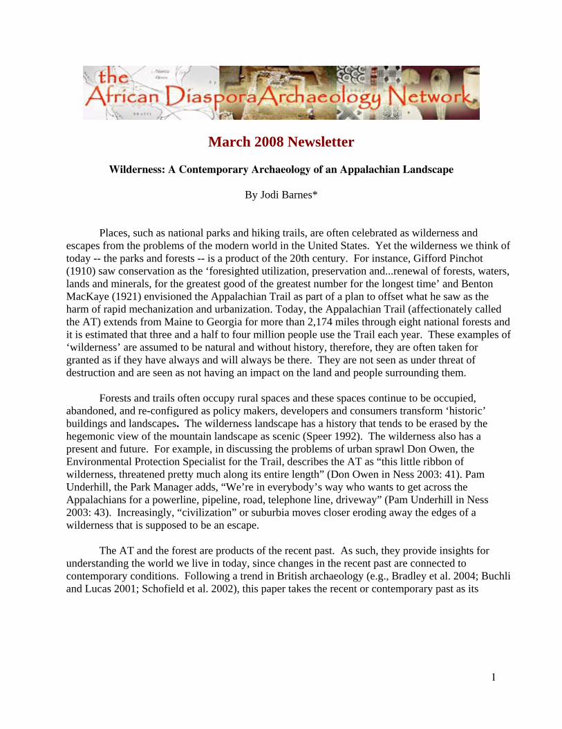
Figure 5. Stone wall along Brown Mountain Creek.
For a time, the indentured servitude of Germans or Scotch-Irish was the major source of
labor on mountain farms and plantations. Yet African slavery increasingly became a significant form of labor in the mountains of Virginia. Slavery did not function alone; land provided the economic basis for the structuring of polarized local economies in which slaveholders amassed a majority of the acreage of land while more than half the white households remained landless (Dunaway 2003).
Jesse Richeson, a Euro-American, began acquiring land by purchase and by grant in
1812. He acquired a mill along the Pedlar River and amassed about 2,000 acres consolidating land from some of the original land grants in the area. Richeson built a small plantation producing corn and tobacco. He owned about 39 slaves and possibly rented houses and land to tenants.
Laborers cleared Jesse Richeson’s land and made it productive. They cut the timber,
tilled the soil, planted and harvested the crops, and worked in the mill, which functioned as a gristmill, producing ground corn and flour, and a sawmill. According to Jesse Richeson’s will, an enslaved laborer named Mose was the miller.3
Following the Civil War, Mose Richeson became one of a few freed slaves to attain land
in Appalachia. In 1868, Mose Richeson purchased 220 acres of land along Brown Mountain Creek. Taft Hughes, a former resident along Brown Mountain Creek, told Dave Benavitch (1992):
6
Mose run the mill down on Pedlar. His father was a slaveholder and Mose Richardson was his son by a slave woman. Back in them days they had a way of taking an acreage of land, so he let his son by this slave woman run the mill so he made a little money. So that’s the reason he came by the land on Brown Mountain Creek.
Land gave former enslaved laborers freedom -- freedom from being subject to the will of their former owners. The mountain land provided Mose the ability to support his family and control the means of production. Mose Richeson became one of the largest landowners in the area at the time with his sons continuing the land acquisition after his death in 1898. Most of the mountain land was under cultivation, with some of the land rented to tenants.
Now I know you are probably thinking -- isn’t this article about the recent past? It still is. As I talked with Trail Club members, descendant and local communities, the history of the forest and the AT became inextricably intertwined with the stories of slavery and tenant farming. Yet what was so often left out was displacement and the creation of the National Forest.
Displacement: Land and Water in an Industrial Economy
The capital investment in the railroad and basic industries in the last decades of the 19th century lifted expansion to a crescendo and transformed much of Appalachia from a rural agricultural economy to one in which major sub-regions became dependent on industry (Lewis 2004: 59). The lives of the African American families living along Brown Mountain Creek were affected by the economic development from the industrial revolution and the expansion of cities. These changes combined with population growth, the timber boom, and the conservation movement transformed the farm and forest economy, dislocated farm families, and recreated the Appalachian landscape. Agricultural production had bound the rural areas of Amherst County, Virginia with the more urban centers such as Lynchburg. The transformation of the economy from tobacco cultivation to manufacturing had consequences in Lynchburg itself as well as the surrounding rural areas. As more manufacturing plants were built above the City’s intake on the James River, the dumping of industrial waste eventually caused the James to become unfit for use domestically (Wingfield 1974: 3). The Blue Ridge Mountains, in the distance, became the ideal water supply reconnecting the rural with the urban. At the same time as the people of Lynchburg were thinking about their water supply, forest advocates were thinking about the protection of Appalachian watersheds through the establishment of national forests, reconnecting Appalachia to the nation.
7
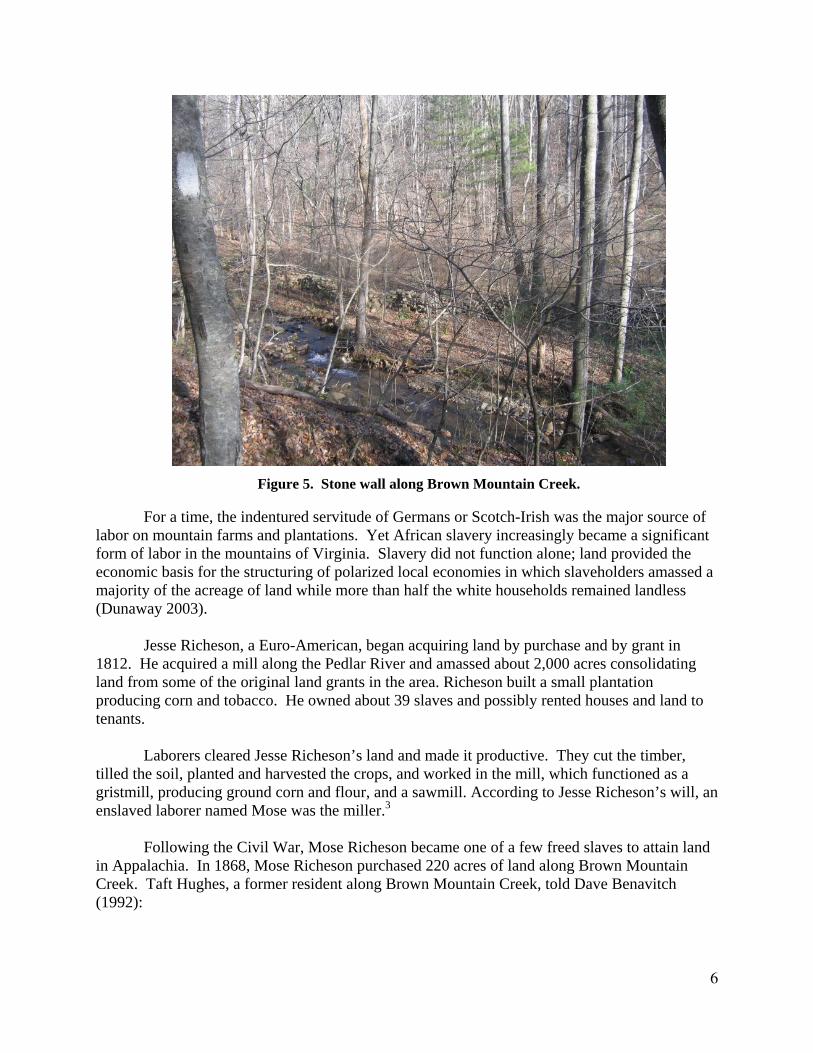
Figure 6. Lynchburg, Virginia, 1875.
Image from Lynchburg and Central Virginia Historic Railroad Photographs.
Figure 7. The Blue Ridge Mountains.
8
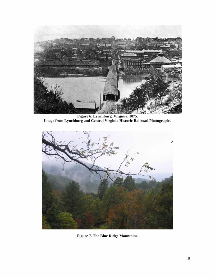
Surveys revealed that the Pedlar River in Amherst County could furnish a flow of water that would satisfy the demands of the City for decades (Fuertes 1903). To supply the water, the construction of a concrete dam and the installation of a pipeline twenty-one miles long was proposed. The dam site was to be located at the confluence of Swapping Camp Creek, Brown Mountain Creek and the Pedlar River. At this time it was the location of the former Richeson Mill.4 To protect the water, the City Water Commissioner, proposed the purchase of all of the land lying in the watershed of the Pedlar River.
Considerable opposition to the project developed. However, a bond issue was passed in 1904
(Wingfield 1974: 4). The City of Lynchburg began purchasing land and the water from the new source was delivered to the City in 1907. The purchase of land for watershed protection was aided by the passage of the Weeks Act in 1911. This permitted an agreement between the Forest Service and the City of Lynchburg regarding land purchase.
Figure 8. Lynchburg Reservoir. Image from
U.S. Forest Service, Glenwood & Pedlar Ranger District.
9
Visions of how to protect the water supply -- or conserving nature -- favored some groups of people over others. As the federal and local governments moved in to try their hands at managing natural resources, the people who had depended on such lands for food and livelihood found their interests shoved to the side (Steinberg 2002). Moses Richeson’s sons finally sold the land to the Forest Service in 1919. They dismantled the houses and took the building materials and their possessions with them.
Forests and Trails: The Making of Wilderness
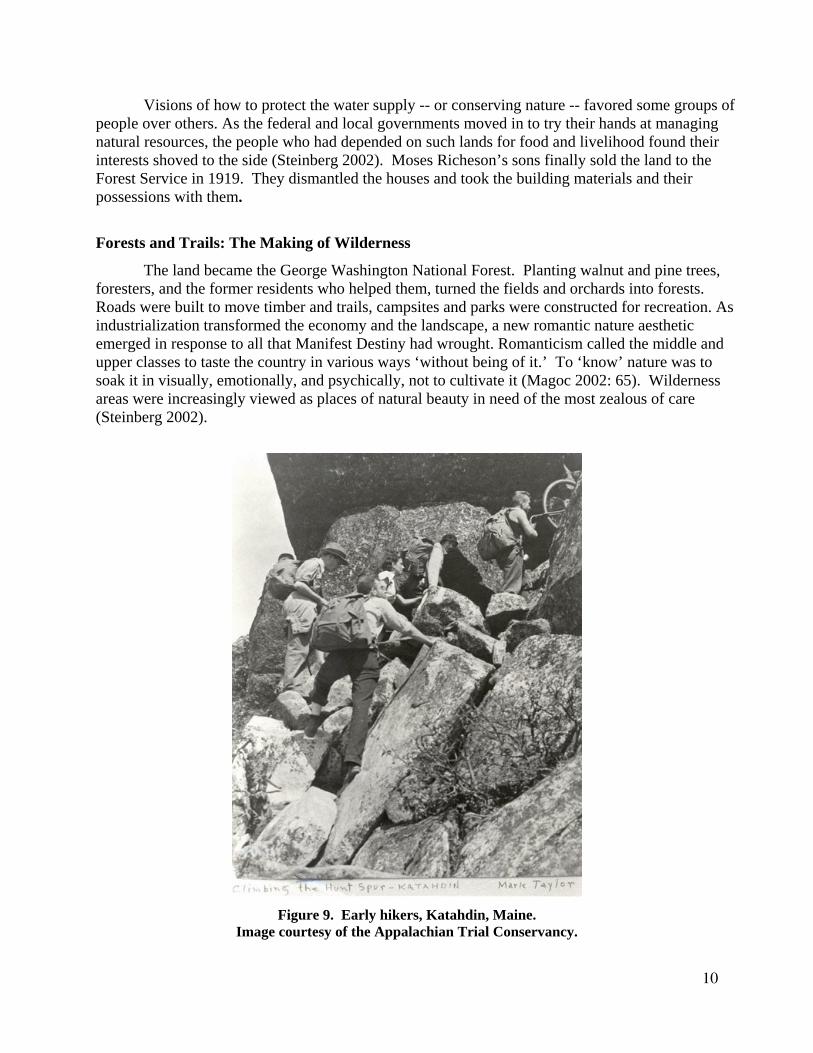
The land became the George Washington National Forest. Planting walnut and pine trees, foresters, and the former residents who helped them, turned the fields and orchards into forests. Roads were built to move timber and trails, campsites and parks were constructed for recreation. As industrialization transformed the economy and the landscape, a new romantic nature aesthetic emerged in response to all that Manifest Destiny had wrought. Romanticism called the middle and upper classes to taste the country in various ways ‘without being of it.’ To ‘know’ nature was to soak it in visually, emotionally, and psychically, not to cultivate it (Magoc 2002: 65). Wilderness areas were increasingly viewed as places of natural beauty in need of the most zealous of care (Steinberg 2002).
Figure 9. Early hikers, Katahdin, Maine.
Image courtesy of the Appalachian Trial Conservancy.
10
The AT was born out of this back to nature movement. Benton MacKaye (1932) envisioned the Trail as a reform project that promised to weave new connections between American society and the land through a working knowledge of nature. Built through volunteer labor, construction of the southern portions of the AT began as early as 1931 and the Trail was completed in 1937. In 1939, the Forest Service, the National Park Service, and the Appalachian Trial Conference signed an agreement to recognize the Appalachian Trial concept and pledged to protect it. The 1968 Trail Act established the AT as a National Park. Today, the National Park Service, the Appalachian Trail Conservancy, 30 Trail Clubs and other state and federal agencies, such as the Forest Service, manage it cooperatively.
About 60 miles of the Trail wander through the George Washington National Forest, part of that being the section of Trail that winds along Brown Mountain Creek. This section of the AT was built and is maintained through the imagination and the labor of people from the surrounding area -- the Natural Bridge Appalachian Trail Club. When I started this project, Trail Club members and local community members asked, how will your research help protect the Trail? Although legislation was passed to protect the Trail, ski resorts, mountaintop second-home developments, military-communications towers, cell towers, mining and timber-cutting, new highways, and the inevitable advance of the city threatened and continues to threaten the Trail environment (King 20000: 16).
American lawmakers radically redefined what constituted legitimate uses of the environment.
We live amid the legacy of those years, which has bequeathed to us many of the institutions -- parks, forest reserves, game laws, wardens, rangers, and the like -- that govern our relations with the natural world (Jacoby 2001). These changes can also be seen physically, materially -- the reservoir and dam, old logging roads, trails and blazes, campgrounds and shelters and scenic views. The Appalachian National Scenic Trail is an artifact that tells a story of 20th century American industrialization, volunteerism, and conservation (Scherer 2000: 29). At a more local scale, that same Trail tells a story of small farms, displacement and water conservation. The landscape -- as a result of the interactions between humans and nature -- shows how the legacy of the recent past can provide insights for understanding the world we live in today.
Contemporary Concerns: Land, Water and Public Policy
Today, the George Washington National Forest is considered one of the top ten endangered forests (National Forest Protection Alliance 2005) and the government is attempting to weaken regulations protecting national forests. The Bush administration repealed the Roadless Area Conservation Rule, opening acres of America's national forests to logging, road construction, mining, oil exploration and other forms of development. They also proposed to fund budget shortfalls by selling nearly a billion dollars worth of National Forest land.5 All of these proposals overlook the fact that a large portion of our drinking water originates in National Forests (Sierra Club n.d.).
The lack of rain in 2007 had many cities and their inhabitants worried about their water supply and farmers concerned about their crops. The city of Lynchburg usually receives 100 percent of their water supply from the Pedlar Reservoir, yet last year the Reservoir was 160 centimeters below its normal level (Faulconer 2007). The reservoir, which once submerged the Richeson Mill, was now so low the foundation of the mill could be seen and the City was forced
11
to get 95 percent of their water from the James River again. Families who relied on the water table for their well water were afraid they would turn on a tap and find no water because of the lack of rain and increased pressure on the water table from development in the area. The landscape that was depopulated to provide the City of Lynchburg water supply now faces a shortage of water and the encroachment of development.
Figure 10. Lynchburg Reservoir (2007). Photo by Bob Fener.
Figure 11. Richeson Mill (2007). Photo by Bob Fener.
12
Policy decisions shape the Appalachian landscape past and present. These decisions rely on the voices of the public, yet so often the decisions about what happens along this section of the Appalachian Trail take place in Washington, DC, Lynchburg, VA or Harper’s Ferry, WV with the Appalachian Trial Conservancy. The appearance of democracy lends the policies legitimacy, but the interests of those with the strongest narrative, or the most money are usually privileged. For the African American descendants this land has become the ‘governments’ land, rather than a place for recreation. This could be a reflection of what Smith (2007) describes as slavery's legacy, which created an entirely different relationship to the land and environment for African Americans than exists for white Americans. Smith argues that African American environmental thought is based on African Americans' desire to own their own land; slavery and racial oppression that ‘put black Americans into a conflicted relationship to the land -- by
Figure 12. A Hike with Taft Hughes.
From Grau (2005).
Figure 13. Excavations 2005, Justin Golash, Jordan Leverett and Don Owen.
13
coercing their labor, restricting their ability to own land, and impairing their ability to interpret the landscape’ (Smith 2007: 7). For African American descendants in the area, the land, which was farmed by their ancestors, has taken on different meanings and policy decisions have not reflected their interests.
Taft Hughes, an African American, grew up along Brown Mountain Creek. His family rented land from Mose Richeson’s sons. “My dad paid a fourth of his crop. If you owned your team (of horses), you only paid a fourth” (Hughes in Benavitch 1992: 8). Several years ago, the past met the present when Taft Hughes hiked along the Appalachian Trail with members of the Natural Bridge Appalachian Trail Club (NBATC). He told the hikers about growing up in this mountain hollow, getting water from the spring house and walking across the creek on a foot log; the hikers told him about filtering the creek water to prevent Giardia and asked questions about farming, hunting and gathering plants (Fener n.d.). In addition, Taft described earning his first dollar planting walnut trees with Forest Service Ranger Wilson (Benavitch 1992). These conversations have continued through archaeological research along the Trail. Hiking along this ‘little ribbon of wilderness’ reflects more than getting out to nature, it tells a story about people and their relationship with the landscape today as well as in the past. If conservation policies are to be sustainable, they must allow change to continue. Yet our decisions about what to lose, what to retain, and what to build anew, will be better, if they are informed by careful understanding (Bradley et al. 2004) of the past as well as the present.
Notes
* Jodi Barnes is a doctoral candidate in the Department of Anthropology, American University. 1. This was adapted from a paper by George Tolley (1995). 2. This view overlooks the relationship of American Indians with the landscape before European contact. American Indians farmed the soil, hunted game, set fires, and gathered nuts and berries, engaging in a relationship with the land while shaping it to meet the needs of everyday survival (Steinberg 2002: 11). 3. The 1850 Census shows that one of Jesse Richeson’s slaves was a 25 year old male Mulatto, fitting the age of Moses within two years. During the sale of his father’s estate, Samuel Richeson purchased a mulatto slave named Moses who worked as a miller for $1200. At the same time, Samuel purchased the mill owned by Jesse Richeson. 4. The mill changed hands several times after Jesse Richeson’s death. His son Samuel Richeson purchased the mill in 1855. Around 1869, it became the Cunningham Mill, eventually being sold to the City of Lynchburg (Tolley 1995). 5. There have also been positive initiatives. On April 28, U.S. Representative Rick Boucher and U.S. Senator John Warner introduced the Virginia Ridge and Valley Act of 2005, a bill that would permanently protect 55,000 acres of National Forest land in Virginia as wilderness. The bill passed the House of Representatives on Tuesday, October 23, 2007. The Act is now in the
14
Senate. Senator Coburn of Oklahoma has put a “hold” on much of the legislation -- 87 bills at last count, one of which is the Virginia Ridge and Valley Act. Yet this bill does not protect National Forests in Amherst County, VA.
Acknowledgements
Research was conducted with support from the Bell Fellowship, awarded by the Forest History Society, Durham, NC; Andrew W. Mellon Research Fellowship, awarded by the Virginia Historical Society, Richmond, VA and Sigma Xi Grants-in-Aid. I’d like to thank Joan Gero, Dan Hicks, Mary Beaudry, and Dave Gadsby for helping me think through some of the ideas in this paper. This project could not have been done without the help of George Tolley, archaeologist for the George Washington and Jefferson National Forest, the Appalachian Trail Park Office and the Appalachian Trail Conservancy, but the opinions in this article are my own.
Bibliography
Appadurai, Arjun, Ed. 1988 The Social Life of Things. Cambridge: Cambridge University Press. Barnes, Jodi and Dave Gadsby 2008 The Archaeology of Ten Minutes Ago: Material Histories of the Burgeoning Past and the
Vanishing Present. Symposium at the Society for Historical Archaeology Annual Meetings in Albuquerque, NM.
Benavitch, David 1992 Oral History with Taft Hughes, Amherst County, Virginia, October 7, 1992. Electronic
document, www.nbatc.org/taft_hughes.html, accessed 18 February 2008. Bender, Barbara 1998 Stonehenge: Making space. Oxford: Berg. Bradley, Andrea, Victor Buchli, Graham Fairclough, Dan Hicks, Janet Miller, and John Schofield 2004 Change and Creation: Historic Landscape Character, 1950-2000. London: English Heritage. Buchli, Victor, and Gavin Lucas, Eds 2001 Archaeologies of the Contemporary Past. London: Routledge. Cook, Samuel R. 2000 Monacans and Miners: Native American and Coal Mining Communities in Appalachia. Lincoln:
University of Nebraska Press. Daniels, S. 1989 Marxism, culture and the duplicity of landscape. In New Models in Geography, edited by R. Peet
Dunaway, Wilma A. 2003 Slavery in the American Mountain South. Cambridge: Cambridge University Press. Faulconer, Justin 2007 Area under drought advisory. News & Advance, Lynchburg, VA. 19 October. Fener, Bob n.d. A Hike along Brown Mountain Creek with Taft Hughes. Audio recording. Fuertes, James H. 1903 Report on a new water supply for Lynchburg, Va., from Pedlar River. J. P. Bell Company
Printers, Lynchburg, VA. Gosden, Chris, and Yvonne Marshall 1999 The Cultural Biography of Objects. World Archaeology 31(2): 169-178. Grau, Amanda 2005 Brown Mountain Creek. Journeys: The Magazine of the Appalachian Trail Conservancy 1(3):
12-15. Hoskins, Janet 1993 The Play of Time: Kodi Perspectives on Calendars, Exchange and History. Berkeley: University
of California Press. 1998 Biographical Objects: How Things Tell the Stories of People's Lives. London: Routledge. Jacoby, Karl 2001 Crimes Against Nature: Squatters, Poachers, Thieves, and the Hidden History of American
Conservation. Berkeley: University of California Press. Lewis, Ronald L. 1998 Transforming the Appalachian countryside: railroads, deforestation, and social change in West
Virginia, 1880-1920. Chapel Hill University of North Carolina Press. Keane, Webb 1997 Signs of Recognition: Powers and Hazards of Representation in an Indonesian Society.
Berkeley: University of California Press. King, Brian B. 2000 Trail Years: A History of ATC. ATN: Appalachian Trailway News 61(1): 2-12, 52-63. MacKaye, Benton 1921 An Appalachian Trail: A Project in Regional Planning. Journal of the American Institute of
Architects 9(Oct): 325-330. 1932 The Appalachian Trail: A Guide to the Study of Nature. The Scientific Monthly 34(4): 330-342.
16
MacKenzie, Maureen 1991 Androgynous Object: String Bags and Gender in Central New Guinea. London: Harwood
Academic Publishers. Magoc, Chris J. 2002 So Glorious a Landscape: Nature and the Environment in American History and Culture.
Wilmington, DE: Scholarly Resources Inc. McGuire, Randall H. 1991 Building Power in the Cultural Landscape of Broome County, New York 1880 to 1940. In
Archaeology of Inequality, edited by R. H. McGuire and R. Paynter, pp. 102-124. Social Archaeology. Oxford: Blackwell Publishers.
Meskell, Lynn 2004 Object Worlds in Ancient Egypt: Material Biographies in Past and Present. London: Berg. 2005 Introduction: Object Orientations. In Archaeologies of Materiality, edited by L. Meskell. Oxford:
Blackwell Publishers. Miller, Daniel, Ed. 2005 Materiality. Durham: Duke University Press. National Forest Protection Alliance 2005 Endangered National Forests. National Forest Protection Alliance, Spokane, Washington. Ness, Erik 2003 The Path Taken: Benton MacKaye Brought Us the Appalachian Trail -- and New Ways to Look
at the American Landscape. Preservation 55(July/August): 40-43. Pinchot, Gifford 1910 The Fight for Conservation. Project Gutenberg Ebooks. Scherer, Glenn 2000 What is past, and passing, and to come. ATN: Appalachian Trailway News 61(2): 22-25, 28-29. Schofield, John 2007 Modern Times. Conservation Bulletin 56(Autumn): 2. Schofield, John, William Gray Johnson, and Colleen M. Beck 2002 Matériel Culture the Archaeology of Twentieth-century. London: Routledge. Sierra Club, Virginia Chapter n.d. National Forests Are More Than Timber. Electronic document,
http://virginia.sierraclub.org/more-than-timber.html, accessed 28 February 2008.
Smith, Kimberly K. 2007 African American Environmental Thought: Foundations. Lawrence: University Press of Kansas. Speer, Jean Haskell 1992 The Hegemony of Landscape in Appalachian Culture. Journal of Appalachian Studies 4: 24-33. Steinberg, Ted 2002 Down to Earth: Nature's Role in American History. New York: Oxford University Press. Straw, Richard 2006 Appalachian History. In A Handbook to Appalachia, edited by Grace Toney Edwards, JoAnn
Aust Asbury, and Ricky L. Cox, pp. 1-26. Knoxville: University of Tennessee Press. Thomas, Julian 1996 Time, Culture and Identity. London: Routledge. Tilley, Christopher 1996 An Ethnography of the Neolithic: Early Prehistoric Societies in Southern Scandinavia.
Cambridge: Cambridge University Press. 1999 Metaphor and Material Culture. Oxford: Blackwell Publishers. Tolley, George 1995 Long Mountain Community. Paper presented at the Virginia Academy of Science, Annual
Meetings, Lexington, Virginia. Wingfield, Ernest 1974 History of Lynchburg's Water. Unpublished paper, Jones Memorial Library, Lynchburg,