69
Maritime spatial planning in the Baltic Sea region 2013 Tiina Tihlman Ministerial Adviser Seminar in Reykjavik 27.5.2013

Maritime spatial planning in the Baltic Sea region 2013
Tiina Tihlman Ministerial Adviser Seminar in Reykjavik 27.5.2013
Content of my presentation
1. MSP & EU policy context 2. Developing maritime spatial planning in the Baltic Sea area - HELCOM-VASAB MSP working group - EU preparatory action; Plan Bothnia pilot plan 3. Resent maritime spatial planning developments in Finland - Kymenlaakso maritime spatial plan - Underwater biodiversity research program VELMU
Esittäjän nimi alatunnisteeseen 2

1. MSP & EU policy context
DG MARE (Maritime) • 2007 The integrated maritime policy IMP • 2008 “The MSP Roadmap” msp-principles and financing for
preparatory actions
• 2013 European Commission adopted a proposal for a Directive on maritime spatial planning and integrated coastal zone management
Esittäjän nimi alatunnisteeseen 3

… MSP & EU policy context
MSP directive proposal aims to integrate EU policies: • the Marine strategy framework directive, • The Common fisheries policy 2014 -2020, • The Renewable energy directive, • The Motorways of the Sea initiative, • The Habitats Directive, • The Blue growth initiative, and
• Europe 2020 - A strategy for smart, sustainable and inclusive
growth
• EU Baltic Sea Strategy Esittäjän nimi alatunnisteeseen 4

The proposal for a Directive on maritime spatial planning and integrated coastal zone management, March 2013 Objectives of the proposal • Economic development (Blue growth, synergies) • Stable investment climate (predictability) • Cross border cooperation (infrastucture) • Coordination (administration) • Environmental protection (reduce pressures)
Esittäjän nimi alatunnisteeseen 5

Member states should establish and implement MSP and ICZM:
• Nominate an authority • Establish a process • Establish and implement maritime plan/plans and a coastal
strategy/strategies
Esittäjän nimi alatunnisteeseen 6

Definitions “…process or processes cover the full cycle of problem identification, information collection, planning, decision-making, management, monitoring of implementation, and stakeholder participation.” Area of coastal strategies - territorial waters and land
Area of msp plans - EEZ and territorial waters
Esittäjän nimi alatunnisteeseen 7

Objectives of msp-plans and strategies
• Apply ecosystem-based approach • Secure energy supply, • Promote marine transport, • Foster the growth of fisheries and aquaculture, • Ensure the protection and improvement of the environment • Sustainable use of natural resources
Esittäjän nimi alatunnisteeseen 8

Common requirements for maritime plans and coastal strategies
• Operational steps • MSP plans and coastal strategies should be coordinated
nationally and with neighboring countries • Revised every 6th year
Esittäjän nimi alatunnisteeseen 9

Specific requirements
for plans • Mapping of actual, potential spatial and temporal distribution
of all relevant maritime activities • Consider at least energy, transport routes, cables and pipelines,
fishing areas, sea farming sites, nature conservation sites for coastal strategies • Inventory of existing measures applied and evaluation of the
need for new ones • Consider at least natural resources, infrastructure, agriculture,
industry, fishing, aquaculture, environment, climate change
Esittäjän nimi alatunnisteeseen 10

MSP directive proposal
• Is without prejudice to member states competences for town and country planning
• MSP plans and coastal strategies should be done in three years
after the entry of the directive and revised every 6th year • The implementation of the directive should be reported to the
Commission every 6th year
Esittäjän nimi alatunnisteeseen 11

2. Developing maritime spatial planning in the Baltic Sea area HELCOM; Convention on the Protection of the Marine Environment of the Baltic Sea Area (1974 Helsinki Convention). • HELCOM Baltic Sea Action Plan VASAB; Vision and Strategies around the Baltic Sea (1992) • Long Term Perspective LTP JointHELCOM-VASAB MSP WG 2010 • Baltic Sea States HELCOM and VASAB representatives, EU
Commission, observers EU Baltic Sea Strategy: Maritime spatial plan by 2020 EU Comission MSP communication 2008 requirement
Esittäjän nimi alatunnisteeseen 12

HELCOM-VASAB MSP WG
So far the group has - agreed on HELCOM-VASAB MSP and ICZM principles - drafted a Legislative basis for msp –study - drafted a paper Ecosystem approach in drafting a maritime
spatial plan –study HELCOM Ministerial meeting on October 2013 Copenhagen VASAB Ministerial Meeting September 2014 Tallinn
Esittäjän nimi alatunnisteeseen 13

2. Developing maritime spatial planning in the Baltic Sea area
The group needs now a new mandate for 2013-2016 Draft work plan 2013-2016: • Exchange of experience • Framework • MSP and MSFD • MSP and ICZM • Data • EU Baltic Sea Strategy Horizontal Action Spatial planning
leadership • To create better understanding of the specific conditions and
need for MSP in BSR in EU and to seek common approach to EU initiatives
Esittäjän nimi alatunnisteeseen 14

Status of maritime spatial planning in Baltic Sea countries • Germany – spatial planning on territorial waters and on EEZ
based on legistaltion • Poland – developing msp • Lithuania – developing msp • Latvia – developing msp • Estonia – developing msp – drafting regional maritime plans • Norway – maritime spatial planning – non binding management
plans • Denmark – not developing msp - no planning on sea • Russia – developing msp – no legislation on msp • Sweden – developing legislation • Finland – land use planing and building act implemented on
territorial waters, no planning legislation on EEZ
Esittäjän nimi alatunnisteeseen 15

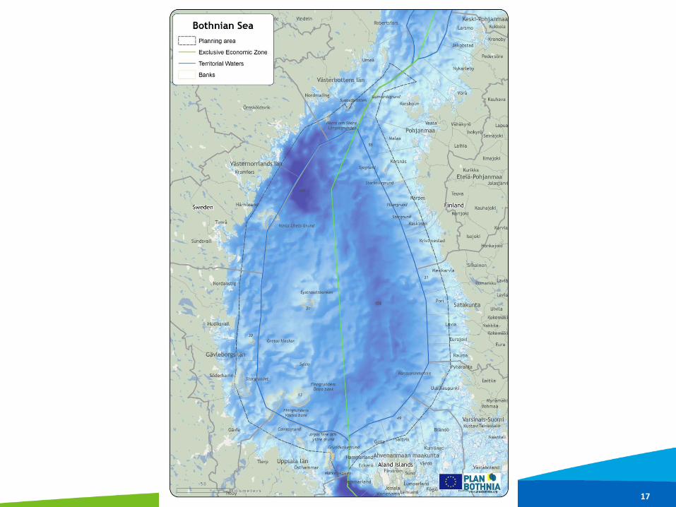
PLAN BOTHNIA - pilot plan project
• EU DG MARE MSP ”preparatory action” • Joint HELCOM-VASAB MSP principles • The 10 EU MSP principles in Roadmap • Testing joint transboundary spatial planning in the
Bothnian Sea between Finland and Sweden • 18 months, 500 000 €
Esittäjän nimi alatunnisteeseen 16
Esittäjän nimi alatunnisteeseen 17
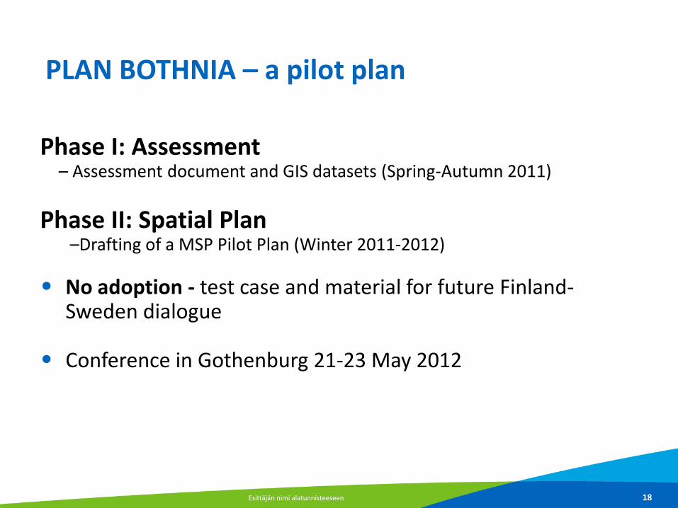
PLAN BOTHNIA – a pilot plan
Phase I: Assessment – Assessment document and GIS datasets (Spring-Autumn 2011) Phase II: Spatial Plan
–Drafting of a MSP Pilot Plan (Winter 2011-2012)
• No adoption - test case and material for future Finland-Sweden dialogue
• Conference in Gothenburg 21-23 May 2012
Esittäjän nimi alatunnisteeseen 18
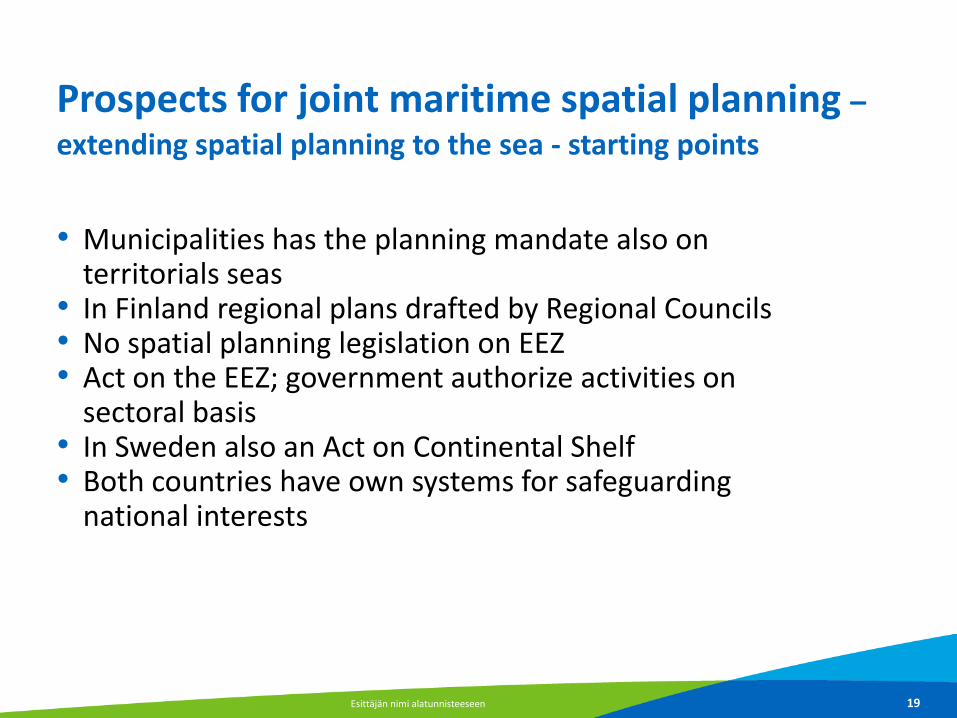
Prospects for joint maritime spatial planning –
extending spatial planning to the sea - starting points
• Municipalities has the planning mandate also on
territorials seas • In Finland regional plans drafted by Regional Councils • No spatial planning legislation on EEZ • Act on the EEZ; government authorize activities on
sectoral basis • In Sweden also an Act on Continental Shelf • Both countries have own systems for safeguarding
national interests
Esittäjän nimi alatunnisteeseen 19

…Prospects for joint maritime spatial planning - extending spatial planning to the sea - starting points
• Only few municipal plans covers also sea area both in
Sweden and in Finland • Finnish regional plans covers mainly coastal waters • Sectoral planning – areal interests too • International legislation • Åland has its own spatial planning system
Esittäjän nimi alatunnisteeseen 20

Finnish Land Use Planning System
Photo Pirjo Ferin 21
LOCAL MASTERPLAN
REGIONAL LAND
USE PLAN
- Approved
by Council of
State
- Drawn up
and approved
by Regional
Council
- Confirmed
by Ministry
of the
Environment
LOCAL
DETAILED
PLAN
- Prepared and approved
by local authority
- Prepared and approved
by local authority
Joint master plan
Nationalland use
objectives

A Regional land use plan
Sets out a general framework for the more detailed local plans Must promote the implementation of the national land use guidelines •Special attention is paid to: • structure of the region
• sustainability of land use, transport, technical services, natural resources
• region's businesses
• protection of landscape, natural values, and cultural heritage
• recreation
Esittäjän nimi alatunnisteeseen 22

Finnish law on EEZ 2004/1058
Rights and jurisdiction • Right to make research, exploit, preserve, manage, and to carry
out activities aiming to economic use and research • Jurisdiction according to international law to built artificial
islands, constructions and use them as well as to protect and research the marine environment
Tiina Tihlman Ministry of the Environment Finland 27.5.2013 23

esittäjän nimi / organisaatio / mahdollinen avainsana 24

esittäjän nimi / organisaatio / mahdollinen avainsana 25

esittäjän nimi / organisaatio / mahdollinen avainsana 26
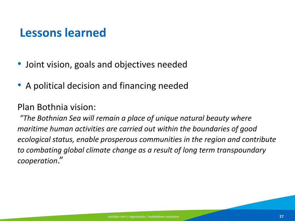
Lessons learned
• Joint vision, goals and objectives needed • A political decision and financing needed Plan Bothnia vision: ”The Bothnian Sea will remain a place of unique natural beauty where
maritime human activities are carried out within the boundaries of good
ecological status, enable prosperous communities in the region and contribute
to combating global climate change as a result of long term transpoundary
cooperation.”
esittäjän nimi / organisaatio / mahdollinen avainsana 27

The vision should be implemented by:
a. Creating a basis framework to ensure the good status of ecosystems and their ecosystem services
b. Ensuring a network of offshore nature protected areas c. Safeguarding maritime traffic d. Designating sufficient suitable areas for sea based energy e. Maintaining spawning, nursery and fishing areas necessary for
maintaining a viable local fishery f. Highlighting/illustrating the importance of the sea to the
coastal communities
esittäjän nimi / organisaatio / mahdollinen avainsana 28
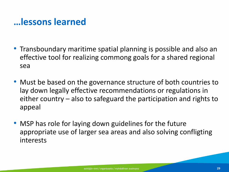
…lessons learned
• Transboundary maritime spatial planning is possible and also an effective tool for realizing commong goals for a shared regional sea
• Must be based on the governance structure of both countries to
lay down legally effective recommendations or regulations in either country – also to safeguard the participation and rights to appeal
• MSP has role for laying down guidelines for the future
appropriate use of larger sea areas and also solving confligting interests
esittäjän nimi / organisaatio / mahdollinen avainsana 29

…lessons learned
• Is perhaps not the most suitable tool to manage activities that are to very high degree dependent on regulations based on EU or international legislation like fishery or shipping – still, influencing on such policies might be possible
• Which questions/problems can be solved by a plan
• Quality information for drafting a plan needed – common
understanding of basic structure, functions and needs of protections are crucial
esittäjän nimi / organisaatio / mahdollinen avainsana 30

Experiences of Planbothnia
Drafting a plan for a sea area jointly with another country • Bring up topical questions • Increased knowledge and experience • Was involving regions and planners • Many similarities between SE and FI • Planning culture: Finland has plans on three planning level,
Sweden has detailed planning -> results in planning regulations, markings
• Future needs
Esittäjän nimi alatunnisteeseen 31
Reflection on MSP principles and the Bothnian Sea
• Plan Bothnia is fulfilling succesfully both EU and HELCOM-VASAB msp-principles
esittäjän nimi / organisaatio / mahdollinen avainsana 32

Maritime spatial planning in Kymenlaakso, Finland
Frank Hering Environmental planner

Location
27.5.2013 34

MSP in the Kymenlaakso region
• The Regional Council of Kymenlaakso decided in 2012 to elaborate a regional plan focusing on MSP / ICZM
• The regional plan of Kymenlaakso is among the first regional plans in Finland focussing on questions related to MSP / ICZM
27.5.2013 35

Central topics
• Considering underwater bio- and geodiversity • Improving the environmental state of the sea • Developing tourism / recreation • Managing structural changes of the defence forces in
the archipelago • Improving maritime safety • Developing the sustainable use of natural ressources
(fish/ sand/ wind…) • Enabling sustainable economic development…
27.5.2013 36

Permanent issues
• Lack of ressources… • Lack of data…
27.5.2013 37

MSP and regional planning in Finland
27.5.2013 38
• Didn´t we already do MSP and ICZM in the past? • Do we have to start from zero or do we just have to
improve our existing planning schemes and methods? • Can we afford? What is the benefit for the region? • Where do we get data from? • Is our legislation ready? • How do we improve International cooperation? • …
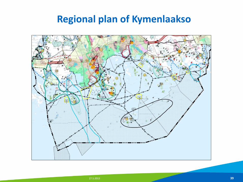
Regional plan of Kymenlaakso
27.5.2013 39

27.5.2013 40
Developing area for tourism
windfarm
Protection area Filling areas
Recreation area
Underwater cultural heritage / seabattle area
Geodiversity area
Land reclamation / harbour enlargement

27.5.2013 41
Biodiversity hot spot area
Geodiversity hot spot area
Fish farming

27.5.2013 42
Riffs, sandbanks and indicator species

Modelling diversity
27.5.2013 43
KOTKA

27.5.2013 44

27.5.2013 45
Fishfarming areas

27.5.2013 46
Underwater noise / silence

VELMU – Underwater biodiversity research program
27.5.2013 47

Asiantuntijataho ja paikkatiedot: RKTL, Kaakkois-Suomen ELY-keskus / ympäristöhallinto
Vaelluskalat

EIA Nordstream (minerisk areas etc.)
27.5.2013 49


Markku Viitasalo, Finnish Environment Institute
M. Viitasalo; Kalmar 21.3.2013
Planning the marine conservation and sustainable use of marine resources: how underwater inventories can help?
Mats Westerbom
The Finnish Inventory Programme for Underwater Marine Environment

Uses of marine space are increasing
Oulunsalo-Hailuoto windmill park (Bothnian Bay) – planned for 2012-2018: 43-75 turbines (100 m high) Source: Environment Impact Assessment, virtual image
M. Viitasalo; Kalmar 21.3.2013

Habitats Directive Annex I:
Sandbanks slitghtly covered by water Reefs Sea cliffs Shingle or stony beaches Mudflats and sandflats Coastal lagoons Large shallow inlets and bays Estuaries Boreal Baltic narrow inlets
Nature Heritage Services
Habitats
Annex II: Species
M. Viitasalo; Kalmar 21.3.2013

Alisma wahlenbergii
• An aquatic plant species endemic to
the Baltic Sea
• Most of its occurrences found in Finland
• A species in need of ”especial protection”
©Metsähallitus 2010
Hippuris tetraphylla
• Within the EU occurs only in Finland
• The habitat directive demands Finland to
protect its habitats
©Metsähallitus 2010
Species
M. Viitasalo; Kalmar 21.3.2013

CBD target: 10 % of World’s marine areas efficiently protected until 2020
M. Viitasalo; Kalmar 21.3.2013

Heidi Piiroinen / HS
”The VELMU-programme secures the gain of information on
marine underwater environment.”
Government Program of the PM Jyrki Katainen, p. 70 (22.6.2011)
The Finnish Inventory Programme of Underwater Marine Environment
M. Viitasalo; Kalmar 21.3.2013

17407
observation
points
VELMU plan for 2012-2014
Some 24.000 points have been done earlier (since 2004) Most of them are in ”grids”
M. Viitasalo; Kalmar 21.3.2013

How are the observations made in practise?
M. Viitasalo; Kalmar 21.3.2013

Metsähallitus, luontopalvelut
”Drop-video” Habitats, large species
Scuba diving Habitats, species
Species and communities
Benthic sampling Benthic species
M. Viitasalo; Kalmar 21.3.2013

DeepVision HD-video camera, Max. depth 70 m
The new High Definition drop-video
Tiina Asp, Natural Heritage Services
M. Viitasalo; Kalmar 21.3.2013

Geological inventories
Research sonar Side scan sonar Multibeam sonar Seismic reflection profiler
M. Viitasalo; Kalmar 21.3.2013

Where are we today?
Biological inventories 2004-2012
M. Viitasalo; Kalmar 21.3.2013

LIDAR
Light Detection and Ranging
gulfsci.usgs.gov/tampabay
Method development: Remote sensing of underwater geo- and biodiversity
M. Viitasalo; Kalmar 21.3.2013

GIS data and maps on the distribution of species, communities and habitats
General maps of the distribution of hot-spots of biodiversity and human pressures
Biodiversity-indices Finnish Marine Atlas
End products of VELMU (and related projects)
M. Viitasalo; Kalmar 21.3.2013

Modelling key species
Bladderwrack Fucus vesiculosus
Henna Rinne, Åbo akademi
M. Viitasalo; Kalmar 21.3.2013

GIS analysis of human pressures
Preliminary analysis of human pressures on the S and SW coast of Finland (1 km grid cell)
MERIGIS-project / Marco Nurmi
M. Viitasalo; Kalmar 21.3.2013

Combining info on biota and human pressures Example: pike, fairways, cables and other leads
Finnish Game and Fisheries Research Institute / Varpu Mitikka
SYKE / Marco Nurmi
M. Viitasalo; Kalmar 21.3.2013

Summary
© Riku Lumiaro
• A great need for protecting marine space
• However, good data for species, habitats and environmental variables are lacking
• VELMU collects data to support protection and sustainable use of marine space
M. Viitasalo; Kalmar 21.3.2013

Thank you for your attention Tiina Tihlman [email protected] www.ymparisto.fi


