Middle Peninsula Planning District Commission 2017 Mathews County Ditch Mapping and Database Further investigating roadside ditch issues in Mathews County through mapping and research of property deeds and design of a framework for a database to house information on failing ditches to assist with prioritization of maintenance needs. This project was funded by the Virginia Coastal Zone Management Program at the Department of Environmental Quality through grant number # NA15NOS4190164 Task #94.02 of the National Oceanic and Atmospheric Administration, Office for Coastal Management under the Coastal Zone Management Act of 1972, as amended. The views expressed herein are those of the authors and do not necessarily reflect the views of NOAA or any of its subagencies or DEQ.
Transcript
Middle Peninsula Planning District Commission
2017
Mathews County Ditch
Mapping and Database Further investigating roadside ditch issues in Mathews County through mapping and
research of property deeds and design of a framework for a database to house
information on failing ditches to assist with prioritization of maintenance needs.
This project was funded by the Virginia Coastal Zone Management Program at the Department of Environmental Quality through grant number # NA15NOS4190164 Task #94.02 of the National Oceanic and Atmospheric Administration, Office for Coastal Management under the Coastal Zone Management Act of 1972, as amended. The views expressed herein are those of the authors and do not necessarily reflect the views of NOAA or any of its subagencies or DEQ.
Introduction Poor ditch maintenance and sea level rise directly affect the local tax base, land and
water quality and wetlands preservation in an area. Proper maintenance helps to control and
mitigate the impacts of flooding on upland, wetlands and fisheries. This project intended to
further investigate roadside ditch issues in Mathews County through mapping and research of
property deeds to document ownership of ditches and outfalls. This effort helped in
understanding the needed maintenance of failing ditches and to design a framework for a
database to house information on failing ditches that could assist in the prioritization of
maintenance needs. The Middle Peninsula Planning District Commission (MPPDC) proposed 3
activities to reduce the information gap between stakeholders and those tasked with repairing
the drainage system:
DAA will create maps identifying ditches in the targeted area with associated parcel
information using Mathews County tax parcel maps overlapped with aerial imagery to
provide information on ditch and channel locations;
Virginia Coastal Policy Clinic (VCPC) at the College of William and Mary will conduct
research, compile deeds and easement documentation identifying ditch ownership
responsibility, easement rights and other interests in the roadside and outfall ditches
identified with the ditch prioritization tool developed under the National Fish and
Wildlife Foundation (NFWF) contract. VCPC will use the maps created by DAA.
DAA will design a database for the organization and illustration of legal records and
property ownership of failing ditches. Working with partners DAA and Virginia
Department of Transportation (VDOT), MPPDC staff will determine the appropriate
3
database architecture needed to maintain and connect deed and easement information
relative to each private and public property for each ditch and associated parcel.
Product #1: Enforceable Policy Action: Declaration of Public Policy Drainage Concern and Action Mathews County Board of Supervisors (BOS) reaffirmed a public policy need for
technical analysis and strategic planning assistance for ditch maintenance in the County.
Simultaneously community concern for a policy solution became vocal and vitriolic. To help
clarify misconceptions about ditch maintenance responsibilities, revalidate VDOT’s position on
ditch maintenance, Mathews County’s position on the issue, and legal research conducted to
date, Delegate Keith Hodges hosted a meeting on November 22, 2016 in Mathews County.
Attendance at the meeting included four out of five of the Mathews County Board of
Supervisors, the Mathews County Administrator, Delegate Keith Hodges, the new Mathews
County Planning Director, VDOT representatives, Mathews County citizens, Virginia Department
of Environmental Quality, MPPDC staff and a reporter from the Gazette-Journal. At the
meeting Delegate Hodges presented a document that identified the outcomes of previous
projects that addressed ditch maintenance in Mathews County (Appendix A). Policy options
were presented to Mathews County to consider:
4
To-date Mathews County has not taken action on this particular matter and is considering their
options.
In addition to offering policy options to Mathews County to improve the county wide
ditching issue, Delegate Hodges drafted new legislation to help Mathews and other Tidewater
Virginia localities. (Appendix B). In short HB 1774 Directs the Commonwealth Center for
Recurrent Flooding Resiliency (the Center) to convene a work group to consider alternative
methods of stormwater management in rural Tidewater localities. The bill provides that the
group is to be facilitated by the Virginia Coastal Policy Center at William and Mary Law School
and is to include representatives of institutions of higher education, state agencies, local
governments, private industry, and other groups. The bill provides that the work group is to
review and consider the creation of rural development growth areas, the development of a
volume credit program, the payment of fees to support regional best management practices,
and the allowance of the use of stormwater in highway ditches to generate volume credits. The
bill requires the Center to report the results of the work group's examination to the Governor
5
and the Chairmen of the House Committee on Agriculture, Chesapeake and Natural Resources
and the Senate Committee on Agriculture, Conservation and Natural Resources by January 1,
2018, which is the date the work group provisions of the bill are set to expire (LIS, 2017). This bill
was approved by the Governor on March 13, 2017.
Product #2: Mathews Target Area Ditch Maps DAA provided MPPDC and VCPC with maps of the target areas in Mathews County.
These target areas were selected by Mathews County staff and the Ditch Committee in 2014.
Figure 1 and 2 provides an example of maps developed by DAA. These maps are of Area 2 –
Diggs - which identifies outfall ditches and the direction of the flow of water. VCPC used this
information to conduct research, compile deeds, and easement documentation to determine
ownership and maintenance responsibility.
6
Figure 1: A map of Area 2- Diggs that identifies roadside ditches and outfalls and ownership. The dotted box is blown up in Figure 2.
7
Figure 2: A zoomed in version of map.
8
Product #3: Research and Compile Land Records Data The VCPC, located at the College of William and Mary Law School completed a report
intended to provide legal information and policy options useful to the Mathews County BOS.
The report focuses on the allocation of maintenance responsibilities for the drainage ditches.
The final white paper and correspondence letter can be found in Appendix C.
Product #4: Design framework of a Ditch Maintenance Database (Done) DAA staff completed a GIS geodatabase to house ditch data including ownership,
maintenance, aerial and lidar terrain surface maps. The database can be found here:
http://arcg.is/2feRWwf. For a quick look at the database please see Appendix D. A spread sheet
describing layer attribute was also completed. Mathews County has been given several options
for hosting the geodatabase, with the most likely option being ESRI's ArcGIS Online web service.
Conclusions As a result of this project Mathews County was provided information, policy options,
and tools to effectively and comprehensively address ditching in the County. With extensive
work on this issue and the creation of a database, the County was provided a management tool
to assist in prioritizing ditch maintenance needs within Mathews County.
MPPDC staff shared outcomes of this project with the Middle Peninsula Planning District
Commission, the Mathews County Board of Supervisors, the Mathews County Ditch Committee,
as well as the Local Government Administrators. All Middle Peninsula localities experience
aging and failing roadside and outfall ditches to some degree, and these project results offer
ample information and insight regarding policy options for those localities interested in
Finally, based on the passing of HB 1774 (Stormwater management; workgroup to
examine ways to improve management) during the 2017 General Assembly session, the
Commonwealth Center for Recurrent Flooding Resiliency is convening a work group to examine
opportunities to improve stormwater management in rural localities located in Tidewater
Virginia. In part the workgroup will review and consider alternative methods that could be used
in rural localities to meet or exceed the level of water quality protection and water quantity
control provided by the Virginia Stormwater Management Program (VSMP). Therefore,
stormwater and ditches and outfalls management discussions will continue under their
auspices. Currently the workgroup is under development and is scheduled to meet June 2017.
10
Appendix A History of Projects Presented at Meeting
11
Middle Peninsula Planning District Commission Projects:
Mathews County and Roadside Ditching and Drainage
To: Delegate Keith Hodges
November 14, 2016
From: Lewie Lawrence, MPPDC Executive Director
RE: Mathews County Technical, Legal and Policy Ditch Work Completed to Date
DEFINING THE OVERALL PROBLEM:
Ditch Drainage in Mathews County and a request to assist Mathews BOS with understanding choices
RELEVANT GRANTS:
Grant #1 (2012): MPPDC staff hired John S. Morris, III (a legal consultant) to understanding the legal responsibilities of maintaining such channels or ditches. During this grant seven selected ditches were assessed and recommendations for analyzing and resolving future problems at these sites were made. Grant Conclusions:
Mathews County Ditching Committee consisting of Mathews County Residents
The duty to keep ditches clear and maintained is determined on a case-by-case basis. o Responsible if…..
the ditch is created by a single landowner or used to channel excessive water from a single landowner, that landowner would be responsible for damages resulting from the ditch.
a party created/relocated a channel on or along its property in such a manner that caused it to become clogged or handle less water
o No one is responsible…. for a ditch to the extent it is a natural channel. when ditches overflow and floods a road and it meets the Supreme Court’s definition of
an extraordinary rainfall for lack of flow (i.e. due to lack of elevation), however if flow has been impeded in an
unreasonable manner, the party impeding the flow of water would be liable for any resulting damage.
If natural clogging of a ditch occurs.
Grant #2 (2013): Contracted with the Virginia Coastal Policy Clinic (VCPC) to research: (1) ditch maintenance responsibility, (2) federal and state funding programs to assist local governments and
12
citizens with ditch maintenance and (3) the authority local government to enter private property to clean ditches in the name of public improvements and/or how such authority could be enabled. Grant Conclusions:
A list of federal and state grant programs to help local governments repair and improve ditch drainage (i.e. USDA Rural Utilities Service Program; Clean Water Act, Section 319 -- TMDL Implementation Funding; etc.)
Review of two funding options for private drainage maintenance: (a) local tax revenue and (b) a utility model to sustain financing for long-term repair and maintenance.
Review of Virginia Code regarding drainage statutes, drainage districts or management programs in place.
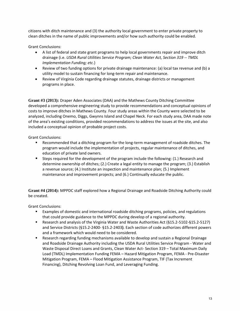
Grant #3 (2013): Draper Aden Associates (DAA) and the Mathews County Ditching Committee developed a comprehensive engineering study to provide recommendations and conceptual opinions of costs to improve ditches in Mathews County. Four study areas within the County were selected to be analyzed, including Onemo, Diggs, Gwynns Island and Chapel Neck. For each study area, DAA made note of the area’s existing conditions, provided recommendations to address the issues at the site, and also included a conceptual opinion of probable project costs. Grant Conclusions:
Recommended that a ditching program for the long-term management of roadside ditches. The program would include the implementation of projects, regular maintenance of ditches, and education of private land owners.
Steps required for the development of the program include the following: (1.) Research and determine ownership of ditches; (2.) Create a legal entity to manage the program; (3.) Establish a revenue source; (4.) Institute an inspection and maintenance plan; (5.) Implement maintenance and improvement projects; and (6.) Continually educate the public.
Grant #4 (2014): MPPDC staff explored how a Regional Drainage and Roadside Ditching Authority could be created. Grant Conclusions:
Examples of domestic and international roadside ditching programs, policies, and regulations that could provide guidance to the MPPDC during develop of a regional authority.
Research and analysis of the Virginia Water and Waste Authorities Act (§15.2-5102-§15.2-5127) and Service Districts (§15.2-2400- §15.2-2403). Each section of code authorizes different powers and a framework which would need to be considered.
Research regarding funding mechanisms available to develop and sustain a Regional Drainage and Roadside Drainage Authority including the USDA Rural Utilities Service Program - Water and Waste Disposal Direct Loans and Grants, Clean Water Act- Section 319 – Total Maximum Daily Load (TMDL) Implementation Funding FEMA – Hazard Mitigation Program, FEMA - Pre-Disaster Mitigation Program, FEMA – Flood Mitigation Assistance Program, TIF (Tax Increment Financing), Ditching Revolving Loan Fund, and Leveraging Funding.
13
Grant #5 (2015): MPPDC staff is worked to review and determine legal ownership of ditches selected by the Mathews Count Ditch Committee and developed a database to organize and manage legal records associated with ditch ownership. Grant Conclusions:
Created maps identifying ditches in the targeted area with associated parcel information from Mathews County tax parcel maps overlapped with aerial imagery to provide information on ditch and channel locations
Mapping information was given to interns/fellows at Virginia Coastal Policy Clinic (VCPC) at the College of William and Mary to conduct research, compile deeds and easement documentation identifying ditch ownership responsibility, easement rights and other interests in the roadside and outfall ditches identified with the ditch prioritization tool developed under the NFWF contract
DAA designed a database for the organization and illustration of legal records and property ownership of failing ditches.
14
Appendix B HB 1774- Stormwater management; work group to examine ways to improve
15
16
17
18
19
20
Appendix C VCPC Memo- MATHEWS COUNTY DITCH MAINTENANCE
21
22
Consent of Landowner
From: Hoagland, Roy [mailto:[email protected]] Sent: Wednesday, August 10, 2016 3:22 PM
To: Lewie Lawrence
Cc: Andrews, Elizabeth; Lubrano, Jonathon Subject: Follow up on ditches
Per your request, VCPC has re-reviewed in detail the materials it received from Ms. Bova and Mr. Morrow. There is nothing in the materials that changes the conclusions for Gullwing Cove Lane or the ditches of Mathews County in general as provided in the recent analysis you received. For your information, Virginia Code § 33.2-709 establishes that a consent of landowners document has “the force and effect of a deed from the landowners of the county for the right-of-way so long as it is used by the public, in case the highway is established, and it shall be recorded in the deed books of the county.” No existing case law seems to challenge or modify this statute. The road researched in the VCPC analysis, Gullwing Cove Lane, is a private road, not a public road, so the statute does not apply. Moreover, the majority of the consent documents provided to VCPC by Ms. Bova and Mr. Morrow do not generally contain language providing VDOT with drainage ditch obligations, but rather simply grant (to the State or County) a 30- or 40-foot right of way to establish and maintain a public road. To determine VDOT’s obligation to maintain any drainage ditches for these roads, please see the VDOT Regulations and Manual section of the VCPC analysis. In addition, further research into the property records would be relevant for reaching definitive conclusions about any specific right of way.
Please let us know if there's anything else we can do for you on this project. Roy A. Hoagland, Esq. Co-Director, Virginia Coastal Policy Center William & Mary Law School, Patrick Galt House PO Box 8795, Williamsburg VA 23187 804.221.0404 (c) 757.221.7404 (o)
America’s oldest law school educating citizen lawyers prepared to lead and to serve.
23
1
TO: Lewie Lawrence FR: Elizabeth Andrews, Roy Hoagland DA: August 16, 2016 RE: MATHEWS COUNTY DITCH MAINTENANCE
Per your request, the Virginia Coastal Policy Center (VCPC) undertook an investigation of the challenges presented by the current issues surrounding the drainage ditch network of Mathews County. While our original discussions considered the possibility of VCPC students conducting a series of examinations of ownership and maintenance responsibilities, the work in the field revealed that such a project would yield, from a legal perspective, uncertain conclusions.
This memo covers the work VCPC conducted in the field; examines the law and
problems surrounding the drainage ditches; and proposes some next steps and possible solutions. A snapshot summary of the analysis of the relevant statutory, common, and regulatory
law is that the Virginia Department of Transportation, the government of Mathews County, or private residents are only responsible for maintaining the drainage ditches which they own in fee simple or for which they hold a drainage easement. Of course, common law defines a property owner’s liability for water flow off his/her land, whether through a drainage ditch or not. Furthermore, it appears that despite a regulatory requirement for the Virginia Department of Transportation (VDOT) to ensure the existence of drainage easements for roads accepted into the secondary state highway system, VDOT has not always taken or recorded these easements itself and the public property records do not consistently acknowledge drainage easements for ditches on the property. As a result, it is unclear even from VDOT’s perspective which ditches it does and does not have a legal responsibility to maintain.
VCPC designed and tested a ten step research method for determining ditch ownership
and maintenance responsibilities based on the law and field experience. The resultant outcome was VCPC’s conclusion that
1) ditch ownership or maintenance responsibility is often ambiguous, 2) the work involved in determining ownership or responsibility can be very time
consuming, requiring a great deal of on-the-ground leg work, and
24
2
3) aside from the common law responsibility for water control noted above, there may well be no recorded easement or other legal document placing any obligation on a public or private entity to maintain a ditch.
With this all in mind, knowing that the goal is to have a functional drainage ditch system, allocating responsibility for maintaining the drainage ditches becomes the more important goal than determining ownership or searching for those easements which VDOT may or may not hold. As such, the memo concludes with a number of recommendations that may be shuffled and combined to develop a cohesive policy which ensures responsibility for maintenance of the ditches is allocated clearly to at least one party.
25
3
Introduction
Mathews County, Virginia, located on the Middle Peninsula, is the second smallest county in the Commonwealth by land area. With the exception of a small western border with Gloucester County, the county is entirely water bound. The Piankatank River lies to the North, the Chesapeake Bay is to the East, and Mobjack Bay and the North River are to the South. Mathews County is predominately rural, and its drainage system consists almost entirely of ditches and culverts which are designed to flow through outfalls and into the natural waterways surrounding the county.
For a variety of reasons, including lack of maintenance, sediment overloads, sea level rise, subsidence, and other changes in climate and topography, the Mathews drainage system is largely inadequate. Roads and private property are frequently flooded following major rain events, which is causing damage to property and affecting county services. One of the primary obstacles facing Mathews County as it works to solve this problem is that ditch ownership and maintenance responsibility is unclear for large parts of the drainage system. As a result, the county lies at a standstill of inaction as property owners, state agencies, and local governments all wrestle with the issue of who is responsible for maintenance.
The Law The Byrd Act
The Byrd Act was passed by the Virginia legislature in 1932 and created the secondary state highway systems.1 The secondary highway system “consist[s] of all of the public highways, causeways, bridges, landings, and wharves . . . not included in the primary state highway system. . . . [and] shall include such highways and community roads leading to and from public school buildings, streets, causeways, bridges, landings, and wharves in towns having a population of 3,500 or less.”2 All of the roads in existence at the time of the Byrd Act that fell under the definition are incorporated in the secondary highway system.
The Byrd Act also details requirements for roads to be accepted into the highway system. Many of the requirements detail how large the rights-of-way has to be for a road, and the size varies depending on the road and the existing rights-of-way. The minimum standard appears to be 30 feet, and that is the width presumed by Section 105 of Title 33.2, which is actually outside of the Byrd Act (see the next section of this memo).
Ditches and drainage issues do not come up in the secondary system incorporated by the Byrd Act and there is no mention of drainage ditches in the Byrd Act.
Other Virginia Statutes
Title 33.2 of the Virginia Code contains several other statutes outside of the Byrd Act incorporation system that are relevant to a discussion on drainage ditches and drainage
1 1932 Va. Acts, ch. 415, at 872. 2 Va. Code Ann. § 33.2-324 (2014).
26
4
easements. As noted previously, Section 105 details the evidence as to the existence of a public highway. Prima facie evidence that a road is a public highway includes highway officials working the road as a public highway and public use of the road as a highway.3 The right-of-way for this presumed public highway shall be 30 feet in width from the center of the way.4
Under Title 33.2, the Commonwealth Transportation Board (hereinafter “the Board”) has the authority to pave any unpaved roads requested by a municipality, but the section only mentions that existing drainage ditches should not be disturbed to the extent feasible.5 Counties can also request the Board to take certain new roads into the secondary system, and the Board has certain requirements for the streets to meet, one of which is to minimize storm runoff.6
Section 229 deals with the Virginia Department of Transportation’s (VDOT’s)7 responsibility to keep records of transactions relating to all rights-of-way acquired where public funds are expended.8 The section does not state anything about drainage easements, and there do not appear to be any cases of record about drainage easements and this statute. It is important to note that staff in the Transportation Section in the Attorney General’s Office advised that VDOT does not have records of drainage easements created or recorded before the Byrd Act adoption in July of 1932. Rather, any such easements, if in existence and recorded, would be found in the land records of the relevant county courthouse.
The section dealing directly with easements, Section 259, states only what happens if the Department has obtained a permanent drainage easement. “Whenever . . . the Department has acquired any permanent drainage easement, the Department shall, until such time as such easement has been terminated, perform repairs required to protect the roadway and to ensure the proper function of the easement within the right-of-way and within the boundaries of such easement.”9 When read in combination with section 229, the argument can be made that VDOT’s duty to maintain drainage ditches for which it holds a permanent drainage easement necessitates knowledge of and recordation of the location of such drainage easement.
Furthermore, it is important to emphasize a potential gap in responsibility for drainage ditch maintenance. VDOT is required to maintain the function of the drainage easements they hold. However, as discussed in detail later, the VDOT Drainage Manual indicates that while VDOT must ensure there is a drainage easement for the roads they adopt in the secondary system, they are not required to actually hold the easement themselves.10 For example, the construction company for a road may have acquired and held the easement after the road was constructed, and that company may not still exist. As such, it appears VDOT is only responsible for maintaining ditches 1) under drainage easements it holds, and 2) when a problem in a ditch,
3 Va. Code Ann. § 33.2-105 (2014). 4 Id. 5 Id. at § 332. 6 Id. at § 334. 7 The Commonwealth Transportation Board is the governing body for the state transportation agency, the Virginia Department of Transportation. See Va, Code Ann. § 33.2-215. 8 Va. Code Ann. § 33.2-229 (2014). 9 Id. at § 259. 10 VDOT Drainage Manual, Chapter 4 – Legal, § 4.9.1, available at
for which VDOT holds no drainage easement itself, impairs the function of the ditch within the 30ft radius from the center of the road or within one of VDOT’s held easements. In other words, VDOT is only responsible to maintain the function of roadside ditches and its held drainage easements, not outfall ditches for which it does not, itself, hold an easement.
Section 335 of Title 33.2 allows counties to recommend that the Board take existing roads into the secondary system, but “such streets must have easements appurtenant thereto that conform to policy of the Board with respect to drainage. After the streets are taken into the secondary state highway system, VDOT shall maintain the same in the manner provided by law.”11 (The “policy of the Board” is considered in the VDOT regulation and manual section of this memo.) Further, Part E of Section 335 states that “[a]cceptance of any street into the secondary state highway system for maintenance, improvement, construction, and reconstruction shall not impose any obligation on the Board to acquire any additional right-of-way or easements should they be necessary by virtue of faulty construction or design.”12 This means that the Board can require (and does require) drainage easements for certain roads to be accepted into the secondary system, but it may not hold the easement itself.13
Virginia Case Law
Most of the case law in Virginia concerning ditches/flooding stems from common law rules regarding surface water. There are not too many cases relevant to this issue. For an exhaustive study, see the Morris report to the Middle Peninsula Planning District Commission (“MPPDC”) from 2013.14
Basic Virginia law establishes that a landowner cannot interrupt the natural flow of surface water on his property to cause injury to the property of another.15 Landowners can move a natural watercourse, as long as that change does not cause damage to nearby properties.16 A party that constructs a road can be held liable for damages to an adjoining lot from flooding for failure to install adequate drainage systems.17 Governmental entities are subject to the same rules as private property owners and builders.18
As noted previously, while Virginia statutes provide for maintenance of drainage ditches where the Commonwealth holds drainage ditch easements, case law imposes the same burden of maintenance on municipalities when they acquire drainage easements.19 Similarly, a more recent
11 VA Code Ann. § 33.2-335. See also VDOT, Secondary Street Requirements (2005), available at
http://www.virginiadot.org/info/secondary_street_acceptance_requirements.asp. 12 Va. Code Ann. § 33.2-335. 13 Gerald L. Baliles, Highways. Secondary Roads. Rural additions. Acceptance of Road into State
Secondary System. 1983-84 Va. Op. Atty. Gen. 192, 1984 WL 184219 (May 24, 1984). 14 John S. Morris, III, Report: Roadside and Outfall Drainage Ditches, Middle Peninsula Planning District Commission, http://www.mppdc.com/articles/reports/Final%20Report%20%20Exhibits_131118_RED.pdf (2013). 15 McGehee v. Tidewater Ry. Co., 108 Va. 508 (1908). 16 Mullins v. Greer, 226 Va. 587 (1984). 17 Raleigh Court Corp. v. Faucett, 140 Va. 126 (1924). 18 Howlett v. City of South Norfolk, 193 Va. 564 (1952). 19 Jenkins v. County of Shenandoah, 246 Va. 467 (1993).
Virginia Supreme Court case found VDOT liable for damages caused by flooding stemming from the failure to dredge a natural waterway.20 The court in Livingston v. Virginia Department
of Transportation found that the surrounding properties would not have flooded had VDOT performed proper ditch maintenance.21 This case is different from the ditches scenario in Mathews County because VDOT, in Livingston, acknowledged that the ditch at issue was within their right-of-way.22 By contrast, in Mathews County, who holds the easement and who owns the ditch is often the unresolved issue. Many of the ditches in Mathews County appear to have no recorded drainage easements, and, thus, there may often be no identifiable party to which the courts may assign liability for improper maintenance and flooding.
VDOT Regulations & Manuals
VDOT has regulations, manuals, and policies governing easements and drainage ditches:
24 VAC 30-92-120 Secondary Street Acceptance Requirements (SSAR).
This regulation, which covers only acceptance of new roads into the secondary state system, requires drainage easements from roadside ditches through outfalls to a natural watershed.23 VDOT manuals and regulations state, however, that VDOT does not usually hold the drainage easements themselves when accepting these roads into the secondary system.24 The builder of the road generally retains the drainage responsibility.25
24 VAC 30-91-110 Subdivision Street Requirements (SSR).
The SSAR became effective in 2009; secondary streets prior thereto fell under the Subdivision Street Requirements (SSR) regulation.26 The SSR has the same requirements as the SSAR for secondary street acceptance.27 While the SSR was first implemented in 1949, it is unclear when VDOT began requiring drainage easements for acceptance into the system.28
VDOT Drainage Manual.
The VDOT Drainage Manual restates the position above, that is, that roads accepted into the secondary system must have a drainage easement, but that VDOT does not need to be the entity to hold that easement.29 The Manual does state that it sometimes may be necessary for VDOT to acquire an easement for drainage.30 The Manual makes no mention of drainage easements for 20 Livingston v. Va. Dep’t of Transp., 284 Va. 140, 140 (2012). 21 Id. at 153. 22 Id. at 147. 23 24 VAC § 30-92-120 (2016). 24 Id.; see also VDOT Drainage Manual, Chapter 4 – Legal, § 4.9.1, available at
http://www.virginiadot.org/business/resources/LocDes/DrainageManual/drain-manual-chapter-04.pdf. 25 Id. at § 4.9.2. 26 See VDOT, Subdivision Street Requirements (2005), http://www.virginiadot.org/projects/ssr-rev.asp. 27 See 24 VAC § 30-91-110 (2016). 28 See generally id.; see also VDOT, Subdivision Street Requirements (2005), available at http://www.virginiadot.org/projects/ssr-rev.asp. 29 VDOT Drainage Manual, Chapter 4 – Legal, § 4.9.1, available at
roads brought into the system under the Byrd Act.31 The Manual lists three categories where there are drainage easements and who maintains them:32
First, there are drainage easements acquired by the Department and for which the Department has full responsibility for maintenance.33 There are no lists or situations specified, however, which require the Department to acquire an easement.34
Second, there are drainage easements dedicated to a county as a portion of a subdivision plat.35 In this situation, the county holds the drainage ditch easement and the maintenance responsibility for the ditch even when the Department takes the roads into the secondary system.36
Finally, there are drainage easements held by third parties; for example, when more recently constructed roads (well after the Byrd Act) are required to have such for acceptance into the secondary highway system.37 In this case, VDOT will take the road, but will not take the drainage easement.38 The builder of the road remains responsible for drainage ditch compliance, even after the road has been turned over to the state.39
Ten Steps: – Researching Ditch Ownership and
Maintenance Responsibility This section provides step-by-step instructions for how to actually conduct property research in Mathews County when searching to determine the ownership of a drainage ditch or record of maintenance responsibility. The County’s drainage system is a complex web of ditches and culverts that cross over and between public and private property, often along property dividing lines. Evaluating ditch ownership requires labor intensive on-site research at the Mathews County Clerk’s Office.
The process suggested here is a 10-step process:
Step 1: Determine Which Ditches to Examine Step 2: Acquire the Appropriate Maps Step 3: Visit Each of the Ditches in Person
31 Id. 32 Id. at § 4.9.2. 33 Id. 34 Id. 35 Id. 36 Id. See also 24 VAC 30-92-120(L), which states that VDOT must ensure drainage easements within the right of way of the road comply with MS4 permit provisions, but that it is not required to acquire any easements outside of the designated right-of-way to ensure compliance. Furthermore, for subdivision plats, VDOT is to be exempt from “operation, maintenance, retrofitting, or liability of the storm water management facility or facilities associated with the subdivision” as a prerequisite to any road in the subdivision being accepted into the secondary system. 37 VDOT Drainage Manual, Chapter 4 – Legal, § 4.9.2, available at
Step 4: Create a File Folder for Each Ditch Step 5: Visit the Clerk’s Office in Mathews Step 6: Pay Clerk Expenses Step 7: Find and Scan the Appropriate Tax Map Step 8: Determine the Relevant Plats Step 9: Identify the Owner of the Lot and Locate the Deed Step 10: Locate and Examine Each of the Deeds
Step 1: Determine Which Ditches to Examine The ditches that run alongside state roads within VDOT’s 30ft right of way under statutory law are not the focus of this project. Instead, the outfall ditches that veer off of these roadside ditches and cut through private property are the ones being researched. Unfortunately, there is no current methodology for identifying where theses ditches are located. The ditches under consideration for development of this 10-step process were drawn from the Mathews County Rural Ditch Enhancement Study prepared by Draper Aden Associates for the Mathews County Ditching Committee and the Middle Peninsula Planning District Commission (“The MPPDC report”).40 Further examination of specific ditches will require the use of a rational, strategic system for selecting those ditches to examine. Step 2: Acquire the Appropriate Maps Before conducting any research, it is essential to have a map that has both the roads and the ditch being investigated clearly labelled. This makes it much easier to find the ditches in the field as well as identify the relevant properties on the tax map. For this project, we were able to draw on topographic maps drawn from the MPPDC Report; these maps had both the ditches and roads labelled. We made some minor adjustments to the maps so it was easier for us to spot the ditches on them. Moving forward, however, others may not have such maps as readily available and will need to prepare at least part of them themselves. Regardless, a single map designating both the roads and the ditches on it is essential. Note: In moving forward, if individuals identify specific problem ditches, the overall maps may not be as necessary. The important nexus is between the ditch location and the tax map. If the individuals can point to the location of the ditch on the tax map, then the topographic map will be largely unnecessary. Step 3: Visit Each of the Ditches in Person It is critical that anyone doing this research visits each ditch prior to going to the county clerk’s office. This is true even if a previous researcher has already visited the ditch. The visit provides important context to the researcher and serves as verification of the existence and path of the ditch.
40 Draper Aden Associates, Mathews County Rural Ditch Enhancement Study (2015), available at http://www.mppdc.org/articles/reports/Mathews_County_Ditch_Study_DAA_1505.pdf.
In addition, the researchers in the field should take numerous photographs, in an organized manner, of each ditch, as well as photographs of the adjoining properties with visible addresses. The address should be for a house next to the road where the outfall ditch veers off; it does not need to be the exact address of the property abutting the outfall, just one nearby. This address serves as a reference point for finding the appropriate tax map in the clerk’s office. The name of the road itself is insufficient. In addition, researchers should take many pictures of relevant portions of the ditch. Although identifying the outfall on a map is relatively easy, actually figuring out which ditch represents the outfall in person can be problematic. Much of Mathews County is forested, and the ditches may be no wider or deeper than the spade of a shovel. The pictures of the ditch and its outfalls form an essential part of the record. Visiting the ditch also provides a broader context to what researchers will find when they look on the tax maps and plats. Each and every ditch’s legal history is easier to discern when knowing what the area actually looks like. Seeing the ditches in person is critical for understanding the legal documents from the beginning to the end of the process. As an example, there was at least one instance where part of the ditch seen in person was not a part of the MPPDC Report. This could be due to any number of reasons, such as, but not limited to, natural formation from waterflow and erosion, or a landowner activity. But had there not been a visual of the ditch, there would have been substantial confusion regarding its existence. Step 4: Create a File Folder for Each Ditch Upon return from the field, the researcher should create an electronic file folder (in Dropbox, e.g.) and name it clearly so as to signify which ditch the folder covers. In the case of this project, designations provided in the MPPDC report, such as 3A, 3B, 4A, etc., served the purpose. This is critical to keeping all of the information organized as there will be a lot of it, typed, photographic, and scanned, for each ditch. Each of these folders should contain several sub-folders within them. These should be titled “Pictures,” “Tax Map(s),” “Plat(s),” and “Deeds.” In addition, there should be a memorandum summarizing the researched ownership information included in the folder once the research is finished. Because the format of the information can be extremely similar between ditches, it is important to have such a system to keep information for each ditch clearly separate. The deed research will generate multiple deeds for multiple property plots aligning each ditch, resulting in extensive documentation for even a small outfall. Step 5: Visit the Clerk’s Office in Mathews This research cannot be done remotely. Mathews is an old and rural county, and most of the records are available only in hard copies; the electronic records go back only as far as 2006. The staff working at the office are quite helpful and are willing to assist a researcher in getting started. The office itself can be tricky to locate, but it’s to the left of the main entrance to the courthouse.
32
10
Additionally, the record review in the Clerk’s office is not a quick process; the more time a researcher can spend at the clerk’s office in a single session, the better. The minimum amount of time a researcher can spend at the office and make good progress is two hours, but three to four hours is more advisable. Step 6: Pay Clerk Expenses Besides the cost of travel to get to and from Mathews County, the primary expense that will be incurred is photocopying. Each page costs $.50, which adds up quickly. The office does not have an option to scan documents onto a flash drive to avoid this cost and any hard copies of the tax maps, plats, and deeds will have to be paid for at the clerk’s office. It is certainly possible to bring a digital camera or portable scanner to copy the records and avoid this cost, though the quality of the copy may suffer depending on the skill of the researcher to capture the image and the resolution of the camera or scanner. Step 7: Find and Scan the Appropriate Tax Map All of the tax maps for Mathews County are in a single book in hard copy form in the clerk’s office. To find the appropriate tax map, we provided the relevant address discovered from our work in the field to one of the staff. She was able to type in the address and pull up the appropriate tax map. Moving forward, a researcher will need to accomplish this step on his/her own. The staff will definitely be able to show the researcher how to do so. The tax maps are organized by area; if there is a lot on the border of the tax map that is not labelled, it is possible to flip a few pages forward and back to find the map that includes the property with the ditch. It is important to scan them and save copies of the tax maps. Step 8: Determine the Relevant Plats A researcher will need to figure out, based on the tax maps and the maps prepared before visiting the ditches in person, which lots the ditch in question passes through. Although some ditches pass through a single lot, most of the ditches pass through several or serve as a boundary line between lots and thus implicate both. The tax map should have a code for each lot that identifies where to find the plat for each lot. The first two digits of the code identify the number of the plat book that the plat is in, and the second number identifies which page of the plat book the plat is in. For example, code number 23-134 would signify that the relevant plat is in Plat Book #23, page 134. Note: Although many ditches serve as dividing lines between plats, the ditches are almost never labeled or drawn on the tax maps, so a researcher will likely have to look through several plats to verify which plots of land are relevant to the ditch in question. Again, the plats must be compared to both the tax maps and the maps prepared prior to visiting the ditches to ensure the researcher has the right plats. The verified plats should be copied.
33
11
Step 9: Identify the Owner of the Lot and Locate the Deed Each plat should have the identified plot owner’s name listed, as well as the location of the deed. The deeds are numbered the same way as the plats, so the digits before the hyphen will identify the number of the deed book, and the digit after the hyphen will determine the page. Before moving directly to the deed book, the first step is to check the electronic records. There are several computer terminals in the records room for this purpose. The search fields are fairly self-explanatory (although it is important to refresh the field each time a new entry is made). Search by the deed name discovered in the plat book to pull up any of the related electronic deed documentation. Some names can be more difficult than others; for example, Hudgins is an extremely common and old Mathews County name which will generate an extremely large number of results. Parsing through the different names can be tedious. Some of the related documentation will be electronic copies of the deed itself, but some may be other relevant documents. It is important to read through all of it and print out what is deemed to be important. Step 10: Locate and Examine Each of the Deeds Step 8 should provide the location of the most recent deed. As mentioned in step 9, this may be electronic or it may only be in its paper form. Regardless it is very important to locate and read the deed very carefully. In reading the deed, the researcher is looking primarily for two things.
First is any mention of the ditch itself or any easements that might implicate the ditch. In our research we rarely found mention of either, and the boundaries of the property are often defined only in relation to the adjacent properties (e.g., “the property line extends to the border of the Crompton property to the West”).
Second is the reference to the previous deed, which will be in the same format: deed book number, hyphen, page number.
Next, the researcher will locate each of the former deeds going further and further back in time. The referenced deed book number will become smaller and smaller as the dates go back. Repeat the research steps for each of the deeds.
For this project, we photocopied each of the deeds we encountered, regardless of the specific information it contained as it was often difficult to understand and evaluate quickly the information it contained. More experienced researchers may be able to more effectively examine a deed to determine the necessity of photocopying. Regardless, it is important contextually to make note of the existence of each of the deeds.
Ideally, the researcher would then pursue the process in the opposite direction to see if
any other transfers occurred. We lacked the time to do so.
34
12
Gullwing Cove Lane Drainage Ditch Analysis The Lane and the Ditch
Using the steps laid out above, VCPC students conducted research to try to determine the ownership of a particular drainage ditch in Mathews and the legal responsibility for its maintenance. The selected ditch runs off of Gullwing Cove Lane in Diggs, Mathews County. Gullwing Cove Lane is a small road that runs southeast from an intersection with Route 645, Aaron’s Beach Road. There is a drainage ditch that runs along the north-easterly side of the road. Halfway to the end of the lane, the ditch cuts underneath the road through a culvert. It then runs perpendicular to the road in a south-westerly direction before turning south and running into an outfall. The purpose of the outfall is to drain the ditch into Gordon Creek, which runs directly to the Chesapeake Bay.
On March 24th, 2016 at around 12 pm, the ditch was filled with a substantial amount of water. The water was dark, reddish-brown, and appeared to have been standing for some time. There was no visible flow, outward or otherwise, from the road. The ditch was wide with eroding bands; depth was difficult to ascertain. It had clearly become a habitat in its own right as several semi-aquatic species of reptile were observed dwelling within. The pictures below are images of the ditch, taken on the day observed, showing it as it approaches the culvert and then after it deviates from the road to head toward the outfall.
35
13
The following section of one of the Mathews County tax maps shows the location of the ditch in relation to the road as well as the various private land parcels. The ditch is highlighted in red.
The majority of our research focused on parcel 142 and parcel 143. Both parcels have Gullwing Cove Lane on their eastern border, but they also share a border which appeared from the tax map to run through the middle of the drainage ditch after its split from the lane. Interestingly, deeds from both parcels consistently include language about a right of way easement on their eastern border, indicating that Gullwing Cove Lane is not a county road but instead a private road serving as an access easement for adjoining property owners. In one deed on page 37 of Deed Book 162, Gullwing Cove Lane is described as “the existing private road running from the land . . . to the state highway [Route 645].” The drainage ditch, after it passes through the culvert and underneath the lane, runs between the lands of Dementi and Holland (parcels 142 and 143 on the tax map).41 Specifically, it appears to operate as the dividing line between the two properties.
Dementi’s deed from Fleming, the previous owner, mentions “all easements of right of way” in the property description. No mention is made, however, of the ditch or any related easement to it.42 The same is true of the Holland deed. The only apparent easement is the right of way for the private lane - Gullwing Cove Road.
41 Mathews County Deed Book 162, page 36; Deed Book 122, page 279. 42 Deed Book 166, page 556.
36
14
While there is no mention of the ditch in any of the deed language, it does appear on the survey of Dementi’s property.43 The survey exhibits the ditch running from Gullwing Cove into the marsh with the caption “center of ditch the line.”44 Presumably, the language indicates that the “line” is the property line, arguably placing half of the ditch on the Dementi property and half on the Holland property.
For the Dementi property we were able to locate six deeds, running back to the 1920s. In that chain of title there is only one deed (in 1943) that mentions a ditch and it is mentioned only as a property boundary, not as a drainage ditch and not with any associated easement. It does not show up in property descriptions before or after. On the Holland side of the property line, we located two deeds in the chain of title but neither mentioned a ditch in any capacity. Finally, we examined two highway plat books, one from 1963 and one from 1990. While the 1990 book showed a previously noted private right of way easement, it reflected no other easements nor the ditch.
Legal Responsibility for Gullwing Cove Lane Drainage Ditch
Even though there is no mention of drainage ditches in the Byrd Act, it is necessary to determine whether Gullwing Cove Lane falls under the Act for the sake of understanding any maintenance obligation owed by VDOT. While it is unclear whether Gullwing Cove Lane was in existence upon passage of the Byrd Act, regardless it does not appear to meet the Act’s threshold requirements for induction into the system. As previously noted, to be inducted into the secondary highway system a road must (1) be some sort of public thoroughfare, (2) not be included in the primary highway system, and (3) “[lead] to and from public school buildings, streets, causeways, bridges, landings, and wharves in towns having a population of 3,500 or less.”45 First, Gullwing Cove Lane is a private road, not any type of public highway. It meets the second prong in that it is not part of the primary highway system. Third, it is not in a town and its purpose is not to allow public access to areas of public utility. Rather, it has the purpose of private ingress and egress for the neighboring properties, not public movement. Therefore, it does not appear that the road falls under the Byrd Act. Thus, it does not appear that VDOT has any maintenance responsibilities for the road or its drainage as a consequence.
Even if Gullwing Cove Lane were considered a constituent of the secondary highway system, the clogging of the ditches would only be alleviated if VDOT could be shown to have maintenance responsibilities outside of its standard easement. The Byrd Act highway system included the creation of maintenance easements that are generally 30 feet from the centerline of the road. Gullwing Cove Lane’s drainage issues extended well beyond that distance; moreover, it is not clear from our observations that work within the 30-foot maintenance easement area would alleviate the problems in the outfall ditch and of the surrounding land.
With the conclusion that the Byrd Act’s inclusionary criteria do not apply, the next level of analysis looks to the applicability of Title 33.2:
43 Deed Book 166, page 549. 44 Id. 45 Va. Code Ann., supra note 1, at § 324.
37
15
Under Section 105 there is a presumption that when a road is treated as a public highway it will be presumed to be such. Further, there will be a presumed maintenance easement of 30 feet from the road’s center. Gullwing Cove Lane has been paved and developed, perhaps indicating some public maintenance but there does not appear to be any other evidence to support a conclusion of it being a public highway. And, as noted previously, all documents reference it as a private road. In addition, there exists the aforementioned problem regarding the narrow width of any presumed maintenance easement in this specific scenario: a 30 foot easement would not serve as a sufficient width to solve the drainage problem.
Section 335 states that the Commonwealth Transportation Board can require a drainage easement for certain roads but when doing so it may not hold or acquire the easement. In the case of the Gullwing Cove Lane ditch, there is no evidence to indicate the granting of any easement; the title work indicated that the ditch was treated only as a geographical feature.
Relevant case law, as noted previously, dictates that a landowner can be held liable when an interruption of the natural flow of surface water injures another landowner. VDOT can similarly bear responsibility when its failure to maintain a ditch results in flooding of surrounding property. In the Gullwing Cove Lane instance, there are no records of who built the roadway or the drainage ditch nor evidence of record of any injury to any landowner.
Finally, when considering VDOT regulations and manuals, though VDOT takes drainage easements in some circumstances, in others it does not and the maintenance obligations remain with the builder of the road. In a situation like the present case of Gullwing Cove this is a particular problem because it is not clear that VDOT has an easement nor does it seem that there is a record of who actually constructed the road. If there is an easement it is not clear who has it. The most likely scenario for Gullwing Cove is that it falls under the third category of easements described in VDOT’s manual—that, even if VDOT has taken on maintenance of the ditch, unless some record of an easement is found, responsibility for maintenance cannot be legally allocated.
Conclusion This project evidenced the difficulty in ascertaining the ownership of and responsibility
for maintaining specific ditches. Only a couple of the deeds mentioned a ditch or easement of any kind, for example. While most of the plats indicated that the Gullwing Cove Lane ditch marked a boundary between two adjacent properties, the deed documents were not specific as to its role as a property delineation. And while it is likely that this and other ditches may actually sit halfway between two private properties, each stemming from the centerline of the ditch, the deeds themselves do not verify that assumption. One thing that is clear is that the amount of legwork necessary to complete this research is significant. Any given outfall ditch is likely to pass through or form the apparent boundary between multiple properties, sometimes two or three plats and sometimes many. Each of these properties will produce extensive documentation and multiple deeds, culminating in a web of information for each ditch. Synthesizing the information to come to any conclusion will also take a fair amount of time. In evaluating the best method for
38
16
moving forward, it is important to take into account the time and work necessary to examine each ditch.
Moreover, there is nothing within the statutes, case law, or regulations to indicate that VDOT would have maintenance obligations for the Gullwing Cove Lane ditch. And even if there were an easement held by VDOT, there is no evidence to conclude that its duty to maintain extends beyond the 30 foot width of the easement. In the case of Gullwing Cove Lane, there is no indication that VDOT has a maintenance obligation over either the roadside or the outfall ditch.
Furthermore, it is unclear if the responsibility to maintain this ditch falls on anyone. The ditch serves as a property boundary between two lots. Even if it can be said that each property owner owns half the ditch, there is no indication that the landowners possess a responsibility to maintain the ditch, as the property records of both lots do not identify a held drainage easement for the ditch. Rather, traditional common law responsibilities and liabilities governing overflow of surface water control, regardless of the ditch’s presence.
Options and Recommendations FOIA Request
The first option for next steps for Mathews County or the MPPDC to consider is to submit a request pursuant to the Virginia Freedom of Information Act (FOIA)46 to VDOT for copies of or access to any and all records of drainage easements in Mathews County held by VDOT. Consideration of this action as a next step centers around the current lack of clarity surrounding what easements VDOT does and does not hold of record. VDOT has advised that it does not have drainage easement records for roads prior to the Byrd Act; however, records of drainage easements held by VDOT subsequent to the enactment of the Byrd Act should exist. A FOIA request should also be sent to the Office of the Attorney General of Virginia for any public, non-privileged information relating to drainage easements in Mathews County.47
Virginia FOIA requests can be made by phone or email. For VDOT, the person to contact for a FOIA request is Holly Jones. Ms. Jones can be reached by phone at (804) 371-8696 or by email at [email protected]. For FOIA requests for the Attorney General’s Office, the Attorney General’s website allows a FOIA submission online at http://ag.virginia.gov/index.php/FOIA-requests.
46 Va. Code § 2.2-3700 et seq. 47 Note that § 2.2-3704(F) of the FOIA authorizes a public body to impose reasonable charges for accessing, duplicating, supplying, or searching for requested records, so VDOT and the Office of the Attorney General may charge for copies of documents requested pursuant to these proposed FOIA requests. Additionally, § 2.2-3704(D) states that a public body is not required to create a new record if the record does not already exist, but it may abstract or summarize information under such terms and conditions as agreed between the requester and the public body; so the documents produced in response to these proposed FOIA requests may require further analysis to determine ownership of easements.
Currently, Mathews County has a voluntary “Outfall Ditch Program” to assist its residents. The website, http://www.co.mathews.va.us/departments-services/planning-zoning-wetlands/outfall-ditch-program, states that the “project is done in cooperation with the Virginia Department of Transportation and the Sheriff’s Office.” Under this program, residents fill out an application which places the ditch of concern on a priority list for maintenance action. Prisoners from the local jail then clean the ditch.
This program is underutilized by residents and limited in its application. Mathews County advised that it only receives about 15-20 applications each year. The Sheriff oversees the program and conveys prisoners to the ditch sites where they remove debris. The program does not deal with the grading of the ditch, which may be a significant contributor to problems, and the cleaning may well be a temporary solution as debris may accumulate again in the ditch over time. Mathews County may wish to consider expanding the prisoner worker program to include regrading of ditches and increased frequency of prisoner cleanups. For the former, there are websites that offer guidance in how to regrade a drainage ditch; however, the County may prefer to utilize engineering assistance. Even if the County does not pursue either the grading or increased cleaning frequency options, Mathews County should consider adopting a more proactive program to seek to inform more residents about the Outfall Ditch Program. A more active outreach program would likely yield more than 15 applications a year.
Creation of a Ditch Specific Entity or Authority
One alternative to consider given the scope of the problem is the creation of a dedicated entity or authority which could create a centralized database of information and begin to create a map of drainage ditch ownership as the availability of specific information accrues. The sheer number of ditches in the County and the amount of adjoining properties make the task of proactively researching them all potentially insurmountable. Creation of an authority could serve as a resource for property owners if they are affected by problematic ditches and/or unsure of where the responsibility for maintenance lies. Property owners could file a request with the authority, which could undertake the necessary research and provide property owners with the results. The authority could then catalogue the findings of the completed work. If the County pursued the suggested option of filing a FOIA request with VDOT, the authority could integrate its research results with the results of the FOIA request. In doing so, the authority would be creating an overall working map for use as a resource for the future. However, as noted in the work of this project, the authority’s results may not lead to a definitive resolution. That is, without clear records of a held drainage easement for a ditch, the responsibility for maintaining the ditch may not be clearly allocated to anyone in particular.
Allocating Responsibility to Landowners
Due to the difficulty in ascertaining ditch ownership and/or maintenance responsibility, investment of time and money could be reduced by side-stepping the ownership questions and, as an alternative solution, allocating maintenance responsibility for the ditches to the adjacent landowners. In such a system, landowners would be required to maintain the ditch on, or
bordering, their property. This is not dissimilar to a property owner’s responsibility for snow removal from sidewalks in certain urban environments.48 Joint liability and responsibility could be established for the ditches on shared property boundaries.
Under state law, VDOT would remain responsible for maintaining drainage ditches for which it holds a drainage easement as well as the statutory right-of-way for roads in the secondary system. The County could assign the responsibility for maintaining the remaining ditches to property owners, specifying that this responsibility does not apply to ditches for which VDOT holds a drainage easement. One possible mechanism for achieving this would be the adoption of an ordinance in Mathews County under Mathews County Municipal Code § 86; this section currently regulates derelict buildings, nuisance, litter disposal, and trash receptacle conditions.49 Section 86-7 imposes a responsibility on landowners to maintain and regularly empty trash receptacles.50 A similar responsibility could be placed on landowners to maintain the drainage ditches and ensure regular cleaning of them to prevent clogging when VDOT does not hold a drainage easement on that ditch. Section 86-8 imposes a responsibility on residents to maintain their property “in a clean and litter free manner”;51 it is possible to incorporate ditches into that section or craft an independent section. Private residents believing that VDOT held a drainage easement on the ditch running through or bordering their property could be required to complete and submit a form to the County allowing them to opt out of the responsibility to maintain their ditches upon establishing alternate, e.g., VDOT, responsibility. In this way, residents with a desire to avoid maintenance obligations would bear the responsibility for establishing the obligations of another, such as VDOT. The County could share any legitimate and verifiable information establishing such with VDOT.
The mechanism for enforcement could be relatively simple, providing for a fine for those who fail to maintain the ditch. The Mathews County Municipal Code already incorporates a provision for a fine of no higher than $100 for violations of Section 86, where none is specifically provided.52 The County could adopt a specific fine for the ditch maintenance provisions if it wished to levy a greater fine. Landowners should be enabled to appeal the levy of a fine, the available defense being the showing of an easement held by another, such as VDOT.
The success of such a plan would depend in part on the community acceptance of the concept; reduced flooding, improved functionality of the ditch system, protection of property values, and other benefits would hopefully help garner support. Compliance could be eased by combining this option with the expanded Outfall Ditch Program operated by the Sherriff’s Department. Employing the programs together could improve the effectiveness of both, as
48 See, e.g., Richmond Code § 90-42, § 38-152 requiring the removal of rubbish, debris and snow from sidewalks. The Code provides that residents of property bordering on a public sidewalk must keep the sidewalk free of rubbish, debris, litter and snow. Snow must be removed within six hours after a snowfall ends. If snow stops falling during the night, snow must be removed from the sidewalk before 11 a.m. the following morning. Violation of the snow removal ordinance is a Class 4 misdemeanor. Violation of the debris ordinance is a Class I misdemeanor. 49 See Mathews County, VA, Municipal Code §86 available at http://ecode360.com/8426748. 50 Id. at § 86-7. 51 Id. at § 86-8. 52 Id. at § 86-17.
landowners responsible for ditch maintenance may be more likely to seek the assistance that the Outfall Ditch Program offers.
It would be important that the County craft the program carefully to protect property owners from liability and other property disputes arising from the ditch maintenance obligation. The responsibility to maintain the ditch should not in any way be deemed to indicate ownership, incur additional real property tax liability, or establish an adverse possession claim; should not be deemed a trespass; and should not expand liability for failure to maintain the ditch beyond the fine. There would be value in enumerating these protections when crafting the program and the need for such may well serve as an additional reason for creating a separate provision outside of Sections 86-7 and 8.
A Final Thought
These options and recommendations, as reflected in the Creation of an Authority and Allocating Responsibility to Landowners discussion, should not be viewed as necessarily independent solutions. Combinations may establish the most effective solution. For example, a program could be designed that 1) uses FOIA requests for VDOT to determine those drainage ditch easements it holds; 2) expands and promotes the Ditch Outfall Program from the Department of Corrections to provide a practical means for cleaning the ditches; and 3) imposes the responsibility for maintaining the ditches on landowners. Under such a combined system, VDOT’s responsibility would be clearly limited to those ditches for which the records establish it holds an easement and landowners would bear the responsibility to maintain the outfall ditches, a responsibility that could be met in part by an expanded Outfall Ditch Program.