132
1 Monitoring and Surveillance Technologies for Fisheries Drafted for Waitt Institute By Shah Selbe, Conservation Technologist November 2014
1
Monitoring and Surveillance Technologies for Fisheries
Drafted for Waitt Institute By Shah Selbe, Conservation Technologist
November 2014
2
Table of Contents
Introduction 3 The Importance of Technology 4 The Current Technological Landscape 4 Deterrence and Enforcement 6
Traditional manned surface vessel patrols 7
Traditional manned aerial patrols 14
Unmanned surface vessels (USV) 21
Unmanned aerial vehicles (UAV) 28
Autonomous Underwater Vehicles (AUV) 36
Aerostats, Airships, and Balloon Technology 43
Enforcement Buoys 51
Acoustic sensors 56
Remote Sensing: Optical satellite imagery 61
Remote Sensing: Synthetic aperture radar 66
Radar technologies 71
Vessel Monitoring Systems 75
Automatic Identification Systems 80
Mobile technologies, crowdsourcing, and the internet 85
Geofencing 90
Onboard Observation Technology (EM) 93
Camera Surveillance 97
Integrated Systems: Networked Systems and “Big Data” 102
Technology Selection for Managers 106
Case Study #1: Low Cost Approach to IUU Fishing Documentation 109
Case Study #2: The Wave Glider Acoustic Picket Fence 111
Case Study #3: Pew and SkyTruth Satellite Monitoring 113
Case Study #4: WhaleAlert and WHOI Acoustic Buoys 116
Case Study #5: Mathematical Modeling for Smarter Drones 119
Summary 122
Author Background 127
References 128 All images obtained under Creative Commons license or created by the author. Links to the image sources can be found in the endnotes.
3
Introduction In recent years, there has been a growing movement to protect our oceans through the use of marine protected areas. Some of the most pristine marine ecosystems remaining on Earth are at risk of damage from over-harvesting of resources. This impact has been demonstrated repeatedly through scientific studies and in visibly reducing catch from fisheries. Pressure from human activities has resulted in a number of countries accelerating the conservation of areas of high ecological value. However well intentioned these approaches are, they risk being ineffective without a mechanism to monitor and enforce these marine reserves. Without better monitoring, control, and surveillance (MCS), these could become parks on paper and in legislation alone. While improvements in legal and policy frameworks are fundamental to solving this problem, these efforts can become difficult to enforce under traditional capabilities. Without the ability to improve our MCS, any policy or legal improvements risks not being effective. Illegal, unregulated, and unreported (IUU) fishing is a significant issue impacting our ability to responsibly manage fisheries and create healthy ocean ecosystems for generations to come. Unrestrained commercial fishing, which is exacerbated by IUU fishing, is the single greatest pressure to most of our remote marine ecosystems. Many policy and scientific efforts taken to reduce the level of IUU fishing is difficult to evaluate as a result of our inability to effectively monitor fishing activity. MCS seeks to do more than stop the theft of marine life by vessels; it aims to play a fundamental role in shaping our management of the oceans. The information collected can create more accurate stock assessments, detect changes in fishing activity, characterize the uses of marine areas, and point out weak areas in overall strategy or legislation. Efforts taken against IUU fishing need to have sufficient versatility to deal with the issue as things evolve. As with any illegal activity, IUU efforts tend to adapt quickly and move to the area of least resistance. Numerous studies have shown the importance of MCS in sustainable management and fisheries health. A 2006 report showed that out of 53 countries with 95% of global fish landings, 57% of them failed on compliance according to MCS.
The backbone of MCS in today’s world, given the exponential growth in capabilities, is technology. Technology has become a fundamental component to ensuring compliance. It must be integrated as a key part of the legal, policy, and enforcement scheme to be fully successful. In turn, it can help support the goals covered in those schemes. Technology, as a means of protecting our oceans, is currently at a very critical state. The industry, as described by this paper, is relatively juvenile as a result of limited actors and a lack of overall technology strategy. However, there has been considerable innovation in technological growth that can create very exciting opportunities in the years to come.
Many of the traditional MCS technologies are military and coastal security approaches that have been
used for decades. These tend to follow military protocol and are inherently closed out of concern about information security and classified nature of those operations. With an increasingly connected world and more technologically capable industrial fishing vessels, this old approach can no longer support MCS alone. Our traditional MCS methods are too cumbersome to operate with the necessary versatility. We need to get smarter about how we watch over our oceans.
4
The Importance of Technology The connection that technology has to the issue of IUU fishing is too significant to ignore. From a logistical standpoint, the only means of supplementing enforcement capacity is through the increased use of technology. In many ways, it appears to be the most cost-effective means to turn IUU fishing into a “high risk, low reward” activity. Since there are not currently (or likely to be in the future) adequate economic resources to flood the oceans with enforcement vessels, the most viable offset would come through technological capacity. No overall solution about how to manage the global issue of IUU fishing can be complete in the 21st century without answering the question of its relationship to technology. Currently, massive gaps exist between the capabilities of developed countries versus developing ones. There exists a large difference between those who have the capacity to effectively monitor the oceans and those who don’t. This generally results in developing countries being fully reliant on assistance from the developed ones for all MCS. This assistance comes through the use of military assets, which results in more technologically capable countries being less likely to share any information with others. With such an inherently international problem as IUU fishing, this must change. Additionally, current enforcement primarily functions through untargeted patrols of an area, which leads to wasted resources and effort. This wasted effort is particularly concerning in areas with few or nonexistent enforcement vessels. Illegal fishing operations are making the use of technology as an increasingly larger part of their operations to better catch, launder, and disguise their illicit activities. Inaction on the part of the ocean protection community will allow the illegal operations to gain the upper hand.
Technology allows these patrols to evolve and use intelligence to become more targeted and tactical. It allows us to optimize our effectiveness in the face of limited resources. The cost associated with technology generally reduces as it becomes more commonplace. Each marginal user and the rate of technology growth typically help to lower those costs, which aid in the adoption of a technological solution. This process would allow us to optimize national, regional, and international data sharing, communication, and collaboration. Many advantages exist to the use of technology as part of an overall IUU fishing mitigation scheme.
The Current Technological Landscape For compliance to regulations and enforcement of violations, effective surveillance is fundamental.
Unfortunately, the current state of ocean technology is rather disjointed, expensive and centered around science or military purposes. Many of the engineers that are involved in the oceans are focused on science and exploration, naval engineering (and other vessel technology), or industrial fisheries improvements (better gear, larger equipment, fish trackers, etc.). Some fisheries improvements focus on “smart gear,” innovations in more selective fishing equipment to reduce bycatch, but the majority is aimed around helping fishers extract the greatest amount of catch to profit margins. Demonstration tests have shown the potential of some advanced technologies for surveillance purposes, but nothing has yet been created on a comprehensive policy-focused level. There currently exists a void of leadership in the use of technology to fight illicit activities.
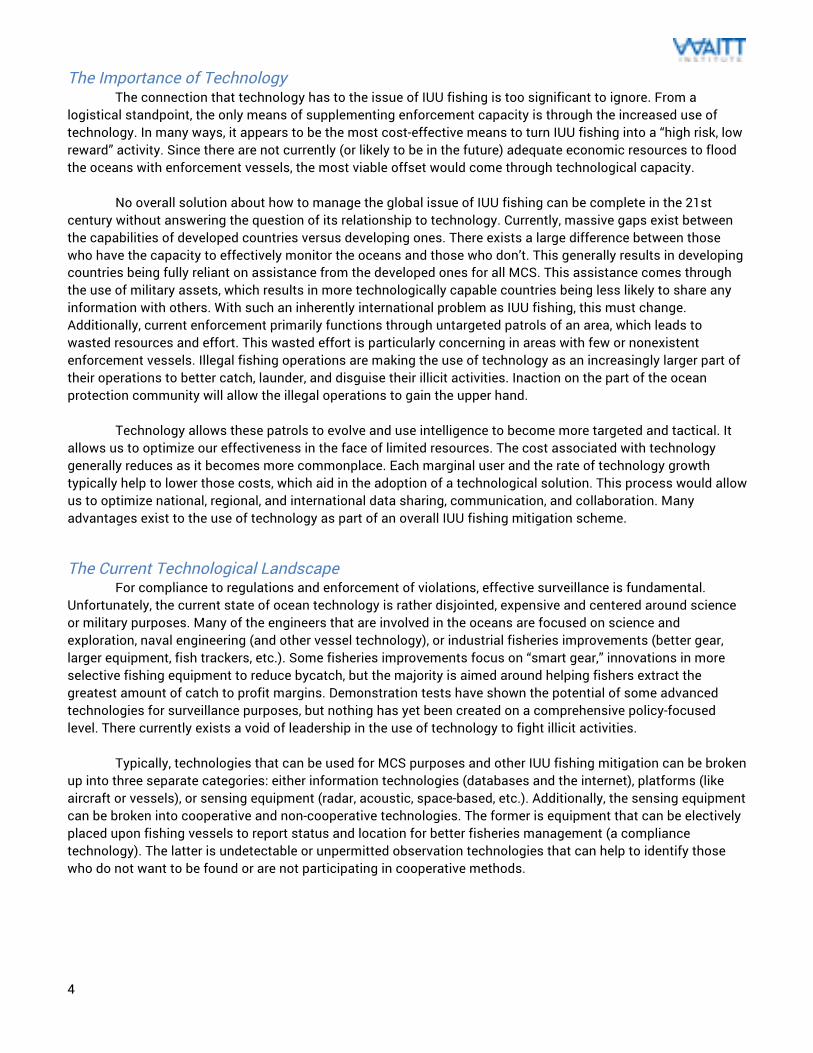
Typically, technologies that can be used for MCS purposes and other IUU fishing mitigation can be broken up into three separate categories: either information technologies (databases and the internet), platforms (like aircraft or vessels), or sensing equipment (radar, acoustic, space-based, etc.). Additionally, the sensing equipment can be broken into cooperative and non-cooperative technologies. The former is equipment that can be electively placed upon fishing vessels to report status and location for better fisheries management (a compliance technology). The latter is undetectable or unpermitted observation technologies that can help to identify those who do not want to be found or are not participating in cooperative methods.
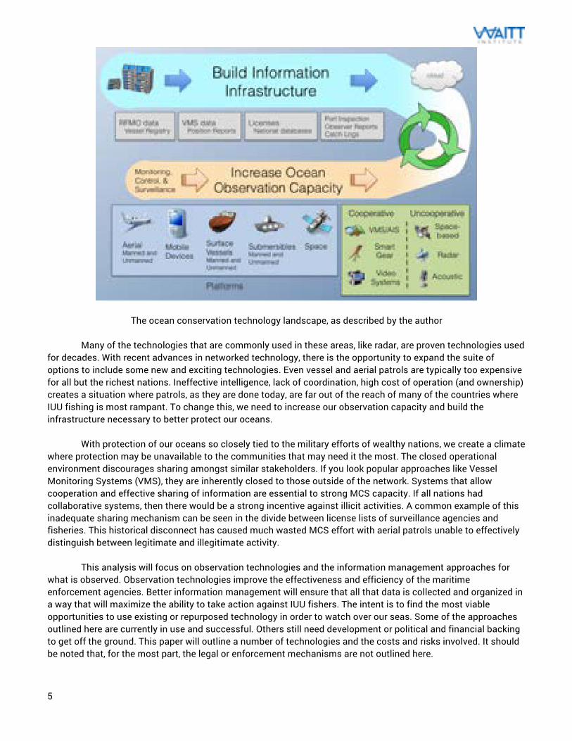
5
The ocean conservation technology landscape, as described by the author
Many of the technologies that are commonly used in these areas, like radar, are proven technologies used for decades. With recent advances in networked technology, there is the opportunity to expand the suite of options to include some new and exciting technologies. Even vessel and aerial patrols are typically too expensive for all but the richest nations. Ineffective intelligence, lack of coordination, high cost of operation (and ownership) creates a situation where patrols, as they are done today, are far out of the reach of many of the countries where IUU fishing is most rampant. To change this, we need to increase our observation capacity and build the infrastructure necessary to better protect our oceans.
With protection of our oceans so closely tied to the military efforts of wealthy nations, we create a climate where protection may be unavailable to the communities that may need it the most. The closed operational environment discourages sharing amongst similar stakeholders. If you look popular approaches like Vessel Monitoring Systems (VMS), they are inherently closed to those outside of the network. Systems that allow cooperation and effective sharing of information are essential to strong MCS capacity. If all nations had collaborative systems, then there would be a strong incentive against illicit activities. A common example of this inadequate sharing mechanism can be seen in the divide between license lists of surveillance agencies and fisheries. This historical disconnect has caused much wasted MCS effort with aerial patrols unable to effectively distinguish between legitimate and illegitimate activity.
This analysis will focus on observation technologies and the information management approaches for
what is observed. Observation technologies improve the effectiveness and efficiency of the maritime enforcement agencies. Better information management will ensure that all that data is collected and organized in a way that will maximize the ability to take action against IUU fishers. The intent is to find the most viable opportunities to use existing or repurposed technology in order to watch over our seas. Some of the approaches outlined here are currently in use and successful. Others still need development or political and financial backing to get off the ground. This paper will outline a number of technologies and the costs and risks involved. It should be noted that, for the most part, the legal or enforcement mechanisms are not outlined here.
6
Deterrence and Enforcement While the scope of this paper focuses on technologies that can be used for MCS and enforcement, a key
parameter in the management of MPAs is in compliance and deterrence. This can come from an effective outreach campaign and a well-trained and capable enforcement force. There must be ample effort and consideration taken to make sure these are effective. The most advanced technology available is only as effective as the users that are implementing it and collecting the data. Training and outreach are critical parts of this work. A trustworthy and highly visible enforcement approach can provide accountability on the water and demonstrate the seriousness of the administration in protecting their waters. An outreach communications campaign would help in making this more successful.
It has also been seen that one of the largest deterrents to illicit activity is the awareness of undetectable technological monitoring. Many of the technologies that are outlined in this report possess a considerable deterrence factor. Additionally, strategically communicated awareness of technological capabilities can provide substantial deterrence at negligible costs. Often times, the fear of being caught is effective enough at discouraging illegal activities. This can have the same impacts that you see in areas where a watchdog culture has emerged among fellow fishers, like in some of the Alaskan fisheries. The technologies covered in this report should be considered to be additive, and not necessarily chronological in implementation. There are details in each technology description that outlines the appropriate uses.
7
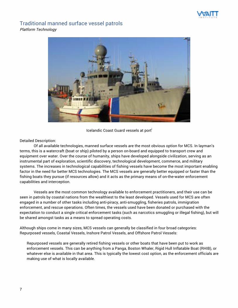
Traditional manned surface vessel patrols Platform Technology
Icelandic Coast Guard vessels at porti Detailed Description:
Of all available technologies, manned surface vessels are the most obvious option for MCS. In layman’s terms, this is a watercraft (boat or ship) piloted by a person on-board and equipped to transport crew and equipment over water. Over the course of humanity, ships have developed alongside civilization, serving as an instrumental part of exploration, scientific discovery, technological development, commerce, and military systems. The increases in technological capabilities of fishing vessels have become the most important enabling factor in the need for better MCS technologies. The MCS vessels are generally better equipped or faster than the fishing boats they pursue (if resources allow) and it acts as the primary means of on-the-water enforcement capabilities and interception.
Vessels are the most common technology available to enforcement practitioners, and their use can be
seen in patrols by coastal nations from the wealthiest to the least developed. Vessels used for MCS are often engaged in a number of other tasks including anti-piracy, anti-smuggling, fisheries patrols, immigration enforcement, and rescue operations. Often times, the vessels used have been donated or purchased with the expectation to conduct a single critical enforcement tasks (such as narcotics smuggling or illegal fishing), but will be shared amongst tasks as a means to spread operating costs. Although ships come in many sizes, MCS vessels can generally be classified in four broad categories: Repurposed vessels, Coastal Vessels, Inshore Patrol Vessels, and Offshore Patrol Vessels:
Repurposed vessels are generally retired fishing vessels or other boats that have been put to work as enforcement vessels. This can be anything from a Panga, Boston Whaler, Rigid Hull Inflatable Boat (RHIB), or whatever else is available in that area. This is typically the lowest cost option, as the enforcement officials are making use of what is locally available.
8
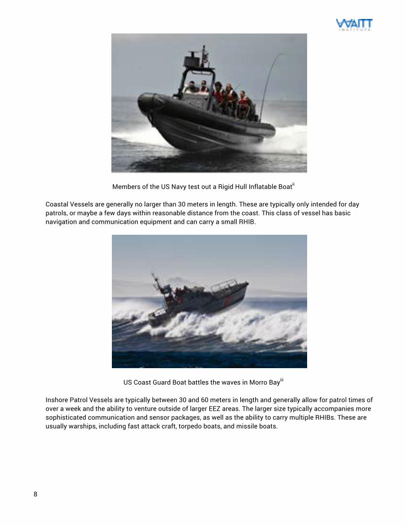
Members of the US Navy test out a Rigid Hull Inflatable Boatii Coastal Vessels are generally no larger than 30 meters in length. These are typically only intended for day patrols, or maybe a few days within reasonable distance from the coast. This class of vessel has basic navigation and communication equipment and can carry a small RHIB.
US Coast Guard Boat battles the waves in Morro Bayiii Inshore Patrol Vessels are typically between 30 and 60 meters in length and generally allow for patrol times of over a week and the ability to venture outside of larger EEZ areas. The larger size typically accompanies more sophisticated communication and sensor packages, as well as the ability to carry multiple RHIBs. These are usually warships, including fast attack craft, torpedo boats, and missile boats.
9
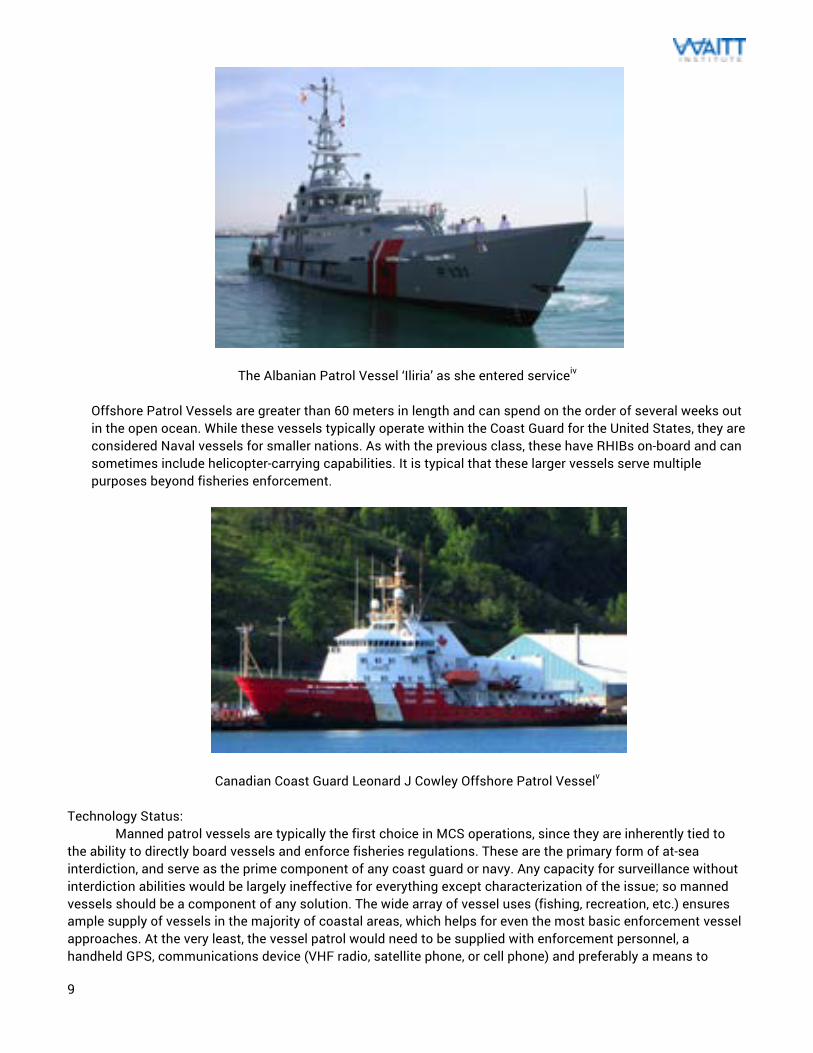
The Albanian Patrol Vessel ‘Iliria’ as she entered serviceiv Offshore Patrol Vessels are greater than 60 meters in length and can spend on the order of several weeks out in the open ocean. While these vessels typically operate within the Coast Guard for the United States, they are considered Naval vessels for smaller nations. As with the previous class, these have RHIBs on-board and can sometimes include helicopter-carrying capabilities. It is typical that these larger vessels serve multiple purposes beyond fisheries enforcement.
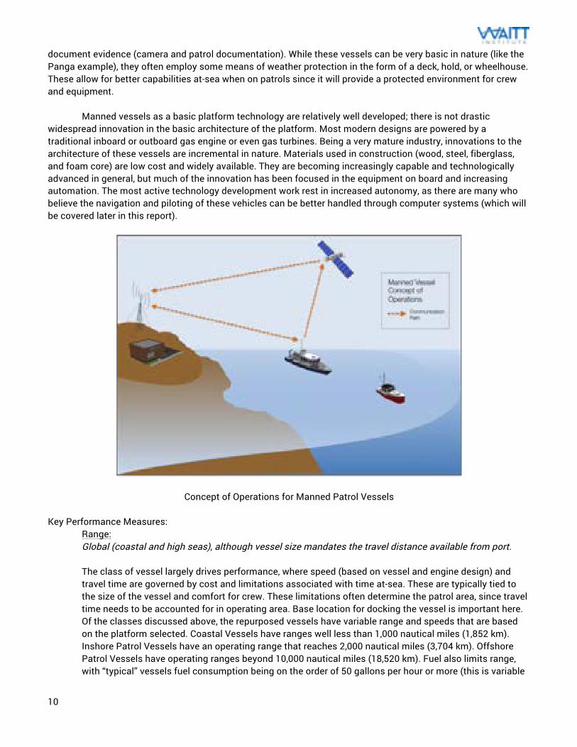
Canadian Coast Guard Leonard J Cowley Offshore Patrol Vesselv
Technology Status: Manned patrol vessels are typically the first choice in MCS operations, since they are inherently tied to the ability to directly board vessels and enforce fisheries regulations. These are the primary form of at-sea interdiction, and serve as the prime component of any coast guard or navy. Any capacity for surveillance without interdiction abilities would be largely ineffective for everything except characterization of the issue; so manned vessels should be a component of any solution. The wide array of vessel uses (fishing, recreation, etc.) ensures ample supply of vessels in the majority of coastal areas, which helps for even the most basic enforcement vessel approaches. At the very least, the vessel patrol would need to be supplied with enforcement personnel, a handheld GPS, communications device (VHF radio, satellite phone, or cell phone) and preferably a means to
10
document evidence (camera and patrol documentation). While these vessels can be very basic in nature (like the Panga example), they often employ some means of weather protection in the form of a deck, hold, or wheelhouse. These allow for better capabilities at-sea when on patrols since it will provide a protected environment for crew and equipment. Manned vessels as a basic platform technology are relatively well developed; there is not drastic widespread innovation in the basic architecture of the platform. Most modern designs are powered by a traditional inboard or outboard gas engine or even gas turbines. Being a very mature industry, innovations to the architecture of these vessels are incremental in nature. Materials used in construction (wood, steel, fiberglass, and foam core) are low cost and widely available. They are becoming increasingly capable and technologically advanced in general, but much of the innovation has been focused in the equipment on board and increasing automation. The most active technology development work rest in increased autonomy, as there are many who believe the navigation and piloting of these vehicles can be better handled through computer systems (which will be covered later in this report).
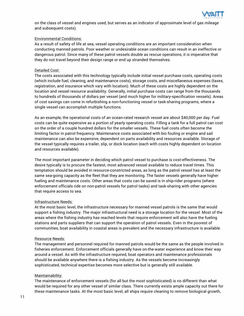
Concept of Operations for Manned Patrol Vessels
Key Performance Measures: Range: Global (coastal and high seas), although vessel size mandates the travel distance available from port. The class of vessel largely drives performance, where speed (based on vessel and engine design) and travel time are governed by cost and limitations associated with time at-sea. These are typically tied to the size of the vessel and comfort for crew. These limitations often determine the patrol area, since travel time needs to be accounted for in operating area. Base location for docking the vessel is important here. Of the classes discussed above, the repurposed vessels have variable range and speeds that are based on the platform selected. Coastal Vessels have ranges well less than 1,000 nautical miles (1,852 km). Inshore Patrol Vessels have an operating range that reaches 2,000 nautical miles (3,704 km). Offshore Patrol Vessels have operating ranges beyond 10,000 nautical miles (18,520 km). Fuel also limits range, with “typical” vessels fuel consumption being on the order of 50 gallons per hour or more (this is variable
11
on the class of vessel and engines used, but serves as an indicator of approximate level of gas mileage and subsequent costs). Environmental Conditions: As a result of safety of life at sea, vessel operating conditions are an important consideration when conducting manned patrols. Poor weather or undesirable ocean conditions can result in an ineffective or dangerous patrol. Since many of these patrol vessels double as rescue operations, it is imperative that they do not travel beyond their design range or end up stranded themselves. Detailed Cost: The costs associated with this technology typically include initial vessel purchase costs, operating costs (which include fuel, cleaning, and maintenance costs), storage costs, and miscellaneous expenses (taxes, registration, and insurance which vary with location). Much of these costs are highly dependent on the location and vessel resource availability. Generally, initial purchase costs can range from the thousands to hundreds of thousands of dollars per vessel (and much higher for military-specification vessels). Areas of cost savings can come in refurbishing a non-functioning vessel or task-sharing programs, where a single vessel can accomplish multiple functions. As an example, the operational costs of an ocean-rated research vessel are about $40,000 per day. Fuel costs can be quite expensive as a portion of yearly operating costs. Filling a tank for a full patrol can cost on the order of a couple hundred dollars for the smaller vessels. These fuel costs often become the limiting factor in patrol frequency. Maintenance costs associated with bio fouling or engine and sail maintenance can also be expensive, dependent on parts availability and resources available. Storage of the vessel typically requires a trailer, slip, or dock location (each with costs highly dependent on location and resources available). The most important parameter in deciding which patrol vessel to purchase is cost-effectiveness. The desire typically is to procure the fastest, most advanced vessel available to reduce travel times. This temptation should be avoided in resource-constricted areas, as long as the patrol vessel has at least the same sea-going capacity as the fleet that they are monitoring. The faster vessels generally have higher fueling and maintenance costs. Other areas that costs can be saved is in ship-rider programs (where enforcement officials ride on non-patrol vessels for patrol tasks) and task-sharing with other agencies that require access to sea. Infrastructure Needs: At the most basic level, the infrastructure necessary for manned vessel patrols is the same that would support a fishing industry. The major infrastructural need is a storage location for the vessel. Most of the areas where the fishing industry has reached levels that require enforcement will also have the fueling stations and parts suppliers that can support the operation of patrol vessels. Even in the poorest of communities, boat availability in coastal areas is prevalent and the necessary infrastructure is available.
Resource Needs: The management and personnel required for manned patrols would be the same as the people involved in fisheries enforcement. Enforcement officials generally have on-the-water experience and know their way around a vessel. As with the infrastructure required, boat operators and maintenance professionals should be available anywhere there is a fishing industry. As the vessels become increasingly sophisticated, technical expertise becomes more selective but is generally still available. Maintainability: The maintenance of enforcement vessels (for all but the most sophisticated) is no different than what would be required for any other vessel of similar class. There currently exists ample capacity out there for these maintenance tasks. At the most basic level, all ships require cleaning to remove biological growth,
12
hull repairs, repainting, and periodic engine maintenance. This work is process throughout the ship’s life, and it works best if conducted under a set schedule. Some of this maintenance includes dry-dock, which requires access to the underside of the vessel for repair. Evidence Creation: Since manned vessels are the primary way to perform vessel boarding, this platform technology has the highest potential for actionable data collection. Transporting enforcement officials to the offending vessel while at sea ensures that the illegal acts can be documented before any of the evidence is destroyed. This also allows for the most direct way to escort the vessel to port, so they can face prosecution.
Advantages: There are many obvious advantages that come with using a platform technology as prevalent as manned vessels. These are the best overall technology for enforcement purposes, as they allow both surveillance capabilities and the option for officials to directly interact with the perpetrator as the crime is taking place. For this reason, these vessels serve the strongest inherent deterrence factor as their presence helps to limit IUU activity. The advantages to many other technologies covered in this report cannot be fully realized without manned vessel capability for interdiction. All effective enforcement operations require manned vessel capabilities (typically referred to as “boots on the water”). Boats are also very common, particularly in areas where there exists a fishing industry in need of monitoring. Their prevalence makes their purchase and maintenance relatively easy and supports an existing expert community. Disadvantages: The issue with this platform is that it is difficult from a strategic standpoint, as it can be easily counteracted. The travel time required for these vessels and known storage locations allow IUU fishers the ability to track and react to when a vessel leaves port. Multi-vessel IUU operations typically include spotters that are focused on tracking patrol vessel movements. This is less possible under random patrol operations or roaming vessels (which are not assigned to a single port). For this reason, base station placement is critical to successful enforcement. Since surface travel is inherently slow in comparison to other technologies, this results in less than optimal coverage areas. Fuel costs are a major disadvantage for manned vessels, as they often are the largest limiter on patrol ability. In general, there is always a desire for more vessels, increased fuel funding, or newer equipment.
Implementation Approach:
13
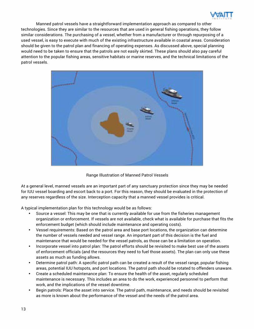
Manned patrol vessels have a straightforward implementation approach as compared to other technologies. Since they are similar to the resources that are used in general fishing operations, they follow similar considerations. The purchasing of a vessel, whether from a manufacturer or through repurposing of a used vessel, is easy to execute with much of the existing infrastructure available in coastal areas. Consideration should be given to the patrol plan and financing of operating expenses. As discussed above, special planning would need to be taken to ensure that the patrols are not easily skirted. These plans should also pay careful attention to the popular fishing areas, sensitive habitats or marine reserves, and the technical limitations of the patrol vessels.
Range Illustration of Manned Patrol Vessels At a general level, manned vessels are an important part of any sanctuary protection since they may be needed for IUU vessel boarding and escort back to a port. For this reason, they should be evaluated in the protection of any reserves regardless of the size. Interception capacity that a manned vessel provides is critical. A typical implementation plan for this technology would be as follows:
• Source a vessel: This may be one that is currently available for use from the fisheries management organization or enforcement. If vessels are not available, check what is available for purchase that fits the enforcement budget (which should include maintenance and operating costs).
• Vessel requirements: Based on the patrol area and base port locations, the organization can determine the number of vessels needed and vessel range. An important part of this decision is the fuel and maintenance that would be needed for the vessel patrols, as those can be a limitation on operation.
• Incorporate vessel into patrol plan: The patrol efforts should be revisited to make best use of the assets of enforcement officials (and the resources they need to fuel those assets). The plan can only use these assets as much as funding allows.
• Determine patrol path: A specific patrol path can be created a result of the vessel range, popular fishing areas, potential IUU hotspots, and port locations. The patrol path should be rotated to offenders unaware.
• Create a scheduled maintenance plan: To ensure the health of the asset, regularly scheduled maintenance is necessary. This includes an area to do the work, experienced personnel to perform that work, and the implications of the vessel downtime.
• Begin patrols: Place the asset into service. The patrol path, maintenance, and needs should be revisited as more is known about the performance of the vessel and the needs of the patrol area.
14
Traditional manned aerial patrols Platform Technology
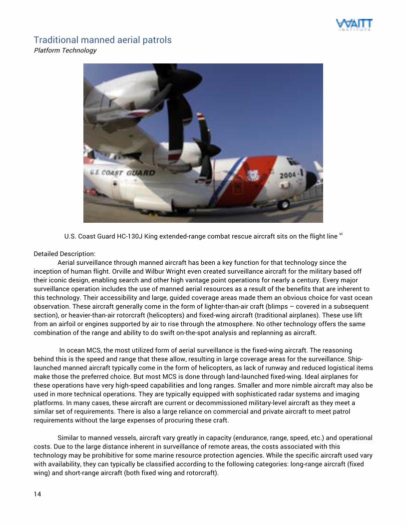
U.S. Coast Guard HC-130J King extended-range combat rescue aircraft sits on the flight line vi Detailed Description: Aerial surveillance through manned aircraft has been a key function for that technology since the inception of human flight. Orville and Wilbur Wright even created surveillance aircraft for the military based off their iconic design, enabling search and other high vantage point operations for nearly a century. Every major surveillance operation includes the use of manned aerial resources as a result of the benefits that are inherent to this technology. Their accessibility and large, guided coverage areas made them an obvious choice for vast ocean observation. These aircraft generally come in the form of lighter-than-air craft (blimps – covered in a subsequent section), or heavier-than-air rotorcraft (helicopters) and fixed-wing aircraft (traditional airplanes). These use lift from an airfoil or engines supported by air to rise through the atmosphere. No other technology offers the same combination of the range and ability to do swift on-the-spot analysis and replanning as aircraft. In ocean MCS, the most utilized form of aerial surveillance is the fixed-wing aircraft. The reasoning behind this is the speed and range that these allow, resulting in large coverage areas for the surveillance. Ship-launched manned aircraft typically come in the form of helicopters, as lack of runway and reduced logistical items make those the preferred choice. But most MCS is done through land-launched fixed-wing. Ideal airplanes for these operations have very high-speed capabilities and long ranges. Smaller and more nimble aircraft may also be used in more technical operations. They are typically equipped with sophisticated radar systems and imaging platforms. In many cases, these aircraft are current or decommissioned military-level aircraft as they meet a similar set of requirements. There is also a large reliance on commercial and private aircraft to meet patrol requirements without the large expenses of procuring these craft. Similar to manned vessels, aircraft vary greatly in capacity (endurance, range, speed, etc.) and operational costs. Due to the large distance inherent in surveillance of remote areas, the costs associated with this technology may be prohibitive for some marine resource protection agencies. While the specific aircraft used vary with availability, they can typically be classified according to the following categories: long-range aircraft (fixed wing) and short-range aircraft (both fixed wing and rotorcraft).
15
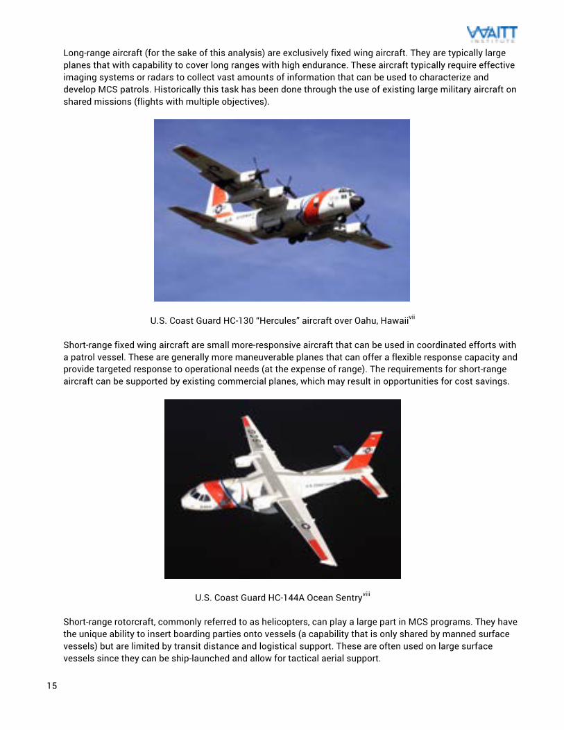
Long-range aircraft (for the sake of this analysis) are exclusively fixed wing aircraft. They are typically large planes that with capability to cover long ranges with high endurance. These aircraft typically require effective imaging systems or radars to collect vast amounts of information that can be used to characterize and develop MCS patrols. Historically this task has been done through the use of existing large military aircraft on shared missions (flights with multiple objectives).
U.S. Coast Guard HC-130 “Hercules” aircraft over Oahu, Hawaiivii Short-range fixed wing aircraft are small more-responsive aircraft that can be used in coordinated efforts with a patrol vessel. These are generally more maneuverable planes that can offer a flexible response capacity and provide targeted response to operational needs (at the expense of range). The requirements for short-range aircraft can be supported by existing commercial planes, which may result in opportunities for cost savings.
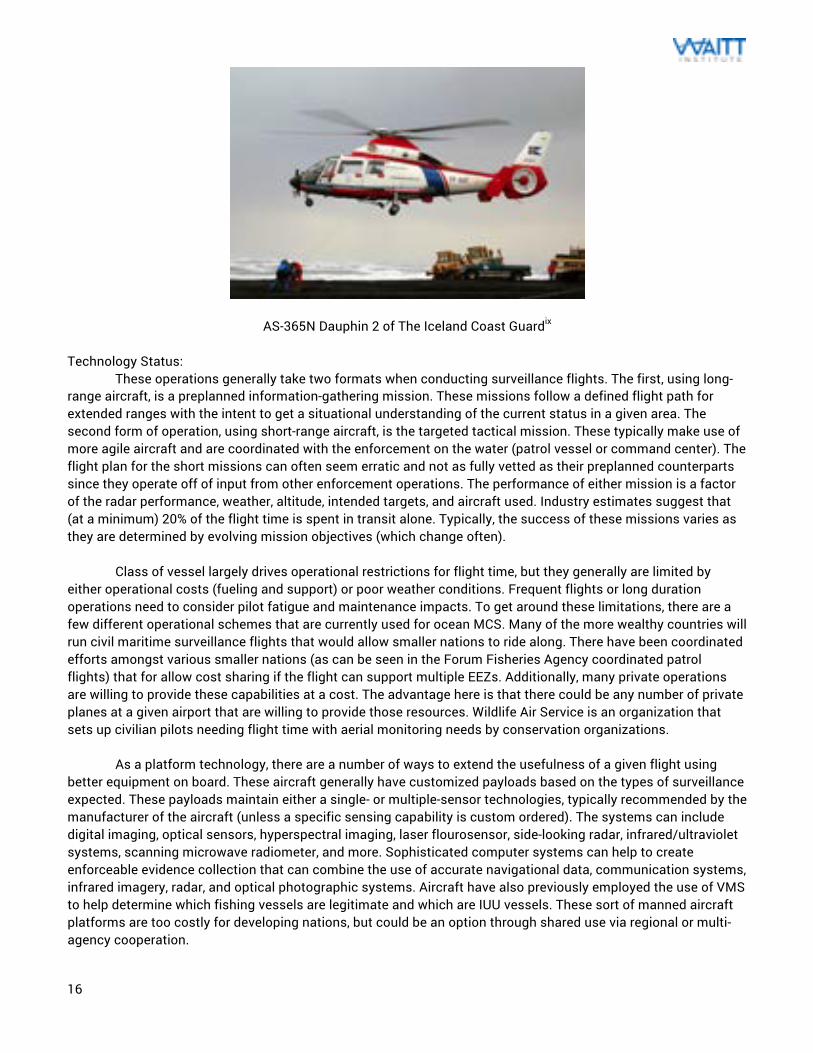
U.S. Coast Guard HC-144A Ocean Sentryviii Short-range rotorcraft, commonly referred to as helicopters, can play a large part in MCS programs. They have the unique ability to insert boarding parties onto vessels (a capability that is only shared by manned surface vessels) but are limited by transit distance and logistical support. These are often used on large surface vessels since they can be ship-launched and allow for tactical aerial support.
16
AS-365N Dauphin 2 of The Iceland Coast Guardix
Technology Status: These operations generally take two formats when conducting surveillance flights. The first, using long-range aircraft, is a preplanned information-gathering mission. These missions follow a defined flight path for extended ranges with the intent to get a situational understanding of the current status in a given area. The second form of operation, using short-range aircraft, is the targeted tactical mission. These typically make use of more agile aircraft and are coordinated with the enforcement on the water (patrol vessel or command center). The flight plan for the short missions can often seem erratic and not as fully vetted as their preplanned counterparts since they operate off of input from other enforcement operations. The performance of either mission is a factor of the radar performance, weather, altitude, intended targets, and aircraft used. Industry estimates suggest that (at a minimum) 20% of the flight time is spent in transit alone. Typically, the success of these missions varies as they are determined by evolving mission objectives (which change often). Class of vessel largely drives operational restrictions for flight time, but they generally are limited by either operational costs (fueling and support) or poor weather conditions. Frequent flights or long duration operations need to consider pilot fatigue and maintenance impacts. To get around these limitations, there are a few different operational schemes that are currently used for ocean MCS. Many of the more wealthy countries will run civil maritime surveillance flights that would allow smaller nations to ride along. There have been coordinated efforts amongst various smaller nations (as can be seen in the Forum Fisheries Agency coordinated patrol flights) that for allow cost sharing if the flight can support multiple EEZs. Additionally, many private operations are willing to provide these capabilities at a cost. The advantage here is that there could be any number of private planes at a given airport that are willing to provide those resources. Wildlife Air Service is an organization that sets up civilian pilots needing flight time with aerial monitoring needs by conservation organizations. As a platform technology, there are a number of ways to extend the usefulness of a given flight using better equipment on board. These aircraft generally have customized payloads based on the types of surveillance expected. These payloads maintain either a single- or multiple-sensor technologies, typically recommended by the manufacturer of the aircraft (unless a specific sensing capability is custom ordered). The systems can include digital imaging, optical sensors, hyperspectral imaging, laser flourosensor, side-looking radar, infrared/ultraviolet systems, scanning microwave radiometer, and more. Sophisticated computer systems can help to create enforceable evidence collection that can combine the use of accurate navigational data, communication systems, infrared imagery, radar, and optical photographic systems. Aircraft have also previously employed the use of VMS to help determine which fishing vessels are legitimate and which are IUU vessels. These sort of manned aircraft platforms are too costly for developing nations, but could be an option through shared use via regional or multi-agency cooperation.
17
There is a considerable amount of innovation taking place within aerial technology with their significance in the modern world. Much of that innovation focuses in commercial transport (through improved fuel efficiency, passenger capacity, and engine noise reduction) or in military superiority. Airframe design, for the sake of manned surveillance operations, has extracted the majority of the efficiency we can get out of today’s materials. As with ocean vessels, the most exciting innovation is coming through creating autonomous systems. Unmanned aircraft (as will be discussed later in this paper) is one of the most quickly growing technology areas today. Although manned aircraft will likely always remain some component of MCS, we will see an increasing amount of this effort being replaced by the unmanned vehicles as a result of their numerous advantages and lower operating costs. Key Performance Measures:
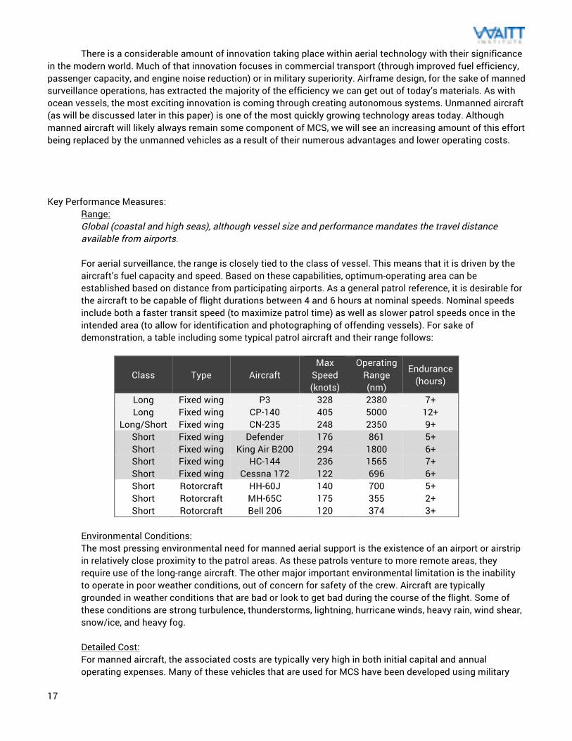
Range: Global (coastal and high seas), although vessel size and performance mandates the travel distance available from airports. For aerial surveillance, the range is closely tied to the class of vessel. This means that it is driven by the aircraft’s fuel capacity and speed. Based on these capabilities, optimum-operating area can be established based on distance from participating airports. As a general patrol reference, it is desirable for the aircraft to be capable of flight durations between 4 and 6 hours at nominal speeds. Nominal speeds include both a faster transit speed (to maximize patrol time) as well as slower patrol speeds once in the intended area (to allow for identification and photographing of offending vessels). For sake of demonstration, a table including some typical patrol aircraft and their range follows:
Class Type Aircraft Max
Speed (knots)
Operating Range (nm)
Endurance (hours)
Long Fixed wing P3 328 2380 7+ Long Fixed wing CP-140 405 5000 12+
Long/Short Fixed wing CN-235 248 2350 9+ Short Fixed wing Defender 176 861 5+ Short Fixed wing King Air B200 294 1800 6+ Short Fixed wing HC-144 236 1565 7+ Short Fixed wing Cessna 172 122 696 6+ Short Rotorcraft HH-60J 140 700 5+ Short Rotorcraft MH-65C 175 355 2+ Short Rotorcraft Bell 206 120 374 3+
Environmental Conditions: The most pressing environmental need for manned aerial support is the existence of an airport or airstrip in relatively close proximity to the patrol areas. As these patrols venture to more remote areas, they require use of the long-range aircraft. The other major important environmental limitation is the inability to operate in poor weather conditions, out of concern for safety of the crew. Aircraft are typically grounded in weather conditions that are bad or look to get bad during the course of the flight. Some of these conditions are strong turbulence, thunderstorms, lightning, hurricane winds, heavy rain, wind shear, snow/ice, and heavy fog. Detailed Cost: For manned aircraft, the associated costs are typically very high in both initial capital and annual operating expenses. Many of these vehicles that are used for MCS have been developed using military
18
requirements and maintain the costs associated with those types of systems. Aircraft purchase costs, for some of the vehicles outlined above, can vary from $35 million for the P-3 to $30,000 for a used Cessna 172 (with a newer Cessna at just under $200,000). Most aircraft that would provide adequate surveillance ability would cost in the $100,000+ range and up. Some areas have used ultralight aircraft to do surveillance (which has unique dangers and risks associated), where brand new kits for those aircraft can cost around $9,000 and require assembly. As a general rule, aircraft operating costs can be divided into fixed costs (insurance, storage/hangar fees) and variable costs (fuel, oil, and maintenance). The selection of an intended patrol aircraft is largely driven by the costs associated with this operation and maintenance. Aircraft operations can vary widely in cost-per-air-hour, dependent on the configuration of the aircraft and onboard equipment. Hourly rates for surveillance missions for their military counterparts can run anywhere from a few thousand USD to $50,000+ USD. Even small planes like the Cessina can have operating costs as much as $200 per hour. As a point of reference, Canada’s CP140 aircraft needs 180 hours of flight time to survey their coastlines, with flight costs in the military aircraft range. For resource constrained enforcement operations, this can be cost prohibitive. This is the appeal for cost sharing amongst agencies in order to make efficient use of this time. Additionally, an alternative to the potentially prohibitive costs of owning and operating a dedicated aircraft is through the use of the services of a commercial contractor. These commercial operations are not as directly impacted by fluctuations in governmental funding appropriations and can typically maintain cutting edge sensors and better management of operational cost. Smaller nations often send their enforcement officials to ride-along on the flights of wealthier ones to allow for this capacity to be obtained for cheap. If the area is one that has frequent private flights or small commercial plane traffic, a scheme could be developed to crowdsource that aerial monitoring capacity to a network of pilots who frequent the area. The plans for a system can be developed (including the supporting technology) if this approach is preferable. Infrastructure Needs: The infrastructure necessary for manned aircraft operations is available anywhere there is an airport or that currently supports flight operations. This includes the air traffic control, maintenance expertise, fueling needs, and parts availability. In some more remote regions, some of these needs may be less developed than in large metropolitan airports. All the same capacity necessary to operate transportation and cargo flights, from an infrastructure perspective, would be the same for surveillance flights. Resource Needs: The most critical need for aircraft is experienced pilots and operators to perform the surveillance tasks according to budget and plan. While surveillance flights (from a pilot’s perspective) are not entirely different than other forms of flights, there should be an understanding on how that specific mission tailors flight plans and the best methods for effective evidence collection. Enforcement officials could provide an understanding of the methods behind detection and evidence gathering that would correspond to local laws. Many times a spotter will join the pilot to help identify items of interest. Experienced maintenance technicians and a ground support team would also be needed, to act on any issues with the plane or provide additional support where necessary. Fortunately, there is a relatively wide base of expertise when it comes to manned aircraft. Maintainability: Regularly scheduled maintenance is a significant part of aircraft ownership and occupies a majority of airport operations on a daily basis. This includes regular inspections of hardware (and software updates) according to the schedule specified by the aircraft manufacturer and legislation. Special considerations need to be taken for engine overhaul, avionics performance, and instrument accuracy. The rigor of this maintenance plan should be high to account for safety of the crew and long aircraft life. Fortunately there is an experienced aircraft maintenance industry in nearly every country in the world, so this is one of the easier parts of relying on this platform technology. Airports supporting these flights typically have
19
maintenance staff available, but it should be verified that there are local resources capable of supporting and providing long-term maintenance of the aircraft. Evidence Creation: Manned aircraft with enforcement officials onboard have many advantages to collection of actionable data about what is happening at sea. High quality geo-referenced imagery and documentation can be collected under the assumption that the navigation system is accurate. Aircraft can circle over perpetrators, capturing vessel identification and flag or vessel conditions that could relate to fish quality or human rights abuses aboard the ship. These documentation abilities are further improved if the aircraft has communication channels to assets on the water (manned or unmanned). Any imagery that is collected needs to be done so in a way that is legally airtight with respect to GPS information, as this is a frequent area of issue from previous court cases. For aerial surveillance conducted under commercial providers, some nations require that enforcement officials ride along onboard (such as in Canada) for any of the collected information to be prosecutable.
Advantages: Traditional aircraft have clear advantages over many other platform technologies in their large global prevalence and ability to cover large distances relatively quickly. For these reasons, they are likely to remain a key tool in surveillance operations. For the foreseeable future, nations will continue to require manned military aircraft as part of the Air Force, Navy, or Coast Guard. With these assets and the availability of commercial aircraft, this platform will always be an option for surveillance. The use of manned aircraft has been thoroughly vetted for MCS operations with numerous aerial partners globally to help provide capacity and cooperating relationships. The technology is really versatile in its ability to provide either broad patrols or targeted response (much like ships, although at a much more rapid pace). Aircraft also have a considerable deterrence factor since they outpace many fishing vessels and have travel paths that are harder to deduce than patrol boats. Additionally, there is a belief that human pilots and operators have superior spotting abilities to the other technologies available today (although this may change as a result of current development in image processing software and MCS pilots of unmanned vehicles). Disadvantages: The major disadvantage with manned flight is the extremely high costs that are involved. This issue is a major limiter of the amount of flights that take place for ocean monitoring. Even the wealthiest militaries lack the funding necessary to make all the flights that they would like to make. These costs are the primary driver in the push to increased unmanned aircraft development and operations. Although cost sharing can help reduce this burden marginally, much of the coastal areas in the world cannot quite justify the expense for constant manned flights. There are limitations on flight distance that come from aircraft design and fuel capacity. While these can be incorporated into an overall MCS strategy, there still exists the need to couple this approach with on-the-water support or strong port controls. The documentation that is provided through aerial spotting needs to be combined with direct enforcement action. Additionally, these surveillance flights tend to be largely uneventful as a result of vast ocean expanses. This can fatigue the pilot and result in situations where something bad could occur. These missions, often called “dull, dirty, or dangerous” are the primary goal in replacement by UAVs.
20
Implementation Approach: As with manned patrol vessels, these aircraft have a straightforward implementation approach as a result of their global prevalence. Most places with airports can provide the logistical capabilities for the maintenance and operation of surveillance flights. The purchasing of an aircraft or coordination in some flight-sharing approach can be managed through normal air resource channels, which most governments have worked through previously. Airport infrastructure would support these activities. Patrol planning would be largely dependent on the areas in need of protection and the funding and aircraft resources available. These plans should pay careful attention to the popular fishing areas, sensitive habitats or marine reserves, and the technical limitations of the patrol aircraft. For most sanctuary protection today, it is likely that manned flights will be a component. As the MPAs get more remote in relation to a nearby airport, these benefits become more limited. A typical implementation plan for this technology would be as follows:
• Source an aircraft: This may be an aircraft that is currently available for use at the local airport. If aircraft are not available, check what is available for purchase that fits the enforcement budget (this is an expensive option).
• [Alternatively] Determine partnership requirements: Find regional aircraft surveillance providers that have access to an aircraft.
• Vessel requirements: Based on the patrol area, the flight plan can be determined. An important part of this decision is the fuel and flight frequency needed for the patrols.
• Determine patrol path: Gather inputs on frequent fishing areas, marine protected areas, and potential IUU hotspots. The fuel resources would drive flight frequency available. These patrol paths should be changed occasionally to keep perpetrators guessing.
• Create a scheduled maintenance plan: To ensure the health of the asset, regularly scheduled maintenance is necessary. This includes an area to do the work, experienced personnel to perform that work, and the implications of the vessel downtime.
• Begin patrols: Place the asset into service. The patrol path, maintenance, and other needs should be revisited as more is known about the performance of the vehicle and the needs of the patrol area.
21
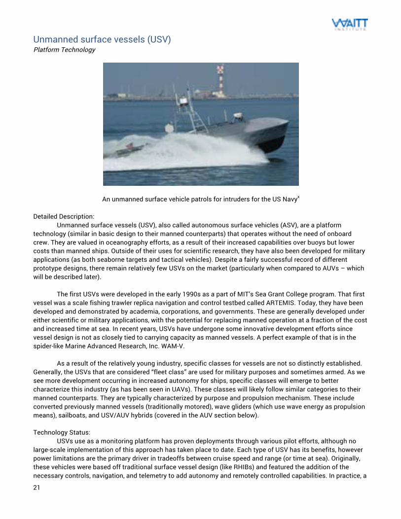
Unmanned surface vessels (USV) Platform Technology
An unmanned surface vehicle patrols for intruders for the US Navyx Detailed Description: Unmanned surface vessels (USV), also called autonomous surface vehicles (ASV), are a platform technology (similar in basic design to their manned counterparts) that operates without the need of onboard crew. They are valued in oceanography efforts, as a result of their increased capabilities over buoys but lower costs than manned ships. Outside of their uses for scientific research, they have also been developed for military applications (as both seaborne targets and tactical vehicles). Despite a fairly successful record of different prototype designs, there remain relatively few USVs on the market (particularly when compared to AUVs – which will be described later). The first USVs were developed in the early 1990s as a part of MIT’s Sea Grant College program. That first vessel was a scale fishing trawler replica navigation and control testbed called ARTEMIS. Today, they have been developed and demonstrated by academia, corporations, and governments. These are generally developed under either scientific or military applications, with the potential for replacing manned operation at a fraction of the cost and increased time at sea. In recent years, USVs have undergone some innovative development efforts since vessel design is not as closely tied to carrying capacity as manned vessels. A perfect example of that is in the spider-like Marine Advanced Research, Inc. WAM-V. As a result of the relatively young industry, specific classes for vessels are not so distinctly established. Generally, the USVs that are considered “fleet class” are used for military purposes and sometimes armed. As we see more development occurring in increased autonomy for ships, specific classes will emerge to better characterize this industry (as has been seen in UAVs). These classes will likely follow similar categories to their manned counterparts. They are typically characterized by purpose and propulsion mechanism. These include converted previously manned vessels (traditionally motored), wave gliders (which use wave energy as propulsion means), sailboats, and USV/AUV hybrids (covered in the AUV section below). Technology Status: USVs use as a monitoring platform has proven deployments through various pilot efforts, although no large-scale implementation of this approach has taken place to date. Each type of USV has its benefits, however power limitations are the primary driver in tradeoffs between cruise speed and range (or time at sea). Originally, these vehicles were based off traditional surface vessel design (like RHIBs) and featured the addition of the necessary controls, navigation, and telemetry to add autonomy and remotely controlled capabilities. In practice, a
22
crew ashore or on companion vessels remotely operates these boats much like traditional ROVs operate (but without the tether). The autonomy typically rests in the low-level vessel control (like throttling or rudder actuation) while overall patrol behavior (GPS waypoint selection) is performed by the operator. Under this scenario, multiple USVs could be managed through a single operator.
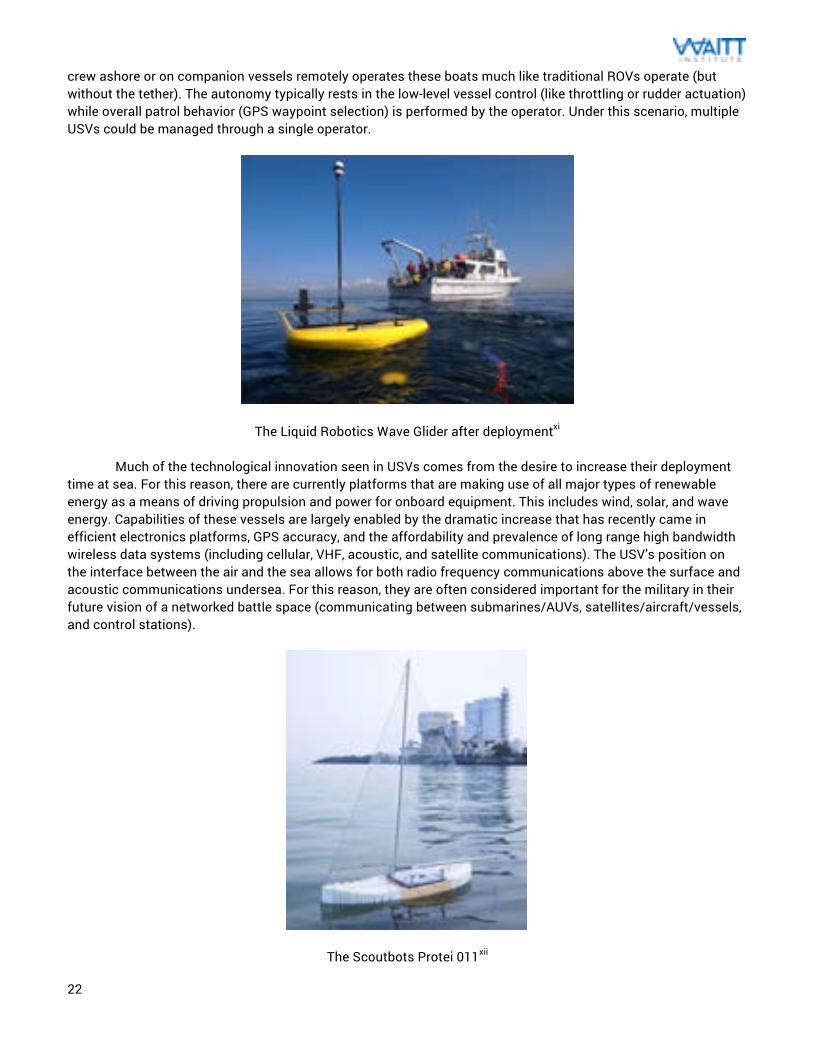
The Liquid Robotics Wave Glider after deploymentxi
Much of the technological innovation seen in USVs comes from the desire to increase their deployment time at sea. For this reason, there are currently platforms that are making use of all major types of renewable energy as a means of driving propulsion and power for onboard equipment. This includes wind, solar, and wave energy. Capabilities of these vessels are largely enabled by the dramatic increase that has recently came in efficient electronics platforms, GPS accuracy, and the affordability and prevalence of long range high bandwidth wireless data systems (including cellular, VHF, acoustic, and satellite communications). The USV’s position on the interface between the air and the sea allows for both radio frequency communications above the surface and acoustic communications undersea. For this reason, they are often considered important for the military in their future vision of a networked battle space (communicating between submarines/AUVs, satellites/aircraft/vessels, and control stations).
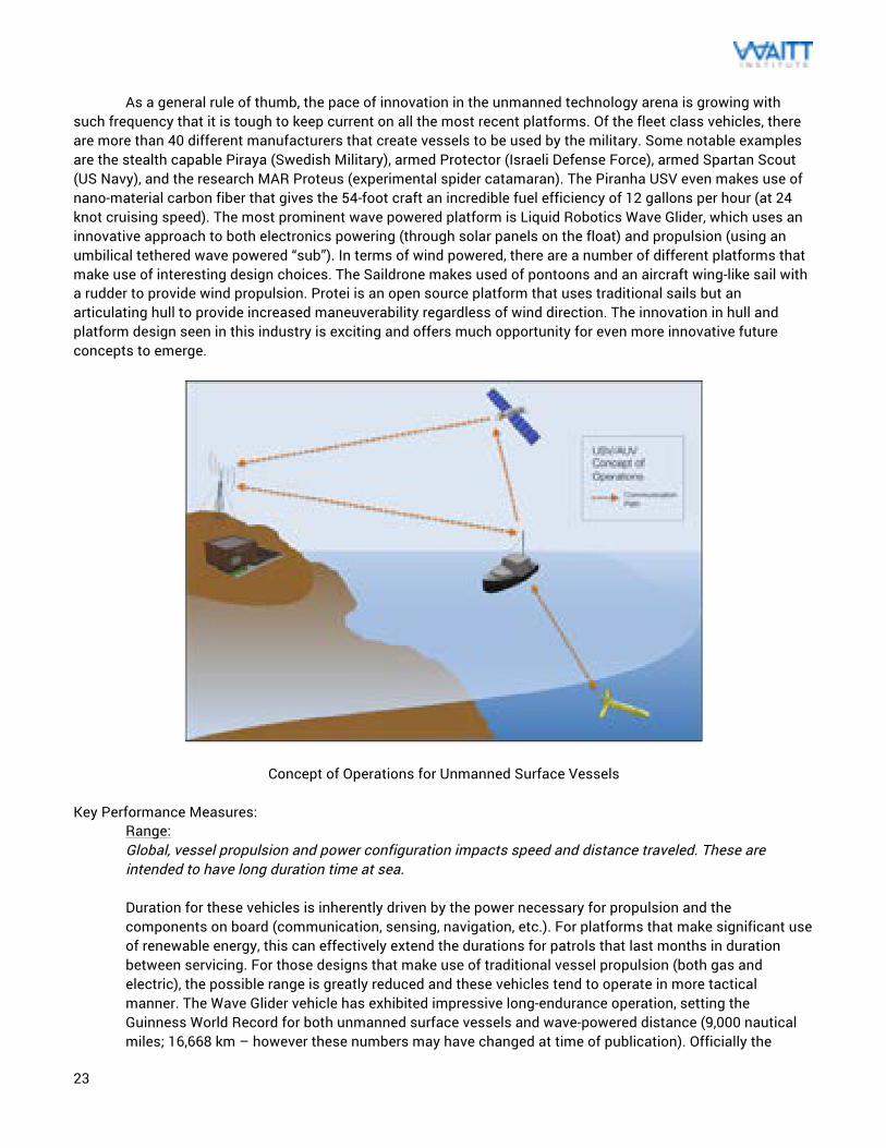
The Scoutbots Protei 011xii
23
As a general rule of thumb, the pace of innovation in the unmanned technology arena is growing with such frequency that it is tough to keep current on all the most recent platforms. Of the fleet class vehicles, there are more than 40 different manufacturers that create vessels to be used by the military. Some notable examples are the stealth capable Piraya (Swedish Military), armed Protector (Israeli Defense Force), armed Spartan Scout (US Navy), and the research MAR Proteus (experimental spider catamaran). The Piranha USV even makes use of nano-material carbon fiber that gives the 54-foot craft an incredible fuel efficiency of 12 gallons per hour (at 24 knot cruising speed). The most prominent wave powered platform is Liquid Robotics Wave Glider, which uses an innovative approach to both electronics powering (through solar panels on the float) and propulsion (using an umbilical tethered wave powered “sub”). In terms of wind powered, there are a number of different platforms that make use of interesting design choices. The Saildrone makes used of pontoons and an aircraft wing-like sail with a rudder to provide wind propulsion. Protei is an open source platform that uses traditional sails but an articulating hull to provide increased maneuverability regardless of wind direction. The innovation in hull and platform design seen in this industry is exciting and offers much opportunity for even more innovative future concepts to emerge.
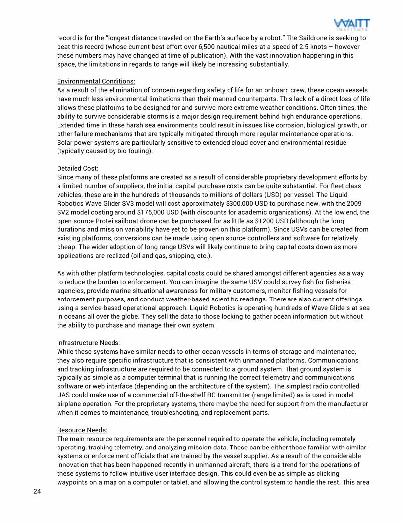
Concept of Operations for Unmanned Surface Vessels Key Performance Measures:
Range: Global, vessel propulsion and power configuration impacts speed and distance traveled. These are intended to have long duration time at sea. Duration for these vehicles is inherently driven by the power necessary for propulsion and the components on board (communication, sensing, navigation, etc.). For platforms that make significant use of renewable energy, this can effectively extend the durations for patrols that last months in duration between servicing. For those designs that make use of traditional vessel propulsion (both gas and electric), the possible range is greatly reduced and these vehicles tend to operate in more tactical manner. The Wave Glider vehicle has exhibited impressive long-endurance operation, setting the Guinness World Record for both unmanned surface vessels and wave-powered distance (9,000 nautical miles; 16,668 km – however these numbers may have changed at time of publication). Officially the
24
record is for the “longest distance traveled on the Earth’s surface by a robot.” The Saildrone is seeking to beat this record (whose current best effort over 6,500 nautical miles at a speed of 2.5 knots – however these numbers may have changed at time of publication). With the vast innovation happening in this space, the limitations in regards to range will likely be increasing substantially. Environmental Conditions: As a result of the elimination of concern regarding safety of life for an onboard crew, these ocean vessels have much less environmental limitations than their manned counterparts. This lack of a direct loss of life allows these platforms to be designed for and survive more extreme weather conditions. Often times, the ability to survive considerable storms is a major design requirement behind high endurance operations. Extended time in these harsh sea environments could result in issues like corrosion, biological growth, or other failure mechanisms that are typically mitigated through more regular maintenance operations. Solar power systems are particularly sensitive to extended cloud cover and environmental residue (typically caused by bio fouling). Detailed Cost: Since many of these platforms are created as a result of considerable proprietary development efforts by a limited number of suppliers, the initial capital purchase costs can be quite substantial. For fleet class vehicles, these are in the hundreds of thousands to millions of dollars (USD) per vessel. The Liquid Robotics Wave Glider SV3 model will cost approximately $300,000 USD to purchase new, with the 2009 SV2 model costing around $175,000 USD (with discounts for academic organizations). At the low end, the open source Protei sailboat drone can be purchased for as little as $1200 USD (although the long durations and mission variability have yet to be proven on this platform). Since USVs can be created from existing platforms, conversions can be made using open source controllers and software for relatively cheap. The wider adoption of long range USVs will likely continue to bring capital costs down as more applications are realized (oil and gas, shipping, etc.). As with other platform technologies, capital costs could be shared amongst different agencies as a way to reduce the burden to enforcement. You can imagine the same USV could survey fish for fisheries agencies, provide marine situational awareness for military customers, monitor fishing vessels for enforcement purposes, and conduct weather-based scientific readings. There are also current offerings using a service-based operational approach. Liquid Robotics is operating hundreds of Wave Gliders at sea in oceans all over the globe. They sell the data to those looking to gather ocean information but without the ability to purchase and manage their own system. Infrastructure Needs: While these systems have similar needs to other ocean vessels in terms of storage and maintenance, they also require specific infrastructure that is consistent with unmanned platforms. Communications and tracking infrastructure are required to be connected to a ground system. That ground system is typically as simple as a computer terminal that is running the correct telemetry and communications software or web interface (depending on the architecture of the system). The simplest radio controlled UAS could make use of a commercial off-the-shelf RC transmitter (range limited) as is used in model airplane operation. For the proprietary systems, there may be the need for support from the manufacturer when it comes to maintenance, troubleshooting, and replacement parts. Resource Needs: The main resource requirements are the personnel required to operate the vehicle, including remotely operating, tracking telemetry, and analyzing mission data. These can be either those familiar with similar systems or enforcement officials that are trained by the vessel supplier. As a result of the considerable innovation that has been happened recently in unmanned aircraft, there is a trend for the operations of these systems to follow intuitive user interface design. This could even be as simple as clicking waypoints on a map on a computer or tablet, and allowing the control system to handle the rest. This area
25
will end up getting more and more intuitive in the next few years, allowing for fewer demands on the operators. There is currently substantial work being done in the unmanned aircraft space that would translate nicely for USV use. Maintainability: As a result of the wide range of platform designs, the ease of maintenance for these vessels can vary greatly. At the most simple, these can follow similar maintenance approach as would be found in normal manned surface vessels (and outlined in a previous section). This would allow for repairs and periodic work to be done by any qualified boat mechanic. However, as the designs get more innovative and look less like a traditional boat, their proprietary design can make parts availability become more expensive. The autonomous nature of these vessels also includes fairly sophisticated electrical design and software, which would likely require expert assistance. The benefit behind these using open source programming or hardware for that part would result in a larger pool of experts to work with. Evidence Creation: Since these platforms are (for the most part) in pilot testing or limited deployment, their performance for the sake of evidence collection is yet to be fully demonstrated. There have been some successful demonstrations of the platform to behave as needed for MCS operations, but their full collection of data and prosecution based on that information has not formally be performed as of the writing of this document. As a means of gathering evidence, these would typically make use of geo-referenced photographic and/or acoustic data. The quality of collected data, authentication of sensors used, and GPS positioning would allow for a stronger case. This means the data can be proven to be accurate and georeferenced with clear identification of the vessel and illegal activity. Key information includes high quality imagery, accurate USV and ship positioning, and distance detection from the USV.
Advantages: The major advantage to this approach is its lack of a crew on board, which extends the time at sea and operating capabilities regardless of sea conditions. This is beneficial because the use of enforcement officers’ eyes as the primary observation capacity is not necessarily optimal use of personnel. Additionally, documenting illegal activities can be a dangerous prospect, so this achieves the important goal of removing the human from harms way. The autonomy that these vehicles possess is a significant advantage. With extremely long range and endurance, these can provide much greater on-the-water observation capabilities than most other platforms. Additionally, multiple vessels can be operated by a single team or operator, which helps drastically in the use of these systems. The lack of a need to carry a crew or equipment with specific height constraints enables these USVs to maintain a minimized silhouette. This minimized above-the-water superstructure is optimal for surveillance activities. The Wave Glider, when configured for MCS, is painted black and is difficult to find for even those who are tracking it for recovery. Disadvantages: The major disadvantage in the design of these systems is in the inherent tradeoff in speed versus duration. The faster designs typically have shorter range. The designs that focus on long endurance are typically optimized for low energy usage, which slows down their cruise speed. The Wave Glider, for example, travels a maximum of approximately 1.7 knots under optimal conditions. The slow speed puts the vessel at risk of vandalism or damage. This should be a concern for unmanned enforcement vessels, as IUU fishers may rather destroy the technology than allow it to bring them to justice. This also has implications on USVs that are operating in scientific purposes since the backlash of attacks on enforcement vessels could make these oceanographic instruments a target. There are also legal considerations to be considered with the use of unmanned vessels. If one were to accidently drift into the EEZ of an unfriendly nation, that action could be considered an aggressive act by the
26
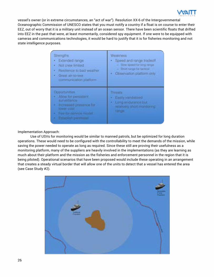
vessel’s owner (or in extreme circumstances, an “act of war”). Resolution XX-6 of the Intergovernmental Oceanographic Commission of UNESCO states that you must notify a country if a float is on course to enter their EEZ, out of worry that it is a military unit instead of an ocean sensor. There have been scientific floats that drifted into EEZ in the past that were, at least momentarily, considered spy equipment. If one were to be equipped with cameras and communications technologies, it would be hard to justify that it is for fisheries monitoring and not state intelligence purposes.
Implementation Approach: Use of USVs for monitoring would be similar to manned patrols, but be optimized for long duration operations. These would need to be configured with the controllability to meet the demands of the mission, while saving the power needed to operate as long as required. Since these still are proving their usefulness as a monitoring platform, many of the suppliers are heavily involved in the implementations (as they are learning as much about their platform and the mission as the fisheries and enforcement personnel in the region that it is being piloted). Operational scenarios that have been proposed would include these operating in an arrangement that creates a steady virtual border that will allow one of the units to detect that a vessel has entered the area (see Case Study #2).
27
Range Illustration of Unmanned Surface Vessels
These are generally configured for long duration deployments, which makes them useful for especially remote MPAs that need prolonged monitoring. They can also be used in near-shore uses, but the tradeoff in cost and operations when compared to a manned vessel should be evaluated. As the open source low cost options increase, there will be more incentive to make use of these in poorer communities. The industry should evolve into some more practical options over the next decade. A typically implementation plan for this technology would be as follows:
• Source a vessel: Since USVs are fairly new; this would need to be a new vessel. An assessment should be made to check what is available for purchase that fits the enforcement budget. For those who are technically inclined, a converted vessel or open source option could be available (although this approach is not commercially viable now).
• Vessel requirements: Based on the patrol area, base port locations, and deployment capabilities (from another vessel), the number of vessels needed and vessel range can be determined. An important part of this decision is the fuel and maintenance that would be needed for the vessel patrols, as those can be a limitation on operation. If the propulsion is renewable, then an expected coverage area should be determined.
• Incorporate vessel into patrol plan: The patrol efforts should be revisited to make best use of the assets that enforcement officials have (and the resources they need to fuel those assets). The plan can only use these assets as much as funding allows.
• Determine patrol path: A specific patrol path can be created a result of the vessel range, popular fishing areas, potential IUU hotspots, and port locations. This should be run from an operations control center.
• Create a scheduled maintenance plan: To ensure the health of the asset, regularly scheduled maintenance is necessary. This includes an area to do the work, experienced personnel to perform that work, and the implications of the vessel downtime. For automated systems, this may be more difficult.
• Begin patrols: Place the asset into service. The patrol path, maintenance, and needs should be revisited as more is known about the performance of the vessel and the needs of the patrol area.
28
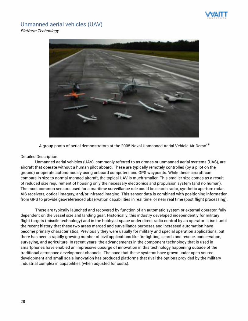
Unmanned aerial vehicles (UAV) Platform Technology
A group photo of aerial demonstrators at the 2005 Naval Unmanned Aerial Vehicle Air Demoxiii Detailed Description: Unmanned aerial vehicles (UAV), commonly referred to as drones or unmanned aerial systems (UAS), are aircraft that operate without a human pilot aboard. These are typically remotely controlled (by a pilot on the ground) or operate autonomously using onboard computers and GPS waypoints. While these aircraft can compare in size to normal manned aircraft, the typical UAV is much smaller. This smaller size comes as a result of reduced size requirement of housing only the necessary electronics and propulsion system (and no human). The most common sensors used for a maritime surveillance role could be search radar, synthetic aperture radar, AIS receivers, optical imagery, and/or infrared imaging. This sensor data is combined with positioning information from GPS to provide geo-referenced observation capabilities in real time, or near real time (post flight processing). These are typically launched and recovered by function of an automatic system or external operator, fully dependent on the vessel size and landing gear. Historically, this industry developed independently for military flight targets (missile technology) and in the hobbyist space under direct radio control by an operator. It isn’t until the recent history that these two areas merged and surveillance purposes and increased automation have become primary characteristics. Previously they were usually for military and special operation applications, but there has been a rapidly growing number of civil applications like firefighting, search and rescue, conservation, surveying, and agriculture. In recent years, the advancements in the component technology that is used in smartphones have enabled an impressive upsurge of innovation in this technology happening outside of the traditional aerospace development channels. The pace that these systems have grown under open source development and small scale innovation has produced platforms that rival the options provided by the military industrial complex in capabilities (when adjusted for costs).
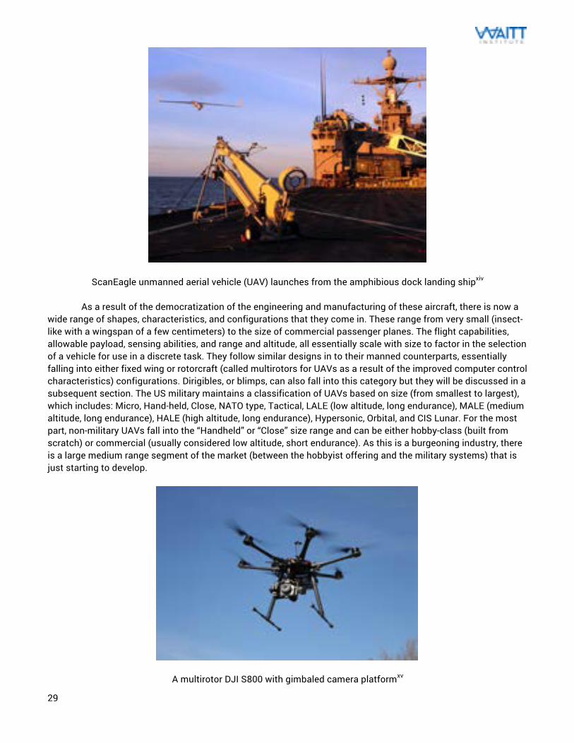
29
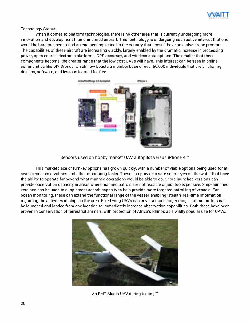
ScanEagle unmanned aerial vehicle (UAV) launches from the amphibious dock landing shipxiv As a result of the democratization of the engineering and manufacturing of these aircraft, there is now a wide range of shapes, characteristics, and configurations that they come in. These range from very small (insect-like with a wingspan of a few centimeters) to the size of commercial passenger planes. The flight capabilities, allowable payload, sensing abilities, and range and altitude, all essentially scale with size to factor in the selection of a vehicle for use in a discrete task. They follow similar designs in to their manned counterparts, essentially falling into either fixed wing or rotorcraft (called multirotors for UAVs as a result of the improved computer control characteristics) configurations. Dirigibles, or blimps, can also fall into this category but they will be discussed in a subsequent section. The US military maintains a classification of UAVs based on size (from smallest to largest), which includes: Micro, Hand-held, Close, NATO type, Tactical, LALE (low altitude, long endurance), MALE (medium altitude, long endurance), HALE (high altitude, long endurance), Hypersonic, Orbital, and CIS Lunar. For the most part, non-military UAVs fall into the “Handheld” or “Close” size range and can be either hobby-class (built from scratch) or commercial (usually considered low altitude, short endurance). As this is a burgeoning industry, there is a large medium range segment of the market (between the hobbyist offering and the military systems) that is just starting to develop.
A multirotor DJI S800 with gimbaled camera platformxv
30
Technology Status: When it comes to platform technologies, there is no other area that is currently undergoing more innovation and development than unmanned aircraft. This technology is undergoing such active interest that one would be hard pressed to find an engineering school in the country that doesn’t have an active drone program. The capabilities of these aircraft are increasing quickly, largely enabled by the dramatic increase in processing power, open source electronic platforms, GPS accuracy, and wireless data options. The smaller that these components become, the greater range that the low cost UAVs will have. This interest can be seen in online communities like DIY Drones, which now boasts a member base of over 50,000 individuals that are all sharing designs, software, and lessons learned for free.
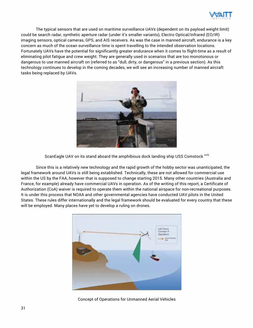
Sensors used on hobby market UAV autopilot versus iPhone 4.xvi This marketplace of turnkey options has grown quickly, with a number of viable options being used for at-sea science observations and other monitoring tasks. These can provide a safe set of eyes on the water that have the ability to operate far beyond what manned operations would be able to do. Shore-launched versions can provide observation capacity in areas where manned patrols are not feasible or just too expensive. Ship-launched versions can be used to supplement search capacity to help provide more targeted patrolling of vessels. For ocean monitoring, these can extend the functional range of the vessel, enabling ‘stealth’ real-time information regarding the activities of ships in the area. Fixed wing UAVs can cover a much larger range, but multirotors can be launched and landed from any location to immediately increase observation capabilities. Both these have been proven in conservation of terrestrial animals, with protection of Africa’s Rhinos as a wildly popular use for UAVs.
An EMT Aladin UAV during testingxvii
31
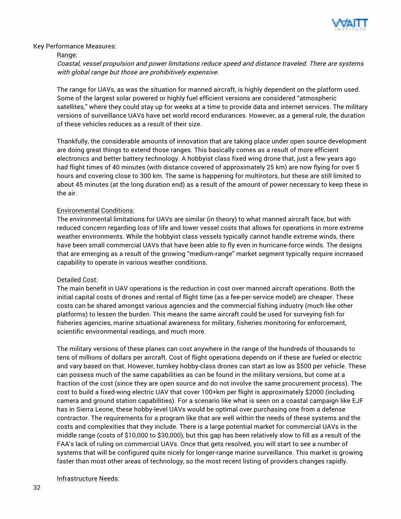
The typical sensors that are used on maritime surveillance UAVs (dependent on its payload weight limit) could be search radar, synthetic aperture radar (under it’s smaller variants), Electro Optical/Infrared (EO/IR) imaging sensors, optical cameras, GPS, and AIS receivers. As was the case in manned aircraft, endurance is a key concern as much of the ocean surveillance time is spent travelling to the intended observation locations. Fortunately UAVs have the potential for significantly greater endurance when it comes to flight-time as a result of eliminating pilot fatigue and crew weight. They are generally used in scenarios that are too monotonous or dangerous to use manned aircraft on (referred to as “dull, dirty, or dangerous” in a previous section). As this technology continues to develop in the coming decades, we will see an increasing number of manned aircraft tasks being replaced by UAVs.
ScanEagle UAV on its stand aboard the amphibious dock landing ship USS Comstock xviii Since this is a relatively new technology and the rapid growth of the hobby sector was unanticipated, the legal framework around UAVs is still being established. Technically, these are not allowed for commercial use within the US by the FAA, however that is supposed to change starting 2015. Many other countries (Australia and France, for example) already have commercial UAVs in operation. As of the writing of this report, a Certificate of Authorization (CoA) waiver is required to operate them within the national airspace for non-recreational purposes. It is under this process that NOAA and other governmental agencies have conducted UAV pilots in the United States. These rules differ internationally and the legal framework should be evaluated for every country that these will be employed. Many places have yet to develop a ruling on drones.
Concept of Operations for Unmanned Aerial Vehicles
32
Key Performance Measures:
Range: Coastal, vessel propulsion and power limitations reduce speed and distance traveled. There are systems with global range but those are prohibitively expensive.
The range for UAVs, as was the situation for manned aircraft, is highly dependent on the platform used. Some of the largest solar powered or highly fuel efficient versions are considered “atmospheric satellites,” where they could stay up for weeks at a time to provide data and internet services. The military versions of surveillance UAVs have set world record endurances. However, as a general rule, the duration of these vehicles reduces as a result of their size. Thankfully, the considerable amounts of innovation that are taking place under open source development are doing great things to extend those ranges. This basically comes as a result of more efficient electronics and better battery technology. A hobbyist class fixed wing drone that, just a few years ago had flight times of 40 minutes (with distance covered of approximately 25 km) are now flying for over 5 hours and covering close to 300 km. The same is happening for multirotors, but these are still limited to about 45 minutes (at the long duration end) as a result of the amount of power necessary to keep these in the air. Environmental Conditions: The environmental limitations for UAVs are similar (in theory) to what manned aircraft face, but with reduced concern regarding loss of life and lower vessel costs that allows for operations in more extreme weather environments. While the hobbyist class vessels typically cannot handle extreme winds, there have been small commercial UAVs that have been able to fly even in hurricane-force winds. The designs that are emerging as a result of the growing “medium-range” market segment typically require increased capability to operate in various weather conditions. Detailed Cost: The main benefit in UAV operations is the reduction in cost over manned aircraft operations. Both the initial capital costs of drones and rental of flight time (as a fee-per-service model) are cheaper. These costs can be shared amongst various agencies and the commercial fishing industry (much like other platforms) to lessen the burden. This means the same aircraft could be used for surveying fish for fisheries agencies, marine situational awareness for military, fisheries monitoring for enforcement, scientific environmental readings, and much more. The military versions of these planes can cost anywhere in the range of the hundreds of thousands to tens of millions of dollars per aircraft. Cost of flight operations depends on if these are fueled or electric and vary based on that. However, turnkey hobby-class drones can start as low as $500 per vehicle. These can possess much of the same capabilities as can be found in the military versions, but come at a fraction of the cost (since they are open source and do not involve the same procurement process). The cost to build a fixed-wing electric UAV that cover 100+km per flight is approximately $2000 (including camera and ground station capabilities). For a scenario like what is seen on a coastal campaign like EJF has in Sierra Leone, these hobby-level UAVs would be optimal over purchasing one from a defense contractor. The requirements for a program like that are well within the needs of these systems and the costs and complexities that they include. There is a large potential market for commercial UAVs in the middle range (costs of $10,000 to $30,000), but this gap has been relatively slow to fill as a result of the FAA’s lack of ruling on commercial UAVs. Once that gets resolved, you will start to see a number of systems that will be configured quite nicely for longer-range marine surveillance. This market is growing faster than most other areas of technology, so the most recent listing of providers changes rapidly.
Infrastructure Needs:
33
The advantage to UAV operation is the fact that you can support flexible operations from any location (not tied to airports like their manned counterparts). The hand-launched systems are very flexible and can be used anywhere. While these systems have similar needs to other platforms in terms of storage and maintenance, they also require specific infrastructure that is consistent with unmanned platforms. Communications and tracking infrastructure are required to be connected to a ground system. That ground system is typically as simple as a computer terminal that is running the correct telemetry and communications software or web interface (depending on the architecture of the system). The simplest radio controlled UAS could make use of a commercial off-the-shelf RC transmitter as is used in model airplane operation. For the proprietary systems, there may be the need for support from the manufacturer when it comes to maintenance, troubleshooting, and replacement parts. The hobby systems are being built globally, so there are a large number of online marketplaces that sell replacement parts for cheap. Resource Needs: The main resource requirements are the personnel required to operate the vehicle, including remotely operating, tracking telemetry, and analyzing mission data. These can be either those familiar with similar systems or enforcement officials that are trained by the vessel supplier. As a result of the considerable innovation that has happened recently in unmanned aircraft, there is trend for the operations of these systems to follow intuitive user interface design. This could even be as simple as clicking waypoints on a map on a computer or tablet, and allowing the control system to handle the rest. This area will end up getting more and more intuitive in the next few years, allowing for fewer demands on the operators. These systems largely fly themselves, so the need for operators to have RC airplane experience is getting less important. At the most basic, one pilot and one imagery analyst would allow for a single UAV to be flown and the information to be reviewed.
Maintainability: For the large-scale systems, the maintenance requirements are much like what is needed for traditional manned aircraft. In both these systems and the hobbyist versions, regularly scheduled maintenance is likely to be needed. This is very simple on the low-end models since there is a wealth of information as to how to do that available on the internet. The community around homebuilt drones (as a result of coming out of the open source and maker communities) is exceptionally helpful to troubleshoot and fix errors when they are encountered. Many of these systems are built using materials and methods that allow for quick repair. Crashing RC aircraft happens often as part of the build and testing process (when developing your own version) so these systems are optimized for easy repair. Replacement parts are abundant. Evidence Creation: There have been a number of pilot projects that demonstrate the potential of evidence collection using these systems. UAVs play a major part in the intelligence gathering process of the largest military programs in the world and, often times, their tactical operations are based solely off the information collected by these systems. There have not yet been any successful high profile examples where footage from a drone has been used in legal prosecution of a fisheries crime. The FAA recently attempted to prosecute an individual who flew an acrobatic UAV through a city, based on the footage that was posted online. The National Transportation Safety Board (NTSB) ruled in the UAV operator’s favor, but there are appeals open and the case is still ongoing at the time of publication. As a platform, there should be no reason why the footage collected could not be used to prosecute as long as the images are geo-referenced correctly and can focus on the vessel long enough to identify it. There would need to be special attention given to the accuracy of the data, quality of the imagery, and authentication of the hardware on the drone.
Advantages: There are a number of advantages in using this technology. These will be realized more and more as the prices drop and the capabilities increase. Drone technology will become the primary means of conducting aerial
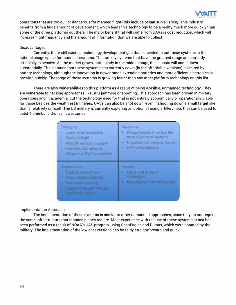
34
operations that are too dull or dangerous for manned flight (this include ocean surveillance). This industry benefits from a huge amount of development, which leads this technology to be a reality much more quickly than some of the other platforms out there. The major benefit that will come from UAVs is cost reduction, which will increase flight frequency and the amount of information that we are able to collect. Disadvantages: Currently, there still exists a technology development gap that is needed to put these systems in the optimal usage space for marine operations. The turnkey systems that have the greatest range are currently artificially expensive. As the market grows, particularly in the middle range, these costs will come down substantially. The distance that these systems can currently cover (in the affordable versions) is limited by battery technology, although the innovation in newer range-extending batteries and more efficient electronics is growing quickly. The range of these systems is growing faster than any other platform technology on this list. There are also vulnerabilities to this platform as a result of being a visible, unmanned technology. They are vulnerable to hacking approaches like GPS jamming or spoofing. This approach has been proven in military operations and in academia, but the technology used for that is not entirely economically or operationally viable for those besides the wealthiest militaries. UAVs can also be shot down, even if shooting down a small target like that is relatively difficult. The US military is currently exploring an option of using artillery nets that can be used to catch home-build drones in war zones.
Implementation Approach: The implementation of these systems is similar to other unmanned approaches, since they do not require the same infrastructure that manned planes require. Most experience with the use of these systems at sea has been performed as a result of NOAA’s UAS program, using ScanEagles and Pumas, which were donated by the military. The implementation of the low cost versions can be fairly straightforward and quick.
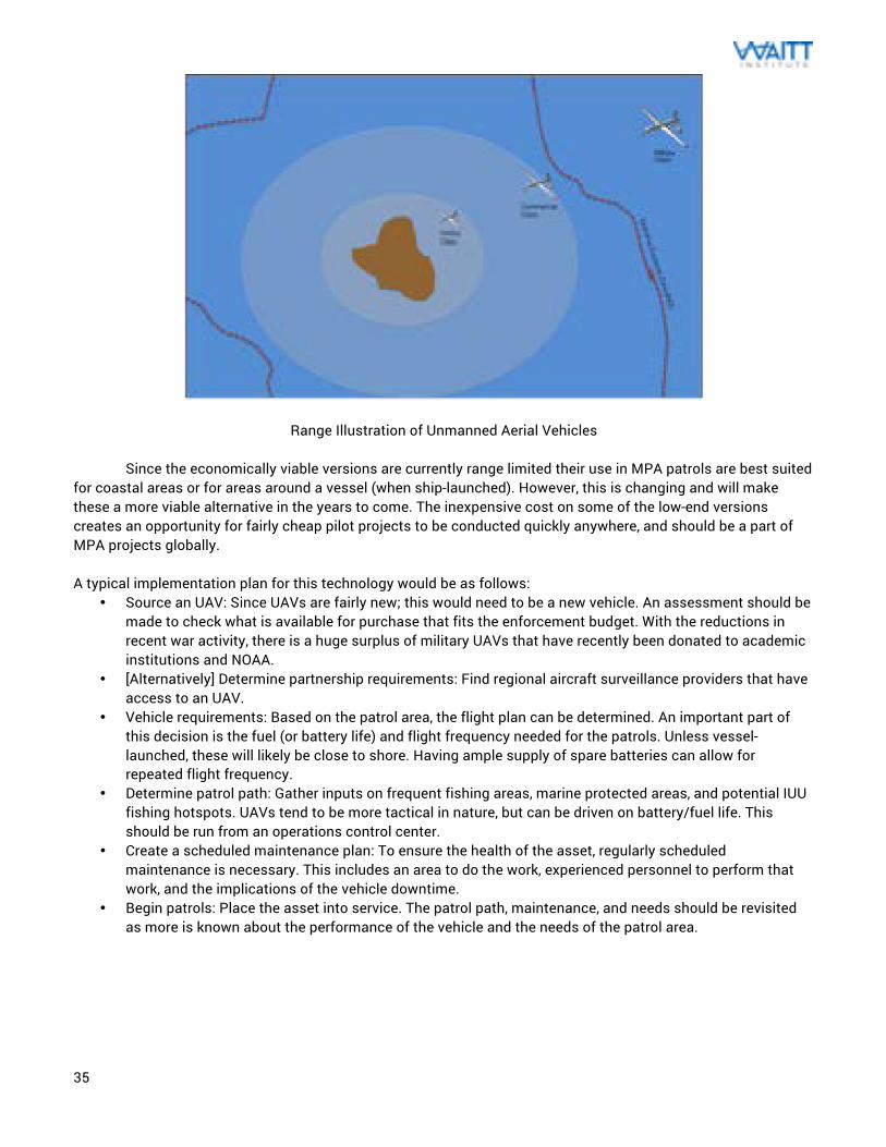
35
Range Illustration of Unmanned Aerial Vehicles Since the economically viable versions are currently range limited their use in MPA patrols are best suited
for coastal areas or for areas around a vessel (when ship-launched). However, this is changing and will make these a more viable alternative in the years to come. The inexpensive cost on some of the low-end versions creates an opportunity for fairly cheap pilot projects to be conducted quickly anywhere, and should be a part of MPA projects globally. A typical implementation plan for this technology would be as follows:
• Source an UAV: Since UAVs are fairly new; this would need to be a new vehicle. An assessment should be made to check what is available for purchase that fits the enforcement budget. With the reductions in recent war activity, there is a huge surplus of military UAVs that have recently been donated to academic institutions and NOAA.
• [Alternatively] Determine partnership requirements: Find regional aircraft surveillance providers that have access to an UAV.
• Vehicle requirements: Based on the patrol area, the flight plan can be determined. An important part of this decision is the fuel (or battery life) and flight frequency needed for the patrols. Unless vessel-launched, these will likely be close to shore. Having ample supply of spare batteries can allow for repeated flight frequency.
• Determine patrol path: Gather inputs on frequent fishing areas, marine protected areas, and potential IUU fishing hotspots. UAVs tend to be more tactical in nature, but can be driven on battery/fuel life. This should be run from an operations control center.
• Create a scheduled maintenance plan: To ensure the health of the asset, regularly scheduled maintenance is necessary. This includes an area to do the work, experienced personnel to perform that work, and the implications of the vehicle downtime.
• Begin patrols: Place the asset into service. The patrol path, maintenance, and needs should be revisited as more is known about the performance of the vehicle and the needs of the patrol area.
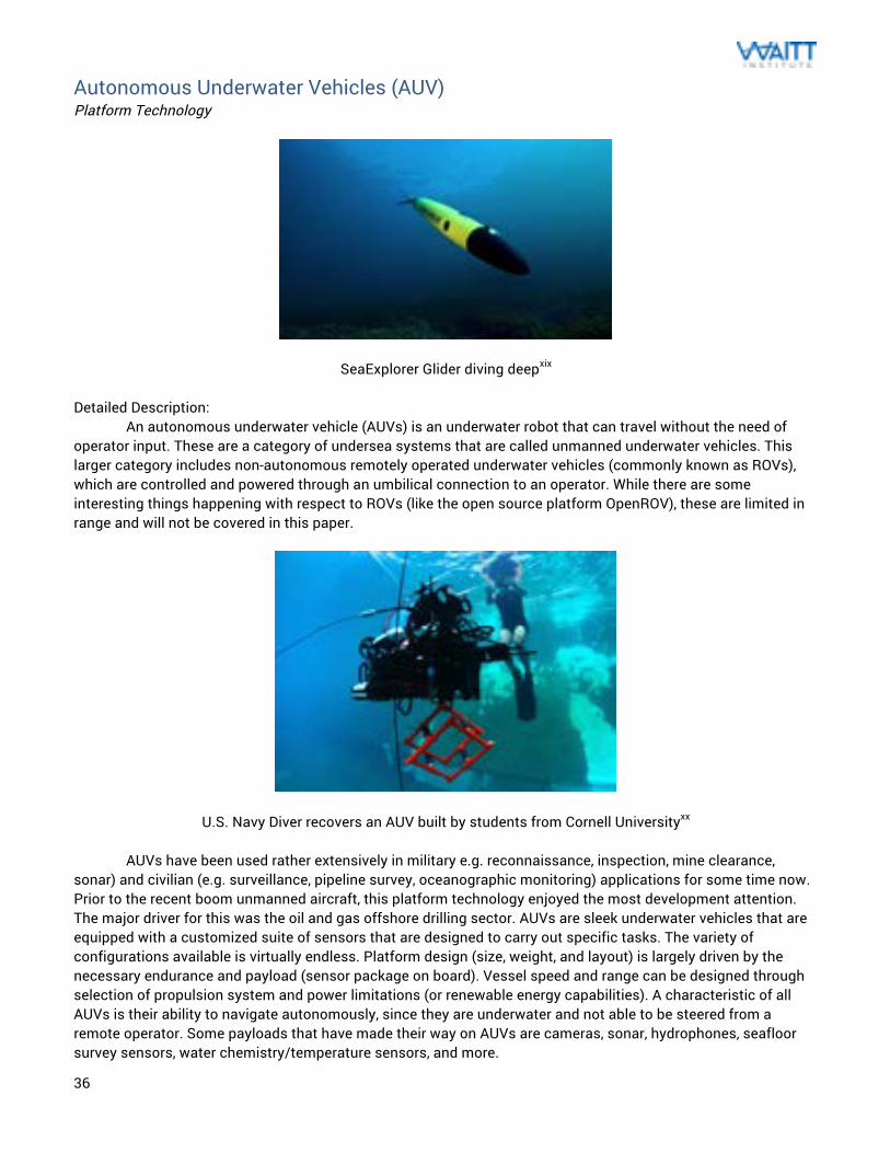
36
Autonomous Underwater Vehicles (AUV) Platform Technology
SeaExplorer Glider diving deepxix Detailed Description: An autonomous underwater vehicle (AUVs) is an underwater robot that can travel without the need of operator input. These are a category of undersea systems that are called unmanned underwater vehicles. This larger category includes non-autonomous remotely operated underwater vehicles (commonly known as ROVs), which are controlled and powered through an umbilical connection to an operator. While there are some interesting things happening with respect to ROVs (like the open source platform OpenROV), these are limited in range and will not be covered in this paper.
U.S. Navy Diver recovers an AUV built by students from Cornell Universityxx AUVs have been used rather extensively in military e.g. reconnaissance, inspection, mine clearance, sonar) and civilian (e.g. surveillance, pipeline survey, oceanographic monitoring) applications for some time now. Prior to the recent boom unmanned aircraft, this platform technology enjoyed the most development attention. The major driver for this was the oil and gas offshore drilling sector. AUVs are sleek underwater vehicles that are equipped with a customized suite of sensors that are designed to carry out specific tasks. The variety of configurations available is virtually endless. Platform design (size, weight, and layout) is largely driven by the necessary endurance and payload (sensor package on board). Vessel speed and range can be designed through selection of propulsion system and power limitations (or renewable energy capabilities). A characteristic of all AUVs is their ability to navigate autonomously, since they are underwater and not able to be steered from a remote operator. Some payloads that have made their way on AUVs are cameras, sonar, hydrophones, seafloor survey sensors, water chemistry/temperature sensors, and more.
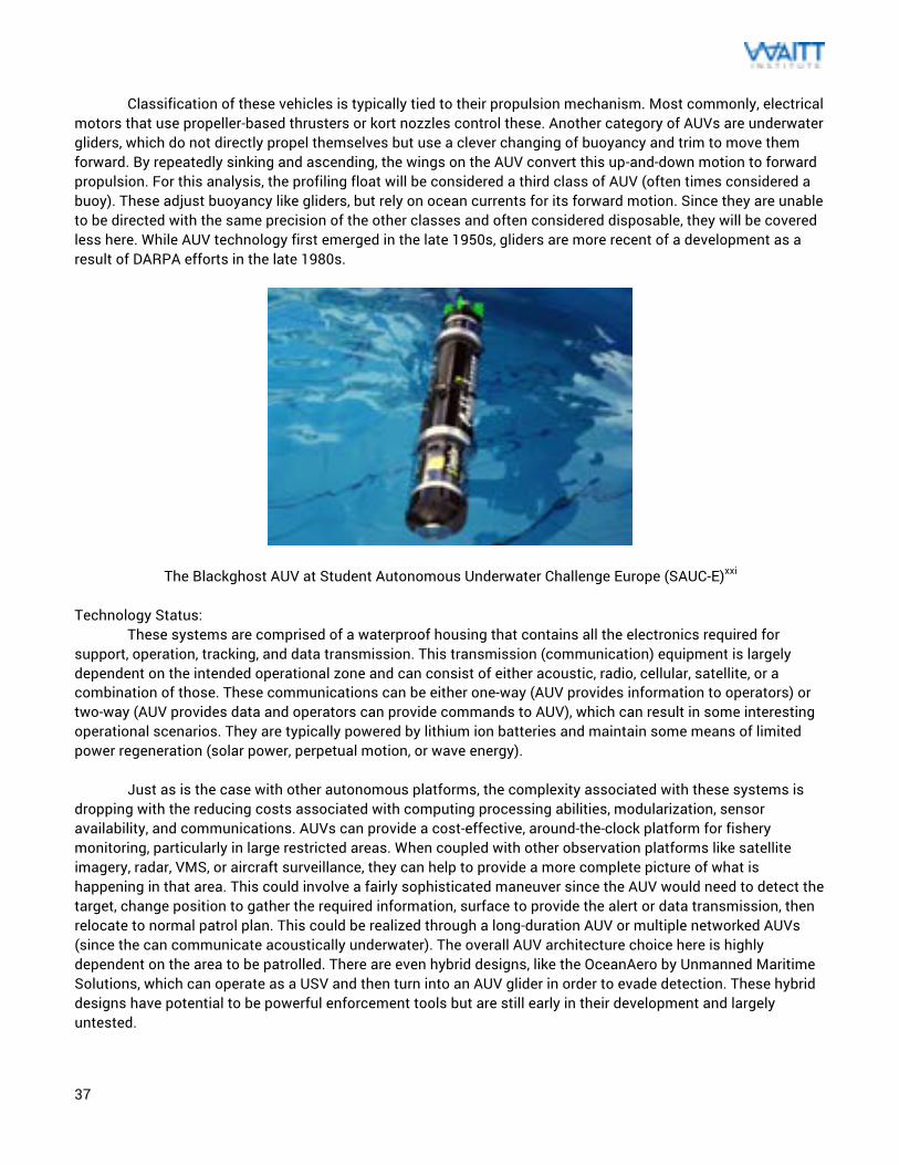
37
Classification of these vehicles is typically tied to their propulsion mechanism. Most commonly, electrical motors that use propeller-based thrusters or kort nozzles control these. Another category of AUVs are underwater gliders, which do not directly propel themselves but use a clever changing of buoyancy and trim to move them forward. By repeatedly sinking and ascending, the wings on the AUV convert this up-and-down motion to forward propulsion. For this analysis, the profiling float will be considered a third class of AUV (often times considered a buoy). These adjust buoyancy like gliders, but rely on ocean currents for its forward motion. Since they are unable to be directed with the same precision of the other classes and often considered disposable, they will be covered less here. While AUV technology first emerged in the late 1950s, gliders are more recent of a development as a result of DARPA efforts in the late 1980s.
The Blackghost AUV at Student Autonomous Underwater Challenge Europe (SAUC-E)xxi Technology Status: These systems are comprised of a waterproof housing that contains all the electronics required for support, operation, tracking, and data transmission. This transmission (communication) equipment is largely dependent on the intended operational zone and can consist of either acoustic, radio, cellular, satellite, or a combination of those. These communications can be either one-way (AUV provides information to operators) or two-way (AUV provides data and operators can provide commands to AUV), which can result in some interesting operational scenarios. They are typically powered by lithium ion batteries and maintain some means of limited power regeneration (solar power, perpetual motion, or wave energy).
Just as is the case with other autonomous platforms, the complexity associated with these systems is dropping with the reducing costs associated with computing processing abilities, modularization, sensor availability, and communications. AUVs can provide a cost-effective, around-the-clock platform for fishery monitoring, particularly in large restricted areas. When coupled with other observation platforms like satellite imagery, radar, VMS, or aircraft surveillance, they can help to provide a more complete picture of what is happening in that area. This could involve a fairly sophisticated maneuver since the AUV would need to detect the target, change position to gather the required information, surface to provide the alert or data transmission, then relocate to normal patrol plan. This could be realized through a long-duration AUV or multiple networked AUVs (since the can communicate acoustically underwater). The overall AUV architecture choice here is highly dependent on the area to be patrolled. There are even hybrid designs, like the OceanAero by Unmanned Maritime Solutions, which can operate as a USV and then turn into an AUV glider in order to evade detection. These hybrid designs have potential to be powerful enforcement tools but are still early in their development and largely untested.
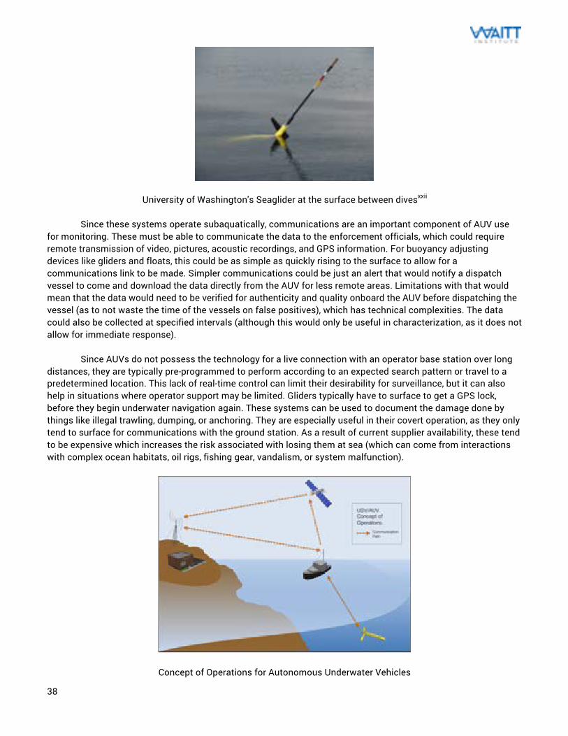
38
University of Washington's Seaglider at the surface between divesxxii Since these systems operate subaquatically, communications are an important component of AUV use for monitoring. These must be able to communicate the data to the enforcement officials, which could require remote transmission of video, pictures, acoustic recordings, and GPS information. For buoyancy adjusting devices like gliders and floats, this could be as simple as quickly rising to the surface to allow for a communications link to be made. Simpler communications could be just an alert that would notify a dispatch vessel to come and download the data directly from the AUV for less remote areas. Limitations with that would mean that the data would need to be verified for authenticity and quality onboard the AUV before dispatching the vessel (as to not waste the time of the vessels on false positives), which has technical complexities. The data could also be collected at specified intervals (although this would only be useful in characterization, as it does not allow for immediate response). Since AUVs do not possess the technology for a live connection with an operator base station over long distances, they are typically pre-programmed to perform according to an expected search pattern or travel to a predetermined location. This lack of real-time control can limit their desirability for surveillance, but it can also help in situations where operator support may be limited. Gliders typically have to surface to get a GPS lock, before they begin underwater navigation again. These systems can be used to document the damage done by things like illegal trawling, dumping, or anchoring. They are especially useful in their covert operation, as they only tend to surface for communications with the ground station. As a result of current supplier availability, these tend to be expensive which increases the risk associated with losing them at sea (which can come from interactions with complex ocean habitats, oil rigs, fishing gear, vandalism, or system malfunction).
Concept of Operations for Autonomous Underwater Vehicles
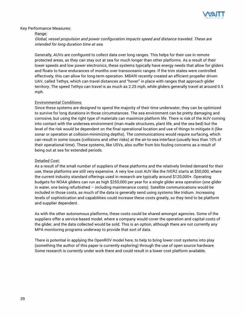
39
Key Performance Measures:
Range: Global, vessel propulsion and power configuration impacts speed and distance traveled. These are intended for long duration time at sea. Generally, AUVs are configured to collect data over long ranges. This helps for their use in remote protected areas, as they can stay out at sea for much longer than other platforms. As a result of their lower speeds and low power electronics, these systems typically have energy needs that allow for gliders and floats to have endurances of months over transoceanic ranges. If the trim states were controlled effectively, this can allow for long-term operation. MBARI recently created an efficient propeller driven UAV, called Tethys, which can travel distances and “hover” in place with ranges that approach glider territory. The speed Tethys can travel is as much as 2.25 mph, while gliders generally travel at around 0.5 mph. Environmental Conditions: Since these systems are designed to spend the majority of their time underwater, they can be optimized to survive for long durations in those circumstances. The sea environment can be pretty damaging and corrosive, but using the right type of materials can maximize platform life. There is risk of the AUV coming into contact with the undersea environment (man made structures, plant life, and the sea bed) but the level of the risk would be dependent on the final operational location and use of things to mitigate it (like sonar or operation at collision-minimizing depths). The communications would require surfacing, which can result in some issues (collisions and other risks) at the air-to-sea interface (usually less than 10% of their operational time). These systems, like USVs, also suffer from bio fouling concerns as a result of being out at sea for extended periods.
Detailed Cost: As a result of the small number of suppliers of these platforms and the relatively limited demand for their use, these platforms are still very expensive. A very low cost AUV like the IVER2 starts at $50,000, where the current industry standard offerings used in research are typically around $120,000+. Operating budgets for NOAA gliders can run as high $250,000 per year for a single glider area operation (one glider in water, one being refurbished – including maintenance costs). Satellite communications would be included in those costs, as much of the data is generally send using systems like Iridium. Increasing levels of sophistication and capabilities could increase these costs greatly, so they tend to be platform and supplier dependent. As with the other autonomous platforms, these costs could be shared amongst agencies. Some of the suppliers offer a service-based model, where a company would cover the operation and capital costs of the glider, and the data collected would be sold. This is an option, although there are not currently any MPA monitoring programs underway to provide that sort of data. There is potential in applying the OpenROV model here, to help to bring lower cost systems into play (something the author of this paper is currently exploring) through the use of open source hardware. Some research is currently under work there and could result in a lower cost platform available.
40
Infrastructure Needs: These systems typically require infrastructure similar to UAVs and USVs, although their long deployment durations mean that they are typically more autonomous in navigation purposes. They generally only need to infrastructure for deployments/retrieval and to monitor the data sent upon surfacing. Deployment and recovery generally happen using RHIBs or a charter boat. After the AUV is at sea, periodic checks on glider health and data collection can be managed through a normal computer interface. Communication approach (likely satellite for the distances) would need to be obtained to provide those checks. It is likely that considerable data storage hardware would be necessary since these typically surface a few times a day to receive commands, transmit data collected, and obtain positions. An enforcement AUV may have a different mission profile so that may change the surfacing schedule.
Resource Needs: AUVs require less direct navigation support than other unmanned technologies, so once deployed the operator requirements are reduced to whatever would be needed to make the periodic checks. The durations could be as much as 6 months (or longer) where this level of support would work. For the time around the deployments and recovery, there is an increased level of work necessary to do the pre- and post-processing of the AUV. For the actual deployment and recovery, a crew of 2-3 operators would be optimal. As the number of gliders operating at once increases, this operator need increases. A rule of thumb is that every 10 gliders would require 2-3 staff operators. Maintainability: Current AUV offerings are specialized products, where replacement parts and maintenance procedures are generally specific to the supplier and provided along with purchase of these vessels (this should include some level of support for a set time or vessel life). As a result of this proprietary nature, repairs and maintenance could get costly. However, issues like hull or electrical failure could lead to total loss of the AUV. Periodic maintenance and calibration of the equipment onboard would need to be done to keep these reliable. The preparation for the deployment would need someone knowledgeable in AUVs to perform the testing, battery recharging, re-ballasting, calibration, and mission software programming.
Creation of a framework like that of the open source hobby UAV community could change that, particularly if a “standard” platform configuration like OpenROV could be established. This could lessen the burden of maintenance to any open source community member instead of proprietary engineers only. Evidence Creation: The ability for AUVs to be used to create prosecutable data against IUU operations has yet to be demonstrated. There have been pilots to show their ability to gather meaningful data, like images or acoustic data in the environment around the platform. There is a limitation for AUVs in that their time is primarily spent underwater so it would likely have to surface to capture any useful evidence. As their automation and capabilities increase, these could be programmed to follow acoustic signals to surface and gather the appropriate information. This information would mean that it can be proven to be accurate and GPS authenticated (as well as being able to identify the vessel and illegal activity). Key information includes high quality imagery, accurate AUV and ship positioning, and distance detection from the AUV.
Advantages: The advantage that these have over the other platforms is ease of travel. The physics of undersea transport works out to more energy-saving navigation than aerial or surface transport. This allows these vessels to stay out much longer than the other vessels, although USVs ability to drift (or use wave or wind power) effectively matches this duration. Through using the clever glider configuration, these can operate more silently and discretely than USVs. This is a major benefit in passive acoustic sensors, since the AUV silence helps reduce
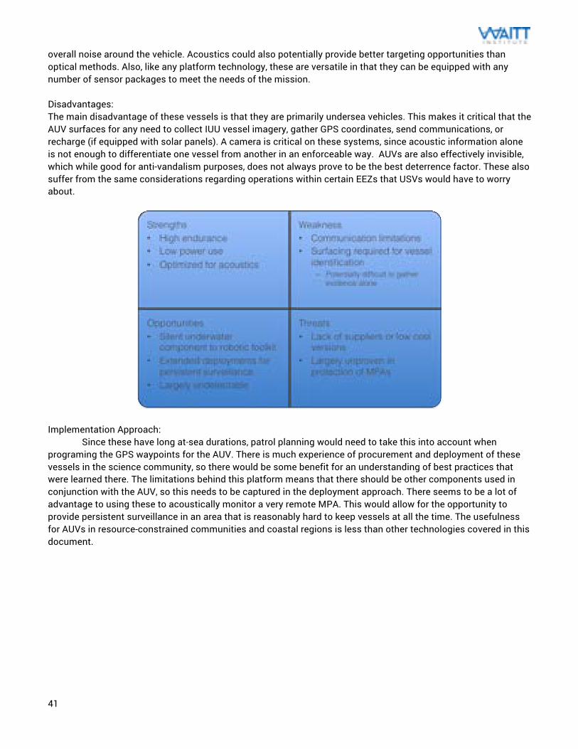
41
overall noise around the vehicle. Acoustics could also potentially provide better targeting opportunities than optical methods. Also, like any platform technology, these are versatile in that they can be equipped with any number of sensor packages to meet the needs of the mission. Disadvantages: The main disadvantage of these vessels is that they are primarily undersea vehicles. This makes it critical that the AUV surfaces for any need to collect IUU vessel imagery, gather GPS coordinates, send communications, or recharge (if equipped with solar panels). A camera is critical on these systems, since acoustic information alone is not enough to differentiate one vessel from another in an enforceable way. AUVs are also effectively invisible, which while good for anti-vandalism purposes, does not always prove to be the best deterrence factor. These also suffer from the same considerations regarding operations within certain EEZs that USVs would have to worry about.
Implementation Approach: Since these have long at-sea durations, patrol planning would need to take this into account when programing the GPS waypoints for the AUV. There is much experience of procurement and deployment of these vessels in the science community, so there would be some benefit for an understanding of best practices that were learned there. The limitations behind this platform means that there should be other components used in conjunction with the AUV, so this needs to be captured in the deployment approach. There seems to be a lot of advantage to using these to acoustically monitor a very remote MPA. This would allow for the opportunity to provide persistent surveillance in an area that is reasonably hard to keep vessels at all the time. The usefulness for AUVs in resource-constrained communities and coastal regions is less than other technologies covered in this document.
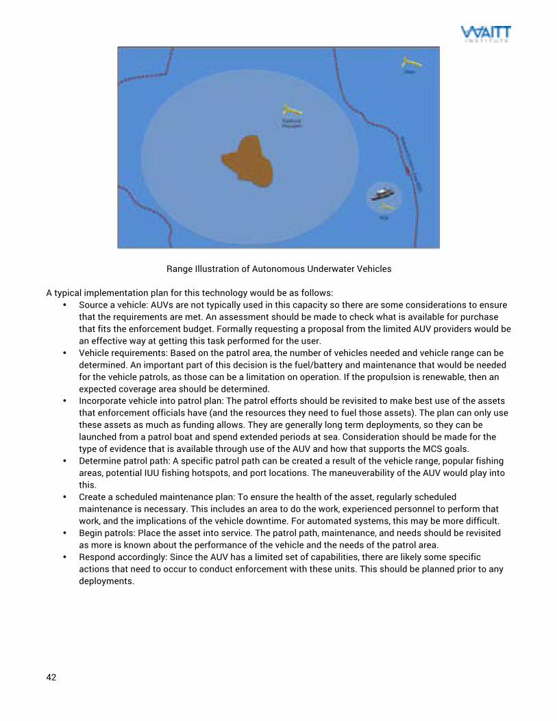
42
Range Illustration of Autonomous Underwater Vehicles A typical implementation plan for this technology would be as follows:
• Source a vehicle: AUVs are not typically used in this capacity so there are some considerations to ensure that the requirements are met. An assessment should be made to check what is available for purchase that fits the enforcement budget. Formally requesting a proposal from the limited AUV providers would be an effective way at getting this task performed for the user.
• Vehicle requirements: Based on the patrol area, the number of vehicles needed and vehicle range can be determined. An important part of this decision is the fuel/battery and maintenance that would be needed for the vehicle patrols, as those can be a limitation on operation. If the propulsion is renewable, then an expected coverage area should be determined.
• Incorporate vehicle into patrol plan: The patrol efforts should be revisited to make best use of the assets that enforcement officials have (and the resources they need to fuel those assets). The plan can only use these assets as much as funding allows. They are generally long term deployments, so they can be launched from a patrol boat and spend extended periods at sea. Consideration should be made for the type of evidence that is available through use of the AUV and how that supports the MCS goals.
• Determine patrol path: A specific patrol path can be created a result of the vehicle range, popular fishing areas, potential IUU fishing hotspots, and port locations. The maneuverability of the AUV would play into this.
• Create a scheduled maintenance plan: To ensure the health of the asset, regularly scheduled maintenance is necessary. This includes an area to do the work, experienced personnel to perform that work, and the implications of the vehicle downtime. For automated systems, this may be more difficult.
• Begin patrols: Place the asset into service. The patrol path, maintenance, and needs should be revisited as more is known about the performance of the vehicle and the needs of the patrol area.
• Respond accordingly: Since the AUV has a limited set of capabilities, there are likely some specific actions that need to occur to conduct enforcement with these units. This should be planned prior to any deployments.
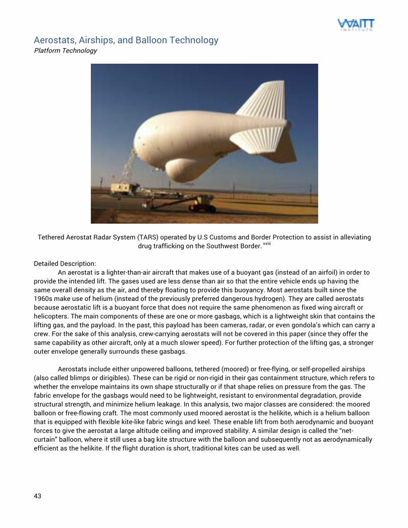
43
Aerostats, Airships, and Balloon Technology Platform Technology
Tethered Aerostat Radar System (TARS) operated by U.S Customs and Border Protection to assist in alleviating drug trafficking on the Southwest Border. xxiii
Detailed Description:
An aerostat is a lighter-than-air aircraft that makes use of a buoyant gas (instead of an airfoil) in order to provide the intended lift. The gases used are less dense than air so that the entire vehicle ends up having the same overall density as the air, and thereby floating to provide this buoyancy. Most aerostats built since the 1960s make use of helium (instead of the previously preferred dangerous hydrogen). They are called aerostats because aerostatic lift is a buoyant force that does not require the same phenomenon as fixed wing aircraft or helicopters. The main components of these are one or more gasbags, which is a lightweight skin that contains the lifting gas, and the payload. In the past, this payload has been cameras, radar, or even gondola’s which can carry a crew. For the sake of this analysis, crew-carrying aerostats will not be covered in this paper (since they offer the same capability as other aircraft, only at a much slower speed). For further protection of the lifting gas, a stronger outer envelope generally surrounds these gasbags.
Aerostats include either unpowered balloons, tethered (moored) or free-flying, or self-propelled airships
(also called blimps or dirigibles). These can be rigid or non-rigid in their gas containment structure, which refers to whether the envelope maintains its own shape structurally or if that shape relies on pressure from the gas. The fabric envelope for the gasbags would need to be lightweight, resistant to environmental degradation, provide structural strength, and minimize helium leakage. In this analysis, two major classes are considered: the moored balloon or free-flowing craft. The most commonly used moored aerostat is the helikite, which is a helium balloon that is equipped with flexible kite-like fabric wings and keel. These enable lift from both aerodynamic and buoyant forces to give the aerostat a large altitude ceiling and improved stability. A similar design is called the “net-curtain” balloon, where it still uses a bag kite structure with the balloon and subsequently not as aerodynamically efficient as the helikite. If the flight duration is short, traditional kites can be used as well.
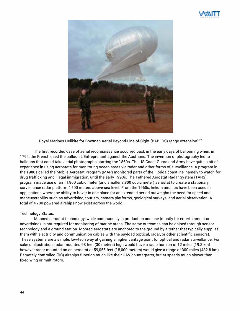
44
Royal Marines Helikite for Bowman Aerial Beyond-Line-of-Sight (BABLOS) range extensionxxiv
The first recorded case of aerial reconnaissance occurred back in the early days of ballooning when, in 1794, the French used the balloon L’Entreprenant against the Austrians. The invention of photography led to balloons that could take aerial photographs starting the 1860s. The US Coast Guard and Army have quite a bit of experience in using aerostats for monitoring ocean areas via radar and other forms of surveillance. A program in the 1980s called the Mobile Aerostat Program (MAP) monitored parts of the Florida coastline, namely to watch for drug trafficking and illegal immigration, until the early 1990s. The Tethered Aerostat Radar System (TARS) program made use of an 11,900 cubic meter (and smaller 7,800 cubic meter) aerostat to create a stationary surveillance radar platform 4,500 meters above sea level. From the 1960s, helium airships have been used in applications where the ability to hover in one place for an extended period outweighs the need for speed and maneuverability such as advertising, tourism, camera platforms, geological surveys, and aerial observation. A total of 4,700 powered airships now exist across the world. Technology Status: Manned aerostat technology, while continuously in production and use (mostly for entertainment or advertising), is not required for monitoring of marine areas. The same outcomes can be gained through sensor technology and a ground station. Moored aerostats are anchored to the ground by a tether that typically supplies them with electricity and communication cables with the payload (optical, radar, or other scientific sensors). These systems are a simple, low-tech way at gaining a higher vantage point for optical and radar surveillance. For sake of illustration, radar mounted 98 feet (30 meters) high would have a radio horizon of 12 miles (19.3 km) however radar mounted on an aerostat at 59,055 feet (18,000 meters) would give a range of 300 miles (482.8 km). Remotely controlled (RC) airships function much like their UAV counterparts, but at speeds much slower than fixed wing or multirotors.
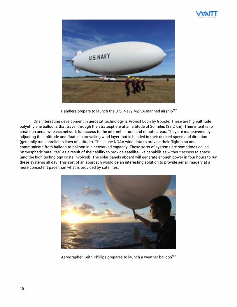
45
Handlers prepare to launch the U.S. Navy MZ-3A manned airshipxxv One interesting development in aerostat technology is Project Loon by Google. These are high-altitude polyethylene balloons that travel through the stratosphere at an altitude of 20 miles (32.2 km). Their intent is to create an aerial wireless network for access to the internet in rural and remote areas. They are maneuvered by adjusting their altitude and float in a prevailing wind layer that is headed in their desired speed and direction (generally runs parallel to lines of latitude). These use NOAA wind data to provide their flight plan and communicate from balloon-to-balloon in a networked capacity. These sorts of systems are sometimes called “atmospheric satellites” as a result of their ability to provide satellite-like capabilities without access to space (and the high technology costs involved). The solar panels aboard will generate enough power in four hours to run these systems all day. This sort of an approach would be an interesting solution to provide aerial imagery at a more consistent pace than what is provided by satellites.
Aerographer Keith Phillips prepares to launch a weather balloonxxvi
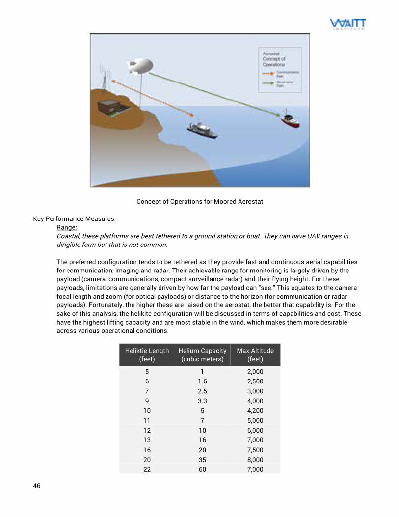
46
Concept of Operations for Moored Aerostat Key Performance Measures:
Range: Coastal, these platforms are best tethered to a ground station or boat. They can have UAV ranges in dirigible form but that is not common. The preferred configuration tends to be tethered as they provide fast and continuous aerial capabilities for communication, imaging and radar. Their achievable range for monitoring is largely driven by the payload (camera, communications, compact surveillance radar) and their flying height. For these payloads, limitations are generally driven by how far the payload can “see.” This equates to the camera focal length and zoom (for optical payloads) or distance to the horizon (for communication or radar payloads). Fortunately, the higher these are raised on the aerostat, the better that capability is. For the sake of this analysis, the helikite configuration will be discussed in terms of capabilities and cost. These have the highest lifting capacity and are most stable in the wind, which makes them more desirable across various operational conditions.
Heliktie Length (feet)
Helium Capacity (cubic meters)
Max Altitude (feet)
5 1 2,000 6 1.6 2,500 7 2.5 3,000 9 3.3 4,000
10 5 4,200 11 7 5,000 12 10 6,000 13 16 7,000 16 20 7,500 20 35 8,000 22 60 7,000
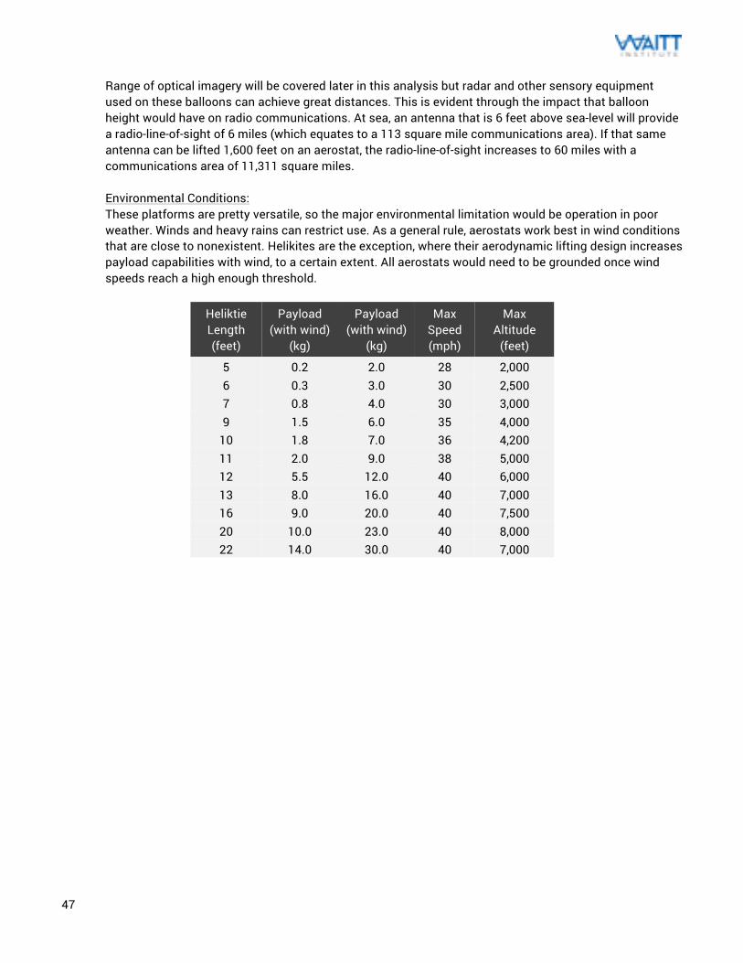
47
Range of optical imagery will be covered later in this analysis but radar and other sensory equipment used on these balloons can achieve great distances. This is evident through the impact that balloon height would have on radio communications. At sea, an antenna that is 6 feet above sea-level will provide a radio-line-of-sight of 6 miles (which equates to a 113 square mile communications area). If that same antenna can be lifted 1,600 feet on an aerostat, the radio-line-of-sight increases to 60 miles with a communications area of 11,311 square miles. Environmental Conditions: These platforms are pretty versatile, so the major environmental limitation would be operation in poor weather. Winds and heavy rains can restrict use. As a general rule, aerostats work best in wind conditions that are close to nonexistent. Helikites are the exception, where their aerodynamic lifting design increases payload capabilities with wind, to a certain extent. All aerostats would need to be grounded once wind speeds reach a high enough threshold.
Heliktie Length (feet)
Payload (with wind)
(kg)
Payload (with wind)
(kg)
Max Speed (mph)
Max Altitude
(feet)
5 0.2 2.0 28 2,000 6 0.3 3.0 30 2,500 7 0.8 4.0 30 3,000 9 1.5 6.0 35 4,000
10 1.8 7.0 36 4,200 11 2.0 9.0 38 5,000 12 5.5 12.0 40 6,000 13 8.0 16.0 40 7,000 16 9.0 20.0 40 7,500 20 10.0 23.0 40 8,000 22 14.0 30.0 40 7,000
48
Detailed Cost: Operation costs for flying a tethered aerostat are fairly low, since these are simple systems and easily deployed. Costs are minimal outside of initial capital costs for the balloon, sensor, cable, spool, and miscellaneous small hardware. Recurring costs can typically only be in helium purchase. Depending on the availability of helium in the area (access to a lifting gas is critical for aerostat operation), this cost can vary. Most other components (besides sensors) can be found at a local hardware store. Some suppliers sell these as turnkey systems (with deployment equipment and storage hardware) for a markup. There is a potential to run these in a lower cost manner, if you look at the costs of just the hardware alone. Public Labs sells a balloon mapping kit (that uses a latex neoprene weather balloon) for $95. Allsopp Helikites (the main helikite supplier) lists their balloon costs as follows:
Heliktie Length (feet)
Helium Capacity (cubic meters)
Unit Price (USD $)
5 1 670 6 1.6 1,000 7 2.5 1,400 9 3.3 2,100
10 5 2,800 11 7 3,100 12 10 5,000 13 16 6,400 16 20 TBD 20 35 TBD 22 60 TBD
Infrastructure Needs: This platform is tactical in nature, so it would be used in specific targeted deployments for an area. The needed hardware to accompany these systems (balloon, cable, sensor, lifting gas) can be very basic compared to the support necessary for any of the other platform technologies. With the exception of the aerostat and sensor, most other supporting hardware can be purchased anywhere. The payload defines the demands regarding computing and electrical power. Since these typically operate in tethered form, an umbilical power supply can be provided through the tether. These are also highly portable systems, so they can very easily be transported in cars or vessels. If a dirigible UAV architecture were being used, then they would require the same infrastructure as an UAV. Resource Needs: Lower cost mobile aerostat systems can be used for weeks in their observation durations, with only two people needed to launch and retrieve the system. If a camera system is being used with real time video output, then an analyst could monitor the video on the ground. Otherwise, the data can be downloaded and reviewed at a later date. From a technology standpoint, these are very simple and require no sophisticated expert understanding to operate. Maintainability: As a result of their simple design, the operators using these systems can maintain these fairly easily. The single most sensitive component is the balloon, where a tear could render it unusable. Sometimes aerostats will include a protective outer covering, but the low cost systems are not easily fixed. If the balloon is sufficiently protected, then the rest of the components are simple enough to fix by anyone with
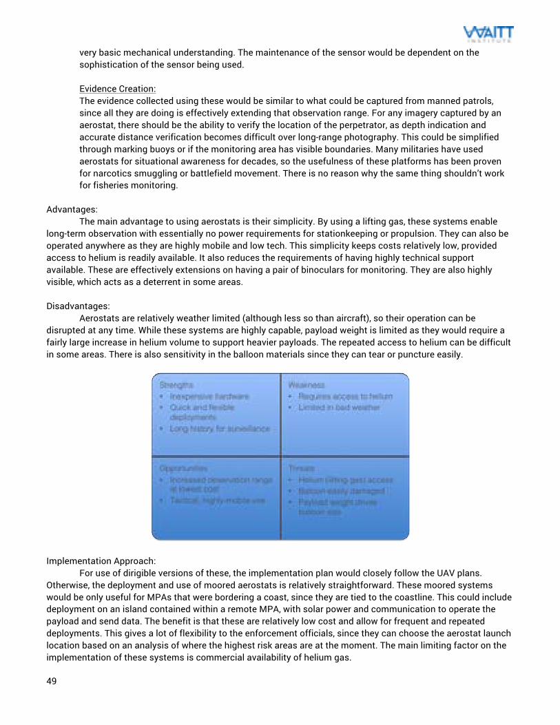
49
very basic mechanical understanding. The maintenance of the sensor would be dependent on the sophistication of the sensor being used. Evidence Creation: The evidence collected using these would be similar to what could be captured from manned patrols, since all they are doing is effectively extending that observation range. For any imagery captured by an aerostat, there should be the ability to verify the location of the perpetrator, as depth indication and accurate distance verification becomes difficult over long-range photography. This could be simplified through marking buoys or if the monitoring area has visible boundaries. Many militaries have used aerostats for situational awareness for decades, so the usefulness of these platforms has been proven for narcotics smuggling or battlefield movement. There is no reason why the same thing shouldn’t work for fisheries monitoring.
Advantages: The main advantage to using aerostats is their simplicity. By using a lifting gas, these systems enable long-term observation with essentially no power requirements for stationkeeping or propulsion. They can also be operated anywhere as they are highly mobile and low tech. This simplicity keeps costs relatively low, provided access to helium is readily available. It also reduces the requirements of having highly technical support available. These are effectively extensions on having a pair of binoculars for monitoring. They are also highly visible, which acts as a deterrent in some areas. Disadvantages: Aerostats are relatively weather limited (although less so than aircraft), so their operation can be disrupted at any time. While these systems are highly capable, payload weight is limited as they would require a fairly large increase in helium volume to support heavier payloads. The repeated access to helium can be difficult in some areas. There is also sensitivity in the balloon materials since they can tear or puncture easily.
Implementation Approach: For use of dirigible versions of these, the implementation plan would closely follow the UAV plans. Otherwise, the deployment and use of moored aerostats is relatively straightforward. These moored systems would be only useful for MPAs that were bordering a coast, since they are tied to the coastline. This could include deployment on an island contained within a remote MPA, with solar power and communication to operate the payload and send data. The benefit is that these are relatively low cost and allow for frequent and repeated deployments. This gives a lot of flexibility to the enforcement officials, since they can choose the aerostat launch location based on an analysis of where the highest risk areas are at the moment. The main limiting factor on the implementation of these systems is commercial availability of helium gas.
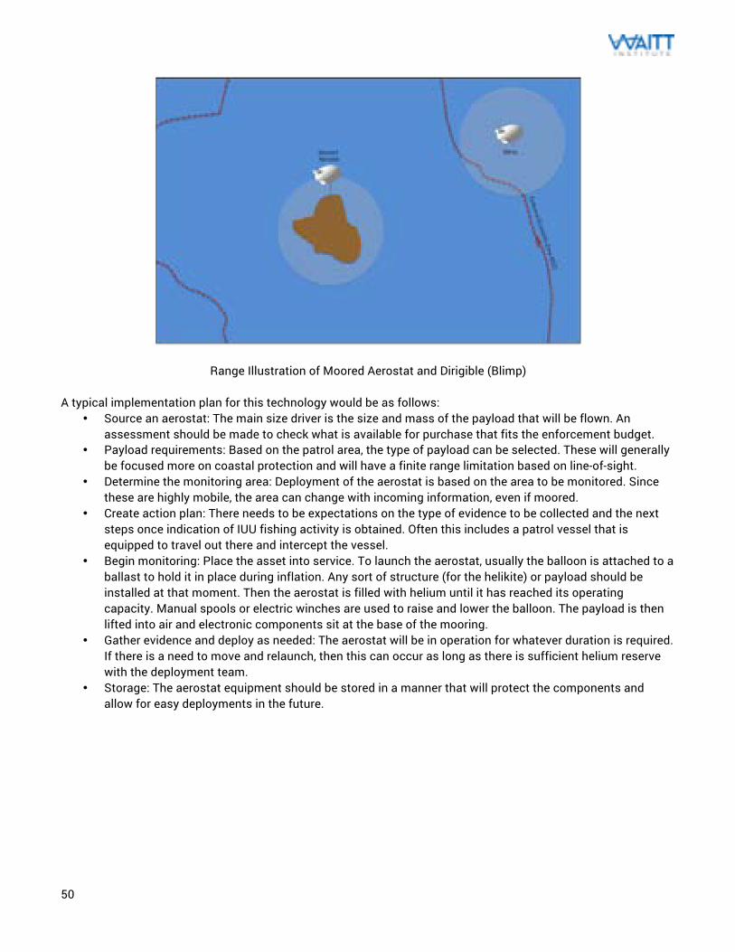
50
Range Illustration of Moored Aerostat and Dirigible (Blimp) A typical implementation plan for this technology would be as follows:
• Source an aerostat: The main size driver is the size and mass of the payload that will be flown. An assessment should be made to check what is available for purchase that fits the enforcement budget.
• Payload requirements: Based on the patrol area, the type of payload can be selected. These will generally be focused more on coastal protection and will have a finite range limitation based on line-of-sight.
• Determine the monitoring area: Deployment of the aerostat is based on the area to be monitored. Since these are highly mobile, the area can change with incoming information, even if moored.
• Create action plan: There needs to be expectations on the type of evidence to be collected and the next steps once indication of IUU fishing activity is obtained. Often this includes a patrol vessel that is equipped to travel out there and intercept the vessel.
• Begin monitoring: Place the asset into service. To launch the aerostat, usually the balloon is attached to a ballast to hold it in place during inflation. Any sort of structure (for the helikite) or payload should be installed at that moment. Then the aerostat is filled with helium until it has reached its operating capacity. Manual spools or electric winches are used to raise and lower the balloon. The payload is then lifted into air and electronic components sit at the base of the mooring.
• Gather evidence and deploy as needed: The aerostat will be in operation for whatever duration is required. If there is a need to move and relaunch, then this can occur as long as there is sufficient helium reserve with the deployment team.
• Storage: The aerostat equipment should be stored in a manner that will protect the components and allow for easy deployments in the future.
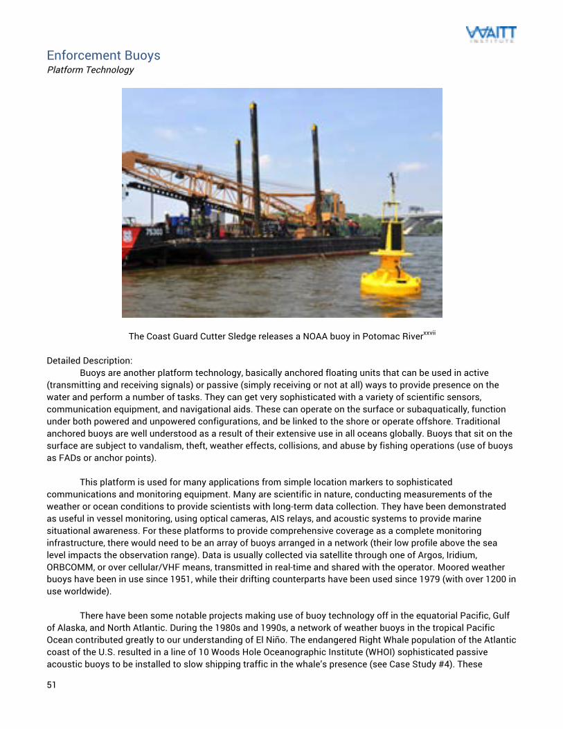
51
Enforcement Buoys Platform Technology
The Coast Guard Cutter Sledge releases a NOAA buoy in Potomac Riverxxvii Detailed Description: Buoys are another platform technology, basically anchored floating units that can be used in active (transmitting and receiving signals) or passive (simply receiving or not at all) ways to provide presence on the water and perform a number of tasks. They can get very sophisticated with a variety of scientific sensors, communication equipment, and navigational aids. These can operate on the surface or subaquatically, function under both powered and unpowered configurations, and be linked to the shore or operate offshore. Traditional anchored buoys are well understood as a result of their extensive use in all oceans globally. Buoys that sit on the surface are subject to vandalism, theft, weather effects, collisions, and abuse by fishing operations (use of buoys as FADs or anchor points). This platform is used for many applications from simple location markers to sophisticated communications and monitoring equipment. Many are scientific in nature, conducting measurements of the weather or ocean conditions to provide scientists with long-term data collection. They have been demonstrated as useful in vessel monitoring, using optical cameras, AIS relays, and acoustic systems to provide marine situational awareness. For these platforms to provide comprehensive coverage as a complete monitoring infrastructure, there would need to be an array of buoys arranged in a network (their low profile above the sea level impacts the observation range). Data is usually collected via satellite through one of Argos, Iridium, ORBCOMM, or over cellular/VHF means, transmitted in real-time and shared with the operator. Moored weather buoys have been in use since 1951, while their drifting counterparts have been used since 1979 (with over 1200 in use worldwide). There have been some notable projects making use of buoy technology off in the equatorial Pacific, Gulf of Alaska, and North Atlantic. During the 1980s and 1990s, a network of weather buoys in the tropical Pacific Ocean contributed greatly to our understanding of El Niño. The endangered Right Whale population of the Atlantic coast of the U.S. resulted in a line of 10 Woods Hole Oceanographic Institute (WHOI) sophisticated passive acoustic buoys to be installed to slow shipping traffic in the whale’s presence (see Case Study #4). These
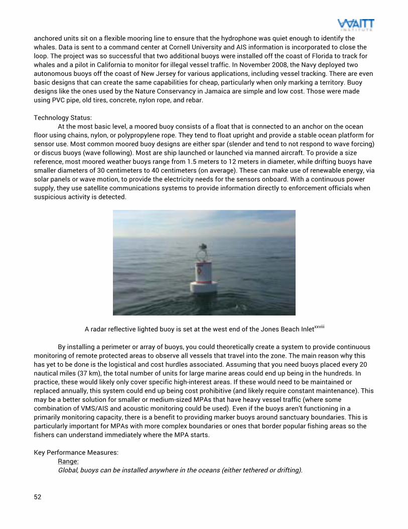
52
anchored units sit on a flexible mooring line to ensure that the hydrophone was quiet enough to identify the whales. Data is sent to a command center at Cornell University and AIS information is incorporated to close the loop. The project was so successful that two additional buoys were installed off the coast of Florida to track for whales and a pilot in California to monitor for illegal vessel traffic. In November 2008, the Navy deployed two autonomous buoys off the coast of New Jersey for various applications, including vessel tracking. There are even basic designs that can create the same capabilities for cheap, particularly when only marking a territory. Buoy designs like the ones used by the Nature Conservancy in Jamaica are simple and low cost. Those were made using PVC pipe, old tires, concrete, nylon rope, and rebar. Technology Status: At the most basic level, a moored buoy consists of a float that is connected to an anchor on the ocean floor using chains, nylon, or polypropylene rope. They tend to float upright and provide a stable ocean platform for sensor use. Most common moored buoy designs are either spar (slender and tend to not respond to wave forcing) or discus buoys (wave following). Most are ship launched or launched via manned aircraft. To provide a size reference, most moored weather buoys range from 1.5 meters to 12 meters in diameter, while drifting buoys have smaller diameters of 30 centimeters to 40 centimeters (on average). These can make use of renewable energy, via solar panels or wave motion, to provide the electricity needs for the sensors onboard. With a continuous power supply, they use satellite communications systems to provide information directly to enforcement officials when suspicious activity is detected.
A radar reflective lighted buoy is set at the west end of the Jones Beach Inletxxviii By installing a perimeter or array of buoys, you could theoretically create a system to provide continuous monitoring of remote protected areas to observe all vessels that travel into the zone. The main reason why this has yet to be done is the logistical and cost hurdles associated. Assuming that you need buoys placed every 20 nautical miles (37 km), the total number of units for large marine areas could end up being in the hundreds. In practice, these would likely only cover specific high-interest areas. If these would need to be maintained or replaced annually, this system could end up being cost prohibitive (and likely require constant maintenance). This may be a better solution for smaller or medium-sized MPAs that have heavy vessel traffic (where some combination of VMS/AIS and acoustic monitoring could be used). Even if the buoys aren’t functioning in a primarily monitoring capacity, there is a benefit to providing marker buoys around sanctuary boundaries. This is particularly important for MPAs with more complex boundaries or ones that border popular fishing areas so the fishers can understand immediately where the MPA starts. Key Performance Measures:
Range: Global, buoys can be installed anywhere in the oceans (either tethered or drifting).
53
The inherent advantage to the use of buoys is their long deployment endurances as a result of a lack of need for propulsion, since they are either operated in moored or drifting form. These are typically placed out at sea and expected to last for a long time (typically 18 months for drifting buoys, potentially longer for robust tethered versions). Only downtime generally comes as part of the periodic maintenance necessary. Sensors placed on buoys are most effective in the area immediately around that platform, and their limitations lie in the sensor range limitations. Environmental Conditions: As these are designed for extended time at sea, worst-case environmental conditions drive details of the buoy design. They are usually constructed of very hardy materials to withstand the abuse associated with heavy storms and the sea environment. This includes an exceptionally strong tether line and anchor. Detailed Cost: Traditionally, buoys are expensive platforms. This comes from the requirements for protection against the marine environment, the need for robustness, and the desire to put on as many sensors as possible. The large costly units (like the WHOI versions) would not be needed for all locations. The systems used in near shore environments can be much simpler, which lower the initial capital expenses. The majority of the costs are in two major areas: upfront costs (unit purchase and deployment) and repair. Operational costs are very low as it consists of the data transmission costs and data analysis. A large portion of NOAA’s annual buoy budget is spent on vandalism associated with their scientific buoys (both intentional and unintentional). Vandalism includes interactions or collisions with fishing equipment and vessels. The US buoy network has encountered 54 cases of vandalism over a five year period that resulted in a $5.4 million cost to the taxpayers. A safe assumption for enforcement buoys is that these vandalism costs would be greater since the mission were not purely scientific. While there is benefit to using scientific platforms for some enforcement monitoring (to share costs between organizations), it may place undesirable risk on the scientific mission. Infrastructure Needs: The infrastructure requirements for buoys would be similar to what is used for AUVs, since they behave similarly when in operation (long deployment durations and no real-time navigation needs). The only infrastructure needs would be to monitor data and for deployments and retrievals. Deployment and recovery generally happen using a large vessel or a charter boat. Periodic data collection can be managed through normal computer interface and data storage. Communication data connection (likely satellite for the distances) would need to be obtained to provide those checks. Resource Needs: Deployment of these (dependent on size) is largely similar to the methods used for AUVs except that it is generally a larger operation. The buoy system (including tether and anchor) is much typically much larger heavier an AUV and would require a vessel that is equipped appropriately. The crew necessary would start at a minimum of 2-3 operators and increase for the larger and more sophisticated (or larger) systems. The time around the deployments and recovery, processing and repairs would require specialized support for all but the simplest designs. Once the buoys are on station, operator support drops to whatever is needed to perform data collection and analysis (one operator could support multiple buoys). Maintainability: Buoys require periodic maintenance as a result of their time out at sea and issues that arise from vandalism. The environmental factors that can damage buoys are high winds, aggressive waves, strong currents, corrosion, marine growth, and fish bite. Since repairs require buoy retrieval, the costs associated with that sea time can add up depending on frequency of repair. Service outages can also be caused by mechanical damage to the superstructure, physical damage to onboard equipment, and mooring failures. This generally results in upgrade or service needing to be performed on an annual basis (unless the buoy is considered expendable).
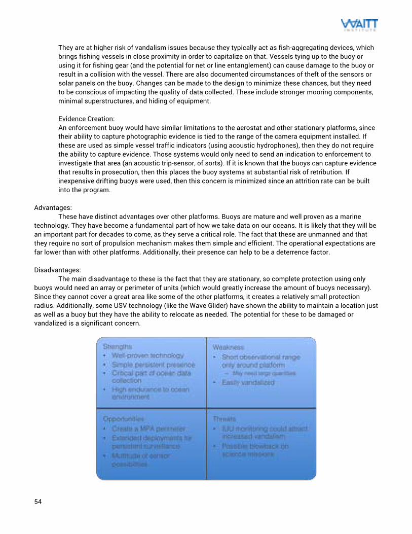
54
They are at higher risk of vandalism issues because they typically act as fish-aggregating devices, which brings fishing vessels in close proximity in order to capitalize on that. Vessels tying up to the buoy or using it for fishing gear (and the potential for net or line entanglement) can cause damage to the buoy or result in a collision with the vessel. There are also documented circumstances of theft of the sensors or solar panels on the buoy. Changes can be made to the design to minimize these chances, but they need to be conscious of impacting the quality of data collected. These include stronger mooring components, minimal superstructures, and hiding of equipment. Evidence Creation: An enforcement buoy would have similar limitations to the aerostat and other stationary platforms, since their ability to capture photographic evidence is tied to the range of the camera equipment installed. If these are used as simple vessel traffic indicators (using acoustic hydrophones), then they do not require the ability to capture evidence. Those systems would only need to send an indication to enforcement to investigate that area (an acoustic trip-sensor, of sorts). If it is known that the buoys can capture evidence that results in prosecution, then this places the buoy systems at substantial risk of retribution. If inexpensive drifting buoys were used, then this concern is minimized since an attrition rate can be built into the program.
Advantages: These have distinct advantages over other platforms. Buoys are mature and well proven as a marine technology. They have become a fundamental part of how we take data on our oceans. It is likely that they will be an important part for decades to come, as they serve a critical role. The fact that these are unmanned and that they require no sort of propulsion mechanism makes them simple and efficient. The operational expectations are far lower than with other platforms. Additionally, their presence can help to be a deterrence factor. Disadvantages: The main disadvantage to these is the fact that they are stationary, so complete protection using only buoys would need an array or perimeter of units (which would greatly increase the amount of buoys necessary). Since they cannot cover a great area like some of the other platforms, it creates a relatively small protection radius. Additionally, some USV technology (like the Wave Glider) have shown the ability to maintain a location just as well as a buoy but they have the ability to relocate as needed. The potential for these to be damaged or vandalized is a significant concern.
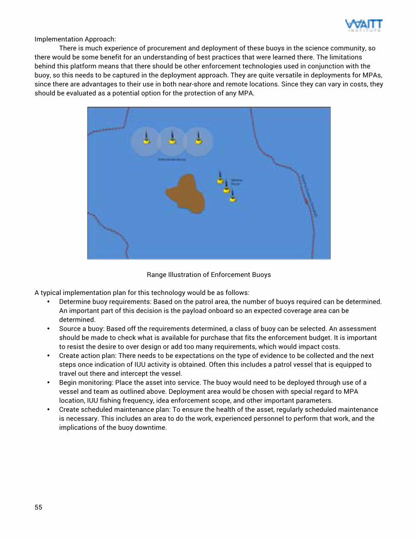
55
Implementation Approach: There is much experience of procurement and deployment of these buoys in the science community, so there would be some benefit for an understanding of best practices that were learned there. The limitations behind this platform means that there should be other enforcement technologies used in conjunction with the buoy, so this needs to be captured in the deployment approach. They are quite versatile in deployments for MPAs, since there are advantages to their use in both near-shore and remote locations. Since they can vary in costs, they should be evaluated as a potential option for the protection of any MPA.
Range Illustration of Enforcement Buoys A typical implementation plan for this technology would be as follows:
• Determine buoy requirements: Based on the patrol area, the number of buoys required can be determined. An important part of this decision is the payload onboard so an expected coverage area can be determined.
• Source a buoy: Based off the requirements determined, a class of buoy can be selected. An assessment should be made to check what is available for purchase that fits the enforcement budget. It is important to resist the desire to over design or add too many requirements, which would impact costs.
• Create action plan: There needs to be expectations on the type of evidence to be collected and the next steps once indication of IUU activity is obtained. Often this includes a patrol vessel that is equipped to travel out there and intercept the vessel.
• Begin monitoring: Place the asset into service. The buoy would need to be deployed through use of a vessel and team as outlined above. Deployment area would be chosen with special regard to MPA location, IUU fishing frequency, idea enforcement scope, and other important parameters.
• Create scheduled maintenance plan: To ensure the health of the asset, regularly scheduled maintenance is necessary. This includes an area to do the work, experienced personnel to perform that work, and the implications of the buoy downtime.
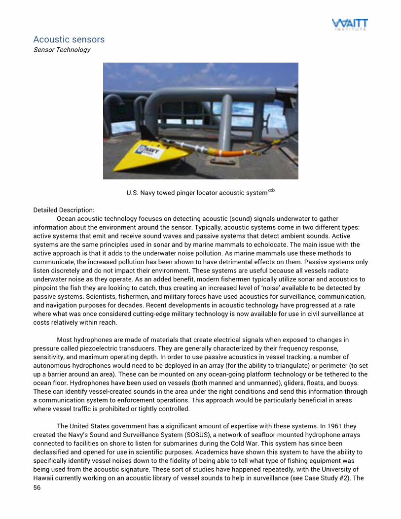
56
Acoustic sensors Sensor Technology
U.S. Navy towed pinger locator acoustic systemxxix Detailed Description: Ocean acoustic technology focuses on detecting acoustic (sound) signals underwater to gather information about the environment around the sensor. Typically, acoustic systems come in two different types: active systems that emit and receive sound waves and passive systems that detect ambient sounds. Active systems are the same principles used in sonar and by marine mammals to echolocate. The main issue with the active approach is that it adds to the underwater noise pollution. As marine mammals use these methods to communicate, the increased pollution has been shown to have detrimental effects on them. Passive systems only listen discretely and do not impact their environment. These systems are useful because all vessels radiate underwater noise as they operate. As an added benefit, modern fishermen typically utilize sonar and acoustics to pinpoint the fish they are looking to catch, thus creating an increased level of ‘noise’ available to be detected by passive systems. Scientists, fishermen, and military forces have used acoustics for surveillance, communication, and navigation purposes for decades. Recent developments in acoustic technology have progressed at a rate where what was once considered cutting-edge military technology is now available for use in civil surveillance at costs relatively within reach. Most hydrophones are made of materials that create electrical signals when exposed to changes in pressure called piezoelectric transducers. They are generally characterized by their frequency response, sensitivity, and maximum operating depth. In order to use passive acoustics in vessel tracking, a number of autonomous hydrophones would need to be deployed in an array (for the ability to triangulate) or perimeter (to set up a barrier around an area). These can be mounted on any ocean-going platform technology or be tethered to the ocean floor. Hydrophones have been used on vessels (both manned and unmanned), gliders, floats, and buoys. These can identify vessel-created sounds in the area under the right conditions and send this information through a communication system to enforcement operations. This approach would be particularly beneficial in areas where vessel traffic is prohibited or tightly controlled. The United States government has a significant amount of expertise with these systems. In 1961 they created the Navy’s Sound and Surveillance System (SOSUS), a network of seafloor-mounted hydrophone arrays connected to facilities on shore to listen for submarines during the Cold War. This system has since been declassified and opened for use in scientific purposes. Academics have shown this system to have the ability to specifically identify vessel noises down to the fidelity of being able to tell what type of fishing equipment was being used from the acoustic signature. These sort of studies have happened repeatedly, with the University of Hawaii currently working on an acoustic library of vessel sounds to help in surveillance (see Case Study #2). The
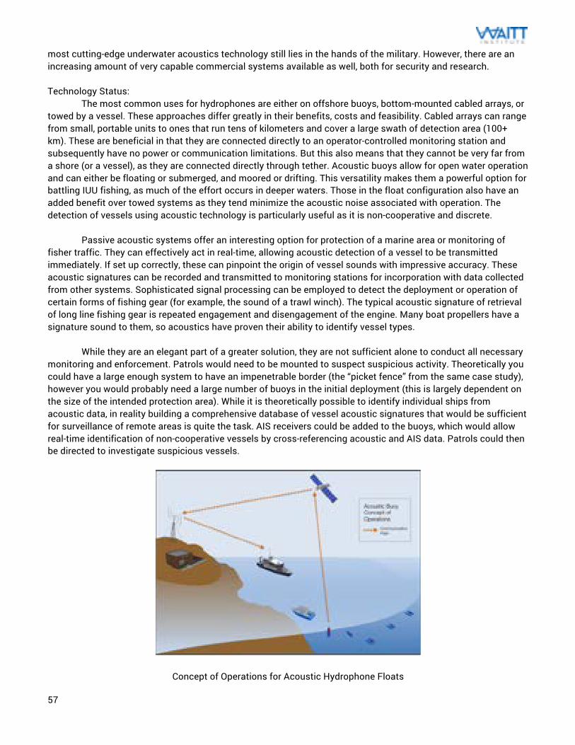
57
most cutting-edge underwater acoustics technology still lies in the hands of the military. However, there are an increasing amount of very capable commercial systems available as well, both for security and research. Technology Status: The most common uses for hydrophones are either on offshore buoys, bottom-mounted cabled arrays, or towed by a vessel. These approaches differ greatly in their benefits, costs and feasibility. Cabled arrays can range from small, portable units to ones that run tens of kilometers and cover a large swath of detection area (100+ km). These are beneficial in that they are connected directly to an operator-controlled monitoring station and subsequently have no power or communication limitations. But this also means that they cannot be very far from a shore (or a vessel), as they are connected directly through tether. Acoustic buoys allow for open water operation and can either be floating or submerged, and moored or drifting. This versatility makes them a powerful option for battling IUU fishing, as much of the effort occurs in deeper waters. Those in the float configuration also have an added benefit over towed systems as they tend minimize the acoustic noise associated with operation. The detection of vessels using acoustic technology is particularly useful as it is non-cooperative and discrete. Passive acoustic systems offer an interesting option for protection of a marine area or monitoring of fisher traffic. They can effectively act in real-time, allowing acoustic detection of a vessel to be transmitted immediately. If set up correctly, these can pinpoint the origin of vessel sounds with impressive accuracy. These acoustic signatures can be recorded and transmitted to monitoring stations for incorporation with data collected from other systems. Sophisticated signal processing can be employed to detect the deployment or operation of certain forms of fishing gear (for example, the sound of a trawl winch). The typical acoustic signature of retrieval of long line fishing gear is repeated engagement and disengagement of the engine. Many boat propellers have a signature sound to them, so acoustics have proven their ability to identify vessel types. While they are an elegant part of a greater solution, they are not sufficient alone to conduct all necessary monitoring and enforcement. Patrols would need to be mounted to suspect suspicious activity. Theoretically you could have a large enough system to have an impenetrable border (the “picket fence” from the same case study), however you would probably need a large number of buoys in the initial deployment (this is largely dependent on the size of the intended protection area). While it is theoretically possible to identify individual ships from acoustic data, in reality building a comprehensive database of vessel acoustic signatures that would be sufficient for surveillance of remote areas is quite the task. AIS receivers could be added to the buoys, which would allow real-time identification of non-cooperative vessels by cross-referencing acoustic and AIS data. Patrols could then be directed to investigate suspicious vessels.
Concept of Operations for Acoustic Hydrophone Floats
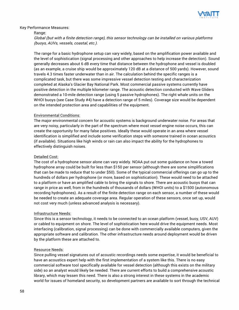
58
Key Performance Measures:
Range: Global (but with a finite detection range), this sensor technology can be installed on various platforms (buoys, AUVs, vessels, coastal, etc.). The range for a basic hydrophone setup can vary widely, based on the amplification power available and the level of sophistication (signal processing and other approaches to help increase the detection). Sound generally decreases about 6 dB every time that distance between the hydrophone and vessel is doubled (as an example, a cruise ship would be approximately 120 dB at a distance of 500 yards). However, sound travels 4.3 times faster underwater than in air. The calculation behind the specific ranges is a complicated task, but there was some impressive vessel detection testing and characterization completed at Alaska’s Glacier Bay National Park. Most commercial passive systems currently have positive detection in the multiple kilometer range. The acoustic detection conducted with Wave Gliders demonstrated a 10-mile detection range (using 5 passive hydrophones). The right whale units on the WHOI buoys (see Case Study #4) have a detection range of 5 miles). Coverage size would be dependent on the intended protection area and capabilities of the equipment. Environmental Conditions: The major environmental concern for acoustic systems is background underwater noise. For areas that are very noisy, particularly in the part of the spectrum where most vessel engine noise occurs, this can create the opportunity for many false positives. Ideally these would operate in an area where vessel identification is simplified and include some verification steps with someone trained in ocean acoustics (if available). Situations like high winds or rain can also impact the ability for the hydrophones to effectively distinguish noises. Detailed Cost: The cost of a hydrophone sensor alone can vary widely. NOAA put out some guidance on how a towed hydrophone array could be built for less than $150 per sensor (although there are some simplifications that can be made to reduce that to under $50). Some of the typical commercial offerings can go up to the hundreds of dollars per hydrophone (or more, based on sophistication). These would need to be attached to a platform or have an amplified cable to bring the signals to shore. There are acoustic buoys that can range in price as well, from in the hundreds of thousands of dollars (WHOI units) to a $1500 (autonomous recording hydrophones). As a result of the finite detection range on each sensor, a number of these would be needed to create an adequate coverage area. Regular operation of these sensors, once set up, would not cost very much (unless advanced analysis is necessary). Infrastructure Needs: Since this is a sensor technology, it needs to be connected to an ocean platform (vessel, buoy, USV, AUV) or cabled to equipment on shore. The level of sophistication here would drive the equipment needs. Most interfacing (calibration, signal processing) can be done with commercially available computers, given the appropriate software and calibration. The other infrastructure needs around deployment would be driven by the platform these are attached to. Resource Needs: Since pulling vessel signatures out of acoustic recordings needs some expertise, it would be beneficial to have an acoustics expert help with the first implementation of a system like this. There is no easy commercial software tool specifically available for vessel detection (although this exists on the military side) so an analyst would likely be needed. There are current efforts to build a comprehensive acoustic library, which may lessen this need. There is also a strong interest in these systems in the academic world for issues of homeland security, so development partners are available to sort through the technical
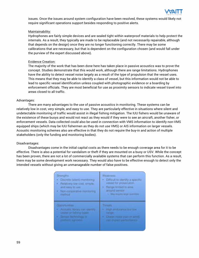
59
issues. Once the issues around system configuration have been resolved, these systems would likely not require significant operations support besides responding to positive alerts. Maintainability: Hydrophones are fairly simple devices and are sealed tight within waterproof materials to help protect the internals. As a result, they typically are made to be replaceable (and not necessarily repairable, although that depends on the design) once they are no longer functioning correctly. There may be some calibrations that are necessary, but that is dependent on the configuration chosen (and would fall under the purview of the expert discussed above). Evidence Creation: The majority of the work that has been done here has taken place in passive acoustics was to prove the concept. Studies demonstrate that this would work, although there are range limitations. Hydrophones have the ability to detect vessel noise largely as a result of the type of propulsion that the vessel uses. This means that they may be able to identify a class of vessel, but this information would not be able to lead to specific vessel identification unless coupled with photographic evidence or a boarding by enforcement officials. They are most beneficial for use as proximity sensors to indicate vessel travel into areas closed to all traffic.
Advantages:
There are many advantages to the use of passive acoustics in monitoring. These systems can be relatively low in cost, very simple, and easy to use. They are particularly effective in situations where silent and undetectable monitoring of traffic would assist in illegal fishing mitigation. The IUU fishers would be unaware of the existence of these buoys and would not react as they would if they were to see an aircraft, another fisher, or enforcement vessels. Data collected could also be used in connection with VMS information to identify non-VMS equipped ships (which may be IUU fishermen as they do not use VMS) or AIS information on larger vessels. Acoustic monitoring schemes also are effective in that they do not require the buy-in and action of multiple stakeholders (only the funding and monitoring bodies). Disadvantages:
Disadvantages come in the initial capital costs as there needs to be enough coverage area for it to be effective. There is also a potential for vandalism or theft if they are mounted on a buoy or USV. While the concept has been proven, there are not a lot of commercially available systems that can perform this function. As a result, there may be some development work necessary. They would also have to be effective enough to detect only the intended vessels without giving an unmanageable number of false positives.
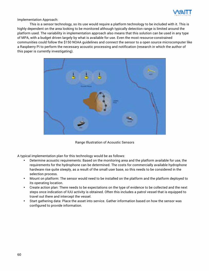
60
Implementation Approach: This is a sensor technology, so its use would require a platform technology to be included with it. This is
highly dependent on the area looking to be monitored although typically detection range is limited around the platform used. The variability in implementation approach also means that this solution can be used in any type of MPA, with a budget driven largely by what is available for use. Even the most resource-constrained communities could follow the $150 NOAA guidelines and connect the sensor to a open source microcomputer like a Raspberry Pi to perform the necessary acoustic processing and notification (research in which the author of this paper is currently investigating).
Range Illustration of Acoustic Sensors A typical implementation plan for this technology would be as follows:
• Determine acoustic requirements: Based on the monitoring area and the platform available for use, the requirements for the hydrophone can be determined. The costs for commercially available hydrophone hardware rise quite steeply, as a result of the small user base, so this needs to be considered in the selection process.
• Mount on platform: The sensor would need to be installed on the platform and the platform deployed to its operating location.
• Create action plan: There needs to be expectations on the type of evidence to be collected and the next steps once indication of IUU activity is obtained. Often this includes a patrol vessel that is equipped to travel out there and intercept the vessel.
• Start gathering data: Place the asset into service. Gather information based on how the sensor was configured to provide information.
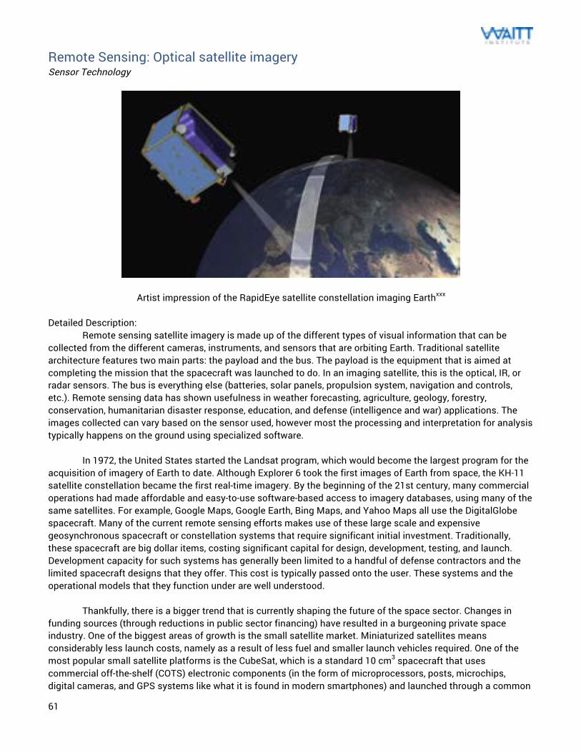
61
Remote Sensing: Optical satellite imagery Sensor Technology
Artist impression of the RapidEye satellite constellation imaging Earthxxx Detailed Description: Remote sensing satellite imagery is made up of the different types of visual information that can be collected from the different cameras, instruments, and sensors that are orbiting Earth. Traditional satellite architecture features two main parts: the payload and the bus. The payload is the equipment that is aimed at completing the mission that the spacecraft was launched to do. In an imaging satellite, this is the optical, IR, or radar sensors. The bus is everything else (batteries, solar panels, propulsion system, navigation and controls, etc.). Remote sensing data has shown usefulness in weather forecasting, agriculture, geology, forestry, conservation, humanitarian disaster response, education, and defense (intelligence and war) applications. The images collected can vary based on the sensor used, however most the processing and interpretation for analysis typically happens on the ground using specialized software. In 1972, the United States started the Landsat program, which would become the largest program for the acquisition of imagery of Earth to date. Although Explorer 6 took the first images of Earth from space, the KH-11 satellite constellation became the first real-time imagery. By the beginning of the 21st century, many commercial operations had made affordable and easy-to-use software-based access to imagery databases, using many of the same satellites. For example, Google Maps, Google Earth, Bing Maps, and Yahoo Maps all use the DigitalGlobe spacecraft. Many of the current remote sensing efforts makes use of these large scale and expensive geosynchronous spacecraft or constellation systems that require significant initial investment. Traditionally, these spacecraft are big dollar items, costing significant capital for design, development, testing, and launch. Development capacity for such systems has generally been limited to a handful of defense contractors and the limited spacecraft designs that they offer. This cost is typically passed onto the user. These systems and the operational models that they function under are well understood. Thankfully, there is a bigger trend that is currently shaping the future of the space sector. Changes in funding sources (through reductions in public sector financing) have resulted in a burgeoning private space industry. One of the biggest areas of growth is the small satellite market. Miniaturized satellites means considerably less launch costs, namely as a result of less fuel and smaller launch vehicles required. One of the most popular small satellite platforms is the CubeSat, which is a standard 10 cm3 spacecraft that uses commercial off-the-shelf (COTS) electronic components (in the form of microprocessors, posts, microchips, digital cameras, and GPS systems like what it is found in modern smartphones) and launched through a common
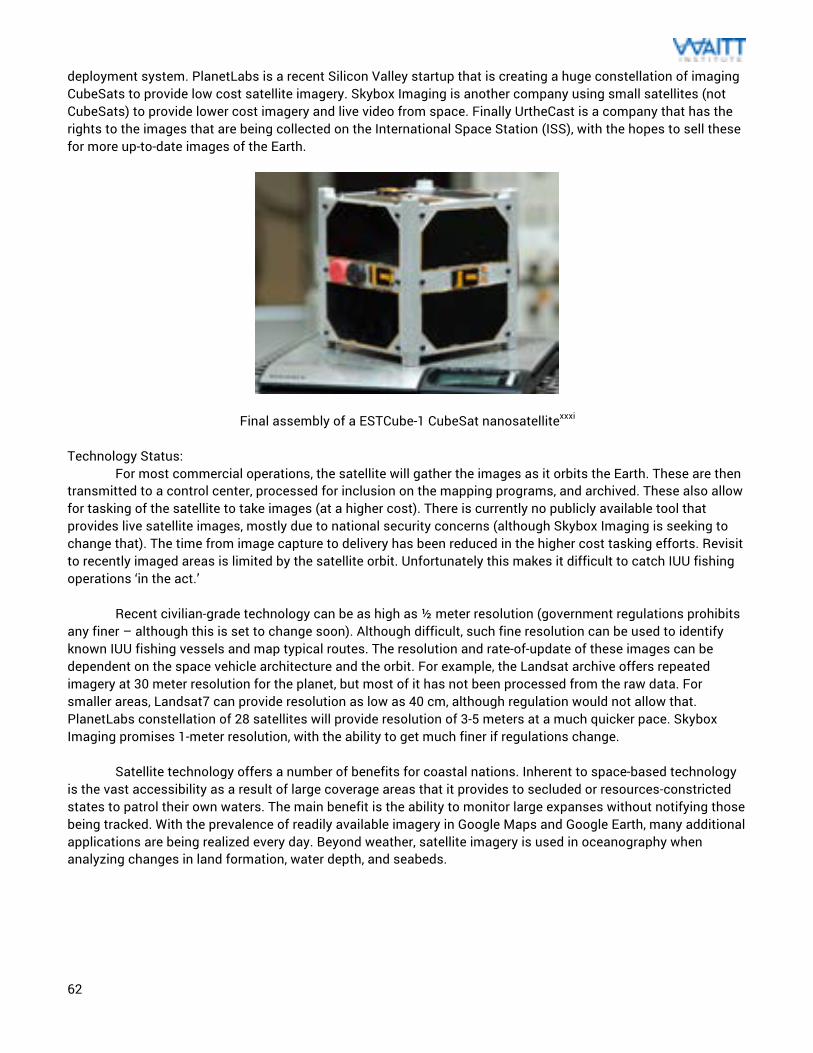
62
deployment system. PlanetLabs is a recent Silicon Valley startup that is creating a huge constellation of imaging CubeSats to provide low cost satellite imagery. Skybox Imaging is another company using small satellites (not CubeSats) to provide lower cost imagery and live video from space. Finally UrtheCast is a company that has the rights to the images that are being collected on the International Space Station (ISS), with the hopes to sell these for more up-to-date images of the Earth.
Final assembly of a ESTCube-1 CubeSat nanosatellitexxxi Technology Status:
For most commercial operations, the satellite will gather the images as it orbits the Earth. These are then transmitted to a control center, processed for inclusion on the mapping programs, and archived. These also allow for tasking of the satellite to take images (at a higher cost). There is currently no publicly available tool that provides live satellite images, mostly due to national security concerns (although Skybox Imaging is seeking to change that). The time from image capture to delivery has been reduced in the higher cost tasking efforts. Revisit to recently imaged areas is limited by the satellite orbit. Unfortunately this makes it difficult to catch IUU fishing operations ‘in the act.’
Recent civilian-grade technology can be as high as ½ meter resolution (government regulations prohibits
any finer – although this is set to change soon). Although difficult, such fine resolution can be used to identify known IUU fishing vessels and map typical routes. The resolution and rate-of-update of these images can be dependent on the space vehicle architecture and the orbit. For example, the Landsat archive offers repeated imagery at 30 meter resolution for the planet, but most of it has not been processed from the raw data. For smaller areas, Landsat7 can provide resolution as low as 40 cm, although regulation would not allow that. PlanetLabs constellation of 28 satellites will provide resolution of 3-5 meters at a much quicker pace. Skybox Imaging promises 1-meter resolution, with the ability to get much finer if regulations change.
Satellite technology offers a number of benefits for coastal nations. Inherent to space-based technology
is the vast accessibility as a result of large coverage areas that it provides to secluded or resources-constricted states to patrol their own waters. The main benefit is the ability to monitor large expanses without notifying those being tracked. With the prevalence of readily available imagery in Google Maps and Google Earth, many additional applications are being realized every day. Beyond weather, satellite imagery is used in oceanography when analyzing changes in land formation, water depth, and seabeds.
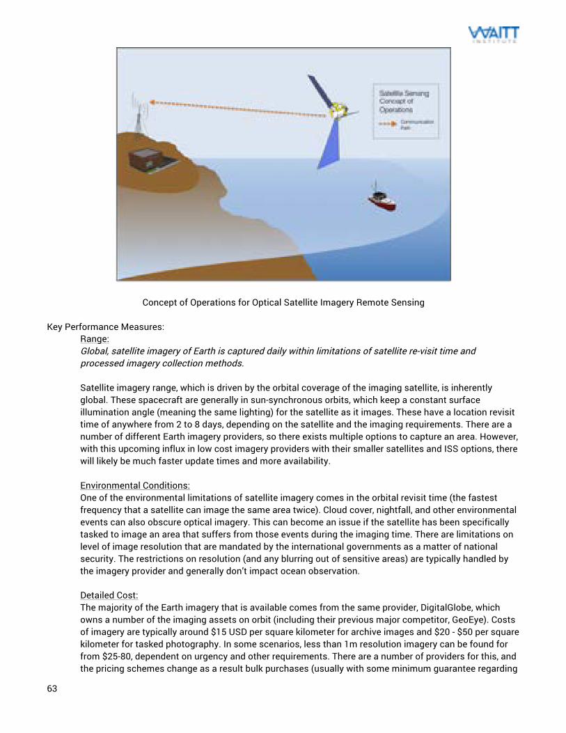
63
Concept of Operations for Optical Satellite Imagery Remote Sensing Key Performance Measures:
Range: Global, satellite imagery of Earth is captured daily within limitations of satellite re-visit time and processed imagery collection methods. Satellite imagery range, which is driven by the orbital coverage of the imaging satellite, is inherently global. These spacecraft are generally in sun-synchronous orbits, which keep a constant surface illumination angle (meaning the same lighting) for the satellite as it images. These have a location revisit time of anywhere from 2 to 8 days, depending on the satellite and the imaging requirements. There are a number of different Earth imagery providers, so there exists multiple options to capture an area. However, with this upcoming influx in low cost imagery providers with their smaller satellites and ISS options, there will likely be much faster update times and more availability. Environmental Conditions: One of the environmental limitations of satellite imagery comes in the orbital revisit time (the fastest frequency that a satellite can image the same area twice). Cloud cover, nightfall, and other environmental events can also obscure optical imagery. This can become an issue if the satellite has been specifically tasked to image an area that suffers from those events during the imaging time. There are limitations on level of image resolution that are mandated by the international governments as a matter of national security. The restrictions on resolution (and any blurring out of sensitive areas) are typically handled by the imagery provider and generally don’t impact ocean observation. Detailed Cost: The majority of the Earth imagery that is available comes from the same provider, DigitalGlobe, which owns a number of the imaging assets on orbit (including their previous major competitor, GeoEye). Costs of imagery are typically around $15 USD per square kilometer for archive images and $20 - $50 per square kilometer for tasked photography. In some scenarios, less than 1m resolution imagery can be found for from $25-80, dependent on urgency and other requirements. There are a number of providers for this, and the pricing schemes change as a result bulk purchases (usually with some minimum guarantee regarding
64
cloud cover). US taxpayers have free access to LANDSAT data, but it generally doesn’t have the same resolution of the commercial offerings (and would not be able to identify vessels). The issue with these is that, unless tasked, the images can be up to a few years old (which makes it difficult to properly characterize fishing activity). However, this cost structure is set to change in the coming years. As a result of the reduced cost of building and launching small satellites (on the order of 100 times cheaper) or licensing the imagery from the ISS, these prices will drop. Both PlanetLabs and UrtheCast are offering APIs to allow software tools access to their data. Skybox Imaging plans to sell a system called SkyNode, which is a ground system and 2.4 meter satellite communications antenna to allow tasking of the satellite, ordering of imagery, and archiving of video and pictures in as little as 20 minutes (which is significant compared to the processing times with current options). Infrastructure Needs: In collection of the imagery, all that is required is a normal computer interface to use and analyze the photographs. Often times, web applications are used to better distribute the data or allow for crowdsourced analysis. There is opportunity in the crowdsourcing of this imagery, since there are plenty of “armchair environmentalists” that would love the chance to give some time to help monitor MPA imagery. This is a phenomenon (crowdsourcing) that both SkyTruth and MicroMappers has used successfully on different causes. Resource Needs: While it would be beneficial to work with a satellite imagery analyst professional, much of the evaluation of this data is relatively straightforward (to the point that it has been performed by the public through crowdsourcing). If the data were to be coupled with AIS or VMS data, there would likely be technical support needed to determine the best way to facilitate that. Maintainability: Since the equipment necessary for collection of satellite images are assets owned by private corporations or the government, enforcement personnel using this data would have no maintenance requirements. Evidence Creation: Satellite imagery is becoming an increasingly important tool for identification of IUU fishing. There have been a number of success stories in the use of the data to identify vessels in areas they were not supposed to be. There have even been some examples of identification of fishing equipment not adhering to the relevant regulations. There is considerable effort in this area by groups like the Pew Environment Group and SkyTruth to show the benefit in this approach (see Case Study #3). There was even one story of randomly taken Google Earth imagery catching illegal trawling happening in Spain’s Canary Islands, a place where the fishing method is not legal. This technology is especially powerful, particularly when coupled with AIS, VMS, or radar data.
Advantages: There are many advantages to the use of satellite imagery for ocean monitoring. These systems have a clear commercial need in industries worldwide, so there is a strong desire to increase access to space-obtained data. As a result, there is no need for development resources to come from ocean organizations (they can just reap the benefits). While the major demand in imagery remains focused on land, there are a number of efforts currently underway to increase the frequency of the images captured over water (particularly as a result of events like commercial airliner disappearances). The costs, while reasonably low, are only going to get lower and image quality will only get better. A number of the commercial Earth imagery providers have been lobbying the government for more leniencies on the resolution limitations on what is publically available.
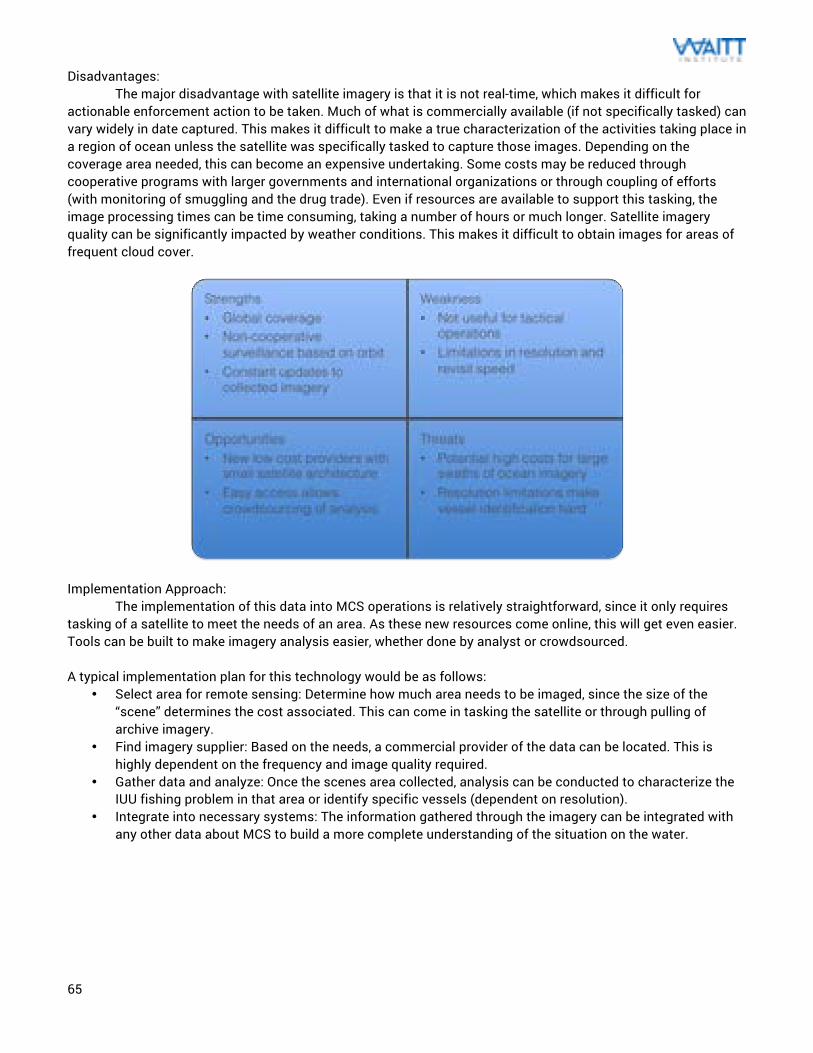
65
Disadvantages: The major disadvantage with satellite imagery is that it is not real-time, which makes it difficult for actionable enforcement action to be taken. Much of what is commercially available (if not specifically tasked) can vary widely in date captured. This makes it difficult to make a true characterization of the activities taking place in a region of ocean unless the satellite was specifically tasked to capture those images. Depending on the coverage area needed, this can become an expensive undertaking. Some costs may be reduced through cooperative programs with larger governments and international organizations or through coupling of efforts (with monitoring of smuggling and the drug trade). Even if resources are available to support this tasking, the image processing times can be time consuming, taking a number of hours or much longer. Satellite imagery quality can be significantly impacted by weather conditions. This makes it difficult to obtain images for areas of frequent cloud cover.
Implementation Approach: The implementation of this data into MCS operations is relatively straightforward, since it only requires tasking of a satellite to meet the needs of an area. As these new resources come online, this will get even easier. Tools can be built to make imagery analysis easier, whether done by analyst or crowdsourced. A typical implementation plan for this technology would be as follows:
• Select area for remote sensing: Determine how much area needs to be imaged, since the size of the “scene” determines the cost associated. This can come in tasking the satellite or through pulling of archive imagery.
• Find imagery supplier: Based on the needs, a commercial provider of the data can be located. This is highly dependent on the frequency and image quality required.
• Gather data and analyze: Once the scenes area collected, analysis can be conducted to characterize the IUU fishing problem in that area or identify specific vessels (dependent on resolution).
• Integrate into necessary systems: The information gathered through the imagery can be integrated with any other data about MCS to build a more complete understanding of the situation on the water.
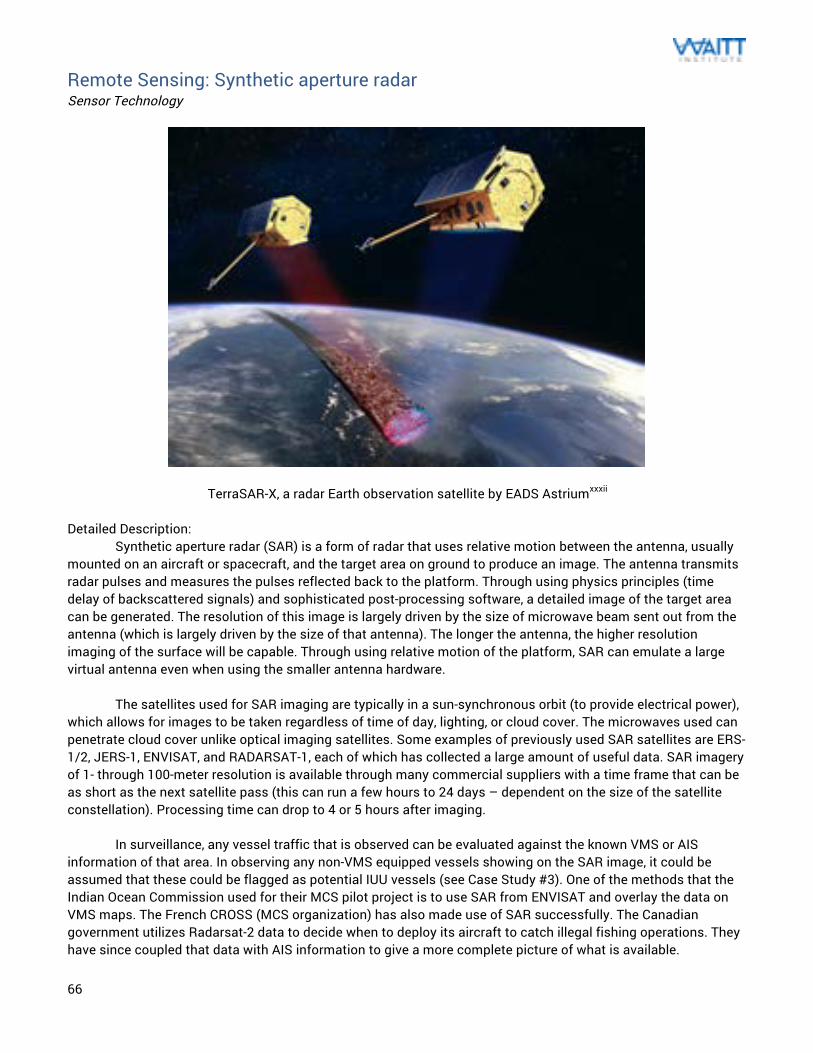
66
Remote Sensing: Synthetic aperture radar Sensor Technology
TerraSAR-X, a radar Earth observation satellite by EADS Astriumxxxii Detailed Description: Synthetic aperture radar (SAR) is a form of radar that uses relative motion between the antenna, usually mounted on an aircraft or spacecraft, and the target area on ground to produce an image. The antenna transmits radar pulses and measures the pulses reflected back to the platform. Through using physics principles (time delay of backscattered signals) and sophisticated post-processing software, a detailed image of the target area can be generated. The resolution of this image is largely driven by the size of microwave beam sent out from the antenna (which is largely driven by the size of that antenna). The longer the antenna, the higher resolution imaging of the surface will be capable. Through using relative motion of the platform, SAR can emulate a large virtual antenna even when using the smaller antenna hardware. The satellites used for SAR imaging are typically in a sun-synchronous orbit (to provide electrical power), which allows for images to be taken regardless of time of day, lighting, or cloud cover. The microwaves used can penetrate cloud cover unlike optical imaging satellites. Some examples of previously used SAR satellites are ERS-1/2, JERS-1, ENVISAT, and RADARSAT-1, each of which has collected a large amount of useful data. SAR imagery of 1- through 100-meter resolution is available through many commercial suppliers with a time frame that can be as short as the next satellite pass (this can run a few hours to 24 days – dependent on the size of the satellite constellation). Processing time can drop to 4 or 5 hours after imaging.
In surveillance, any vessel traffic that is observed can be evaluated against the known VMS or AIS information of that area. In observing any non-VMS equipped vessels showing on the SAR image, it could be assumed that these could be flagged as potential IUU vessels (see Case Study #3). One of the methods that the Indian Ocean Commission used for their MCS pilot project is to use SAR from ENVISAT and overlay the data on VMS maps. The French CROSS (MCS organization) has also made use of SAR successfully. The Canadian government utilizes Radarsat-2 data to decide when to deploy its aircraft to catch illegal fishing operations. They have since coupled that data with AIS information to give a more complete picture of what is available.
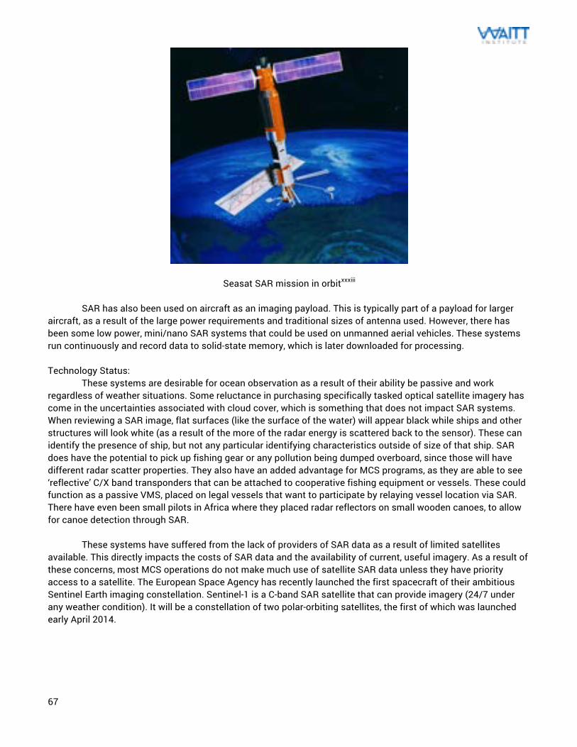
67
Seasat SAR mission in orbitxxxiii SAR has also been used on aircraft as an imaging payload. This is typically part of a payload for larger aircraft, as a result of the large power requirements and traditional sizes of antenna used. However, there has been some low power, mini/nano SAR systems that could be used on unmanned aerial vehicles. These systems run continuously and record data to solid-state memory, which is later downloaded for processing. Technology Status: These systems are desirable for ocean observation as a result of their ability be passive and work regardless of weather situations. Some reluctance in purchasing specifically tasked optical satellite imagery has come in the uncertainties associated with cloud cover, which is something that does not impact SAR systems. When reviewing a SAR image, flat surfaces (like the surface of the water) will appear black while ships and other structures will look white (as a result of the more of the radar energy is scattered back to the sensor). These can identify the presence of ship, but not any particular identifying characteristics outside of size of that ship. SAR does have the potential to pick up fishing gear or any pollution being dumped overboard, since those will have different radar scatter properties. They also have an added advantage for MCS programs, as they are able to see ‘reflective’ C/X band transponders that can be attached to cooperative fishing equipment or vessels. These could function as a passive VMS, placed on legal vessels that want to participate by relaying vessel location via SAR. There have even been small pilots in Africa where they placed radar reflectors on small wooden canoes, to allow for canoe detection through SAR.
These systems have suffered from the lack of providers of SAR data as a result of limited satellites
available. This directly impacts the costs of SAR data and the availability of current, useful imagery. As a result of these concerns, most MCS operations do not make much use of satellite SAR data unless they have priority access to a satellite. The European Space Agency has recently launched the first spacecraft of their ambitious Sentinel Earth imaging constellation. Sentinel-1 is a C-band SAR satellite that can provide imagery (24/7 under any weather condition). It will be a constellation of two polar-orbiting satellites, the first of which was launched early April 2014.
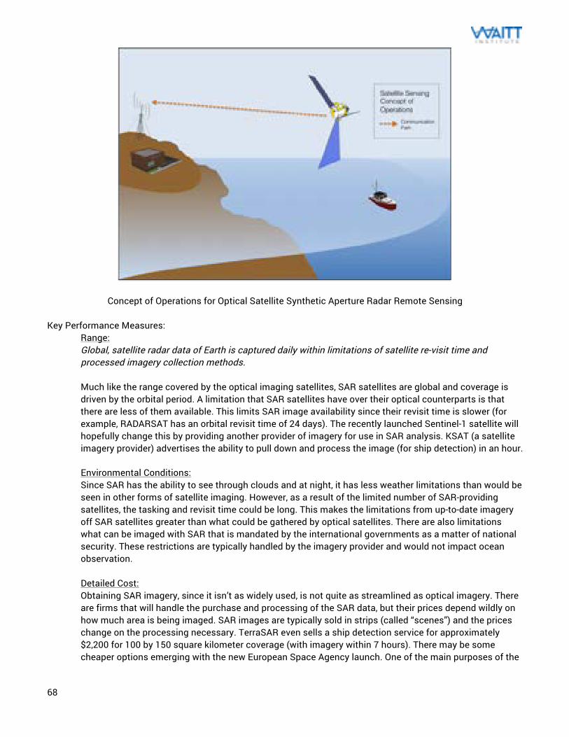
68
Concept of Operations for Optical Satellite Synthetic Aperture Radar Remote Sensing Key Performance Measures:
Range: Global, satellite radar data of Earth is captured daily within limitations of satellite re-visit time and processed imagery collection methods. Much like the range covered by the optical imaging satellites, SAR satellites are global and coverage is driven by the orbital period. A limitation that SAR satellites have over their optical counterparts is that there are less of them available. This limits SAR image availability since their revisit time is slower (for example, RADARSAT has an orbital revisit time of 24 days). The recently launched Sentinel-1 satellite will hopefully change this by providing another provider of imagery for use in SAR analysis. KSAT (a satellite imagery provider) advertises the ability to pull down and process the image (for ship detection) in an hour. Environmental Conditions: Since SAR has the ability to see through clouds and at night, it has less weather limitations than would be seen in other forms of satellite imaging. However, as a result of the limited number of SAR-providing satellites, the tasking and revisit time could be long. This makes the limitations from up-to-date imagery off SAR satellites greater than what could be gathered by optical satellites. There are also limitations what can be imaged with SAR that is mandated by the international governments as a matter of national security. These restrictions are typically handled by the imagery provider and would not impact ocean observation. Detailed Cost: Obtaining SAR imagery, since it isn’t as widely used, is not quite as streamlined as optical imagery. There are firms that will handle the purchase and processing of the SAR data, but their prices depend wildly on how much area is being imaged. SAR images are typically sold in strips (called “scenes”) and the prices change on the processing necessary. TerraSAR even sells a ship detection service for approximately $2,200 for 100 by 150 square kilometer coverage (with imagery within 7 hours). There may be some cheaper options emerging with the new European Space Agency launch. One of the main purposes of the
69
ESA Sentinel-1 program is monitoring of the marine environment. Those SAR images will be open access to all and will provide SAR imagery for free (which someone could use to build a ship detection tool). Infrastructure Needs: Processing of SAR imagery requires specific software in order to perform this correctly. This can be a relatively complicated process in order to produce usable imagery. In collection of the imagery data, all that is required is a normal computer interface to use and analyze the data. Often times, web applications are used to better distribute the data (once processed) or allow for crowdsourced analysis. Resource Needs: Unprocessed SAR imagery would require a satellite SAR analysis professional or commercial company, since there is work required to get this data in a usable format. Fortunately there are a number of providers that will handle that analysis for a user. Once processed, evaluation of this data is relatively straightforward like it would be for optical imagery. If the data were to be coupled with AIS or VMS data, there would likely be technical support needed to determine the best way to facilitate that. Due to the processing needs, crowdsourcing the analysis of SAR imagery would require the post-processed state of images. Maintainability: Since the equipment necessary for collection of satellite images are assets owned by private corporations or the government, enforcement personnel using this data would have no maintenance requirements. Evidence Creation: Satellite imagery is becoming an increasingly important tool for identification of IUU fishing. There have been a number of success stories in the use of the data to identify vessels in areas they were not supposed to be and fishing equipment not adhering to the relevant regulations. There is considerable effort in this area by groups like SkyTruth to show the benefit in this approach (again, Case Study #3). This technology is especially powerful, particularly when coupled with AIS, VMS, or radar data.
Advantages:
SAR is a radar technology, which provides it with some of the inherent benefits that come with that sensing approach. The physics around the signal allows it to see through situations that other forms of observation couldn’t. This includes things that would have different reflective properties than the ocean, like any oil spills or ship pollution dumping. Radar is more reliable for tasking since it can gather information at any time (day or night) and independent of cloud cover. Additionally, radar satellites have been use in surveillance (in a military context) since 1978, which allows for a significant framework of knowledge. It is a proven approach for ship detection (and the byproduct of ships like oil spills or dumping) so there are a number of competent agencies that are able to conduct that analysis. Disadvantages:
Unfortunately there is no consistent global coverage of SAR, either provided by satellites or aircraft. As a result, the availability of SAR imagery is fairly expensive for all but the wealthiest nations (generally with their own classified SAR platforms). While Sentinel-1 can do a lot to change that, it is one satellite and will currently be tasked for much of its orbit. The chance is slim that they will use their imaging resources (electrical power, bandwidth, and processing analyst) for large swaths of the ocean without confirmation that there is something there. As a remote imagery option, this makes SAR difficult to rely on except for in tactical manners. Tactical means is how the militaries with SAR assets typically use that resource. While this is useful for vessel detection, SAR usually cannot help with vessel identification unless under some very unique circumstances.
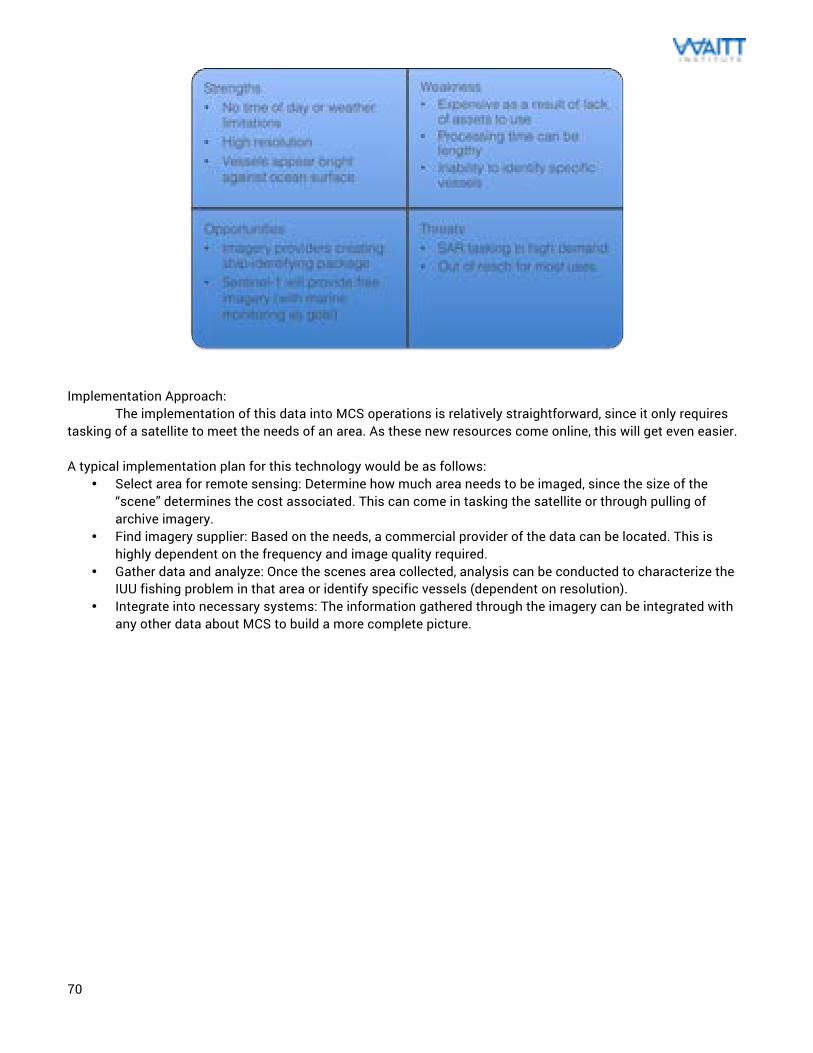
70
Implementation Approach: The implementation of this data into MCS operations is relatively straightforward, since it only requires tasking of a satellite to meet the needs of an area. As these new resources come online, this will get even easier. A typical implementation plan for this technology would be as follows:
• Select area for remote sensing: Determine how much area needs to be imaged, since the size of the “scene” determines the cost associated. This can come in tasking the satellite or through pulling of archive imagery.
• Find imagery supplier: Based on the needs, a commercial provider of the data can be located. This is highly dependent on the frequency and image quality required.
• Gather data and analyze: Once the scenes area collected, analysis can be conducted to characterize the IUU fishing problem in that area or identify specific vessels (dependent on resolution).
• Integrate into necessary systems: The information gathered through the imagery can be integrated with any other data about MCS to build a more complete picture.
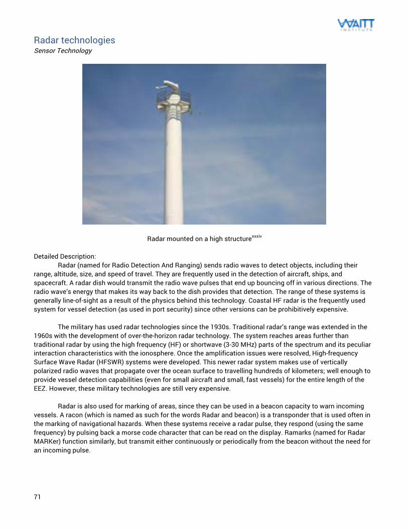
71
Radar technologies Sensor Technology
Radar mounted on a high structurexxxiv Detailed Description: Radar (named for Radio Detection And Ranging) sends radio waves to detect objects, including their range, altitude, size, and speed of travel. They are frequently used in the detection of aircraft, ships, and spacecraft. A radar dish would transmit the radio wave pulses that end up bouncing off in various directions. The radio wave’s energy that makes its way back to the dish provides that detection. The range of these systems is generally line-of-sight as a result of the physics behind this technology. Coastal HF radar is the frequently used system for vessel detection (as used in port security) since other versions can be prohibitively expensive. The military has used radar technologies since the 1930s. Traditional radar’s range was extended in the 1960s with the development of over-the-horizon radar technology. The system reaches areas further than traditional radar by using the high frequency (HF) or shortwave (3-30 MHz) parts of the spectrum and its peculiar interaction characteristics with the ionosphere. Once the amplification issues were resolved, High-frequency Surface Wave Radar (HFSWR) systems were developed. This newer radar system makes use of vertically polarized radio waves that propagate over the ocean surface to travelling hundreds of kilometers; well enough to provide vessel detection capabilities (even for small aircraft and small, fast vessels) for the entire length of the EEZ. However, these military technologies are still very expensive. Radar is also used for marking of areas, since they can be used in a beacon capacity to warn incoming vessels. A racon (which is named as such for the words Radar and beacon) is a transponder that is used often in the marking of navigational hazards. When these systems receive a radar pulse, they respond (using the same frequency) by pulsing back a morse code character that can be read on the display. Ramarks (named for Radar MARKer) function similarly, but transmit either continuously or periodically from the beacon without the need for an incoming pulse.
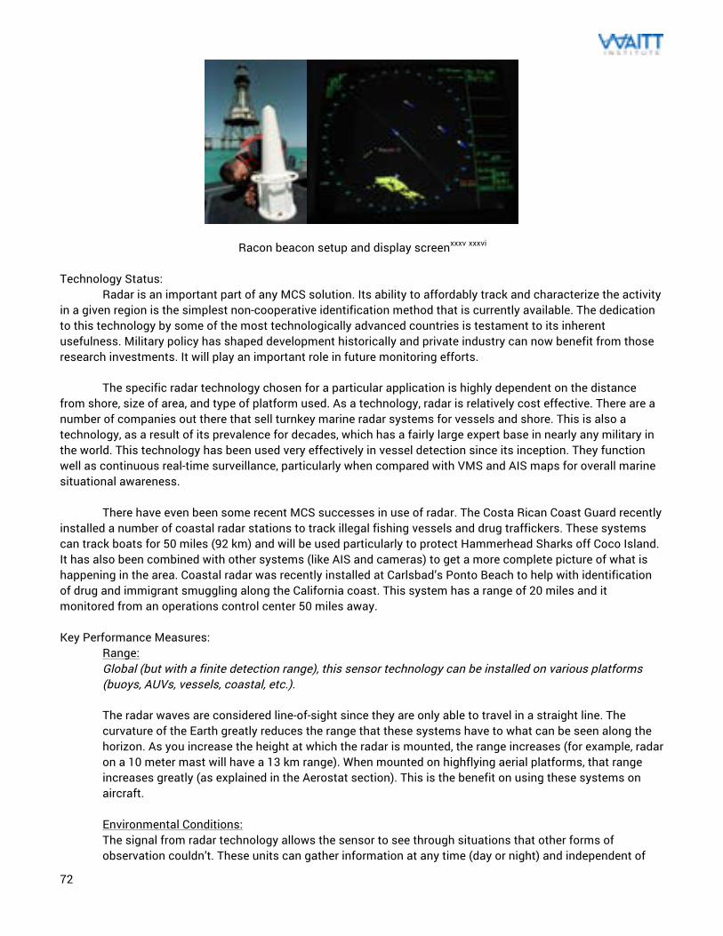
72
Racon beacon setup and display screenxxxv xxxvi Technology Status: Radar is an important part of any MCS solution. Its ability to affordably track and characterize the activity in a given region is the simplest non-cooperative identification method that is currently available. The dedication to this technology by some of the most technologically advanced countries is testament to its inherent usefulness. Military policy has shaped development historically and private industry can now benefit from those research investments. It will play an important role in future monitoring efforts. The specific radar technology chosen for a particular application is highly dependent on the distance from shore, size of area, and type of platform used. As a technology, radar is relatively cost effective. There are a number of companies out there that sell turnkey marine radar systems for vessels and shore. This is also a technology, as a result of its prevalence for decades, which has a fairly large expert base in nearly any military in the world. This technology has been used very effectively in vessel detection since its inception. They function well as continuous real-time surveillance, particularly when compared with VMS and AIS maps for overall marine situational awareness. There have even been some recent MCS successes in use of radar. The Costa Rican Coast Guard recently installed a number of coastal radar stations to track illegal fishing vessels and drug traffickers. These systems can track boats for 50 miles (92 km) and will be used particularly to protect Hammerhead Sharks off Coco Island. It has also been combined with other systems (like AIS and cameras) to get a more complete picture of what is happening in the area. Coastal radar was recently installed at Carlsbad’s Ponto Beach to help with identification of drug and immigrant smuggling along the California coast. This system has a range of 20 miles and it monitored from an operations control center 50 miles away. Key Performance Measures:
Range: Global (but with a finite detection range), this sensor technology can be installed on various platforms (buoys, AUVs, vessels, coastal, etc.). The radar waves are considered line-of-sight since they are only able to travel in a straight line. The curvature of the Earth greatly reduces the range that these systems have to what can be seen along the horizon. As you increase the height at which the radar is mounted, the range increases (for example, radar on a 10 meter mast will have a 13 km range). When mounted on highflying aerial platforms, that range increases greatly (as explained in the Aerostat section). This is the benefit on using these systems on aircraft. Environmental Conditions: The signal from radar technology allows the sensor to see through situations that other forms of observation couldn’t. These units can gather information at any time (day or night) and independent of
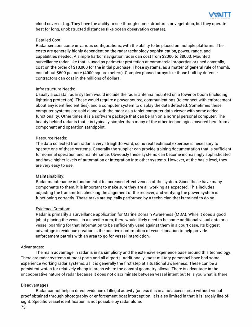
73
cloud cover or fog. They have the ability to see through some structures or vegetation, but they operate best for long, unobstructed distances (like ocean observation creates). Detailed Cost: Radar sensors come in various configurations, with the ability to be placed on multiple platforms. The costs are generally highly dependent on the radar technology sophistication, power, range, and capabilities needed. A simple harbor navigation radar can cost from $2000 to $8000. Mounted surveillance radar, like that is used as perimeter protection at commercial properties or used coastally, cost on the order of $10,000 for the initial purchase. Those systems, as a matter of general rule of thumb, cost about $600 per acre (4000 square meters). Complex phased arrays like those built by defense contractors can cost in the millions of dollars. Infrastructure Needs: Usually a coastal radar system would include the radar antenna mounted on a tower or boom (including lightning protection). These would require a power source, communications (to connect with enforcement about any identified entities), and a computer system to display the data detected. Sometimes these computer systems are sold along with the radar as a tablet computer data viewer with some added functionality. Other times it is a software package that can be ran on a normal personal computer. The beauty behind radar is that it is typically simpler than many of the other technologies covered here from a component and operation standpoint. Resource Needs: The data collected from radar is very straightforward, so no real technical expertise is necessary to operate one of these systems. Generally the supplier can provide training documentation that is sufficient for nominal operation and maintenance. Obviously these systems can become increasingly sophisticated and have higher levels of automation or integration into other systems. However, at the basic level, they are very easy to use. Maintainability: Radar maintenance is fundamental to increased effectiveness of the system. Since these have many components to them, it is important to make sure they are all working as expected. This includes adjusting the transmitter, checking the alignment of the receiver, and verifying the power system is functioning correctly. These tasks are typically performed by a technician that is trained to do so. Evidence Creation: Radar is primarily a surveillance application for Marine Domain Awareness (MDA). While it does a good job at placing the vessel in a specific area, there would likely need to be some additional visual data or a vessel boarding for that information to be sufficiently used against them in a court case. Its biggest advantage in evidence creation is the positive confirmation of vessel location to help provide enforcement patrols with an area to go for vessel interdiction.
Advantages: The main advantage in radar is in its simplicity and the extensive experience base around this technology. There are radar systems at most ports and all airports. Additionally, most military personnel have had some experience working radar systems, as it is generally the first step at situational awareness. These can be a persistent watch for relatively cheap in areas where the coastal geometry allows. There is advantage in the uncooperative nature of radar because it does not discriminate between vessel intent but tells you what is there. Disadvantages: Radar cannot help in direct evidence of illegal activity (unless it is in a no-access area) without visual proof obtained through photography or enforcement boat interception. It is also limited in that it is largely line-of-sight. Specific vessel identification is not possible by radar alone.
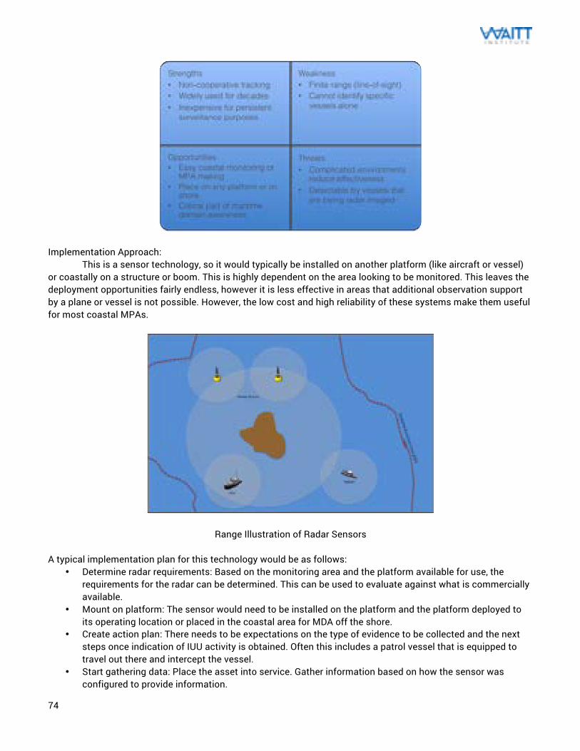
74
Implementation Approach:
This is a sensor technology, so it would typically be installed on another platform (like aircraft or vessel) or coastally on a structure or boom. This is highly dependent on the area looking to be monitored. This leaves the deployment opportunities fairly endless, however it is less effective in areas that additional observation support by a plane or vessel is not possible. However, the low cost and high reliability of these systems make them useful for most coastal MPAs.
Range Illustration of Radar Sensors
A typical implementation plan for this technology would be as follows: • Determine radar requirements: Based on the monitoring area and the platform available for use, the
requirements for the radar can be determined. This can be used to evaluate against what is commercially available.
• Mount on platform: The sensor would need to be installed on the platform and the platform deployed to its operating location or placed in the coastal area for MDA off the shore.
• Create action plan: There needs to be expectations on the type of evidence to be collected and the next steps once indication of IUU activity is obtained. Often this includes a patrol vessel that is equipped to travel out there and intercept the vessel.
• Start gathering data: Place the asset into service. Gather information based on how the sensor was configured to provide information.
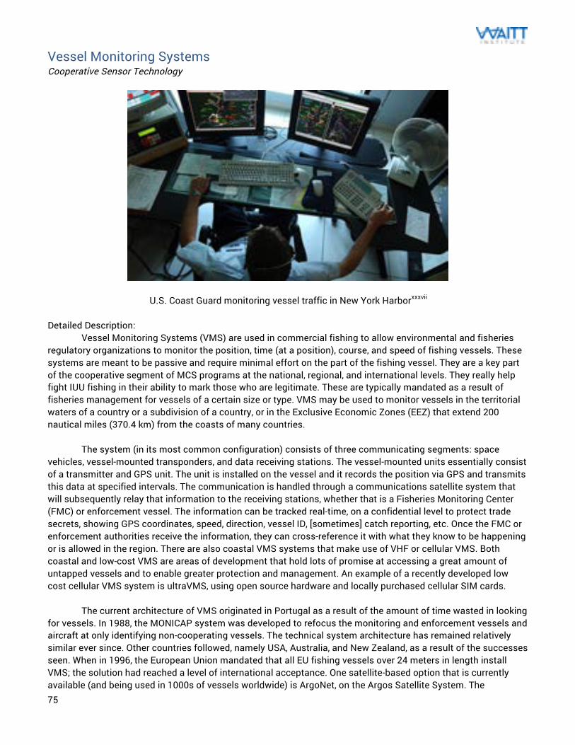
75
Vessel Monitoring Systems Cooperative Sensor Technology
U.S. Coast Guard monitoring vessel traffic in New York Harborxxxvii Detailed Description: Vessel Monitoring Systems (VMS) are used in commercial fishing to allow environmental and fisheries regulatory organizations to monitor the position, time (at a position), course, and speed of fishing vessels. These systems are meant to be passive and require minimal effort on the part of the fishing vessel. They are a key part of the cooperative segment of MCS programs at the national, regional, and international levels. They really help fight IUU fishing in their ability to mark those who are legitimate. These are typically mandated as a result of fisheries management for vessels of a certain size or type. VMS may be used to monitor vessels in the territorial waters of a country or a subdivision of a country, or in the Exclusive Economic Zones (EEZ) that extend 200 nautical miles (370.4 km) from the coasts of many countries.
The system (in its most common configuration) consists of three communicating segments: space vehicles, vessel-mounted transponders, and data receiving stations. The vessel-mounted units essentially consist of a transmitter and GPS unit. The unit is installed on the vessel and it records the position via GPS and transmits this data at specified intervals. The communication is handled through a communications satellite system that will subsequently relay that information to the receiving stations, whether that is a Fisheries Monitoring Center (FMC) or enforcement vessel. The information can be tracked real-time, on a confidential level to protect trade secrets, showing GPS coordinates, speed, direction, vessel ID, [sometimes] catch reporting, etc. Once the FMC or enforcement authorities receive the information, they can cross-reference it with what they know to be happening or is allowed in the region. There are also coastal VMS systems that make use of VHF or cellular VMS. Both coastal and low-cost VMS are areas of development that hold lots of promise at accessing a great amount of untapped vessels and to enable greater protection and management. An example of a recently developed low cost cellular VMS system is ultraVMS, using open source hardware and locally purchased cellular SIM cards. The current architecture of VMS originated in Portugal as a result of the amount of time wasted in looking for vessels. In 1988, the MONICAP system was developed to refocus the monitoring and enforcement vessels and aircraft at only identifying non-cooperating vessels. The technical system architecture has remained relatively similar ever since. Other countries followed, namely USA, Australia, and New Zealand, as a result of the successes seen. When in 1996, the European Union mandated that all EU fishing vessels over 24 meters in length install VMS; the solution had reached a level of international acceptance. One satellite-based option that is currently available (and being used in 1000s of vessels worldwide) is ArgoNet, on the Argos Satellite System. The
76
Indonesian Ministry of Marine Affairs and Fisheries is using Argos for their national VMS and they have the one of the largest operational VMS programs globally with 1,500 fishing vessels equipped with transmitters and 15 patrol boats equipped with data receiving systems. In Peru, there are over 1,000 vessels tracked within the EEZs since 1998, which makes for a very effective case study. The Korean Squid Fishing Association also employs these to track squid fishing in Russian waters. A similar approach can be used to monitor critical fish species around the Pacific island states. Currently, the US Coast Guard has three Orbital Sciences low-earth orbit (piggyback payloads) that listen for VMS information through the NavCenter in the Department of Homeland Security. There is a similar system being implemented throughout the European Union called Integrity and it will be mandated that these be employed across Europe. Technology Status: As a result of this being a participatory system coupled with the fact that fishing locations can be considered “trade secrets,” VMS is considered an inherently closed system. This means that the data collected is only available to specific entities (which, some say, enables more effective prosecution). Protection of the information is a big issue with VMS, as this information is the secrets of their fishing approach. If this cannot be assured, then the level of cooperation will reduce drastically. Typically these VMS operations function through two different means: indirect or direct reporting. For indirect reporting, the VMS data is sent to the FMC in the flag state of the vessel. Then, this information is sent to the RFMO (Regional Fisheries Management Organization) secretariat or to the state of which the vessel is in their EEZ. The flaw in this operation is the opportunity for corruption of data since the burden of responsibility rests on the receiving flag state. In direct reporting, both the RFMO/EEZ state and the flag state receives VMS data from the vessel at the same time. This is the preferred method, although adequate security must be in place. One of the major flaws to such a system is the fact that, if someone doesn’t want to be found (the majority of IUU fishermen), they can very easily not use the system. However, by paring it with other surveillance technology, it can be used to identify those with non-functioning or missing systems. Under this scenario, the part of the price to fish in the EEZs of these nations would be the cost of a fully functional VMS transponder (with vessel ID and locations). Effective implementation of VMS requires adequate buy-in, and that will need to be available if an international solution is ever pursued. Also, VMS can also be a cost burden to poor coastal fishermen as they all communicate through satellite communications. Coastal VMS, using VHF or cellular radio, is currently in development but not fully in use. VMS, on a global scale and in the opinion of experts, is the best option for safety and surveillance within the EEZs. If all ships were required to have one of these systems installed, then that would enable governments to monitor transponder traffic and thereby better manage their fisheries. These VMS units need to be installed on the vessel in a way that will reduce the risk associated with tampering with the device. In practice, these units are rarely inspected and need to operate undisturbed without errors. There is a strong incentive in tampering with the information, so that the fishers can fish for longer or venture into marine reserves for better catch. Tampering generally occurs by keeping the position information from being obtained (GPS tampering), keeping the position from being transmitted (VMS tampering) or sending incorrect position reports. The original method of tampering for these was by blocking the antenna or unplugging the unit (then claiming ignorance). Those methods were predictable when looking at VMS data (predictable or repeated outages at certain times or places). One case of tampering by a Honduran vessel’s VMS showed their registered location over 3,000 nautical miles away from their actual physical location (this has been repeated in other experiments). There even exist tampering devices that are made to plug into some popular VMS designs. While VMS is an elegant outcome, it is not the overall solution as a result of its inability to address those who do not want to be found. However, there have been studies that have shown that it changes behavior for a fishery or area. Before VMS adoption, a large amount of enforcement effort went into just looking at all vessels to determine their legality. This resulted in ineffective uses of the limited enforcement resources available. Now, the implementation of VMS frees up these resources to only focus on those who do not show up as part of the VMS system. It also helps with overall fisheries management, since vessel speed, location, fishing technique, and time
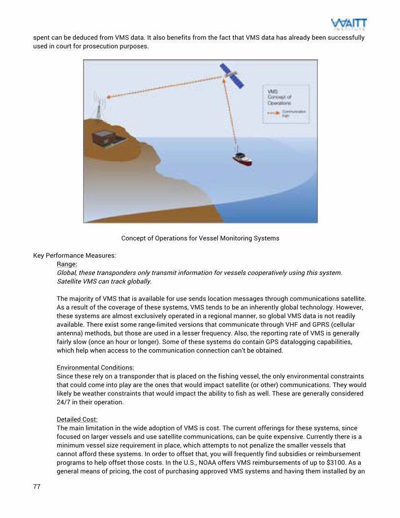
77
spent can be deduced from VMS data. It also benefits from the fact that VMS data has already been successfully used in court for prosecution purposes.
Concept of Operations for Vessel Monitoring Systems Key Performance Measures:
Range: Global, these transponders only transmit information for vessels cooperatively using this system. Satellite VMS can track globally. The majority of VMS that is available for use sends location messages through communications satellite. As a result of the coverage of these systems, VMS tends to be an inherently global technology. However, these systems are almost exclusively operated in a regional manner, so global VMS data is not readily available. There exist some range-limited versions that communicate through VHF and GPRS (cellular antenna) methods, but those are used in a lesser frequency. Also, the reporting rate of VMS is generally fairly slow (once an hour or longer). Some of these systems do contain GPS datalogging capabilities, which help when access to the communication connection can’t be obtained. Environmental Conditions: Since these rely on a transponder that is placed on the fishing vessel, the only environmental constraints that could come into play are the ones that would impact satellite (or other) communications. They would likely be weather constraints that would impact the ability to fish as well. These are generally considered 24/7 in their operation. Detailed Cost: The main limitation in the wide adoption of VMS is cost. The current offerings for these systems, since focused on larger vessels and use satellite communications, can be quite expensive. Currently there is a minimum vessel size requirement in place, which attempts to not penalize the smaller vessels that cannot afford these systems. In order to offset that, you will frequently find subsidies or reimbursement programs to help offset those costs. In the U.S., NOAA offers VMS reimbursements of up to $3100. As a general means of pricing, the cost of purchasing approved VMS systems and having them installed by an
78
approved technician (to ensure it is tamperproof) is around $4000. The approval process ensures that these units are compatible with local data receiving stations and the communications systems that are preferred. The lack of a global VMS standard makes the available options vary widely. Additionally, there would be an annual VMS communication service fee of at least $500, which can add to overall operational cost for fishers. The VMS that operates on VHF and cellular systems generally still maintains the ability to communicate through satellite systems, so these are typically in the same price range. For low cost VMS, there have been pilots to use GPS trackers (and download the data later) but these were too tedious for widespread adoption. The ultraVMS unit seeks to use open source hardware design and cellular data to offer key VMS functionality, safety at sea capabilities, and a geofencing platform for the cost of $150 plus SIM card SMS plan. On top of the unit costs, there are system or data costs that would be incurred by establishing an onshore FMC to manage the VMS data. This can be anywhere from having a single computer with an internet connection to a $500,000+ data center depending on the needs of the community. Infrastructure Needs: Every participating vessel would require the use of a transponder on board, either powered by battery or through the power system of the vessel. All of these approaches need to include some communications mechanisms to send the data. There also should be a back end for the VMS data to be collected and managed. These FMC infrastructure needs can be fairly basic but it should in place for the data to be used effectively. Current VMS systems require a level of privacy so this needs to be taken into account on for the infrastructure needs. Resource Needs: Generally there needs to be at least one person familiar with the VMS system to help provide support on unit procurement (by the fishers) and to provide the data review and analysis. This is usually someone who is associated with the fisheries department or enforcement, although VMS tends to be handled at the regional level. Some RFMOs just relay VMS information related to the EEZ to member countries who do not have the infrastructure or expertise available. There is benefit to these systems being handled more locally but costs sometimes prohibit this (as the industry is currently structured). If VMS were to be managed through a more open framework, this data could be easier to manage and it would spark more innovation in the industry. Currently the information is fiercely protected as to protect the trade secrets of the fishers. Maintainability: These units are basically electrical boxes, so they are not usually repaired easily on sight. Malfunctioning units will generally be sent back to the supplier for repair and troubleshooting. In larger port areas, there are sometimes vendors that will have some repair capabilities and can get the units back in working order soon. Either way, turnaround is important if VMS is a mandated component of the fisheries management plan. Any time without the unit would mean loss of fishing income by the fisher. The communications side of these units relies on public systems, so no maintenance would be required. Most FMCs would pull the data through normal computer terminals, so maintenance of those systems would be managed through normal means. Evidence Creation: In terms of evidence creation, the data from VMS is considered one piece of the gold standard of fisheries evidence for all but manned patrols. There have been a number of successful prosecutions performed using some combination of VMS data and photographic evidence or boarding. Even in places like the California coastline, a combination of VMS data and photographic evidence would create what is considered an “airtight case.” This is partly because of the protection of the data here and partly because of the reputation of these systems.
Advantages:
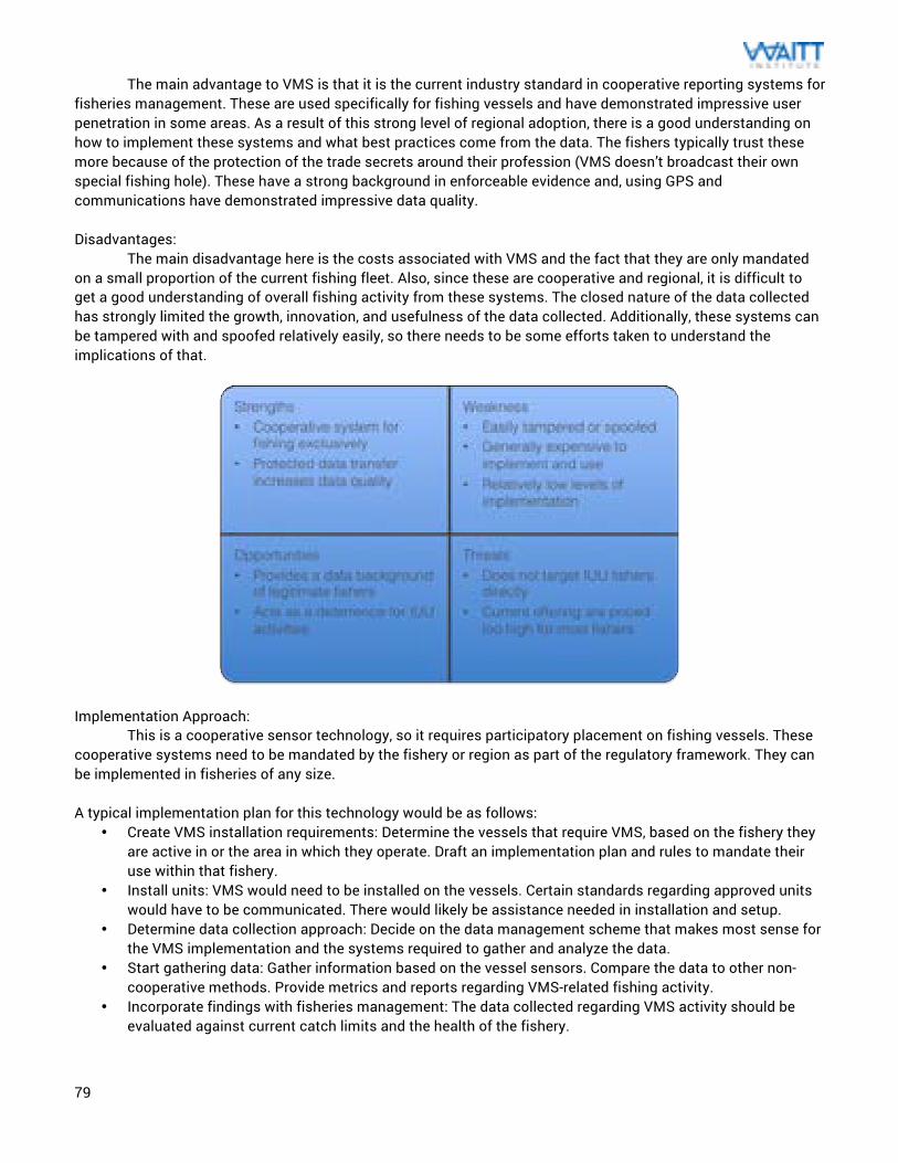
79
The main advantage to VMS is that it is the current industry standard in cooperative reporting systems for fisheries management. These are used specifically for fishing vessels and have demonstrated impressive user penetration in some areas. As a result of this strong level of regional adoption, there is a good understanding on how to implement these systems and what best practices come from the data. The fishers typically trust these more because of the protection of the trade secrets around their profession (VMS doesn’t broadcast their own special fishing hole). These have a strong background in enforceable evidence and, using GPS and communications have demonstrated impressive data quality. Disadvantages: The main disadvantage here is the costs associated with VMS and the fact that they are only mandated on a small proportion of the current fishing fleet. Also, since these are cooperative and regional, it is difficult to get a good understanding of overall fishing activity from these systems. The closed nature of the data collected has strongly limited the growth, innovation, and usefulness of the data collected. Additionally, these systems can be tampered with and spoofed relatively easily, so there needs to be some efforts taken to understand the implications of that.
Implementation Approach:
This is a cooperative sensor technology, so it requires participatory placement on fishing vessels. These cooperative systems need to be mandated by the fishery or region as part of the regulatory framework. They can be implemented in fisheries of any size. A typical implementation plan for this technology would be as follows:
• Create VMS installation requirements: Determine the vessels that require VMS, based on the fishery they are active in or the area in which they operate. Draft an implementation plan and rules to mandate their use within that fishery.
• Install units: VMS would need to be installed on the vessels. Certain standards regarding approved units would have to be communicated. There would likely be assistance needed in installation and setup.
• Determine data collection approach: Decide on the data management scheme that makes most sense for the VMS implementation and the systems required to gather and analyze the data.
• Start gathering data: Gather information based on the vessel sensors. Compare the data to other non-cooperative methods. Provide metrics and reports regarding VMS-related fishing activity.
• Incorporate findings with fisheries management: The data collected regarding VMS activity should be evaluated against current catch limits and the health of the fishery.
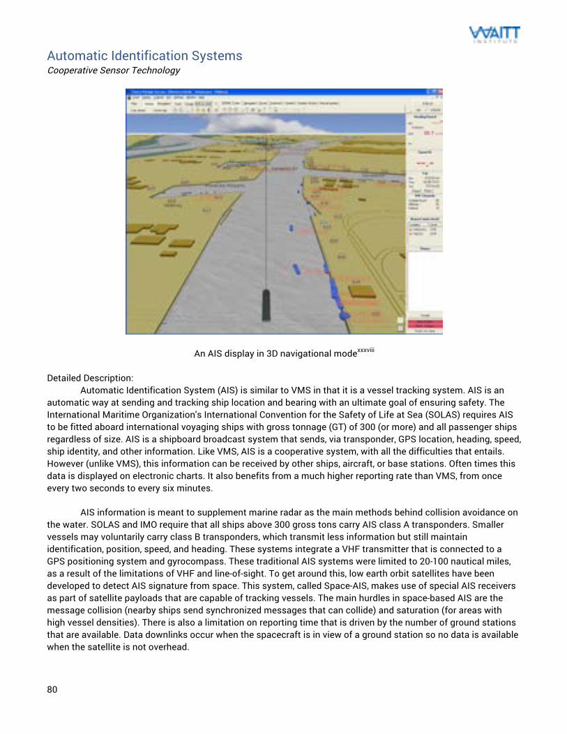
80
Automatic Identification Systems Cooperative Sensor Technology
An AIS display in 3D navigational modexxxviii Detailed Description: Automatic Identification System (AIS) is similar to VMS in that it is a vessel tracking system. AIS is an automatic way at sending and tracking ship location and bearing with an ultimate goal of ensuring safety. The International Maritime Organization's International Convention for the Safety of Life at Sea (SOLAS) requires AIS to be fitted aboard international voyaging ships with gross tonnage (GT) of 300 (or more) and all passenger ships regardless of size. AIS is a shipboard broadcast system that sends, via transponder, GPS location, heading, speed, ship identity, and other information. Like VMS, AIS is a cooperative system, with all the difficulties that entails. However (unlike VMS), this information can be received by other ships, aircraft, or base stations. Often times this data is displayed on electronic charts. It also benefits from a much higher reporting rate than VMS, from once every two seconds to every six minutes. AIS information is meant to supplement marine radar as the main methods behind collision avoidance on the water. SOLAS and IMO require that all ships above 300 gross tons carry AIS class A transponders. Smaller vessels may voluntarily carry class B transponders, which transmit less information but still maintain identification, position, speed, and heading. These systems integrate a VHF transmitter that is connected to a GPS positioning system and gyrocompass. These traditional AIS systems were limited to 20-100 nautical miles, as a result of the limitations of VHF and line-of-sight. To get around this, low earth orbit satellites have been developed to detect AIS signature from space. This system, called Space-AIS, makes use of special AIS receivers as part of satellite payloads that are capable of tracking vessels. The main hurdles in space-based AIS are the message collision (nearby ships send synchronized messages that can collide) and saturation (for areas with high vessel densities). There is also a limitation on reporting time that is driven by the number of ground stations that are available. Data downlinks occur when the spacecraft is in view of a ground station so no data is available when the satellite is not overhead.
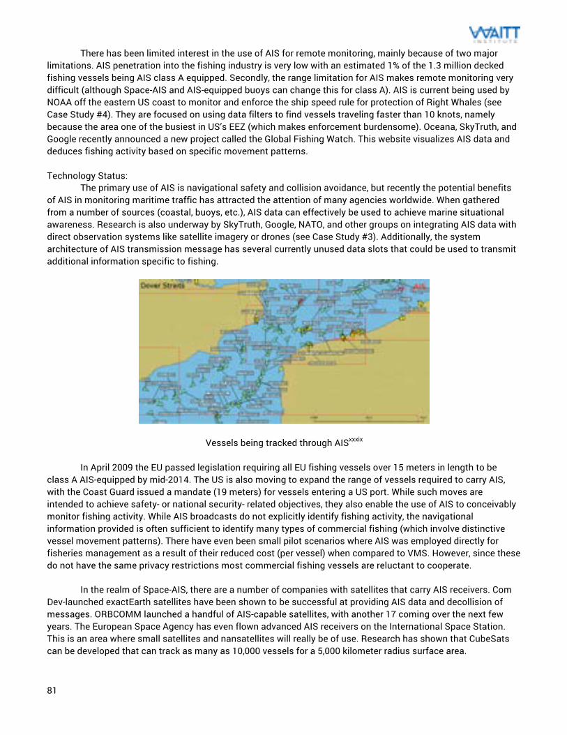
81
There has been limited interest in the use of AIS for remote monitoring, mainly because of two major limitations. AIS penetration into the fishing industry is very low with an estimated 1% of the 1.3 million decked fishing vessels being AIS class A equipped. Secondly, the range limitation for AIS makes remote monitoring very difficult (although Space-AIS and AIS-equipped buoys can change this for class A). AIS is current being used by NOAA off the eastern US coast to monitor and enforce the ship speed rule for protection of Right Whales (see Case Study #4). They are focused on using data filters to find vessels traveling faster than 10 knots, namely because the area one of the busiest in US’s EEZ (which makes enforcement burdensome). Oceana, SkyTruth, and Google recently announced a new project called the Global Fishing Watch. This website visualizes AIS data and deduces fishing activity based on specific movement patterns. Technology Status: The primary use of AIS is navigational safety and collision avoidance, but recently the potential benefits of AIS in monitoring maritime traffic has attracted the attention of many agencies worldwide. When gathered from a number of sources (coastal, buoys, etc.), AIS data can effectively be used to achieve marine situational awareness. Research is also underway by SkyTruth, Google, NATO, and other groups on integrating AIS data with direct observation systems like satellite imagery or drones (see Case Study #3). Additionally, the system architecture of AIS transmission message has several currently unused data slots that could be used to transmit additional information specific to fishing.
Vessels being tracked through AISxxxix In April 2009 the EU passed legislation requiring all EU fishing vessels over 15 meters in length to be class A AIS-equipped by mid-2014. The US is also moving to expand the range of vessels required to carry AIS, with the Coast Guard issued a mandate (19 meters) for vessels entering a US port. While such moves are intended to achieve safety- or national security- related objectives, they also enable the use of AIS to conceivably monitor fishing activity. While AIS broadcasts do not explicitly identify fishing activity, the navigational information provided is often sufficient to identify many types of commercial fishing (which involve distinctive vessel movement patterns). There have even been small pilot scenarios where AIS was employed directly for fisheries management as a result of their reduced cost (per vessel) when compared to VMS. However, since these do not have the same privacy restrictions most commercial fishing vessels are reluctant to cooperate. In the realm of Space-AIS, there are a number of companies with satellites that carry AIS receivers. Com Dev-launched exactEarth satellites have been shown to be successful at providing AIS data and decollision of messages. ORBCOMM launched a handful of AIS-capable satellites, with another 17 coming over the next few years. The European Space Agency has even flown advanced AIS receivers on the International Space Station. This is an area where small satellites and nansatellites will really be of use. Research has shown that CubeSats can be developed that can track as many as 10,000 vessels for a 5,000 kilometer radius surface area.
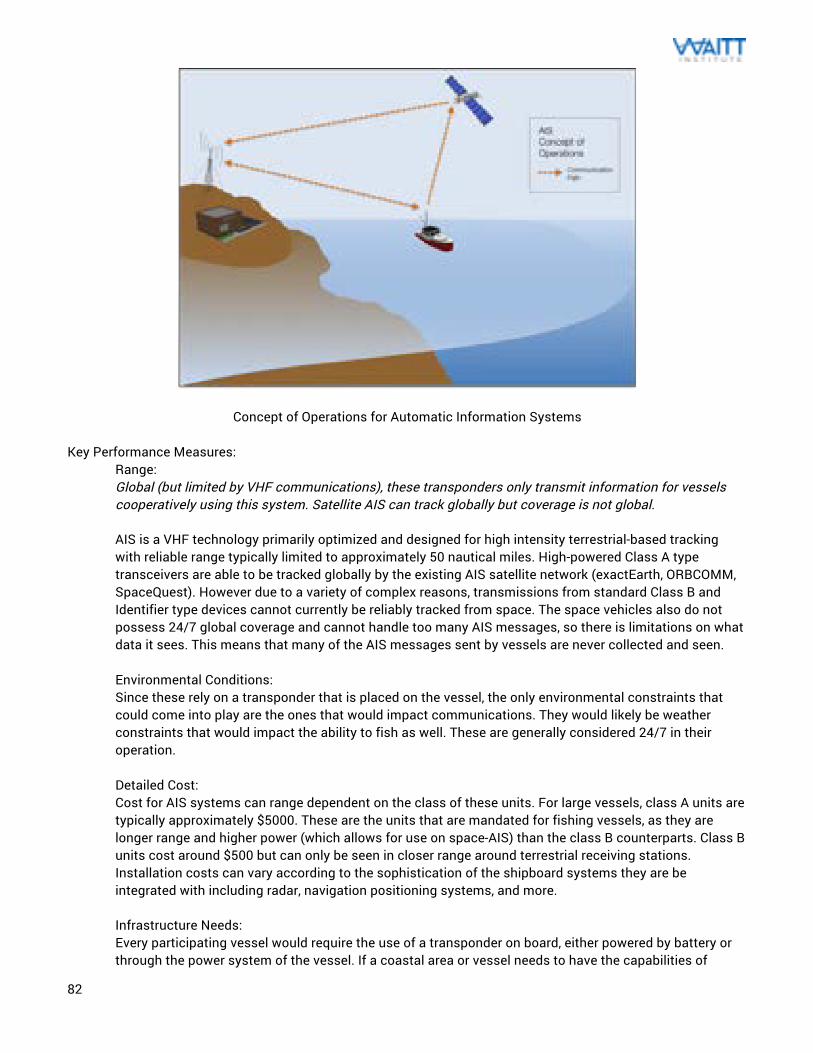
82
Concept of Operations for Automatic Information Systems Key Performance Measures:
Range: Global (but limited by VHF communications), these transponders only transmit information for vessels cooperatively using this system. Satellite AIS can track globally but coverage is not global. AIS is a VHF technology primarily optimized and designed for high intensity terrestrial-based tracking with reliable range typically limited to approximately 50 nautical miles. High-powered Class A type transceivers are able to be tracked globally by the existing AIS satellite network (exactEarth, ORBCOMM, SpaceQuest). However due to a variety of complex reasons, transmissions from standard Class B and Identifier type devices cannot currently be reliably tracked from space. The space vehicles also do not possess 24/7 global coverage and cannot handle too many AIS messages, so there is limitations on what data it sees. This means that many of the AIS messages sent by vessels are never collected and seen. Environmental Conditions: Since these rely on a transponder that is placed on the vessel, the only environmental constraints that could come into play are the ones that would impact communications. They would likely be weather constraints that would impact the ability to fish as well. These are generally considered 24/7 in their operation. Detailed Cost: Cost for AIS systems can range dependent on the class of these units. For large vessels, class A units are typically approximately $5000. These are the units that are mandated for fishing vessels, as they are longer range and higher power (which allows for use on space-AIS) than the class B counterparts. Class B units cost around $500 but can only be seen in closer range around terrestrial receiving stations. Installation costs can vary according to the sophistication of the shipboard systems they are be integrated with including radar, navigation positioning systems, and more. Infrastructure Needs: Every participating vessel would require the use of a transponder on board, either powered by battery or through the power system of the vessel. If a coastal area or vessel needs to have the capabilities of
83
receipt of AIS data, then a VHF antenna and AIS receiver would need to be installed. The data from these is generally displayed on a marine information system or normal computer. There have even been smartphone apps that mimic the duties of an AIS receiver, like the one created by MarineTraffic.com called mAIS. Resource Needs: The operators focused on AIS are typically those worried about vessel traffic and collisions. These were originally developed as a marine situational awareness and collision avoidance technology, so they are critical (along with radar) at major port areas. The data is more open than VMS, so the analysis and data management of the information is easier to understand and obtain. There are even open websites available to track vessel traffic of units with class A transponders (although these are only a small percentage of vessels in that area as a result of receiver limitations). Maintainability: These units are basically electronic boxes, so they are not usually repaired easily on site. Malfunctioning units will generally be sent back to the supplier for repair and troubleshooting. In larger port areas, there are sometimes vendors that will have some repair capabilities and can get the units back in working order soon. There is likely to be more experienced people with AIS than VMS, since these are for all vessels and not just fishing vessels. Evidence Creation: The use of AIS in IUU fishing violation evidence creation is relatively young. There is starting to be an increased interest in using class A AIS data to characterize behavior like fishing, transshipments, and refueling. Some of the effort done by SkyTruth, Analyze, and Google can be seen here (see Case Study #3). However, the number of fishing vessels using AIS is small (less than 500,000 of the 4+ million fishing vessels). Additionally, this data would have to be combined with satellite imagery of illegal behavior or vessel boarding by enforcement. As of now, only “interesting behavior” has been noted but that may change as this technology develops. Also, since AIS is largely voluntary for fishing vessels there isn’t a strong framework to catch something IUU-related. It should also be noted that this system was not designed to operate in this capacity, so there are inherent technical limitations on using AIS for enforcement.
Advantages:
One of the main advantages of AIS is the fact that it has pretty broad acceptance in the maritime community as a result of its benefit as a safety tool. This increases the value-added nature of the technology and provides an incentive towards minimizing the chance that it will be tampered with (although this is not true for times when illegal activity are taking place). Since these are location-aware devices, there is an opportunity for them to help communicate spatial boundaries like marine protected areas in places where physical landmarks cannot help. This can help as MPAs evolve and get better as a result of increased scientific understanding. In theory, AIS should have the same functionality as VMS in terms of adding some beneficial information for enforcement. Also, since VHF frequencies have a longer wavelength and better propagation than radar, they can help to increase visibility behind islands and around bends (mainly a navigational advantage), which improves MCS. Disadvantages:
The main disadvantage with AIS is that they are not mandated on the majority of fishing vessels. Even if they were to become a critical part of fisheries management, current AIS receivers are either close range (shore-based) or limited in vessels they can track (current space assets). This means that they are not sufficiently representative of the vessels out at sea. These problems can be solved with sufficient investments in the industry. There is also a risk that the use of AIS for fisheries enforcement could reduce the use of these units or increase the incentives around spoofing these systems. Currently most vessel operators do not expect this
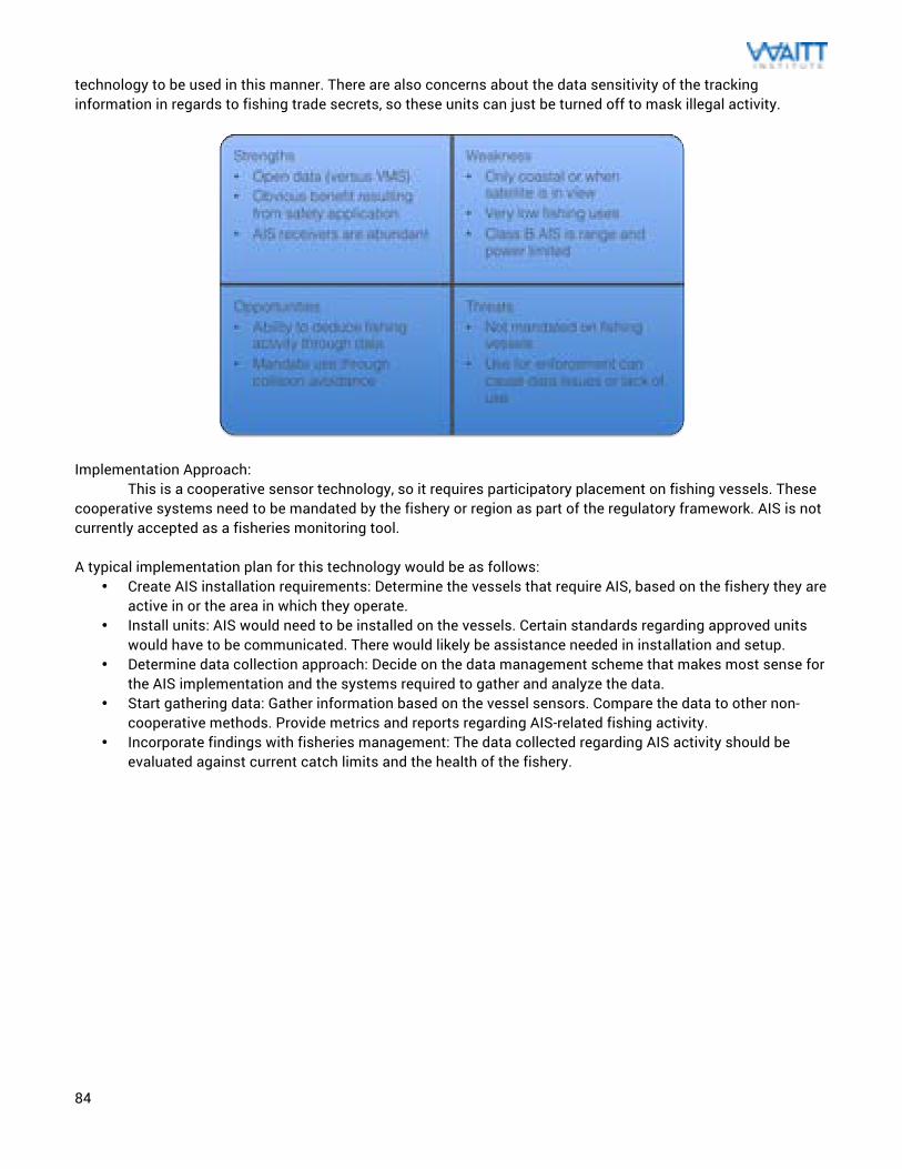
84
technology to be used in this manner. There are also concerns about the data sensitivity of the tracking information in regards to fishing trade secrets, so these units can just be turned off to mask illegal activity.
Implementation Approach:
This is a cooperative sensor technology, so it requires participatory placement on fishing vessels. These cooperative systems need to be mandated by the fishery or region as part of the regulatory framework. AIS is not currently accepted as a fisheries monitoring tool. A typical implementation plan for this technology would be as follows:
• Create AIS installation requirements: Determine the vessels that require AIS, based on the fishery they are active in or the area in which they operate.
• Install units: AIS would need to be installed on the vessels. Certain standards regarding approved units would have to be communicated. There would likely be assistance needed in installation and setup.
• Determine data collection approach: Decide on the data management scheme that makes most sense for the AIS implementation and the systems required to gather and analyze the data.
• Start gathering data: Gather information based on the vessel sensors. Compare the data to other non-cooperative methods. Provide metrics and reports regarding AIS-related fishing activity.
• Incorporate findings with fisheries management: The data collected regarding AIS activity should be evaluated against current catch limits and the health of the fishery.
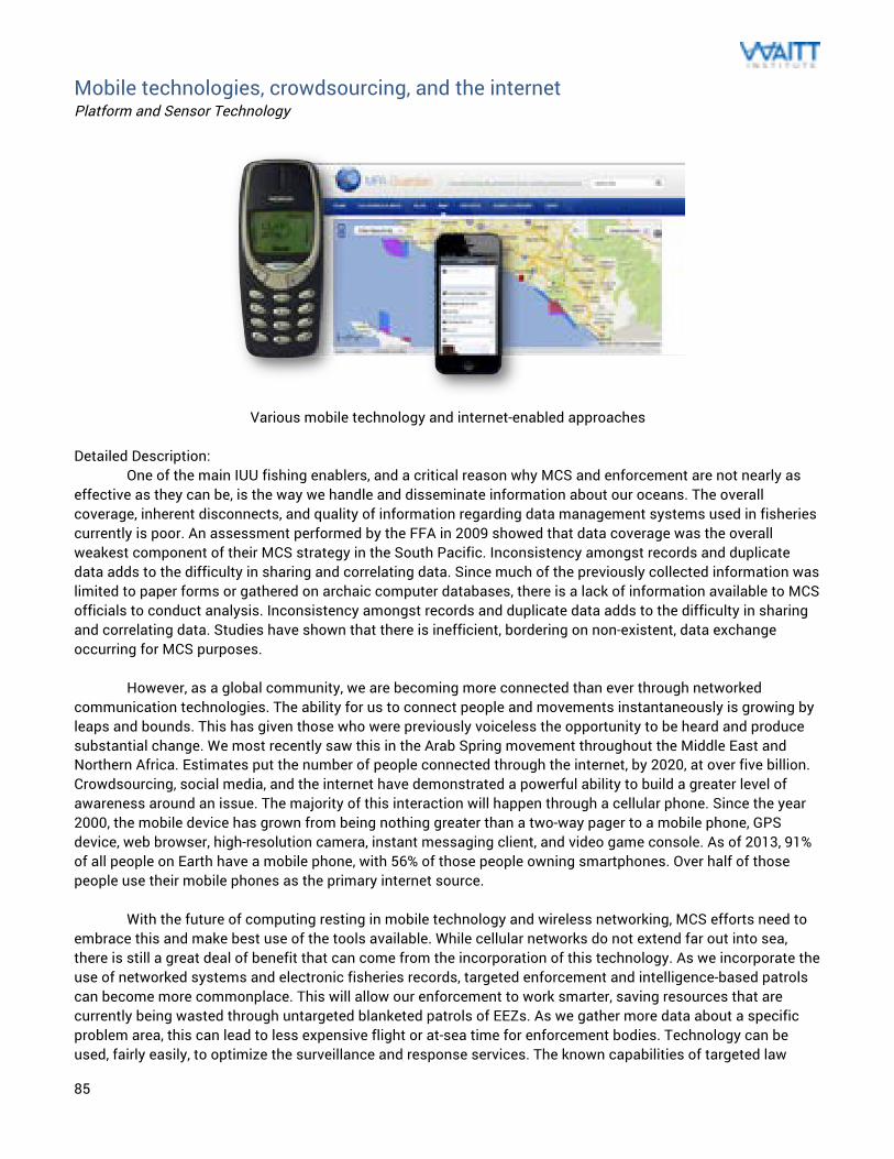
85
Mobile technologies, crowdsourcing, and the internet Platform and Sensor Technology
Various mobile technology and internet-enabled approaches
Detailed Description: One of the main IUU fishing enablers, and a critical reason why MCS and enforcement are not nearly as effective as they can be, is the way we handle and disseminate information about our oceans. The overall coverage, inherent disconnects, and quality of information regarding data management systems used in fisheries currently is poor. An assessment performed by the FFA in 2009 showed that data coverage was the overall weakest component of their MCS strategy in the South Pacific. Inconsistency amongst records and duplicate data adds to the difficulty in sharing and correlating data. Since much of the previously collected information was limited to paper forms or gathered on archaic computer databases, there is a lack of information available to MCS officials to conduct analysis. Inconsistency amongst records and duplicate data adds to the difficulty in sharing and correlating data. Studies have shown that there is inefficient, bordering on non-existent, data exchange occurring for MCS purposes. However, as a global community, we are becoming more connected than ever through networked communication technologies. The ability for us to connect people and movements instantaneously is growing by leaps and bounds. This has given those who were previously voiceless the opportunity to be heard and produce substantial change. We most recently saw this in the Arab Spring movement throughout the Middle East and Northern Africa. Estimates put the number of people connected through the internet, by 2020, at over five billion. Crowdsourcing, social media, and the internet have demonstrated a powerful ability to build a greater level of awareness around an issue. The majority of this interaction will happen through a cellular phone. Since the year 2000, the mobile device has grown from being nothing greater than a two-way pager to a mobile phone, GPS device, web browser, high-resolution camera, instant messaging client, and video game console. As of 2013, 91% of all people on Earth have a mobile phone, with 56% of those people owning smartphones. Over half of those people use their mobile phones as the primary internet source. With the future of computing resting in mobile technology and wireless networking, MCS efforts need to embrace this and make best use of the tools available. While cellular networks do not extend far out into sea, there is still a great deal of benefit that can come from the incorporation of this technology. As we incorporate the use of networked systems and electronic fisheries records, targeted enforcement and intelligence-based patrols can become more commonplace. This will allow our enforcement to work smarter, saving resources that are currently being wasted through untargeted blanketed patrols of EEZs. As we gather more data about a specific problem area, this can lead to less expensive flight or at-sea time for enforcement bodies. Technology can be used, fairly easily, to optimize the surveillance and response services. The known capabilities of targeted law
86
enforcement presence will also foster an increased perceived risk amongst the public when it comes to illicit activities, creating a deterrence to IUU fishing. The increased coordination would also help with the shortcomings in aerial surveillance response by better quantifying the problem and allowing for optimal use of existing enforcement framework. Technology Status: Currently, there is no cohesive regional or international approach to data collection and MCS. As a result, multiple data standards currently exist that are driving the divide against further collaboration. Some interesting work has been done in the European Union and the South Pacific to change this, but that still leaves much of the world’s fishable waters at a severe disadvantage. What is needed is a better way to use new technologies to change this. There have been some recent projects in various places to change this.
The Environmental Justice Foundation ran a project in Sierra Leone to give cell phones and GPS-enabled cameras to the local fishermen to document the IUU fishing happening in their waters (see Case Study #1). These fishers were able to snap a picture and send in information about the intruder’s call sign, name, or any unique markings. MPA Guardian goes even a step further. By developing an app for use on smartphones, any damaging actions in marine protected areas can be documented anonymously and shared with the authorities (which can also be done on the website). By increasing the number of potential “watchdogs,” this creates an incentive structure that places risk to perpetrators very high, as anyone can be watching (similar to what has been seen in successful neighborhood watch programs). Our ability to share and operate off otherwise previously unavailable information is greater than any point in history and should be leveraged to help stop these illicit activities. The FFA has even seen interest from industry, charter fishing operations, cargo operators, airlines, NGOs and coastal communities to participate in IUU fishing reporting.
Additionally, the better we get at managing all the data surrounding fisheries, the more of it that can be
integrated into the way that we do MCS. Our fisheries can get better at real-time data exchange with the fishermen they support. This can allow catch quotas, fisheries status, weather events, and changes in closed areas all to be communicated cheaply and effectively using this technology. The more we can eliminate the inaccuracies and inefficiencies associated with a paper-based data process, the easier it will be for use to do something useful with that data. Mobile application technologies like Digital Deck enable the sharing of that information to promote this better decision-making. This approach is quickly becoming the basis of better fisheries management in the coming years as they also allow for improvements in traceability and the communication of that to the consumer. As we start adopting more and more of these new data approaches, we can start to create a common architecture that will drive data standards and make sure that we change the relationship that our oceans have with data.
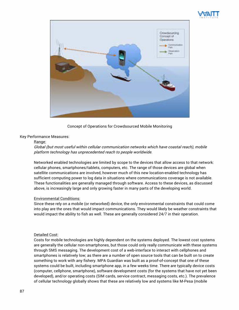
87
Concept of Operations for Crowdsourced Mobile Monitoring Key Performance Measures:
Range: Global (but most useful within cellular communication networks which have coastal reach), mobile platform technology has unprecedented reach to people worldwide. Networked enabled technologies are limited by scope to the devices that allow access to that network: cellular phones, smartphones/tablets, computers, etc. The range of those devices are global when satellite communications are involved, however much of this new location-enabled technology has sufficient computing power to log data in situations where communications coverage is not available. These functionalities are generally managed through software. Access to these devices, as discussed above, is increasingly large and only growing faster in many parts of the developing world. Environmental Conditions: Since these rely on a mobile (or networked) device, the only environmental constraints that could come into play are the ones that would impact communications. They would likely be weather constraints that would impact the ability to fish as well. These are generally considered 24/7 in their operation. Detailed Cost: Costs for mobile technologies are highly dependent on the systems deployed. The lowest cost systems are generally the cellular non-smartphones, but those could only really communicate with these systems through SMS messaging. The development cost of a web-interface to interact with cellphones and smartphones is relatively low; as there are a number of open source tools that can be built on to create something to work with any fishery. MPA Guardian was built as a proof-of-concept that one of these systems could be built, including smartphone app, in a few weeks time. There are typically device costs (computer, cellphone, smartphone), software development costs (for the systems that have not yet been developed), and/or operating costs (SIM cards, service contract, messaging costs, etc.). The prevalence of cellular technology globally shows that these are relatively low and systems like M-Pesa (mobile
88
banking that originated in Kenya) demonstrate that these can be used for things other than phone calls. Operational costs should be offset on any implementation of a technology like this. Infrastructure Needs: The beauty behind these systems is the inherent lack of individual infrastructure for their operation. If the area has a communications network and access to electrical power, any variation on a network-based approach can take place. Most areas in this world now have access to cellular technology and the supporting components (SIM cards, chargers, etc.) Resource Needs: Outside of developers needed to set up these systems to begin with, they are inherently easy to use given appropriate user interface design. If the system is decentralized by device (web-application and smartphone app), this will allow for access and input to be available to anyone. Maintainability: System support and maintenance (on the software side) performed by the developer, but it would be pushed to users seamlessly through the web platform or app updates. There should be no other maintenance necessary since these are device-independent. Failure of cell phone hardware or computing hardware would be handled as needed. Evidence Creation: Since this is a relatively new approach, there have not been any examples of successful prosecution using networked systems. This does not mean that it cannot happen. The changes to systems and laws that could start to make this “a reality” is currently underway. We will likely see more and more opportunities of this as the technology progresses. There have already been numerous examples where something captured on video from a cell phone has resulted in an investigation (mostly for political crimes).
Advantages: The advantage to using this technology is that the internet makes it inherently global. This helps with access and scaling of these approaches. Cellular technology has reached impressive levels of penetration and is only getting more prevalent. The increasing growth of smartphone systems could lead to a wider reach of contributors. They can even be used to upload when out at sea, as scientists used to upload data about ocean plastics using Ojimbo Labs widgets and satellite uplinks. As we increase the number of contributors to a system like this, it increases the number of eyes on the water. There have been numerous examples where technologies like this have empowered communities and created a strong movement around an issue, which is something that ocean conservation can benefit from. As more data is collected, we will know more about what is happening in our oceans. This is important in better understanding of fishing impact and creation of better performance measures and statistics around enforcement. Additionally, using electronic systems for documentation of this data will help to create standards around the data and build a better picture to be tracked over years. This will help communicate issues outside of the fishery and attract much needed resources. Lack of details about what is happening out at sea is one of the major limiting factors to appropriate levels of funding for enforcement. Disadvantages: The disadvantages with these systems are that they haven’t had widespread use for these purposes, mostly as a result of these capabilities being relatively new. As a result, there will be development efforts and some trial-and-error before this approach is shown to be useful. Particularly important in crowdsourcing the reporting of illegal activity, these systems require participation. This requires outreach, education, and an action by an active participant (which would be the downloading of an app or a SMS sent to a reporting number). There could be a reluctance to share as a result of fear of retribution, but clever identity protection schemes (anonymity) can change that. The level of sensitivity in the data, be it classified, proprietary, or restricted, can make sharing schemes difficult and subsequently result in complicated international arrangements.
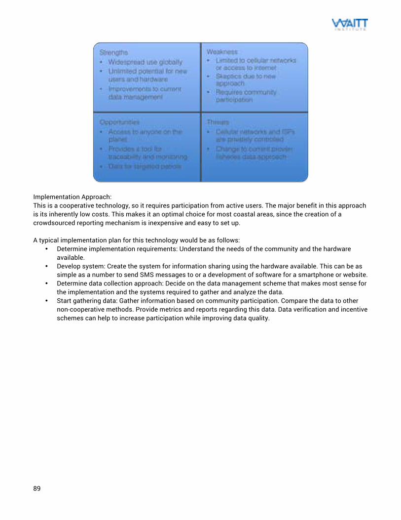
89
Implementation Approach: This is a cooperative technology, so it requires participation from active users. The major benefit in this approach is its inherently low costs. This makes it an optimal choice for most coastal areas, since the creation of a crowdsourced reporting mechanism is inexpensive and easy to set up. A typical implementation plan for this technology would be as follows:
• Determine implementation requirements: Understand the needs of the community and the hardware available.
• Develop system: Create the system for information sharing using the hardware available. This can be as simple as a number to send SMS messages to or a development of software for a smartphone or website.
• Determine data collection approach: Decide on the data management scheme that makes most sense for the implementation and the systems required to gather and analyze the data.
• Start gathering data: Gather information based on community participation. Compare the data to other non-cooperative methods. Provide metrics and reports regarding this data. Data verification and incentive schemes can help to increase participation while improving data quality.
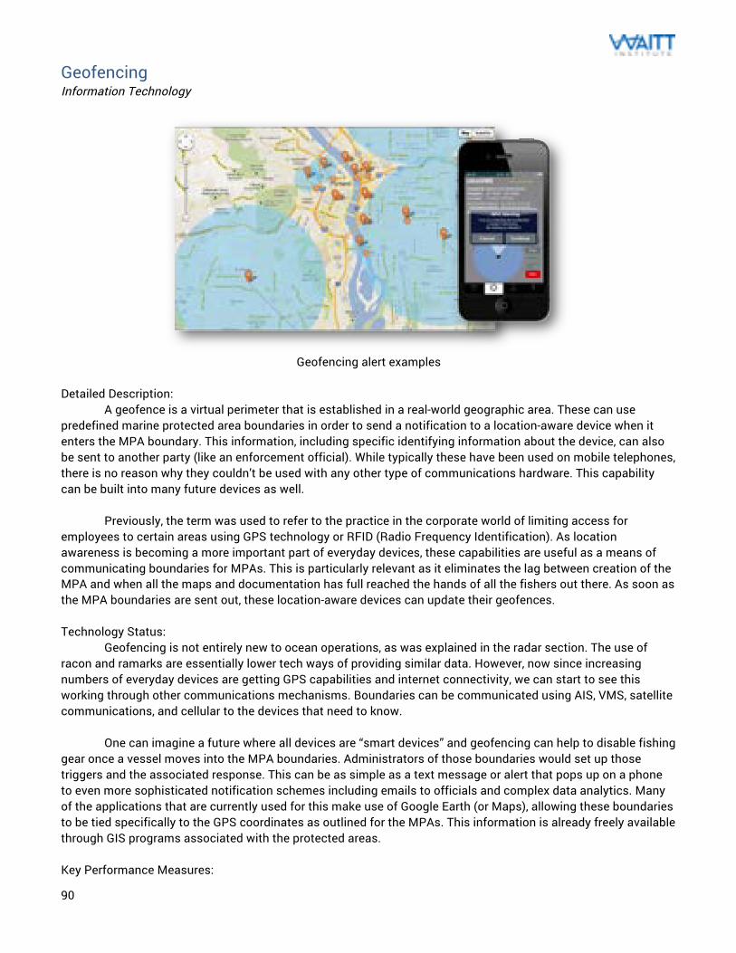
90
Geofencing Information Technology
Geofencing alert examples
Detailed Description: A geofence is a virtual perimeter that is established in a real-world geographic area. These can use predefined marine protected area boundaries in order to send a notification to a location-aware device when it enters the MPA boundary. This information, including specific identifying information about the device, can also be sent to another party (like an enforcement official). While typically these have been used on mobile telephones, there is no reason why they couldn’t be used with any other type of communications hardware. This capability can be built into many future devices as well. Previously, the term was used to refer to the practice in the corporate world of limiting access for employees to certain areas using GPS technology or RFID (Radio Frequency Identification). As location awareness is becoming a more important part of everyday devices, these capabilities are useful as a means of communicating boundaries for MPAs. This is particularly relevant as it eliminates the lag between creation of the MPA and when all the maps and documentation has full reached the hands of all the fishers out there. As soon as the MPA boundaries are sent out, these location-aware devices can update their geofences. Technology Status: Geofencing is not entirely new to ocean operations, as was explained in the radar section. The use of racon and ramarks are essentially lower tech ways of providing similar data. However, now since increasing numbers of everyday devices are getting GPS capabilities and internet connectivity, we can start to see this working through other communications mechanisms. Boundaries can be communicated using AIS, VMS, satellite communications, and cellular to the devices that need to know. One can imagine a future where all devices are “smart devices” and geofencing can help to disable fishing gear once a vessel moves into the MPA boundaries. Administrators of those boundaries would set up those triggers and the associated response. This can be as simple as a text message or alert that pops up on a phone to even more sophisticated notification schemes including emails to officials and complex data analytics. Many of the applications that are currently used for this make use of Google Earth (or Maps), allowing these boundaries to be tied specifically to the GPS coordinates as outlined for the MPAs. This information is already freely available through GIS programs associated with the protected areas. Key Performance Measures:
91
Range: Global (but with a finite range geographically tied to the area), this location indicator would be limited to the communication technology used to display the information.
This technology can be used globally, since it uses GPS coordinates to determine the location. The limitation is that this can only be used through a location-enabled device so this approach is ineffective for people who do not possess these. Environmental Conditions: Since these rely on a device, the only environmental constraints that could come into play are the ones that would impact satellite connection with GPS. Detailed Cost: There are typically device costs (computer, cellphone, smartphone) that are highly variable on the unit selected. The geofencing would be performed on the software-side of the device, so the costs to that would be connected to whatever work to happen development-wise. Infrastructure Needs: The only needs would be the unit that this feature would be built into. Resource Needs: Geofencing is simple to use by design, so no additional resources would be needed. Maintainability: Any updates or maintenance to the GPS fences would be handed on the developer side, so it would not impact the end user. Evidence Creation: This technology is only to be used in the alerting of people to MPA boundaries. There could be an added functionality to alert someone (via email or text message) that the user has entered the area. For that to be possible, the app on the device would need to push the GPS location back to the authorities once a trigger event has occurred.
Advantages: The benefit to using geofencing is that it could easy integrate into a number of these other technologies, especially for mobile, VMS, or AIS. This is a feature that is increasingly useful for situations that MPA boundaries are required to be effectively communicated with the user (fisher). These messages can also include details for MPA regulations if more complicated in terms of uses beyond just no-take reserves. Disadvantages: This technology needs a device to work with, which creates some limitations in its implementation. There also needs to be a fair amount of participation for its use. As more devices are network-connected and location-aware, this will become increasingly useful. Unfortunately we are early in this development phase where with only phones and some navigation devices having that networked capability.
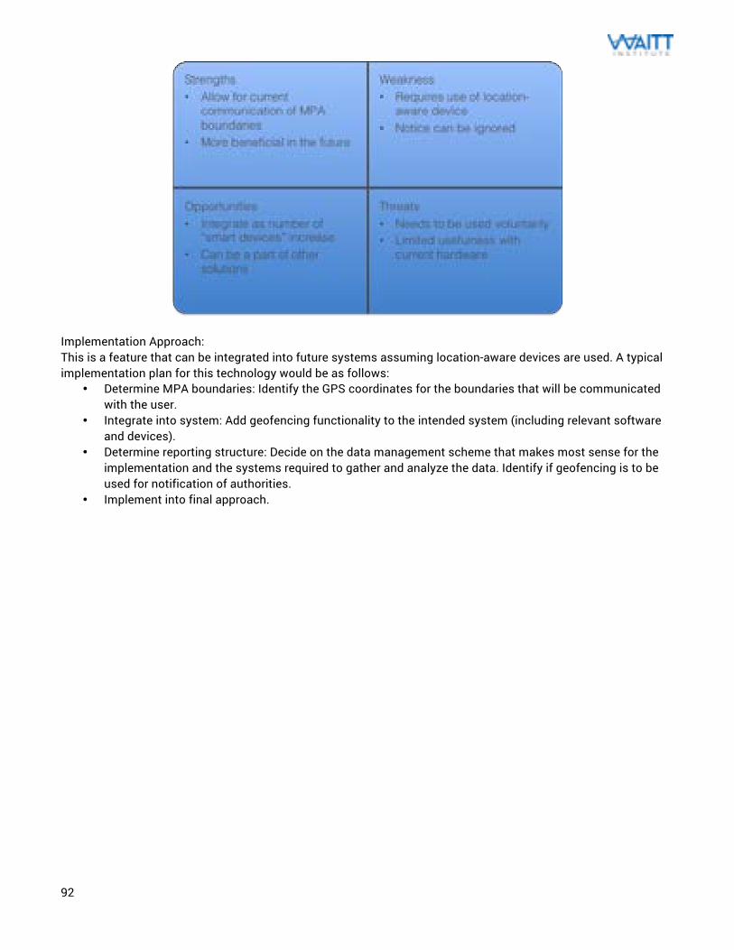
92
Implementation Approach: This is a feature that can be integrated into future systems assuming location-aware devices are used. A typical implementation plan for this technology would be as follows:
• Determine MPA boundaries: Identify the GPS coordinates for the boundaries that will be communicated with the user.
• Integrate into system: Add geofencing functionality to the intended system (including relevant software and devices).
• Determine reporting structure: Decide on the data management scheme that makes most sense for the implementation and the systems required to gather and analyze the data. Identify if geofencing is to be used for notification of authorities.
• Implement into final approach.
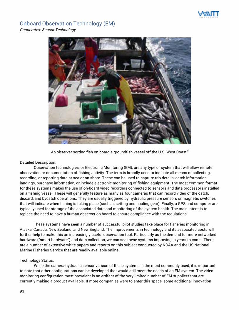
93
Onboard Observation Technology (EM) Cooperative Sensor Technology
An observer sorting fish on board a groundfish vessel off the U.S. West Coastxl Detailed Description: Observation technologies, or Electronic Monitoring (EM), are any type of system that will allow remote observation or documentation of fishing activity. The term is broadly used to indicate all means of collecting, recording, or reporting data at sea or on shore. These can be used to capture trip details, catch information, landings, purchase information, or include electronic monitoring of fishing equipment. The most common format for these systems makes the use of on-board video recorders connected to sensors and data processors installed on a fishing vessel. These will generally feature as many as four cameras that can record video of the catch, discard, and bycatch operations. They are usually triggered by hydraulic pressure sensors or magnetic switches that will indicate when fishing is taking place (such as setting and hauling gear). Finally, a GPS and computer are typically used for storage of the associated data and monitoring of the system health. The main intent is to replace the need to have a human observer on board to ensure compliance with the regulations. These systems have seen a number of successful pilot studies take place for fisheries monitoring in Alaska, Canada, New Zealand, and New England. The improvements in technology and its associated costs will further help to make this an increasingly useful observation tool. Particularly as the demand for more networked hardware (“smart hardware”) and data collection, we can see these systems improving in years to come. There are a number of extensive white papers and reports on this subject conducted by NOAA and the US National Marine Fisheries Service that are readily available online. Technology Status: While the camera-hydraulic sensor version of these systems is the most commonly used, it is important to note that other configurations can be developed that would still meet the needs of an EM system. The video monitoring configuration most prevalent is an artifact of the very limited number of EM suppliers that are currently making a product available. If more companies were to enter this space, some additional innovation
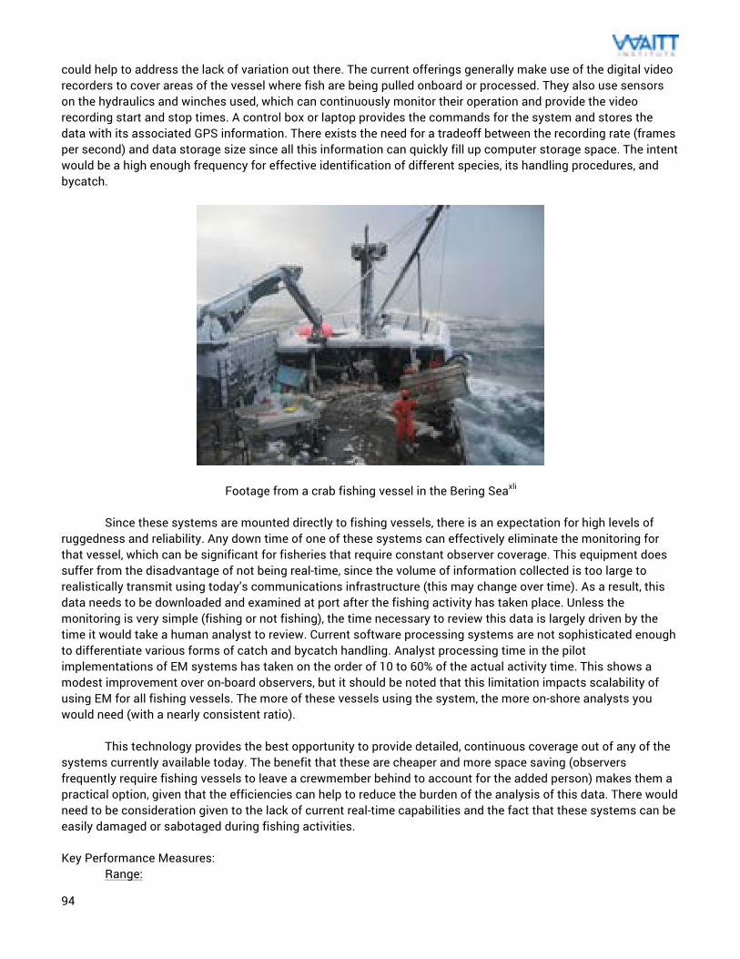
94
could help to address the lack of variation out there. The current offerings generally make use of the digital video recorders to cover areas of the vessel where fish are being pulled onboard or processed. They also use sensors on the hydraulics and winches used, which can continuously monitor their operation and provide the video recording start and stop times. A control box or laptop provides the commands for the system and stores the data with its associated GPS information. There exists the need for a tradeoff between the recording rate (frames per second) and data storage size since all this information can quickly fill up computer storage space. The intent would be a high enough frequency for effective identification of different species, its handling procedures, and bycatch.
Footage from a crab fishing vessel in the Bering Seaxli Since these systems are mounted directly to fishing vessels, there is an expectation for high levels of ruggedness and reliability. Any down time of one of these systems can effectively eliminate the monitoring for that vessel, which can be significant for fisheries that require constant observer coverage. This equipment does suffer from the disadvantage of not being real-time, since the volume of information collected is too large to realistically transmit using today’s communications infrastructure (this may change over time). As a result, this data needs to be downloaded and examined at port after the fishing activity has taken place. Unless the monitoring is very simple (fishing or not fishing), the time necessary to review this data is largely driven by the time it would take a human analyst to review. Current software processing systems are not sophisticated enough to differentiate various forms of catch and bycatch handling. Analyst processing time in the pilot implementations of EM systems has taken on the order of 10 to 60% of the actual activity time. This shows a modest improvement over on-board observers, but it should be noted that this limitation impacts scalability of using EM for all fishing vessels. The more of these vessels using the system, the more on-shore analysts you would need (with a nearly consistent ratio). This technology provides the best opportunity to provide detailed, continuous coverage out of any of the systems currently available today. The benefit that these are cheaper and more space saving (observers frequently require fishing vessels to leave a crewmember behind to account for the added person) makes them a practical option, given that the efficiencies can help to reduce the burden of the analysis of this data. There would need to be consideration given to the lack of current real-time capabilities and the fact that these systems can be easily damaged or sabotaged during fishing activities. Key Performance Measures:
Range:
95
Global, since these units are installed on the vessel and the data is logged on memory onboard. EM generally requires no communication with anything off the vessel as a result of video streaming costs. This makes the use of these systems effectively global, but would need a port that knows how to process the information. Environmental Conditions: For an EM system with video cameras to be effective, there needs to be good visibility for the cameras to capture what happens on the deck. This means that foggy or extreme weather situations can make this ineffective. Since the data is generally logged onboard and reviewed later, visibility is the main environmental impact that these systems need to avoid. Detailed Cost: Based off the studies that were conducted using EM, it was shown that current offering are about one-third of the cost of a human observer. For the ground-fish fisheries of British Columbia (BC), one of these systems costs about $150 per sea-day in operations costs only. The final costs of the installed units could be as much as $10,000 per vessel. Human observers in BC cost about $550 per sea-day, so this is cheaper once the up-front equipment costs are discounted. This technology is still largely out of reach for poorer fishers and would work best if implemented on more profitable fisheries. Infrastructure Needs: These systems are generally installed on more sophisticated vessels with a power system and fishing equipment that sensors can be mounted onto. In theory, they can be adapted for the vessel that it is installed on but there is a minimum vessel size where these systems are not worth the added cost. These systems are best in fisheries that have a very high observer coverage. There is opportunity for these systems to improve greatly using modern technology (better digital cameras, Bluetooth connectivity, etc.) but there should be a bigger assessment of the market. These currently have fairly small levels of adoption. Resource Needs: Since these operate autonomously, the main resource need is the analyst that would review the footage after the vessel returns to shore. This would probably be a fisheries official, enforcement officer, or someone who is familiar with observer tasks. Since the hardware is fairly specialized (proprietary) and there aren’t a number of competitors, repairs for EM are generally conducted back at the supplier. Maintainability: EM systems are made up of a number of electronic boxes and cameras, so they are not usually repaired easily on site. Malfunctioning units will generally be sent back to the supplier for repair and troubleshooting. In larger port areas, there are sometimes vendors that will have some repair capabilities and can get the units back in working order soon. Evidence Creation: These have mostly been tested in small-scale implementations in fisheries that have a strong compliance structure already. As a result, there has not been any high profile IUU fishing prosecutions made as a result of EM. There are some fundamental ways that can reduce the effectiveness of EM (like presorting catch off video) so these tend to be used in fairly healthy fisheries. There are also similar legal issues regarding privacy and proprietary issues that you would find with human observers. As a result, there have been no broad international implementations of these systems beyond national (or even regional) jurisdiction.
Advantages:
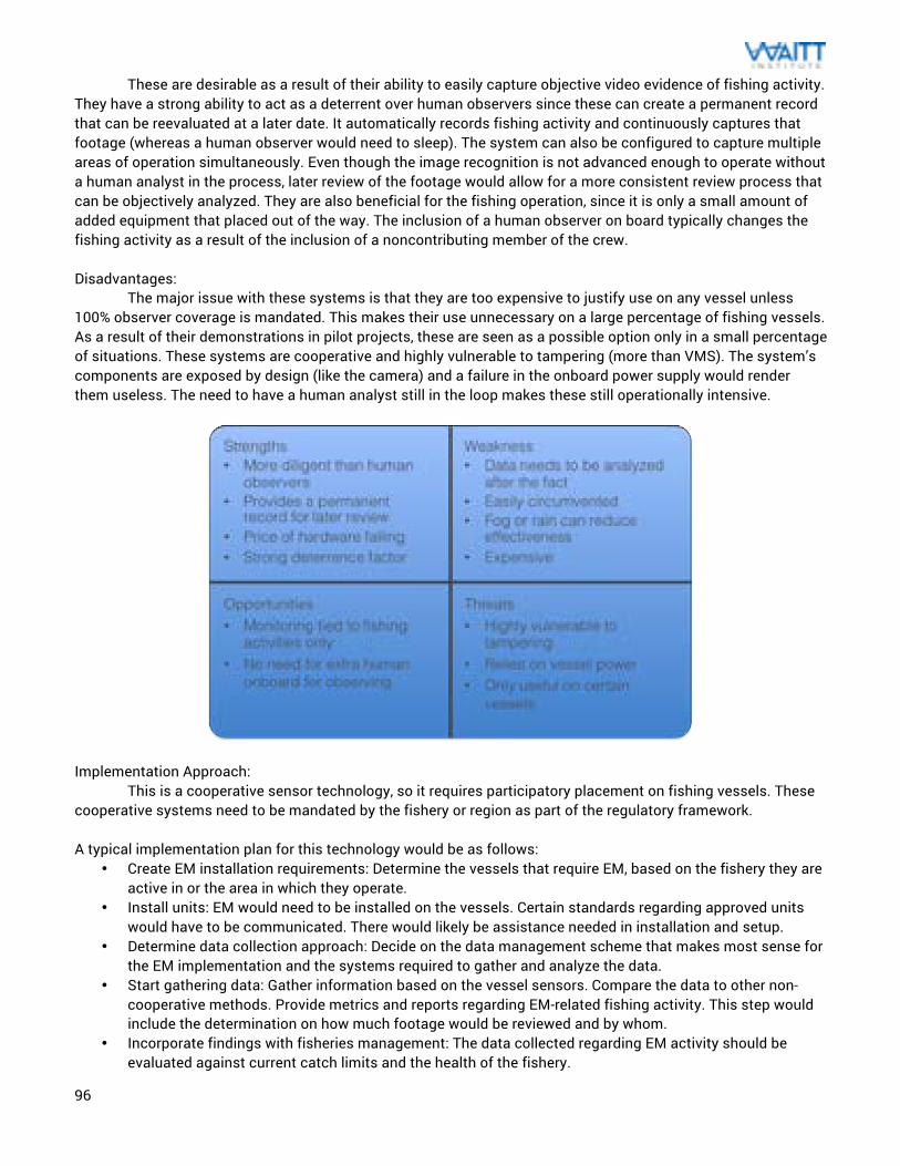
96
These are desirable as a result of their ability to easily capture objective video evidence of fishing activity. They have a strong ability to act as a deterrent over human observers since these can create a permanent record that can be reevaluated at a later date. It automatically records fishing activity and continuously captures that footage (whereas a human observer would need to sleep). The system can also be configured to capture multiple areas of operation simultaneously. Even though the image recognition is not advanced enough to operate without a human analyst in the process, later review of the footage would allow for a more consistent review process that can be objectively analyzed. They are also beneficial for the fishing operation, since it is only a small amount of added equipment that placed out of the way. The inclusion of a human observer on board typically changes the fishing activity as a result of the inclusion of a noncontributing member of the crew. Disadvantages: The major issue with these systems is that they are too expensive to justify use on any vessel unless 100% observer coverage is mandated. This makes their use unnecessary on a large percentage of fishing vessels. As a result of their demonstrations in pilot projects, these are seen as a possible option only in a small percentage of situations. These systems are cooperative and highly vulnerable to tampering (more than VMS). The system’s components are exposed by design (like the camera) and a failure in the onboard power supply would render them useless. The need to have a human analyst still in the loop makes these still operationally intensive.
Implementation Approach:
This is a cooperative sensor technology, so it requires participatory placement on fishing vessels. These cooperative systems need to be mandated by the fishery or region as part of the regulatory framework. A typical implementation plan for this technology would be as follows:
• Create EM installation requirements: Determine the vessels that require EM, based on the fishery they are active in or the area in which they operate.
• Install units: EM would need to be installed on the vessels. Certain standards regarding approved units would have to be communicated. There would likely be assistance needed in installation and setup.
• Determine data collection approach: Decide on the data management scheme that makes most sense for the EM implementation and the systems required to gather and analyze the data.
• Start gathering data: Gather information based on the vessel sensors. Compare the data to other non-cooperative methods. Provide metrics and reports regarding EM-related fishing activity. This step would include the determination on how much footage would be reviewed and by whom.
• Incorporate findings with fisheries management: The data collected regarding EM activity should be evaluated against current catch limits and the health of the fishery.
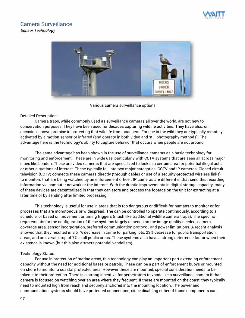
97
Camera Surveillance Sensor Technology
Various camera surveillance options
Detailed Description: Camera traps, while commonly used as surveillance cameras all over the world, are not new to conservation purposes. They have been used for decades capturing wildlife activities. They have also, on occasion, shown promise in protecting that wildlife from poachers. For use in the wild they are typically remotely activated by a motion sensor or infrared (and operate in both video and still photography methods). The advantage here is the technology’s ability to capture behavior that occurs when people are not around.
The same advantage has been shown in the use of surveillance cameras as a basic technology for monitoring and enforcement. These are in wide use, particularly with CCTV systems that are seen all across major cities like London. These are video cameras that are specialized to look in a certain area for potential illegal acts or other situations of interest. These typically fall into two major categories: CCTV and IP cameras. Closed-circuit television (CCTV) connects these cameras directly (through cables or use of a security-protected wireless links) to monitors that are being watched by an enforcement officer. IP cameras are different in that send this recording information via computer network or the internet. With the drastic improvements in digital storage capacity, many of these devices are decentralized in that they can store and process the footage on the unit for extracting at a later time or by sending after limited processing.
This technology is useful for use in areas that is too dangerous or difficult for humans to monitor or for
processes that are monotonous or widespread. The can be controlled to operate continuously, according to a schedule, or based on movement or timing triggers (much like traditional wildlife camera traps). The specific requirements for the configuration of these systems largely depends on the image quality needed, camera coverage area, sensor incorporation, preferred communication protocol, and power limitations. A recent analysis showed that they resulted in a 51% decrease in crime for parking lots, 23% decrease for public transportation areas, and an overall drop of 7% in all public areas. These systems also have a strong deterrence factor when their existence is known (but this also attracts potential vandalism). Technology Status: For use in protection of marine areas, this technology can play an important part extending enforcement capacity without the need for additional bases or patrols. These can be a part of enforcement buoys or mounted on shore to monitor a coastal protected area. However these are mounted, special consideration needs to be taken into their protection. There is a strong incentive for perpetrators to vandalize a surveillance camera if that camera is focused on watching over an area where they frequent. If these are mounted on the coast, they typically need to mounted high from reach and securely anchored into the mounting location. The power and communication systems should have protected connections, since disabling either of those components can
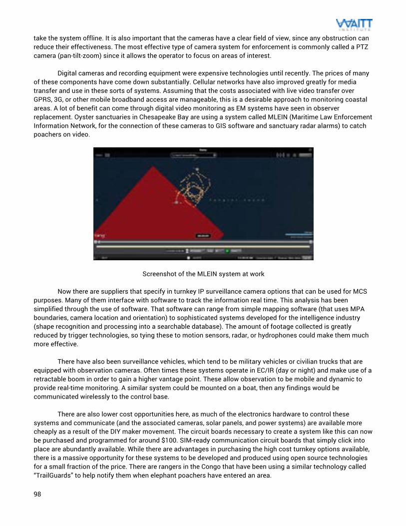
98
take the system offline. It is also important that the cameras have a clear field of view, since any obstruction can reduce their effectiveness. The most effective type of camera system for enforcement is commonly called a PTZ camera (pan-tilt-zoom) since it allows the operator to focus on areas of interest. Digital cameras and recording equipment were expensive technologies until recently. The prices of many of these components have come down substantially. Cellular networks have also improved greatly for media transfer and use in these sorts of systems. Assuming that the costs associated with live video transfer over GPRS, 3G, or other mobile broadband access are manageable, this is a desirable approach to monitoring coastal areas. A lot of benefit can come through digital video monitoring as EM systems have seen in observer replacement. Oyster sanctuaries in Chesapeake Bay are using a system called MLEIN (Maritime Law Enforcement Information Network, for the connection of these cameras to GIS software and sanctuary radar alarms) to catch poachers on video.
Screenshot of the MLEIN system at work Now there are suppliers that specify in turnkey IP surveillance camera options that can be used for MCS purposes. Many of them interface with software to track the information real time. This analysis has been simplified through the use of software. That software can range from simple mapping software (that uses MPA boundaries, camera location and orientation) to sophisticated systems developed for the intelligence industry (shape recognition and processing into a searchable database). The amount of footage collected is greatly reduced by trigger technologies, so tying these to motion sensors, radar, or hydrophones could make them much more effective. There have also been surveillance vehicles, which tend to be military vehicles or civilian trucks that are equipped with observation cameras. Often times these systems operate in EC/IR (day or night) and make use of a retractable boom in order to gain a higher vantage point. These allow observation to be mobile and dynamic to provide real-time monitoring. A similar system could be mounted on a boat, then any findings would be communicated wirelessly to the control base. There are also lower cost opportunities here, as much of the electronics hardware to control these systems and communicate (and the associated cameras, solar panels, and power systems) are available more cheaply as a result of the DIY maker movement. The circuit boards necessary to create a system like this can now be purchased and programmed for around $100. SIM-ready communication circuit boards that simply click into place are abundantly available. While there are advantages in purchasing the high cost turnkey options available, there is a massive opportunity for these systems to be developed and produced using open source technologies for a small fraction of the price. There are rangers in the Congo that have been using a similar technology called “TrailGuards” to help notify them when elephant poachers have entered an area.
99
Key Performance Measures: Range: Coastal, these platforms are best tethered to a ground station or buoy. The main range-extending mechanism is in the zoom. Since many of these new wireless systems transmit their video recording through air (requiring no infrastructure), they can be remotely located. This can be up to a half a mile away or further if they operate off of cellular networks. This decentralized focus allows for a more useful system, where the image capture is conducted close to the area being monitored while the video management system can be in a more convenient location (and integrate multiple feeds). This approach also allows for these wireless surveillance cameras to be moved as needed to provide coverage to the most appropriate area as the threat evolves. The proliferation of more capable zoom cameras and higher resolution megapixel cameras in PTZ systems increases the camera placement possibilities. This technology does have its limitations in distance to the horizon, depth perception at high zoom, and image quality closely tied to how much light reaches the sensor. There can be cameras with impressive digital or mechanical zoom, but the real limitation is how many pixels would be necessary to determine illegal activity at maximum zoom. This capability comes at a combination of the focal length of the camera, zoom capabilities, and distance to observing object. Generally the lens diameter also needs to scale with the distance ration so that there is the same total amount of light collected. Usually the distance is driven by what is economically viable with the cameras that are currently on the market. Environmental Conditions: Since these are optical systems, the major limitation for these is visibility. For weather situations that are overly foggy or extreme rain, the cameras become ineffective. Additionally, solar powered systems may suffer from prolonged periods of cloud cover and lack of light. This can be counteracted by effectively sizing the battery to the typical weather conditions of the area that these are to be implemented. Detailed Cost: Costs for these systems can vary significantly, based on the hardware selected and capabilities that the system possesses. In their most simple DIY form, these include a camera, LCD monitor, network-attached storage device, and power system (battery and solar panel). The inclusion of a 3G router and modem to the storage device can extend range but would include the costs related to data transmission. Some turnkey systems are available for costs in the $5,000 to $10,000 range. It is important that these systems feature some PTZ capability or the scope of view would be limited. There are also generally installation and setup costs that need to be accounted for as well. The primary variable cost here is in the camera that is selected. Inexpensive CMOS technology cameras can be found for less than $100 but those typically have poor photo quality and poor light sensitivity. Better quality comes through use of CCD chips (of ¼”, 1/3”, or ½” sensor) which are generally integrated into the better systems that can pan, tilt, zoom, and include microphones and more. These are usually a couple hundred dollars for a camera. It is very important to note that camera technology is improving rapidly while costs are dropping drastically. There is quite a bit of interest in better cameras for smartphones and other camera-enabled equipment so the cost-per-capability of these systems is rapidly getting better. With the increased use of microcontroller computers like the Raspberry Pi, there has been an explosion in growth around plug-and-play circuit boards that can perform much of the functionality of these systems for a very low price. DIY hobbyists have shown the ability to create these high definition CCTV IP camera systems using commercially available components for less than $150. With some software coding and
100
the connection to solar panels and a battery, these can offer the same capabilities at a greatly reduced price. As with the more expensive versions above, data costs should be taken to account on systems that are expected to run on 3G networks. Infrastructure Needs: From an overall infrastructure standpoint, video surveillance systems are pretty basic. Generally these make use of the wireless camera system (and its associated power and communications system), the network-attached storage or DVR, and the software for the dedicated computer system or tablet. Usually the self-contained camera systems (those that are powered by solar panels and contain the communications and storage systems co-located with the camera) are highly mobile without a need to run wires or make other changes to infrastructure. Generally, there is a need to mount these to secure platforms to minimize the ability to vandalize or steal the hardware. When these are used to monitor for illegal activities it is important that these be mounted securely and remain inaccessible. This can include the use of large booms with concrete footings and other tamper-proof approaches. To analyze the footage from these systems, access to a computer or LCD screen is necessary. As a result of the popularity of CCTV systems for homes and businesses, there are numerous software packages available for smartphones or popular tablets that allow for more mobile review of the data. This could be beneficial for enforcement officials to monitor while out on patrol to provide more tactical efforts. Resource Needs: Video camera surveillance is fairly simple in its operation, so the main expertise would be needed during the installation and setup. The video analyst can be anyone who is familiar with the types of incursions that would be considered illegal. Since these can only monitor and capture long-range footage, it is best for this to be paired with enforcement on the water to act on intelligence gathered by the camera system. Maintainability: The commonality of the hardware associated with CCTV makes the maintenance and repair fairly straightforward for larger metropolitan areas that have many audio-video professionals. For more remote areas, access to replacement hardware may be more difficult but all of this is readily available online from a huge number of suppliers and on sites like Amazon or Ebay. Malfunctioning hardware should be easily replaced. Evidence Creation: Video recording through CCTV can provide compelling evidence in most investigations. The widespread usage of video systems for surveillance has resulted in the collection of recorded evidence behind numerous crimes. The value in watching a video of the crime taking place can help the criminal justice system grasp the implications of the crime far more easily than still imagery or positional data. While most of the examples of this have occurred in areas outside of marine protection, there have been systems like MLEIN that have been successful in this case. Particularly if enforcement officials can make a boarding while the perpetrator is still on camera, this can create an airtight case for later prosecution. Traditional courts require strict rules around the recovery of video and chain-of-custody, but these will evolve as the technology becomes more prominent. Camera footage can also help to identify witnesses that observe a crime occurring. These systems also have a strong deterrence factor that can help enforcement better manage an area and protect an MPA.
Advantages: The main advantage for camera systems are how modular and flexible they can be. These can grow as needed to fit the demands of the protected area. Solar panel and multi-day battery storage would allow low-power surveillance to take place in most remote areas in affordable ways. These have become a critical component for
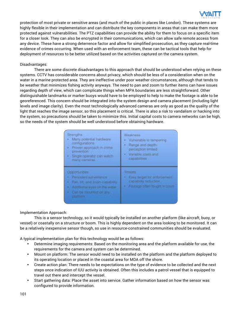
101
protection of most private or sensitive areas (and much of the public in places like London). These systems are highly flexible in their implementation and can distribute the key components in areas that can make them more protected against vulnerabilities. The PTZ capabilities can provide the ability for them to focus on a specific item for a closer look. They can also be encrypted in their communications, which can allow safe remote access from any device. These have a strong deterrence factor and allow for simplified prosecution, as they capture real-time evidence of crimes occurring. When used with an enforcement team, these can be tactical tools that help for deployment of resources to be better utilized based on the activities captured on the camera system. Disadvantages: There are some discrete disadvantages to this approach that should be understood when relying on these systems. CCTV has considerable concerns about privacy, which should be less of a consideration when on the water in a marine protected area. They are ineffective under poor weather circumstances, although that tends to be weather that minimizes fishing activity anyways. The need to pan and zoom to further items can have issues regarding depth of view, which can complicate things when MPA boundaries are less straightforward. Other distinguishable landmarks or marker buoys would have to be employed to help to make the footage is able to be georeferenced. This concern should be integrated into the system design and camera placement (including light levels and image clarity). Even the most technologically advanced cameras are only as good as the quality of the light that reaches the image sensor, so this placement is critical. There is also a risk to vandalism or hacking into the system, so precautions should be taken to minimize this. Initial capital costs to camera networks can be high, so the needs of the system should be well understood before obtaining hardware.
Implementation Approach:
This is a sensor technology, so it would typically be installed on another platform (like aircraft, buoy, or vessel) or coastally on a structure or boom. This is highly dependent on the area looking to be monitored. It can be a relatively inexpensive sensor though, so use in resource-constrained communities should be evaluated.
A typical implementation plan for this technology would be as follows:
• Determine imaging requirements: Based on the monitoring area and the platform available for use, the requirements for the camera and system can be determined.
• Mount on platform: The sensor would need to be installed on the platform and the platform deployed to its operating location or placed in the coastal area for MDA off the shore.
• Create action plan: There needs to be expectations on the type of evidence to be collected and the next steps once indication of IUU activity is obtained. Often this includes a patrol vessel that is equipped to travel out there and intercept the vessel.
• Start gathering data: Place the asset into service. Gather information based on how the sensor was configured to provide information.
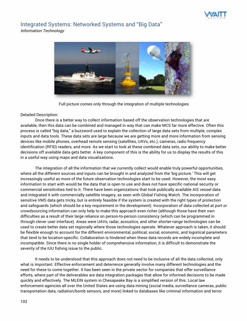
102
Integrated Systems: Networked Systems and “Big Data” Information Technology
Full picture comes only through the integration of multiple technologies
Detailed Description: Once there is a better way to collect information based off the observation technologies that are available, then this data can be combined and managed in way that can make MCS far more effective. Often this process is called “big data,” a buzzword used to explain the collection of large data sets from multiple, complex inputs and data tools. These data sets are large because we are getting more and more information from sensing devices like mobile phones, overhead remote sensing (satellites, UAVs, etc.), cameras, radio frequency identification (RFID) readers, and more. As we start to look at these combined data sets, our ability to make better decisions off available data gets better. A key component of this is the ability for us to display the results of this in a useful way using maps and data visualizations. The integration of all the information that we currently collect would enable truly powerful opportunities, where all the different sources and inputs can be brought in and analyzed from the ‘big picture.’ This will get increasingly useful as more of the future observation technologies start to be used. However, the most easy information to start with would be the data that is open to use and does not have specific national security or commercial sensitivities tied to it. There have been organizations that took publically available AIS vessel data and integrated it with commercially satellite imagery, as seen with Global Fishing Watch. The incorporation of sensitive VMS data gets tricky, but is entirely feasible if the system is created with the right types of protection and safeguards (which should be a key requirement in the development). Incorporation of data collected at port or crowdsourcing information can only help to make this approach even richer (although those have their own difficulties as a result of their large reliance on person-to-person consistency (which can be programmed in through clever user interface). Areas were UAVs, radar, acoustics, and other shorter-range technologies can be used to create better data set regionally where those technologies operate. Whatever approach is taken, it should be flexible enough to account for the different environmental, political, social, economic, and logistical parameters that tend to be location-specific. Collaboration is hindered when these data records are widely incomplete and incompatible. Since there is no single holder of comprehensive information, it is difficult to demonstrate the severity of the IUU fishing issue to the public. It needs to be understood that this approach does not need to be inclusive of all the data collected, only what is important. Effective enforcement and deterrence generally involve many different technologies and the need for these to come together. It has been seen in the private sector for companies that offer surveillance efforts, where part of the deliverables are data integration packages that allow for informed decisions to be made quickly and effectively. The MLEIN system in Chesapeake Bay is a simplified version of this. Local law enforcement agencies all over the United States are using data mining (social media, surveillance cameras, public transportation data, radiation/bomb sensors, and more) linked to databases like criminal information and terror
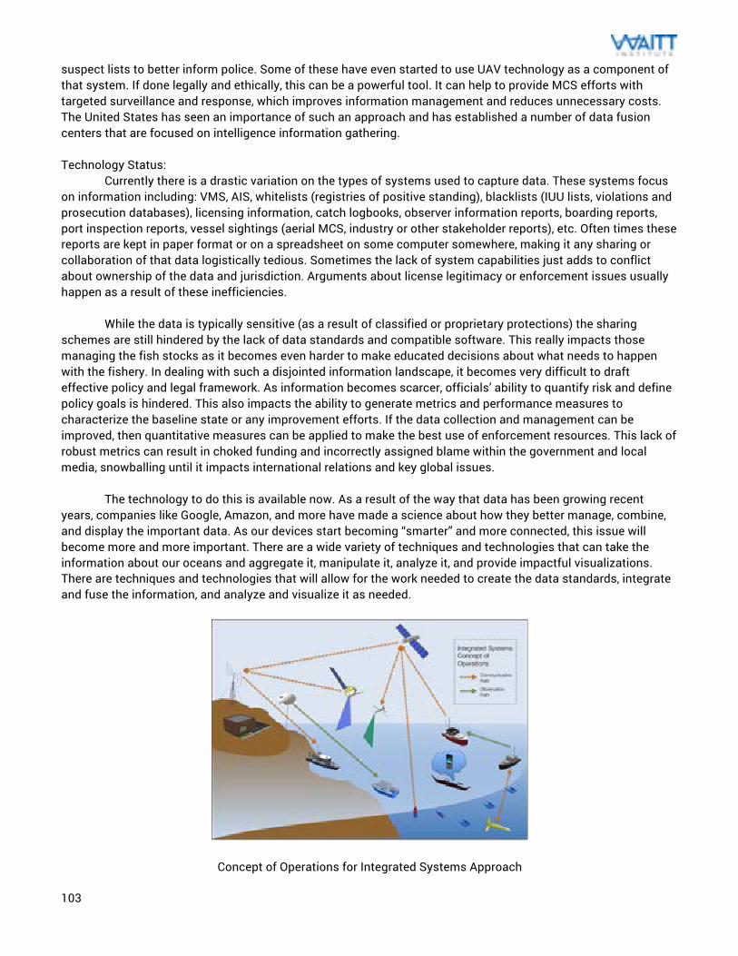
103
suspect lists to better inform police. Some of these have even started to use UAV technology as a component of that system. If done legally and ethically, this can be a powerful tool. It can help to provide MCS efforts with targeted surveillance and response, which improves information management and reduces unnecessary costs. The United States has seen an importance of such an approach and has established a number of data fusion centers that are focused on intelligence information gathering. Technology Status: Currently there is a drastic variation on the types of systems used to capture data. These systems focus on information including: VMS, AIS, whitelists (registries of positive standing), blacklists (IUU lists, violations and prosecution databases), licensing information, catch logbooks, observer information reports, boarding reports, port inspection reports, vessel sightings (aerial MCS, industry or other stakeholder reports), etc. Often times these reports are kept in paper format or on a spreadsheet on some computer somewhere, making it any sharing or collaboration of that data logistically tedious. Sometimes the lack of system capabilities just adds to conflict about ownership of the data and jurisdiction. Arguments about license legitimacy or enforcement issues usually happen as a result of these inefficiencies.
While the data is typically sensitive (as a result of classified or proprietary protections) the sharing schemes are still hindered by the lack of data standards and compatible software. This really impacts those managing the fish stocks as it becomes even harder to make educated decisions about what needs to happen with the fishery. In dealing with such a disjointed information landscape, it becomes very difficult to draft effective policy and legal framework. As information becomes scarcer, officials’ ability to quantify risk and define policy goals is hindered. This also impacts the ability to generate metrics and performance measures to characterize the baseline state or any improvement efforts. If the data collection and management can be improved, then quantitative measures can be applied to make the best use of enforcement resources. This lack of robust metrics can result in choked funding and incorrectly assigned blame within the government and local media, snowballing until it impacts international relations and key global issues. The technology to do this is available now. As a result of the way that data has been growing recent years, companies like Google, Amazon, and more have made a science about how they better manage, combine, and display the important data. As our devices start becoming “smarter” and more connected, this issue will become more and more important. There are a wide variety of techniques and technologies that can take the information about our oceans and aggregate it, manipulate it, analyze it, and provide impactful visualizations. There are techniques and technologies that will allow for the work needed to create the data standards, integrate and fuse the information, and analyze and visualize it as needed.
Concept of Operations for Integrated Systems Approach
104
Key Performance Measures:
Range: Global, but as an information technology solution these require access to computing hardware. This is a database solution that can be hosted on the cloud. This would help in computing the related data, since cloud services like Google can do distributed computing for faster analysis. Environmental Conditions: Since this approach only better collaborates the data we currently collect, there are no real environmental conditions that would impact this technology. Detailed Cost: The costs for this approach are mostly dependent on the quality of data being integrated. This is mainly a database and software problem, so the software engineers required to make these systems work effectively would be driven by the size of the project. The operational costs of this tend to be similar to what is required in the operation of any web-based platform. There are plenty of freely available open source tools to conduct these analyses. Infrastructure Needs: The main infrastructure necessary for networked systems is the computing hardware that in needed to access the data. These can be traditional computers or mobile devices, which is all driven by how the network is set up. Resource Needs: The main resource requirements in the creation of a system like this would be the software developers necessary to understand the data and structure a format that will display it in a useful way. Since “big data” has been a popular area of expertise in recent years, there are a large number of data analysts and programmers that know how to maneuver around this issue quite well. This is the primary technical expertise that is required for these systems. Generally, they are architected to operate effortlessly once the system has been set up so anyone can make use of the data collected. Maintainability: If you are the creator and host of these systems, there will likely be web development support and database work necessary to ensure that everything is running seamlessly. This is similar to any software or web-based project and the maintenance expertise is readily available. Evidence Creation: Traditionally, these systems were developed independently and did not have the ability to speak to each other and integrate information. As a result, there have not been too many examples of effective prosecution based on the data collected for the more sophisticated approaches. Theses do an incredible job at characterizing the situation and are an important part of marine domain awareness. For this reason, enforcement officials and fisheries management can learn to be more effective with the resources they do have.
Advantages: The increased integration of the data collected about our oceans should be a final state that we strive to work towards at a global level. The technology to better manage the information that we have about our oceans is here today and should be applied to these systems that have been created in the past and what will be created in the future. It is good practice to make best use of the information out there, and using collaborative approaches will make that happen. As more and more of the databases we work on get hosted in the cloud, this will make
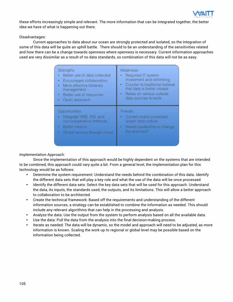
105
these efforts increasingly simple and relevant. The more information that can be integrated together, the better idea we have of what is happening out there. Disadvantages: Current approaches to data about our ocean are strongly protected and isolated, so the integration of some of this data will be quite an uphill battle. There should to be an understanding of the sensitivities related and how there can be a change towards openness where openness is necessary. Current information approaches used are very dissimilar as a result of no data standards, so combination of this data will not be as easy.
Implementation Approach: Since the implementation of this approach would be highly dependent on the systems that are intended to be combined, this approach could vary quite a bit. From a general level, the implementation plan for this technology would be as follows:
• Determine the system requirement: Understand the needs behind the combination of this data. Identify the different data sets that will play a key role and what the use of the data will be once processed.
• Identify the different data sets: Select the key data sets that will be used for this approach. Understand the data, its inputs, the standards used, the outputs, and its limitations. This will allow a better approach to collaboration to be architected.
• Create the technical framework: Based off the requirements and understanding of the different information sources, a strategy can be established to combine the information as needed. This should include any relevant algorithms that can help in the processing and analysis.
• Analyze the data: Use the output from the system to perform analysis based on all the available data. • Use the data: Pull the data from the analysis into the final decision-making process. • Iterate as needed: The data will be dynamic, so the model and approach will need to be adjusted, as more
information is known. Scaling the work up to regional or global level may be possible based on the information being collected.
106
Technology Selection for Managers Summary on how to select appropriate technologies In determining the technologies that would be most useful for a specific deployment, it is important to have an honest evaluation of the situation in that area. There should be a good understanding (amongst all stakeholders) of marine protected area boundaries, popular fishing spots, relevant science assessments, and any ports or marinas where vessels reside. This information will be critical in enforcement planning and prosecution of violators. Additionally, this will help in the evaluation of which technologies would work best as a result of a mapping of the MCS area and it’s proximity to the coast (and any enforcement or fishery bases). Knowledge about the fishers that frequent the area will help to understand cooperative relationships and potential perpetrators. The vessel flags and details behind fishing rights in the area (licensing, agreements, IUU activity) for all vessels in the jurisdiction can start to create a useful database for managing these efforts. For an enforcement deployment to be successful, the resources available can drive the scope as to what is possible. The resources should include initial capital expenses, quarterly or annual operating expenses, personnel available, and level of technical expertise amongst that personnel. There should be a clear revenue model to ensure that the needed operating expenses (especially vessel fuel) are maintained at a sustainable level for the technologies selected. Any relevant technical expertise or training should be identified early as to avoid any downtime from uncertainties around the technology and its use. At a most basic level, any enforcement operation should have access to a boat in order to provide a presence on the water. In many cases, it will be necessary for enforcement personnel to approach a violating vessel or gather prosecutable evidence in person. These sorts of tasks would require a vessel (or at least access to one) to complete them successfully. It is important that the boat is the appropriate level of complexity and sophistication for the area in which it will be used. Often times, there is a desire to purchase the most technologically superior vessel available to use in enforcement. In practice, it has been seen that this approach leads to lots of downtime as a result of unnecessary maintenance complexity and operational costs that far exceed the budget.
The enforcement operation should also have a solid patrol plan that is created with the information identified above. This plan should be drafted in conjunction with fisheries management and any relevant science about the waters to be protected. Any critical training and communication needs to be created prior to start of the patrol. This includes external communication with fishers and the general public, as this is an important component of successful MCS. This external communication needs to include the regulations and some method at marking or identifying the protected areas to the fishers. This could be simple marker buoys, maps, smart VMS/AIS, geofencing, or any other mechanism that will allow for the fishers to know which areas to avoid. The plan should also allow for both cooperative (schemes like VMS, AIS, EM, or more) and uncooperative (vessel patrols, manned flights, UAVs, aerostats, etc.) methods for fisheries surveillance.
With respect to the actual technology selection, the following table outlines some of the cost drivers for
each, strength in detection abilities, and support requirements. Simple lookout stations utilizing binoculars and a two-way radio can be remarkably effective. Aerostats should be avoided in areas where access to helium is difficult. While current UAV technology is best suited for near-shore monitoring, it should be noted that that industry would likely see ample innovation in the decades to come. It is likely that UAVs will become the standard in the near future as a result of efforts by SoarOcean, Conservation Drones, DJI, 3D Robotics, Airware, and more. Additionally, the capabilities emerging in the small satellite industry for optical imagery will provide some interesting operational models in the coming years. There is also much effort by organizations like Google, Facebook, and SpaceX to create a scenario for (both space and atmospheric) satellite-based global internet coverage. If there exist cheaper communication networks based off of 3G/4G technologies as a result of those efforts, then this can make for some interesting solutions to MCS by reducing communication costs.
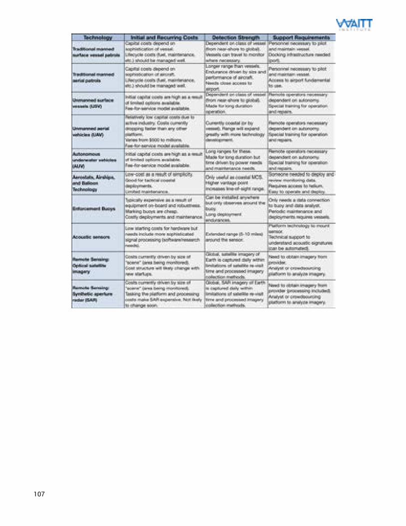
107
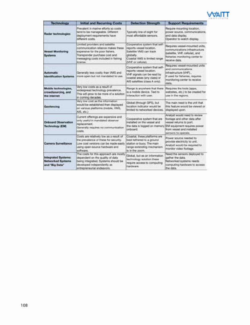
108
109
Case Study #1: Low Cost Approach to IUU Fishing Documentation Introduction In many of the places globally where IUU fishing has been identified, western Africa is one region that has been struggling the hardest. The Environmental Justice Foundation (EJF) organization has found that up to 37 percent of the catch harvested off the coast there is illegal, unreported, or unregulated. Since this is an area that is close to the European Union market, this is a considerable concern. Additionally, many of the solutions to battle IUU fishing that are typically proposed are well beyond the financial or technical ability for these communities to deal with. This is not a unique situation for western Africa, but one that plays a key role in the between $10 billion and $23 billion worth of IUU fishing that happen every year. Background One of the major issues with IUU fishing in an area like West Africa is the lack of patrol capacity available for these communities. There is not sufficient funding to follow the same Coast Guard vessel approach of many other nations. As a result, there needs to be a better way that they can manage their fisheries. EJF has been working with the central government and community leaders in Sierra Leone to establish comprehensive fisheries management approaches and marine protected areas in the region.
Since 2009, they have worked with fishing communities around Sherbro River to document the considerable issue with IUU fishing in their coastal waters by foreign industrial fishing vessels. EJF helped to find a surveillance boat to help to document this. They would respond to calls from fishers when they witnessed a foreign vessel in the area. Often times this came as a result of their fishing equipment being destroyed by industrial trawlers. The EJF staff members there would travel to take pictures, video, and GPS information to submit to the authorities in the Sierra Leone government, European Union, and vessel’s flag state. This was done with the hope that it would stop the import of the IUU catch to the EU’s market. Since January 2010, EJF has documented 252 IUU fishing instances by over 23 fishing communities in the area. Nine out of ten vessels that EJF filed were certified to export the catch to the EU. Problem There has to be a cheap and effective way to protect these areas. Many of the fishers in Sierra Leone were at risk of violence or death when it came to sharing seas with these IUU fishers. They were watching their catch declining, the health of their fish stocks dropping fast, and feared a total collapse. The communities in this area rely almost entirely on the sea for their economic livelihood and diet. In Sierra Leone alone, seafood makes up 64 percent of the diet in Sierra Leone and fisheries employment accounts for over 230,000 jobs. Collapse of that could be catastrophic. The communities there understand the importance of that. Details EJF had started to provide cell phones and GPS-enabled cameras to the fishers and trained them to use them in ways that can provide actionable evidence of what is happening in their ocean. The benefit to this approach is that they are appropriate technologies, which means they are cheap and simple. This is a major advantage in that it allows the people using it to easily understand the tools and make any adjustments, changes, or repairs to the process as needed. This allows the artisanal fisher operating out of a dugout canoe to have the same impact that EJF’s staff would have in taking a photo of an illegal vessel and sending that to the authorities to stop that fish from entering the market. EJF performed this training with help from National Geographic’s Ocean Innovations initiative. The fishers were shown how to capture the call sign, name, and any unique features of the vessel as they document that with GPS coordinates. Once they send the data to EJF, this allows the organization to collect that information and address if further documentation needs to take place. If that were the case, then EJF would dispatch their boat to go and capture more evidence of the vessel as needed. In certain instances, EJF has brought along Sierra Leone enforcement or fisheries personnel to perform a boarding of the IUU vessel. This data is then shared with the EU for communication with the member states and all potential
110
ports in the area. There is a hope that these ports will either refuse to accept the illegal caught fish or will seize the entire catch. There have been some successes with this approach, such as the $6 million worth of illegally caught fish that was detained in a Spanish port or the $200,000 fine for the cargo ship that accepted some of another illegal catch. It appears that IUU fishing has dropped off drastically in the area, leading to EJF’s plan to work with other countries in the region through a similar model. The community fishers feel better about traveling out into their waters and report that they have seen larger catches, although this may be anecdotal. This program shows that certain IUU fishing issues can be solved using a relatively small amount of money if the technology chosen isn’t oversized for the job. It also helped that the staff that EJF relies on in Sierra Leone is made up of local people from the community, which is a good model of assistance from community members of enforcement operations. Some of the successes that this program has enjoyed are as follows:
• The government of Sierra Leone has levied $300,000 worth of fines on IUU fishing vessels that were identified through EJF efforts.
• IUU vessels appear to have all left the coastal waters off Sierra Leone as of January 2012. • Notorious port of convenience, Las Palmas, in Spain tightened controls of fish imports. This included
the rejection of 28 tons of fish that were identified by EJF efforts. • Panama fined the Seta 74 vessel $200,000, the reefer outlined above, for transshipping illegal catch. • Korea had been considering sanctions for 14 of the vessels that were shown to be involved in IUU
fishing there. They mandated that the vessels in that region carry VMS. • Communities across the coast report increase ability to fish as a result of less illegal trawlers in their
waters. • Fishers have begun taking photos of their catch to document biodiversity and successes from this
endeavor. There has been further training to help record catch data including species, size, and locations. The hopes are that this citizen science will benefit education in the community and help with researchers of the oceans in that area.
Parties Involved The Environmental Justice Foundation is a UK- based non-profit organization working internationally to protect the environment and defend human rights. They have worked in Sierra Leone since 2009.
111
Case Study #2: The Wave Glider Acoustic Picket Fence Introduction The Wave Glider, designed and manufactured by Liquid Robotics Inc., is a wave-propelled unmanned surface vessel that harnesses ocean waves to provide persistent ocean travel. The vehicle is a hybrid surface float that is tethered to a “glider” underwater vehicle. The vehicle is propelled by the conversion of wave energy into forward thrust in an entirely mechanical fashion (which saves electrical power). The float makes use of solar panels and 650 watt-hours batter capacity to power the payload, sensors, and communications equipment. The low-profile superstructure on the float and high-strength tether allows for robust operation at sea. One of the major uses for this technology is remote monitoring and maritime domain awareness (MDA). There are benefits for the Wave Glider’s use in MDA: low profile (makes detection difficult), small size, wave propulsion removes limitations, long deployment durations, and solar panels for electronics. Background Some of the most critical areas for monitoring also tend to be some of the most remote or large in size. This makes for a difficult problem to solve as a means to establish persistent surveillance in those areas as a result of diminishing effectiveness of our traditional methods as durations grow. Through persistent surveillance, we can reduce the possibility that IUU fishers and other detrimental operations make their way into the sanctuaries when enforcement is not around. The Papahānaumokuākea Marine National Monument (formerly called the Northwestern Hawaiian Islands Marine National Monument), is an ocean area (larger than the country of Greece or Australia’s Great Barrier Reef) made up for the ten islands and atolls of the Northwestern Hawaiian Islands. The monument is made up of over 140,000 square miles of reefs, atolls, and ocean area in the Pacific (making it larger than all of America’s terrestrial National Parks combined). There is considerable desire to protect this region for both cultural (pertaining to Native Hawaiian culture) and ecological reasons. Problem Marine protected areas like Papahānaumokuākea are in dire need of more effective monitoring methods. Buoys are desirable because of their persistent deployments, however their fixed location makes them vulnerable to vandalism. Unmanned surface vessels resolve the issue with pilot fatigue, but traditional propulsion means generally limits their operation as a result of fuel or power. Autonomous underwater gliders (AUVs) have demonstrated significant deployments, but lack the ability to effectively confirm vessel detection. The Wave Glider has demonstrated an ability to take some of the advantages of all of these approaches while somewhat minimizing its limitations. Those limitations are the low travel speeds available and the relatively short detection range limited to directly around the vehicle. The main aim for looking at new technology approaches here would be to reduce the costs associated with the monitoring of these areas. Crewed-flight and -vessel time is too costly to perform on a constant basis. By pilot testing the Wave Glider approach, a concept of operations can be created that will help to determine if this will work. The plan for this pilot was to quantify the cost for the detection capabilities of the Wave Glider and how that could be worked into a long-term implementation plan. Details
The proposed solution would make use of commercial-off-the-shelf components from Liquid Robotics (Wave Glider) and Teledyne Benthos (Directional Acoustic Transducer DAT). Each of these acoustic sensors would have distance limitations for reliable vessel noise detection. This would mean that a number of Wave Gliders, each with the DAT sensor, could line up to form a perimeter in what is called the “picket fence” approach. This would allow for autonomous monitoring of the Papahānaumokuākea Marine National Monument with the ability to remotely detect, localize, and report on underwater sounds that would come from restricted vessels. The project has tested two Wave Glider units, one for detection and the other for calibration and sound check, to
112
create the concept of operations for the program. This will also characterize different environmental conditions (as ocean temperature impacts acoustic propagation) and different vessel types and behaviors. The vessels would each tow directional passive acoustic receivers (built by Teledyne Benthos) that would allow them to work together to pinpoint vessels and bearing. This testing effort occurred in a January 2014 in an exercise off the coast of Hawaii using the rich acoustic expertise that University of Hawaii CIMES possesses. They are working to develop detection algorithms to implement into the Teledyne Benthos acoustic modem infrastructure. The final plan would be to ultimately use a fleet of ten Wave Gliders that would be operated by the US Coast Guard. This complete fleet (nine detection platforms and one sound source platform) would be deployed in the Papahānaumokuākea Marine National Monument for 30 days to prove the benefits in the “picket fence” pattern approach.
The Wave Gliders will make use of GPS and Iridium communication to allow for real-time control through
the Wave Glider Management System (WGMS), a web-based interface. This is a geo-referenced graphical interface that is used for the mission planning (through GPS waypoints) and direct control of the Wave Glider. The “picket fence” patrol path would be programmed for each of the units (and coordinated with each other) to create that virtual acoustic fence surrounding the monitoring area. The direct control could then be used if there is a need to tighten the monitoring area or to seek out and investigate something specific. The Wave Glider has even demonstrated the ability to stationkeep within a small perimeter of just a few dozen meters.
These vessels will have the capability to detect IUU vessels through the acoustic signature of different
types of ships. This has been demonstrated in the recent test to be possible up to 10 miles away, although that could potentially extend further based on environmental factors. The current capability can only identify a single vessel at once. The hope is that the “picket fence” would help to inform decision making around enforcement, particularly on the need to send expensive enforcement vessels to investigate or board a vessel. These systems proved to have a significantly low radar reflection and electromagnetic signature. They can even be painted black to further hide the surveillance vessel. During the recovery operations, there was significant difficultly locating the test vessel even with the knowledge of specific GPS coordinates and in communication with the vessel. Later versions can even carry radar, RF, visual sensing, and AIS receivers to perform detection, identification, and tracking. Parties Involved These efforts are primarily headed up by the University of Hawaii’s Center for Island, Maritime, and Extreme Environment Security (CIMES), National Center for Secure and Resilient Maritime Commerce and Coastal Environments (CSR) at the Stevens Institute of Technology, and the Department of Homeland Security. Liquid Robotics is a key partner in these efforts, in providing the first two Wave Gliders under an academic rate with ocean data services. There has also been some participation from SPAWAR, Marine Conservation Institute, US Coast Guard, NOAA, and Google.
113
Case Study #3: Pew and SkyTruth Satellite Monitoring Introduction
IUU fishing, when examined on a global scale, is too significant of a problem to be monitored by boats and planes alone. The vast expanses of oceans that cover this planet begs for another way, one that will allow for large swaths to be monitored for low cost and manageable levels of effort. Based off the technology currently available, the biggest potential comes from satellite observation. Through a partnership with Pew Charitable Trust’s Global Ocean Legacy program, an organization called SkyTruth has been using data from satellites to monitor fishing vessel activity around the protected Easter Island (within Chilean territorial waters). This is a 12-month program to collect information about vessels and attempt to differentiate commercial fishing activity in these waters. SkyTruth is a small nonprofit organization in the US (founded in 2001) that specializes in applying satellite-based remote sensing technology to exposing truth in environmental issues. Remote sensing is the gathering of observational data from a vast distance, generally done through aircraft or satellite. The benefit to this approach is the discrete observation of a phenomenon, which allows for something like fishing behavior to be monitored without the fisher knowing that they are being watched. This can be done passively (using an optical imaging satellite) or actively (by radar or other means). When coupling that with information we already know, a better understanding of the area can be gathered. Background
A key tool in satellite data related to ocean operations is what is a system called Automatic Identification Systems (AIS). This is a cooperative systems mandated on large vessels to help with collision avoidance and safety of life at sea. AIS data is VHF radio-frequency signals that are broadcast from vessels to provide vessel type, location, heading, and speed. These are currently globally mandated for vessels over 300 tons as a navigational aid, but have been used on smaller ships and fishing boats in specific instances. In practice, they are used on vessels over 90 tons and on most large-scale industrial fishing vessels. The system was originally developed to operate via shore- and vessel-based receivers, but there has been a lot of recent development in the use of low earth satellites for space-based AIS (which extends the range past 30 miles). This has resulted in a large number of commercial space-AIS data providers (although the orbits of the satellite assets limit the data to only when the spacecraft pass overhead).
Additionally, satellite imagery allows us the ability to see vessels that are not participating in the AIS
transmissions. These observations are important for us to see what is considered “dark vessels.” Dark vessels are those that are do not want to transmit position information like AIS. While this doesn’t necessarily mean the vessel is doing something illegal, it can be seen as a potential indicator of illegal activity. Radar satellites use a method called synthetic aperture radar imaging to identify the presence of vessels and pinpoint them to a certain location at a certain time. There are several commercial vendors who supply these images. Most of these images come from MDA Corporation’s Radarsat-2 satellite, however there will be some additional assets coming online soon. Most commercial radar images will not allow for vessels smaller than 20 meters in length to be detected. Problem
The amount of information that is currently known about what is happening in the most remote regions of the ocean is severely limited. The difficulty in monitoring our most remote regions is the inability for current technologies to effectively observe at a reasonable cost. Many of the technologies that are able to cover wide areas quickly (like manned aircraft or vessels) are too expensive to operate in that manner in all but the most unique circumstances. The technologies that have the necessary range are generally too slow or vulnerable for remote use. This leaves monitoring efforts at a difficult point, where satellite assets seem to be the most appropriate methods.
114
The area around Easter Island is on important ecological significance to that region. There are highly profitable fisheries in the region, which have an advantage in exploiting areas that can produce better catch. The Easter Island marine protected area is 700,000 kilometers around the island. The region extends 200 nautical miles from the Rapa Nui and Salas y Gómez islands, which are especially remote. It is actually one of the most remote inhabited islands in the world. The Chilean officials had an idea that there was an illegal fishing problem in the area, but they needed to be certain. With the islands over 2,000 miles off the coast of Chile, it made for a difficult monitoring challenge. Details The Chilean government was working with Pew Charitable Trusts on this problem and Pew decided to hire SkyTruth to see what satellites could tell us. They began by looking at what fishers wanted in that region, which looked to be mostly tuna and swordfish. From that, he could tell what sorts of vessels would be fishing and when were the key seasons. They could use the same tools that the fishers used for fish forecasting. These systems typically take measurements of ocean temperature, currents, wind speed, wind direction, phytoplankton concentration, thermocline depth, and more to build a model of where the fish will be. By purchasing the fish forecasts from the three most popular commercial vendors, this would create the first layer of data to help determine where the fishers would be. Next, AIS data was used to identify vessel traffic in the area, including the ships that were passing through Easter Island’s no-fishing area. They purchased AIS data from all the providers that were supplying it. However, since most fishing vessels do not use AIS unless mandated to, this didn’t answer the entire problem. What it did do was give a good understanding of the vessels that were broadcasting their information. This gave SkyTruth another important part of that picture. To get that last part of the picture, SkyTruth worked with Kongsberg Satellite Services (KSAT) to work with that data and determine where else to look. Using the information collected from AIS and the fish forecasting, areas of the oceans around Easter Island can be identified for imaging using radar satellite. It was decided that, if a vessel is large enough to be imaged using radar imaging, but not using AIS, chances were that they are a fishing vessel (this assumption may not be accurate). KSAT followed those recommendations and took SAR images (each covering an area of 115 miles by 115 miles) to create a composite picture of the area. It ultimately took nine sequenced images (three strips of three images) across three orbits to get the whole area. SAR is expensive, so this was a cost of approximately $5000 per image for this snapshot in time. By matching up the SAR data with the AIS images from the same time and place, SkyTruth was able to get an understanding of what has happening in those protected areas. Chances are that the vessels in this area during fishing season, if big enough to use AIS but not transmitting AIS data, are up to an illegal activity (maybe illegal fishing, human trafficking, or drug smuggling). The analysis of 163 satellite images that were obtained between January and October of 2014 showed 73 vessels operating in the Rapa Nui. Only 31 of the 73 were identified to be legitimately transmitting AIS (22 cargo ships, 5 fishing vessels, and the remaining unidentified). The other 42 ships were considered “suspicious” in their lack of data sharing in a protected area. According to the regulations in an area, that alone can make a vessel “illegal.” Based off what was seen in the observed area, SkyTruth came to the conclusion that the number of unidentified vessel-days in operation over the January to October observation period is about 295. The next step was to dig deeper into the data, which was something that a data analysis firm (based in Washington DC, called Analyze) thought they could do. They essentially applied “big data” analytics to this problem using predictive analytics, visualization, statistical, and machine learning approaches. They determined that, for the fishing vessels voluntarily using AIS, distinctive patterns could be analyzed to identify fishing activity. If you saw a refrigerated cargo vessel stop at the edge of a marine protected area, there would be questions about what they were doing there or whom they may be meeting up with. Analyze took nearly 500 million data points from 110,000 vessels and looked at time, vessel identity, navigational status, rate of turn, speed, latitude, longitude, heading, bearing, and more. Based off this data, they could demonstrate that unique motion behaviors
115
can be associated with fishing activity and algorithms could be created to alert to that fishing behavior. Frequent and significant changes in vessels heading and velocity appeared to be strong predictors of fishing. The vessels can self-report fishing activity by selecting a navigational status of “7” but it seemed like this was being both under- and over-reported in the data. The advantage to this is that it can help to provide more intelligent interdiction of illegal fishing out at sea. If vessel behavior detection could identify odd fishing behavior, the enforcement vessels could better plan patrols. It can have implications outside of fishing as well, allowing scientists another data point to measure fishing capture yields or the impact that fishing is having on fish populations. So Analyze placed together a machine-learning software approach called Mercury to better determine if a ship is fishing versus other maritime efforts like cargo transit, passenger service, and more. It would use the geometric behaviors of the vessels to deduce activities. As a result of the huge amounts of data involved, Google has shown interest in using their computing resources to help scale this project on a much larger level. Parties Involved This effort was largely due to a partnership between SkyTruth and Pew’s Global Ocean Legacy project, through funding from the Bertarelli Foundation and close work with the End Illegal Fishing campaign at Pew Charitable Trusts. SkyTurth worked with Analyze for the automatic classification and used their expertise in remote sensing and visualization. Google plans to host the AIS data and Analyze’s algorithm in their cloud and use their BigQuery data analysis tool in order to make this information open. Additionally much of this work was made possible through help from NOAA, SpaceQuest, KSAT, and others.
116
Case Study #4: WhaleAlert and WHOI Acoustic Buoys Introduction Fishing is not the only human activity that can have significant impact on our ocean ecosystems. Some of the most sensitive parts of the ocean need to be protected from other human impacts. Fast moving cargo vessels and other ships can have detrimental effects on ocean wildlife that spends time in the upper part of the ocean. Whales and other marine mammals need to surface occasionally, and that can prove to have devastating outcomes. Outside of the Stellwagen Bank National Marine Sanctuary, a combination of technologies is making it a safer place for the whales out there. Through the use of passive acoustics and smart buoys, there exists a way to monitor what is happening in the sanctuary. By sending that information via satellites and publishing it in a smartphone app, the notifications of whale presence can be communicated to those operating the vessels that pose the biggest threat. This has come together in a great showcase of the power of technology as an entire system. This system has implications regarding illegal vessels as well, as a California pilot project inspired by the success of this case study shows. Background Stellwagen Bank National Marine Sanctuary is an 842 square mile NOAA managed sanctuary that sits at the mouth of Massachusetts Bay between Cape Cod and Cape Ann. It sits 25 miles east of Boston, 5 miles east of Gloucester, and 5 miles north of Provincetown, Massachusetts. This puts the sanctuary in a critical area for mariner traffic, as that part of the United States has been heavily populated for hundreds of years. The Northeast Gateway, which is a deep-water natural gas port, is located just over 2 miles from the western border of the sanctuary. The key protected animal is the sanctuary is the North Atlantic right whale, which live along the eastern coast of North America (from Florida to Newfoundland). They are one of the most rare large animals on the planet, with only 350-550 left in existence. They are large, slow moving, and have a normal lifespan of 50 to 70 years. The whales were originally hunted for whale oil but finally gained protection in 1935. The whales are now protected under three separate federal laws: the Endangered Species Act, the Marine Mammal Protection Act, and the National Marine Sanctuary Act. The vessel traffic on the east-west shipping lanes that lead to Boston heads right through the prime feeding area for these whales. This alone makes for a dangerous situation. However, Excelerate Energy anticipated that New England’s demand for liquefied natural gas would increase greatly. Their vessels are massive, 291 meters long and over 90,000 tons, and would require use of these shipping lanes to come into and out of Boston Harbor. When they applied to build the Northeast Gateway Deepwater Port, many feared the worst for the remaining whales. Excelerate hoped to create a situation that would avoid the construction of a large gas storage facility so close to a densely populated coastline. A unique partnership resulted in a better solution that would help both conservationists and business folk alike. Problem Collisions with ships have become a leading cause of the premature death of these whales. As a result of their behavior, they are particularly vulnerable to ship strike. They swim slowly, live near shore, and spend extended amount of time at the surface. Under the fragile nature of the current population, just the loss of one or two breeding females a year can lead to the population’s extinction. In only a four-year period (2002-2006), the U.S. National Marine Fisheries Service confirmed 10 right whales killed and two severely injured by ship collisions. There were fears that the actual numbers (including undetected) was actually much more.
United States law requires that all large vessels (over 19 meters) should slow to speeds of 10 knots in the areas where right whales are known to occur. Coastal managers would frequently use planes and boats to spot
117
right whales, and then relay that information to ships in the area. However, these were limited to only during the day and when the weather was good. It was also ineffective when the whales were not near the surface. They were always looking for better ways to increase right whale survival, but with no luck. Details The final solution was a unique approach to protection with significant technological challenges. A perimeter line of 10 buoys was anchored to the sea floor along the shipping lanes, transecting the sanctuary. These buoys were specially equipped with acoustic hydrophones and satellite communications to allow a laboratory on shore to confirm the presence of whales. Finally, through the use of AIS, GPS, and a smartphone app, the mariners are alerted to the presence of a whale and the need to slow down to the mandated speed. The buoys are sophisticated equipment with a number of innovative engineering solutions to deal with its unique challenges. They record underwater sounds and perform an analysis of those sounds onboard. The computer on the buoy can separate the whale call out of the massive amounts of acoustic noise in the area. When that software detects a right whale call, it will notify the analyst at the Cornell Lab of Ornithology via satellite phone and SMS messages. Then, the analyst verifies the information before it is sent out as a warning to ships in the area. These experts can eliminate any false positives, validate that whales are there, update the scientific information, and then relay the messages to ships in the area. The time it takes from buoy detection to vessel warning can be as little as 20 minutes. Each buoy has a listening radius of 5 nautical miles so the 10 buoys cover a 55-mile stretch of the shipping lanes.
Woods Hole Oceanographic Institution (WHOI) was in charge of building these units. There were significant engineering challenges encountered in their build. The seas off the coast there are rough and testing showed that they buoy movement caused so much noise on the mooring line that they hydrophone could not hear anything else. So WHOI engineers invented a new way of attaching two mooring lines, one highly stretchable segment attached between the surface buoy and a buoyant sphere (10 to 20 meters underwater), then a non-stretchable segment attached to the seafloor anchor. This allowed the surface buoy to move around as much as it needed to, without pulling the hydrophone along with it. These stretchable segments had an impressive ability to stretch two and a half times their length without breaking while the hydrophone remains still enough to hear the whales. These innovative moorings got their first major test with Tropical Storm Noel, where the waves reached over 10 meters high. Cornell scientists and engineers created the buoy computers that auto-detected the whale calls at an accuracy that would result in timely information to the Cornell lab.
As a part of the agreement to create the deepwater port, Excelerate Energy funded WHOI and the Cornell
lab to create these buoys. When the system would alert the presence of the whales in the nearby areas, the ships would be required to post spotters on the deck to look out for whales. They would also slow down to the required 10 knots, which could give the whales more time to get out of the way. This technology that was used for these acoustic detection buoys can have impacts outside of whale safety. These same WHOI group installed a demonstration mooring off the coast of southern California to detect illicit vessel traffic. This project, funded by the Department of Homeland Security, has implications beyond smuggling detection and port protection. A similar approach can be used to monitor for illegal fishing.
A second part of this approach could allow this information to be communicated beyond just the liquefied
natural gas vessels that were partners. Through the use of AIS, the ship location could be correlated with the last known sighting of the whales and buoy location. Since this tool was developed to primarily help avoid ship collisions, it could be also used to help avoid whale collisions. A smartphone app that could be used on iPhones or iPads was developed to do just that. EarthNC worked with NOAA to create a free app that would warn mariners when they entered high collision risk areas. The app creates a one-stop source for the right whale management measures, latest detections, regulations, and other information overlaid on digital NOAA charts. The mariner can connect this on the ship’s bridge, so that the detection of a whale’s presence is noted with an audio alert of the whale call. The app also makes use of GPS, AIS, and an internet connection to alert the mariners to the most recent information to avoid any fines. The app includes the following features for the mariner:
118
• Current vessel location (from GPS) on the digital NOAA chart • Graphical buoy representation with colors indicating whale status (green circle around the buoy
indicates no whale detection, yellow circle indicates that a right whale has been detected in the past 24 hours and to slow to 10 knots or less)
• Marking of Seasonal Management Areas (as orange colored areas), where seasonally required speed limits are in place (including a popup alert to indicate that)
• Mandatory Ship Reporting areas where a popup alert will remind commercial ships over 300 gross tons to report when entering the designated right whale reporting area
• Areas to be Avoided, where a red polygon is identified and a popup alert will appear to request that they ship (if over 300 gross tons) does not transit.
• NOAA-identified Recommended Routes for areas in right whale habitat that vessels cannot avoid • Dynamic Management Areas that popup if there are multiple detections of right whales, so
vessels can slow to 10 knot speeds • Right whale identification tip guide and photo gallery
Both the acoustic buoys and the Whale Alert app are an important tool for conservationists, fisheries
officials, and mariners to for the protection of these animals. It helps to reduce the risk of collisions and shipping related deaths of the right whale. NOAA has issue penalties from $11,500 to $92,000 for ships that violated speed restrictions in the Seasonal Management Areas. Parties Involved
There were a large number of partner organizations involved in this project over the last few years. These include:
• Bioacoustics Research Program, Cornell Laboratory of Ornithology, Cornell University: Development and operation of acoustic detection system for right whales
• Center for Coastal and Ocean Mapping, University of New Hampshire: Development of AIS transmission capability for alert messaging
• EarthNC: Development of application for iPhone and iPad • EOM Offshore: Maintenance of real-time buoys • Excellerate Energy: Funding of acoustic detection system • Gaia GPS: Development of application for iPhone and iPad • International Fund for Animal Welfare: Project funding, research and liaison with maritime and
environmental communities • Massachusetts Port Authority: Liaison with maritime community • National Oceanic and Atmospheric Administration, National Marine Fisheries Service:
Development and implementation of right whale conservation measures Project funding • National Oceanic and Atmospheric Administration, Stellwagen Bank National Marine Sanctuary:
Project initiation, management and coordination. Development of AIS messaging capability Operation of AIS messaging site. Project funding.
• National Park Service, Cape Cod National Seashore: Host location for AIS transmission site • NYK Lines (North America): Field testing of app • United States Coast Guard: Development of AIS program. Research and development of AIS
messaging capability. Operation of AIS messaging site. • Woods Hole Oceanographic Institution: Development of buoy system for acoustic detection
system
119
Case Study #5: Mathematical Modeling for Smarter Drones Introduction The global prevalence of IUU fishing has created a circumstance where the newest technologies area getting a lot of attention as the “silver bullet” in our fight against these poachers. This has shown that technologies, which cover large expanses, things like satellite imagery and aerial flights, can be a huge advantage. Some of these potential solutions share a lot with other forms of wildlife protection, including those seen across the reserves in Africa. The profits that illegal organizations are seeing from poaching and illegal fishing are significant, so there needs to be a better way to do this. For many of the organizations exploring solutions to this issue, aerial surveillance seems to be the most benefit for the associated costs. When it comes to aerial technologies, there is none more popular currently than drones. Unmanned aircraft, or drones, allow small planes to be remotely piloted to perform much of the same tasks that were traditionally performed by small manned aircraft. These can be very helpful in covering a great amount of ground. The only issue is that the flight paths these take are only as informed as the operators flying them. There needs to be a better way to be more effective at this. That is where mathematical modeling can help to bring in known variables and clearly determine the areas where illegal activities are more likely to happen, ensuring that the flight can have the most impact. Background At the University of Maryland Institute for Advanced Computer Studies, economist Thomas Snitch works on applying mathematical forecasting models to find illegal activities being done by people in all parts of the globe. The recent work supported the military efforts in Iraq and Afghanistan, where predictive modeling has shown to be very effective in determining where insurgents were planning on planting roadside (IED) bombs. They analyzed every IED explosion over the last five years visually on a map and where the U.S. troops were when the attack occurred. Then, using their analytical methods and information from drones, determined that when an IED bomb explodes that there is a 90% chance that the bomb factory is between 685 and 750 meters from the explosion. This gave the troops on the ground a very effective means at searching these areas and anticipating future attacks. They used satellite imagery to determine the most attractive areas for future IED attacks and informed the soldiers of where to look. These efforts were seen as a phenomenal success. Snitch was always a lover of travel and wildlife and, during a meeting with U.S. military planners, has an epiphany that these methods could be used to combat illegal poaching. By analyzing the efforts of poachers in the same way that the insurgents were analyzed, they can determine best places to place the rangers and drones for the highest probability of capture. This is particularly important; since much of the poaching activity is funding these insurgent efforts that Snitch was fighting against in the first place (African terrorist organizations like the Lord’s Resistance Army, the Janjaweed and al-Shabaab). They recently put that to work with rhino poachers in Southern Africa and will be conducting a similar analysis for the protected gorillas. Well, now his team wants to bring these efforts to help stop illegal fishing. Problem One of the toughest parts of monitoring and surveillance of the oceans is how to deal with the massive expanses of ocean where this behavior could occur. The ocean is large and any monitoring that is sent to an area that IUU fishing is not occurring, can be considered a loss of precious resources. With the inherent limitations associated with the amount of resources that enforcement and protection generally have, this is a considerable concern. Often times, surveillance flights are operated in an almost entirely random manner. Untargeted patrols generally take long-range aircraft and fly in a specific pattern with hope that someone will be caught during that effort. The often-ineffective nature of these flights results in a desire to consider them as a characterization tool instead of a specific tactical tool. This disconnect in resources is seen the rhino poaching efforts as well. The park rangers that are protecting these animals make $150 a month while the operations they fight against are
120
more numerous, better armed, and much better funded. There is quite a bit of money in illegal poaching just like there is in IUU fishing. Another issue is the way that many organizations feel about using drone technology. There is much excitement here, resulting in many organizations spending too much of their enforcement funds on military systems that are difficult for the officials to work with, repair, or operate. Many times it has been shown that these can’t actually stop the poachers since their flights are largely ineffective. They generally just fly back and forth in a manner that would only catch something under a luck scenario. The UAVs that are selected for these missions and the manner that they are operated, needs to be cheaper and better informed to get the most out of these operations. Just like in IUU fishing interception, if the rangers are not close enough to do something when the drone detects the illegal act, it becomes increasingly difficult to capture the perpetrator. Snitch is trying to prove that this data-driven approach can cut poaching by 70 percent in Kruger Park for 20 percent of the cost of the drone operation that WWF and Google recently undertook there. Details In order to create a situation where drone flights are informed and beneficial, there needs to be a better understanding of areas to be monitored through predictive analysis and heuristic modeling. If the flights were taken by arbitrarily launching UAVs, then the limited range would ensure limited impact. For the Africa project, better poacher and animal knowledge was gained using high resolution satellite imagery as a base layer, then adding data from animal collars, ranger GPS waypoints, weather, ground intelligence, previous poaching incidents, and other relevant information. By the model being heuristic, it ensures that there is constant addition of new data to the model on a weekly basis so the model can look for changes in the data and learn to monitor new patterns. This is an important feature since illegal activities tend to adapt and take the path of least resistance. This learning approach allows enforcement to stay one step ahead of the criminals. It can easily been seen that this could be paralleled through the data covered in case study #3, where AIS information, SAR and satellite imagery, fish forecasts, VMS data, and more can all help to better characterize our oceans. Also the use of appropriate drones can help to further refine this model and help to create more effective patrols. For the work in South Africa, the UAV Solutions Talon 120 drone was used. These have a wingspan of 10 feet, which allows the government there to license the Talon as a hobby aircraft. The entire systems, including cameras and the ground control system and computer, are less than $25,000. This makes it much easier to use than the systems that were developed under military funding. They are modular and can snap together easily, which allows for repair to be done in an hour. Operations using this UAV have been trained to rangers in a few hours so this is an effective level for use in the field. The technology used must be appropriate for the local environment (without all the unnecessary add-ons) and straightforward for use by the locals. They are hand-launchable and perform belly landings. The battery can be recharged in an automobile and they go from assembly to launch in five minutes. Some of the lessons learned from this experience are as follows:
• Satellite imagery of the highest resolution matters for terrestrial applications. This may be less important for ocean environments.
• Sophisticated algorithms and elegant modeling help to predict poaching behavior very well. • Statistical characterization of the environment from previous incidents allows for statistical
identification of the likelihood of future events. • Model should be tuned to the specific features and resources of an area. Many factors do not
generally have the same importance as you move from area to area. • Human behavior is not distributed either uniformly or randomly. Patterns can be assessed and
modeled through a search for preferences of actions or what deters an action. This applies to criminals, arsonists, terrorists and poachers.
• Many of these areas are far too big to just randomly launch UAVs (and range is far less of a factor than previously thought). Nighttime operations present an additional challenge. UAVs are only a tool.
121
• Mathematical modeling is critical to the narrowing of these areas. This model must adapt after each flight and as data is added.
• There needs to be a focus on the location of the enforcement officials and their ability (and speed) to be deployed to a specific area.
Snitch’s team plans to use Talon 120s and 240s to do ocean testing of Chesapeake Bay out of Pax River
Naval Air Station. They have performed two feasibility studies and believe that this analytical modeling method can be successfully used for both coastal challenges and the remote open ocean. This will include the modification of one of the UAVs to have flight times of more than 6.5 hours and be capable of water landings. Their hopes are for a future pilot in Canada and South Africa, including modeling of their territorial waters. Parties Involved Thomas Snitch is a visiting professor at the University of Maryland Institute for Advanced Computer Studies (UMIACS). His research focuses on how to use mathematical models to use drone and satellite imagery to combat poaching, find terrorists, and more. The rest of the team included students and faculty at UMIACS, Falcon UAV, UAV Solutions, Digital Globe, Endangered Wildlife Trust, United Nations Wildlife Enforcement Monitoring System (WEMS), GeoEye Foundation, and more.
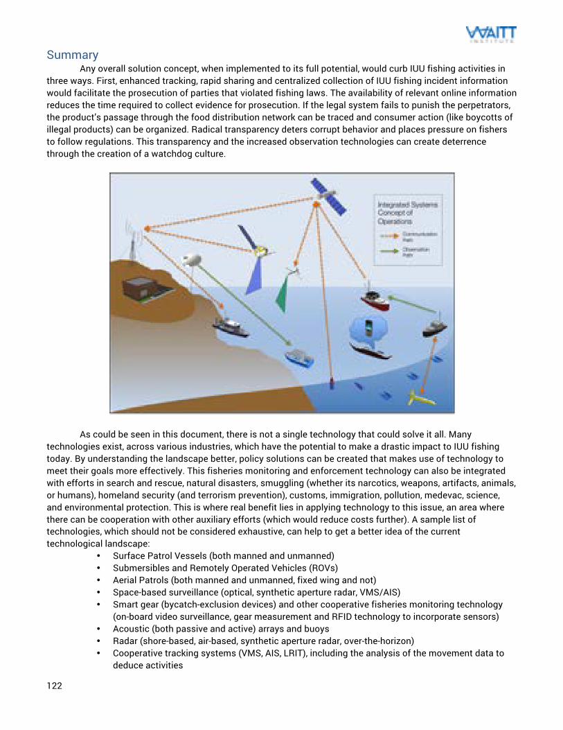
122
Summary Any overall solution concept, when implemented to its full potential, would curb IUU fishing activities in
three ways. First, enhanced tracking, rapid sharing and centralized collection of IUU fishing incident information would facilitate the prosecution of parties that violated fishing laws. The availability of relevant online information reduces the time required to collect evidence for prosecution. If the legal system fails to punish the perpetrators, the product’s passage through the food distribution network can be traced and consumer action (like boycotts of illegal products) can be organized. Radical transparency deters corrupt behavior and places pressure on fishers to follow regulations. This transparency and the increased observation technologies can create deterrence through the creation of a watchdog culture.
As could be seen in this document, there is not a single technology that could solve it all. Many technologies exist, across various industries, which have the potential to make a drastic impact to IUU fishing today. By understanding the landscape better, policy solutions can be created that makes use of technology to meet their goals more effectively. This fisheries monitoring and enforcement technology can also be integrated with efforts in search and rescue, natural disasters, smuggling (whether its narcotics, weapons, artifacts, animals, or humans), homeland security (and terrorism prevention), customs, immigration, pollution, medevac, science, and environmental protection. This is where real benefit lies in applying technology to this issue, an area where there can be cooperation with other auxiliary efforts (which would reduce costs further). A sample list of technologies, which should not be considered exhaustive, can help to get a better idea of the current technological landscape:
• Surface Patrol Vessels (both manned and unmanned) • Submersibles and Remotely Operated Vehicles (ROVs) • Aerial Patrols (both manned and unmanned, fixed wing and not) • Space-based surveillance (optical, synthetic aperture radar, VMS/AIS) • Smart gear (bycatch-exclusion devices) and other cooperative fisheries monitoring technology
(on-board video surveillance, gear measurement and RFID technology to incorporate sensors) • Acoustic (both passive and active) arrays and buoys • Radar (shore-based, air-based, synthetic aperture radar, over-the-horizon) • Cooperative tracking systems (VMS, AIS, LRIT), including the analysis of the movement data to
deduce activities
123
• Vessel marking standards and technology schemes to address it (vessel recognition, IMO number identification technologies)
• Mobile phone (and satellite phone) technologies and notification schemes • Reporting technologies, making use of the internet and crowdsourcing, that engage stakeholders
beyond the enforcement community • Technology support methods into ecosystem-based management approaches • Catch accounting and stock assessment systems • Electronic logbooks with easy of data entry, standardized data formats, attachment to VMS data,
and sensor incorporation • Traceability technologies (RFID, barcode/QR, supply chain tracking, genetic testing traceability) • Industry participation in biological and ecological data collection that may deter illegal activities
and better enable to scientific community to gauge the issues • Hydraulic system and engine monitoring devices (currently readily available) to evaluate
operations • Solutions for targeting vehicles that are not using cooperative systems (satellite, aerial, and
acoustic signature detection technology) While all of these technologies can help reduce the “low risk, high reward” situation around IUU fishing, not all of these were discussed in this report. One example of that is with traceability technologies as those are more of a supply chain logistics issue (and one that has been solved very effectively in other industries).
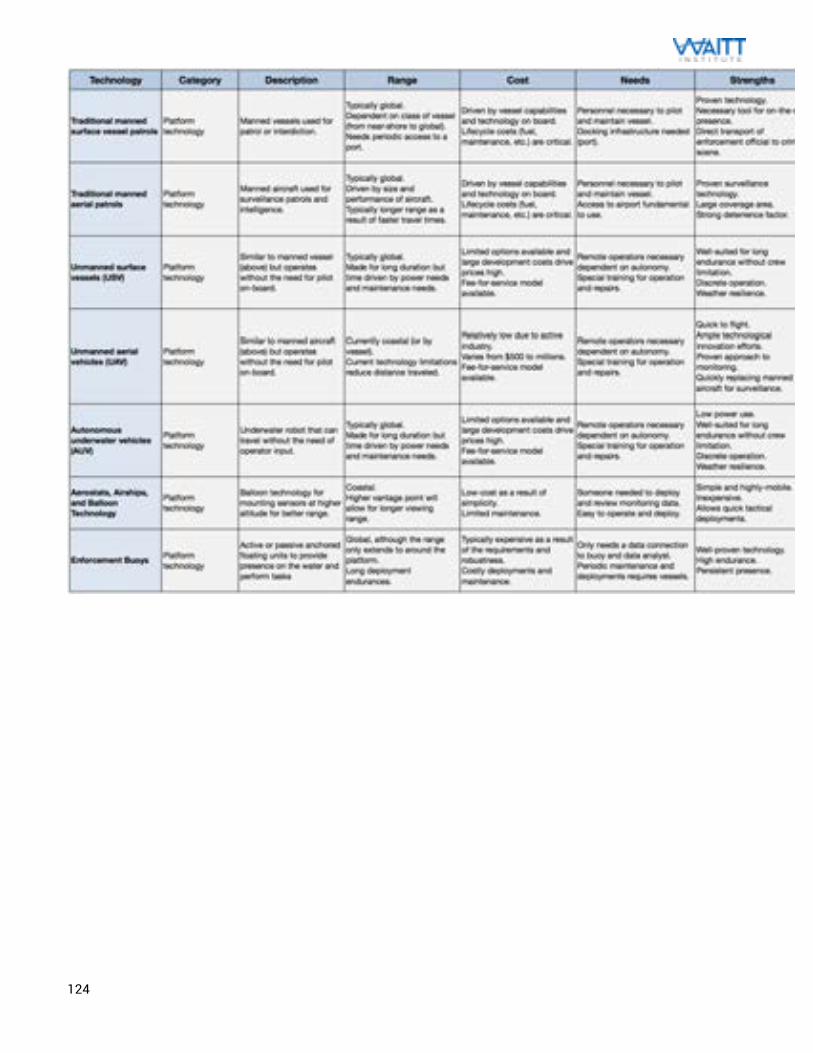
124
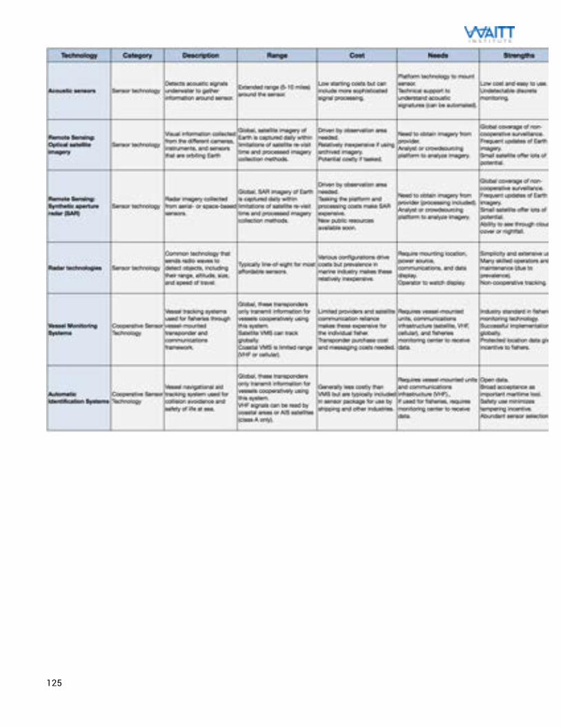
125
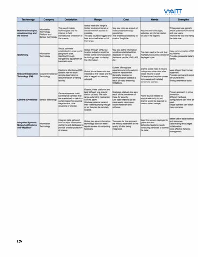
126
127
Author Background Shah Selbe is an engineer, conservation technologist, and technology expert working to identify and implement innovative approaches to ocean conservation. This work began at Stanford University in 2009 and I have worked with a number of influential nonprofits and government organizations worldwide (Center for Ocean Solutions, Monterey Bay Aquarium, New England Aquarium, National Geographic Society, Waitt Institute, Pew Environment Group, and many more). This work, often called “FishNET”, was honored as 2011 Buckminster Fuller Challenge Semi-Finalist, 2011 Savannah Ocean Exchange Gulfstream Navigator Finalist, and 2011 Katerva Award Nominee. Most recently, this work resulted in National Geographic naming me as one of their 2013 Emerging Explorers. I am also a blogger on the Ocean Views blog on National Geographic NewsWatch.
128
References Abileah, Ronald and Lewis, David. “Monitoring High-Seas Fisheries With Long-Range Passive Acoustic Sensors.” SRI International, 1996. Argo Science Team. “On the Design and Implementation of Argo: A Global Array of Profiling Floats.” Argo. December 1998. Chatham House. “Recommended Best Practices for Regional Fisheries Management Organizations” The Royal Institute of International Affairs, 2007. Darling, Gregory. “Illegal Unreported and Unregulated (IUU) FISHING.” Darling Session 5 Meeting notes. Chatham House, presented 9th May 2007. Hayes, Sean A, et al. “An inexpensive passive acoustic system for recording and localizing wild animal sounds.” Acoustical Society of America. 26 February 2000. High Seas Task Force. “Better High Seas Monitoring, Control, and Surveillance – An Improved Network.” Meeting of the High Seas Task Force, Paris. 9 March, 2005. Sevgi, Levent, Ponsford, Anthony, and Chan, Hing. “An Integrated Maritime Surveillance System Based on High-Frequency Surface-Wave Radars, Part 1 and 2.” IEEE Antennas and Propagation Magazine, Volume 43. August 2001. Wahl, Terje. “Using RADARSAT-1 for Fisheries Enforcement Operations.” Norwegian Defence Research Establishment. 2010. Flewwelling, P.; Cullinan, C.; Balton, D.; Sautter, R.P.; Reynolds, J.E. “Recent trends in monitoring, control and surveillance systems for capture fisheries.” FAO Fisheries Technical Paper. No. 415. Rome, FAO. 2002. 200p. A. M. Ponsford, Ian A. D'Souza and T. Kirubarajan3, “Surveillance of the 200 Nautical Mile EEZ Using HFSWR in Association with a Spaced-based AIS Interceptor,” IEEE. 2009. Brooke SD, Lim TY, and Ardron JA. “Surveillance and enforcement of remote maritime areas.” Marine Conservation Biology Institute, 2010. 37 Pages. “Fishing Vessel Monitoring Systems: Past, Present, and Future.” High Seas Task Force. OECD, Paris. 17 October 2005. Molenaar, Erik Jaap & Tsamenyi, Martin. “Satellite-Based Vessel Monitoring Systems International Legal Aspects & Developments in State Practice.” FAO Legal Papers. April 2000. Jensen & Vinther, “Attitude Determination and Control System for AAUSAT3 Masters Thesis.” Aalborg University Department of Electronic Systems. 3 June 2010. MRAG Asia Pacific. “Safeguarding the Stock.” FFA MCS Analytical Studies. 14 September 2009. Freeberg, Mark et al. “Fisheries Enforcement through Vessel Localization using AVHRR and SAR Technology.” IEEE. 1994.
129
Ansell, Neil. “FAO Pilot Project for MCS in the Indian Ocean.” Indian Ocean Commission, Mauritius. 1 September 2006. Teng, Chung-Chu et al. “Buoy Vandalism Experienced by NOAA National Data Buoy Center.” NOAA National Data Buoy Center. 2009 Gould, W John. “From Swallow floats to Argo – The Development of Neutrally Buoyant Floats.” Scripps Institute of Oceanography. 2010. WWF UK. “Observer Programmes: Best Practices.” WWF European Policy Office. 2006. “Information and communications technologies benefit fishing communities.” FAO Sustainable Fisheries Livelihoods Programme. 2007. Huw Irranca-Davies MP, UK Minister for Marine and Natural Environment. “Keynote Address.” Chatham House. 15 October 2009. Friedrich, Jürgen. "Legal Challenges of Nonbinding Instruments: The Case." German Law Journal. 2008. Gruber, Nicolas et al. “The Argo-Oxygen Program.” Argo Steering Committee. Februrary 2007. Lemoine, G. G. et al. “Development in Satellite Fisheries Monitoring and Control.” European Commission Joint Research Centre. 8th International Conference on Remote Sensing for Marine and Coastal Environments, Halfax, Canada. 17-19 May 2005. Meere, Frank and Mary Lack. “Assesment of Impacts of Illegal, Unregulated and Unreported (IUU) Fishing in the Asia-Pacific.” Singapore: Asia-Pacific Economic Cooperation Fisheries Working Group. 2008. Moore, Geoffrey. “Technology Adoption Life Cycle.” Crossing the Chasm: Marketing and Selling High-Tech Products to Mainstream Customers. 1991. Nader, Fred. “Stakeholder Analysis Tool.” National Training Lab. 1990. Clark, Christopher Ph.D., Cornell University Bioacoustics Program. Stanford Independent Study Interview. 2009. “Tethered Aerostat Radar System.” Federation of American Scientists. 24 February 2000. <http://www.fas.org/nuke/guide/usa/airdef/tars.htm>. “Raytheon Successfully Demonstrates High Frequency Surface Wave Radar for Long-Range Oceanic Surveillance.” Business Wire. 23 December 1999. <http://www.highbeam.com/doc/1G1-58356871.html>. “Vessel Monitoring System.” Wikipedia. 1 August 2010. <http://en.wikipedia.org/wiki/Vessel_monitoring_system>. “Iceland VMS Programme.” UN Fisheries and Aquaculture Department. 2010. <http://www.fao.org/fishery/vmsprogramme/VMS_Iceland/en>. “NOAA Fisheries: Assessment and Monitoring.” NOAA Fisheries Office of Science & Technology. 2010. <http://www.st.nmfs.noaa.gov/st4/index.html>. United States Coast Guard Navigation Center. 2010. <http://www.navcen.uscg.gov/>.
130
“Technology in Space.” ORBCOMM. 2010. <http://www.orbcomm.com/ais/ais.htm>. Brinton, Turner. “NGA to Seek Higher-Resolution Commercial Satellite Imagery.” 25 September 2009. <http://www.spacenews.com/earth_observation/nga-seek-higher-resolution-commercial.html>. “Catching the catchers: Google Earth exposes illegal fishing on Canary Islands.” Ogle Earth. 25 June 2007. <http://www.ogleearth.com/2007/06/catching_the_ca.html>. Canadian Space Agency. “Insight… The RADARSAT Promise.” Sat Magazine. July 2010. <http://www.satmagazine.com/cgi-bin/display_article.cgi?number=449609965>. CubeSat. 2014. <http://www.cubesat.org/>. de Selding, Peter. “Satellite Technology Helps Canada Patrol Waterways.” Space.com. 4 May 2009. <http://www.space.com/businesstechnology/090504-busmon-radarsat-ships.html>. “First-Ever Successful UAS Mission into a Tropical Storm (Ophelia – 2005).” NOAA Unmanned Aircraft Systems (UAS). 2010. <http://uas.noaa.gov/projects/demos/aerosonde/Ophelia_final.html>. “Allsopp Helikites Aerostats.” Allsopp Helikites. 2010. <http://www.allsopphelikites.com>. “Tethered Aerostat Radar System.” Wikipedia. 25 January 2010. <http://en.wikipedia.org/wiki/Tethered_Aerostat_Radar_System>. “MCS Components and Equipment Costs.” FAO Recent Trends in MCS. 2003. <http://www.fao.org/DOCREP/005/Y4411E/y4411e0c.htm>. Lippsett, Lonny. “Buoys Help Avert Whale-Ship Collisions.” Oceanus. 22 July 2009. <http://www.whoi.edu/oceanus/viewArticle.do?id=57146>. IOC Secretariat. “Guidelines for the Implementation of Resolution XX-6 of the IOC Assembly Regarding the Deployment of Profiling Floats in the High Seas within the Framework of the Argo Programme.” Intergovernmental Oceanographic Commission. 13 January 2009. <http://www.ioc-unesco.org/index.php?option=com_oe&task=viewDocumentRecord&docID=3085>. Rollins, John. “Fusion Centers: Issues and Options for Congress.” Congressional Research Service. 18 January 2008. <http://www.fas.org/sgp/crs/intel/RL34070.pdf>. Simpson, Sarah. “10 Solutions to Save the Oceans.” Conservation Magazine. September 2007. <http://www.conservationmagazine.org/2008/07/10-solutions-to-save-the-ocean/>. Fox, Chris. “Technologies for Ocean Acoustic Monitoring.” National Oceanic and Atmospheric Administration. 24 February 2006. <http://oceanexplorer.noaa.gov/technology/tools/acoustics/acoustics.html>. "VMS Program." NOAA Fisheries Service Frequently Asked Questions. April 2007. <http://sero.nmfs.noaa.gov/vms/VMSFAQs041707_2.pdf>. Palau National Communication Corp. "GSM Mobile Wireless FAQ." PNCC Wireless. 10 March 2009. <http://www.palaunet.com/pdf/GSM%20Mobile%20Wireless%20FAQ.pdf>. “Stealing the Future - Commercial Fishing in Palau, Micronesia.” Palau Shark Sancturay. 13 May 2008. <http://sharksanctuary.blogspot.com/2008/05/stealing-future-commercial-fishing-in.html>.
131
“Fears Pacific Tuna Stocks in Trouble.” Scoop Independent News. 26 October 2007. <http://www.illegal-fishing.info/item_single.php?item=news&item_id=2130&approach_id=12>. “Fisheries Treaties and Governance Bodies.” International MCS Network. <http://www.imcsnet.org/imcs/fisheries_treaties.shtml>. “Documents related to IUU Fishing.” International MCS Network. <http://www.imcsnet.org/imcs/doc_address_iuu.shtml>. “IUU Fishing Report Library.” International MCS Network. <http://www.imcsnet.org/imcs/iuu_reports.shtml>.
132
i http://en.wikipedia.org/wiki/File:Icelandic_coast_guard_ships_in_harbour.jpg ii http://commons.wikimedia.org/wiki/File:US_Navy_RHIB_SWCC.jpg iii http://en.wikipedia.org/wiki/File:Coast_Guard_Boat_in_Morro_Bay.jpg iv http://en.wikipedia.org/wiki/File:Patrol_Boat_Iliria.jpg v http://commons.wikimedia.org/wiki/File:CCGS_Leonard_J_Cowley,_Offshore_Patrol_Vessel.jpg vi http://commons.wikimedia.org/wiki/File:US_Navy_040514-N-0295M-004_A_U.S._Coast_Guard_HC-130J_King_extended-range_combat_rescue_aircraft_sits_on_the_flight_line.jpg vii http://commons.wikimedia.org/wiki/File:US_Navy_021220-N-7590D-044_HC-130_aircraft_from_the_U.S._Coast_Guard_Air_Station_Barbers_Point,_Hawaii,_performs_a_homeland_security_flight.jpg viii http://en.wikipedia.org/wiki/File:HC-144A_Ocean_Sentry_(2).jpg ix http://commons.wikimedia.org/wiki/File:AS-365N_Dauphin_2_of_The_Iceland_Coast_Guard.JPEG#mediaviewer/Fichier:AS-365N_Dauphin_2_of_The_Iceland_Coast_Guard.JPEG x http://de.wikipedia.org/wiki/Datei:US_Navy_110720-N-ZZ999-007_A_common_unmanned_surface_vehicle_patrols_for_intruders_during_Trident_Warrior_2011.jpg xi http://blogs-images.forbes.com/toddwoody/files/2011/09/wave-glider-1.jpg xii http://scoutbots.com/collections/frontpage/products/protei-011-optimist-assembled xiii http://en.wikipedia.org/wiki/File:Group_photo_of_aerial_demonstrators_at_the_2005_Naval_Unmanned_Aerial_Vehicle_Air_Demo.jpg xiv http://commons.wikimedia.org/wiki/File:US_Navy_110225-N-RC734-356_A_Scan_Eagle_unmanned_aerial_vehicle_(UAV)_launches_from_the_amphibious_dock_landing_ship_USS_Comstock_(LSD_45).jpg xv http://commons.wikimedia.org/wiki/File:Quadrocopter_Multicopter_DJI-S800_on-air_credit_Alexander_Glinz.jpg#mediaviewer/Fichier:Quadrocopter_Multicopter_DJI-S800_on-air_credit_Alexander_Glinz.jpg xvi http://www.wired.com/dangerroom/2012/06/ff_flyingsmartphone xvii http://en.wikipedia.org/wiki/File:AladinDrohne.jpg xviii http://www.flickr.com/photos/usnavy/5574186033/ xix https://en.wikipedia.org/wiki/File:Seaexplorer_diving.jpg xx http://commons.wikimedia.org/wiki/File:U.S._Navy_Diver_2nd_Class_Andrew_Bui,_with_Space_and_Naval_Warfare_Systems_Center_Pacific,_recovers_an_autonomous_underwater_vehicle_(AUV)_built_by_students_from_Cornell_University_after_navigating_through_an_130724-N-TM257-006.jpg xxi https://en.wikipedia.org/wiki/File:Blackghost.jpg xxiihttp://en.wikipedia.org/wiki/File:Seaglider-Surface.jpg xxiii https://www.flickr.com/photos/cbpphotos/9423674184/ xxiv http://commons.wikimedia.org/wiki/File:Figure_4._Royal_Marines_10_m3_Desert_Star_Helikite_for_Bowman_Aerial_Beyond-Line-of-Sight_(BABLOS)_range_Extension.jpg xxv http://commons.wikimedia.org/wiki/File:Handlers_prepare_to_launch_the_U.S._Navy_MZ-3A_manned_airship_for_an_orientation_flight_from_Naval_Air_Station_Patuxent_River,_Md.,_on_Nov._6,_2013_131106-N-PO203-532.jpg xxvi http://commons.wikimedia.org/wiki/File:US_Navy_020527-N-9788M-001_USS_Kitty_Hawk_-_weather_balloon.jpg xxvii http://en.wikipedia.org/wiki/File:Coast_Guard_Cutter_Sledge_sets_buoy_in_Potomac_River.jpg xxviii http://commons.wikimedia.org/wiki/File:A_radar_reflective_lighted_buoy_is_set_at_the_west_end_of_the_Jones_Beach_Inlet_jetty_near_New_Haven,_Conn.,_Aug._1,_2013_130801-G-AE983-477.jpg xxix http://en.wikipedia.org/wiki/File:Navy_Towed_Pinger_Locator.jpg xxx http://en.wikipedia.org/wiki/File:RapidEye_Satellites_Artist_Impression.jpg xxxi http://en.wikipedia.org/wiki/File:Estcube-1_2012-12-27.jpg xxxiihttp://en.wikipedia.org/wiki/File:20100621_TanDEM-X_download.jpg xxxiii http://de.wikipedia.org/wiki/Datei:Seasat_in_orbit.jpg xxxiv http://www.flickr.com/photos/andygalloway93/2354962104/ xxxv http://commons.wikimedia.org/wiki/File:Racon_beacon_setup.jpg xxxvi http://commons.wikimedia.org/wiki/File:Radar_Racon_O.jpg xxxvii http://en.wikipedia.org/wiki/File:OperationsSpecialistVTS.jpg xxxviii http://commons.wikimedia.org/wiki/File:Tresco_3D_AIS.JPG xxxix http://de.wikipedia.org/wiki/Datei:AIS_Manche_Est.png xl http://www.noaanews.noaa.gov/stories2008/20080402_africanteam.html xli http://en.wikipedia.org/wiki/File:Crab_fishing_boat.png


