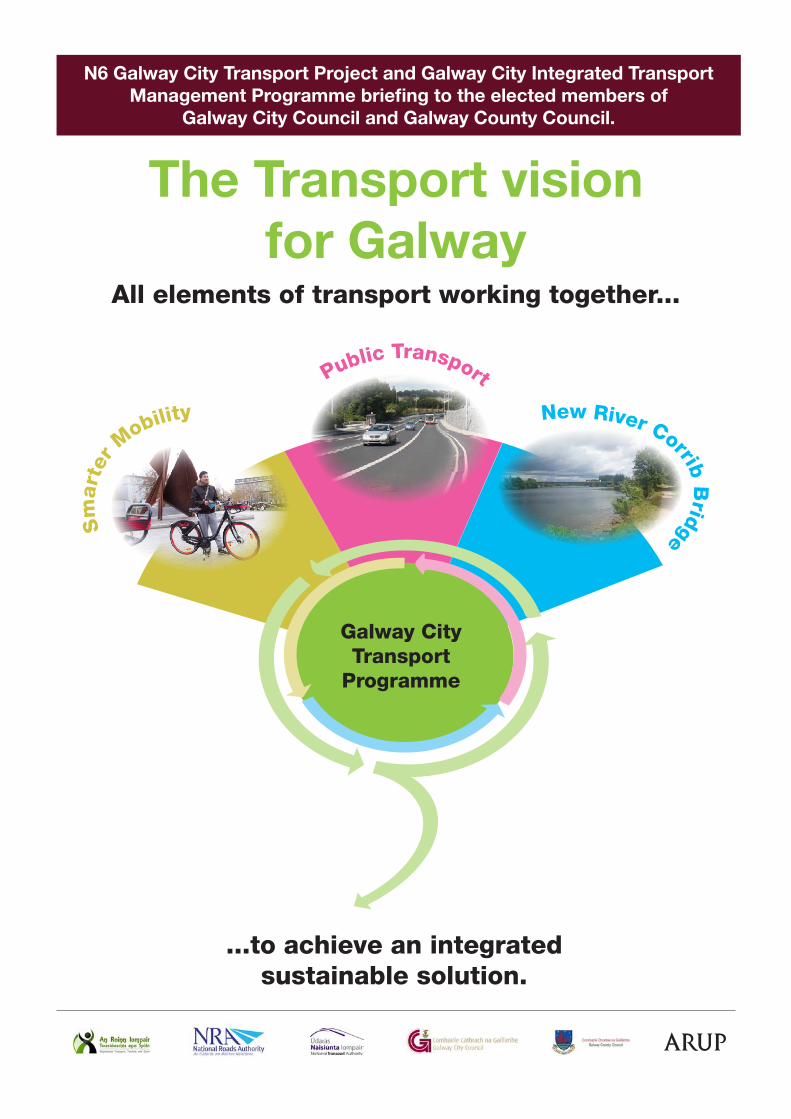
The Transport vision for Galway ...to achieve an integrated sustainable solution. P u b l i c T r a n s p o r t S m a r t e r M o b i li t y N e w R i v e r C o r r i b B r i d g e Galway City Transport Programme All elements of transport working together... N6 Galway City Transport Project and Galway City Integrated Transport Management Programme briefing to the elected members of Galway City Council and Galway County Council.
Transcript
The Transport vision for Galway
...to achieve an integrated sustainable solution.
Public Transport
Sm
arte
r Mobility New River Corrib B
ridge
Galway City Transport
Programme
All elements of transport working together...
N6 Galway City Transport Project and Galway City Integrated Transport Management Programme briefing to the elected members of
Galway City Council and Galway County Council.
Galway County Council, on its own behalf and on behalf of Galway City Council, under an agreement made pursuant to Section 85 of the Local Government Act 2001, are developing a solution to the existing N6 transportation issues in Galway City and environs.
The overall aim of the N6 Galway City Transport Project is to develop a sustainable solution to the congestion issues that exist in Galway City and to better connect the west of County Galway to the national road network.
This is the third briefing on the N6 Galway City Transport Project with further briefings proposed at key milestones.
Why is the scheme needed?
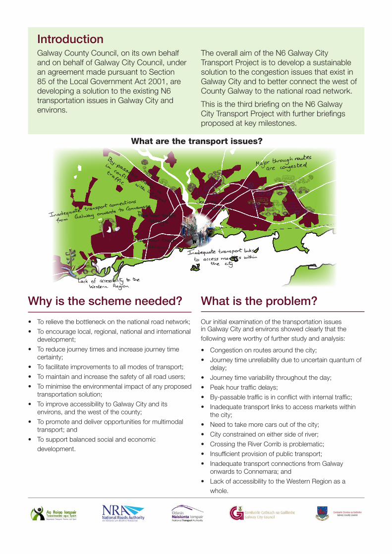
What are the transport issues?
• To relieve the bottleneck on the national road network;
• To encourage local, regional, national and international development;
• To reduce journey times and increase journey time certainty;
• To facilitate improvements to all modes of transport;
• To maintain and increase the safety of all road users;
• To minimise the environmental impact of any proposed transportation solution;
• To improve accessibility to Galway City and its environs, and the west of the county;
• To promote and deliver opportunities for multimodal transport; and
• To support balanced social and economic development.
Introduction
Our initial examination of the transportation issues in Galway City and environs showed clearly that the following were worthy of further study and analysis:
• Congestion on routes around the city;
• Journey time unreliability due to uncertain quantum of delay;
• Journey time variability throughout the day;
• Peak hour traffic delays;
• By-passable traffic is in conflict with internal traffic;
• Inadequate transport links to access markets within the city;
• Need to take more cars out of the city;
• City constrained on either side of river;
• Crossing the River Corrib is problematic;
• Insufficient provision of public transport;
• Inadequate transport connections from Galway onwards to Connemara; and
• Lack of accessibility to the Western Region as a whole.
What is the problem?
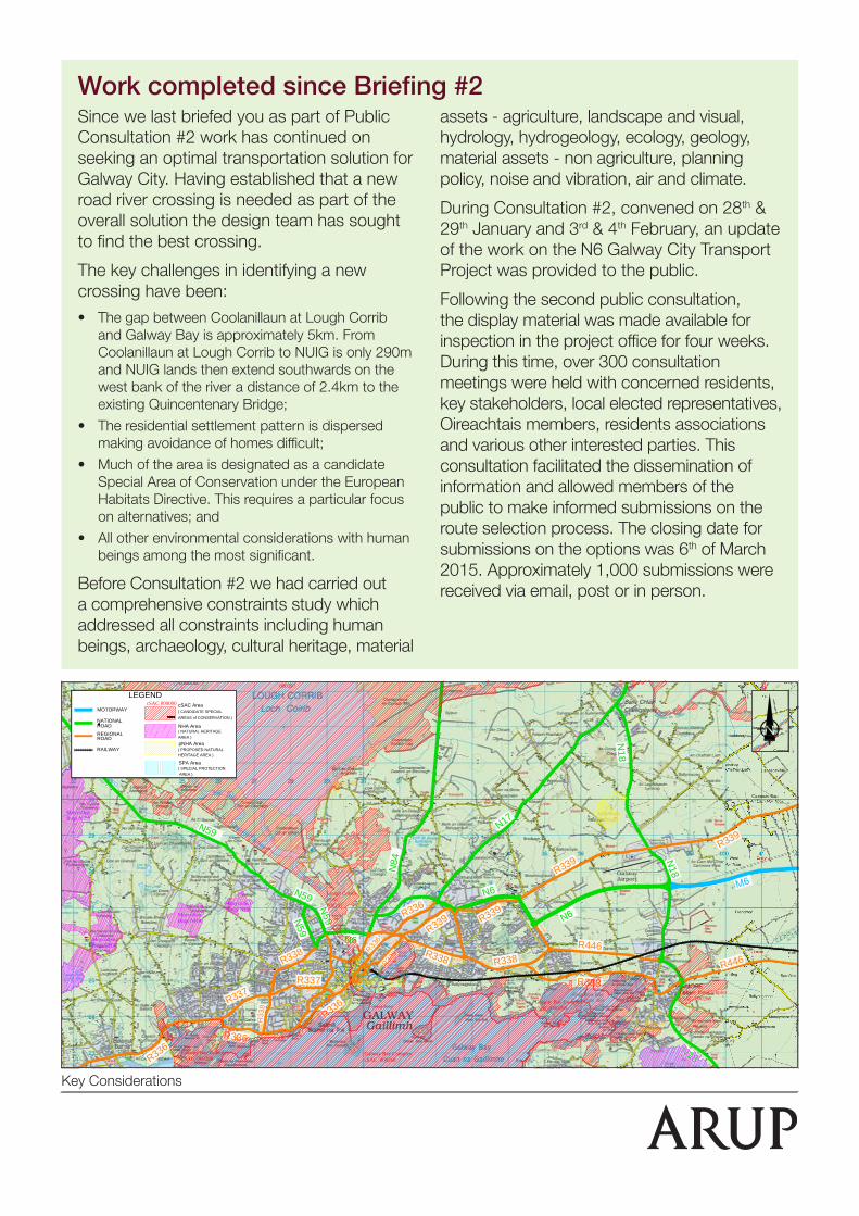
Work completed since Briefing #2Since we last briefed you as part of Public Consultation #2 work has continued on seeking an optimal transportation solution for Galway City. Having established that a new road river crossing is needed as part of the overall solution the design team has sought to find the best crossing.
The key challenges in identifying a new crossing have been:• The gap between Coolanillaun at Lough Corrib
and Galway Bay is approximately 5km. From Coolanillaun at Lough Corrib to NUIG is only 290m and NUIG lands then extend southwards on the west bank of the river a distance of 2.4km to the existing Quincentenary Bridge;
• The residential settlement pattern is dispersed making avoidance of homes difficult;
• Much of the area is designated as a candidate Special Area of Conservation under the European Habitats Directive. This requires a particular focus on alternatives; and
• All other environmental considerations with human beings among the most significant.
Before Consultation #2 we had carried out a comprehensive constraints study which addressed all constraints including human beings, archaeology, cultural heritage, material
assets - agriculture, landscape and visual, hydrology, hydrogeology, ecology, geology, material assets - non agriculture, planning policy, noise and vibration, air and climate.
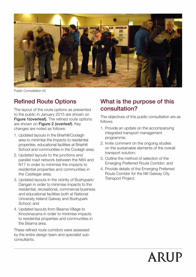
During Consultation #2, convened on 28th & 29th January and 3rd & 4th February, an update of the work on the N6 Galway City Transport Project was provided to the public.
Following the second public consultation, the display material was made available for inspection in the project office for four weeks. During this time, over 300 consultation meetings were held with concerned residents, key stakeholders, local elected representatives, Oireachtais members, residents associations and various other interested parties. This consultation facilitated the dissemination of information and allowed members of the public to make informed submissions on the route selection process. The closing date for submissions on the options was 6th of March 2015. Approximately 1,000 submissions were received via email, post or in person.
N17
N84
N6
N59
N18
N18
N84
N6
R339
R446R446
R338
R336
R337
R338
R339
R338
R337
R336
R336
N59
N59
N59
N6
R336
R339
R33
8
R338
N18
M6
R339
N17
R339
R336
KiltullaghTurlough
Ballyvaughan TurloughcSAC 000996
Caherglassaun TurloughcSAC 000238
Cahermore TurloughcSAC 002294
East Burren ComplexcSAC 001926
East Burren ComplexcSAC 001926
East Burren ComplexcSAC 001926
East Burren ComplexcSAC 001926
Galway Bay ComplexcSAC 000268
Galway Bay ComplexcSAC 000268
Galway Bay ComplexcSAC 000268
Galway Bay ComplexcSAC 000268
Lough CorribcSAC000297
Lough CorribcSAC000297
Lough Fingall ComplexcSAC 000606
Moneen MountaincSAC 000054
Galway Bay ComplexcSAC 000268
Galway Bay ComplexcSAC 000268
Galway Bay ComplexcSAC 000268
Galway Bay ComplexcSAC 000268
Galway Bay ComplexcSAC 000268
Lough Corrib
Galway BayComplex
Galway BayComplex
Cregganna Marsh SPA
Inner Galway Bay SPA
CreggannaMarsh NHA
MoycullenBogs NHA
MoycullenBogs NHA
MoycullenBogs NHA
MoycullenBogs NHA
LEGEND
MOTORWAY
NATIONAL
REGIONAL
RAILWAY
cSAC 000000 cSAC Area( CANDIDATE SPECIAL AREAS of CONSERVATION )
NHA Area
pNHA Area
( NATURAL HERITAGEAREA )
( PROPOSED NATURALHERITAGE AREA )
SPA Area ( SPECIAL PROTECTION AREA )
ROAD
ROAD
N17
N84
N6
N59
N18
N18
N84
N6
R339
R446R446
R338
R336
R337
R338
R339
R338
R337
R336
R336
N59
N59
N59
N6
R336
R339
R33
8
R338
N18
M6
R339
N17
R339
R336
KiltullaghTurlough
Ballyvaughan TurloughcSAC 000996
Caherglassaun TurloughcSAC 000238
Cahermore TurloughcSAC 002294
East Burren ComplexcSAC 001926
East Burren ComplexcSAC 001926
East Burren ComplexcSAC 001926
East Burren ComplexcSAC 001926
Galway Bay ComplexcSAC 000268
Galway Bay ComplexcSAC 000268
Galway Bay ComplexcSAC 000268
Galway Bay ComplexcSAC 000268
Lough CorribcSAC000297
Lough CorribcSAC000297
Lough Fingall ComplexcSAC 000606
Moneen MountaincSAC 000054
Galway Bay ComplexcSAC 000268
Galway Bay ComplexcSAC 000268
Galway Bay ComplexcSAC 000268
Galway Bay ComplexcSAC 000268
Galway Bay ComplexcSAC 000268
Lough Corrib
Galway BayComplex
Galway BayComplex
Cregganna Marsh SPA
Inner Galway Bay SPA
CreggannaMarsh NHA
MoycullenBogs NHA
MoycullenBogs NHA
MoycullenBogs NHA
MoycullenBogs NHA
LEGEND
MOTORWAY
NATIONAL
REGIONAL
RAILWAY
cSAC 000000 cSAC Area( CANDIDATE SPECIAL AREAS of CONSERVATION )
NHA Area
pNHA Area
( NATURAL HERITAGEAREA )
( PROPOSED NATURALHERITAGE AREA )
SPA Area ( SPECIAL PROTECTION AREA )
ROAD
ROAD
Key Considerations
Public FeedbackThe feedback from the public was very useful to the design team. Alternative alignments, junction arrangements and other engineering measures were developed based on this feedback. Where possible, improvements were incorporated into the options being considered.
There were three particular concerns that arose in the public feedback and these are:
1. Habitats have been given more importance than people – the impact of the options on people’s homes and on communities is too great;
2. We need a solution to the congestion but public transport can solve this congestion; and
3. 2006 GCOB scheme should be considered.The design team acknowledges the merit in these concerns and outlines how they are being addressed.
Habitats versus People
As outlined at the first and second briefings, extensive ecological studies were necessary to map ecological habitats and species to such a level that the specific habitat and quality of the habitat is known and that the location and extent of the species is known.
The EU Habitats Directive requires us to assess impacts on both habitats and species within the designated sites i.e. the candidate Special Area of Conservation (cSAC) and Special Protection Area (SPA). The presence of the designated sites is relevant as it focuses on the importance of considering all alternatives as it is only in the absence of all alternatives, and in the interest of overriding public interest, that we can progress with a project that adversely impacts the integrity of the cSAC.
Therefore, the importance of establishing the extent of the Annex I habitat within the designated sites, and the range of the species which are qualifying interests or a special conservation interest of the designated sites, is also critical.
While having to comply with the requirements of the EU Habitats Directive, the balance of the impact on human beings versus habitats has been addressed in the refinements to the route options which resulted in a better overall balance, with options modified to lessen the significant adverse impacts on human beings.
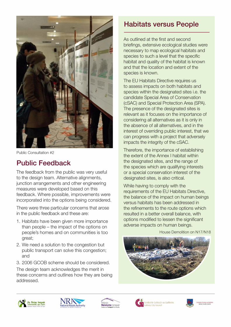
Public Consultation #2
House Demolition on N17/N18
Public Transport & Smarter Travel
As required by national policy the design team has incorporated the principles of smarter mobility into the design process since commencement of the project. In particular this has meant that using smarter travel and public transport measures have always been included as measures that are being considered as part of the available alternatives to solve Galway City’s transportation problem.
Having established that another road crossing of the River Corrib is required the design team has now identified the optimum alternative for such a river crossing. This necessary step now allows further development of smarter travel and public transport measures for Galway City. The National Transport Authority is engaged with Galway City Council at this time on this component of the overall solution. This work includes mapping origin and destination desire lines to establish the optimum provision of public transport to serve this demand and to improve cross city connectivity, identification of infrastructural pinch points, demand management testing and park and ride potential. The final output will represent the optimum approach to an all-inclusive transportation framework that maximises the potential for creating capacity both by modal shift and infrastructure improvements in order to meet both the current and the future needs of Galway.
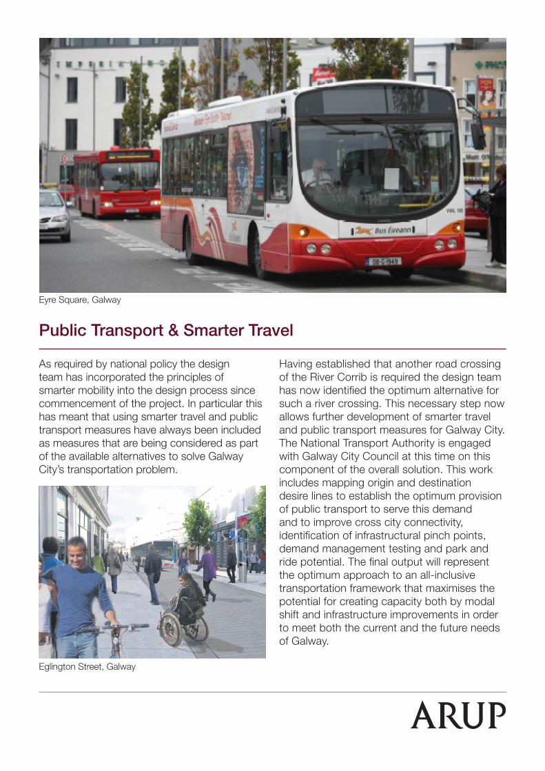
Eyre Square, Galway
Eglington Street, Galway
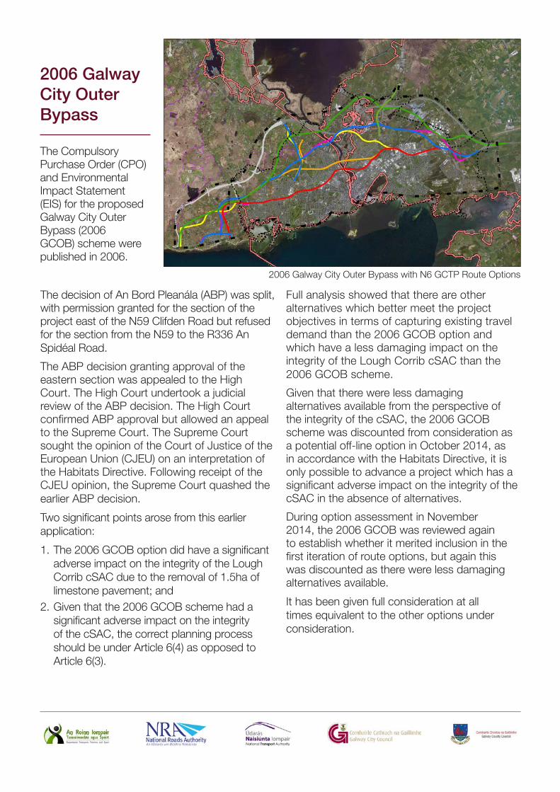
2006 Galway City Outer Bypass
Legend
JN233985_GCOB.D...
JN233985_GCOB.D...
DUTS Scheme Study AreaBoundary
City Boundary
CorridorGreen N84 Link
Green Route
Blue Route
Blue Bearna Link
Blue N59 Link
Red Route
Orange Route
Orange N59 Link
Yellow Route
Yellow Bearna Link
Yellow N59 Link
Pink Route
Pink Bearna Link
Pink N59 Link
2006 GCOB East ofN59
2006 GCOB West ofN59
candidate Special AreaConservation
Natural Heritage Areas
Proposed NaturalHeritage Areas
Special ProtectionAreas
A3
Job No
233985-00Drawing No Issue
GCOB-SK-R-308 I1
Drawing StatusFor Information
2006 Galway City Outer BypassRoute with Designated Site Boundaries
Corporate HouseCity East Business ParkBallybrit, Galway, Ireland
Tel +353 (0)91 460675www.N6GalwayCity.iewww.arup.ie
The decision of An Bord Pleanála (ABP) was split, with permission granted for the section of the project east of the N59 Clifden Road but refused for the section from the N59 to the R336 An Spidéal Road.
The ABP decision granting approval of the eastern section was appealed to the High Court. The High Court undertook a judicial review of the ABP decision. The High Court confirmed ABP approval but allowed an appeal to the Supreme Court. The Supreme Court sought the opinion of the Court of Justice of the European Union (CJEU) on an interpretation of the Habitats Directive. Following receipt of the CJEU opinion, the Supreme Court quashed the earlier ABP decision.
Two significant points arose from this earlier application:
1. The 2006 GCOB option did have a significant adverse impact on the integrity of the Lough Corrib cSAC due to the removal of 1.5ha of limestone pavement; and
2. Given that the 2006 GCOB scheme had a significant adverse impact on the integrity of the cSAC, the correct planning process should be under Article 6(4) as opposed to Article 6(3).
Full analysis showed that there are other alternatives which better meet the project objectives in terms of capturing existing travel demand than the 2006 GCOB option and which have a less damaging impact on the integrity of the Lough Corrib cSAC than the 2006 GCOB scheme.
Given that there were less damaging alternatives available from the perspective of the integrity of the cSAC, the 2006 GCOB scheme was discounted from consideration as a potential off-line option in October 2014, as in accordance with the Habitats Directive, it is only possible to advance a project which has a significant adverse impact on the integrity of the cSAC in the absence of alternatives.
During option assessment in November 2014, the 2006 GCOB was reviewed again to establish whether it merited inclusion in the first iteration of route options, but again this was discounted as there were less damaging alternatives available.
It has been given full consideration at all times equivalent to the other options under consideration.
The Compulsory Purchase Order (CPO) and Environmental Impact Statement (EIS) for the proposed Galway City Outer Bypass (2006 GCOB) scheme were published in 2006.
2006 Galway City Outer Bypass with N6 GCTP Route Options
What is the purpose of this consultation?The objectives of this public consultation are as follows:
1. Provide an update on the accompanying integrated transport management programme;
2. Invite comment on the ongoing studies on the sustainable elements of the overall transport solution;
3. Outline the method of selection of the Emerging Preferred Route Corridor; and
4. Provide details of the Emerging Preferred Route Corridor for the N6 Galway City Transport Project.
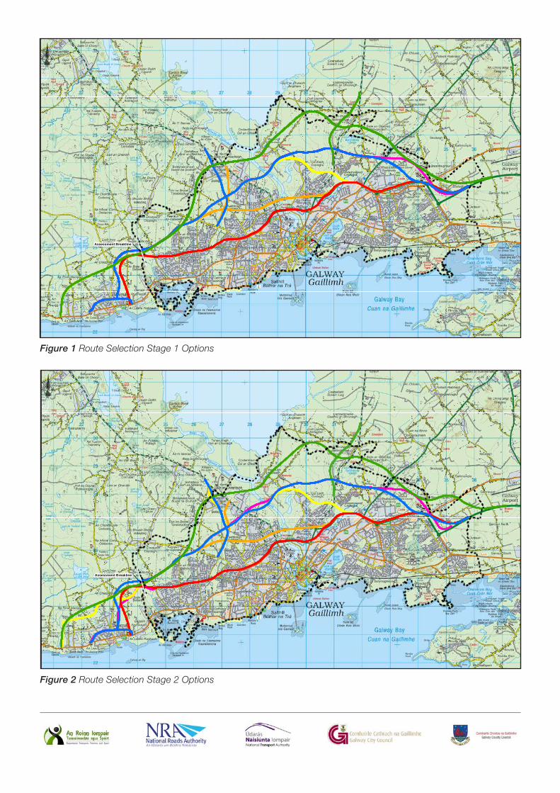
Refined Route OptionsThe layout of the route options as presented to the public in January 2015 are shown on Figure 1(overleaf). The refined route options are shown on Figure 2 (overleaf). Key changes are noted as follows:
1. Updated layouts in the Briarhill/Coolagh area to minimise the impacts to residential properties, educational facilities at Briarhill School and communities in the Coolagh area;
2. Updated layouts to the junctions and parallel road network between the N84 and N17 in order to minimise the impacts to residential properties and communities in the Castlegar area;
3. Updated layouts in the vicinity of Bushypark/Dangan in order to minimise impacts to the residential, recreational, commercial business and educational facilities both at National University Ireland Galway and Bushypark School; and
4. Updated layouts from Bearna Village to Knocknacarra in order to minimise impacts to residential properties and communities in the Bearna area.
These refined route corridors were assessed by the entire design team and specialist sub-consultants.
Public Consultation #2
Assessment Breakline
Legend
City Boundary
Red Route Option
Orange RouteOption
Yellow Route Option
Blue Route Option
Pink Route Option
Green Route Option
A3
Job No
233985-00Drawing No Issue
Figure 1 I2
Drawing StatusRoute Selection
Stage 1 Route Options Plan Layout
Job TitleClients
N6 Galway City Transport Project
Issue Date By Chkd Appd
I2 07/05/2015 GOD MH EMC
Drawing Title
ROUTE SELECTION
Date:
Scale:
May 20151:50,000
Consultant
Corporate HouseCity East Business ParkBallybrit, Galway, Ireland
Tel +353 (0)91 460675www.N6GalwayCity.iewww.arup.ie
Disclaimer Note:The constraints and options shown are draft only and subject to change. More detailed assessments, on-going studies and the information received from the public may result in changes to these constraints and options.Nóta Séanta: Tá na srianta agus na roghanna atá léirithe ina bhfoirm dréacht, d’fhéadfaí athraithe teacht orthu. Is mar thoradh ar mheasúnaithe níos mionchruinne, ar staidéar leanúnach agus ar eolas ón bpobal go ndéanfar athruithe ar na srianta agus na roghanna seo.
Selection of Emerging Preferred Route Corridor A comprehensive appraisal of the refined route options was carried out using the multiple criteria outlined by the Department of Transport in their report ‘Guidelines on a Common Appraisal Framework for Transport Projects and Programmes (June 2009)’ i.e. Economy, Safety, Environment, Accessibility & Social Inclusion and Integration.
Economy Option Comparison Estimates of the refined route options were prepared and a cost benefit analysis was completed. Factors such as route option length, property acquisitions and significant structures impact on the overall costs, whilst factors such as traffic volumes, junction connectivity and delay contribute significantly to the estimation of the benefits of the scheme. It is the relationship of the costs of the route option to the benefits of the route options that define the economic appraisal of the route option.
Safety In terms of safety benefits, all options will deliver safety benefits as all options are forecast to deliver significant safety benefits to the network as a result of transferring high levels of traffic on to newer, safer roads.
EnvironmentEnvironment encompasses many disciplines, with the emphasis and importance of the different disciplines varying depending on the particular discipline. A ranking assessment methodology was adopted for each of the specialist assessments within the Environment criterion. Human Beings, Ecology, Landscape and Visual, and Material Assets – Non Agricultural are significant disciplines under the Environment criterion.
Accessibility and Social Inclusion All of the route options seek to resolve the transportation issues in Galway which will free capacity for further improvements to the public transport network, which in turn will remove traffic from the city streets. This will allow improvement of the streetscapes to enable workers/school children to commute by walking and cycling, thereby reducing the very high percentage of short commutes by providing a safe environment for such a change in behaviour.
Therefore all of the route options will facilitate the provision of improved public transport to a much greater extent in Galway by alleviating congestion and freeing capacity.
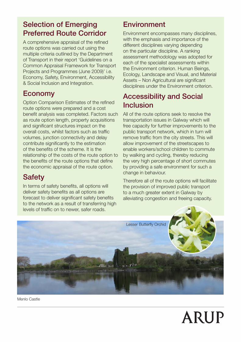
Menlo Castle
Lesser Butterfly Orchid
All decisions must align with Government policy to ensure that the project is in line with land use integration, geographical integration and other Government policies. Options which provide resolution of the transportation issues in Galway must be compatible with the Government’s objectives in National, Regional and Local policy documents.
Transport integration aims to provide improved road linkages between key centres, improved connectivity between roads and other modes, improved public transport, and improved access to other transport infrastructure such as ports and airports.
All of the route options have the potential to improve public transport by providing faster and more reliable routes, both at the higher level to connect Galway City with the other major cities and locally by relieving capacity for the further provision of local bus services. This in turn facilitates balanced regional development within a co-ordinated, coherent and mutually beneficial framework.
Therefore all of the route options will improve integration in Galway by alleviating congestion and freeing capacity which in turn brings markets closer together and serves to close the regional periphery gap.
Integration
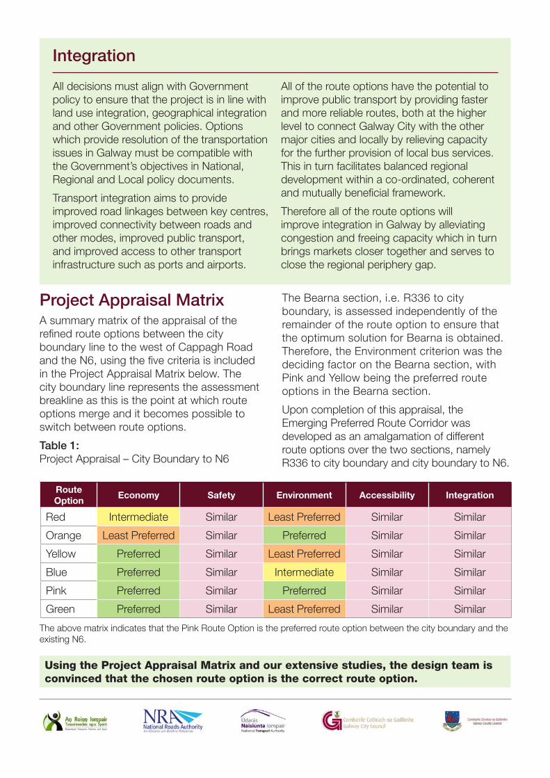
Project Appraisal MatrixA summary matrix of the appraisal of the refined route options between the city boundary line to the west of Cappagh Road and the N6, using the five criteria is included in the Project Appraisal Matrix below. The city boundary line represents the assessment breakline as this is the point at which route options merge and it becomes possible to switch between route options.
Table 1: Project Appraisal – City Boundary to N6
The Bearna section, i.e. R336 to city boundary, is assessed independently of the remainder of the route option to ensure that the optimum solution for Bearna is obtained. Therefore, the Environment criterion was the deciding factor on the Bearna section, with Pink and Yellow being the preferred route options in the Bearna section.
Upon completion of this appraisal, the Emerging Preferred Route Corridor was developed as an amalgamation of different route options over the two sections, namely R336 to city boundary and city boundary to N6.
Red Intermediate Similar Least Preferred Similar Similar
Orange Least Preferred Similar Preferred Similar Similar
Yellow Preferred Similar Least Preferred Similar Similar
Blue Preferred Similar Intermediate Similar Similar
Pink Preferred Similar Preferred Similar Similar
Green Preferred Similar Least Preferred Similar Similar
The above matrix indicates that the Pink Route Option is the preferred route option between the city boundary and the existing N6.
Using the Project Appraisal Matrix and our extensive studies, the design team is convinced that the chosen route option is the correct route option.
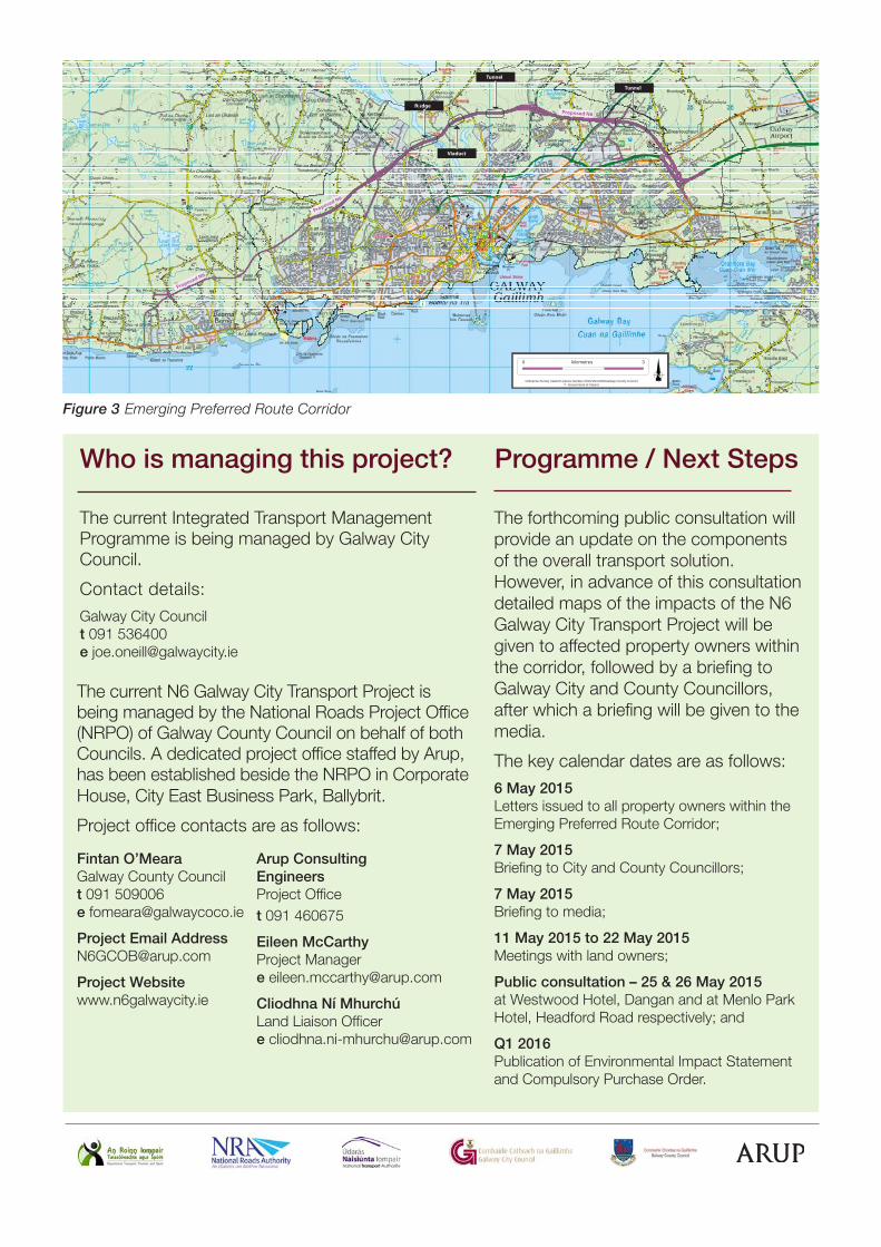
The Emerging Preferred Route Corridor is shown on Figure 3 (overleaf) and is an amalgamation of sections of the various refined route options and will become the proposed N6 Galway City Transport Project.
The proposed N6 Galway City Transport Project ties into the existing R336 at an at-grade roundabout junction approximately 2km to the west of Bearna Village and then proceeds north and east to the north of Bearna Village and onwards towards Letteragh. An at-grade roundabout is proposed at Na Foraí Maola to minimise impacts to homes at this location. This section delivers an effective single carriageway bypass of Bearna village and also connects the R336 and Connemara to the National road network.
At-grade roundabouts are also proposed at the crossing point of the Bearna to Moycullen road and at the Ballymoneen Road, which provides connectivity to Knocknacarra and ultimately releases capacity on the road network to deliver a public transport corridor from the western suburbs. A dual carriageway is proposed from the townland of Letteragh with a grade separated junction to connect the N59. A new link road connects the N59 to the north of Bushypark Church and Bóthar Stiofáin with the proposed N6 Galway City Transport Project. This revised link road seeks to minimise impacts on residential lands and zoned lands in this area.
The proposed N6 Galway City Transport Project then continues in sections of cut and fill, travelling over the N59 at Dangan, through National University Ireland Galway recreational lands on a revised alignment to minimise impacts on the sports facilities, and over the River Corrib on a bridge structure. There is a significant impact on NUIG recreational lands, but this bridge crossing does not impact on any priority habitat within the Lough Corrib cSAC. This location has been identified as the preferred new crossing point on the River Corrib.
To the east of the river, the proposed N6 Galway City Transport Project is generally on embankments or viaduct structures, before entering a section of cut preceding a tunnel at Lackagh Quarry. The provision of these viaducts and the tunnel at Lackagh Quarry enable the proposed N6 Galway City Transport Project to cross the cSAC without direct impact on priority habitat.
After exiting the tunnel, it continues on embankments and passes over the N84. Grade separated signalised junctions are provided at the N84 and the N17, again this modification resulted in reduced impacts in Castlegar. This junction facilitates a high quality access to Parkmore and Ballybrit, thus releasing capacity on the local road network at Briarhill.
The proposed N6 Galway City Transport Project then proceeds in a cut and cover tunnel to the north of Galway Racecourse before turning south to connect to an all-movement grade separated junction to the south of the existing Briarhill Junction, in the townland of Coolagh. The convergence of all movements at this single junction in an area where the existing N6 already dominates the landscape, reduces the impacts to the receiving environment at Coolagh Village. It also provides a clear terminus to the western end of the M6.
The proposed N6 Galway City Transport Project meets the project objectives and avoids direct impacts on designated priority habitat. The preferred route option, which is between 25m and 75m in width, lies within the emerging preferred corridor of 150m in width and has been designed to reduce the impact on residential property as much as possible but the route is expected to require the demolition of 41 homes. There are an additional 10 homes where the curtilage is adversely impacted and these may become acquisitions following discussions. The estimated cost of the scheme is in the order of €500M.
Emerging Preferred Route Corridor
Who is managing this project?
The forthcoming public consultation will provide an update on the components of the overall transport solution. However, in advance of this consultation detailed maps of the impacts of the N6 Galway City Transport Project will be given to affected property owners within the corridor, followed by a briefing to Galway City and County Councillors, after which a briefing will be given to the media.
The key calendar dates are as follows:6 May 2015 Letters issued to all property owners within theEmerging Preferred Route Corridor;
7 May 2015Briefing to City and County Councillors;
7 May 2015Briefing to media;
11 May 2015 to 22 May 2015Meetings with land owners;
Public consultation – 25 & 26 May 2015at Westwood Hotel, Dangan and at Menlo ParkHotel, Headford Road respectively; and
Q1 2016Publication of Environmental Impact Statement and Compulsory Purchase Order.
The current N6 Galway City Transport Project is being managed by the National Roads Project Office (NRPO) of Galway County Council on behalf of both Councils. A dedicated project office staffed by Arup, has been established beside the NRPO in Corporate House, City East Business Park, Ballybrit.
Project office contacts are as follows:
The current Integrated Transport Management Programme is being managed by Galway City Council.