14
Presentation to the Board of Selectman April 23 rd , 2014 Sarah Oktay, Chair: CMPWG
Presentation to the Board of Selectman April 23rd, 2014
Sarah Oktay, Chair: CMPWG
Creation and Purpose The Coastal Management Plan (CMP) workgroup is a temporary workgroup formed by the Board of
Selectmen in March of 2012 to create a Coastal Management Plan for the Town of Nantucket that establishes priorities and procedures for protecting and managing town owned infrastructure, public access points and roads around the island adjacent to the coastline.
The impetus for creating the plan came as a result of two issues;
1) Nantucket wanted local control of the activities that would occur in our local waters and
2) the 2008 Annual Town Meeting voted to create Chapter 67-1 of our local code (and reaffirmed in 2013 stating: “There shall be a temporary moratorium on the use of Town properties located along the eastern coastline of Nantucket from Great Point south to and including the Siasconset sewer beds (hereinafter "Town-owned coastal land") for new coastal engineering structures, bluff armoring projects, hard or soft erosion control devices, bulkheads and the like, on Town-owned coastal land until December 31st 2013 or until a Coastal Management Plan was written” ( see http://ecode360.com/12120302 for the full text).. Exceptions for small pilot projects or emergencies were allowed.
Framework and committee composition The Town’s Department of Marine and Coastal Resources
(David Fronzuto, Emergency Management/Marine Safety Coordinator, and Jeff Carlson, Natural Resources Coordinator) in conjunction with Kara Buzanoski, Director of the Department of Public Works, created the framework of the plan with a list of town owned property and roads and infrastructure throughout the island along with overarching principles of best practices.
After review by the Town of Nantucket it was determined that drafting a more formal and comprehensive document would more completely address the intention of the Town Meeting Vote and the needs of the Town and a workgroup was formed.
Workgroup Sarah Oktay (Conservation Commission representative and
Chair), Bobby DeCosta (BOS representative and Co-Chair), Carl Borchert, Kirk Riden (replacing original member Bam LaFarge), Jamie Feeley, John Stover, and Emily MacKinnon (secretary)
The CMP conducted thirty-six public meetings including six public hearings over the course of two years from March 2012 to March 2014.
The CMPWG received helpful technical assistance from the state’s Coastal Zone Management agency (Steve McKenna, Rebecca Haney, and Julia Knisel) and reviewed documents and presentations on the Storm Smart Coasts Program (http://www.mass.gov/eea/agencies/czm/program-areas/stormsmart-coasts/) Presentation link: http://www.nantucket-ma.gov/DocumentCenter/View/920
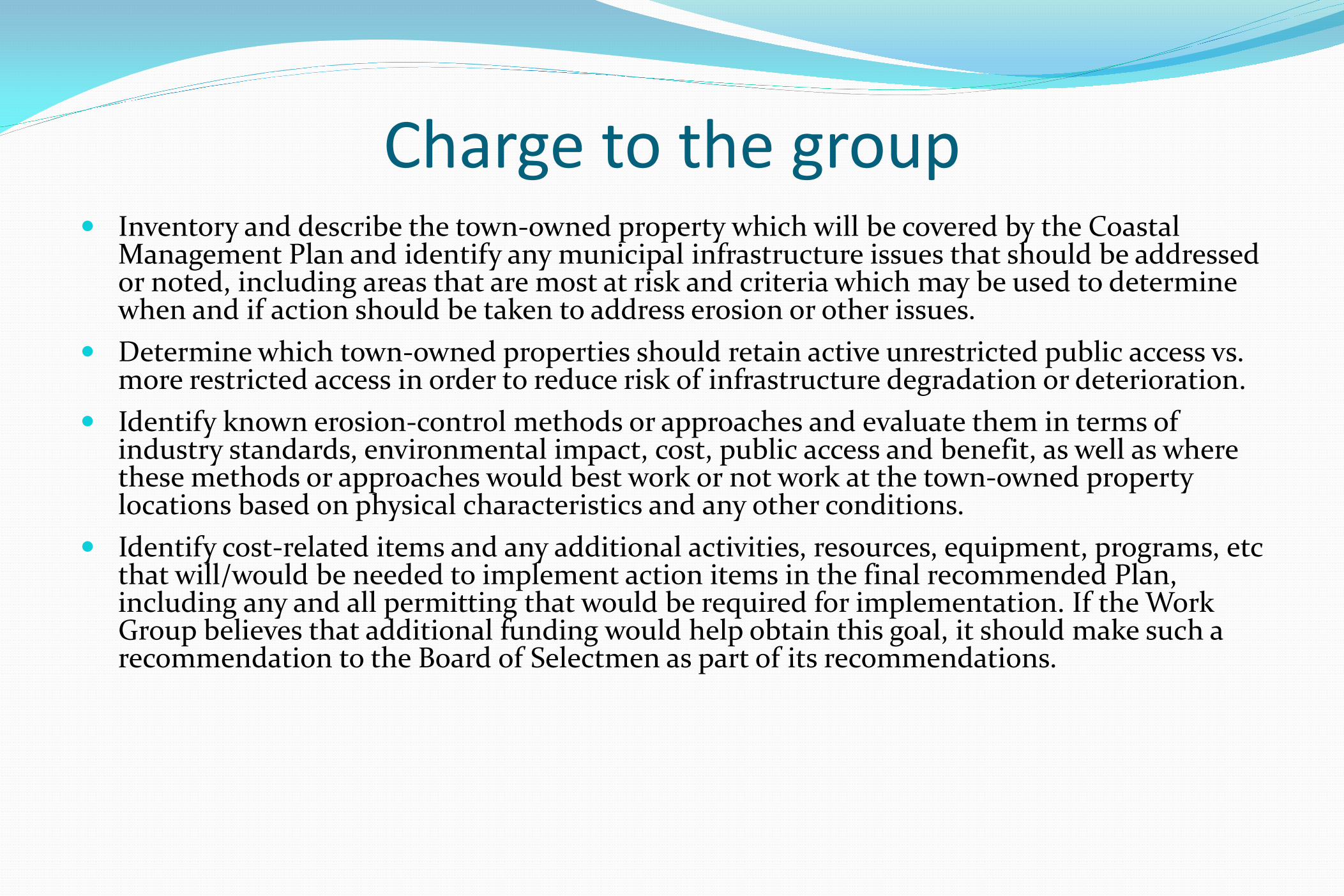
Charge to the group Inventory and describe the town-owned property which will be covered by the Coastal
Management Plan and identify any municipal infrastructure issues that should be addressed or noted, including areas that are most at risk and criteria which may be used to determine when and if action should be taken to address erosion or other issues.
Determine which town-owned properties should retain active unrestricted public access vs. more restricted access in order to reduce risk of infrastructure degradation or deterioration.
Identify known erosion-control methods or approaches and evaluate them in terms of industry standards, environmental impact, cost, public access and benefit, as well as where these methods or approaches would best work or not work at the town-owned property locations based on physical characteristics and any other conditions.
Identify cost-related items and any additional activities, resources, equipment, programs, etc that will/would be needed to implement action items in the final recommended Plan, including any and all permitting that would be required for implementation. If the Work Group believes that additional funding would help obtain this goal, it should make such a recommendation to the Board of Selectmen as part of its recommendations.

Process The committee divided the island into 10 sectors Each section of the island has different challenges, wave
strengths, erosional patterns and concerns from federally protected species to public access.
Topics the plan includes are arranged into a matrix which covers: water quality, coastal hazards, habitat, erosion control, harbors, public access policy, beach access policy, offshore resources, fisheries, alternative energy, homeland security, data accessibility, consistency with state and local laws, and integration with our municipal harbors plan.
A list of town owned resources and infrastructure was establish for each sector

Example Sector maps and properties http://www.nantucket-
ma.gov/DocumentCenter/View/937 http://www.nantucket-
ma.gov/DocumentCenter/View/925 http://www.nantucket-
ma.gov/DocumentCenter/View/924 http://www.nantucket-
ma.gov/DocumentCenter/View/932 http://www.nantucket-ma.gov/295/CMP-Files-and-Maps

Additional resources Shoreline change transect maps for each sector were included
with the CZM baseline data for the past 150+ years. This is available in the plan and online at MORIS, the Massachusetts Ocean Resource Information System,
http://www.mass.gov/eea/agencies/czm/program-areas/stormsmart-coasts/shoreline-change/
Also includes Hurricane surge Zone maps (SLOSH) http://www.mass.gov/eopss/agencies/mema/hurricane-inundation-maps.html and infrastructure issues relative to storm damage and rising sea level concerns A list of erosion control methods and associated advantages
and disadvantages was included in the plan
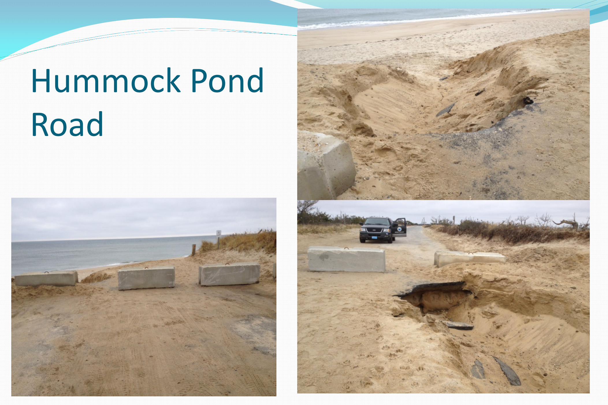
Hummock Pond Road
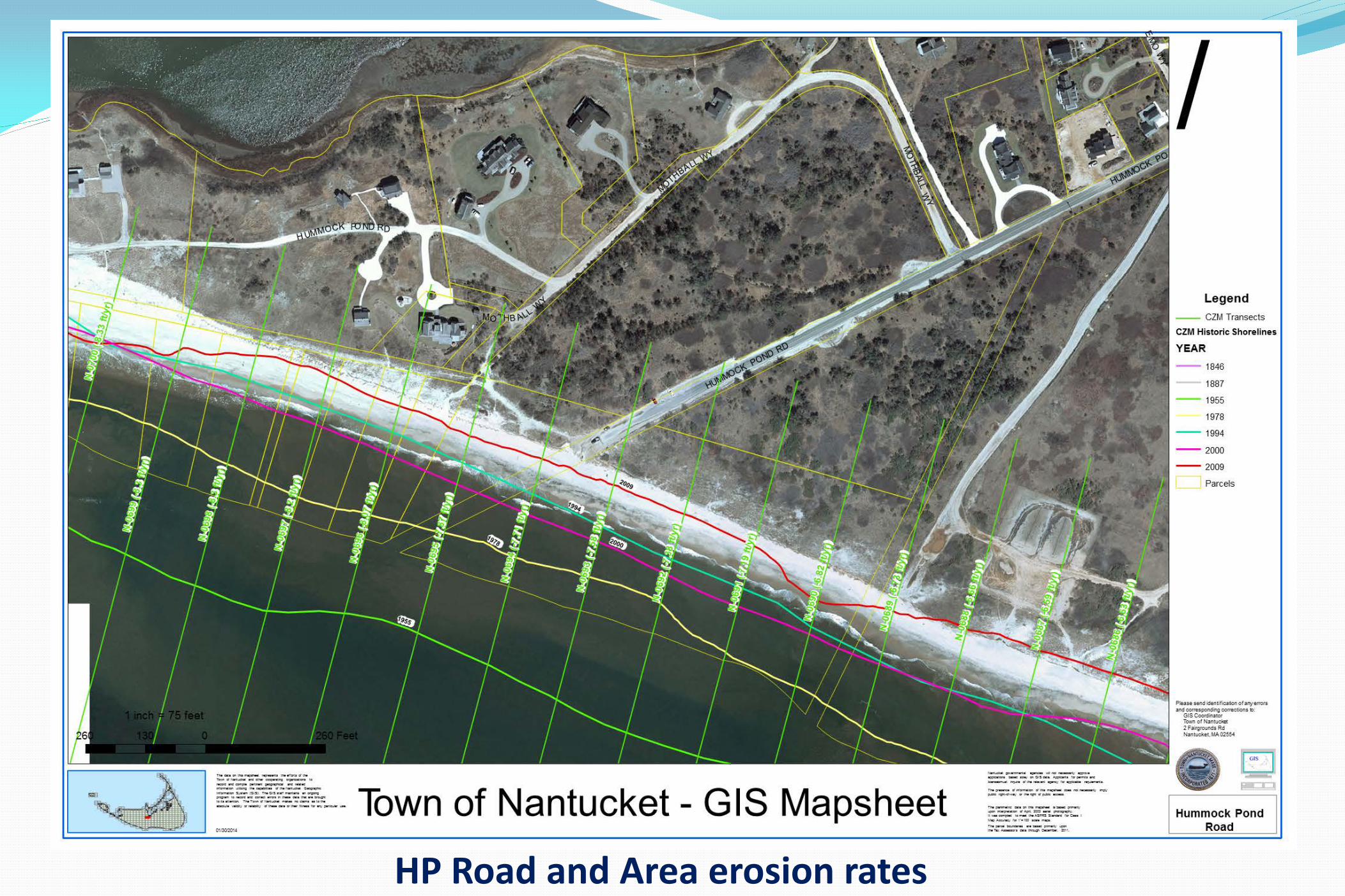
HP Road and Area erosion rates
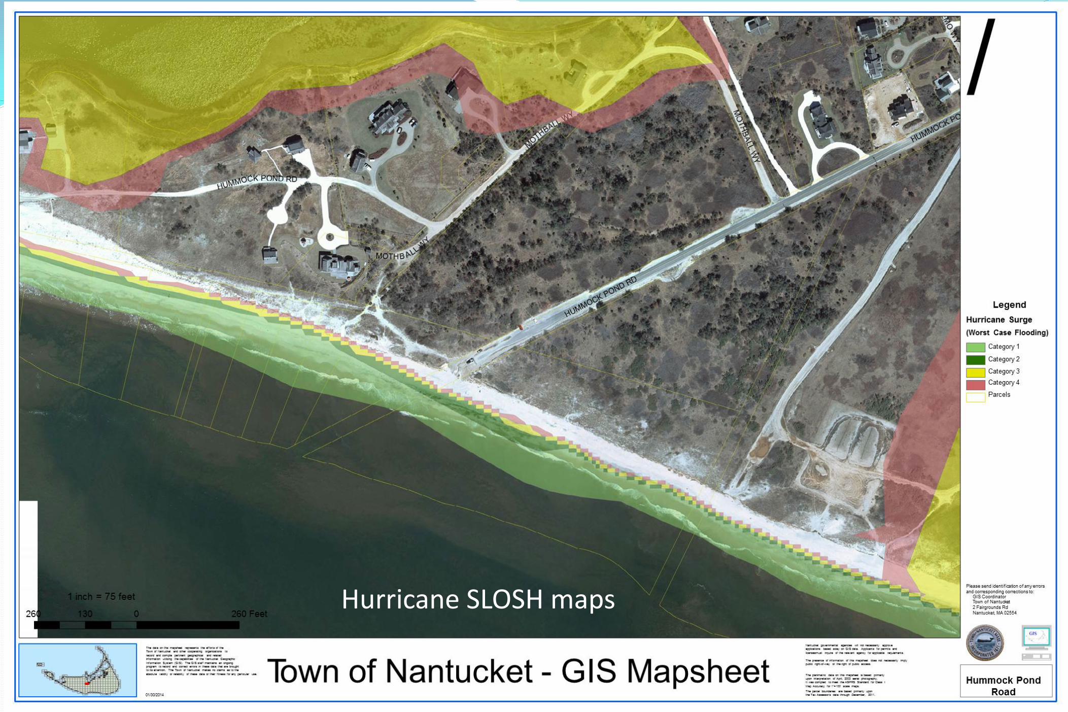
Hurricane SLOSH maps
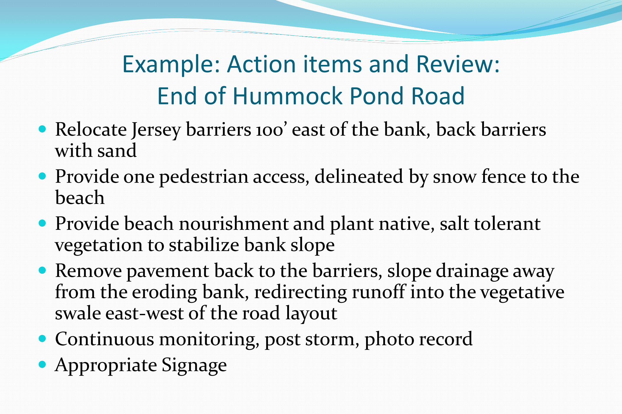
Example: Action items and Review: End of Hummock Pond Road
Relocate Jersey barriers 100’ east of the bank, back barriers with sand
Provide one pedestrian access, delineated by snow fence to the beach
Provide beach nourishment and plant native, salt tolerant vegetation to stabilize bank slope
Remove pavement back to the barriers, slope drainage away from the eroding bank, redirecting runoff into the vegetative swale east-west of the road layout
Continuous monitoring, post storm, photo record Appropriate Signage
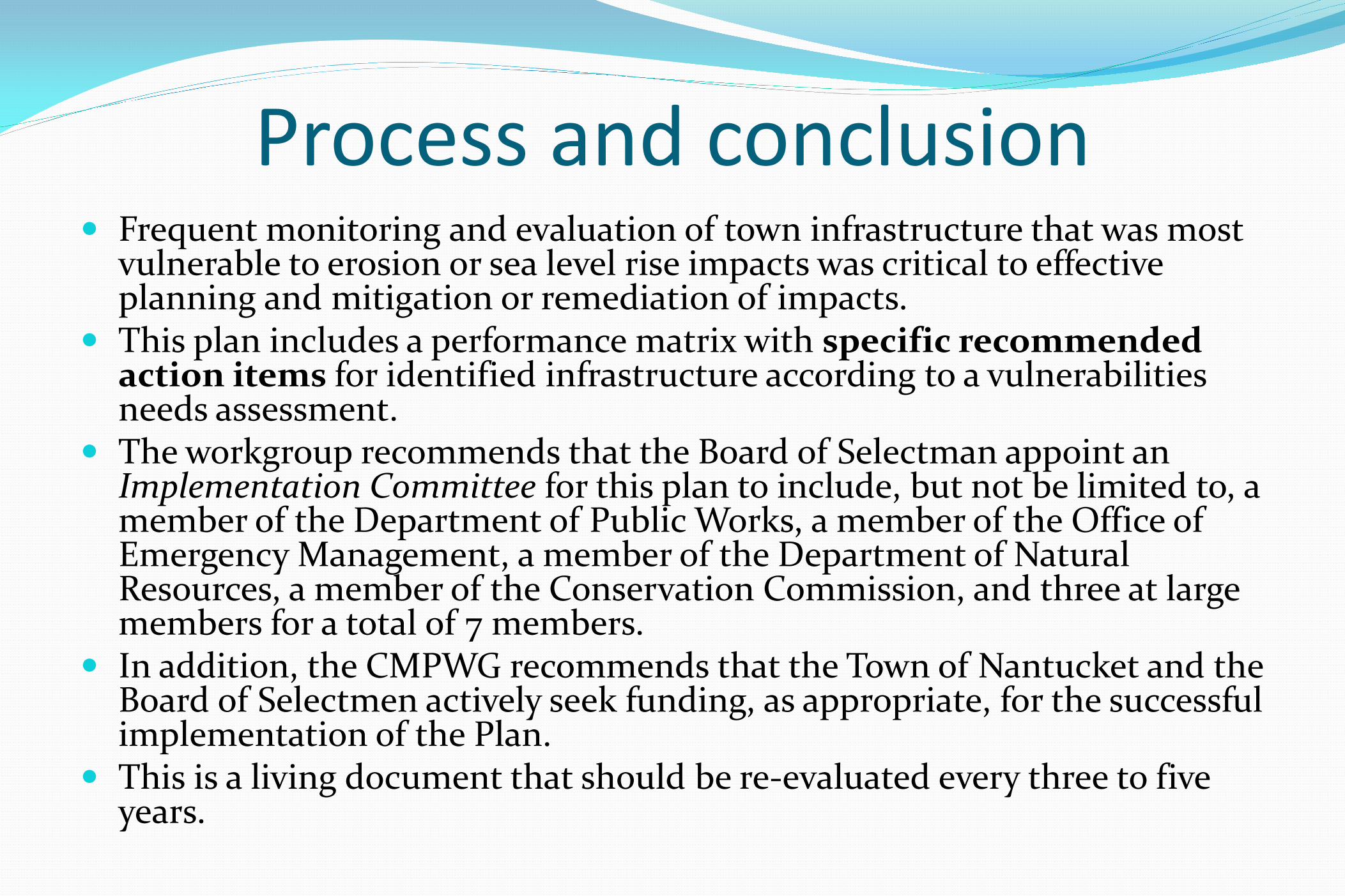
Process and conclusion Frequent monitoring and evaluation of town infrastructure that was most
vulnerable to erosion or sea level rise impacts was critical to effective planning and mitigation or remediation of impacts.
This plan includes a performance matrix with specific recommended action items for identified infrastructure according to a vulnerabilities needs assessment.
The workgroup recommends that the Board of Selectman appoint an Implementation Committee for this plan to include, but not be limited to, a member of the Department of Public Works, a member of the Office of Emergency Management, a member of the Department of Natural Resources, a member of the Conservation Commission, and three at large members for a total of 7 members.
In addition, the CMPWG recommends that the Town of Nantucket and the Board of Selectmen actively seek funding, as appropriate, for the successful implementation of the Plan.
This is a living document that should be re-evaluated every three to five years.
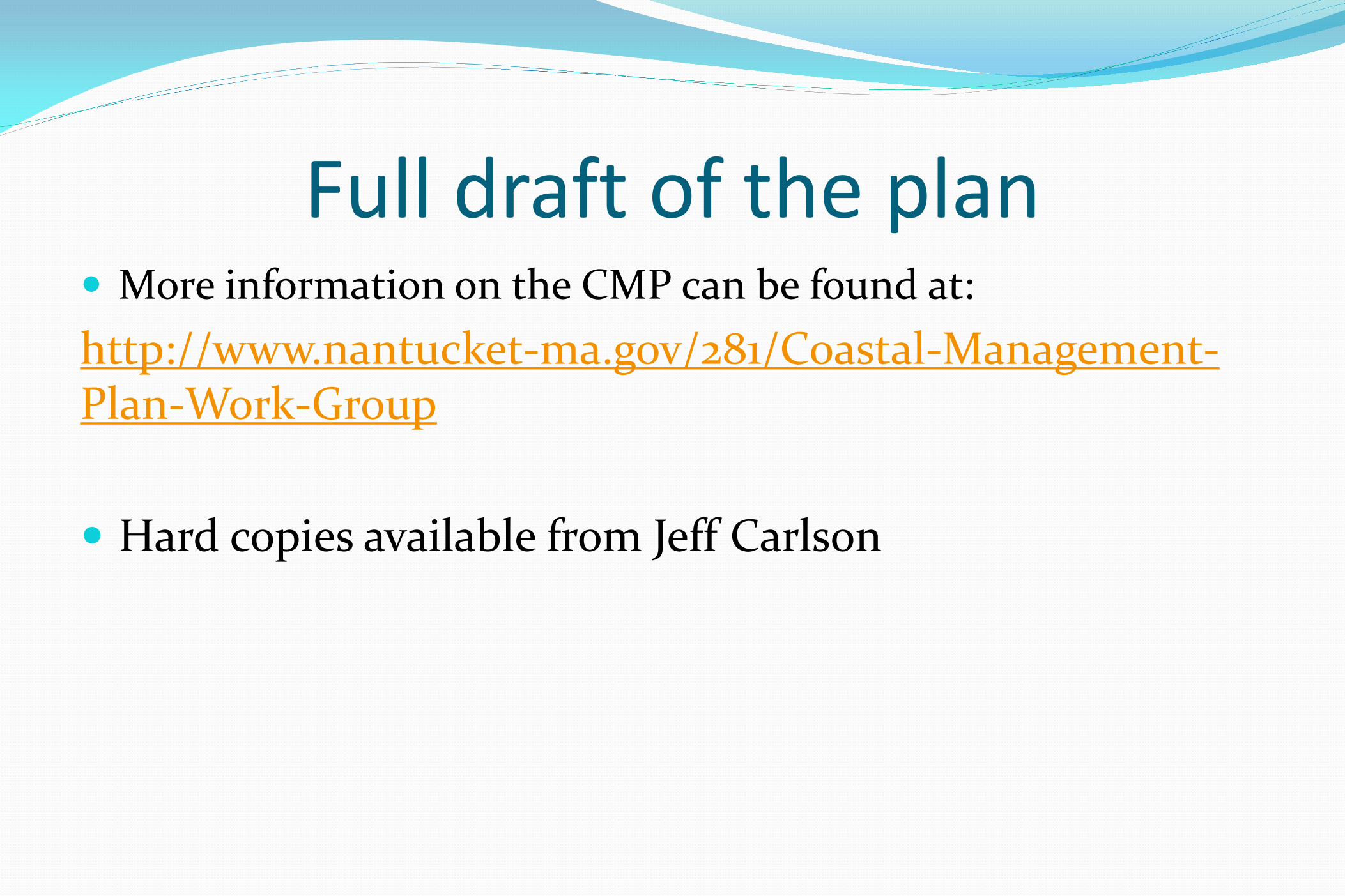
Full draft of the plan More information on the CMP can be found at: http://www.nantucket-ma.gov/281/Coastal-Management-Plan-Work-Group Hard copies available from Jeff Carlson


