NCHRP 20-59(53) FloodCast: A Framework for Enhanced Flood Event Decision Making for Transportation Resilience April 2017 Presenters: Mat Mampara, Caroline Whitehead & Alaurah Moss (Dewberry)
Transcript
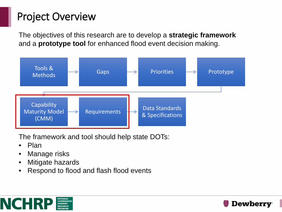
NCHRP 20-59(53)
FloodCast: A Framework for Enhanced Flood Event Decision Making for Transportation Resilience
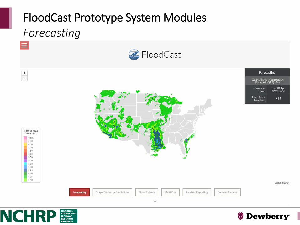
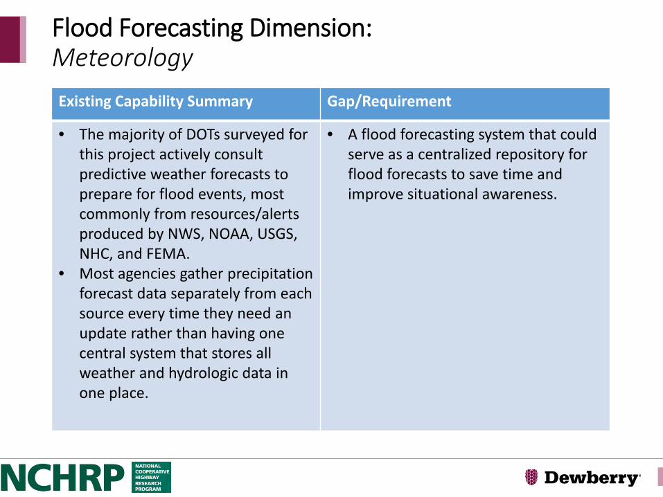
• The majority of DOTs surveyed for this project actively consult predictive weather forecasts to prepare for flood events, most commonly from resources/alerts produced by NWS, NOAA, USGS, NHC, and FEMA.
• Most agencies gather precipitation forecast data separately from each source every time they need an update rather than having one central system that stores all weather and hydrologic data in one place.
• A flood forecasting system that could serve as a centralized repository for flood forecasts to save time and improve situational awareness.
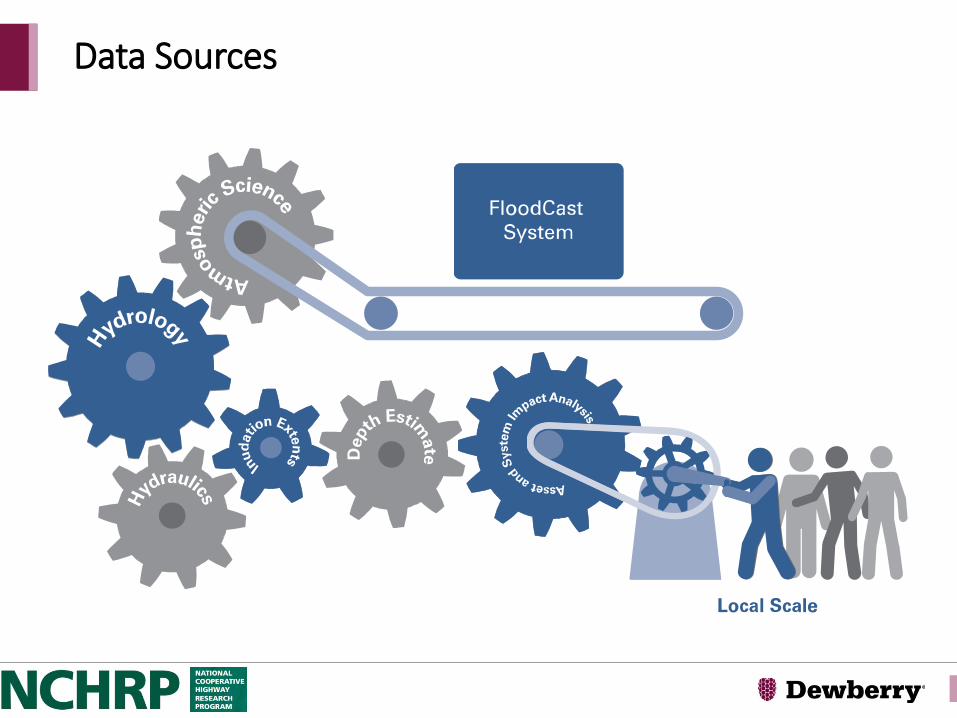
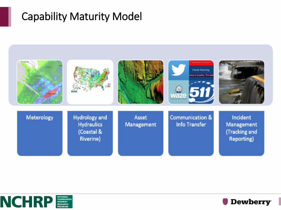
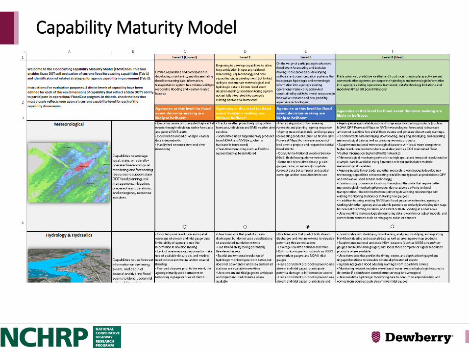
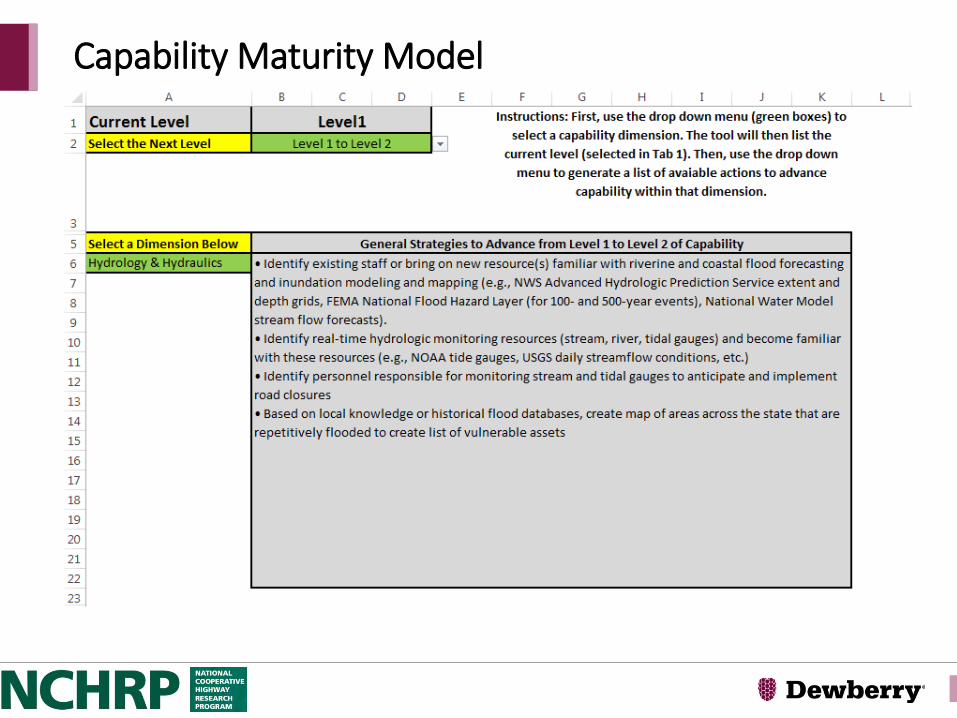
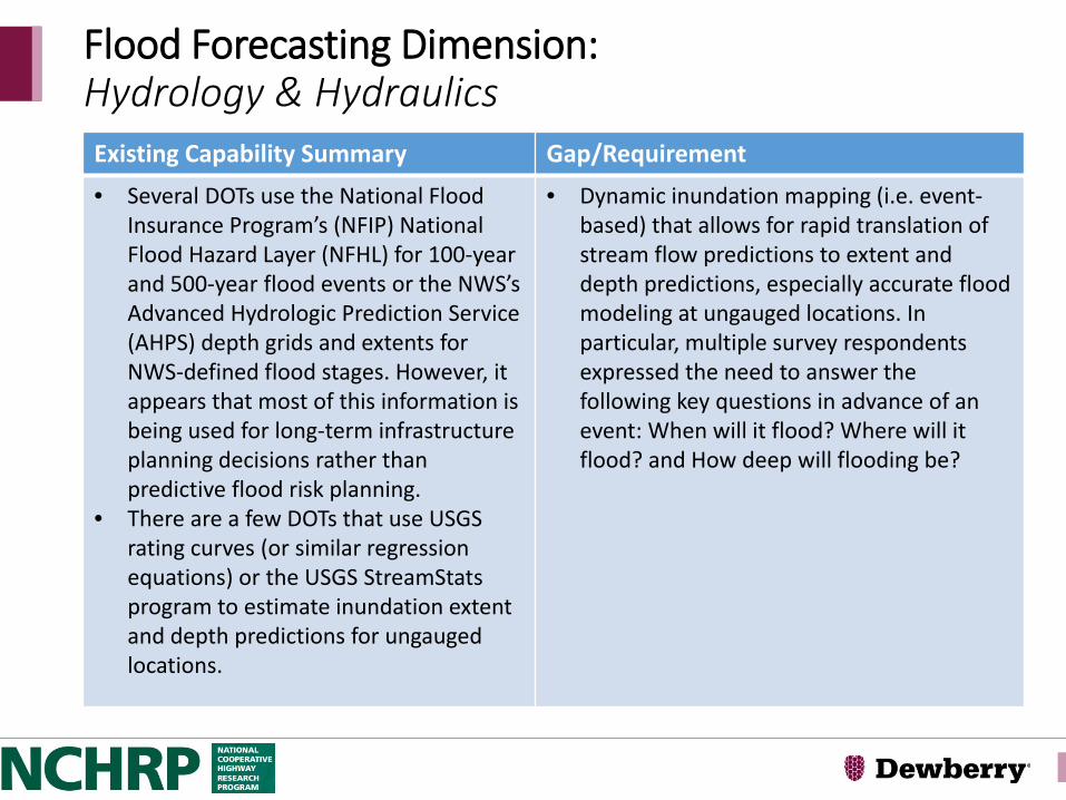
Flood Forecasting Dimension:Hydrology & Hydraulics Existing Capability Summary Gap/Requirement • Several DOTs use the National Flood
Insurance Program’s (NFIP) National Flood Hazard Layer (NFHL) for 100-year and 500-year flood events or the NWS’s Advanced Hydrologic Prediction Service (AHPS) depth grids and extents for NWS-defined flood stages. However, it appears that most of this information is being used for long-term infrastructure planning decisions rather than predictive flood risk planning.
• There are a few DOTs that use USGS rating curves (or similar regression equations) or the USGS StreamStatsprogram to estimate inundation extent and depth predictions for ungauged locations.
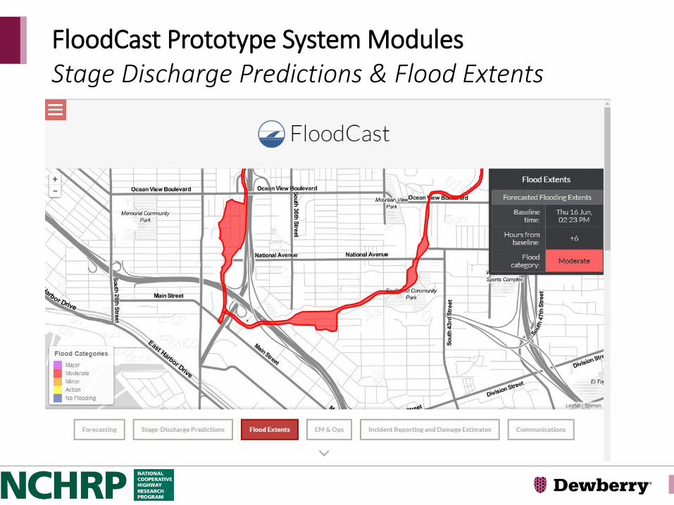
• Dynamic inundation mapping (i.e. event-based) that allows for rapid translation of stream flow predictions to extent and depth predictions, especially accurate flood modeling at ungauged locations. In particular, multiple survey respondents expressed the need to answer the following key questions in advance of an event: When will it flood? Where will it flood? and How deep will flooding be?
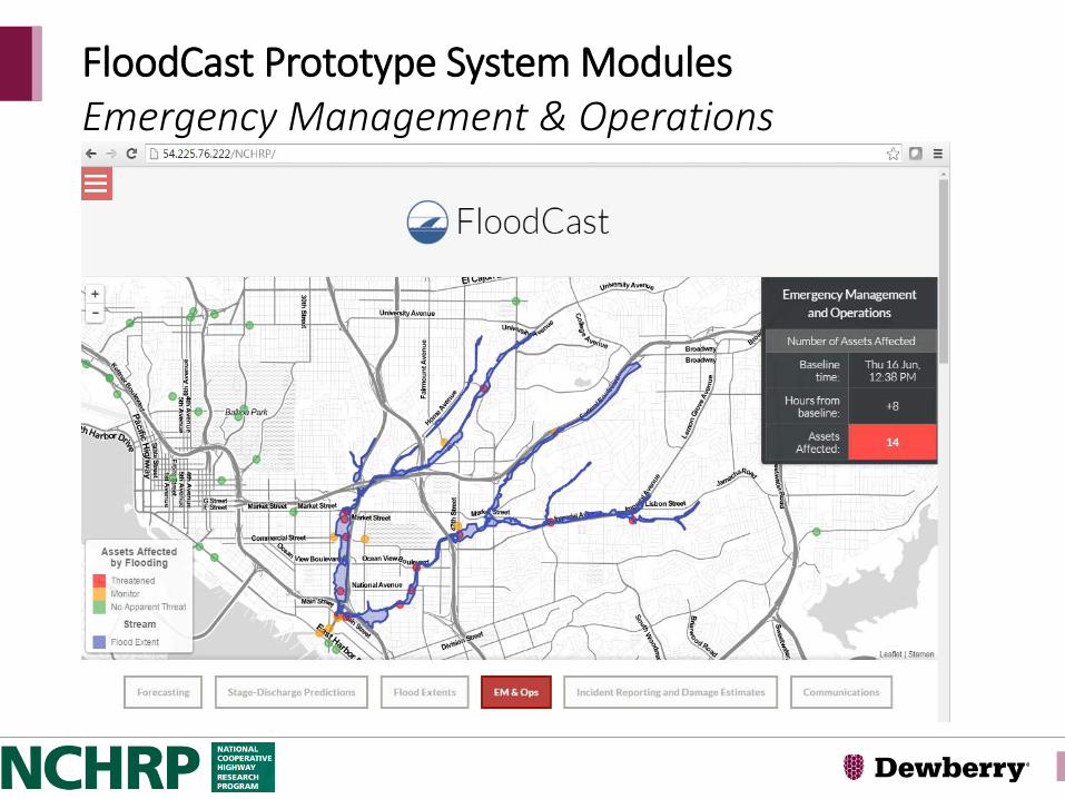
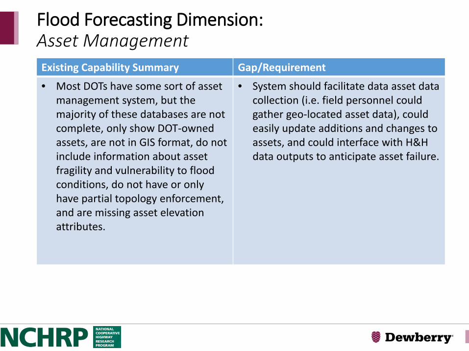
• Most DOTs have some sort of asset management system, but the majority of these databases are not complete, only show DOT-owned assets, are not in GIS format, do not include information about asset fragility and vulnerability to flood conditions, do not have or only have partial topology enforcement, and are missing asset elevation attributes.
• System should facilitate data asset data collection (i.e. field personnel could gather geo-located asset data), could easily update additions and changes to assets, and could interface with H&H data outputs to anticipate asset failure.
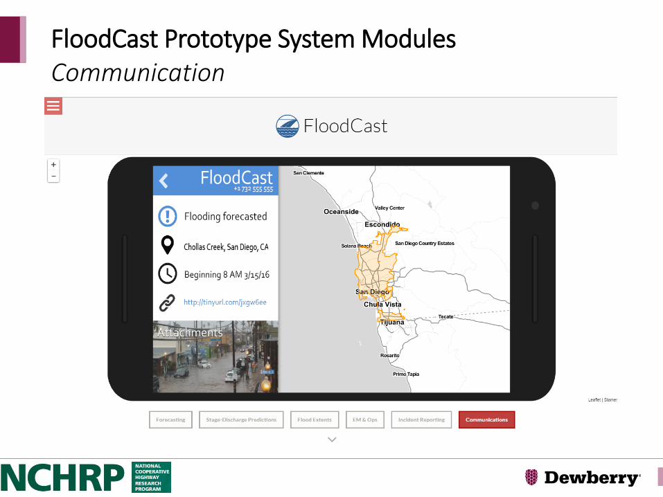
Flood Forecasting Dimension:Communication & Information Transfer Existing Capability Summary Gap/Requirement
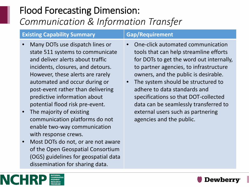
• Many DOTs use dispatch lines or state 511 systems to communicate and deliver alerts about traffic incidents, closures, and detours. However, these alerts are rarely automated and occur during or post-event rather than delivering predictive information about potential flood risk pre-event.
• The majority of existing communication platforms do not enable two-way communication with response crews.
• Most DOTs do not, or are not aware of the Open Geospatial Consortium (OGS) guidelines for geospatial data dissemination for sharing data.
• One-click automated communication tools that can help streamline efforts for DOTs to get the word out internally, to partner agencies, to infrastructure owners, and the public is desirable.
• The system should be structured to adhere to data standards and specifications so that DOT-collected data can be seamlessly transferred to external users such as partnering agencies and the public.
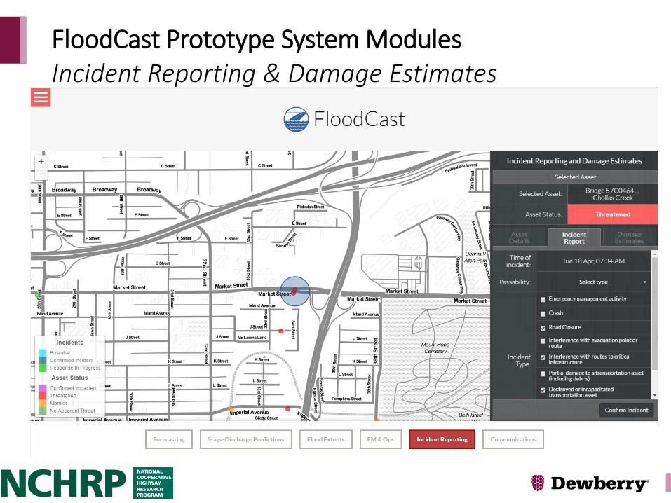
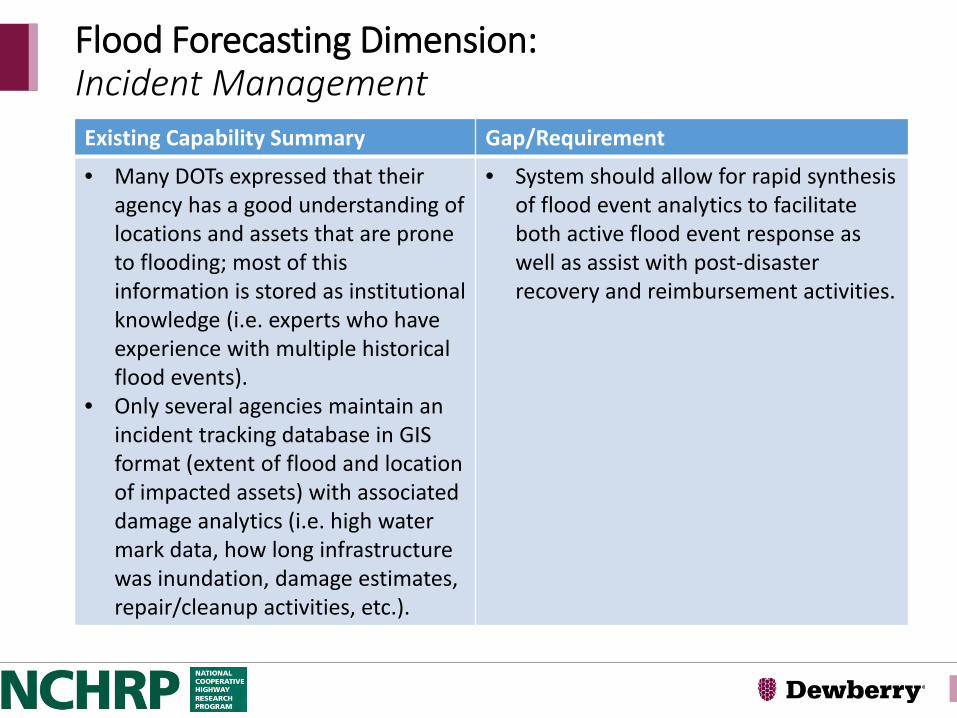
• Many DOTs expressed that their agency has a good understanding of locations and assets that are prone to flooding; most of this information is stored as institutional knowledge (i.e. experts who have experience with multiple historical flood events).
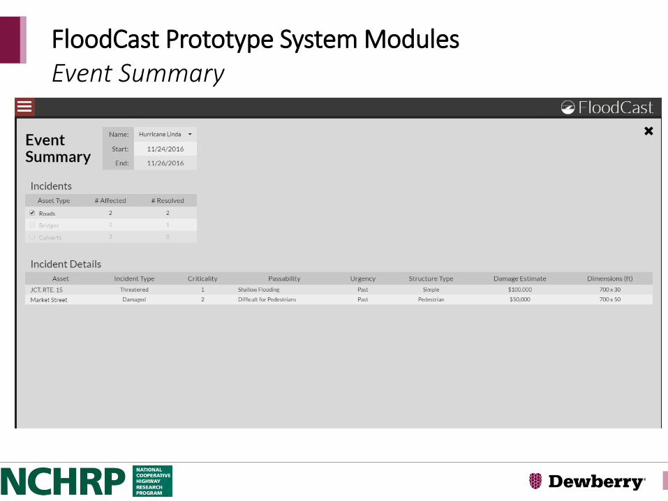
• Only several agencies maintain an incident tracking database in GIS format (extent of flood and location of impacted assets) with associated damage analytics (i.e. high water mark data, how long infrastructure was inundation, damage estimates, repair/cleanup activities, etc.).
• System should allow for rapid synthesis of flood event analytics to facilitate both active flood event response as well as assist with post-disaster recovery and reimbursement activities.