37
Grandview Heights NCP #3 Neighbourhood Heritage Context Study November 2017

Grandview Heights NCP #3
Neighbourhood Heritage Context
Study
November 2017
Grandview Heights NCP 3 • Neighbourhood Heritage Context Study
1
Table of Contents
1.0 Introduction . . . . . . 2
1.1 Study Purpose and Background . . . 21.2 Geographical Context . . . . 3
2.0 Neighbourhood Evolution Over Time . . 5
2.1 Historical Chronology . . . . 52.2 Natural, Cultural and Historical Context . . 6 2.2.1 Indigenous Landscape 2.2.2 Post-contact Settlement 2.2.3 Logging the Land 2.2.4 Emergence of Agriculture 2.2.5 Semi-rural Suburb
3.0 Defining Heritage Features and Values . . 16
3.1 Cultural Values and Features . . . 163.2 Physical Values and Features . . . 173.3 Heritage Values and Features . . . 18
4.0 Heritage Recommendations . . . 21
4.1 General Recommendations . . . . 224.2 Commemoration, Communication, Placemaking . 25 4.2.1 Commemoration 4.2.2 Communication 4.2.3 Placemaking
5.0 Appendices . . . . . . 31
A Research Sources . . . . . 31 B Glossary of Terms . . . . . 33 C Community Questionnaire . . . 35
Denise Cook Design764 Donegal PlaceNorth Vancouver, B.C.V7N [email protected]
Grandview Heights NCP 3 • Neighbourhood Heritage Context Study
2
1.0 Introduction
1.1 Study Purpose and Background
Every neighbourhood has a history. NCP #3 shares a natural and cultural heritage with the other adjacent neighbourhoods of Grandview Heights, encompassing features and stories from the natural environment, Indigenous perspectives and post-contact activities dating from the past century.
This study identifies and recognizes a range of cultural landscape heritage values and resources in the NCP #3 portion of Grandview Heights.
The goal of this study is not so much to re-present history that is already known, but to effectively synthesize historical facts and stories with heritage values to ensure the retention of some of the historical character and value of the place in the neighbourhood plan.
The study identifies the major factors and processes that have influenced the community’s evolution using a historical context statement and thematic framework specific to the area.
The study will be used essentially to identify the particular heritage of this neighbourhood so that this information can be considered in terms of the neighbourhood plan. It can also contribute to the character of the public realm, to create design guidelines that really respond to what is of value, and also to provide input into the design signage and other public realm amenities, and any interpretive programs.
The overall goal of this study is to synthesize historical research, identify heritage values and make recommendations to ensure the historical character and heritage value found in the place are considered within the neighbourhood plan.
Grandview Heights NCP 3 • Neighbourhood Heritage Context Study
3
1.2 Geographical Context of Grandview Heights NCP #3
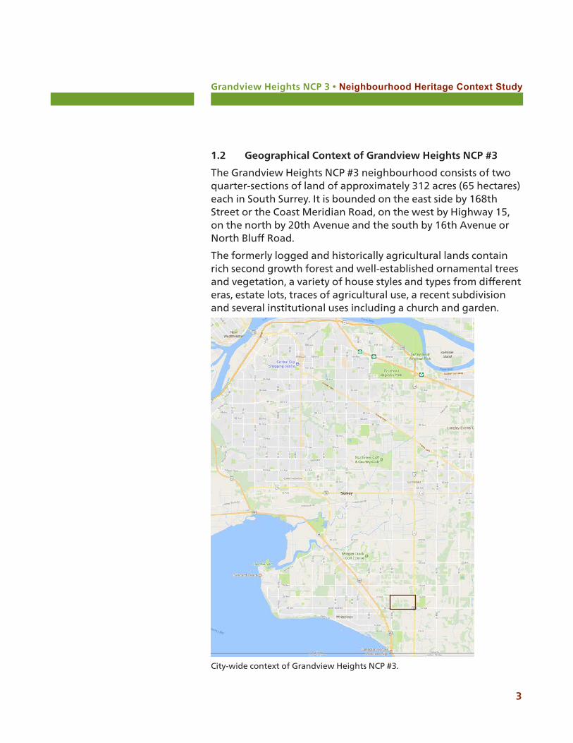
The Grandview Heights NCP #3 neighbourhood consists of two quarter-sections of land of approximately 312 acres (65 hectares) each in South Surrey. It is bounded on the east side by 168th Street or the Coast Meridian Road, on the west by Highway 15, on the north by 20th Avenue and the south by 16th Avenue or North Bluff Road.
The formerly logged and historically agricultural lands contain rich second growth forest and well-established ornamental trees and vegetation, a variety of house styles and types from different eras, estate lots, traces of agricultural use, a recent subdivision and several institutional uses including a church and garden.
City-wide context of Grandview Heights NCP #3.
Grandview Heights NCP 3 • Neighbourhood Heritage Context Study
4
21 Ave
22 Ave
167 St
15 Ave
21 Ave
171
St16
9 S
t
22 Ave
21A Ave
172
St
Edge
woo
d D
r167
St
16 Ave
20 Ave
168
St
Hig
hway
15
18 Ave
14 Ave
174
St
166
St
177
St
169
St
19 Ave
170
St
175
St
18 Ave
172
St
´Grandview Heights NCP #3 100MetersScale
ALR
Study Area Boundary Agricultural Land Reserve (ALR)
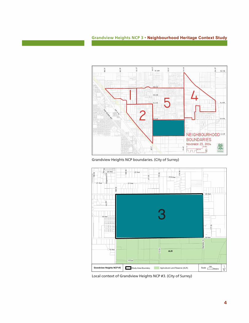
Local context of Grandview Heights NCP #3. (City of Surrey)
Grandview Heights NCP boundaries. (City of Surrey)
3
Grandview Heights NCP 3 • Neighbourhood Heritage Context Study
5
2.0 Neighbourhood Evolution Over Time
Like all neighbourhoods, Grandview Heights NCP #3 has continued to evolve over time. The following table outlines a general historical chronology for the neighbourhood and its broader context within the City of Surrey.
2.1 Historical Chronology
Date Chronological event Concurrent events / landscape changes
12,000 BP First Nations, including today’s Semiahmoo, Kwantlen and Katzie are using and travelling through the future south Surrey landscape.
First Nations use the Serpentine, Nikomekl and Campbell rivers along with their side channels to navigate the region. They fish, hunt and harvest spiritual, medicinal and food plants.
1860s The first logging companies are established in the area.
Marks the beginning of the transformation of the landscape through intense resource extraction.
1873 Today’s city of Surrey is surveyed into townships and sections within New Westminster District.
The formerly natural landscape punctuated by topography, rivers and streams is imposed upon by gridded blocks.
1878 Pioneer David Brown establishes a residence at the corner of Clover Valley and North Bluff roads and becomes the postmaster at Hall’s Prairie.
Grandview Heights and NCP #3 are opened up for farming and residential use.
1886 Royal City Planing Mills operates a logging railway through Grandview Heights.
Further opening up of the landscape to logging, indicating the importance of the industry in this area.
1887 The Semiahmoo Indian Reserve is established by the Canadian government near White Rock.
Kensington Prairie School is opened at the corner of 168th St and 32nd Ave in a private residence.
The Semiahmoo First Nation is confined to a small area of land.
The post-contact population is large enough to sustain a school.
1893 Pioneer brothers Peter and David Brown create Redwood Park.
The logged land is transformed into a tree collection with specimens from around the world.
Grandview Heights NCP 3 • Neighbourhood Heritage Context Study
6
Date Chronological event Concurrent events / landscape changes
1910 Establishment of the BC Electric Railway between New Westminster and Chilliwack.
The railway served the logging and agricultural communities on the south shore of the Fraser River that had been developing since the 1860s.
The closest station to NCP #3 was the Meridian station at Highway 10 and Coast Meridian Road.
1913 The Pacific Highway is established, running from the New Westminster rail and road bridge at Brownsville along the Yale Road to Clover Valley Road.
Clover Valley Road from Yale Road to the border is re-named and included in the Pacific Highway designation.
1920s-’30s The Grandview Heights area is opened up for small-agricultural and non-agricultural residential settlement.
A number of modest homes are constructed along the roadways, with land extending behind.
Subdivision of land occurs and farm holdings and residential properties are created with access along the roadway grid.
1923 The Pacific Highway is paved. The highway is now a formal and popular tourist route connecting Vancouver to the United States. Development, including small businesses, occurs along the route.
1945 Post-World War II, NCP #3 continues to develop into estate and residential lots.
Further residential development on previously farmed land and an increase in the local population.
1960s Redwood Park is donated to the City of Surrey.
The legacy of the Brown family is a place of high value to the residents of Grandview Heights.
1972 The Agricultural Land Reserve is established.
The legislation is designed to conserve valuable agricultural lands in BC, including parts of Grandview Heights.
Darts Hill Garden Park is established. The formal agricultural and orchard lands history, house a collection of rare and notable plants and trees.
Grandview Heights NCP 3 • Neighbourhood Heritage Context Study
7
2.2 Natural, Cultural and Historical Context
2.2.1 An Indigenous landscape since time immemorial
The interior of Surrey was sculpted and is drained by the Nicomekl and Serpentine Rivers, and the Campbell River to the south. Along most of their courses the rivers meander across the floor of flat to very gently undulating valleys from 1 1/2 to 3 1/2 miles wide. These valleys are former embayments of the sea. The main valleys of the Nicomekl and Serpentine vary in elevation from about 5 to 30 feet above sea level. The valley of the lower Campbell is from about 25 feet to 75 feet above sea level.
The three rivers meandering through the lowlands were affected by tides for most of their length. Where periodic flooding occurred, from combinations of high runoff and high tides, mainly treeless or lightly wooded areas occurred which are now referred to as Hall’s Prairie, Kensington Prairie, and Langley Prairie.1
NCP #3 is located in an area of Surrey called the Campbell Upland which gives the neighbourhood its distinct topography sloping. This neighbourhood in particular has steep topography sloping to the south. Its southern boundary is named North Bluff Road, an acknowledgement of this topography.
NCP #3 has large areas of mixed second growth forest which generally consists of red alder and big-leaf maple mixed with coniferous trees. The dominant shrub covers are deciduous species such as hardhack, Himalayan blackberry, or planted crops.2 This vegetation is found in areas that were logged in the early 20th century.
The original vegetation consisted of open areas with scattered groves of spruce and hemlock intermixed with cedar, alder and birch creating an early logging industry. Grassy areas, usually fairly swampy, had heavy underbrush of hard hack, willow, crab-apple, and a variety of shrubs and reeds.
Upper Sam Hill Creek and Sam Hill Creek, tributary creeks to the Little Campbell River, flows through NCP #3. Sam Hill Creek drains the southern uplands of Surrey west of 176th Street and east
1 www.surreyhistory.ca/surreycontours.html2 HB Lanarc 2011.
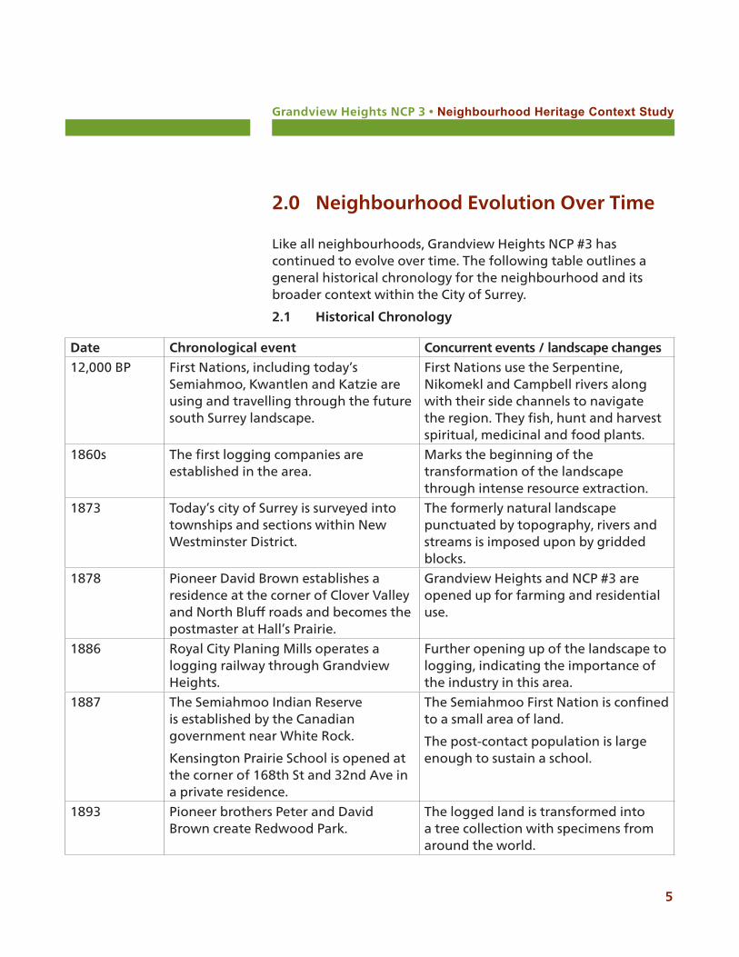
Semiahmoo First Nation reserve c. 1960. (Surrey Archives WH.1386)
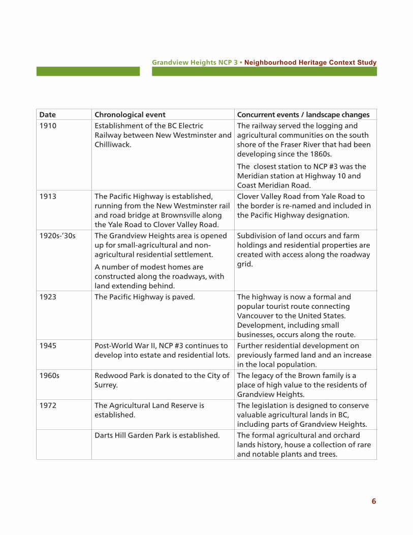
First Nations artifacts. (Surrey Museum)

Grandview Heights NCP 3 • Neighbourhood Heritage Context Study
8
White Rock north of Buena Vista Avenue. It enters the Campbell River at Peace Portal Golf Course.
As with most of British Columbia, the first European settlers in South Surrey did not come to an empty land. The area in which NCP #3 is located was the traditional territory of a small Halkomelem speaking group called the Snokomish. Their territory included the shores of Boundary Bay, and the drainage basins of the Serpentine, Nicomekl and Campbell Rivers. Shortly before 1850, the Snokomish population was almost entirely eradicated by a smallpox epidemic. Their remaining members were absorbed into the neighbouring Semiahmoo First Nation, who acquired the saltwater portion of Snokomish territory, with the remaining becoming Kwantlen First Nation territory.3
The Semiahmoo, Katzie and Kwantlen First Nations peoples have lived in the South Surrey area for thousands of years. Settlements along the mouth of the Fraser River, at Crescent Beach, at the mouth of the Campbell River and in the north along the sheltered bends of the Fraser River had well established villages and temporary or seasonal settlements.4
Community life centered on hunting and fishing, tidal resources of shellfish and river supplies of salmon, herring, and oolichans. Shorelines and forests of birds, deer, elk and bear provided resources to support life in the delta of the Fraser River. The Campbell, Nicomekl and Serpentine Rivers were the connected inland routes used for trading and communication, while coastal waterways connected the First Nations to the surrounding communities. Today, trees, fish and wildlife and medicinal and cultural plants in the area are important to First Nations.
The growth of logging in the area in the late 1870s provided employment for many First Nations men. In the 1890s, as logging increased, a skid road was constructed to move logs to the Campbell River (part of the Semiahmoo Reserve) where they were boomed for movement to market.
The Semiahmoo Reserve was established by the Canadian government in 1887, today located on 312 acres between the
3 The Territory of the Semiahmoo, adapted from Wayne P. Suttles, Economic Life of the Coast Salish of Haro and Rosario Straits.4 www.surrey.ca /6555.aspx
Grandview Heights NCP 3 • Neighbourhood Heritage Context Study
9
boundary of White Rock, the Canada-U.S. boundary and Peace Arch Provincial Park.
In the late 1890s, subsistence fishing was severely impacted by the construction of canneries and placing of commercial fish traps which restricted First Nations access to fishing grounds.
It is important to note that Coast Salish living in Puget Sound and adjacent lands and those in British Columbia originally co-existed across the international border prior to contact with whites and the establishment of treaties, reserves and borders.5 Today, families with Snokomish heritage among the Semiahmoo retain hereditary rights to the mouths of the Nicomekl, Serpentine and Campbell Rivers.6
2.2.2 Post-contact settlement
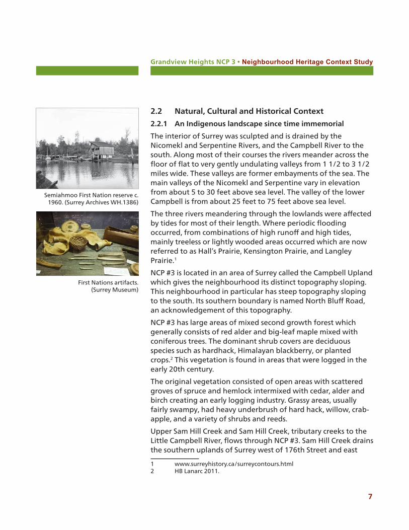
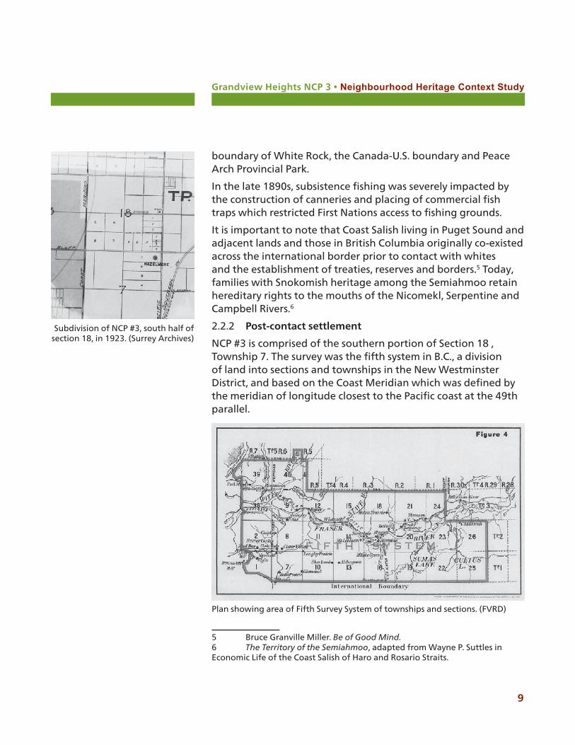
NCP #3 is comprised of the southern portion of Section 18 , Township 7. The survey was the fifth system in B.C., a division of land into sections and townships in the New Westminster District, and based on the Coast Meridian which was defined by the meridian of longitude closest to the Pacific coast at the 49th parallel.
5 Bruce Granville Miller. Be of Good Mind.6 The Territory of the Semiahmoo, adapted from Wayne P. Suttles in Economic Life of the Coast Salish of Haro and Rosario Straits.
Plan showing area of Fifth Survey System of townships and sections. (FVRD)
Subdivision of NCP #3, south half of section 18, in 1923. (Surrey Archives)
Grandview Heights NCP 3 • Neighbourhood Heritage Context Study
10
The post-contact settlement of Grandview Heights began with David Brown, who arrived in Surrey from Ontario via Iowa, San Francisco and Victoria in 1878. He resided at the corner of the former Clover Valley (today 176th Street/Pacific Highway) and North Bluff Road (16th Avenue).7 Other Browns would follow, including J.N. Brown who pre-empted a quarter-section of NCP #3.
Pre-emptions in place in 1910 in NCP #3 include:
J.N. Brown SE 1/4 Section 18Government Reserve SW 1/4 Section 18
Many settlers in the late 1880s worked on the construction of new roads, such as the Coast Meridian, were employed on local farms or worked in the lumber industry.
Spurred by a revitalization in the logging and lumber industry and by the construction of the Pacific Highway, Grandview Heights and NCP #3 experienced growth after the World War I, demonstrated in part by agricultural expansion, subdivision and incoming families, and the opening of institutions such as the Grandview Heights Elementary School adjacent to NCP #3.
Post-contact settlement resulted in the neighbourhood of NCP #3 being bounded by several historically important transportation corridors, including the Coast Meridian Road (168th Street), the Highway 15, the Pacific Highway (176th Street) and North Bluff Road (16th Avenue).
The Coast Meridian Road was originally defined as a survey line during J.W. Trutch’s survey of Surrey in 1859. It was the meridian of longitude closest to the Pacific coast at the 49th parallel, the international boundary between Canada and the U.S. . This survey line became a road in 1880, with the southern portion completed in 1886.
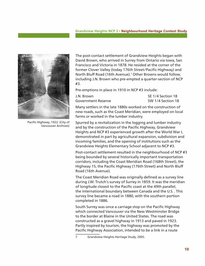
South Surrey was once a carriage stop on the Pacific Highway which connected Vancouver via the New Westminster Bridge to the border at Blaine in the United States. The road was constructed as a gravel highway in 1913 and paved in 1923. Partly inspired by tourism, the highway was promoted by the Pacific Highway Association, intended to be a link in a route
7 Grandview Heights Heritage Study, 2005.
Pacific Highway, 1922. (City of Vancouver Archives)

Grandview Heights NCP 3 • Neighbourhood Heritage Context Study
11
connecting Vancouver to Mexico.
North Bluff Road was originally referred to by George Vancouver in 1792, describing the northern extreme of the continental shore as a low bluff point. The north bluff Vancouver referred to is near Ocean Park, with a continuation into Surrey along the present and the North Bluff Road.
2.2.3 Logging the Land
Grandview Heights was originally a logging area. The Royal City Planing Mills pre-empted many tracts of land, including the adjacent northeast quarter section of Section 18. The company established an operation east of Elgin near the Nicomekl River to log the areas south of Kensington Prairie. In 1886, a logging railway was built east through Grandview Heights. At the west of the line, logs were dumped into a ditch and floated into the Nicomekl River. When the New Westminster and Southern Railway was completed in 1891, the logging railway was extended to join it at the bend east of the Hall’s Prairie Road. Other mills operating in the area of Grandview heights include the Royal City Planing Mills, Brunette Mills, and later the Campbell River Timber Company.
Map showing the location of the New Westminster and Southern Railway and the BC Mills Timber & Trading Co. logging railway adjacent to NCP #3 (from Treleavan, 1981).
Forest at Hall’s Prairie c.1920. (Surrey Archives 121.082)
Logging locomotive at Hazelmere c.1800s. (Surrey Archives 121.016)
Grandview Heights NCP 3 • Neighbourhood Heritage Context Study
12
Railways in Surrey began with the logging railways which used horse-drawn carts narrow gauge tracks, an improvement over the earlier skid roads. The BC Mills Timber and Trading Co. railway, opened in 1891, located just east of NCP #3, was a steam locomotive railway which eventually connected to the 1891 New Westminster and Southern Railway, which in turn was connected to the Great Northern railway in Blaine.
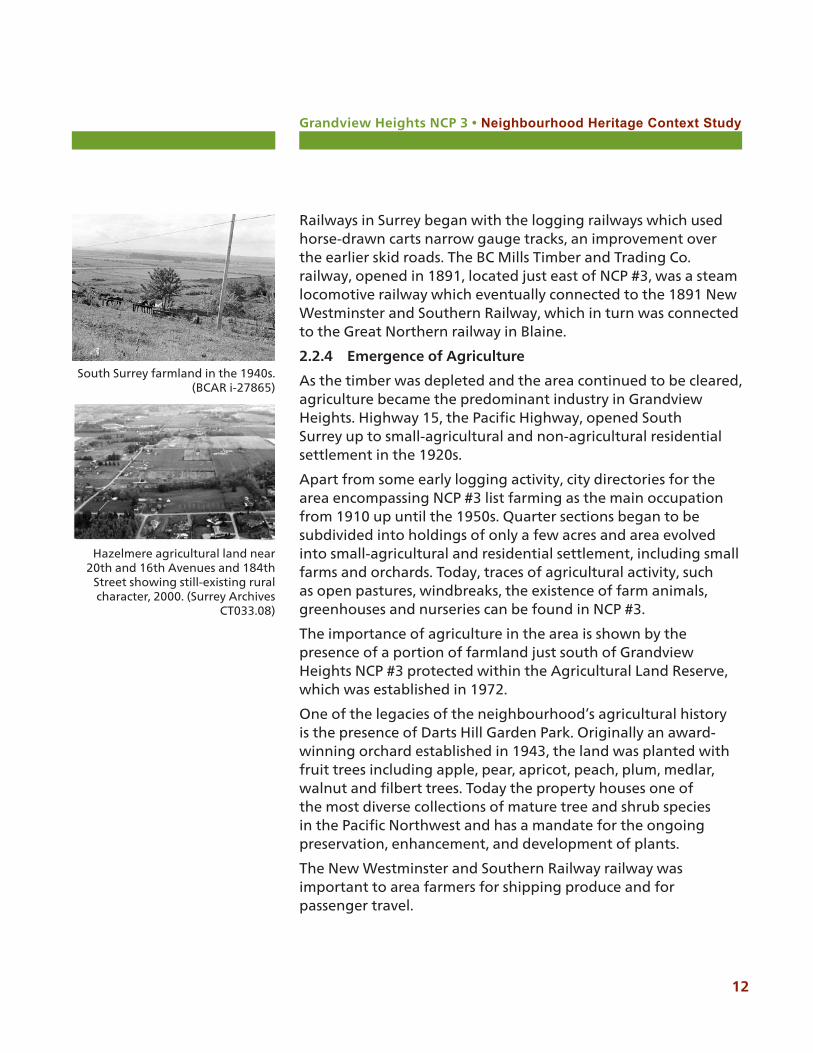
2.2.4 Emergence of Agriculture
As the timber was depleted and the area continued to be cleared, agriculture became the predominant industry in Grandview Heights. Highway 15, the Pacific Highway, opened South Surrey up to small-agricultural and non-agricultural residential settlement in the 1920s.
Apart from some early logging activity, city directories for the area encompassing NCP #3 list farming as the main occupation from 1910 up until the 1950s. Quarter sections began to be subdivided into holdings of only a few acres and area evolved into small-agricultural and residential settlement, including small farms and orchards. Today, traces of agricultural activity, such as open pastures, windbreaks, the existence of farm animals, greenhouses and nurseries can be found in NCP #3.
The importance of agriculture in the area is shown by the presence of a portion of farmland just south of Grandview Heights NCP #3 protected within the Agricultural Land Reserve, which was established in 1972.
One of the legacies of the neighbourhood’s agricultural history is the presence of Darts Hill Garden Park. Originally an award-winning orchard established in 1943, the land was planted with fruit trees including apple, pear, apricot, peach, plum, medlar, walnut and filbert trees. Today the property houses one of the most diverse collections of mature tree and shrub species in the Pacific Northwest and has a mandate for the ongoing preservation, enhancement, and development of plants.
The New Westminster and Southern Railway railway was important to area farmers for shipping produce and for passenger travel.
South Surrey farmland in the 1940s.(BCAR i-27865)
Hazelmere agricultural land near 20th and 16th Avenues and 184th
Street showing still-existing rural character, 2000. (Surrey Archives
CT033.08)
Grandview Heights NCP 3 • Neighbourhood Heritage Context Study
13
While Japanese Canadian farmers owned a number of farms in South Surrey, city directories do not indicate that any Japanese Canadians or other immigrants owned land in NCP #3 up to 1970. The Japanese Canadians in South Surrey grew strawberries, rhubarb, small fruit, currants, raspberries and asparagus. During World War II, in 1942, all Japanese families in Surrey were interned outside the 100-mile limit from the B.C. coast known as the Protected Area. Most of the Surrey farmers went to Alberta to work on sugar beet farms in order to stay together as families, while their land was confiscated and sold.
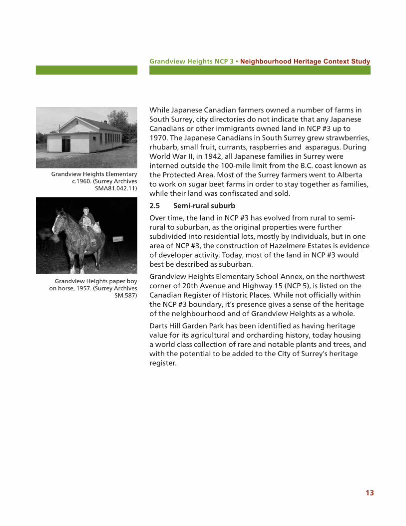
2.5 Semi-rural suburb
Over time, the land in NCP #3 has evolved from rural to semi-rural to suburban, as the original properties were further subdivided into residential lots, mostly by individuals, but in one area of NCP #3, the construction of Hazelmere Estates is evidence of developer activity. Today, most of the land in NCP #3 would best be described as suburban.
Grandview Heights Elementary School Annex, on the northwest corner of 20th Avenue and Highway 15 (NCP 5), is listed on the Canadian Register of Historic Places. While not officially within the NCP #3 boundary, it’s presence gives a sense of the heritage of the neighbourhood and of Grandview Heights as a whole.
Darts Hill Garden Park has been identified as having heritage value for its agricultural and orcharding history, today housing a world class collection of rare and notable plants and trees, and with the potential to be added to the City of Surrey’s heritage register.
Grandview Heights Elementary c.1960. (Surrey Archives
SMA81.042.11)
Grandview Heights paper boy on horse, 1957. (Surrey Archives
SM.587)
Grandview Heights NCP 3 • Neighbourhood Heritage Context Study
14
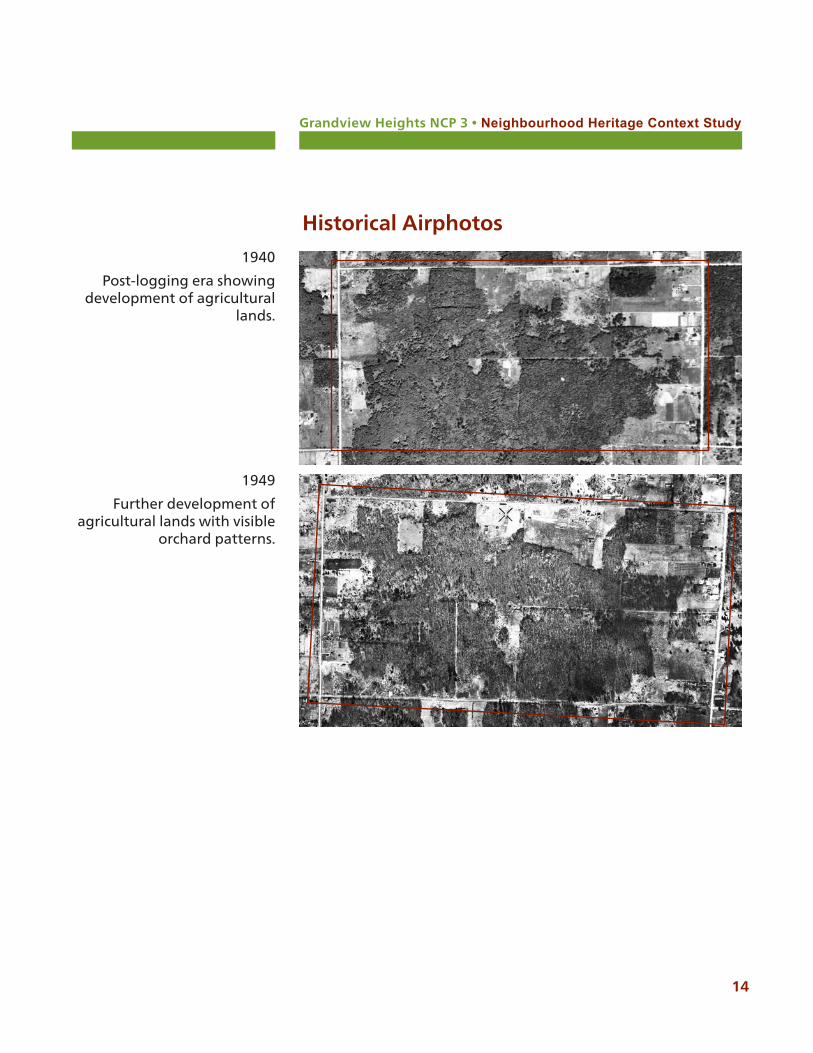
Historical Airphotos
1940
Post-logging era showing development of agricultural
lands.
1949
Further development of agricultural lands with visible
orchard patterns.
Grandview Heights NCP 3 • Neighbourhood Heritage Context Study
15
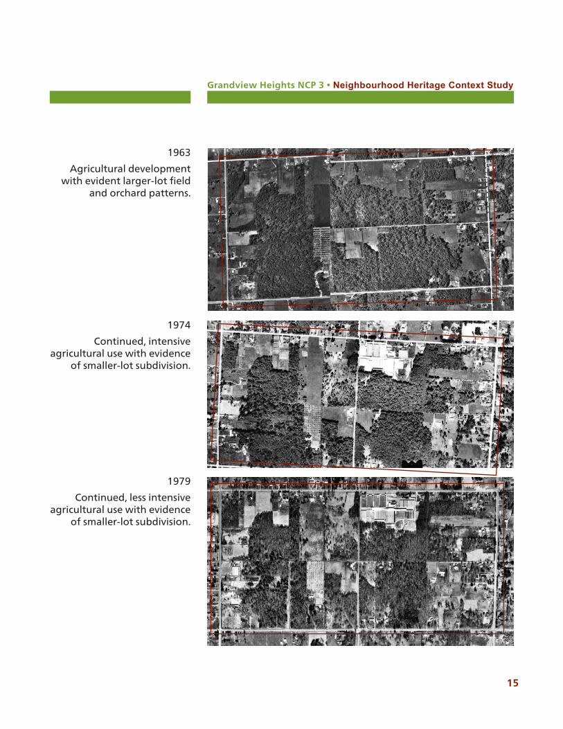
1974
Continued, intensive agricultural use with evidence
of smaller-lot subdivision.
1979
Continued, less intensive agricultural use with evidence
of smaller-lot subdivision.
1963
Agricultural development with evident larger-lot field
and orchard patterns.
Grandview Heights NCP 3 • Neighbourhood Heritage Context Study
16
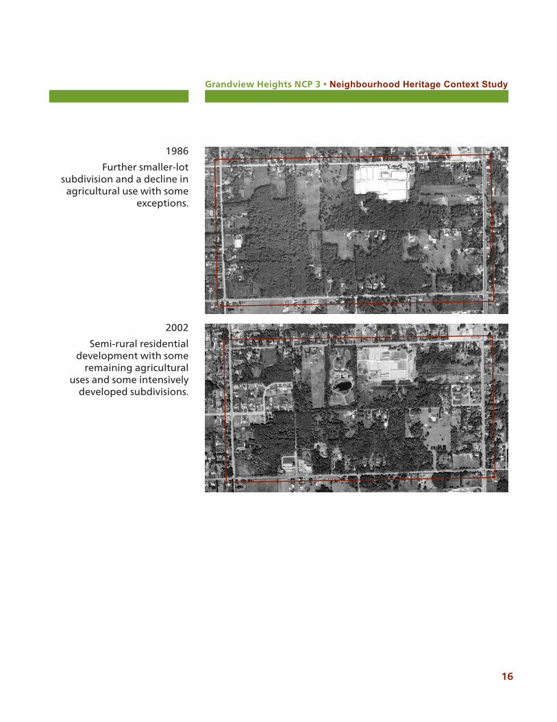
2002
Semi-rural residential development with some
remaining agricultural uses and some intensively
developed subdivisions.
1986
Further smaller-lot subdivision and a decline in
agricultural use with some exceptions.
Grandview Heights NCP 3 • Neighbourhood Heritage Context Study
17
3.0 Physical, Cultural and Heritage Values and FeaturesThe area encompassed by NCP #3 is part of the larger cultural landscape of the Grandview Heights area, and South Surrey as a whole. Analysing NCP #3 using techniques of a cultural landscape assessment process assists in understanding the remaining physical characteristics, both natural and cultural, that represent the past use of the land.
This is important when considering a more subtle view of cultural heritage in a place where more widely recognized or typical heritage features do not exist. This approach provides an opportunity to address heritage character in a way that can potentially be integrated into the neighbourhood plan, making it part of the area’s sense of place.
Heritage features can include context, built heritage, cultural landscape components and intangible elements.
3.1 Cultural values and features
The cultural values of Grandview Heights NCP 3 are found primarily in its past tradition use by the Semiahmoo, Katzie and Kwantlen First Nations, and their attachment to the regenerating forest and significant plants. It also continues to reflect the culture of a small-town farming community that has evolved into a distinct semi-rural neighbourhood that reflects it’s agricultural roots.
Summary of values and features:
• Archaeological and burial sites associated with the Semiahmoo First Nation that may be found outside the NCP #3 plan area
• Traditional use of the land by Semiahmoo, Kwantlen and Katzie First Nations
• Continuation of rural and agricultural traditions, including greenhouses, animal husbandry and horticultural practices
• Presence of Agricultural Land Reserve lands adjacent to the neighbourhood
• Semi-rural or suburban lifestyle and character• Darts Hill Garden Park is recognized as a long-standing
Heritage values are the aesthetic, historic,
scientific, cultural, social, educational or spiritual
values which are important to the community and for
past, present, and future generations.
Grandview Heights NCP 3 • Neighbourhood Heritage Context Study
18
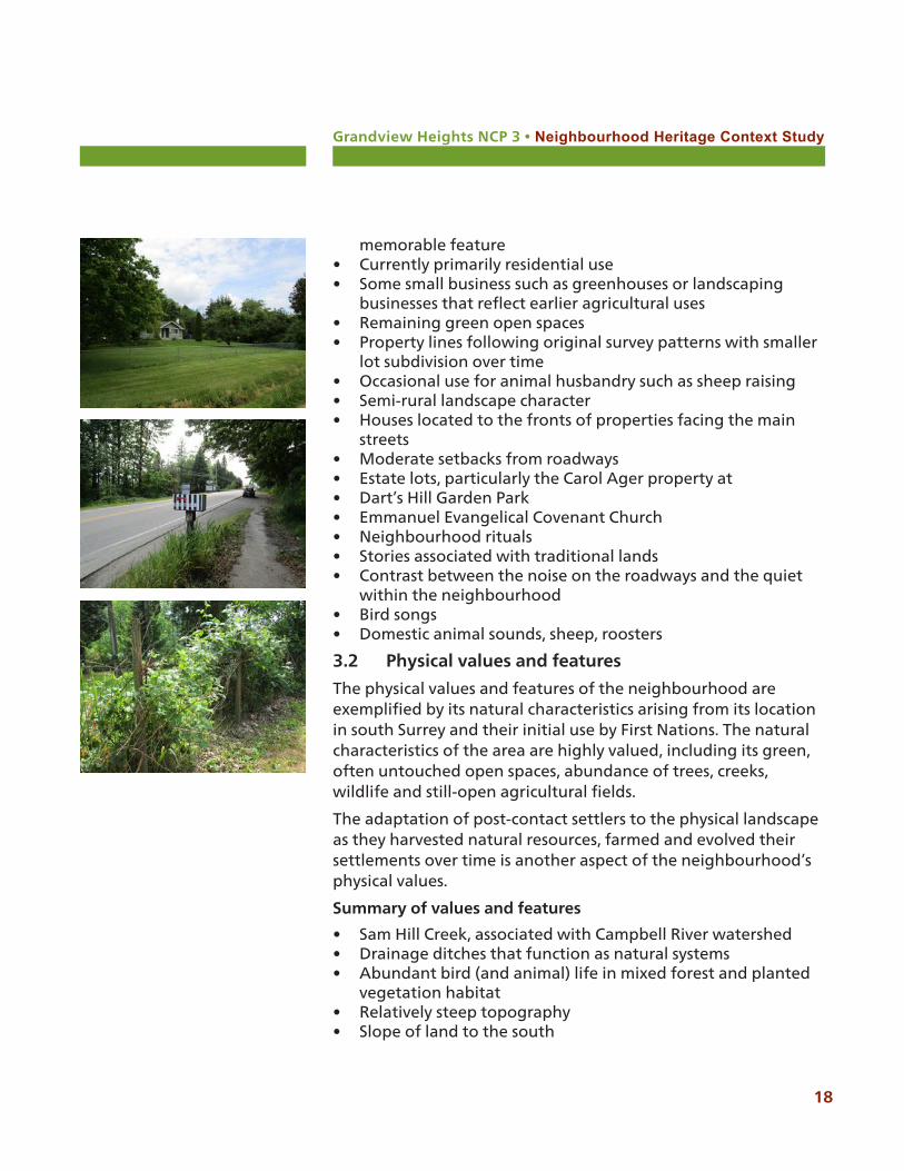
memorable feature• Currently primarily residential use• Some small business such as greenhouses or landscaping
businesses that reflect earlier agricultural uses• Remaining green open spaces• Property lines following original survey patterns with smaller
lot subdivision over time• Occasional use for animal husbandry such as sheep raising• Semi-rural landscape character• Houses located to the fronts of properties facing the main
streets• Moderate setbacks from roadways• Estate lots, particularly the Carol Ager property at • Dart’s Hill Garden Park• Emmanuel Evangelical Covenant Church• Neighbourhood rituals• Stories associated with traditional lands• Contrast between the noise on the roadways and the quiet
within the neighbourhood• Bird songs• Domestic animal sounds, sheep, roosters
3.2 Physical values and features
The physical values and features of the neighbourhood are exemplified by its natural characteristics arising from its location in south Surrey and their initial use by First Nations. The natural characteristics of the area are highly valued, including its green, often untouched open spaces, abundance of trees, creeks, wildlife and still-open agricultural fields.
The adaptation of post-contact settlers to the physical landscape as they harvested natural resources, farmed and evolved their settlements over time is another aspect of the neighbourhood’s physical values.
Summary of values and features
• Sam Hill Creek, associated with Campbell River watershed• Drainage ditches that function as natural systems• Abundant bird (and animal) life in mixed forest and planted
vegetation habitat• Relatively steep topography• Slope of land to the south
Grandview Heights NCP 3 • Neighbourhood Heritage Context Study
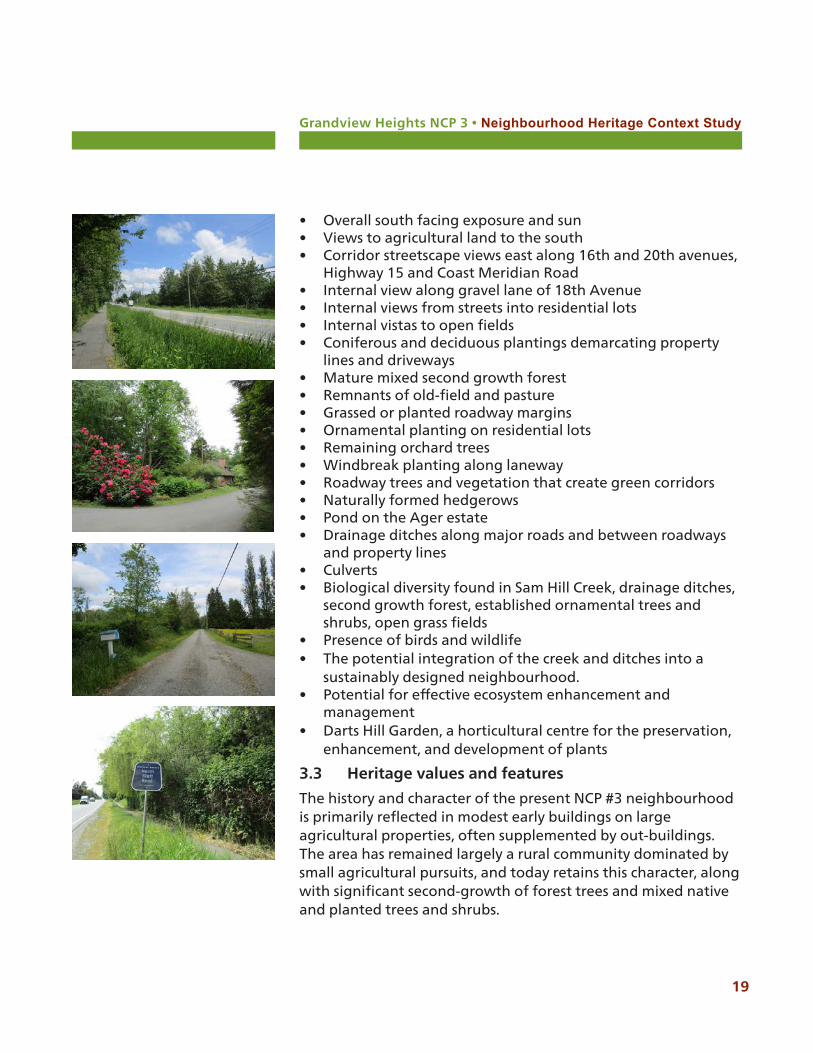
• Overall south facing exposure and sun• Views to agricultural land to the south• Corridor streetscape views east along 16th and 20th avenues,
Highway 15 and Coast Meridian Road• Internal view along gravel lane of 18th Avenue• Internal views from streets into residential lots• Internal vistas to open fields• Coniferous and deciduous plantings demarcating property
lines and driveways• Mature mixed second growth forest• Remnants of old-field and pasture• Grassed or planted roadway margins• Ornamental planting on residential lots• Remaining orchard trees• Windbreak planting along laneway• Roadway trees and vegetation that create green corridors• Naturally formed hedgerows• Pond on the Ager estate• Drainage ditches along major roads and between roadways
and property lines• Culverts• Biological diversity found in Sam Hill Creek, drainage ditches,
second growth forest, established ornamental trees and shrubs, open grass fields
• Presence of birds and wildlife• The potential integration of the creek and ditches into a
sustainably designed neighbourhood.• Potential for effective ecosystem enhancement and
management• Darts Hill Garden, a horticultural centre for the preservation,
enhancement, and development of plants
3.3 Heritage values and features
The history and character of the present NCP #3 neighbourhood is primarily reflected in modest early buildings on large agricultural properties, often supplemented by out-buildings. The area has remained largely a rural community dominated by small agricultural pursuits, and today retains this character, along with significant second-growth of forest trees and mixed native and planted trees and shrubs.
19
Grandview Heights NCP 3 • Neighbourhood Heritage Context Study
20
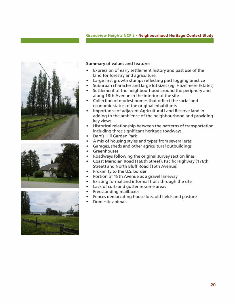
Summary of values and features
• Expression of early settlement history and past use of the land for forestry and agriculture
• Large first growth stumps reflecting past logging practice• Suburban character and large lot sizes (eg. Hazelmere Estates)• Settlement of the neighbourhood around the periphery and
along 18th Avenue in the interior of the site• Collection of modest homes that reflect the social and
economic status of the original inhabitants• Importance of adjacent Agricultural Land Reserve land in
adding to the ambience of the neighbourhood and providing key views
• Historical relationship between the patterns of transportation including three significant heritage roadways
• Dart’s Hill Garden Park• A mix of housing styles and types from several eras• Garages, sheds and other agricultural outbuildings• Greenhouses• Roadways following the original survey section lines• Coast Meridian Road (168th Street), Pacific Highway (176th
Street) and North Bluff Road (16th Avenue)• Proximity to the U.S. border• Portion of 18th Avenue as a gravel laneway• Existing formal and informal trails through the site • Lack of curb and gutter in some areas• Freestanding mailboxes• Fences demarcating house lots, old fields and pasture• Domestic animals
Grandview Heights NCP #3 • Neighbourhood Heritage Context Study
21
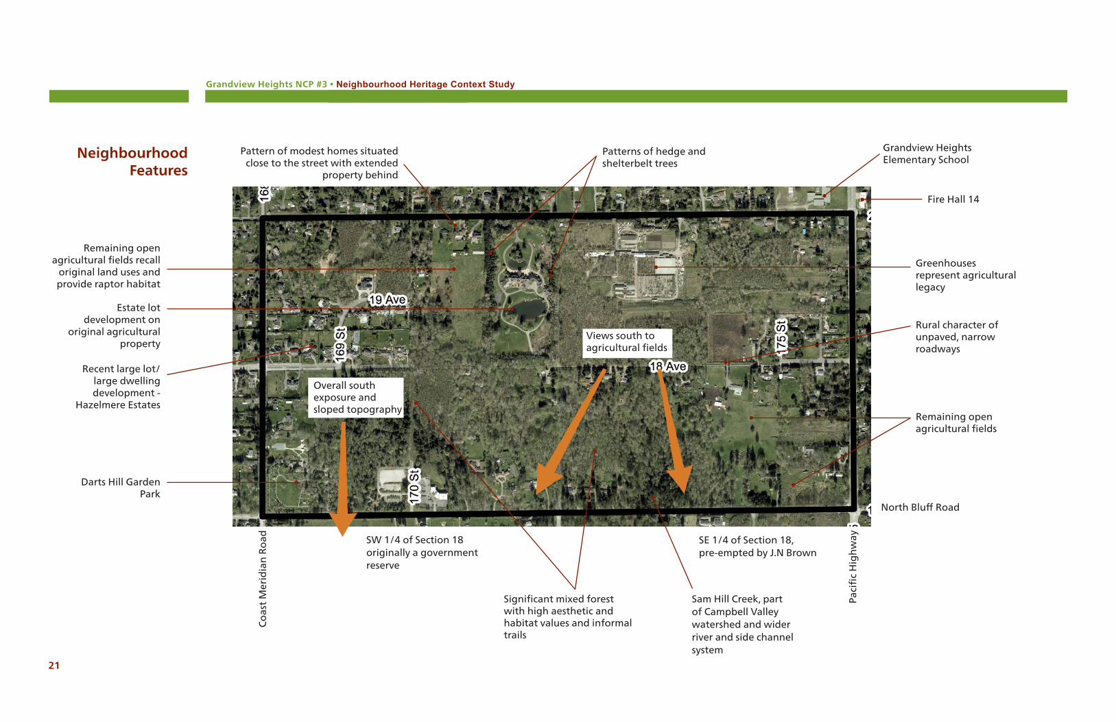
Neighbourhood Features
Paci
fic
Hig
hw
ay
Darts Hill Garden Park
Recent large lot/large dwelling development -
Hazelmere Estates
North Bluff Road
Fire Hall 14
Grandview Heights Elementary School
Patterns of hedge and shelterbelt trees
Remaining open agricultural fields
Rural character of unpaved, narrow roadways
Greenhouses represent agricultural legacy
Pattern of modest homes situated close to the street with extended
property behind
Remaining open agricultural fields recall
original land uses and provide raptor habitat
Estate lot development on
original agricultural property
Sam Hill Creek, part of Campbell Valley watershed and wider river and side channel system
Significant mixed forest with high aesthetic and habitat values and informal trails
Co
ast
Mer
idia
n R
oad SW 1/4 of Section 18
originally a government reserve
SE 1/4 of Section 18, pre-empted by J.N Brown
Views south to agricultural fields
Overall south exposure and sloped topography
Grandview Heights NCP 3 • Neighbourhood Heritage Context Study
22
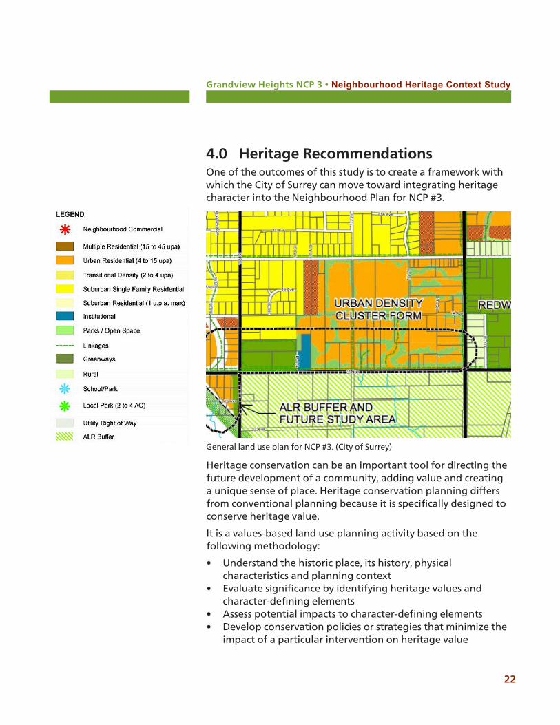
4.0 Heritage RecommendationsOne of the outcomes of this study is to create a framework with which the City of Surrey can move toward integrating heritage character into the Neighbourhood Plan for NCP #3.
General land use plan for NCP #3. (City of Surrey)
Heritage conservation can be an important tool for directing the future development of a community, adding value and creating a unique sense of place. Heritage conservation planning differs from conventional planning because it is specifically designed to conserve heritage value.
It is a values-based land use planning activity based on the following methodology:
• Understand the historic place, its history, physical characteristics and planning context
• Evaluate significance by identifying heritage values and character-defining elements
• Assess potential impacts to character-defining elements• Develop conservation policies or strategies that minimize the
impact of a particular intervention on heritage value
Grandview Heights NCP 3 • Neighbourhood Heritage Context Study
23
NCP #3, and no properties within it, are currently on Surrey’s heritage register and it does not have any other type of formal heritage recognition.
NCP #3 is not legally protected through designation, covenants, heritage revitalization agreements and it not part of a heritage conservation area. Sam Hill Creek has been identified for its ecological and fish habitat values while the southern half of NCP #3 has been identified as a significant habitat feature.
4.1 General recommendations
Consider the management of heritage values in the NCP #3 neighbourhood in part through the application of Development Permit Areas.
DP1, Form and Character, can be applied to draw from the identified heritage values and characteristics of NCP #3 to create unique neighbourhood spaces. DP2, Hazard Lands, directs development to respond sensitively to the sloped topography of the neighbourhood which is a physical heritage value. DP3, Sensitive Ecosystems, applies directly to Sam Hill Creek and riparian area vegetation in the neighbourhood’s ditches, as well as to green infrastructure and significant oldfield habitat areas. DP4, Farm Protection, provides buffers between development and agricultural areas, as well as acknowledging the agricultural heritage and traces in the NCP #3 neighbourhood.
Consider zoning as an effective planning tool for heritage conservation.
Examples include Heritage Revitalization Agreements, amenity contributions, and the creation of specific neighbourhood character areas.
Refer to the heritage-related objectives in Surrey’s Sustainability Charter to contribute to retaining neighbourhood character and heritage conservation in NCP #3.
Strategic directions for the built environment and neighbourhoods emphasize the provision of public amenities such as water fountains, public art and benches that can be designed as interpretive or commemorative features.
The integration of natural areas, ecosystems, and green

Grandview Heights NCP 3 • Neighbourhood Heritage Context Study
24
areas in NCP #3 is consistent with what is valued about the neighbourhood, including an abundance of trees, natural and manmade waters and untouched areas. The strategies promote placemaking which is fully conducive to education and communication about heritage values, while transportation networks, such as roadways and trails, can be designed to have a heritage character and be part of a key pedestrian network.
Biodiversity conservation can be part of the management of valued natural areas, oldfield raptor habitat and urban forests on both public and private lands in NCP #3.
The culture and community heritage of NCP #3 can be celebrated through the provision of public, and the potential use of private, places for festivals, programming and events, its natural and built heritage, and public art that interprets, commemorates and communicates the heritage values of the neighbourhood.
Consult the Standards and Guidelines for the Conservation of Historic Places in Canada1 as guidance for heritage conservation and development in NCP #3.
For broader-scale neighbourhood planning purposes, the General Standards for Preservation, Rehabilitation and Restoration, Standards 1-9, may be consulted. Also useful for general neighbourhood planning guidance is Section 4.1, Guidelines for Cultural Landscapes Including Heritage Districts.
Work closely with Surrey Parks during the development of the NCP #3 neighbourhood.
Trails, open space, park design and vegetation management can be developed for the neighbourhood using identified values and heritage characteristics as inspiration for design elements that reflect heritage character.
As a few examples, this could include the retention or planting of shelterbelt tree patterns, the location and character of pedestrian trails, open spaces that reflect agricultural fields, planting based on First Nations’ identification of medicinal or cultural plants, use of historical materials, or the design of small-scale elements such as fences.
1 http://www.historicplaces.ca/en/pages/standards-normes
Grandview Heights NCP 3 • Neighbourhood Heritage Context Study
25
Refer to Part 15 of the Local Government Act, the key legislation that guides local government actions relating to heritage conservation and provides tools for its use.
Consider planning relaxations in exchange for voluntary conservation on private lands. For example, the City might offer bonus density to a developer in return for conserving any identified heritage feature, based on the principle that the added value of the bonus density is done as compensation for the added cost of the conservation initiative.
Develop place-appropriate design guidelines.
Following best-practice, design guidelines should be values-based, relatively non-prescriptive and accessible as a means to promote appropriate planning and design in the NCP #3 neighbourhood on both public and private lands.
Grandview Heights NCP 3 • Neighbourhood Heritage Context Study
26
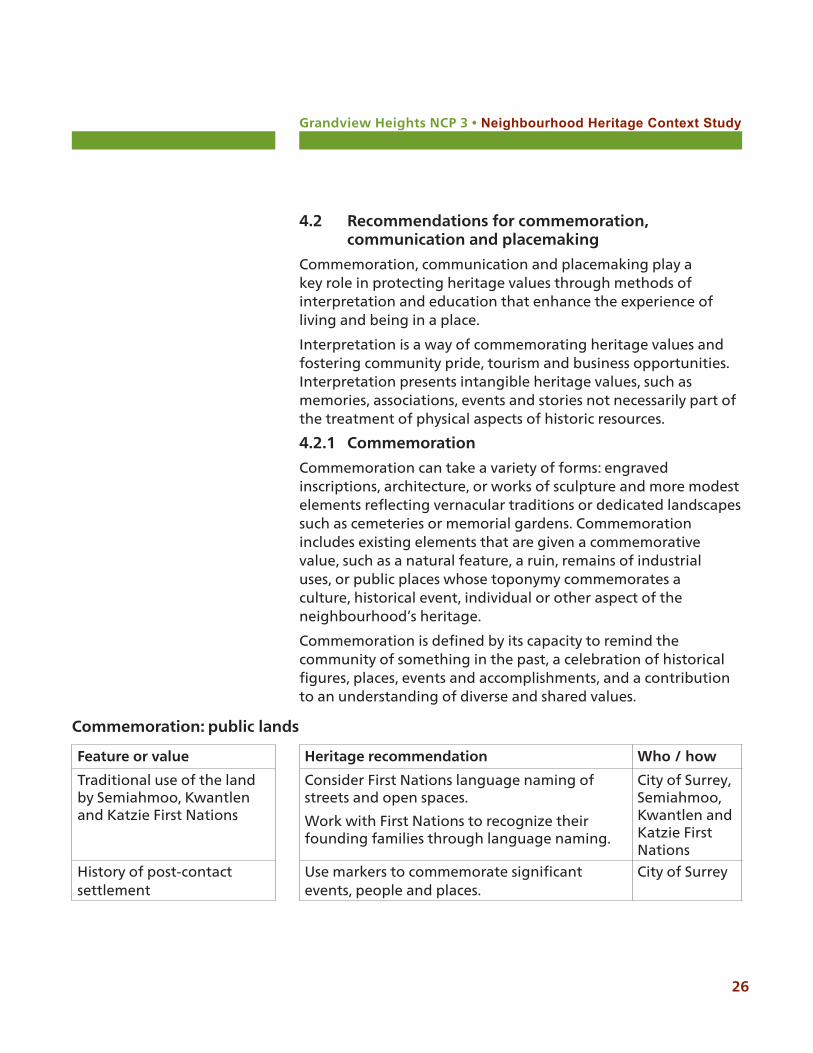
Feature or value Heritage recommendation Who / how
Traditional use of the land by Semiahmoo, Kwantlen and Katzie First Nations
Consider First Nations language naming of streets and open spaces.
Work with First Nations to recognize their founding families through language naming.
City of Surrey, Semiahmoo, Kwantlen and Katzie First Nations
History of post-contact settlement
Use markers to commemorate significant events, people and places.
City of Surrey
Commemoration: public lands
4.2 Recommendations for commemoration, communication and placemaking
Commemoration, communication and placemaking play a key role in protecting heritage values through methods of interpretation and education that enhance the experience of living and being in a place.
Interpretation is a way of commemorating heritage values and fostering community pride, tourism and business opportunities. Interpretation presents intangible heritage values, such as memories, associations, events and stories not necessarily part of the treatment of physical aspects of historic resources.
4.2.1 Commemoration
Commemoration can take a variety of forms: engraved inscriptions, architecture, or works of sculpture and more modest elements reflecting vernacular traditions or dedicated landscapes such as cemeteries or memorial gardens. Commemoration includes existing elements that are given a commemorative value, such as a natural feature, a ruin, remains of industrial uses, or public places whose toponymy commemorates a culture, historical event, individual or other aspect of the neighbourhood’s heritage.
Commemoration is defined by its capacity to remind the community of something in the past, a celebration of historical figures, places, events and accomplishments, and a contribution to an understanding of diverse and shared values.
Grandview Heights NCP 3 • Neighbourhood Heritage Context Study
27
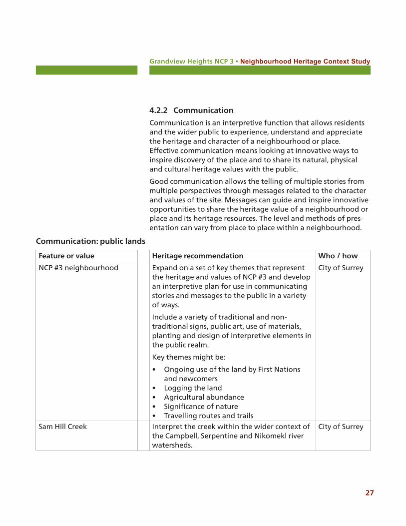
4.2.2 Communication
Communication is an interpretive function that allows residents and the wider public to experience, understand and appreciate the heritage and character of a neighbourhood or place. Effective communication means looking at innovative ways to inspire discovery of the place and to share its natural, physical and cultural heritage values with the public.
Good communication allows the telling of multiple stories from multiple perspectives through messages related to the character and values of the site. Messages can guide and inspire innovative opportunities to share the heritage value of a neighbourhood or place and its heritage resources. The level and methods of pres-entation can vary from place to place within a neighbourhood.
Feature or value Heritage recommendation Who / how
NCP #3 neighbourhood Expand on a set of key themes that represent the heritage and values of NCP #3 and develop an interpretive plan for use in communicating stories and messages to the public in a variety of ways.
Include a variety of traditional and non-traditional signs, public art, use of materials, planting and design of interpretive elements in the public realm.
Key themes might be:
• Ongoing use of the land by First Nations and newcomers
• Logging the land• Agricultural abundance• Significance of nature• Travelling routes and trails
City of Surrey
Sam Hill Creek Interpret the creek within the wider context of the Campbell, Serpentine and Nikomekl river watersheds.
City of Surrey
Communication: public lands
Grandview Heights NCP 3 • Neighbourhood Heritage Context Study
28
Feature or value Heritage recommendation Who / how
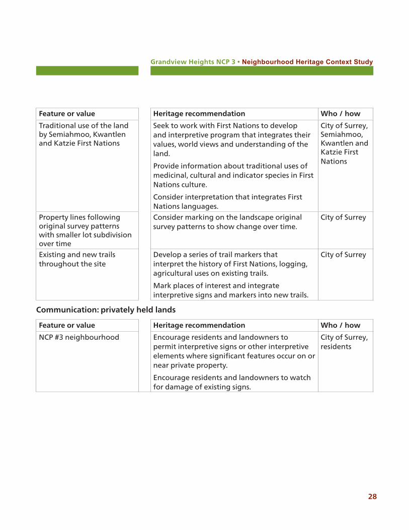
NCP #3 neighbourhood Encourage residents and landowners to permit interpretive signs or other interpretive elements where significant features occur on or near private property.
Encourage residents and landowners to watch for damage of existing signs.
City of Surrey, residents
Communication: privately held lands
Feature or value Heritage recommendation Who / how
Traditional use of the land by Semiahmoo, Kwantlen and Katzie First Nations
Seek to work with First Nations to develop and interpretive program that integrates their values, world views and understanding of the land.
Provide information about traditional uses of medicinal, cultural and indicator species in First Nations culture.
Consider interpretation that integrates First Nations languages.
City of Surrey, Semiahmoo, Kwantlen and Katzie First Nations
Property lines following original survey patterns with smaller lot subdivision over time
Consider marking on the landscape original survey patterns to show change over time.
City of Surrey
Existing and new trails throughout the site
Develop a series of trail markers that interpret the history of First Nations, logging, agricultural uses on existing trails.
Mark places of interest and integrate interpretive signs and markers into new trails.
City of Surrey
Grandview Heights NCP 3 • Neighbourhood Heritage Context Study
29
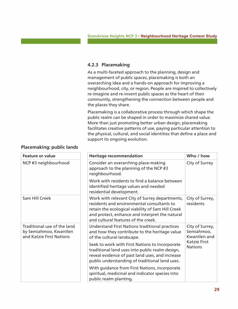
4.2.3 Placemaking
As a multi-faceted approach to the planning, design and management of public spaces, placemaking is both an overarching idea and a hands-on approach for improving a neighbourhood, city, or region. People are inspired to collectively re-imagine and re-invent public spaces as the heart of their community, strengthening the connection between people and the places they share.
Placemaking is a collaborative process through which shape the public realm can be shaped in order to maximize shared value. More than just promoting better urban design, placemaking facilitates creative patterns of use, paying particular attention to the physical, cultural, and social identities that define a place and support its ongoing evolution.
Feature or value Heritage recommendation Who / how
NCP #3 neighbourhood Consider an overarching place-making approach to the planning of the NCP #3 neighbourhood.
Work with residents to find a balance between identified heritage values and needed residential development.
City of Surrey
Sam Hill Creek Work with relevant City of Surrey departments, residents and environmental consultants to retain the ecological viability of Sam Hill Creek and protect, enhance and interpret the natural and cultural features of the creek.
City of Surrey, residents
Traditional use of the land by Semiahmoo, Kwantlen and Katzie First Nations
Understand First Nations traditional practices and how they contribute to the heritage value of the cultural landscape.
Seek to work with First Nations to incorporate traditional land uses into public realm design, reveal evidence of past land uses, and increase public understanding of traditional land uses.
With guidance from First Nations, incorporate spiritual, medicinal and indicator species into public realm planting.
City of Surrey, Semiahmoo, Kwantlen and Katzie First Nations
Placemaking: public lands
Grandview Heights NCP 3 • Neighbourhood Heritage Context Study
30
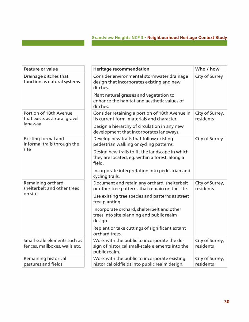
Feature or value Heritage recommendation Who / how
Drainage ditches that function as natural systems
Consider environmental stormwater drainage design that incorporates existing and new ditches.
Plant natural grasses and vegetation to enhance the habitat and aesthetic values of ditches.
City of Surrey
Portion of 18th Avenue that exists as a rural gravel laneway
Consider retaining a portion of 18th Avenue in its current form, materials and character.
Design a hierarchy of circulation in any new development that incorporates laneways.
City of Surrey, residents
Existing formal and informal trails through the site
Develop new trails that follow existing pedestrian walking or cycling patterns.
Design new trails to fit the landscape in which they are located, eg. within a forest, along a field.
Incorporate interpretation into pedestrian and cycling trails.
City of Surrey
Remaining orchard, shelterbelt and other trees on site
Document and retain any orchard, shelterbelt or other tree patterns that remain on the site.
Use existing tree species and patterns as street tree planting.
Incorporate orchard, shelterbelt and other trees into site planning and public realm design.
Replant or take cuttings of significant extant orchard trees.
City of Surrey, residents
Small-scale elements such as fences, mailboxes, walls etc.
Work with the public to incorporate the de-sign of historical small-scale elements into the public realm.
City of Surrey, residents
Remaining historical pastures and fields
Work with the public to incorporate existing historical oldfields into public realm design.
City of Surrey, residents

Grandview Heights NCP 3 • Neighbourhood Heritage Context Study
31
Feature or value Heritage recommendation Who / how
Relatively steep topography with slope of land to the south
Retain the topography of the site by integrating new development and design to fit the slopes, rather than vice versa.
City of Surrey, development community
Sam Hill Creek Provide education and encourage landowners and residents to respect setbacks and integrate native planting where the creek crosses private property.
Ensure environmentally sound integration of the creek into site and residential design.
City of Surrey, residents, development community
A mix of housing styles and types from several eras
Consider heritage incentives to developers to retain selected small-scale or character build-ings for use as public amenities (arts amenity, daycare) and explore other potential uses.
City of Surrey, development community
Any remaining orchard, shelterbelt and other trees on site
Encourage the retention of existing orchard, shelterbelt and other trees on private property.
City of Surrey, development community, residents
Remaining historical pastures and fields
Consider working with residents to allow the use of historical pastures and fields for community events and celebrations.
City of Surrey, residents
Placemaking: privately held lands
Grandview Heights NCP 3 • Neighbourhood Heritage Context Study
32
Appendix A: Research Sources
City of Surrey. Grandview Heights NCP Area #3 Public Open House. November 23, 2016 Comment Sheet Summary
City of Surrey. Official Community Plan. 2013.
City of Victoria Planning and Development Department. Design Guidelines: Old Town, Victoria, B.C. Victoria: 2006.
Commonwealth Historic Resource Management. Grandview Heights NCP #2 (and NCP #1) Heritage Assessment. City of Surrey, 2006.
District of Surrey. Drainage Report. October 1963.
Felker, Andy and Nora Felker. Lower Fraser Valley Then and Now. Richmond BC: 2011.
Grandview Heights General Land Use Plan. City of Surrey, 2005.
Hayes, Derek. Historical Atlas of Vancouver and the Lower Fraser Valley. Vancouver: Douglas & McIntyre, 2005.
HB Lanarc and Raincoast. City of Surrey Ecosystem Management Study. 2011.
Henderson’s BC Directory 1890-1970.
International Council on Monuments and Sites. The Heritage of Commemoration. 2014.
Donald Luxton & Associates. Grandview Heights Heritage Study. City of Surrey, 2005.
Miller, Bruce Granville. Be of Good Mind: Essays on the Coast Salish. Vancouver: UBC Press, 2007.
Orchard, Imbert. Growing Up in the Valley: A Pioneer Childhood in the Lower Fraser Valley. Victoria: Provincial Archives of BC, 1983.
Parks Canada Agency. Cultural Resource Management Policy. Ottawa: 2013.
Parks Canada Agency. Standards and Guidelines for the Conservation of Historic Places in Canada. Ottawa: 2012.
Pearson, John. Land of the Peace Arch. Cloverdale: Surrey Centennial Committee, 1958.
Province of British Columbia. Year Book of British Columbia and Manual of Provincial Information. Victoria: 1897.
Grandview Heights NCP 3 • Neighbourhood Heritage Context Study
33
Sixth Report of the Department of Agriculture of the Province of British Columbia. Victoria: King’s Printer, 1901.
Stewart, Margaret M. Early History of Hall’s Prairie. Surrey Archives, no date.
“Story of timber has been Surrey’s story.” Surrey Leader, Thursday April 28, 1966.
Surrey Historical Society. Looking Back at Surrey. Surrey BC: Tannis Printing Ltd.
Surrey History accessed at http://members.shaw.ca/jack_brown/
Surrey Museum and Archives pre-emption maps 1858, 1897, 1910.
Surrey Museum and Archives research files.
Surrey Leader newspaper.
Surrey Year Book, 1953, 1955, 1956, 1960.
Suttles, Wayne P. The Economic Life of the Coast Salish of Haro and Rosario Straits. New York: Garland Publishing Inc. 1974.
Treleaven, Fern G. The Surrey Story. Surrey: Surrey Museum and Historical Society, 1978.
Treleaven, Fern G. Rivers, Roads and Railways: 100 Years of Transportation in Surrey. Surrey: Surrey Museum and Historical Society, 1981.
Whiteside, Richard V. Surrey Pioneers. Vancouver: Evergreen Press, 1974.
Williams BC Gazeteer and Directory 1892 - 1970.
Wrigley’s BC Directory 1890-1970.
Grandview Heights NCP 3 • Neighbourhood Heritage Context Study
34
Appendix B: Glossary of Terms
The following definitions may be useful when integrating heritage and cultural landscape features into the neighbourhood plan.
ConservationAll actions or processes that are aimed at safeguarding the character-defining elements of a cultural resource so as to retain its heritage value and extend its physical life. This may involve preservation, rehabilitation, restoration, or a combination of these actions or processes Reconstruction of a disappeared cultural resource is not considered conservation.
Cultural LandscapeThe World Heritage Committee has identified cultural landscapes as geographical areas or properties uniquely representing the combined work of nature and of man. The three categories extracted from the Committee’s Operational Guidelines, are as follows:
1. A landscape designed and created intentionally by man2. An organically evolved landscape which may be a relict (or
fossil) landscape or a continuing landscape3. An associative cultural landscape which may be valued
because of the religious, artistic or cultural associations of the natural element
Heritage CharacterThe heritage character of a place is comprised of all valued heritage features which give that place its distinctive quality, appearance and sense of place that distinguishes it from other places.
Heritage ResourceA heritage resource can be a structure, building, group of build-ings, district, landscape, artifact, archaeological site, or other place or feature that is recognized as having heritage value, con-tributing to the historical significance of the place.
Heritage ValueHeritage value is what a community recognizes as significant about its history. Heritage value statements answer the question

Grandview Heights NCP 3 • Neighbourhood Heritage Context Study
35
“why is this important to our heritage?” by identifying aesthetic, historic, scientific, cultural, social, educational or spiritual values which are important for past, present, and future generations. The heritage value of a historic place is embodied in its character-defining materials, forms, location, spatial configurations, uses and cultural associations or meanings. Identifying heritage values can ensure the appropriate conservation of a place, which in turn protects its heritage character.
Historic placeA structure, building, group of buildings, district, landscape, archaeological site, sacred site, or other place in Canada that has been formally recognized for its heritage value. In defining historic places, it is acknowledged that most newcomer heritage sites are regarded as such because people’s activities made them so, while First Nations sacred sites are regarded as such because they are believed to have been created by powerful spirit forces.
Landscape CharacteristicsThe processes and physical forms that characterize the appearance of a landscape. They are the tangible and intangible characteristics of the landscape that individually and collectively give a landscape character and aid in understanding its cultural values and the historic and current uses of the land.
Grandview Heights NCP 3 • Neighbourhood Heritage Context Study
36
Appendix C: Community Questionnaire
The following list of questions was prepared for consideration by the community to better understand the NCP #3 neighbourhood.
1. What do you consider to be the natural, cultural, spiritual or historical importance or significance of Grandview Heights NCP #3?
2. What are some of the intangible aspects, such as rituals, events, community memory, oral traditions, ceremonial places etc.?
3. What aspects of the neighbourhood do you particularly value? Why do you value them?
4. How does the culture or history of the neighbourhood connect to the bigger picture of traditional lands, the City or region?
5. Are there aspects of the neighbourhood that you would like to see changed?
6. What are some of the significant features of NCP #3, and that contribute to the character of the neighbourhood? Where are they located?
7. What are some of the important stories or themes that should be included in this historical context and woven into the neighbourhood plan? How can these stories best be told?
8. What are some of the challenges you see about development or change in the neighbourhood?
9. What are some ideas about how cultural and natural heritage could be integrated into neighbourhood planning?


![Bayside Neighbourhood Character ReviewAugust 2004...Bayside Neighbourhood Character Review 2004 [ Brief and Method ] 3 1.1 Brief The City of Bayside has undertaken a number of heritage,](https://static.documents.pub/doc/80x56/5fffa41c1fce0510b565e6cc/bayside-neighbourhood-character-reviewaugust-2004-bayside-neighbourhood-character.jpg)


