22
Grandview Heights NCP 4 • Neighbourhood Heritage Context Study Grandview Heights NCP 4 Neighbourhood Heritage Context Study 30 May 2011
Grandview Heights NCP 4 • Neighbourhood Heritage Context Study
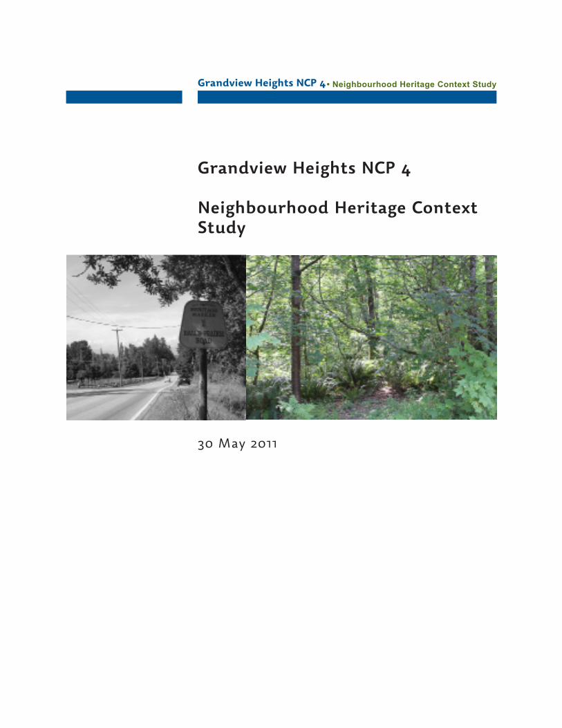
Grandview Heights NCP 4
Neighbourhood Heritage Context Study
30 May 2011
Grandview Heights NCP 4 • Neighbourhood Heritage Context Study
1
Part 1 Neighbourhood Context
1.1 Study Overview . . . . . 2
1.2 Definitions . . . . . 3
1.3 Natural, Historical and Cultural Context . . 5
1.4 Key Themes . . . . . 13
Part 2 Cultural Landscape Assessment
2.1 Cultural Landscape Characteristics . . 14
2.2 Community Heritage Values . . . 16
2.3 Map . . . . . . 19
Part 3 Using the Heritage Context Study
3.1 Integrating Heritage . . . 20
References . . . . . . 21
Denise Cook Design
764 Donegal Place
North Vancouver, B.C.
V7N 2X7
604.626.2710
Table of Contents
Grandview Heights NCP 4 • Neighbourhood Heritage Context Study
2
Study Overview
Every neighbourhood has a history. NCP 4 shares a natural and cultural heritage with the other adjacent neighbourhoods of Grandview Heights, encompassing stories and structures from the natural environment, settlement, resource extraction and business activities over the past century. This report identifies and recognizes a range of cultural landscape heritage resources and values in the NCP 4 portion of Grandview Heights.
This neighbourhood heritage context study identifies the major factors and processes that have influenced the community’s evolution using an historical context statement and thematic framework specific to the area. This identification and synthesis of historical patterns and themes will enable the community to articulate its heritage values and identify heritage features in the neighbourhood that could be integrated into the neighbourhood planning process.
The goal of this study is not so much to re-present history that is already known, but to effectively synthesize historical facts and stories with heritage values to ensure the retention of some of the historical character and value of the place within the neighbourhood plan.
The study will:
Provide background for the Neighbourhood Community Plan•Evaluate community heritage values to facilitate the identification •of key resources that contribute to the neighbourhood’s sense of placeAssist the community in identifying a heritage conservation vision•Identify buildings, structures, cultural landscapes and heritage areas •that contribute to the area’s heritageBriefly identify next steps that will enable the community to manage •change while enabling the conservation of the area’s heritage character.Prepare for ongoing heritage conservation activities in the •neighbourhoodPrepare a community development plan that builds sensitively and •sustainably on local heritage and community character
Neighbourhood Context
1: Neighbourhood Context
Grandview Heights NCP 4 • Neighbourhood Heritage Context Study
3
Definitions
The following definitions may be useful when integrating heritage and cultural landscape features into the neighbourhood plan.
ConservationAll actions or processes that are aimed at safeguarding the character-defining elements of a cultural resource so as to retain its heritage value and extend its physical life. This may involve preservation, rehabilitation, restoration, or a combination of these actions or processes Reconstruction of a disappeared cultural resource is not considered conservation.
Cultural LandscapeThe World Heritage Committee has identified cultural landscapes as geographical areas or properties uniquely representing the combined work of nature and of man. The three categories extracted from the Committee’s Operational Guidelines, are as follows:
(i) a landscape designed and created intentionally by man
(ii) an organically evolved landscape which may be a relict (or fossil) landscape or a continuing landscape
(iii) an associative cultural landscape which may be valued because of the religious, artistic or cultural associations of the natural element
Culturally Modified Tree SiteA tree or remnant of a tree associated with old growth forests which bears evidence of traditional aboriginal or non-aboriginal forest use. Examples: bark-stripped cedar, cedar trees with evidence of plank removal, survey blazes, plank notches, logging evidence, etc.
Heritage CharacterThe heritage character of a place is comprised of all valued heritagefeatures which give that place its distinctive quality, appearance andsense of place that distinguishes it from other places.
Heritage ResourceA heritage resource can be a structure, building, group of buildings,district, landscape, artifact, archaeological site, or other place or feature that is recognized as having heritage value, contributing to the historical significance of the place.
Neighbourhood Context
Grandview Heights NCP 4 • Neighbourhood Heritage Context Study
4
Heritage ValueHeritage value is what a community recognizes as significant about its history. Heritage value statements answer the question “why is this important to our heritage?” by identifying aesthetic, historic, scientific, cultural, social, educational or spiritual values which are important for past, present, and future generations. The heritage value of a historic place is embodied in its character-defining materials, forms, location, spatial configurations, uses and cultural associations or meanings. Identifying heritage values can ensure the appropriate conservation of a place, which in turn protects its heritage character.
Historic placeA structure, building, group of buildings, district, landscape, archaeological site, sacred site, or other place in Canada that has been formally recognized for its heritage value. In defining historic places, it is acknowledged that most newcomer heritage sites are regarded as such because people’s activities made them so, while First Nations sacred sites are regarded as such because they are believed to have been created by powerful spirit forces.
Landscape CharacteristicsThe processes and physical forms that characterize the appearance of a landscape. They are the tangible and intangible characteristics of the landscape that individually and collectively give a landscape character and aid in understanding its cultural values and the historic and current uses of the land.
Neighbourhood Context
Grandview Heights NCP 4 • Neighbourhood Heritage Context Study
5
Natural, Historical and Cultural Context
Beginnings
The interior of Surrey was sculptured and is drained by the Nicomekl and Serpentine Rivers, and the Campbell River to the south. Along most of their courses the rivers meander across the floor of flat to very gently undulating valleys from 1 1/2 to 3 1/2 miles wide. These valleys are former embayments of the sea. The main valleys of the Nicomekl and Serpentine vary in elevation from about 5 to 30 feet above sea-level. The valley of the lower Campbell is from about 25 feet to 75 feet above sea-level.
The three rivers meandering through the lowlands were affected by tides for most of their length. Where periodic flooding occurred, from combinations of high runoff and high tides, mainly treeless or lightly wooded areas occurred which are now referred to as Hall’s Prairie, Kensington Prairie, and Langley Prairie.
NCP 4 is located in an area of Surrey called the Campbell Upland which gives the neighbourhood its distinct topography.
These were more open areas, with scattered groves of spruce and hemlock, intermixed with cedar, alder and birch. Grassy areas, usually fairly swampy, were intermixed with heavy underbrush of hard hack, willow, crab-apple, and a variety of shrubs and reeds.
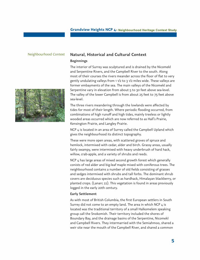
NCP 4 has large areas of mixed second growth forest which generally conists of red alder and big-leaf maple mixed with coniferous trees. The neighbourhood contains a number of old fields consisting of grasses and sedges intermixed with shrubs and tall forbs. The dominant shrub covers are deciduous species such as hardhack, Himalayan blackberry, or planted crops. (Lanarc 22). This vegetation is found in areas previously logged in the early 20th century.
Early Settlement
As with most of British Columbia, the first European settlers in South Surrey did not come to an empty land. The area in which NCP 4 is located was the traditional territory of a small Halkomelem speaking group call the Snokomish. Their territory included the shores of Boundary Bay, and the drainage basins of the Serpentine, Nicomekl and Campbell Rivers. They intermarried with the Semiahmoo, shared a weir site near the mouth of the Campbell River, and shared a common
Neighbourhood Context
Grandview Heights NCP 4 • Neighbourhood Heritage Context Study
6
hunting territory. This was perhaps stimulated by trade with Fort Langley as the trade route went through Snokomish territory. Shortly before 1850 the Snokomish were almost entirely wiped out by a smallpox epidemic.
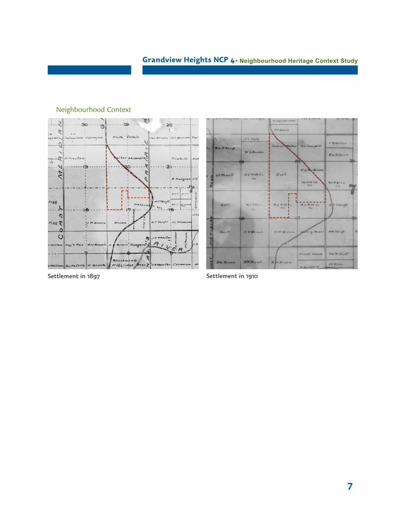
NCP 4 is contained within Sections 17 and 20 of Township 7. The survey was based on the The Coast Meridian which was defined by the meridian of longitude closest to the Pacific coast at the 49th parallel.
The settlement of Grandview Heights began with David Brown, who arrived in Surrey from Ontario via Iowa, San Francisco and Victoria in 1878 and took up residence at the corner of the Clover Valley and North Bluff Roads (176th and 16th). Brown became the postmaster for Hall’s Prairie at an annual salary of $25.
Pre-emptions in place in in 1910 in NCP 4 include:
Samuel Walker NW 1/4 Section 20
R.H. Campbell NE 1/4 Section 20
George Nelson/Royal City Planing Mills SE 1/4 Section 20
Government Reserve SW 1/4 Section 20
Royal City Planing Mills N 1/2 Section 17
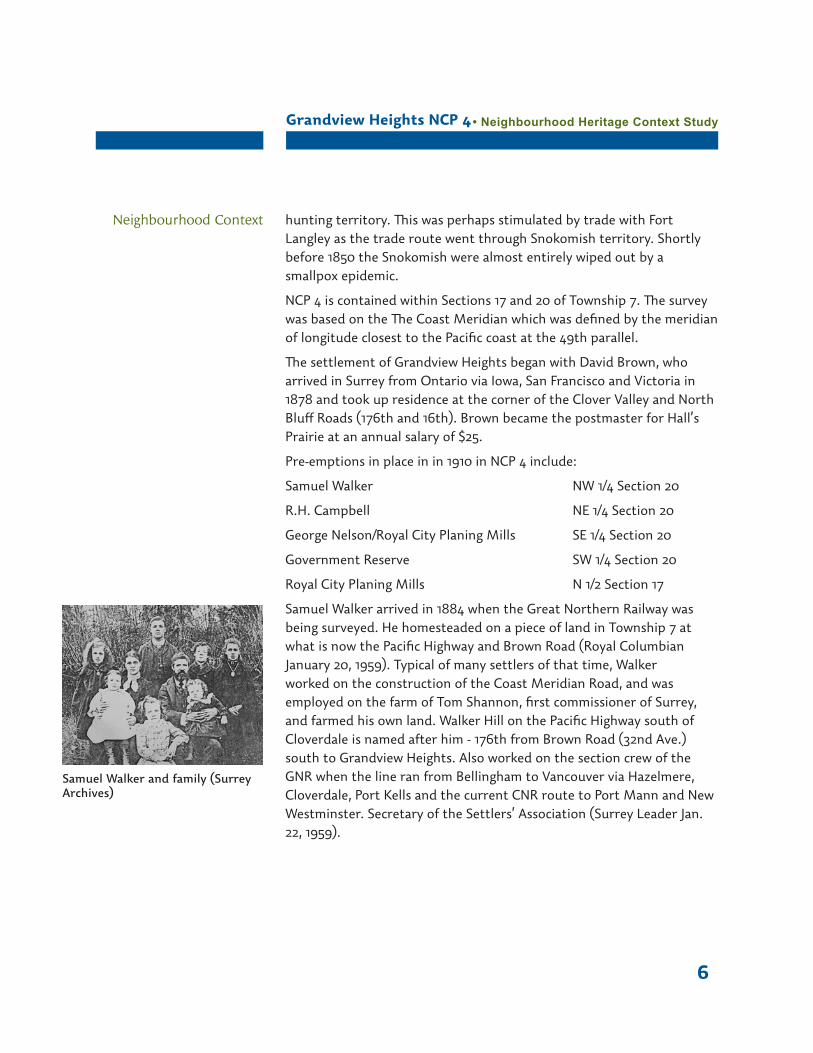
Samuel Walker arrived in 1884 when the Great Northern Railway was being surveyed. He homesteaded on a piece of land in Township 7 at what is now the Pacific Highway and Brown Road (Royal Columbian January 20, 1959). Typical of many settlers of that time, Walker worked on the construction of the Coast Meridian Road, and was employed on the farm of Tom Shannon, first commissioner of Surrey, and farmed his own land. Walker Hill on the Pacific Highway south of Cloverdale is named after him - 176th from Brown Road (32nd Ave.) south to Grandview Heights. Also worked on the section crew of the GNR when the line ran from Bellingham to Vancouver via Hazelmere, Cloverdale, Port Kells and the current CNR route to Port Mann and New Westminster. Secretary of the Settlers’ Association (Surrey Leader Jan. 22, 1959).
Neighbourhood Context
Samuel Walker and family (Surrey Archives)
Grandview Heights NCP 4 • Neighbourhood Heritage Context Study
7
Neighbourhood Context
Settlement in 1897 Settlement in 1910
Grandview Heights NCP 4 • Neighbourhood Heritage Context Study
8
Using the Land
The Royal City Planing Mills owned three quarter-sections of NCP 4 in 1910, an indication of the importance of the area for timber supply
The Royal City Planing Mills established an operation east of Elgin near the Nicomekl River to log the areas south of Kensington Prairie. In 1886, a logging railway was built east through Grandview Heights. When the New Westminster and Southern Railway was completed in 1891, the logging railway was extended to join it at the bend east of the Hall’s Prairie Road.
The Royal City Planing Mills, Brunette Mills, and later the Campbell River Timber Company all operated in the area, the last as late as 1927.
As the timber was depleted and the area cleared for settlement, farming began in earnest in the Grandview Heights area. The Pacific Coast Highway or Pacific Highway, opened South Surrey up to small-agricultural and non-agricultural residential settlement in the 1920s. Quarter sections were subdivided into holdings of only a few acres. Some of these small farms are still in evidence today.
Grandview Heights NCP 4 is located adjacent to a portion of Surrey protected within the Agricultural Land Reserve.
The Surrey Co-operative was formed nearby in Cloverdale. The Co-op started in 1919 when a group of local farmers got together and bought a carload of grain for livestock feed because purchasing it individually was too costly - buying co-operatively was more cost effective. The Surrey Co-op became the largest agricultural co-op in Canada. It operated one of the largest feed manufacturing plants in BC in 1957, ran a gas station, lumberyards and a shopping mall, Cloverdale Square. (Whalley Herald Aug. 7 1957). No members outside a radius of 12 miles were allowed to join. (Country Guide Magazine, April 1947). The business disbanded 1985.
Other agricultural institutions started nearby include the Surrey annual agricultural fair, which began in 1888 (Daily Columbian, September 21, 1891), the Surrey Agricultural Association and the Cloverdale Lettuce and Vegetable Co-operative.
City directories for the area encompassing NCP 4 list farming as the main occupation from the 1890s up until the 1950s. The area evolved small-agricultural and non-agricultural residential settlement in the
Grandview Heights NCP 4 • Neighbourhood Heritage Context Study
9
Neighbourhood Context 1920s. Quarter sections were subdivided into holdings of only a few acres. Some of these small farms are still in evidence today. With this change, the study area went from being rural to semi-rural. Over time, these properties were further subdivided into residential lots, sometimes by individuals, but often by developers who would create a subdivision of many lots and build speculative homes on them. This change made the study area suburban. Most of the land in NCP #4 would best be described as suburban.
Transportation Corridors
The neighbourhood of NCP 4 is bounded by several historically important transportation corridors, including the Great Northern Railway right-of-way, the Pacific Highway, and Hall’s Prairie Road.
In 1881, the Municipality awarded Will Shannon, a Clover Valley settler, the contract to construct Hall’s Prairie Road from the Yale Wagon Road (1875) to the U.S. border, with a bridge at the Campbell River crossing. The improved access allowed direct mail service to the area and David W. Brown became its first postmaster in 1881. In 1883, Henry T. Thrift started a weekly stage service and mail route, serving several points along the route from New Westminster.
Hall’s Prairie Road was a lifeline to the isolated settlers in South Surrey. After the road was opened, and before Blaine grew into a provisional centre, a stage line operated to New Westminster, taking passengers and any kind of local produce he could buy cheaply and sell at the market. After Blaine began to grow, local residents did much of their shopping across the border.
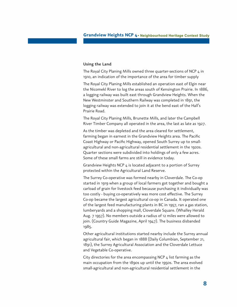
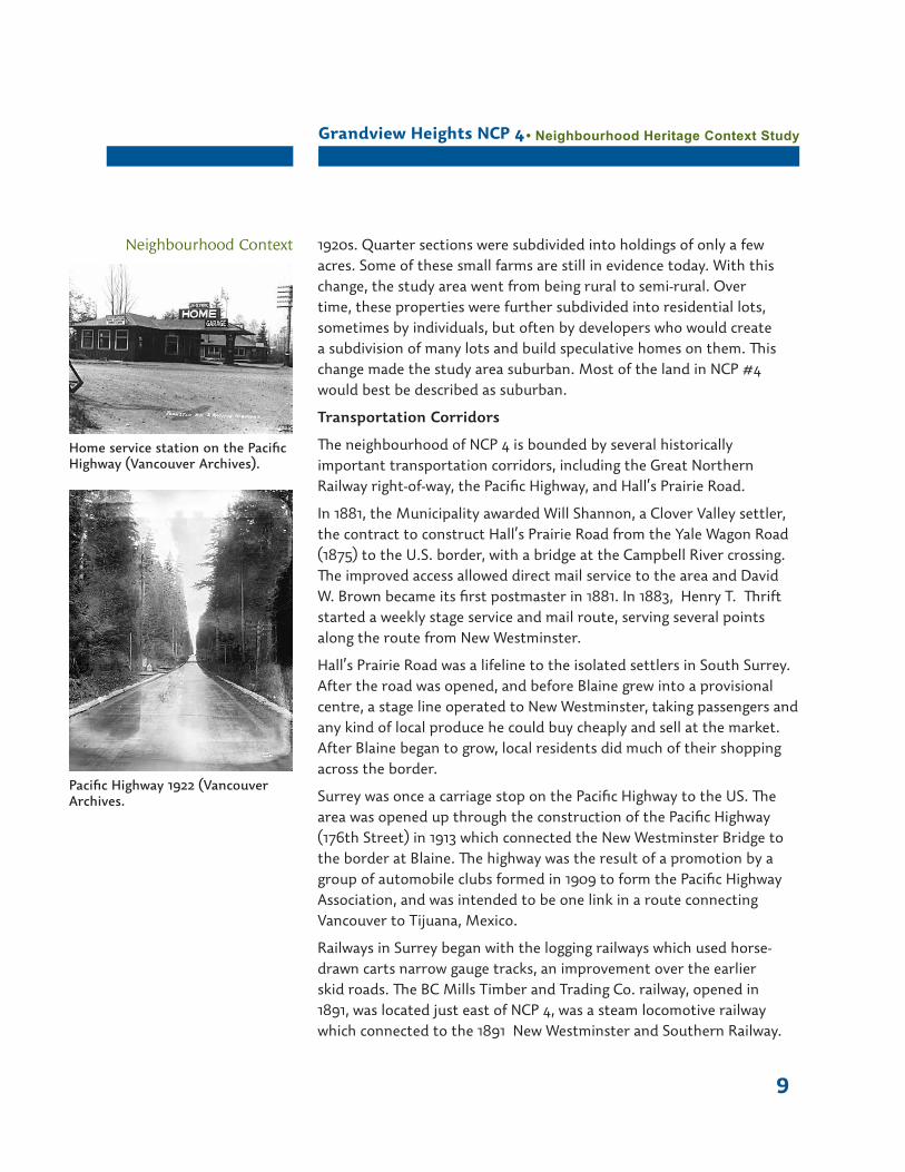
Surrey was once a carriage stop on the Pacific Highway to the US. The area was opened up through the construction of the Pacific Highway (176th Street) in 1913 which connected the New Westminster Bridge to the border at Blaine. The highway was the result of a promotion by a group of automobile clubs formed in 1909 to form the Pacific Highway Association, and was intended to be one link in a route connecting Vancouver to Tijuana, Mexico.
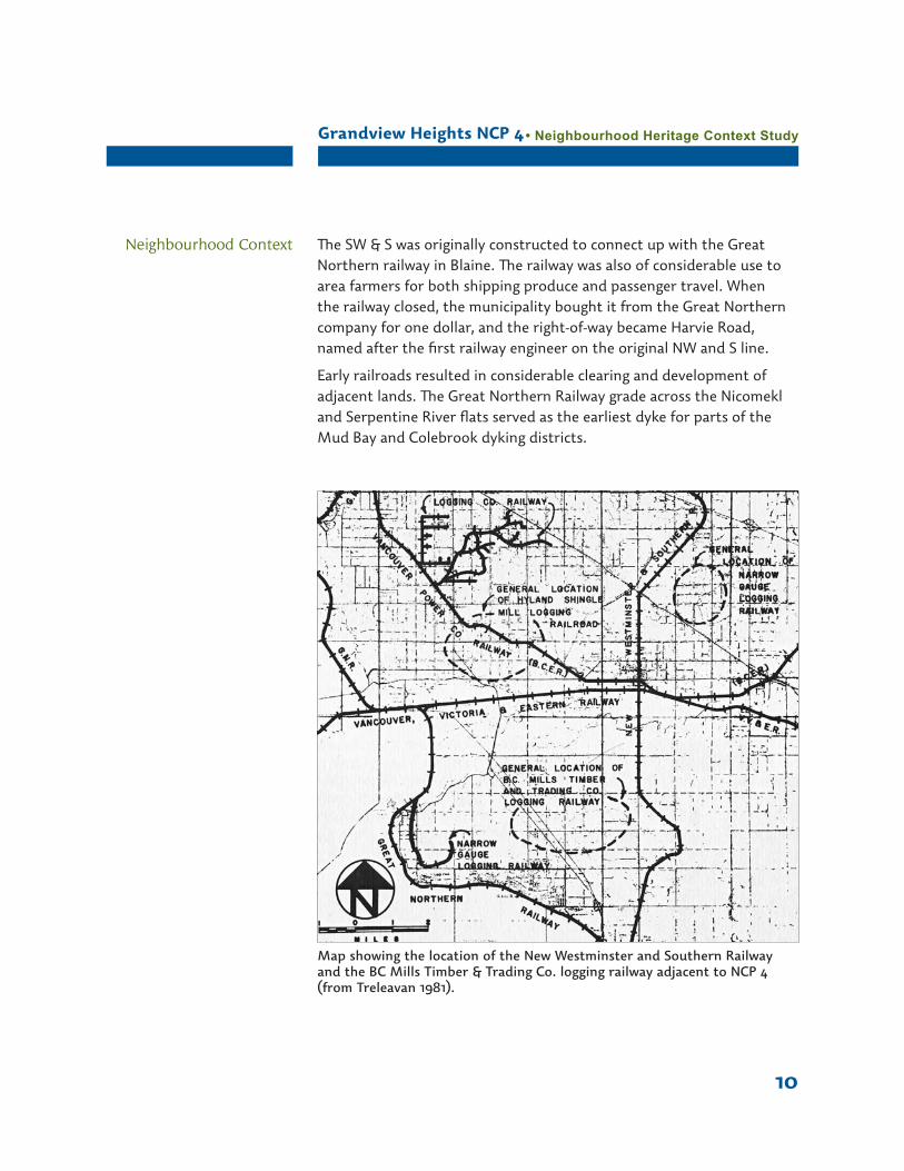
Railways in Surrey began with the logging railways which used horse-drawn carts narrow gauge tracks, an improvement over the earlier skid roads. The BC Mills Timber and Trading Co. railway, opened in 1891, was located just east of NCP 4, was a steam locomotive railway which connected to the 1891 New Westminster and Southern Railway.
Home service station on the Pacific Highway (Vancouver Archives).
Pacific Highway 1922 (Vancouver Archives.
Grandview Heights NCP 4 • Neighbourhood Heritage Context Study
10
Map showing the location of the New Westminster and Southern Railway and the BC Mills Timber & Trading Co. logging railway adjacent to NCP 4 (from Treleavan 1981).
Neighbourhood Context The SW & S was originally constructed to connect up with the Great Northern railway in Blaine. The railway was also of considerable use to area farmers for both shipping produce and passenger travel. When the railway closed, the municipality bought it from the Great Northern company for one dollar, and the right-of-way became Harvie Road, named after the first railway engineer on the original NW and S line.
Early railroads resulted in considerable clearing and development of adjacent lands. The Great Northern Railway grade across the Nicomekl and Serpentine River flats served as the earliest dyke for parts of the Mud Bay and Colebrook dyking districts.
Grandview Heights NCP 4 • Neighbourhood Heritage Context Study
11
Ethnic Diversity
In 1888 the Great Northern Railway started to build a railway from Blaine through the valley to New Westminster. Two gangs of men were employed, one gang of white men and the other Chinese. The white men’s camp was just where Gordon Thompson’s house now stands and the Chinese camp was near the creek on the Bamford Road.
Emigration started around 1915. Japanese immigrants owned a number of farms in South Surrey. Immigrants bought farms, and grew strawberries, rhubarb, small fruit, currants, raspberries, asparagus. In 1947 the Patullo Bridge opened, providing easier access for trucks taking berries to market. The Japanese farmers felt their hard work was going to pay off. By the end of 1942, all Japanese families in Delta and Surrey were banished from what was known as the Protected Area. Most of the Surrey farmers went to Alberta to work on sugar beet farms because there they could stay together as families. Farms were sold by the Custodian of Enemy Property. Few returned to Surrey after the war. Motosaku Akage was born in 1897 in Cloverdale. . Both Japanese and Chinese farmers raised poultry; some Japanese worked in the logging camps.
Suburban Development after World War II
After the end of the Second World War, further subdivision occurred for the development of large estate lots. South Surrey up to small-agricultural and non-agricultural residential settlement in the 1920s. Quarter sections were subdivided into holdings of only a few acres. Some of these small farms are still in evidence today. With this change, the study area went from being rural to semi-rural. Over time, these properties were further subdivided into residential lots, sometimes by individuals, but often by developers who would create a subdivision of many lots and build speculative homes on them. NCP 4 gradually evolved into a suburban community.
Neighbourhood Context

Grandview Heights NCP 4 • Neighbourhood Heritage Context Study
12
1940 aerial photograph of Grandview Heights NCP 4
Great Northern Railway
Second growth forest
Logged land further cleared for agriculture or homesteads, beginnings of smaller lot subdivision
24th Avenue
Paci
fic H
ighw
ay
Hal
l’s P
rair
ie R
oad
Neighbourhood Context
Grandview Heights NCP 4 • Neighbourhood Heritage Context Study
13
Key Themes
Early industry and agriculture:
Few original landholders•Survey into large lots primarily for forestry and agriculture•Resource-based industries•Smaller farm holdings for dairy, fruit orchards and vegetable •gardensAdjacent to land protected by Agricultural Land Reserve•
Transportation and Communication
Surrounded by key transportation corridors including rail and •roadway
Suburban development:
Later settlement in a remote location•Smaller lot subdivision between the wars•Little commercial development•Mix of lot sizes and diverse building styles•
Cultural diversity:
Attraction to a variety of cultural groups with individual traditions•Farming practices of Chinese and Japanese•Relocation of Japanese during World War II•
Post WWII transformation:
Little development means retention of primarily rural uses and •characterRural-based businesses where they exist•Unique character based on its historical development•
Neighbourhood Context
Grandview Heights NCP 4 • Neighbourhood Heritage Context Study
14
2: Cultural Landscape Features
Identifying Cultural Landscapes
The area encompassed by NCP 4 is part of the larger cultural landscape of the Grandview Heights area, and South Surrey as a whole. Analysing NCP 4 using techniques of a cultural landscape assessment process assists in understanding the remaining physical characteristics, both natural and cultural, that represent the past use of the land. This is important when considering a more subtle view of cultural heritage in a place where more widely recognized or typical heritage features do not exist. This approach provides an opportunity to address heritage character in a way that can potentially be integrated into the neighbourhood plan, making it unique to the area’s sense of place.
Cultural Landscape Characteristics of NCP 4
Natural Systems and Features
Streams associated with the Campbell River watershed•Abundant bird life in mixed forest habitat•
Land use
Primarily residential use with occasional small business such as •animal boarding or towingProperty lines following original survey patterns with smaller lot •subdivision over timeOccasional use for animal husbandry such as sheep raising•Rural landscape character•Houses located to the fronts of properties facing the main streets•Moderate setbacks from roadways•Estate lots•Redwood Park•
Cultural traditions
Continuation of rural and agricultural traditions•Presence of Agricultural Land Reserve lands adjacent to the •neighbourhood
Circulation
Roadways following the original survey section lines•Great Northern Railway right-of-way•176th Street, Highway 15, Pacific Highway and Hall’s Prairie Road•
Cultural Landscape Features
Grandview Heights NCP 4 • Neighbourhood Heritage Context Study
15
Gravel or dirt roads or laneways•Relatively narrow road widths•Lack of curb and gutter•A variety of streetscapes•
Topography
Location on a high point of land•Sloped topography to north and south•
Vegetation
Coniferous and deciduous plantings demarcating property lines and driveways•Mature mixed second growth forest•Remnants of old-field and pasture•Grassed or planted roadway margins•Ornamental planting on residential lots•Windbreak planting•Roadway trees•Naturally formed hedgerows•Orchard remnants•
Buildings and Structures
A mix of housing styles and types from several eras•Garages and sheds•
Views and vistas
Panoramic views to the northeast•Views to the south along 176th and 186th streets•Views to the north shore mountains and middle ground along 176th •and 186th streetsCorridor streetscape views east along 24th Avenue•Internal views from streets into residential lots•Internal vistas to agricultural lands•
Water features
Drainage ditches between the asphalt roadways and property lines•Culverts•
Small scale and landscape elements
Mailboxes•Fences demarcating house lots, old fields and pasture•Domestic animals•
Cultural Landscape Features
Grandview Heights NCP 4 • Neighbourhood Heritage Context Study
16
Community Heritage Values
Current values-based heritage practice acknowledges the importance of community consultation in understanding the heritage value of a neighbourhood. The following questions were designed to stimulate discussion about community value and character.
What is the heritage of Grandview Heights NCP 4? Why is it •important?What are some of the important features of NCP 4? Why are they •important? Where are they located?Are there any additional stories or themes that should be included •in this historical context?What are some of the important stories or historical themes of the •neighbourhood?What words best describe your neighbourhood?•What are the challenges or concerns about changes to the •neighbourhood?
A meeting of the Citizen’s Advisory Committee for Grandview Heights NCP4 was held on April 19, and the heritage of the area was reviewed and discussed. Significant values for participants included the retention of the neighbourhood’s rural character as the basis for a new community, and the importance of creating a non-generic community with which its citizens could identify. It was emphasized that heritage significance can be important in directing the future development of the community, adding value and creating a unique sense of place. This can be accomplished through such things as place names; infrastructure, roadway and building design; open space, trail and landscape design; the development of values-based, flexible and non-prescriptive design guidelines; and creative interpretation.
Values expressed at the meeting have been synthesized with research and field work findings and are summarized below.
Historical valuesExpression of early settlement history•Importance of the Agricultural Land Reserve in adding to the •ambience of the neighbourhood, including intangible features (seasonal changes, smells, etc.)There is an historical relationship between the patterns of •transportation including road grids, railway and highway.
Heritage Values
Heritage values are the aesthetic, historic, scientific, cultural, social, educational
or spiritual values which are important to the community
and for past, present, and future generations.
Grandview Heights NCP 4 • Neighbourhood Heritage Context Study
17
176th Street was originally a commercial corridor with stores and •garages located along it. It is now considered to be ugly and busy. The focus now should be on 24th Avenue.Redwood Park is a dominant feature that embodies much about the •history of Surrey.The Great Northern Railway is an important feature in the •neighbourhood.
Cultural or social valuesThere is a division between the north and south parts of the •neighbourhoodThe rural character of the area is very much appreciated and there •is support for the retention of this rural or suburban lifestyle and character. Traces of this rural character could be used as a basis for community building.Redwood Park is an important gathering place for those in the •south side of the community. Originally an arboretum that has been turned into a community landscape, the trees there could be an inspiration for new landscaping within Grandview Heights NCP 4.
Aesthetic valuesViews and vistas are an important part of the neighbourhood, with •north and west views. The views are very different depending upon your location in the neighbourhood.Landscape features, such as hedgerows and rows of trees should be •protected and integrated into new design.Evidence of this rural character is found in such things as the street •widths, ditches, boundary demarcations, vegetation and having a horse as a neighbour.The new fire hall was considered a good inspiration for future •design.Residents would like to see the creation of a unique and different •community.The overall aesthetics of South Surrey need to be retained.•
Scientific and educational valuesBiological diversity of creeks, drainage ditches, second growth forest, •wildlifePotential for effective ecosystem enhancement and management•Redwood Park as the site of an original arboretum.•The integration of creeks and watercourses into the design of the •neighbourhood.
Grandview Heights NCP 4 • Neighbourhood Heritage Context Study
18
Map
The map on the following page shows some of the cultural landscape characteristics identified in NCP 4, Grandview Heights.
Cultural Landscape Features
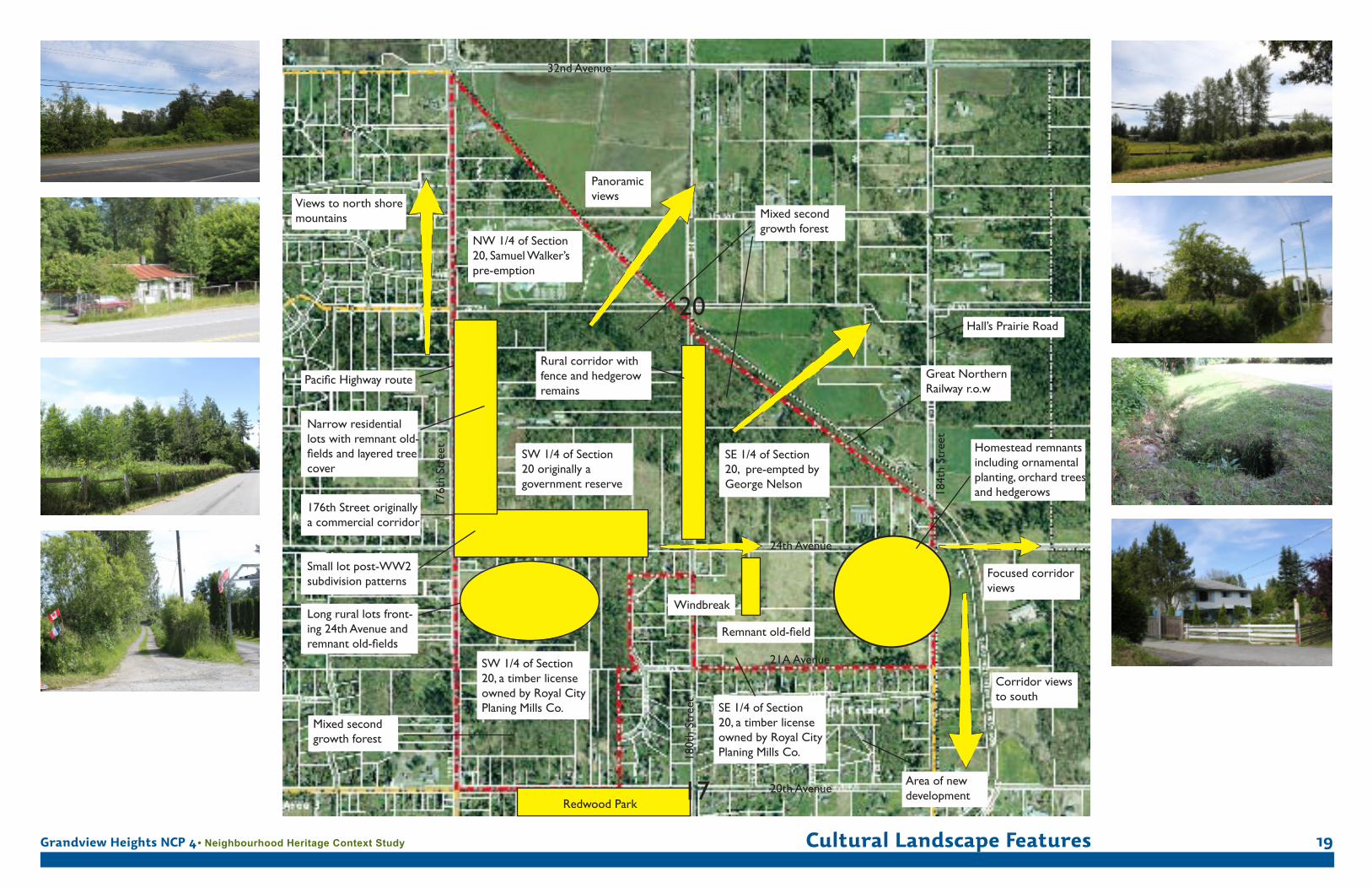
Grandview Heights NCP 4 • Neighbourhood Heritage Context Study Cultural Landscape Features 19
24th Avenue
20th AvenueRedwood Park
21A Avenue
Remnant old-field
176t
h St
reet
180t
h St
reet
32nd Avenue
184t
h St
reet
Great Northern Railway r.o.w
Mixed second growth forest
Mixed second growth forest
Panoramic views
Homestead remnants including ornamental planting, orchard trees and hedgerows
SW 1/4 of Section 20 originally a government reserve
SE 1/4 of Section 20, pre-empted by George Nelson
NW 1/4 of Section 20, Samuel Walker’spre-emption
SW 1/4 of Section 20, a timber license owned by Royal City Planing Mills Co. SE 1/4 of Section
20, a timber license owned by Royal City Planing Mills Co.
Rural corridor with fence and hedgerow remains
Small lot post-WW2 subdivision patterns
176th Street originally a commercial corridor
Long rural lots front-ing 24th Avenue and remnant old-fields
Narrow residential lots with remnant old-fields and layered tree cover
Pacific Highway route
Views to north shore mountains
Focused corridor views
Windbreak
Corridor views to south
Area of new development
Hall’s Prairie Road20
17
Grandview Heights NCP 4 • Neighbourhood Heritage Context Study
20
Part 3: Using the Heritage Context Study
Integrating Heritage into the Neighbourhood Plan
The intent of this study is to create a framework with which the City of Surrey can move toward integrating heritage into the Neighbourhood Plan for NCP 4. The following are ideas that could assist with this integration.
Continue to consult with local residents and groups for additional •input into what is valued in the community.
Integrate principles of heritage conservation into the •neighbourhood plan.
Raise awareness of local heritage character to foster a sense of •stewardship.
Collect stories about the place that can be used for interpretation.•
Use the cultural landscape characteristics list, along with community •input, to generate ideas about the public realm and its future character. Use the list to retain elements that define the historical character of the neighbourhood.
Retain, replant or take cuttings of extant orchard trees.•
Prepare a plan for interpretive activities and programs.•
Encourage the conservation of heritage character through a •program of incentives for private property owners.
Develop values-based design guidelines to help retain the character •of the place.
Undertake activities of interpretation and commemoration based on •the content of the Context Plan.
Interpretation can be used as a way of conserving an historic place •through an understanding of the historic values. Interpretation is a way of commemorating heritage values and fostering community pride, tourism and business opportunities. Interpretation presents intangible heritage values, such as memories, associations, events and stories not covered in the treatment of physical aspects of historic resources.
Integrate heritage character or features into design and planning •details.
Using the Neighbourhood Heritage Context Study
Grandview Heights NCP 4 • Neighbourhood Heritage Context Study
21
Selected ReferencesCommonwealth Historic Resource Management.
District of Surrey. Drainage Report. October 1963.
Hayes, Derek. Historical Atlas of Vancouver and the Lower Fraser Valley. Vancouver: Douglas & McIntyre, 2005.
Henderson’s BC Directory 1890-1950.
Donald Luxton & Associates. Grandview Heights Heritage Study. City of Surrey, 2005.
Orchard, Imbert. Growing Up in the Valley: A Pioneer Childhood in the Lower Fraser Valley. Victoria: Provincial Archives of BC, 1983.
Pearson, John. Land of the Peace Arch. Cloverdale: Surrey Centennial Commitee, 1958.
Province of British Columbia. Year Book of British Columbia and Manual of Provincial Information. Victoria: 1897.
Sixth Report of the Department of Agriculture of the Province of British Columbia. Victoria: King’s Printer, 1901.
Surrey Historical Society. Looking Back at Surrey. Surrey BC: Tannis Printing Ltd.
Surrey History accessed at http://members.shaw.ca/jack_brown/
Surrey Museum and Archives pre-emption maps 1858, 1897, 1910.
Surrey Museum and Archives research files.
Surrey Leader Newspaper
Surrey Year Book, 1953, 1955, 1956, 1960.
Treleaven, Fern G. The Surrey Story. Surrey: Surrey Museum and Historical Society, 1978.
Treleaven, Fern G. Rivers, Roads and Railways: 100 Years of Transportation in Surrey. Surrey: Surrey Museum and Historical Society, 1981.
Whiteside, Richard V. Surrey Pioneers. Vancouver: Evergreen Press, 1974.
Williams BC Gazeteer and Directory 1892 - 1950.
Wrigley’s BC Directory 1890-1950.


