1 Nisswa Zoning Ordinance (Chapter IV of City Code) Table of Contents 4.1 PART 1 - TITLE, INTENT AND PURPOSE ............................................................................ 4 4.1.1 Title ........................................................................................................................................................... 4 4.1.2 Intent ........................................................................................................................................................ 4 4.1.3 Purpose..................................................................................................................................................... 4 4.2 PART 2 - RULES AND DEFINITIONS .................................................................................... 4 4.2.1 Rules of Interpretation ........................................................................................................................... 4 4.2.2 Definitions ............................................................................................................................................... 5 4.3 PART 3 - DISTRICTS, USE AND DIMENSIONAL CHARTS .............................................. 23 4.3.1 Creation of Districts ............................................................................................................................. 23 4.3.2 District Boundaries ............................................................................................................................... 23 4.3.3 Nisswa Zoning Map Adopted............................................................................................................. 23 4.3.4 Districts Established............................................................................................................................. 23 4.3.5 Shoreland Classifications Established................................................................................................ 24 4.3.6 District Purposes .................................................................................................................................. 24 4.3.7 Criteria for Land Use Categories ........................................................................................................ 26 4.4 PART 4 - LAND USE CHART .................................................................................................. 26 4.4.1 Land Use Chart ..................................................................................................................................... 26 4.5 PART 5 - LOT SIZE, SETBACKS, AND AREA STANDARDS............................................... 29 4.5.1 Interpretation of Standards ................................................................................................................. 29 4.5.2 Lot Size, Setbacks and Area Standards Chart ................................................................................... 29 4.6 PART 6 - GENERAL PROVISIONS ........................................................................................ 35 4.6.1 Application of this Ordinance ............................................................................................................ 35 4.6.2 Environmental Documents and Concurrent Permits ..................................................................... 35 4.6.3 Existing Lots.......................................................................................................................................... 36 4.6.4 Non-Conforming Uses ........................................................................................................................ 36 4.6.5 Building Standards ................................................................................................................................ 39 4.7 PART 7 - RESIDENTIAL PERFORMANCE STANDARDS .................................................. 39 4.7.1 Guest Cabins and Guest Quarters ..................................................................................................... 39 4.7.2 Temporary Structures........................................................................................................................... 42 4.7.3 Stairways, Lifts and Landings (Lake Access Structures).................................................................. 42 4.7.4 Agricultural Uses, Animal Husbandry Provisions............................................................................ 42 4.7.5 Duplexes/Multi-Family on Natural Environment Lakes ............................................................. ..44 4.7.6 Multi-Family Dwellings, Special Provisions...................................................................................... 43 4.7.7 Manufactured Housing Developments ............................................................................................. 43 4.7.8 Open Space Development (OSD) ..................................................................................................... 44 4.7.9 Standards for Linden Lakeshore Residential District (LR) ........................................................... ..47 4.7.10 Urban Residential Planned Unit Development (PUD) ................................................................... 48 4.7.11 Accessory Structures ........................................................................................................................... 50 4.7.12 Structure Size Requirements .............................................................................................................. 51 4.7.13 Sale of Motor Vehicles ........................................................................................................................ 50 4.8 PART 8 - COMMERCIAL PERFORMANCE STANDARDS.................................................. 50 4.8.1 Low Impact Design .............................................................................................................................. 50 4.8.2 Visual Standards – Screening and Landscaping ............................................................................... 50 4.8.3 Exterior Building Finishes – Commercial Structures ...................................................................... 51 4.8.4 Additions, Alterations and Accessory Buildings .............................................................................. 53 4.8.5 Rooftop Equipment ............................................................................................................................. 53 4.8.6 Trash Handling Equipment................................................................................................................. 53 4.8.7 Exterior Lighting................................................................................................................................... 53
Transcript
1
Nisswa Zoning Ordinance (Chapter IV of City Code) Table of Contents
4.1 PART 1 - TITLE, INTENT AND PURPOSE ............................................................................ 4 4.1.1 Title ........................................................................................................................................................... 4 4.1.2 Intent ........................................................................................................................................................ 4 4.1.3 Purpose ..................................................................................................................................................... 4
4.2 PART 2 - RULES AND DEFINITIONS .................................................................................... 4 4.2.1 Rules of Interpretation ........................................................................................................................... 4 4.2.2 Definitions ............................................................................................................................................... 5
4.3 PART 3 - DISTRICTS, USE AND DIMENSIONAL CHARTS .............................................. 23 4.3.1 Creation of Districts ............................................................................................................................. 23 4.3.2 District Boundaries ............................................................................................................................... 23 4.3.3 Nisswa Zoning Map Adopted............................................................................................................. 23 4.3.4 Districts Established ............................................................................................................................. 23 4.3.5 Shoreland Classifications Established ................................................................................................ 24 4.3.6 District Purposes .................................................................................................................................. 24 4.3.7 Criteria for Land Use Categories ........................................................................................................ 26
4.4 PART 4 - LAND USE CHART .................................................................................................. 26 4.4.1 Land Use Chart ..................................................................................................................................... 26
4.5 PART 5 - LOT SIZE, SETBACKS, AND AREA STANDARDS............................................... 29 4.5.1 Interpretation of Standards ................................................................................................................. 29 4.5.2 Lot Size, Setbacks and Area Standards Chart ................................................................................... 29
4.6 PART 6 - GENERAL PROVISIONS ........................................................................................ 35 4.6.1 Application of this Ordinance ............................................................................................................ 35 4.6.2 Environmental Documents and Concurrent Permits ..................................................................... 35 4.6.3 Existing Lots.......................................................................................................................................... 36 4.6.4 Non-Conforming Uses ........................................................................................................................ 36 4.6.5 Building Standards ................................................................................................................................ 39
4.7 PART 7 - RESIDENTIAL PERFORMANCE STANDARDS .................................................. 39 4.7.1 Guest Cabins and Guest Quarters ..................................................................................................... 39 4.7.2 Temporary Structures ........................................................................................................................... 42 4.7.3 Stairways, Lifts and Landings (Lake Access Structures).................................................................. 42 4.7.4 Agricultural Uses, Animal Husbandry Provisions............................................................................ 42 4.7.5 Duplexes/Multi-Family on Natural Environment Lakes ............................................................. ..44 4.7.6 Multi-Family Dwellings, Special Provisions ...................................................................................... 43 4.7.7 Manufactured Housing Developments ............................................................................................. 43 4.7.8 Open Space Development (OSD) ..................................................................................................... 44 4.7.9 Standards for Linden Lakeshore Residential District (LR) ........................................................... ..47 4.7.10 Urban Residential Planned Unit Development (PUD) ................................................................... 48 4.7.11 Accessory Structures ........................................................................................................................... 50 4.7.12 Structure Size Requirements .............................................................................................................. 51 4.7.13 Sale of Motor Vehicles ........................................................................................................................ 50
4.8.8 Temporary Structures ........................................................................................................................... 54 4.8.9 Developer Agreement/Bonds ............................................................................................................ 56 4.8.10 Bed and Breakfast Inns ........................................................................................................................ 55 4.8.11 Accessory Structures ............................................................................................................................ 56 4.8.12 Additions to Residential Structures .................................................................................................... 57 4.8.13 Commercial Structure Size Requirements ......................................................................................... 57 4.8.14 Change in Character of Business ........................................................................................................ 57 4.8.15 Water-Oriented Accessory Structures ............................................................................................... 58 4.8.16 Lake Access Structures......................................................................................................................... 58 4.8.17 Resorts .................................................................................................................................................... 59 4.8.18 Commercial Storage Units ................................................................................................................... 59
4.9 PART 9 - GENERAL PERFORMANCE STANDARDS ......................................................... 65 4.9.1 Signs ........................................................................................................................................................ 65 4.9.2 Nuisance Standards .............................................................................................................................. 75 4.9.3 Historic Sites .......................................................................................................................................... 77 4.9.4 Fences ..................................................................................................................................................... 77 4.9.5 Storage .................................................................................................................................................... 78 4.9.6 Sanitation Standards ............................................................................................................................. 78 4.9.7 Pets and Livestock ................................................................................................................................ 79 4.9.8 Tree Removal/Woodland Preservation/Soil Erosion Prevention ................................................ 80 4.9.9 General Buffer Standards (Riparian and Non-Riparian Properties) ............................................. 80 4.9.10 Buffers on Riparian Property .............................................................................................................. 81 4.9.11 Stormwater Drainage ............................................................................................................................. 82 4.9.12 Fertilizer Use ......................................................................................................................................... 82 4.9.13 Maintenance of Stormwater Retention Ponds ................................................................................. 83 4.9.14 Groundwater Protection....................................................................................................................... 84 4.9.15 Grading and Road Construction in Shoreland Area ....................................................................... 84 4.9.16 Parking and Loading ............................................................................................................................ 87 4.9.17 Controlled Access Lots ........................................................................................................................ 88 4.9.18 Short Term Rentals............................................................................................................................... 88
4.10 PART 10 - SPECIAL PROVISIONS .......................................................................................... 88 4.10.1 Shoreland Planned Unit Development .............................................................................................. 88 4.10.2 Campgrounds ........................................................................................................................................ 95 4.10.3 Extractive Use Standards – Mining .................................................................................................... 96 4.10.4 Home Occupation ................................................................................................................................ 97 4.10.5 Auto Salvage Yards ............................................................................................................................... 98 4.10.6 Land Fills – Solid Waste ...................................................................................................................... 98 4.10.7 Planned Development Districts ......................................................................................................... 98
4.11 PART 11 – SUBDIVISION PROVISIONS ............................................................................... 105 4.11.1 Sketch Plan .......................................................................................................................................... 106 4.11.2 Preliminary Plat, Preliminary Condominium Plat or Metes and Bounds Subdivision Resulting
in at Least One Parcel Less than 10 Acres ...................................................................................... 106 4.11.3 Final Plat or Final Condominium Plat ............................................................................................. 108 4.11.4 Design Layout Standards - Minimum .............................................................................................. 110 4.11.5 Survey Standards ................................................................................................................................. 111 4.11.6 Street Improvement Standards ......................................................................................................... 111 4.11.7 Sanitary Provision Standards ............................................................................................................. 111 4.11.8 Water Supply Standards ..................................................................................................................... 112 4.11.9 Drainage/Grading Standards ............................................................................................................ 112 4.11.10 Dedication to the Public – Standards .............................................................................................. 113
4.12 PART 12 - COMMUNICATIONS TOWERS .......................................................................... 114 4.12.1 Purpose and Intent ............................................................................................................................. 114
4.1 PART 1 - TITLE, INTENT AND PURPOSE 4.1.1 Title This c h a p t e r o f t he C i t y Co d e shall be referred to and cited as the Nisswa Zoning Ordinance, except herein where it shall be cited as the “Ordinance.” 4.1.2 Intent The Ordinance was established pursuant to the authority granted by the Minnesota statutes, in particular Minnesota Statutes Chapter 412 and 462, and any Amendments thereto. 4.1.3 Purpose This Ordinance is adopted for the purpose of:
A. Protecting the public health, safety, comfort, convenience and general welfare; and B. Inaugurating and effectuating the goals and policies of the comprehensive plan;
and C. Promoting order in development by dividing the area of the City into zones and
regulating therein the location, construction, reconstruction, alteration and use of structures and land; and
D. Promoting order in development by providing for the subdivision of lands in
accordance with the districts of the City; and E. Conserving the natural and scenic beauty and attractiveness of the City for the
health and welfare of the public; and F. Providing for adequate light, air and access to property by regulating the use of
land and buildings and the bulk of structures in relation to surrounding properties; and
G. Providing for the administration of the provisions of the Ordinance and defining the authority and duties of the Administrator, Planning Commission, Board of Adjustment and City Council under this Ordinance; and
H. Providing standards and criteria for the subdivision and zoning of shorelands to
preserve and enhance the quality of surface and ground waters, conserve the economic and natural environment values of shorelands, and provide for the wise use of water and related land resources of the City.
4.2 PART 2 - RULES AND DEFINITIONS 4.2.1 Rules of Interpretation For the purpose of this Ordinance the following rules shall apply to the interpretation of the language used herein.
A. The word person includes a firm, association, organization, partnership, trust,
5
company, or corporation as well as an individual. B. The masculine gender includes the feminine gender. C. The singular includes the plural and the plural the singular. D. The present tense includes the past and future tenses and the future, the present. E. The word may is permissive, the words shall or will are mandatory. Mandatory
compliance with the Ordinance shall allow for variances thereto. F. All distances expressed in feet shall be to the nearest tenth of a foot,
horizontally or vertically. G. In all instances where a number must be whole, and fractions cannot be
used, the number shall be rounded down to the nearest whole number, unless specifically stated otherwise.
H. In the event of a conflict, the most restrictive provision shall apply.
4.2.2 Definitions The following words shall be defined as follows for the purposes of this Ordinance: Abandoned Building: A building as defined hereafter on public or private property which no longer serves a practical use and is considered a safety hazard in the opinion of the Planning & Zoning Administrator due to its location or structural condition. Abandoned Motor Vehicle: A motor vehicle as defined in Minnesota Statutes Chapter 168B and 169, as amended, that has remained on public property in an inoperable condition for more than 48 hours; or b) is on private property without the permission of the owner; or c) has remained on private property for more than 30 days and is inoperable, or is unlicensed, unless kept in a garage or other storage structure. Accessory Use or Structure: A use or structure on the same lot with, and of a nature customarily incidental and subordinate to, the principal use or structure, including tower antennas, dish antennas exceeding 36 inches in diameter, swimming pools, wind generators, garages, sheds, boathouses, and similar structures. Antennas exceeding 36 inches in diameter shall meet all setback requirements, but shall not be subject to height restrictions. The square footage of an accessory structure shall be the area enclosed within the foundation and the base area of any cantilevered section, with allowance for no more than three- foot roof overhang, regardless of the number of floors. Agricultural Use: The use of land for the growing and/or production of crops, or livestock products for the production of income, including incidental retail sales of produce and animal products. Allowable Dwelling Unit: A dwelling unit that would be allowed as per a Planned Unit Development density analysis. Animal Husbandry: The care and breeding of domestic animals such as cattle, hogs, sheep, horses, and poultry. Animal Unit: A unit of measure based on the approximate production of wastes.
6
ANIMAL UNIT (1) slaughter weight steer or heifer 1.0 (1) mature dairy cow or horse 1.4 (1) swine over 55 lbs. 0.4 (1) sheep 0.1 (1) dog 0.1 (1) goose 0.1 (1) duck 0.02 (1) turkey 0.018 (1) chicken 0.01 (1) cat 0.05
Antenna: A device used to transmit and/or receive telecommunication, television or radio signals, or electromagnetic waves between terrestrially and/or orbit ally based structures directly or indirectly related to wireless personal communication services and cellular services. Attorney, City: the attorney duly appointed by the Council to represent the City of Nisswa. Auto Salvage Yard: A lot or yard where 3 or more unlicensed motor vehicles are stored while parts are removed, where crushing occurs, or where storage pending part removal and crushing may occur. Bed and Breakfast Inn: A dwelling other than a resort or hotel where nightly accommodations, including food services, are provided for compensation, containing up to six separate rental rooms. Block: An area of land bounded by streets, exterior boundary lines and/or bodies of water. Bluff: A topographic feature such as a hill, cliff, or embankment having all the following characteristics:
A. Part or all of the feature is located in shoreland area; B. A slope rises at least 25 feet above the ordinary high water level of the water
body; C. The grade of the slope from the toe of the bluff to a point 25 feet or more above
the ordinary high water level averages 30% or greater; and D. The slope must drain toward the water body.
An area with an average slope of less than 18% over a distance for 50 feet or more shall not be considered part of the bluff. Bluff Impact Zone: The area of a bluff between the toe of the bluff and the top of the bluff and land located within 30 feet from the top of a bluff. Boathouse: A structure designed and used solely for the storage of boats or boating equipment. Board of Adjustment: The Board, appointed by the City Council, to hear appeals from actions of the Planning & Zoning Administrator or Zoning Inspector and variance requests. Buildable Area: Any site, lot, parcel or any portion thereof that does not contain designated flood plain, wetlands or areas in excess of twenty-five (25) percent slope.
7
Buildable Lot: A lot, pre-existing, for which a deed, recorded contract for deed or other legal conveyance or plat has been recorded prior to the effective date of the City of Nisswa Zoning Ordinance (the Minnesota State Shoreland Management Standards) or a lot legally created under the provisions of this Code. Building: Any structure having a roof, or completely enclosing and roofing an area for the purpose of sheltering persons, animals, or property. Building Height: The vertical distance between the highest adjoining ground level at the building or 10 feet above the lowest ground level whichever is lower and the highest point of a flat roof or average height of the highest gable of a pitched or hipped roof or 10’ below the peak whichever is higher. (see Figure 1 after Lot Requirements Chart in Section 4.5.2). Building Line: A line parallel to a lot line or the ordinary high water level at the required setback beyond which a structure may not extend. Building Official: The person authorized by the State Building Code to administer building permits and appointed by the City Council. May be the same person as the Planning & Zoning Administrator. Building Widths: the smallest dimension of the major portion of the building. Campground: A land use consisting of designated campsites with appropriate facilities designed for temporary occupation by tents or recreational vehicles with single ownership, management services and with site rentals. Campsite: A parcel or site within a resort or campground designated for the occupancy of one family on a periodic basis in a tent or recreational vehicle. City: The City of Nisswa, as duly incorporated in the State of Minnesota. City Clerk: The duly appointed person responsible for the administration of the City affairs. City Sewer or Water Systems: A system of municipally maintained utilities approved by the State and serving more than one building or property. Clustering or Clustered: A development pattern and technique whereby structures or building sites are arranged in close proximity to one another in non-linear groups, adjacent to permanently preserved common open space, so as to make efficient and visually aesthetic use of the natural features of the landscape and maximize visualization of permanently preserved open space. Commercial Use: The principal use of land or buildings for the sale, lease, rental, trade of products, goods, or services. Commissioner: The Commissioner of the Department of Natural Resources. Comprehensive Plan: A compilation of goals, policy statements, standards, programs, and maps for guiding the physical, social, and economic development of the City. Conditional Use: A land use or development as defined by Ordinance that would not be appropriate without restriction, but may specifically be allowed with appropriate restrictions or
8
conditions as determined by the Planning Commission upon a finding that a) the use or development is an appropriate conditional use in the land use zone and b) the use or development with conditions conforms to the Comprehensive Plan and c) the use with conditions is compatible with the existing neighborhood and d) the use with conditions would not be injurious to public health, safety, decency, order, comfort, convenience, appearance, or prosperity. Condominium Ownership: A form of ownership within a multi-owner building or complex wherein the boundaries are defined by a condominium plat in accordance with Minnesota Statutes 1980, Chapter 515A or subsequent revisions. Controlled Access Lot: A privately owned riparian lot meeting the ordinance standards for a buildable lot, owned by more than one owner in undivided interest, provided with facilities and used for access, and not containing a dwelling. Cul-de-sac: The circular turn around at the end of a street with only one outlet. Deck: A horizontal, unenclosed platform with or without attached railings, seats or trellises or other attached features, attached or functionally related to a principal use or site and at any point extending above ground level.
Driveway: A private or public roadway providing access for vehicles to a street or highway from a structure. Duplex, Triplex, or Quad: A dwelling structure on a single lot having two, three, or four dwelling units respectively being attached by common walls, and each unit being equipped with separate sleeping, cooking, eating, living, and interior sanitation facilities. Dwelling, Guest Cabin: A free-standing structure, not for sale or lease, that contains sleeping spaces and functioning bathroom facilities in addition to those provided in the primary dwelling on the lot. A guest cabin shall not be permitted if guest quarters exist on the lot. Dwelling, Guest Quarters: The second story of a detached accessory structure, not for sale or lease, that contains sleeping spaces and bathroom facilities in addition to those provided in the primary dwelling on the lot. Guest Quarters shall not be permitted if a guest cabin exists on the lot. Dwelling, Multi-family: Two or more dwelling units attached together by any point including duplexes, triplexes, townhouses, and multi-level units regardless of type of ownership. Dwelling, Single Family: A dwelling unit totally separated from any other dwelling unit. Dwelling Site: A designated location for residential use by one or more persons using temporary or movable shelter including camping and recreational vehicle sites. Same as campsite. Dwelling Unit: A structure or portion of a structure or other shelter designed as short or long term living quarters for one or more persons including rental or time share accommodations such as motel, hotel, resort rooms, and resort cabins. This includes accommodations for one family. Easement: A grant by a property owner for the use of a strip of land for the purpose of construction and maintenance of utilities including, but not limited to sewers, water mains, electric lines, telephone lines, storm sewer, or drainage ways and gas lines. Engineer: The engineer duly appointed by the Council to perform technical services for the
9
City of Nisswa. Episodic Events: Special events that happen from 1-3 days at a time throughout the year. Special events shall get an Interim Use permit from the Planning Commission for their event and may be exempted from the temporary commercial structures/uses performance standards by the Planning Commission. The Interim Use Permit may be renewed annually. Exterior Finish: The final exterior covering of a structure, including but not limited to brick, natural stone, glass, specialty concrete block such as textured, burnished block or rock faced block, architecturally pre-cast textured concrete panels, masonry stucco, vinyl, steel siding, exterior finish installation system (EFIS), ceramic, glass block or wood (exterior finished grade). Exterior Storage: Storage of goods, materials, equipment, manufactured products outside of a fully enclosed building. Extractive Use: The use of land for surface or subsurface removal of sand, gravel, rock, industrial minerals, metallic or nonmetallic minerals or peat. Family: An individual, or two or more persons related by blood, marriage or adoption, living together in a dwelling unit or a group of not more than six persons, not so related, maintaining a common household. Fence: A partition, wall, or gate erected as a divider, marker, barrier, or enclosure on a property boundary, or a barrier, screed, or enclosure within the property. Final Common Interest Community Plat (CIC Plat): A drawing prepared by a registered professional land surveyor or registered professional architect as to the parts of a plat prepared by each, depicting the condominium subdivision of real estate and related information conforming to the requirements of Minn. Stat. Sec. 515B. Final Condominium Plat: A drawing prepared by a Registered Architect, Registered Engineer, or Registered Land Surveyor depicting the condominium subdivision of real estate and related information conforming to the requirements of Minnesota Statutes 1980, Section 515.A.2-110. Final Plat: A drawing prepared by a Registered Land Surveyor depicting the subdivision of real estate and related information conforming to the requirements of Minnesota Statutes, Chapter 505 or 515 as amended. Floodplain: The areas adjoining a watercourse, intermittent or permanently flowing, which have been or will be covered by the runoff waters of a storm with a 1% chance of occurrence any year (100 year storm). Floodway: The channel of the watercourse and those portions of the adjoining floodplain, which are reasonable required to carry and discharge the regional flood (100 year chance of occurrence). Floor Area: The sum of the gross horizontal areas to the several interior floors of a building excluding basements not used for occupancy. Forest Land Conversion: The clear cutting of forested lands to prepare for a new land use other than the re-establishment of a subsequent forest stands. Foundation: A concrete, concrete and block, or treated wood portion of a structure which
10
totally encloses the perimeter of the structure, supports the bearing loads of the super structure and penetrates the ground to provide frost protection. Green Space: Privately owned property permanently dedicated by covenant to vegetative ground coverage with allowance for recreational facilities, tree coverage or water courses, water supply, sewage disposal and drives. Public property dedicated to park, vegetative buffer, tree coverage, or similar uses. Half Street: A street containing half of the required right-of-way, with the intention of adding the additional right-of-way at a future date from an adjacent property. Hardship: The property in question cannot be put to a reasonable use if used under conditions allowed by the official controls, the plight of the landowner is due to circumstances unique to his/her property not created by the landowner, and the variance, if granted, will not alter the essential character of the locality. Economic considerations alone shall not constitute a hardship if reasonable use for the property exists under the terms of the ordinance. Home Occupation: A use of commercial nature conducted by an occupant of the dwelling entirely within the dwelling or accessory buildings, which use is clearly incidental and secondary to the use of the dwelling for residential purposes, including licensed day care for children within a home. Impervious Surface: The horizontal area of buildings, patios, walks, decks, driveways, accessory structures and other surfaces generally impervious to the penetration of stormwater, including gravel drives and parking. Industrial Use: The use of land or buildings for the production, manufacture, warehousing, storage, or transfer of goods, products, commodities or other wholesale items. Intensive Vegetation Clearing: The complete removal of trees or shrubs in a continuous path, strip, row, or block. Interim Uses: A temporary use of a property until a particular date, until the occurrence of a particular event or until zoning regulations no longer permit it. Interim uses may be granted in accordance with Section 462.3597of Minnesota Statutes, as amended, and are processed in the same manner as conditional uses. Interval Ownership: A form of ownership of real property, condominium land or space further defined by time interval reoccurring each year, resulting in more than one owner of the same property, also known as timeshare. Junk Yard: An area where used waste, discarded or salvaged materials are bought, sold, exchanged, stored, baled, cleared, parked, disassembled, or handled, including but not limited to scrap iron and other metals, paper, rags, rubber products, bottles, and used building materials. Storage of materials in conjunction with the construction or a manufacturing process shall not be included. Three or more automobiles without current licenses constitute a junkyard. Such use shall not include putrescent wastes such as garbage. Lake Classification: The formal classification by the DNR of each body of public waters within the City. Landscaping: The placement of trees, shrubs, grass, and walls and earth mounds or the utilization of existing natural vegetative cover equal thereto.
11
Leaseback by Owner: An arrangement between an owner of property and a leasing agent or resort, to promote and operate the property for rental purposes. LEED: Leadership in Energy and Environmental Design of the United States Green Building Council. Litter: Waste materials including, but not limited to, cans, bottles, plastic, and paper wrappings or containers. Lot: A parcel of land designated by plat, metes and bounds, Registered Land Survey, Auditor’s Plat or other accepted means and separated from other parcels or portions by said description for the purpose of sale, lease, mortgage, building, or separation. Lot Area: The horizontal area of a lot bounded by the lot lines and the ordinary high water line if bounded by water. Lot, Corner: A lot situated at the junction of and abutting on two or more intersecting streets or a lot at the point deflection in alignment of one street with the internal angle less than 135 degrees. Lot, Front: The boundary of a lot which abuts on a public right of way, or if a corner lot, the shortest of the two boundaries. If the lot abuts public water, the lakeside shall be considered the lot front. Lot Line: The property lines bounding a lot except that where the description extends into a public right of way, the right of way line shall be considered the lot line. Lot, Preexisting: A lot which is one unit of a subdivision plat heretofore duly approved and filed or one unit of an Auditor’s Subdivision, or Registered Land Survey, or a lot created by metes and bounds, any of which has been recorded in the office of the County Recorder prior to the effective date of this Ordinance. Lot Tier Depth: The lot depth of a normal lot conforming to the shoreland requirements: General Development Lake, first tier 200 feet; second and additional tiers 267 feet; Recreational Development Lake, all tiers 267 feet; Natural Environment Lake, all tiers 400 feet. Lot Tiers: Successive strips of land parallel with the ordinary high water line, each one-tier depth wide, and extending across the parcel. Lot Width: The shortest distance between lot lines measured at the midpoint of the building line and at the OHW for all riparian lots. Metes and Bounds: Descriptions of property and descriptions of lots other than lots in recorded subdivision plats. Mobile Home/Manufactured Housing: A factory build dwelling 8’ or more in width, containing more than 320 sq. ft. and designed intrinsically as a trailer requiring only minor modifications prior to occupancy and/or not meeting the requirements of the Uniform Building Code but complying with Minnesota Statutes 327.14 to 327.36, as amended, or Federal Department of Housing and Urban Development Standards. Mobile Home/Manufactured Housing Development: A form of planned unit development
12
designed for mobile home/manufactured housing and including two possible types of ownership: single ownership with site rentals or individual site ownership with a homeowner’s association owning common property. Motel/Hotel: A commercial business with a central management to provide lodging and may provide related facilities such as restaurants, bars, and other recreational amenities. This does not include a bed and breakfast inn. Non-conformity/Non-conforming: Any legal use, structure or parcel of land already in existence, recorded or authorized before the adoption of official controls or amendments thereto that would not have been permitted to become established under the terms of the official controls now written, if the official controls had been in effect prior to the date it was established, recorded or authorized. A structure or use granted under a variance after adoption of the zoning Ordinance shall be considered a non-conforming use or structures. Nuisance: By authority and direction of Minnesota Statute, Section 412.221, Subdivision 23 and 24; and Chapter 429, and Chapter 145, nuisance is anything that interferes with the use or enjoyment of property, endangers personal health or safety, or is offensive to the senses, such as excessive smoke, odor, noise, heat, vibration, glare, traffic generation, visual impact, and other similar interferences or offenses. See also performance standards herein. Open Space: Land area designated as reserved from development. Ordinary High Water Level: The boundary of public waters and wetlands consisting of an elevation delineating the highest water level which has been maintained for sufficient period of time to leave evidence on the landscape, commonly that point where the natural vegetation changes from predominantly aquatic to predominately terrestrial. For watercourses where the DNR has determined the ordinary high water level (OHW), that level is adopted. For water courses where the DNR has not made such a determination the ordinary high water level is the elevation of the top of the bank of the channel, for reservoir and flowages the ordinary high water level is the operating elevation of the normal summer pool. Outlot: A lot remnant or any parcel of land included in a plat, which may be used as open space. Such outlot may be a large tract that could be subdivided in the future or may be too small to comply with the minimum size requirements of zoning and subdivision ordinances o r otherwise unsuitable for development and therefore not usable as a building site as it currently exists. Parking Space: A site off public right of way, maintained and sized to be occupied by one automobile. Party Wall or Floor: The structural divider between dwelling units vertically or horizontally, respectively. Passive Recreation: Outdoor activities that include walking, hiking, cross-country skiing, horseback riding, and other non-motorized recreational activities that do not materially alter the landscape, degrade environmental quality, or involve commercial recreational use. Patio: An uncovered, unscreened platform that is at ground level at its highest point. Permitted Use: A land use conforming to the character of a district, which is permitted by ordinance requiring only a land use permit issued by the Planning & Zoning Administrator.
13
Personal Wireless Services: Commercial mobile services, unlicensed wireless services, and common carrier wireless exchange access services. Personal Wireless Service Facilities: Facilities for the provision of personal wireless services. Public Utility: Persons, corporation, or governments supplying gas, electric, transportation, water, sewer, or landline telephone service to the general public. For the purposes of this section of the Ordinance, commercial wireless telecommunication service shall not be considered public utility uses, and are defined separately. Pet: An animal, bird, reptile or fish commonly associated with human habitation, not considered under animal husbandry and not raised for production of income. Planned Unit Development (P.U.D.): A land use or development pattern characterized by a unified site design for a number of dwelling units or dwelling sites on a parcel, whether for sale, rent, or lease, and also involving clustering of these units or sites to provide areas of common green space, density increase, and mix of structure types and land uses. These developments may be organized and operated as condominiums, time share condominiums, cooperatives, full free ownership, commercial enterprises, or any combination of these, or cluster subdivisions of dwelling units, residential, condominiums, townhouses, apartment buildings, campgrounds, recreational vehicle parks, resorts, hotels, motels, and conversions of structures and land uses to these uses. The Open Space Neighborhood Design (OSND) pattern shall be considered a planned unit development. Planning Commission: The body duly appointed by the City Council to determine the development of the City, to decide conditional use permits, and to make recommendations to the City Council on comprehensive plans, district boundaries, subdivision of land and capital improvements. Practical Difficulties: The property owner proposes to use the property in a reasonable manner not permitted by an official control; the plight of the landowner is due to circumstances unique to the property not created by the landowner; and the variance, if granted, will not alter the essential character of locality. Economic considerations alone do not constitute practical difficulties. Practical difficulties include, but are not limited to, inadequate access to direct sunlight for solar energy systems. Preliminary Plan or Preliminary Condominium Plat: A plan prepared in accordance with the Subdivision Ordinance depicting the proposed subdivision of property by Final Plat or Condominium Plat. Principal Structure or Use: The single primary structure or use on a lot, as distinguished from accessory uses or accessory structures. Protective Covenants: Restrictions placed on the property by the owner and duly filed with the County Recorder. These may also be used in planned unit developments to establish homeowners associations, restrict shoreline development and provide for common facilities. Public Waters: Any waters as defined in Minnesota Statutes, as amended. However, no lake, pond, or flowage of less than 10 acres in size in municipalities need be regulated for the purposes of the shoreland management rule. A body of water created by a private user where there was no previous shoreline may, at the discretion of the local government, be exempted from the shoreland management. The official determination of the size and physical limits of drainage areas of rivers and streams should be made
14
by the Commissioner. Recorder: The County Recorder of Crow Wing County. Recreational Vehicle: Vehicles including trailers less than 8 feet wide or containing less than 320 square feet, which are designed to be occupied as living quarters, and capable of being licenses by the State for highway purposes. Replacement Tree: A tree (independent of species) that has a trunk diameter of two (2) inches or more, measured three (3) feet from the ground and has a height of eight (8) feet or more. The species selected shall be capable of growing to a height of at least fifteen feet. Resort: A commercial establishment, regardless of ownership arrangement, that includes buildings, campgrounds, lodges, structures, dwelling units/sites, enclosures or any part thereof kept, used, maintained or advertised as, or held out to the public to be a place where sleeping accommodations are furnished to the public and primarily to those seeking recreation, for periods of one day, one week, or longer, and having for rent three or more cabins, rooms, campsites, or enclosures. These establishments must be primarily service-oriented for transient lodging of guests. All cabins, rooms, dwelling units/sites, or enclosures must be included in the resort rental business. In order to qualify as a resort pursuant to this definition, a resort shall also be fully licensed and permitted under appropriate state and local regulations. The entire parcel of land must be controlled and managed by the licensee. Resort, Fractional Ownership: A resort where the ownership is divided amongst multiple property owners, typically through the direct sale of individual resort units or a share of an individual resort unit. Restaurant: An establishment having facilities for serving meals at tables to the general public, in consideration of payment therefore, and which employs adequate staff to provide the usual, customary and suitable service to guests. Restaurant, Formula: A restaurant or establishment that is contractually required to offer standardized menus and ingredients and where the exterior or interior design and which serves or delivers food or beverages in disposable containers. Right-of-way: A parcel of property dedicated to the public, connecting to other public right-of- ways, which afford primary access by pedestrians and vehicles to abutting properties. Riparian Property: Land that abuts the edge of a lake, river, stream, or wetland adjacent to the edge of a lake, river, or stream. Riparian Rights: The rights of access for navigation, withdrawal of a reasonable amount of water and similar activities, which belong to the owner of land adjacent to a lake or stream. Semi-public Use: The use of land by private non-profit organizations to provide a public service that is ordinarily open to some persons outside the regular constituency of the organization. Considered a P.U.D. under this ordinance Sensitive Resource Management: The preservation and management of areas unsuitable for development in their natural state due to constraints such as shallow soils over ground water or bedrock, highly erosive or expansive soils, steep slopes, susceptibility to flooding or occurrence of flora or fauna in need of special protection.
15
Setback: The minimum horizontal distance between a structure, sewage treatment system, well or other facility and an ordinary high water level, sewage treatment system, well, top of bluff, road, highway, property line or other facility. Three feet of roof overhang, stoops not exceeding 30 sq. ft. and steps from stoop to ground not over 4’ wide may protrude into the setback. Setback – Interior Lot: In a planned unit development, the closest horizontal distance between the lot line and the foundation or wall of a structure when the lot line is not the exterior boundary of the development. Three feet of roof overhand, stoops not exceeding 30 sq. ft. and steps from stoop to ground not over 4’ wide may protrude into the setback. Setback – Road: The closest horizontal distance between the road right of way line and the foundation or wall of a structure. Three feet of roof overhang, stoops not exceeding 30 sq. ft. and steps from stoop to ground not over 4’ wide may protrude into the setback. Setback – Side, Exterior: The closest horizontal distance between the exterior boundary side lot line and foundation or wall of a structure. This setback takes precedence over setback, interior lot, where any conflict exists. Three feet of roof overhang, stoops not exceeding 30 sq. ft. and steps from stoop to ground not over 4’ wide may protrude into the setback. Setback – Waterfront: The closest horizontal distance between the ordinary high water mark and the foundation or wall or edge of a structure. Three feet of roof overhang, stoops not exceeding 30 sq. ft. and steps from stoop to ground not over 4’ wide may protrude into the setback. Sewage Treatment System: A septic tank and soil absorption system or other individual or cluster type sewage treatment system as described and regulated in Chapter 7080 of the State Rules and Regulations. Sewer System: Pipe lines or conduits, pumping stations and force mains and all other constructions, devices, appliances or appurtenances used for conducting sewage or industrial waste or other waste to a point of ultimate disposal. Shore Impact Zone: Land located between the ordinary high water level of a public water and a line parallel to it at a setback of 50% of the normal structure setback. Shoreland: Land located within the following distances from public water: 1000’ from the ordinary high water level of a lake, pond, or flowage; and 300’ from a river or stream, or landward extent of a floodplain designated by ordinance on a river or stream, whichever is greater. The limits of shorelands may be reduced whenever the waters involved are bounded by topographic divides, which extend landward from the water for lesser distances and when approved by the Commissioner. Shoreline Property: A lot directly abutting a public water, generally located in the first lot tier adjoining the public water.
Signs: A name, identification, description, display, illustration, advertisement, or device which is displayed for the purpose of attracting attention to a person, product, place, activity, institution or business.
Sign, Area Identification: Any sign identifying the name of a neighborhood,
residential subdivision, PUD or similar area. Sign, Business: Sign which directs attention to a business, commodity, service,
activity or entertainment sold or offered upon the premises where such sign is located.
16
Sign, Waterfront Business Identification: A sign placed within the shore impact zone
conveying only information relating to the location of, general types of goods and services available at, and name of an establishment in the CW district that depends on patrons arriving by boat. Other detailed information such as product brands and prices shall not be included on a Waterfront Business Sign.
Sign, Waterfront Business Entrance: A sign located at a principal b u s i n e s s entrance
within the CW district.
Sign, Dynamic Display: Any sign capable of displaying words, symbols, figures or images that can be electronically or mechanically moved or changed by remote, automatic, or electronic means but not including merely the ability to turn the sign on and off.
Sign, Freestanding: Any permanent sign and its supporting framework that is anchored in the ground and which is independent from any building or other structure. Note: Does not include large portable signs.
Sign, Hanging: Any sign hanging below a canopy, awning, or building overhang. Sign, Home Occupation: Any sign designating a home occupation as defined in this
Ordinance when such sign is located on the premises of the residential property where the business is being conducted and an interim use permit has been obtained for said business. The sign may only be a wall sign or a freestanding sign.
Sign, Internal Directional: A sign which serves solely to designate the direction of any place or
area located on the same lot as said place or area necessary for the orderly movement of traffic or providing necessary direction to users of the site. Examples include parking lot entrance and exit signs, directional signs to holes within a golf course, and similar signs.
Sign, Internal Identification: A sign that has a purpose secondary to the use of the lot on which it
is located, such as “telephone”, “drive-up window”, “cash machine”, “air” and similar directives. Sign, Multi-Family Building Identification: A sign indicating information related to the name,
address, ownership, and other incidental property information for a multi-family dwelling complex located on the premises of said complex.
Sign, Non-commercial: A sign that is not intended for a commercial use. Sign, Obsolete: A sign which identifies or advertises an activity, business, product, service
or special event no longer produced, conducted, performed or sold on the premises upon which sign is located. Signs of historical character shall not be subject to the provisions of this section.
Signs-Offsite: Any sign not located on the contiguously owned property with the use
which is advertised. Signs-Onsite: Any sign located on the contiguously owned property with the use which
is advertised. Official Signs and Notices: Signs and notices erected and maintained by public officers or
public agencies within their territorial jurisdiction and pursuant to and in accordance with direction or authorization contained in federal, state or local law for the purposes of carrying out an official duty or responsibility.
17
Sign, Nameplate: Any sign indicating the name, address and other non-commercial messages on a residential property.
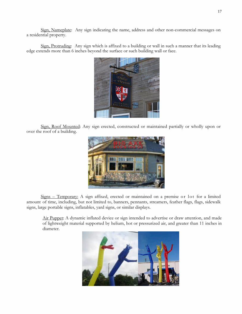
Sign, Protruding: Any sign which is affixed to a building or wall in such a manner that its leading
edge extends more than 6 inches beyond the surface or such building wall or face.
Sign, Roof Mounted: Any sign erected, constructed or maintained partially or wholly upon or
over the roof of a building.
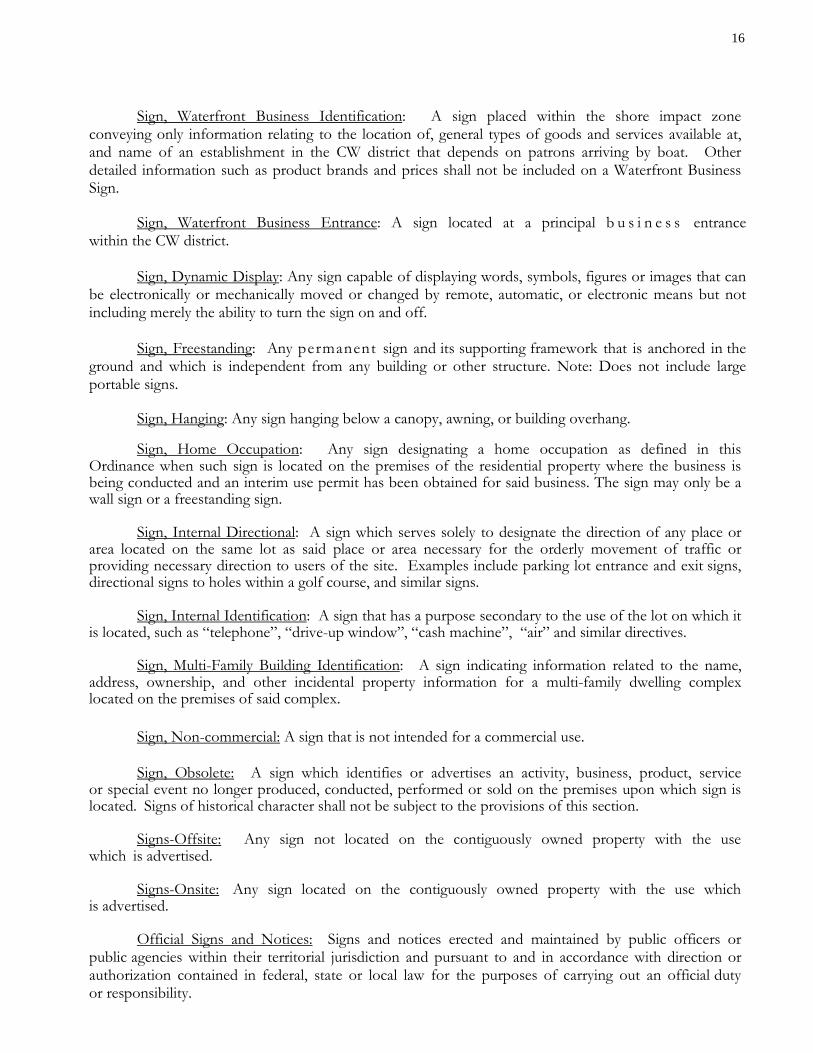
Signs – Temporary: A sign affixed, erected or maintained on a premise o r l o t for a limited
amount of time, including, but not limited to, banners, pennants, streamers, feather flags, flags, sidewalk signs, large portable signs, inflatables, yard signs, or similar displays.
Air Puppet: A dynamic inflated device or sign intended to advertise or draw attention, and made of lightweight material supported by helium, hot or pressurized air, and greater than 11 inches in diameter.
18
Banner: A rectangular sign made of vinyl, canvas, or similar flexible material that is not intended to be permanently mounted to a pole or a building.
Feather Flag: A portable sign that contains a harpoon-style pole or staff driven into the ground for support, supported by means of an individual stand, or attached to a building.
Flag: Any fabric or similar lightweight material attached at no more than two corners of the material, usually to a staff or pole, so as to allow movement of the material by atmospheric changes and which contains distinctive colors, patterns, symbols, emblems, insignia, or other symbolic devices or text. If any dimension of a flag is more than three times as long as any other dimension, it shall be regulated as a banner for the purposes of this ordinance. This only includes a flag attached to a building, and shall not include a flag attached to a pole that is anchored in the ground.
Inflatable: A static inflated device or sign intended to advertise or draw attention, and made of lightweight material supported by helium, hot or pressurized air, and greater than 11 inches in diameter.
19
Large Portable Sign: A portable sign, made of rigid material, larger than 8 square feet which is manifestly designed to be transported, including by trailer or on its own wheels, even though the wheels of such sign may be removed and the remaining chassis or support converted to another sign or attached temporarily or permanently to the ground since this characteristic is based on the design of such sign. (Note: These signs are prohibited in all zoning districts. Schaefer’s Foods has a preexisting non-conforming use for their large portable sign.)
Pennant: A series of typically polygonal shaped flexible material attached along a canvas or rope line, hung at either end, to attract attention.
Sidewalk Sign: A portable sign, made of rigid material, no larger than 8 square feet on one side that is capable of standing without support or attachment, such as Sandwich Boards and A-Frame signs.
Streamer: Long relatively narrow strips of any type material that are free hanging.
20
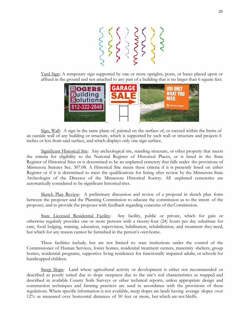
Yard Sign: A temporary sign supported by one or more uprights, posts, or bases placed upon or affixed in the ground and not attached to any part of a building that is no larger than 6 square feet.
Sign, Wall: A sign in the same plane of, painted on the surface of, or erected within the limits of an outside wall of any building or structure, which is supported by such wall or structure and projects 6 inches or less from said surface, and which displays only one sign surface. Significant Historical Site: Any archeological site, standing structure, or other property that meets the criteria for eligibility to the National Register of Historical Places, or is listed in the State Register of Historical Sites or is determined to be an unplatted cemetery that falls under the provisions of Minnesota Statutes Sec. 307.08. A Historical Site meets these criteria if it is presently listed on either Register or if it is determined to meet the qualifications for listing after review by the Minnesota State Archeologist of the Director of the Minnesota Historical Society. All unplatted cemeteries are automatically considered to be significant historical sites. Sketch Plan Review: A preliminary discussion and review of a proposal in sketch plan form between the proposer and the Planning Commission to educate the commission as to the intent of the proposer, and to provide the proposer with feedback regarding concerns of the Commission. State Licensed Residential Facility: Any facility, public or private, which for gain or otherwise regularly provides one or more persons with a twenty-four (24) hours per day substitute for care, food lodging, training, education, supervision, habilitation, rehabilitation, and treatment they need, but which for any reason cannot be furnished in the person’s own home. These facilities include, but are not limited to: state institutions under the control of the Commissioner of Human Services, foster homes, residential treatment centers, maternity shelters, group homes, residential programs, supportive living residences for functionally impaired adults, or schools for handicapped children. Steep Slope: Land where agricultural activity or development is either not recommended or described as poorly suited due to slope steepness due to the site’s soil characteristics as mapped and described in available County Soils Surveys or other technical reports, unless appropriate design and construction techniques and farming practices are used in accordance with the provisions of these regulations. Where specific information is not available, steep slopes are lands having average slopes over 12% as measured over horizontal distances of 50 feet or more, but which are not bluffs.
21
Stoop: A porch with steps at the entrance or exit of a building. Street: A public right of way, which affords primary vehicular access to abutting property and shall include avenue, road, or highway, boulevard, drive, etc. Structure: Any building, appurtenance including decks or other facility constructed, placed or erected by man except aerial or underground utility lines such as sewer, electric, telephone, telegraph, gas lines, and except walks or steps on grade not more than 4’ wide, stoops not exceeding 30 sq. ft., fences, temporary furniture, planters, and retaining walls consisting of wood or block four feet high or less. Fences shall require a land use permit, but subject only to Section 4.9.4 of the Zoning Ordinance. Subdivider: The owner, agent, person, corporation, partnership, or legal entity proposing to subdivide property under his/her control. Subdivision: The division of real estate into two or more parcels for the purpose of sale, rent, or lease, or mortgage, including planned unit development.
A. Subdivision by Plat: The subdivision into two or more parcels of any size by the authority of Minnesota Statutes, Chapter 505, with documents prepared by a Registered Land Surveyor and duly approved by the Planning Commission and Council.
B. Subdivision by Condominium Plat: The subdivision of a building or the subdivision of real estate into two or more spaces or parcels of any size by the authority of Minnesota Statutes, Chapter 515A with documents prepared by a Registered Land surveyor and duly approved by the Planning Commission and Council.
C. Subdivision by Metes and Bounds: Any division of real estate resulting in two or more parcels which are not platted, but divided by description prepared and signed by a Registered Land Surveyor. All subdivision by metes and bounds resulting in residential parcels less than 20 acres or 500 feet in width; and commercial parcels less than 5 acres or 300 feet in width shall be considered for approval by the Planning Commission. Subdivision by metes and bounds shall be limited to no more than one split of a parcel into two parcels, including the remnant parcel, in a three year period.
D. Subdivision as a Result of the Expansion or Extension of a Road Right-of-Way: Any division of real estate resulting in two or more parcels which are not platted or divided by metes and bounds description, but are divided as a result of the expansion or extension of a road right-of-way as a result of City Council or County Board action, the resulting parcel(s) of land may be considered buildable if all minimum design standards can be met and the resulting lots are at least 100 feet, or 80% of the required lot width, whichever is less.
Subdivision by Common Interest Community (CIC): The subdivision of a building or the subdivision of real estate into two or more spaces or parcels of any size by the authority of Minnesota Statutes, Chapter 515B, with documents prepared by a Registered Land Surveyor and duly approved by the Planning Commission and City Council. Surface Water Oriented Commercial Use: The use of land for commercial purposes where access to and use of a surface water feature is an integral part of the normal operation of business. Marinas, resorts, and restaurants with transient docking facilities are examples of such. Temporary Commercial Structure/Use: A Structure of a temporary character including but not limited to sell food, services or retail.
22
Temporary Structure: A structure of a temporary character including but not limited to houseboats, recreational vehicles, tents, or shacks used as dwellings for more than a 5-day period per year. Any new dwelling constructed or placed after the date of this ordinance and not on a permanent foundation shall be considered a temporary structure. Toe of Bluff: The lower point of a 50-foot segment with an average slope exceeding 18%, or the ordinary high water level if closer to the bluff than the lower point of a 50-foot segment with an average slope exceeding 18%. Top of the Bluff: The higher point of a 50-foot segment with an average slope exceeding 18%. Tower: Any pole, spire, or structure or combination thereof, to which an antenna is attached, or which is designated for an antenna, meteorological device or similar apparatus to be attached, and all supporting lines, cables, wires and braces, which is intended to be used for commercial purposes. Variance: A legally permitted deviation as provided in M.S. 462.357, Sub. 6, as amended, from the requirements of this ordinance, including restrictions placed on nonconformities, as determined by the Board of Adjustment. Vegetation Removal, Clear Cutting: The removal of more than 75% and up to 100 % of a stand of trees and brush, on a lot or parcel of land up to 40 acres. Vegetation Removal, Open Cutting: The removal of more than 25% and up to 75% of a stand of trees and brush on a lot or parcel of land up to 40 acres. This shall include the removal of more than 50% of the under-story trees and brush from the property. Vegetation Removal, Select Cutting: Removal of dead, diseased or damaged trees or shrubs, or removal of trees for placement of structures and drives, and further removal of only individual trees to uniformly thin up to 25% of a stand on a lot or parcel of land up to 40 acres. Up to 50% of the under-story and brush may be removed. Walkway: A parcel of land dedicated to the public for non-vehicular access purposes. Water-Oriented Accessory Structure: A small above-ground building which because of the relationship of its use to a surface water feature is located closer to public waters than the normal structure setback. Wetland: Lands transitional between terrestrial and aquatic systems where the water table is usually at or near the surface or the land is covered by shallow water. For purposes of this definition, wetlands must:
A. have a predominance of hydric soils B. be inundated or saturated by surface or groundwater at a frequency and duration to
support a prevalence of hydrophytic vegetation typically adapted for life in saturated soil conditions; and
C. under normal circumstances, support a prevalence of hydrophytic vegetation.
A “wetland” means the distinct hydrologic feature with characteristics of wetlands surrounded by non-wetland and including all contiguous wetland types, except those connected solely by riverine
23
wetlands. Wetland Area means a portion of a wetland or the entire wetland. Wetlands do not include public waters wetlands and public waters that are designated on the public water inventory maps prepared under Minnesota Statutes, Section 103G.201, as amended. “Wetlands in a cultivated field” shall mean a wetland where greater than 50% of its boundary abuts land that was in agricultural crop production in six of the ten years before January 1, 1991. “Wetlands on Agricultural land” shall mean a wetland where greater than 50% of its boundary abuts agricultural land. Wireless Telecommunications Services: Licensed commercial wireless telecommunication services including cellular, personal communication services (PCS), special mobilized radio (SMR), enhanced specialized mobilized radio (ESMR), paging and similar services that are marketed to businesses and the general public. Zoning Administrator: The duly appointed person responsible for the enforcement and administration of this Ordinance. May be the same as the Building Official or Planning & Zoning Administrator. Zoning District or District: An area of the City of Nisswa defined on the zoning map, which defines the boundaries of the districts. Zoning Map: The map of the City of Nisswa, amended from time to time, which defines the boundaries of the districts. Zoning Permit or Land Use Permit: A permit issued by the Planning & Zoning Administrator to allow the construction of a structure or to allow a land use when the provisions of this ordinance have been met and when approval of any conditional use permits or variances has been granted and when the fees are paid. A land use permit may have administrative conditions specific to the subject site when provided by the ordinance. The building permit issued by the Building Official for erection, modification, or removal of a building structure constitutes the land use permit for that use. 4.3 PART 3 - DISTRICTS, USE AND DIMENSIONAL CHARTS 4.3.1 Creation of Districts
The City of Nisswa is hereby divided into districts as shown on the official District Map, which may be subsequently amended by the procedures outlined in Chapter 15.
4.3.2 District Boundaries
The boundaries are generally on the center of streets, on lot lines, on shorelines and/or, on the center of streams or rivers. Every effort will be made to avoid dividing a single parcel of land into two (2) or more districts.
4.3.3 Nisswa Zoning Map Adopted
The Official Nisswa Zoning Map is hereby adopted as part of the Nisswa Zoning Ordinance. Any changes to the districts or district boundaries shall be done as an ordinance amendment pursuant to the provisions of this Ordinance. 4.3.4 Districts Established
24
The following districts are hereby established: Open Space Residential District OSR Shoreland Residential District SR
Linden Lakeshore Overlay District LR Urban Residential UR Commercial Waterfront District CW Central Business District CB Highway Business District HB Public and Recreation District P Planned Development District PDD
4.3.5 Shoreland Classifications Established The lakes in the City have been classified as follows:
Natural Environment (NE) Lake I. D. Numbers Fish Trap (Bourzak) 18-400 Bass (Ray) (Gull Chain) 11-220 Hole-in-the-day
18-401
Unnamed 11-217 Recreational Development (RD) Fawn/Edna 18-397/396 Bass (South of Hubert) 18-402
General Development (GD) Gull (Including Bishop’s Creek) 11-305 Thor Lake (Gull) Lower Cullen 18-403 Nisswa, 18-399 Roy 18-398 Clark 18-374 Hubert 18-375 Round 18-373 The streams in the City have been classified as follows: Cullen Creek – (from Lower Cullen Lake to Nisswa Lake) –Remote Lazy Brook a.k.a Clark Lake Brook (from Clark Lake to Highway 371) - Forested Lazy Brook (from Highway 371 to Nisswa Lake) – Tributary Bishop’s Creek- Tributary 4.3.6 District Purposes A. Open Space Residential District OSR A district designed to preserve open land, sensitive natural features and rural community character that would be lost under conventional development. It is the intent of this district to permit a reasonable amount of residential development in small compact neighborhoods of single family detached homes in an open space setting, located and designed to reduce the perceived intensity of development, preserve natural features and provide privacy and neighborhood identity. All areas identified by the Nisswa Land Use Map as “OPEN SPACE RESIDENTIAL” shall be developed in a manner that protects the rural character of the area and that reduces the need for premature extension of municipal sewer services.
25
B. Shoreland Residential District SR
A district designed to provide residential development that is at least as restrictive as the Minnesota shoreland management standards contained in State Rules Chapter 6120. New residential subdivisions will be based on conservation design principles. New developments may be connected to the municipal sewer system. The City should not encourage maximum density increases within PUDs or multi-family housing styles within this district. See also the LR Overlay District.
C. Urban Residential UR
A district designed to provide traditional residential neighborhood sites adjacent to downtown and the Sportland Corner area. Residential densities will vary based on connection to municipal utilities. The district provides for single family, duplex, tri-plex and quad home developments. Building types that incorporate multiple units may be allowed by conditional use permit.
D. Linden Lakeshore Residential (Overlay) LR
An overlay district developed and designed to provide specific and unique performance standards for a previously platted and developed neighborhood adjacent to public waters. The district is currently limited to the riparian lots within the neighborhoods along East and West Linden Avenue. Newly created parcels will be required to meet all SR District provisions.
E. Commercial Waterfront District CW A district that provides for the development of commercial resorts, golf courses and associated uses. The use and associated development shall recognize and address the sensitive relationship that the family resort has had with surrounding residential uses and the impact on water quality. As such all uses shall require a conditional use permit for expansion of the development. The district should encourage unique tourism businesses. Properties developed under this designation shall be used primarily as transient lodging spaces and related commercial uses. Uses shall not include privately owned residences.
F. Central Business District CB
A district that allows and encourages building design and lay-out for pedestrian access associated with the traditional downtown area, including zero-lot line setbacks, sidewalks, awnings and other architectural design features. The City should encourage tourism- related businesses, offices, medical facilities and public uses to locate within this district.
G. Highway Business District HB A district that allows and encourages commercial development that provides services and shopping facilities adjacent to Trunk Highway 371. The City should encourage Open space design principles for commercial projects within this district.
H. Public and Recreation District P A district that provides for public recreation areas and structures and allows private recreational uses. Such uses shall include, but not be limited to parks, tot-lots, nature areas, City buildings, sewer facilities and private recreation and open space.
I. Planned Development District PDD
26
A district that provides a regulatory framework to encourage improved environmental design allowing flexibility in the development of land while insuring compliance with the intent of the Zoning Ordinance and Comprehensive Plan. The Planned Development District has no set standards and specifications. The minimum acreage required for a Planned Development District is 85 acres and the property must also be served by City Sewer. 4.3.7 Criteria for Land Use Categories The following criteria shall be used in establishing the Nisswa Zoning Map and any future amendments to the Map:
A. Preservation of natural sensitive areas B. Present ownership and development C. Shoreland soil types and their engineering capabilities D. Topographic characteristic E. Vegetative cover F. In-water physical characteristics G. Recreational use of surface water H. Road and service center accessibility I. Socio economic development needs of the public J. Availability of public sewer K. The necessity to preserve and restore certain areas having significant historical or
ecological value L. Conflicts between land uses and impacts of commercial uses or higher densities on
adjacent properties M. Alternatives available for desired land use N. Prevention of spot zoning O. Conformance to the City of Nisswa Land Use Plan.
4.4 PART 4 - LAND USE CHART 4.4.1 Land Use Chart The following Land Use Chart is adopted. All uses are considered prohibited unless specifically allowed in this Code, even if they are not listed specifically under excluded uses. An amendment to the chart may be initiated by the Nisswa City Council, Planning Commission or a resident/property owner within the City as per the provisions of Chapter 15. P SHALL DESIGNATE PERMITTED USES WITHIN THE DISTRICT C SHALL DESIGNATE CONDITIONAL USES WITHIN THE DISTRICT I SHALL DESIGNATE INTERIM USES WITHIN THE DISTRICT BLANK SHALL DESIGNATE PROHIBITED USES WITHIN THE DISTRICT
City of Nisswa Land Use Classification Chart
OSR - Open Space Residential SR/LR - Shoreland/Linden Residential District UR - Urban Residential CW - Commercial Waterfront CB - Central Business HB - Highway Business
P - Denotes Permitted Use
C - Denotes Conditionally Permitted Use
I - Denotes Interim Use
27
Blank - Denotes Prohibited Use P - Parks and Recreation
Uses OSR SR/LR UR CW CB HB P
Accessory Uses P P P P P P P
Accessory Uses For General Public C C C
Accessory Structures (See Also Performance Standards) P/C P/C P/C P/C P/C P/C P/C
Adult Use Business (See Performance Standards in Chapter 8, Nisswa City Code, Part 11)
C
Adult Daycare C C
Agricultural Use P
Animal Husbandry P
Assembly Plants C
Assisted Living/Board & Lodging C C
Auto Salvage Yard C
Bed and Breakfast I I I I I I
Boarding House C C C
Brewery/Taproom C C
Churches C C C C
Clinic, Hospital C C
Communication Towers On Public Property C
Controlled Access Lot
Commercial Storage Units C C
Decks on Structures Existing on October 1, 1979 at Less Than Normal Setbacks
See Section 4.6.4, subdivision 1
Detachable Vestibules on Existing Buildings From October 15th to May 1st
See Performance Standards
Dwelling, Duplex C C C C
Dwelling, Guest Cabins P P P
Dwelling, Guest Quarters P P P
Dwelling, Multi-family C C C
28
Dwelling, Single Family Homes P P P C
Dwelling, Triplex and Quad Residential in PUD C C C C
Dwelling Unit Above Commercial Use C C C
Grading/Dirt moving See Section 4.9.15
Gravel Mining I
Home Occupations I I I
Historic Sites(add definition) C C C C C C C
Junk Yard
Light Manufacturing Plants C C
Mobile Home/Manufactured Housing Developments C
Motels/Hotels C C
Motor Fuel Stations C C
Motor Vehicle Sales C
Municipal Sewage Disposal C C
Nursing Home C C C C
Outside Storage of Products for Sale/Rent C C
Parks, Non-Motorized Public Recreation Including Trails P P P P P P P
Planned Unit Developments, Mixed Use C C C C
Planned Unit Developments, Commercial C C C
Planned Unit Developments, Residential C C C
Professional Buildings C C C
Public Buildings C C C C C C C
Restaurants C C C
Retail Stores C C C
Services C C
Semi-Public Uses (PUD) C C C C C
Snowmobile Trails P P P P P P P
State Licensed Residential Facility P P P I
Storage Buildings C
Temporary Structures, Construction Trailers P P P P P P P
Temporary Structures/Uses, Commercial I I
Utilities, Semi-public C C C C C C C
Theaters C C C
Vegetation Removal See Sections 4.9.8 & 4.9.15
Vehicle Body Repair, Machine Shops C C
Warehousing C
29
Water Oriented Accessory Structures See Section 4.9.15 4.5 PART 5 - LOT SIZE, SETBACKS, AND AREA STANDARDS 4.5.1 Interpretation of Standards A. The provisions of this Section shall be held to be the minimum requirements; and
B. Where the provisions of this Ordinance are either more restrictive or less restrictive than applicable provisions for other laws, ordinances, statutes, resolutions, covenants or regulations of any kind, the more restrictive shall prevail, except where authorized by the more restrictive agency. Except where specifically delegated to the City of Nisswa, it shall be the responsibility of the more restrictive agency to enforce their more restrictive provision.
4.5.2 Lot Size, Setbacks and Area Standards Chart The following Lot Size, Setbacks and Area Standards Chart is adopted:
30
Nisswa Lot Requirements Chart
Requirement District
OSR SR/LR UR CW CB HB P Lot Size Single Family (Non-riparian) 100,000 sq. ft. 40,000 sq. ft. 20,000 sq. ft. Multi-Family and Tri-Plex/Four Plex (Per Unit) per PUD Plans per PUD Plans per PUD Plans Single Family (GD) Unsewered 100,000 sq. ft. 20,000 sq. ft. Single Family (GD) Sewered 20,000 sq. ft. Single Family (RD) Unsewered 100,000 sq. ft. 40,000 sq. ft. Single Family (RD) Sewered 20,000 sq. ft. Single Family (NE) Unsewered 100,000 sq. ft. 80,000 sq. ft. Single Family (NE) Sewered N/A 40,000 sq. ft. Single Family (Tributary Segment) 100,000 sq. ft. 20,000 sq. ft. Single Family (Forested Segment) 100,000 sq. ft. 40,000 sq. ft. Single Family (Remote Segment) 100,000 sq. ft. 40,000 sq. ft. Duplex Lot Width (Multiply Base Size) 1.8 1.8 1.8 1.8
Duplex Lot Area (Multiply Base Size) 2.0 2.0 2.0 2.0 Other Lots Unsewered 20,000 sq. ft. 20,000 sq. ft. 30,000 sq.ft. Other Lots Sewered 20,000 sq. ft. 20,000 sq. ft. 30,000 sq. ft. 15,000 sq. ft.
Lot Width At OHW and at Bldg. Setback Line (GD) 200 100
*Structure, vegetation removal, or excavation not permitted in wetland setback. Wetland must be min. of 400 sf. and/or listed on the NWI for setback requirement. Septic Tank or Drainfield Setback
35 4.6 PART 6 - GENERAL PROVISIONS 4.6.1 Application of this Ordinance Subdivision 1. The provisions of this Ordinance shall be held to be the minimum requirements for maintaining the public health, safety, morals and welfare. Subdivision 2. Except as this Ordinance specifically provides, with provision for variance granted thereto, no structure shall be erected, converted, enlarged, reconstructed or altered and no structure or land shall be used for any purpose nor in any manner which is not in conformity with this Ordinance and without a permit issued, therefore, when required by this Ordinance. Subdivision 3. The provisions of this Ordinance shall apply to all land area within the corporate limits of the City of Nisswa. Subdivision 4. Where certain lands are annexed into the corporate limits of the City of Nisswa, they shall be zoned Open Space Residential (OSR). Within sixty (60) days of the annexation approval by the appropriate state authority, the Nisswa Planning Commission shall initiate a planning study to determine the appropriate district for the newly annexed property. Subdivision 5. The provisions of this Ordinance were prepared to be at least as restrictive as the “Statewide Standards for ‘Management of Shoreland Areas’” effective July 3, 1989, except as specifically authorized by the MN DNR. The shoreland standards shall be the first City reference document and shall govern in case of oversight, exclusion or question in this Ordinance. 4.6.2 Environmental Documents and Concurrent Permits Subdivision 1. It shall be the property owner’s responsibility to secure necessary concurrent permits such as State Waste Disposal Permits, Health Department Permits, U.S. Army Corps of Engineers Permits, and Department of Natural Resources Public Water Permits and Department of Natural Resources Water Appropriation Permits. Approval by the City does not imply approval by other agencies. Subdivision 2. The applicant for a permit for any action for which environmental documents are required either by State law or rules or by the Planning Commission shall supply in the manner prescribed by this chapter all unprivileged data or information reasonably requested by the City that the applicant has in his/her possession or to which he/she has reasonable access. Subdivision 3. The applicant for a permit for any action for which an environmental assessment worksheet (EAW) is required either by State law or rules or by the Planning Commission shall pay all costs of preparation and review of the EAW and/or EIS, if required. Upon request of and in a manner prescribed by the City, the applicant shall prepare, and submit to the City, all information necessary to complete a draft EAW. If an EIS is required, the applicant shall provide all information, plans, and data pertaining to the proposal required by the City to prepare the EIS.
36 Subdivision 4. No permit for an action for which an EAW or EIS is required shall be issued until all costs of the preparation and review are paid and the environmental review process has been completed. Subdivision 5. The administration of an EAW or EIS shall be in accordance with the rules and regulations of the Minnesota Environmental Quality Board. The Planning & Zoning Administrator or designee shall be responsible to the City Council and have the authority to administer the environmental document. The Planning Commission shall review each document and make recommendations to the City Council whose decisions shall be final. 4.6.3 Existing Lots Subdivision 1. A nonconforming single lot of record located within a shoreland area may be allowed as a building site without variances from lot size requirement, provided that:
1. All structure and septic system setback distance requirements can be met; 2. A Type 1 sewage treatment system consistent with Minnesota Rules, Chapter 7080 and the City of
Nisswa SSTS regulations, can be installed or the lot is connected to a public sewer; and 3. The impervious surface cover does not exceed the requirements of the underlying zone.
Subdivision 2. In a group of two or more contiguous lots of record under a common ownership, an individual lot must be considered as a separate parcel of land for the purpose of sale or development, if it meets the following requirements:
1. The lot must be at least 66 percent of the dimensional standard for lot width and lot size for the shoreland classification consistent with Minnesota Rules, Chapter 6120;
2. The lot must be connected to a public sewer, if available, or must be suitable for the installation of a
Type 1 sewage treatment system consistent with Minnesota Rules, Chapter 7080 and the City of Nisswa SSTS regulations;
3. Impervious surface coverage must not exceed the requirements of the underlying zone; and 4. Development of the lot must be consistent with the City of Nisswa Comprehensive Plan.
Subdivision 3. A lot subject to Section 4.6.3, subdivision 2, not meeting the requirements of Section 4.6.3, subdivision 2, must be combined with the one or more contiguous lots so they equal one or more conforming lots as much as possible. Subdivision 4. Notwithstanding Section 4.6.3, subdivision 2, contiguous nonconforming lots of record in shoreland areas under a common ownership must be able to be sold or purchased individually if each lot contained a habitable residential dwelling at the time the lots came under common ownership and the lots are suitable for, or served by, a sewage treatment system consistent with the requirements of Minnesota Rules, section 115.55 and Minnesota Rules, Chapter 7080, as amended, or connected to a public sewer. Subdivision 5. Any lot, pre-existing as described in this chapter, which has been assessed for sanitary sewer or water service and for which a separate service stub was provided by the City, shall be considered a buildable lot. 4.6.4 Non-Conforming Uses
37 Any structure or use existing or Planned Unit Development approved before the effective date of this Ordinance and which does not conform to the provisions of the Ordinance may be continued subject to the following: Subdivision 1. No such use shall be expanded or enlarged except in conformity with the provisions of this Ordinance, with considerations for variances thereto, and consideration for previously approved Planned Unit Developments. If a non-conforming use of land or a structure is discontinued for one year or more, any future use of the land or structure shall conform to this Ordinance. Subdivision 2. If a non-conforming structure is damaged, by any cause, to an extent where the repair costs exceed 50% of its estimated market value, as indicated in the records of the County Assessor at the time of damage, the structure may be replaced with a structure of the exact dimensions of the original structure provided a permit is applied for within 180 days of when the property was damaged. The City may impose additional conditions they feel necessary to protect the surrounding area or the City as a whole. Where no land use permit has been applied for within 180 days of when the property was damaged, then the structure or its replacement shall thereafter conform to this Ordinance. Subdivision 3. Any nonconformity, including the lawful use or occupation of land or premises existing at the time of the adoption of this Code, may be continued, including through repair, replacement, restoration, maintenance or improvement so long as the structure or use is not expanded. Replacement of a non-conforming structure will not be allowed where the nonconformity or occupancy has been discontinued for a period of one year or more. Any structural repairs or replacement of non-conforming structures shall require a land use permit. Subdivision 4. Sewage treatment systems shall meet the requirements of MPCA Rules Chapter 7080 except that a system shall be considered conforming if it was constructed pursuant to Rule WPC 40 or 7080 prior to amendment and is functioning properly, as determined by a compliance inspection by a person licensed by the State of Minnesota. However, any cesspool, leaching pit, seepage pit or other deep disposal method or a system too close to the water table shall be considered non-conforming. Sewage treatment systems shall be upgraded to a conforming status according to the following schedule:
1. Upon issuance of any permit, conditional use permit or variance for any improvement on, or use of, the property; or
2. Upon determination that leakage to the surface or lake or into an adjacent well is occurring, or
determination that the system is discharging into the ground at an elevation less than 3’ above the highest known water table.
3. Upon determination by Planning & Zoning Administrator that system is inadequate for a change
in occupation or use within the structure.
Subdivision 5. Upon availability of a City sewer system to the property, connection to that system shall be made regardless of the conformance or non-conformance of the individual system, in accordance with the policies of the City as set forth in the Sewer Use Ordinance and the Sewer Rate Ordinance. Subdivision 6. Owners of non-conforming sewage systems, which in the opinion of the Planning & Zoning Administrator, cannot be upgraded to conforming status using a drain field or mound system and which cannot be combined into a conforming private cluster system shall be required to use a holding tank. The holding tank shall include a water meter. The owner shall provide all pumping records and a copy of a current contract with a certified pumper annually to the Planning & Zoning Administrator. Subdivision 7. Non-conforming signs in existence June 16, 1982 shall be allowed, except as otherwise provided in this ordinance.
38 Subdivision 8. Non-Conforming Structures. Any structure existing at the date of adoption of this Ordinance which does not comply with the provisions of this Ordinance by reason of restrictions on area, lot coverage, yards, or other characteristics of the structure or lot may be continued provided that:
1. No addition shall be allowed without variance if the existing structure is less than 50 feet from the OHWL.
2. No addition shall create a non-conforming structure where one does not exist except by variance. 3. Additions to non-conforming structures may be permitted provided the addition is to the rear, or
either side of the existing structure, and provided that said proposed addition meets all current setbacks under the Ordinance. No addition shall be allowed on the waterfront setback side of the existing structure except by variance.
4. The existing structure may not be rebuilt, enlarged or altered, except in conformity with the
provisions of this Ordinance, after damage to an extent of more than 50 percent of its replacement value at the time of damage.
5. The existing structure shall have normal repairs and maintenance, not including structural repairs,
necessary to keep the structure in sound condition. 6. If a non-conforming structure in the shoreland district with less than 50% of the required setback
from the water is destroyed by fire or other peril to greater than 50% of its estimated market value, as indicated in the records of the county assessor at the time of damage, the City may require the structure setback be increased and place reasonable conditions are placed upon a land use permit to mitigate created impacts on the adjacent property or water body or City as a whole.
Subdivision 9. Deck Additions to Non-conforming Structures. For decks to be added to non- conforming structures constructed prior to October 1, 1979, such use shall be considered a permitted use provided all the following apply:
1. A thorough evaluation of the property and structure reveals that no reasonable location exists for a deck meeting or exceeding the waterfront setback.
2. The deck encroachment toward the ordinary high water level does not exceed 15% of the existing
waterfront setback of the structure or does not encroach closer than 50’ whichever is more restrictive. 3. The deck is not roofed or screened.
Subdivision 10. A non-conforming single lot of record located within a shoreland area may be allowed as a building site without variances from lot size requirements, provided that:
1. All structures and septic systems setback distance requirements can be met;
2. A Type 1 sewage treatment system consistent with Minnesota Rules, Chapter 7080, can be installed or
the lot is connected to a public sewer; and
3. The impervious surface coverage does not exceed 25% of the lot.
Subdivision 11. In a group of two or more contiguous lots of record under a common ownership, an
39 individual lot must be considered as a separate parcel of land for the purpose of sale or development, if it meets the following requirements:
1. The lot must be at least be 66% of the dimensional standard for lot width and lot size for the
shoreline classification consistent with Minnesota Rules, Chapter 6120;
2. The lot must be connected to a public sewer, if available, or must be suitable for the installation of a Type 1 sewage treatment system consist with Minnesota Rules, Chapter 7080, and local government controls;
3. Impervious surface coverage must not exceed 25% of each lot; and
4. Development of the lot must be consistent with an adopted comprehensive plan.
A lot subject to this provision not meeting the requirements of the above provisions must be combined with one or more contiguous lots so they equal one or more conforming lots as much as possible.
Subdivision 12. Contiguous non-conforming lots of record in shoreland areas under a common ownership must be able to be sold or purchased individually if each lot contained a habitable residential dwelling at the time the lots came under common ownership and the lots are suitable for, or served by, a sewage treatment system consistent with the requirements of Minnesota Statute Section 115.55 and Minnesota Rules, Chapter 7080, or connected to a public sewer. 4.6.5 Building Standards Subdivision 1. All structures and appurtenances shall be constructed in accordance with the general standards of the building industry. The City does not examine plans for nor assume liability for the structural stability or quality of the structures. Subdivision 2. Plumbing facilities installed after the date of this Ordinance in all structures shall conform to the State Plumbing Code. All structures shall conform to the State Electrical Code. The certification by the State Electrical inspector shall be visible in the electric box. Subdivision 3. Any public or private supply of water for domestic purposes must meet or exceed standards for water quality of the Minnesota Department of Health and MPCA. Private wells must be located, constructed, maintained and sealed in accordance with or in a more thorough manner than the water well construction code of Minnesota Health Department. All wells must be constructed, maintained and/or sealed by a well driller licensed by the State of Minnesota Subdivision 4. Any person, including natural person, firm, partnership, corporation, limited liability company, or other legal entity, applying for a land use permit, except for an individual who intends to own and occupy the premises as a residence, shall provide to the Planning & Zoning Administrator that person’s residential building or remodeling contractor’s license number, or a certificate of exemption, or evidence that the project is for Habitat for Humanity and/or Builder’s Outreach Foundation, pursuant to Minnesota Statutes Section 326.83-.991, as amended. The term “Residential Real Estate” means a new or existing building constructed for habitation by one to four families, and includes detached garages. The license number shall be placed on all applications, permits, site plans and advertising and on all contracts entered into by the licensee. 4.7 PART 7 - RESIDENTIAL PERFORMANCE STANDARDS 4.7.1 Guest Cabins and Guest Quarters
40 A guest cabin or guest quarters may be allowed, regardless of lot size, provided the structure meets the standards outlined in this section: Subdivision 1. The guest cabin shall meet all requirements, including, impervious coverage limits, setbacks, adequate septic system capacity or ability to connect to the city sewer system, and a stormwater management plan. Subdivision 2. The guest cabin shall not cover more than 700 sq. ft. of land and shall not exceed 15’ in height. Basements are prohibited. Porches, decks and outside stairways and stoops exceeding 4’ in width shall be included in the 700 sq. ft. of land covered. Subdivision 3. The guest cabin shall be located to reduce its visibility as viewed from public waters and adjacent shorelands by vegetation, topography, an increased setback of 100’ on a GD Lake and 125’ on a RD Lake, color and other methods acceptable to the City assuming summer leaf-on conditions. Subdivision 4. A guest cabin shall not be permitted if guest quarters exist on the lot. Subdivision 5. Guest quarters shall meet all requirements, including impervious coverage limits, setbacks, adequate septic system capacity or ability to connect to the city sewer system, accessory structure height limit, and a stormwater management plan. Subdivision 6. Guest quarters shall not exceed 1200 sq. ft. in size, regardless of the size of the accessory structure upon which they are built. Balconies and outside stairways exceeding 4’ in width shall be included in the 1200 sq. ft. maximum size. Subdivision 7. Guest quarters shall not be permitted if a guest cabin exists on the lot. Subdivision 8. Existing boathouses and other detached accessory structures within the lake setback shall not be converted to a guest cabin or guest quarters. Subdivision 9. Guest cabins, guest cottages and guest quarters shall adhere to subsection 4.9.10 Buffers on Riparian Property
Before a permit may be issued any required stormwater plan(s) and/or shoreline buffer plan(s) along with a timeline for implementation and inspection, shall be submitted to and accepted by the City.
Appendix C: SHORELINE RAPID ASSESSMENT MODEL
The Shoreline Rapid Assessment Model (SRAM) is a tool for quickly and objectively determining the degree of natural vegetation along a shoreline and the amount of natural buffer required to meet the ordinance requirements. With this model, the Shore Impact Zone (SIZ) is evaluated for natural vegetative cover and a cumulative score is tallied. The SIZ is the first half of the structural setback from the Ordinary High Water Elevation (OHW). Vegetative restoration that may be
The Shoreline Rapid Assessment Model (SRAM) is a tool for quickly and objectively determining the degree of natural vegetation along a shoreline and the amount of natural buffer required to meet the ordinance requirements. With this model, the Shore Impact Zone (SIZ) is evaluated for natural vegetative cover and a cumulative score is tallied. The SIZ is the first half of the structural setback from the Ordinary High Water Elevation (OHW). Vegetative restoration that may be necessary must be performed according to Chapter 4.9.9 of the Zoning Ordinance.
41
Condition of Shoreline Score: Stable shoreline < 25% of shoreline is eroding or unstable 25‐50% of shoreline is eroding or unstable 50‐75% of shoreline is eroding or unstable > 75% of shoreline is eroding or unstable
0 ‐1 ‐2 ‐3 ‐4
% Naturally Vegetated Cover in SIZ 2 Points: < 25% of surface is covered by shrubs and trees 25‐50% of surface is covered by shrubs and trees 50‐75% of surface is covered by shrubs and trees > 75% of surface is covered by shrubs and trees
13 5 7
necessary must be performed according to Chapter 4.9.9 of the Zoning Ordinance. Shoreline: Ground Cover:
If score is • Leave a 20’ No Mow Buffer possible other mitigation
If score is
• Leave a 15’ No Mow
If score is • Leave a 10’ No Mow
Above buffers shall allow for an area to
lake, per Ordinance
Landowner Permit or Parcel Number Score (Maximum Score = 14) Staff Signature Date
42
4.7.2 Temporary Structures Temporary structures for residential uses, including the use of construction trailers or campers, shall be allowed for a period not to exceed 90 days. A permit shall be required and issued by the Planning & Zoning Administrator with conditions to ensure the health safety and welfare of the public. Minimum facilities for temporary structures shall include provisions for wastewater, water supply and solid waste. All recreational vehicles or other camping units used as temporary structures shall be completely removed from the property after use during the allowed time limit. No miscellaneous or storage structures shall be constructed or placed without permit. All permits for temporary structures, other than construction trailers, shall expire on October 15, in the year issued to ensure removal prior to snowfall. 4.7.3 Stairways, Lifts and Landings (Lake Access Structures) Stairways and lifts are the preferred alternative to major topographic alterations for achieving access up and down bluffs and steep slopes to shore areas. Stairways and lifts must meet the following design requirements: A. Stairways and lifts must not exceed four feet in overall width on residential lots. Wider stairways may be used for commercial properties, public open-space recreational properties and planned unit developments. B. Landings for stairways and lifts on residential lots must not exceed 24 sq. ft. in area. Landings larger than 24 sq. ft. may be used for commercial properties, public open- space recreational properties and planned unit developments. C. Canopies or roofs are not allowed on stairways, lifts or landings. D. Stairways, lifts and landings may be either constructed above the ground on posts or pilings, or placed into the ground, provided they are designed and built in a manner that ensures control of soil erosion. E. Stairways, lifts and landings must be located in the most visually inconspicuous portions of lots, as viewed from the surface of the public water assuming summer, leaf-on conditions, whenever practical. F. Facilities such as ramps, lifts or mobility paths for physically handicapped persons are also allowed for achieving access to shore areas, provided that the dimensional and performance standards of sub-items A-E above are complied with. 4.7.4 Agricultural Uses, Animal Husbandry Provisions The keeping of horses, cattle or other large domestic animals shall be allowed in the Open Space Residential (OSR) District. The maximum animal density shall be a fenced area containing 1 acre per animal unit. The fenced area shall be enclosed with wire, pipe fencing, board fencing, or other decorative or non-obtrusive material. Adequate provisions for disposal of manure, control of flies,
43
and an adequate buffer to adjoining properties left natural or screened shall be provided by the owner. The fenced area shall be no closer than 150 feet to any stream, lake or well. The Planning Commission may impose more restrictive conditions as part of the conditional use permit review, if it determines that it is necessary for the protection of the health, safety and welfare of the public to do so. 4.7.5 Duplexes/Multi-Family on Natural Environment Lakes Duplexes must meet the following requirements: A. Each building must be set back at least 200’ from the ordinary high water line. B. Each building must be on municipal sewer and water or have common sewer and water facilities. C. Watercraft docking facilities for each lot must be centralized. D. No more than 25% of a lake’s shoreline can be developed as duplex, triplex or quad developments. 4.7.6 Multi-Family Dwellings, Special Provisions Buildings with four or more units shall be designed by a licensed architect, who shall certify that the building meets the International Building Code. Visual screening shall be provided in the side yard setback area if adjacent to any other residential district. 4.7.7 Manufactured Housing Developments Development of this type creates a heavy demand and reliance on municipal type facilities including roads, sewer, water, and fire protection. In addition, these developments are often the densest in a community requiring heavier streets, more public recreational facilities and nearby shopping. This usage is generally considered compatible with the Urban Residential (UR) District only, and requires public sewer. A Minnesota Department of Health permit shall be required. All new manufactured housing developments shall be processed as a Planned Unit Development. See Chapter IX (Special Provisions) for procedural requirements. The following chart shall serve as minimum standards. The City may further restrict said developments in order to comply with the criteria for the issuance of a conditional use permit.
Minimum parcel size for a new use 5 acres Minimum parcel width for a new use 400 feet Minimum lot size for each dwelling unit 6,000 square feet
Minimum Lot Width 50
Maximum Impervious Coverage (lot) 50%
44
Front Yard Setback (Interior) 25’
Rear Yard Setback (Interior) 10’
Side Yard Setback (Interior) 10’
Exterior Lot Line Setback 30’ Minimum land in common ownership or not used in lots. 50%
Minimum road width 40’ Corridor 24’ Surface
Minimum on-lot parking 2 vehicles
Maximum density See PUD standards for UR District. Other requirements All requirements of a Planned Unit
Development as applicable to the UR District shall apply except as noted herein.
A. A 20-foot landscaping buffer shall be required on the perimeter of the subject property. A
minimum of two trees shall be planted on each individual site within the development. B. All manufactured housing developments shall require public sewer and water service. C. A permanent paved parking space shall be provided at each site. The City, as part of the
conditional use permit review process, may require additional parking sites. D. A permanent storm safety shelter shall be provided for the residents of the park. The
shelter shall be sized adequately and shall meet the requirements of the Uniform Building Code and Statutes.
E. Individual winterized sewer, water, and electrical connections for each site shall be provided.
4.7.8 Open Space Development (OSD)
A. General. Lands that are 10 acres or greater and fall within the Open Space Residential District are encouraged to be developed as an Open Space Development. OSD provides for residential development in rural areas in a way that maintains or enhances the City’s rural character; is sensitive to the physical characteristics of the site; retains large, undivided parcels of land that provide opportunities for compatible forestry and other rural land uses; protects sensitive environmental resources; facilitates creation of open space corridors; and minimizes impacts of road and premature demand for utility systems. Open Space Developments must be completed by plat.
B. Establishment of an Open Space Parcel.
1. Each OSD development shall contain a contiguous Open Space Parcel comprising a minimum of 50% of the buildable land area to be subdivided.
45
2. The Open Space Parcel may be owned by a homeowners association, corporation, partnership, land trust, individual, or other legal entity.
3. The following uses of the Open Space Parcel are permitted, subject to any land use limitations in the underlying district: i. Agriculture, ii. Forestry, iii. Passive recreation, iv. Natural areas including, but not limited to, critical areas and
associated buffers, and wildlife corridors. v. Single family dwelling with a conservation easement is placed over
the Open Space Parcel restricting further development. 4. The Open Space Parcel shall contain any significant resource identified
within the property to be subdivided including but not limited to wetlands, historical sites and wildlife corridors.
5. In order to retain large, undivided parcels of land that provide opportunities to compatible agricultural and forestry uses and protection of sensitive environmental resources, the Open Space Parcel shall, to the greatest extent possible, be a single contiguous parcel and shaped so as to be usable for resource uses. Where the Open Space Parcel is intended for other uses, more flexibility is allowed in the shape of the parcel; however, the Open Space parcel may not include strips located between dwellings.
6. Open Space Parcels that are used for agriculture, forestry or sensitive resource protection shall not be bisected by roads or easements.
7. Where consistent with other provisions of this chapter, the Open Space Parcel shall be contiguous with any abutting conservation parcel, open space, greenbelt, agricultural lands, commercial forestry lands, public preserves, parks, or schools. Wildlife corridors shall be linked with other wildlife corridors abutting the proposed subdivision.
C. Design Criteria.
1. Minimum Lot Size. None, subject to compliance with applicable standards for sewage disposal and provision of water.
2. Development Yield. The applicant shall submit a table showing the maximum number of dwelling units that would be permitted in the underlying district where the parcel is located. Where the parcel encompasses multiple districts, the maximum number of units shall calculate the allowable density for each district separately, consistent with the minimum lot size, lot widths, setbacks, and other provisions of the Zoning Ordinance. Land that is not considered buildable, shall be excluded from the development yield analysis.
The total number of units provided for within the development shall not exceed the amount calculated in the development yield. 3. Setbacks. Setbacks from the exterior boundary of the site shall be the same as required in the underlying district. Side setback requirements shall be waived to allow flexibility in site design. However: i. Individual buildings shall be separated by a minimum of ten feet. ii. The Planning Commission may establish setbacks, as necessary to buffer agricultural,
46
forestry and water-use activities from residential uses. D. Subdivision Design – Residential Lots.
1. The configuration and size of lots shall be varied and blend with the natural features of the site in order to retain the natural, rural character of the site, particularly as viewed from public roadways.
2. Windfirm trees shall be retained where they would screen residences from collector roads, arterials or state highways, unless they would unduly impede site development, be incompatible with the intended use of the Open Space parcel, or pose a risk to public safety for motorists on those roadways and to private utilities.
3. A lot created for any existing residence on the property may be discontiguous from the remaining residential lots in the proposed subdivision.
4. Residential lots shall be grouped and not assembled in a linear configuration. A linear configuration refers to a site design for the residential portion of a development which may be described as long and narrow. Exceptions shall be granted at the discretion of the Planning Commission where unusual site conditions, such as wetlands or steep slopes, warrant a linear configuration. The reason for minimizing linear configurations is to retain the natural, rural character of the site, particularly as viewed from public roadways.
E. Administration and Maintenance Requirements. Prior to final approval of any OSD,
the City will require adequate provisions developed for preservation and maintenance in perpetuity of the Open Space parcel and for the continued existence and functioning of the development as a community.
4.7.9 Standards for Linden Lakeshore Residential District (LR) General Policy Statement. The Linden Lakeshore Residential District (LR) was created to address specific concerns over the redevelopment of properties adjacent to Grand View Lodge on the East and West Linden Avenue Neighborhood. This area was developed early in the history of the City of Nisswa and the riparian lots do not meet the current development standards for Shoreland Residential Neighborhoods. This neighborhood is unique since it was platted early in the history of the City and most of the riparian lots are very near 20,000 sq. ft. in area and the properties are connected to the municipal sewer system. As such specific development standards for the district are hereby established. A. On one (1) occasion, an addition on to non-conforming principal structures without the need for a variance is allowed if the following conditions are met:
1. The addition shall not allow the ground covered by principal structure to increase by more than 50% of the existing ground cover, inclusive of decks and patios. 2. The addition is one-story or 15 feet in height, whichever is less. 3. The total impervious coverage on the property does not exceed 25% for all
structures and 30% including sidewalks, driveways and patios.
47
4. The addition does not encroach closer to the OHW than the existing principal structure.
5. The principal structure and the proposed addition are entirely outside of the shore impact zone.
6. The applicant shall provide adequate provisions for stormwater management and drainage on their property and shall provide improved vegetative screening.
B. No additions on to non-conforming accessory structures shall be allowed without a variance. C. Side yard setbacks shall be a minimum of thirty (30%) percent of the total lot width at the
building setback line. In no case shall a structure or addition on to a structure be placed within five (5) feet of a side lot line nor shall it be placed within twenty feet (20) of a structure on an adjoining parcel of land.
D. Non-conforming Structures. In the event a nonconforming structure is removed,
demolished or damaged to an extent greater than 50% of the market value of the structure, any new structure shall conform to the following minimum standards:
Lakeshore Setback: 75’ Side Yard Setback: 10’ Impervious Coverage: 25% Road R-O-W: 20’ 4.7.10 Urban Residential Planned Unit Development (PUD) A. Objectives. It is the policy of the City to promote progressive development of land and construction by encouraging Urban Residential Planned Unit Development to achieve: 1. A maximum choice of living environments by allowing a variety of housing building types, including single and multi-family developments and permitting an increased density per acre and a reduction in lot dimensions, yard, building set-backs and area requirements; 2. A more useful pattern of open space and recreation areas and, if permitted as part of the project, more convenience in the location of mixed residential uses; 3. A development pattern, which preserves and utilizes natural features, trees and other vegetation, and prevents the disruption of natural drainage patterns; 4. A more efficient use of land and a resulting substantial savings through shorter utilities and streets; 5. A development pattern in harmony with land use density, transportation facilities, and community facilities objectives of the comprehensive plan. B. General Procedure. Planned Unit Developments (PUD) shall be proposed and approved in accordance with this section. The burden of justification for any planned unit residential development project shall be the exclusive responsibility of a developer. The developer shall be responsible for providing the information and data required in this section. In addition, as the planned unit development is an innovative approach, the developer shall provide any other data or information as may be required by the Planning Commission or the City Council. It is the intent of this Ordinance to require subdivision of property according to the Nisswa Subdivision Ordinance simultaneous with the application of the PUD.
48
C. Pre-Application Meeting. Before submitting a formal application for a PUD, the developer shall meet with the Planning Commission. The purpose of this meeting is to discuss early informally, the purpose and effect of this Ordinance and the criteria and standards contained in this Ordinance and to familiarize the developer with the City’s Comprehensive Plan, including the land use plan, the major thoroughfare plan, and the parks and open space plan, the subdivision regulations and the drainage, sewer, and water systems of the City. D. Application. An application for approval of a preliminary plan for a proposed PUD shall be filed with the Planning & Zoning Administrator. A filing fee as established from time to time by City Council resolutions shall accompany the application. The application with accompanying statements shall be submitted in the number of copies that are indicated on the application, and shall include: 1. A vicinity map at a scale, acceptable to the Planning Commission, showing property lines, streets, easements, existing zoning, and such other items as the Planning Commission may require to show the relationship of the proposed PUD to the comprehensive plan of the City, to existing schools and other community facilities and services, and to the surrounding area; 2. A preliminary plan of the entire area in such detail as to show the land uses being requested, the densities being proposed where applicable, the system of collector streets and off-street parking system; 3. A written statement explaining in detail and with supporting documentation the specifics of the development plan as it relates to the type of dwelling units proposed and the resultant population, the extent and nature of non-residential development and the resulting traffic generated and parking demands created; 4. The proposed schedule for the development site; 5. A statement setting forth the reasons why, in the opinion of the applicant, the PUD will be in the public interest and consistent with the objectives specified for PUDs. E. Minimum Design Standards.
1. Minimum Lot Size and PUD Density. The minimum lot size requirements outlined in this ordinance do not apply to a PUD. The maximum dwelling unit density shall be determined by the area remaining after wetlands and steep slopes have been removed from the PUD area. The maximum dwelling unit density shall be one unit per 10,000 square feet of useable land area for single family and duplex, tri-plex or quad-plex housing styles. The individual lot sizes may be smaller than this, but the density may not exceed one unit per 10,000 sq. ft.
2. Setback Requirements. Notwithstanding other provisions within this Ordinance, every individual residential lot must be a minimum of 15 feet from the perimeter of the PUD. Structures must be a minimum of 50 feet from the perimeter of the site.
3. Access. Every PUD must have adequate direct access to a publicly maintained road. Internal roads within the PUD shall be public roads unless due to slopes or other features, the City Engineer recommends that a private road network is preferred. Connections to adjoining parcels of land should
49
be included in the development plans. 4. Utilities. Each PUD within the UR District must be connected to municipal
sewer and shall provide for a common, not individual, water supply. 5. Open Space. A minimum of 50% of the PUD must remain in permanent
open space, consistent with the following minimum standards. i. Home-owner’s Association. ii. Non-profit organization whose purpose is to use the land for open
space purposes as provided in any permanent easements and development restrictions.
iii. City, County or other governmental agency. 4.7.11 Accessory Structures
A. Accessory structures may only be constructed on a lot containing a principal structure. The footprint of an accessory structure may not be larger than the footprint of the principal structure on the same lot, unless a conditional use permit is obtained. Accessory structures shall be allowed within all residential districts by permit issued by the Planning & Zoning Administrator or by conditional use permit issued by the Planning Commission as follows:
B. Size Limitation. The cumulative square footage of all detached accessory structures on a residential property may not exceed 2,500 square feet, except in the OSR District, where a conditional use permit is required.
Detached Accessory Structures Square Footage OSR SR LR UR
Up To 1200 sq. ft. and Exterior color Matches Principal Structure
P P P P
Between 1200 sq. ft. and 2500 sq. ft. With setbacks of 30 feet on all sides or setback listed in 4.5.2 whichever is greater and Exterior color matches Principal Structure And Vegetative Screening is Planted in Setback area
P P C P
Between 1200 sq. ft. and 2500 sq. ft. With setbacks of 30 feet on all sides or setback listed in 4.5.2 whichever is greater and Exterior color does not have to match Principal Structure and Vegetative Screening is Planted in Setback area
C C C
Greater than 2500 sq. ft. and Exterior color matches Principal Structure
C
Note: Attached garages, storage buildings, and sheds connected by a roofed walkway at least 10 feet
50
long shall be considered detached accessory structures for the purposed of this Ordinance. Note: Accessory structures must also meet OHW setbacks unless otherwise provided in this ordinance. 4.7.12 Structure Size Requirements All principal residential structures shall have a minimum average structure width of twenty-two feet and a minimum living area of 850 sq. ft. No residential attached garage or storage area shall exceed 150% of the ground floor footprint of living area. Residential dwellings exceeding 4,500 square feet (including attached storage areas) on less than 2 ½ acres require a conditional use permit where reasonable conditions may be placed. 4.7.13 Sale of Motor Vehicles The sale or display for sale of motor vehicles, motorcycles or recreational vehicles or equipment that is owned by the property owner shall be allowed within all residential districts. The sale of such vehicles shall not be allowed if the vehicles are not owned by the property owner. At no time shall any property owner display for sale more than two (2) motor vehicles, motorcycles, recreational vehicles or equipment. 4.8 PART 8 - COMMERCIAL PERFORMANCE STANDARDS 4.8.1 Low Impact Design The City of Nisswa encourages that all new commercial structures and all commercial remodeling that adds more than a 50% increase in building value, be designed for low impact and be Leadership in Energy and Environmental Design (LEED) certified. Businesses are encouraged to consult with a design professional with LEED certification to obtain written documentation of compliance with LEED standards prior to construction and a final certification of compliance within six months of building occupancy. 4.8.2 Visual Standards – Screening and Landscaping
A. No use shall create, maintain or continue any structure or use that has a strong negative visual impact or violates the standards of the City.
B. Where any business or industry is adjacent to property zoned residential, or any use
cannot meet the visual standards of the City, screening shall be provided by the business or offending use.
C. Screening required shall be in addition to normal landscaping and planting, and
consist of a visual obstruction completely containing the activity on the commercial or offending use.
D. Screening may consist of dense evergreen plantings 8 feet or more in height, wood
walls with 100% obstruction, a building wall consisting of aesthetically pleasing materials, with no signage, chain-link fence with privacy slats of earth tone colors, or
51
similar structures. All structural elements shall meet required setbacks. E. All commercial buildings in the Central Business (CB) and Highway Business (HB)
Districts shall be landscaped according to a plan prepared by a Professional Landscape Architect, or a commercial nursery, and be approved by the Planning Commission.
4.8.3 Exterior Building Finishes – Commercial Structures A. Exterior Building Finishes. It is the intent of this ordinance to provide a variety of exterior building treatment options to allow for creativity and personal identity in the development of commercial projects within the City. Building materials shall be durable and conducive to easy maintenance and upkeep. Materials shall be selected and scaled for suitability to the type of structure and design in which they are used. Structures shall have complementary and harmonious materials used on all elevations that are wholly or partly visible to the public from the public or private street, place, way or adjacent property. All exterior wall finishes on any principal or accessory building shall be one of, or a combination of, the following:
1. Face brick. 2. Natural or cut stone, wood or log. 3. Specially designed, precast concrete units if the surfaces have been integrally treated with an applied decorative material or texture (excluding raw concrete block painted or unpainted. 4. Decorative glass or fiberglass or vinyl material units, if surfaces have been integrally treated with an applied decorative material or texture. Smooth fiberglass material may be employed in combination with textured fiberglass material or with other textured materials provided in this Section. 5. Stucco and other cementation coating applied in a manner so as to create a harmonious design in conjunction with the materials. 6. Fiber Cement Siding. 7. Metal Panel Systems. Concealed fastener metal panels and standing seam roof materials may be employed. Exposed fasten metal wall panels such as ribbed metal panels and corrugated wall panel systems may be used in combination with other façade materials such as wood, fiber cement, stone, log or with other textured materials provided by this Section. 8. All structures shall be compatible with neighboring structures in mass, color and exterior materials.
52
9. The Planning Commission may approve other new materials that are equal to or better than the materials listed in this Section.
B. Formula Businesses. All formula businesses shall meet the requirements set forth below:
1. Outdoor storage areas, mechanical equipment, and utility vaults, shall not be visible from adjacent streets and pedestrian walkways.
2. Site services should be located on the least visible side of the structure or site or within interior building spaces.
3. All signs shall use natural materials such as wood, metal masonry or stone. 4. There shall be no exterior vending machines such as soft drink dispensers,
ice cube freezers and the like. 5. Trash receptacles shall be placed at the entrances to any building containing
formula businesses and shall be maintained by those businesses. Exterior receptacles shall not exhibit logos or advertising.
6. The Planning Commission may restrict formula businesses or revise design standards to ensure the preservation of the unique small town character of the City of Nisswa.
C. Site Development Requirements along Highway 371. In addition to the general site requirements for all construction projects, commercial developments within 500 feet of State Trunk Highway 371 right-of-way shall utilize the following site design requirements:
1. Where feasible, the development shall design backage roads as part of the
internal road network. 2. Parking lots shall be located in the side or rear yard area of the development
as seen from Highway 371 or the collector and or backage road system. Further where no frontage road exists on Highway 371, parking will be allowed up to 40 feet in front of the building if a landscaping plan is provided which completely screens the parking lot from the highway. Screening should consist of spruce, bushes, or similar native vegetation.
3. Developers should utilize shared parking lots where feasible. 4. Developers shall provide for safe pedestrian movement between buildings
and between adjacent uses. 5. No permanent new access points shall be allowed on to Highway 371.
Where no frontage or backage road is available, a temporary access point may be allowed providing future alternate access is planned and shown on plat. The removal of the temporary access shall be regulated by the conditional use permit.
6. Driveways shall be located outside of the functional area of intersections or turn lanes.
7. Adequate vehicle stacking at the driveway shall be provided. 8. If an existing use is intensified or changed, the City may require the
elimination of access points on to Highway 371. If removal is not possible,
53
the City, in consultation with MnDOT may work with the property owner to move the access to a safer location.
D. Site Development Requirements for Commercial Structures in the Central Business (CB) District
1. All new or reconstructed structures shall be placed within 15 feet of the
right- of-way. 2. Adequate provisions for pedestrian movement (sidewalks) between
properties shall be included in all site plans.
4.8.4 Additions, Alterations and Accessory Buildings All subsequent additions, exterior alterations and accessory buildings constructed after the erection of an original building or buildings shall be of the same materials or better than those used in the original building and shall be designed in a manner conforming to the original architectural concept and general appearance. These provisions shall not prevent the upgrading of the quality of materials used in a remodeling or expansion program involving all structures on the property. 4.8.5 Rooftop Equipment
A. Screening. Rooftop equipment, including rooftop structures related to elevators, shall be completely screened from eye level view from contiguous properties and adjacent streets. Such equipment shall be screened with parapets or other materials similar to and compatible with exterior materials and architectural treatment on the structure being served. Horizontal or vertical slats of wood material shall not be utilized for this purpose.
B. Solar Energy. Equipment for the capture and transfer of solar energy shall be exempted
from (A) in this section, provided that the equipment is designed and located to blend with the overall design of the structure.
4.8.6 Trash Handling Equipment All waste materials, debris, refuse or garbage shall be kept in an enclosed building or enclosed within a container. Said container shall be completely screened by a wall or equivalent visual screen. Said screen or enclosed building shall be architecturally compatible with the principal building it serves. 4.8.7 Exterior Lighting
A. Fixtures: Lighting. Fixtures shall be of a downcast, cutoff type, concealing the light source from view and preventing glare and spilling into residential areas. Lighting levels at contiguous residential property lines shall not exceed one-half (1/2) foot-candle.
B. Linear LED or neon architectural or sign accents, shielded or unshielded, are not allowed
on any building, canopy or sign, with the exception of temporary seasonal holiday lights.
54
C. All parking lot and security lighting shall be directed away from adjoining residential
uses.
D. Minimum Lighting Levels. Energy efficient lighting systems shall be employed for all exterior lighting. Minimum lighting levels for covered and open parking facilities shall not exceed:
General parking & pedestrian areas (high activity) 9 foot-candle Vehicle use areas 1 foot-candle *Minimum light of foot-candles at a height of five feet (5').
E. Maximum Lighting Levels: 1. Height Restrictions: Lighting fixtures mounted on poles or structures shall have a maximum height of twenty-five feet (25’) when the commercial property is adjacent to a residentially zoned property, except that no lighting shall be placed higher than twelve feet (12’) within fifty feet (50’) of a residentially zoned property. Exceptions to these height requirements may be granted when said lighting is located in an area otherwise screened or blocked from view from the residential property, such as lighting on the side of a commercial building opposite the residential property. 2. Maximum Lighting Levels: Any light or combination of lights used for exterior illumination on a commercial or industrial property that cast light on a public street shall not exceed one (1) foot-candle (meter reading) as measured from the centerline of said street. Any light or combination of lights that cast light on residential property shall not exceed one-half (1/2) foot-candles (meter reading) as measured from said property. 4.8.8 Temporary Structures
A. Temporary construction trailer structures shall be allowed for a period not to exceed 90 days, unless extended in writing by the Planning & Zoning Administrator. A land use permit shall be required and issued by the Planning & Zoning Administrator with conditions to ensure the health safety and welfare of the public. Minimum facilities for temporary structures shall include provisions for water supply and wastewater.
B. Temporary Commercial structures/uses within the CB and HB Districts may be
allowed by an interim use permit with appropriate conditions to ensure the health safety and welfare of the public. The following requirements will apply to all temporary commercial structures/uses within the CB and HB Districts:
1. Temporary commercial structures/uses shall not be permitted in the public
realm including but not limited to public sidewalks, public streets, parks, right of way and parking spaces.
2. An interim use permit may be granted with appropriate conditions for temporary commercial structures on private property.
55
3. Adequate measures to control power, noise and waste shall be provided. A copy of an electrical inspection stating the power source is state electric code compliant shall be provided to the City.
4. Temporary Commercial structures/uses that include food handling shall provide the City with a copy of all required permits, inspections and or licenses from the State Health Department and or other applicable state agencies.
5. Temporary commercial structures must comply with City of Nisswa sign regulations including off-site advertising signs.
6. The Planning Commission may restrict temporary commercial structures/uses to ensure the preservation of the unique small town character of the City of Nisswa.
7. All temporary commercial structures shall be removed from the property once the interim use permit expires.
4.8.9 Developer Agreement/Bonds
A. As part of any permitting or review process, the Planning Commission may require the developer of any commercial property to enter into a developer agreement. Said agreement shall be in a format that is acceptable to the City Attorney and shall be recorded. The terms of the developer agreement may include the conditions approved by the City, bonding requirements and other items deemed necessary by the City.
B. Prior to construction of any public utility or roadway, the developer shall post a
bond or other security satisfactory to the City Attorney, in the amount of between 125% and 200% of the cost of off-site and on-site sewer, water, storm sewer, other utilities and street improvements required for the project as estimated by the Engineer. The actual percentage will be determined by the City Engineer and be based on the reasonable anticipated costs for the City to complete the required improvements if the developer would fail to complete them.
C. The City shall hold said bond as security to assure the timely and satisfactory
installation of the improvements listed in (A) above and the timely completion of any building and shall use the proceeds, if the developer defaults on his/her plans for any reason, to remove or complete the construction. The City may, at its discretion, allow construction and approval of the utilities and street after preliminary approval, but before final approval of a plat or condominium plat in lieu of the bond.
D. Such financial guarantees as may be required may be reduced in increments as
construction and/or installation is completed to the satisfaction of the Engineer and Planning Commission.
4.8.10 Bed and Breakfast Inns
56
A. Intent - Because of changes in the character of the community and tourism trends across the region, the City of Nisswa recognizes the need to allow Bed and Breakfast developments within the City within certain districts and with performance standards that protect the integrity of the surrounding district and the health, safety and welfare of the general public.
B. Performance Standards - The following minimum standards shall apply to all bed
and breakfast uses within the City of Nisswa:
1. The bed and breakfast must be operated in the principal residence on the subject property and not in an accessory structure. 2. The bed and breakfast must be owner occupied and must be operated by the owner, his/her family and up to two (2) additional employees. 3. The bed and breakfast shall not provide more than six (6) guest rooms to the traveling public for compensation. 4. No cooking facilities shall be provided in any guest room and the bed and breakfast shall only provide meals and food service to registered overnight guests. 5. Prior to opening, the structure shall be inspected by the City Planning & Zoning Administrator for compliance with any and all conditions established by the Planning Commission in granting a conditional use permit. 6. Off-street parking shall be provided and shall include a minimum of one off street parking space per guest room, one for each non-family employee and two for the principal residence. Parking shall be effectively screened from adjoining residences by wood fencing or plantings and shall not be located any closer than 5 feet from any property line. All off-street parking areas shall be paved or hard surfaced. 7. One on-premises advertising sign per street frontage shall be allowed not exceeding two (2) square feet per sign. The sign shall be placed on the principal structure and shall not be lighted. 8. No other commercial enterprises shall be operated in the facility during the term of the conditional use permit. 9. The interim use permit shall be reviewed by the Planning Commission upon sale or transfer of the property from the owner/operator.
4.8.11 Accessory Structures
A. Size Limitation. 1. In the HB and CW Districts, additions and accessory structures with a cumulative square
footage not exceeding 200 sq. ft. shall be allowed by issuance of a land use permit from the Planning & Zoning Administrator. A conditional use permit is required for any additions or accessory structures with a cumulative size exceeding 200 square feet.
2. In the CB District, additions and accessory structures with cumulative square footage not exceeding 100 sq. ft. shall be allowed by issuance of a land use permit from the Planning and Zoning Administrator. A conditional use permit is required for any additions or accessory structures with a cumulative size exceeding 100 square feet.
B. Exterior Finish. All additions and accessory structures shall have an exterior finish that matches the finishing materials on the principal structure.
57
4.8.12 Additions to Residential Structures In all commercial districts, an addition may be placed to the side and rear of an existing non-conforming residential structure, provided the structures and any additions meet all setback requirements. 4.8.13 Commercial Structure Size Requirements A. Except public buildings, such as City Hall, Community Center, schools or churches, no structure within the CB District shall exceed 10,000 square feet in ground cover. B. Any structure or combination of structures located on a single parcel of land within the CB District that exceeds 10,000 square feet in ground cover shall require a conditional use permit and be subject to the following additional design requirements: 1. All uses shall be required to provide a pedestrian walkway to any adjacent property. 2. At least 35% of any building face that fronts a public road shall consist of windows. 3. Building façades should be organized vertically and shall have a clearly defined base, middle and top. 4. A building more than 50 feet in width should be divided into increments of no more than 40 feet through articulation of the façade. This could be achieved through the combinations of the following techniques: a. Divisions or breaks in materials b. Window bays c. Separate entrances and entry treatments d. Use of architectural details such as parapets 5. The color of buildings should complement the adjacent buildings’ colors and include a complementary mix of colors. 6. Parking areas shall be located on the side or rear of the principle structure. 7. No merchandise shall be stored within any required yard area.
C. Any structure or combination of structures located on a single parcel of land within the HB District that exceeds 10,000 square feet in ground cover shall be subject to the following additional design requirements:
1. All retail or office uses shall be required to provide a pedestrian walkway to
any adjacent property. 2. At least 35% of any building face that fronts a public road shall consist of
windows. 3. No merchandise shall be stored within any required yard area.
4.8.14 Change in Character of Business If a previously permitted or legally existing commercial use changes character to a degree where the performance standards are no longer met, a new conditional use permit shall be required.
58
4.8.15 Water-Oriented Accessory Structures Each residential lot shall be allowed, by land use permit issued by the Planning and Zoning Administrator, one water-oriented accessory structure if it complies with the following provisions:
1. The structure shall be used for storage of watercraft equipment only. 2. The structure shall not include elements designed for human habitation, nor contain water
supply or sewage treatment facilities. 3. The structure is not a boathouse or boat storage structure as defined under Minnesota
Statutes, section 103G.245. 4. The structure is not in the Bluff Impact Zone. 5. The structure must not cover more than 140 square feet. 6. The structure width facing towards the OHW may not exceed 10 feet in width. 7. The structure shall not exceed 10 feet in height. The roof may be used as a deck, but shall
not be enclosed in any manner other than safety rails, nor shall the roof or used for a storage purposes.
8. The setback of the structure from the OHW must be at least 20 feet. 9. Exterior colors shall be earth-tone to blend in with surrounding vegetation. 10. Shrubs or other natural vegetation, acceptable to the Planning and Zoning Administrator,
shall be planted to reduce visibility from public waters and adjacent shorelands assuming summer leaf-on conditions.
11. Storm water runoff from the structure shall be drained away from the lake. There shall be no direct flow of water from the structure to adjacent water bodies.
4.8.16 Lake Access Structures A lake access structure may be allowed by conditional use permit upon evidence that the structure is necessary to provide safe access to the shoreline. Such structures shall be limited to the following: A. Stairway width shall not exceed 10 feet. B. Landings shall not exceed 100 sq. ft. C. Decks shall not exceed 500 sq. ft. (cumulative). D. Stairs shall be designed either close to the ground on pilings or built in such a manner as to control erosion. E. Any structure shall be designed to be stable, not creating erosion and not creating a slope exceeding 30%. F. At least 80% of the shore impact zone must be preserved in a natural state. G. The access facilities must concentrate the usage to no more than one location for each 500 feet of frontage, and occupy no more than 10% of the property frontage or 100 feet, whichever is less (cumulative). If there is less than 500 feet of frontage, there shall be no more than one lake access location. H. Visible surfaces of access structures, as viewed from the water or adjoining property, shall be dark earth-toned colors, and the structure shall be treated to reduce visibility with vegetative screening, or other means acceptable to the City. I. Any previous development of the property at a point closer than a 75’ setback will be included as part of the new permit, and changes may be required of these existing
59
improvements. J. Plans for upkeep and maintenance shall be addressed and periodic inspection specified by the Planning Commission. 4.8.17 Resorts
A. Structure replacement within an existing resort. Resorts are allowed to maintain and replace their structures, without regard to available density, so long as the establishment continues to operate as a resort and all of the following standards are met: 1. Structures, including lodges, shall not be replaced any closer to any
waterbody or setback than the existing structure. Replacement structures must meet elevation and maximum height requirements for the relevant shoreland classification. For resorts established prior to the date of local adoption of these standards, structures not meeting the structure setbacks in Section 4.1, must only be replaced with structures with the same or lesser height of building, except as noted in the following. There shall be no increase in structure footprint, except as follows:
a. An increase in the structure footprint or height of structure may be
permitted to minimally meet federal, state, or local dwelling standards or codes, provided there is no increase in structure footprint lake ward and no increase in structure width as measured parallel to shore. To minimally meet such standards or codes means that the replacement structure shall not add new architectural elements, such as more bedrooms than the original structure.
b. A structure within the first tier that is moved or replaced outside the
shore impact zone and landward to meet the structure setback requirements to the maximum extent feasible within the tier with regard to wetlands, bluffs, land below the ordinary high water level of public waters, and sewage treatment systems, may be permitted a larger building footprint provided it conforms with the allowable total land surface area that can be covered by structures in each tier as calculated in subpart D, and the impervious surface coverage within the first tier shall not exceed 25 percent.
2. A specified area within the development shall be restored and maintained
in a natural state to the following standards:
a. For developments with less than 50 percent of shore impact zone currently in a natural state, at least 10 percent of the shore impact zone and shoreline shall be restored to its natural state or, alternatively, in front of each replacement structure for its entirety, a buffer strip consisting of native vegetation of trees, shrubs, understory plants extending from the shoreline landward 35 feet
60
shall be created according to a plan approved by the Planning Commission.
b. For developments with at least 50 percent of the shore impact zone
currently in a natural state, this condition shall be preserved and maintained according to a plan approved by the Planning Commission.
3. For resorts with 20 or more dwelling units, erosion control and stormwater
management for the entire resort shall be designed by certified personnel in erosion and sediment control using the best management practices found in the latest Pollution Control Agency’s stormwater best management practices manual, approved by the Planning Commission, and effectively implemented. For resorts with fewer than 20 dwelling units, erosion control and stormwater management plans for the entire resort shall be approved by the Planning Commission and effectively implemented.
4. For developments that exceed or will exceed the allowable density as
calculated in subpart D of this section, stormwater runoff from the expansion structures and associated impervious surfaces created shall be specifically mitigated using best management practices that may include filter strips, infiltration basins, rain gardens and other conservation designs. Best management practices must be designed and installed in accordance with the latest Pollution Control Agency’s stormwater best management practices manual.
B. Resort expansion. Existing resorts may be allowed to expand so long as the
establishment continues to operate as a resort and all of the following standards are met:
1. There is available additional density as calculated in subpart D of this
section and the expansion will not result in exceeding the authorized density. 2. The impervious surface coverage shall not exceed 25 percent within the
total project area and in any tier, except for general development lakes the second and third tiers impervious surface coverage shall not exceed 35 percent provided that the total project area impervious surface coverage shall not exceed 25 percent.
3. Expansions shall be designed and managed such that there are no garages
or storage structures associated with dwelling units/sites and other amenities that would encourage long-term residential use.
4. On-site water supply and sewage treatment systems shall be designed and
installed to meet or exceed applicable standards or rules of the Minnesota Department of Health and the Minnesota Pollution Control Agency. Alternative on-site sewage treatment systems processes, such as the use of
61
aerobic treatment systems to prolong the life of drainage fields, may be allowed if they meet the rules of the Minnesota Pollution Control Agency, chapter 7080.
5. If required, a marina permit has been obtained for the development. 6. For expansions to existing resorts that will result in fewer than 20 total
dwelling units and less than 15 percent impervious surface coverage in the first tier, the expansion shall meet the following standards:
a. Stormwater runoff from the expansion structures and associated
impervious surfaces created shall be specifically mitigated using best management practices that may include filter strips, infiltration basins, rain gardens and other conservation designs. Best management practices must be designed and installed in accordance with the latest Pollution Control Agency stormwater best management practices manuals.
7. For expansions to existing resorts that will result in fewer than 20 total
dwelling units and more than 15 percent impervious surface coverage in the first tier, the expansion shall meet the following standards:
a. Erosion control and stormwater management for developments must
meet the standards in the Ordinance. b. A specified area within the development shall be restored and
maintained in a natural state to the following standards:
i. For developments with less than 50 percent of shore impact zone currently in a natural state, at least 10 percent of the shore impact zone and shoreline shall be restored to its natural state or, alternatively, in front of each replacement structure for its entirety, a buffer strip consisting of native vegetation of trees, shrubs, understory plants extending from the shoreline landward 35 feet shall be created according to a plan approved by the local government.
ii. For developments with at least 50 percent of the shore
impact zone currently in a natural state, this condition shall be preserved and maintained according to a plan approved by the local government.
8. Expansions to existing resorts that result in more than 20 total dwelling units
shall be done using the Planned Unit Development provisions of the Ordinance.
C. Shoreline recreation facilities for resorts. Shoreline recreation facilities, including but
62
not limited to swimming areas, docks and watercraft mooring areas, and launching ramps shall be c e n t r a l i z e d a n d l o c a t e d in suitable areas. Evaluation of suitability must include consideration of land slope, water depth, aquatic and shoreland vegetation, soils, depth to groundwater and bedrock, or other relevant factors. Boating facilities shall be located adjacent to the deepest water available and avoid or minimize impacts to aquatic vegetation. The number of spaces provided for continuous beaching, mooring, or docking of watercraft must not exceed one for each dwelling unit or site allowed in the first tier. Continuous docking space shall only be used by transient, short- term lodgers at the resort. The resort licensee may also have one dock for personal use.
D. Open Space Requirements 1. Open space must constitute at least 50 percent of the total project area and
must include: a. Areas with physical characteristics unsuitable for development in their
natural state; b. Areas containing significant historic sites or unplatted cemeteries; c. At least 50 percent of the shore impact zone preserved in its natural or
existing state. 2. Open space may include: a. Outdoor recreational facilities for use by resort guests;
b. Subsurface sewage treatment systems if the use of the space is restricted to avoid adverse impacts on the systems;
c. Non-public water wetlands 3. Open space shall not include: a. Structures; b. Road rights-of-way or land covered by road surfaces and parking areas; c.. Land below the OHWL of public waters; d. Commercial facilities or uses.
E. Open Space Maintenance Requirements
1. The appearance of open space areas, including topography, vegetation, and allowable uses must be preserved and maintained by prohibiting the following:
a. Vegetation and topographic alterations other than routine maintenance; b. Construction of additional buildings or storage of vehicles and other materials;
c. Uncontrolled beaching of watercraft.
F. Resort development density evaluation steps. The density evaluation steps for resort developments are as follows:
1. The tract of land occupied by the establishment shall be divided into
tiers by locating one or more lines approximately parallel to a line that identifies the ordinary high water level at the following intervals, proceeding landward:
Shoreland Tier Dimensions (feet)
63
General development lakes -first tier 200 General development lakes all other tiers 267 Recreational development lakes - all tiers 267 Natural environment lakes - all tiers 400 All river classes 300
2. Multiply the usable area within each tier (the usable area excludes all wetlands, bluffs, and land below the ordinary high water level of public waters) by the ratio to yield the total land surface area that can be covered by structures in each tier.
3. Allowable densities may be transferred from any tier to any other tier
farther from the shoreline of the lake or river, but must not be transferred to any other tier closer to the shoreline.
4. Determine the average inside living area size of dwelling units or sites
within each tier, including both existing and proposed units and sites. Computation of inside living area sizes need not include decks, patios, stoops, steps, garages, or porches and basements, unless they are habitable space.
5. Select the appropriate floor area ratio from the following table:
Average unit floor area (sq. ft.)
*Sewered General Development lakes *First tier on unsewered General Development Lakes *Tributary River Segments
*All other tiers on unsewered General Development Lakes *Recreational Development Lakes *Forested River Segments
*For average unit floor areas less than shown, use the floor area ratios listed for 200 square
feet. For areas greater than shown, use the ratios listed for 1,500 square feet. For recreational camping areas, use the ratios listed at 400 square feet. Manufactured home sites in recreational camping areas shall use a ratio equal to the size of the manufactured home, or if unknown, the ratio listed for 1,000 square feet.
6. Multiply the useable area within each tier by the floor area ratio to yield total floor area for each tier allowed to be used for dwelling units or sites. 7. Divide the area computed in 6. by the average determined in 4. This yields a base number of dwelling units and sites for each tier.
F. Resort Conversions. A resort shall not be converted to a different use until and unless it
conforms to all of the standards required for that use, including but not limited to setbacks, density and impervious coverage limitations. The allowances for resort use provided for in this section are not transferable to any other use, even if that use is permitted under this Code.
4.8.18 Commercial Storage Units
1. Commercial storage units shall not exceed 50 percent of the parcel area. 2. Approved commercial storage parking areas must be paved with an all-weather surface.
Class 5 is not permitted. 3. Commercial storage unit parcels shall maintain a setback of 50 feet on all sides. 4. Commercial storage unit structures shall not be located in designated parking areas or
areas striped for parking. 5. Commercial storage units are to be screened on all sides. 20 feet linear footage facing the
road may be visible for placement of a driveway. 6. Screening may consist of double or triple deep staggered dense evergreen and coniferous
plantings 8 feet or more in height to be approved by the Planning and Zoning Administrator prior to the issuance of a land use permit.
7. All lighting is to be in compliance with section 4.8.7 “Exterior Lighting.” 8. No commercial storage unit business may be placed on a parcel located within 1000 feet
of a dwelling, house of worship, or school parcel. 9. No commercial storage unit business may have more than 5 buildings or 100 rental units
whichever is less. 10. Commercial storage units are limited in use to that of storage of materials. No work shop
activities, social gatherings, habitation, or the like is allowed. 11. No living accommodations are permitted. 12. Water is permitted for irrigation only. 13. Storage pods, boats, RV, fish houses and similar storage items (in the sole digression of
the Planning Commission and City Council) not permitted outside of the enclosed storage unit.
1,400 .142 .072 .036 1,500 .150 .075 .038
65
14. Commercial Storage Units located in the Open Space Residential (OSR) zone are to be on parcels no less than 20 acres.
15. Commercial storage units are permissible in the OSR and HB zoning districts with a conditional use permit.
4.9 PART 9 - GENERAL PERFORMANCE STANDARDS 4.9.1 Signs
A. Findings, Purpose and Intent. 1. Findings. The City hereby finds as follows:
a. Exterior signs have a substantial impact on the character and quality of the environment.
b. Signs provide an important medium through which individuals may convey a variety of messages.
c. Signs can create traffic hazards, aesthetic concerns and detriments to property values, thereby threatening the public health, safety and welfare.
2. Purpose and Intent. It is not the purpose or intent of this sign ordinance to regulate the message displayed on any sign; nor is it the purpose or intent of this ordinance to regulate any building design or any display not defined as a sign, or any sign that is located inside a building. The purpose and intent of this article is to:
a. Regulate the number, location, size, type, illumination and other physical characteristics of signs within the City in order to promote the public health, safety and welfare.
b. Maintain, enhance and improve the aesthetic environment of the City by preventing visual clutter that is harmful to the appearance of the community.
c. Improve the visual appearance of the City while providing for effective means of communication, consistent with constitutional guarantees and the City’s goals of public safety and aesthetics.
d. Provide for fair and consistent enforcement of the sign regulations set forth herein under the zoning authority of the City.
B. General Provisions
1. Required Permits. Except for signs listed in section 9.1, Subdivision C and signs placed by the City, County or State to relate the laws or ordinances, all other signs require a sign permit issued by the Planning & Zoning Administrator, unless otherwise stated in this ordinance.
2. The Planning & Zoning Administrator may require Planning Commission review of any sign permit. The Planning Commission may restrict signs or revise design standards to ensure the preservation of the unique small town character of the City of Nisswa.
3. For every sign that is allowed, any non-commercial message can be substituted. 4. All permanent signs must have a landscaping plan submitted with the application to be
approved by the Planning and Zoning Administrator. 5. If any provision of this ordinance is found to be invalid, the remainder of this
ordinance shall remain valid.
C. Exempt Signs. The following signs can be erected without a permit:
66
1. All noncommercial signs of any size may be posted in any number beginning 46 days before the state primary in a state general election year until ten days following the state general election and (thirteen) weeks prior to any special election until ten days following the special election.
2. Signs that are the same dimensions, in the same location, and use the same type of materials as a previously, legally-existing sign. In these situations, the Planning & Zoning Administrator must be contacted to verify that a permit is not required. If the previously permitted sign has been removed for over a year, a new sign permit is required.
3. Signs in the Public & Recreation District. However, these signs may only be placed by the City of Nisswa.
D. Prohibited Signs. The following signs shall not be allowed within the City of Nisswa: 1. Signs not authorized by a local unit of government. 2. Signs located within the City of Nisswa right-of-way. City Staff has the authority to
immediately remove any sign that is placed in the public right-of-way. Signs will be stored at City Hall for 30 days upon removal to allow the owner an opportunity to retrieve the sign.
3. Flashing or rotating signs resembling emergency vehicles. 4. A sign that obstructs any window, door, fire escape, stairway or opening intended
to provide air or access to any building or structure. 5. Illuminated blinking and flashing signs or devices giving off an intermittent or rotating
beam consisting of a collection or concentration of rays of light. 6. A sign on private property placed without the permission of the property owner. 7. Freestanding Signs supported by guy wires, braces or other means of non-base
support. 8. Signs on parked vehicles. Signs placed on or affixed to vehicles and/or trailers
which are parked on a public right-of-way, private property, or public property so as to be visible from a public right-of-way. Such vehicle or trailer or other portable structure shall not remain parked for longer than 72 consecutive hours on the same property. This is not in any way intended to prohibit signs placed on or affixed to vehicles or trailers such as lettering on motor vehicles where the sign is incidental to the primary use of the motor vehicle or trailer or signage intended to convey a message to the motoring or pedestrian public while in operation on public roadways.
9. Obsolete signs. 10. A sign that is declared to be illegal, unsafe, deteriorated, or abandoned. 11. Large portable signs.
E. Repair or Removal of Signs.
1. Illegal, Prohibited, Obsolete, Unsafe Signs. Upon notification by the City that a sign is illegal, prohibited, obsolete, unsafe or abandoned, the owner of said sign or owner of property there under shall remove same. The City may order the removal of any sign erected or maintained in violation of this Ordinance. Ten (10) days notice in writing shall be given to the owners of such sign, or the owner of the building, structure or premises on which sign is located, to either bring the sign into compliance with this Ordinance, or cause its removal. Upon failure to remove the sign or to comply with this notice, the City shall remove the sign immediately and without notice, if it reasonably appears that the condition of the sign is such as to
67
present an immediate threat to the safety of the public. Any cost of removal incurred by the City shall be assessed to the owner of the property on which such sign is located or may be collected in appropriate legal proceedings. The owner, lessee or manager of any ground sign and the owner of the land on which the same is located shall keep grass or weeds and other growth cut and debris and rubbish cleaned up and removed from the lot on which a sign is located.
2. Abandoned Signs. If a business moves to another location, or ceases to operate, the permittee or property owner has 30 days to remove the sign. If the sign remains for longer than 30 days after the business ceases operations or moves to another location, with 10 days notice to the permittee, the City may remove the sign and charge the permittee the costs of removal and storage of the sign.
3. Deteriorated Signs. Any sign or sign structure which may be, or may hereafter become, rotted, unsafe, unsightly or otherwise deteriorated shall be repaired or removed by the lessee, licensee, owner or agent of the owner of the property upon which the sign is located after receipt of written notice from the City. Structural repair of a non-conforming sign shall not be permitted.
F. Residential District Standards. 1. The chart shown on the next page, Residential District Sign Standards,
indicates the types of signs that are allowed in residential districts and the standards relating to the number, size, height, type, and permitted illumination for the signs allowed in the OSR, SR and UR Districts.
G. Commercial District Standards.
1. The charts on the following pages indicate the types of signs that are allowed in commercial districts and the standards relating to the number, size, height, type, and illumination for the signs allowed in the CB, HB and CW Districts.
H. Additional Standards within the Commercial Waterfront (CW) District.
1. Outside lighting may be located within the shore impact zone or over public waters if it is used primarily to illuminate potential safety hazards and is shielded or otherwise directed to prevent direct illumination out across public waters. This does not preclude use of navigational lights.
2. No signs or supporting facilities for signs may be placed in on or upon public waters, except as authorized by the Department of Natural Resources or the Crow Wing County Sheriff’s office for purposes of public safety.
Residential Districts Sign Standards Type of Sign Number Allowed Maximum
Size Maximum Height
Illumination Allowed
Area Identification 1 per development 32 sf 8 ft Downcast or Backlit1 Home Occupation 1 per dwelling 6 sf 6 ft Downcast or Backlit Multi-Family Building 1 per building 10 sf 8 ft Downcast or Backlit Residential Nameplate 1 per building or
dwelling 3 sf 12 ft Downcast or Backlit
Internal Directional 2 per site 4 sf 6 ft Not Allowed Internal Identification 2 per site 4 sf 6 ft Not Allowed
68
1- These signs that are 50 sf or less, with a height less than 8’ from the ground, may use ground lighting, provided that the light and fixture are not visible from a public right of way and the light doesn’t extend beyond the sign. Central Business District Sign Standards Type of Sign Number
Allowed Maximum Size Maximum Height Illumination
Allowed Area Identification
By IUP By IUP By IUP Downcast or Backlit2
Internal Directional
2 per site 4 sf 6 ft Downcast or Backlit
Internal Identification
2 per site 4 sf 6 ft Not Allowed
Business Signs Wall 2 per street
frontage1 Cumulatively 5% of the face of the building (one side) 100 sf max.
Height of Building Downcast or Backlit
Roof Mounted By IUP By IUP By IUP Downcast or Backlit Protruding
1
24 sf. May project up to 5’ from face of the building.
6 ft above roof line Not Allowed
Hanging 4 sf Must maintain 7 ft of clearance from sidewalk
Not Allowed
Freestanding 32 sf 12 ft Downcast or Backlit2 Business Signs Along Paul Bunyan Trail
Wall 1
16 sf Height of Building Downcast or Backlit Protruding 24 sf. May project up to 5’
from face of the building. 6 ft above roof line Not Allowed
1- The allowable wall signage of one street fronting wall may be transferred to one wall that does not front a public street, but which fronts a parking area and contains pedestrian entry, as long as no more than 5% of the face of the building (one Side), 100 sf max, is cumulatively used for signage. 2- These signs that are 50 sf or less, with a height less than 8’ from the ground, may use ground lighting, provided that the light and fixture are not visible from a public right of way and the light doesn’t extend beyond the sign. Note: For multi-tenant buildings, each tenant is allowed wall signage in accordance with the table above. Highway Business District Sign Standards Type of Sign Number
Allowed Maximum Size Maximum Height Illumination
Allowed Area Identification
By IUP By IUP By IUP Downcast or Backlit2
Internal Directional
3 per site 4 sf 6 ft Downcast or Backlit
Internal Identification
3 per site 4 sf 6 ft Downcast or Backlit
Business Signs Wall 2 per street Cumulatively 5% of the face Height of Building Downcast or Backlit
69
frontage1 of the building (one side) 100 sf max.
Protruding 1
24 sf. May project up to 5’ from face of the building.
6 ft above roof line Not Allowed
Roof Mounted By IUP By IUP Downcast or Backlit Freestanding Lesser of 128 sf or 1 sf per
linear foot of road frontage 20 ft Downcast or Backlit2
Business Signs Along Paul Bunyan Trail Wall
1 16 sf Height of Building Downcast or Backlit
Protruding 24 sf. May project up to 5’ from face of the building.
6 ft above roof line Not Allowed
1 The allowable wall signage of one street fronting wall may be transferred to one wall that does not front a public street, but which fronts a parking area and contains pedestrian entry, as long as no more than 5% of the face of the building (one Side), 100 sf max, is cumulatively used for signage. 2- These signs that are 50 sf or less, with a height less than 8’ from the ground, may use ground lighting, provided that the light and fixture are not visible from a public right of way and the light doesn’t extend beyond the sign. Note: For multi-tenant buildings, each tenant is allowed wall signage in accordance with the table above. Commercial Waterfront District Sign Standards Type of Sign Number
Allowed Maximum Size Maximum Height Illumination
Allowed Waterfront Business Identification
1 per site 32 sf if not illuminated, 16 sf if illuminated
10 ft Downcast or Backlit
Waterfront Business Entrance
1 100 sf
15 ft Not Allowed
Internal Identification
3 per site 4 sf 6 ft Downcast or Backlit
Business Signs Wall 2 per street
frontage1 Cumulatively 5% of the face of the building (one side) 100 sf max.
Height of Building Downcast or Backlit
Protruding 1
24 sf. May project up to 5’ from face of the building.
6 ft above roof line Not Allowed
Roof Mounted By IUP By IUP Downcast or Backlit Freestanding Lesser of 128 sf or 1 sf per
linear foot of road frontage 20 ft Downcast or Backlit2
Business Signs Along Paul Bunyan Trail Wall
1 16 sf Height of Building Downcast or Backlit
Protruding 24 sf. May project up to 5’ from face of the building.
6 ft above roof line Not Allowed
1 The allowable wall signage of one street fronting wall may be transferred to one wall that does not front a public street, but which fronts a parking area and contains pedestrian entry, as long as no more than 5% of the face of the building (one Side), 100 sf max, is cumulatively used for signage. 2- These signs that are 50 sf or less, with a height less than 8’ from the ground, may use ground lighting,
70
provided that the light and fixture are not visible from a public right of way and the light doesn’t extend beyond the sign. Note: For multi-tenant buildings, each tenant is allowed wall signage in accordance with the table above.
I. Dynamic Display Signs 1. Dynamic display signs are allowed in the Highway Business District only and require a
conditional use permit. 2. Only one contiguous dynamic display area is allowed on a sign face. 3. The full sign image or any portion thereof must have a minimum duration of 15 seconds. 4. The images and messages displayed must be static, and the transition from one static display to
another must be instantaneous without any special effects. No portion of the image may flash, scroll, twirl, change color, or in any manner imitate movement. No portion of any dynamic display sign may fluctuate in light intensity or use intermittent, strobe, or moving light or light that changes in intensity in sudden transitory bursts, streams, zooms, twinkles, sparkles, or in any manner that creates the illusion of movement.
5. The images and messages displayed must be complete in themselves, without continuation in content to the next image or message or to any other sign.
6. A dynamic display may only be placed on a freestanding sign that is hardwired (one is allowed per property).
7. The total amount of area of a dynamic display shall not exceed 50% of the total sign size or 50 square feet, whichever is smaller.
8. Dynamic display signs must comply with the following brightness standards: a. No sign may be of such intensity or brilliance that it interferes with the effectiveness of
an official traffic sign, device, or signal. b. The luminance values of 5,000 nits (daytime limit) and 500 nits (nighttime limit) shall not
be exceeded by the dynamic display sign manufacturer. c. All permitted dynamic display signs shall be equipped with a photoelectric cell that
automatically determines the ambient illumination and is programmed to automatically dim the sign according to ambient light conditions, or that can be adjusted to comply with the 0.3 foot-candle measurements. If the photoelectric cell fails, the dynamic display sign must automatically go to the nighttime setting.
d. The illuminance of a dynamic display sign shall be measured with an illuminance meter set to measure foot-candles accurate to a least two decimals. Illuminance shall be measured with the dynamic display sign off, and again with the dynamic display sign displaying a white image for a full color-capable dynamic display sign, or a solid message for a single-color dynamic display sign. All measurements shall be taken as close as practical to a perpendicular plane of the sign at the distance in feet determined by the following formula: �𝑆𝑆𝑆𝑆𝑆𝑆𝑆𝑆𝑆𝑆𝑆𝑆 𝑓𝑓𝑓𝑓𝑓𝑓𝑓𝑓𝑆𝑆𝑓𝑓𝑆𝑆 𝑓𝑓𝑓𝑓 𝑠𝑠𝑠𝑠𝑓𝑓𝑠𝑠 𝑥𝑥 100. The difference between the off and solid-message measurement shall not exceed 0.3 foot-candles at night.
e. These signs must also be equipped with an on/off switch so that the sign can be immediately turned off if it malfunctions. A malfunction shall be defined as more than one panel failing to work correctly. The sign owner or operator must immediately turn off the sign or lighting when notified by the City that it is not complying with the standards in this section.
9. No dynamic display sign may be located within one hundred (100) feet of any residentially zoned property.
10. The architectural design for freestanding signs that include a dynamic display shall be that of
71
high quality. The base shall be landscaped and the sign structure shall use natural materials such as wood, stone, or brick to fit the “up north” character of Nisswa. The Planning Commission shall approve the design of the sign as part of the CUP process.
11. Non-conforming signs are not allowed to add a dynamic display. 12. Properties that have a dynamic display sign are allowed 2 fewer banners/feather flags/yard
signs than they normally would be allowed (see 4.9.1.M - Temporary Signs).
J. Illuminated Digit Displays 1. Only motor fuel stations are allowed illuminated digit displays to be incorporated into their
freestanding sign. This display shall only use 7-segment displays, as shown in the image below. The display must be static and may not exceed 20 square feet. The size of this display shall count towards the maximum allowable dynamic display area of “50% of the total sign size or 50 square feet.” Illuminated digit displays shall comply with the same brightness standards as dynamic display signs. If an illuminated digit display malfunctions, it must be immediately turned off.
K. Off-Site Advertising signs.
1. General Policy. The City of Nisswa recognizes that the size of off-site advertising signage
can have a detrimental impact on surrounding land uses. It is the policy of the City to restrict the size, location and height of off-site advertising signs so as to minimize those impacts. New off-site advertising signs are not allowed, but existing ones may continue their use.
2. District Prohibition. Off-site advertising signs shall not be allowed in the OSR, SR, LR, UR, CB, HB and CW Districts within the City.
3. Pre-existing Off-site signs. Existing off-site signs shall not be added to but shall be maintained at the present size and location. Off-site signs shall display in a conspicuous manner t h e owner’s name, permit number, and registration number or both and date of construction. In the case where there is at least a 50% reduction in the sign area, the supports of said sign may be replaced upon notification of the Zoning Administrator. Materials for supports shall be made of similar material as the original supports.
4. Minimum Construction Standards. Off-site signs shall be securely built, constructed and erected on posts sunk at least three feet below the natural surface of the ground. All wood posts shall be treated to protect them structurally when they enter into the ground. The owner of any off-site sign shall be required to have it p r o p e r l y maintained, as determined by the Planning & Zoning Administrator.
5. Directional assistance signs may be provided by the City at other locations, with the costs borne by the parties named.
72
6. Commercial non-conforming off-site signs shall not be replaced. Residential off-site signs shall be removed upon the placement of a directional assistance sign at the same intersection.
7. New on-site sign will take precedence over off-site signs and will require the removal of the off-site sign as provided in subsection 6 above.
L. Sign Area Measurement.
1. The area of a sign shall be measured as the square feet enclosed by the exterior perimeter of a sign not including the structural supports. For cut-out letter signs, draw the smallest rectangle that encloses the limits of sign.
2. Only the largest side of a double faced sign or a v-shaped sign with no greater than a 30
degree angle between faces shall be considered. If the angle between faces is greater than 30 degrees, the area of both faces shall be considered.
3. Height of a freestanding sign shall be measured from the top of the sign structure to the top
of the ground surface.
4. When two walls facing the same direction are 20 feet or greater from each other, they shall be
counted as two separate walls.
73
5. Wall Size Measurement
M. Temporary Signs
1. Commercial Districts a. Temporary signs must not interfere with pedestrian traffic or sight lines for vehicular
traffic. b. No temporary sign may be specifically illuminated. c. No temporary sign may use fluorescent colors. d. All temporary signs must present a professional appearance and must be maintained in
good condition. e. Sidewalk signs must be removed each night and must be in compliance with OSHA
egress standards (28 in). f. Properties that are currently for sale or rent may have one (1) additional sign per street
frontage, provided that it does not exceed eighteen (18) square feet when the speed limit of the abutting road is under 45 mph, and does not exceed thirty two (32) sf when the speed limit of the abutting road is 45 mph or greater. The sign must be removed within 30 days of the sale or rental. No permit is required.
g. The tables below show the temporary signage that developed properties in each commercial district may display on their property.
Central Business District Type of Temporary Sign # allowed at one time Maximum Size Banners
74
Feather Flags 2 total
32 sf cumulatively Yard Signs
Sidewalk Signs Flags Any 15 sf -Inflatables, Air Puppets, Large Portable Signs, Pennants, Streamers, and any other forms of temporary signage, are prohibited. Note: For multi-tenant buildings, each tenant is allowed the signage in the table as if it were a separate property.
Highway Business District and Commercial Waterfront District Type of Temporary Sign # allowed at one time Maximum Size Banners
2 total* 50 sf
Feather Flags 32 sf Yard Signs 6 sf Sidewalk Signs 1 per tenant 8 sf, 5 ft tall Flags Any 15 sf -Inflatables*, Air Puppets, Large Portable Signs, Pennants, Streamers, and any other forms of temporary signage, are prohibited. *Properties with at least 400 linear feet of frontage on a public road are allowed 3 at one time. *Properties with at least 600 linear feet of frontage on a public road are allowed 4 at one time, and one of those may be an inflatable, provided that it does not exceed 90 sf, 20 ft in height, is located within 50 ft from the building, and is displayed no more than 90 days in one calendar year. *CW parcels that do not abut a County Road or a State Highway may display these signs in any number.
2. Residential Districts
a. Large portable signs, sidewalk signs, banners, feather flags, inflatables, pennants, streamers, or any other similar temporary signs that are not specifically allowed in this subsection, are prohibited.
b. Individual properties in the UR and OSR districts that are currently for sale are allowed one yard sign, provided that it is removed within 30 days of the sale.
c. Individual properties in the SR district that are currently for sale are allowed two yard signs, provided that both signs are removed within 30 days of the sale.
d. Once a final plat in the SR and UR districts is filed with the County Recorder, the development is allowed one (1) additional temporary freestanding sign, provided that it does not exceed eighteen (18) square feet. The sign must be removed once 75% of the lots have been sold.
e. For two times each calendar year, when any individual property in a residential district is having a garage sale, that property is allowed one (1) yard sign for a maximum of seven (7) consecutive days.
f. When a property in a residential zone has been issued a land use permit for construction, it may have one (1) additional yard sign, provided that it does not exceed 6 square feet and is removed within 30 days of the completion of construction.
g. No permit is required for these temporary signs that are allowed in residential districts.
75
N. Shielding of Illumination (Except Neon Lighting)
1. Lighting shall be downcast or backlit and illuminate the sign only. External/indirect illumination of signs shall be designed, located, shielded and directed in such a manner that the light source is fixed and is not directly visible from and does not cast glare on any adjacent public right-of-way, motorists vision or adjacent residential property.
2. Linear LED or neon architectural or sign accents, shielded or unshielded, are not allowed on any building, canopy or sign, with the exception of temporary seasonal holiday lights.
3. Such illumination shall also be so directed and/shielded so as to prevent casting illumination out across public waters.
O. Documented Location
1. The location of all signs must be documented as part of the sign permit application. This documentation may be with photographs, sketch(s) or a written description that is clear and correct.
4.9.2 Nuisance Standards Performance Standards:
Compliance required. Every use permitted by this Ordinance shall be so established and maintained as to comply with the provisions of this section. The Council may require the complaining party to provide such tests or investigations by an independent testing organization satisfactory to the Council as are necessary to show non-compliance with these standards. The entire cost of such investigations and tests shall be paid for by the complaining party unless the results disclose non-compliance with these standards; in that event, the entire cost shall be borne by the owner or operator of the non-complying use. This provision does not preclude the City from making any investigations and tests it finds appropriate to determine compliance with these standards. A. Noise. Noise shall be measured on any property line of the tract on which the source of the noise is located. Noise shall be so muffled as not to become objectionable due to intermittence, beat, frequency, shrillness, or intensity. At the property line of the parcel on which the source of noise is located, the sound pressure level of noise is located, the sound pressure level of noise radiated shall not exceed the following limits measured for 10% (L10) and 50% (L50) of a one hour period, using a sound level meter having the characteristics as specified in the latest standards S1.4-1983 of the American National Standards Institute, specification for sound level meters, and using procedures approved by the Pollution Control Agency. In addition, no persons shall make or cause to be made, any impulsive and loudly audible noise that injures or endangers the comfort, repose, health, peace, safety or welfare of any persons or precludes their enjoyment of property or affects their property value. Decibel Level Chart
B. Odor. No use shall cause the discharge of toxic, noxious or odorous matter beyond the limits of the site where it is located in such concentrations as to be obnoxious or otherwise detrimental to the public health, safety, comfort or welfare or cause injury to property or business.
C. Glare. Direct or reflected glare, such as from floodlights, spotlights or high
temperature process illumination, and as differentiated from general illumination, shall not be visible beyond the site of origin at any property line. Any lights used for exterior illumination shall be directed away from adjacent properties. Lights used for externally lighting of signs shall be shielded from any roadway.
D. Vibration. Vibration at any property line shall not be discernible to the human
sense of feeling for three minutes or more duration in any one-hour period. Vibration of any kind shall not produce at any time an acceleration of more than one-tenth gravities or result in any combination of amplitudes and frequencies beyond the “safe” range of Table VII, United States Bureau of Mines Bulletin No. 442, “Seismic Effects of Quarry Blasting” on any structure. The methods and equations of that bulletin shall be used to compute all values for the enforcement of this provision.
E. Smoke. Smoke shall be measured at the point of emission by using the
Ringelmann Smoke Chart published by the United States Bureau of Mines in Circular No. 7718. Smoke not darker or more opaque than No. 3 on the chart may be emitted for a period not longer than four minutes in any 30 minutes. These provisions applicable to visible gray smoke shall also apply to visible smoke of a different color but with an equivalent opacity. Open burning shall require a DNR burning permit.
F. Dust. Solid or liquid particles shall not be emitted at any point in concentrations
exceeding three-tenths grains per cubic foot of the conveying gas or air. For measurement of the amount of particles in gases resulting from combustion, standard corrections shall be applied to a stack temperature of 500 degrees Fahrenheit and 50 per cent excess air.
G. Fumes and Gases. Fumes or gases shall not be emitted at any point in
concentrations that are noxious, toxic or corrosive. The values given in Table 1 (Industrial Hygiene Standards–Maximum Allowable Concentration for eight hour, five days per week), Table 3 (Odor Thresholds), Table 4 (Concentrations of Substances Causing Pain in the Eyes), and Table 5 (Exposure to Substances Causing
77
Damage to Vegetation) in the latest revision of Chapter 5, “Physiological Effects” that contains such tables, in the “Air Pollution Abatement Manual” published by the Manufacturing Chemists’ Association, Inc., Washington, D.C., are hereby established as guides for the determination of permissible plans for the elimination of fumes or gases before the issuance of a land use permit.
H. Fire Hazards. Any activity involving the use or storage of flammable or explosive
materials shall be protected by adequate fire-fighting and fire prevention equipment and by such safety devices as are normally used in the handling of such materials. Such hazards shall be kept removed from adjacent activities to a distance, which is compatible with the potential danger involved.
I. Wastes. All solid waste materials, debris or refuse shall be kept within a completely
enclosed building or properly contained in a closed container designed for such purposes. All liquid wastes containing any organic or toxic matter shall be either discharged into a public sanitary sewer with permission of the City of treated in a manner prescribed by the health officer.
J. Air Pollution. Every activity shall conform to State regulations relating to air
quality standards and air pollution control. K. Erosion. No activity shall be carried on in such a way that water, soil or any
objectionable substance is carried on to any adjacent property. L. Radioactivity or Electrical Disturbance. No activity shall emit dangerous
radioactivity at any point or any electrical disturbance adversely affecting the operation of any equipment at any point beyond the property line containing the activity. Adverse effects shall be measured by FCC standards.
M. Abandoned buildings. No person shall allow a building, mobile home/manufactured
house, or other structure to be abandoned, deteriorate and become a safety hazard. The Planning & Zoning Administrator shall determine if a structure is a safety hazard and if so, shall order its removal. Such removal shall take place within 30 days of the order. If the owner fails to remove the structure, the City may do so and assess the cost against the property through the County taxation method.
4.9.3 Historic Sites A significant historical site, as defined by the State of Minnesota may not be modified, altered or built upon in a manner, which affects the historical value or nature of the site and without consultation and approval, by the Minnesota Historical Society. 4.9.4 Fences A. Fences shall not exceed 72 inches in height.
78
B. Fences shall not be erected where they create a visual safety hazard. C. No fence shall be erected within ten (10) feet of the shoulder of any public road or within one (1) foot of the right-of-way whichever distance from the road surface is greater. D. All fences must meet the OHW setback or if houses are in line no closer than the front of the house, whichever is greater. E. No barbed wire fencing shall be used within the City of Nisswa, except in OSR District when used for agricultural purposes. F. Fences not meeting the requirements of this section shall require a Conditional Use Permit. 4.9.5 Storage A. Exterior Storage. All materials and equipment shall be stored within a building or fully screened so as not to be visible from adjoining properties, except for the following: laundry drying, recreational equipment, construction and landscaping materials and equipment currently being used for construction of the premises, woodpiles, agricultural equipment and materials if these are used or intended for use on the premises, and off-street parking except as otherwise regulated herein. Boats, recreational vehicles and fish houses are permissible if stored in the rear yard not less than 10 feet distant from any property line. Fish houses shall not be used as a dwelling.
B. Abandoned Vehicle Storage. Abandoned vehicles shall not be stored outside in any district. Existing abandoned vehicles shall be removed within 30 days after the adoption of this Ordinance.
C. Bulk Storage. All uses associated with the bulk storage of oil, gasoline, liquid
propane, liquid fertilizer, chemicals and similar liquids shall comply with the requirements of the Minnesota State Fire Marshall, the Minnesota Pollution Control Agency and Minnesota Department of Agriculture Office and when in excess of allowed domestic requirements shall have documents from those offices stating that the use is in compliance. No storage facility shall be constructed or placed where spillage from the facility would drain to a drainage way or public waters without providing diking and an impervious basin.
4.9.6 Sanitation Standards
A. Solid Waste
All solid waste shall be disposed of in accordance with the standards of Crow Wing County. Brush piles, yard wastes and compost piles containing no put risible materials are permitted provided they do not become a fire hazard or visual nuisance. B. Domestic Sewage
1. All structures shall discharge into a municipal sanitary system if available. 2. All other structures shall have an individual or common sewage treatment
system meeting the requirements the Minnesota Department of Health well code setbacks and the Minnesota Pollution Control Agency Standards, “Individual Sewage Treatment Systems Standards – Chapter 7080” as
79
amended by the MPCA and the Nisswa City Code. Further, all systems shall be constructed by installers certified by the State of Minnesota to install on-site disposal systems. All applications for an on-site treatment system shall be submitted in accordance with the MPCA regulations and the Nisswa City Code.
3. All non-conforming systems shall be brought into conformance as provided in this Ordinance.
4. Sewage tanks being abandoned shall be thoroughly pumped and filled with soil.
5. Maintenance of individual or common sewage treatment systems shall be in accordance with Minnesota Pollution Control Rules, Chapter 7080, as amended by the MPCA and the Nisswa City Code.
6. The City may authorize a time extension for the installation of a conforming sanitary sewer system to allow for winter weather delays, provided no imminent health threat is posed to the general public.
C. Agriculture or Animal Wastes Within the shoreland area, 1000 feet from a lake or 300 feet from a watercourse, no waste products from agriculture or animal husbandry operations shall be deposited by man at any greater rate than the plant and soil system can absorb the nutrients; nor shall any wastes be allowed to accumulate where surface waters flow directly to public waters or watercourses. No livestock shall be allowed to water directly in a stream or public water. D. Water Supply All structures shall be connected to a municipal water supply if made available. All water systems shall meet the requirements of the Minnesota Department of Health Standards for water systems. 1. Compliance with State Regulations. All domestic and agricultural wells shall conform to the Minnesota Department of Health standards for wells. A licensed well driller shall drill all domestic wells. The driller shall submit a log to the City. 2. Well Abandonment. All wells being abandoned shall be sealed according to Minnesota Department of Health Standards and reported to the Minnesota Department of Health and the City. 3. Shallow Wells. Shallow wells such as sand points not exceeding 50’ in depth or penetrating at least 10’ of impervious material, may be used only for non- domestic, non-potable water usage such as for lawn watering or for livestock. The well shall be sealed with concrete around the casing and shall not be located in a pit, basement, or any location subject to flooding.
A.9.7 Pets and Livestock
A. Pets. Pets shall be defined as household pets; normal domestic pets; and other animals, birds, and reptiles normally kept caged. Animals normally considered “wild” shall require a conditional use permit and appropriate state permits. Pets shall be properly cared for, shall not be allowed to create problems for neighbors or the City, or become a nuisance, and shall have sanitary conditions maintained.
80
B. Animal Husbandry. Keeping of livestock may be permitted in the Open Space Residential (OSR) District. Livestock shall be properly cared for, shall not create problems for neighbors or the City and shall have sanitary standards maintained as noted in Section 4.9.6 above.
4.9.8 Tree Removal/Woodland Preservation/Soil Erosion Prevention
A. Diseased trees shall be removed immediately and disposed of as firewood or by other burning. Branches shall also be burned.
B. Vegetation removal, clear-cutting, if allowed must be complete including removal
of all debris. Soil erosion must be prevented and replanting of native species is encouraged.
C. Vegetation removal, select or open cutting, if allowed, must provide for removal of
debris. Replanting of native species is encouraged. D. Natural areas designated by conditions on conditional use permits for screening or
woodland preservation purposes shall be left natural except for removal of diseased trees. Replanting or thickening with native species is encouraged.
E. Any area disturbed during any grading operation shall have the native topsoil
replaced and be seeded with perennial grasses. F. Vegetation alterations necessary for the construction of structures and sewage
treatment systems under validly issued permits for these facilities are exempt from the above standards except (E). All debris shall be removed.
G. Open Cutting and Clear Cutting within the City shall require the issuance of a
conditional use permit by the Planning Commission. In all districts, Clear Cutting is prohibited in the shore or bluff impact zone and on steep slopes.
4.9.9 General Buffer Standards (Riparian and Non-riparian property)
A. General. Alterations of natural vegetation and topography shall be controlled to prevent erosion into public waters, fix nutrients, infiltrate rainwater runoff, preserve shoreland aesthetics and historic values, prevent bank slumping, limit direct and indirect impacts on water quality, and protect fish and wildlife habitat.
B. Buffer Recommended. A shoreline buffer, consisting of trees, shrubs, and ground
cover of native plants and understory is recommended for all riparian properties. Such a buffer will protect fish and wildlife habitat, control runoff and erosion and limit the water quality impacts of development, thus benefiting all riparian property owners.
4.9.10 Buffers on Riparian Property
81
A. Before a permit is issued for a Guest Cabin, Guest Cottage, Guest Quarters, CUP, IUP or Variance on a riparian property, there shall be an on-site inspection of the property by City Staff and/or up to two Planning Commission Members to determine:
1. Existing stormwater management on the property is adequately provided to ensure that stormwater runoff does not flow into lakes, streams, wetlands, or onto neighboring properties and roads;
2. Any existing shoreline buffers and vegetation, both along the shoreline and within the Shore Impact Zone (SIZ) (First half of the structure setback from the OHW);
3 If there is the need for any additional stormwater management; and
4. If there is the need for additional buffer(s) and/or vegetation.
B. Installations of a beach sand blanket are allowed with a land use permit. Only two permits are allowed per property. Permits will be issued if ALL of the following are met:
• Plant liners underneath beach blanket applications are strictly forbidden. • Sand layer is only authorized to a thickness of 6 inches up to 30% the width of the property line or 50
feet wide whichever is less and up to 10 feet landward of the ordinary high water level. • The beach blanket does not cover emergent aquatic vegetation, unless authorized by an aquatic plant
management permit (contact your local DNR Fisheries office). • Sand must be cleaned and washed so that it is free of fine particles with a confirmation of such
provided to the city from the distributor of the sand. • Permit must be applied for at least 10 days prior to the date of sand blanket installation. • Permit does not expire and is transferable in the event of property changing hands. • The limit of 2 permits is in relation to each given property; new ownership does not constitute
additional permits.
This on-site inspection shall utilize an adaptation of the objective assessment tool “Shoreline Rapid Assessment Model” (shown on the next page) to determine the degree of buffers along the shoreline and natural vegetation in the shore impact zone. The results of this objective assessment will be used to guide what, if any, additional vegetation and buffers should be required to provide adequate protection from runoff into public waters.
Holding ponds, rain gardens and berms may also be utilized to control the stormwater runoff.
Prior to the issuance of a Land Use Permit for an approved Guest Cabin, Guest Cottage, Guest Quarters, CUP, IUP or Variance, any conditioned stormwater plan(s) and/or shoreline buffer plan(s) along with a timeline for implementation and inspection shall be submitted to the City Engineer for review and approval.
4.9.11 Stormwater Drainage
82
A. All proposed excavation and/or construction shall provide a site plan showing stormwater drainage and runoff. All runoff from impervious areas shall be designed to allow entrapment of silts and nutrients prior to discharge to a natural drainage way or public water.
• A stormwater drainage plan for single family residential (three or fewer lots) or smaller projects may be approved by the Planning and Zoning Administrator, Planning and Zoning Commission, City Engineer, or referred to the Crow Wing County Soil and Conservation District for approval or improvements.
• Commercial, Office, Resort, Multi-family Development, or Residential Subdivision Plats (over three lots) must be designed by an SWPPP (StormWater Pollution Protection Plan) certified professional or a licensed engineer in the State of Minnesota, using the best management practices found in the latest Pollution Control Agency’s stormwater best management practices manual, approved by the Planning Commission, and effectively implemented.
B. Riparian land to be developed for any use, must first submit stormwater management measures to prevent and/or contain erosion and runoff. The erosion control measures shall be approved by a licensed engineer or by the Crow Wing County Soil and Conservation District. C. Existing natural drainage-ways on the site shall be maintained to the extent possible. D. Existing off-site drainage-ways, upstream form the property, flowing through the property shall be maintained. E. Direct runoff of stormwater to adjacent water bodies, including wetlands and adjacent parcels shall be eliminated through the use of berms, swales, or other permanent means. F. On-site stormwater retention basins or ponds shall be of sufficient size to hold the 100-year, 24 hour storm event. Basins or ponds shall be vegetated and designed to lower naturally after a storm event. G. All areas disturbed by any type of excavation or construction shall be covered with a
minimum of 3-inches of top soil and seeded. Drainage-ways over 2% gradients shall be sodded.
4.9.12 Fertilizer Use Use of fertilizer and pesticides in the shoreland management district must be done in such a way as to minimize runoff into the shore impact zone or public water by the use of earth, vegetation, or both. Use of fertilizer containing phosphorus must conform to State of Minnesota Statutes. 4.9.13 Maintenance of Stormwater and Retention Ponds
83
**Reserved 4.9.14 Groundwater Protection Groundwater shall be protected in compliance with State of Minnesota Statues.
4.9.15 Grading and Road Construction in Shoreland Area
A. Grading or filling in shoreland areas including riprap, wetlands or in the bed of public waters, or any alterations of the natural topography requires a land use permit or conditional use permit. Hand work and the removal of an annual ice ridge are exempt. When the slope of the land is toward a public water or watercourse involving the movement of more than 10 cubic yards of material in a bluff or shore impact zone or more than 50 cubic yards of material anywhere else in the City, this activity must be authorized by conditional use permit. The total movement of material shall be measured by the amount of material being removed plus the amount of material being installed (e.g. 5 cubic yards of dirt removed and replaced with 5 cubic yards of sand = the movement of 10 cubic yards of material). Excavation for permitted structures, drives, sewer systems and parking areas is allowable as part of the structure or sewer permit. The following conditions shall apply:
1. The smallest amount of bare ground is exposed for as short a time as
feasible. 2. Four inches of topsoil is replaced and temporary ground cover such as
mulch is used and permanent ground cover such as sod is planted. 3. Methods to prevent erosion and trap sediment are employed. 4. Fill is stabilized to acceptable engineering standards and must not create an
unstable slope.
B. Ice Ridges. If ice ridges occur annually above the OHW, the property owner may restore the shoreline every year without a permit. Removal or grading of an ice ridge must not disturb emergent aquatic vegetation, unless authorized by an aquatic plant management permit from the Department of Natural Resources Division of Fisheries. Restoration shall be permitted only where:
1. The ice ridge resulted from ice action within the last year. 2. The total length of shoreline zone to be affected does not exceed 200 feet. 3. All ice ridge material that is composed of muck, clay, or organic sediment is
deposited and stabilized at an upland site above the ordinary high water level of any public water.
4. All ice ridge material that is composed of sand or gravel is removed or graded to conform to the original cross-section and alignment of the lakebed, with a finished surface at or below the ordinary high water level.
5. No additional excavation or placement of fill material occurs on the site. 6. All exposed areas are immediately stabilized as needed to prevent erosion and
sedimentation.
84
C. The placement of up to 2” of topsoil used for the purposes of establishing turf shall be allowed without the need for a permit.
D. Plans to place fill or excavated material on steep slopes must be reviewed by a
qualified professional for continued slope stability and must not create finished slopes of 30% or greater.
E. Fill or excavated material must not be placed in bluff impact zones. F. Fill placed in public water below the ordinary high water line requires a DNR
Waters Permit and a Corps of Engineers Permit. G. Excavation in the bed of public waters requires a DNR Waters Permit and/or a
Corps of Engineers Permit. Maintenance of any excavation shall be the responsibility of the permittee.
H. Only clean fill consisting of sand, gravel, or rock will be allowed where contact with
water is anticipated. Mineral soil may be allowed elsewhere. I. Alterations to topography must only be allowed if they are accessory to permitted or
conditional uses and do not adversely affect adjacent or nearby properties. J. The owner of any shoreline is responsible for the maintenance and erosion
prevention of that shoreline. K. Wetland Alteration Criteria. Before authorizing any grading or filling activity in any
type 2, 3, 4, 5, 6, 7, or 8 wetland, local officials must consider how extensively the proposed activity would affect the following functional qualities of the wetland:
1. sediment and pollutant trapping and retention; 2. storage of surface runoff to prevent or reduce flood damage; 3. fish and wildlife habitat; 4. recreational use; 5. shoreline or bank stabilization; or 6. noteworthiness, including special qualities such as historic significance,
critical habitat for endangered plants and animals or others.; and 7. This evaluation must also include a determination of whether the wetland
alteration being proposed requires permits, reviews, or approvals by other local, state, or federal agencies such as a watershed district, the Minnesota Department of Natural Resources or the United States Army Corps of Engineers.
L. Connections to public waters of man-made boat slips, canals, lagoons, harbors, and
similar inland excavations is prohibited. Existing connections shall be considered Public Waters.
M. Public and private roads, driveways and parking areas must be designed to take
85
advantage of natural vegetation and topography to achieve maximum screening from public waters.
N. Roads, driveways, and parking areas shall meet structure setbacks and shall not be
placed within bluff and shore impact zones, when other reasonable and feasible placement alternatives exist. If no alternatives exist, they may be placed within these areas, and shall be designed to minimize adverse impacts.
O. Public and private watercraft access ramps, approach roads, and access-related
parking areas may be placed within shore impact zones provided the vegetative screening and erosion control conditions of this subpart are met.
P. Steep Slopes. The potential for possible soil erosion impacts and development
visibility from public waters must be evaluated before issuing a permit involving ground disturbance on steep slopes. Conditions must be attached to the permit to prevent erosion and to preserve maximum existing vegetation.
Q. No filling of areas inundated by the 100-year storm along drainage ways shall be
allowed, except by conditional use permit. R. All parking areas, heavy use areas, storage areas, and impervious areas shall be
designed to allow entrapment of silts and nutrients prior to discharge to a natural drainage way or public water. New constructed stormwater outfalls to public waters must provide filtering or settling of suspended solids and skimming of surface debris before discharge.
S. Erosion control measures shall be provided where necessary in the opinion of the
Engineer. All areas disturbed during any grading shall be covered with topsoil and seeded. Areas subject to concentrated runoff or steeper than 3:1 shall be sodded or seeded and protected with appropriate mulch cover as directed by the Engineer.
T. Riprap. The City of Nisswa encourages the use of riprap only as a last resort to
control shoreline erosion. Other methods are generally preferred, including the planting of native, deep rooted vegetation. The use of riprap and retaining walls for ornamental purposes or for terracing natural slopes is discouraged within the shore and bluff impact zones. Where riprap is used, the installation shall be done to the following standards:
1. Gradation. A well-graded mixture of rock sizes not to exceed 30” in
diameter shall be used instead of one uniform size. 2. Quality of stone. Riprap must be durable so that freeze/thaw cycles do not
decompose it in a short time; most igneous stones such as granite have suitable durability.
3. Riprap depth. The thickness of riprap layers shall be at least 2 times the maximum stone diameter.
4. Vegetation.
86
a. Existing vegetation on the shoreline shall be maintained without disturbance.
b. All bare soil on the slope above the riprap shall be stabilized with seed and mulch, or sod.
c. Wooded, deep rooted vegetation shall be planted among the riprap to help stabilize and create wildlife habitat.
5. Filter material. Filter material is required between riprap and the underlying soil surface to prevent soil from moving through the riprap; a filter cloth material or a layer of gravel is usually used for the filter.
6. Leaching Protection. Leaching shall be controlled by installing a riprap gradation small enough to act as a filter against the channel base material, or a protective filter can be installed between the riprap and the base material.
7. Riprap Limits. The riprap shall extend for a maximum flow depth, or to a point where vegetation will be satisfactory to control erosion.
8. Curves. Riprap shall extend to five times the bottom width upstream and downstream of the beginning and ending of the curve as well as the entire curved section.
9. Riprap Size. The size of riprap to be installed depends on site-specific conditions.
10. Riprap Prohibitions. Slopes on which riprap is used to stabilize shorelines shall be no steeper than 2:1.
11. Maintenance. It shall be the property owner’s responsibility to perform maintenance on installed riprap. Inspections shall be made of all sites immediately after the first rainfall following installation of riprap. Thereafter, riprapped sites should be checked following large storms, especially those which are near or exceed the storm frequency used in the design.
4.9.16 Parking and Loading To reduce impervious coverage, the minimum number of parking stalls required to meet the needs of the development, while still complying with the ordinance, are encouraged.
A. Parking Requirements. 1. On-site parking or garage space shall be provided in all in all districts, except as exempted by the Planning Commission. For lots fronting a highway or collector street, on-site parking lots and driveways shall be designed in manner which will allow vehicles to enter the street in a forward facing direction. On-site parking spaces shall not be used for storage. 2. In all residential zoning districts (OSR, SR, LR, UR) parking on publicly owned or controlled land is prohibited. 3. In commercial zoning districts (CW, HB) off-street parking shall be provided. On-street parking is not allowed under any circumstances. 4. In the Central Business District (CB) Zone, on-site parking is required. Exceptions shall be granted at the discretion of the Planning Commission.
87
B. Parking Location and Design 1. On-site parking shall meet Ordinance setback requirements. 2. All parking shall be paved with an all-weather surface and be adequately drained to a pervious surface designed to allow entrapment of silts and nutrients prior to discharge into public waters. 3. Commercial or industrial parking lots shall be located in the side or rear yard area of the development as seen from Highway 371, or the collector and or backage road system. Where no frontage road exists parallel to Highway 371, parking will be allowed up to 40 feet wide in front of the building if a landscaping plan which completely screens the parking lot from the highway is provided and approved by the planning Commission. Screening shall consist of trees, bushes or similar native vegetation, including non-deciduous vegetation to provide screening during leaf-off seasons.
C. Parking stall size. Parking stalls shall be a minimum of 20 feet long and 9 feet wide
except in commercial districts, where 9.5 feet is required, and as required by other state or federal regulations.
D. Landscaping in Parking Lots.
1. Parking lots with more than 10 parking stalls shall have five percent (5%) of the surface area of the parking lot landscaped with grass, shrubbery, trees and /or other approved ground cover. The Owner shall be responsible for maintaining any landscaped areas within the parking lot. 2. More than 5 parking stalls contiguously located and any commercial or business/ industrial parking adjacent to residential zoning shall be landscaped according to a plan approved by the Planning Commission.
E. Shared Parking Facilities. The Planning Commission may recommend that a shared
parking facility is in the best interest of the district in which the proposed use is located. A shared parking facility shall be allowed by a conditional use permit.
F. Loading Berths.
1. All required loading berths shall be off street and shall be located on the same lot or adjoining lot as the principal use served. Loading shall not occupy the front yard space. Berths shall not be used for storage in excess of 8 hours. 2. Loading berths shall be no less than 15 feet in width and 50 feet long with 14 feet of vertical clearance. Berths shall have all weather surfaces and be well drained.
G. Parking Lot Lighting Parking lot lighting must comply with Ordinance section 4.8.8 Exterior Lighting.
4.9.17 Controlled Access Lots
Controlled access lots, or any privately-owned lot, tract or parcel of land, however designated or described, intended to be used to provide accesses to public waters for owners of non-riparian lots, shall be prohibited
88
4.9.18 Short Term Rentals
The City of Nisswa operates its short term rental licensing through Crow Wing County.
All licensing, permitting, complaints, and enforcement will be in the jurisdiction of Crow Wing
County.
4.10 PART 10 - SPECIAL PROVISIONS 4.10.1 Shoreland Planned Unit Development
Planned Unit Development requires the assistance of professional planning and usually involves the approval of multiple agencies or other governmental bodies. Where circumstances are favorable, PUDs provide more latitude in land use than normal development to allow for planning, clustering facilities, consolidating green spaces, and internal recreation amenities. While densities higher than normal are often allowed, they must be justified by the preservation and consolidation of green space, increased screening and landscaping, increased recreational amenities, and other significant improvements and design features beneficial to the residents, neighbors, and the general public. A. Mixed use PUD where appropriate, may be allowed, provided the use not normally allowed in the district does not exceed 45% of the building floor area. B. Review Criteria
The City shall require a conditional use permit for all Planned Unit Developments. In addition to the criteria for the granting of a conditional use permit in Chapter 11, the City must consider the following criteria in the examination of a parcel for suitability as a PUD: 1. Existing recreational use of the surface waters and likely increases in use associated with planned unit developments; and 2. Physical and aesthetic impacts of increased density; and 3. Suitability of lands for the planned unit development approach; and 4. Level of current development in the area; and 5. Amounts and types of ownership of undeveloped lands; and 6. Size of the parcel and amount, if any, of shoreline. A resort in existence prior to June 16, 1982, but under-sized, shall also be considered for subdivision, but shall not be allowed to increase units. C. General Requirements
1. New multifamily buildings, four units or larger, shall be designed by an architect, shall be compatible in color, character and mass with surrounding land use.
2. New multifamily building shall have one-hour fire rated party floors and party walls.
3. All Planned Unit Developments shall be connected to municipal sewer. If
89
it is determined that the extension of municipal sewer is not feasible, the City Council may allow the use of a conforming central sewage disposal system in compliance with MPCA 7080 regulations.
4. A winterized central water system shall be required. 5. Centralized waterfront facilities are required that do not use more than
20% of the shoreline. The number of slips allowed in a multiple dock system will be limited to one slip per unit allowed in the first tier.
6. The PUD parcel must directly abut on a public road maintained by the City. 7. Covenants and incorporating documents providing for a homeowners’
association shall be submitted to the City prior to final approval of the PUD. 8. Vegetation removal shall be limited to select cutting as defined in this
ordinance. 9. Internal private access roads on common property shall be allowed, if a
permanent private maintenance agreement is approved by the City. 10. Maintenance of all commonly owned facilities shall be by the home
owner’s association. 11. Storage areas for recreational equipment (boats, personal watercraft, etc.)
shall be required for Residential PUDs. 12. Commercial PUDs are prohibited from having garages and basements to
ensure transient nature of development. 13. Subdivision may be allowed by plat or condominium plat, 14. Recreation facilities shall be provided as required by the Planning
Commission. 15. Screening and landscaping shall be provided as required by the Planning
Commission. At a minimum, any PUD within the shorelands district shall provide screening and plantings to reduce visibility of any structures from the public waters.
16. Unless otherwise provided in this section, all shoreland PUDs shall have a minimum of five (5) acres in project area and a minimum of 400 feet of lot width at the OHW and building setback line. PUDs shall be limited to a maximum of five (5) tiers. Not fewer than three units or sites shall be required to utilize the PUD process.
D. Density Evaluation and Minimum Requirements for Shoreland PUDs.
Shoreland dwelling unit or site density evaluation. Proposed new or expansions to existing planned unit developments must be evaluated using the following procedures and standards.
1. The project parcel must be divided into tiers by locating one or more lines approximately parallel to a line that identifies the ordinary high water level at the following intervals, proceeding landward:
Table 4.10.1 A - Shoreland Tier Dimensions
Unsewered (Feet) Sewered (Feet)
General development lakes – first tier 200 200
90
General development lakes – second and additional tiers 267 267
Recreational Development lakes 267 267
Natural Environment Lakes 400 320 The suitable area within each tier is next calculated by excluding all wetlands, bluffs, or land below the ordinary high water level of public waters. This area is then subjected to either the residential or commercial planned unit development density evaluation steps to arrive at an allowable number of dwelling units or sites. 2. Shoreland residential PUD density evaluation steps. To determine the allowable density of residential dwelling units or sites, the suitable area within each tier is divided by the single family residential lot size standard for lakes (see district requirements), which shall then be used to yield a base density of dwelling units or sites for each tier. The City may allow some dwelling unit or site density increases for residential planned unit developments above the densities determined in the evaluation if all dimensional standards for the district are met or exceeded. No density increases will be allowed unless the setback is increased to 150’ for GD and RD lakes and 225’ for NE lakes. Maximum density increases may only be allowed if all design criteria in Subsection E below are also met or exceeded. Increases in dwelling unit or site densities must not exceed the maximums in the following table. Allowable densities may be transferred from any tier to any other tier farther from the shoreland water body or water course, but must not be transferred to any other tier closer. 3. Commercial planned unit development density evaluation. The density evaluation steps and design criteria for commercial planned unit developments are outlined below. Step ONE. Identify the developable land areas within each tier as outlined in subsection 1 above. Step TWO. Determine the average inside living area size of dwelling units or sites within each tier, including both existing and proposed units and sites. Computation of inside living area sizes need not include decks, patios, stoops, steps, garages, or porches and basements, unless they are habitable space.
Step THREE. Select the appropriate floor area ratio from the following table: Table 4.10.1 B Commercial Planned Unit Development Floor Area Ratios* Public Water Classes
Average Unit floor area (sq. ft.)
Sewered General development lakes; first
tier on unsewered general development
lakes
Second and Additional tiers on unsewered
general development lakes; recreational development lakes
Natural environment lakes and streams
200 .040 .020 .010
91
300 .048 .024 .012 400 .056 .028 .014
500-1500 .065 .032 .016 *For average unit floor areas less than shown, use the floor area ratios listed for 200 square feet. For areas greater than shown, use the ratios listed for 1,500 square feet. For recreational campsites, use the ratios listed at 1,000 square feet.
Step FOUR. Multiply the useable area within each tier by the floor area ratio to yield total floor area for each tier that is allowed to be used for dwelling units or sites.
Step FIVE. Divide the area computed in STEP 3 by the average determined in STEP 2. This yields a base number of dwelling units or sites for each tier. Use 1000 sq. ft. for an R.V. 4. Determine whether the project is eligible for any additional density increases. To be eligible, projects must meet some of the design standards in the chart below and exceed one or more of them. The City shall decide how much, if any, increase in density to allow for each tier, but must not exceed the maximum allowable density increases listed in the following table: Shoreland Density Increases are determined by the following Performance Standards Chart:
Performance Standard Base Density Increased by up to
Increase Setback by 25% or Increase Setback by 50 % or No Structures in Tier 1 (Or in Residential PUD increase setback to 150’ for GD & RD, 225’ for NE)
15% or 25% or 35%
Impervious Coverage Reduced to 20% Project-wide or Impervious Coverage Reduced to 15% Project -wide
10%
or 25%
Remove All Non-Conforming Structures 10% Approved Shoreland Restoration Plan 10%
Notes:
1. Density Increases are maximums and are not guaranteed, unless approved by the Planning Commission.
2. Density Increases in the above table are cumulative. 3. Density Increases in Tier 1 cannot exceed 50%. 4. Allowable densities may be transferred from any tier to any other tier farther
from the shoreland, lake or river, but must not be transferred to any other tier closer. No density increases will be allowed unless the setbacks for all structures are increased by at least 25% from the OHW.
92
E. PUD Design Criteria.
1. All residential planned unit developments must contain at least three dwelling units or sites.
2. Green Space Requirements. In lieu of traditional platting and lot size
requirements, Green Space must be provided, including at least 50% of the total project area. The area must be owned by the Homeowners Association and provide adequate recreational opportunities for residents of the PUD. Green space shall not include dwelling units or sites, road right-of-way, or land covered by road surfaces, parking areas, or structures or developed areas. Green space must include areas with physical characteristics unsuitable for development in its natural state, and areas containing significant historic sites or unplatted cemeteries. Green space may include outdoor recreational facilities for use by owners of the dwelling units or sites, or the public. Green space must not include commercial facilities or uses, but may contain water-oriented facilities and private golf courses, trails, tennis facilities, and similar uses. Green space may include subsurface sewage treatment systems if the use of the space is restricted to avoid adverse impacts on the systems
3. The shore and bluff impact zones, based on normal structure setbacks,
must be included as Green space. At least 50% of the shore impact zone area of existing developments or at least 70% of the shore impact zone area of new developments must be preserved in its natural or existing state.
4. The appearance of green space and other common areas, including areas of
unique topography, vegetation, must be preserved by use of restrictive deed covenants, permanent easements, public dedication and acceptance, or other equally effective and permanent means. The instruments must include all of the following protections:
a. Commercial uses shall be prohibited; b. Vegetation and topographic alterations other than maintenance shall
be prohibited; c. Construction of additional buildings or storage of vehicles and other
materials shall be prohibited; and d. Uncontrolled beaching shall be prohibited; e. Development organization and functioning: Unless an equally
effective alternative community framework is established, when applicable, all residential planned unit developments must use an owners association with the following features:
i. Membership must be mandatory for each dwelling unit or site
purchaser and any successive purchasers.
93
ii. Each member must pay a pro rata share of the association’s expenses, and unpaid assessments can become liens on units or sites.
iii. Assessments must be adjustable to accommodate changing conditions.
iv. The association must be responsible for insurance, taxes, and maintenance of all commonly owned property and facilities.
v. Changes in the association documents must receive prior approval by the City.
5. Centralization and Design of Facilities and Structures. Planned unit
developments must be connected to publicly owned water supply and sewer systems, if available. On-site water supply and sewage treatment systems must be centralized and designed and installed to meet or exceed applicable standards or rules of the Minnesota Department of Health and the Minnesota Pollution Control Agency. On-site sewage treatment systems must be located on the most suitable areas of the development, and sufficient lawn area free of limiting factors must be provided for a replacement soil treatment system for each sewage system.
6. Dwelling Unit Locations. Dwelling units or sites must be clustered into one
or more groups and located on suitable areas of the development. They must be designed and located to meet or exceed the following dimensional standards for the relevant shoreland classification: setback from the ordinary high water level, elevation above the surface water features, and maximum height. Setbacks from the ordinary high water level must be increased for developments with density increases.
7. Shore recreation facilities including, but not limited to, swimming areas,
docks, and watercraft mooring areas and launching ramps must be centralized and located in areas suitable for them. Evaluation of suitability must include consideration of land slope, water depth, vegetation, soils, depth to groundwater and bedrock, or other relevant factors. The number of spaces provided for continuous beaching, mooring, or docking of watercraft must not exceed one for each allowable dwelling unit or site in the first tier. Launching ramp facilities, including a small dock for loading and unloading boats and equipment, may be provided for use by occupants of dwelling units or sites located in other tiers.
8. Structures, parking areas, and other facilities must be treated to reduce
visibility as viewed from public waters and adjacent shorelands by vegetation, topography, increased setbacks, color, or other means acceptable to the Planning Commission, assuming summer, leaf-on conditions.
9. An erosion control and stormwater management plan shall be required for
each Planned Unit Development. The PUD must be designed, and its construction managed, to minimize the likelihood of serious erosion
94
occurring either during or after construction. This must be accomplished by limiting the amount and length of time of bare ground exposure. Temporary ground covers, sediment entrapment facilities, vegetated buffer strips, or other appropriate techniques must be used to minimize erosion impacts on surface water features. Erosion control plans approved by a soil and water conservation district may be required if project size and site physical characteristics warrant.
10. All stormwater plans shall be designed and constructed to effectively manage
reasonably expected quantities and qualities of stormwater runoff, including a minimum of 10-year storm event. Impervious surface coverage within any tier must not exceed 25% of the tier area.
11. Administration and any maintenance requirements: Prior to final approval
of any planned unit developments, the City will require adequate provisions developed for preservation and maintenance in perpetuity of green spaces and for the continued existence and functioning of the development as a community.
F. Non-shoreland Planned Unit Developments Density shall conform to the requirements of the appropriate district, impervious coverage and the conditional use permit. Design criteria shall be the same as above for residential PUDs and for commercial PUDs, and as determined in the Conditional Use Permit. See the specific district for land and use requirements. 4.10.2 Campgrounds Development of this type is recreational in nature but generally is not compatible with shoreland development of the City due to the density at peak usage. Campgrounds shall be limited to CW and UR Districts. Certain allowances are made for campsites as a part of resorts in the CW District, which sites shall have similar or lower standards than provided below. Campsites may be allowed as an accessory use to an approved Commercial Planned Unit Development. A. Minimum Standards:
Minimum parcel size 5 acres Minimum parcel width 400’ Minimum campsite or lot size 3,000 square feet Minimum width 40’ Maximum density 6 units/acre
Minimum road width 40’ corridor/ 24’ surface two way 30’ corridor/18’ surface one way
Minimum on lot parking 1 vehicle with trailer Additional off-road parking 1 space/10 campsites Setback, side exterior 50’ Setback, side interior 10’
95
Setback, road exterior 75’ Setback, rear exterior 50’ Maximum building height 25’ Maximum floors 2 Campsites and buildings (height above highest known water table) 3’
B. Performance Standards:
1. Recreational facilities will be provided as determined by the Conditional Use Permit.
2. Water system capable of providing 100 gallons per site per day; at a rate of 1,000 gallons per day at 20 psi residual pressure at the most remote fixture.
3. Conforming on-site sewage collection and disposal system sized for 100 gallons per campsite per day.
4. Solid waste facilities consisting of one 30 gallon can for each 4 campsites or one dumpster for each 20 sites, constructed to prevent overturning or cover removal by animals and screened.
5. Fire pit for each campsite. 6. Campsites for recreational vehicles shall have sewer connection, water
connection, and electrical connection, or recreational vehicles shall be self- contained and a wastewater disposal station for each 100 such vehicles at least 50’ from the nearest campsite shall be provided.
7. Drinking water and restroom facilities with showers shall be provided, all within 400’ of every site not served with full facilities.
8. The exterior setback area shall be screened to obstruct 50% vision from the boundary line, assuming leaf-off conditions.
9. Grass or other complete ground cover shall be maintained except in parking areas and roads.
10. Recreation vehicles shall be moved off site, moved into a designated storage area or shall be unoccupied for at least 4 consecutive months of every year.
11. Evidence shall be provided prior to final approval that the license and approval process of Minnesota Department of Health has been adhered to.
12. The submission requirements for a campground shall be the same as Planned Unit Development/Conditional Use Permit except as determined not applicable by the Planning & Zoning Administrator.
4.10.3 Extractive Use Standards – Mining Mining, either metallic mineral or other extractive use shall be allowed within the City of Nisswa by Conditional Use Permit as indicated in this Ordinance. A. Performance Standards. All excavation and extraction shall conform to the following: 1. Distance from property lines: No quarrying operation shall be carried on or any stockpile placed closer than fifty (50) feet from any property line, unless a greater distance is specified by the
96
conditional use permit where such is deemed necessary for the protection of adjacent property. 2. Distance from public right-of-way: In the event that the site of the mining or quarrying operation is adjacent to the right-of-way of any public street or road nor part of such operation shall take place closer than fifty (50) feet to the nearest line of such right-of-way. 3. Equipment: All equipment and machinery shall be operated and maintained in such a manner as to minimize dust, noise, and vibration. Power drives or power producing machinery not including vehicles shall not be housed or operated less than one thousand (1,000) feet from any residence. A new residence shall take precedence over any existing extractive use operation. No machinery shall be placed or operated within 200’ of a lake. 4. Processing: Crushing, washing and refining or bituminous production or other similar processing may be authorized by the Conditional Use Permit as an accessory use; provided, however, that such accessory processing shall not be in conflict with the use of regulations of the district in which the operation is located. Processing shall only be permitted in the OSR District. 5. Rehabilitation: To guarantee the restoration, rehabilitation, and reclamation of mined-out areas, every applicant granted an extraction/mining permit as herein provided shall furnish a performance bond running to the City in an amount of not less than $1,000,000 and not more than $10,000,000 as a guarantee that such applicant, in restoring, reclaiming, and rehabilitating such land and haul road shall, within a reasonable time and to the satisfaction of the City meet the following minimum requirements: 6. Surface rehabilitation: All excavation shall be made either to a water-producing depth, with a water depth of not less than five (5) feet or the surface of such area which is not permanently submerged shall be graded or backfilled to contour and shape the peaks and depressions thereof, so as to produce a gently drained surface that will minimize erosion due to rainfall and which will be in substantial conformity to the adjoining land area. Four (4) inches of black topsoil shall be placed on all areas, except beaches, that will remain above water level. Haul roads will be restored to their condition prior to the beginning of the extraction operation. 7. Vegetation: Vegetation shall be restored by appropriate seeds of grasses or planting of shrubs or trees in all parts of said mining area where such area is not to be submerged underwater as hereinabove provided. 8. Banks of excavations not backfilled: The banks of all excavations not backfilled shall be sloped not steeper than three (3) feet horizontal to one (1) foot vertical and said bank shall be seeded. B. Additional Requirements. In addition to the foregoing the Conditional Use Permit may impose such other conditions, requirements, or limitations concerning the nature, extent of the use and operation of such extraction/mining sites as the City may deem necessary for the protection of adjacent properties and the public interest. The City prior to issuance of the permit shall determine the said conditions and the amount of the performance bond. C. Haul roads shall be periodically restored to grade, cross-section and surface present at the beginning of operation. Upon completion of operations, or upon order of the City Council, an evaluation shall be made based on the normal anticipate life of the roadway, the early diminution of that life by summation of equivalent 9-ton axle loads and the anticipated cost of upgrading to a newly overlaid roadway. The operator shall pay the City or forfeit his/her bond in the determined amount. D. Application; contents; procedure: An application for such operation shall set forth the
97
following information, in addition to those outlined in the submittal requirements for a conditional use permit: 1. Name of the owner or owners of land from which removal is to be made; 2. Name of the applicant making request for such a permit; 3. Name of the person or corporation conducting the actual removal operation; (4) location, description and size of the area from which the removal is to be made; 4. Location of processing plant use; 5. Type and amount of resources or materials to be removed; 6. Proposed method of removal and whether or not blasting or other use of explosives will be required; 7. Description of equipment to be used; 8. Method of rehabilitation and reclamation of the borrow area; 9. Identification of haul roads; 10. Type of hauling equipment; 11. Haul road restoration plan; 12. Time frame for material removal and completion of rehabilitation plan; 13. Traffic control plan; and 14. Site Survey completed by a licensed surveyor. 4.10.4 Home Occupation General: Each home occupation established or substantially changed after the effective date of this ordinance shall be considered an interim use. Due to the normal difference in operation, no Interim Use permit shall be transferable to a new owner/renter, thus the permit will not run with the property, nor be transferable to a different property. Each Home Occupation shall be subject to at least the following minimum conditions:
A. All business activities shall be clearly incidental to the use of the property for residential purposes.
B. The business owner must be a resident of the dwelling. Additional family member
employees are allowed. Up to one non-family member employee is allowed on the premises.
C. Hours of operation shall be limited by i n t e r i m u se permit to be compatible
with residential use. D. On the premises, retail sales will be allowed only of products manufactured on
those premises unless specifically authorized by interim use permit. E. All activities will be controlled to prevent nuisance problems of noise, vibration,
smoke, dust, fumes, or litter. F. Parking adequate for all activities related to the home occupation shall be provided
on-site, including parking for a non-family member employee.
98
4.10.5 Auto Salvage Yards Because of the sensitive environmental features of the City of Nisswa, including lakes, wetlands, high water tables, auto salvage yards are only allowed within the City by conditional use permit in the OSR District. 4.10.6 Land Fills – Solid Waste No landfills are allowed in the City of Nisswa due to the close proximity to the lakes and streams. Crow Wing County has the responsibility for solid waste disposal. Disposal of trees, stumps, rock, brush, and other natural products by burning and/or burying is allowed on construction sites as determined by the land use permit and a DNR burning permit, if applicable. 4.10.7 Planned Development Districts A. General.
1. The Planned Development District provides a regulatory framework to encourage
improved environmental design allowing flexibility in the development of land while insuring compliance with the basic intent of the Zoning Ordinance and Comprehensive Plan. The Planned Development has no “set” standards and specifications. Developers can propose uses or combination of uses and configurations of intensity and density of development. Through a process of Planning and Zoning Commission review, public hearing and City Council review and approval, accompanied by discussions with developers and, as appropriate, with other interested parties, an agreement is reached between the property owner and the City of Nisswa. The details of this agreement constitute the zoning controls of the property. These controls have the same legal force and effect as to standard zoning requirements.
2. To achieve the community benefits of PDD zoning, it is generally true that the
project size should be large enough to allow clustering and to establish a coherence of design. Mixed use may be allowed to an extent that no land use conflicts will result. It is a basic public expectation that landowners requesting PDD will develop designs that reflect the Comprehensive Plan. The extent of variation or exception that will be allowed by the Planning and Zoning Commission will be dependent on how well the above stated planning expectations are expressed in the proposed development plan.
3. The minimum acreage required for a Planned Development District is 85 acres.
Further all Planned Development District must be served by City Sewer. B. Procedure: General Implementation Plan.
1. The procedure for rezoning to a Planned Development District shall be the same as required for any other plat and conditional use permit under this Ordinance, except that in addition thereto the following information
99
describing a general implementation plan shall be filed by the applicant with the Planning Commission staff:
a. A map of the project area including its relationship to surrounding
properties and topography and other key features. The PDD may include more than one parcel and more than one owner. For purposes of applying the criteria and standards for PDD zoning the total area shall be considered as one parcel regardless of the number of parcel subdivisions.
b. A statement of rationale as to why Planned Development District zoning is proposed. This shall identify current barriers and barriers that the developer perceives in the form of requirements of standard districts and opportunities for community betterment the developer suggests are available through the proposed Planned Development District Zoning and all positive results of a PDD.
c. Within the PDD, mixed land uses may be proposed. However they must be found to be compatible based on the site and building design proposed. Compatibility will also be judged on the basis of how well the proposed project fits within the context of the neighborhood and abutting properties. The basic intent of the Zoning Ordinance, Comprehensive Plan and Master Plan must be adhered to.
d. Brief analysis of social and economic impacts on the community of the project, and positive relationships to the Comprehensive Plan.
e. A general development plan of the proposed project showing at least the following information in sufficient detail to make possible evaluation against criteria for approval.
i. Public and private roads, driveways and parking facilities. ii. Land uses and size, arrangement and location of lots and
proposed buildings or groups of buildings. iii. The types, size and location of structures. iv. A general utility plan including drainage plan. v. Snow removal areas and procedures must be described in the
plans. vi. All sit lighting shall be controlled so as not to extend a direct
light source onto abutting properties and be directed downward. Maximum illumination levels shall not exceed 1.5 Horizontal Foot Candles or 3 vertical Foot Candles.
vii. The location of recreational and open space areas and facilities and specifically describing those that are to be reserved or dedicated for public acquisition and use.
viii. Detailed landscape treatment plan. iv. Screening and requirements for buffer yards will be
emphasized in plan reviews. Such screening should be intended to shield neighboring properties from any adverse external effects of the proposed developments. Screening
100
and buffer yards should also be used to shield the proposed development from the negative impacts of adjacent uses, such as streets.
x. Numerical data on size of the development, density/intensity of various parts of the development, expected staging, and any other plans of data required by the Planning and Zoning Commission or City Council.
xi. The applicant shall comply with the City of Nisswa Road Standards.
xii. Pedestrian circulation should be carefully planned so as to prevent pedestrian use of vehicular ways and parking spaces. In all cases, pedestrian access shall be provided to public walkways.
xiii. Special emphasis shall be placed on trash collection points. Trash containers shall be screened and so designed so as to be conveniently accessible to their users and collectors.
xiv. The physical attributes of the site shall be respected with particular concern for preservation of natural features, tree growth and open space. A minimum of 50% of the site must remain in permanent common open space. Common Open Space is defined as a portion of a development site that is permanently set aside for public or private use, is held in common ownership by all individual owners within a development, and will not be developed. Common open space shall include wetlands, upland recreational areas, wildlife areas, historic sites, and areas unsuitable for development in their natural state.
xv. General outline of the intended organizational structure for a property owners association, if any, deed restrictions, covenants and provisions for private provision of common services, if any.
C. Planning Commission Review
1. Following determination by the Planning Commission staff that an application is complete, and fees have been paid the matter shall be reviewed by City staff and shall then be placed on a Planning Commission agenda for concept review. Initial review is review of the project at the concept level and is not binding. The preferred procedure is for one or more iterations of Planning Commission initial review to occur prior to introduction of a formal petition for rezoning. Various other city departments may review the plan for recommendations to the Planning Commission. A conceptual master plan, phasing plan and projected housing units and commercial uses should be presented with this review.
2. Whenever the required petition is introduced, the normal rezoning procedure occurs, including notice and hearing before the Planning Commission. The issues that are the subject of this public hearing are the rezoning request and
101
the general implementation plan. 3. Following the required public hearing before the Planning Commission, the
Planning Commission shall meet to make a determination and recommendation whether to advise the City Council to approve the rezoning and the general implementation plan, to approve it with modifications, or deny it.
D. Criteria for Approval.
1. As a basis for determining the acceptability of a Planned Development District, the following criteria shall be applied to the general implementation plan with specific consideration as to whether or not it is consistent with the general purpose and intent of the Nisswa Zoning Ordinance, the and the Nisswa Comprehensive Plan, whether it has been prepared with competent professional expertise and guidance, whether it produces significant community benefits of an environmental design nature or otherwise that compensate for modifications in normal municipal standards.
a. Character and intensity of land use. The uses proposed and their
intensity and arrangement on the site shall: i. Respect the physical attributes of the site with particular
concern for preservation of natural features, tree growth and open spaces.
ii. Produce an attractive environment of sustained aesthetic and ecological desirability, economic stability and functional practicality compatible with development prospects for the area.
iii. Not adversely affect the anticipated provision of school or municipal services.
iv. Not create a traffic or parking demand incompatible with the existing or proposed facilities to serve it.
2. Economic feasibility and impact. The proponents of a Planned
Development District shall provide evidence satisfactory to the Planning Commission and the City Council that the project will not adversely affect the economic prosperity of the City or the values of surrounding properties.
3. Engineering design standards. Streets and other ways, outdoor lighting, provision for stormwater drainage, sanitary sewer service, water supply, or other similar environmental and municipal engineering considerations shall be based on appropriate standards necessary to implement the specific function and the specific situation, provided, however, that in no case shall standards be less than those necessary to achieve the public health, safety and welfare as determined by the City.
4. Preservation and maintenance of open space in a Planned Development
102
District. Provision shall be made for the preservation and maintenance of open spaces either by public reservation or dedication to public entities or commitment to preservation by a private entity. Dedication of open space calculations will be the same as PDD contracts shall contain specific reference to the ownership of such open space areas and to provision for maintenance.
5. Transmittal of Planning and Zoning Commission recommendations, report and related matters. The Planning Commission’s reports and recommendations shall be made in a written report to the City Council. A complete set of maps, plans and written documentation fully describing the proposed developments as recommended by the Planning Commission at a general implementation plan level shall accompany the report of the Planning Commission. The matter shall not be considered by the City Council unless this documentation has a signature by the Planning Commission Chairman over a statement that the documentation is complete and that it accurately reflects Planning Commission recommendations. In a situation in which the applicant disagrees with certain recommendations of the Planning Commission and is urging the City Council to approve with modifications, the applicant must supply documentation of those modifications to the Council prior to the matter being placed on the agenda of the City Council.
E. Owner’s Consent Following City Council Approval.
1. If the Planned Development District Ordinance as adopted by the City Council provides explicitly, the area of the PDD can be segmented. Unless segmented, the owners of record of all included parcels must consent in writing within a single 30 day period following City Council adoption in order for the PDD rezoning to take effect. If segmented, the written consent rule applies separately to each segment. Consent shall be binding upon future owners of the parcels in question and they may not be conditioned or revocable by owners.
F. Effect of PDD-GIP Zoning.
1. The approval of a General Implementation Plan shall not authorize issuance
of land use permits. The permits may not be issued until approval by the City of the Specific Implementation Plan.
2. Rezoning to PDD on the basis of an approved General Implementation Plan shall revert to prior zoning if the Specific Implementation Plan is not approved within one year from the date of filing. Extensions may be granted for cause by the Planning Commission. Records of extensions shall be recorded within the Planning & Zoning Administrator.
G. Filing; Effective Date.
1. When the consent signatures for lands in the parcel being rezoned are all
103
acquired and turned in to the Planning Commission staff, the documentation on Planning Commission and City Council action and on the General Implementation Plan and the consent signatures shall be logged in and filed by the City and the property shall be indicated as rezoned on City Zoning maps. The indication shall be PDD-GIP. The City shall record at the Crow Wing County Recorder’s Office an affidavit of notice of PDD zoning against all real property included in the district. This shall be done on the effective date of the PDD-GIP zoning. The City shall require the applicant to supply necessary property descriptions and to pay recording fees.
H. Specific Implementation Plan.
1. Their precise plan for development shall contain graphic and tabular presentations at a level of detail equivalent to the level of detail of a final plat. Accompanying text information shall describe in detail the development plans, methodologies and timetables for the area covered by the Specific Implementation Plan.
2. The area included in a Specific Implementation Plan may be only a portion of the area included in a previously approved General Implementation Plan.
3. The Specific Implementation Plan submission may include site plan and design information, allowing the Planning Commission to combine design review and review of the Specific Implementation Plan. Design review may, at the choice of the applicant, be deferred until a later time when specific site and building developments will be brought forth.
4. As part of submission for Specific Implementation Plan approval, the applicant shall submit proof of financing capability pertaining to construction and maintenance and operation of public works elements of the proposed development.
5. The Planning Commission and/or City Council may specify other plans, documents or schedules that must be submitted prior to consideration or approval of the Specific Implementation Plan, as such may be relevant to review procedures and standards.
I. Planning and Zoning.
1. When the Specific Implementation Plan submission is deemed by the Planning Commission staff to be complete, and then placed upon the agenda of the Planning Commission for review, consideration and approval or rejection. City Engineer and City Attorney shall review the plan and submit their recommendations to the Planning Commission. No public hearing is required at this stage, but one or more public hearings or informational meetings may be provided optionally.
2. The Specific Implementation Plan submission shall be reviewed by the Planning Commission against the standards of this Ordinance, and the previously approved General Implementation Plan. In order to approve a Specific Implementation Plan, the Planning Commission must determine
104
that the Specific Implementation Plan is reasonably consistent with the previously approved General Implementation Plan.
3. If the Planning Commission recommends approval of a Specific Implementation Plan, complete documentation describing this Specific Implementation Plan, including financial security, and any contracts that the Planning Commission deems necessary for the implementation of the plan, shall be prepared, reviewed by the Planning Commission staff as complete and, when found to be complete by said Planning Commission staff, shall be placed on the agenda of the City Council. All documents and plans shall be reviewed by the City Engineer and City Attorney.
J. City Council Review.
1. The City Council shall consider and act on the Specific Implementation Plan after reviewing the recommendations of the Planning Commission on same. The City Council shall approve a Specific Implementation Plan that is reasonably consistent with the previously approved General Implementation Plan.
K. Filing and Effective Date.
1. Section 4.10.7, subdivisions E, F & G, apply to the processing and consent signatures of a Specific Implementation Plan following approval by the City Council. Signatures are required by property owners only in the area affected by the Specific Implementation Plan. The affidavit of zoning status need not be recorded at the SIP stage if one is duly on record from the PDD-GIP stage.
L. Effect of SIP Approval; Alterations.
1. The filing of an approved Specific Implementation Plan shall authorize release of building and other land use permits to carry out development activities consistent with that approved plan.
2. Any subsequent change of use of any parcel or any modification of the Specific Implementation Plan shall first be submitted for approval to the Planning Commission and if, in the opinion of the Planning Commission, such change or modification constitutes a substantial alteration of the Specific Implementation Plan, the Specific Implementation Plan shall be required to be amended through the same procedures used to approve, file and record the Specific Implementation Plan. If in the opinion of the Planning Commission, such changes or modification do not constitute a substantial alteration of the Specific Implementation Plan, the change may be accomplished by approval of the Planning Commission. Such approved modifications shall be documented and recorded in the official file of the City on the PDD District.
3. Specific Implementation Plan approval lapses one year after its effective date if substantial development progress has not occurred. The Planning
105
Commission may grant extensions for good cause. 4.11 PART 11 – SUBDIVISION PROVISIONS 4.11.1 Sketch Plan A sketch plan shall contain the following data: A. Existing Conditions 1. Approximate exterior boundary drawn to a scale of not less than 1” = 100’ with the scale and northerly direction shown thereon. 2. Indication of floodplains, wetlands, slopes over 12%, bluffs, tree cover and ordinary high water mark. 3. Use of adjoining properties including street locations, structure locations and property lines. 4. Significant historical sites. 5. Approximate locations of existing structures. 6. Approximate locations of existing wells and sewage treatment systems. 7. Location by Section, Town, & Range with small scale sketch showing location within the city. 8. The existing district and the district of adjacent parcels. B. Proposed Design 1. Proposed roads and walkways. 2. Proposed lots with building setbacks and bluff impact zones. 3. Proposed Green Space. 4. Proposed City sewer and water system connections or sewage treatment systems and well locations. 4.11.2 Preliminary Plat, Preliminary Condominium Plat or Metes and Bounds Subdivision Resulting in at Least One Parcel Less than 10 Acres A Preliminary Plat, Preliminary Condominium Plat or Metes and Bounds Subdivision resulting in at least one parcel less than 10 acres shall contain the following data (except as waived in advance by the Planning Commission), along with other reasonable information required by the Commission needed to make a proper evaluation of the proposal: A. Existing Conditions 1. Boundary lines with lengths and bearings drawn to exact scale of no less than 1” = 100’ taken from a boundary survey by a Registered Land Surveyor with the legal description of the property, total acreage, name of the fee owner, developer and surveyor. North arrow and scale. 2. Topography consisting of 2-foot contour intervals, or, at the discretion of the Planning Commission during the sketch plan review, 10-foot contour intervals taken from USGS mapping with additional field determined spot elevations added to define drainage ways, 100 year floodplains, wetlands, slopes and the Ordinary High Water Mark.
106
3. Near shore aquatic conditions, including depths, types of bottom, sediments and aquatic vegetation. 4. Tree cover limits. 5. Soils as determined by hand borings on a random basis, to determine depth to ground water at lower elevations and suitability for sewage treatment systems. At least one boring for each unit unless waived by the Planning Commission. 6. Location of adjoining streets, wetlands, structures and property lines within 200 feet of subject parcel, including acreage of any property owned by the developer not included in the preliminary plat. 7. Significant historical sites. 8. Significant wildlife habitat areas. 9. Endangered, threatened, rare or critical species, both flora and fauna. 10. Date of boundary survey, topography and proposed plat. 11. Layout of existing streets, walkways, driveways, blocks, lots, and structures drawn to the same scale. 12. Locations of existing wells and sewage treatment systems. 13. Location by Section, Town, & Range with small scale sketch showing location within the city. 14. The existing district and the district of adjacent parcels. B. Proposed Design
1. Layout of proposed streets, walkways, driveways, blocks, lots, buildings if known, drawn to same scale as existing data.
2. Dimensions scaled to nearest 5 feet of all lot lines, street widths, easement widths and lakeshore lengths.
3. Buildable areas of proposed lots. 4. Structure setback lines from streets, lot lines and Ordinary High Water Mark
and a designation of the buildable area on the parcel. 5. Proposed Green Space with area shown. 6. Proposed public dedication areas other than streets or walkways with the
area shown. 7. Proposed City sewer or water system connections and extensions existing
and proposed with grades shown. 8. Potential locations and estimated depth to water table for all proposed
on-site sewage disposal systems, two per lot. 9. Information regarding adequacy of domestic water supply. 10. Proposed storm drainage system and erosion control, both during and after
construction activities. 11. Proposed street standards and profiles. 12. Potential principal structure and accessory structure locations and elevations. 13. Extent of anticipated vegetation and topographic alterations. 14. Proposed covenants. 15. Name of subdivision and proposed street names, which shall not duplicate or
be alike another plat previously recorded. 16. Stages of development proposed.
107
C. Evidence of Authority to subdivide the parcel consisting of fee ownership or written
concurrence of fee owners. D. Cost/Benefit Analysis. An analysis of the ongoing cost to the City to provide
services and maintenance to the development shall be prepared using a form provided by the City. This cost shall be compared on the same form to the estimated increased valuation of the property and the corresponding tax revenue. The development shall not be approved if public subsidy is required for ongoing services and maintenance.
E. Failure of the subdivider to act after an approval of the Preliminary Plat or
Preliminary Condominium Plat within one year shall void the approval, unless extended by the Planning Commission. A second extension shall require a new public hearing.
F. Subdivision by metes and bounds. Any division of real estate resulting in two or
more parcels which are not platted, but divided by legal description prepared and signed by a Registered Land Surveyor. All subdivision by metes and bounds resulting in residential parcels less than 20 acres or 500 feet in width; and commercial parcels less than 5 acres or 300 feet in width shall be considered for approval by the Planning Commission. Subdivision by metes and bounds shall be limited to no more than one split of a parcel into two parcels, including the remnant parcel, in a three year period of time.
G. Subdivision of a result of the expansion or extension of a road right-of-way. Any
division of real estate resulting in two or more parcels which are not platted or divided by metes and bounds description, but are divided as a result of the expansion or extension of a road right-of-way as a result of City Council or County Board action, the resulting parcel(s) of land may be considered buildable if all minimum design standards can be met and the resulting lots are at least 100 feet, or 80% of the required lot width, whichever is less.
H. Application of this Chapter
The provisions of this Ordinance shall be applicable to any subdivision of property within the City after the effective date of this Ordinance. 1. Subdivision by Plat or Condominium Plat shall be approved by the Planning Commission and Council. 2. Subdivision by metes and bounds shall be approved by the Planning Commission with any necessary reasonable conditions, if the resulting parcels are less than 20 acres and 500 feet of width for residential lots or 5 acres and 300 feet of width for commercial lots, and shall be limited to no more than one split of a parcel into two parcels, including the remnant parcel, in a three year period of time. An additional parcel for right-of-way or commonly owned driveway access may also be allowed.
108
The proposed legal description for subdivision of land by metes and bounds shall be prepared and certified by metes and bounds shall be prepared and certified by a Registered Land Surveyor. Approval by the Planning Commission shall be indicated by the signature of the Planning Commission Chair, upon approval of the Commission, and attached to said legal description. The County Recorder or Registrar of Deeds may accept each such Certificate for filing and recording upon compliance with these provisions. 3. Administrative Approval. Where subdivided parcels are the result of a Court order(s); adjustment of a lot line by relocation of a common boundary; cemetery lots; or lots created for the sole purpose of public utilities, including lift stations, step stations, manholes, and related structures, the lot split may be approved administratively by the Planning & Zoning Administrator upon presentation to the Planning & Zoning Administrator of all information required by this Ordinance. I. Procedure Metes and Bounds Lot Split Approval. Where appropriate under the provisions of Section 4.11.2(H), the subdivider shall submit documents containing the essential information of a proposed plat or plan and including dimensions computed to one hundredth of a foot, and bearings computed to equivalent accuracy, to the Planning Commission for approval. Subdivision by metes and bounds shall be approved by the Planning Commission with any necessary reasonable conditions, if the resulting parcels are less than 20 acres and 500 feet of width for residential lots or 5 acres and 300 feet of width for commercial lots, and shall be limited to no more than one split of a parcel into two parcels, including the remnant parcel, in a three year period of time.
An additional parcel for right of way or commonly owned driveway access may also be allowed. 1. The subdivider shall submit 4 copies of his proposal to the Planning & Zoning Administrator 14 days prior to the normal Planning Commission meeting. 2. The Planning & Zoning Administrator shall review the proposed lot split for compliance with the Zoning Ordinance including a field review at his discretion. 3. The Planning Commission shall decide the approval of the lot split within a reasonable time based on the resulting lots complying with the Ordinance, the feasibility of the resulting lots for their intended purpose, and the provision for access to adjacent properties. Conditions may be attached to an approval requiring appropriate improvements as provided in 4.11.2(H). No more than one split into two parcels shall be allowed in a three-year period of time. An additional parcel for right-of-way or commonly owned driveway access may also be allowed. 4. The resulting land descriptions shall be prepared and signed by a Registered Land Surveyor and shall comply with Section 4.11.2(H) of this ordinance. 5. Upon approval of the subdivision, the sub-divider shall pay the required park dedication fee to the City and present a signed and notarized deed incorporating the legal description(s) from the Certificate of Survey including a current title opinion or title insurance commitment. Failure to pay the park dedication fee and record a signed deed(s) within one (1) year shall void approval of the Metes and Bounds Subdivision unless such time is extended by the Planning Commission. 4.11.3 Final Plat or Final Condominium Plat
109
A Final Plat or Final Condominium Plat shall contain all elements required by this Ordinance and Minnesota Statutes 505, 515A or 515B respectively, and the State Plat Manual including but not limited to the following: A. Conformance with approved Preliminary Plat or agreed upon portion thereof. B. Design standards in conformance with the City of Nisswa Zoning and Subdivision Ordinance. C. Preparation by a Registered Land Surveyor. Signatures of Mayor, Clerk, County Auditor, County Treasurer and all parties with legal interest in the fee ownership of the land. D. Dedication to the public of easements, right-of-ways, walkways and land to become public. E. Drainage and utility easements over natural drainage ways and significant wetlands. F. Reservation of private streets in Outlots. G. Covenants: Covenants shall be filed concurrently with the plat and shall be required to create an association of homeowners if a privately maintained cluster sewer or water system, common roads, a private trail system or other shared facilities are proposed for the subdivision. 1. The Association shall consist of all benefited lot owners. 2. The Association shall be responsible for all costs of maintenance and replacement. 3. The costs shall be uniformly divided by lots served. 4. The costs shall be lienable against the lots by the Association if payment is not forthcoming. 5. The status of the facility shall be clearly stated as subject to perpetual private maintenance. 6. Provisions shall be made for emergency access or emergency maintenance by the City with subsequent reimbursement by the Association. H. Concurrent documents 1. Title Opinion, less than 60 days old, acceptable to the City Attorney and showing conformance with those parties represented by signature on the plat as holding interest in the property being divided. 2. Financial security acceptable to the City Attorney in the amount of 125% of the cost estimated by the City Engineer for the uncompleted required improvements. 3. Development contract acceptable to the City Attorney, if required. I. Upon signature, the subdivider shall file all pertinent documents with the County Recorder. Failure to file a Final Plat or Plan within two years shall void the approval, unless extended by the City Council. 4.11.4 Design Layout Standards - Minimum The following design standards shall be considered minimum acceptable requirements in the review of the proposed subdivision by the Planning & Zoning Administrator, City Attorney, City Engineer, Planning Commission and Council, except as waived by variance approved by the Board of Adjustment. A. The land shall be properly zoned and suitable in its natural state for the intended purpose with minimal alteration required. Land subject to flooding, land below the ordinary high water mark, wetlands, areas with high water table, bluffs, lands with slopes exceeding 12% or land containing other significant constraint(s) upon future intended usage, shall not be considered in the
110
minimum size of a lot. The suitability analysis for each lot shall also consider soil and rock formations with severe limitations for development, severe erosion potential, inadequate water supply or sewage treatment capabilities, near-shore aquatic conditions unsuitable for water-based recreation, important fish and wildlife habitat, presence of significant historic sights, or any other feature of the natural land likely to be harmful to the health, safety, or welfare of future residents of the proposed subdivision or of the community. B. All non-conforming structures and uses shall be brought into conformity during the subdivision process, except as specifically waived by motion of the Planning Commission. C. Each lot shall be adjacent to public sewer or shall have a minimum contiguous lawn area that is free of limiting factors sufficient for the construction of two standard soil treatment sewage systems. D. Where near shore aquatic conditions are unsuitable for direct access, alternative provisions for water based recreation shall be specified. E. Lot areas and dimensions shall conform to the requirements of the Zoning Ordinance, without variance. F. Lot layouts shall be compatible with the existing layout of adjoining properties and/or shall not constrain the future development of adjacent properties if those properties were to be developed as per the Zoning Ordinance. G. Side lot lines shall be substantially at right angles to straight road lines or radial to curved road lines, radial to lake or stream shores, and shall not contain bends or jogs unless topographic conditions necessitate a different arrangement. Existing structures shall not be construed to be a topographic condition. H. Each lot shall have a minimum of 33 feet of frontage on a designated right of way. Commonly owned property or Green Space used for access in a Planned Unit Development shall have a minimum of 33 feet of frontage on a public right of way. I. Proposed streets shall conform to the adopted road standards of the City of Nisswa, County and State highway plans and existing boundary conditions. 1. Streets shall be related to the topography so as to produce useable lots and reasonable gradients not in excess of 10% for collector roads and 12% for minor roads. 2. Public access shall be given to adjacent properties unless the topography clearly indicated future connection is not feasible. 3. When parcels abutting arterial or collector roads are subdivided, no new access points shall be created unless an equal number of access points are removed, unless access points are created not less than 500 feet apart in which case there shall be no limit on the number of accessed allowed. 4. Half streets or connections of half streets to partial streets without providing for the full required right-of-way will not be permitted. 5. Streets shall be designed as collectors or local streets in accordance with the City of Nisswa Road Plan. 6. The number of streets that terminate without a through connection shall be minimized and a street connected to a cul-de-sac (turnaround) shall not exceed 1,200 feet in length. 7. Access shall be given to all adjacent properties when required by the Planning Commission. All streets intended to be extended to adjoining property, shall be provided with a temporary cul-de-sac with the sides on a temporary easement, which will revert to the adjoining lot owner when released by the City. Landlocked areas shall not be created. 8. Right of Way shall be dedicated to the public: Cul-de-sac (turnaround) 68’ radius
111
Arterials 100’ or as determined by Crow Wing Co. Collectors 66’ Local Streets 66’ Additional Right of Way may be required to promote public safety and convenience if special conditions require, such as intersections, sight lines on corners or excessive cut or fill sections. 9. Intersections a. Street centerlines shall intersect at not less than 75 degrees. b. Street jogs shall be no less than 200’ from centerline to centerline. c. Gradients at intersections and for 50’ approaching on each side of an intersection shall not exceed 2%. The approach shall contain no grades greater than 7% for 200’ on each side of the intersection. 10. Roads, driveways and parking areas shall meet structure setbacks and shall not be placed within bluff and shore impact zones. 11. Street names shall conform to the pattern of the City and continue an existing name on the same alignment, where determined applicable by the Planning Commission. Street names shall be coordinated with the Crow Wing County Surveyor’s Office. J. Easements shall be provided for public utilities or drainage where required by the Planning Commission and shall be following widths, minimum: Water main 20 feet Sanitary Sewer 40 feet Storm Sewer 20 feet Electrical, telephone or cable television 10 feet Drainage way 10 feet K. Lots requiring variances to allow their use for the intended purposes or requiring holding tanks for sewage shall not be allowed. 4.11.5 Survey Standards Survey Standards shall be those required by Minnesota Statutes 505, including the placement of all monuments including block corners, lot corners, curve points and lake survey line points on lot lines. All U.S., State, County and other official bench marks, monuments or triangulation points in or adjacent to the proposed subdivision shall be preserved in position unless relocation is approved by the controlling agency. 4.11.6 Street Improvement Standards All streets within the subdivision shall be constructed by the subdivider or otherwise provided for by agreement in a Development Contract between the subdivider and the City Council with all expenses borne by the subdivider. Local streets and collector streets shall be constructed according to the established minimum standards and shall be approved by the City Engineer. 4.11.7 Sanitary Provision Standards No land shall be subdivided for building purposes unless two adequate sites are available on the newly created lot for a conforming on-site sewage treatment system, or the sub-divider constructs a cluster system serving the lots, to be owned and maintained by a property owners’ association,
112
or the lot is provided with sanitary service by a municipal sewer system at the expense of the subdivider. A. A municipal sewer system shall be extended to the lot at the subdivider’s expense by agreement in a Developer Agreement between the subdivider and the City Council if the existing system is adjacent to the parcel being subdivided or reasonably close, in the opinion of the Engineer and Planning Commission, or if the density of the proposed development necessitates a municipal sewer connection. The sewer shall also be extended to the exterior boundary of the subdivision at locations designated by the Engineer. B. On-site systems or cluster on-site systems shall conform to Minnesota Pollution Control Agency Standards, Individual Sewage Treatment Systems Standard, Chapter 7080, and provide for two (2) treatment sites for drain fields. C. Municipal sewage facilities shall be designed by a Registered Engineer, approved by the City Engineer, approved by the Minnesota Pollution Control Agency, and installed according to “Standard Utilities Specifications”, City Engineer’s Association of Minnesota. 4.11.8 Water Supply Standards The subdivider shall be responsible to provide the proposed subdivision with adequate spacing between building sites, on-site sewage disposal sites, and potential well locations to allow the well installations to conform with the City of Nisswa Zoning Ordinance requirements or the sub-divider shall provide the lot with a cluster water supply system to be owned and operated by a property owner’s association. A. On-site wells or cluster water systems shall conform to the Minnesota Department of Health Rules and Regulations MHD 210-230 “Water Well Construction Code”, and the cluster system shall receive the approval of the City Engineer. 4.11.9 Drainage/Grading Standards The subdivider shall consider the retention of natural stormwater/snowmelt drainage patterns in the design of his proposed subdivision. The subdivider shall be responsible to provide adequate drainage facilities for his development and upstream properties. A. Drainage Plan(s). All subdivisions shall demonstrate provisions for adequate surface or subsurface runoff of stormwater and snow melt directed to natural drainage ways. B. All natural drainage ways draining properties upstream from the subject property shall be identified and preserved, and no structures shall be less than one (1) foot above the water level in the drainage way created by a storm of a 100 year, 24 hour rain event. No filling of areas inundated by the 100 year, 24 hour rain event shall be allowed. C. Additional runoff for a 100 year, 24 hour rain event from all streets and building sites at build-out shall be accounted for and maintained within the development. D. Natural or manmade storage areas shall be utilized where needed and shall be designated by drainage and utility easement by the sub divide. All storage areas shall be vegetated and designed to lower naturally after a storm. E. All drainage structures or improvements provided shall be sufficient in size to pass a 100 year, 24 hour storm event through the natural drainage way.
113
F. All areas disturbed by grading, street construction or structure installation shall be covered with a minimum of 3-inches natural topsoil and seeded. Drainage ways over 2% in gradient shall, at a minimum, be sodded. G. All parking areas, heavy use areas, storage areas and impervious area shall be diverted to a basin designed to allow entrapment of silts and nutrients prior to discharge to a natural drainage way. H. There shall be no discharge of untreated stormwater to a water body. I. Erosion control measures shall be provided as needed to prevent and/or contain erosion. 4.11.10 Dedication to the Public – Standards A. In accordance with the provisions of Section 462.358 of the Minnesota Statutes, or amendments thereto, the sub divider shall dedicate, to the public, lands for highway rights-of-way, street rights-of-way, utility easements, wetland easements, and similar lands required for perpetual and public improvements. B. The City of Nisswa finds it in the public interest and necessary to provide future parks, trails and other public open and recreational spaces for the citizens of Nisswa. As such, for every new subdivision of land involving three or more lots which are to be developed for residential purposes, the City Council, with the recommendation of the Planning Commission, shall require a payment or dedication to the City of any one of the following, to be reviewed on an annual basis at the beginning of each calendar year: 1. A reasonable portion of a land dedication for conservation purposes or for public use as parks, recreational facilities, playgrounds, trails, wetlands, or open space, up to 0.016 acres per resident expected in the proposed development, using the most recent average household size as determined by the Minnesota State Demographer’s Office and the U.S. Census Bureau. 2. A payment of up to $416 per expected resident in the proposed subdivision, using the most recent average household size as determined by the Minnesota State Demographer’s Office and the U.S. Census Bureau. 3. A combination of land dedication and cash payment to the City for parks and open space purposes that reflects the values contained herein and in the City’s Comprehensive Plan. C. The amount of land and/or payment shall be set by the City Council, from the recommendation of the Planning Commission, after taking into consideration the open space, park, recreational, or common areas facilities which the applicant proposes to reserve for public use within the subdivision. The City shall grant preference to payment in lieu of land dedication unless an area within the land to be platted has been identified by the City for park acquisition. The following factors shall be taken into consideration when reviewing potential lands for park dedication: 1. The suitability of the land for its intended purpose. 2. The future needs of the community regarding parks, trails, and open spaces. 3. The amount of any fees imposed, consistent with the requirements and limitations contained in this Section. 4. Whether the land is adjacent to or near other public recreation lands. 5. Whether there is an opportunity to extend an existing or proposed trail or to enlarge an
114
existing or proposed park or recreational facility. 6. Whether the land dedication would protect environmentally or historically significant or sensitive sites. 7. Whether the land dedication provides a unique public benefit or contains unique natural features. D. Where private open space for park or recreation purposes is provided in a proposed subdivision and such space is to be privately owned and maintained by the future residents of the subdivision or owners of the development, the Planning Commission may consider granting a credit for park dedication. A credit of up to 2.5% of the buildable area of the proposed open space may be given provided that the following conditions are met: 1. The land area designated as open space and used in the calculation of the 2.5%-credit shall not include any area that is otherwise considered unbuildable, including, but not limited to, wetlands, steep slopes exceeding 12%, and the area within setbacks from property lines, required buffer zones, bluffs, and the ordinary high water mark, among others. 2. The land area designated as open space within the development is not occupied by non-recreational buildings, such as maintenance or caretaking buildings, and is available for use to all residents of the proposed subdivision. 3. The use of the private open space is restricted for park and recreational purposes by recorded covenants which run with the land in favor of the future owners of the property within the development and which cannot be defeated or eliminated without the consent of the City of Nisswa. 4. The area required to obtain increased densities shall not be included in the computation of such private open space. E. Funds received by the City, in lieu of land dedication, shall be placed in a special fund in accordance with Section 462.358 Subdivision 2b, of the Minnesota Statutes. F. All land dedication pursuant to this Ordinance shall be conveyed to the City through a Warranty Deed drafted by the City Attorney. 4.12 PART 12 - COMMUNICATIONS TOWERS 4.12.1 Purpose and Intent The purpose of this performance standard is to establish predictable and balanced regulations for the siting, screening, construction and engineering of wireless communication equipment in order to accommodate the growth of wireless communication systems within the City of Nisswa, while protecting the public from adverse impacts on the City’s aesthetic resources, and protecting the public welfare by: 1. Providing for the appropriate location and development of communication towers to serve the residents and businesses in the City of Nisswa; 2. Minimizing adverse visual impact of towers through careful design, siting, and vegetation screening;
115
3. Avoiding potential damage to adjacent properties from tower failure through engineering and careful siting of the tower structure; 4. Maximizing the use of any new tower structure to reduce the number of towers needed; 5. The 1996 Federal Telecommunications Act – Facilities Siting Policy is hereby adopted by reference. 4.12.2 Districts Towers as defined in the performance standard shall not be located on any non-city owned residentially zoned or CB (Central Business District) zoned parcel of property within the City of Nisswa. First preference for siting towers should be given to the City-owned parcel of property currently containing the municipal sewer ponds. 4.12.3 Performance Standards All towers erected, constructed or located within the City of Nisswa shall comply with the following requirements: A. Any proposed tower shall be designed structurally, electrically and in all respect to accommodate both the applicant’s antennas and comparable antennas for at least two additional users if the tower is over 100 feet in height or for at least one additional user if the tower is over 60 feet in height. Towers must be designed to allow for future rearrangement of antennas upon the tower to accept antennas mounted at varying height. B. Since the number of opportunities to construct a tower is limited by this Ordinance, the applicant should demonstrate to the satisfaction of the Planning Commission and/or the City Council that opportunities will be made available for co-locating other antennas on the structure. C. Area Wide Analysis/Proof of Need. The applicant shall demonstrate by providing a coverage/interference analysis that the location of the antenna as proposed is necessary to meet the frequency use and spacing needs of the wireless telecommunication facilities and to provide adequate coverage and capacity which cannot currently be adequately served. D. Proof of Non-Interference. Each application for construction of a wireless telecommunication facility shall include a certified statement that the construction of the tower, including reception and transmission functions, will not interfere with radio, television or public safety telecommunications. E. Setbacks. Towers shall meet setbacks of, at a minimum, the tower height from side property lines, rear property lines, road right-of-ways, and other structures. Under no circumstances will towers be allowed within one-quarter (1/4) mile from the OHW (Ordinary High Water Mark) of any lake which is located within the City of Nisswa. Towers will also meet a minimum setback of 500 feet from the nearest property line of a residentially zoned parcel.
116
F. Lighting. No illumination of towers will be allowed, unless specifically required by another governmental agency. If lights are required, all lights will meet minimum requirements of the subject agency. Lights will be shielded to prevent glare or illumination onto neighboring properties and to prevent distraction of the traveling public. G. Structural, Design, Height, Screening, Access and Building Requirements. 1. Maximum tower height is limited to 150 feet above ground upon which antenna is placed. 2. The use of guyed towers is prohibited. 3. Towers must be self-supporting without the use of wires, cables, beams or other means. The design should utilize an open framework or monopole configuration. Permanent platforms or structures exclusive of antennas that serve to increase off-site visibility are prohibited. 4. The base of the tower shall occupy no more than 500 square feet and no part of the tower shall be larger than the base. 5. Minimum spacing between tower locations is one (1) mile. 6. Tower locations should provide the maximum amount of screening possible and shall preserve on-site vegetation to the maximum extent possible for off- site view of the facility. 7. The base of the tower and any accessory structure shall be landscaped. Accessory structures will be designed to be architecturally compatible with the principal structures on the site. Accessory structures shall meet all of the requirements of the underlying district. 8. The tower shall be painted light blue or other color that is demonstrated to minimize visibility. No advertising or identification shall be placed on the tower or antenna. 9. Antennas placed on the tower shall be subject to State and Federal regulations pertaining to non-ionizing radiation and other health hazards related to such facilities. If new, more restrictive standards are adopted, the antennas shall be made to comply or the Planning Commission may restrict continued operations. The cost of verification of compliance shall be borne by the owner and operator of the tower. 10. Towers shall be provided with security fencing to prevent unauthorized entry. 11. Antennas mounted on roofs and walls of existing structures may be approved as a conditional use permit by the Planning Commission provided the antennas meet the requirements of this Ordinance. Those antennas rigidly attached to the building, and whose base is on the ground, may reduce the required setback by the amount equal to the distance from the point of attachment to the ground. 4.12.4 Obsolete or Unused Towers The property owners shall remove all obsolete or unused towers and accompanying accessory structures within six (6) months of cessation of use. 4.13 PART 13 - ADMINISTRATION 4.13.1 Planning & Zoning Administrator The Planning & Zoning Administrator shall be appointed by the City Council. A. The Duties of the Planning & Zoning Administrator:
1. To determine if applications are complete and comply with the terms of the
117
Ordinance. 2. Maintain permanent and current records of the Ordinance including but not
limited to maps, amendments, land use permits, conditional use permits, interim use permits, variances, appeals and applications, certificates of compliance for on-site sewage treatment systems, and a separate file for future conditions or expirations of permits.
3. Review, file, and forward applications for appeals, variances, conditional/interim uses, and zoning amendments.
4. Enforce the provisions of this Ordinance by reviewing complaints and by pursuing contacts with any violator in accordance with standard procedures as adopted and modified from time to time; and instituting with the City Attorney in the name of the City any appropriate actions or proceedings against any violator.
5. To attend meetings and provide research and findings to the Board of Adjustment/Planning Commission.
6. To issue conditional/interim use permits when directed by the Planning Commission.
7. To issue notices of a zoning change when directed by the City Council. 8. To mail a copy of the findings to the applicant. 9. To file copies of fully approved conditional/interim use permits, and
v ariances with the County Recorder within 15 day of approval. 10. To communicate with the DNR where required by the Ordinance, including
notice and findings of all conditional use permits, variances, zoning changes, and plats within shorelands.
11. To administer the local duties of the Environmental Review Program. 12. To conduct periodic and final inspections with a member of the Planning
Commission, of property subject to conditions of approval relating to variances, conditional use permits and other land use applications.
13. To conduct inspections of the installation of sewage treatment systems to determine compliance with the terms of the Ordinance and State Rules and issue compliance certificates for those that are conforming.
14. To issue permitted land use permits upon application for structures on lots conforming to this Ordinance when the conditions of this Ordinance are met;
4.13.2 Board of Adjustment The Board of Adjustment shall consist of the members of the Planning Commission, and shall hold its meeting concurrently with the Planning Commission meetings on a monthly or more frequent basis at the discretion of the Chairman. A. Duties of the Board of Adjustment: 1. To hold hearings on variances after proper public notices in the official newspaper and individual notice by regular mail to any property owners. 2. To decide within a reasonable time requests for variance, with findings to explain the basis for the decision.
118
3. To decide within a reasonable time appeals from the action of the Planning & Zoning Administrator wherein the Board will take the authority of the Administrator. 4. To keep a record of its proceedings, notifications, and the findings for its action. B. The chair and vice chair of the Planning Commission shall serve in the same role for the Board of Adjustment. 4.13.3 Planning Commission The Planning Commission shall be the Board appointed by the City Council. No more than two members of the Planning Commission shall be members of the City Council. Duties of the Planning Commission under this Ordinance: A. Public Hearings. To hold hearings after proper public notices in the official newspaper and individual notice by regular mail or for any purpose for which a conditional use permit, interim use permit or other action is required by this Ordinance or Minnesota Statutes. B. To decide within the allowable time the following: 1. Recommendation to the City Council regarding requested district boundary changes or amendments to the Ordinance. Such recommendations shall be made within 60 days of the initial application. 2. To review and approve or deny proposed plats or proposed condominium plats and to provide recommendations on final plats and final condominium plats to the City Council. 3. To review and approve or deny all metes and bounds property divisions within the City. 4. To review and approve or deny requests for conditional/interim use permits, and explain the basis for the decision in findings. 5. To periodically review the zoning map and Ordinances and determine their role in shaping the growth of the community and to recommend changes to the City Council of these documents to guide growth and current land use toward the goals of the Comprehensive Plan. 6. To recommend on a timely basis that the City Council review the Comprehensive Plan when appropriate. 7. To keep a record of its proceedings, notifications and the findings for its actions. C. It shall be the duty of each individual member to be present at all meetings of the Planning Commission and Board of Adjustment. More than three absences in any one year period shall be grounds for replacement by the City Council. D. At the annual organizational meeting, the Planning Commission shall elect from among its membership a chair, and vice chair. E. The Planning Commission shall be required to attend an annual training session. 4.13.4 City Council The City Council shall have the following duties under this Ordinance:
119
A. Appoint the Planning & Zoning Administrator by a majority vote or terminate him or her by a 4/5 vote of the full Council.
B. Appoint the Board of Adjustment and Planning Commission members by majority
vote or to remove members by a 4/5 vote of the full Council. C. To decide to accept, modify, or reject within the allowable time the following:
1. Recommendations from the Planning Commission for changes in district boundaries or amendments to the Ordinance.
2. Recommendations from the Planning Commission for acceptance of final plats, condominium plats, or other recommendations.
3. To instigate an appeal proceeding upon review of the Planning Commission or Board of Adjustment actions if it finds the said actions to deviate from the ordinance. Said instigation shall be started at the next normal Council meeting, following the Planning Commission or Board of Adjustment action. All original parties shall be notified by mail of the appeal hearing.
4. To hear appeals from the actions of the Board of Adjustment or the Planning Commission where the Planning Commission has the authority for final decision.
4.13.5 Conditional Use Permits Pursuant to Minnesota Statutes, Chapter 462, The Planning Commission shall issue conditional use permits to the property for structures or other specified uses upon approval after a public hearing where it makes findings of fact that the proposal is consistent with the terms of this section. A. Application Process. All applications for a conditional use permit shall be submitted to the Planning & Zoning Administrator by the application deadline published on the annual planning commission meeting schedule, accompanied by the required submission, along with the appropriate fee. The fee or contract owner of the property shall sign the application.
The Planning & Zoning Administrator shall notify all property owners within 350’ by regular mail and shall advertise the sharing once in the legal section of the official newspaper at least 10 days ahead of the public hearing. He shall send the same notice postmarked at least 10 days in advance of the hearing, to the DNR if the proposed use is in shoreland. At his/her option, the proposer may request a sketch plan review with no action by the Planning Commission and with no fee by giving at least 10 days’ notice thereof to the Planning & Zoning Administrator if meeting time permits.
In evaluating all conditional use requests, the zoning authority shall require the property owner to address, when appropriate, stormwater runoff management, reducing impervious surfaces, increasing setback, restoration of wetlands, vegetative buffers, sewage treatment and water supply capabilities, and other conservation-designed actions.
120
In applying for a conditional use permit the owner of the property is agreeing to allow representatives of the city to access their property at any time to confirm conditions are being followed through with until such time that all conditions have been met. B. Submissions for CUP. As a minimum, the following items shall be submitted along with the appropriate application fees: 1. Legal description of site; and 2. A survey reflecting the current conditions, completed by a Registered Land Surveyor, indicating impervious surface coverage, setbacks and all improvements. Survey must show parcel and existing building dimensions and two (2) foot contours for all commercial projects and surface water features and any wetlands that are on the National Wetland Inventory and/or are greater than 400 square feet in its entirety; and 3. Location of all existing and proposed buildings and their square footage. All proposed buildings shall be staked on-site and 4. Existing and proposed curb cuts, driveway, access roads, parking, off street loading and sidewalks; and 5. Proposed landscaping and screening plans; and 6. Proposed stormwater management plan; and 7. Proposed and existing sanitary sewer and water supply plans with estimated usages on peak day; and 8. Soil data; and 9. Proposed signing and lighting; and 10. Current survey showing existing iron pipe boundary monuments marked with proof of survey. Stakes shall be visible on-site; and 11. Floor Plans indicating dimension of all proposed rooms and areas identifying the proposed uses; and 12. Elevations of the proposed buildings identifying exterior treatments and materials to be used and color; and 13. For all commercial buildings exceeding 1,500 square feet in area, plans signed by an architect, licensed in Minnesota, indicating conformance with applicable regulations and codes. 14. Other information where it is determined by the Planning & Zoning Administrator or the Planning Commission to be necessary to determine whether or not the application meets the criteria for issuance of a conditional use permit. 15. The Planning & Zoning Administrator shall have the authority to waive submittal requirements on a case by case basis, subject to the approval of the Planning Commission/Board of Adjustment, where the information submitted is, in the judgment of the Planning & Zoning Administrator, not required to make an informed decision on the application. If an item waived by the Planning & Zoning Administrator is required by the Planning Commission upon the Commission’s first review, the application shall be deemed incomplete until the information is provided. C. Evaluation Criteria. The following criteria shall be used in reviewing a proposed conditional use permit application. The use with conditions will: 1. Ensure that the use and enjoyment of other property in the immediate vicinity for the purposes already permitted is not impaired.
121
2. Will not impede the normal and orderly development and improvement of surrounding vacant property for predominant uses in the area. 3. That adequate utilities, access roads, drainage and other necessary facilities have been or are being provided. 4. Provide adequate measures sufficient off-street parking and loading spaces to serve the proposed use. 5. Ensure that adequate measures have been or will be taken to prevent or control offensive odor, fumes, dust, noise, and vibration, so that none of these will constitute a nuisance, and to control lighted signs and other lights in such a manner that no disturbance to neighboring properties will result. 6. Not depreciate property values within the immediate vicinity. 7. Not cause the local, County or State road systems to exceed their safe carrying capacity. For projects within the shoreland district additional review criteria shall be considered and a thorough evaluation of the proposal, the water body, and the topographic, vegetation and soils condition on the site must be made to ensure: 1. The prevention of soil erosion or other possible pollution of public waters both during and after construction. 2. The visibility of structures and other facilities as viewed from public waters is limited. 3. The site is adequate for water supply and on-site sewage treatment if necessary. 4. The types, uses and numbers of watercraft the project will attract are compatible in relation to the suitability of public waters to safely accommodate those watercraft. 5. The use or development is an appropriate conditional use in the land use District. 6. The use or development with conditions, conforms to the Comprehensive plan for land use. 7. The use with conditions is compatible with the existing neighborhood. 8. The use with conditions would not be injurious to public health, safety, decency, order, comfort, convenience, appearance, or prosperity. D. In permitting a new conditional use or alteration of an existing conditional use, the Planning Commission may impose, in addition to the standards and requirements expressly specified by this Ordinance, additional conditions which the Planning Commission considers necessary to protect the best interest of the surrounding area or the City as a whole. These conditions may include but are not limited to the following: 1. Increasing the required lot size or yard dimension. 2. Limiting the height, size or location of buildings. 3. Controlling the location and number of vehicle access points. 4. Increasing the street width. 5. Increasing the number, size, location, or lighting of signs. 6. Limiting the number, size, location, or lighting of signs. 7. Requiring diking, fencing, screening, landscaping, or other steps to protect adjacent or nearby property. 8. Designating sites for green space. 9. Restricting the number of access points on to the County Road system or Highway 371. 10. Increasing Setbacks from Wetlands to ensure protection of the resource. 11. Restricting Formula Restaurant or revising design standards to ensure the preservation of the unique small town character of the City of Nisswa.
122
E. The findings and determinations shall be provided to the DNR postmarked within 10 days, if in shorelands. F. Conditional use permits shall be transferable to new property owners. G. Failure by the owner to act in reliance on a conditional use permit within 6 months or failure to complete the work under a conditional u se permit within two years, unless extended by the Planning Commission, shall void the permit. A second extension shall require a new public hearing. This provision shall apply to any conditional use permit outstanding at the time of the Ordinance adoption except Planned Unit Developments. H. Appeals from the action of the Planning Commission shall be filed with the City Clerk within 30 days after Planning Commission or Board of Adjustment action, or at the next regular meeting of the City Council, whichever is later. The City Council shall hear the appeal. I. The conditional use permit shall be filed with the County Recorder within 15 days of approval with the filing fee paid by the applicant. J. The applicant shall be responsible for all the City’s professional costs in reviewing the proposal, including but not limited to legal, engineering, planning, and financing assistance. K. Planned Unit Development Procedure and Submissions: 1. Additional Procedural Requirements. The applicant shall submit a concept plan to the Planning Commission for review and discussion at least 5 days prior to the meeting, or shall provide the complete application required in (2) hereafter. 2. Upon decision to proceed by the Planning Commission, the applicant shall submit preliminary documents, prepared with professional help, including as a minimum the items listed under (2) above, and further shall contain the following: a. Proposed concept plan of operation. b. Proposed plat or proposed condominium plat, if applicable. c. 2’ contour interval topography. d. Specimen tree locations. e. Locations of structures on adjoining properties. f. Proposed facilities: 1. buildings 2. recreation facilities 3. drives and parking 4. grading limits 5. planting 6. signs and lighting 7. sewage disposal system concept 8. water supply and fire protection concept 9. drainage plan 10. Floor plans and elevation views of proposed structures 11. Proposed timing and phasing 12. Proposed final security to be given to the City
123
13. Proposed development contract with the City 3. The Planning Commission shall review the above data and make a decision within the prescribed time frame in accordance with Minnesota Statutes. L. The City Council may initiate an appeal and review the decision if desired, no later than the next regular Council meeting after the Planning Commission action. M. Once the approval is received the applicant shall then proceed within the time frame accepted under the preliminary proposal to provide final documents as required, including: 1. Financial security 2. Development contract 3. Final plat or condominium plat 4. Final covenants and Homeowners Association documents 5. Final time schedule 6. Final site plan, which will control development with proposed grades and elevations. 7. Multifamily or commercial building plans by Registered Architect if 3 units or more over 1500 square feet respectively 8. Sewer and water plans by Registered engineer 9. Final grading plan, with erosion control 10. Final landscaping/screening plan by Registered Landscape Architect or nursery 11. Agency approval documents 12. Title opinion 13. Surveyors plat check 14. As built plans shall be filed with the City on sewer and water systems within 60 days of completion N. The Planning Commission shall review the final documents and if complete in accordance
with the preliminary approval, shall approve the application and recommend approval of the plat to the City Council.
4.13.6 Interim Uses Interim uses, as defined in Minnesota Statutes, Chapter 462.3597, a s a m e n d e d , are allowed by the City after appropriate review by the Planning Commission. An interim use is a use that for a brief period will be compatible with existing or anticipated uses, or a use that is presently judged acceptable for an area until such time it will not be acceptable given anticipate growth patterns. An interim use will be reviewed in the same manner as a Conditional Use permit. All submittal requirements in 4.13.5 shall be required for interim use permits. A. In addition to the review criteria for conditional use permits, the following criteria shall be used for Interim use permits. The findings of fact shall include that: 1. The use conforms to zoning regulations; and 2. The date or event that will terminate the use; and 3. The permission of the use will not impose additional costs on the public if it is necessary for the public to take the property in the future; and 4. That the user agrees to any conditions deemed appropriate by the City for the
124
permission of the use. B. Any interim use may be terminated by a change in the district. 4.13.7 Variances Where the literal interpretation of the terms of this ordinance cause a hardship to a property owner, the Board of Adjustment may grant a variance from a standard or dimensional requirement as set forth in the procedures outlined below. A. A Complete Application. Variances shall be issued for structures and/or uses as approved by the Board of Adjustment after a public hearing. All applications for a variance shall be submitted to the Planning & Zoning Administrator by the application deadline published on the annual planning commission meeting schedule, accompanied by a professionally prepared survey, unless waived by the Planning & Zoning Administrator, along with the appropriate fee. The application shall be judged as a complete application if it contains the information required in Section 4.13.7. The fee or contract owner or his/her authorized agent shall sign the application. B. The Administrator shall notify all property owners within 350’ by regular mail and shall advertise the hearing once in the legal section of the official newspaper at least 10 days ahead of the public hearing. He shall send the same notice to the DNR postmarked at least 10 days prior to the date of the hearing, if the proposed use is in shorelands. At his/her option, the proposer may request a sketch plan review with no action taken by the Board of Adjustment and with no fee by giving 10 days’ notice thereof to the Planning & Zoning Administrator if meeting time permits. The Planning & Zoning Administrator shall provide the findings and determination to the DNR postmarked within 10 days, if in shoreland. C. In evaluating all variance requests, the zoning authority shall require the property owner to address, when appropriate, stormwater runoff management, reducing impervious surfaces, increasing setback, restoration of wetlands, vegetative buffers, sewage treatment and water supply capabilities, and other conservation designed actions. D. Variance Criteria. Variance shall be granted if the Board of Adjustment finds that the application meets the following criteria: 1. Has the applicant established that there are practical difficulties, as defined in this ordinance, in complying with the official control? 2. Will the deviation from the Ordinance still be in harmony with the general purposes and intent of the Ordinance and Comprehensive Plan? 3. Is the plight of the property owner due to circumstances unique to the property and not caused by the property owner? 4. Do the terms and conditions of the variance protect the essential character of the neighborhood? 5. Is the variance based on findings of fact other than economic considerations? 6. Is the variance for a land use that is allowed under the terms of this Chapter? E. General Provisions
125
1. Variances shall not allow or create a use not provided for in a district. 2. Variances shall run with the land and are transferable with the real estate to a new owner. 3. Variances shall be decided within 60 days of the receipt of a completed application as
determined by the Planning & Zoning Administrator, unless extended pursuant to Chapter 15.99 of Minnesota Statutes.
4. Failure by the owner to act in reliance on the variance within six (6) months or failure to complete the work under a variance within one year unless extended by the Board of Adjustment shall void the variance. A second extension shall require a new public hearing. This provision shall apply to any variance outstanding at the time of the Ordinance adoption.
5. Appeals from the action of the Board of Adjustment shall be filed with the City Clerk within 30 days after Planning Commission or Board of Adjustment action, or at the next regular meeting of the City Council, whichever is later. The City Council shall hear the appeal.
6. Violation of the conditions on a variance shall void the variance. 7. The Planning & Zoning Administrator shall file a copy of all approved variances with
the County Recorder within 15 days of approval at the expense of the applicant. 4.13.8 Land Use Permits Land Use permits shall be issued for all new structures, driveways, patios, any change in structure exterior dimensions, any time impervious coverage is added, and any construction or repair of sewage systems, and any grading and filling in shorelands not exempted by this ordinance. No person shall assemble, install, remove, or construct any structure prior to applying for and receiving a land use permit. In order to obtain a permit for any improvement of any type it shall be necessary to upgrade or replace any non-conforming sewage treatment to meet the standards for conforming systems. No land use permit shall be issued without a valid certificate of compliance. A. Where a proposed use requires action of the Board of Adjustment, Planning Commission or Council, or posting of financial security, or filing restriction with the County Recorder, said action shall occur and the conditional use permit, variance, district change, final plat plan approval, or approval of metes and bounds division shall be issued and/or security posted or restriction filed before the land use permit is issued. B. The land use permit application shall contain the legal description of the property and the signature of the fee or contract owner of the property or his/her authorized agent. Lot corners shall be visible on the lot. The Planning & Zoning Administrator may require a new survey when stakes are not visible or have been removed through erosion, construction, or other action, and a new certificate with existing and record dimensions. Where a restriction is required by this ordinance, the City shall provide evidence that such a restriction has been recorded to the Planning & Zoning Administrator prior to issuance of the permit. C. Unless extended by the Planning & Zoning Administrator, where a land use permit has been issued but no action in reliance on it has occurred within 12 months, the land use permit shall be null and void. The Planning & Zoning Administrator may extend the time limits for good cause. A second extension shall require a new fee.
126
D. Once action on a permit has commenced, all work on the project, including the exterior finish, shall be completed within 12 months, unless otherwise approved by the Planning Commission. E. Granting of a land use permit shall not be considered a statement of compliance with regional, State or Federal codes, statutes, or laws, or approval of the design of the structure or accessories, or description or survey of the property. Subsequent actions of the Planning & Zoning Administrator shall not be considered acceptance of structural components or workmanship, but rather shall be for the purpose of determining general compliance with the Ordinance. F. If the Planning & Zoning Administrator determines, in writing that any violation of the permit or any section of the ordinance has occurred, the permit shall immediately become null and void. Such a determination shall be appeal able to the Board of Adjustments, which shall consider the matter at its next meeting. G. In evaluating all land use permit applications, the zoning authority shall require the property owner to address, when appropriate, stormwater runoff management, reducing impervious surfaces, increasing setback, restoration of wetlands, vegetative buffers, sewage treatment and water supply capabilities, and other conservation-designed actions. 4.13.9 Fees The Council shall adopt a schedule of fees for all permits. No permit shall be issued, or request brought before the Board of Adjustment or Planning Commission until the fees are paid. All late applications or after the fact applications shall require an additional fee whether the permit is issued or not. 4.14 PART 14 - ENFORCEMENT 4.14.1 Violations and Penalties
A. Violation of any provision of this Chapter shall be considered either an administrative offense subject to an administrative fine; a criminal offense; or a civil offense subject to enforcement through civil remedies. Each act of violation in every calendar day upon which said violation occurs or continues may be considered a separate offense. The owner of the subject property and any contractor involved may be considered jointly liable in appropriate circumstances.
B. In all cases where the City reviewing, investigating, or administering a land use
application for purposes of enforcing compliance with this Chapter, the offending party, real estate owner, and/or permit holder shall be required jointly and severally to reimburse the City for the City’s fees and costs associated with enforcing compliance with this Chapter. Fees and costs include, but are not limited to, attorney’s fees, engineering fees, consultant fees, and other professional services deemed necessary by the City. The City also reserves the right to record a lien against real estate that is the subject of a land use enforcement action pursuant to
127
Section 514.67 of Minnesota Statutes, for any of the aforementioned unpaid fees and services.
C. The City shall not accept applications where the applicant has past due fees or
charges due to the City or the County until the account is made current. D. No applications shall be accepted by the Planning & Zoning Administrator from
a contractor or property owner having outstanding violations. Permits can only be issued to contractors or property owners with outstanding violations by majority vote of the Planning Commission after the violation has been addressed to the satisfaction of the Planning Commission.
4.14.2 Liability of City Officials The failure of any officer of the City or Board o r C o m m i t t e e o r C o m m i s s i o n or employees of the City to act pursuant to this ordinance except as an individual acting in his/her own behalf, shall not be an offense and shall not subject the officer, Board or employee to any penalty except that provided for under performance of City personnel under the City personnel policies. The City shall not be liable for problems arising from reliance on lot corners, legal description or other information provided by the property owner. 4.14.3 Equitable Relief In the event of a violation or threatened violation of any provision of this ordinance or the conditions of any permit issued pursuant to the ordinance, the City in addition to other remedies, may act or institute civil action to prevent, restrain, correct, or abate such violation or threatened violation. 4.15 PART 15 - SEPARABILITY, SUPREMACY, EFFECTUATION, AMENDMENTS 4.15.1 Separability Every section, provision, or part of this Ordinance or any permit issued pursuant to this Ordinance is declared separable from every other section, provision or part thereof to the extent that if any section, provision or part of this Ordinance or any permit issued pursuant to this Ordinance shall be held invalid by a court of competent jurisdiction, it shall not invalidate any other section, provision, or part thereof. 4.15.2 Supremacy When any condition implied by this Ordinance on the use of land or building is either more restrictive or less restrictive than applicable conditions imposed by statute, rules and regulations, other City ordinance or regulation or other jurisdiction, the more restrictive shall apply. The Ordinance does not abrogate any easements, restrictions or covenants imposed on the land by private declaration or agreement, but where such provisions are less restrictive than an applicable provision of this Ordinance, the Ordinance shall prevail.
128
4.15.3 Effectuation This ordinance shall be in full force and effect one week from and after its publication after passage by the City Council. 4.15.4 Amendment The City Council may adopt amendments by majority of the full Council to either the Zoning Ordinance or Zoning Map in relation to the land uses within a district or the boundaries of the district(s). Such amendments shall not be issued indiscriminately, but shall only be used as a means to reflect changes in the goals of the community or changes in the conditions of the City. A. An amendment may be initiated by the Council, the Planning Commission or by the property owner. B. The Planning & Zoning Administrator shall review the proposed changes and make a recommendation to the Planning Commission. C. The Planning Commission shall cause all property owners within 350’ of the proposed district change to be notified by regular mail and shall publish a hearing notice for either a Zoning Ordinance change in the legal section of the official newspaper and if the proposed change is in shorelands, shall provide notice to the DNR postmarked at least 10 days ahead of the public hearing. The Planning Commission shall hold the hearing and make a recommendation to the City Council within 60 days of the date of application. Adoption of a new Zoning Map shall require published notice only. D. The City Council shall review the recommendations and shall make a timely decision. An amendment requires a majority vote of the full Council to be enacted. E. The Planning Commission and City Council shall consider the criteria identified in Section 4.3.7 prior to deciding on any rezoning of land. F. The City Clerk shall publish a summary of the text of the change or description of boundary change or a new Zoning Map whichever is appropriate in the official newspaper within one week after action by the Council and shall send a copy to the DNR if the change affects shorelands. 4.15.5 Lake Classification Amendment The City Council may adopt multiple shoreland classifications to a single body of water by resolution. Such resolution shall not be passed indiscriminately, but shall only be adopted upon a determination that such action is necessary to address a unique situation. The procedure for making a determination on the necessity of a multiple lake classification is as follows: A. A study of the water body shall be initiated by the City Council. The Planning Commission or any property owners may petition the Council for such a study. A petition shall not compel the Council to proceed.
129
B. Prior to commencing a study of the water body, the Commission shall be notified of the City’s intent to commence the study. C. The study shall be prepared by the Planning & Zoning Administrator and overseen by the Planning Commission. The study shall examine the following: 1. Determine whether the lake has an irregular natural shoreline configuration, possesses two or more bays, arms, islands, peninsulas or points, or the lake has been artificially segmented by roadways, railways, bridges or levees. If none of these conditions exist, multiple shoreland classification shall not be applied to the lake. 2. Where the conditions of (1) exist, a recommendation shall be made as to the appropriate lake classification for each segment identified in (1). The recommendation shall be based on references to the following: a. The records and files of the Department of Natural Resources, including maps, lists, and other products of the Protected Waters Inventory; b. Data and publications of the DNR Shoreland Update Project DNR Bulletin No. 25 (1968); c. Supplementary Report No. 1 - Shoreland Management Classification System for Public Waters (1976) of the Division of Waters d. Minnesota's Lakeshore, part 2, Statistical Summary, Department of Geography, University of Minnesota; e. Any additional supporting data supplied by the Commissioner. E. Upon receipt of the study, the Planning Commission shall cause all property owners within a minimum of 500' of the shoreline proposed to be reclassified to be notified by regular mail and shall publish a hearing notice for in the legal section of the official newspaper and shall provide notice and proposed reclassification to the DNR at least 10 days ahead of the public hearing. The Planning Commission shall hold the hearing and make a recommendation to the City Council. F. The City Council shall review the recommendation and shall make a decision within 60 days of receiving the recommendation from the Planning Commission. A majority vote to reclassify shall be done by resolution. G. Where a resolution to reclassify is adopted, the City Clerk shall forward the resolution to the Commissioner for review and approval. Multiple shoreland classifications are subject to review and approval by the Commissioner. H. Where approved by the Commissioner, the City Clerk shall publish a description of reclassified area or a map showing the change, whichever is appropriate, in the official newspaper within thirty days of a response from the DNR. Where a reclassification is denied, the City Clerk shall notify all property owners identified in (D) of the Commissioner’s decision. 4.15.6 Notices Notices for all public hearings required, as part of this notices shall include the legal description for the subject property, the description of the proposed action under consideration, the location, time
130
and date for the public hearing. All notices shall be given in accordance with the requirements set forth in Minnesota Statutes. Failure to receive notice called for by this Ordinance shall not invalidate any action taken by the City so long as the City acted reasonably in its attempt to provide such notice.