Don Berchoff Director, Office of Science and Technology National Weather Service National Oceanic and Atmospheric Administration National MIC/HIC Conference—20 April, Leesburg, Va NWS Science and Technology Roadmap… Enabling the Future
Transcript
Don BerchoffDirector, Office of Science and Technology
National Weather ServiceNational Oceanic and Atmospheric Administration
National MIC/HIC Conference—20 April, Leesburg, Va
NWS Science and Technology Roadmap…
Enabling the Future
Outline
• Science & Technology Imperatives• Mission-Limiting Science & Technology Issues• Science and Technology Vision• Strategies/Plans/Actions• Moving Research into Operations• Partnerships• Implementation Challenges• Summary
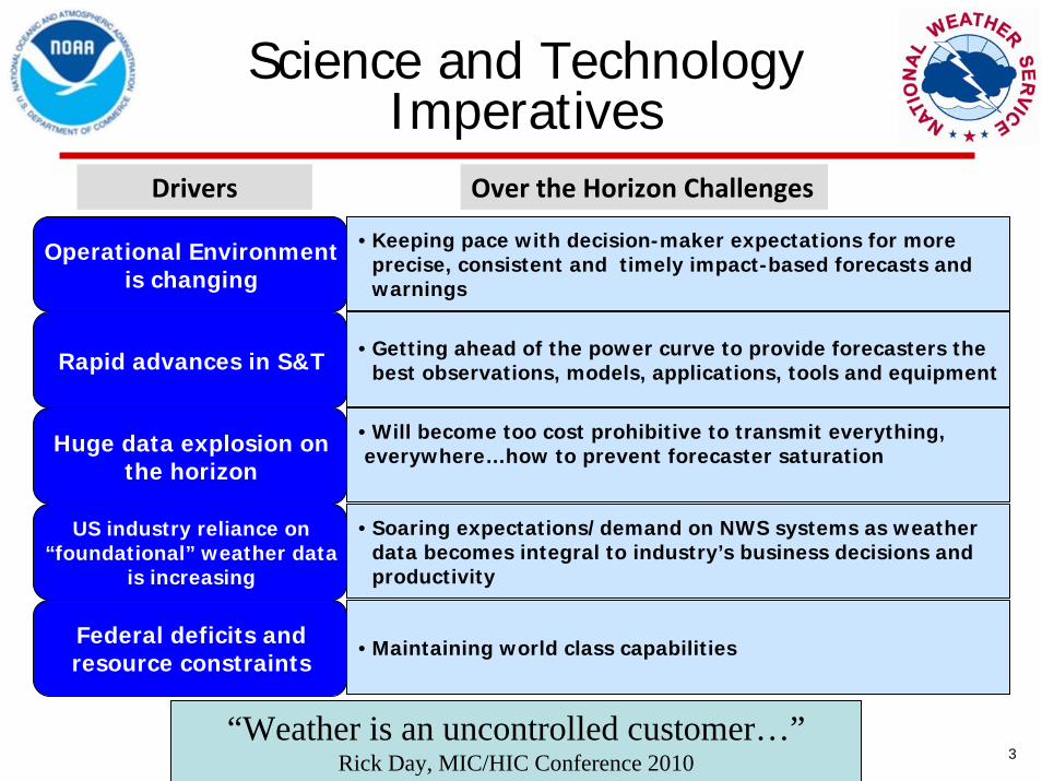
Science and Technology Imperatives
3
Operational Environment is changing
Rapid advances in S&T
Huge data explosion on the horizon
US industry reliance on “foundational” weather data
is increasing
Federal deficits and resource constraints
• Keeping pace with decision-maker expectations for more precise, consistent and timely impact-based forecasts and warnings
• Getting ahead of the power curve to provide forecasters the best observations, models, applications, tools and equipment
• Will become too cost prohibitive to transmit everything,everywhere…how to prevent forecaster saturation
• Soaring expectations/demand on NWS systems as weather data becomes integral to industry’s business decisions and productivity
• Maintaining world class capabilities
Over the Horizon ChallengesDrivers
“Weather is an uncontrolled customer…”Rick Day, MIC/HIC Conference 2010
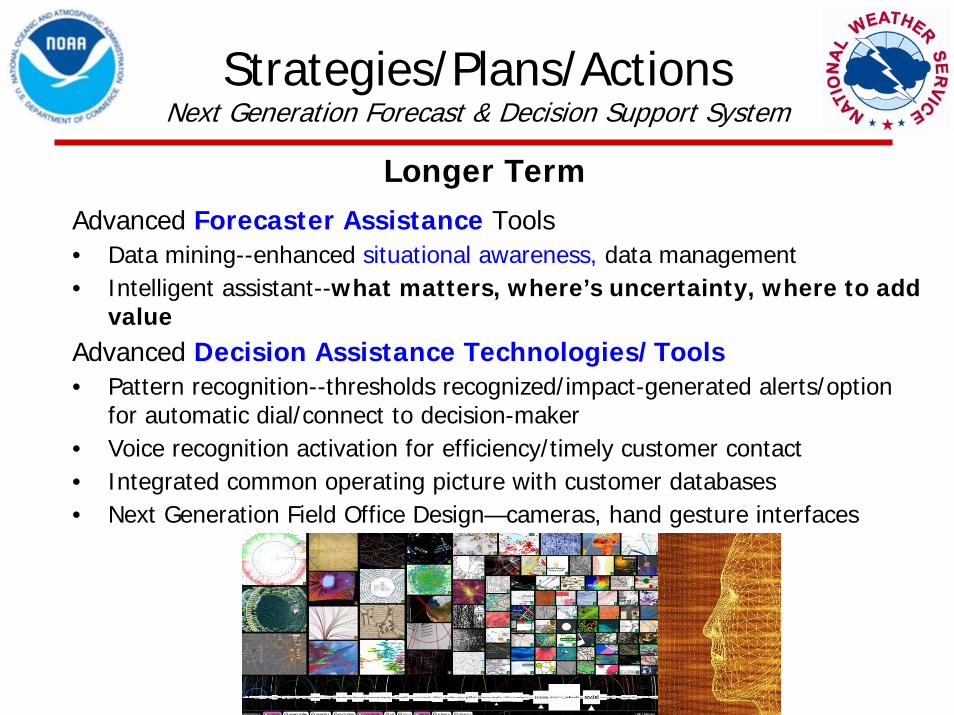
Advanced Forecaster Assistance Tools• Data mining--enhanced situational awareness, data management• Intelligent assistant--what matters, where’s uncertainty, where to add
for automatic dial/connect to decision-maker• Voice recognition activation for efficiency/timely customer contact• Integrated common operating picture with customer databases• Next Generation Field Office Design—cameras, hand gesture interfaces
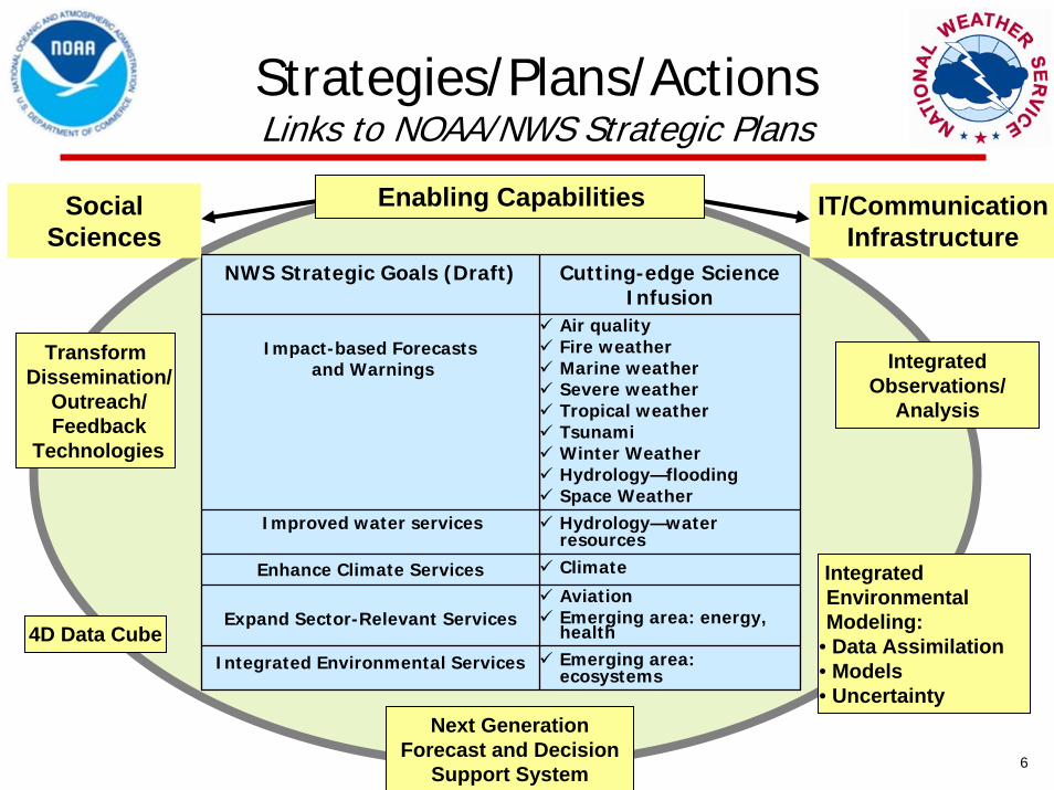
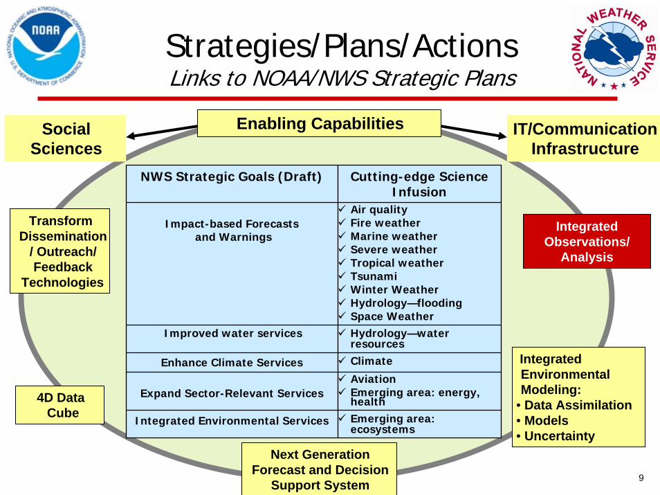
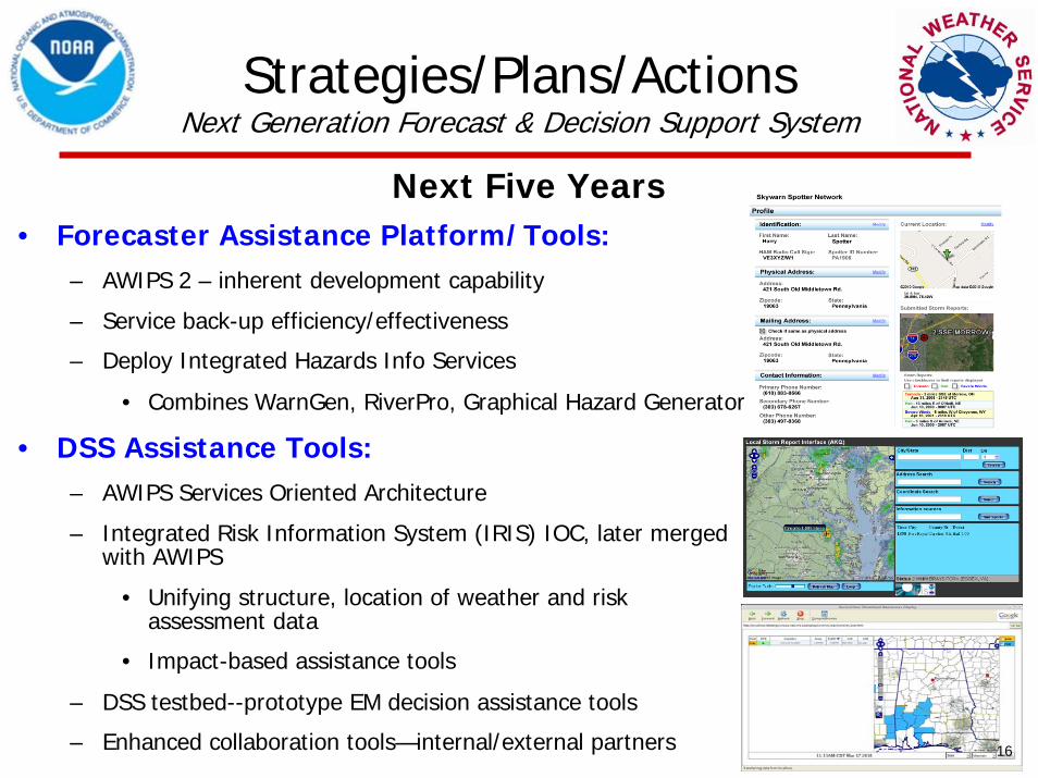
Strategies/Plans/ActionsNext Generation Forecast & Decision Support System
Longer Term
NOMADS, MADIS, NDFD data/information ready
CustomGraphic
Generators
CustomGraphic
Generators
Integration into User DecisionsIntegration into User Decisions
• Decision assistance tools/technologies– Move iNWS (WR prototype) into operations
• Alerts to PDAs, cell-phones; user decision thresholds/areas
– Hands-free technologies prototyped at DSS testbed
• Agile infusion of dissemination technologies– DSS testbed--build, prototype, test, field– Rennaissance Computing Institute (Renci) as partner
• Push/Pull IT and communications infrastructure – NWS Satellite Products User Readiness team defining what/how
needs to be delivered – Ramping up bandwidth: 2X current
Next Five Years
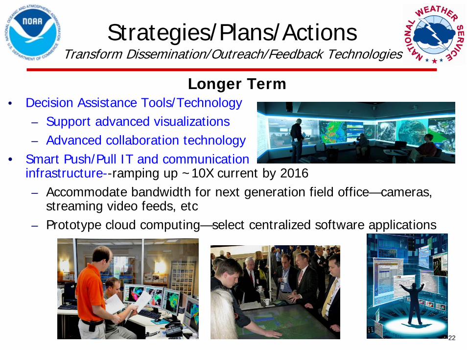
• Decision Assistance Tools/Technology– Support advanced visualizations– Advanced collaboration technology
• Smart Push/Pull IT and communication infrastructure--ramping up ~10X current by 2016– Accommodate bandwidth for next generation field office—cameras,
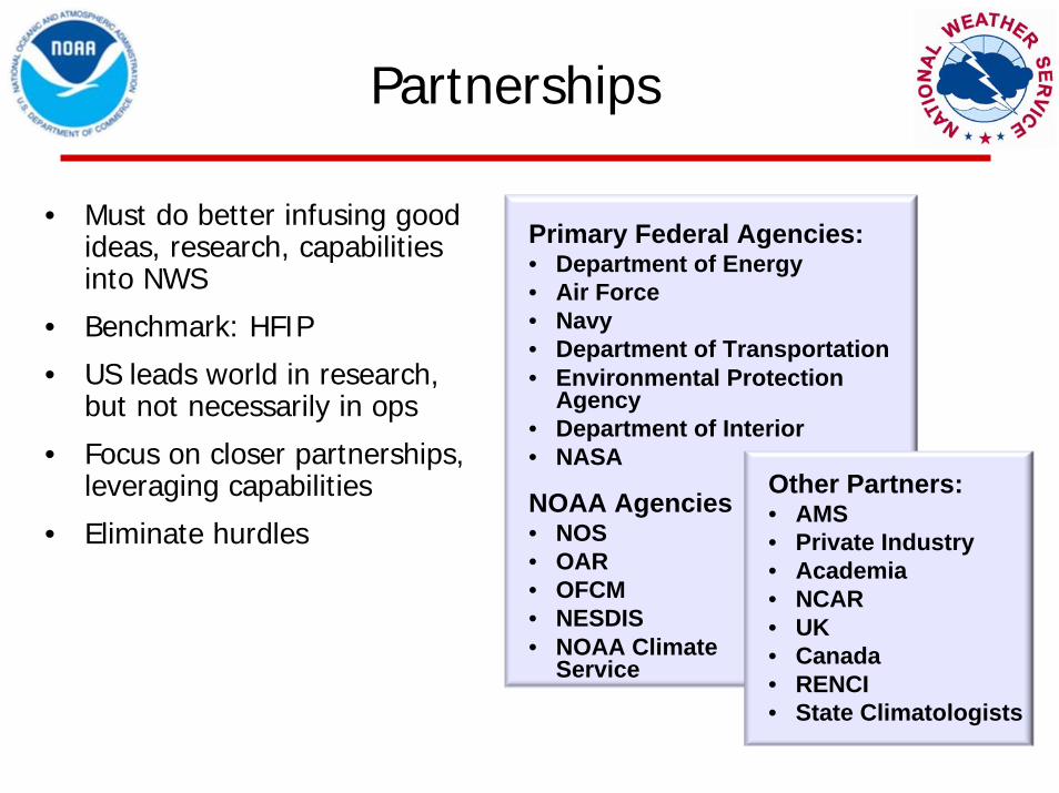
Other Partners:• AMS• Private Industry• Academia• NCAR• UK• Canada• RENCI• State Climatologists
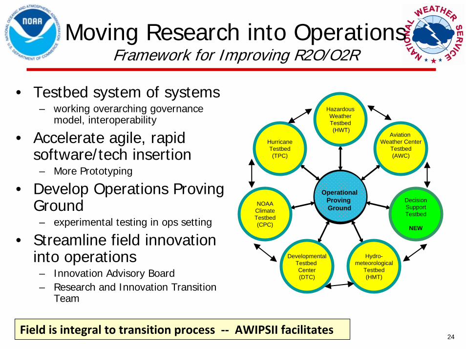
• Must do better infusing good ideas, research, capabilities into NWS
• Benchmark: HFIP
• US leads world in research, but not necessarily in ops
• Focus on closer partnerships, leveraging capabilities
• Eliminate hurdles
Implementation Challenges
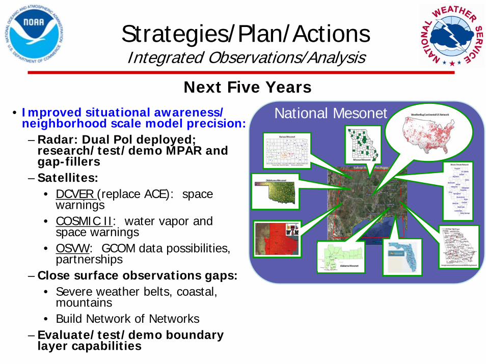
• Resources…– High Performance Computing– Satellite costs– Closing boundary layer, surface, coastal, river, sub-surface
observational gaps– Mesonet development—federal, local, state, academia and private
sector partnership challenges
• Infusing local innovations into enterprise system• IT security keeping pace w/cutting-edge technologies• Streamlined R2O/O2R--always a challenge• Culture—not invented here syndrome• Priorities…
26
Summary
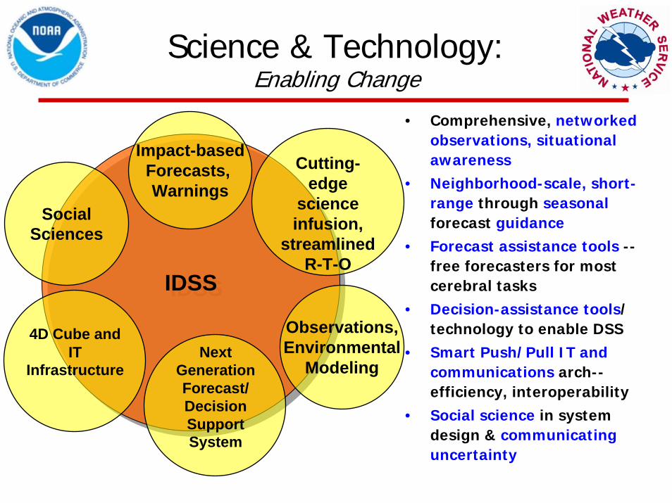
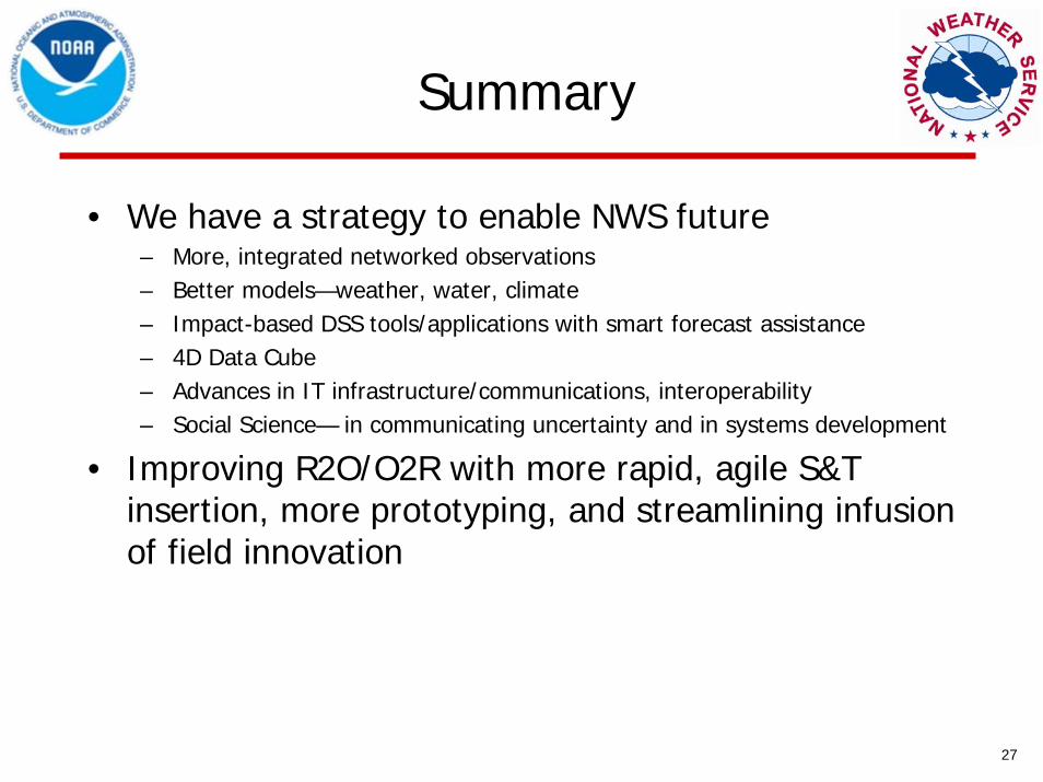
• We have a strategy to enable NWS future – More, integrated networked observations– Better models—weather, water, climate– Impact-based DSS tools/applications with smart forecast assistance– 4D Data Cube – Advances in IT infrastructure/communications, interoperability – Social Science— in communicating uncertainty and in systems development
• Improving R2O/O2R with more rapid, agile S&T insertion, more prototyping, and streamlining infusion of field innovation
27
Discussion
Backup
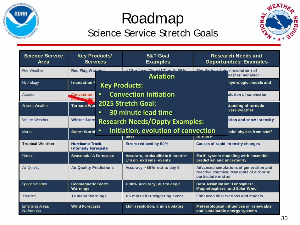
30
RoadmapScience Service Stretch Goals
RoadmapScience Service Stretch Goals
Severe Weather Tornado Warning Warn on Forecast, LT > 1hr Improved understanding of tornado formation and severe weather microphysics