25
NWS Winter Weather Products & NWS Winter Weather Products & Media Coordination Media Coordination National Weather Service National Weather Service Des Moines, IA Des Moines, IA
| Date post: | 31-Dec-2015 |
| Category: |
Documents |
| Upload: | brittany-wilkins |
| View: | 216 times |
| Download: | 1 times |

NWS Winter Weather Products & NWS Winter Weather Products & Media CoordinationMedia Coordination
National Weather Service National Weather Service
Des Moines, IADes Moines, IA

NWS Winter Weather Products NWS Winter Weather Products & Media Coordination& Media Coordination
HPC/SPC/CPC Winter Weather ProductsHPC/SPC/CPC Winter Weather Products WFO Winter Weather Products WFO Winter Weather Products Media Coordination Media Coordination Internal NWS Collaboration Internal NWS Collaboration Outreach Outreach

HPC Winter Weather Products HPC Winter Weather Products
HPC Winter Weather Website: www.hpc.ncep.noaa.gov/wwd/winter_wx.shtml
HPC Winter Weather Products HPC Winter Weather Products
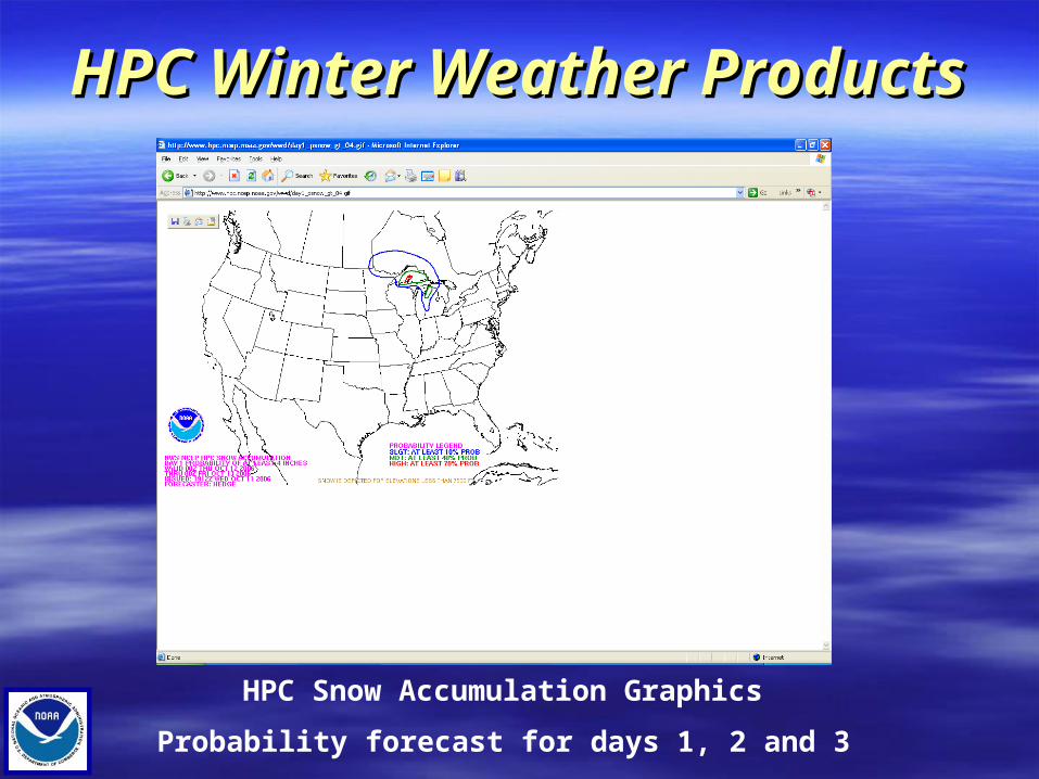
HPC Snow Accumulation Graphics
Probability forecast for days 1, 2 and 3

HPC Winter Weather Products HPC Winter Weather Products Freezing rain graphic like snowfall graphicFreezing rain graphic like snowfall graphic
Composite graphic combines 4, 8 and 12 snowfall probabilities Composite graphic combines 4, 8 and 12 snowfall probabilities
and ice graphicand ice graphic
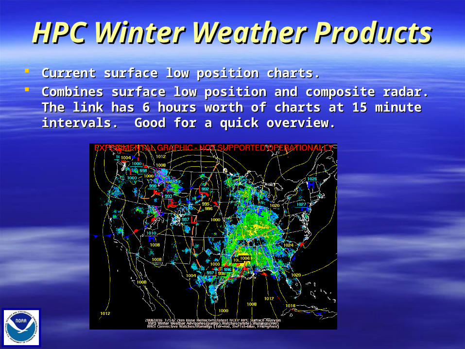
HPC Winter Weather Products HPC Winter Weather Products Current surface low position charts.Current surface low position charts. Combines surface low position and composite radar. The link has Combines surface low position and composite radar. The link has
6 hours worth of charts at 15 minute intervals. Good for a quick 6 hours worth of charts at 15 minute intervals. Good for a quick overview.overview.

HPC Winter Weather Products HPC Winter Weather Products HPC forecast significant surface low positions.HPC forecast significant surface low positions. Forecasts valid through 60 hours.Forecasts valid through 60 hours. Region with circles represent where lows historically verify 75% of the time.Region with circles represent where lows historically verify 75% of the time.

HPC Winter Weather Products HPC Winter Weather Products Low tracks and clusters.Low tracks and clusters. Through 72 hours after model run initialization.Through 72 hours after model run initialization. Cluster diagram of various model runs with HPC preffered in black. Cluster diagram of various model runs with HPC preffered in black.

HPC Winter Weather Products HPC Winter Weather Products Experimental winter weather impact graphics. Experimental winter weather impact graphics. Model derived graphics with no forecaster intervention. Model derived graphics with no forecaster intervention.
Interactive display. Interactive display.
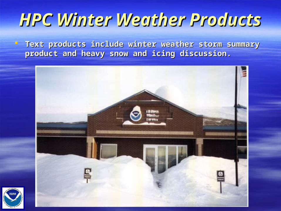
HPC Winter Weather Products HPC Winter Weather Products Text products include winter weather storm summary product and Text products include winter weather storm summary product and
heavy snow and icing discussion. heavy snow and icing discussion.

SPC Winter Products SPC Winter Products SPC issues Mesoscale discussions for winter weather under certain circumstances. SPC issues Mesoscale discussions for winter weather under certain circumstances. Mesoscale discussions focus on the “why” a significant winter weather event will Mesoscale discussions focus on the “why” a significant winter weather event will
likely occur within 3 hours. The discussion is accompanied by a graphic of the event. likely occur within 3 hours. The discussion is accompanied by a graphic of the event.

WFO OutlooksWFO OutlooksHazardous Weather Outlooks –Hazardous Weather Outlooks –Issued through day seven. Includes all hazards includingIssued through day seven. Includes all hazards including
winter weather. To be included in the HWO, the event shouldwinter weather. To be included in the HWO, the event should
have at least a 30 percent chance of reaching at leasthave at least a 30 percent chance of reaching at least
advisory criteria.advisory criteria.

WFO Winter Weather Watches WFO Winter Weather Watches Winter Weather Watches –Winter Weather Watches – Issued 12 hours through 48 hours. Issued 12 hours through 48 hours. Issued with winter weather element has at least a 50 percent probability of occurrence. Issued with winter weather element has at least a 50 percent probability of occurrence. Winter weather watches are issued for:Winter weather watches are issued for:
1.1. Winter Storm: For heavy snow, sleet, ice or a combination of elements. Winter Storm: For heavy snow, sleet, ice or a combination of elements.
2.2. Blizzard:Blizzard: For blizzard conditions.For blizzard conditions.
3.3. Wind Chill:Wind Chill: For dangerous wind chill. For dangerous wind chill.

WFO Winter Weather Warnings WFO Winter Weather Warnings Winter Weather Warnings –Winter Weather Warnings – Issued through 36 hours. Issued through 36 hours. Issued with winter weather element has at least a 80 percent probability of occurrence. Issued with winter weather element has at least a 80 percent probability of occurrence. Winter weather warnings are issued for:Winter weather warnings are issued for:
1.1. Winter Storm: For a combination of heavy snow, sleet, ice or wind (25-34 mph). Winter Storm: For a combination of heavy snow, sleet, ice or wind (25-34 mph).
2.2. Blizzard:Blizzard: At least 35 mph winds, ¼ mile visibility due to falling or blowing snow from 3 hours or more. Note there is no minimal snow forecast for a blizzard warning. At least 35 mph winds, ¼ mile visibility due to falling or blowing snow from 3 hours or more. Note there is no minimal snow forecast for a blizzard warning.
3.3. Wind Chill:Wind Chill: For dangerous wind chills of less than 30 degrees F. For dangerous wind chills of less than 30 degrees F.
4.4. Heavy Snow:Heavy Snow: At least 6 inches of snow in 12 hours or 8 inches in 24 hours. At least 6 inches of snow in 12 hours or 8 inches in 24 hours.
WFO Winter Weather WarningsWFO Winter Weather Warnings
Winter Weather Warnings –Winter Weather Warnings –5.5. Sleet:Sleet: For heavy sleet (1/2 inch or more). For heavy sleet (1/2 inch or more).
6.6. Ice:Ice: For ice of ¼ inch or more. For ice of ¼ inch or more.
WFO Winter Weather Advisories WFO Winter Weather Advisories Winter Weather Advisories –Winter Weather Advisories – Issued through 36 hours with at least an 80 percent chance of occurrence. Issued through 36 hours with at least an 80 percent chance of occurrence. Issued for the same elements as winter weather warnings, but amount thresholds lower than warning criteria. Issued for the same elements as winter weather warnings, but amount thresholds lower than warning criteria. Single element advisories. Single element advisories. If there are two or more elements, the advisory can be combined into a “winter weather advisory”. If there are two or more elements, the advisory can be combined into a “winter weather advisory”.

WFO Winter Products WFO Winter Products Winter Weather Products –Winter Weather Products – Short term forecasts:Short term forecasts: Issued in the near term to emphasize short term forecast trends.Issued in the near term to emphasize short term forecast trends. Snowfall Public Information Statements:Snowfall Public Information Statements: Issued occasionally during winter weather events with the latest snowfall totals. Issued occasionally during winter weather events with the latest snowfall totals. Local Storm Reports:Local Storm Reports: Issued for damaging events such as ice storm damage and wind damage. Issued for damaging events such as ice storm damage and wind damage. Winter Weather watch/warning/advisory product (WSW):Winter Weather watch/warning/advisory product (WSW): Product used to issue all winter weather watch/warning/advisory products. Updated four times daily in addition to initial issuance Product used to issue all winter weather watch/warning/advisory products. Updated four times daily in addition to initial issuance
(4 am, 11 am, 4 pm and 9 pm). (4 am, 11 am, 4 pm and 9 pm). Non-Precipitation Weather watch/warning/advisory product (NPW):Non-Precipitation Weather watch/warning/advisory product (NPW): Product used to issue all non-precipitation Product used to issue all non-precipitation watch/warning/advisory products. Updated four times daily watch/warning/advisory products. Updated four times daily in addition to in addition to
initial issuance (4 am, 11 am, 4 pm and 9 pm).initial issuance (4 am, 11 am, 4 pm and 9 pm).

Why VTEC?Why VTEC? Customers needed an easy-to-decode, uniform way to receive Customers needed an easy-to-decode, uniform way to receive
Watch/Warning/Advisory (W/W/A) informationWatch/Warning/Advisory (W/W/A) information Allows start to finish tracking of W/W/As Allows start to finish tracking of W/W/As Allows for quicker dissemination of W/W/A information in Allows for quicker dissemination of W/W/A information in
conjunction with UGC headerconjunction with UGC header Helps to standardize our products for both internal and external use Helps to standardize our products for both internal and external use
(webpages, TV crawls)(webpages, TV crawls)

Definition of a VTEC EventDefinition of a VTEC Event
An event is a specific combination of phenomenon (e.g., Heavy Snow, An event is a specific combination of phenomenon (e.g., Heavy Snow, Tornado, Wind) and level of significance (e.g., Watch, Warning, or Tornado, Wind) and level of significance (e.g., Watch, Warning, or Advisory). Advisory).
Common examples of events include:Common examples of events include: PhenomenonPhenomenon Level of SignificanceLevel of Significance
Heavy Snow WarningHeavy Snow Warning HSHS WW
Winter Storm WarningWinter Storm Warning WSWS W W
Tornado WatchTornado Watch TOTO AA
Wind AdvisoryWind Advisory WIWI YY
Each event given an Event Tracking Number (ETN), a four-digit number Each event given an Event Tracking Number (ETN), a four-digit number which stays with the event through its lifetime - from first issuance until which stays with the event through its lifetime - from first issuance until upgrade, downgrade, cancellation or expiration.upgrade, downgrade, cancellation or expiration.

VTEC ExplainedVTEC Explained
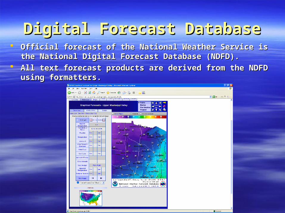
Digital Forecast DatabaseDigital Forecast Database Official forecast of the National Weather Service is the National Official forecast of the National Weather Service is the National
Digital Forecast Database (NDFD).Digital Forecast Database (NDFD). All text forecast products are derived from the NDFD using All text forecast products are derived from the NDFD using
formatters. formatters.
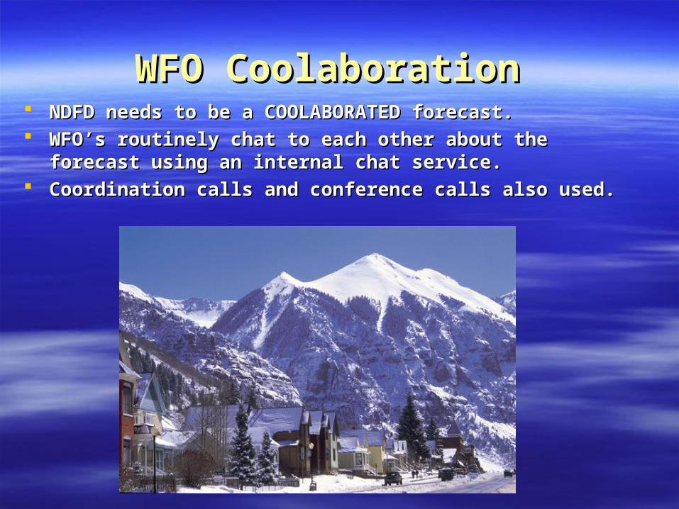
WFO Coolaboration WFO Coolaboration NDFD needs to be a COOLABORATED forecast. NDFD needs to be a COOLABORATED forecast. WFO’s routinely chat to each other about the forecast using an WFO’s routinely chat to each other about the forecast using an
internal chat service. internal chat service. Coordination calls and conference calls also used. Coordination calls and conference calls also used.

Media Collaboration Media Collaboration Using MEDIA CHAT. WFO Des Moines will have Media Chat open Using MEDIA CHAT. WFO Des Moines will have Media Chat open
at a minimum whenever a “headline” is in effect. Media Chat will at a minimum whenever a “headline” is in effect. Media Chat will be routinely open during “normal” operations. be routinely open during “normal” operations.
Media Collaboration can occur between the media and/or between Media Collaboration can occur between the media and/or between the media and the NWS using Media Chat. the media and the NWS using Media Chat.
Other methods of coordination include calling on the Media Line Other methods of coordination include calling on the Media Line (515-270-4516), or using the Media Hotline (Des Moines).(515-270-4516), or using the Media Hotline (Des Moines).

Outreach Outreach National Weather Service appreciates all public outreach done by National Weather Service appreciates all public outreach done by
the media.the media. Without the media, awareness campaigns would not be effective. Without the media, awareness campaigns would not be effective. Interviews and including the NWS in your activities is Interviews and including the NWS in your activities is
encouraged. encouraged. The NWS also appreciates all independent outreach efforts. The NWS also appreciates all independent outreach efforts. Iowa Winter Weather Day – November 9, 2006Iowa Winter Weather Day – November 9, 2006 Severe Weather Awareness Week in 2007 – First full week of April. Severe Weather Awareness Week in 2007 – First full week of April.

Thank You for Attending! Thank You for Attending!
Enjoy the PresentationsEnjoy the Presentations


