27 January 2015 Mr J Dunckley C/- Mr Mike Walrond Geosolve Limited P O Box 2427 South Dunedin Dunedin 9044 Dear Mr Walrond RESOURCE CONSENT APPLICATION LUC-2014-631: 259 MALVERN STREET, DUNEDIN Your application for resource consent for earthworks associated with the establishment of building platforms on the above property was processed on a non-notified basis, in accordance with sections 95A to 95G of the Resource Management Act 1991. In considering those sections, it was determined that any adverse effects would be no more than minor, there were no potentially affected parties in respect of the application, and there were no special circumstances in relation to the proposal. Therefore, public notification of the application was not required, and the application was considered by a senior planner under delegated authority on 27 January 2015. The council has granted consent to the application, with conditions. The report underpinning the decision is outlined below, and the decision certificate, which includes details of the consent conditions, is attached to this letter. BACKGROUND TO THE PROPOSAL In December 2011, resource consent was issued to subdivide the subject site into 19 residential lots and an access lot/common area in four stages (refer SUB-2011-25). A land use consent for residential activity with more than 12 residential units sharing a private way, and the removal of vegetation and establishment of residential activity within an Urban Landscape Management Area was also issued at this time (refer LUC-2011-100). DESCRIPTION OF ACTIVITY The application seeks resource consent for earthworks required to form residential building platforms associated with the 19-lot residential subdivision. The following earthworks are proposed: Estimated maximum depth of cut – 3m
Transcript
27 January 2015
Mr J DunckleyC/- Mr Mike WalrondGeosolve LimitedP O Box 2427South DunedinDunedin 9044
Your application for resource consent for earthworks associated with the establishment of building platforms on the above property was processed on a non-notified basis, in accordance with sections 95A to 95G of the Resource Management Act 1991. In considering those sections, it was determined that any adverse effects would be no more than minor, there were no potentially affected parties in respect of the application, and there were no special circumstances in relation to the proposal. Therefore, public notification of the application was not required, and the application was considered by a senior planner under delegated authority on 27 January 2015.
The council has granted consent to the application, with conditions. The report underpinning the decision is outlined below, and the decision certificate, which includes details of the consent conditions, is attached to this letter.
BACKGROUND TO THE PROPOSALIn December 2011, resource consent was issued to subdivide the subject site into 19 residential lots and an access lot/common area in four stages (refer SUB-2011-25). A land use consent for residential activity with more than 12 residential units sharing a private way, and the removal of vegetation and establishment of residential activity within an Urban Landscape Management Area was also issued at this time (refer LUC-2011-100).
DESCRIPTION OF ACTIVITYThe application seeks resource consent for earthworks required to form residential building platforms associated with the 19-lot residential subdivision. The following earthworks are proposed: Estimated maximum depth of cut – 3m Estimated maximum depth of fill – 4m Volume of excavated soil – 2900m³
The proposed earthworks relate only to the creation of building platforms, and not the establishment of accesses, which were addressed as part of the subdivision consent.
Subdivision consent SUB-2011-25 has not yet been completed, and the land is still held in the underlying 3.7875ha title, legally described as Lot 30 Deposited Plan 23390, held in computer freehold register OT15B/293.
REASONS FOR APPLICATIONThe subject site is zoned Residential 1 in the Dunedin City District Plan. A portion of the site (in the form of a 10m wide corridor passing across the lower to middle of the
property) is part of an urban landscape conservation area (ULCA24 - Leith Valley Dunedin). The hazard information held by the council indicates that part of the property is within an area where land stability has been identified as a potential hazard.
LandscapeAs noted above, issues relating to the Leith Valley Dunedin Urban Landscape Conservation Area were addressed and authorised by land use consent LUC-2011-100 and are not considered further in this report.
EarthworksAs noted above, excavations of approximately 2900m³ are proposed, involving cut and/or fill up to 4.0m in depth. As such, the proposal does not comply with the following district plan rules: Permitted Activity Rule 17.7.3(ii), Table 17.5, which specifies that on sites
within an urban landscape conservation area, the maximum volume of excavation and fill is 10m³, and the maximum change in ground level is 1.0m
Controlled Activity Rule 17.7.4(iii), Table 17.6, which specifies that on all sites outside of the Rural zone, the maximum volume of excavation and fill is 250m³, and the maximum change in ground level is 2.0m. Some of the proposed earthworks are not within the ULCA corridor, but nevertheless breach these thresholds.
The earthworks are a restricted discretionary activity pursuant to Rule 17.7.5(ii), and the council's discretion is restricted to assessing those effects detailed under that rule. In assessing these effects, the council will have regard to assessment matters 17.8.1 to 17.8.6.
PLANNING ASSESSMENTAffected PersonsNo written approvals from affected persons were included with the application. No person or party is considered to be adversely affected by the proposal, for the reasons outlined below in the section headed ‘Effects on the Environment’.
Effects on the EnvironmentThe following assessment of effects on the environment has been carried out in accordance with Section 104(1) of the Resource Management Act 1991. It addresses those assessment matters listed in Section 17.8 of the district plan considered relevant to the proposed activity, and is carried out on the basis that the environment is characterised by a mix of medium density residential activity and bush clad slopes. The topography of the land and nearby Water of the Leith are key physical features which influence the nature and extent of development in this locality.
Any actual or potential effects on the environment of allowing this proposal to proceed will be no more than minor for the following reasons:
1. Effects on Stability and Flood Risk (Assessment Matter 18.7.1) The application was referred to the council's consultant engineers, MWH, for assessment. The geotechnical engineer, Mr Lee Paterson, has commented as follows:
…HazardsThere are no relevant natural hazards recorded against the property. Notwithstanding this, the land at this address has been the subject of separation from the Leithton Close subdivision and of previous subdivision applications. As part of those previous applications our records show the following: Manmade fill may have been deposited within proposed Lots 1 to 5
inclusive from uphill of this flat area. Details regarding soil types, depth, and compaction are not known.
The terrace forming much of Lots 18 and 19 may be an ancient landslide slump feature. We have no record of movement of the terrace, nor any report of investigations into this feature.
2
…Previous CommunicationsMWH provided input to the previous application in April 2011 as follows:
We note the intention of the applicants to minimise the extent of bush clearance from the steeper slopes within this subdivision. Protection of these areas will mitigate the risk of soil erosion and intercept a percentage of surface runoff from the hillside.
The possible presence of fill ground within the flatter Stage 1 and 2 lots should be investigated or a consent notice should flag for these lots the need for subsoil investigations when designing the individual dwellings to mitigate the risk of settlement damage.
The terrace at Lots 18 and 19 should be investigated by a geotechnical consultant to establish whether any creep movement has occurred in recent decades and therefore whether any mitigation works (such as subsoil drainage) should be undertaken prior to Stage 3 development.
We also recommended: immediate investigations into the presence of fill within Stages 1
and 2, or the application of a suitably worded consent notice for the relevant subdivision lots
the investigation, prior to Stage 3 development, into long term stability of the terrace at Lots 18 and 19 of the subdivision.
DiscussionThe application provides design advice on the specific geometry by Geosolve; a respected geotechnical specialist firm.
The proposal need not create or exacerbate instabilities on this or adjacent properties provided it is appropriately designed and certified.
No earthworks are yet proposed on Lots 17, 18 or 19, in accordance with previous advice. Development of these lots will be subject to specific engineering assessment of long-term piezometric monitoring and ground stability modelling.
AdviceThe development includes significant earthwork on a steep slope. We recommend that advice be made to the effect:- Fill Earthworks beneath dwelling platforms must be engineered in
accordance with NZS 4431-1989 Code of Practice for Earthfill for Residential Development
All cut and fill slopes must be signed off as stable by a suitably qualified person.
All engineered / reinforced earth fill slopes must be designed, specified and Producer-Statement-Certified by an appropriately qualified Engineer to provide minimum acceptable Factors of Safety against foreseeable load conditions for internal (local) and external (global) stability.
All Storm water runoff must be controlled to avoid displacement of concentrated overland flows onto adjacent landowners.
Development of lots 17, 18 and 19 will be subject to specific engineering assessment of long-term piezometric monitoring and ground stability modelling.
It is considered appropriate to include conditions of consent and advice notes to reflect Mr Paterson’s advice in the bullet points above, to ensure the design and construction of the earthworks is properly carried out and supervised, and
3
that appropriate measures are put in place to avoid damage to adjoining land and property during the excavation period – see attached decision certificate.
2. Effects on Neighbours (Assessment Matter 17.8.2) The nature of the work proposed is such that there is the potential for issues of noise and dust to arise. The application states:
The works are not expected to adversely affect the environment as they are approved in principle by the subdivision consent process… To ensure that silt runoff and erosion will not affect neighbouring properties, standard erosion and sediment control procedures will be in place during construction… Operating hours will comply with regulatory requirements for noise. Dust control will be achieved via water application if excessive dust is released from site.
Notwithstanding these comments, it is considered prudent to include consent conditions requiring that the earthworks activity be limited to the times and noise limits set out in the New Zealand Standard NZS 6803:1999; and that excavated soil be watered down if necessary to reduce dust. Please refer to the attached decision certificate.
Subject to compliance with these conditions of consent, it is considered that the potential for adverse effects on neighbouring properties will be adequately mitigated.
3. Effects on Visual Amenity and Landscape (Assessment Matter 17.8.3) The potential for excavated soil to have an adverse effect if left banked up for an indefinite length of time is such that it is considered appropriate to include a condition of consent requiring that any surplus soil be used for landscaping or removed from the site within six months of excavations and earthworks being completed, and that any surplus fill be appropriately disposed of at an approved clean fill site.
4. Effects on any Archaeological or Cultural Sites (Assessment Matter 17.8.4) The subject site is not included in Schedule 25.2 (Archaeological Sites) of the district plan and there is no other information to hand that indicates that the property has particular archaeological or cultural significance. Nevertheless, consent conditions are included in the attached decision certificate which detail the process to be followed should koiwi tangata (human skeletal remains), waahi taoka (resources of importance), waahi tapu (places or features of special significance) or other Maori artefact material be discovered within the site, or in the event that excavations reveal any feature or archaeological material that predates 1900, or heritage material, or disturb a previously unidentified archaeological or heritage site.
5. Effects on the Transportation Network (Assessment Matter 17.8.5) A number of truck movements associated with the cartage of excavated soil from the site is to be expected with any building project. Given the scale and likely duration of the project, a number of such movements are anticipated, but it is unlikely that these movements will have a more than minor effect on the transportation network.
6. Sedimentation Effects (Assessment Matter 17.8.6) In the interests of best practice, a consent condition is included in the attached decision certificate requiring that appropriate measures and devices are installed to control and contain storm water run-off from the site during earthworks, and as the site is developed. In addition, an advice note is included encouraging the consent holder to adhere to the best practice guidelines for managing erosion and sediment control measures.
CONSENT DECISIONThat, pursuant to sections 34A(1), 104 and 104C of the Resource Management Act 1991, the Dunedin City Council grants consent to a discretionary (restricted)
4
activity being earthworks associated with the establishment of building platforms at 259 Malvern Street, Dunedin, legally described as Lot 30 Deposited Plan 23390 (computer freehold register OT15B/293), subject to the conditions imposed under Section 108 of the Act, as shown on the attached certificate.
REASONSEffectsIn accordance with Section 104(1)(a) of the Resource Management Act 1991, the actual and potential adverse effects associated with the proposed activities have been assessed and outlined above. It is considered that the proposal will have no more than minor adverse effects on the environment.
District Plan – Objectives and PoliciesIn accordance with Section 104(1)(b) of the Resource Management Act 1991, the objectives and policies of the district plan were taken into account when assessing the application. The proposal is considered to be consistent with the following objectives and policies:
Objective 17.2.3 and Policy 17.3.9 (Hazards, Hazardous Substances and Earthworks), which seek to ensure that earthworks are undertaken in a manner that does not put the safety of people or property at risk, and minimises adverse effects on the environment.
RIGHTS OF OBJECTIONIn accordance with Section 357A of the Resource Management Act 1991, the consent holder may object to this decision or any condition within 15 working days of the decision being received, by applying in writing to the Dunedin City Council at the following address:
Senior Planner - EnquiriesDunedin City Council P O Box 5045Moray PlaceDunedin 9058
MONITORINGSection 35(2)(d) of the RMA requires every council to monitor resource consents that have effect in its region or district. The scale and nature of the activity, the complexity and number of the conditions needed to address the environmental effects and whether the conditions have been complied with determine the number of monitoring inspections required. Given the nature of your intended works, this consent will require one inspection.
The City Planning Department sets out the fixed fees charged for monitoring in its schedule of fees. The fee for your scheduled inspection will be included in the invoice for your application.
If additional inspections are required beyond those scheduled at the time the consent is issued, there is the ability to apply additional charges to cover the costs of the extra inspections. You can reduce the need for additional inspections by complying with the conditions of consent in a timely manner and by ensuring ongoing compliance with those conditions. Please ensure that you read the conditions of your consent carefully to establish your obligations when exercising your consents.
Yours faithfully
Karen Bain
5
Planner
6
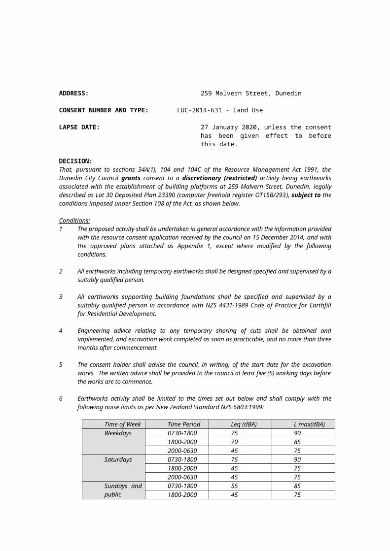
ADDRESS: 259 Malvern Street, Dunedin
CONSENT NUMBER AND TYPE: LUC-2014-631 - Land Use
LAPSE DATE: 27 January 2020, unless the consent has been given effect to before this date.
DECISION:That, pursuant to sections 34A(1), 104 and 104C of the Resource Management Act 1991, the Dunedin City Council grants consent to a discretionary (restricted) activity being earthworks associated with the establishment of building platforms at 259 Malvern Street, Dunedin, legally described as Lot 30 Deposited Plan 23390 (computer freehold register OT15B/293), subject to the conditions imposed under Section 108 of the Act, as shown below.
Conditions:1 The proposed activity shall be undertaken in general accordance with the
information provided with the resource consent application received by the council on 15 December 2014, and with the approved plans attached as Appendix 1, except where modified by the following conditions.
2 All earthworks including temporary earthworks shall be designed specified and supervised by a suitably qualified person.
3 All earthworks supporting building foundations shall be specified and supervised by a suitably qualified person in accordance with NZS 4431-1989 Code of Practice for Earthfill for Residential Development.
4 Engineering advice relating to any temporary shoring of cuts shall be obtained and implemented, and excavation work completed as soon as practicable, and no more than three months after commencement.
5 The consent holder shall advise the council, in writing, of the start date for the excavation works. The written advice shall be provided to the council at least five (5) working days before the works are to commence.
6 Earthworks activity shall be limited to the times set out below and shall comply with the following noise limits as per New Zealand Standard NZS 6803:1999:
7 Any soil exposed during excavation and/or construction of the retaining walls shall be watered down when necessary, to reduce the potential for nuisance from dust.
8 Any surplus excavated soil remaining on the property shall be used for landscaping or removed from the site within six months of excavations and earthworks being
completed. Any surplus excavated soil shall be disposed of to an approved clean fill site (i.e. a site where dumping of fill is permitted by the district plan or authorised by resource consent). The consent holder shall ensure contractors are advised accordingly.
9 To ensure effective management of erosion and sedimentation, appropriate measures and devices are to be installed to control and contain storm water run-off from the site during earthworks and as the site is developed. Temporary drainage connections to an approved stormwater outlet are to be installed if necessary.
10 If the consent holder:
(a) discovers koiwi tangata (human skeletal remains), waahi taoka (resources of importance), waahi tapu (places or features of special significance) or other Maori artefact material, the consent holder shall:
(i) notify the Consent Authority, Tangata whenua and New Zealand Historic Places Trust and, in the case of skeletal remains, the New Zealand Police.
(ii) stop work within the immediate vicinity of the discovery to allow a site inspection by the New Zealand Historic Places Trust and the appropriate runanga and their advisors, who shall determine whether the discovery is likely to be extensive, if a thorough site investigation is required, and whether an Archaeological Authority is required.
Any koiwi tangata discovered shall be handled and removed by tribal elders responsible for the tikanga (custom) appropriate to its removal or preservation.
Site work shall recommence following consultation with the Consent Authority, the New Zealand Historic Places Trust, Tangata whenua, and, in the case of skeletal remains, the New Zealand Police, provided that any relevant statutory permissions have been obtained.
(b) discovers any feature or archaeological material that predates 1900, or heritage material, or disturbs a previously unidentified archaeological or heritage site, the consent holder shall:
(i) stop work within the immediate vicinity of the discovery or disturbance; and
(ii) advise the Consent Authority, the New Zealand Historic Places Trust, and in the case of Maori features or materials, the Tangata whenua, and if required, shall make an application for an Archaeological Authority pursuant to the Historic Places Act 1993; and
(iii) arrange for a suitably qualified archaeologist to undertake a survey of the site.
Site work shall recommence following consultation with the Consent Authority.
Advice Notes:1 Any future development of lots 17, 18 and 19 will be subject to specific
engineering assessment of long-term piezometric monitoring and ground stability modelling.
2 The consent holder is reminded that any retaining walls supporting over 1.5m, a surcharge, slope or terracing must be designed, specified and supervised by a suitably qualified person prior to and during their construction.
8
3 All structures (and associated drainage), excavation and construction activity must be contained within the property boundaries.
4 The consent holder is encouraged to adhere to the best practice guidelines for managing erosion and sediment control measures for small sites, as set out in the Dunedin City Council "Silt and Sediment Control for Smaller Sites" document.
5 In addition to the conditions of a resource consent, the Resource Management Act 1991 establishes through Sections 16 and 17 a duty for all persons to avoid unreasonable noise, and to avoid, remedy or mitigate any adverse effect created from an activity they undertake.
6 A resource consent is pertinent to the property to which it relates, and consequently the ability to exercise this consent is not restricted to the party who applied and/or paid for the consent application.
7 The lapse period specified above may be extended on application to the council pursuant to Section 125 of the Resource Management Act 1991.
8 It is the responsibility of any party exercising this consent to comply with any conditions imposed on the resource consent prior to and during (as applicable) exercising the resource consent. Failure to comply with the conditions may result in prosecution, the penalties for which are outlined in Section 339 of the Resource Management Act 1991.
Issued at Dunedin on 27 January 2015
Karen BainPlanner
9
Appendix 1: Copy of Approved Plans for LUC-2014-631: (Scanned images, not to scale)