41
Pavement Condition Data – Locally Maintained Roads Tanveer Chowdhury, P.E. Maintenance Division, VDOT Sept. 17, 2013

Pavement Condition Data –
Locally Maintained Roads
Tanveer Chowdhury, P.E.
Maintenance Division, VDOT Sept. 17, 2013

Pavement Condition Data
• Data collection scope
• Data collection protocols
• Index used
• Data description
• Data/images viewing software
• Understanding the Ratings
• Questions

Scope of Pavement Data Collection
• Data collection is contracted out to Fugro-Roadware
• About 2800 directional miles of data was collected on local
arterial roads
• For VDOT Total yearly collection: approx. 20,400
directional miles
– Interstate: approx. 2,200 directional miles (100% of IS
system)
– Primary: approx. 10,500 directional miles (100% of PR
system)
– Secondary: approx. 7,700 directional miles (~20% of
SC system)
• Secondary system is on a 5-year collection cycle

Pavement Data Collection
• Pavement distress data collected using digital
imagery and semi-automated crack detection
methodology
• Sensors collect roughness and rutting data
• Cracking data processed by software
• Patching, bleeding, and delamination are
evaluated by distress raters with the images on a
computer screen

5
Distress Rating
• Distress rating manual –
protocol to identify and
quantify distresses
• Originated from PAVER
manual used by US Army
Corps of Engineers
• Modified following guidance
from SHRP LTPP distress
rating manual

Data Collection Vehicle
•Inventory from
imagery
•Location determined
•Offset measured
•Height and width
measured
•Sign code recorded
•Condition assessment
Assets
•Image recognition
software
•Strobe-lit
pavement video
•Roughness
•Texture
•Rutting
•Surface Distress
•Ground Penetrating
Radar
Pavement
•Inertial measurement
unit
•HPMS curve type
•Long. Grade
•Cross slope
•Centerline mapping
•Spatial referencing for
GIS integration
Geometry &
Spatial
•Single view
•Panoramic view
•1300 x 1030 pixel
•1920 x 1080 (HDTV)
•Direct-to-digital
•Custom angles
Photolog

High Definition Right of Way Images
• High Definition 1920 x 1080 CCD
Camera
• Wide angle High Definition images
• A single image every 21 feet
(variable)

International Roughness Index (IRI)
• Laser SDP System
• 16 kHz laser in each
wheelpath
• Measures continuous
longitudinal profile of the
roadway

Laser Rut Measuring System
• Pair of rear mounted INO Lasers
• Measure full transverse profile of the road surface to over 1,200 points
• Transverse profile is evaluated to determine the depths of ruts

Pavement Distress Marking

Distress Data Collected
• Asphalt Surfaced pavement
• Alligator Cracking
• Longitudinal Cracking
• Transverse Cracking
• Patching
• Potholes
• Delaminations
• Bleeding
• Rutting
• Reflection cracking
•Jointed concrete pavement
• Longitudinal Cracking • Transverse Cracking • Divided Slabs • Blowups • Patches (PCC/AC) • Spalling of long/trans cracks • Joint seal condition
•Continuously reinforced concrete pavement
• Transverse Cracking • Clustered Cracking • Punchouts • Patches (PCC/AC) • Spalling of longitudinal cracking • Joint seal condition
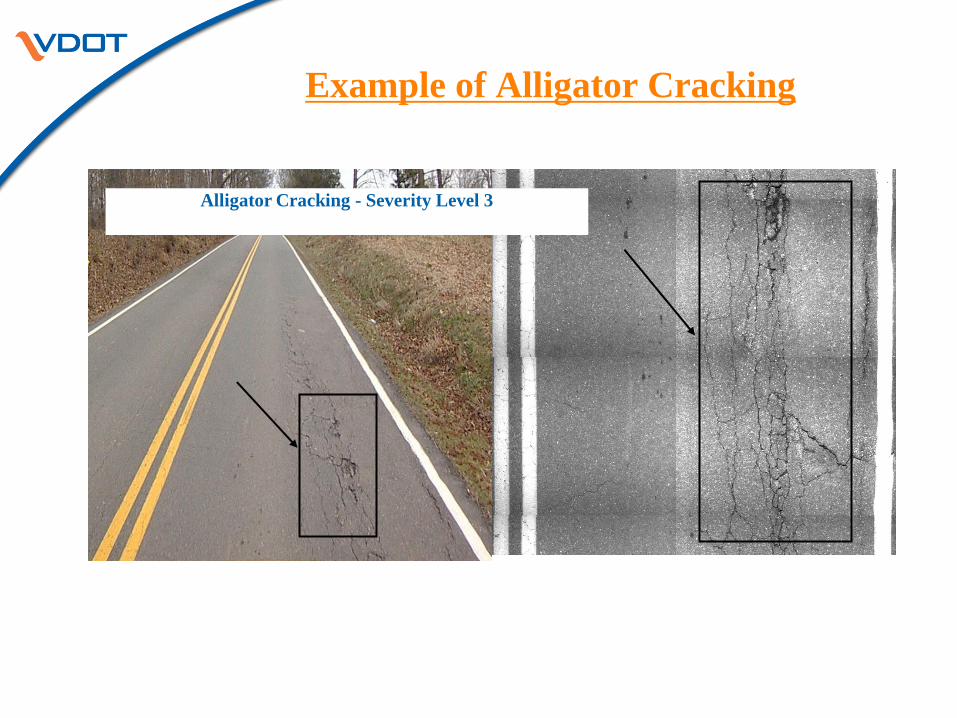
Example of Alligator Cracking
Alligator Cracking - Severity Level 3

Example of Transverse Cracking

Example of Longitudinal Cracking
Longitudinal Cracking - Severity Level 2

Example of Rutting
An Example of Rutting

Data Summarization: Data Delivery Formats
• Summarization of Production Data
– Split by road system
– Split by pavement type
• Asphalt Concrete Pavements (ACP)
– Bituminous (BIT)
– Bituminous over Continuously Reinforced Concrete (BOC)
– Bituminous over Jointed Reinforced Concrete (BOJ)
• Continuously Reinforced Concrete Pavement (CRCP)
• Jointed Concrete Pavement (JRCP)
– Delivered in 0.10 Mile and 1 mile sections

Data Summarization -
Pavement Condition Indices
• Flexible Pavement
– Load Related Distress Rating (LDR)
– Non-load Related Distress Rating (NDR)
• Jointed Concrete Pavement
– Slab Distress Rating (SDR)
• Continuously Reinforced Concrete Pavement
– Concrete Distress Rating (CDR)
– Concrete Punchout Rating (CPR)
• The lower of the two index values is the Critical Condition Index (CCI)

Pavement Condition Index Calculation

Pavement Condition by CCI Index
– Pavement Condition Category based on CCI
• Excellent (≥ 90)
• Good (Between 70 and 89)
• Fair (Between 60 and 69)
• Poor (Between 50 and 59)
• Very Poor (≤ 49)
– Poor and Very Poor pavements are termed as
“deficient”

Control Site Preliminary Data Collection
• 14 control sites – Distributed across each system and pavement type
– Wide range of pavement conditions between sites
• Review of results from control sites by third party consultant – Establish precision and bias values for roughness and rutting measurements
– Calibrate the pavement distress rating process
• Consultant reviews against reference values based on average rating from four experienced raters
• Comparison of Individual Data Collection Vehicles to Reference Values – At least 3 runs per site per truck
– Single truck results are reviewed for reasonableness and repeatability

QA, QC and IV&V of Production Data –
Roadware’s Internal QA/QC
• Initial QA/QC
– Equipment QC at Control Sites
• Accuracy
– IRI: ± 5% of VDOT Reference Value
– Rut: ± 2mm of VDOT Reference Value
• Repeatability
– 5 runs at highway speeds, limit < 5%
QA, QC and IV&V of Production Data –
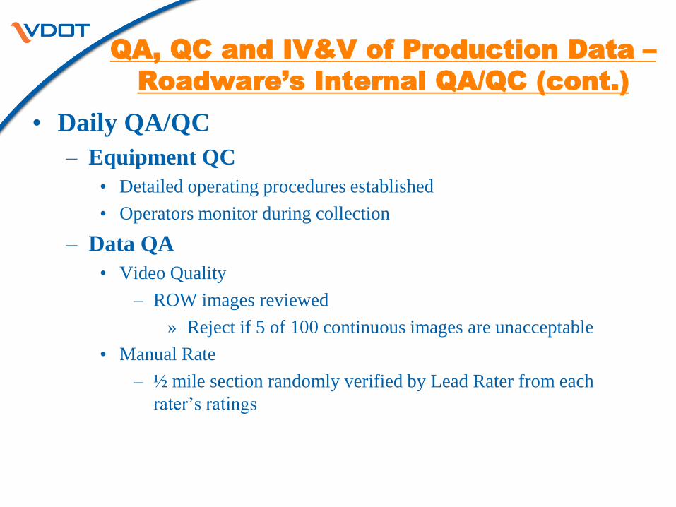
Roadware’s Internal QA/QC (cont.)
• Daily QA/QC
– Equipment QC
• Detailed operating procedures established
• Operators monitor during collection
– Data QA
• Video Quality
– ROW images reviewed
» Reject if 5 of 100 continuous images are unacceptable
• Manual Rate
– ½ mile section randomly verified by Lead Rater from each
rater’s ratings

Data Collection Scope
• The data collection scope did not include the entire
locally maintained network of roads
• About 2800 miles of data was collected on arterials
(major and minor) roads maintained by the
localities
• Approximately 65% of the roads were primaries
while the rest were secondaries

Data Collected by Locality -
Bristol Maintenance District
District Jurisdiction Directional
Miles
Bristol 101-Town of Big Stone Gap 6.3
Bristol 102-City of Bristol 25.2
Bristol 119-Town of Marion 6.1
Bristol 139-Town of Wytheville 12.1
Bristol 140-Town of Abingdon 8.8
Bristol 143-Town of Bluefield 4.9
Bristol 146-City of Norton 3.9
Bristol 148-Town of Richlands 4.3
Bristol 158-Town of Tazewell 12.7
Bristol 252-Town of Lebanon 7.6
Bristol 295-Town of Saltville 3.3
Bristol 329-Town of Wise 5.9

Data Collected by Locality -
Salem Maintenance District
District Jurisdiction Directional
Miles
Salem 113-City of Galax 15.0
Salem 118-City of Lynchburg 0.5
Salem 120-City of Martinsville 22.8
Salem 125-Town of Pulaski 18.0
Salem 126-City of Radford 22.0
Salem 128-City of Roanoke 93.8
Salem 129-City of Salem 29.5
Salem 141-City of Bedford 10.1
Salem 149-Town of Vinton 5.7
Salem 150-Town of Blacksburg 19.8
Salem 154-Town of Christiansburg 17.1
Salem 157-Town of Rocky Mount 7.9
Salem 266-Town of Narrows 0.1
Salem 279-Town of Pearisburg 1.3

Data Collected by Locality -
Lynchburg Maintenance
District
District Jurisdiction Directional
Miles
Lynchburg 108-City of Danville 88.1
Lynchburg 118-City of Lynchburg 94.9
Lynchburg 130-Town of South Boston 16.5
Lynchburg 144-Town of Farmville 8.0
Lynchburg 162-Town of Altavista 2.4

Data Collected by Locality -
Richmond Maintenance
District
District Jurisdiction Directional
Miles
Richmond 043-Henrico 180.7
Richmond 106-City of Colonial Heights 10.3
Richmond 116-City of Hopewell 25.4
Richmond 123-City of Petersburg 44.0
Richmond 127-City of Richmond 181.8
Richmond 142-Town of Blackstone 6.4
Richmond 166-Town of Ashland 9.2
Richmond 186-Town of Chase City 0.8
Richmond 301-Town of South Hill 13.4

Data Collected by Locality -
Hampton Roads Maintenance
District
District Jurisdiction Directional
Miles
Hampton Roads 109-City of Emporia 7.9
Hampton Roads 114-City of Hampton 108.4
Hampton Roads 121-City of Newport News 105.2
Hampton Roads 122-City of Norfolk 181.8
Hampton Roads 124-City of Portsmouth 103.2
Hampton Roads 131-City of Chesapeake 203.9
Hampton Roads 133-City of Suffolk 213.9
Hampton Roads 134-City of Virginia Beach 276.1
Hampton Roads 137-City of Williamsburg 16.0
Hampton Roads 145-City of Franklin 14.9
Hampton Roads 147-City of Poquoson 4.6
Hampton Roads 190-Town of Chincoteague 4.3

Data Collected by Locality -
Fredericksburg and Culpeper
Maintenance Districts
District Jurisdiction Directional
Miles
Fredericksburg 111-City of Fredericksburg 22.2
Fredericksburg 199-Colonial Beach 5.3
Culpeper 104-City of Charlottesville 35.7
Culpeper 156-Town of Warrenton 12.7
Culpeper 204-Town of Culpeper 10.0
Culpeper 275-Town of Orange 10.0

Data Collected by Locality -
Staunton Maintenance
District
District Jurisdiction Directional
Miles Staunton 103-City of Buena Vista 6.6 Staunton 105-Town of Clifton Forge 3.3
Staunton 107-City of Covington 5.4 Staunton 112-Town of Front Royal 8.7 Staunton 115-City of Harrisonburg 29.3
Staunton 117-City of Lexington 5.3
Staunton 132-City of Staunton 29.3 Staunton 136-City of Waynesboro 24.5 Staunton 138-City of Winchester 15.2
Staunton 159-Town of Luray 8.8
Staunton 168-Berryville 2.4
Staunton 176-Town of Bridgewater 4.8
Staunton 177-Broadway 2.1 Staunton 216-Town of Elkton 1.0
Staunton 228-Town of Grottoes 1.7 Staunton 306-Town of Strasburg 2.7
Staunton 330-Town of Woodstock 3.8

Data Collected by Locality -
Northern Virginia
Maintenance District
District Jurisdiction Directional
Miles
Northern Virginia 000-Arlington 50.3
Northern Virginia 100-City of Alexandria 66.8
Northern Virginia 110-City of Falls Church 10.2
Northern Virginia 151-City of Fairfax 26.1
Northern Virginia 152-City of Manassas Park 5.6
Northern Virginia 153-Town of Vienna 11.2
Northern Virginia 155-City of Manassas 33.0
Northern Virginia 235-Town of Herndon 14.4
Northern Virginia 253-Town of Leesburg 25.8
Northern Virginia 286-Purcellville 1.4

Data Description
• Data dictionary describes the details of the data
• Provided for each pavement type
• Detailed description is provided for field name, format, and
unit of measure
• Link to the data: http://www.virginiadot.org/business/local-
assistance-programs.asp#UrbanHighways

Extract from Data Dictionary
Description Field Name Pavement
Type Units Format
RNS route name ROUTE_NAME
ALL
xxxxxxxxxxxxxxxxx
xxxxxxxxxxxxxxxxx
x
Full name of
LOC_COMP_DIREC
TIONALITY_CD
LOC_COMP_DIRECTIONALITY
_NAME
ALL
xxxxxxxxxxxxxxxx
LOC_COMP_DIREC
TIONALITY_CD
LOC_COMP_DIRECTIONALITY
_CD
ALL
x
Route ID CHTRIS_ID ALL xxxxxxxxxx Date Tested DDATE ALL
YYYYMMDD Maintenance District NMAINT_DIS ALL
9
Maintenance
Jurisdiction
NMAINT_JUR ALL
999 VDOT Number of
Lanes (Windshield)
NLANE ALL
9
Survey Direction CDIRECTION ALL x
VDOT Begin County
relative mile point
NBEG_MP ALL
Mile 999.999
VDOT End County
relative mile point
NEND_MP ALL
Mile 999.999

Extract from Data Dictionary
(contd.)
Description Field Name Pavement Type Units Format
Alligator Cracking Severity 1 NA_CR1_SF BIT/BOJ/BOC
Square Feet 99999
Alligator Cracking Severity 2 NA_CR2_SF BIT/BOJ/BOC
Square Feet 99999
Alligator Cracking Severity 3 NA_CR3_SF BIT/BOJ/BOC
Square Feet 99999
Patching Area - wheel path NPA_WP_SF BIT/BOJ/BOC Square Feet 999999
Patching Area - Non wheel
path
NPA_NWP_SF BIT/BOJ/BOC
Square Feet 999999 Potholes Count NPOT_NO BIT/BOJ/BOC
Count 999
Delaminations Area NDELAM_SF BIT/BOJ/BOC
Square Feet 9999 Bleeding Severity 1 NBLEED1_SF BIT/BOJ/BOC
Square Feet 9999 Bleeding Severity 2 NBLEED2_SF BIT/BOJ/BOC
Square Feet 9999 Average Deeper Rut
(Straight-edge)
NRUT_S_AVG BIT/BOJ/BOC
Inch 9.99

Major Distresses Impacting
Pavement Ratings
• Load Related Distresses (LDR)
– Alligator Cracking Severity Level 1, 2 and 3
– Rutting
– Wheel Path Patching
• Non-Load Related Distresses (NDR)
– Transverse Cracking Severity Level 1 and 2
– Reflective Transverse Cracking Severity Level 1, 2
and 3
– Longitudinal Cracking Severity Level 1 and 2
– Reflective Longitudinal Cracking Severity Level 1,
2 and 3
– Longitudinal Joint Cracking Severity Level 1 and 2
– Non-Wheel Path Patching

Ivision
• VDOT requested for a system that allowed
users to view the images and data
simultaneously in a user friendly
environment
• Ivision has a small band width and can be
used by authorized personnel with internet
access
• Primarily thumbnail images are viewed but
ability to view full size images exists

Ivision Demo

Understanding the Ratings
• What it represents: − Individual distresses collected
− Summarized by 10th mile and 1 mile sections
− Represents condition at the network level
− Represents the condition of the surface (may or may not
give indication about underlying problems)
− Whether the distresses are load related or
environmental/material related
− Consistent way of assessing the entire network
− Snapshot in time
38

Understanding the Ratings
• What it does not represent/ limitations: − Does not give a clear picture of the sub-surface or
structural issues
− If the length of the section is long, may dilute localized
problems
− If the length of the section is short, may exaggerate
distressed condition
− May be affected by time and temperature of the pavement
during survey
− Should be seen in the context of maintenance history, the
ratings may not represent the complete field condition of
the pavement section
39

Understanding the Ratings
• While the ratings represent an overall condition
of the pavement, for project level decision
making, the localities:
− Need to look at the 0.1 mile ratings and the detailed
distresses
− Have the knowledge of maintenance history
− Perform field visits
− Perform other investigations (coring, FWD etc.) as
necessary
40

Thank You


