Pensacola Bay Bridge Replacement Pensacola Bay Bridge Replacement Project Development & Environment Study Project Development & Environment Study Project Development & Environment Study Project Development & Environment Study Presentation to Florida Presentation to Florida Alabama Alabama Presentation to Florida Presentation to Florida-Alabama Alabama Transportation Planning Organization Transportation Planning Organization TCC, CAC, BPAC, & TPO Meetings TCC, CAC, BPAC, & TPO Meetings Feb 23 Feb 23 rd rd / Mar 12 / Mar 12 th th , 13 , 13 th th , 14 , 14 th th 2012 2012
Transcript
Pensacola Bay Bridge ReplacementPensacola Bay Bridge ReplacementProject Development & Environment StudyProject Development & Environment StudyProject Development & Environment StudyProject Development & Environment Study
Presentation to FloridaPresentation to Florida AlabamaAlabamaPresentation to FloridaPresentation to Florida--AlabamaAlabamaTransportation Planning OrganizationTransportation Planning OrganizationTCC, CAC, BPAC, & TPO MeetingsTCC, CAC, BPAC, & TPO MeetingsFeb 23Feb 23rdrd / Mar 12/ Mar 12thth, 13, 13thth, 14, 14thth 20122012
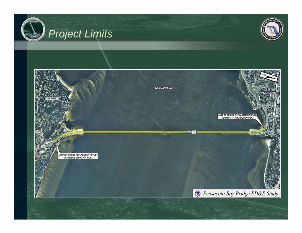
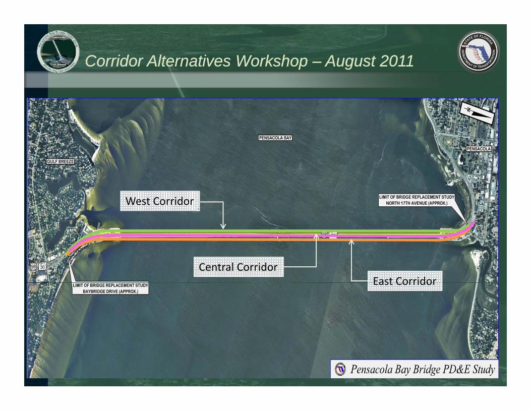
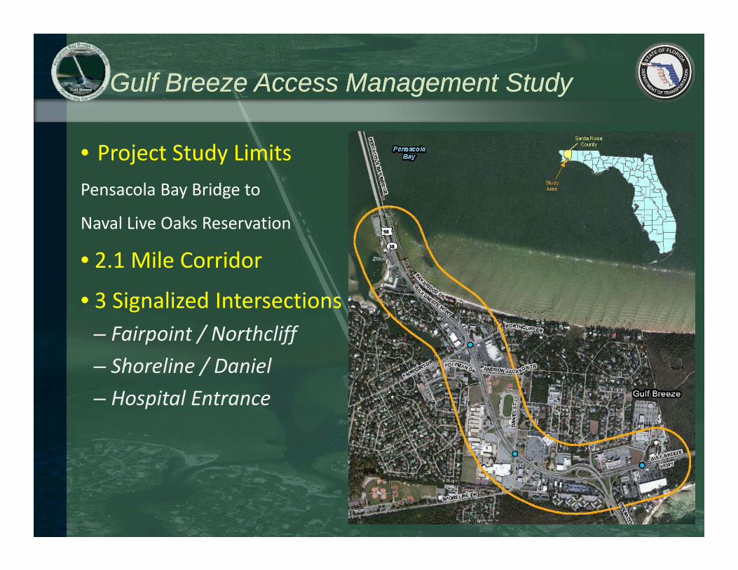
Project LimitsProject Limits
PurposePurpose
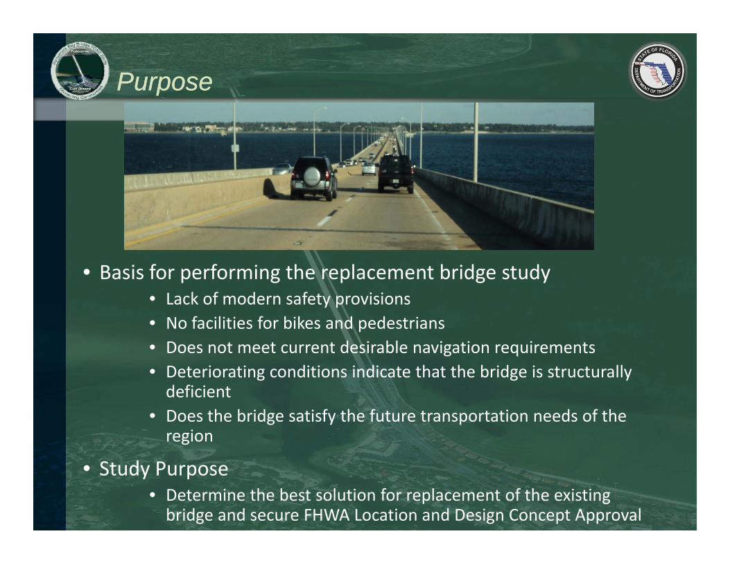
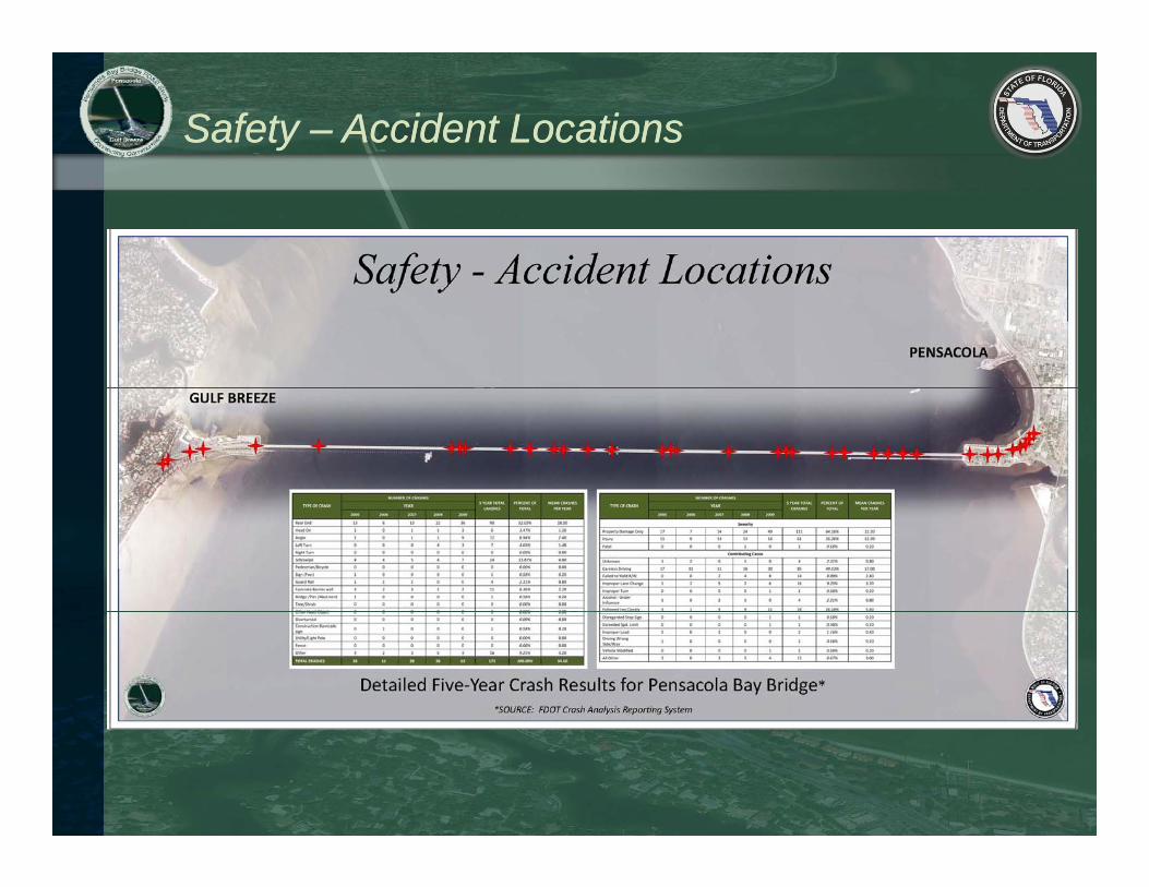
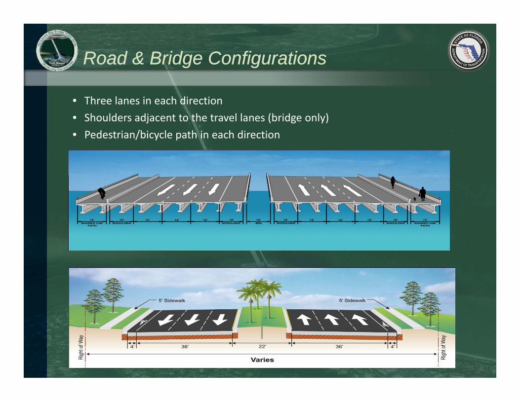
• Basis for performing the replacement bridge study• Lack of modern safety provisions N f ili i f bik d d i• No facilities for bikes and pedestrians
• Does not meet current desirable navigation requirements• Deteriorating conditions indicate that the bridge is structurally d fi i tdeficient
• Does the bridge satisfy the future transportation needs of the region
• Study Purpose• Determine the best solution for replacement of the existing bridge and secure FHWA Location and Design Concept Approval
Project DeliveryProject Delivery
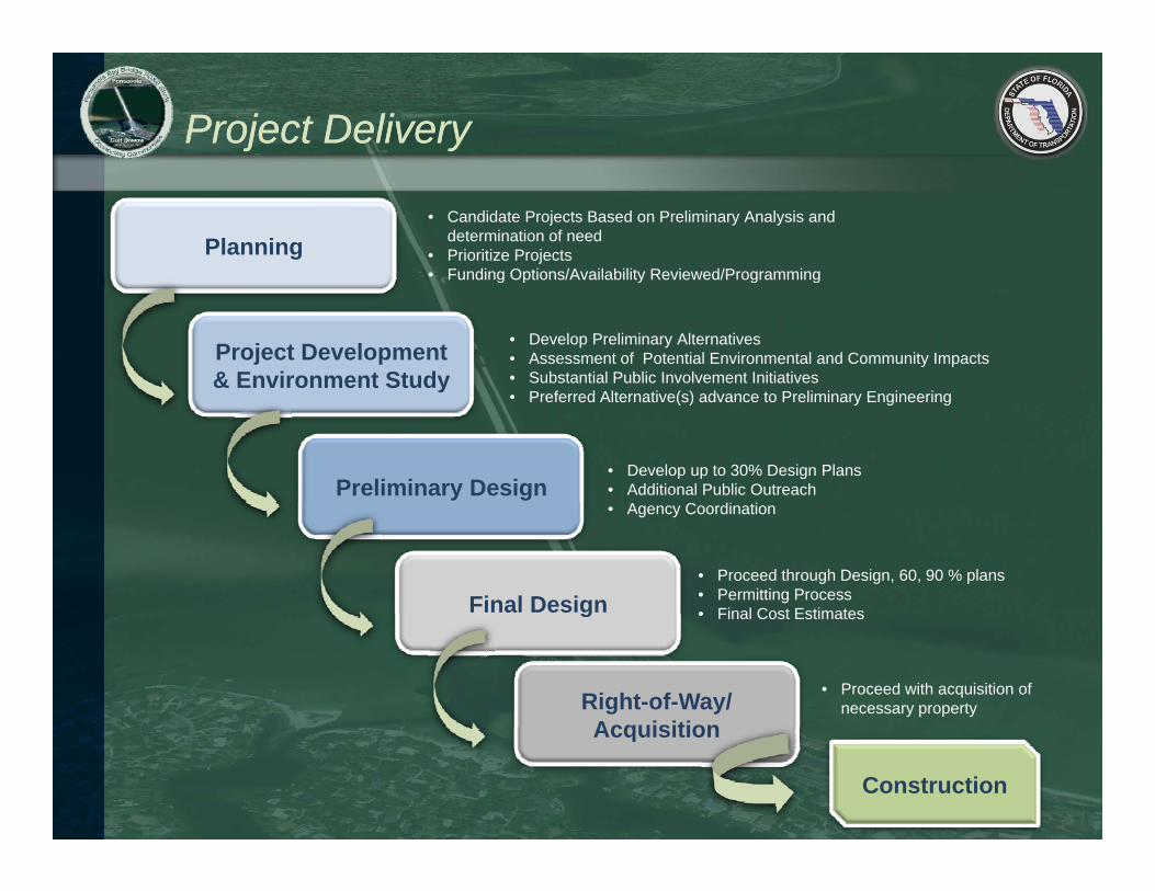
Planning• Candidate Projects Based on Preliminary Analysis and
determination of need• Prioritize Projects• Funding Options/Availability Reviewed/Programming
Project Development & Environment Study
Funding Options/Availability Reviewed/Programming
• Develop Preliminary Alternatives• Assessment of Potential Environmental and Community Impacts • Substantial Public Involvement Initiativesy
Preliminary Design
• Preferred Alternative(s) advance to Preliminary Engineering
• Develop up to 30% Design Plans• Additional Public Outreach
Final Design
• Agency Coordination
• Proceed through Design, 60, 90 % plans• Permitting Process• Final Cost Estimatesg
Right-of-Way/ Acquisition
• Final Cost Estimates
• Proceed with acquisition of necessary property
Acquisition
Construction
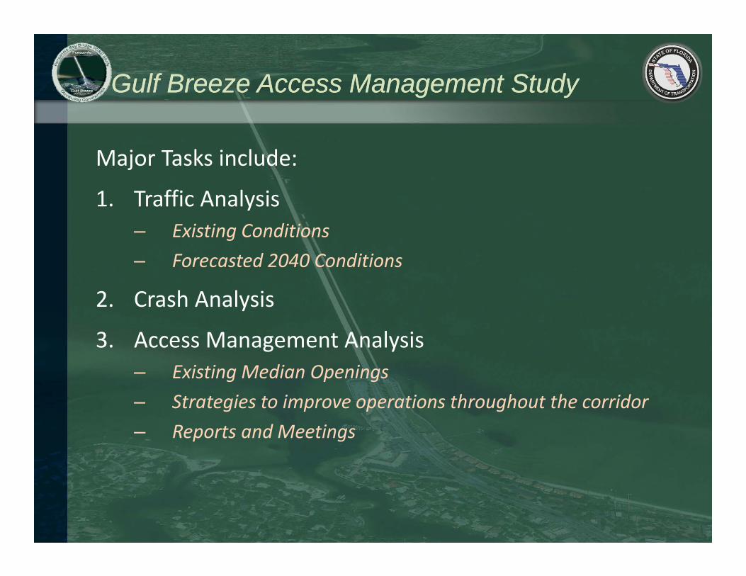
PD&E Task ElementsPD&E Task Elements
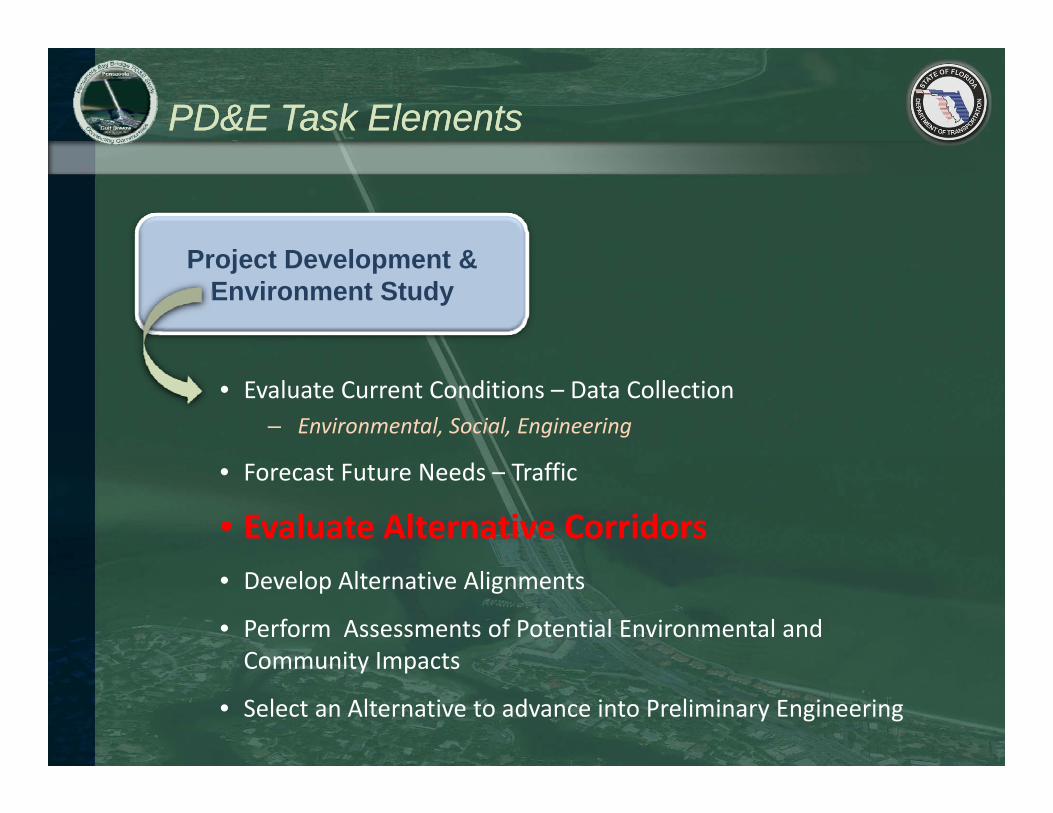
P j t D l t &Project Development & Environment Study
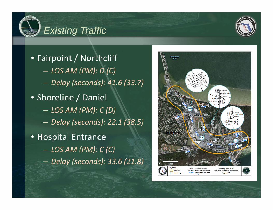
• Evaluate Current Conditions – Data Collection– Environmental, Social, Engineering
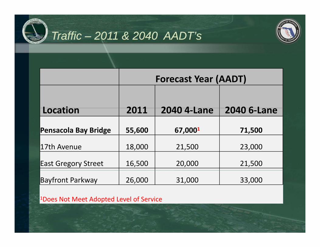
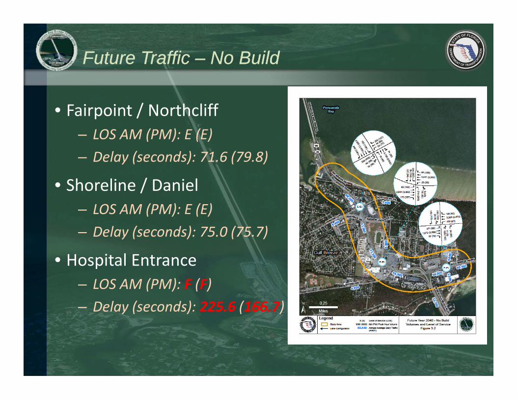
• Forecast Future Needs – Traffic
• Evaluate Alternative Corridors• Develop Alternative Alignments
• Perform Assessments of Potential Environmental and Community ImpactsCommunity Impacts
• Select an Alternative to advance into Preliminary Engineering
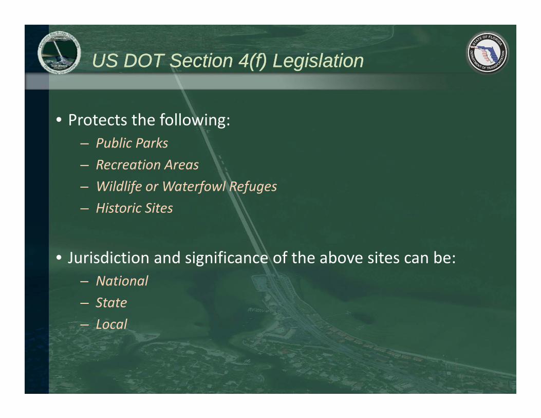
US DOT Section 4(f) LegislationUS DOT Section 4(f) Legislation
• Protects the following:– Public Parks– Recreation Areas
Wildlif W t f l R f– Wildlife or Waterfowl Refuges– Historic Sites
• Jurisdiction and significance of the above sites can be:– National– State– Local
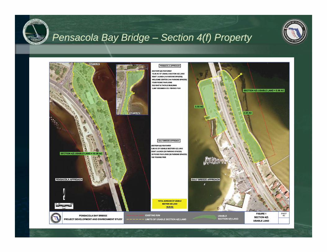
Pensacola Bay Bridge Pensacola Bay Bridge –– Section 4(f) PropertySection 4(f) Property
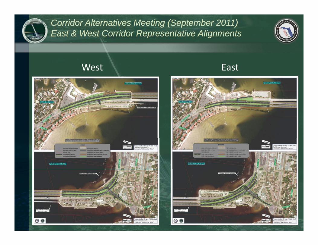
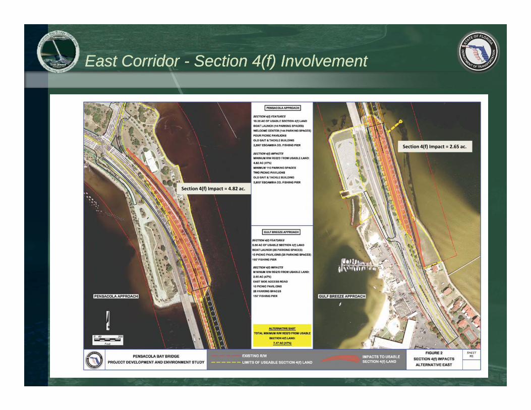
East Corridor East Corridor -- Section 4(f) InvolvementSection 4(f) Involvement
Section 4(f) Impact = 2.65 ac.
Section 4(f) Impact = 4.82 ac.
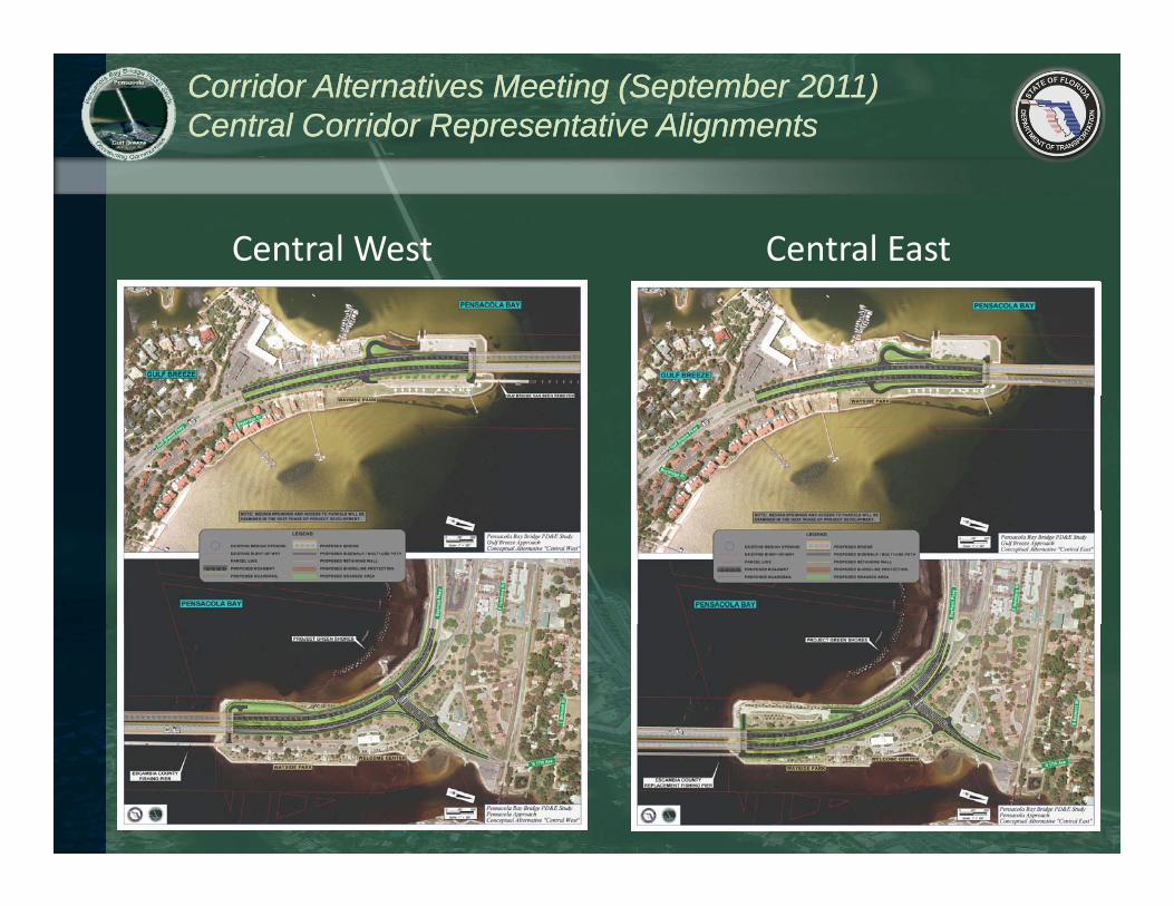
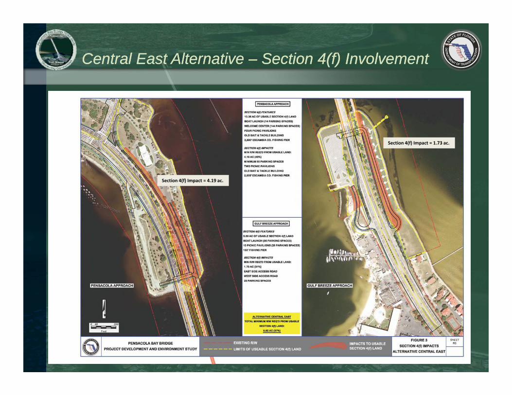
Central East Alternative Central East Alternative –– Section 4(f) InvolvementSection 4(f) Involvement
Section 4(f) Impact = 1.73 ac.
Section 4(f) Impact = 4.19 ac.
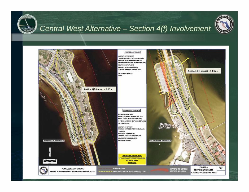
Central West Alternative Central West Alternative –– Section 4(f) InvolvementSection 4(f) Involvement
Section 4(f) Impact = 1.04 ac.
Section 4(f) Impact = 0.00 ac.
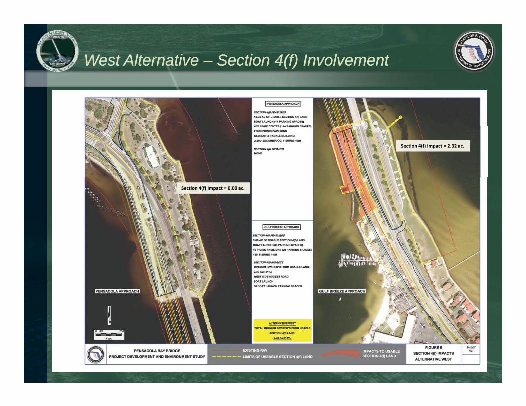
West Alternative West Alternative –– Section 4(f) InvolvementSection 4(f) Involvement
Section 4(f) Impact = 2.32 ac.
Section 4(f) Impact = 0.00 ac.
US DOT Section 4(f) LegislationUS DOT Section 4(f) Legislation
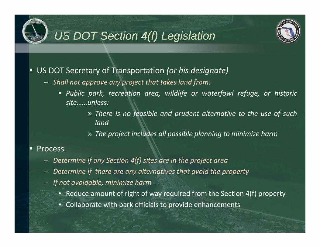
• US DOT Secretary of Transportation (or his designate)– Shall not approve any project that takes land from:
• Public park, recreation area, wildlife or waterfowl refuge, or historicsite……unless:
» There is no feasible and prudent alternative to the use of suchland
» The project includes all possible planning to minimize harm
• Process– Determine if any Section 4(f) sites are in the project area
Determine if there are any alternatives that avoid the property– Determine if there are any alternatives that avoid the property– If not avoidable, minimize harm
• Reduce amount of right of way required from the Section 4(f) property• Collaborate with park officials to provide enhancements
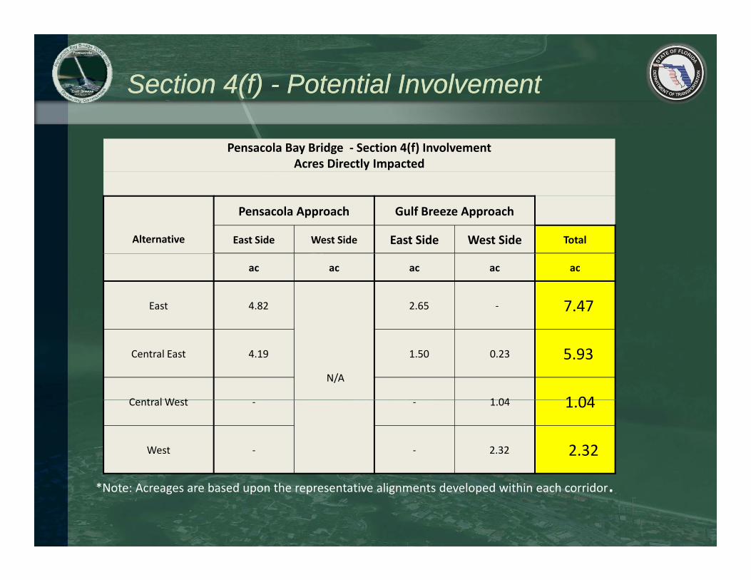
Pensacola Bay Bridge ‐ Section 4(f) InvolvementAcres Directly Impacted
Alternative
Pensacola Approach Gulf Breeze Approach
East Side West Side East Side West Side Total
ac ac ac ac ac
East 4.82 2.65 ‐ 7.47
N/A
Central East 4.19 1.50 0.23 5.93
C t l W t 1 04 1 04Central West ‐ ‐ 1.04 1.04
West ‐ ‐ 2.32 2.32
*Note: Acreages are based upon the representative alignments developed within each corridor.
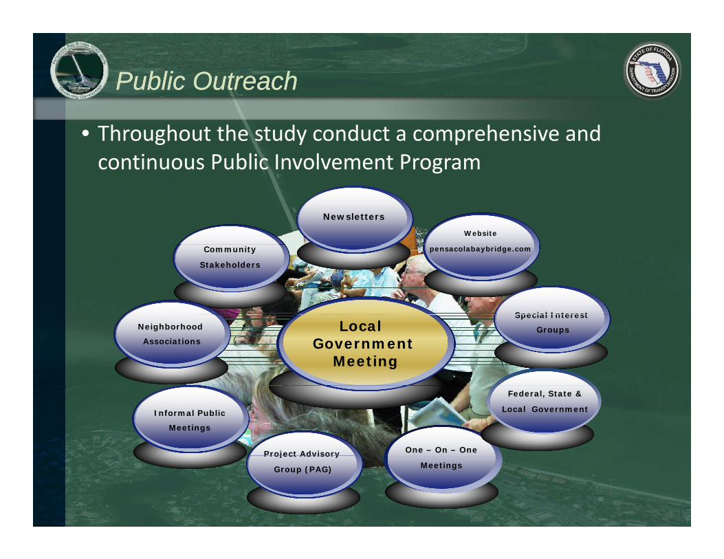
Public OutreachPublic Outreach
• Throughout the study conduct a comprehensive and continuous Public Involvement Program
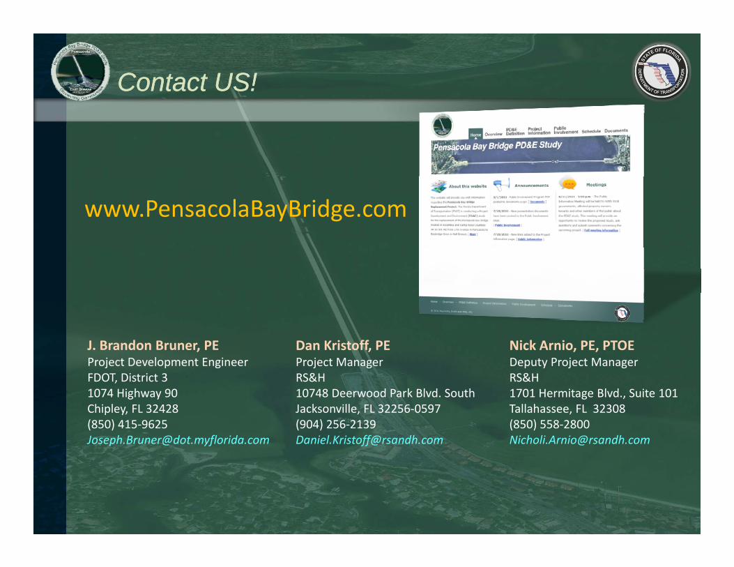
Website
Newsletters
pensacolabaybridge.comCommunity
Stakeholders
Special InterestNeighborhood
Associations
Special Interest
GroupsLocal Government
Meeting
One – On – One
Informal Public
Meetings
Project Advisory
Local, State
& Federal
Officials
Federal, State &
Local Government
MeetingsProject Advisory
Group (PAG)
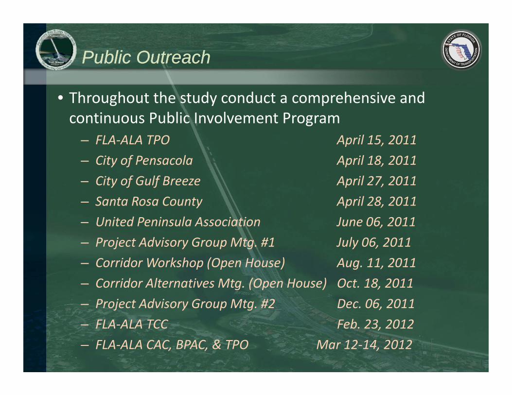
Public OutreachPublic Outreach
• Throughout the study conduct a comprehensive and continuous Public Involvement Programcontinuous Public Involvement Program
– FLA‐ALA TPO April 15, 2011– City of Pensacola April 18, 2011– City of Gulf Breeze April 27, 2011– Santa Rosa County April 28, 2011– United Peninsula Association June 06 2011– United Peninsula Association June 06, 2011– Project Advisory Group Mtg. #1 July 06, 2011– Corridor Workshop (Open House) Aug. 11, 2011– Corridor Alternatives Mtg. (Open House) Oct. 18, 2011– Project Advisory Group Mtg. #2 Dec. 06, 2011
FLA ALA TCC Feb 23 2012– FLA‐ALA TCC Feb. 23, 2012– FLA‐ALA CAC, BPAC, & TPO Mar 12‐14, 2012
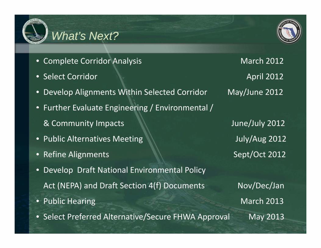
What’s Next?What’s Next?
• Complete Corridor Analysis March 2012
• Select Corridor April 2012• Select Corridor April 2012
• Develop Alignments Within Selected Corridor May/June 2012


![Pensacola Journal. (Pensacola, Florida) 1908-03-08 [p 11].](https://static.documents.pub/doc/80x56/61bd218761276e740b0fabbe/pensacola-journal-pensacola-florida-1908-03-08-p-11.jpg)


![Pensacola Journal. (Pensacola, Florida) 1908-12-05 [p 2].](https://static.documents.pub/doc/80x56/619d680ad06f7d3cb96cfa45/pensacola-journal-pensacola-florida-1908-12-05-p-2.jpg)


![Pensacola Journal. (Pensacola, Florida) 1909-08-08 [p 10].](https://static.documents.pub/doc/80x56/61cbb8b00e8e361d7a3444f7/pensacola-journal-pensacola-florida-1909-08-08-p-10.jpg)


