12
Proposed Preliminary Urban Renewal Area Boundary Submitted by The Elk Mountains Planning Group, Inc. December 2, 2009

Proposed Preliminary Urban
Renewal Area Boundary
Submitted by
The Elk Mountains Planning Group, Inc.
December 2, 2009

City of Alamosa Preliminary Urban Renewal Area Boundary
Elk Mountains Planning Group / Reid Architects Page 2
The City of Alamosa funded this study to determine if its commercial core area could qualify as an Urban
Renewal Area as defined under CRS 31-25-103(2). It is intended only to determine preliminary
boundaries for a URA and should not be considered an Urban Renewal Plan for the City of Alamosa. The
proposed boundary is schematic and may or may not conform to actual lot lines.
This study was completed by the Consulting Team of:
Julie Ann Woods, AICP/ASLA
The Elk Mountains Planning Group
PO Box 11891
Aspen, CO 81612
970-923-9485 and 970-948-0802
And
Suzannah Reid, Architect
Reid Architects
PO Box 1303
Aspen, CO 81612
970-920-9225

City of Alamosa Preliminary Urban Renewal Area Boundary
Elk Mountains Planning Group / Reid Architects Page 3
TABLE OF CONTENTS
1. Introduction and Background
2. Evaluation Criteria
3. Method of Analysis
4. Approach
5. Proposed Preliminary URA Boundary
6. Financing Tools
7. Preliminary Findings
8. Preliminary Recommendations
EXHIBITS
A. Sample Site Data Form
B. Parking lots within and in proximity to the proposed URA boundary
C. Preliminary URA Boundary
D. Zoning Map with URA Boundary
E. Water Service Map
F. Sanitary Sewer Service Map
G. Storm Sewer Service Map
H. Transportation Infrastructure Map (including streets, alleys, sidewalks and trails)

City of Alamosa Preliminary Urban Renewal Area Boundary
Elk Mountains Planning Group / Reid Architects Page 4
Introduction and Background
In the Spring of 2009, the City of Alamosa put
out a request for proposals for a planning
consultant that could assist the municipality in
evaluating whether the commercial core and
adjacent lands could qualify to be designated an
Urban Renewal Area (URA). The City had
previously established an Urban Renewal Area
years ago, but no work was done to pursue a
downtown revitalization.
The Elk Mountains Planning Group (EMPG) was
hired in June 2009 to evaluate the area and
determine what might be an appropriate
boundary. EMPG specializes in resort and
mountain town planning and has offices in
Crested Butte and Snowmass Village. The
President of EMPG is Julie Ann Woods,
AICP/ASLA who has over 30 years of planning
and landscape architecture experience. EMPG
partnered with Reid Architects, located in
Aspen, to assist in building evaluations and
boundary assessment. Suzannah Reid,
Architect and Principal of Reid Architects,
specializes in the evaluation of historic buildings
and districts throughout Colorado.
It should be clear that the Consulting Team was
not hired to develop an Urban Renewal Plan.
This would be the next step should the City
decide to pursue the establishment of an Urban
Renewal Authority. The Team was hired only to
help the City identify a preliminary boundary
around a “blighted area” (defined in the next
section) that could qualify that part of the City
for a future Urban Renewal Area.
The Consulting Team made three trips to
Alamosa: the first trip in early July, the second
in mid-August, and the third trip in mid-
October. Each time the Team photographed,
videotaped, and analyzed the area and the
condition of buildings in proximity to the
commercial core area. The study area was not
pre-determined by the City, but was generally
identified as the area between 10th St. to the
south, 4th Street to the north, Highway 285 to
the west, and the Rio Grande River to the east.
Approximately 300 properties are located
within the study area, and although not every
property had a site data inventory sheet
completed, all properties within the study area
were reviewed and evaluated.
In conjunction with this analysis, the City of
Alamosa Public Works Department provided
mapping of the existing utilities and the
condition of streets, alleys and sidewalks which
were used in determining the proposed
boundary.

City of Alamosa Preliminary Urban Renewal Area Boundary
Elk Mountains Planning Group / Reid Architects Page 5
Evaluation Criteria
The State Statutes provide for specific criteria
that must be used in the evaluation of property
to determine if an area is “blighted” in order to
establish a URA. CRS 31-25-103(2) defines
“blighted area” as an area that in its present
condition and use, does the following:
• substantially impairs or arrests the sound
growth of the municipality;
• retards the provision of housing
accommodations; or
• constitutes a social or economic liability;
and
• is a menace to the public health, safety,
morals, or welfare
The pertinent and specific language and criteria
from CRS 31-25-103 are set forth below.
(2)"Blighted area" means an area that, in its
present condition and use and, by reason of the
presence of at least four of the following factors,
substantially impairs or arrests the sound
growth of the municipality, retards the provision
of housing accommodations, or constitutes an
economic or social liability, and is a menace to
the public health, safety, morals, or welfare:
a) Slum, deteriorated, or deteriorating
structures;
b) Predominance of defective or inadequate
street layout;
c) Faulty lot layout in relation to size,
adequacy, accessibility, or usefulness;
d) Unsanitary or unsafe conditions;
e) Deterioration of site or other improvements;
f) Unusual topography or inadequate public
improvements or utilities;
g) Defective or unusual conditions of title
rendering the title nonmarketable;
h) The existence of conditions that endanger
life or property by fire or other causes;
i) Buildings that are unsafe or unhealthy for
persons to live or work in because of
building code violations, dilapidation,
deterioration, defective design, physical
construction, or faulty or inadequate
facilities;
j) Environmental contamination of buildings
or property; or
k) The existence of health, safety, or welfare
factors requiring high levels of municipal
services or substantial physical
underutilization or vacancy of sites,
buildings, or other improvements; (note:
actually lettered k.5 as k was previously
deleted)
The Statutes also provide for a “voluntary”
inclusion:
(l) If there is no objection by the property
owner or owners and the tenant or tenants of
such owner or owners, if any, to the inclusion
of such property in an urban renewal area,
"blighted area" also means an area that, in its
present condition and use and, by reason of
the presence of any one of the factors
specified in paragraphs (a) to (k.5) of this
subsection (2), substantially impairs or arrests
the sound growth of the municipality, retards
the provision of housing accommodations, or
constitutes an economic or social liability, and
is a menace to the public health, safety,
morals, or welfare. For purposes of this
paragraph (l), the fact that an owner of an
interest in such property does not object to the
inclusion of such property in the urban

City of Alamosa Preliminary Urban Renewal Area Boundary
Elk Mountains Planning Group / Reid Architects Page 6
renewal area does not mean that the owner
has waived any rights of such owner in
connection with laws governing
condemnation. (Emphasis added)
Two other definitions from this section of the
State Statutes that are pertinent to this analysis
include the following:
(7) "Slum area" means an area in which there is
a predominance of buildings or improvements,
whether residential or nonresidential, and
which, by reason of dilapidation, deterioration,
age or obsolescence, inadequate provision for
ventilation, light, air, sanitation, or open spaces,
high density of population and overcrowding, or
the existence of conditions which endanger life
or property by fire or other causes, or any
combination of such factors, is conducive to ill
health, transmission of disease, infant mortality,
juvenile delinquency, or crime and is
detrimental to the public health, safety, morals,
or welfare.
And
(8) "Urban renewal area" means a slum area,
or a blighted area, or a combination thereof
which the local governing body designates as
appropriate for an urban renewal project.
Method of Analysis
The Consulting Team used the above criteria as
the framework for assessing the blighted area
and analyzing buildings, but the limited budget
only allowed for a “windshield survey” of the
area. As a result, no building system
evaluations were undertaken, no research was
completed on the title to any property, nor was
“environmental contamination” of any property
verified.
Further, for consistency in the evaluation of the
area, the Consulting Team established its own
set of “rules” that were employed throughout
the evaluation of specific buildings. These
“rules” were developed in the course of the
evaluation to help the team apply the criteria
consistently, since no two buildings are exactly
alike. The “rules” employed in this study were
as follows:
1. Addresses were consistently missing or
illegible, and as long as the address
located the building on the correct
block and the right side of the street, it
was not particularly relevant to the
analysis. Many designated addresses
were assigned using the standard
formula and may not be actual;
2. Structures with any visible deferred
maintenance fell under criteria a)
above;
3. Criteria e) refers to “private
improvements”;
4. Properties with a “gaping tooth”, where
the setback is not consistent with or
appropriate to the overall block
pattern, were determined to “arrest
development”;

City of Alamosa Preliminary Urban Renewal Area Boundary
Elk Mountains Planning Group / Reid Architects Page 7
5. If a lot/use was too intense in terms of
noise or activity, it was determined to
“retard” housing accommodation;
6. Environmental contamination was
assumed only if there was a
“perception” that the use or previous
use was a likely source of
contamination (e.g. a building that
appeared to be a former garage or gas
station);
7. Under-built lots and vacant buildings
were considered an economic liability;
8. Where chain link fence was present on
the perimeter of the lot, it was
determined to be a “negative
pedestrian experience” and a social
liability;
9. Negative pedestrian experience (social
liability) was also considered present
where there were no or few storefront
windows in the commercial areas,
inappropriate use in both commercial
settings or residential settings, or
parking lots and large areas of paving
along the street front; and
10. Corner buildings that presented two
different qualities were treated as two
separate buildings and considered
relative to each block face.
The Consulting Team began its analysis by
photographing the condition of individual
buildings, and used a Site Data Form (Exhibit A)
to determine whether they would “qualify” as
being blighted. The Team then took a step back
from the individual properties and looked at the
building conditions within each “block” to
assess and rank whether there was a
“preponderance” of buildings and
improvements that were detrimental to the
public health, safety, morals or welfare, or in
danger of contributing to blight. These
considerations were tempered by the
appropriate and/or predominant use of each
block. Lastly, the Team took an even broader
look at sub-areas or “neighborhoods” to
determine whether they were lacking in
adequate utility service or transportation
infrastructure, and whether they impaired or
arrested the sound growth of the municipality
and whether the sub-areas were good
candidates for redevelopment.
In addition to the inventory and analysis, the
Consulting Team held several conference calls
with the City Manager and the Public Works
staff to review findings of the evaluation and to
seek further input on the neighborhoods and
proposed redevelopment area. This
information further refined the preliminary
boundaries of the Urban Renewal Area.
Approach
The Consulting Team started with the
evaluation of Main Street buildings first to
determine if the commercial core would be
eligible for a URA. After reviewing the

City of Alamosa Preliminary Urban Renewal Area Boundary
Elk Mountains Planning Group / Reid Architects Page 8
properties between Denver Ave. and West Ave.,
it became evident that, though there was a
significant amount of “deferred maintenance”
and a number of vacant buildings, for the most
part Alamosa’s commercial core remains quite
vital. In fact, there are a number of buildings
from the turn of the century through the 1950s
that are in good condition and are excellent
examples of 19th and early 20th century
Commercial, Art Deco and Streamline
architectural styles. The occasional Victorian-
era residential building also contributes to the
character of the commercial zone.
Fourth Street was next to be evaluated and is a
transitional neighborhood including both
residential and commercial buildings and uses.
A majority of buildings on this block are
publicly-owned or house non-profit
organizations. The Consulting Team found
examples of deferred maintenance, but the
buildings are relatively well-maintained. Unlike
Main St., 4th Street has a significant amount of
lot area that is used for parking. The Consulting
Team believes that the commercial core area
between 4th and 6th Street in general has too
much land dedicated to parking. Though some
parking is needed for the various churches and
civic buildings located on 4th Street in particular,
it is the Consulting Team’s opinion that the
removal of buildings to make room for parked
vehicles erodes the overall density needed to
support a thriving downtown. Exhibit B
indicates the location of parking lots located
within the commercial core.
Sixth Street (6th St) followed 4th Street and it
was quickly evident that such factors as speed
of traffic, right-of-way width, narrowness of
sidewalks, and lack of development along the
south side of the corridor all contributed to
blight in this section of the city. The magnitude
of the rail yard with its open expanse and lack
of “urban edge” also appears to contribute to
the under use and deterioration of buildings on
the north side of the corridor. Without a means
to arrest further deterioration of this north 6th
St. area, adjacent Main St. businesses are in
jeopardy of also being impacted by blight.
Crossing the railroad tracks to the south, the
Consulting Team next evaluated the residential
areas along 7th, 8th and 9th Streets. With the
exception of businesses along State Street, the
areas where commercial/industrial uses were
allowed to encroach into the residential areas
have had the most negative impact on the area.
In fact, it is the Consulting Team’s opinion that
the current zoning (Exhibit D) in the area is too
intense and could further erode the
neighborhoods. Though the area along 8th St.

City of Alamosa Preliminary Urban Renewal Area Boundary
Elk Mountains Planning Group / Reid Architects Page 9
from State Ave. to Ross Ave. is recommended
for inclusion in the boundary, the area south of
here is relatively robust and would not benefit
from inclusion in the boundary.
The last segments of the study area that were
evaluated were those located to the east of
Denver Ave., and to the west in proximity to the
US 285 corridor. Much of these lands, though
not all, are under-developed, have deferred
maintenance, or contribute little to the
economic and social health of the area and
would be good candidates for future
redevelopment.
Proposed Preliminary URA
Boundary
Exhibit C indicates the preliminary boundary of
the “blighted area” determined by the
Consulting Team. To be clear, not all of the
properties located in the preliminary boundary
meet 4 out of the 11 criteria as described
above. However, it is the Consulting Team’s
opinion that the designated boundary area
contains “. . .a predominance of buildings or
improvements, whether residential or
nonresidential, and which, by reason of
dilapidation, deterioration, age or obsolescence,
inadequate provision for ventilation, light, air,
sanitation, or open spaces, high density of
population and overcrowding, or the existence
of conditions which endanger life or property by
fire or other causes, or any combination of such
factors, is conducive to ill health, transmission
of disease, infant mortality, juvenile
delinquency, or crime and is detrimental to the
public health, safety, morals, or welfare.”
Financing Tools
Once the City completes an Urban Renewal
Plan, it will need to determine what tools will
work to implement the plan. The following is
just a brief overview of tools commonly used in
Colorado that may be appropriate for Alamosa.
Eminent Domain is a tool of urban renewal that
gives local governing bodies, including urban
renewal authorities, the right to assemble
private property for the purpose of
accomplishing a necessary public benefit
project. The law of eminent domain
(condemnation) may only be used to benefit
the public and requires just compensation (fair
market value) for the property owner whose
land is being acquired.
Tax Increment Financing (TIF) is another tool of
urban renewal that allows a local authority to
leverage sales and property taxes to help
finance projects such as infrastructure
development or environmental clean up. When
an urban renewal project is planned, the local
authority undertakes an economic analysis to
determine how much additional property tax
and/or sales tax could be generated upon
completion of the redevelopment. The
projected tax revenue increase from the
redevelopment, called the “tax increment” can
City of Alamosa Preliminary Urban Renewal Area Boundary
Elk Mountains Planning Group / Reid Architects Page 10
be used to finance bonds or reimburse
developers for some of their project financing,
creating more attractive sites for developers.
Bond Issuance. An urban renewal authority has
the power to issue bonds of the authority to
finance its activities or operations. Bonds may
be general obligation bonds under which the
authority’s full faith, credit and assets are
pledged or special obligation bonds which are
payable solely from and secured only by a
pledge of any income, proceeds, revenues, or
funds of the authority derived or to be derived
by it in connection with its undertaking of any
project of the authority.
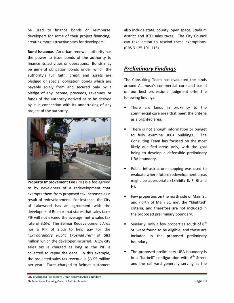
Property Improvement Fee (PIF) is a fee agreed
to by developers of a redevelopment that
exempts them from proposed tax increases as a
result of redevelopment. For instance, the City
of Lakewood has an agreement with the
developers of Belmar that states that sales tax +
PIF will not exceed the average metro sales tax
rate of 3.5%. The Belmar Redevelopment Area
has a PIF of 2.5% to help pay for the
“Extraordinary Public Expenditures” of $83
million which the developer incurred. A 1% city
sales tax is charged as long as the PIF is
collected to repay the debt. In this example,
the projected sales tax revenue is $3-$5 million
per year. Taxes charged to Belmar customers
also include state, county, open space, Stadium
district and RTD sales taxes. The City Council
can take action to rescind these exemptions.
(CRS 31.25.101-115)
Preliminary Findings
The Consulting Team has evaluated the lands
around Alamosa’s commercial core and based
on our best professional judgment offer the
following findings:
• There are lands in proximity to the
commercial core area that meet the criteria
as a blighted area.
• There is not enough information or budget
to fully examine 300+ buildings. The
Consulting Team has focused on the most
likely qualified areas only, with the goal
being to develop a defensible preliminary
URA boundary.
• Public Infrastructure mapping was used to
evaluate where future redevelopment areas
might be appropriate (Exhibits E, F, G and
H).
• Few properties on the north side of Main St.
and north of Main St. met the “blighted”
criteria, and therefore are not included in
the proposed preliminary boundary.
• Similarly, only a few properties south of 8th
St. were found to be eligible, and those are
included in the proposed preliminary
boundary.
• The proposed preliminary URA boundary is
in a “barbell” configuration with 6th Street
and the rail yard generally serving as the

City of Alamosa Preliminary Urban Renewal Area Boundary
Elk Mountains Planning Group / Reid Architects Page 11
“bar” that connects two larger blighted
areas to the east and west.
• Not all property located in the proposed
preliminary URA boundary is considered
blighted, but may be located in an area with
a preponderance of blighted buildings.
• The existing CB Commercial/Business
zoning, which is the primary zoning within
the proposed preliminary URA boundary,
may not be appropriate for the
enhancement of the commercial core or the
stabilization of residential neighborhoods
north of 4th St. and south of the railroad
yard.
Preliminary Recommendations
The proposed preliminary URA boundary is as
depicted in Exhibit C. The City decision-makers
should determine if they are comfortable with
the proposed boundaries, or if there are other
portions of the City that should be considered
for inclusion or exclusion.
In addition to the recommended boundaries,
the Consulting Team offers the following
recommendations to strengthen the
commercial core while the City moves forward
with an Urban Renewal Plan:
• A zoning and the land use code evaluation
should be undertaken to implement new
zoning that would strengthen the
commercial core and stabilize adjacent
residential neighborhoods.
• The City should seek out grants that would
allow for the study of designating the
commercial core as a Local, State or
Nationally-recognized Historic District.
• The City should undertake a multi-pronged
approach to stabilizing the commercial core
including considering the benefits of
establishing a Main Street program.
• The City should consider the many good
ideas that have been put forth in the
various downtown studies completed to
date and should build upon this work when
developing the Urban Renewal Plan.
• The City should consider undertaking a
preliminary baseline economic/tax analysis
in order to get an idea of the amount of
leverage that could be garnered if the URA
is formed and a TIF district implemented.
The City may determine from such a
preliminary study that a URA may not
achieve the redevelopment goals desired by
the community, and it could save time and
money by pursuing other redevelopment
strategies.
The Consulting Team is available to assist the
City with the development of the Urban
Renewal Plan, the pursuit of historic
preservation grants and land use/zoning
evaluation as next steps toward stabilizing the
commercial core and establishing an Urban
Renewal Authority.
City of Alamosa Preliminary Urban Renewal Area Boundary
Elk Mountains Planning Group / Reid Architects Page 12
EXHIBITS
A. Sample Site Data Form
B. Parking lots within and in proximity to
the proposed URA boundary
C. Preliminary URA Boundary
D. Zoning Map with URA Boundary
E. Water Service Map
F. Sanitary Sewer Service Map
G. Storm Sewer Service Map
H. Transportation Infrastructure Map
(including streets, alleys, sidewalks and
trails)


